Republic of the Congo Travel Guide
This is a Republic of the Congo Travel Guide from taste2travel.com
Date Visited: March 2024
Introduction
Tucked away in the heart of Central Africa, the Republic of the Congo is one of the continent’s best-kept secrets – a land of untamed wilderness, lush rainforests, and rich cultural heritage just waiting to be explored.

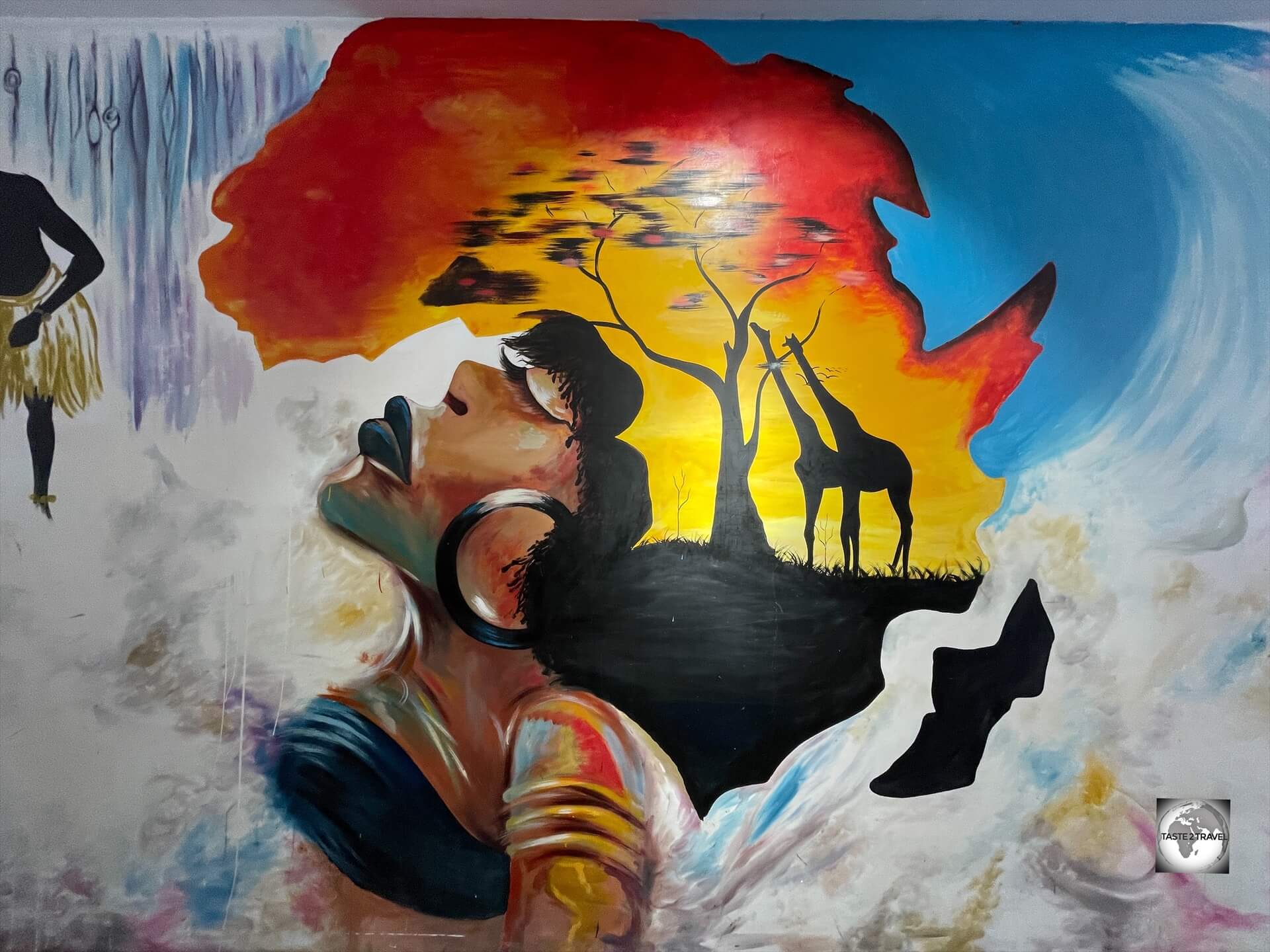
Art work in Brazzaville.
Often overshadowed by its larger neighbours, this is a country for adventurous spirits seeking a raw, authentic African experience far off the beaten tourist trail.
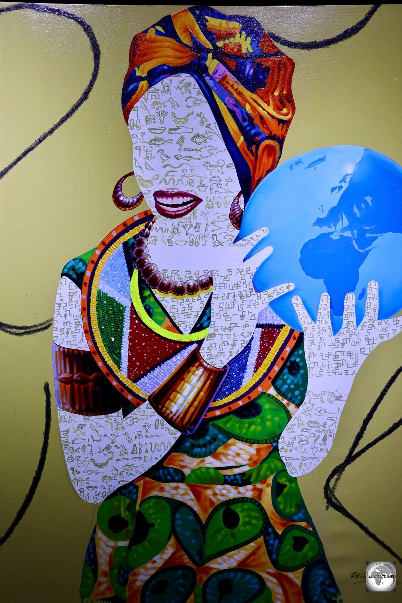
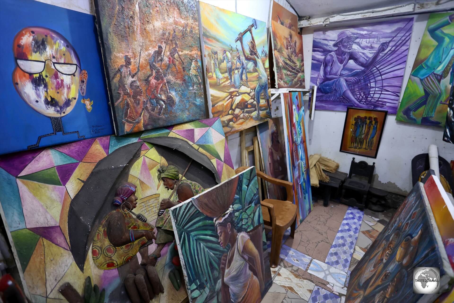
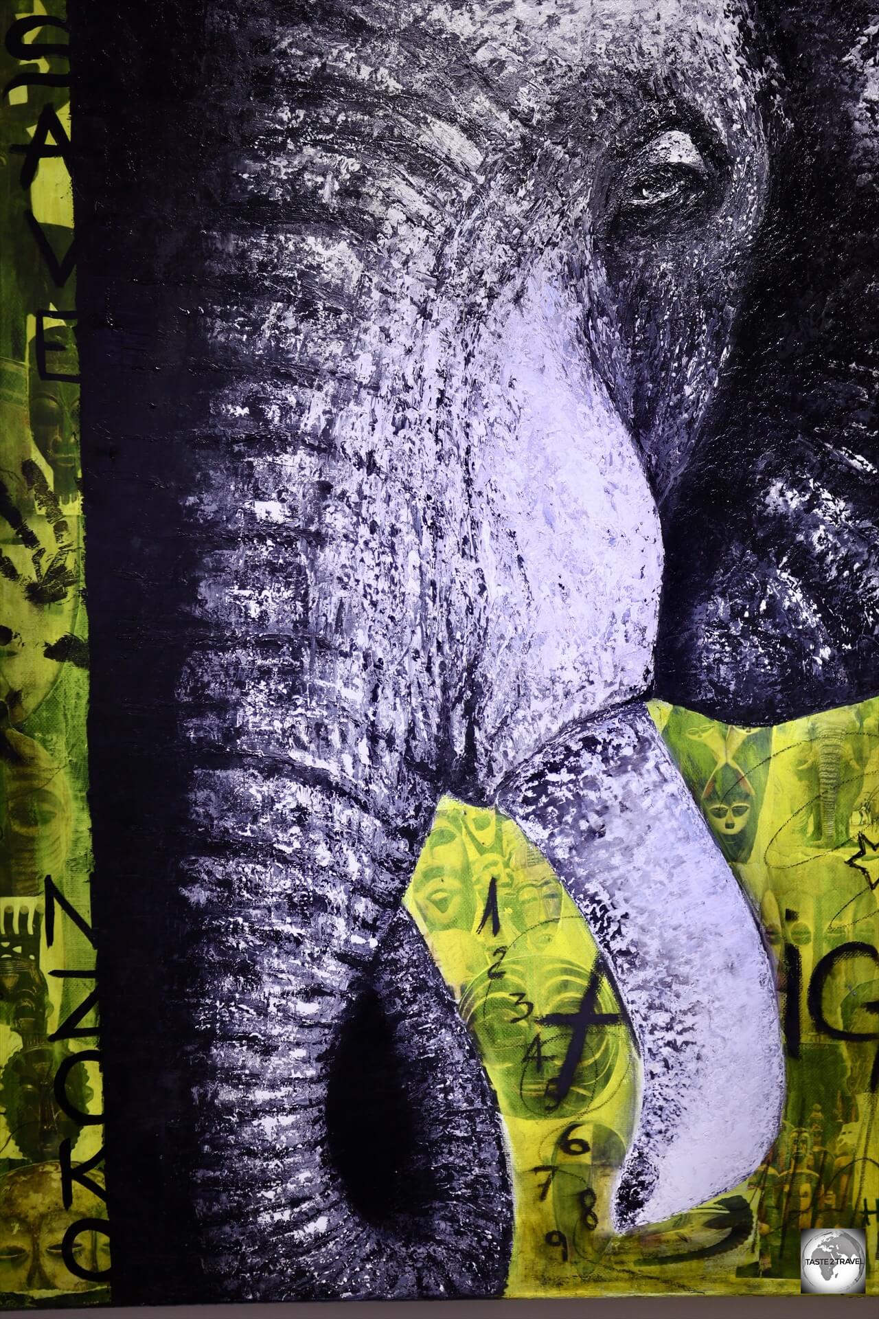
One of many contemporary paintings which are available for purchase from the Brazza-Art-Galerie in Brazzaville.
Unfortunately, people hear the word ‘Congo’ and automatically assume that it’s an unsafe, dangerous destination because ‘the Congo’ is often featured on the nightly news for all the wrong reasons.
However, there are two countries in Africa named “Congo” (as outlined below), the safe, peaceful and relaxed Republic of the Congo (which is the focus of this guide) and its neighbour, the Democratic Republic of Congo (DRC) which is much more unstable, turbulent, unsafe, corrupt and the one everyone hears about for all the wrong reasons.
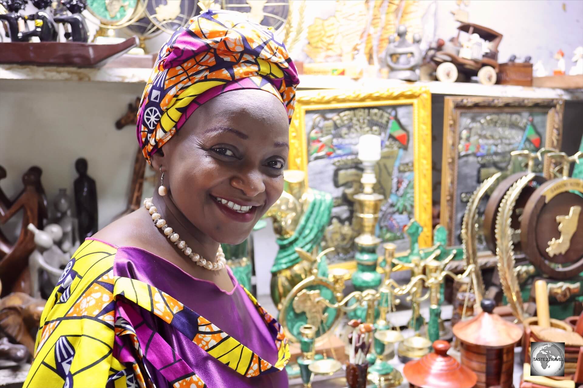
A Congolese artisan at a craft market in Brazzaville.
Visitors to the Republic of the Congo might be surprised to find that the country is very relaxed, safe and secure and that the locals are very friendly, welcoming and have a slight air of French sophistication, a legacy from the French colony period.
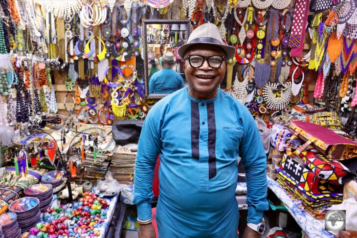
Brazzaville is home to many incredible African craft shops.
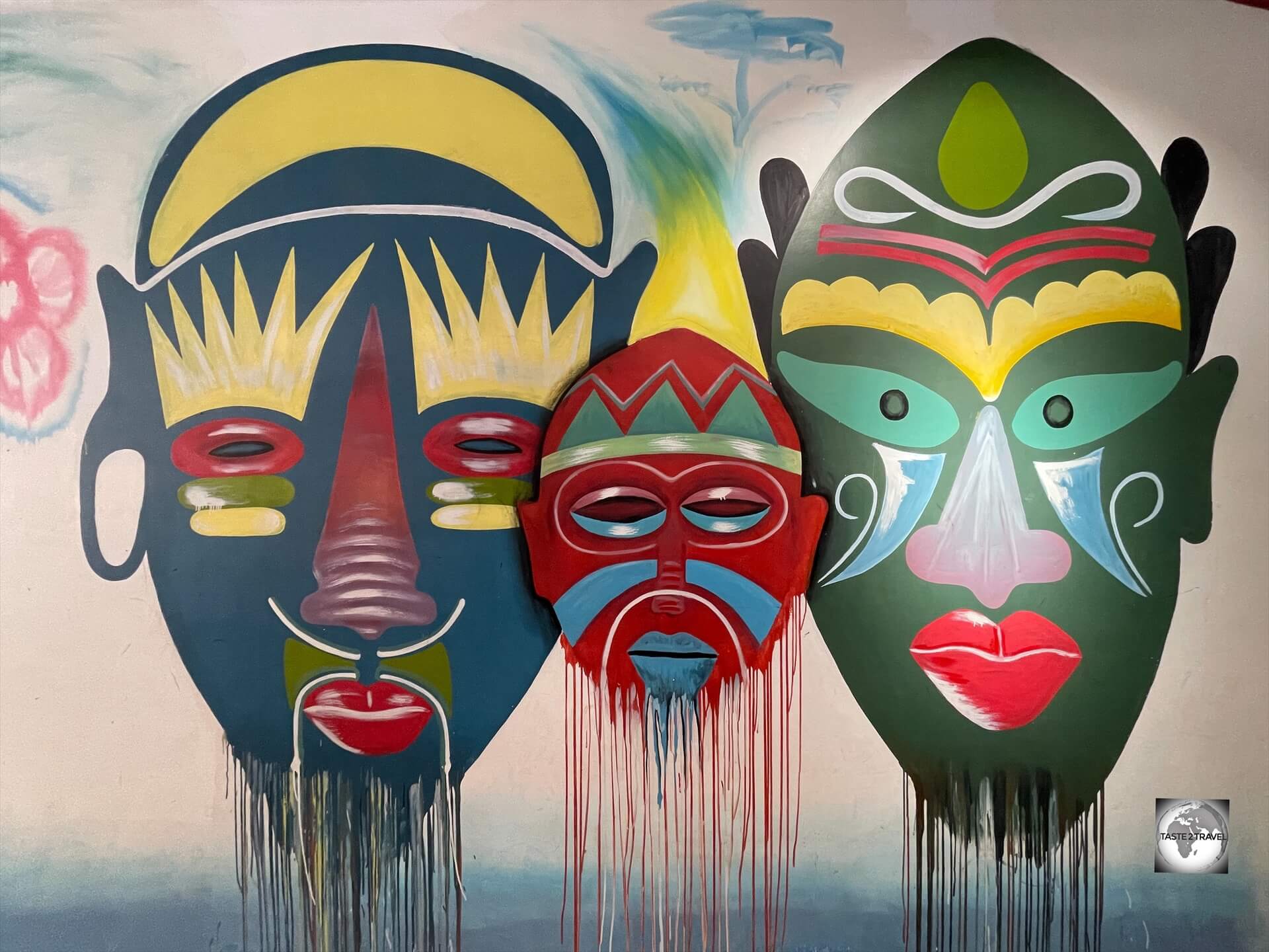
There is a thriving arts scene in Brazzaville which can be observed in the many craft markets and art galleries in Brazzaville.
The French influence is noticeable in the more affluent areas of Brazzaville where fine patisseries, cafés and bistros can be found.
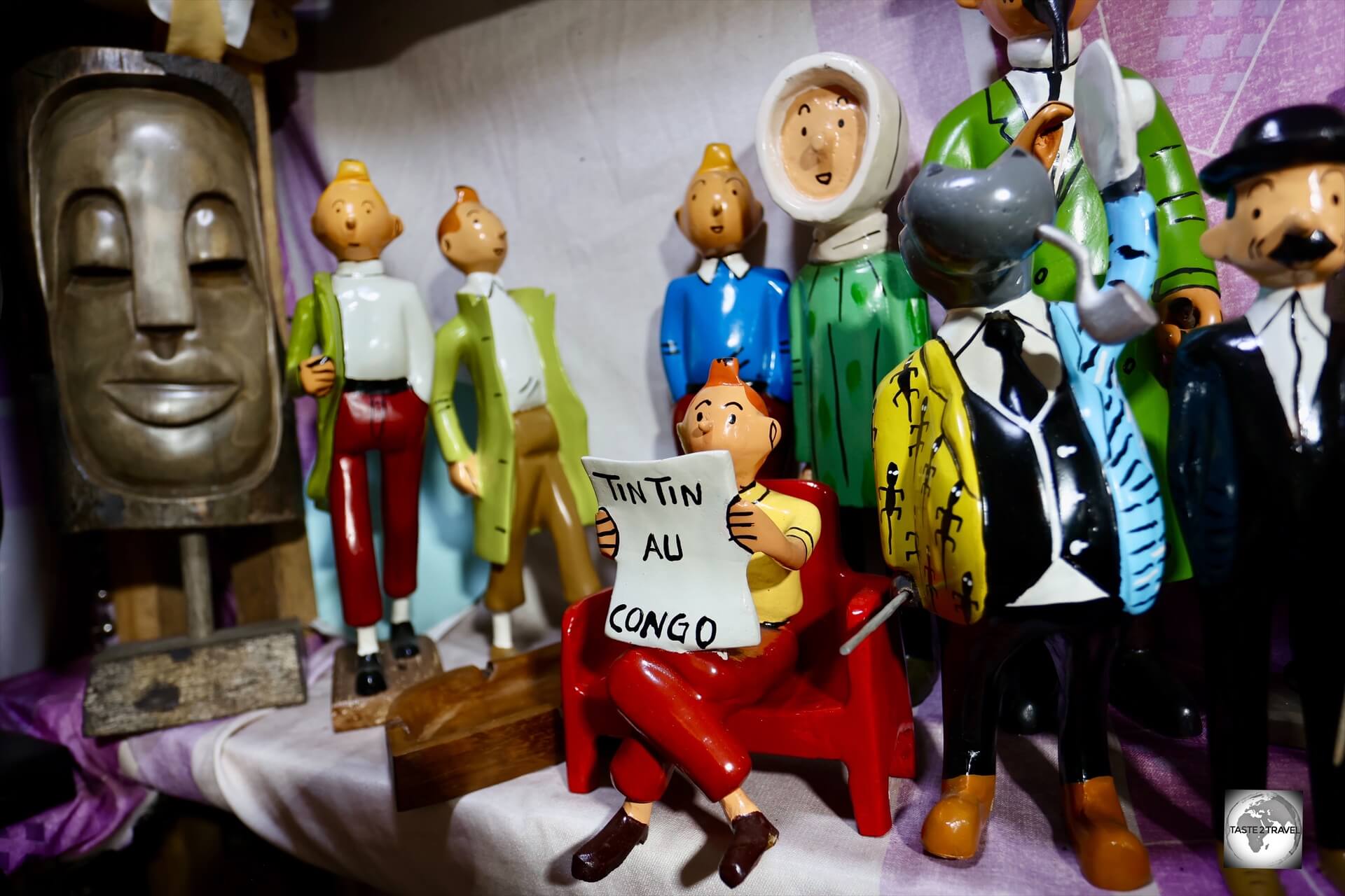
Tintin in the Congo was the second volume of “The Adventures of Tintin”, the comics series by Belgian comic strip artist Hergé.
Further afield, National Parks offer the chance to see lowland Gorillas and a plethora of other African wildlife.
Exploring the National Parks however isn’t cheap with a typical daytrip from Brazzaville costing at least €400 per person.
Street art in Brazzaville.
I enjoyed my time in the Republic of the Congo, which was limited to a week-long stay in Brazzaville.
I look forward to returning one day to explore the country more fully.
Location
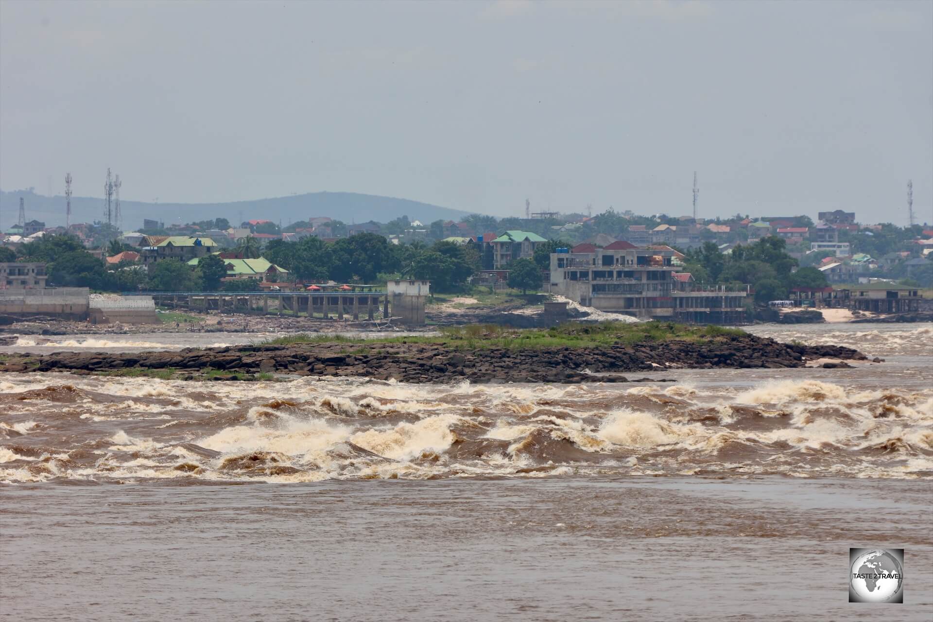
The Congo River separates Brazzaville, the capital of the Republic of the Congo, from Kinshasa, the capital of the DRC, which can be seen in the distance.
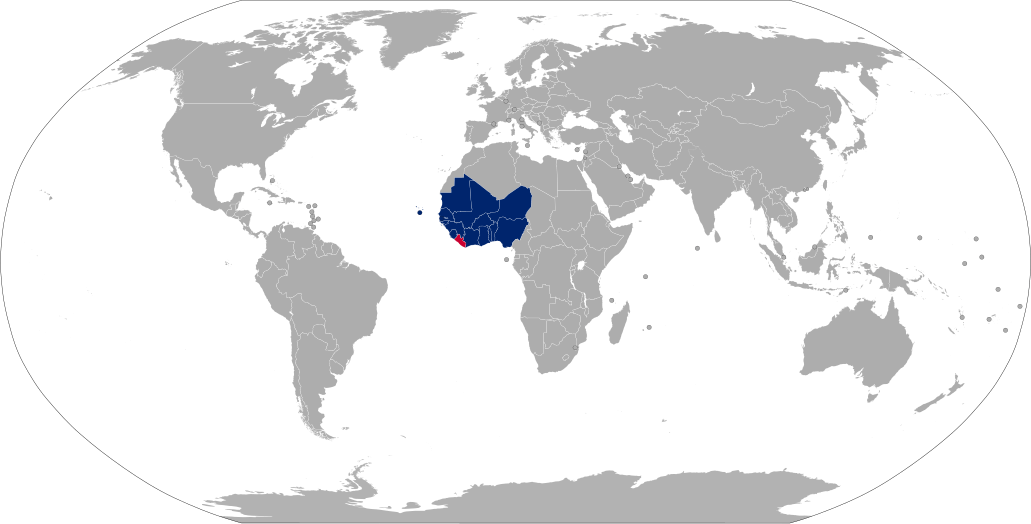
Straddling the Equator, the Republic of the Congo is located in Central Africa.
It is bordered to the west by Gabon, to the northwest by Cameroon, to the northeast by the Central African Republic, to the southeast by the Democratic Republic of the Congo, to the south by the Angolan exclave of Cabinda, and to the southwest by the Atlantic Ocean.
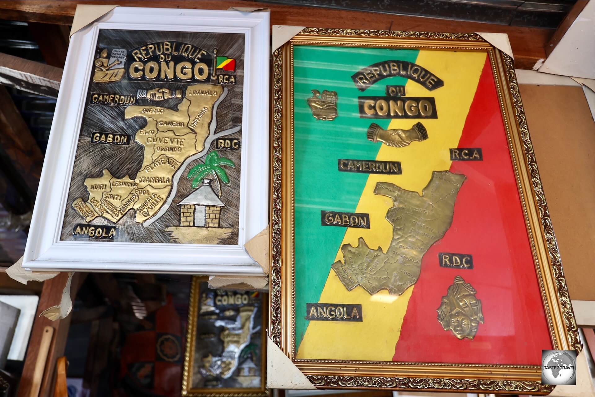
Souvenir copper maps of the Republic of the Congo, showing all neighbouring countries.
The capital, and largest city, is Brazzaville (population: 2.2 million) which is located in the lush, green interior, on the banks of the mighty Congo River, across from Kinshasa, the much larger capital of the Democratic Republic of Congo (DRC).
Did you know? With a length of 4,700 km (2,900 mi), the Congo River is the continent’s second longest river, after the Nile!
Located on the coast is the country’s 2nd largest city, and economic hub, Pointe-Noire (population: 1.4 million).
Why the two Congo’s?
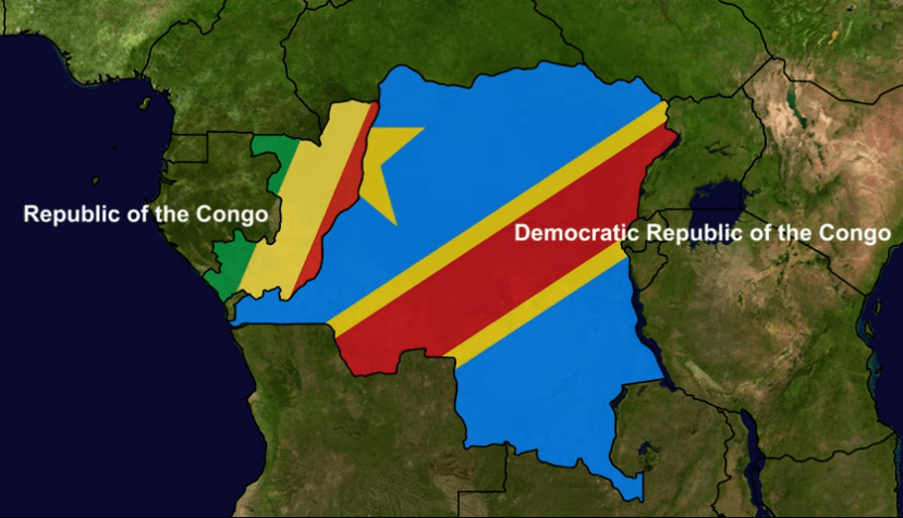
The existence of two Congo’s is due to their distinct colonial histories.
The Congo, which always makes the nightly news cycle for all the wrong reasons, is the Democratic Republic of the Congo (DRC), while the Republic of the Congo is much more peaceful, stable, relaxed, secure and a total joy to visit.
The capital of the Republic of the Congo is Brazzaville (population: 2.2 million), while the capital of the DRC is Kinshasa (population: 17.8 million). Both cities face each other across the Congo River.
Did you know? Kinshasa has the distinction of being the largest French-speaking city in the world!
The Republic of the Congo is often referred to as Congo-Brazzaville (after its capital) to avoid confusion with its much larger neighbour, the DRC or Congo-Kinshasa (after its capital).
The DRC has a population of 96 million, while Congo-Brazzaville has just 5 million.
With a surface area of 342,000 km², Congo-Brazzaville is around 7 times smaller than Congo-Kinshasa, which covers an area of 2,345,000 km².
Did you know? In terms of land area, the DRC is the 2nd largest country in Africa, after Algeria!
The Republic of the Congo was a French colony, while the Democratic Republic of the Congo was a Belgian colony, initially King Leopold II’s personal possession.
The Congo River formed a natural boundary between the two, with France controlling the territory to the west and Belgium to the east.
Throughout history, and even today, both countries have been exploited for their resources, although the DRC has always been known for its brutal exploitation, particularly of rubber and minerals.
French Congo
The French established the colony of French Congo in the late 19th century. It gained independence in 1960 and remains known as the Republic of the Congo.
Did you know? During WWII, when the Nazi’s occupied France, General Charles de Gaulle established a French government-in-exile which was headquartered in Brazzaville. He lived in Brazzaville from 1940 to 1943.
Belgian Congo
King Leopold II of Belgium controlled the territory that became the Democratic Republic of the Congo (DRC), initially as a private possession, later becoming the Belgian Congo.
It gained independence in 1960, with its capital at Kinshasa, and was later known as Zaire under President Mobutu Sese Seko’s dictatorship.
Following the overthrow of Mobutu by Laurent-Désiré Kabila and his rebel forces, Zaire once again became the Democratic Republic of the Congo (DRC) on May 17, 1997.
History
During WWII, General Charles de Gaulle established a French government-in-exile which was headquartered in Brazzaville.
The Republic of the Congo has a rich and complex history shaped by indigenous kingdoms, European colonisation, and post-independence political shifts.
Pre-Colonial Era
Before European contact, the area now known as the Republic of the Congo was home to several Bantu-speaking ethnic groups and powerful kingdoms such as the Kingdom of Kongo – one of the most prominent, which also extended into parts of modern Angola and the DRC.
Other kingdoms included the Teke and Loango, which had their own systems of governance and trade networks.
These societies engaged in trade with each other and with European merchants (especially the Portuguese) along the Atlantic coast as early as the 15th century.
Colonial Period
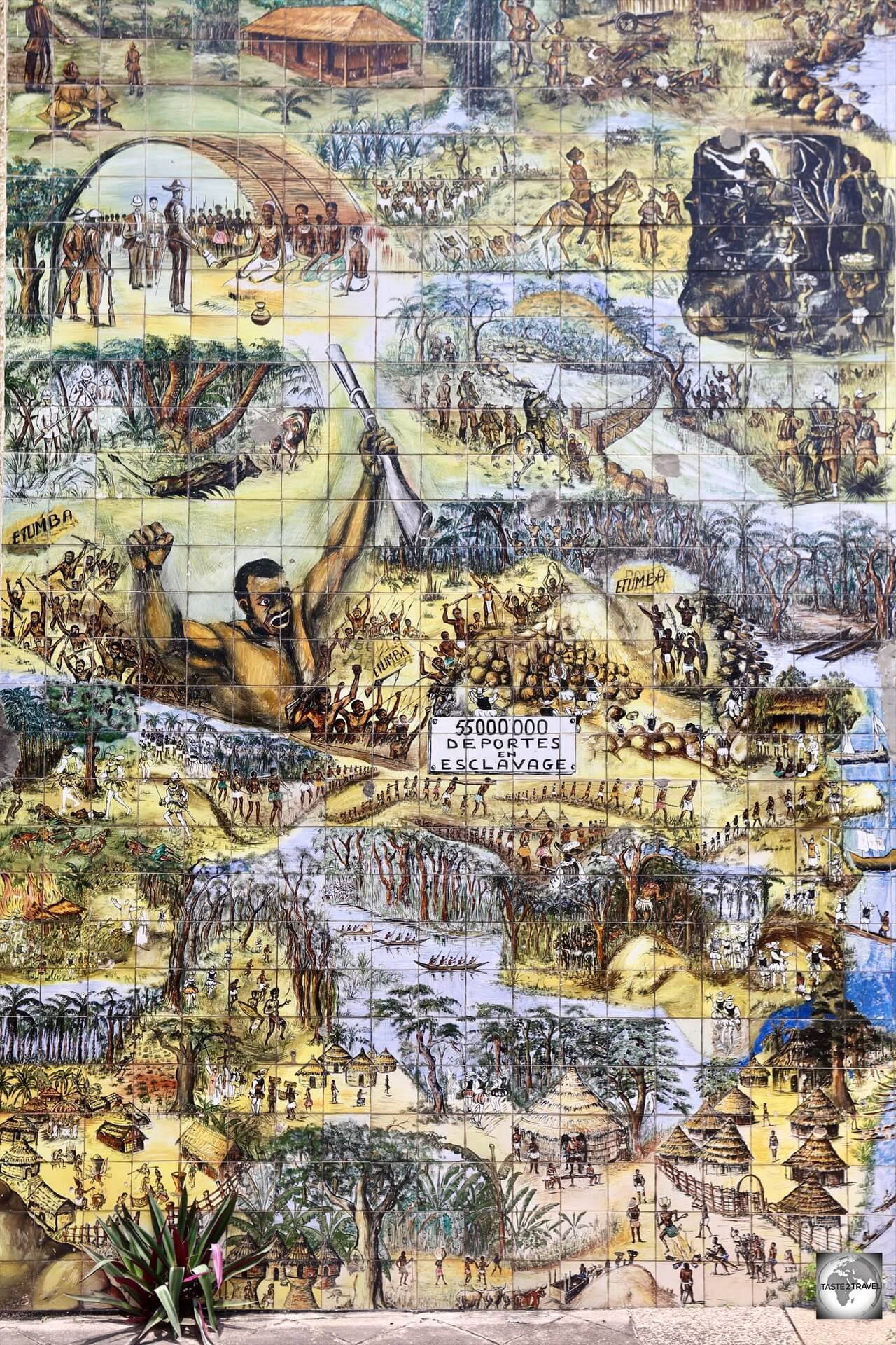
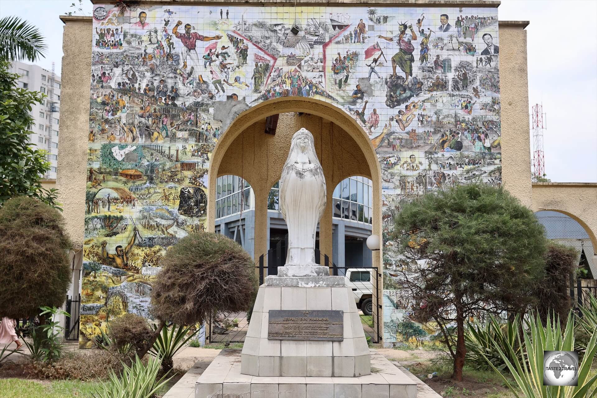
The Fresque de l’Afrique (Fresco of Africa) represents the history of the Congolese people and their struggle for independence.
In the late 19th century, French explorer Pierre Savorgnan de Brazza established a French protectorate over the area, signing treaties with local rulers.
The city of Brazzaville, founded in 1880, became the capital and a key administrative centre.
By 1910, the region was incorporated into French Equatorial Africa, a federation of French colonial territories in Central Africa, comprising Gabon, French Congo, Ubangi-Shari (now Central African Republic), and Chad. Its capital was Brazzaville.
The French exploited the land and its people, especially through forced labor and harsh conditions in rubber and timber extraction industries.
Resistance movements and local dissatisfaction grew over time.
Free France Movement
After France’s fall to the Nazi’s in 1940, Brazzaville became a focal point for Free France.
It served as the capital of Free French Africa, providing General Charles de Gaulle with a political and military base.
The Free France movement in Brazzaville played a crucial role in rallying support for General Charles de Gaulle’s resistance movement.
Brazzaville, the capital of French Equatorial Africa, became a key hub for Free France, offering legitimacy, manpower, resources, and a base for military operations.
The city hosted the Brazzaville Conference in 1944, where representatives from French African colonies met to discuss the future of the French colonial empire, marking a significant step in shaping the relationship between France and its colonies.
Independence and Early Years (1960s)
The Republic of the Congo gained independence from France on August 15, 1960.
Fulbert Youlou became the first president, but was overthrown in 1963 amid political unrest.
The country soon moved toward a Marxist-Leninist system under leaders like Marien Ngouabi, who declared the People’s Republic of the Congo in 1969 — making it the first Marxist state in Africa.
Socialism and Political Instability (1970s–1990s)
A series of instability, including coups and assassinations, marked this period.
Marien Ngouabi was assassinated in 1977, and Denis Sassou Nguesso came to power in 1979.
The country aligned itself with the Soviet Union and other communist states during the Cold War.
By the late 1980s and early 1990s, pressures for reform and the global decline of communism led to the abandonment of Marxism and the introduction of multi-party politics.
Civil War and Recent History (1990s–Present)
After a brief period of democratic governance, civil war erupted in 1997 between forces loyal to then-President Pascal Lissouba and former President Denis Sassou Nguesso.
Sassou Nguesso returned to power after the war and has remained a dominant figure ever since, often winning elections amid accusations of electoral manipulation and suppression of dissent.
The country has remained relatively stable compared to some of its neighbours, especially DRC, but continues to struggle with economic inequality, corruption, and political repression despite being rich in natural resources like oil and timber.
People
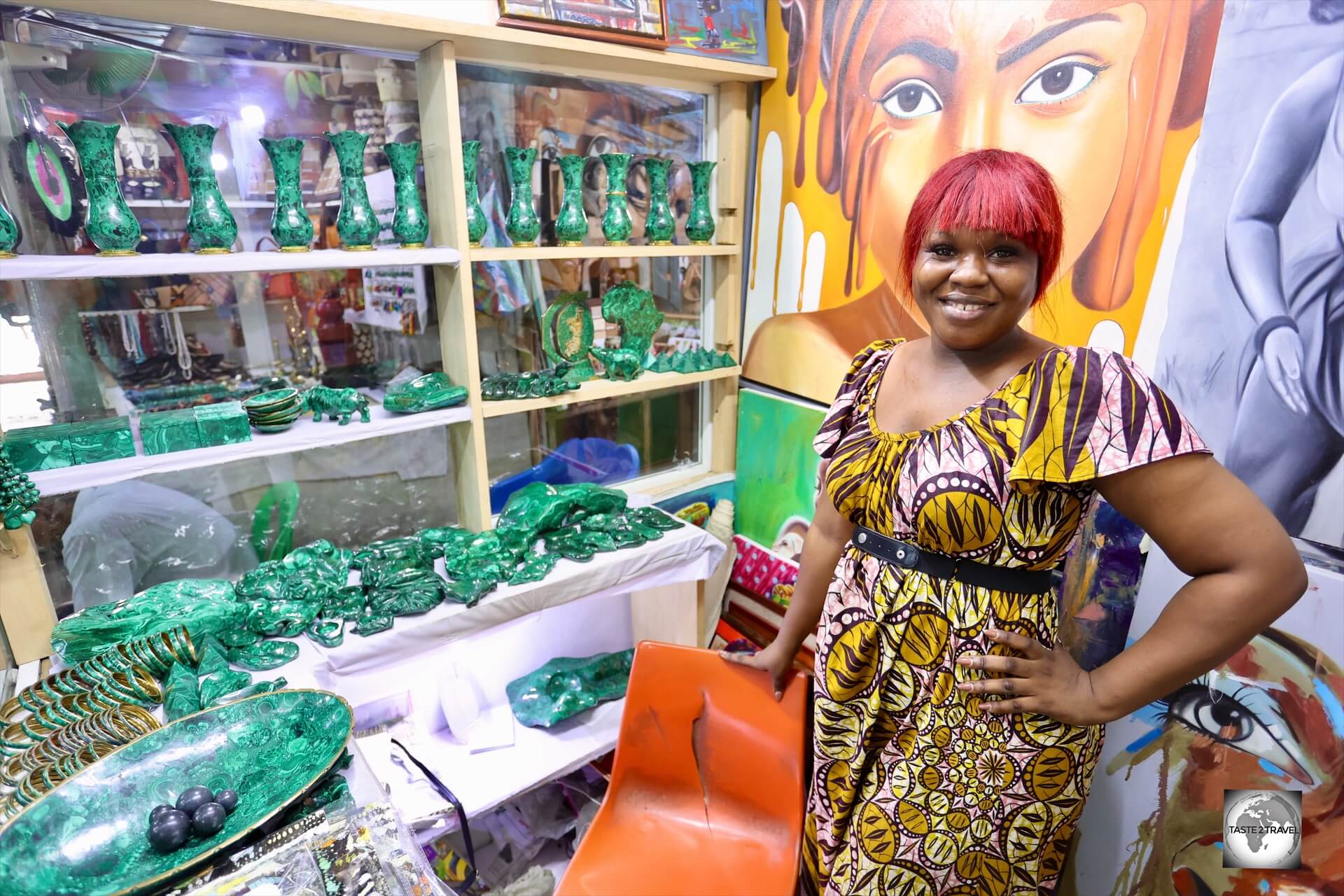
Always friendly and welcoming, this Congolese shop owner managed to sell me an elephant carved from Malachite.
Home to 5 million souls, the people of the Republic of the Congo are as vibrant and diverse as the landscapes they call home.
Known for their warmth, resilience, and strong cultural identity, the Congolese make up a society that blends ancient traditions with modern influences, city energy with village rhythms, and over a hundred ethnic groups into a remarkably cohesive national spirit.
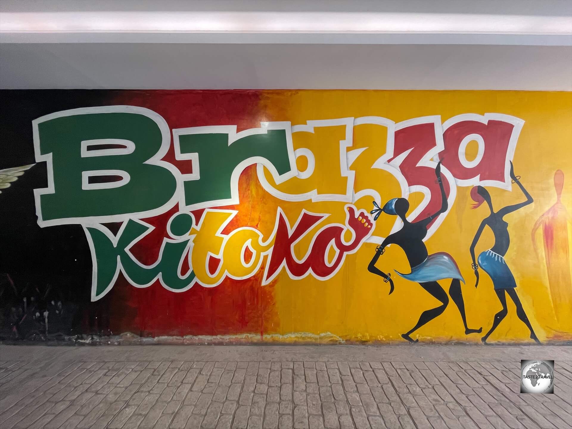
Street art in Brazzaville.
The Republic of the Congo is home to over 60 ethnic groups, but most belong to larger ethnolinguistic families:
- Kongo (Bakongo): The largest ethnic group, especially around Brazzaville and the southwest
- Teke: Historically influential, especially in the central regions
- Mbochi (or Mboshi): Predominantly in the north; President Denis Sassou Nguesso is from this group
- Sangha and other forest peoples in the north and northwest, including some semi-nomadic groups

Traditional pottery masks for sale at a craft market in Brazzaville.
As for languages, French is the official language, used in government, education, and the media, while two major national languages are widely spoken:
-
- Lingala: spoken in Brazzaville and along the Congo River
- Kituba (or Munukutuba): a simplified Kongo language, common in Pointe-Noire and the south
Most people speak two or three languages, their ethnic language, plus Lingala or Kituba, and often some French.
Brazzaville is a city with a thriving art scene (such as this street art) and a renown musical scene.
Brazzaville, in particular, is known for its stylish and musical vibe – it’s even home to the “Sapeurs”, the flamboyantly dressed men who treat fashion as high art.

A souvenir wooden tray featuring the ‘Sapeurs’ of Brazzaville.
Brazzaville is also home to a thriving art scene with many fine art galleries located in the downtown area.
Paintings for sale at a craft market in Brazzaville.
In terms of religion, Christianity is the dominant faith, mostly Roman Catholic, followed by Protestant denominations.
Despite the introduction of Christianity by French missionaries, traditional African religions are still practiced, often blended with Christianity.
Flag

The flag of the Republic of the Congo features the Pan-African colours of green, yellow and red.
The flag of the Republic of the Congo was adopted on September 15, 1959, just before the country gained independence from France in 1960.
The flag is distinct in that it is one of the few national flags that use a diagonal design.
Like many other African flags, the Congolese flag uses the Pan-African colours.
The flag is a diagonal tricolour that consists of three colours:
- Green in the upper hoist-side triangle (top left)
- Yellow in a diagonal band running from the bottom hoist-side corner to the top fly-side corner
- Red in the lower fly-side triangle (bottom right)
Symbolism of the colors:
- Green symbolises the Congo’s agriculture and forests.
- Yellow represents friendship and nobility.
- Red stands for the struggle for independence and the people’s courage.
Pan-African Colours

The traditional flag of Ethiopia, the colours of which have been adopted by numerous African nations.
Green, yellow and red, the colours of the flag of Ethiopia, have come to represent the pan-Africanist ideology due to the country’s history of having avoided being taken over by a colonial power.
Numerous African countries have adopted the colours into their national flags, and they are similarly used as a symbol by many Pan-African organisations and the Rastafari movement.
Countries whose flags use the Pan-African colours include – Benin, Burkina Faso, Cameroon, Central African Republic, Chad, Republic of the Congo, Ghana, Guinea, Guinea-Bissau, Mali, Senegal, São Tomé and Príncipe and Togo.
Currency
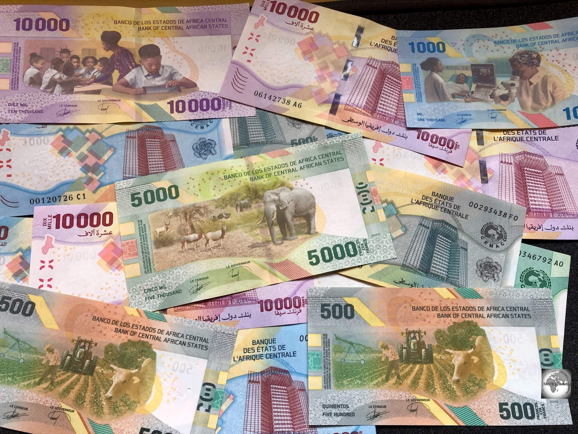
The currency of the Republic of the Congo is the Central African CFA franc, abbreviated as XAF.
The currency of the Republic of the Congo is the Central African CFA franc, abbreviated as XAF or sometimes written as FCFA (from Franc de la Coopération Financière en Afrique Centrale).
Apart from the Republic of the Congo, this currency is used by five other countries in Central Africa, including – Equatorial Guinea (click to view my travel guide), Cameroon, Chad, Central African Republic and Gabon.
The CFA franc is pegged to the Euro, with a fixed exchange rate, providing stability in international transactions.
Currently, €1 = 655.96 CFA francs.
This peg has meant that travel costs in all countries in the CFA zone are much higher than costs on the non-CFA countries.
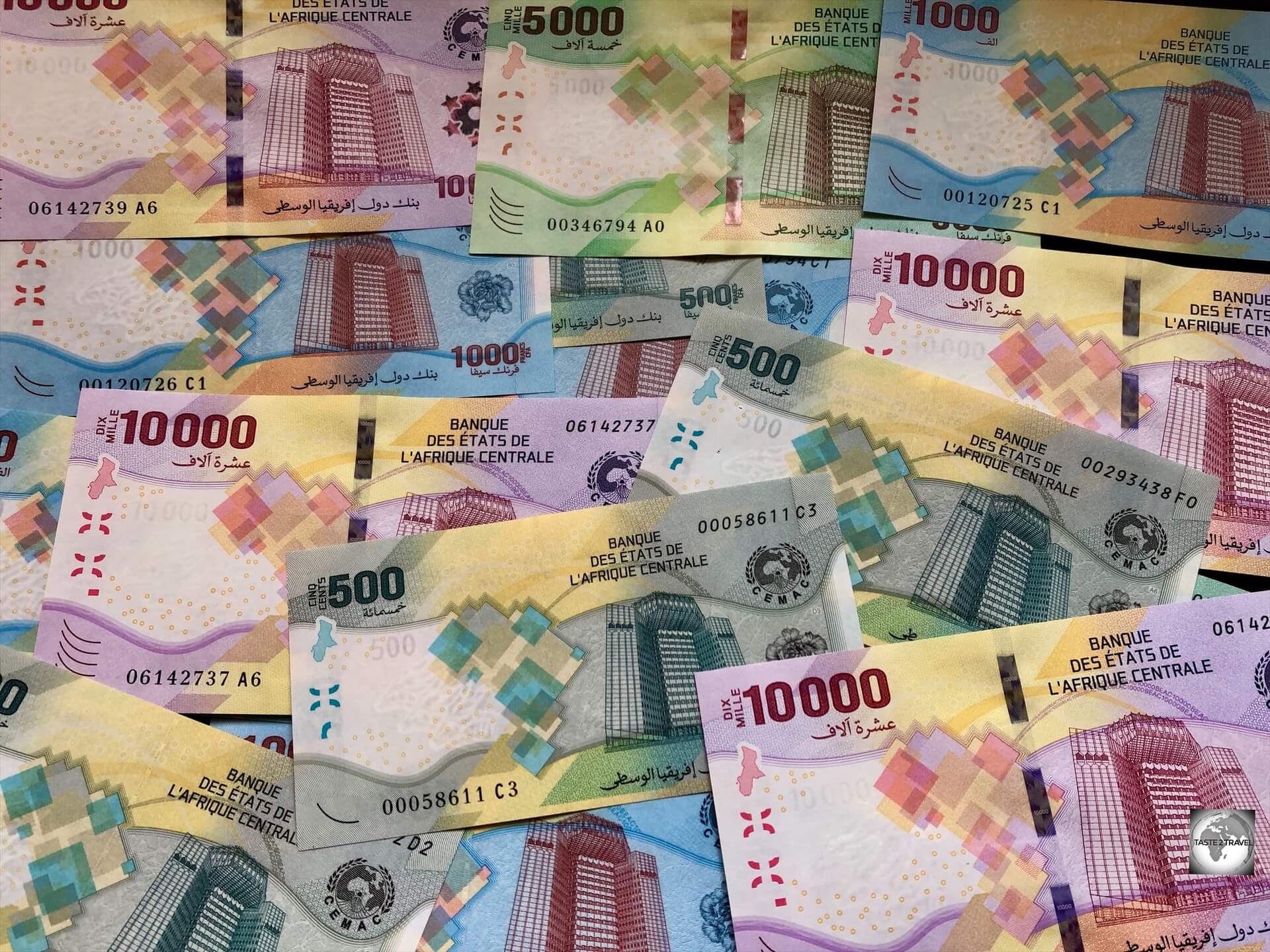
The currency of the Republic of the Congo is the Central African CFA franc, which is the official currency of six central African nations.
The currency is issued and regulated by the Bank of Central African States (BEAC), which is the central bank for the Central African Economic and Monetary Community (CEMAC).
The bank is headquartered in Yaoundé, Cameroon, with the headquarters building featured on the front of all banknotes.
The CFA franc is denoted by the symbol “FCFA” or “XAF” and is available in both coins and banknotes.
Coins are available in denominations of 1, 2, 5, 10, 25, 50, 100, and 500 francs, while banknotes are issued in denominations of 500, 1,000, 2,000, 5,000, and 10,000 francs.
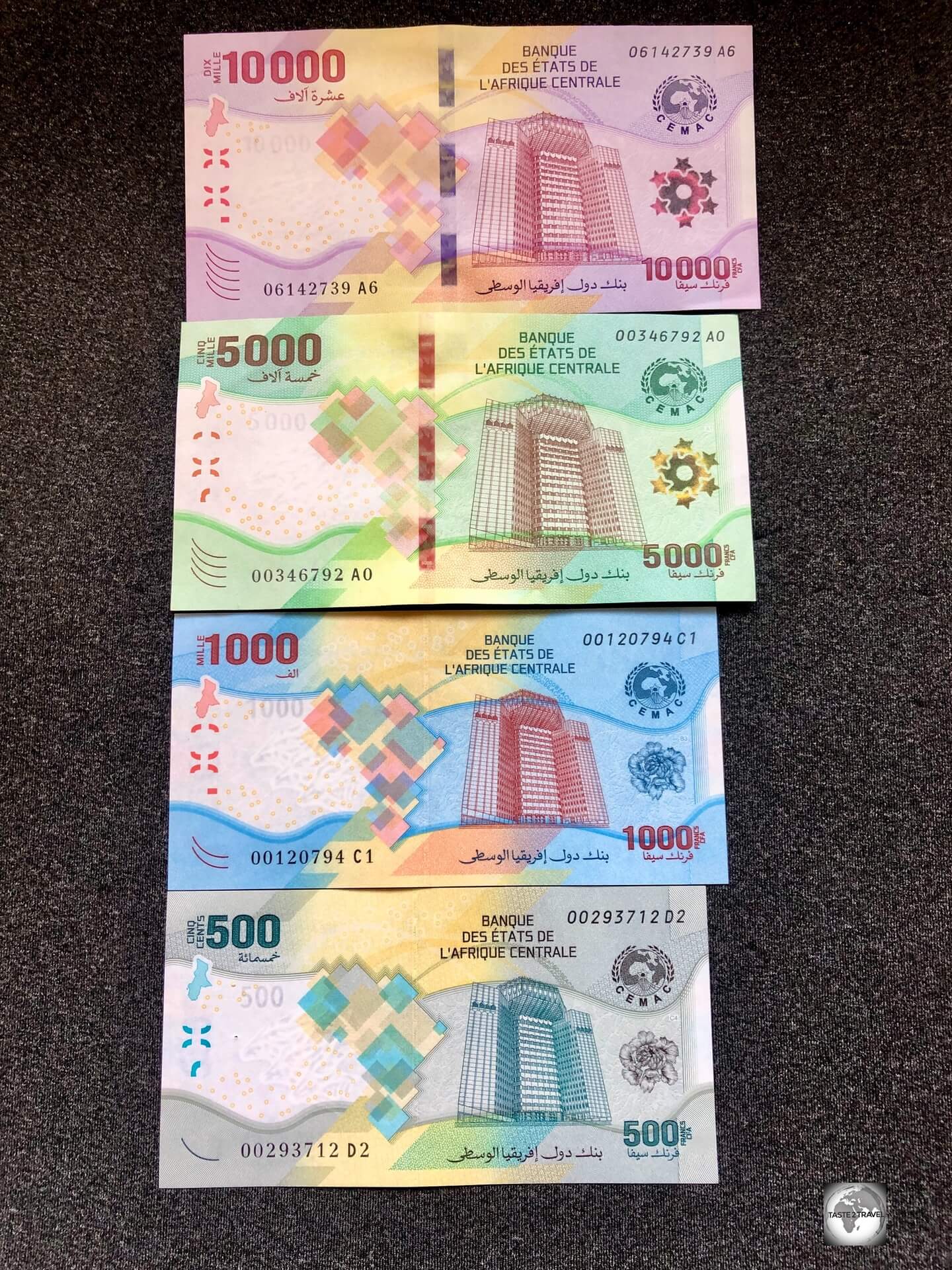
Almost a full set of (uncirculated) CFA franc banknotes – with the 2,000 missing!
Credit Cards
Like almost all other African countries, cash is king in Republic of the Congo with credit cards rarely accepted.
It is advisable to have some local currency on hand for all transactions, as well as Euros for larger purchases or in case of emergencies.
ATMs
ATMs are available in Brazzaville, where you can withdraw cash using international debit or credit cards at any Eco Bank ATM.
Costs
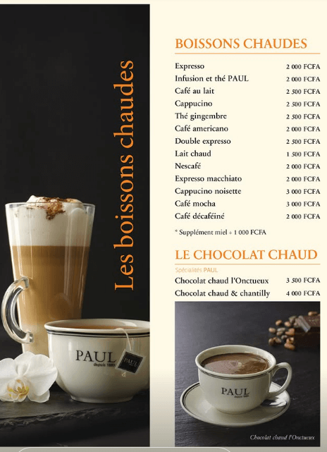
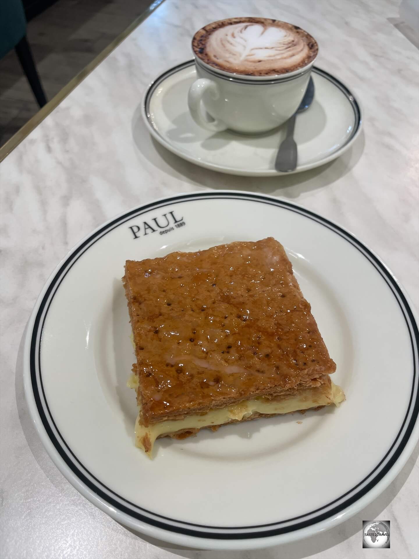
The coffee menu at (café) Paul Congo.
As with any other former-French colony using the XAF currency in Central Africa, travel costs in the Republic of the Congo are higher than in the non-XAF countries.
In cosmopolitan Brazzaville, there are options for all budget levels from backpacker to top-end!
Sample costs:
- Cappuccino at Paul Congo: XAF 2,500 (US$4.30)
- Bottle (.33l) of Coke/ Sprite: XAF 900 (US$1.55)
- Small bottled water: XAF 900 (US$1.55)
- Bottle of Beer: XAF 3,000 (US$5.18)
- Soup at Paul Congo: XAF 4,000 (US$6.90)
- Hamburger at Capital Hôtel: XAF 2,500 (US$4.30)
- Meal at Paul Congo: XAF 10,000 – 15,000 (US$17.20 – $25.90)
- Meal at Capital Hôtel: XAF 8,000 – 10,000 (US$13.80 – $17.20)
- Standard hotel room at the Capital Hôtel: €80 (US$90.68)
- Half day city tour with guide (Satch): €60 (US$68.00)
Tour Guides
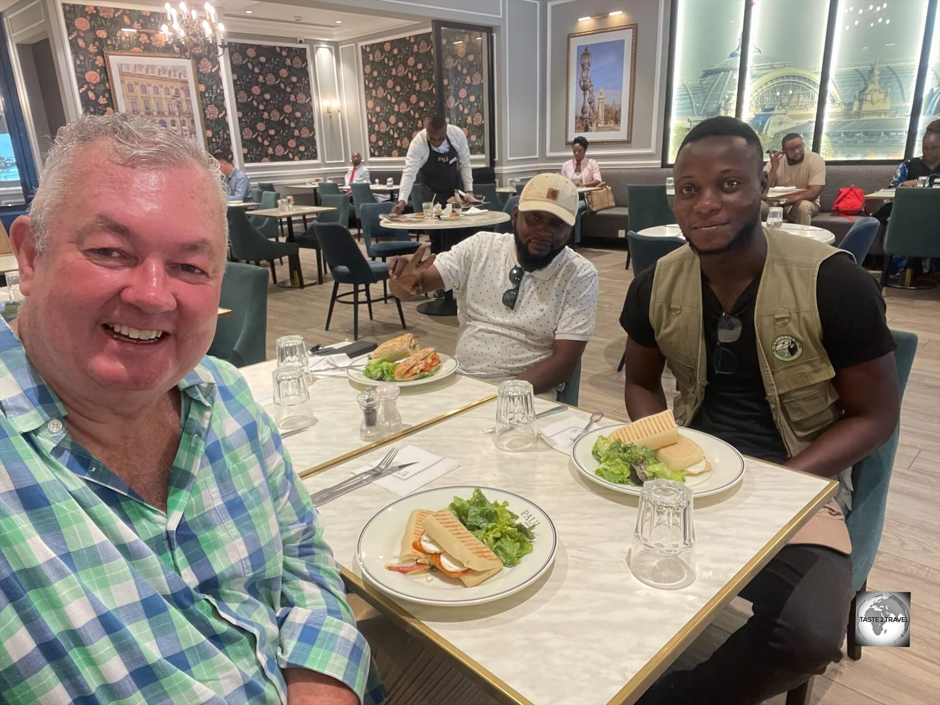
After a hot and sweaty city tour, I treated my guide Satch (pictured right) and driver to lunch at Paul in Brazzaville.
During my time in Brazzaville, I did a city tour with Satch Obambi Ndinga – a native of Brazzaville who spent many years studying in Ghana and hence, speaks good English.
Contact Details for Satch Obambi Ndinga
Facebook: Satch Obambi Ndinga
Instagram: https://www.instagram.com/satchobambi/
Email: 0575772100ss@gmail.com
WhatsApp: +242 06 485 3099
Sightseeing
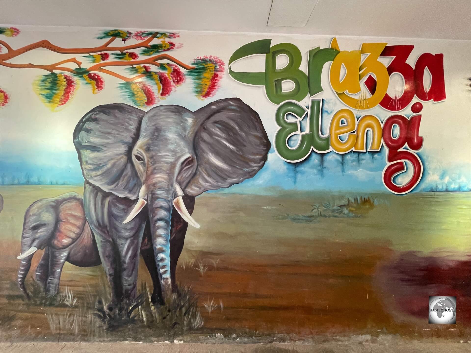
Street art in Brazzaville.
I spent my time in Brazzaville which is a fascinating mix of French colonial charm, African culture and scenic riverfront views, including some impressive art galleries and artisan markets.
Brazzaville is a shopping paradise!
The capital, and largest city of the Republic of the Congo, Brazzaville is quieter and more relaxed than many African capitals.
It has a slow, confident rhythm, friendly people, and a warm, humid climate year-round.
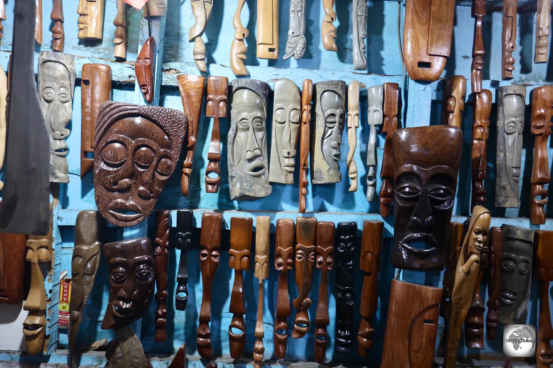
Sleek, slender and beautifully carved, there is no shortage of traditional masks for sale in the craft markets in Brazzaville.
It’s also considered one of Africa’s safest capitals, which makes walking around and exploring more comfortable for travellers.
At no stage was I harassed, hassled nor did I ever feel unsafe.
The locals were very friendly and welcoming and carrying my camera bag on the street was never a problem.
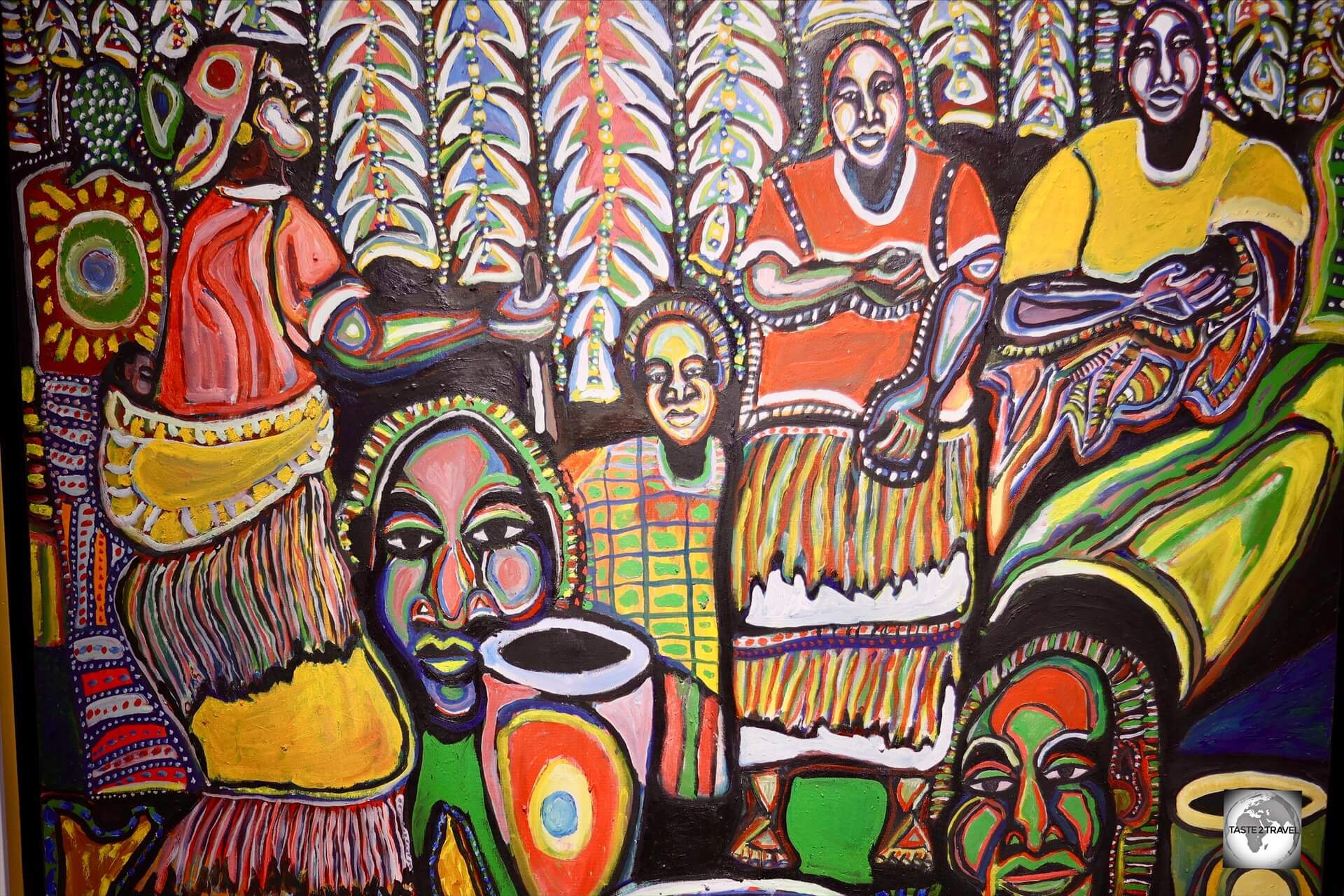
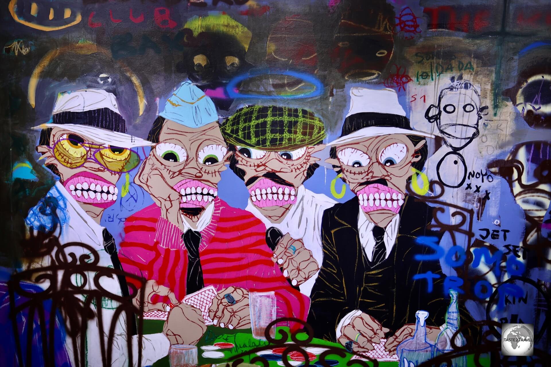
One of many paintings which are offered for sale at the wonderful Brazza-Art-Galerie in Brazzaville.
It might not be as flashy as some capital cities, but Brazzaville is full of unique character and low-key gems, including an African version of the Statue of Liberty.
Following is a guide to some of the top sights and experiences in Brazzaville, the laid-back yet lively heart of the Republic of the Congo.
Sainte-Anne of the Congo Basilica
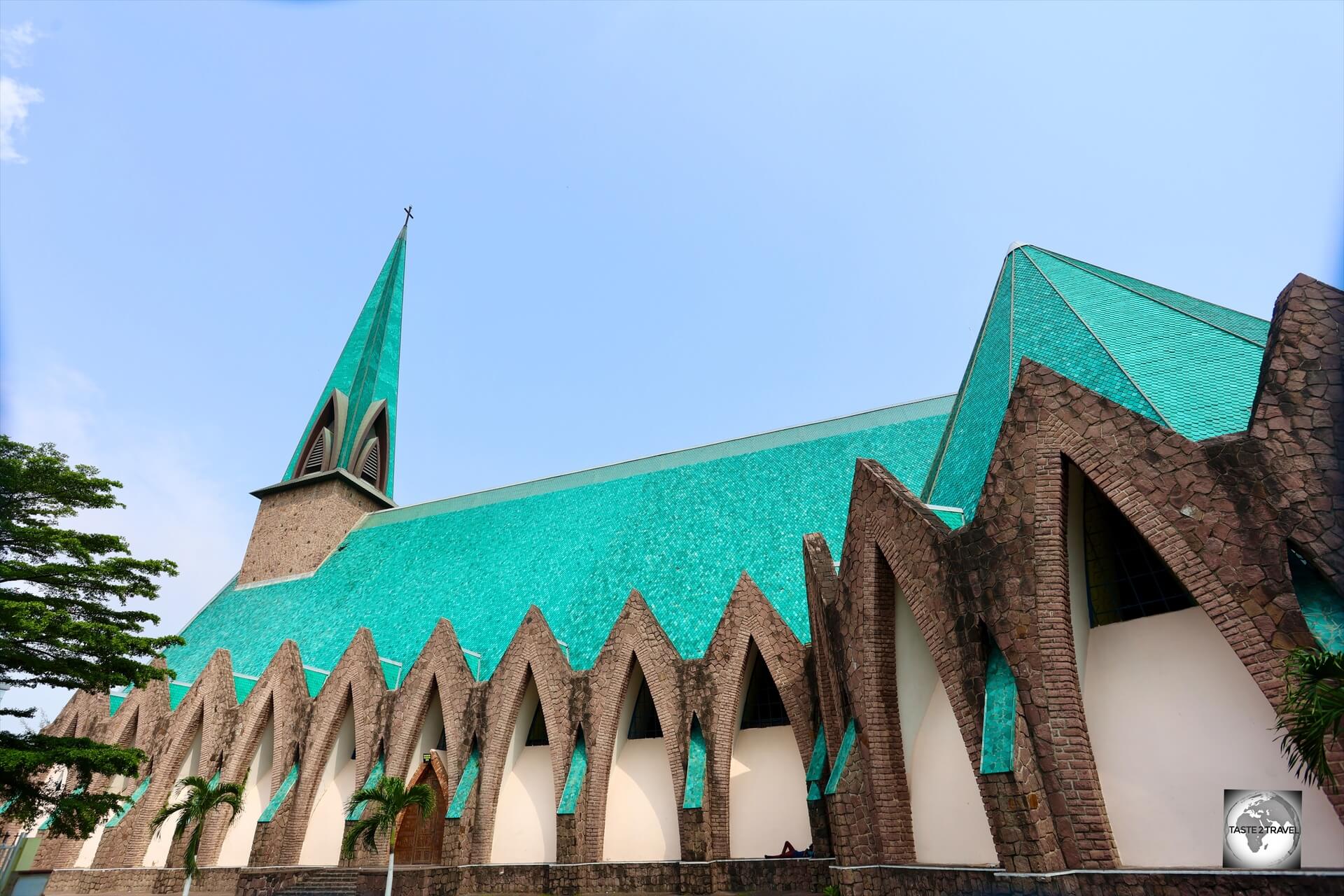
With its striking green tiled roof, Sainte-Anne of the Congo Basilica is one of the most iconic structures in Brazzaville.
An iconic symbol of Brazzaville, the striking Sainte-Anne of the Congo Basilica was built in 1943 by a Protestant French architect named Roger Erell.
Erell created the most striking of churches using a unique design blend of Gothic Architecture and local Congolese influences, making it stand out among colonial-era religious structures.
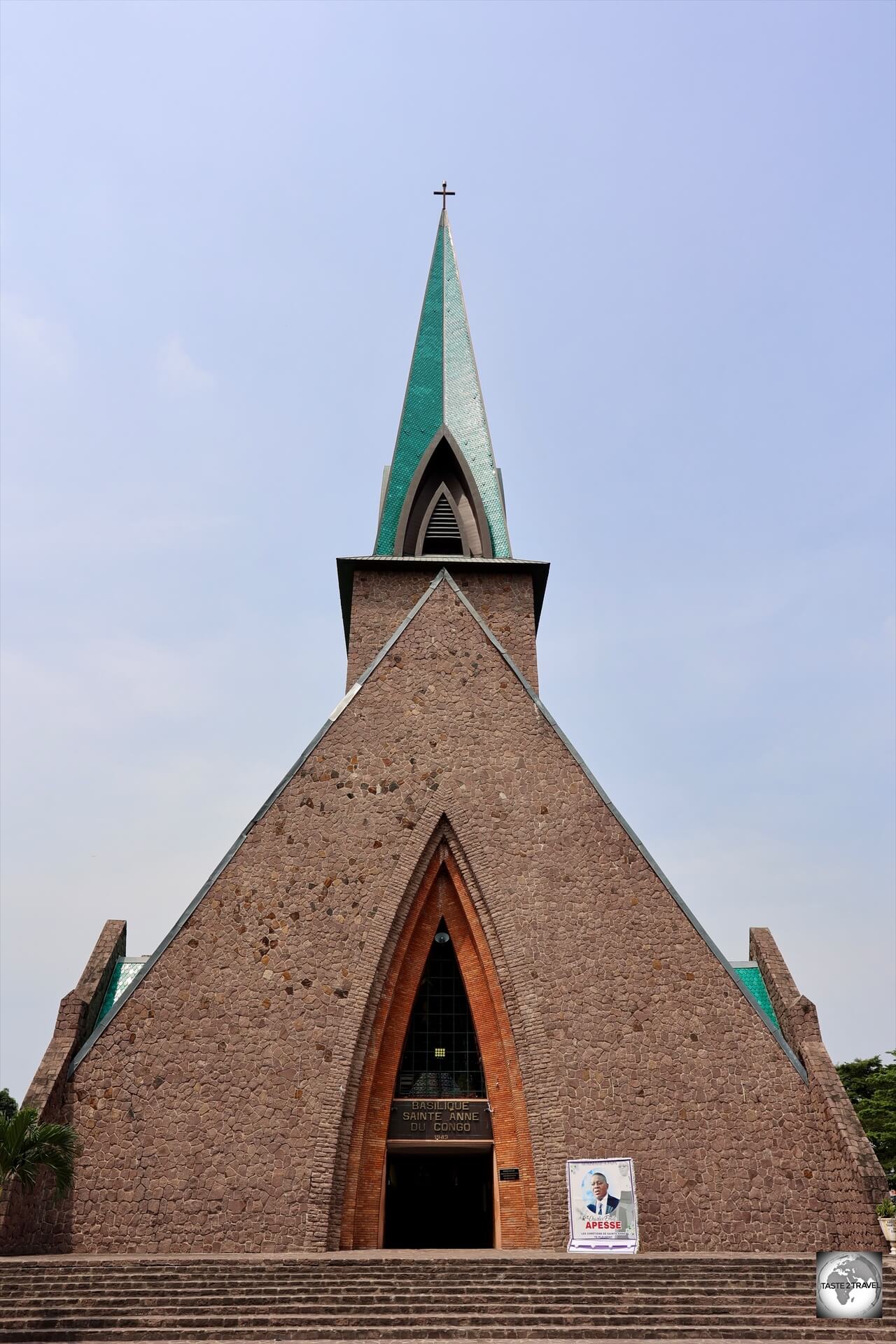
A view of the exterior of Sainte-Anne of the Congo Basilica, which blends European and African design elements.
The basilica was constructed with baked bricks and locally sourced materials, adding a regional authenticity to its construction.
At that time of its construction, Brazzaville was the official capital of Free France, the government-in-exile led by Charles de Gaulle that continued to fight against Hitler even after France had fallen.
The basilica was envisioned as a strong and visible symbol of the power of Free France and was intended to be the “sanctuary of remembrance of Free France”.

A grotto, next to Sainte-Anne of the Congo Basilica, is a popular spot for praying locals.
Charles De Gaulle was a keen supporter of the construction of Sainte-Anne’s church, and provided a substantial donation of 800,000 Francs.
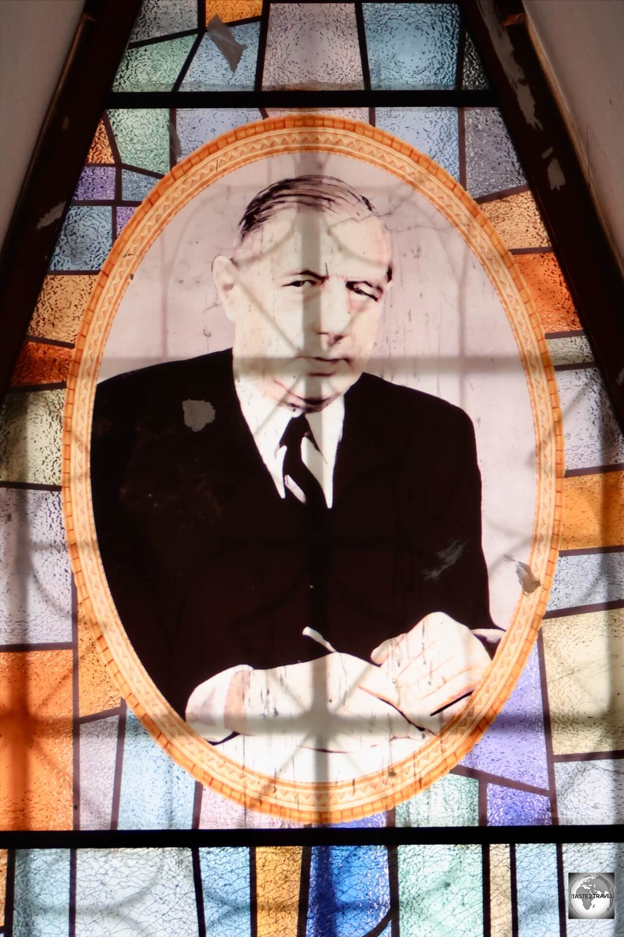
A stained-glass window at Sainte-Anne of the Congo Basilica features a portrait of Charles de Gaulle.
Today, a stained-glass window in the church features a portrait of the former General, in recognition of his generous donation towards construction costs.
The church wasn’t consecrated until 1949, several years after the war had ended, and even then, its construction was incomplete.
In 2011, the spire of the bell tower was finally finished.
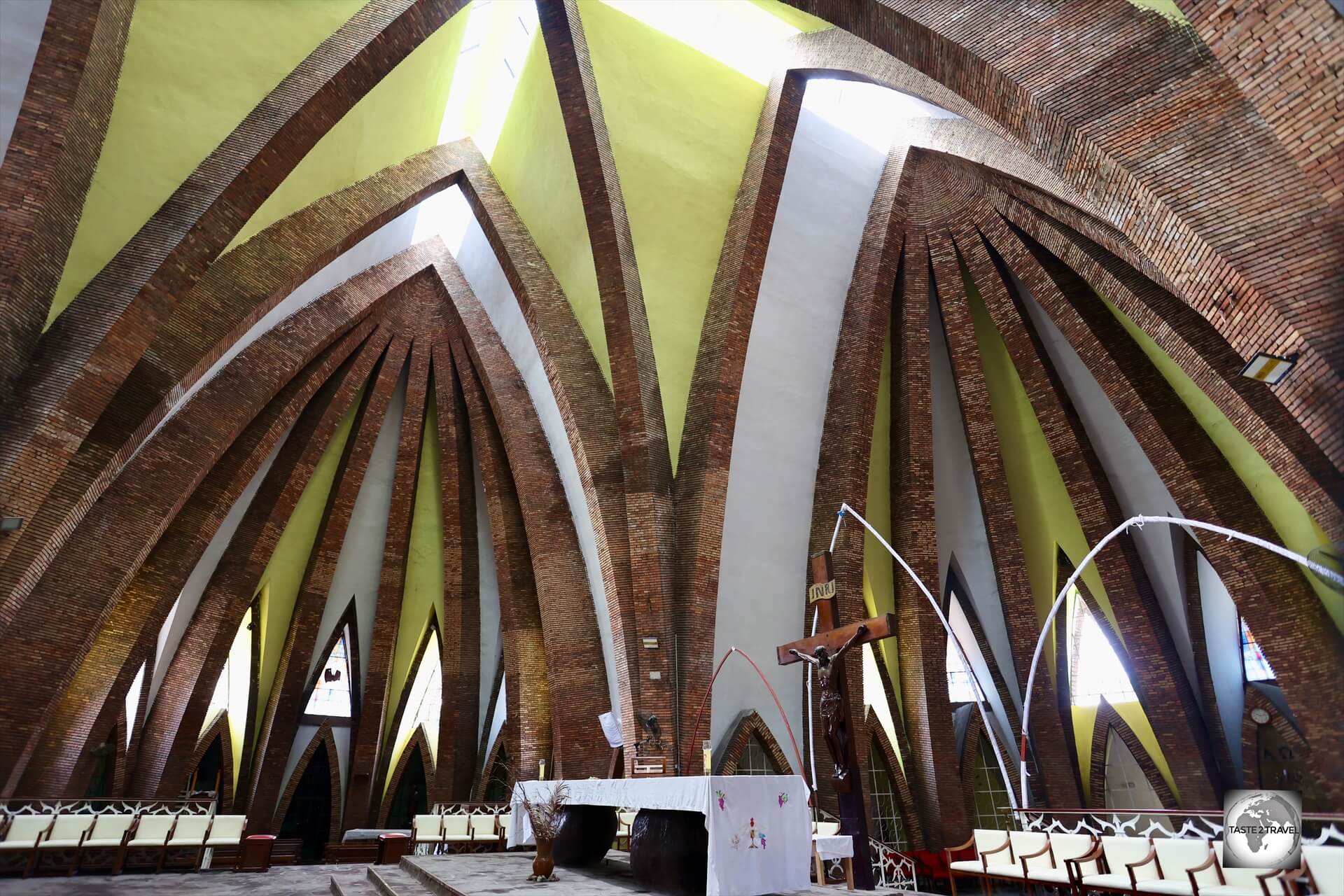
A view of the nave of Sainte-Anne of the Congo Basilica.
From a classical Latin cross point of view, the church is a building of vast proportions using a very sharp pointed arch inspired by the spearheads of northern Congo.
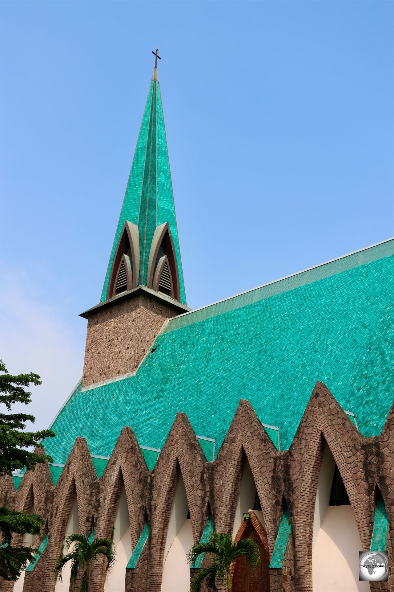
Evoking the emerald-coloured rainforest which surrounds Brazzaville, the roof of St Anne’s is covered with 240,000 green glazed tiles.
The 240,000 green glazed tiles which cover the roof, and the soaring spire, are symbolic of the equatorial rainforest which surrounds Brazzaville.

The entrance to Sainte-Anne of the Congo Basilica is through these striking copper doors, which were designed by sculptor Albert Gilles.
Entrance to the Basilica is through a large, extremely pointed, arched door.
This pointed arch is inspired by spearheads of the Zande culture of Southern Congo.
The main doors to the church feature two giant copper panels.
These copper doors, a notable part of the church’s architecture, were crafted by the sculptor Albert Gilles.
The doors were initially located at St. Joseph Church in Quebec City.
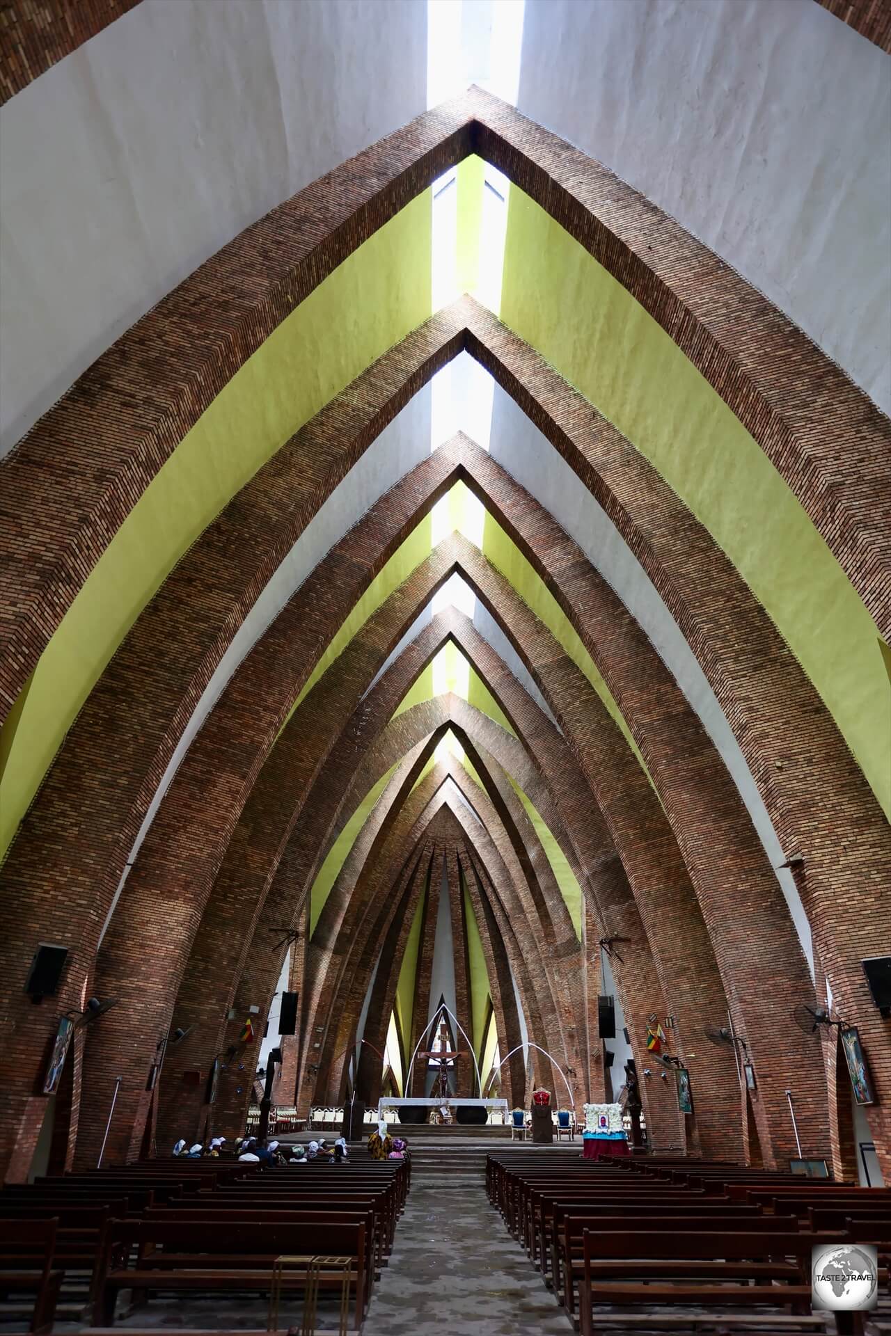
The interior of the basilica features pointy arches, inspired by Congolese spears.
The interior of the basilica features pointy, arches, inspired by Congolese spears, columns, and stained-glass windows – all of which create a solemn and inspiring atmosphere.
Nabemba Tower

Nabemba Tower is the tallest building in the Republic of the Congo.
The tallest building in the Republic of the Congo, this modern skyscraper is named after Mount Nabemba, the country’s highest peak (1,020 metres).
At 106 metres and 30 floors, Nabemba Tower is the tallest building in the Republic of the Congo.
It is named after Mount Nabemba, the highest mountain in the country which has an elevation of 1,020 metres (3,346 ft).
The tower was built with borrowed funds from the French oil company Elf Aquitaine and is also known as the Elf Tower.
The tower was designed by Jean Marie Legrand during the government’s five-year plan and was built between 1983 and 1986.
While it’s mostly used for government offices and not open to the public, it’s still a prominent part of the Brazzaville skyline and a popular photo stop for visiting tourists.
Despite it being considered by some as an architectural gem, local architect Norbert Mbila has said repeatedly that the tower is nothing more than a “symbolic building which was built purely for prestige and it is neither necessary nor useful for such a poor country”.
The annual running costs of the building are around €3.5 million which is an outrageous sum of money for such a poor country.
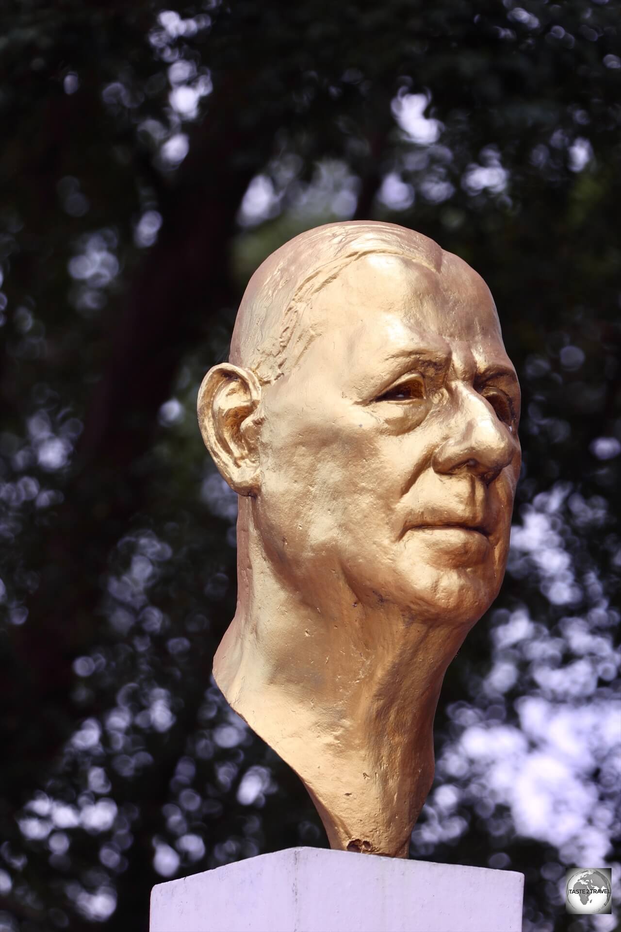
Pierre Savorgnan de Brazza Memorial
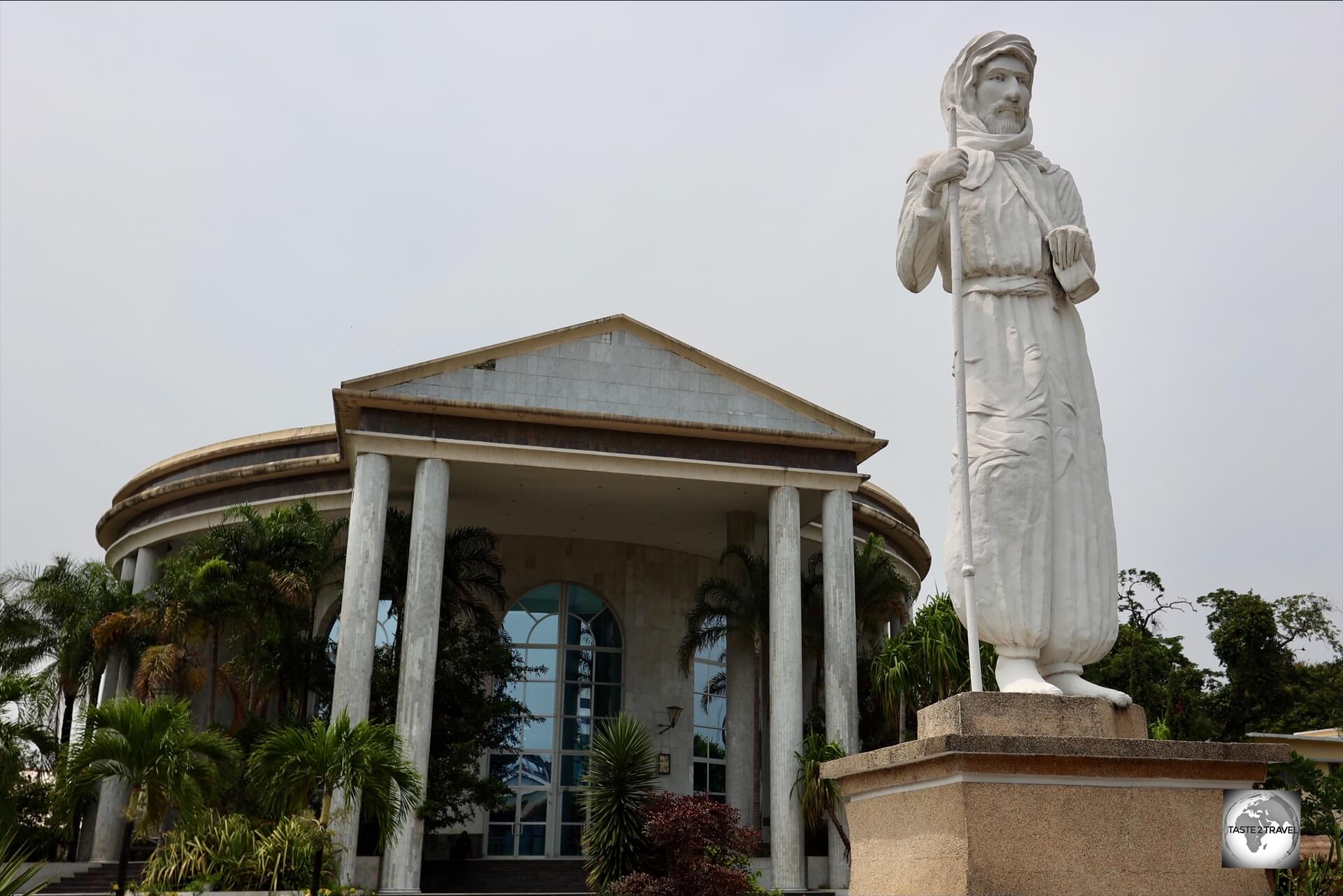
A statue of Pierre Savorgnan de Brazza, the French explorer of Italian origin, who founded Brazzaville in October 1880.
In the heart of Congo’s capital stands a white-marble mausoleum which houses the remains of Pierre Savorgnan de Brazza, the French explorer of Italian origin, who founded Brazzaville in October 1880.
Installed in front of the mausoleum is a statue of the man himself.
With his family’s financial help, de Brazza explored the Ogooué region of Central Africa, and later, with the backing of the Société de Géographie de Paris, he explored the interior of the Congo, travelling along the right bank of the Congo River, where he founded Brazzaville.
Under French colonial rule, the capital of the Republic of the Congo was named Brazzaville after him and the name was retained by the post-colonial rulers.
Statue of Liberty Monument
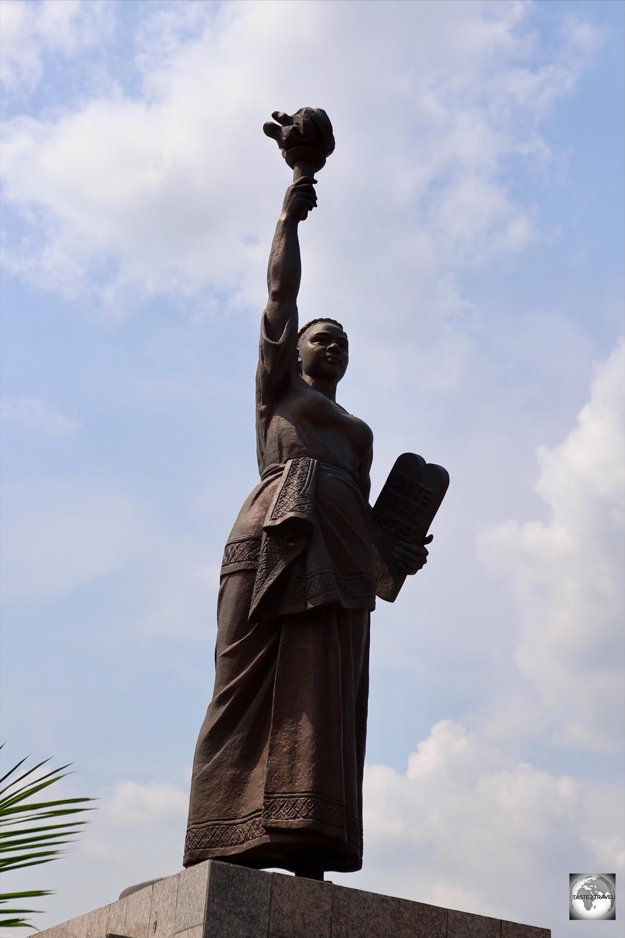
An African version of the Statue of Liberty is installed outside Brazzaville Train Station.
Standing sentinel, outside Brazzaville Train Station (Gare de Brazzaville), is an African version of the Statue of Liberty.
The statue was inaugurated on December 28, 2009, by the President of the Congo and the Minister of Culture and the Arts.
At the time, the main square in front of Gare de Brazzaville was renamed “Place de la Liberté”.
The task of sculpting the statue was entrusted to the Mansudae Art Studio, the leading North Korean art studio which is located in Pyongyang and is featured in my North Korea Travel Guide.
Classically inspired by the American version, which was designed by the French Bartholdi and Eiffel, the woman holds the “inextinguishable” flame of Liberty in one hand and a “tablet of the Law” in the other.
This Africanised version is draped in a traditional Congolese loincloth.
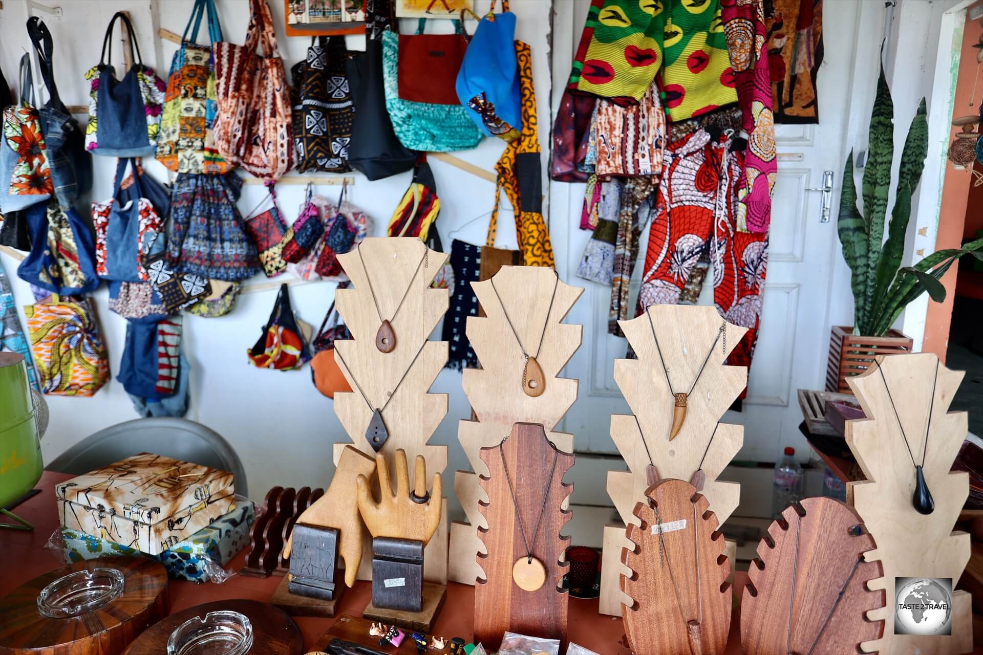
Craft Market
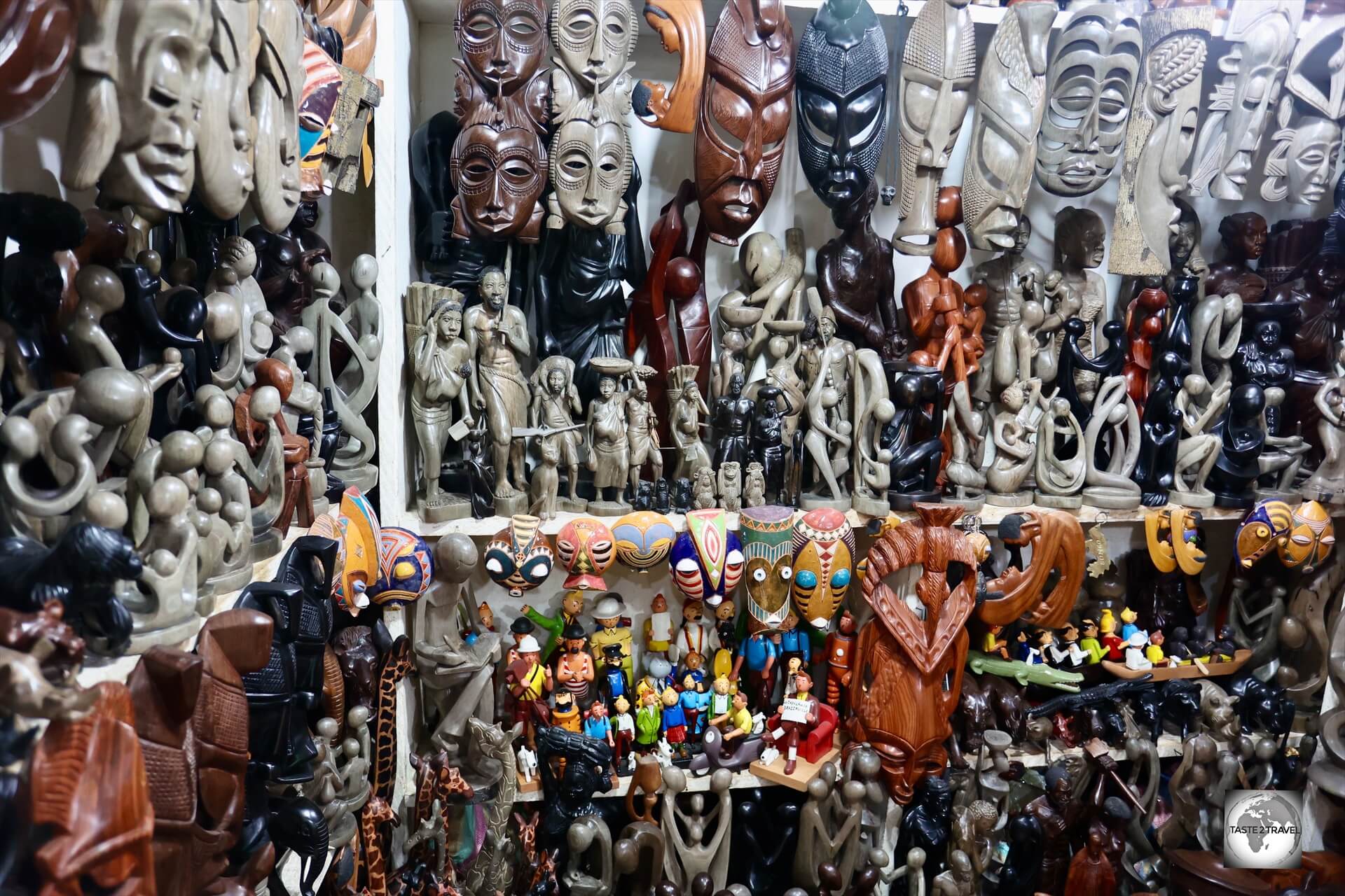
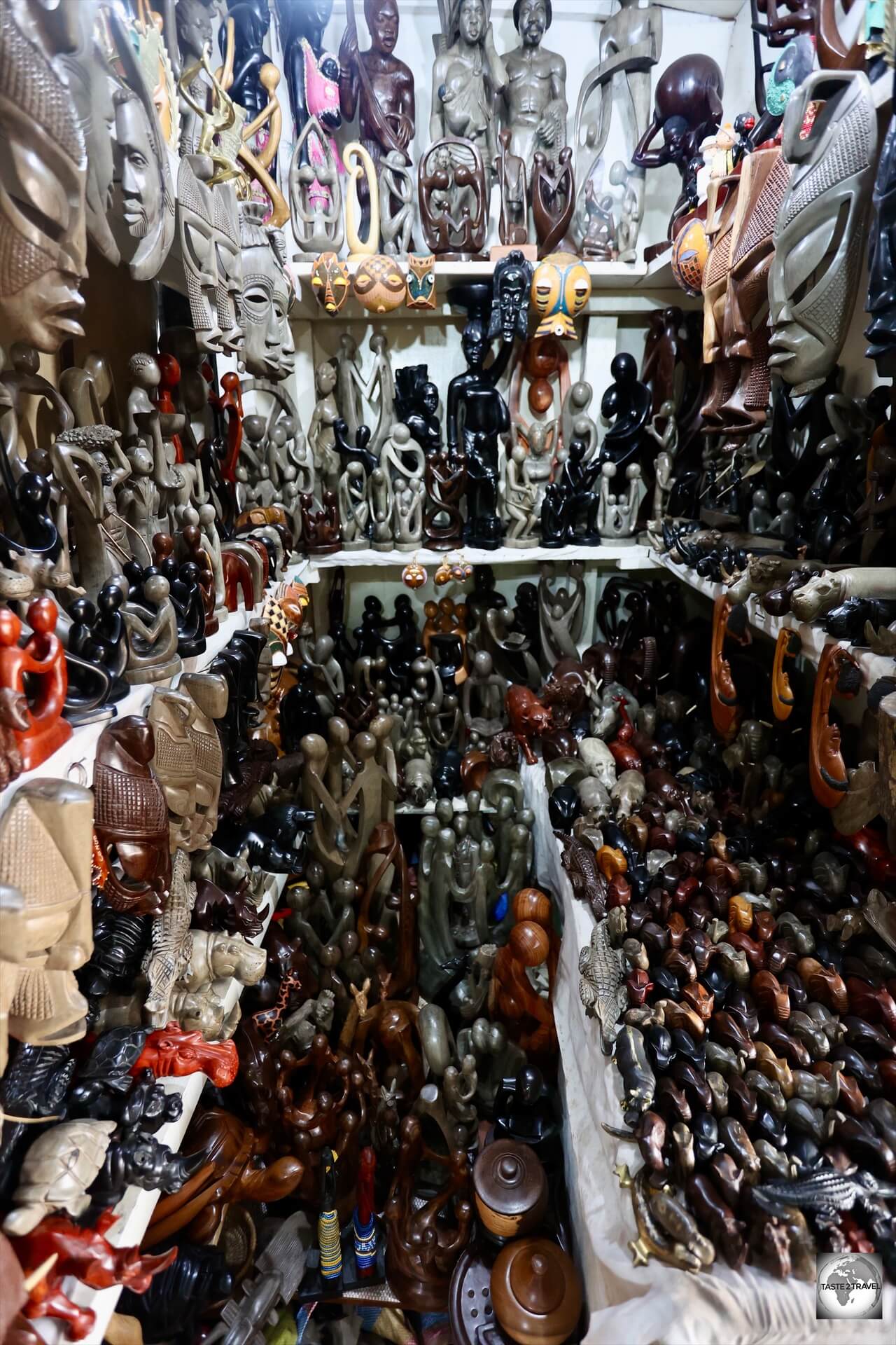
A craft market in Brazzaville, featuring a treasure trove of locally carved masks and soap-stone sculptures.
The craft markets of Brazzaville are brimming with, locally-made, arts and crafts which make for fabulous souvenirs, particularly Poto-Poto market.
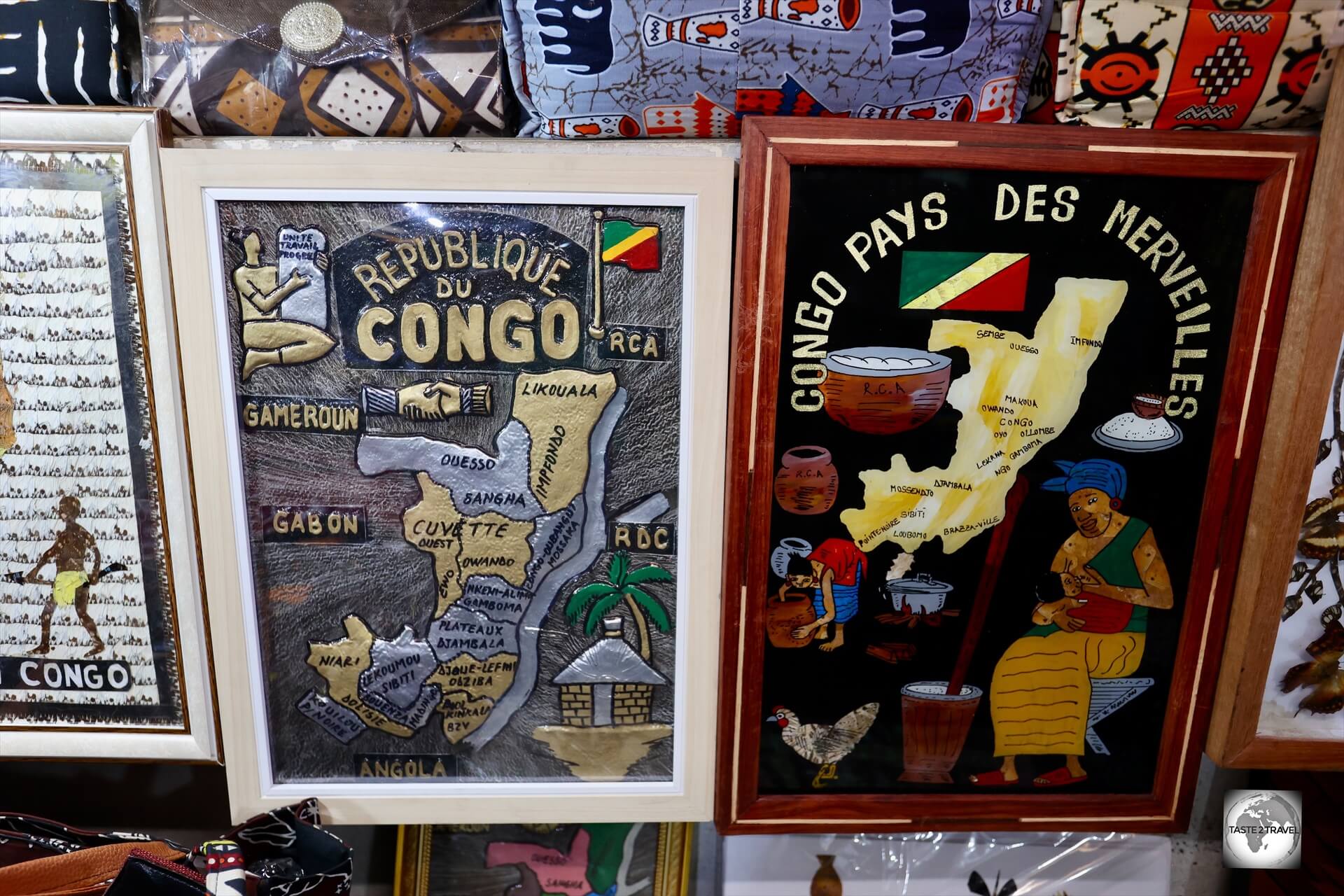
Souvenir metallic maps of the Republic of the Congo make for unique souvenirs.
You can find everything from textiles and art to handicrafts, and even items from the nearby Poto-Poto painting school.
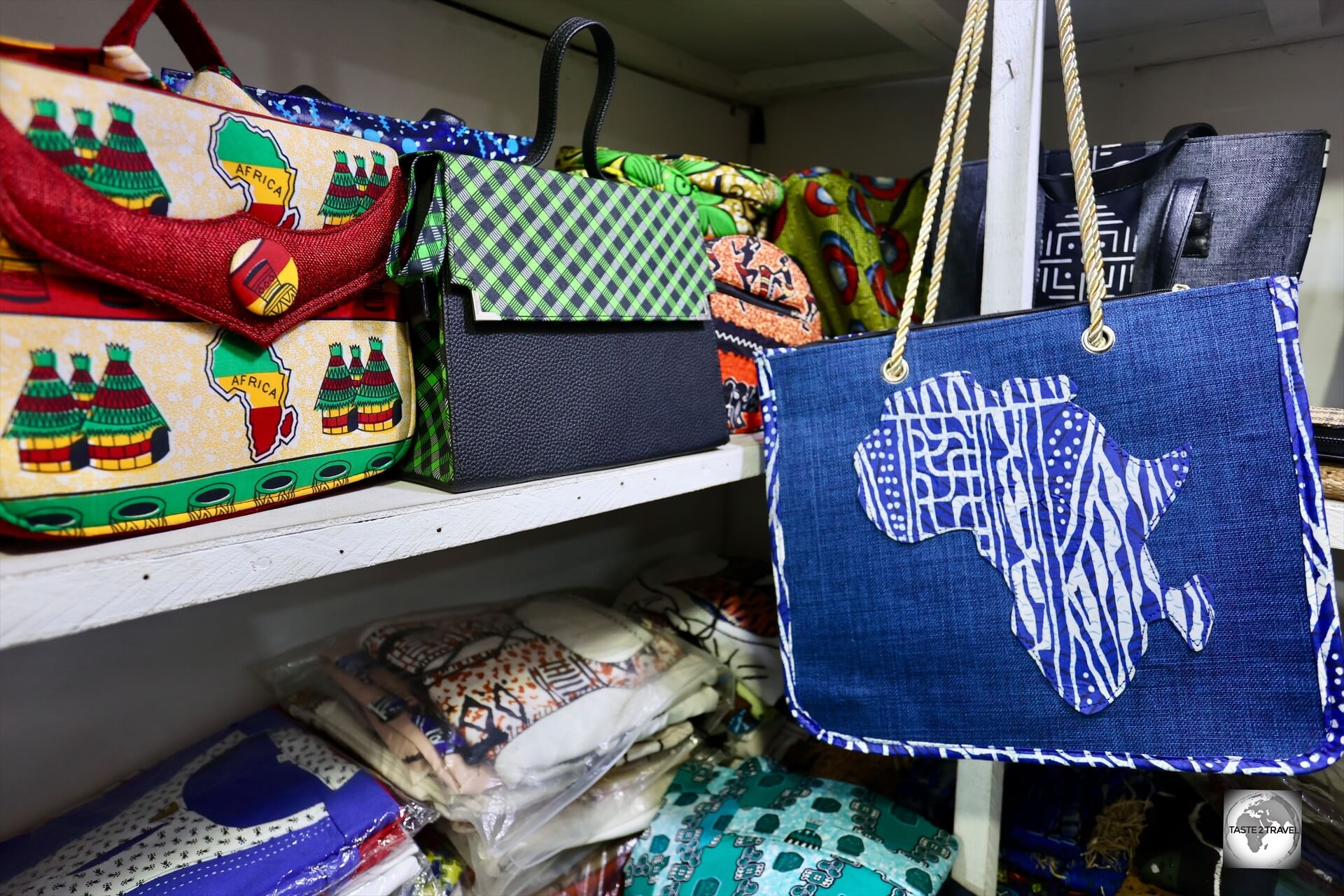
Brazzaville is a shopper’s paradise.
These markets are known for their local artistry and can be a stimulating place to bargain for authentic Congolese items, especially carved Malachite items which is made from locally-sourced Malachite.
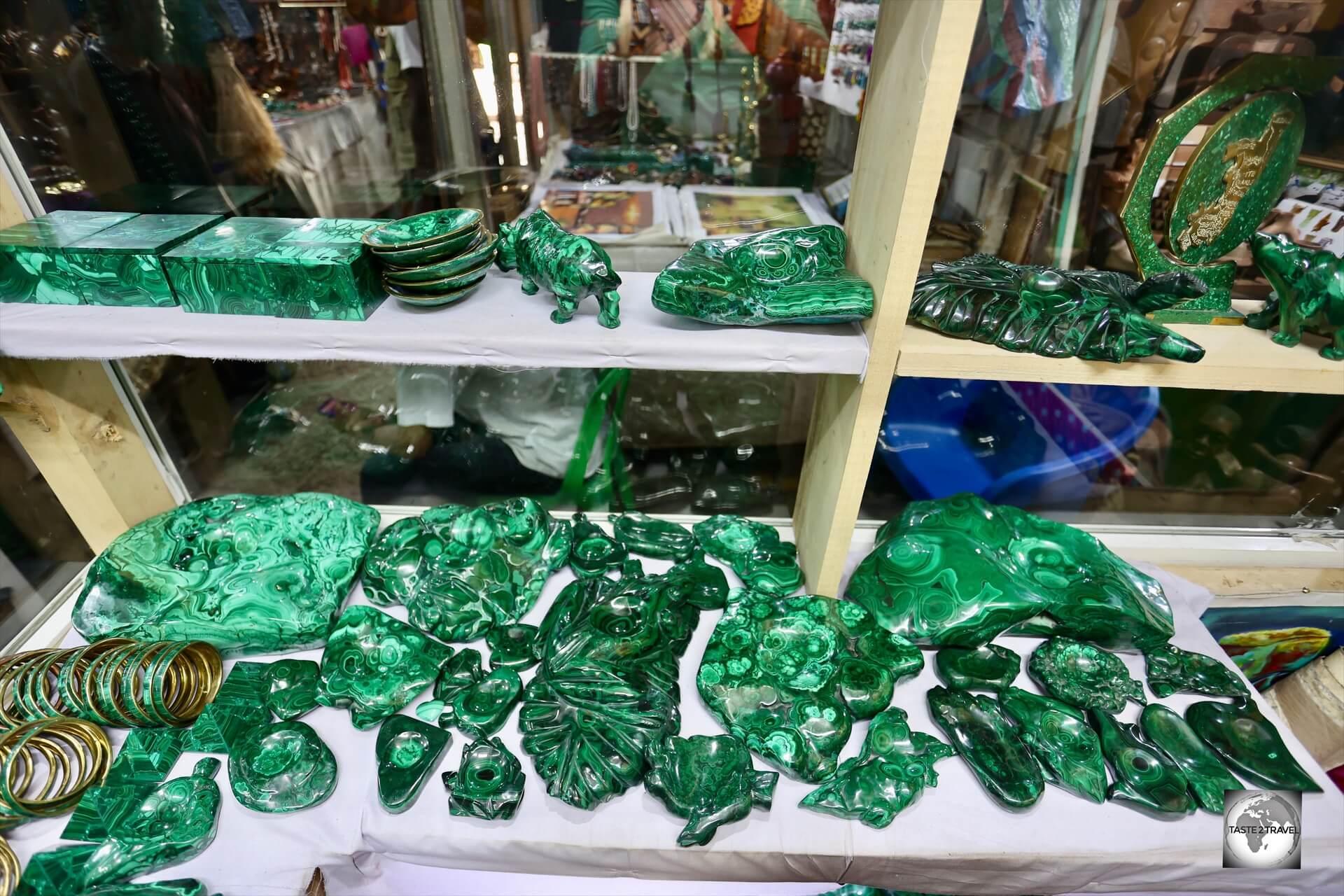
Malachite stone carvings are plentiful in the Republic of the Congo.
Galerie-Art-Brazza
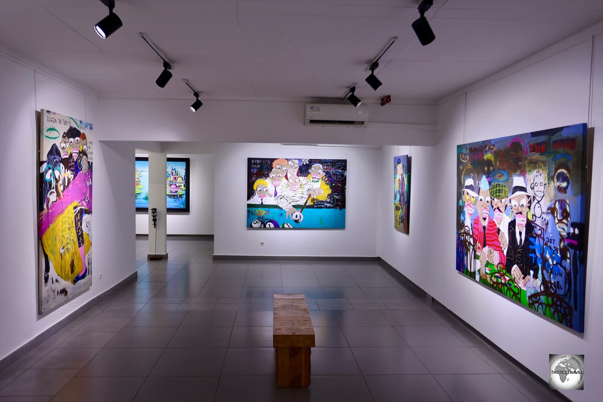
A must visit sight in Brazzaville, Brazza-Art-Galerie is a private art gallery which was established by Sandra Plachesi, a native of France who has lived in Brazzaville for many years.
Brazzaville is a true paradise for artists and art lovers where the art scene is alive and thriving.

The gallery exhibits and eclectic collection of paintings and sculptures by emerging and established African artists.
There are several art galleries around the city which showcase works by local Congolese artists (from both Congo’s).
One such gallery is the Brazza-Art-Galerie.
The aim of the gallery is to promote the works of local Gongolese artists.
The gallery was founded by Sandra Plachesi, a native of France who has lived in Brazzaville for more than ten years and is a keen collector and promoter of local art.
The Brazza-Art-Galerie is known for its program of exhibiting radical local art.
The aim of the gallery is to promote the works of local artists with all works available for purchase.
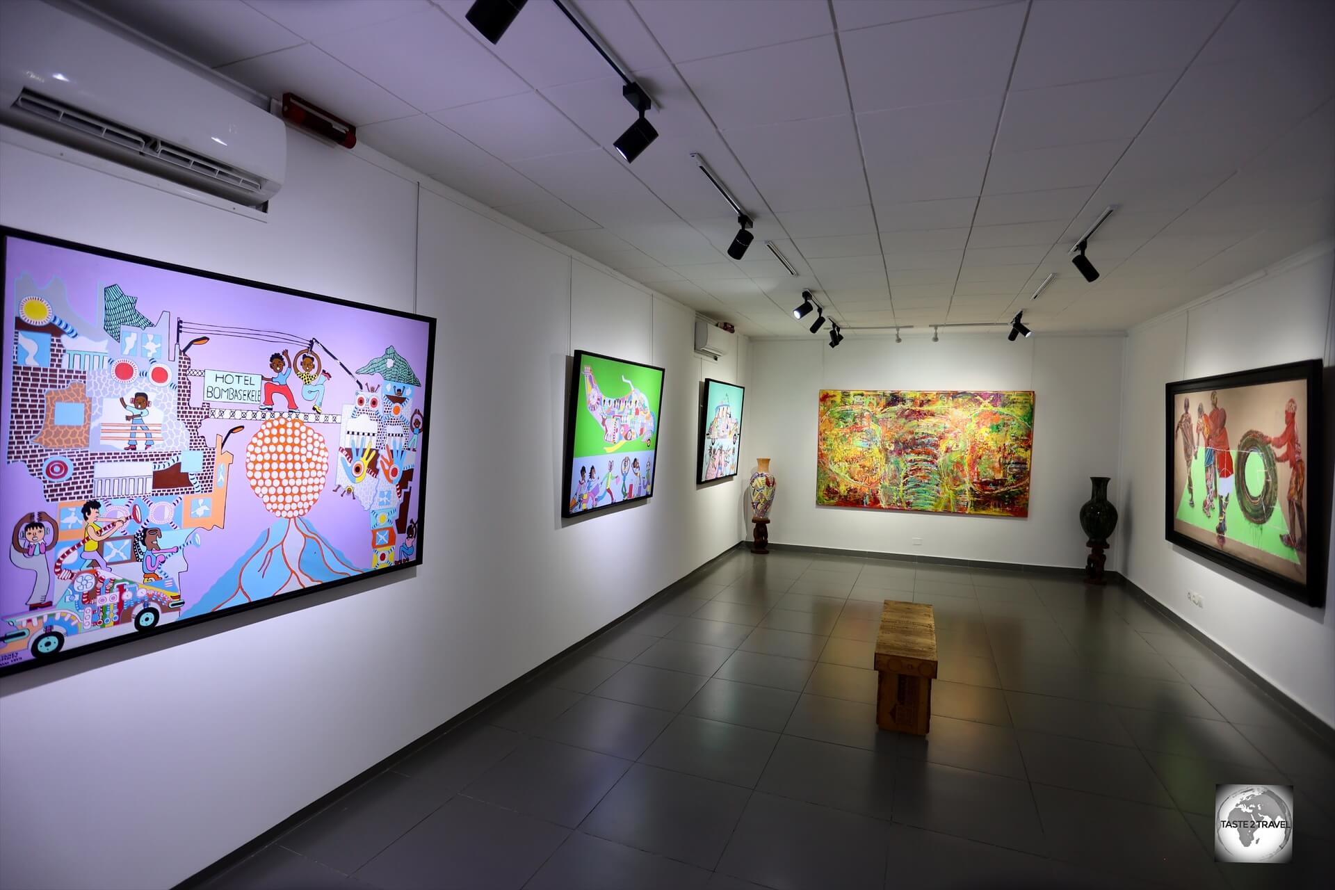
The Brazza-Art-Galerie features several galleries where the works of contemporary Congolese artists are exhibited.
The gallery exhibits and eclectic collection of paintings and sculptures by emerging and established African artists.
Worldwide shipping is available on any large purchase.
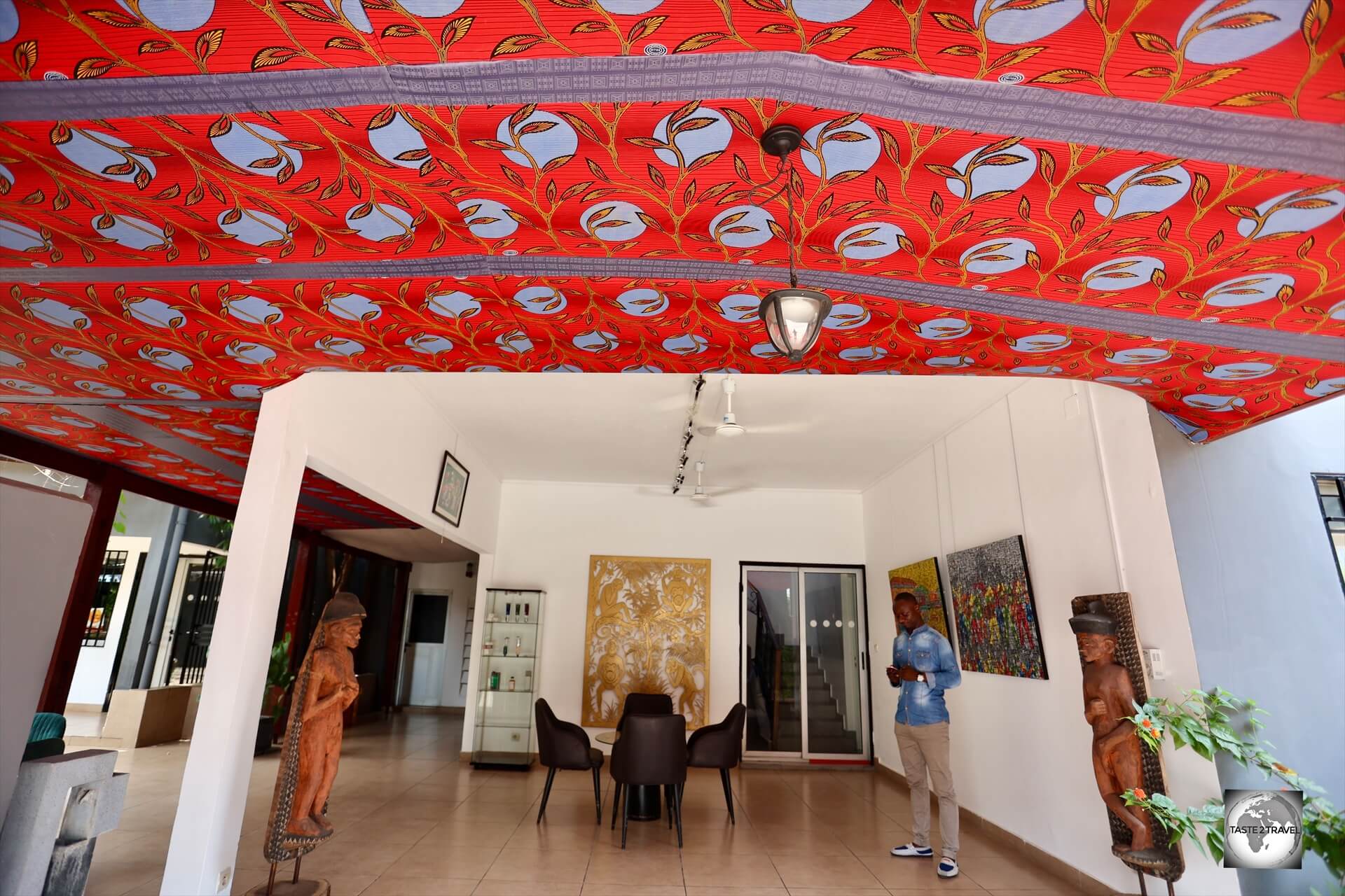
The entrance to Brazza-Art-Galerie which is located in downtown Brazzaville.
Contact Details for Galerie-Art-Brazza
- Address: 213 rue de la Musique Tambourinée –Brazzaville
- Telephone: +242 05 031 2020
- Website: https://galerie-art-brazza.com/
- Email: contact@brazza-art-galerie.com
- Facebook: https://www.facebook.com/galerieartbrazza/
- Instagram: https://www.instagram.com/galerieartbrazza
Fresque de l’Afrique (Fresco of Africa)
Fresque de l’Afrique (Fresco of Africa) represents the history of the Congolese people, from the pre-colonial period to the introduction of socialism in the 1960s.
The “Fresque de l’Afrique” (Fresco of Africa), sometimes called The People Speak to the People, is a work made in 1970 on commission from the Congolese state during the presidency of Marien Ngouabi.
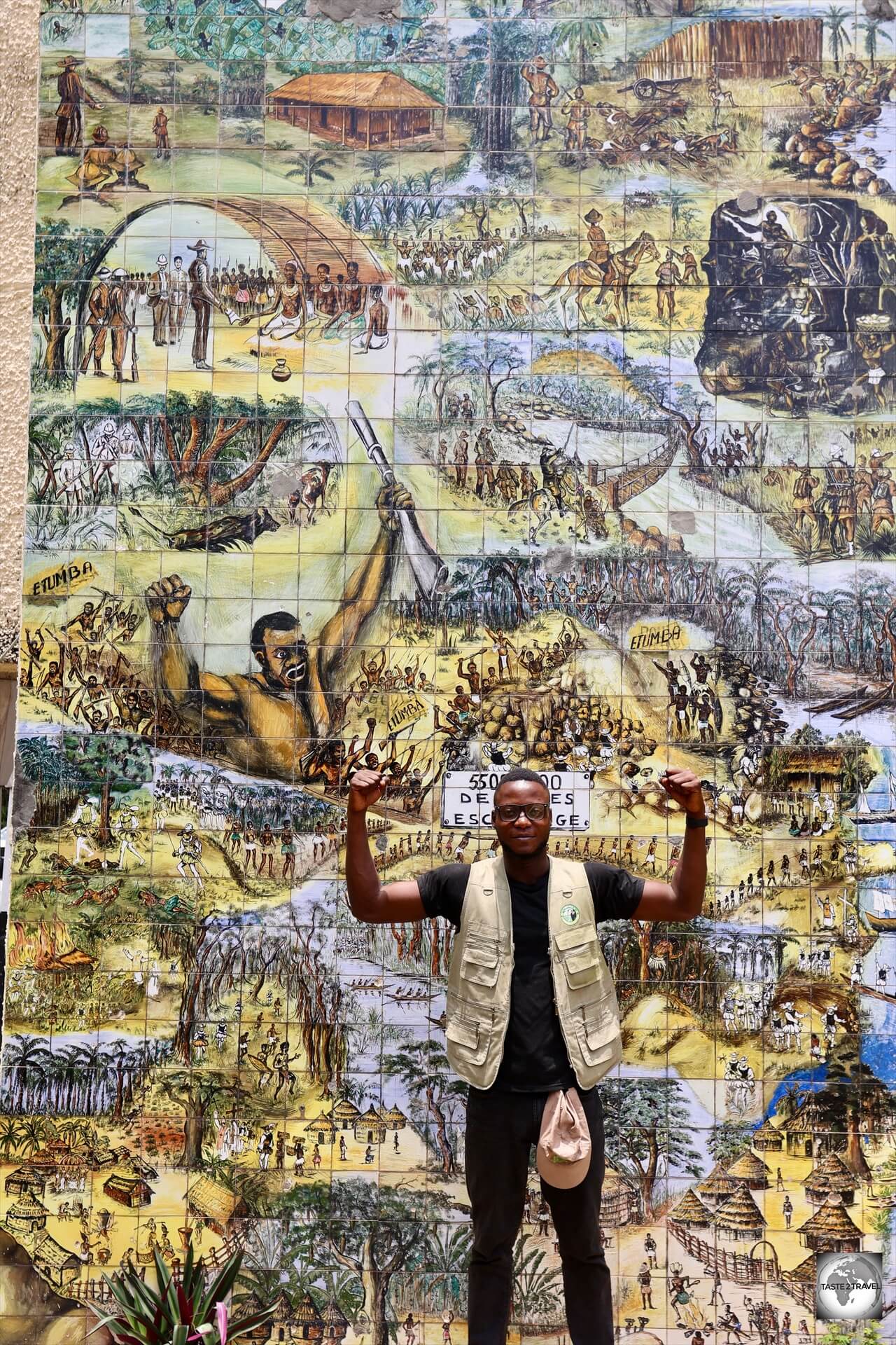
My guide, Satch, being strong, alongside the strong warrior, on the Fresque de l’Afrique in Brazzaville.
Composed of hundreds of hand-painted ceramic tiles, it represents the history of the Congolese people, from the pre-colonial period to the introduction of socialism in the 1960s.

The Fresco of Africa depicts the persecution of the Congolese people by European colonial powers, including enforced slavery.
The art piece was made by four Congolese artists, Michel Hengo, Émile Mokoko, André Ombala and Jean Itoua, supervised by the Italian artist Dégo.
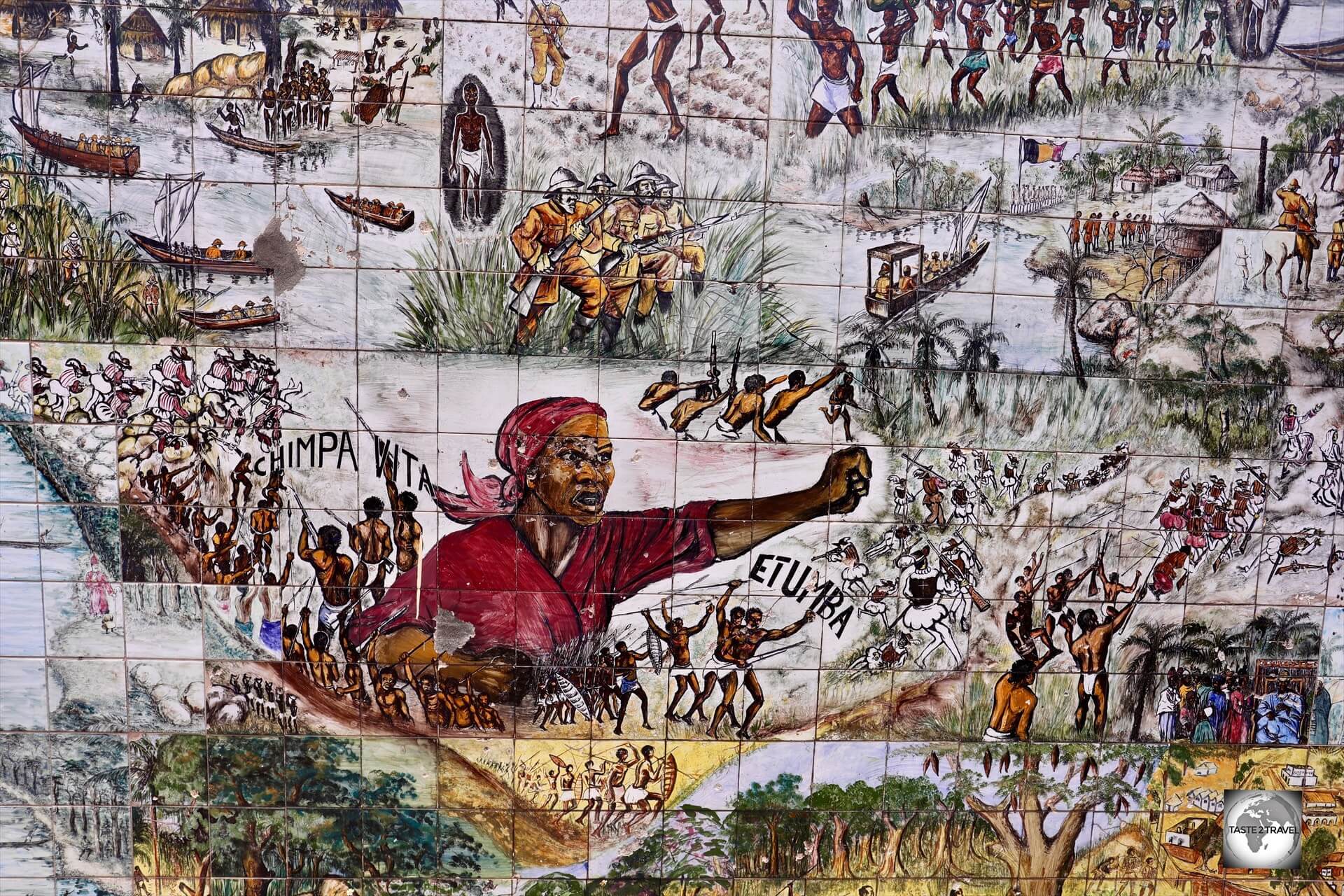
The Fresco of Africa depicts the Congolese rising up to fight against the colonial powers in order to win their independence.
The fresco was originally signed “The people speak to the people”, before its creators were allowed to add their signatures in the 1980s.
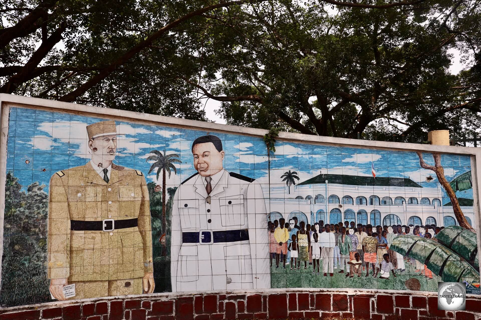
Charles de Gaulle Memorial
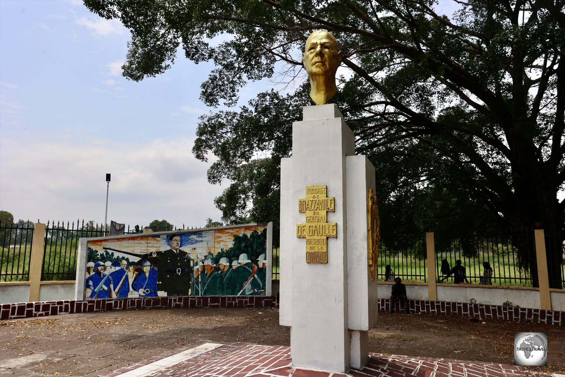
A memorial to Charles de Gaulle, and the Free French movement, is installed in Place De Gaulle (De Gaulle Square).
As outlined in the History section above, Brazzaville served as the capital of the Free France movement from 1940 to 1943.
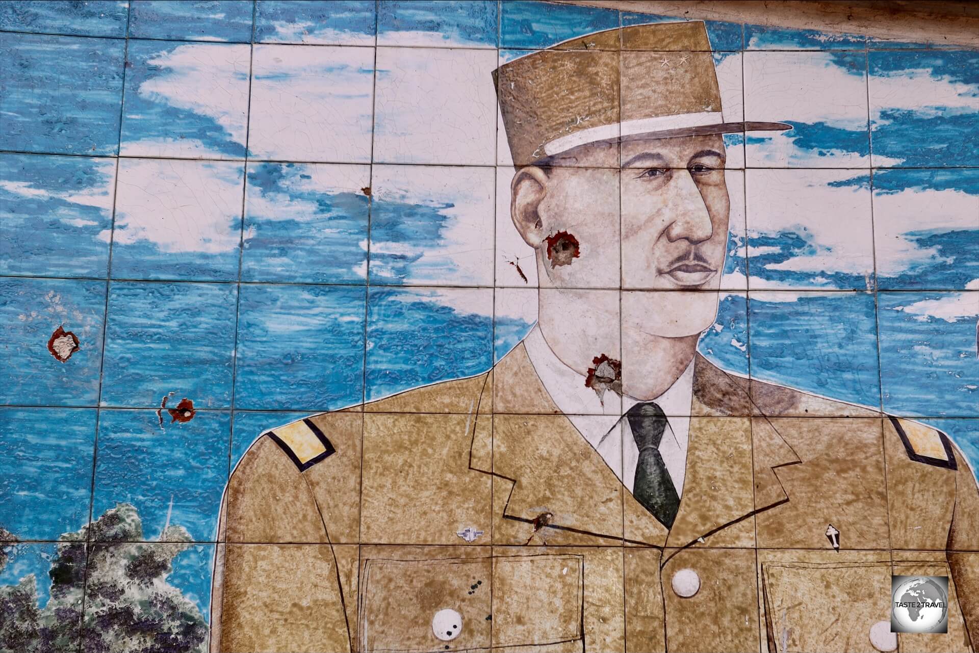
Unfortunately, the (mosaic) face of de Gaulle has been shot twice by bullets!
During this period, it served as the capital of Free French Africa, providing General Charles de Gaulle with a political and military base.
As head of the Free France movement, General Charles de Gaulle lived in Brazzaville from 1940 to 1943.
A memorial to Charles de Gaulle, and the Free French movement, is installed in Place De Gaulle (De Gaulle Square).
15th of August Bridge
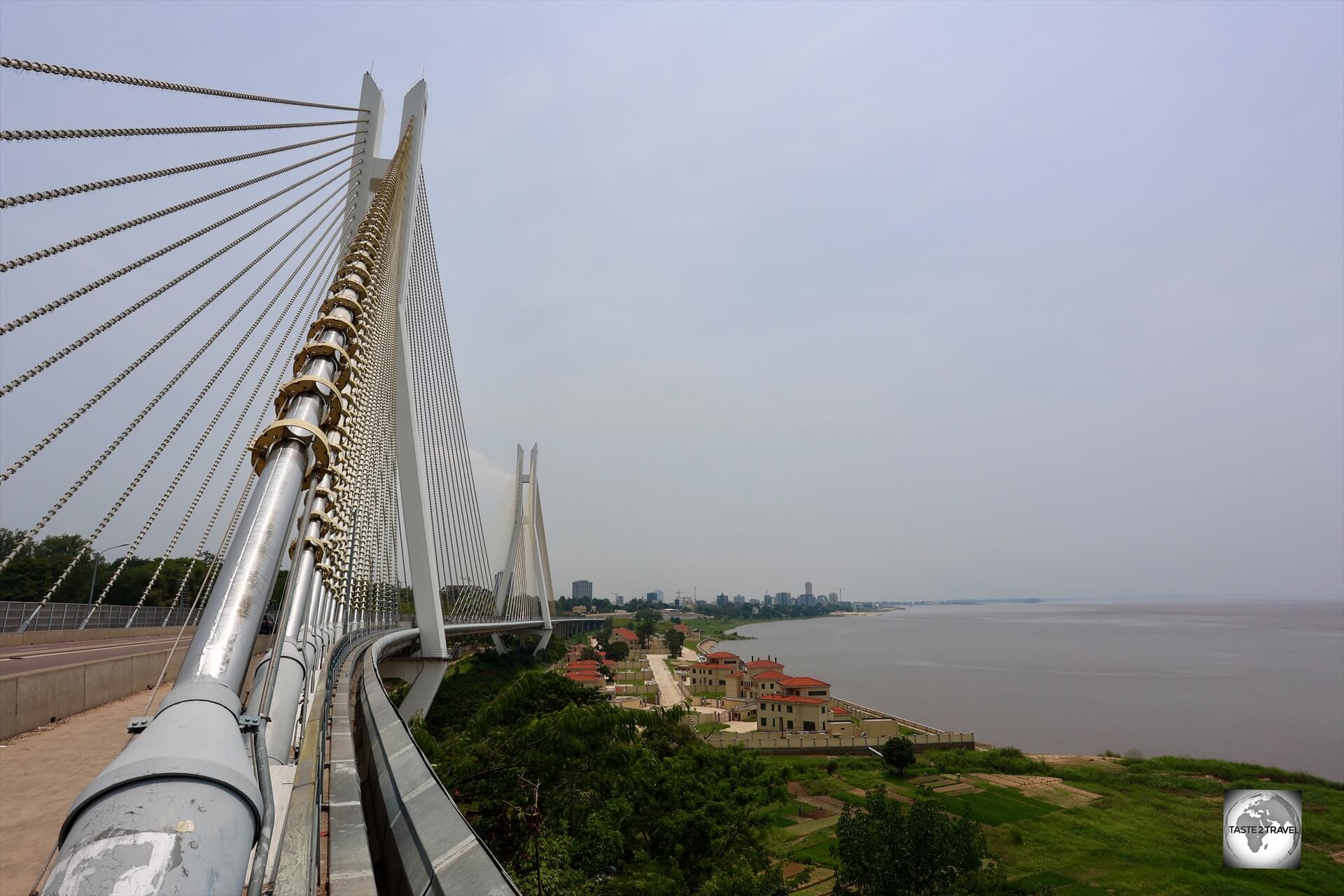
Located on the Corniche, the “15th of August” bridge, is a suspension bridge that commemorates the country’s independence from France on August 15, 1960.
The 15th of August Bridge, officially named Pont du 15 Août 1960, is a suspension bridge that spans a ravine alongside the Congo River.
This majestic bridge commemorates the country’s independence from France on August 15, 1960.
The bridge is a key part of the Corniche, which provides a faster route east out of the city, bypassing the congested city centre.
Kilometre Zero
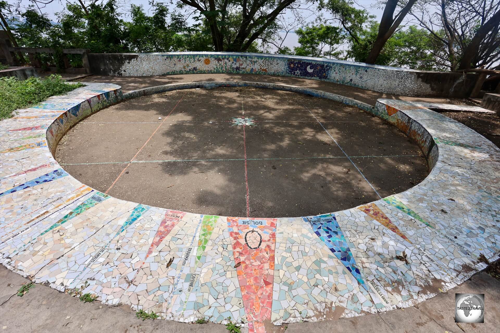
“Kilometre Zero” in Brazzaville is the symbolic point from which for all road distances within the country are measured.
Set in a shady park next to the 15th of August Bridge, “Kilometre Zero” is the symbolic point from which for all road distances within the country are measured.
The exact spot is marked by a large tiled compass with different countries and Congolese towns indicated at different compass points.
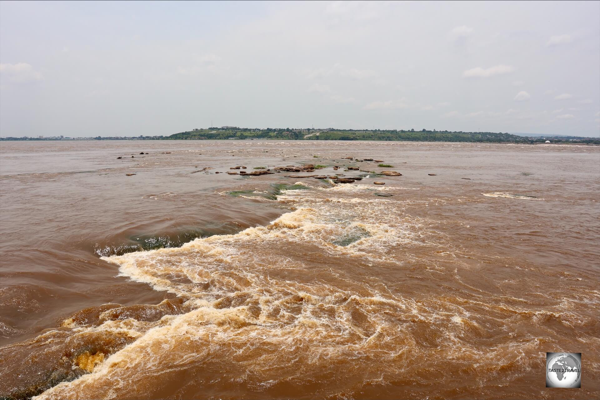
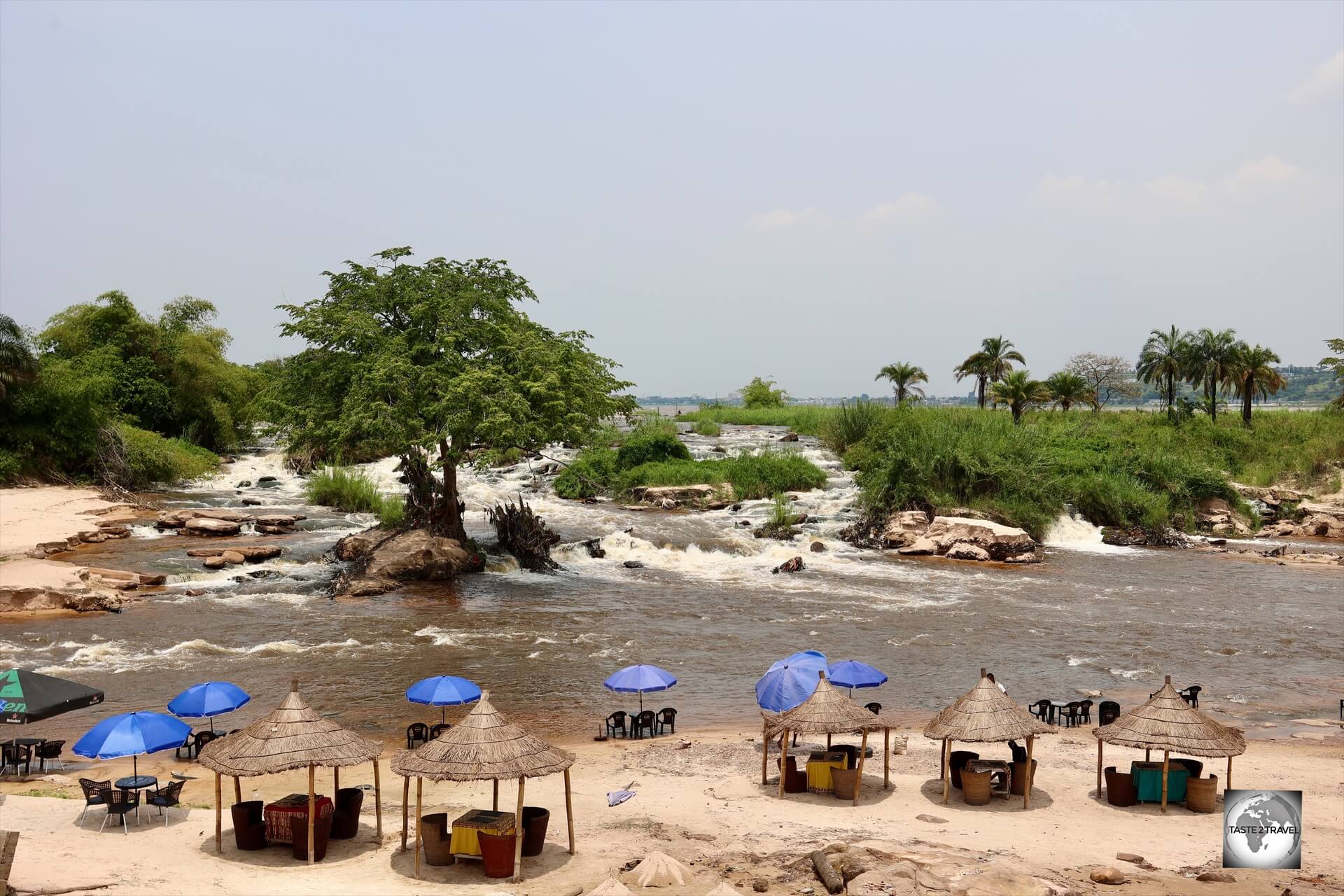
Les Rapides
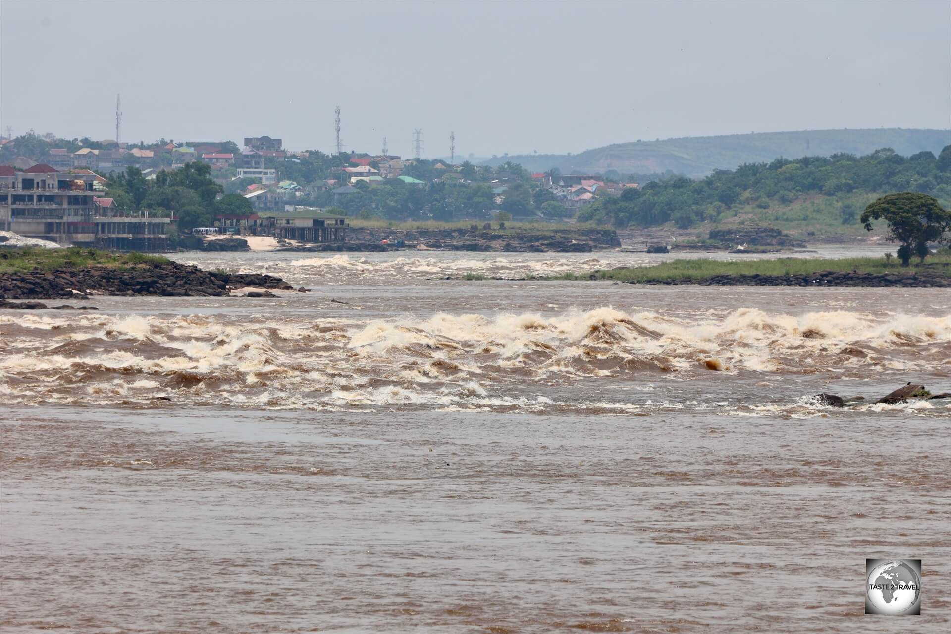
A view of the rapids on the Congo River from Les Rapides bar and restaurant with, Kinshasa (DRC) in the background.
Close to where the Djoué River empties into the much larger Congo River, is Les Rapides, a series of impressive, raging rapids which would be rated off-the-scale in the world of white-water rafting!
Lining the banks of the Congo River are a few garden restaurants which offer a panoramic and dramatic view of the tossing, boiling, furious water.
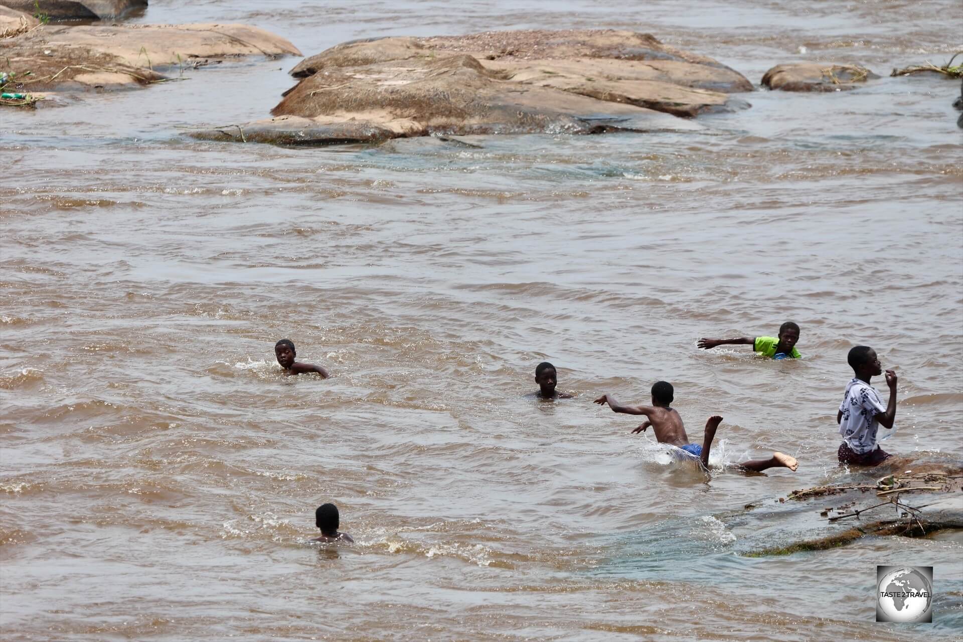
As seen from the terrace of Les Rapides, young dare-devil kids swim in the turbulent waters of the raging Congo River.
The restaurants also offer a view of the dare-devil kids who love to swim in the less-turbulent waters closer to shore.
I invited my guide and driver to a refreshing drink at a popular restaurant and bar called Bar Restaurant Les Rapides.
A view of the Congo River (with DRC on the opposite shore) from Bar Restaurant Les Rapides.
The Congo River is most definitely Brazzaville’s best feature and makes the city what it is.
The gift shop at the Bar Restaurant Les Rapides.
There are many bars and restaurants which offer views of the Congo River.
Bantu Beach
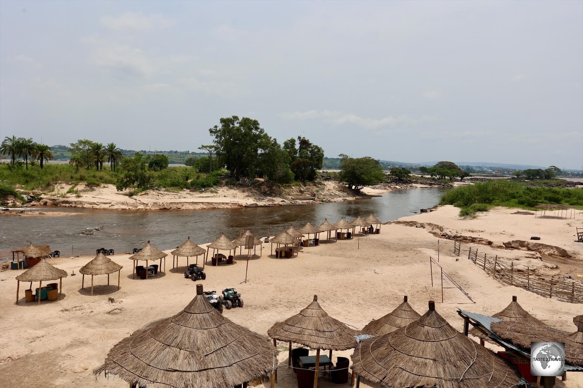
Bantu Beach is a popular recreation spot for locals who wish to cool off in the calm, refreshing waters of the Djoué River.
Located at the point where the Djoué River flows into the Congo River, a sandy inland beach, Bantu Beach is a popular recreation spot for locals who wish to cool off in the calm, refreshing waters of the less powerful Djoué River.
This ultimate chillout zone is operated by the folks from the Bantu Beach Restaurant.
Bantu Beach is located at the point where the Djoué River (seen above) flows into the mighty Congo River.
Visitors have a choice of relaxing under the shade of thatched cabana’s or sitting at chairs and tables which have been placed at the edge of the Djoué River, where one can immerse their feet in the cool river water.

Visitors can sit at chairs and tables which have been placed at the edge of the Djoué River, allowing one to immerse one’s feet in the cool river water.
Local boatman can be hired to row you to nearby islands where you can enjoy a close-up view of the rapids on the raging Congo River.
Djoué River Barrage
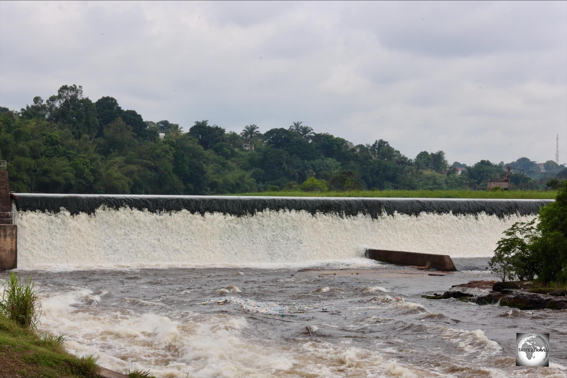
A view of the Djoué River Barrage from the Brazzaville Beach Hotel.
Located on the outskirts of town, 10 km south-west of downtown Brazzaville, the Brazzaville Beach Hotel offers pleasant rooms, a swimming pool and restaurant all of which overlooks the Djoué River and the nearby Djoué River barrage (dam).
The grounds of the Brazzaville Beach Hotel, which overlooks the Djoué River dam.
The hotel restaurant and pool are popular with local visitors on the weekend.
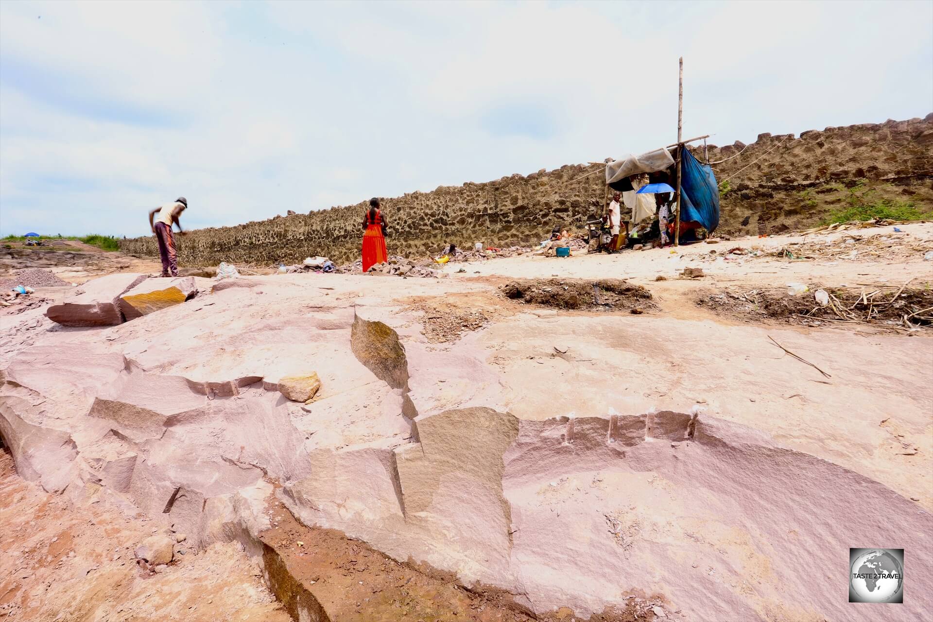
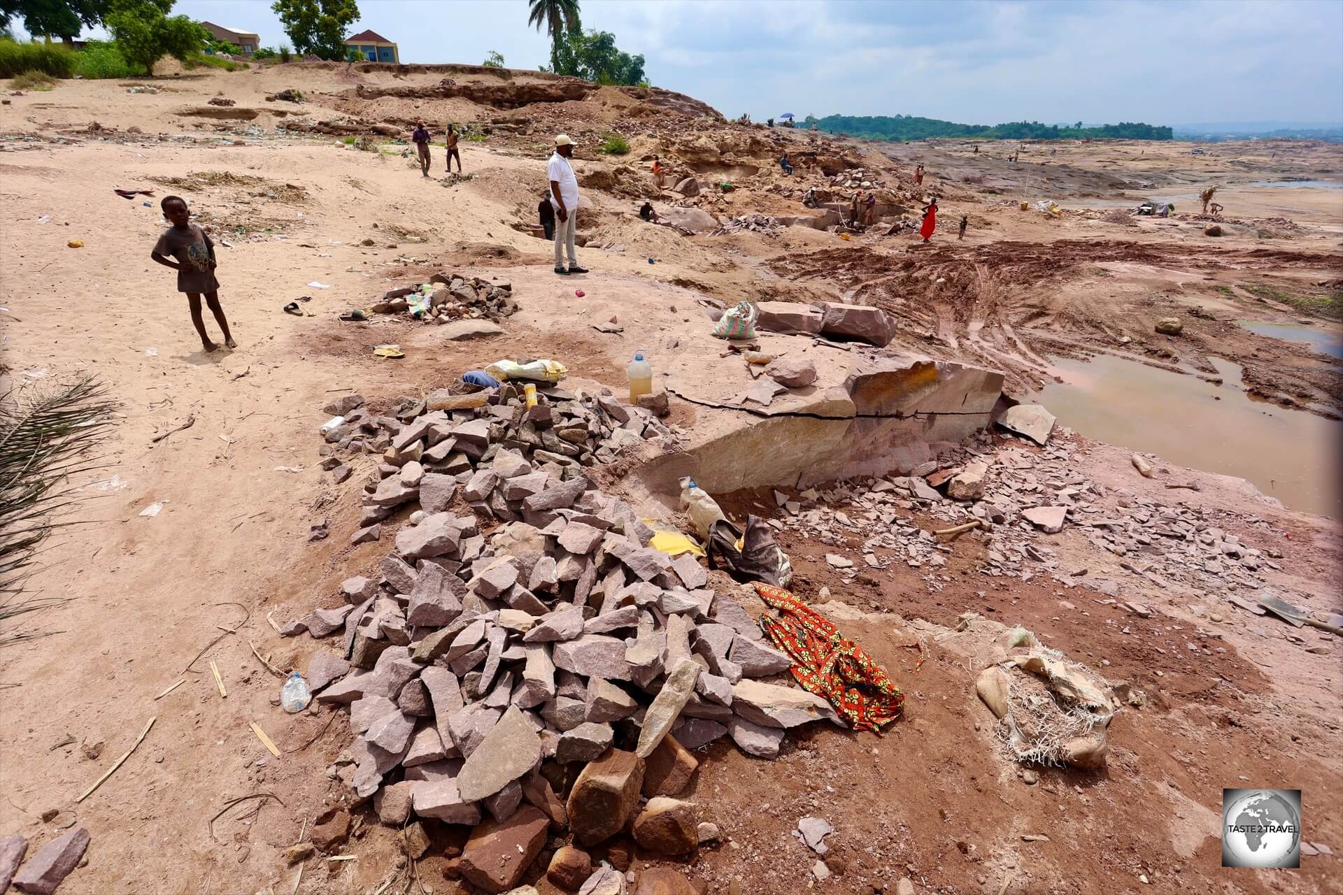
Pink Sandstone Quarry
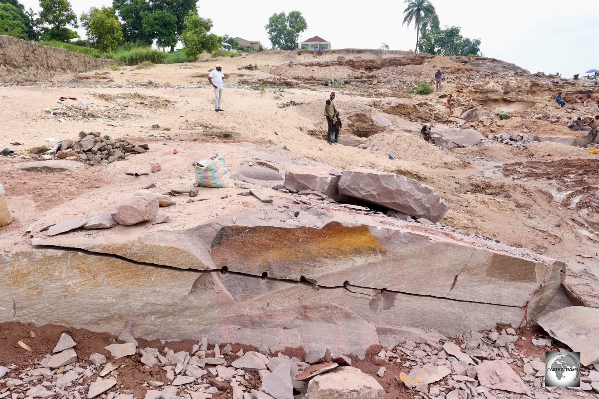
A view of the pink sandstone quarry on the banks of the Congo River, where hard-working labourers use hammer and chisels to chip away the sandstone bedrock manually.
Located on the banks of the Congo River is a pink sandstone quarry where hard-working labourers use hammer and chisels to slowly break the sandstone bedrock into smaller fragments which are then used for the construction and landscaping industry.
Many of the labourers are illegal immigrants from neighbouring DRC and, understandably, did not want their photo taken.
My guide explained that many of the labourers are illegal immigrants from neighbouring DRC and, understandably, did not want their photo taken.
They are paid a minimal wage for a very hard days’ work with both young (children) and old working to break the large sandstone chunks into smaller pieces.
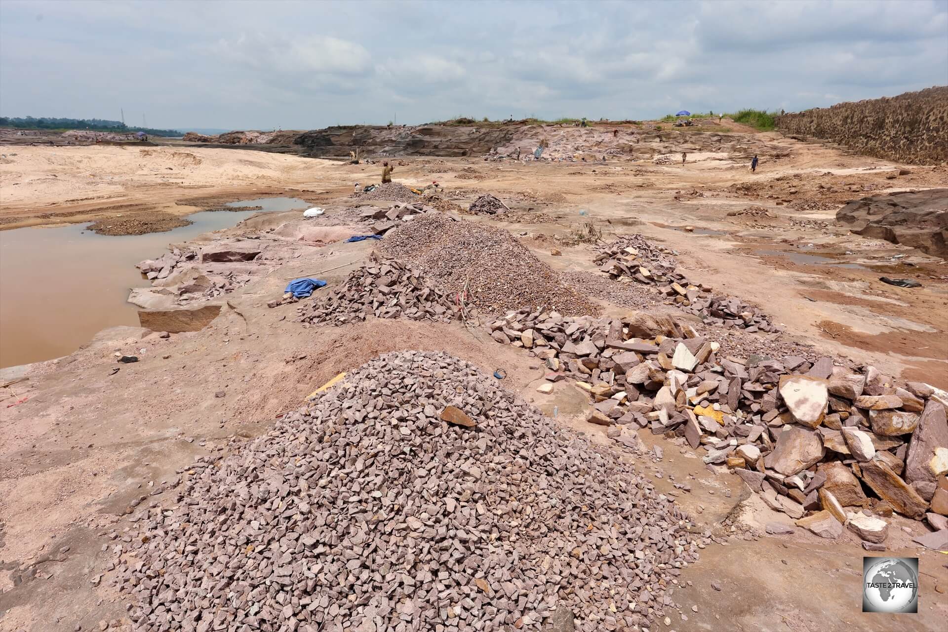
The pink sandstone is broken down into small pieces which are then used in the construction and landscaping industries.
Who is the buyer?
Located nearby is a Chinese-owned rock processing plant!
The pink sandstone quarry spans a huge area with hundreds of labourers working in small tenements.
Accommodation
Capital Hôtel
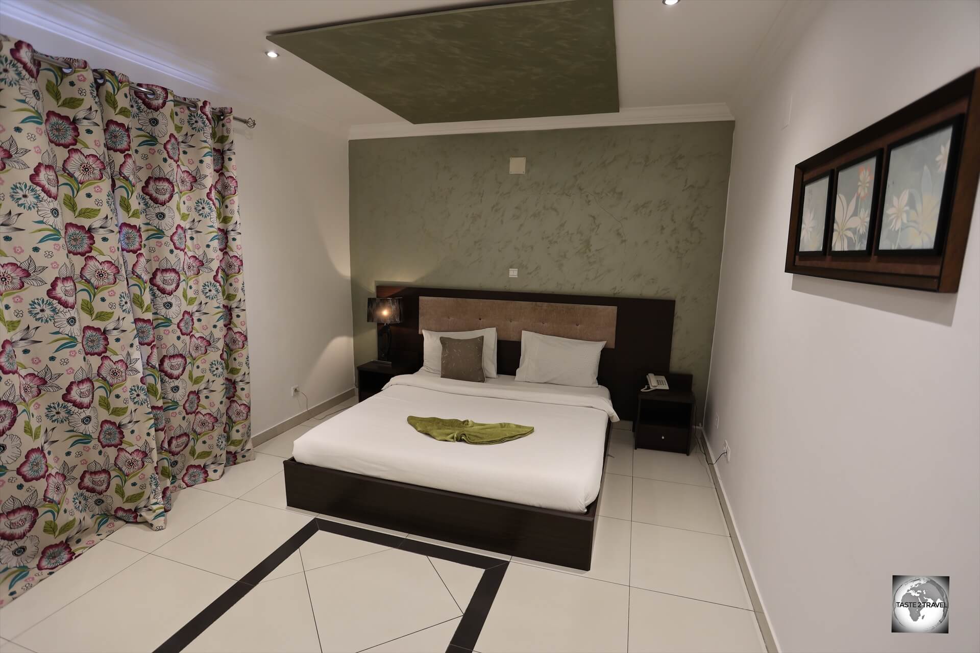
My comfortable and spacious room at the Capital Hôtel, which cost around €80 per night and included buffet breakfast, airport shuttle and free laundry service.
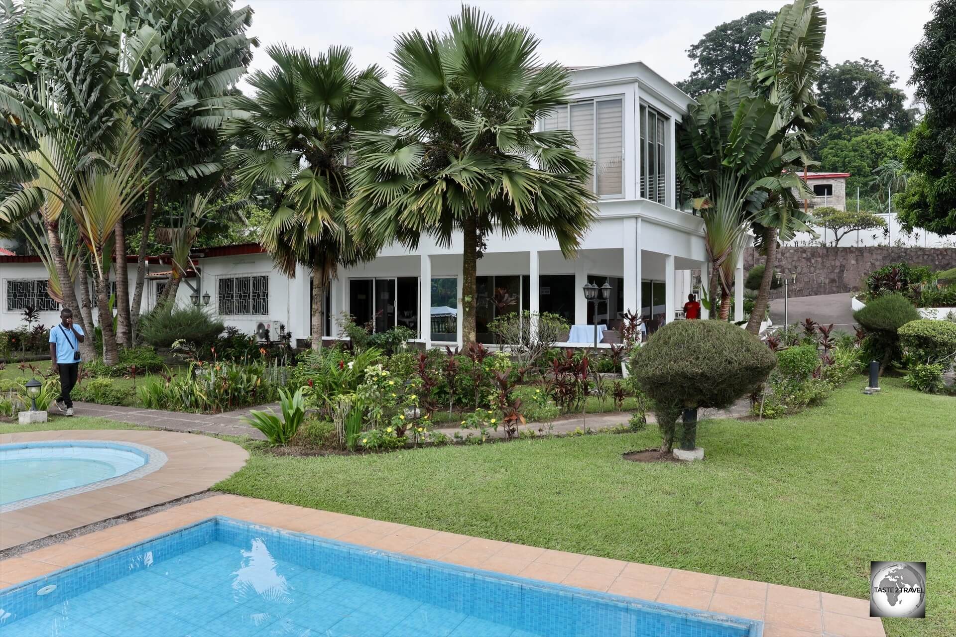
Located in the Plateau district of Brazzaville, the 5-star Capital Hôtel provides 15 spacious, clean rooms, a garden (but no pool), free private parking, a shared lounge, restaurant and a terrace.
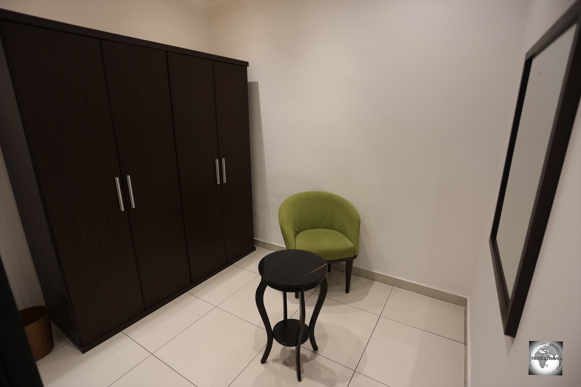
My room at the Capital Hôtel including this small sitting room.
Rooms, which cost around €80, can be booked on booking.com

My bathroom at the Capital Hôtel in Brazzaville.
The friendly staff made me feel very welcome and went out of their way to ensure my stay was an enjoyable one.
The hotel includes free shuttle service to/ from the airport and even a free laundry service.
Amazing!
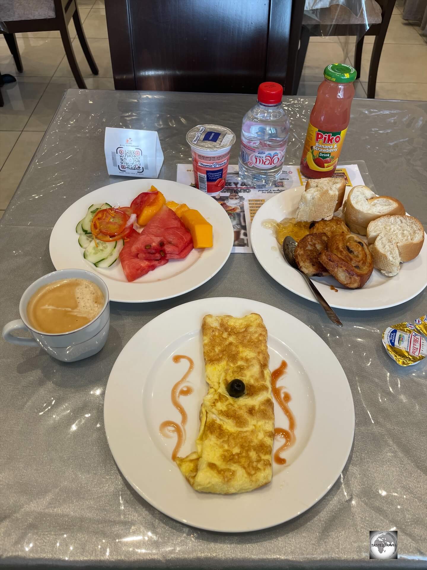
A delicious buffet breakfast is included in the cost of all rooms at the Capital Hôtel.
Also included in the room price is a wonderful buffet breakfast each morning, which is served in the hotel’s restaurant.
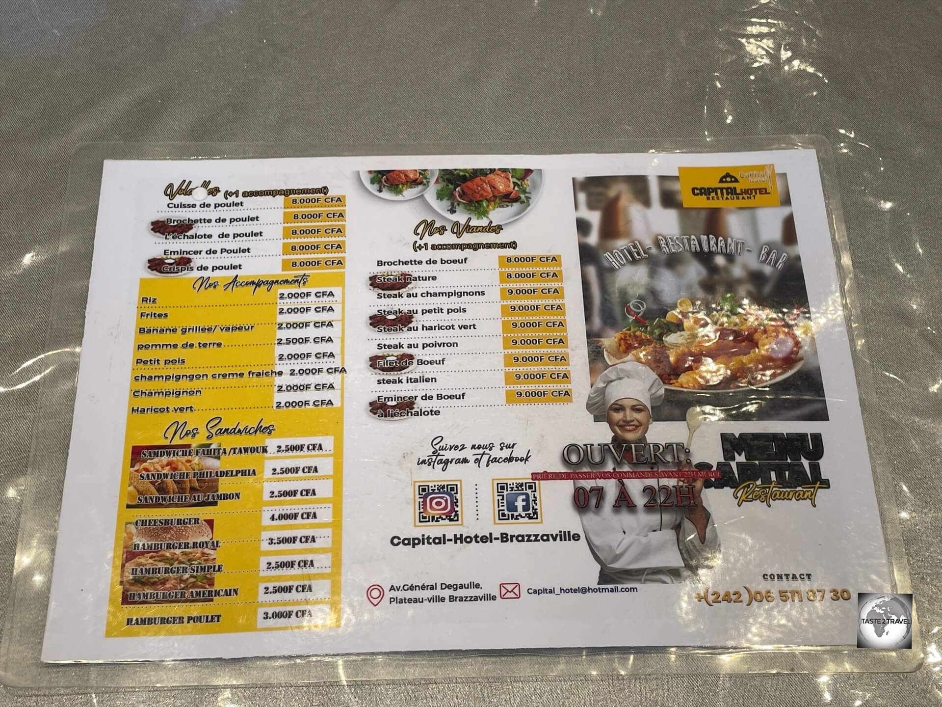
The menu, at the Capital Hôtel restaurant in Brazzaville.
The hotel restaurant is operated by young, friendly Lebanese chef with a menu which is heavy on Lebanese offerings.
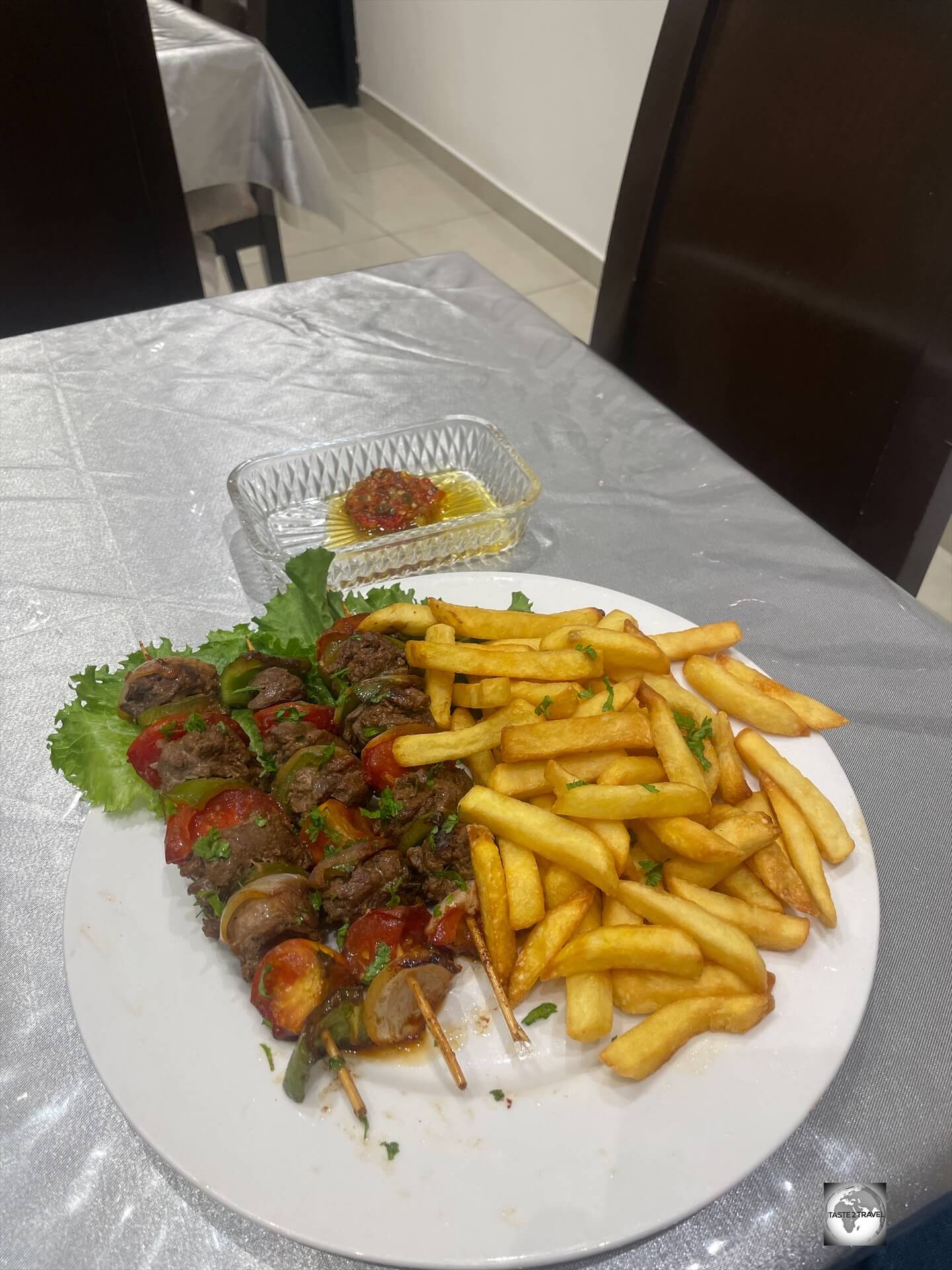
The amazing beef shish kebabs which were prepared by the Lebanese chef at the Capital Hôtel.
I especially recommend any of the shish-kebab meals, such as the incredible beef shish-kebabs, with three giant-size kebabs, which were served with fries and a fiery piri-piri sauce.
The hotel is a short taxi ride from downtown with a taxi fare typically costing XAF 1,000.
Maya-Maya International Airport is just 3 km (1.9 mi) away!
The Capital Hôtel is a wonderful hotel and one I would highly recommend.
Eating Out
Brazzaville, the capital of the Republic of the Congo, boasts a vibrant culinary scene that reflects its rich cultural tapestry.
From traditional Congolese fare to international cuisines, Brazzaville offers everything from sophisticated to traditional market food.
A popular dish is Moambe (Poulet Moambe), a dish made with chicken stewed in a thick, rich sauce of palm butter (moambe), spices, and sometimes peanut butter and normally served with rice or cassava.
Staple foods include:
- Cassava (manioc): The cornerstone of many meals. It’s usually boiled, pounded into dough-like fufu, or dried and ground into flour to make chikwangue (fermented cassava wrapped in banana leaves).
- Plantains: Fried, boiled, or grilled, they’re a common accompaniment.
- Rice and maize: Also popular, especially in urban areas.
Restaurants
Paul Congo
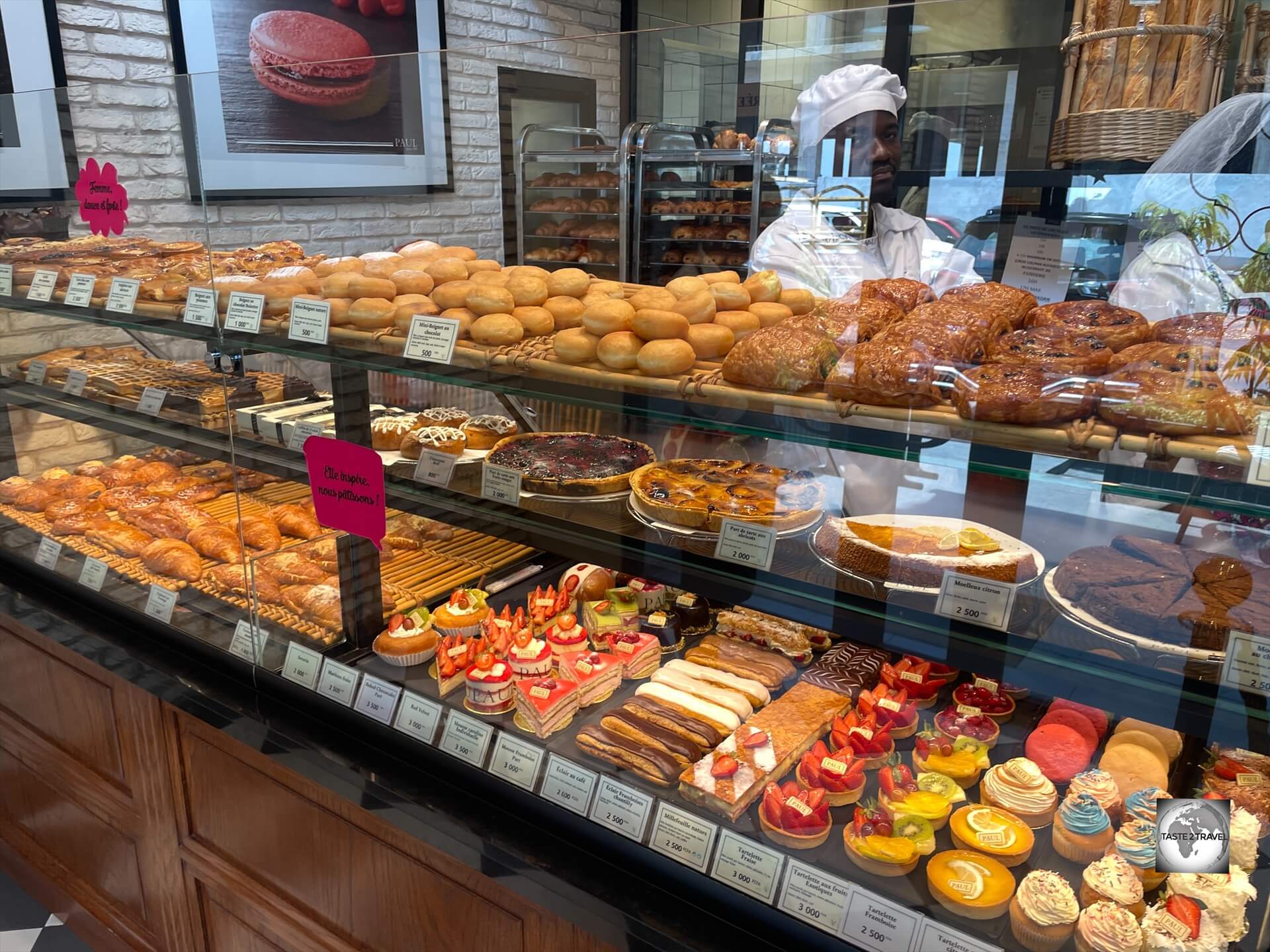
The French patisserie chain – Paul – offers freshly baked French bread, the most divine, freshly made pastries and excellent barista-made coffee.
I’m a big fan of the French Patisserie chain – Paul – and I was happy to find a branch of this fine French culinary institution in Brazzaville, where it is known as Paul Congo!
Tip: For anyone visiting neighbouring Gabon, it’s worth noting that there are three branches of Paul in Libreville (I visited all of them), including one at the airport.
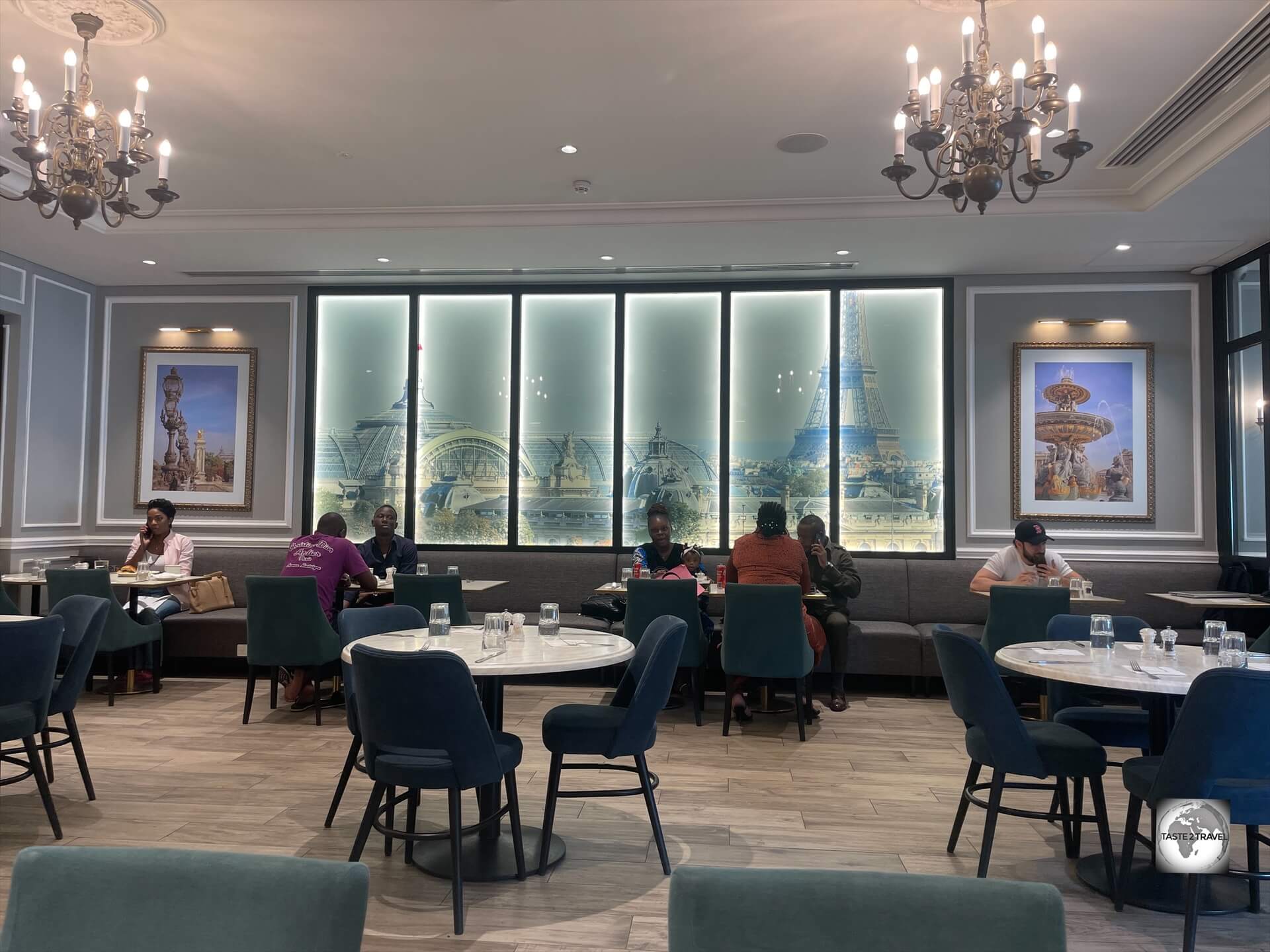
The dining room at Paul in Brazzaville, with its images of a very distant Paris, which is the dream destination for most Congolese.
In both Brazzaville and Libreville, Paul’s are operated as franchises by local Lebanese businessmen.
I believe the world would be a better place if every city had at least one Paul.
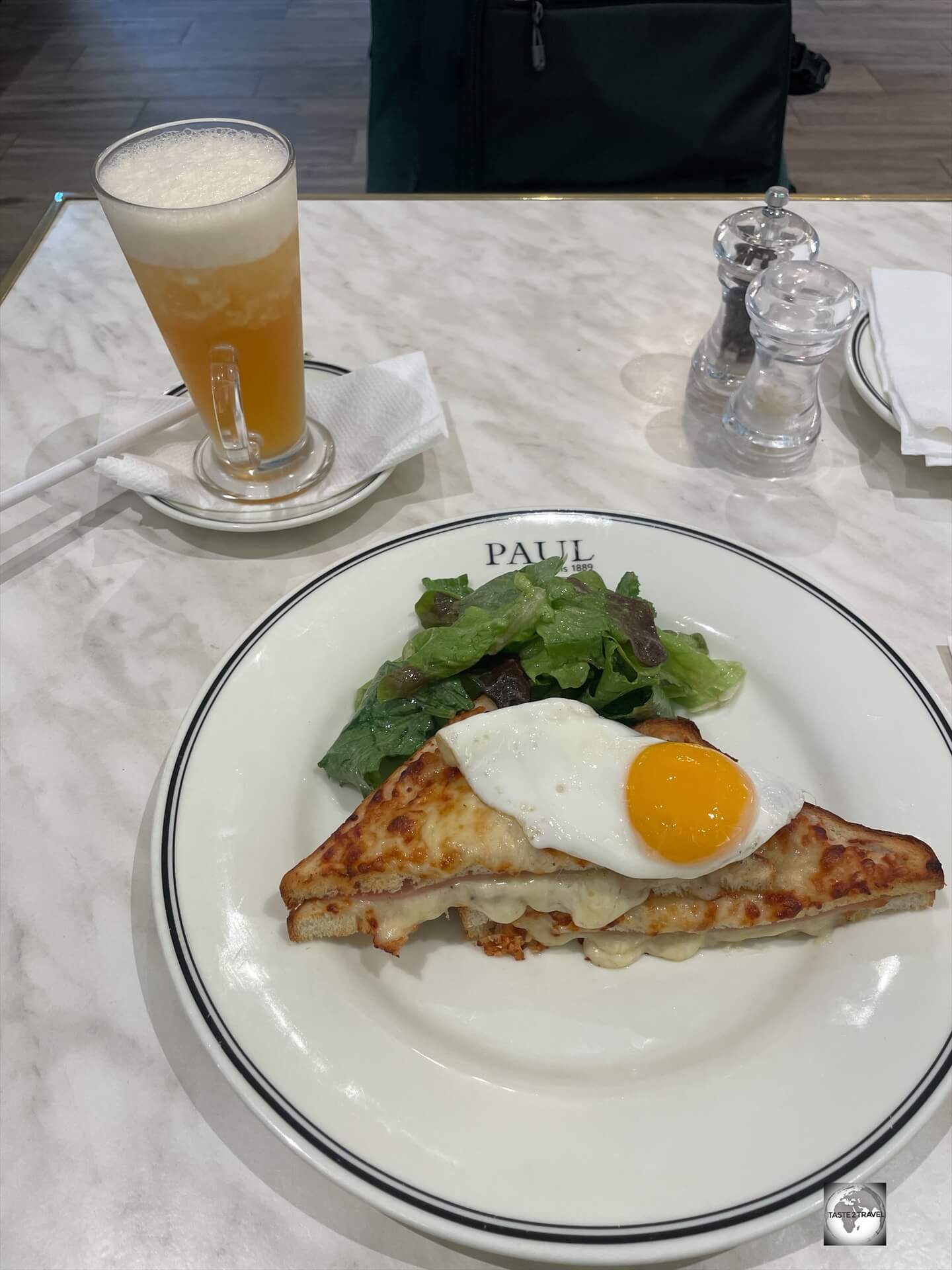
Lunch at Paul in Brazzaville, featuring a French classic – Croque Madame – with a freshly made ice tea.
I’m not ashamed to admit that I visited Paul in Brazzaville on a daily basis.
A cappuccino and a freshly made mille-feuille, the perfect afternoon tea at Paul in Brazzaville.
Paul is home to amazing, barista-made, coffee, the most divine selection of freshly made pastries, freshly baked, crusty baguettes and a menu offering excellent French cuisine.
Heaven!
Bar Restaurant Les Rapides

The shady garden at the Bar Restaurant Les Rapides, which is located 9 km south-west of downtown Brazzaville.
Located on the Congo River, 9 km (5.5 mi) south-west of downtown Brazzaville, is Les Rapides, a rocky section of the river which is full of raging rapids.
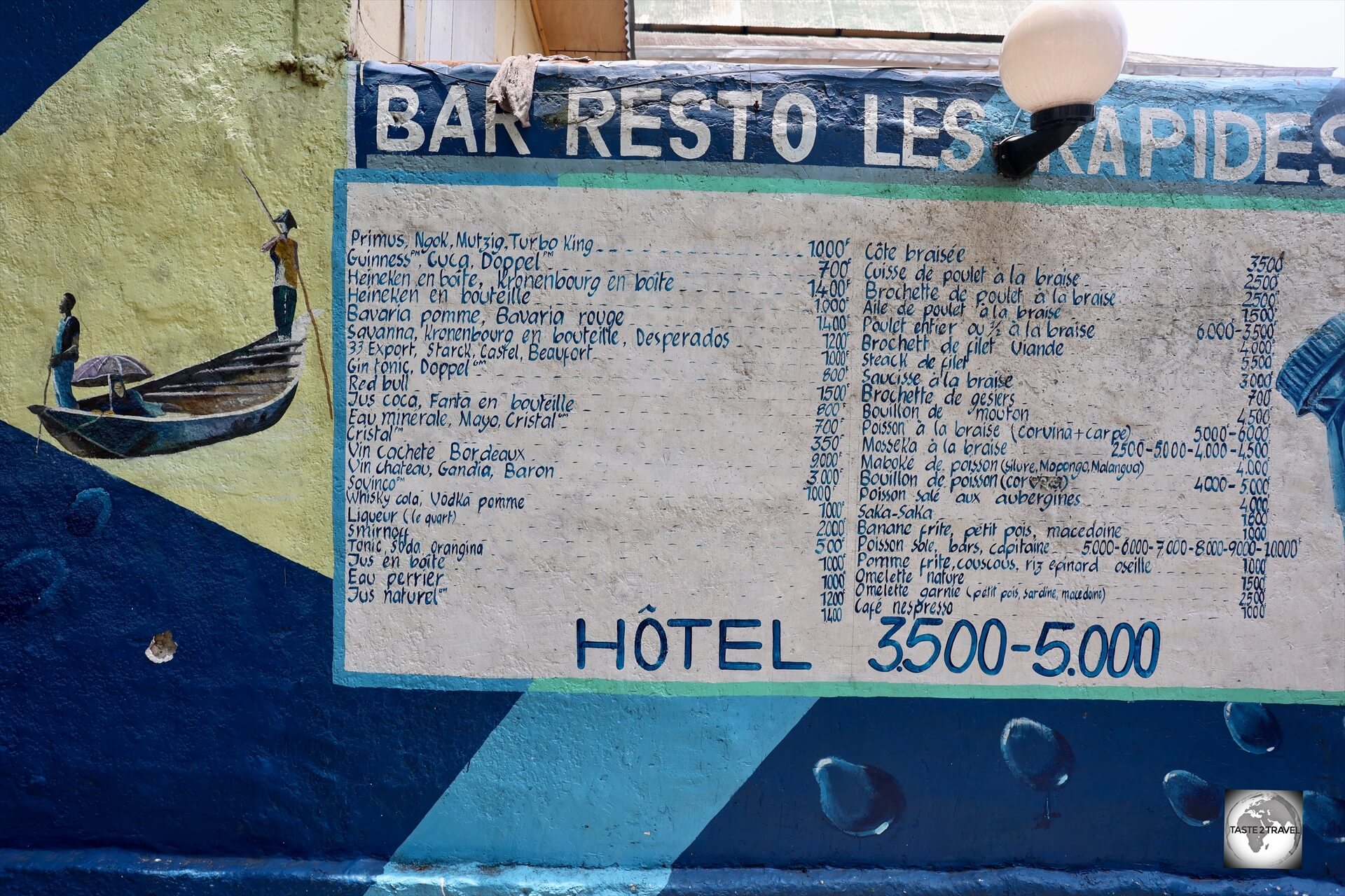
The menu at Bar Restaurant Les Rapides, which overlooks the rapids on the Congo River.
This is the setting for several riverside bars and restaurants where locals come to relax in shady gardens while viewing the many brave young boys who enjoy swimming in the rapids.
Visa Requirements
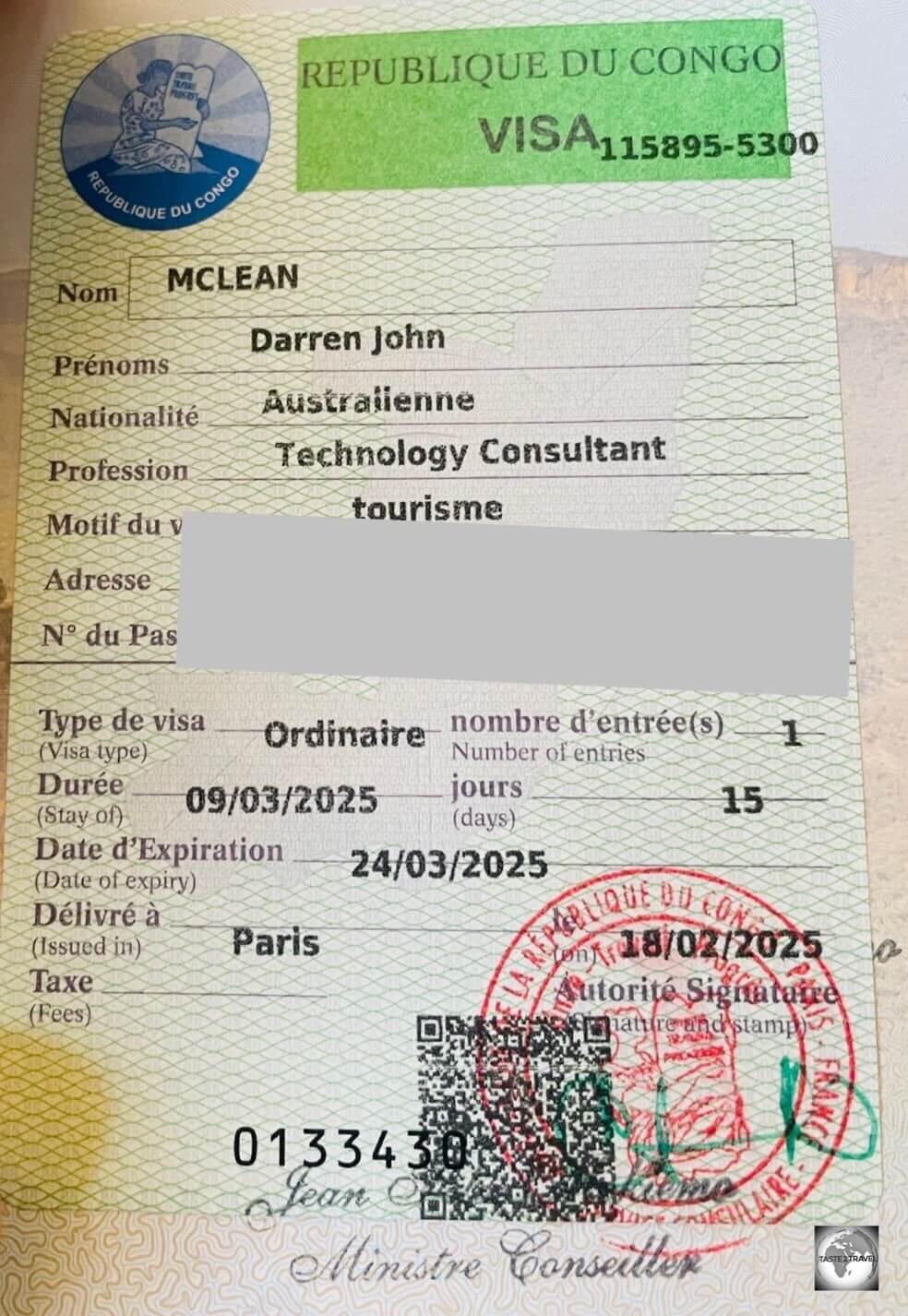
My Congolese visa which was issued at the Republic of the Congo embassy in Paris.
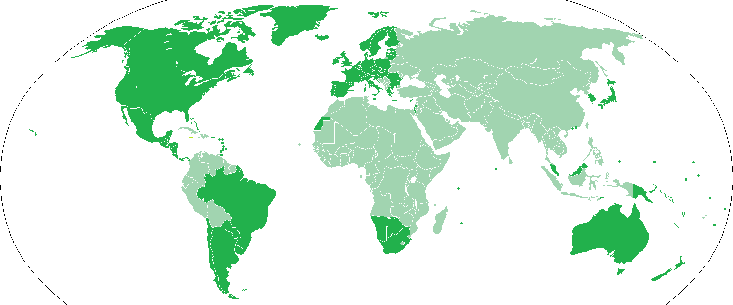
The Visa Policy of the Republic of the Congo is fairly simple – almost everyone needs to apply for a visa in advance from a Congolese embassy.
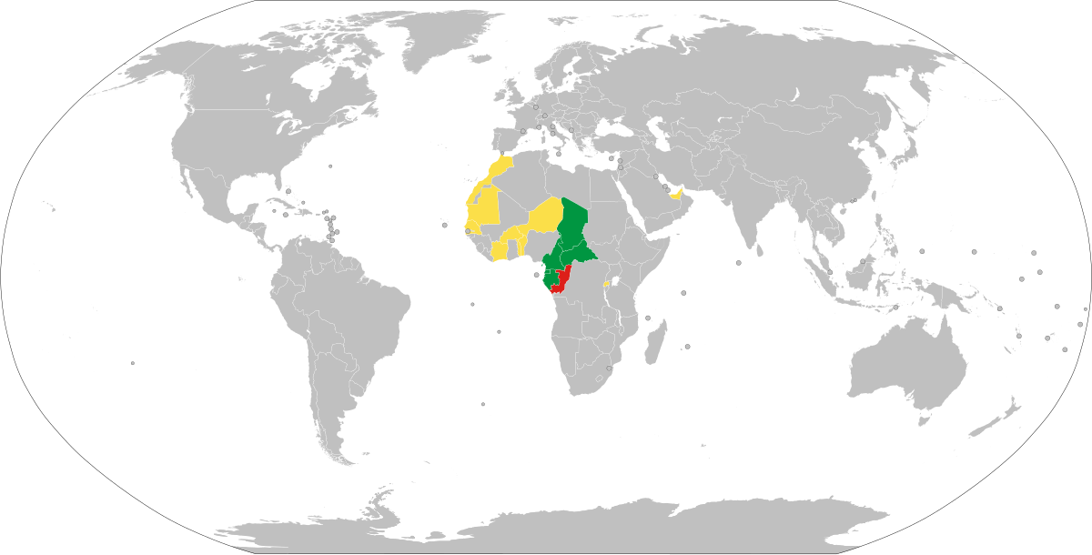
The Visa Policy of the Republic of Congo with grey countries needing a visa in advance.
Passport holders from the Central African Economic and Monetary Community (CEMAC) enjoy visa-free access to the Republic of Congo.
This includes passport holders from Gabon, Cameroon, the Central African Republic (CAR), Chad, the Republic of the Congo and Equatorial Guinea.
Almost all other nationalities are required to visit a Republic of the Congo embassy to obtain a visa.
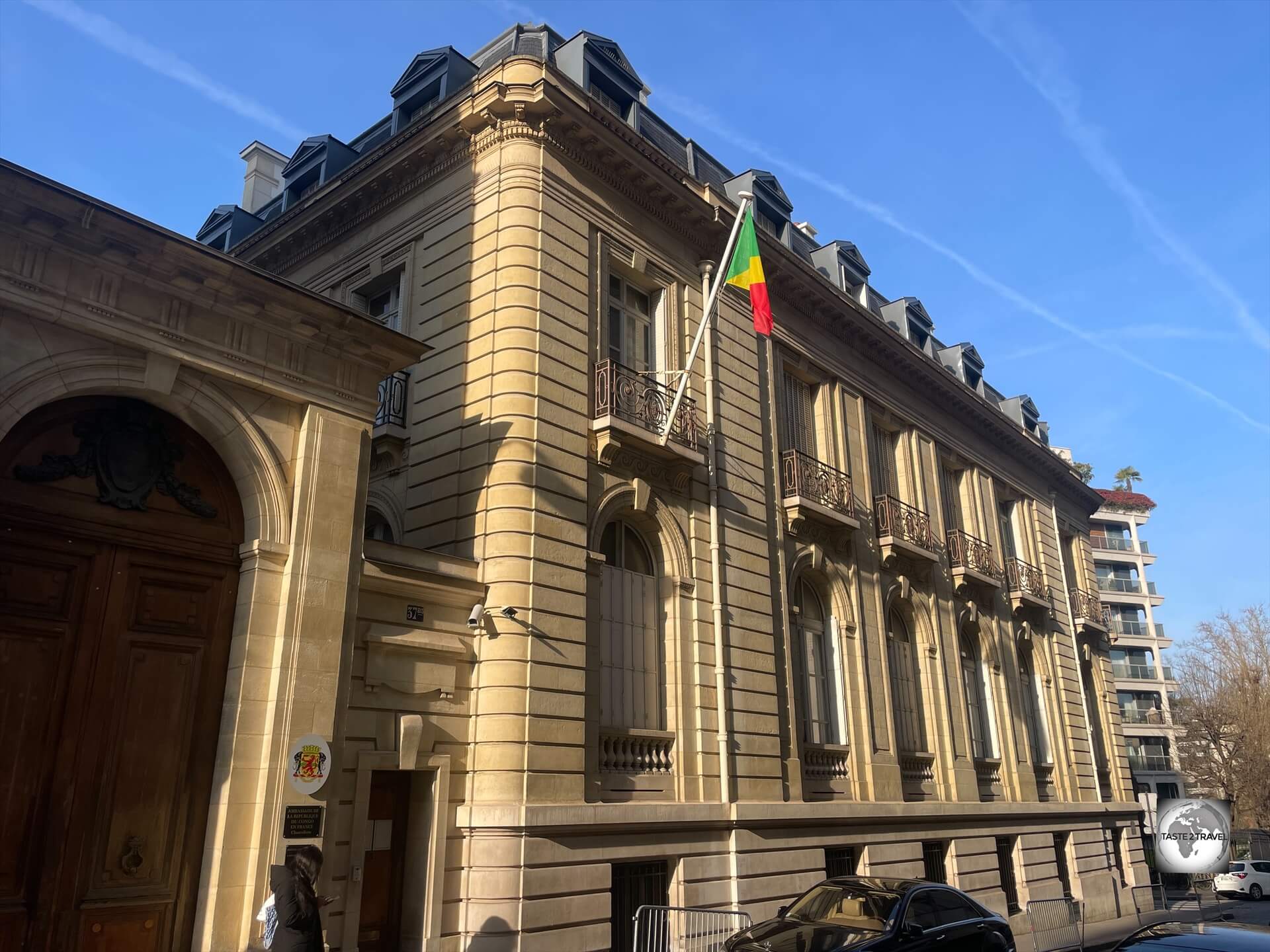
The Republic of the Congo embassy in Paris, which is located a short walk from the Arc de Triomphe.
Online Visa Application (Paris Embassy Only)
Visa applications can be submitted online at the Republic of the Congo embassy in Paris; however, you are still required to physically attend the embassy to submit your passport (and wait the required number of days) before returning to collect your passport.
If you will be applying for your visa at the Paris embassy, you can submit your visa application in advance (highly recommended) using this website: https://girafe.ambacongofr.org/index.php/externe/registration
Important tip:
Even though the visa application form asks for your email address, at no time did I receive any emails from the system.
Luckily, I have the habit of taking screenshots as I work and these served as the only record I had of my application.
You should ensure you take screen shots of:
- the completion page of your visa application (which will include an application number)
- the payment receipt page
- the passport submission appointment page
The application form is only available in French, although Google Chrome will offer English translation.
Online Visa Payment
Once you have completed the 7 pages of the form, you will be taken to a payment page where payment can be made using credit card.
The following visa fees apply at the Paris embassy:
- 15-day tourist visa (normal processing time – i.e. 7 business days): €55
- 15-day tourist visa (express processing time – i.e. 3 business days): €110
Embassy Appointment
Once you have completed your application and made payment, you will be taken to an appointment page where you select the day and time on which you wish to attend the embassy in Paris to deposit your passport.
Submitting your Passport at the Paris Embassy
When I arrived at the Paris embassy, no one was interested in seeing my appointment slip, they simply serve whoever comes through the door.
If you have submitted your application online, you simply need to handover your passport and a printout which shows your visa application number.
Collecting your Passport and Visa at the Paris Embassy
You then return after the required number of business days (they will advise you of the collection date) to collect your passport and visa.
Passports can only be collected after 2pm on the day of collection.
Republic of the Congo Paris Embassy Contact Details:
- Address: 37 Bis Rue Paul Valéry, 75116 Paris, France
- Nearest Metro Stations: Charles de Gaulle Etoile (Arc de Triomphe) and Victor Hugo
- Opening Hours (Monday to Friday): 0900 until 1600
- Telephone: +33 1 45 00 60 57
- Email: contact@ambacongofr.org
- Website: https://ambacongofr.org/
- Visa Application: https://girafe.ambacongofr.org/index.php/externe/visaRegistration/index
Getting There
Air
Maya-Maya Airport (IATA: BZV) is the international airport of Brazzaville, the capital of the Republic of Congo.
The airport is located 5.6 km (3.4 mi) from downtown Brazzaville.
The airport boasts three air bridges which were installed as part of a new, Chinese-built, terminal that opened in 2010, alongside a new 3,300-metre runway. In 2013, the Chinese expanded the airport further.
The following airlines operate scheduled services to/from Maya-Maya Airport:
- Afrijet – flies to/ from Libreville
- Air Côte d’Ivoire – flies to/ from Abidjan, Accra, Libreville, Kinshasa–N’djili
- Air France – flies to/ from Paris–Charles de Gaulle
- ASKY Airlines – flies to/ from Kinshasa–N’djili, Lomé
- Camair-Co – flies to/ from Douala
- Canadian Airways Congo – flies to/ from Impfondo, Ouesso, Pointe-Noire
- Ethiopian Airlines – flies to/ from Addis Ababa
- Kenya Airways – flies to/ from Luanda, Nairobi–Jomo Kenyatta
- Mauritania Airlines – flies to/ from Bamako, Cotonou, Nouakchott
- Royal Air Maroc – flies to/ from Casablanca
- RwandAir – flies to/ from Cotonou, Kigali
- TAAG Angola Airlines – flies to/ from Luanda
- Trans Air Congo – flies to/ from Douala, Libreville, Pointe-Noire
Arrival in Brazzaville
Upon arrival at Maya-Maya International Airport, there are two checkpoints before you reach immigration.
The first is a health check point where you must show your Yellow Fever Vaccination Certificate.
You must be vaccinated in order to be allowed to enter the country.
The second check point is a police check point which is directly in front of immigration.
The police will check your passport, proof of return flight, hotel booking and a Letter of Invitation (LOI)!
Myself, and most other foreigners which arrived on my flight, did not have an LOI.
We were made to sit in a corner and wait while an immigration official called our hotels to ensure we had confirmed reservations.
Once the hotel confirmed my reservation, I was then allowed to proceed to immigration where I was stamped into the country!
While the entry process took time, all officials were friendly and courteous and never asked for money.
Note: The LOI requirement is also enforced at Libreville airport.
If you arrive at Libreville without an LOI, immigration will contact your hotel to confirm your reservation before allowing you to enter Gabon.
Airport Transport
Maya-Maya International Airport is located 5.6 km (3.4 mi) from downtown Brazzaville.
If you’re energetic (or on a tight budget), you could walk from the airport to your hotel.
My hotel, the wonderful Capital Hôtel, was located just 3 km (1.9 mi) from the airport.
My hotel included a free shuttle service.
From the airport into downtown, a taxi will cost between XAF 1,000 – 2,000.
Land
The Republic of the Congo shares land borders with Cameroon, Central African Republic, DRC, Gabon and Angola (Cabinda exclave).
Many of these crossings are located in remote forested regions, and road conditions can vary widely.
Security can sometimes be a concern in border regions, especially near the Central African Republic.
Cameroon
The border between the Republic of the Congo and Cameroon is 523 km in length and includes two key crossings:
- Sangmélima – Ouesso: A well-known northern crossing via road connecting Cameroon’s southern region to the Congolese town of Ouesso.
- Ntam – Souanké: Another border post used for regional trade and travel.
Central African Republic (CAR)
The border between the Republic of the Congo and Central African Republic (CAR) is 487 km in length and includes two key crossings:
- Mobaye – Dongou: Located in the northeast, this crossing allows travel and trade between CAR and northern Congo.
- Bangui (via river) – Likouala region: The Ubangi River serves as a natural border, with boat crossings from Bangui into Likouala.
Democratic Republic of the Congo (DRC)
The border between the Republic of the Congo and Democratic Republic of the Congo (DRC) is 1,229 km in length and includes three key crossings:
- Brazzaville – Kinshasa: The most prominent and heavily used crossing via ferry over the Congo River – one of the busiest urban river crossings in Africa.
- Louzala – Luozi: A lesser-known crossing further south along the river border.
- Louziba – Tshela: In the Bas-Congo area (Kongo Central)
Gabon
The border between the Republic of the Congo and Gabon is 1,903 km (the longest) in length and includes three key crossings:
- Lekoko – Mbinda: Important for rail and road transport; connects to the COMILOG railway.
- Lékoko (border post) – Franceville route: Road access through the forests of southeastern Gabon.
- Ndendé – Dolisie: One of the most active border crossings with road infrastructure.
Angola
The border between the Republic of the Congo and Angola (Cabinda exclave) is 201 km in length and includes two key crossings:
- Massabi – Cabinda: A major legal crossing between the Republic of the Congo and Angola’s Cabinda enclave.
- Yema – Cabinda: Another used but less formalized crossing.
Sea
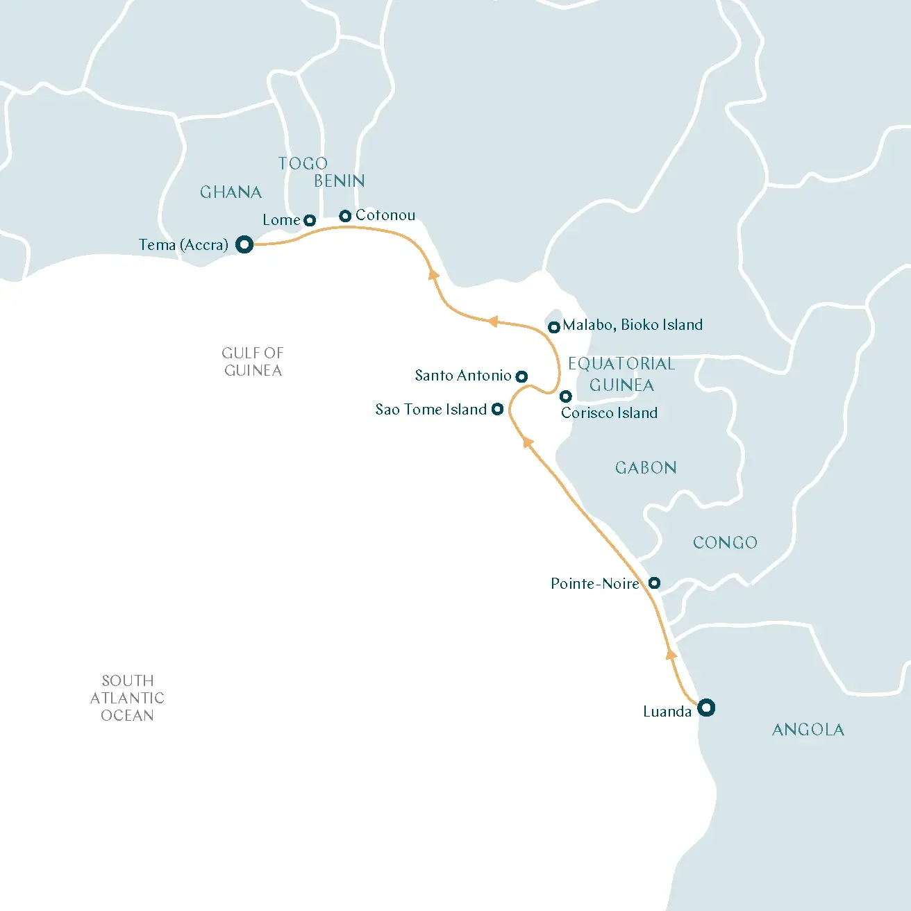
One cruise ship company which calls at Point-Noire is Swan Hellenic on their Southwest Africa Cruise.
Very few cruise ships visit the Republic of the Congo, but one cruise ship company which calls at Pointe-Noire is Swan Hellenic on their Southwest Africa Cruise.
Getting Around
I did a city tour of Brazzaville with a guide and a taxi driver.
Public Transport
Public buses are the most affordable way to travel around Brazzaville.
They serve various routes within the city, though they can sometimes be crowded or unreliable.
The fares are low, making buses a popular choice for locals.
Taxi
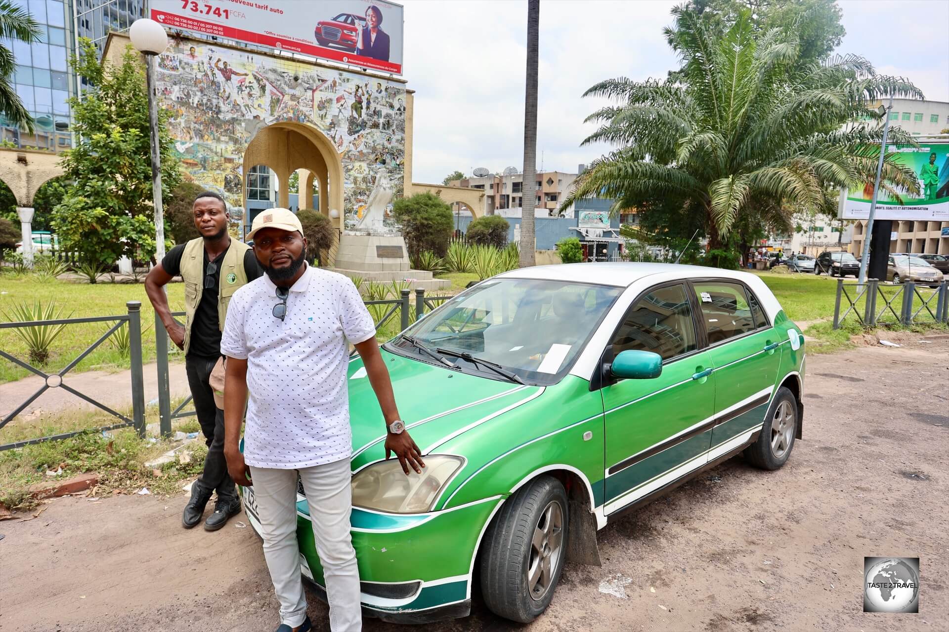
All taxis in Brazzaville are the same uniform green colour which is representative of the lush green forest which surrounds the city.
Taxis in Pointe-Noire are all coloured blue which symbolises the blue Atlantic Ocean which the city is located on.
Taxis are common and can be hailed on the street or booked by phone.
They are an easy way to get around the city with most trips costing around XAF 1,000 – 1,500.
Fares must be negotiated in advance but, because there are few tourists, I found drivers were always honest and quoted the same price.
Rental Cars
You can rent a car with a driver though most hotels.
That’s the end of my travel guide for the Republic of the Congo.
If you wish to leave feedback/ comments, you can do so using the form below.
Safe Travels!
Darren
Further Reading
Following is a list of my travel content from the region:


 of Atlantic coastline with many fine, golden-sand beaches.")


 from a currency trader on Ashmun street, the main street of Monrovia.")


 is used to call the nuns to pray at Moldovița Monastery.")


 of the Virgin Mary.")


 deep, bell-shaped, chamber which has been carved out from the smooth salt-stone, the underground lake at the bottom of the Terezia Mine at Turda Salina has a maximum depth of around 8 metres (26 feet).")
 deep, bell-shaped, chamber of the Terezia Mine form a striking backdrop to the ink-black water of the underground lake.")
 deep, bell-shaped, chamber of the Terezia Mine at Salina Turda, which features a plunging "cascade of salt".")
 where visitors can row a boat on an underground lake.")

 below ground.")


 southwest of the city of Brașov.")


 polymer banknotes.")


 in Iași is famous for the extraordinary lacery in stone which adorns the entire façade - from top to bottom.")

 tall Galați TV Tower rises above the city of Galați, which lies on the banks of the Danube River in eastern Romania. The tower, completed in 1978, is equipped with a tower restaurant (good for lunch), perhaps the only of this kind in Romania.")


 served as the residence for Nicolae Ceauşescu (the last communist leader/ dictator of Romania) and his family.")


 Brâncovenesc-style.")


, the 330,000-sq-metre Palace of Parliament building has more than 3000 rooms.")


 north-east of Chişinău.")


. The "Struve Geodetic Arc" is located in a remote farm field in the middle of nowhere.")


 to Odesa (Ukraine).")


 can be seen from the Cyprus side of the dividing wall in Nicosia.")
 on the UN Buffer zone.")


 offices in Nicosia, Cyprus.")

 is a community centre located in the middle of the dividing lines in Nicosia, opposite the Ledra Palace Hotel. Besides good food, the centre conducts programs focussed on bringing Cypriots together from both sides of the wall.")


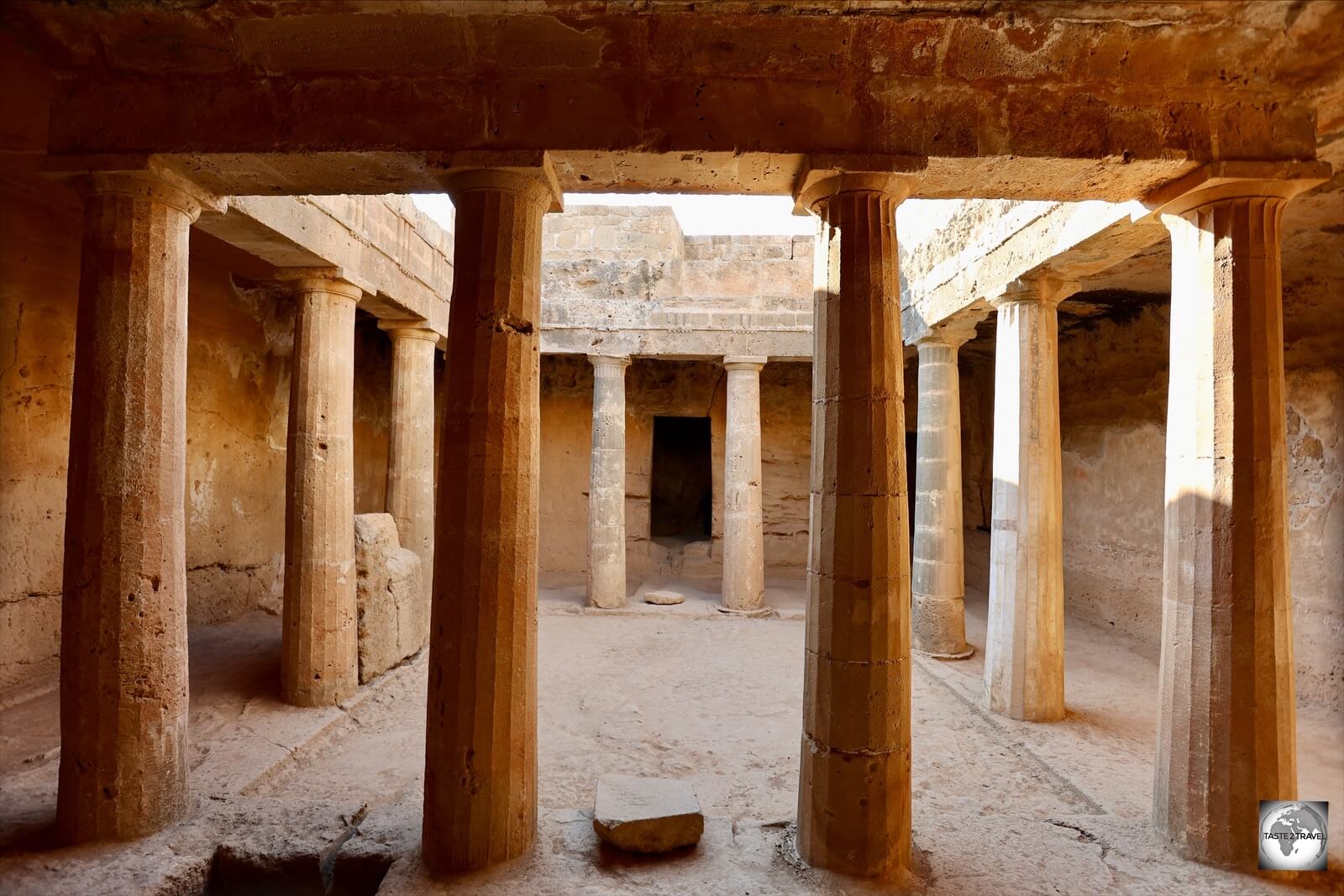
 necropolis - "Tomb of the Kings" - at the UNESCO-listed Nea Paphos archaeological area.")


 to the 3rd-century (CE).")

, also known as Aphrodite's Rock, is a sea stack in Paphos, Cyprus.")


 on the northwest face of Troödos Mountains, in the interior of Cyprus.")
, the current complex is a modern construction, having been built after the original monastery was destroyed by fire.")


.")

.")


, Limassol Castle is a medieval castle in Limassol, that's now home to the Cyprus Medieval Museum.")


.")
 cathedral in the city of Kutaisi.")
, Gelati Monastery is a medieval Orthodox monastery in western Georgia.")


, making it nearly 900 years old.")


, Gori Fortress is a medieval citadel, situated above the city of Gori.")

 above sea level, the town of Signagi overlooks the Alazani Valley and faces the Greater Caucasus mountains.")


, Jumah Mosque is a unique example of religious openness in Tbilisi, which has been a crossroads for many faiths.")


 below ground - one of the deepest in Europe.")


.")
 east of Yerevan, Garni temple is at the edge of a promontory rising above the ravine of the Azat River.")


, Geghard is a medieval monastery which is partially carved out of the adjacent mountain, surrounded by cliffs.")

, was hewn in the 1240s (CE) in an ancient cave with a spring.")

, tomb of Papak Proshyan and his wife Ruzukana.")


.")
 made from a fluffy mixture of flour, butter, and sugar, with a consistency of baked custard.")
, which is sealed by barbed wire fencing.")


 from Khor Virap.")
 is a monastic complex located at the northwestern shore of Lake Sevan.")


 Armenian church in Etchmiadzin.")


 is a string of walnuts covered in (rubbery) grape molasses.")


.")