Kyrgyzstan Travel Guide
Welcome to the taste2travel Kyrgyzstan Travel Guide!
Date Visited: August 2019
Introduction
With an abundance of jaw-droppingly beautiful scenery, friendly locals, fascinating culture, complex history, pristine nature, plentiful accommodation options and lots of quirky reminders of its recent Soviet past, Kyrgyzstan is the tourism darling of Central Asia.
If that’s not enough of an inducement, the country has the most relaxed visa policy of all the Central Asian republics, allowing visa-free travel to citizens of 69 countries, with everyone else able to apply for an e-Visa. This welcoming visa policy has resulted in Kyrgyzstan (officially the Kyrgyz Republic) becoming the gateway of choice for many travellers to Central Asia.
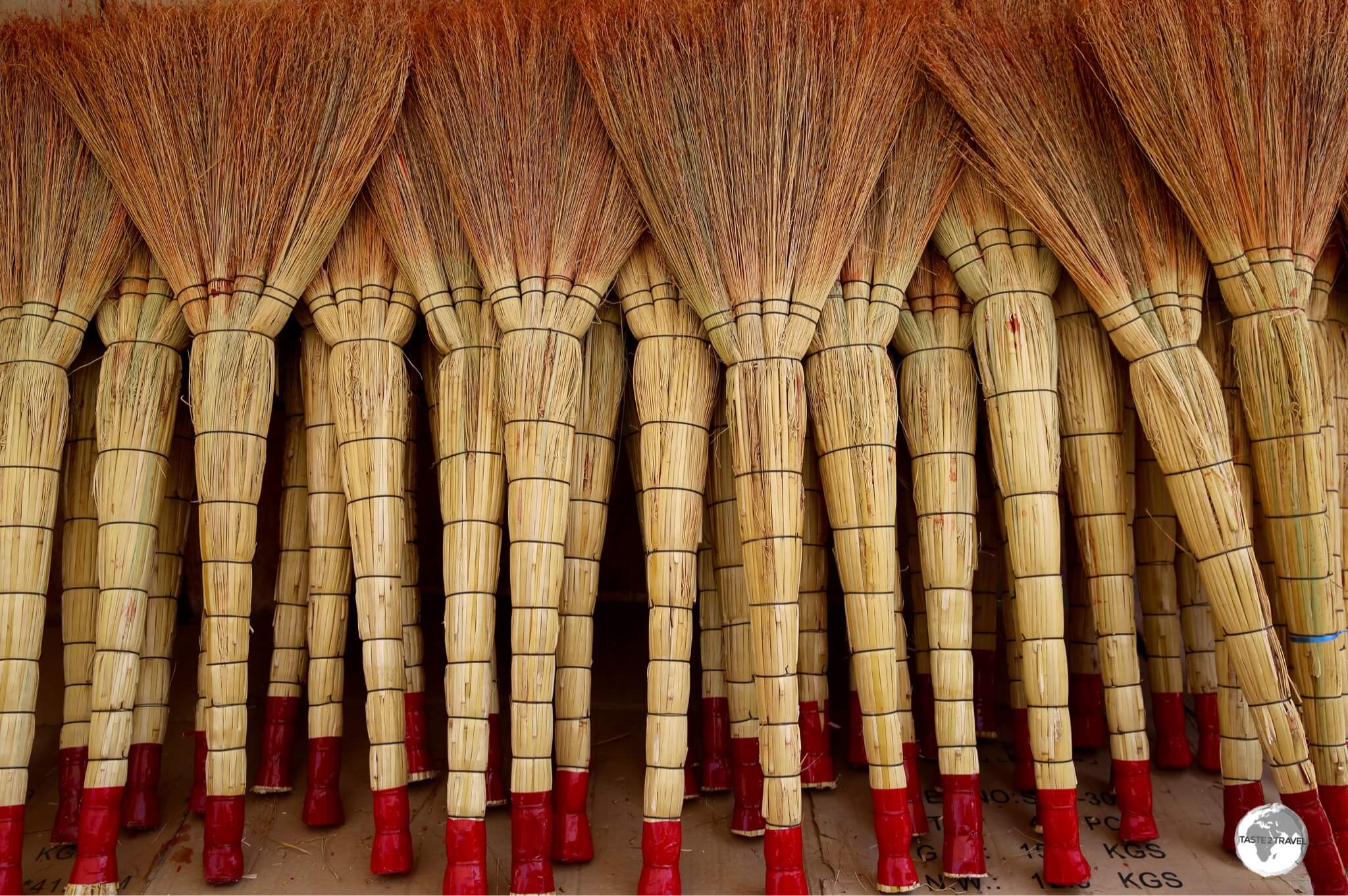
Handmade brooms for sale at the sprawling Osh bazaar.
With 90% of its territory lying above 1,500 metres, winter time is not the time to visit Kyrgyzstan, unless you’re taking to the ski slopes.
As can be expected in a country where the vast majority of attractions are high altitude, summer time is peak season. And while the capital, Bishkek, can be swelteringly hot in the summer, elsewhere temperatures can fall below freezing in the evenings.

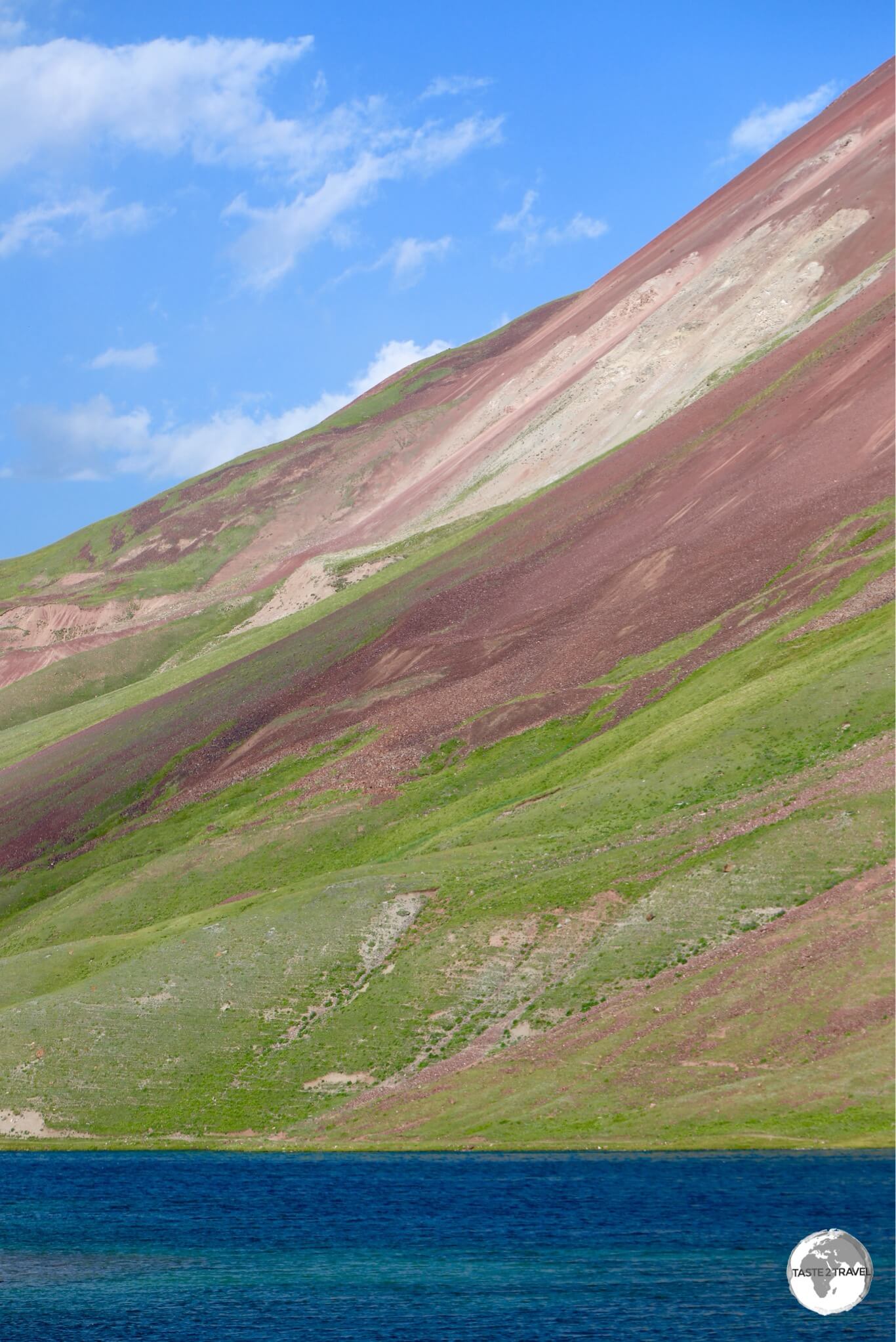
Always resplendent in dazzling blue, lake Issyk-Kul is the seventh deepest, and tenth largest, lake in the world.
No matter how cold the temperature, one of the country’s main attractions, Lake Issyk-Kul, never freezes. During the height of winter, the water temperature of this salt-water lake – the world’s tenth largest lake – hovers between 2-3 degrees Celsius. While Issyk-Kul is a key attraction, there are almost 2,000 alpine lakes throughout Kyrgyzstan.

A yurt camp near lake Son-Kul.
With so much of this alpine country inaccessible during the winter, summer time sees a migration of families and shepherds, who still practice the same nomadic lifestyle that has been an integral part of the culture of the region for centuries.
During the warmer months, whole families relocate to the jailoos (Alpine meadows), living in yurts while they tend to their flocks. In many remote regions, the only accommodation option available is with the nomads, who will happily accommodate you in one of their yurts. Welcoming and accommodating strangers is central to the nomadic way of life and staying in a yurt is an experience which shouldn’t be missed.

Spectacular scenery in the Barskoon Valley.
Of all the countries I visited in Central Asia, Kyrgyzstan was the most rewarding. As a destination, the country has much to offer and, year-on-year, tourism arrival numbers continue to grow with 1.4 million visitors arriving in 2018. While 80% of visitors come from Russia, or neighbouring Kazakhstan, arrivals from elsewhere continue to increase.

A view of the magnificent Lake Son-Kul, which is located at 3016 m (9,900 ft), and is only accessible during the summer months.
If you’re looking for an adventure destination, somewhere off the beaten track which offers superb hiking, culture, history, nomadic culture, amazing cuisine, and so much more, then now is the time to visit – before the tourist hoards arrive!

The beautiful lake Son-Kul is located in the middle of a remote alpine meadow at 3,016 m (9,900 ft). The only accommodation options are yurt camps.
There is much to see and do in this amazing country, as such, this report is twice as long as most of my reports. If you wish to read the report in its entirety, you should get comfortable with a big cup or tea or coffee. Otherwise, you can dip into those sections you wish to read by using the ‘Table of Contents‘.
Location
Bishkek, Kyrgyzstan
Kyrgyzstan is located in the north-east part of Central Asia, in the very heart of Eurasia. An alpine country, there are more than 88 major mountain ranges in Kyrgyzstan, most of them forming the Tian Shan mountains which traverse the north and centre of the country, while the soaring peaks of the Pamir mountain range traverse the southern section of the country. These two mountain systems occupy about 65% of the national territory and are home to around 1,900 alpine lakes.

The road which leads to Moldo-Ashuu pass, a high mountain pass which sits at an elevation of 3,346 m (10,977 feet)
Kyrgyzstan is completely landlocked, being bordered by China, Kazakhstan, Tajikistan, and Uzbekistan (click links to read my travel guides from these destinations).
While the country is one of the smallest in Central Asia, extending 900 km (560 mi) from east to west and 410 km (250 mi) from north to south, poor infrastructure and impossibly mountainous terrain make most land journeys slow and arduous.

One of the highlights of Kyrgyzstan, lake Son-Kul is located at 3,016 m and is only accessible during the summer months.
Lenin Lives!
During the days of the Soviet Union, giant statues of Lenin were ubiquitous, gracing the main square of most cities and towns across the Union. On the 26th of December 1991, the USSR was officially dissolved and, in the days and weeks following, as each republic claimed its independence, statues of the revolutionary leader were quickly removed.
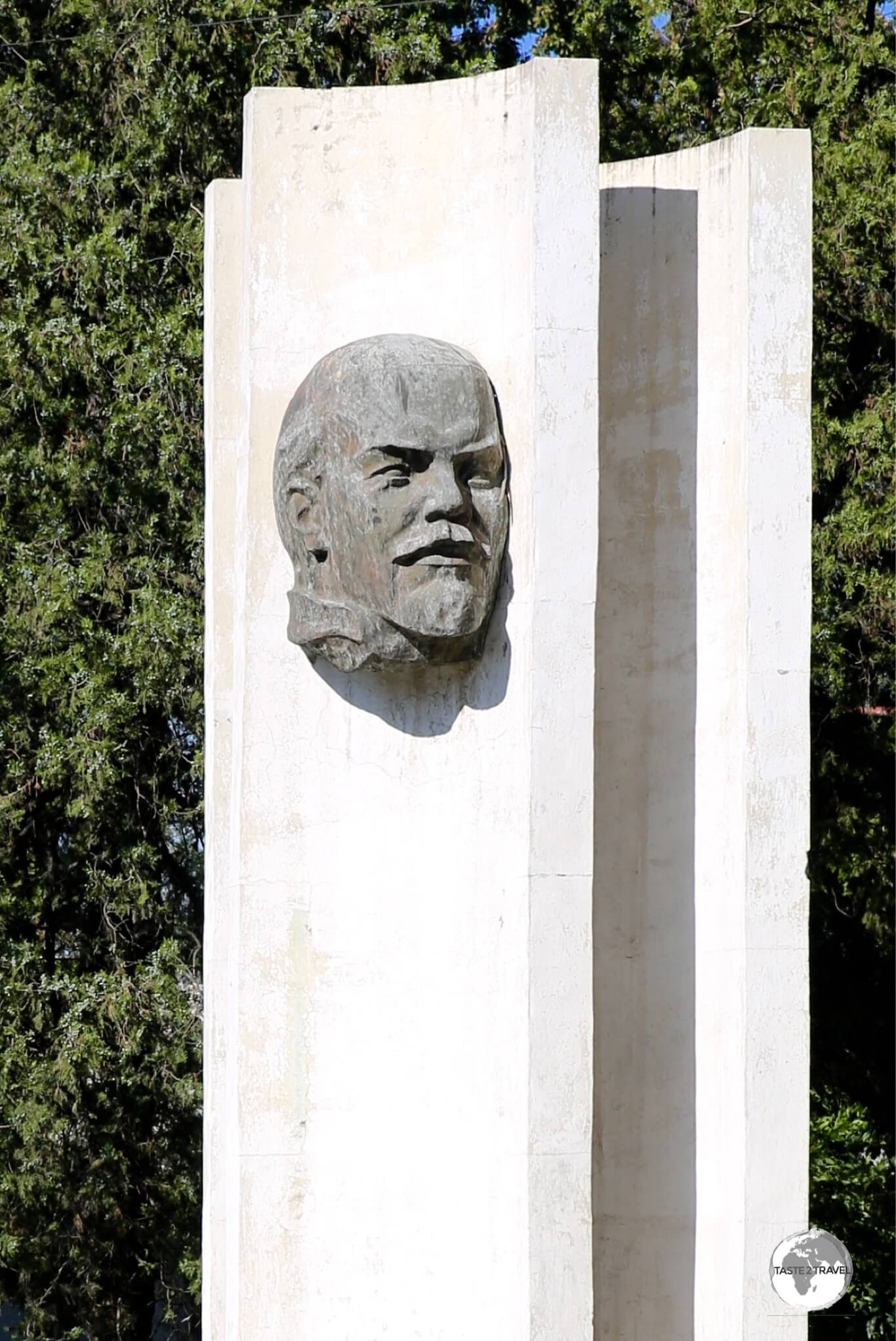
A roadside monument to Lenin in Bishkek.
However, this ‘cleaning out of the Soviet-past’ did not happen in Kyrgyzstan and today, Lenin statues can still be found in most towns and cities. While many Kyrgyz look to the future, and a new era of national history, many still yearn for the Soviet-past, and consider Lenin a hero. Today, the many Lenin statues in Kyrgyzstan lend an anachronistic air to the country!

A larger-than-life statue of Lenin towers over Lenin Avenue in Osh.
The grandest Lenin statue is located in downtown Osh, where a giant Lenin, striking a familiar pose, looks out over Lenin Avenue.

Lenin in Bishkek’s Ala Too square.
The most famous, and perhaps most controversial Lenin statue, is the one which use to stand defiantly in the main square of Bishkek. In 2003, a dozen years after his successors were knocked off their pedestals in the other republic capitals, the Lenin statue in Ala Too square was quietly relocated from the front of the square (where he use to point to the mountains) to the rear of the square (where he now points at the Kyrgyz government building).
Originally, the government wanted to remove the statue, but this caused an up-roar, so the decision was made to relocate him, 650 feet, to the rear of the State History Museum. Out-of-sight, but definitely not out-of-mind!

A very golden Lenin in Karakol.
My favourite Lenin statue can be found adjacent to the main square in Karakol. Painted in gold, and looking like a character from Gold-finger, Lenin truly sparkles in the afternoon sunlight.

A portrait of Lenin, painted by an artist at an art market on Bishkek’s Ala Too Square.
Apart from the statues, portraits of Lenin are still popular among the Kyrgyz. Artists, which can be found in the art market adjacent to Ala Too square in Bishkek, continue to churn out standard images of the revolutionary leader which are available for purchase.
Then there’s the mountain…. Lenin Peak!

The snow-covered Lenin Peak (7,134 metres / 23,406 ft) marks the border between Kyrgyzstan and Tajikistan.
People

Lying at the crossroads between Europe and Asia, the people of Kyrgyzstan are predominantly Eurasian.
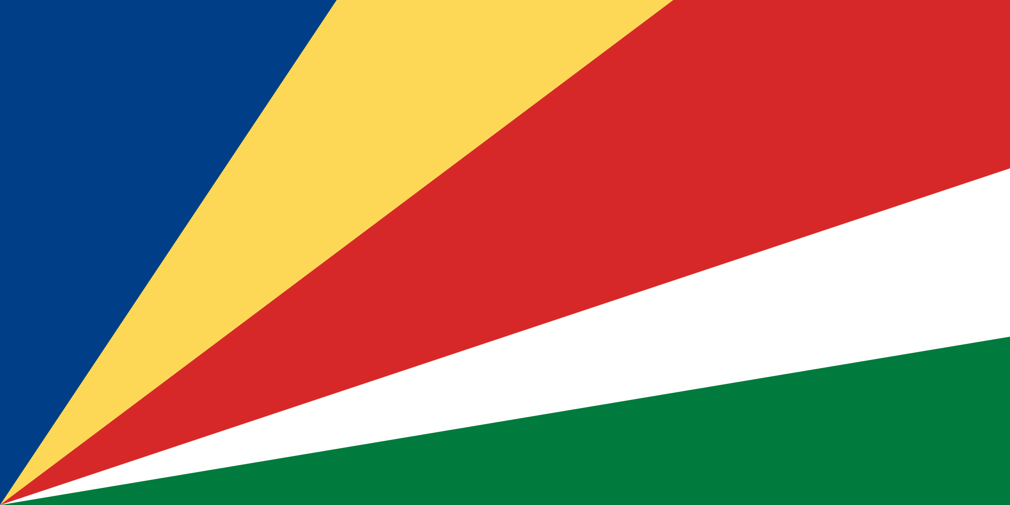
In the Turkic language, Kyrgyz literally means “a collection of forty tribes”, a reference which is today included on the national flag, with the yellow sun featuring 40 sunbeams (please refer to the ‘Flag‘ section for more on this). The early Kyrgyz people originated from areas which today lie in the west of Mongolia.

Relaxing in one of the many parks in Bishkek.
Ancient Chinese texts describe the Kyrgyz tribes as fair-skinned, green- or blue-eyed and red-haired people with a mixture of European and East Asian features. With a current population of 6.2 million people, Kyrgyzstan is a cosmopolitan melting-pot which is home to groups of minorities from around the region.

The Kyrgyz family, and their adopted US Peace Corps volunteer, who I stayed with in a yurt camp at Lake Son-Kul.
This is especially so in the city of Osh, which, for centuries, served as an important junction on the Silk Road. Today, Osh is home to a large Uzbek community but has been influenced through the ages by travellers from well beyond the region.
Adding to the mix, during the Soviet-era, and especially under the rule of Stalin, large numbers of Russians were forcibly relocated to Kyrgyzstan, which influenced the ethnic composition in the region.

Living the fairy-tale! A Kyrgyz couple posing for the camera at the Fairy-tale canyon.
As a case in point – in the ‘Cafe‘ section below, I have included a photo of the wonderful Evgeniia, who is the resident Barista at Karakol Coffee. While the photo looks like a scene from a cafe in Eastern Europe, Evgeniia is a native of Karakol, a city which lies a short distance from China.

The felt Kalpak, or Ak Kalpak, is worn by Kyrgyz men as part of their everyday wardrobe.
The Kyrgyz are predominantly Muslims, with Islam being introduced to the region by Arab traders who travelled along the Silk Road in the seventh and eighth centuries.
Flag

The flag of Kyrgyzstan, flying in Bishkek.
The flag of Kyrgyzstan consists of a red field with a bright, yellow sun at its centre. The sun features 40 sunbeams, which symbolises the unity between the 40 different tribes which have traditionally inhabited the region.
In the centre of the sun is a stylised illustration of the roof (tunduk), which is to be found atop a traditional Kyrgyz yurt – when viewed from the interior.

The Tunduk is seen here, in the interior of my yurt, on lake Son-Kul.
The Tunduk forms the centre-piece of all traditional yurts in Kyrgyzstan and has important meaning for the Kyrgyz, symbolising the unity between the nation and the universe. The Tunduk also allows sunlight to enter the yurt, forming a connection between the interior and exterior worlds!

This Kyrgyzstan flag adorns the wall of a colourful house in the town of Karakol.
Currency

My collection of brand new Som bank notes which I obtained from a bank in Bishkek.
Issued by the National Bank of the Kyrgyz Republic, the som (international currency code: KGS) is the currency of the Kyrgyz Republic. Notes are issued in denominations of 20, 50, 100, 200, 500, 1000 and 5000 som.
Coins, which were introduced into circulation in 2008, are issued in denominations of 1, 10 and 50 tyin and 1, 3, 5 and 10 som.

The highest value bank note in Kyrgyzstan is 5,000 som, which is worth USD$71.
Costs

A selection of Kyrgyzstan Som bank notes.
Like other countries in the region, travel costs in Kyrgyzstan are very reasonable.
Suggested daily budgets:
- Backpacker: Up to USD$40 per day.
- Flashpacker: Between USD$40 -$80 per day.
- Top End: USD$80+
Sample costs:
- Coca Cola (0.33 litre bottle): 27 som (US$0.39)
- Water (0.33 litre bottle): 18 som (US$0.26)
- Cappuccino: 117 som (US$1.68)
- Car Rental (daily 4WD through Kyrgyzstan Tours and Rent-a-Car Service): 5,585 som (US$80)
- Litre of fuel: 39 som (US$0.56)
- Meal (inexpensive restaurant): 275 som (US$3.94)
- Meal for 2 (mid-range restaurant): 1000 som (US$14.32)
- Dorm bed in a budget hostel (Apple Hostel, Bishkek): 698 som (US$10)
- Room in a mid-range hotel (B Hotel, Bishkek): 5,373 som (US$77)
- Room in a top-end hotel (Hyatt Regency Hotel, Bishkek): 15,000 som (US$215)
Connectivity

The first thing I purchase whenever I arrive in a new country is a local SIM card. Why pay expensive roaming fees when a local card costs peanuts and provides so much?
A great bargain in Kyrgyzstan is the tourist SIM card which is offered by O! Telecom. The card cost me 370 som (USD$5.30) and included good network connectivity (nation-wide), and two weeks of unlimited data. A worthwhile investment, especially if you need to use a navigational device while driving.
Sightseeing

A statue of Manus and the, well-guarded, flagpole on Ala-too square in Bishkek.
Bishkek
I have to admit, when I first arrived in Bishkek (from Almaty), I was underwhelmed. A city full of drab, Soviet-era buildings and slightly down at heel was my first impression. While Bishkek does not offer the glitz and glamour of Almaty, it is a delightfully green, relaxing, capital which is easily negotiated on foot and full of post-Soviet anachronisms.
In the end, I stayed for almost a week, happily exploring the various cultural, culinary and recreational offerings. Most travellers I met stayed in town long enough to apply for a Tajikistan visa and make onward travel arrangements. However, if you stick around long enough to scratch beneath the surface, Bishkek will reveal its many charms.
Ala-Too Square
Manas Statue & National History Museum

The State History Museum and the statue to Manas, on Ala-Too square.
The main square of Bishkek, Ala-Too square is dominated by an equestrian statue of local hero Manas. It is said that Manas united the forty different tribes to create the Kyrgyz nation. The pedestal now occupied by Manas was once occupied by Lenin, who has since been moved 650 feet to the rear of the State History Museum. For more on the Lenin statue, please refer to the ‘Lenin Lives‘ section.
The architecture surrounding the square is in the typical Soviet-era ‘neo-brutalist‘ style. One building which sets itself apart, however, is the huge modernist, cube-shaped, State History Museum, which was formerly known as the Lenin museum. At the time of my visit, the museum was closed for renovations and had been closed for some time.
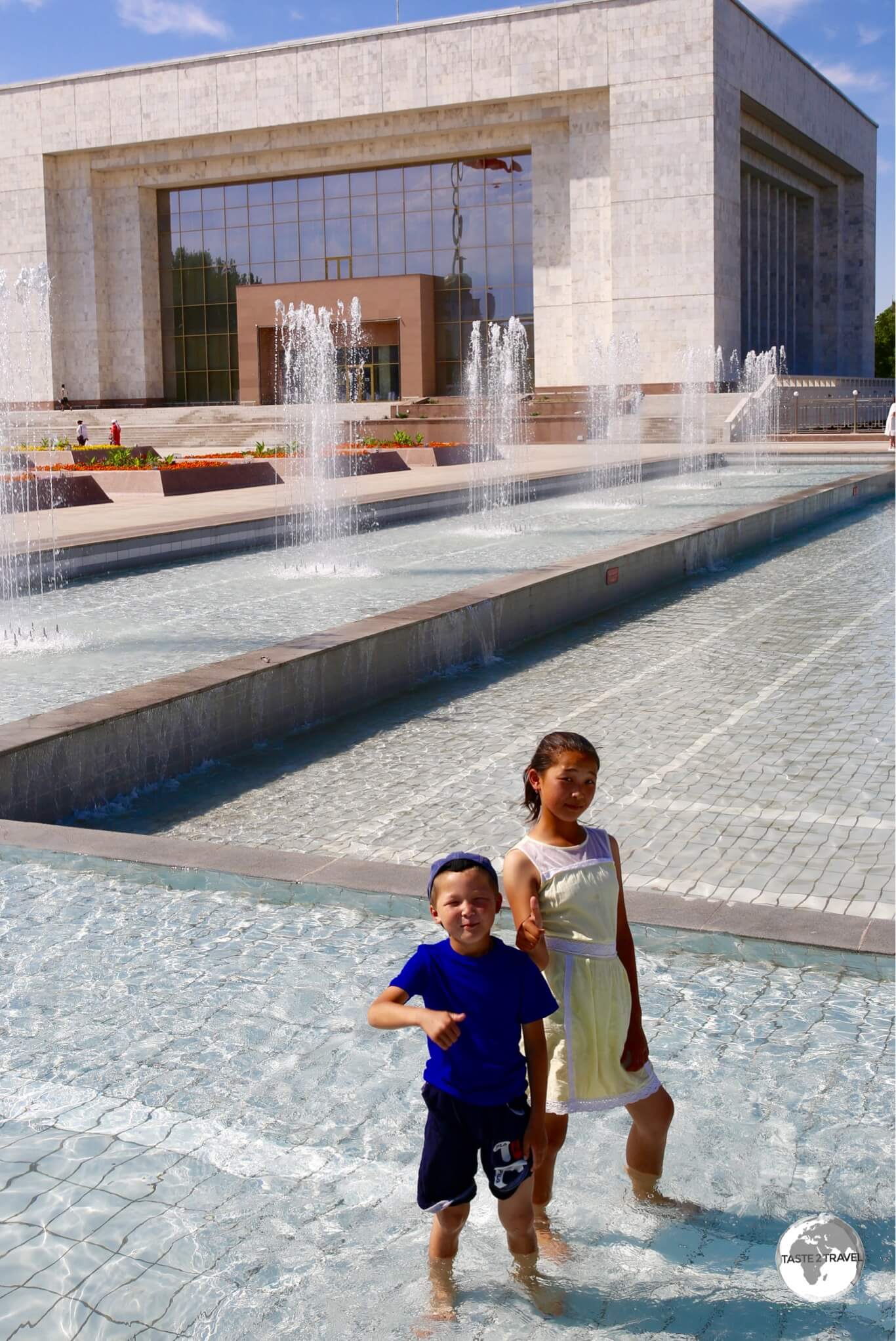
Children cooling off in one of many fountains which line Ala-Too square.
While the museum might be closed, the many fountains, which line the square, are definitely open and are a popular playground for local kids who use them to cool off on hot summer days.
National Flagpole

The guarded flagpole in Bishkek’s Ala-Too square.
One of the quirkiest sights in Bishkek has to be the well-guarded flagpole which dominates Ala-Too square. The flagpole is guarded, during daylight hours, by two honour guards from the National Guard of the Armed Forces.

The replacement guards, from the National Guard of the Armed Forces, goose-stepping to the flagpole.
A changing of the guard ceremony takes place hourly, which sees three goose-stepping guards approach the flagpole from their base, which is located in the basement of the State History Museum. The guards goose-step about 200 metres until they reach the flagpole.

The former guards, preparing to return to their base.
Once at the flagpole, the two replacement guards mount the podium and replace the former guards, who goose-step back with the third guard.

Goose-stepping guards, from the National Guard of the Armed Forces, returning to their base.
Ala-Too Cinema and Surroundings

The beautifully iconic Ala-Too cinema in downtown Bishkek.
Don’t be fooled by its retro appearance! While the Ala-Too cinema is the oldest, and most famous, cinema in Bishkek, it houses four theatres with all projection equipment having been updated in 2012 to allow the cinema to show 3-D films. Located on Ala-Too square, this iconic institution is listed as a cultural monument of the Kyrgyz Republic.
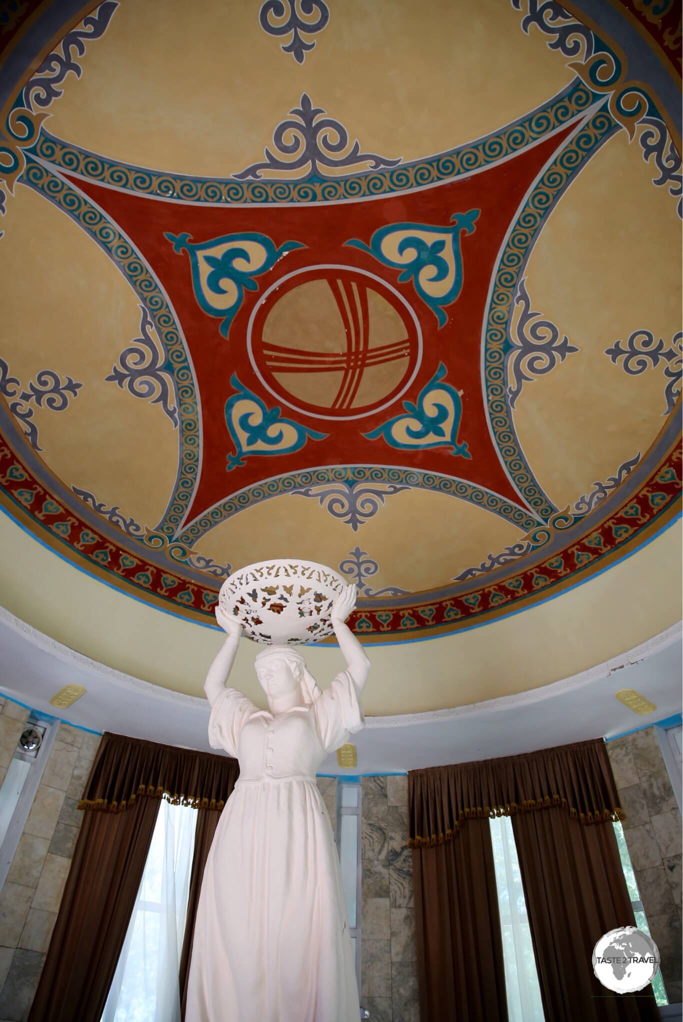
The splendid interior of the cafe, located behind the Ala-Too cinema in Bishkek.
Behind the cinema is a small, rotunda-shaped, cafe which features a painted ‘tunduk’ on its ceiling. Outside the cafe is the ‘Kilometre Zero‘ marker, from which all road distances in Kyrgyzstan are measured.

Kyrgyz folk artwork on sale at the Ala-Too square art market.
Next to the ‘Kilometre Zero‘ marker, is an art market, where local artists paint and sell fine, but very affordable, examples of folk art, portraits of Lenin (see the portrait in the ‘Lenin Lives‘ section) and epic, alpine landscapes, which Kyrgyzstan has in abundance.
Monument to Those Who Died for Freedom

The Monument to Those Who Died for Freedom in downtown Bishkek.
Located alongside Ala-Too square, on Chuy avenue, the ‘Monument to Those Who Died for Freedom‘ commemorates those who died during the pro-democracy events of 2002 and 2010.
The monument is made of two large tiled panels, one black and one white, with a group of people pushing the black stone away from the white.

Selling Kashk or Qurt – a hard, salty fermented cheese snack – in downtown Bishkek.
Statue of Kozhomkul

The statue of the strongman, Kozhomkul, which stands outside the Sports Palace in downtown Bishkek.
There are many monuments in Bishkek, but my personal favourite would have to be the Statue of Kozhomkul, a local strongman who apparently carried his horse home on his shoulders after it became mired.
Fittingly, this impressive statue stands outside the Sports Palace which is named after Kozhomkul. The statue is tucked away in a quiet side street (Togolok Moldo St) one block west of Panfilov park.
Panfilov Park

The Ferris wheel is one of many affordable amusements at Panfilov park in downtown Bishkek.
The capitals of all ex-Soviet republics feature a permanent amusement park and in Bishkek, Panfilov park is where local families congregate.
Located next to Ala-Too square, Panfilov park, which is free to enter, is home to an assortment of amusements and carnival rides, and is especially popular in the evenings when locals come to relax, eat fairy-floss, try their luck shooting at balloons or bumping into each other on bumper cars.
Victory Square

The Victory Monument in Bishkek’s Victory park commemorates the victory over Nazi Germany during WWII.
Located a short walk east of Ala-Too square, Victory park commemorates the victory over Nazi Germany during WWII. The park was created in 1984, on the occasion of the 40th anniversary of the liberation of the USSR.
At the heart of the park is a red-granite monument which is designed to evoke three yurt struts, which curve above an eternal flame. Standing under the struts is a woman, waiting for her husband to return home.
Bishkek Circus

Looking like a UFO which has landed in downtown Bishkek, the Kyrgyz State Circus stages regular circus performances.
If strolling along Frunze street towards Victory Square, you might be forgiven for thinking a UFO has landed in Bishkek. This strange looking, other-worldly, structure is actually the Kyrgyz State Circus. Just like the amusement park at Panfilov park, each Soviet capital also had a dedicated, permanent state circus building.
Bishkek Parks

Bishkek truly is a green city with parks occupying many downtown city blocks.
Many cities claim to be green but Bishkek really is a green city. You can traverse the downtown area by hopping from one park to another.
There are countless green ‘lungs’ in Bishkek, with each park offering plenty of shady bench seats, sculptures, fountains and colourful garden beds. Thanks to a constant supply of fresh water from the Tian Shan mountains, everything is kept lush and green.
Bishkek Shopping
Bishkek Park

Bishkek Park mall offers the best shopping in Bishkek.
There are a few shopping malls in Bishkek, including the ubiquitous TSUM department store, which can be found in every ex-Soviet capital. The best mall is the modern Bishkek Park, which is located at 132 Kiev street, one block back from the main street.
Saima

You too can be a nomad with a ‘DIY Yurt Kit’ – a popular item at Saima.
If you’re looking for quality souvenirs, there’s only one place to go – Saima, which can be found on the main street at 140 Chuy avenue.
The Art of Felting

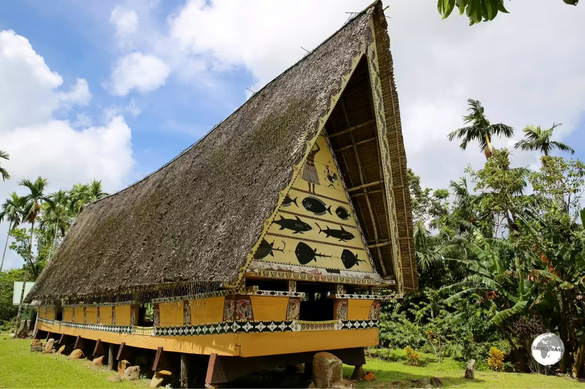
Kyrgyz yurts, such as these on Lake Son-Kul, are always wrapped in large sheets of water-proof, and insulating, felt.
Traditionally, sheep herding was the main activity of the Kyrgyz nomads. Wool was something they had in abundance, so the production of felt, which is made by matting, condensing and pressing wool (and other animal) fibres together, was a logical bi-product from their lifestyle.

The colourful felt slippers from the Saima in Bishkek are an ideal (and practical) souvenir.
Felt production has been an important part of Kyrgyz nomadic culture since at least the Iron age. During the days of the Great Silk Road, felt was among the products traded by the Kyrgyz. Felt has many useful qualities – it’s water-resistant and insulating. The main use for felt has been as a covering for yurts – it keeps the elements out, while keeping the heat in.
Today, artisans craft a variety of products from felt, including slippers, coats, hats, decorations, carpets and more. While products are sold country-wide, the Tumar Art Salon in Bishkek carries many fine examples of felt handicrafts.

At just US$5 each, felt Kalpak’s, available from Saima in Bishkek, are an affordable souvenir of Kyrgyzstan.
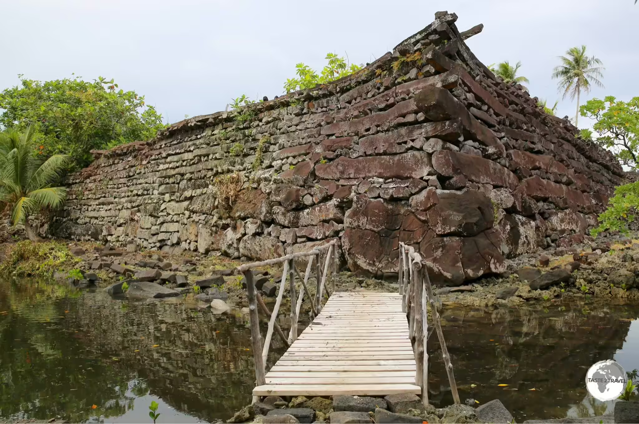
Burana Tower

Burana Tower, a 24 metre-high brick minaret which dates from the 11th-century.
Located 83 km southeast of Bishkek, on the outskirts of the town of Tokmok, Burana Tower is a 24-metre-high, ornately decorated, brick minaret which was once part of the ancient citadel of Balasagun, which was founded by the Sogdians. Located off the main highway, Burana is a popular side-trip for those travelling from Bishkek to Lake Issyk-Kul.
A UNESCO World Heritage site, today the minaret stands alone in the middle of a remote, grassy field. An internal, spiral staircase, leads to the top of the tower which affords panoramic views of the Tian Shan mountains and the surrounding countryside.

An ancient Muslim gravestone at Burana tower.
A short walk (100 metres) north of the tower, a pathway leads you through a cemetery where ancient Muslim gravestones, carved in Arabic text can be observed.
Lake Issyk-Kul

The best beaches on lake Issyk-Kul are to be found on its southern shore.
In a country bursting with amazing sites, the magnificent lake Issyk-Kul is a highlight. Located at an altitude of 1,607 metres (5,272 ft), the statistics are impressive; Issyk-Kul is 182 kilometres (113 mi) in length, up to 60 kilometres (37 mi) wide, and has a surface area of 6,236 square kilometres (2,408 sq mi).
It’s the second-largest mountain lake in the world, behind Lake Titicaca in South America. By volume, it’s the world’s 10th largest lake. At a maximum depth of 668 metres (2,192 ft), Issyk-Kul is the seventh deepest lake in the world. While the lake has more than 118 recorded ‘inflows’, it has no ‘outflows’, with hydrologists hypothesising that the waters of the lake filter deep underground.

With water temperatures above 20 degrees during the summer, and lots of sandy shoreline, the beaches of lake Issyk-Kul are popular with local families.
Despite being surrounded by snow-covered peaks, the saline waters of Issyk-Kul never freeze. During the summer months, water temperatures hovering above 20 degrees which makes the numerous sandy beaches a popular recreation choice for tourists and locals.
Karakol
Relaxed and chilled Karakol (pop: 66,000) is one of the most important tourism hubs in Kyrgyzstan. Located at the eastern end of lake Issyk-Kul, the town itself has few attractions, but it’s surrounded by an array of incredible sights, which makes it a perfect base for day-trips into the countryside.
The town, which is laid out on a very logical grid, was founded in 1869 by the Russians, who built it to serve as an administrative centre on the caravan route from Chuy Valley to Kashgar (China). The town, which lies close to the Chinese border, boasts an eclectic mix of ethnicities, including Kyrgyz, Russians, Kazakhs, Tatars and Uighur’s.
Gingerbread Houses

Karakol is famous for its Russian-style Gingerbread houses.
One of the joys of exploring downtown Karakol is to walk the picturesque streets, which are shaded by rows of huge white poplars and lined with colonial-era, Russian gingerbread cottages.
Painted in bright colours, the cottages feature shuttered windows, neat flower-beds, fruit trees and cute picket fences.

In a town full of decorated cottages, the Nadia Gaga house is in a league of its own.
Holy Trinity Cathedral

A Russian orthodox church, the all-timber, Holy Trinity Cathedral, is one of the main sights of historic Karakol.
Located downtown, the Holy Trinity Cathedral is a Russian Orthodox church which dates from 1872, although the current version dates from 1895, after the original was destroyed by an earthquake in 1890. This imposing wooden structure is topped by five green towers which are crowned by golden, onion-shaped domes.

The altar of the Holy Trinity Cathedral in Karakol.
After the October Revolution, within the framework of the Soviet campaign against religion, the Bolsheviks removed the domes and turned the church into a children’s sport school.
Dungan Mosque

With its Chinese-design influences, the Dungan mosque looks more like a Chinese temple.
Exotic-looking, incongruous and definitely out-of-place, Dungan mosque is an anomaly which looks more like a Buddhist temple than a mosque.
Constructed in 1902, on the initiative of a local Muslim leader, Ibrahim Aji, who invited a famous Beijing architect, Chou Seu to design and build a mosque, the temple was built by a team of 20 Chinese woodworkers, who were skilled at building Chinese-style buildings. The end result was a mosque which looks, unmistakably, like a Chinese-style temple.

Interior view of the Dungan mosque.
Karakol Historical Museum

The Karakol Historical Museum.
The highlight of the low-key Karakol Historical Museum is the large taxidermy display. Taxidermy was a popular form of exhibit for the Russians, with most museums in the ex-Soviet world boasting impressive collections of stuffed critters.

The large taxidermy display at the Karakol History Museum.
Jeti-Ögüz

Jeti-Ögüz, which translates as Seven bulls, is a sandstone formation which rises from a lush green valley.
One worthwhile day-trip from Karakol is to the stunningly beautiful Jeti-Ögüz, which translates as ‘seven bulls‘. Located in a quiet valley, 25 km west of Karakol, the seven bulls are a red sandstone ridge which rises up out of a lush, green valley, through which a powerful mountain stream flows.

Five of the Jeti-Ögüz bulls can be seen more clearly from this angle.
The stream supports a rural village (which is worth exploring), a community of bee-keepers and yurt camps, where tourists can sip tea and pose for photos with impressive eagles.

A curious local in the village at Jeti-Ögüz.
During my visit, the countryside was full of colourful, wild flowers, which contrasted nicely with the surrounding red sandstone.

Two young eagle handlers from Jeti-Ögüz, rent their pet raptors out to tourists for the ultimate selfie photo.
Central Asia is the birthplace of the ancient tradition of eagle hunting. Today however, these majestic birds do less hunting and more posing for selfies with tourists.

The Broken Heart rock at Jeti-Ögüz.
As you drive through the valley towards Jeti-Ögüz, you’ll encounter young Kyrgyz entrepreneurs who, for a small fee of course, will let you pose with their impressive pet eagles.

The ultimate wind barrier – a yurt camp, protected by the towering walls of Jeti-Ögüz.
The detox drink of choice in Kyrgyzstan is Kumis, which is made from fermented mare’s milk. Slightly alcoholic, Kumis is lauded by the Kyrgyz for its physical and mental benefits – so it must be good for you! In the village of Jeti-Ögüz, there are many mare’s which are milked by local farmers.

Milking a mare in the village of Jeti-Ögüz.
Bee Keepers of Jeti-Ögüz

Bee hives at Jeti-Ögüz are kept on the back of trailers which allows them to be easily relocated.
The quiet road, which passes through the lush, green valley towards Jeti-Ögüz, is an ideal place for local bee-keepers to tend their hives. The countryside is full of wild flowers and the apiarists are able to produce their honey and sell it to passing tourists. If you’re lucky enough you might be able to observe a bee-keeper collecting honey from his hives.

The bee keeper at Jeti-Ögüz, applying smoke to the recently-opened hive.
This sequence of photos shows a beekeeper inspecting his hives to determine which frames to harvest.
I should point out that I am allergic to bees and while taking these photos, I was surrounded by a swarm of thousands of bees, many of whom kept bumping into me! I’m pleased to report that I finished the shoot without being stung.

The bee-keeper at Jeti-Ögüz extracts each honeycomb frame from the hive to determine which ones are ready to be harvested.

A frame, loaded with bees and fresh honeycomb.
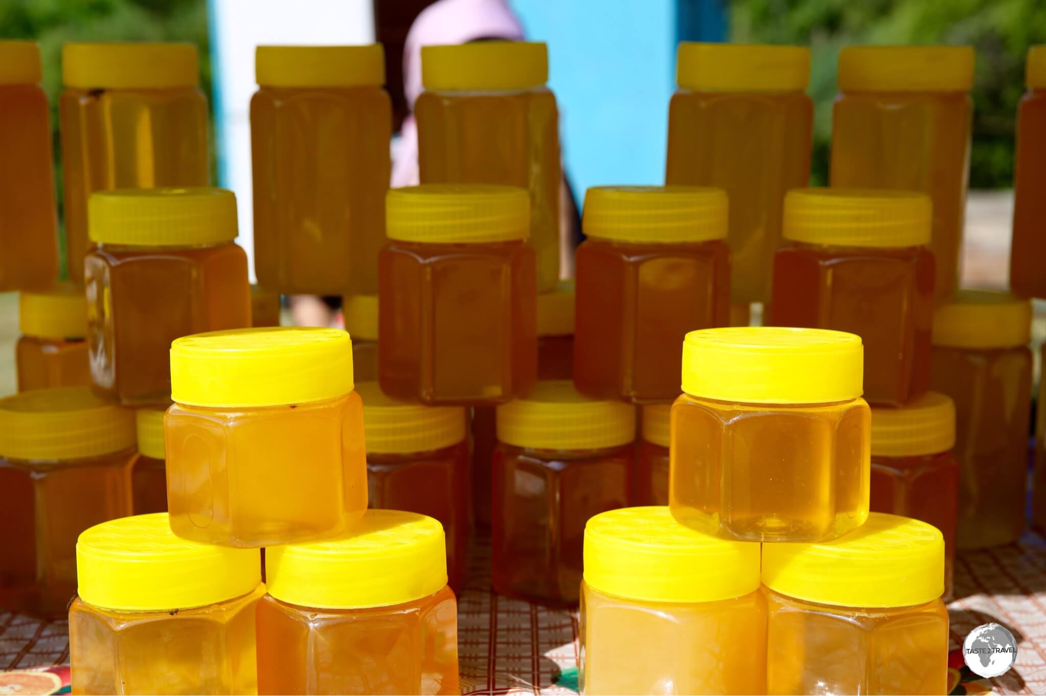
Straight from the hive and full of goodness, freshly bottled honey for sale at Jeti-Ögüz.
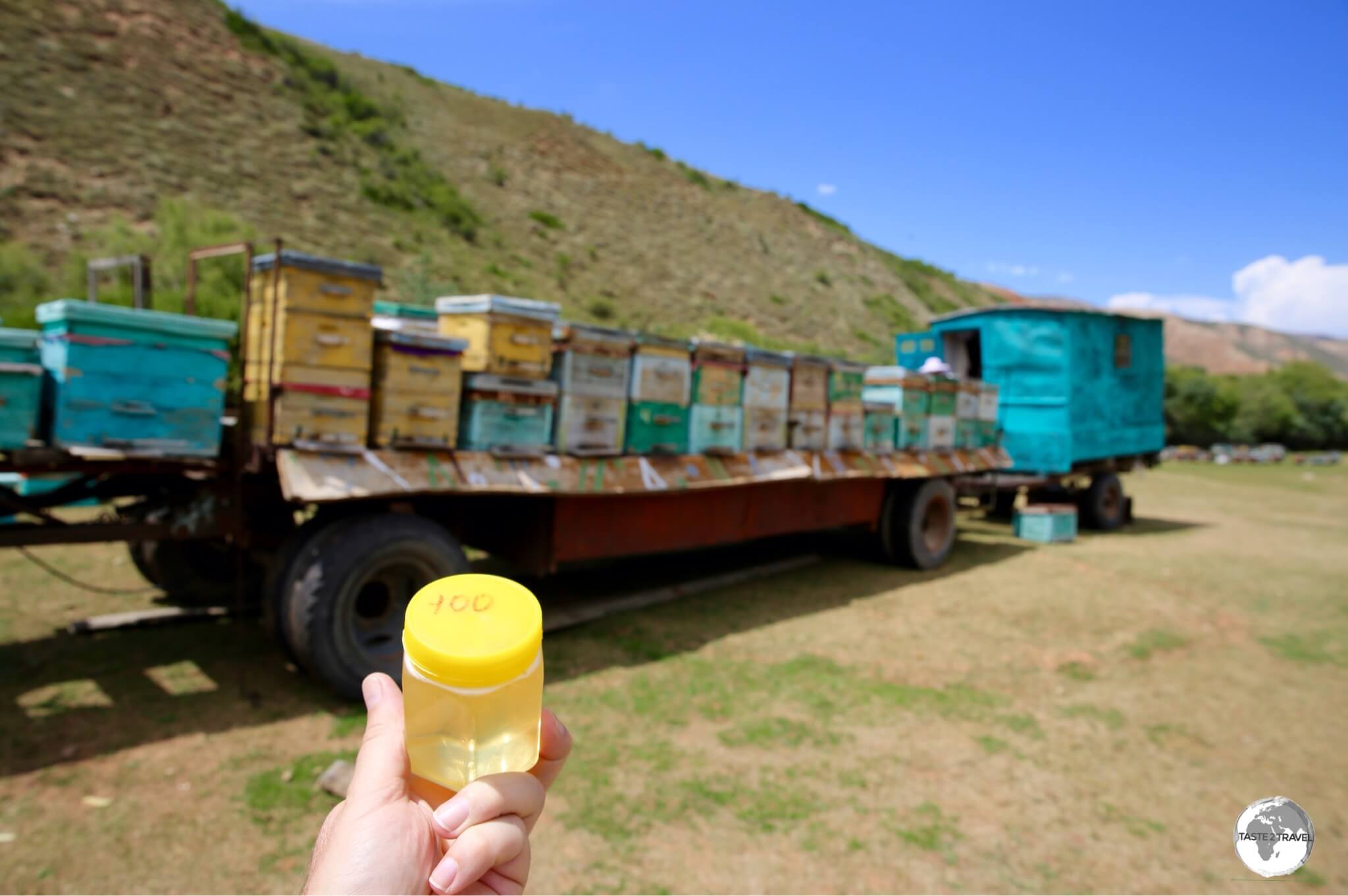
My container of fresh Jeti-Ögüz honey, which cost me just 100 som (US$1.40).

My amazing, go-anywhere, Toyota Land Cruiser rental car in the stunning Barskoon valley.
Located 100 km southwest of Karakol, the Barskoon valley is a remote area of incredible beauty, and has been used as the cover photo for this report.
The road through the valley, which is located a short distance inland from the southern shore of lake Issyk-Kul, use to serve as a Silk Road trading route, connecting Kyrgyzstan with the province of Xinjiang in north-western China.

A shepherd with his flock in the Barskoon valley.
While driving my rental car through the valley, I saw little transport. If you’re relying on public transport, you can (apparently) get a Marshrutka to the town of Barskoon then hire a taxi to take you into the valley.
The Barskoon river flows through the valley, which is home to a couple of waterfalls, shepherds tending to huge flocks of sheep and a bust of the famous cosmonaut – Yuri Gagarin.

The face of the famous Russian cosmonaut, Yuri Gagarin, is carved into a boulder in the Barskoon valley.
The face of cosmonaut Yuri Gagarin, who was the first human to journey into outer space, is carved into a large boulder, which lies on the side of the road, deep inside the Barskoon valley. It’s said that Yuri visited this spot shortly after his historic spaceflight and even possibly stood on this rock!
Skazka Fairy Tale Canyon

The incredible formations of the Skazka Fairy Tale canyon have been created over millennia by erosion.
Continuing west along lake Issyk-Kul from the Barskoon valley, the landscape changes, becoming more arid and sandier. It’s here where you’ll find the best (sandy) beaches and also the incredibly beautiful Skazka Fairy Tale Canyon.

Looking like an artist’s palette, minerals in the earth provide a splash of colour at Skazka Fairy Tale canyon.
The canyon, which is located between the Barskoon valley and the town of Bokonbayevo, is a short walk inland from the main highway which travels along the lake shore. A series of (unmarked) walking tracks leads you up and over eroded sandstone mounds which have been eroded into photogenic shapes.

The colourful earth of the Skazka Fairy Tale canyon contrasts brilliantly against the blue sky.
The colourful soil, which result from minerals in the earth, contrasting against the blue skies make for amazing photography in the late afternoon.
Bokonbayevo

A bust of Lenin outside a government building on the main street of Bokonbayevo.
There’s nothing much to do in the sleepy town of Bokonbayevo but, as the largest settlement west of Karakol, the town makes for a handy base if you wish to explore the attractions on the south shore of lake Issyk-Kul. I stayed overnight on my drive from Karakol to lake Son-Kul.
Issyk-Kul to Son-Kul

Located west of Lake Issyk-Kul, the landscape surrounding Orto Tokoy reservoir is spectacular.
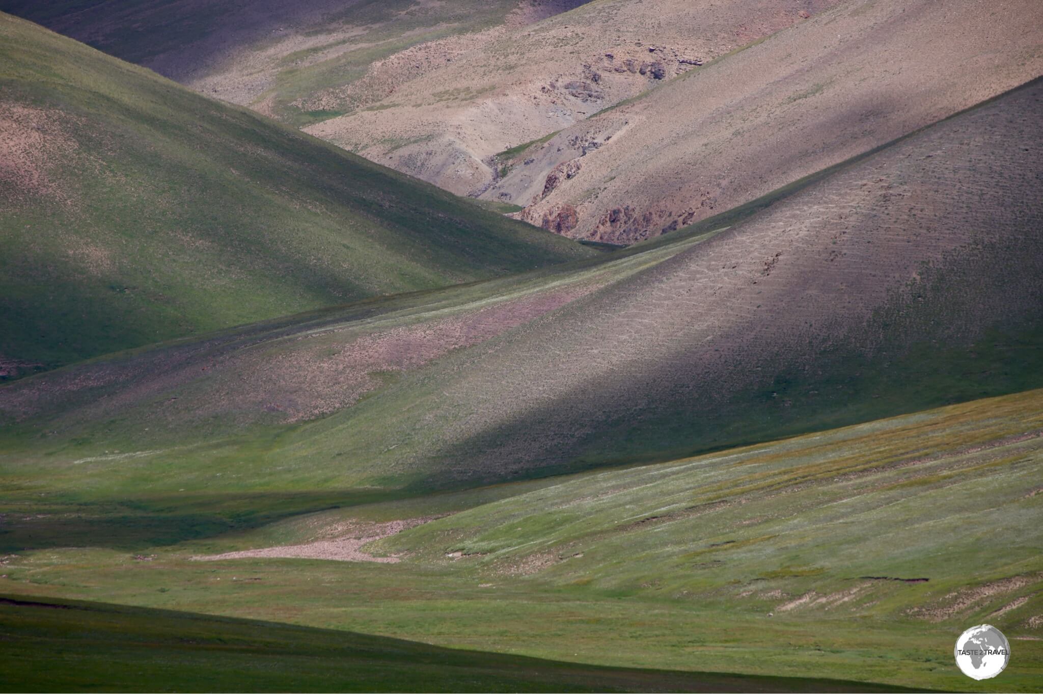
It could be said that, ‘around every bend in the road in Kyrgyzstan, lies another spectacular view’. This is especially true of the journey from Lake Issyk-Kul to Lake Son-Kul, where you encounter one breath-taking view after another.
Note: If you’re self-driving with the aid of a navigation app such as Google Maps or Waze, you will lose network coverage as you approach Lake Son-Kul. However, this is not a problem as there’s only one road to and from the lake.

The Orto Tokoy reservoir is fed by the Chu River.
A short drive west of lake Issyk-Kul lies the incredibly beautiful, Orto Tokoy reservoir. The reservoir is formed by a dam on the Chu river, with an impressive, bare-earth, mountain range forming the perfect background. Stunning!

A colourful sandstone mountain outside the town of Kochkor.
Continuing west, the town of Kochkor lies 40 km beyond Orto Tokoy reservoir.
Kochkor serves as a junction town, allowing you to approach lake Son-Kul from either the east (a much short route) or the west (a much, much longer route). I approached from the west.
The following photos show the scenery from the westerly route.

A hilltop Islamic Tomb outside of Kochkor.

Green hills on the way to lake Son-Kul.

An Islamic Tomb on the road to lake Son-Kul.
Scenery on the road to Lake Son-Kul.
Song-Kul

The mesmerisingly beautiful Lake Son-Kul lies at 3,006 metres and is only accessible during the warmer months.
Perched at 3016 m (9,900 ft), the serenely beautiful Lake Son-Kul is a truly special place. Inaccessible for half of the year, there are no permanent structures on the lake. Nomads from villages lower down the mountain relocate to the shores of the lake during the summer months, offering yurt accommodation to any tourist who finds their way here. While there are no shops, no network coverage for mobile phones, there is fresh air, nature, sublime scenery and basic yurt camps.

The meadows surrounding lake Son-Kul are carpeted with Edelweiss.
The lake is located in the middle of a remote, alpine meadow which is carpeted in white Edelweiss. I lived for a few years in Switzerland, and while “Edelweiss’ is the national flower of Switzerland, I saw very little of it there. However, the meadow surrounding lake Son-Kul is carpeted with it.

A young boy playing on a traditional Kyrgyz swing on the shore of lake Son-Kul.
Access to the lake is via a rough gravel road which is open during the summer months. Although 4WD is best, locals do venture here in their beat-up Ladas.

Horses grazing on the shore of lake Son-Kul.
If you enjoy horse riding, you can organise treks through the different families who own the yurt camps. During the summer, each family transports their animals up to the lake, where the summer pastures offer ample feed. As in other nomadic cultures of Central Asia, horse riding is a national pastime among the Kyrgyz.

My host family, and their adopted US Peace Corps volunteer, outside one of their yurts, on lake Son-Kul.
While on lake Son-Kul, I stayed in a yurt camp owned by a family whose regular home is in the village of Ak-Tal, which is located further down the mountain.
The family relocate each summer to the lake shore, where they offer comfortable yurt accommodation for passing tourists (see the ‘Accommodation‘ section for more).
Also working at the yurt camp was a US Peace Corps volunteer, which was wonderful as he provided translation services and could provide me with detailed information on the culture and lifestyle of the Kyrgyz nomads.

Each morning, one of the family members separates cream from the fresh milk. This is then served with pancakes and jam for breakfast.
Son-Kul to Kazaman

A short drive south of Lake Son-Kul, the Moldo-Ashuu pass lies at 3,346 m (10,980 ft).
As the crow flies, it’s 103 km from lake Son-Kul to the regional centre of Kazarman, which is located at the mid-way point between Son-Kul and Osh. However, by road, it’s a full day’s journey, along never-ending, windy, narrow, mountainous gravel roads, which traverses two spectacular passes.
The first pass you cross, after leaving lake Son-Kul, is Moldo-Ashuu which offers dramatic views to the south. You’ll know when you’ve reached the pass because you’ll see all the locals sitting around chatting on their mobile phones. This is the only place for miles with network coverage!

Stunning scenery on approach to Ak Tal village.

This road is marked on Google maps as the ‘highway’ between Ak Tal and Kazaman. This road is closed and should be avoided!
It’s important to note that the ‘highway’ which is indicated on Google Maps, and which Miss Google will direct you to use, has long been out of service.
I know this, because I followed the road for 30 lonely kilometres before it dead-ended at a collapsed bridge which had fallen into a raging river. To reach Kazarman, you should take the, unmarked, gravel road, north of the river, as indicated on the map below.

The current highway to Kazarman (indicated by arrow) is an unmarked gravel road.

Spectacular views from the road to Kazarman.

More stunning views from the Kazarman highway.

The last pass before reaching Kazarman, the Kara-Koo Pass is located at 2,800 metres (9,186 feet).

A view east from the Kara-Koo Pass.
There’s nothing much to do in Kazarman, although there are some petroglyph’s near to town. There are no hotels, but a CBT office can arrange a home-stay for you (refer to the ‘Accommodation‘ section below).
The Road to Osh

A truck loaded with hay outside of Kazarman.
The road from Kazarman to Osh descends from the high mountains to the hot, dry plains of the Fergana Valley, a part of Kyrgyzstan steeped in history. From Kazarman, it’s a 6-hour, 550 km drive to Osh. On the approach to Jalal-Abad, you finally drive back onto a smooth asphalt road, the first such road this side of Kochkor.

Sheep are mustered at the Kaldama pass, where they await their turn to be shorn.
After leaving Kazarman, the gravel road ascends, steeply, to the Kaldama pass (3,062 m / 10,045 ft), which forms the border between Naryn and Jalal-Abad oblast (region).

A shearer, shearing one of hundreds of sheep, at the Kaldama pass.
At the time of my visit to Kaldama pass, local sheep farmers had congregated with their large flocks of sheep, each awaited their turn to be shorn by a team of shearers, who processed hundreds of sheep, under the sun, using hand shears.

More sheep arriving at Kaldama pass, to await their appointment with the shearer.
From the pass, its a downhill run to the city of Jalal-Abad, with the (still gravel) road passing through cultivated countryside.

A patch-work quilt of cultivated fields, on the road to Jalal-Abad.
Osh
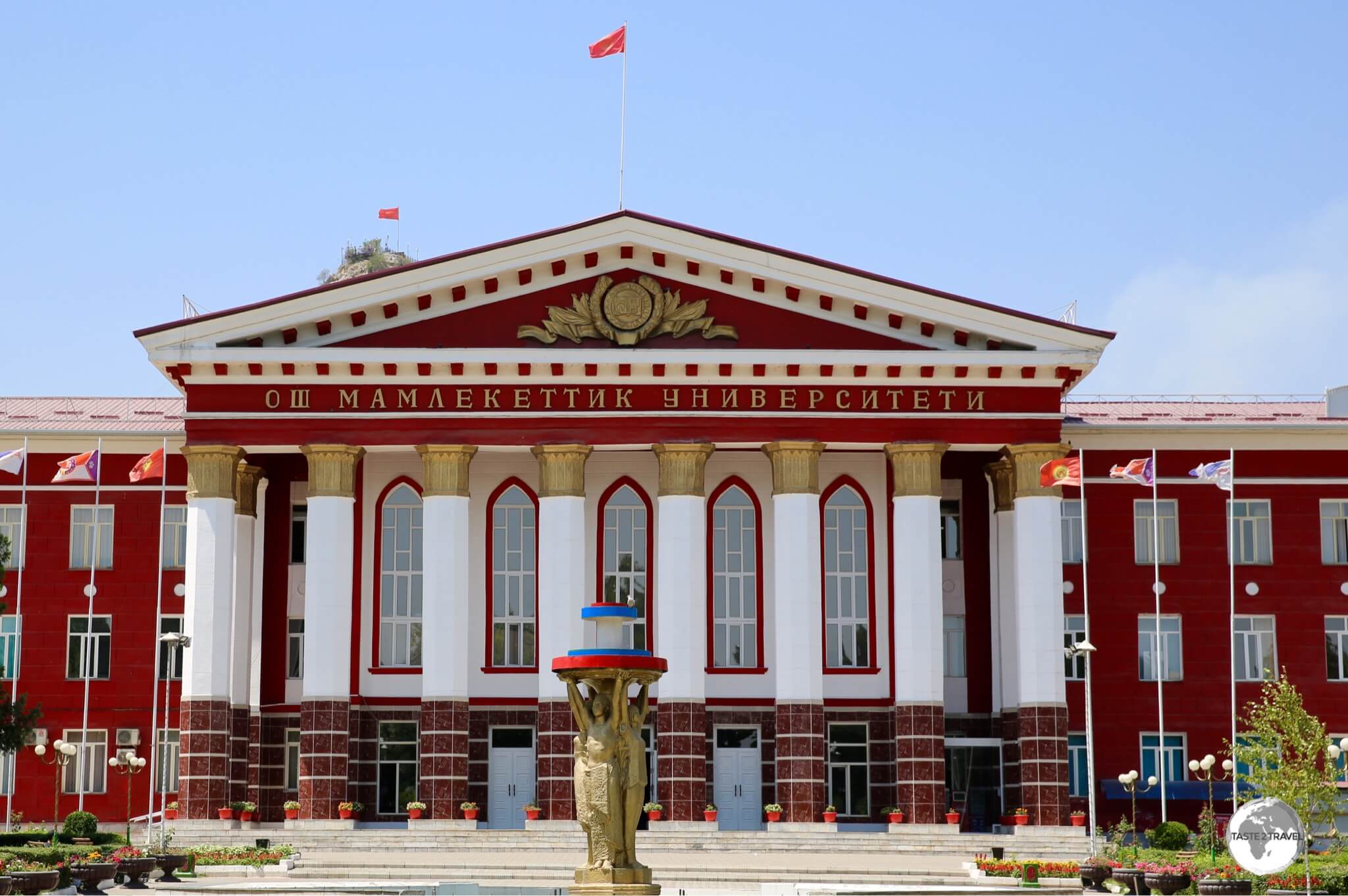
Osh State University.
Located in the heart of the, baking hot, Fergana valley, and with a history spanning more than 3,000 years, Osh is one of the oldest settlements in Central Asia and historically, served as an important junction town in the days of the Great Silk Road. After the capital, Bishkek, Osh is the 2nd largest city in Kyrgyzstan, supporting a population of 256,000.
Due to its location and history, the city is a melting pot of everything ‘Central Asian’. Located a short drive from the Uzbek border, Osh is home to a variety of ethnic groups, including a large Uzbek community. The city is a fascinating and engaging destination, which deserves at least a few days on anyone’s itinerary.
Sulaiman-Too Mountain

The view of downtown Osh from the summit of Sulaiman-Too mountain.
Rising abruptly from the plains of the Fergana Valley, in the heart of downtown Osh, Sulaiman-Too (translates as ‘Solomon’s Throne’) is a UNESCO World Heritage Site, which offers the best views of the city and surrounding countryside.
Historically, the mountain marked the midpoint on the ancient Silk Road, halfway between Europe and Asia. Named after Sulaiman (Solomon), who is a prophet in the Quran, the mountain contains a shrine that supposedly marks his grave.

Locals sliding down the smooth, polished, limestone rock on Sulaiman-Too mountain.
Geographically, the mountain is a giant piece of limestone, which, over millennia has become slippery and polished by the trampling feet of scores of Islamic pilgrims and tourists. One attraction on the slope of the mountain is the polished rock, a smooth limestone boulder which is used as a natural slippery-dip.

Interior of the National Historical and Archaeological Museum at on Sulaiman-Too mountain.
Built into a cave in the side of the mountain, the National Historical and Archaeological Museum showcases archaeological findings from the area and explains the history of Osh.
Jayma Bazaar
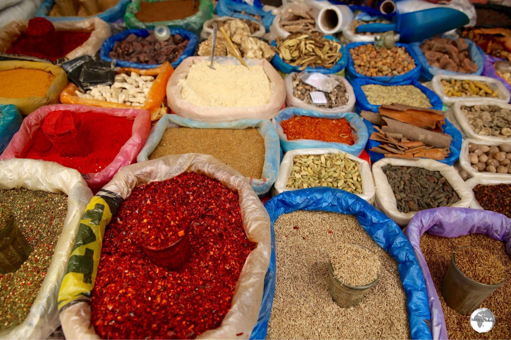
The spice section of the sprawling Jayma Bazaar in Osh.
Osh is famous for the sprawling Jayma bazaar, which has been in operation, on the same site, for more than 2,000 years. The huge market stretches for kilometres along the western bank of the Ak-Bura river, which flows through the heart of Osh.

A shop-keeper at the Jayma bazaar in Osh.
Along with a steady stream of tourists, traders, and customers, flock to the bazaar from all over Kyrgyzstan, Uzbekistan and Tajikistan. If you are travelling on to either of those countries, the money changers at the bazaar offer competitive rates on Tajik somani and Uzbek som.
Osh Soviet-era Murals

The Fabric mosaic is installed on the wall of a local technical college and shows three different workers, with one holding a length of red cloth, a symbol of communism.
During the Soviet era, throughout all cities and towns, colourful and gigantic murals and mosaics were installed on otherwise blank walls to deliver messages of Soviet ideology and to inspire citizens with beautiful everyday surroundings.
While many cities, in a bid to modernise, have destroyed these reminders of the past, Osh still retains many of these retro pieces of street-art.

The Aeroflot mosaic, which adorns the wall of a building in a quiet lane way, was created as an advertisement for the 1980’s Moscow Olympics.
While some of the murals, such as ‘Fabric’ are easy to find, others such as ‘Aeroflot’ and ‘Misha’ are more difficult to find, being tucked away in quiet lane-ways.

Also created for the 1980’s Moscow Olympics, Misha is hiding away in a lane-way near the Aeroflot mosaic.
If you wish to easily locate the murals, a Google map, with all the murals bookmarked, on the timetravelturtle website is especially handy.
Osh to Tajikistan

Located at 3,500 m (11,500 ft), the high-altitude Tulpar-Kul mountain lake is located in Chon-Alay mountain range, near to the border of Tajikistan.
From Osh, I joined a one week 4WD trip along the Pamir Highway to Dushanbe in Tajikistan – for more on this trip, please refer to my Tajikistan Travel Guide.

A curious Yak on the shore of Lake Tulpar-Kul.
The first stop on the trip, and my last destination in Kyrgyzstan was Lake Tulpar-Kul, which is located at a height of 3,500 m (11,500 ft), in a remote corner of the country, in the shadow of Lenin Peak (7,134 m / 23,406 ft).

An early morning view of Lenin Peak (7,134 m / 23,406 ft) from the Lenin Peak Yurt camp.
The lake is home to the Lenin Peak Yurt Camp (see the ‘Accommodation‘ section below) which is used as a base for climbers who use the camp to acclimatise prior to their ascent of Lenin peak. The camp is located at the end of a long, gravel road, which winds its way through the countryside for 35 km, south of the town of Sary Mogul.
There are many hiking trails around the shoreline of the pristine Lake Tulpar-Kul.
The Road to Tajikistan

One last view of Kyrgyzstan, from the Kyzylart Pass (4,280 m / 14,042 ft), before crossing into Tajikistan.
From the Lenin Peak Yurt camp, we had a short (one hour) drive south to the Kyzylart Pass which forms the border between Kyrgyzstan and Tajikistan and located at a lofty 4,280 m (14,042 ft).
It was time to say goodbye to Kyrgyzstan and hello to Tajikistan.

The border marker between Kyrgyzstan and Tajikistan at the Kyzylart Pass.
Accommodation
Kyrgyzstan offers a multitude of accommodation options in the main centres of Bishkek, Osh, Karakol and around the shoreline of Lake Issyk-Kul.
Elsewhere, options are thin on the ground with home-stays filling the void. If you arrive in a town without any established accommodation options, you should seek out the local office of the CBT (Community Based Tourism) which can arrange a local home-stay. There are fifteen branches of the CBT, which can be found in most major towns.
In remote, rural areas, including the popular Son-Kul lake, Yurt camps are the only accommodation option. These allow visitors to experience life in a Kyrgyz felt tent and to sample the nomadic style of living.
Bishkek

The recently renovated and refurbished B Hotel is a comfortable option in downtown Bishkek.
Bishkek offers a range of accommodation to suit all budgets.
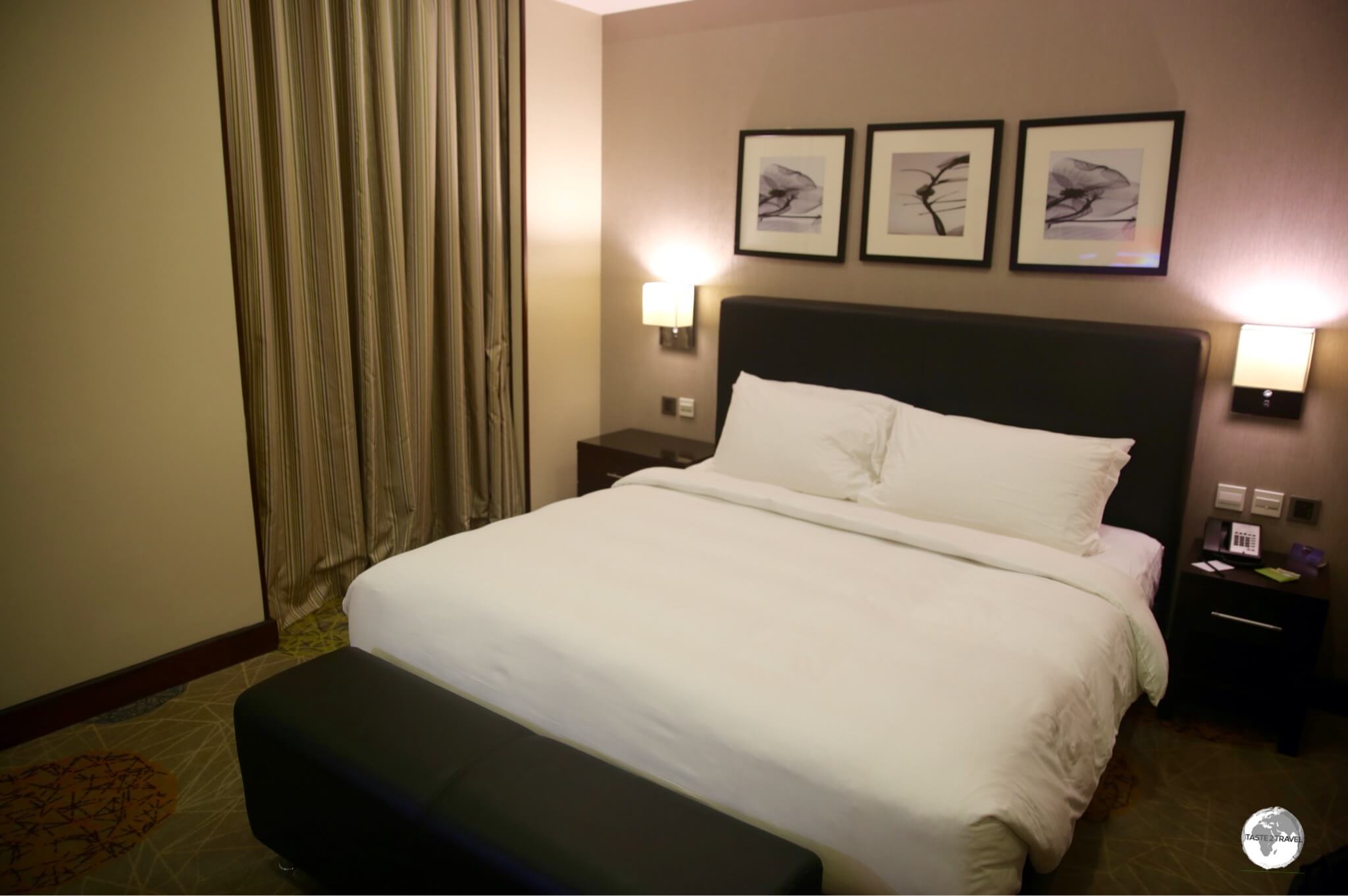
Located in the heart of downtown, the excellent ‘B Hotel‘ offers spacious, comfortable, recently renovated rooms, friendly, helpful staff and a delicious buffet breakfast each morning.
Rooms can be booked on Booking.com for around US$77 per night. The hotel is especially popular with visiting Arab families, who jet in on one of the regular flights from Dubai.

My comfortable and spacious room at the B Hotel in downtown Bishkek.
Around the corner from the B Hotel is the wonderful Park Hotel which offers rooms on Booking.com, starting at US$99 per night. All rooms include a buffet breakfast which includes caviar!
Lake Issyk-Kul

A view of one of the accommodation buildings at the Altyn Bulak Lakeside Resort.
Located on the north shore of lake Issyk-Kul, the town of Cholpon-Ata is home to several accommodation options and, thanks to its close proximity to Bishkek, is popular with weekend tourists.
I spent one night at the Altyn Bulak Lakeside Resort, which is a Kyrgyz version of an all-inclusive resort, which is popular with local families. Despite the fact that there are currently no reviews on TripAdvisor, or that the resort doesn’t appear to have a website, this large, sprawling property offers a variety of accommodation, an onsite restaurant (there are no other dining options in the area) and a beach.

Newly built yurts at the Altyn Bulak Lakeside Resort offer panoramic views of Lake Issyk-Kul.
During my visit, new yurts were being installed, each of which offered panoramic views of the lake. Rooms can be booked on hotels.com for around US$50 per night, which includes breakfast.
Karakol

My cosy room at the wonderful Hillside Four Seasons in Karakol.
As one of Kyrgyzstan’s main tourist hubs, Karakol offers plenty of accommodation options from cheap and cheery hostels to deluxe hotels.
While in town, I chose to stay at the mid-range, Hillside Four Seasons, which is located on a hill, a few kilometres southeast of downtown Karakol.
In a country which offers so many wonderful accommodation choices, Hillside was one of my favourites but is best suited to those who have their own transport (although taxis can be ordered).

The spotlessly clean rooms at the Hillside Four Seasons in Karakol feature modern bathrooms, wood-panelled walls and wooden floors.
This recently built property features beautifully designed rooms, with the most comfortable beds, and a large living area which includes a fully equipped kitchen, projector screen, board games, a guitar, and some comfy bean bags, which are very inviting! The whole place is very chilled and relaxed and is managed by the owner, Ahmet, and his wonderful family.
A standard double room on Hotels.com costs US$48 which is a complete bargain for what is a beautifully designed and well-appointed space. The bargain rates also include a freshly prepared breakfast.
Bokonbayevo

My room at the Emily Guest House in Bokonbayevo, a typical Kyrgyz home-stay style room.
Located a few kilometres south of the southern shore of lake Issyk-Kul, the small, unremarkable, town of Bokonbayevo makes for a convenient overnight base if you’re visiting the nearby Fairy-tale canyon or any of the popular beaches which line the southern shore of Lake Issyk-Kul. If driving from Karakol to Lake Son-Kul, the town lies at about the half-way point.
While there are no established hotels in town, the cosy Emily Guest House offers a typical home-stay experience with meals served in a yurt, which has been installed in the back garden. The guest house is located in a quiet, unpaved, suburban backstreet at Toigonova, 83 which, rather unhelpfully, has no signage to indicate that it is indeed a guest house.
Lake Son-Kul

My colourful Yurt accommodation on Lake Son-Kul. I was the only guest at the camp.
A highlight of my trip to Kyrgyzstan was being able to spend time at a yurt camp on the remote shores of Lake Son-Kul.
Located in the middle of nowhere, at an elevation of 3016 m (9895 feet) above sea level, the lake is inaccessible for half of the year during the long, freezing winter months.
Once the spring thaw melts the snow and ice, locals, who live in the lower village of Ak-Tal, relocate up to the lofty heights of the lake shore, where they setup yurt camps for the summer tourist season.
Due to its seasonal nature, the lake remains free from any sort of development or permanent structures, which is its appeal.

Yurt #6 – my cosy home (with plenty of parking for my Toyota Land Cruiser) on Lake Son-Kul.
If you’re planning on staying at the yurt camps, you should know that these are temporary nomad camps, which offer very basic facilities. What’s carried up the mountain at the beginning of the season needs to be carried back down the mountain at the end of the season.
There are no shops or petrol stations anywhere in this part of the country. You should carry extra fuel and any food or drinks you may need.

The improvised shower block at the yurt camp on Lake Son-Kul, where ice-cold mountain water is heated using a manure-fired stove.
It’s worth mentioning that the lake lies in a giant WiFi black spot with the nearest signal available at Moldo-Ashuu, a high mountain pass which sits at an elevation of 3,346 m (10,977 feet) on the road between Son-Kul and the village of Ak-Tal.
While there are some bookable yurt camps listed on sites such as booking.com, it’s best not to book them as you cannot call anyone once at the lake and signage is non-existent. Rather than wasting your time looking for a yurt camp you have pre-booked, you can check into any number of camps which are dotted around the southern shore of the lake. I was the only guest at my camp!
Kazarman
The dusty, provincial, town of Kazarman lies along the long, meandering, never-ending, slow, gravel road which connects lake Son-Kul to Osh. The town, which makes for an ideal base after a long day of driving, does not have any established hotel options, but does offer a few comfortable home-stays which can be booked through the friendly, English-speaking, lady who runs the local Kazarman CBT office.
While the CBT office functions as a home-stay, I stayed with a nearby family who offer several comfortable rooms with traditional meals served in their kitchen.
Osh

My room at the Rayan hotel in Osh.
Another favourite accommodation option in Kyrgyzstan is the wonderful Rayan Hotel, which is located in downtown Osh. The hotel is designed to cater to both tourists and business travellers, which is wonderful for those of us who occasionally need to plug-in and work on a laptop.
The well-designed, modern, comfortable rooms can be booked on Hotels.com for around US$60 per night, which includes a buffet breakfast with eggs freshly prepared to order. A laundry service is available with a full bag of washing costing me about US$5.
Lenin Peak

My yurt (#5) at the spectacularly beautiful, but incredibly cold, Lenin Peak Yurt camp.
Like lake Son-Kul, the only accommodation option at Lenin Peak is the CBT-run yurt camp. Located at the foot of Lenin Peak – 3,500 metres (11,482 ft) above sea level – the camp lies 35 km south of the village of Sary-Mogol and is often used by groups of climbers as a base, allowing them to acclimatise prior to making their ascent.
Eating Out
The cuisine of Kyrgyzstan is very similar to the cuisine of the other Central Asian republics, with restaurant menus featuring steamed dumplings (known throughout the region as ‘Manti‘), noodle soup (known everywhere as ‘Lagman‘), Plov (a Central Asian version of Pilaf rice), barbecued meats (Shashlik) and salads which are based on tomato and cucumber – all of which are served with a basket of bread.
Restaurants
Bishkek
Cyclone Restaurant
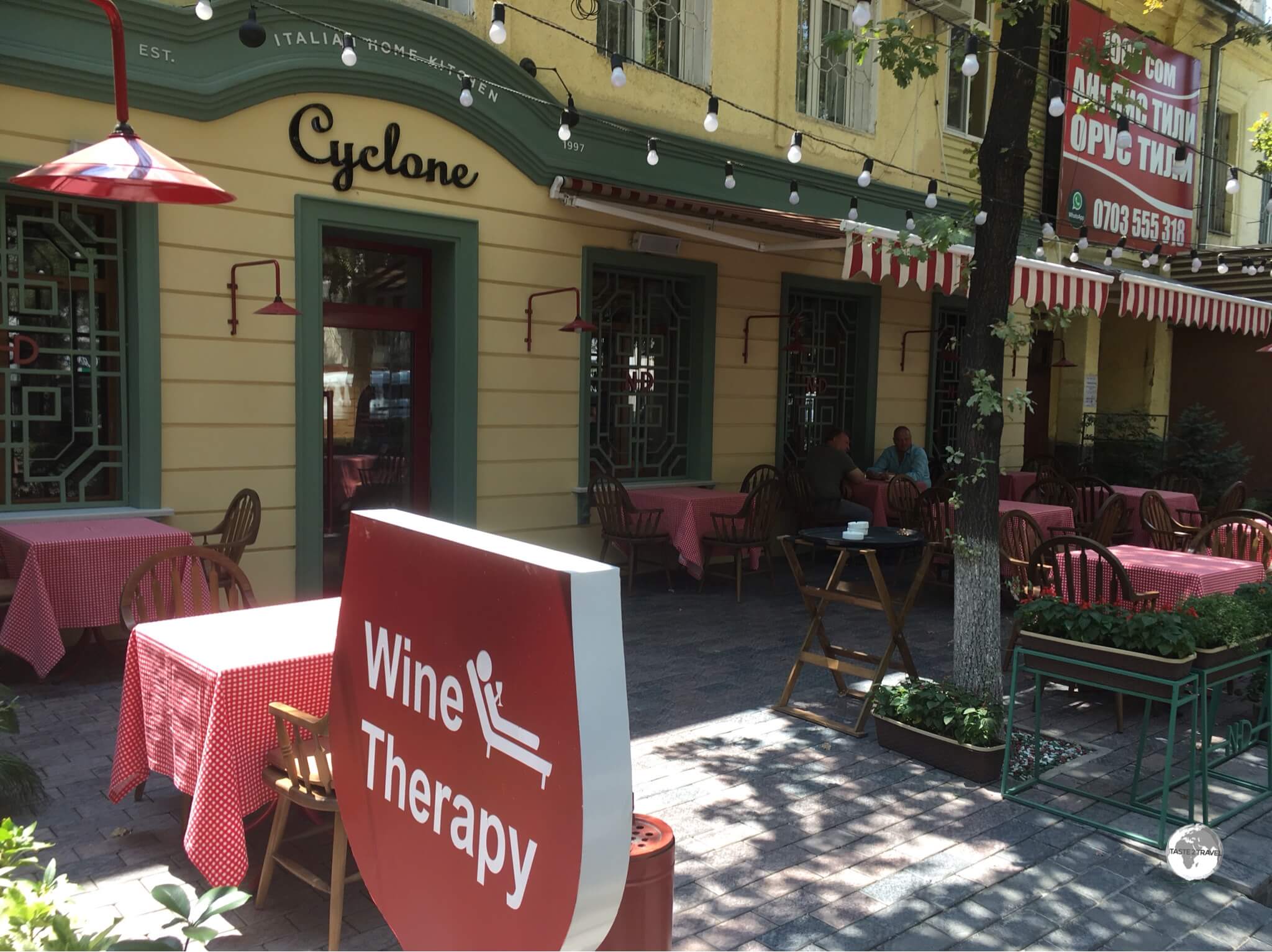
The Cyclone restaurant in Bishkek offers Wine Therapy. Yes please!
Eureka! After travelling the globe, I finally found a place offering Wine Therapy. Is it any wonder I found myself dining at the wonderful Cyclone restaurant more than once?
Offering the best of Italian cuisine, and a selection of amazing wines, Cyclone is located on the main street at 136 Chuy Avenue (just along from Ala Too square). We all need some wine therapy and I’m happy to share this discovery with you! Cheers!
Torro Grill & Bar
If you’re in the mood for a good steak, it’s hard to beat the Torro Grill & Bar. The beef medallions, served with three different homemade sauces, are divine. All the beef served at Torro is sourced from their own local farm and, judging by the flavour, and tenderness of the meat, it would seem the cows live a good life.
The restaurant features a white stretch limousine, which is parked inside the restaurant, into which a couple of dining tables have been installed. Located at 93 Shopokov street (opposite Victory Park), Torro also features a bar which is worth checking out on the weekends.
Frunze Restaurant

A very tasty, and stylised, Chicken Kiev at the Frunze Restaurant.
Owned by the Kaynar Group, a dynamic local catering and restaurant company, the spacious and opulent Restaurant Frunze serves as a restaurant and art gallery.
Offering several large dining halls, each decorated in a different style, the restaurant combines fine dining (I recommend their Chicken Kiev) with art exhibitions which change on a monthly basis.
The restaurant is located at 220A Abdymomunova street, around the corner from the M V Frunze museum.
Karakol

The bakeries of Karakol market are famous for their Mai Tokoch, a round Uighur-style bread which is baked in a clay tandoori oven.
I have to confess – on my first night in Karakol, I was directed to the restaurant Dastorkan by my hotel receptionist and, having being wowed on the first visit, kept returning each day to sample more of their amazing dishes.
The restaurant, which is a favourite of visiting tour groups, and offers a nightly entertainment schedule which features traditional Kyrgyz musicians, is a tourist trap, but the food is authentic and delicious. If you have yet to try a Lagman soup or Manti dumplings, this is the place to initiate yourself into the world of ‘national’ Kyrgyz cuisine.
Cafes

Very cute cafe latte art at Adriano Coffee in Bishkek!
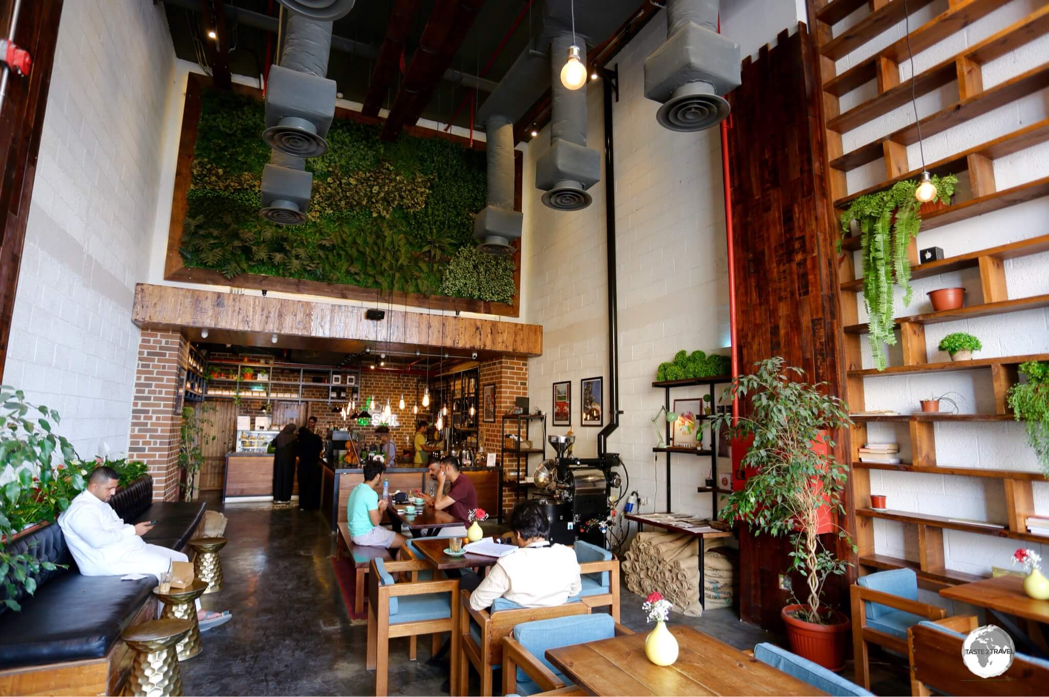
If, like me, caffeine is an essential part of your day, you’ll be happy to know that there is a healthy cafe culture in Kyrgyzstan with excellent options available in Bishkek, Osh and Karakol.
Note: In Central Asia, the term ‘Cafe’ is used to refer to a ‘Cafeteria‘ where pre-cooked meals are served from a buffet and where you’ll definitely not find a decent cup of coffee. If you’re looking for a cappuccino, cafe latte or any other sort of Italian-style coffee, you need to ask for a ‘coffee house‘.
Bishkek

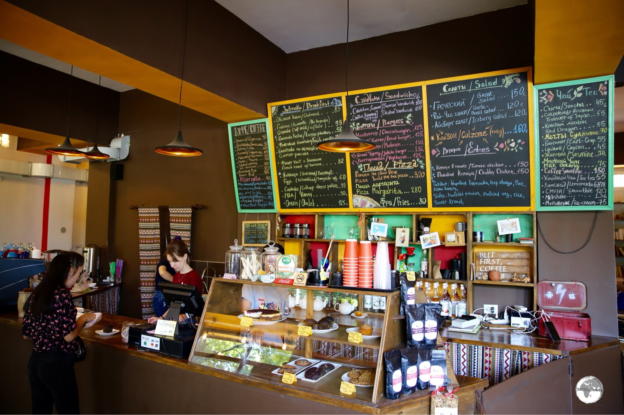
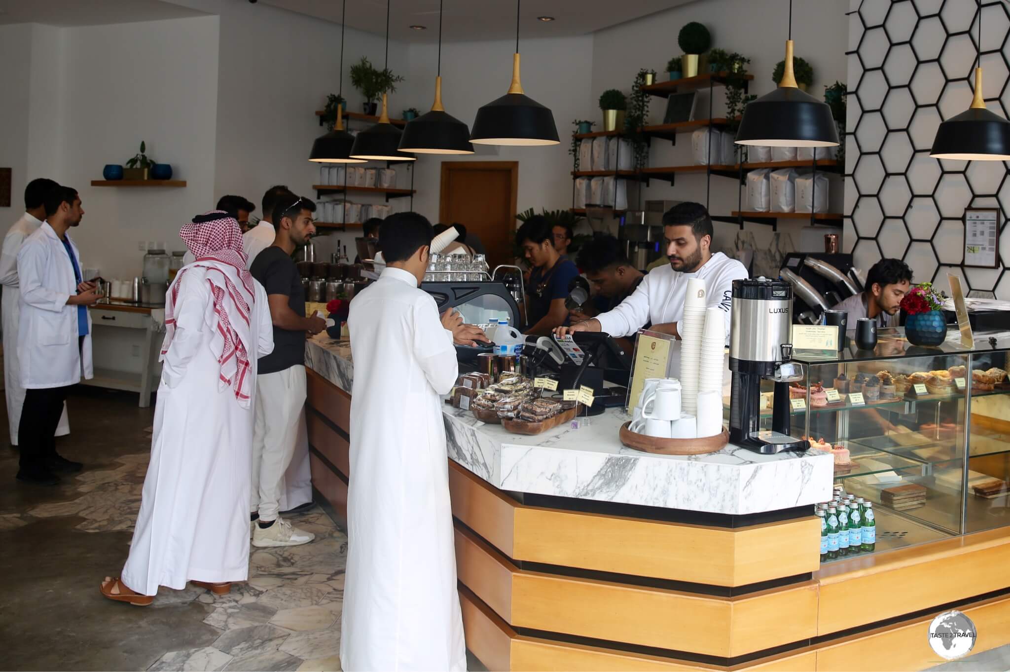
There’s only one place in Bishkek for a proper coffee – Adriano Coffee.
The best coffee house in Bishkek is Adriano coffee. The best thing about Adriano coffee? There are seven branches in Bishkek, so you’re never far from your next caffeine fix. The coffee at Adriano is the best I found in Bishkek, while the menu items make for a pleasant break from the usual offering of ‘national’ cuisine.
The main branch, which seems to attract every visitor in town, is located at 87 Isanov Street, a short walk off the main street – Chuy street – just look for the giant green ‘A‘ out front.
Another worthwhile branch can be found alongside Victory Park, in the modern Business Park complex on Sultan Ibraimov street.
Karakol

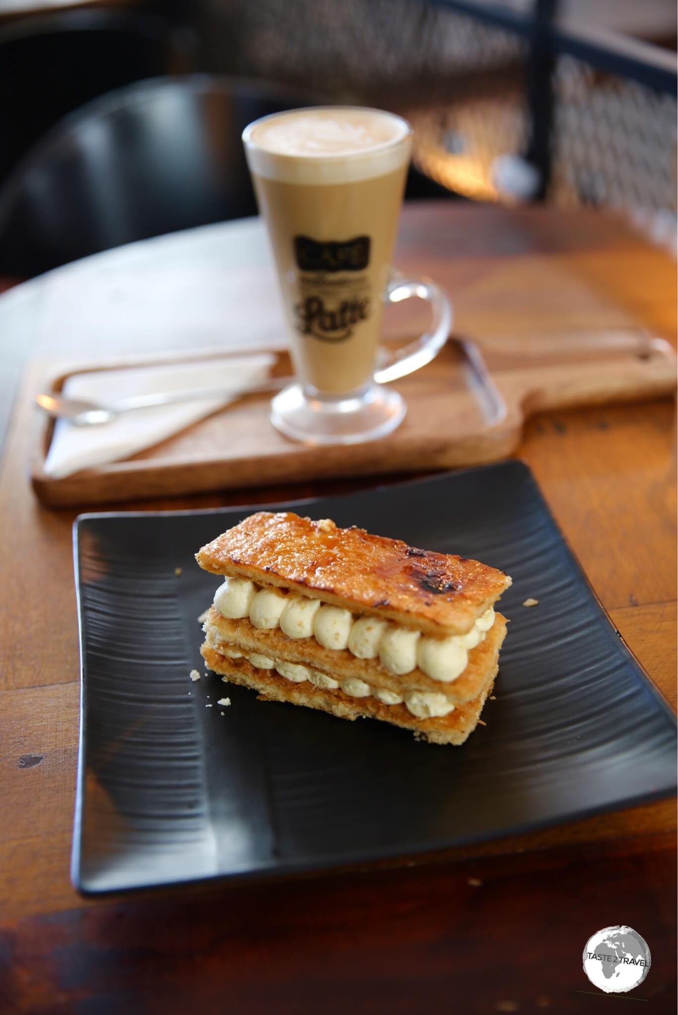
Karakol Coffee is a magnet for visiting travellers, where the wonderful Evgeniia works her Barista magic!
There are a few wannabe coffee houses in Karakol but the only real coffee house is Karakol Coffee. Located downtown at 112 Toktogul Street, this is the kind of funky cafe you would expect to find in any cosmopolitan city in Europe, North America, Australia etc – but here it is, lighting up the cafe scene in tiny Karakol.
If you’re unsure whether you should make the journey to Karakol Coffee, the tempting photos on their website will probably win you over. The menu items are delicious but you should save room for their homemade cakes which are divine.
Osh
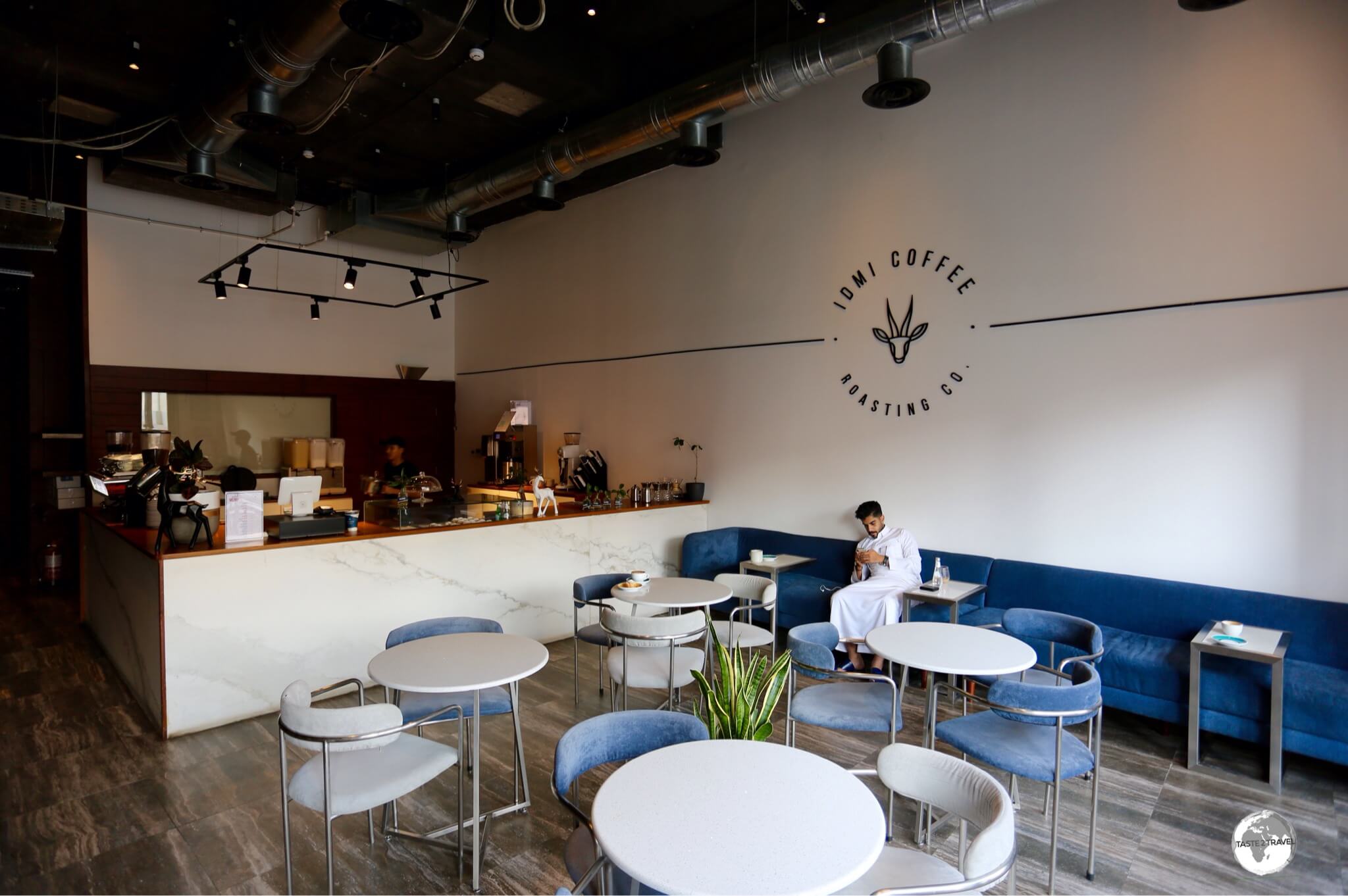
Coffee House Brio in Osh ticks all the boxes for what makes an outstanding cafe – amazing coffee, great food, free WiFi, good networking opportunities and a relaxing ambience that can easily trap you.
While Karakol Coffee is wonderful, I would have to nominate Coffee House Brio as my favourite cafe in all of Kyrgyzstan. Located in downtown Osh at 211 Kurmanjan-Datka Street, this cafe offers wonderful coffee, delicious food and a large dining area which is always full of local peace corps volunteers or travellers planning their next move.
If you’re looking to connect with other travellers, gain some insights from those who have just finished a journey along the Pamir Highway or who have recently arrived from Uzbekistan, this is the place to be.
Bars
Despite being a predominantly Muslim country, Kyrgyzstan, like other Central Asian republics, lived for many years under Soviet rule, where religion was banned and alcohol flowed freely. Due to its recent history, alcohol is available and bars can be found in all major cities.
While in most places standalone bars do not exist, almost all restaurants offer alcohol with your meal.
In Bishkek, the Torro Grill & Bar (93 Shopokov street) is very animated on a Friday night and is a good place to rub shoulders with locals and expats. If you’re in the mood to party, the Chebak Pub (213 Chuy Avenue) has live music most nights and a lively crowd.
Visa Requirements

My Kyrgyzstan Passport Stamp.
Of all the countries in Central Asia, Kyrgyzstan has the most relaxed visa policy, allowing citizens of 69 countries to enter visa-free, while all other passport holders can apply for an e-Visa.
To check your requirements, refer to the Visa Policy of Kyrgyzstan.
Getting There
Air
Scheduled international flights to Kyrgyzstan arrive at Manas International Airport (IATA: FRU), which is the primary gateway to the country, located 25 kilometres (16 miles) northwest of Bishkek. The secondary gateway is Osh Airport (IATA: OSS) which is located 15 minutes north of Osh city centre.
Manas International Airport
Manas International airport serves as a base for no less than four small, national carriers (consolidation anyone?); Air Manas, Air Kyrgyzstan (website only in Russian), TezJet Airlines (website only in Russian) and the Avia Traffic Company, which has the unfortunate distinction of being banned from operating in the EU.
The following airlines provide scheduled flights to/ from Manas International Airport:
- Aeroflot – flights to/ from Moscow–Sheremetyevo
- Air Arabia – flights to/ from Sharjah
- Air Astana – flights to/ from Almaty, Nur-Sultan
- Air Kyrgyzstan – flights to/ from Osh
- Air Manas – flights to/ from Chelyabinsk, Istanbul–Sabiha Gökçen, Krasnoyarsk–Yemelyanovo, Moscow–Domodedovo, Moscow-Zhukovsky, Novosibirsk, Osh, Perm, Tashkent
- Avia Traffic Company – flights to/ from Delhi, Dushanbe, Grozny, Irkutsk, Jalal-Abad, Kazan, Krasnodar, Krasnoyarsk–Yemelyanovo, Moscow–Domodedovo, Moscow-Zhukovsky, Novosibirsk, Osh, St Petersburg, Surgut, Voronezh, Yekaterinburg
Azimuth Rostov-on-Don
- China Southern Airlines – flights to/ from Ürümqi
- flydubai – flights to/ from Dubai–International
- Pegasus Airlines – flights to/ from Istanbul–Sabiha Gökçen
- S7 Airlines – flights to/ from Novosibirsk
- Qazaq Air – flights to/ from Almaty
- TezJet Airlines – flights to/ from Batken, Jalal-Abad, Osh
- Turkish Airlines – flights to/ from Istanbul, Ulaanbaatar
- Ural Airlines – flights to/ from Moscow–Domodedovo, Moscow-Zhukovsky, St Petersburg, Yekaterinburg
- Uzbekistan Airways – flights to/ from Tashkent
Manus Airport Transport
When using taxis in Bishkek, it’s always best to use the local version of Uber – Yandex Taxi. A taxi to/ from Bishkek to the airport will cost around 700 soms (USD$10).
Osh Airport
The following airlines provide scheduled flights to/ from
- Aeroflot – flights to/ from Moscow–Sheremetyevo
- Air Kyrgyzstan – flights to/ from Abakan, Bishkek, Krasnoyarsk–Yemelyanovo, Surgut
- Air Manas – flights to/ from Bishkek, Dushanbe, Krasnoyarsk–Yemelyanovo
- Avia Traffic Company – flights to/ from Bishkek, Irkutsk, Krasnoyarsk-Yemelyanovo, Moscow–Domodedovo, Moscow–Zhukovsky, Novosibirsk, St. Petersburg, Surgut, Yekaterinburg
- China Southern Airlines – flights to/ from Ürümqi
- flydubai – flights to/ from Dubai
- Qazaq Air – flights to/ from Almaty
- S7 Airlines – flights to/ from Moscow–Domodedovo, Novosibirsk
- TezJet Airlines – flights to/ from Bishkek
- Ural Airlines – flights to/ from Anapa, Chelyabinsk, Kazan, Krasnodar, Krasnoyarsk–Yemelyanovo, Moscow–Domodedovo, Moscow–Zhukovsky, Nizhnevartovsk, Nizhny Novgorod, Samara, Sochi, St. Petersburg, Tyumen, Volgograd, Voronezh, Yekaterinburg
Osh Airport Transport
- When using taxis in Osh, it’s always best to use Yandex Taxi. A taxi to/ from downtown Osh costs between 200-300 som.
- Marshrutka (mini bus) #107 or #142 serve the airport between 7 am and 7 pm.
Land

A political map of Kyrgyzstan.
Source: nationsonline.org
Kyrgyzstan shares land borders with Kazakhstan, China, Uzbekistan and Tajikistan. The fastest and most comfortable way to travel into and out of Kyrgyzstan is with shared taxis which run to and from most borders.
As with other countries in the CIS world, not all border crossings into Kyrgyzstan are multilateral (i.e. open to foreigners). Always check first, before heading to the border. Another restriction applies to those entering on an e-Visa. Currently there are 12 border crossings open to such travellers.
Kazakhstan
On the road in a shared taxi from Almaty to Bishkek.
In the north, Kyrgyzstan shares a 1,211 km (753 mi) border with Kazakhstan. There are currently 4 crossings open, with the busiest being the Kordai crossing, which is on the main highway between Bishkek and Almaty.
For more on Kazakhstan, including its entry requirements, please refer to my Kazakhstan Travel Guide.
China
In the east, Kyrgyzstan shares a 1,063 km (660 mi) border with China. There are currently 2 crossings open with the Irkeshtam pass (accessible via Osh then Sary Tash) being the easiest of the two crossings.
Tajikistan

On the Pamir Highway, south of Sari Tash, approaching the Kyrgyzstan/ Tajikistan border.
In the south, Kyrgyzstan shares a 983 km (611 mi) border with Tajikistan. There are currently 4 crossings open with the remote, high-altitude, Pamir Highway crossing at Kyzylart – Bor Dobo (south of Sary Tash) being the most popular with tourists. If you are planning to cross this border, you’ll need a Tajikistan visa and a GBAO permit (Gorno-Badakshan Autonomous Oblast).
For more on Tajikistan, including its entry requirements, please refer to my Tajikistan Travel Guide.
Uzbekistan
In the west, Kyrgyzstan shares a 1,314 km (816 mi) border with Uzbekistan. There are currently 2 crossings open with the main border crossing on the road between Osh and Andijon (Uzbekistan) being the busiest. Land transport (road and rail) between Bishkek and Tashkent goes via Kazakhstan.
For more on Uzbekistan, including its entry requirements, please refer to my Uzbekistan Travel Guide.
Train
In the mood for an odyssey?
Trains between Bishkek and Moscow run several times a week, completing the 3,714 km (2,307 mi) journey in 3 days, 18 hours, with a change required in Ekaterinburg. When will the Russians catch the ‘bullet-train fever’ which has changed the travel landscape in neighbouring China? Ticket prices, availability and route maps can be viewed online at tutu.travel.
Getting Around

The Zero Kilometre marker in Bishkek, from which all road distances in Kyrgyzstan are measured.
Public Transport

A bus in downtown Bishkek.
Unlike most other ex-Soviet capitals, there is no metro operating in Bishkek. The main form of public transport is bus and mini-buses, known locally as Marshrutkas. While buses tend to operate within urban centres, Marshrutkas offer city and intra-city services.
If you wish to view the different bus routes in Bishkek, you can do so here.

Marshrutkas are a popular form of transport throughout Central Asia.
Taxi
Yandex Taxi is an online ride-sharing service which was launched in 2011 and is now present in most of Central Asia. In 2018, Yandex and Uber merged their operations in the region. The Yandex app can be downloaded onto a smartphone and, in terms of functionality, is very similar to Uber.
Within Kyrgyzstan, Yandex is currently active in Bishkek and Osh.
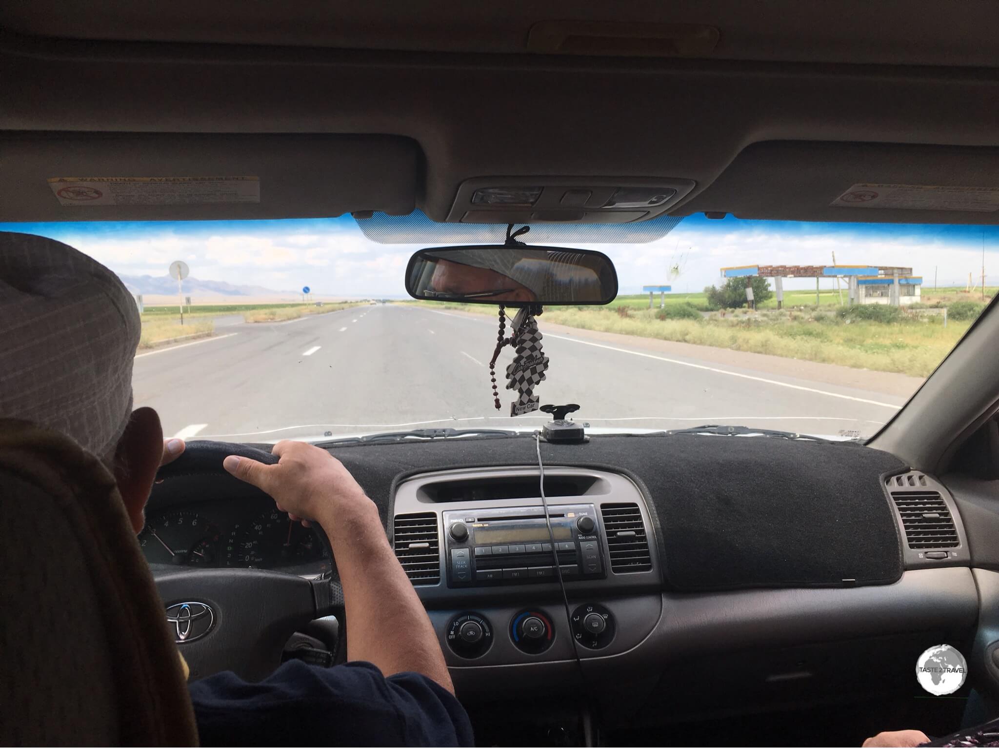
Rental Car

A much needed car wash in Osh! Before and after photos of my amazing, go-anywhere, Toyota Land Cruiser, perfect for the rough Kyrgyzstan roads.
Car rental is becoming more popular in Kyrgyzstan, with more visitors wishing to be fully independent to explore the amazing scenery of this spectacularly beautiful alpine country. With the notoriously terrible roads being constantly improved, and the corrupt police (look out for all the roadside speed checks!) becoming more friendly towards tourists, the stars are slowly aligning for the car rental industry.
If you plan on driving around Kyrgyzstan, it’s essential that you have connectivity to the internet as you will get lost without a navigational app such as Google Maps or Waze.
Journey’s in Kyrgyzstan can be long and arduous, with most highways being rough, corrugated, pot-holed, gravel, narrow roads which wind up and down one mountain pass after another. While roads in the vicinity of Bishkek, Osh and lake Issyk-Kul are well maintained, elsewhere, they are diabolical. This is no place for a regular 2WD compact rental!
However, nowhere is off-limits to a local and his ‘go-anywhere’ Lada. From the middle of a paddock, to a mountain pass, to a river crossing, the tiny Lada can be found everywhere and are the work horses of Central Asia, being employed as family cars, farm wagons and freight carriers.

With a rental car, the whole country is accessible, including the remote yurt camps at Lake Son-Kul where parking is never a problem.
While car rental is becoming more popular, few rental companies exist in Bishkek, and finding an available car can be a challenge. The international rental chains have not made it to Kyrgyzstan, however agents in nearby Almaty (Kazakhstan), such as Hertz, will allow you to drive across the border into Kyrgyzstan. For more on rentals from Almaty, please refer to my Kazakhstan Travel Guide.
Adding to the challenge, most of the companies are locally run, have very small fleets (normally less than 5 cars in total) and don’t accept credit cards. Luckily, withdrawing cash on a credit card at a bank in Bishkek is a very easy process and took me less than 5 minutes.
After much searching, I found an excellent Toyota Land Cruiser, which I rented for US$80 per day through the amazingly entrepreneurial Almaz Alzhambaev of Kyrgyzstan Tours and Rent-a-Car Service in Bishkek. Almaz has a fleet of 7 cars, although he only has one amazing Toyota Land Cruiser.
If I thought US$80, per day, was expensive at the beginning of the trip, by the end of the trip – having driven on the longest and roughest of dirt roads, climbed the steepest of unpaved mountain passes, forded river crossings and driven, off-piste, many times, all without any mechanical issues, then $80 seemed to be a bargain. During two weeks of enduring punishment, the Toyota Land Cruiser never stopped performing and was always 100% reliable!

Filling up my two-tank Land Cruiser at a petrol station in the remote town of Ak-Tal, the first and only station in hundreds of miles.
In addition to its mechanical reliability, the Land Cruiser was fitted with dual-fuel tanks, which is a great advantage in a country where distances, in remote regions, between petrol stations can be vast. While other motorists carried around containers full of spare fuel, I had a second tank, full of fuel, as a backup. I could have driven to Mongolia without refuelling!
Almaz allows one-way rentals, which gave me the flexibility to drive from Bishkek to Osh, where, two weeks later, he flew-in to meet me, then drove the car back to Bishkek, a 10.5-hour journey covering 611 km along windy, mountainous roads. For this, he charged me US$120.
Almaz advised that his cars can be driven across borders into neighbouring countries, once insurance paperwork has been completed. For this, he charges an additional fee of US$40. If you’re heading into Tajikistan, car rentals are non-existent, so it’s best to hire in Kyrgyzstan. I would highly recommend Almaz for all your rental car needs.
Contact details for Almaz:

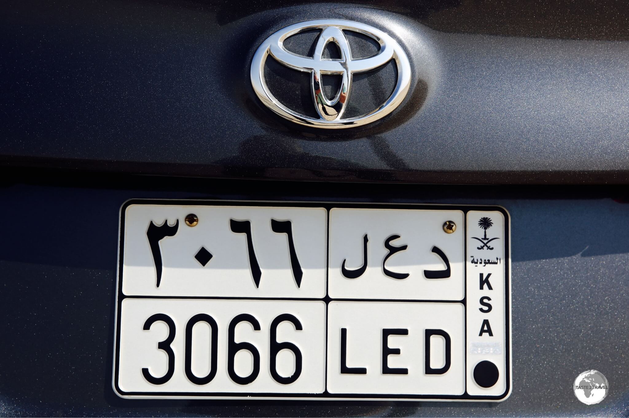
The Kyrgyzstan license plate on my rental car.
That’s the end of my Kyrgyzstan Travel Guide.
Safe Travels!
Darren
Follow me on Instagram:
[instagram-feed feed=1]
Further Reading
Other travel reports from the Central Asia region:
Additional blogs, articles and information on Kyrgyzstan are available on the Indy Guide website.
Kyrgyzstan Travel Guide Kyrgyzstan Travel Guide Kyrgyzstan Travel Guide Kyrgyzstan Travel Guide Kyrgyzstan Travel Guide Kyrgyzstan Travel Guide Kyrgyzstan Travel Guide Kyrgyzstan Travel Guide Kyrgyzstan Travel Guide Kyrgyzstan Travel Guide Kyrgyzstan Travel Guide Kyrgyzstan Travel Guide Kyrgyzstan Travel Guide Kyrgyzstan Travel Guide Kyrgyzstan Travel Guide Kyrgyzstan Travel Guide Kyrgyzstan Travel Guide Kyrgyzstan Travel Guide Kyrgyzstan Travel Guide
Kyrgyzstan Travel Guide Kyrgyzstan Travel Guide Kyrgyzstan Travel Guide Kyrgyzstan Travel Guide Kyrgyzstan Travel Guide Kyrgyzstan Travel Guide Kyrgyzstan Travel Guide Kyrgyzstan Travel Guide Kyrgyzstan Travel Guide Kyrgyzstan Travel Guide Kyrgyzstan Travel Guide Kyrgyzstan Travel Guide Kyrgyzstan Travel Guide Kyrgyzstan Travel Guide Kyrgyzstan Travel Guide Kyrgyzstan Travel Guide Kyrgyzstan Travel Guide Kyrgyzstan Travel Guide Kyrgyzstan Travel Guide
Kyrgyzstan Travel Guide Kyrgyzstan Travel Guide Kyrgyzstan Travel Guide Kyrgyzstan Travel Guide Kyrgyzstan Travel Guide Kyrgyzstan Travel Guide Kyrgyzstan Travel Guide Kyrgyzstan Travel Guide Kyrgyzstan Travel Guide Kyrgyzstan Travel Guide Kyrgyzstan Travel Guide Kyrgyzstan Travel Guide Kyrgyzstan Travel Guide Kyrgyzstan Travel Guide Kyrgyzstan Travel Guide Kyrgyzstan Travel Guide Kyrgyzstan Travel Guide Kyrgyzstan Travel Guide Kyrgyzstan Travel Guide


