Réunion Travel Guide
Welcome to the taste2travel Réunion Travel Guide!
Date Visited: March 2019
Introduction
If I had to nominate my most rewarding and surprising travel destination, so far in 2019, it would have to be Réunion! Prior to my arrival, I had met no one who had been to the island and I had little idea of what awaited me.

A view of the Piton de la Fournaise, one of the world’s most active volcano’s which erupted one month before my visit.
Wow! My only problem in the end was that the two weeks I had allocated, was not enough – there was still so much more to see.

So many breath-taking views on Réunion, including this one of the Plaine des Sables at the Piton de la Fournaise volcano.
If you’ve ever considered visiting this remote French territory, located in the middle of the Indian Ocean, I would encourage you to do so. Apart from the French, very few people knew of the existence or whereabouts of Réunion, but that changed in 2015, when the island made worldwide news after a piece of debris from a plane, thought to be from MH370, washed up on its volcanic shores.
Tourism is an important part of the economy but the island does little to promote itself and almost all visitors are French tourists who arrive from metropolitan France. The approach to tourism could be summed up as – ‘By the French, for the French!‘. With almost all signage in French and locals unwilling (or unable) to speak anything other than French, the island is best suited to visitors who can converse in French.

A view of the Plaine des Sables from my helicopter flight.
Reunion, which is an overseas department of France (department #974), it’s incredibly beautiful, a fascinating, engaging destination which is fully developed and easy to explore. I returned for a second visit, after a side trip to Mayotte (another nearby French territory), and was very happy to be back on the island and would return again given the opportunity.
If you imagine the island to be an Indian ocean backwater then you’ll be surprised to find that Reunion is a thoroughly modern place. The French authorities have invested a huge amount of money developing the territory and, at times, it’s hard to know if you’re in the Indian Ocean or somewhere on the French Riviera.
Modern houses and apartments line pristine streets, locals drive their flashy cars to the local shopping centre to shop for the latest electronic gadgets and fancy boutiques sell current European fashions.

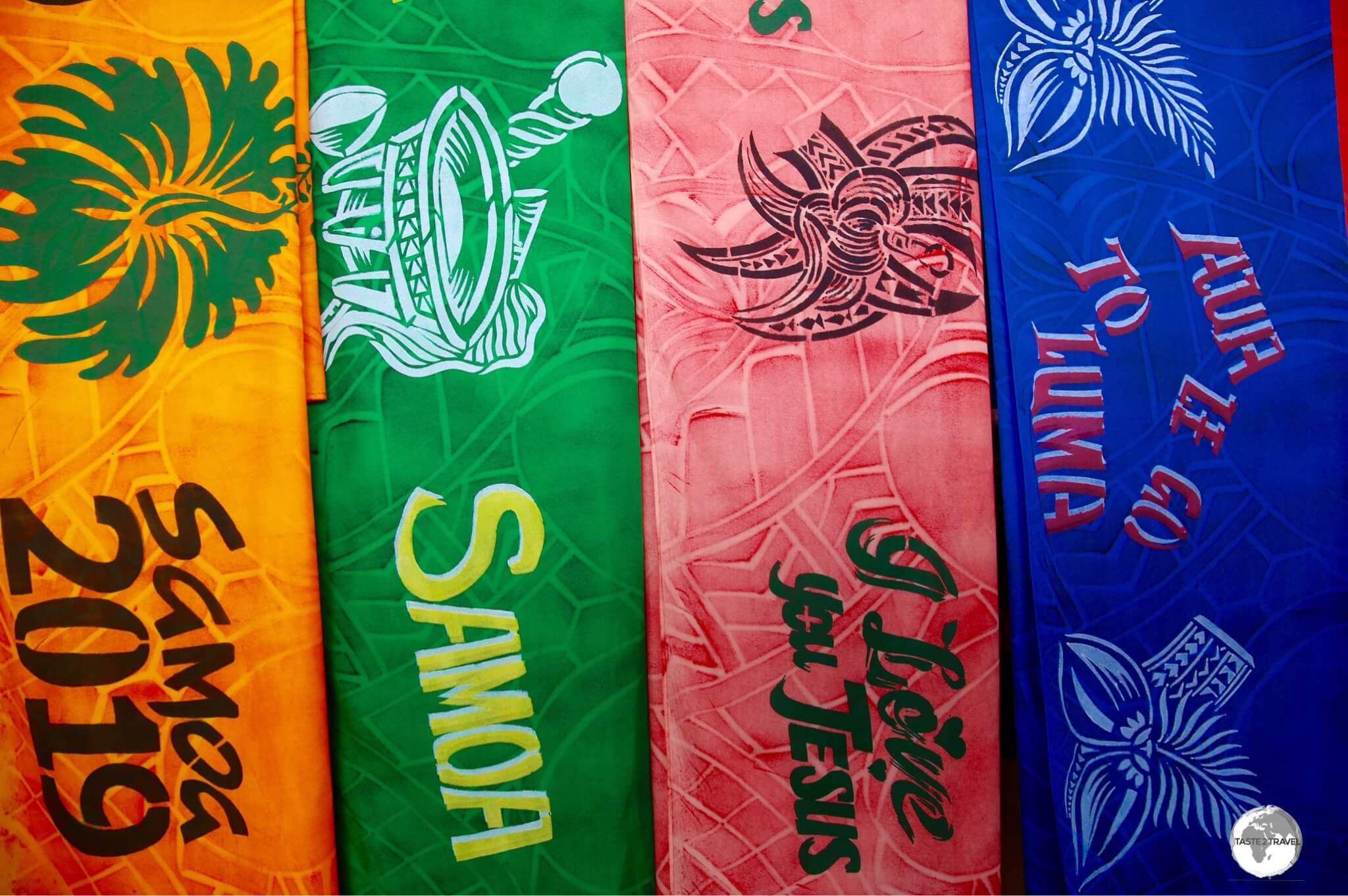
A hand-painted Reunion sarong features a fiery Piton de la Fournaise.
While French is the official language, most islanders speak Réunion Creole. The Reunionnais are friendly and welcoming but more reserved than their neighbours on Mauritius.
If you wish to gain some insights into life on Reunion, a local website – Apressi.re – features content (in French) based on local news and tips. Apreci in creole means enjoy and was launched a year ago by 2 journalists, one from France, the other from Australia.

While sipping a coffee at the Coffee Shop de Bourbon in downtown St. Denis, I was interviewed by Soe, the Australian half of the team.

The dramatic and immense volcano landscapes on Reunion make for impressive photography, best appreciated from a helicopter sightseeing tour.
What makes the island such a rewarding travel destination is its truly astonishing diversity of landscapes. Rising from the Indian Ocean, this huge volcanic, basalt rock is cloaked in lush green vegetation. The island is a scenically magical place, which features two volcanic systems, high plains, soaring peaks, deep ravines, canyons, waterfalls, beaches and more.

The Formica Leo crater at the Piton de la Fournaise volcano.
How diverse are the landscapes? While on the beach at St. Gilles, you can be sweltering away in temperatures approaching 40 degrees (C) and humidity near to 100%. A short drive up the slope of the volcano will bring you to Le Maïdo, which, at an elevation of 2,200 metres, is often cloaked in cool fog, subject to sudden rainstorms and experiences average daytime temperatures of just 15 degrees (C).

Cars parked in a car park (bottom right) inside the Cirque de Salazie provide a sense of scale for the towering walls which encircle the three cirques.
If you love hiking or the outdoors, Reunion is your nirvana! Apart from hiking, the island offers many activities such as paragliding, canyoning, mountain biking, rafting, Scuba diving, fishing, whale-watching, helicopter flights and more.
What are you waiting for?
Location
Located well off the tourist radar, in the middle of the Indian Ocean, the French territory of Réunion (French: La Réunion) lies 944 km (587 mi) east of Madagascar – 1,435 km (892 mi) southeast of Mayotte and 175 km (109 mi) southwest of Mauritius.
At 2,512 square kilometres (970 square miles), it is the largest of the Mascarene islands, a volcanic chain of islands which include neighbouring Mauritius and Rodrigues.
Réunion is located above a hot-spot in the Earth’s crust and was formed by two volcanic systems, one now dormant, Piton des Neiges, and one still very much active, Piton de la Fournaise.

An artist’s depiction of an eruption of the Piton de la Fournaise, displayed at the Volcano House museum.
The island’s topography is incredibly mountainous, with the highest peak, the Piton des Neiges (Snow Peak) reaching 3,069 m (10,069 ft). High plains separate the two systems with the surrounding landscape punctuated by incredibly deep canyons and ravines.

‘Living on the Edge’ – houses built close to the edge of a deep gorge, as seen from my helicopter flight over Réunion Island.
The coastline of Reunion is exposed, rocky and treacherous with one small stretch on the west coast protected by an offshore reef and offering white sandy beaches. There are many reasons to visit Réunion, however beach tourism isn’t one of them, with much nicer beaches available on Mauritius or the Seychelles.

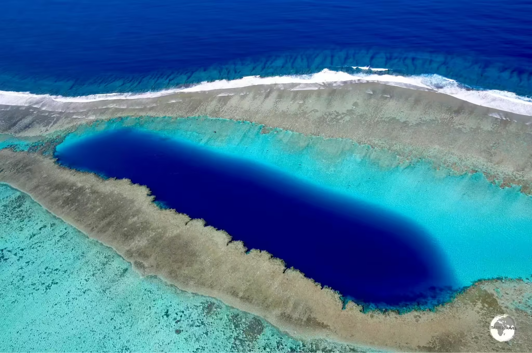
A view from my helicopter flight of the north-west coast shows the coral reef and the lagoon which offers the only protected swimming on Réunion Island.
People

A painting depicting Réunionnais at an exhibition at the Musée de Villèle.
Prior to the discovery of the island by the Portuguese in the 16th century, Reunion was a remote, uninhabited outpost. The French took control of the island in the early 1600’s and began colonising it from 1665.
In the following centuries, the island was used as an important stopover point for trade boats plying the waters between Asia, Europe, Africa and the Middle East. This attracted settlers from France, Madagascar, Mozambique, India, China and the Comoros.
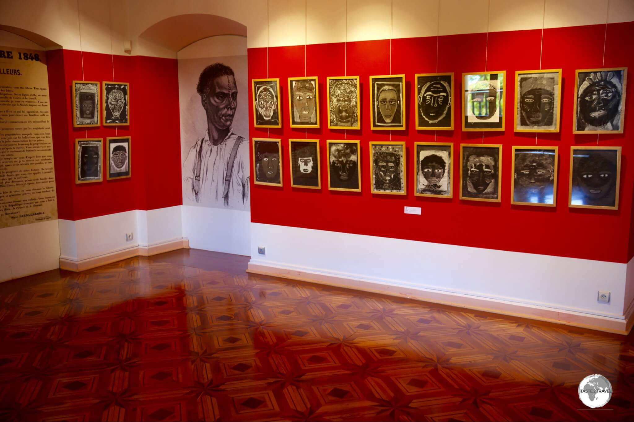
An exhibition at the Musée de Villèle tells the story of Reunion’s days of slavery.
Slaves were introduced to the island to work on sugar plantations, and – following the abolition of slavery – indentured labourers from South India were brought to the island.
As of 2019, Réunion had an ethnically diverse population of 866,506, a population with a mixed Creole culture. Not all inhabitants identify themselves as Creole, especially the approximately 100,000 French mainlander’s who dominate the island’s administration and economy.
Fauna & Flora

Like so many creatures on Reunion, the striking Panther Chameleon was introduced to the island from Madagascar.
Fauna
More than a third of Réunion’s surface area is still covered with native forests and wild plants, providing a rich environment for the island’s fauna. Being a remote island, Réunion is home to a limited variety of native animals, most of which are birds, however many species have been introduced from neighbouring Madagascar.
The island is largely a safe place to explore, with no venomous animals, however, signs on the beaches warn of the possibility of shark attacks.

Being ‘eye-balled’ by a male Panther Chameleon.
Various species of Chameleons have been introduced to Reunion from Madagascar, including the stunningly beautiful Panther Chameleon. I was fortunate to spot a male and female pair lazing in a shrub while on the way to the Grand Galet waterfall. They were happy to pose for photo’s which I can share with you here.

Much smaller and far less striking than the male, this female Panther Chameleon was hanging out in a shrub next to her male partner.
The much more colourful male can grow up to 20 centimetres in length, while the much less flamboyant females reach about half that size. When carrying eggs, females – such as the one pictured above – typically turn dark brown or black with orange striping to signify to males they have no intention of mating.

The Day gecko was introduced to Reunion Island from Madagascar.
Another common sight on Reunion, and another species introduced from Madagascar, is the (very green) Day gecko. As their name suggests, day geckos are active mainly during the day, which is in contrast to most other gecko species. These guys love nectar, pollen and anything sweet. More than once, I enticed them to lick the jam off my knife while having breakfast. Very cute to watch their little pink tongues in action!

The ‘Madagascar Red Fody’ was introduced to Reunion from – guess where?
Another common sight on Reunion, and yet another species introduced from Madagascar, the brilliantly orange Madagascar Red Fody always contrasts starkly against the lush green vegetation and is impossible to miss as it darts before your eyes in an orange flash.

The very curious, Reunion Stone-chat is endemic to the island and can be found in high-altitude forests and scrub lands.
One of my favourite birds on the island is the Reunion Stone-chat, which is intensely curious and friendly and will always come close to investigate you. These social creatures can be found on the higher slopes of the volcanoes, where they inhabit high-altitude forests and scrub lands.
Flora

Vanilla is widely grown on Reunion and is an important export item.
While not native to the island, the vanilla plant is widely cultivated and is an important export item. Introduced to Reunion at the beginning of the 19th century, from Mexico, French colonists wanted to start vanilla production on the island but were unsuccessful since no insect would pollinate the vines.
The industry was saved by a 12 year old slave, Edmond Albius, who discovered the process for the manual fertilisation of this orchid. His technique is still used today, with all vanilla being cross-pollinated by hand. Vanilla from Reunion Island, or Bourbon Vanilla, is considered to be the best in the world.
Hiking

With no roads, the rugged, pristine and somewhat inaccessible, Cirque de Mafate, is a hiker’s paradise.
The Reunion National Park covers 42% of the island, and provides more than 900 km of marked trails for hikers, catering to everyone from beginners to experienced walkers. An added bonus? There are no entrance fees and anyone can camp anywhere around the island.
Reunion has three long-distance hiking trails, endorsed by the French Hiking Federation (Fédération française de randonnée pédestre):
- GR R1 is 60 km in length and takes a route around Piton des Neiges and past the Salazie, Mafate and Cilaos craters.
- GR R2 is the big daddy of them all, crossing the island from north to south, on a 130 km odyssey from the coast to the summits of Piton des Neiges (3,069 m) and Piton de la Fournaise (2,632 m) then back down to the coast.
- GR R3 (38 km) crosses the Mafate crater, a site that is accessible only on foot.

A map illustrating the GR R1 and GR R2 hiking trails on Reunion.
Currency

Euro Currency
The official currency of Réunion is the Euro (€), with €1 currently (December 2020) worth US$1.23. To check the current exchange rate, please click here.
French banks maintain branches throughout the island with ATM’s available in most towns. Credit cards are widely accepted throughout Réunion.

The Réunion €0 souvenir bank note can be purchased from a vending machine at the airport.
If you’re a collector of currencies, you might be interest in purchasing a Réunion €0 souvenir bank note, which will set you back €3 (hardly a fair exchange rate!) and are dispensed from a vending machine which is installed near the departure gates at Roland Garros International airport.
Costs

Many treats on Réunion are surprisingly affordable, including waffles and ice-cream at Café Amorino.
Typical daily travel budgets:
- Budget: €100 (USD$)
- Mid-Range: €100-200 (USD$)
- Top-End: €200+ (USD$)
Sample costs:
- Bottle of Coca Cola (1.5 litre): €1.60 (US$)
- Bottle of Water (330 ml): €0.50 (US$)
- Bottle of Rivière du Mât rum (700 ml): €10.99 (US$)
- Bottle of French wine (750 ml): €5.00+ (US$)
- Cappuccino: €3 (US$)
- Bus Ticket: €1.80 (US$)
- Car hire (compact car per day): €29+ (US$)
- Litre of fuel: €1.48 (US$)
- Meal (inexpensive restaurant): €12 (US$)
- Meal for 2 (mid-range restaurant): €50 (US$)
- Big Mac Meal at McDonald’s: €12 (US$)
- Room in a budget hotel: €18 (US$)
- Room in a mid-range hotel: €80+ (US$)
- Room in a top-end hotel: €150+ (US$)
Sights
I spent two busy weeks exploring Reunion which still wasn’t enough time to cover the myriad sights on the island. With 900 km of hiking trails, you could easily spend weeks on the island. A rental car will allow you to maximise your time and, thanks to the excellent infrastructure, travel times are short.
Saint Denis

One of many magnificent mansions which line the Rue de Paris in Saint Denis.
Like everything else on Reunion, the capital, Saint Denis, was a pleasant surprise – a city full of Creole-style mansions that reflect its colonial heritage.
A small, cosmopolitan city, St. Denis was founded in 1669 and became the capital of Réunion in 1738. The sights of the city can easily be explored on foot in a day, however different museums and galleries have varying opening times so its best to check in advance if something is on your wish list. I’ve included opening hours under each entry.
The main artery of St. Denis is the Avenue de la Victoire, which runs from the waterfront, inland to the Hôtel de Ville (Town hall), at which point it becomes the Rue de Paris, which continues onto Le Jardin de l’État (the State garden).
Most sights are conveniently placed along this central corridor and are listed below in order from the seafront to the garden. St. Denis has many finely preserved buildings, all of which are very photogenic. Many of the mansions which line the city’s streets were built by the owners of sugar and coffee plantations during the island’s colonial hey-day. Today, these mansions serve as galleries, museums and the local tourist information office.
Le Barachois
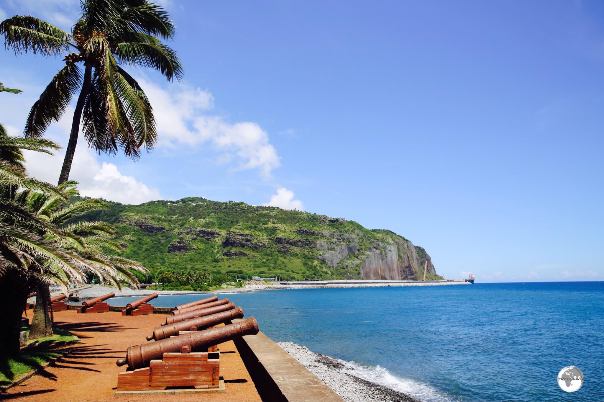
Canons line the waterfront at Le Barachois, a waterfront park, in downtown Saint Denis.
Located on the waterfront in downtown Saint Denis, Le Barachois, a green seafront esplanade is lined with colonial-era canons, and offers sweeping views of the Indian ocean. The park anchors the Avenue de la Victoire and, as such, is a good place to start a walking tour of St. Denis. From here, the avenue leads inland to the first of many sights, the Cathedral Of Saint Denis.
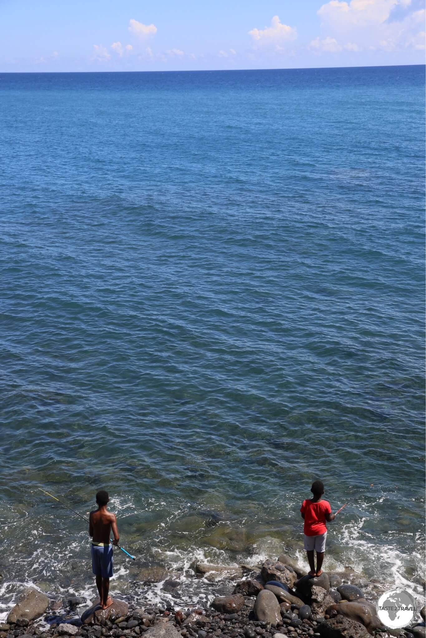
The clean waters of the Indian ocean provide an ideal fishing ground for two local boys, seen here at Le Barachois.
Cathedrale de Saint-Denis de La Reunion

Completed in 1832, the Cathedral of Saint Denis is dedicated to the patron saint of the city.
Located on Avenue de la Victoire, but partially hidden behind a façade of trees, the simple but beautiful Cathedrale de Saint-Denis de La Reunion is fronted by a small park which features an ornamental fountain at its core.

An image of the patron saint of the city, Saint Denis, on display inside the Cathedral of Saint Denis.
The interior of the cathedral is bathed in natural sunlight thanks to wide, arched, windows and features frescoes and an iconic painting of Saint Denis – the patron saint of the city.
In the evening, the cobbled streets surrounding the cathedral come alive with restaurants, bars, bistros and cafes serving the local party crowd.
The best coffee on the island (and amazing food) is to be found at the Coffee Shop de Bourbon which is located one block back from the cathedral at 31 Rue Alexis de Villeneuve (see the ‘Eating Out‘ section for more).

The Monument I Guerre Mondiale (WWI monument) lies in the heart of St. Denis.
Located on a small roundabout opposite the Hôtel de Ville (Town hall), the Monument I Guerre Mondiale is dedicated to those who lost their lives during WWI. This iconic monument serves as a marker for the centre of the old town and it’s at this point that Avenue de la Victoire changes name to become Rue de Paris as it continues its journey inland.
Inaugurated in 1923, the monument features a large granite column which is surmounted by an angel of white marble brandishing a laurel wreath. In 1941, a sealed urn, containing a parcel of “French Land”, was placed inside the monument.
Hôtel de Ville
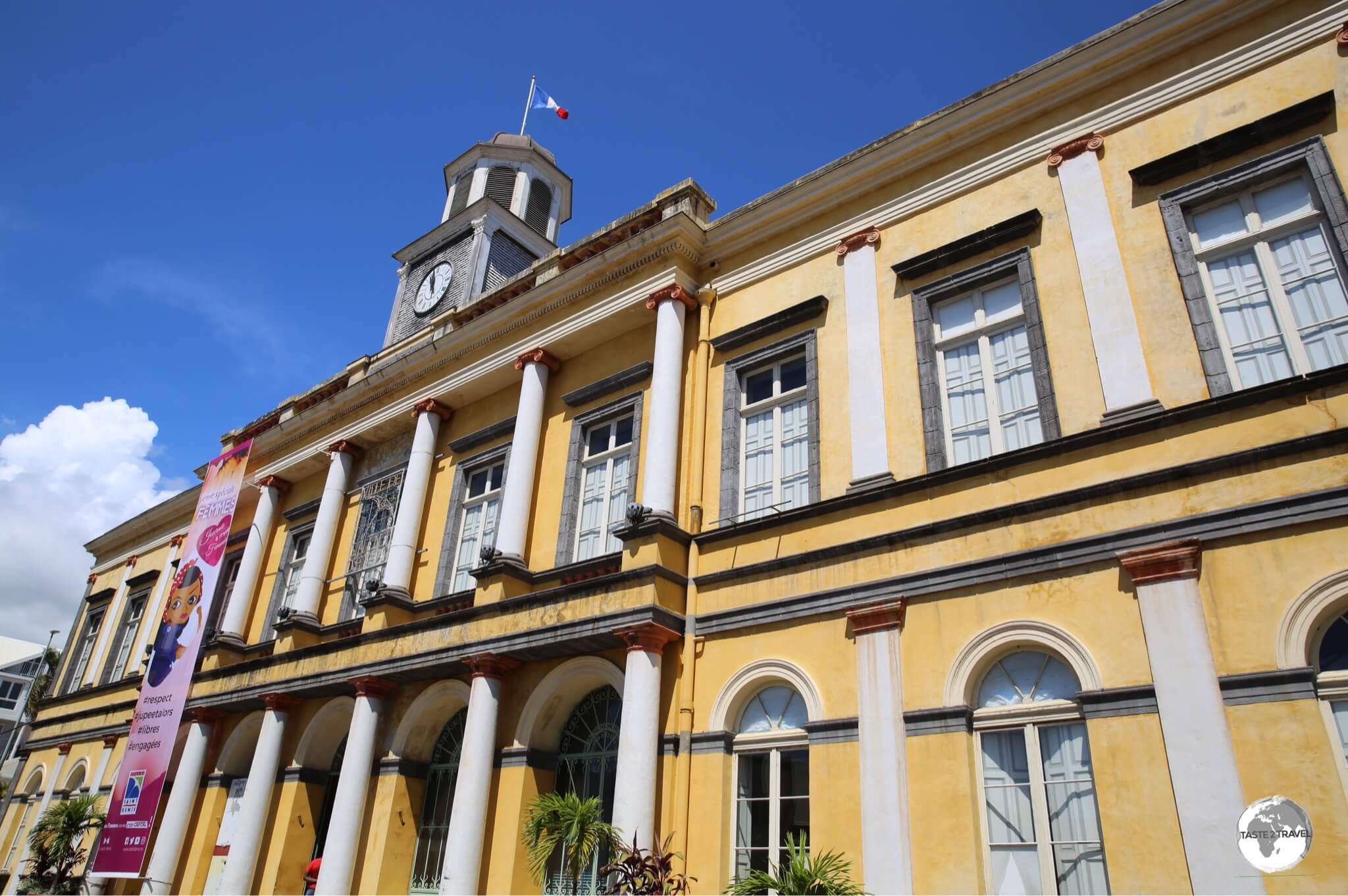
The striking Hôtel de Ville (Town Hall) in St. Denis.
Across the road from the WWI monument is the very photogenic and majestic Hôtel de Ville (Town hall) which displays all the attributes of typical French colonial architecture.
While the town hall is a busy, functioning institution, tours are conducted every Wednesday at 2 pm with tickets available from the tourist information office. If you’re not taking the tour, you’ll have to content yourself with photographing the building from outside.
Maison Carrère

Built in 1905 by Raphaël Carrère, a major sugar trader, Maison Carrère is now home to the local tourist office.
Located a short walk along from the Town hall at 14 Rue de Paris, the beautiful, Maison Carrère is named after Raphaël Carrère, a major sugar trader, who constructed the timber mansion in 1905 to house his wife and five daughters. The mansion today houses a free museum with period furnishings and the city’s Tourist Information office.
Opening Hours: The visitors centre is open everyday, except Sunday, from 8:30 am to 5: 30 pm.
Villa du Conseil Général

The opulent Villa du Conseil Général is one of the principal mansions on Rue de Paris in Saint Denis.
Continuing further along the street to 18 Rue de Paris, the impressive, lavender-coloured, Villa du Conseil Général, was built in the early 1790’s by Jean-Baptiste de Lestrac, the first mayor of Saint Denis.

The Heritage Museum at the Villa du Conseil Général exhibits artwork from local artists.
Today, the villa is the property of the Conseil Général (General Council) who use it to house a Heritage museum which features exhibitions by local artists.
Opening Hours: The museum is open everyday, except Saturday and Sunday, from 8:00 am to 4:00 pm.
L’Arthotèque

Housed in a former mansion, L’Artothèque displays local contemporary art.
Further along the street, at 26 Rue de Paris, L’Arthotèque is a museum dedicated to local contemporary art. Housed in a fine mid-19th-century wooden Creole villa, this small museum boasts more than 1500 pieces of contemporary art in its collection.
Musée Léon Dierx

The impressive Musée Léon Dierx houses an exceptional collection of modern and contemporary art.
If you visit just one museum in St. Denis, it should be the Musée Léon Dierx which is located at 28 Rue de Paris. Home to an impressive and eclectic collection of art, the museum is strong on local content and features stunning old-world paintings which depict the magnificent landscapes of Reunion.

The beautiful galleries of the Musée Léon Dierx are lined with old-world paintings depicting the amazing landscapes of Reunion.
The museum, which is housed in the neoclassical style, Villa Manès, was opened in 1912 by the Reunion General Council. Its small collection of works are housed in beautifully arranged galleries and include works by Picasso, Gauguin and Cézanne.

Artwork at the Musée Léon Dierx pays homage to the great masters.
Opening Hours: The museum is open everyday, except Monday, from 9:30 am to 5:30 pm.

The Villa de la Région houses a museum dedicated to the Decorative arts.
Continuing inland, and located at 49 Rue de Paris, the Villa de la Région houses a small museum dedicated to decorative arts. Housed in a Creole mansion, which dates from the 1840’s, the museum is owned by the Reunion Regional council and features exhibits on creole culture and decorative arts.
Opening Hours: The museum is open everyday, except Monday, from 10:00 am to 5:00 pm.
Jardin de l’Etat

A view of the Jardin de l’Etat from the Muséum d’Histoire Naturelle.
Rue de Paris terminates at the Jardin de l’Etat (State Garden), which provides a small green lung in the heart of the capital. The garden is dominated by the grand edifice of the Muséum d’Histoire Naturelle (Natural History Museum).

The Muséum d’Histoire Naturelle is the centrepiece of the Jardin de l’Etat in Saint Denis.
With old and faded display’s, the Muséum d’Histoire Naturelle is housed in a former colonial palace inside the Jardin de l’État. The museum features displays of the fauna and flora of the island and is a good place to gain an understanding of the natural history of Reunion.
Opening Hours: The museum is open everyday, except Sunday and Monday, from 09:30 am to 5:30 pm.

Colourful, handwoven baskets are just some of the items to be found at the Grand Marché in Saint Denis.

Coffee and chocolates, made from locally grown cacao, served at a cafe in Saint Denis.
Around the Island – West Coast
Attractions are listed in a counter-clockwise direction from St. Denis. As you travel around the island, attractions are clearly signposted with brown signs.

A panoramic view of St. Denis on the road to La Montagne.
Travelling from St. Denis to the west coast, you have the choice of taking the faster, coastal highway (RN1), via the Route du Littoral, or the slower, much more scenic, high road (D41) over the mountain via the town of La Montagne.
Leaving St. Denis, D41 climbs suddenly through a series of tight hair-pin turns, which offer sweeping views of the capital and the Indian ocean. The road continues along the top of the mountain, before descending, eventually re-joining the highway on the coast at La Possession.

A view of Le Maïdo, and the sheer drop into the Cirque de Mafate, from my Corail helicopter flight.
From the town of St. Paul, a brown sign on the highway indicates the turn for Le Maïdo, a spectacular lookout point situated at an elevation of 2,200 m (7,200 ft), which is easily accessible by car.
Located at the top of a sheer cliff, Maïdo could best be described as a balcony which provides unparalleled views over the Cirque de Mafate and the west coast of Reunion island. Various hiking trails allow access to points along the ridge, over which there is a sheer drop to the bottom of the Cirque de Mafate.

My helicopter flight provided a view of the incredibly deep walls which line Cirque de Mafate.
The windy road which climbs from Saint Paul to the summit passes through a forest of highland Tamarin which is a popular area for family picnics. On most days, inclement weather closes in around 11 am, shrouding the entire cirque and volcanic slope in a thick fog, which delivers lots of rain showers.
If you wish to see anything, you need to be on the summit early in the morning.
If you’re driving up from the sweltering hot coast, it will seem ridiculous to be carrying a sweater, but you might just need it at Maïdo where maximum daytime temperatures reach about 15 degrees (c). Once the fog and rain set in, the temperature plummets.

The sunsets over the beach at St. Gilles are spectacular.
With its white-sand beaches and its protected position inside the lagoon, St. Gilles is the main beach resort area on Reunion and is all about fun in the sun.
Home to scores of accommodation & dining options, the area is the place to be if you wish to partake in aquatic activities such as scuba diving, paragliding, fishing-trips, snorkelling trips etc. There is a tourist office downtown which is manned by friendly and enthusiastic staff.

The beautifully restored, Musée de Villèle, is a former estate home, built by a wealthy sugar baron.
Located a short drive up the hill from St. Gilles, in the town of Saint-Gilles-les-Hauts (St. Gilles Heights), the beautifully restored Musée de Villèle, is the former estate home of two illustrious, local sugar-growing clans, the Panon-Desbassyn and Villèle families.

The sumptuous interiors of the Musée de Villèle provide visitors with an insight into Patrician life on Réunion during the colonial era.
One hour, compulsorily guided, tours (in French only), of the main house provide visitors with a sense of what life was like on the island in the late 18th and the 19th century. The interior of the main house is filled with period furniture and collections of historical documents and art.
Slave labour was widely used by wealthy landowners on Reunion, so it’s only fitting that an exhibition dealing with this ugly side of Reunion’s past is installed on the 2nd floor of the mansion.
Opening Hours: The museum is open everyday, except Monday, from 09:30 am to 5:30 pm.

Our pilot from Corail helicopters, preparing us for our flight.
Also located above St. Gilles is the helipad for Corail Helicopters, one of several operators on Reunion who offer helicopter flights over the breathtaking volcanic landscapes of the island. A helicopter flight is the best way to get a true perspective of the island, its varied and magnificent landscape.

A panoramic view of the crater of the very active Piton de la Fournaise volcano, as seen from my Corail helicopter flight.
Corail helicopters offer a range of tours with the shortest flight, a 15 minute cruise over Cirque de Mafate, costing €95, while the longest flight, the 55-minute L’excellence will set you back €320.
I flew on the 45 minute Tour de l’Ile (€280) which provides breath-taking views of the three cirques (Cilaos, Mafate and Salazie) plus the Piton de la Fournaise.

A view of the west coast of Réunion from my Corail helicopter flight.
Flights only take place in the early morning, before the daily cloud cover shrouds everything of interest. Despite the hefty price tag, flights are popular and advance reservations are essential.
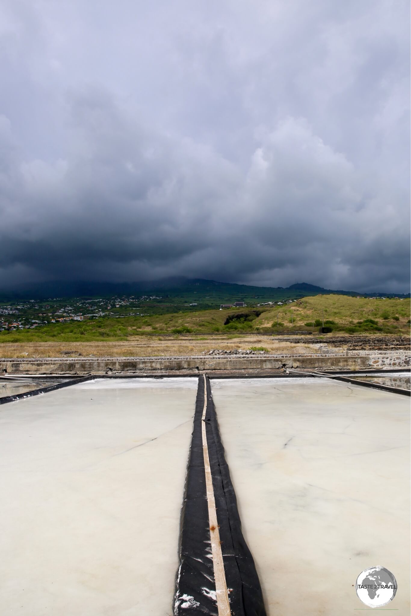
While the upper slopes of the volcano receives frequent rainfall, the nearby salt pans, which lie in a rain shadow, remain mostly dry.
If you follow the coastal road south of St. Leu, you’ll eventually reach Pointe au Sel (Salt Point), which is home to several salt pans and the informative Musée du Sel (Museum of Salt).

Rain, rain, stay away – any rainfall over the salt plans would ruin the production process which relies on evaporation.
What’s interesting about the salt pans is that they rely on evaporation in order to separate the salt from the water. If they receive any precipitation, the whole process fails. On the day I visited, rain could clearly be seen, falling on the upper slopes of the volcano, however this rainfall never reaches the arid coastal plain.
Opening Hours: The museum is open everyday, except Saturday, from 09:00 am to 5:00 pm.
Stella Matutina Museum

Displays at the Stella Matutina Museum are laid-out over 5 floors inside the old sugar factory.
Located a short drive up the slopes of the volcano from the Salt museum, the impressive, Stella Matutina Museum, is housed inside an old sugar factory and tells the story of the sugar industry on Reunion.
Did you know? Reunion has the distinction of being the largest producer of sugar in the European Union.
Opening Hours: The museum is open everyday from 09:30 am to 5:30 pm, except Monday when its open from 1 pm – 5:30 pm. Tickets cost €9.
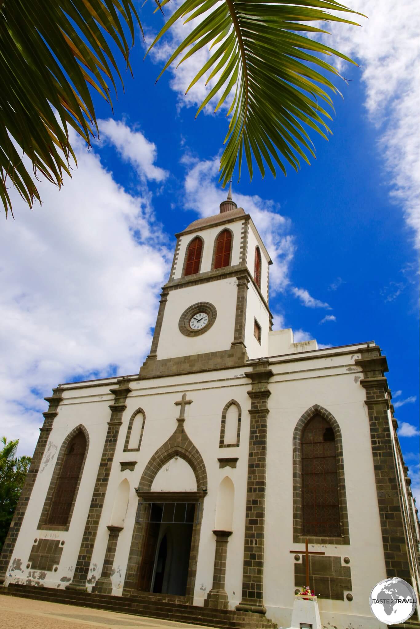
An exterior view of the Eglise de St Louis which dominates the main square of the town of St. Louis.
Further south, the unremarkable town of St. Louis offers limited attractions, but does have an interesting church at its heart.

Strangely relaxing, the interior of the Eglise de St Louis is bathed in a soft, blue light.
The interior of the Eglise de St Louis is always bathed in a beautifully relaxing, almost eerie, blue light thanks to blue plastic panels placed over its windows.

The flag of the Terres Australes et Antarctiques Françaises (TAAF) at the TAAF Information centre in St. Pierre.
St. Pierre is the second city of Reunion but, more importantly for geography buffs and competitive travellers, it is the de-facto capital for the French Southern and Antarctic Lands, known in French as the Terres Australes et Antarctiques Françaises (TAAF).
St. Pierre is home to the TAAF information centre which includes displays on these remote territories.

A monument at the TAAF information centre in St. Pierre shows the location of the Antarctic territories on a globe.
The territory includes the sub-Antarctic, Amsterdam Island, Saint-Paul Island, Crozet Islands, and the Kerguelen Islands which are located far from Reunion in the southern Indian Ocean. The territory also includes Adélie Land, the sector of Antarctica claimed by France.

A map at the TAAF Information centre in St. Pierre shows the location of the French Antarctic Territories.
A French supply ship, the Marion Dufresne, sails to the islands from Reunion on a semi-regular basis and can accommodate 14 paying passengers.

A photo of the Marion Dufresne supply ship at the TAAF information centre in St. Pierre.
The one-month trip covers a distance of 9,000 km, visits all of the islands and includes sightseeing trips with transfers made by helicopter from the ship. If you are interested in applying, you should make enquiries at the following website.

The TAAF information centre is housed inside an old riverside warehouse in St. Pierre.
Located at 1 Rue Gabriel Dejean, the TAAF information centre, which is housed inside a former river-front warehouse, includes displays and photographic exhibitions relating to the islands and also sells ‘TAAF’ postage stamps.

A marker inside the TAAF Information centre indicates distances to the various French Antarctic islands from St. Pierre.
Opening Hours: The TAAF Information Centre is open weekdays from 08:30 am to 12 pm then from 2 pm to 5 pm.

The stunning Cascades de Grand Galet lie a short drive inland from St. Joseph.
There are many amazing waterfalls on Reunion, often reached after many hours of hiking. One stunningly beautiful cascade which can be reached by road is the Cascades de Grand Galet.
From the town of St. Joseph, route D33 winds its way inland for 30 minutes, eventually reaching a car park next to the falls.
Around the Island – South Coast

One of many huge lava fields which flow down to the south coast of Reunion from the Piton de la Fournaise, which is shrouded by cloud cover.
Beyond the west coast town of St. Philippe, the population thins and things quieten down as the road curves to the left, entering the rugged and desolate south coast. The entire south coast lies in the shadow of the volatile and unpredictable Piton de la Fournaise and is characterised by huge lava fields.

Exploring the south coast lava fields in my rental car.
Around the Island – East Coast
After passing through the sparsely populated south coast, the town of Piton Sainte-Rose marks the start of the East coast.
Église Notre Dame des Laves

The miraculous Église Notre Dame des Laves in Piton Sainte-Rose.
A church in a lava field?
Welcome to the truly miraculous Église Notre Dame des Laves (Our Lady of the Lava church). On an island which never fails to surprise, this is one truly surprising attraction – something totally unexpected and almost unbelievable.
In 1977, an eruption from the nearby, and very restless volcano, Piton del la Fournaise, sent an estimated 100 million cubic metres of molten hot (5,000 degrees Celsius) lava gushing towards the sea at speeds of 80 km/h over a period of several days.
In the path of this tremendous onslaught stood the small east coast village of Piton Sainte-Rose. The lava flow made a direct hit on the village, destroying everything in its path except the local police station (now a museum dedicated to telling the story of the eruption) and the church.

A side view of the Église Notre Dame des Laves better illustrates its position in the lava field.
The flow, apparently, split when it came to the church and re-formed again on the other side. Many people see the church’s escape as a miracle of divine intervention. Some lava did enter the church and anything flammable was incinerated.
After the eruption, locals returned to rebuild their village and the church. The lava flow had increased the ground level around the church so today new steps allow churchgoers to cross the lava to and from the church.
La Coulée Volcanique de 1977

La Coulée Volcanique de 1977 is a permanent exhibition which shows dramatic footage from the eruption which destroyed Piton Saint-Rose.
Directly opposite the church the former police station, which was the only other building to survive the eruption, is today home to an exhibition, La Coulée Volcanique de 1977.
This permanent exhibition, which can be visited in 20 minutes, offers explanations of the historic volcanic flow of 1977. Dramatic video footage, photos and newspaper articles from the time, describe the events of the eruption in vivid detail.
Rivière de l’Est Suspension Bridge

The incredible Rivière de l’Est suspension bridge is now permanently closed to pedestrian traffic.
As you exit the town of Sainte-Rose, heading north, you’ll pass the magnificent and impressive suspension bridge which spans the Rivière de l’Est river. Built at the end of the 19th century, and no longer in use or accessible, the 152 metre-long bridge was once a key part of the island’s infrastructure.
Sainte-Anne

The ornate Église Sainte Anne dominates the town of St. Anne, and is a popular wedding venue.
Bras Panon

A worker at the Coopérative Pro Vanille, in Bras Panon, sorting vanilla pods into different lengths.
Heading further north from St. Anne, the town of Bras Panon is home to the Coopérative Pro Vanille. The co-op includes 120 Vanilla producers from the east coast of Reunion with processing, sorting, packaging and shipment of the pods handled at the headquarters in Bras Panon.

Vanilla pods from the Coopérative Pro Vanille are sold according to length.
Hourly tours (only in French) are conducted throughout the day, allowing visitors to gain an understanding of the various stages of vanilla production. For more on this important export item, please refer to the Fauna and Flora section.
Around the Island – Piton de la Fournaise
La Plaine des Cafres

The only sight in the small town of La Plaine des Cafres, Cité du Volcan includes displays and information on the nearby Piton de la Fournaise.
While its tempting to race up the hill to visit the spectacular, #1 attraction on Reunion – the Piton de la Fournaise, it’s worth pausing first to view the displays at the Cité du Volcan (Volcano House museum) in La Plaine des Cafres.
The museum provides a wealth of detail on the volcano, giving visitors an important insight into this amazing wonder of nature and one of the world’s most active volcanoes.
Opening Hours: The museum is open everyday from 09:00 am to 5 pm, except Monday when it’s open from 1 pm to 5 pm.
Piton de la Fournaise

A hiking trail along the edge of the giant enclosure provides stunning views of different volcanic features, such as the Formica Leo crater.
As mentioned – this is the #1 attraction on the island and worth a full day of anyone’s time!

Lava flows on the slopes of the Piton de la Fournaise.
The Piton de la Fournaise (English: Peak of the Furnace) is a shield volcano, which is similar in structure to those found on Hawaii. The volcano is easily accessible along road RF5 which runs from the Cité du Volcan (Volcano House) museum to the edge of the crater, a journey of about an hour.

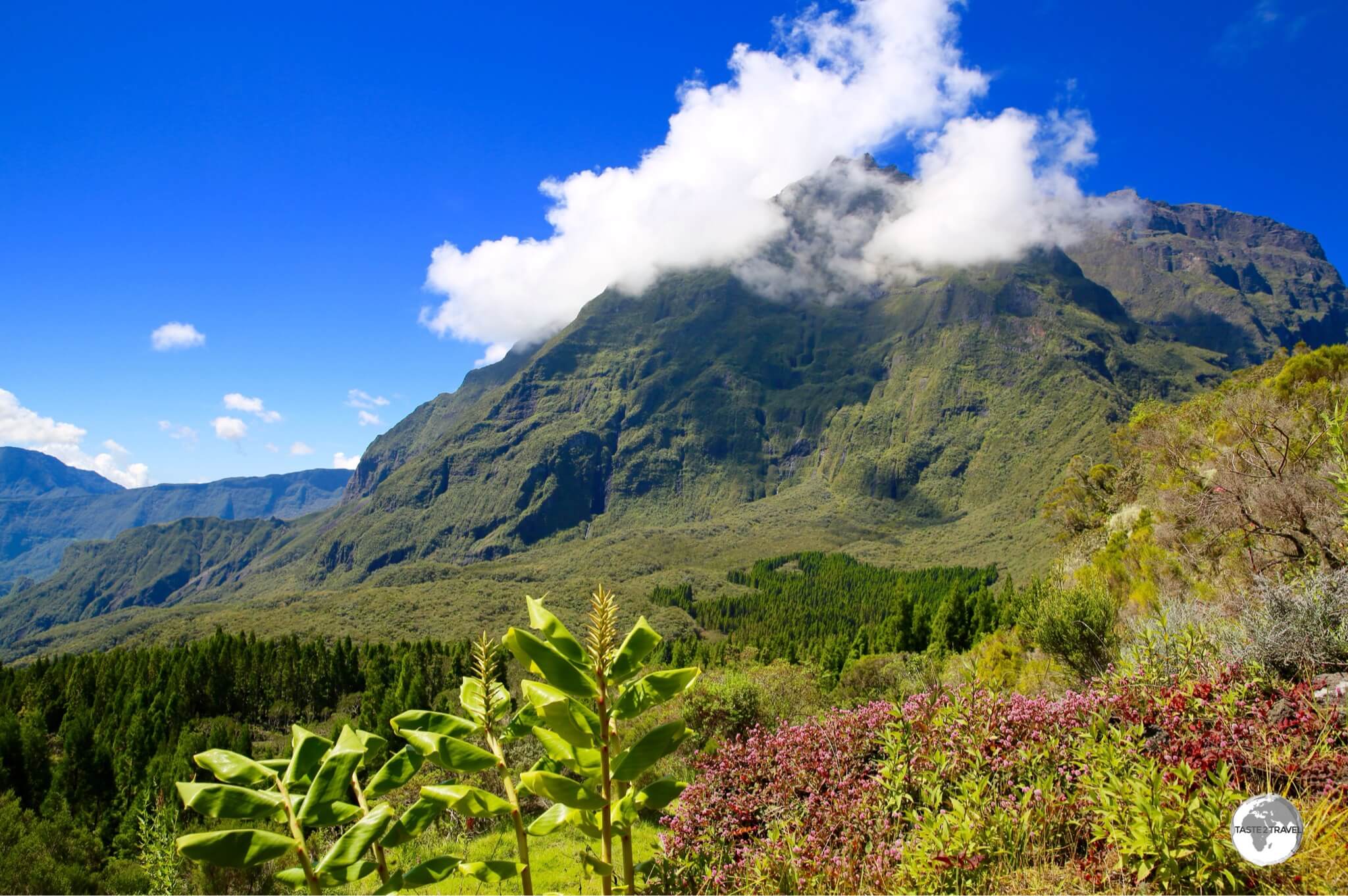
A beautiful view to the summit of the Piton de la Fournaise from the hiking trail.
Located at 2,632 metres, it’s estimated that the volcano is around 500,000 years old and is currently one of the most active volcanoes in the world. Prior to my visit, an eruption had resulted in all hiking trails inside the giant enclosure being closed.
The giant enclosure of Piton de la Fournaise provides hours of hiking possibilities with stunning views in all directions.
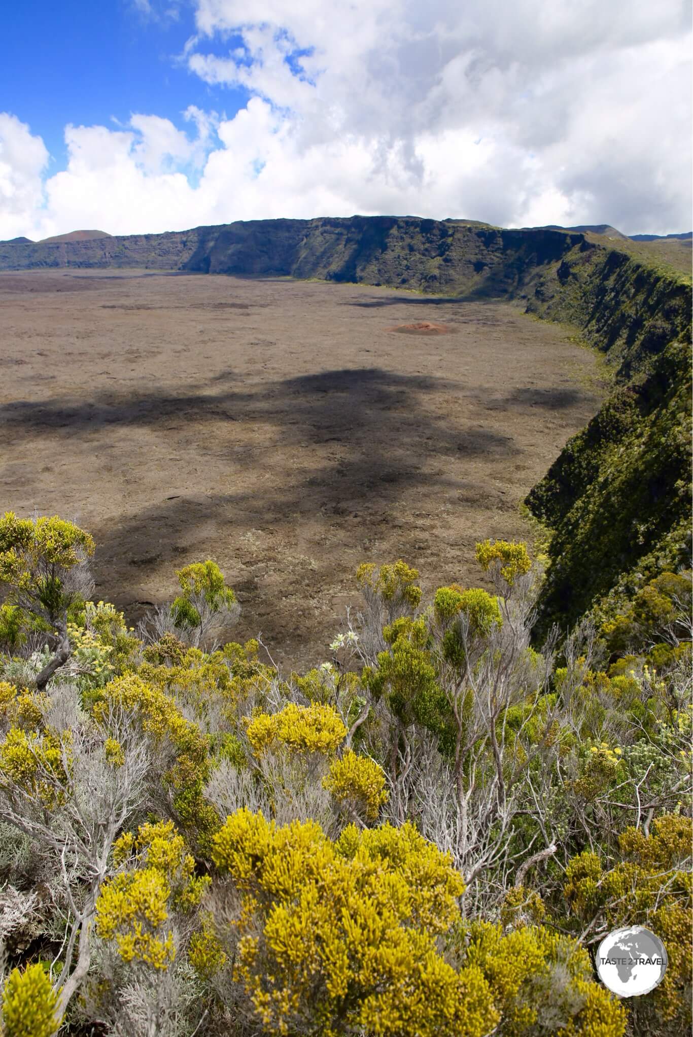
The journey to the volcano takes in many spectacular sights, making the trip a full day out. Ever wondered what it must be like to walk on the moon, or Mars? The lunar landscape on the Plaine des Sables (Plain of Sands) should allow you to satisfy your curiosity.

Looking more like Mars than Earth, the breath-taking Plaine de Sables is just one part of the huge volcanic complex that is the Piton de la Fournaise.
This giant plain of bronze and reddish-brown volcanic soil is lined on both sides by the vertical walls of an ancient river. A truly impressive sight! Hiking trails follow the top of the ridge, providing incredible views at every turn.

The road to the Piton de la Fournaise descends onto the Plaine de Sables.
Before the road descends onto the plain, a viewpoint at Le Pas des Sables offers the most impressive panoramic views of the plain.
A full day exploring the magnificent sights of the Piton de la Fournaise is a must while visiting Reunion!

Another jaw-dropping view on the way to the Piton de la Fournaise is offered at Point de Vue Après Nez de Boeuf.
The Three Cirques
As seen from my helicopter flight, one of the three volcanic Cirques which form the interior of Réunion.
Finally – the Cirques! Do you see just how much there is to do on this one volcanic rock? This report is way too long and I need to stop writing, so I will keep this section brief.
I could easily return to Reunion to spend two weeks exploring the three Cirques and I’m sure many visitors to the island, those who love hiking at least, never make it down to the coast.
The Cirques are sights within their own right and could easily justify their own report!
Cilaos, Salazie and Mafate, the three cirques, are home to inhabited villages in the centre of the island. Large holes in the ground, they were formed long ago when the now dormant volcano, Piton des Neiges, exploded.
The first two, Cilaos in the Southwest and Salazie in the east are accessible by car through very windy roads (the road to Cilaos contains 400 bends), while Mafate is only accessible by foot. A road could be built to provide access – but – Mafate is governed by strict rules, one of which is that a road can never be built inside the cirque.
The cirques are full of hiking trails with lots of accommodation options and restaurants in the two main centres of Cilaos (for Cirque de Cilaos) and Hell-bourg (for Cirque de Salazie).
Cirque de Cilaos

Dramatic landscapes in the Cirque de Cilaos. Do you see the people canyoning?

Now do you see them? If you are looking for adrenaline activities, Cilaos is the place for you.
The main centre in the Cirque de Cilaos is – Cilaos. The town is famous for its spa, which is now old and dated but worth a visit for an hour (strictly timed!) of wellness.

Street art in the town of Cilaos.
The town sits on a ridge in the middle of the Cirque de Cilaos, a dramatic, forested, rugged caldera which you could easily spend a week exploring. Steep hiking trails from Cilaos lead to neighbouring Salazie and Mafate.

The town of Cilaos is dominated by its church, the Eglise de Cilaos.
Dominated by its church, Cilaos is full of shops, restaurants and accommodation, making it a popular place for visitors. Buses offer connections to hiking trail heads, making it an ideal base for ramblers.

The interior of the Eglise de Cilaos.
Embroidery Museum

You have to admire a town which takes its embroidery seriously.
OK! Not something I would normally cover but – Cilaos is known for its unique style of embroidery. You can gain an understanding of this time-honoured craft at the Maison de la Broderie (Embroidery museum) where different ladies demonstrate their skills. I still couldn’t figure out how they did it!
Opening Hours: Located in the heart of Cilaos, the museum is open everyday from 09:30 am to 12 pm, then 2 pm to 5 pm, except Sunday when it closes in the afternoon.

An example of Cilaos embroidery, on display at the Maison de la Broderie.
Cirque de Salazie

One of the many spectacular views of the Cirque de Salazie from my flight with Corail helicopters.
Of all the cirques, Salazie is the easiest to access, via a wide, fast, well-maintained road from the east coast town of Saint-André.
Hiking in the stunningly beautiful Cirque de Salazie.

The main street of Hell-bourg is lined with traditional Creole houses.
The main centre in Salazie for accommodation and dining options is the town of Hell-bourg, a picturesque village which features many fine examples of creole timber houses.

Just some of the 1,500 instruments to be found at the Maison Morange in Hell-bourg.
One of the highlights of Hell-bourg is the excellent museum of musical instruments which is housed in the Maison Morange. Inaugurated in 2015, the museum focuses on instruments from India, Africa and the wider Indian Ocean region.

Just one of the many displays of musical instruments at the Maison Morange in Hell-bourg.
Housed in a traditional Creole house which was built by the former mayor of Bras Panon, Henri Morange, the museum features more than 1,500 instruments. A truly surprising find in this little hilltop town.
Opening Hours: The museum is open everyday from 10:00 am to 6 pm, except Monday.

There are many more Nephila spiders in Hell-bourg than people. I kid you not!
For those who suffer from arachnophobia, you will be pleased to know that Hell-bourg is full of incredibly large Nephila spiders who have strung their webs up everywhere and seem to outnumber the human population exponentially.

See! They are everywhere.
Cirque de Mafate

While there are no roads inside the Cirque de Mafate, a back road from the Cirque de Salazie does allow partial entry by car.
Cirque de Mafate is unique – a Utopian dream for many, a land of no roads and very limited connections to the outside world.
There is no main electrical supply so inhabitants must produce their own electricity using solar panels, and occasionally diesel generators. However, fuel for the generators must be brought by helicopter at high cost. All other heavy materials must also be air-lifted in by helicopter.

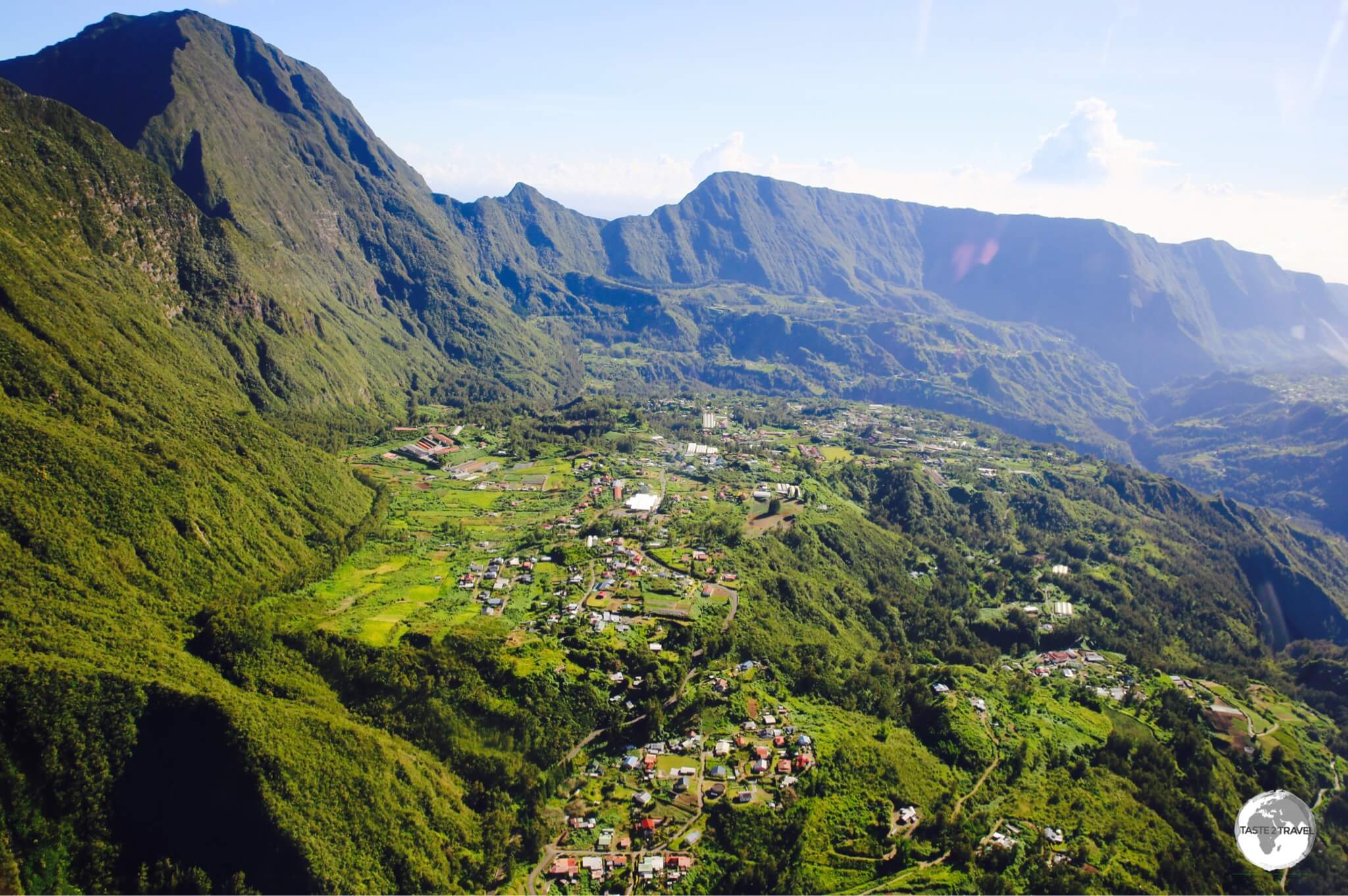
A view of the settlement of La Nouvelle, the largest in the Cirque de Mafate, as seen from the Col des Bœufs pass.
The cirque has one small settlement, La Nouvelle, which offers limited accommodation to overnight hikers. A primary school caters for just 6 pupils. There are no secondary schools.

A local supermarket provides grocery delivery for the residents of La Nouvelle with perishable items being stored in refrigerated containers until they are collected.
The Cirque is entirely public property, managed by the Forestry service from which the inhabitants rent inexpensive concessions. Everything, including groceries from the local supermarket, must be walked into the cirque, while heavier construction items are helicoptered in.

The end of the road to Cirque de Mafate, the car park at the Col des Bœufs pass.
Easy access to Cirque de Mafate is available from the car park at the Col des Bœufs (Pass of the Oxen), which can be reached by car from Cirque de Salazie.

All construction materials destined for Cirque de Mafate must be air-lifted by helicopter.
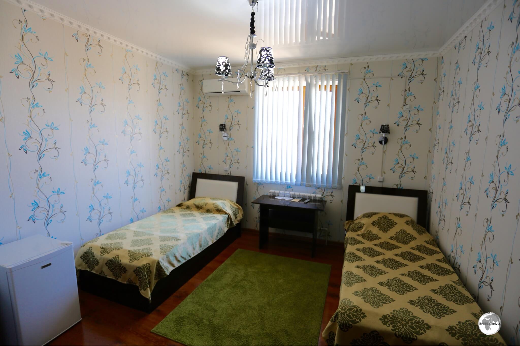
Accommodation
St. Gilles

The comfortable and homely Hôtel Le Kervéguen in St. Gilles.
My first base on Reunion was the main tourist town of St. Gilles, which is located on the west coast and is the epi-centre for the island’s beach scene.
While in St. Gilles, I stayed at the comfortable Hôtel Le Kervéguen, which is located on a hill overlooking town. With room rates starting at US$84 per night, the hotel features dated, but clean and comfortable accommodation, a tight car park (they’re all very tight on Reunion) and a small swimming pool, next to which a buffet breakfast is served each morning for an additional €10. If staying here, you’ll need a car!
Cirque de Cilaos

My stylish room at the very contemporary La Villa Kazuera in Cilaos.
The road in and out of the Cirque de Cilaos is narrow, windy, very steep and full of hair pin turns. Driving time from St. Louis to Cilaos is at least one hour and, rather than rush in and out on a day trip, it’s best to stay for a couple of days, allowing time to relax and appreciate this special environment.
The Cirque has its own micro-climate with torrential downpours occurring like clockwork most afternoons, which only allows the morning for hiking and other activities.
The main town of Cilaos features lots of accommodation options, including the very new La Villa Kazuera. Located on a quiet lane-way, close to the centre of town, the villa offers beautifully styled rooms (from US$62), a communal kitchen, a relaxed garden space, a Jacuzzi (which is a great way to relax during the afternoon downpour) and ample parking.
Cirque de Salazie
Grand Ilet

My room at the newly built Ô Cœur de l’île guest house in the quiet village of Grand Ilet in the Cirque de Salazie.
In the Cirque de Salazie, I spent my first night in the very remote hamlet of Grand Ilet at the brand new and very stylish Ô cœur de l’île, a guest house located on a hill overlooking town.
Owned by a French couple (who speak no English), every space in the guest house has been thoughtfully created and is finished to a high specification. A very nice place to spend a night.
Located at 1,100 m, Grand Ilet is a tiny and remote mountaintop village which sits at the base of the ridge separating the Cirque de Salazie and the Cirque de Mafate.
On the night I stayed in town, the whole place was in darkness, and shrouded in fog, with nowhere open to get dinner. Luckily I had a packet of chips in the car which served as my sustenance. The following morning a continental breakfast was served for which there was an additional charge, which I happily paid.
The guest house is a short drive from the stunning Col des Bœufs, which provides sweeping views of the Cirque de Salazie and easy access to the Cirque de Mafate.
Tip: If you do stay here, the address provided by the property should not be entered into Google Maps, unless you wish to tour all the minor back-roads of the Cirque. Instead, you should simply enter ‘Grand Ilet‘ into Google Maps and let Google direct you to the village. Once there, ask a local for the guest house (it’s located on the hill directly above the village). Feedback from other guests on booking.com suggest this is a reoccurring issue.
Hell-bourg

My room at Le Relais Des Gouverneurs in Hell-Bourg, the main centre in the Cirque de Salazie.
The main accommodation centre in the Cirque de Salazie is Hell-bourg, where I stayed in Le Relais Des Gouverneurs which is located downtown. While the room was comfortable this was not my favourite place to stay!
The guest house is owned by a family who operate it on a schedule which suits them and not their guests. Breakfast finishes at 8:30 am, reception closes soon after and only reopens in the afternoon – all of which, according to the son and manager, is designed to create minimal disruption and inconvenience to the family.
If I ever return to Hell-bourg, I would stay at the much more agreeable, Le Relais des Cimes, where the staff are welcoming, reception is always open, service is wonderful and the restaurant is one of the best in town.
Saint Denis
During a return trip to Reunion from Mayotte, I had two days to soak up the ambience of the capital, St. Denis. Strangely, accommodation options in the capital are limited, with most hotels on the island lining the beaches on the west coast.
Eating Out
Being a French territory, you can be sure of one thing on Reunion – cuisine is taken very seriously!
There’s no shortage of fine restaurants, with amazing dining options available in even the smallest of towns. This is thanks, in no small part, to the army of French ex-pats who, having been trained in the finest culinary schools in France, have relocated to the island to enjoy life in the tropical sun. These ex-pats have opened the most delectable Pâtisseries, Boulangeries, Cafés, Bistros and Restaurants.
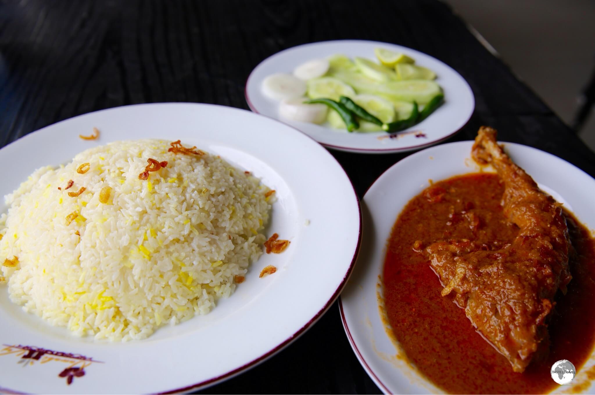
The traditional cuisine of Reunion is ‘carri‘ (yes – that’s ‘curry’ in Creole!), a truly local dish with ingredients simmered to perfection using Indian spices and local ingredients. If you like curry, you’ll love carri!
Restaurants
Le D.C.P.

The Tuna steaks served at Le D.C.P. (Le Dispositifs de Concentration de Poisson) in St. Giles are heavenly.
Of the many amazing restaurants on the island, one of my favourite places to sample local seafood is Le D.C.P. , which of course is an acronym for – Le Dispositifs de Concentration de Poisson. The restaurant is located in a quiet side-street in downtown St. Gilles, which is the only quiet aspect of this popular establishment.
The restaurant is voted on TripAdvisor as #1 of 109 restaurants in St. Gilles and it’s easy to understand why. Every evening, this busy establishment is under the command of its wonderfully unpretentious, friendly and enthusiastic patron, J-C (aka Fisher Man), who ensures the meals keep coming and the guests are happy.
It’s all about the fish at Le D.C.P. and more than once I returned to enjoy their amazing rare-cooked, teriyaki-flavoured, sesame-encrusted, tuna steak, which is served with a side of your choice. I still dream of that meal!
One evening I dined alongside a table of local fisherman who supply the restaurant with its daily catch. It was good to see that they too were enjoying the fruits of their labour. Everything at Le D.C.P. is spot on – a faultless production!
L’Atelier des Saveurs
Occupying a prime position on the main street of Cilaos, the stylish L’Atelier des Saveurs provided me with one of my most memorable meals on Reunion.
This fine dining establishment is owned and operated by a very talented local couple, Gregory (the Chef) and Pauline (Sommerlier/ Server) who met each other while working in Perth, Australia.
The restaurant is voted on TripAdvisor as #1 of 22 in Cilaos and after dining here, I can attest that its prime position is wholly justified. The couple speak English and are very passionate about their food and wines, all of which are divine and sublime! As for any lingering Australian influences – while I was dining, Angus and Julia Stone were playing softly on the music system. Nice!
Dessert

Café gourmand, a selection of desserts, is a popular dessert choice on Réunion.
After a meal, the French love nothing more than finishing with something a little sweet. A popular item, which can be found on many restaurant menus, is Café gourmand which is essentially a sampling plate consisting of an espresso and a selection of miniature desserts (also known as petits fours). This is ideal for those who cannot decide what to order or who wish to try a little of everything!
Cafés
Coffee Shop de Bourbon

The Coffee Shop de Bourbon is the only place on Reunion serving real Barista-made coffee.
Coffee is available everywhere on Reunion, but the island doesn’t have a real cafe culture. Instead, most places prepare espresso coffee using pods. Many cafes do not stock milk so often, a black coffee is all that’s available.
There is one place which stands out as a beacon of hope for those in need of a serious caffeine fix – Coffee Shop de Bourbon in downtown St. Denis. You will not find a single pod here, only qualified Barista’s who understand the different between a flat white, café latte, cappuccino etc.

The owner of the Coffee Shop de Bourbon, Charles Petit, was inspired by the cafe culture of Australia.
Like the owners of L’Atelier des Saveurs, the enthusiastic owner of Coffee Shop de Bourbon, Charles Petit, spent many years living and working in Perth, Australia. While in Perth, Charles was inspired by the Australian café culture (we are fanatical about our cafés!) and, upon returning to his native Reunion, realised the island desperately needed something similar. Today, Coffee Shop de Bourbon is the only proper café on the island.
The Coffee Shop de Bourbon has just celebrated its 3rd birthday and Charles is not sitting still. He’s currently busy setting up a larger café on the waterfront in St. Denis and has plans to export his locally grown and roasted coffee beans. Apart from excellent coffee, the café menu is loaded with lots of tasty options from fresh salads, quiches, sandwiches and more.

A freshly made raspberry mille-feuille with an espresso macchiato at La Case à Pains in St. André. Parfait!
There are many fine boulangeries on Reunion and I tried my best to sample them all! One, which is a standout, is the magnificent La Case à Pains (House of Breads) which offers not just amazing bread but the most divine pastries.
With two branches located on either side of the island (St. Gilles on the west coast and St. André on the east coast), you are never far from a heavenly mille-feuille, Pain au chocolat or many other sublime calorie bombs.
Café De La Gare
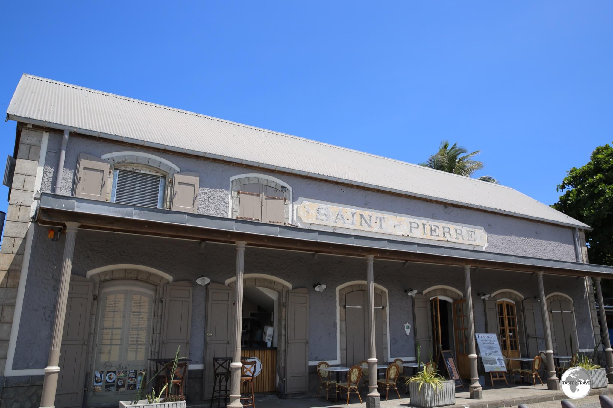
The former railway station in Saint-Pierre has been converted into the pleasant Café De La Gare, however the (pod) coffee is passable!
The second city of Reunion, Saint-Pierre, offers surprisingly few cafe options, however the former railway station, which is located on the waterfront, has been converted into a pleasant cafe – the Café De La Gare. The pod coffee is passable but the food much more appealing.
Bars

An advertisement for the popular Dodo beer.
- Bourbon Rousse – an amber/ red ale beer.
- Bourbon Radler – a lager mixed with lemon juice.
- Bourbon Blanche – like a Belgium style wheat beer with citrus tones.
- Bourbon Héritage Blanche – like a Belgium wheat beer.
- Bourbon ‘Dodo’ – the most popular lager on the island.
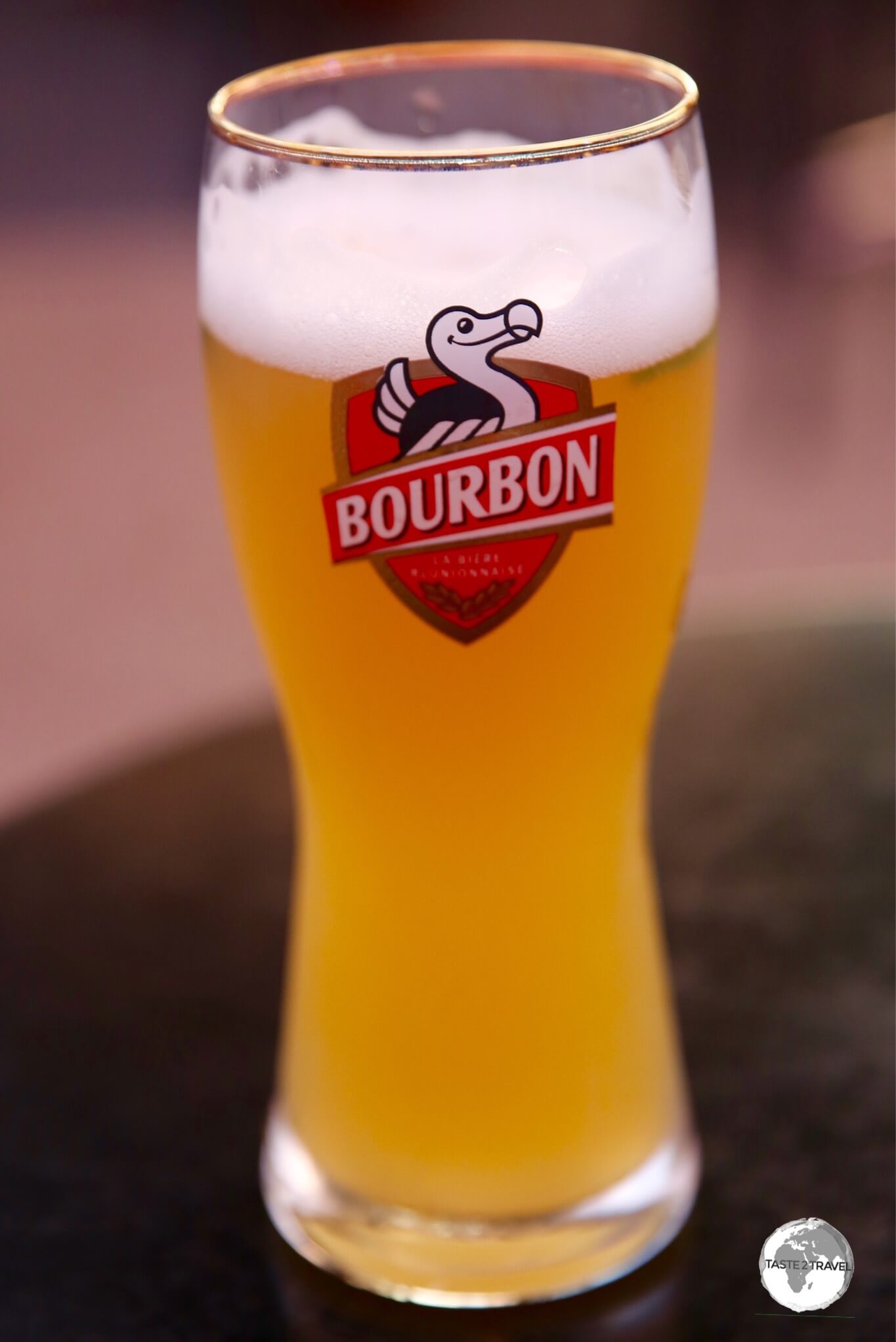
Enjoying a glass of the Bourbon Blanche at La Palmeraie in St. Gilles.
The best place for sunset drinks on Réunion is on the waterfront in St. Giles, where several bars lay out their tables directly on the foreshore from where you can watch the sun set into the Indian Ocean.
Visa Requirements

Passport stamp from Réunion.
Réunion is a French overseas territory, but it is not part of the Schengen Zone and, as such, applies its own visa policy. While French and European passport holders can reside for an unlimited period, many other nationalities can remain for 3 to 6 months.
Getting There
Air

Roland Garros International Airport is the main international gateway to Réunion.
There are two international airports on Reunion:
- The main gateway, Roland Garros International Airport (IATA: RUN), is located in the north coast town of Sainte-Marie, 7 km east of Saint-Denis.
- The secondary, Pierrefonds Airport (IATA: ZSE), is located 5.5 km northwest of Saint Pierre and offers limited services between Reunion and Mauritius.
Roland Garros Airport
The very dated Roland Garros airport is currently under-going a major renovation which is due to be completed by 2022. Most flights to/ from Reunion connect the territory to Metropolitan France. If you remove the French carriers, who provide a frequent shuttle service to the motherland, from the list of carriers serving Roland Garros airport, you’d be left with just three carriers providing services to a limited selection of destinations:
- Air Austral – The national carrier flies to a variety of destinations.
- Air Madagascar – flies to Madagascar only.
- Air Mauritius – flies to Mauritius only.
Air Austral
Roland Garros serves as the base for the local carrier, Air Austral. If you’re island hopping around the Indian Ocean, Air Austral provide the most comprehensive, inter-island network, connecting Reunion to Mauritius, Seychelles, Mayotte, Madagascar and the Comoros.
While their aircraft are modern and the crews are professional, flights are horrendously expensive (as is to be expected by a carrier operating in a monopoly environment) and not always reliable.
I flew on four flights with the airline, the first of which was cancelled and the second of which was rescheduled – twice! The airline redeemed themselves on the last two flights, which operated normally. If you’re planning an itinerary with Air Austral, it’s best to build in buffer days in case of cancellations or delays.
Scheduled Services
The following airlines provide scheduled services to/ from Roland Garros International Airport:
- Air Austral – flies to/from Antananarivo, Bangkok–Suvarnabhumi, Chennai, Dzaoudzi, Johannesburg–O. R. Tambo, Mahé, Marseille, Mauritius, Moroni, Nosy Be, Paris–Charles de Gaulle
- Air France – flies to/from Paris–Orly
- Air Madagascar – flies to/from Antananarivo, Antsiranana, Guangzhou, Sainte-Marie, Tôlanaro
- Air Mauritius – flies to/from Mauritius
- Corsair International – flies to/from Paris–Orly
- French Bee – flies to/from Paris–Orly

A giant terracotta mural adorns the departure hall at Roland Garros International Airport.
Airport Transport
The ‘T’ line bus provides thirteen round trips daily (from 7:00 am to 7:45 pm), connecting the airport with St Denis, a journey of 15 mins which costs €4.
Taxis between Roland Garros International Airport and Saint-Denis cost around €25 during the day and €30 at night. Drivers charge additional fees for luggage and, generally, I would recommend avoid using taxis while on Reunion (refer to the ‘Getting Around‘ section for more nightmare taxi stories).
Pierrefonds Airport
Pierrefonds Airport offers limited services between Reunion and Mauritius.
The following airlines provide scheduled services to/ from Pierrefonds Airport
Sea
Saint Denis 97400, Réunion
Forty-three cruise ships call at Réunion each year from October to April. Ships dock at the main port – Le Port – which is located on the northwest coast of the island, 21 km’s west of St. Denis.
To check the current schedule, click here.
Getting Around
Road
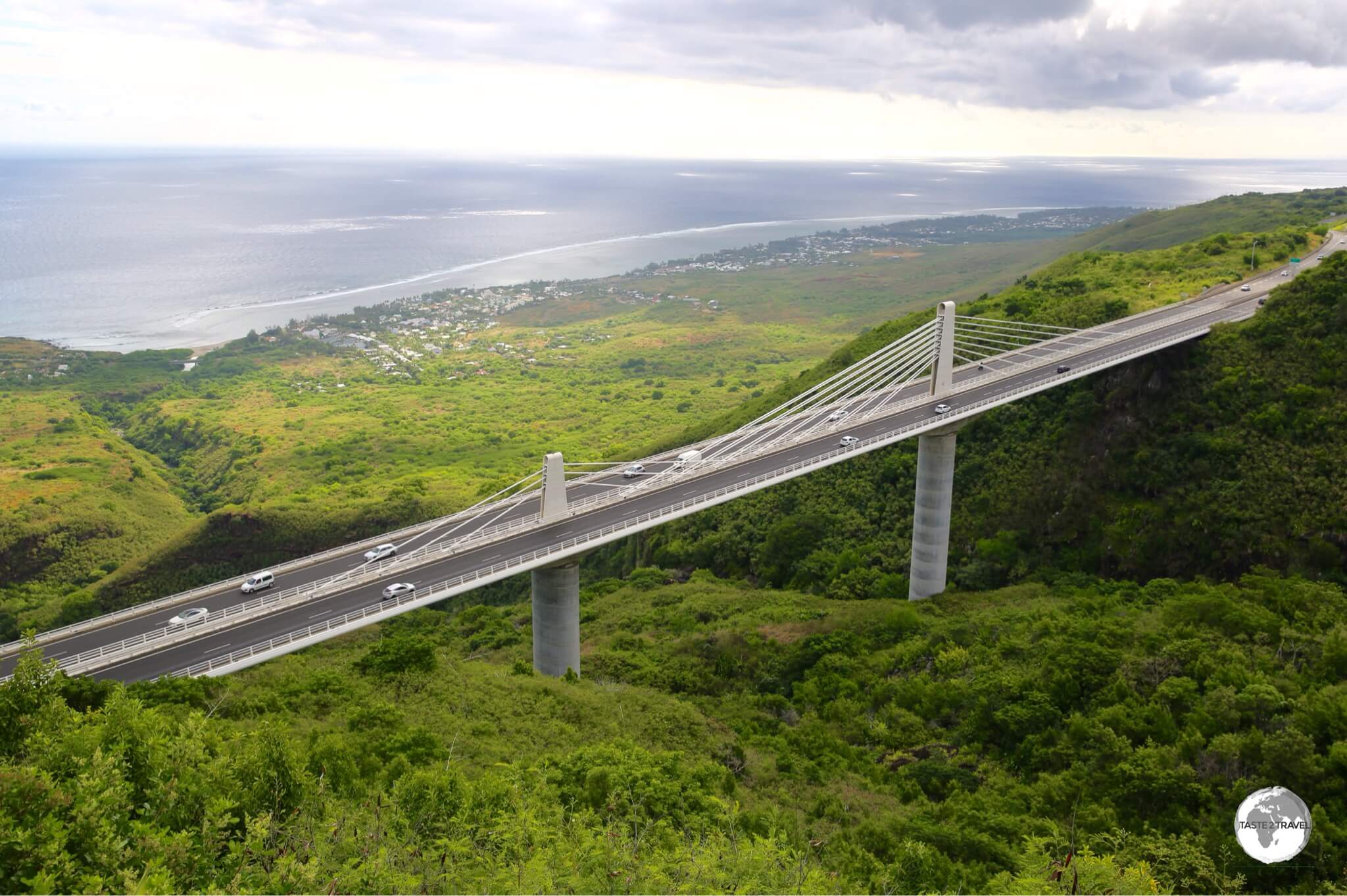
The RN1 passes over the spectacular Route des Tamarins bridge on the west coast of Reunion.
I was pleasantly surprised by the high standard of infrastructure on Reunion. The French government have spared no expense on building impressive highways, cycle-ways, footpaths, bridges, ports and much more. The most impressive project of all is currently under construction (see the following section).
With its deep ravines, the terrain of the island presents engineers with many challenges. The French are champion bridge builders and have created some impressive bridges and viaducts to keep the island moving.

A fast, multi-lane, motorway (indicated in blue) almost circumnavigates the island, providing quick travel times to most places.
From the inland town of Le Tampon, the multi-lane, RN3 descends rapidly down the steep, volcanic slope to the coastal city of St. Pierre, where it becomes the RN1, travelling north, along the west coast, to the capital, Saint Denis.
From Saint Denis, the RN2 whisks you along the east coast as far south as Saint-Benoît. Beware the speed cameras – they really do work!
The only part of the island that’s not covered by the fast motorway is the rugged interior ‘cirques’ and the sparsely populated south coast, which lies in the shadow of the (active) Piton de la Fournaise volcano and is prone to inundation by lava flows whenever an eruption occurs.

As seen from a helicopter, the narrow, windy road (bottom left corner) which passes beneath the vertical walls of the Cirque de Cilaos, providing access to the tiny hamlet of Îlet à Cordes.
Away from the motorway, most roads are in excellent condition, although in the impossibly steep cirques, they can be narrow, windy and at times scary!

A one-lane tunnel on the (two-way) road to Cilaos.
Nouvelle Route du Littoral

An artist impression of the Nouvelle Route du Littoral.
Source: www.bouygues-construction.com
One of the largest and most impressive engineering projects currently underway anywhere in the world must be the Nouvelle Route du Littoral, which is France’s longest offshore viaduct and, at a cost of €1.7 billion, the most expensive road project/ km ever funded by France.
The existing ‘Route du Littoral’ is located at the bottom of steep volcanic cliffs, making it prone to rock-slides, which has resulted in fatalities in the past. Once completed in 2020, the new Route du Littoral will keep travellers well out of harm’s way.
One of the most complex aspects of the work is the construction of a 5.4 km viaduct which rises out from the Indian Ocean on columns. This is being built so that it will be able to withstand 144 km/h hurricane winds as well as waves of up to 10 m in height.
Public Buses

The national bus company, Car Jaune, provides access to all parts of the island.
Various bus companies on Reunion provide modern, clean, public buses, with national services being offered by the state-owned operator, Car Jaune.
Other regional companies include:
- Citalis – covering the northeast coast from Saint-Denis to Sainte-Marie and Sainte-Suzanne.
- Karouest – covering the west coast from La Possession south to Saint-Leu.
- Alterneo – covering the southwest coast, including Saint-Pierre, Saint-Louis, Cilaos and Etang-Salé.
- Cirest – covering the east coast, including Saint-André, Salazie, Sainte-Rose and Bras-Panon.
- Carsud – covering the southwest coast around Saint-Philippe, Saint-Joseph and Le Tampon.
All the websites listed above provide a wealth of information for the travelling public – but only in French! The Car Jaune website includes current Tariffs and a handy Route map.
Between them, the companies connect all towns and villages, no matter how remote, to regional transportation hubs. It was amazing to see wide-bodied buses negotiating tight, hair-pin turns on remote mountain passes and to find a lonely bus stop in the middle of a desolate lava field.

The bus stop at Vierge Parasol, which is located in the middle of an isolated, south coast lava field.
While the network is comprehensive, and certainly looks good on paper, the reality on the ground is a little different with buses providing services during daylight hours only (from 6 am to 7 pm) from Monday to Saturday. While services around the capital are more frequent, the timetable elsewhere is less user-friendly, with services running infrequently.
If your time is limited, and you wish to explore off the beaten track (where many of the highlights are to be found), then you should hire a rental car rather than face frustrating delays waiting on buses that run very occasionally.

A one-way bus ticket on Citalis costs €2 and is valid for 90 minutes.
Taxi
Calling a taxi while on Réunion is one thing you should avoid at all costs!
Taxi’s are few and far between and, like taxis operating in other French territories such as French Polynesia and New Caledonia, the drivers work hours to suit themselves rather than their customers. Outside of business hours, it’s best to book a taxi in advance by calling one of the companies. Taxis do not cruise the streets of Saint-Denis looking for customers, but can be found, during business hours, on taxi ranks.
Uber, or any other ride sharing app, is banned from operating on the island and the drivers I spoke to told me they would fight the introduction of any such competition. There are few taxis on Reunion and those that do exist operate like a cartel in a monopoly environment, charging all sorts of fees.
During one ten-minute taxi ride from the airport to a nearby guest house, the driver complained to me about the high cost of living on Reunion and then, upon completion of the journey, charged me €25! This included the meter fee of €19 then a fee of €2 for each piece of baggage, including my laptop bag, camera bag and main luggage.
On another occasion, late one evening, after dinner and drinks at the Roland Garros bistro in Saint-Denis, I asked the staff to call me a taxi as I didn’t wish to walk back to my apartment. When the driver arrived the meter was already running and had €12 on the display. When I asked the driver why my journey was starting at €12, he explained that, since it was after hours, and he had to drive across town to collect me, that I had to pay for the whole journey, from the time he started his engine! Really??
If you must hire a taxi for an airport transfer, I highly recommend, Pierre Picard of 123 Transfert. Pierre is a private operator, offering transport at reasonable rates, without any of the nonsense. A native of Reunion who spent many years working in France, Pierre is very professional, speaks English and provides transport options island-wide. He can be contacted at:
- WhatsApp/ Cell: +262 693 465 708
- Email: contact@123transfert.eu
- URL: www.123transfert.eu
Rental Car

The license plate on my rental car with the 974 French department number of Réunion.
While taxis should be avoided on Reunion, the best thing you can do for yourself is to hire a rental car the moment you arrive and keep it for the duration of your stay.
With taxis costing a fortune and buses running infrequently, a rental car will be your best transport investment on Reunion.
Being a French territory, the rental companies offer affordable, compact French cars such as Peugeot, Citroen and Renault starting at less than €30 per day.
If you’re from a part of the world where automatic transmission is the norm, you should know that cars on Reunion follow French norms and are almost all manual transmission.
The following rental agencies have branches at the airport:

My rental car on the road to Cilaos.
That’s the end of my Réunion Travel Guide.
Safe Travels!
Darren
Follow me on Instagram:
[instagram-feed feed=1]
Further Reading
You might also be interested in reading other taste2travel articles from the region, such as my:
Réunion Travel Guide Réunion Travel Guide Réunion Travel Guide Réunion Travel Guide Réunion Travel Guide Réunion Travel Guide Réunion Travel Guide Réunion Travel Guide Réunion Travel Guide Réunion Travel Guide Réunion Travel Guide Réunion Travel Guide Réunion Travel Guide Réunion Travel Guide Réunion Travel Guide Réunion Travel Guide Réunion Travel Guide Réunion Travel Guide Réunion Travel Guide Réunion Travel Guide Réunion Travel Guide Réunion Travel Guide Réunion Travel Guide Réunion Travel Guide Réunion Travel Guide Réunion Travel Guide Réunion Travel Guide Réunion Travel Guide Réunion Travel Guide Réunion Travel Guide Réunion Travel Guide Réunion Travel Guide Réunion Travel Guide Réunion Travel Guide Réunion Travel Guide