Test your knowledge with this world capitals quiz from taste2travel.
How well will you score? Your result will be displayed at the bottom of the quiz – will you get to see the legendary Marco Polo?
Good luck!
01. Georgetown is the capital of which country?
Correct!Wrong!
02. Nuku'alofa is the capital of which country?
Correct!Wrong!
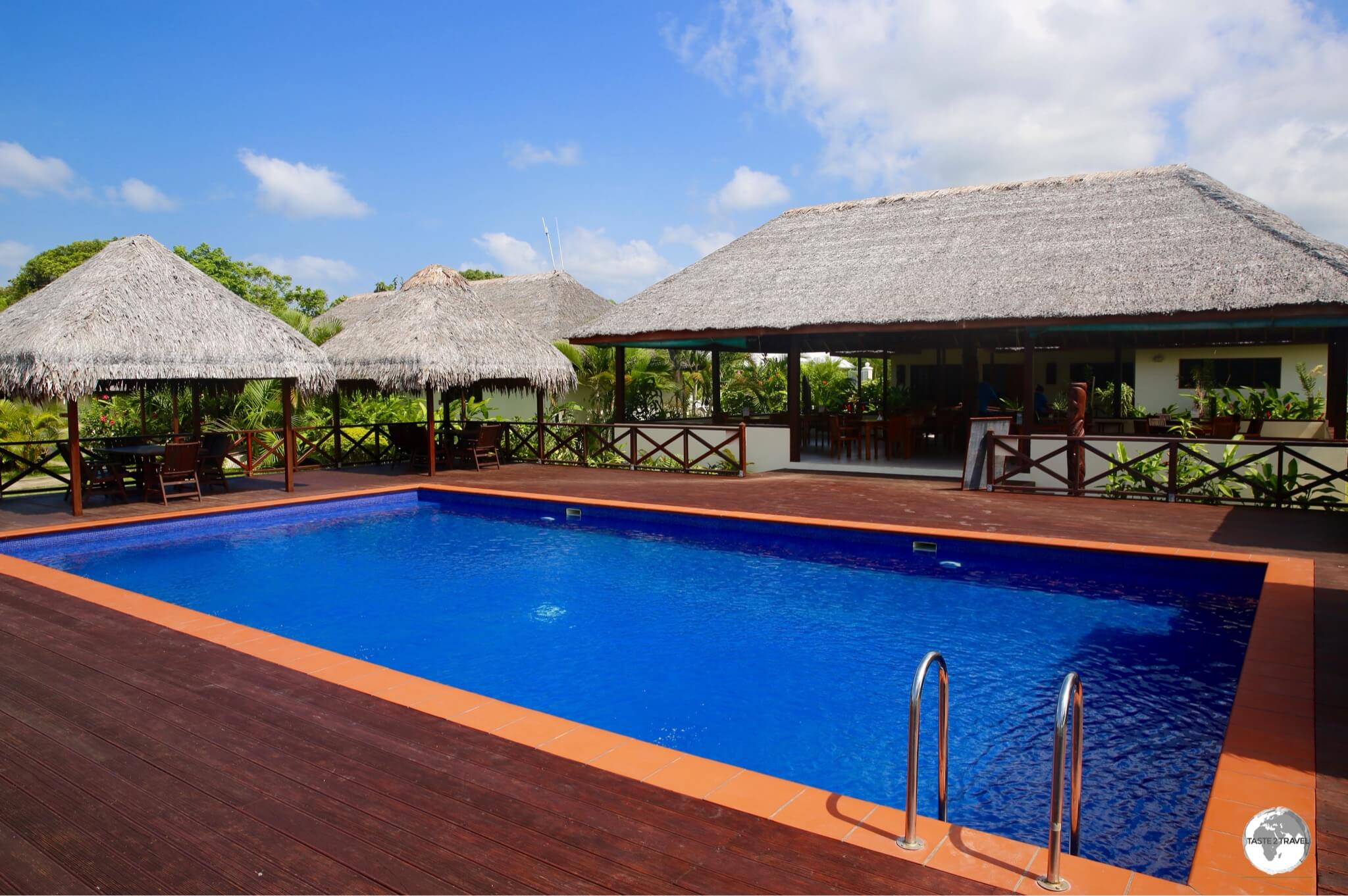
03. Pago Pago is the capital of which territory?
Correct!Wrong!
04. Which is the capital of Iceland?
Correct!Wrong!
05. Which country has Funafuti as its capital?
Correct!Wrong!
06. What is the capital of Suriname?
Correct!Wrong!
07. The capital of the Faroe Islands is?
Correct!Wrong!
08. Pyongyang is the capital of which country?
Correct!Wrong!
09. Oranjestad is the capital of which territory?
Correct!Wrong!
10. The capital of Kiribati is?
Correct!Wrong!
11. What is the capital of Bermuda?
Correct!Wrong!
12. Malé is the capital of which country?
Correct!Wrong!
13. Kralendijk is the capital of which territory?
Correct!Wrong!
14. Which is the capital of the Federated States of Micronesia?
Correct!Wrong!
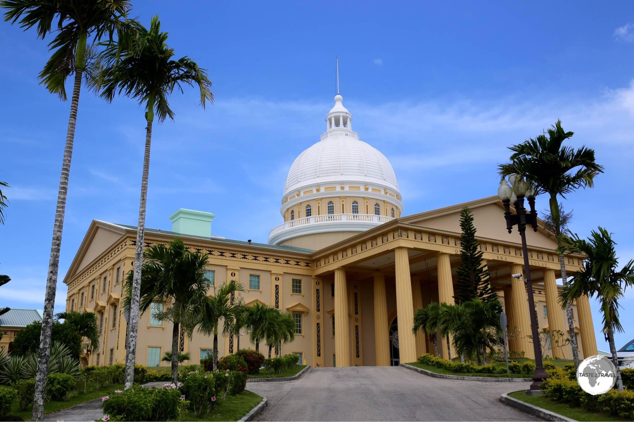
15. Ngerulmud is the capital of which country?
Correct!Wrong!
16. Fort-de-France is the capital of which territory?
Correct!Wrong!
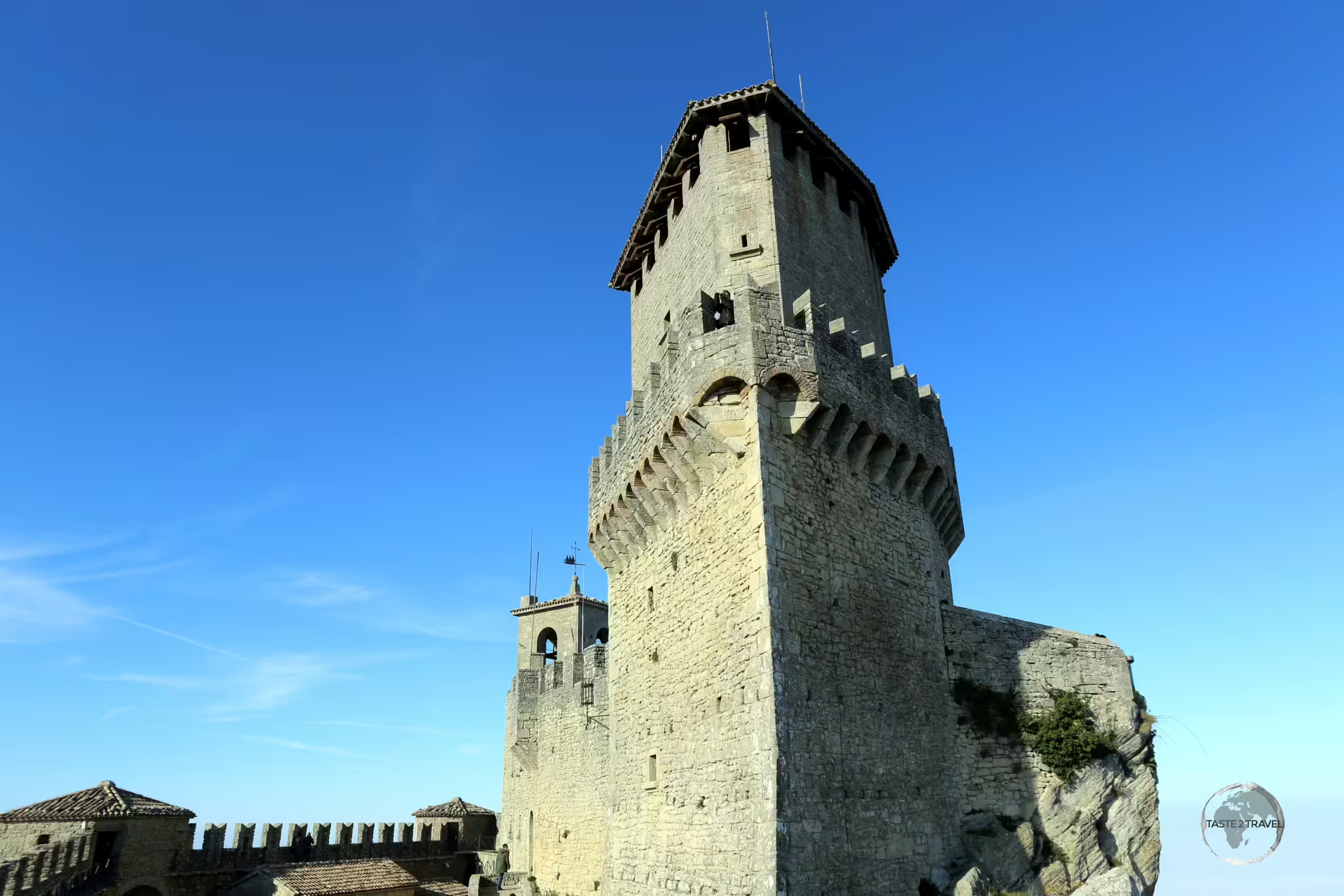
17. Which is the capital of San Marino?
Correct!Wrong!
18. Bridgetown is the capital of which country?
Correct!Wrong!
19. The capital of the Marshall Islands is?
Correct!Wrong!
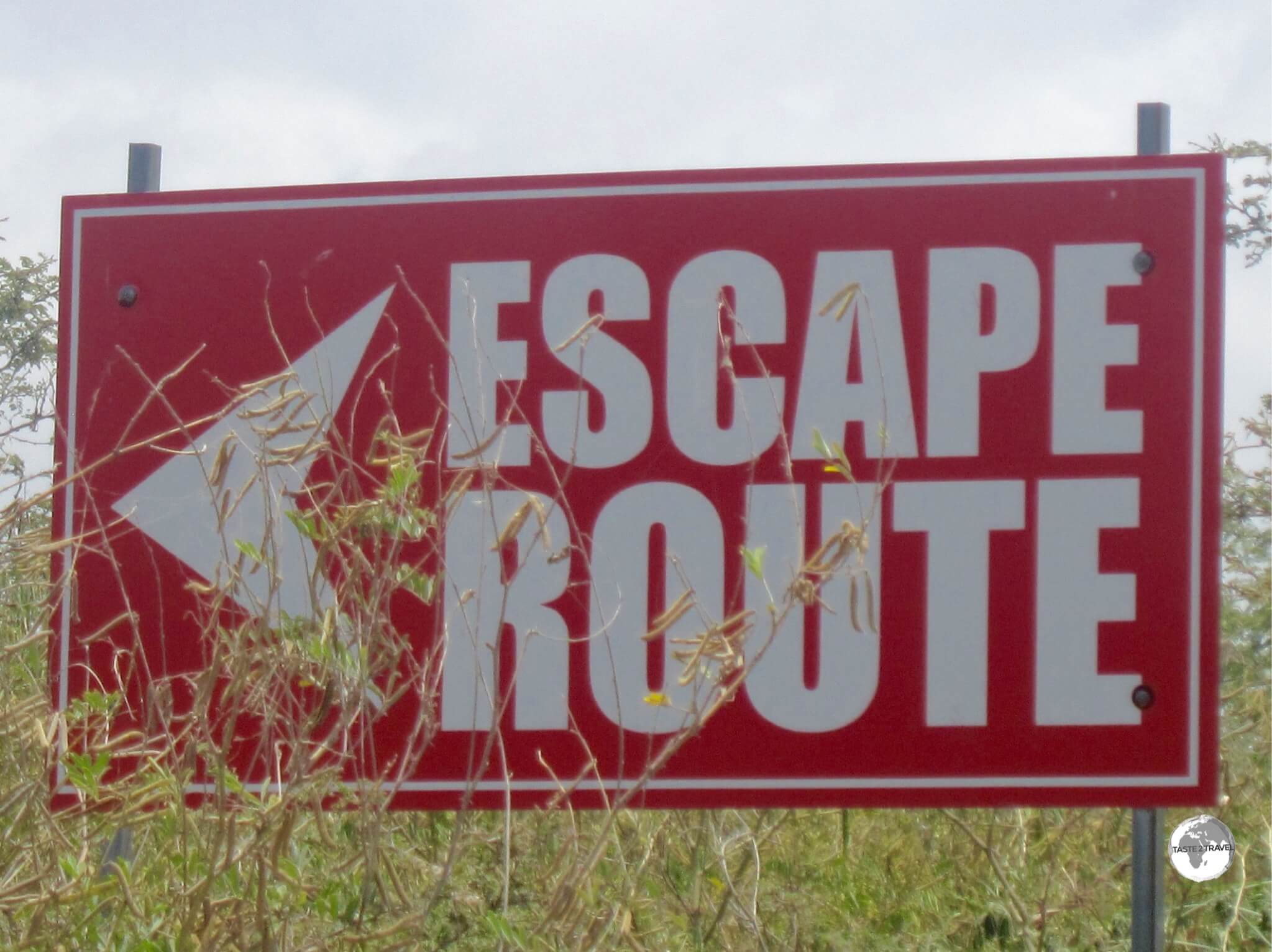
20. Although permanently abandoned following its complete destruction after a volcanic eruption, Plymouth is still the 'de jure' capital (making it the only ghost town that serves as a capital) of which territory?
Correct!Wrong!
Travel Quiz 09: World Capital Cities
Sorry! You scored less than 50%. Why not try one of the other taste2travel trivia quizzes?
You scored less than 75%! Why not try one of the other taste2travel trivia quizzes?
Very Good - a gold star performance! Why not try one of the other taste2travel trivia quizzes?
Excellent result! You're a modern day Marco Polo. Why not try one of the other taste2travel trivia quizzes?
Share your Results:
Travel Quizzes on taste2travel
Welcome to taste2travel!
My name is Darren McLean, I’m the owner of taste2travel and I love travel trivia and I certainly enjoy creating travel quizzes.
There are a total of 80 different travel quizzes on taste2travel, with each quiz containing 20 questions.
That’s a total of 1,600 trivia questions waiting to challenge you.
You’ll find a range of quizzes covering such topics as:
Currencies
Flags
Capital Cities
UNESCO World Heritage Sites
World Museums
Map Quizzes
Continent-specific Quizzes
World Islands
Landlocked Countries and much more!
Don’t forget to share these quizzes with your family, friends and community using the social media buttons at the top of the quiz.
Apart from excellent travel quizzes, you’ll also find other outstanding content on taste2travel – such as travel guides, photo galleries and feature articles which provide tips on booking cheap flights and much more.
Welcome to the taste2travel Tokelau Travel Requirements guide!
Revision Date: February 2025
Update
Tokelau Travel Ban Remains in Place for 2025!
Note:
Fully revised in February 2025, information for this guide has been provided by the Tokelau Department of Transport & Support Services team who staff theTokelau Apia Liaison Office, which is located in Apia, Samoa.
The Tokelau Apia Liaison Office is the sole issuer of travel permits to Tokelau.
Important Update (February 2025):
Currently, the three atolls have a travel ban in place for all visitors.
This also includes a ban on any visitors travelling on the supply ship for the purpose of performing an ‘in-transit’ visit – i.e. travelling from Apia to Tokelau and back to Apia, without leaving the ship.
The travel ban was first implemented in 2020 at the start of the Covid-19 pandemic.
This ban has yet to be lifted!
I’ve received feedback from several travellers who have requested travel permits for Tokelau and these have been refused due to the travel ban.
The advice received from the Tokelau Apia Liaison Office is that the ban will continue to remain in place until the end of 2025.
I have today (12/02/2025) received the following email from Elsie Foua at the Tokelau Apia Liaison Office:
——
Hi Darren,
Thank you for your email in regards to visiting Tokelau.
Please be advised that the borders to Tokelau are currently closed to Visitors until further notice.
We strongly recommend that you refrain from purchasing tickets as we are not liable for any financial loss.
However we encourage you to check our office later on in the year to check whether the ban has been lifted.
If you have any further queries please do not hesitate to contact us via email.
Kind regards,
Elsie.
Elsie Foua Executive Officer – Department of Transport & Support Services
The aim of this post is to outline the process for obtaining a travel permit to visit the remote New Zealand territory of Tokelau.
The application process is long and convoluted (1-2 months) and would discourage all but the most dedicated of travellers.
Originally, in 2018, I arrived in Apia thinking I could jump on the next boat to Tokelau, but – once briefed on the process, realised this would not be possible with even the one month I had.
The information contained in this post is based on a meeting I had at the Tokelau Apia Liaison Office in Apia in 2018, with the then-manager, MargaretPedro.
Margaret has since left the office!
The office is operated by the Tokelau Department of Transport & Support Services who are the sole issuers of travel permits to Tokelau.
Without a permit, you will not be allowed to board the supply ship which sails between Apia and Tokelau.
The only people exempt from this process are New Zealand passport holders (who are not Tokelauan), who can remain in the territory for up to 10 days without a permit.
The only way of reaching Tokelau is on board the MV Mataliki supply ship, which sails two or three times per month from its home port of Apia, Samoa – 500 km south of Tokelau.
It’s important to stress that you cannot show up in Apia and expect to sail to Tokelau on a whim.
The approval process (once you have submitted the required documents and paid the required fee) can take one month or more!
Did you know?
The first people to settle on Tokelau were Polynesians.
Tokelau has fewer than 1,500 inhabitants, the fourth-smallest population of any sovereign state or dependency.
Tokelau came under the administration of New Zealand in 1925.
Tokelau is a self-administering territory of New Zealand.
The Government of Tokelauwebsite provides a wealth of information and news on Tokelau.
The highest point on Tokelau is five metres above sea level.
The atolls of Tokelau are at risk from rising sea levels caused by global warming.
Tokelau is the only country in the world which generates 100% of its power from Solar sources.
Internet and telephone services are provided through Teletok, a monopoly, government-owned operator.
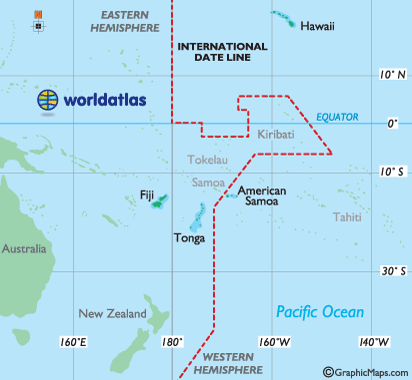
Location & Geography
Tokelau is located halfway between New Zealand and Hawaii. Other nearby islands include Samoa and American Samoa (507 km to the south); Tuvalu(1,178 km to the west); Tonga(1,379 km to the south) and Kiribati (733 km to the northeast).
A map showing the remote location of Tokelau. Source: BBC
The territory consists of three atolls, with the most northern being Atafu, then Nukunonu, to the southeast, then the most southern atoll of Fakaofo. Nukunonu atoll is 4.7 sq. km in area, while Fakaofo is 4 sq. km and Atafu is 3.5 sq. km.
Flag
The flag of Tokelau.
The flag of Tokelau depicts a Tokelauan canoe sailing towards the Southern Cross constellation.
The Southern Cross has served as an important navigational aid for generations of Tokelauan fishermen, helping them to navigate the waters around Tokelau.
Tokelau Apia Liaison Office
The Tokelau government does not maintain diplomatic missions anywhere in the world, however, the closest such thing is the Tokelau Apia Liaison Office and it’s here where you’ll find the very helpful and friendly Support Services team, which is part of the Tokelau Department of Transport & Support Services.
Contact details for the Tokelau Apia Liaison Office:
Email: All visitor enquiries should be direct to either Elsie Foua or Alofa Aleta at:
At the time of document submission, the Support Services team will provide bank details of an account where you’ll need to deposit the application processing fee of NZ$100.
Ferry Bookings
The Tokelau Transport Officer, Pio Alainuuese, is responsible for booking ferry tickets to Tokelau.
Pio will consult with you to make tentative ferry bookings. Once your application has been approved, your bookings will be finalised.
You can contact Pio at the following email address:
Once you’ve paid your processing fee and submitted all completed documents, the Support Services team will forward your application to the Council of Elders (Taupulega) on each atoll you wish to visit.
Each of the three atolls are governed separately, with each Taupulega making its own determination regarding immigration matters, hence if you apply to visit all three atolls, you’ll need approval from all three councils. The application process requires the council to meet and discuss your application and can take up to one month.
Approval
Once your application is approved, the Support Services team will liaise with you to finalise your ferry and accommodation bookings. Then you’re on your way!
Accommodation
Limited accommodation options are available on all three islands. If you wish to stay on one, or more, of the islands, you must organise your accommodation directly with the respective Taupulega Offices (Administration Offices) on each of the islands on which you intend to stay.
Important: When booking accommodation, you should first consult the sailing schedule for your particular voyage. This will determine the duration of your stay on Tokelau.
Getting There & Away
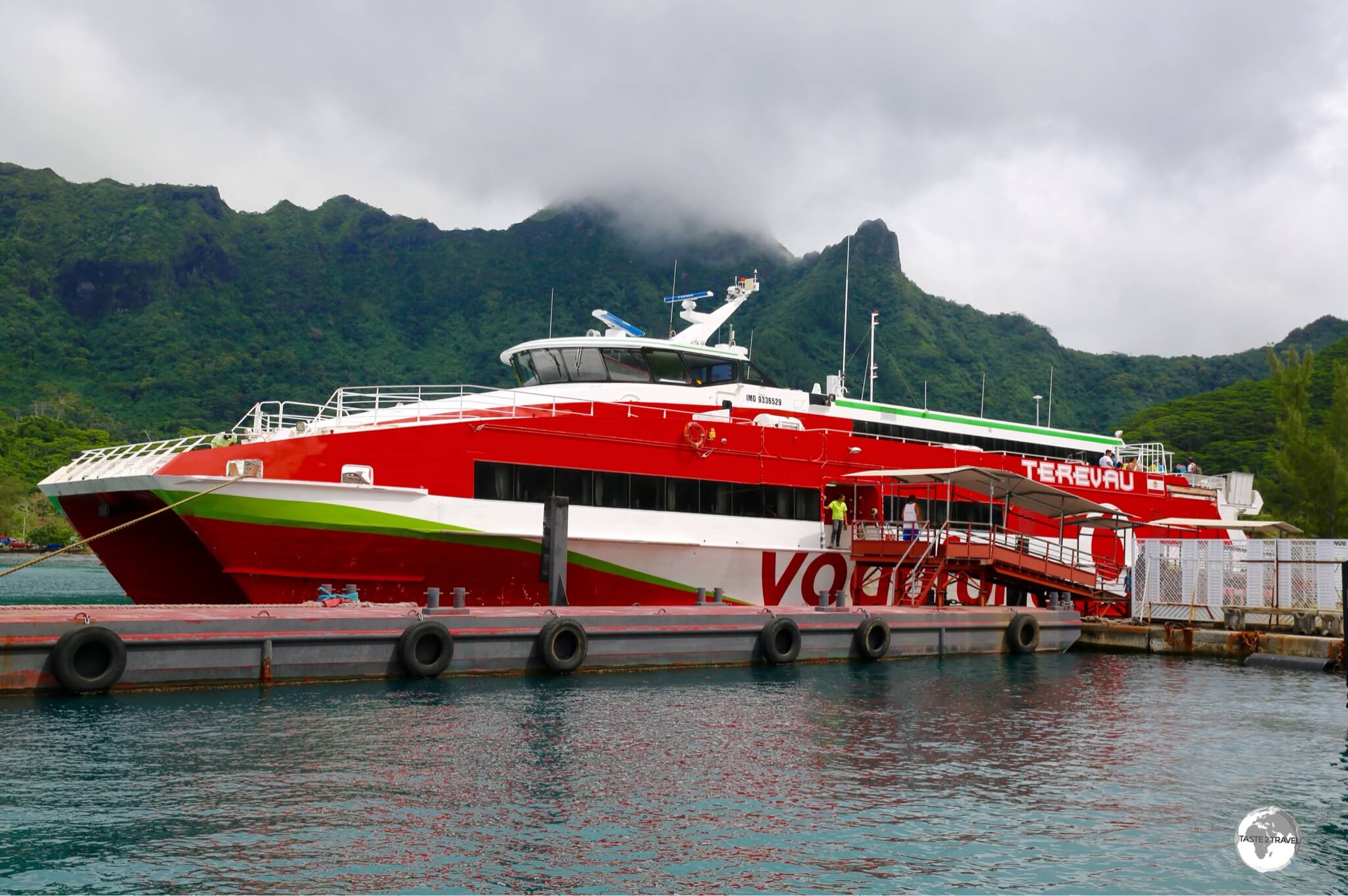
MV Mataliki
The “MV Mataliki”, seen here docked in Apia harbour, was donated to Tokelau by the NZ Government in 2016.
The only way to reach Tokelau is aboard the government vessel, MV Mataliki, which carries both passengers and (non-dangerous) freight from its home port of Apia to Tokelau.
MV Mataliki Sailing Schedule
A published sailing schedule is available online, but is subject to change and does change.
On average the ferry makes two or three round trips each month from Apia.
The Support Services team will confirm sailing dates once you are ready to book a ticket. Boats are often booked-out in advance and priority is given to locals. It’s best to be flexible and book well in advance.
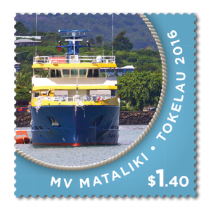
A Tokelau stamp featuring the MV Mataliki.
Travel time from Apia to the various atolls ranges from 24-32 hours.
The ferry leaves Apia in the early morning on the day of departure, arriving the following morning (24 hours later) on the southern atoll of Fakaofo.
After a 3-hour transit stop, the ferry continues onto Nukunonu, arriving later the same day.
After another 3-hour transit stop the ferry sails to the most northern atoll of Atafu, arriving the next morning.
After another 3-hour transit stop, the ferry sails back to Apia, without stopping, arriving in the evening of the following day.
Typical Sailing Schedule
Port
Day
ETA
ETD
Activities
Apia
1
08:30
Depart Apia
Fakaofo
2
09:00
12:00
Arrive Fakaofo/ Unload Cargo
Nukunonu
16:00
19:00
Arrive Nukunonu/ Unload Cargo
Atafu
3
07:00
10:00
Arrive Atafu/ Unload Cargo
Apia
4
18:00
Arrive Apia
It is possible to travel on the ferry from Apia back to Apia, spending just the transit time on the islands, however, you will still be required to obtain a visitors permit.
The Support Services team have advised that, the only tourists that will be allowed to board the ferry in Apia are those who have an approved Visitors Permit for Tokelau (whether staying on the islands or not).
The returnfare (which includes all meals) is NZ$286, which can be paid to the Support Services team at their office in Apia.
MV Kalopaga
Tokelau’s “MV Kalopaga” cargo ship, seen here docked at Apia harbour.
The 2nd ship in the Tokelau government fleet is the MV Kalopaga, a cargo ship which was built in Malaysia and launched in March of 2018. Dangerous freight and other cargo is shipped to the atolls aboard this ship.
That’s the end of this report on Tokelau.
Safe travels!
Darren
Further Reading
Following is a list of other travel guides from the Pacific Ocean region:
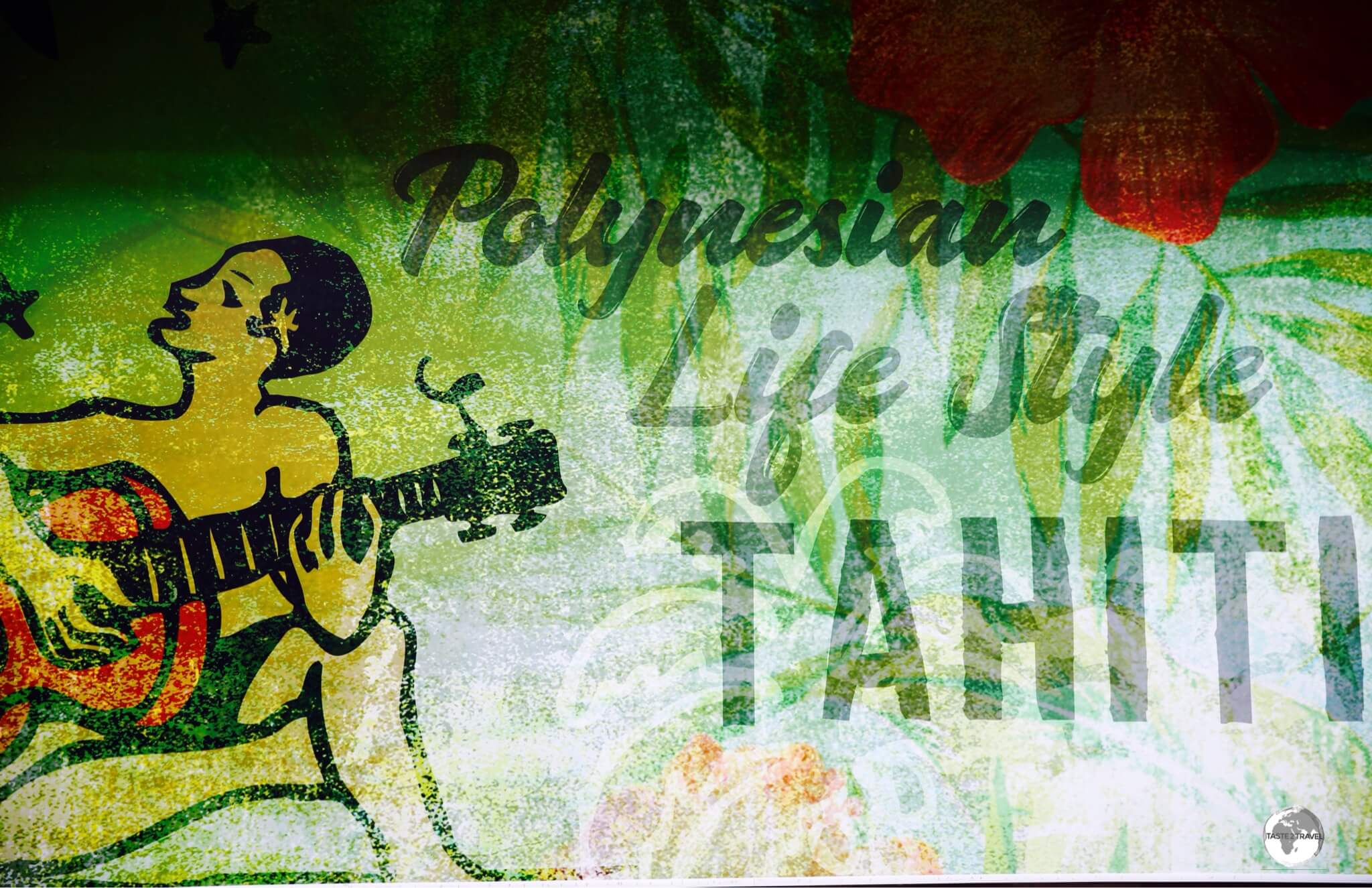
Welcome to the taste2travel French Polynesia Travel Guide!
Date Visited: August 2018 and June 2024
Introduction
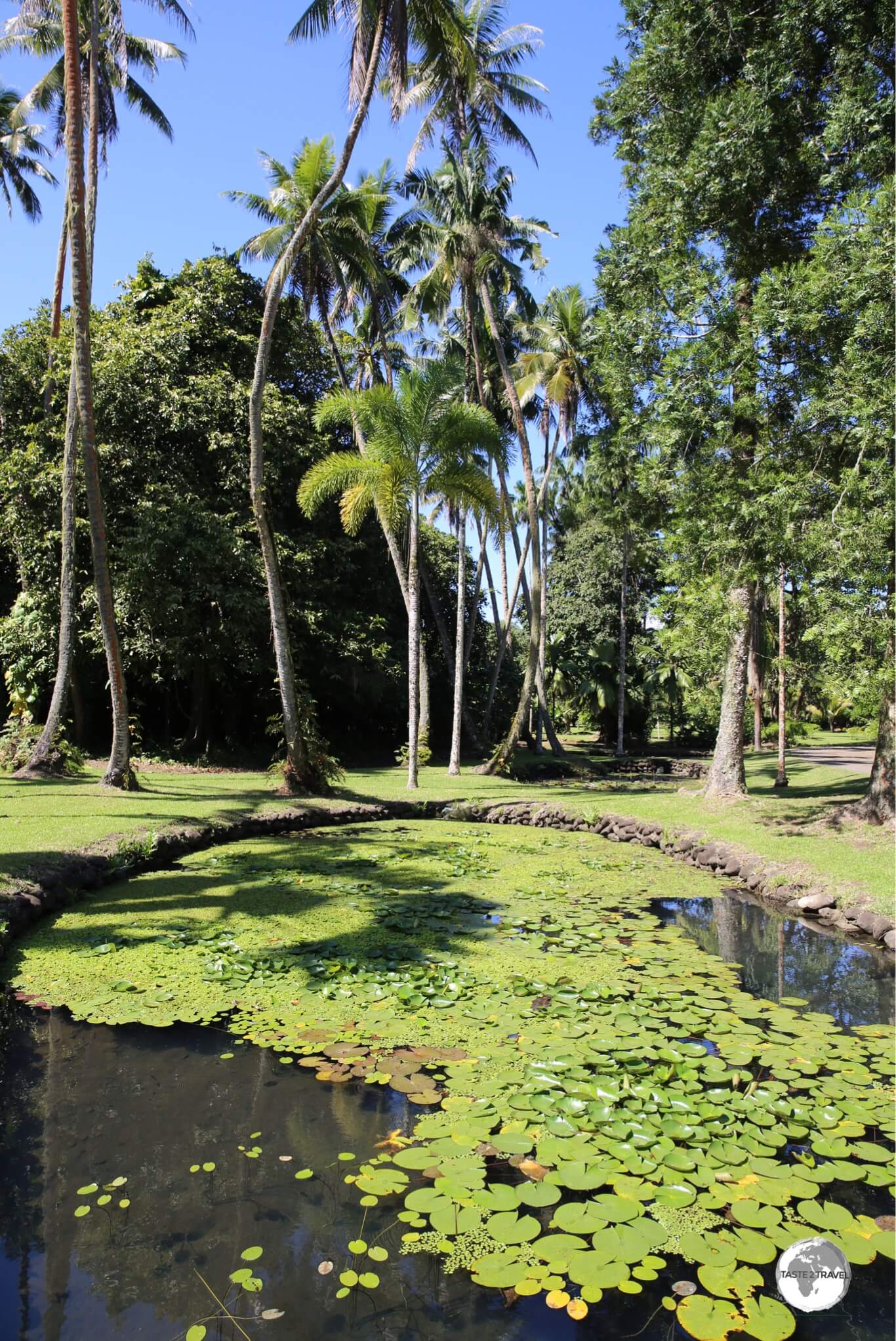
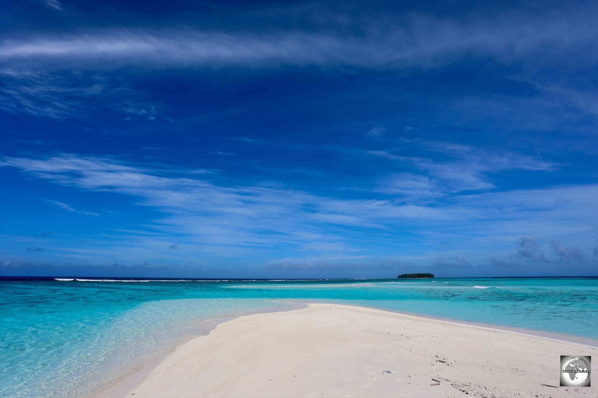
From its dazzling, turquoise-blue, lagoons to its emerald-coloured, razor-back, volcanic peaks, French Polynesia is a veritable south Pacific paradise.
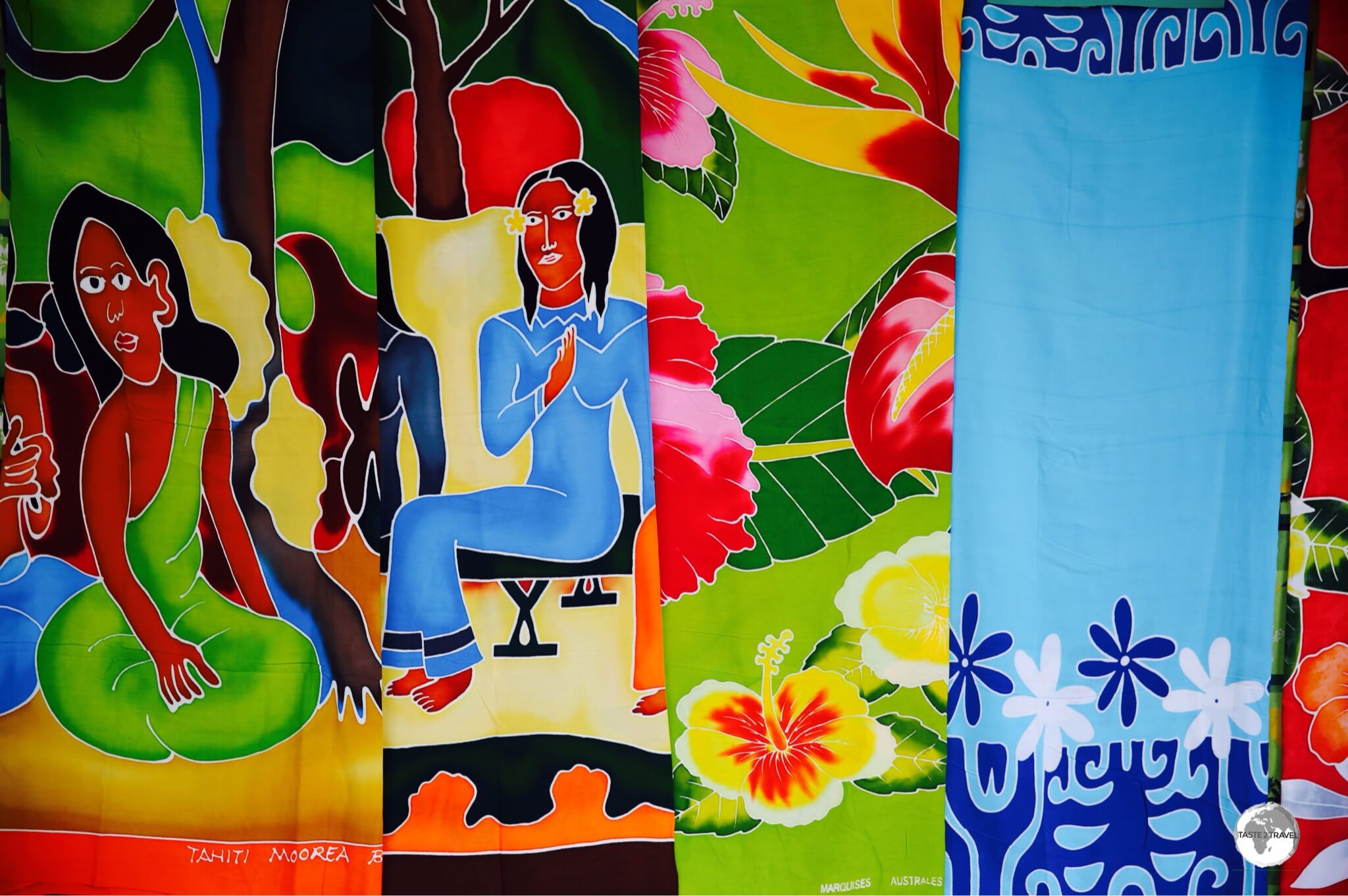
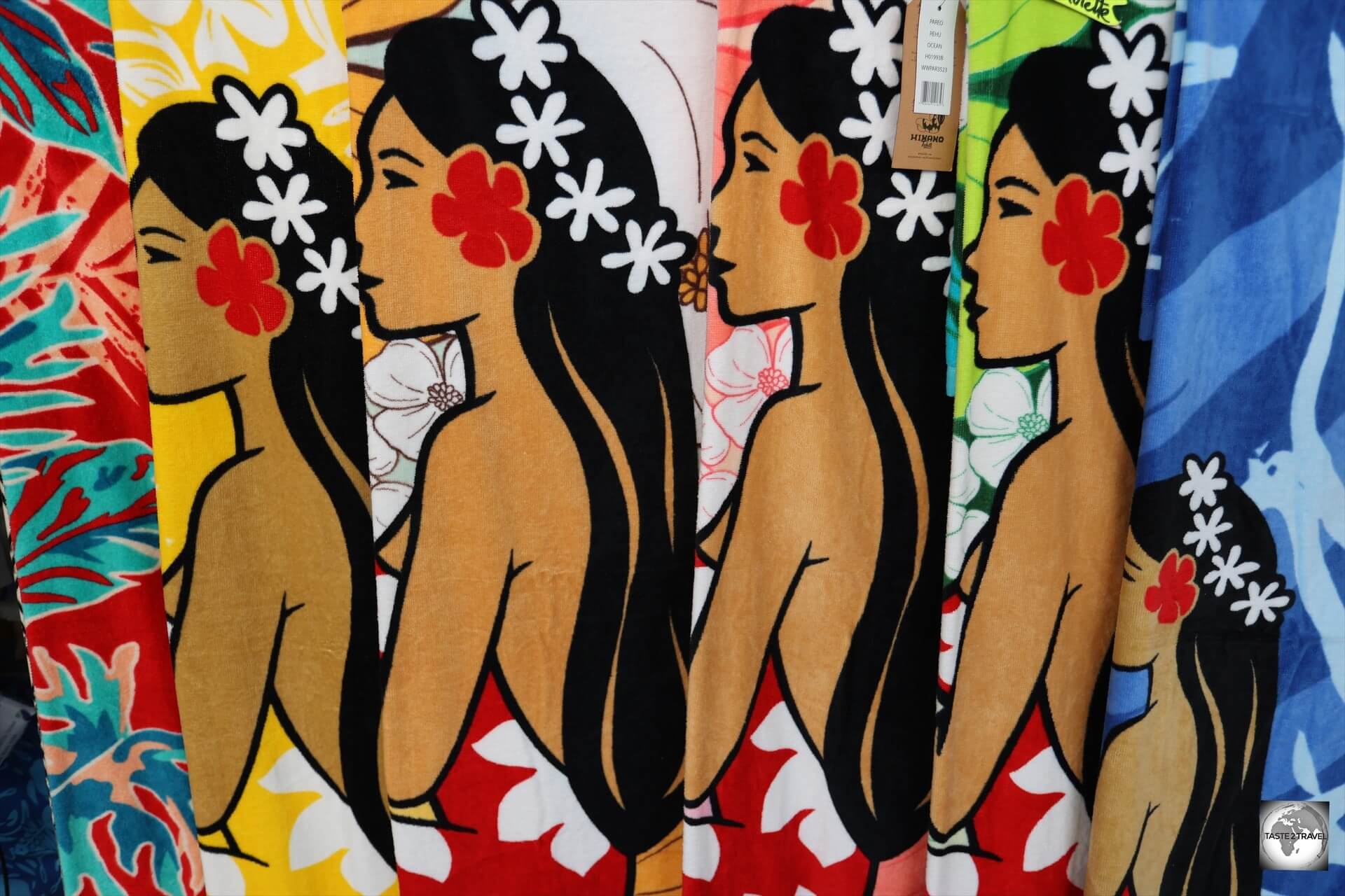
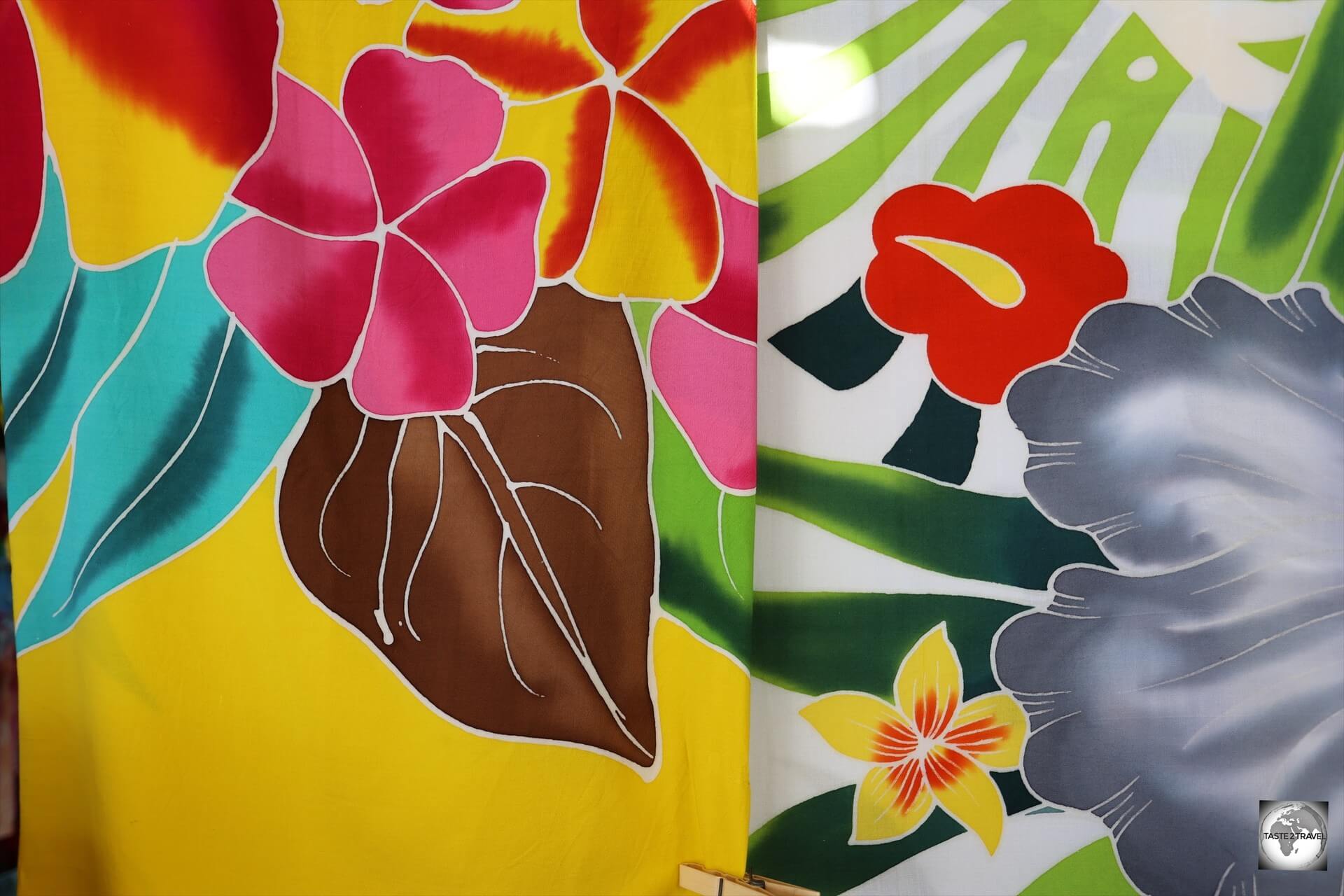
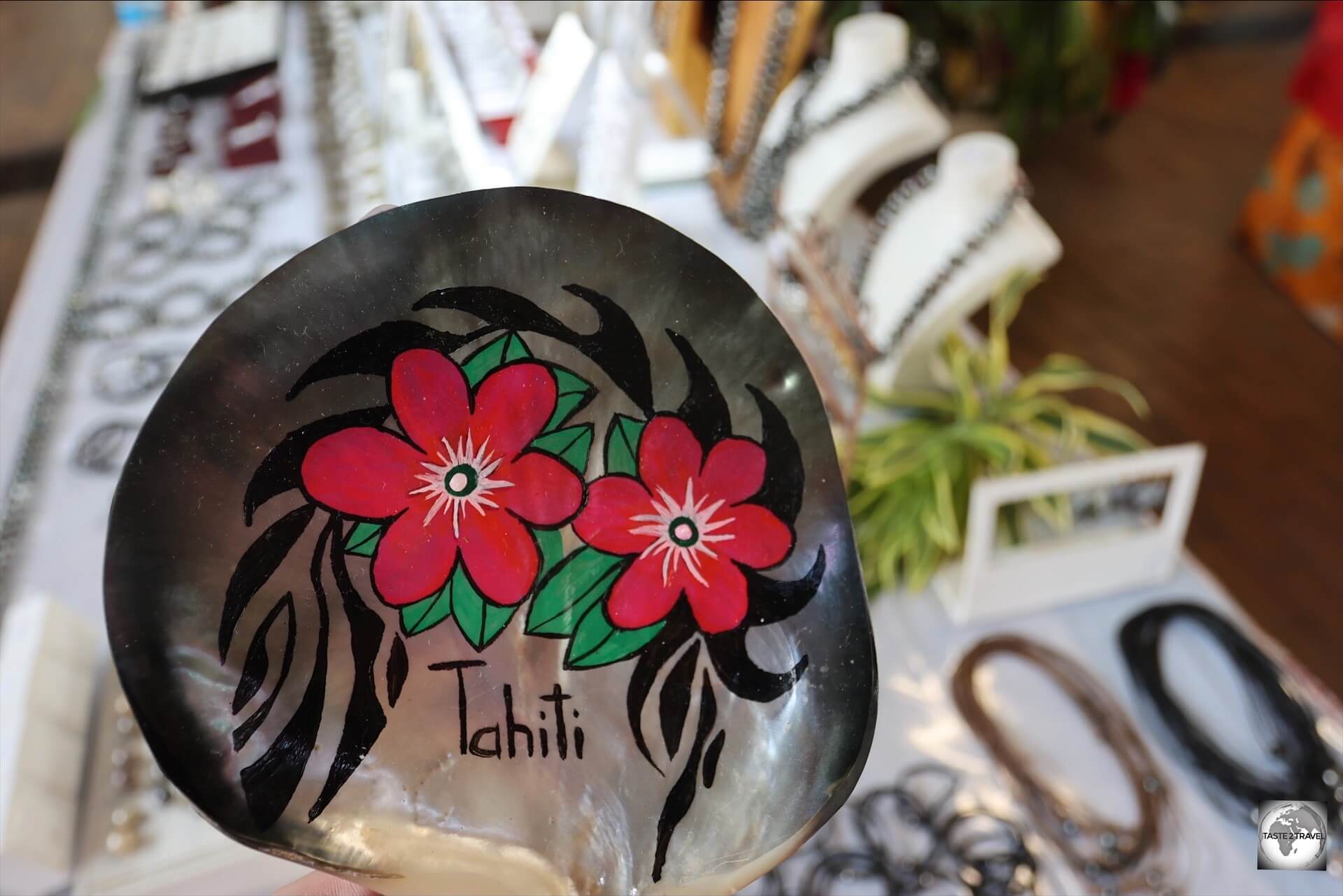
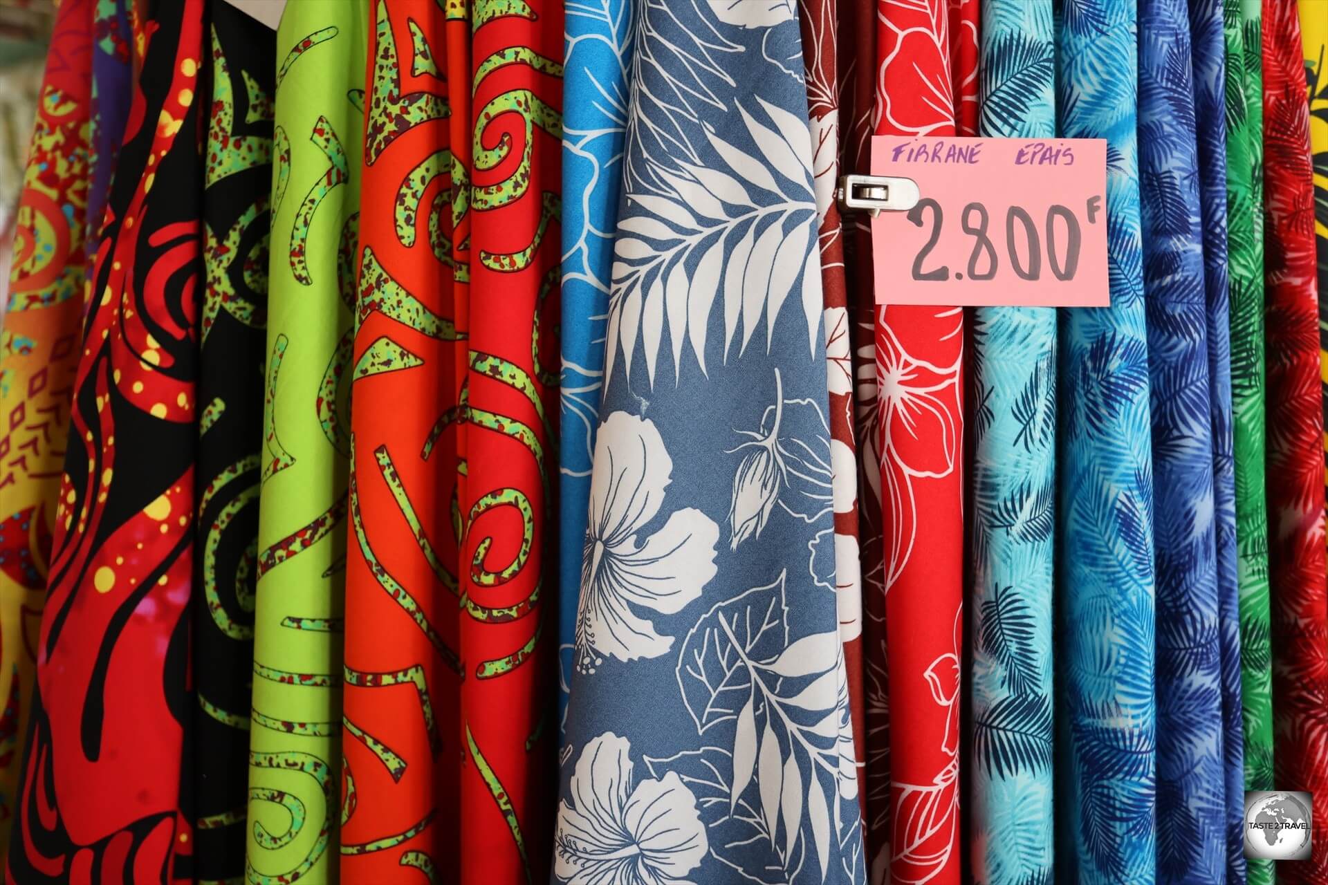
Colourful sarongs on sale at Papeete central market.
For many years, I’d dreamed of travelling to French Polynesia but the cost of flights was always prohibitive.
Then, one day recently, I learned of a little French Bee. In my opinion, the French low-cost carrier, French Bee, is the saviour of tourism in French Polynesia.
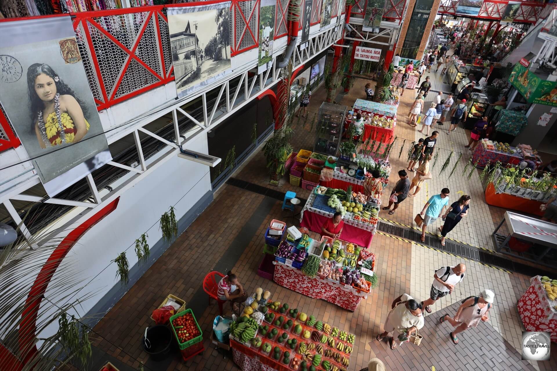
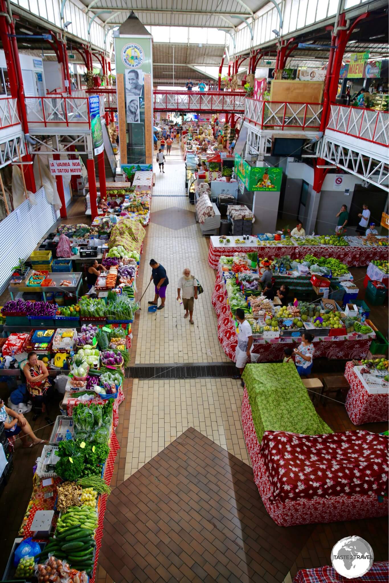
A view of the central market in Papeete, a great place for souvenir shopping.
The airline flies from its base in Paris, to a number of popular holiday destinations around the world, including Tahiti, with flights departing Paris-Orly (with a stopover in San Francisco), every Sunday, Wednesday and Friday.
Refer to the ‘Getting There‘ section below for more details on flights to French Polynesia.
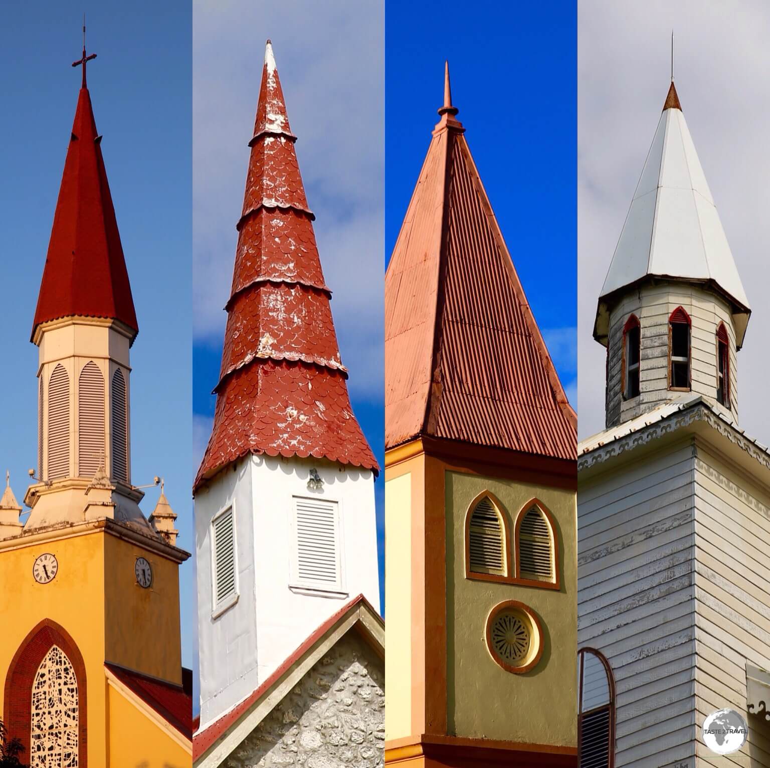
Church steeples on Tahiti.
French Polynesia has never been a cheap destination and while it’s now more affordable to reach, travel costs, once on the ground, are still high.
Handmade necklaces for sale at Papeete central market.
While ‘deluxe’ resorts are the mainstay of the tourism industry, there are plenty of smaller lodges and guesthouses which offer affordable accommodation options and the renown, roulottes(mobile food vans), serve up delicious, budget-friendly meals, each evening on the waterfront in the capital – Papeete (pronounced – [PAA] + [PEE] + [AY] + [TEE]).
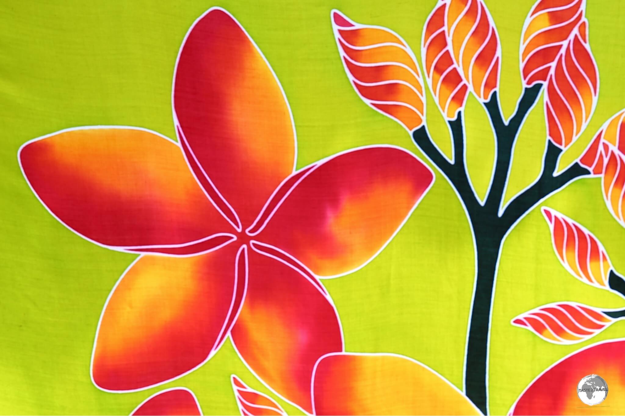
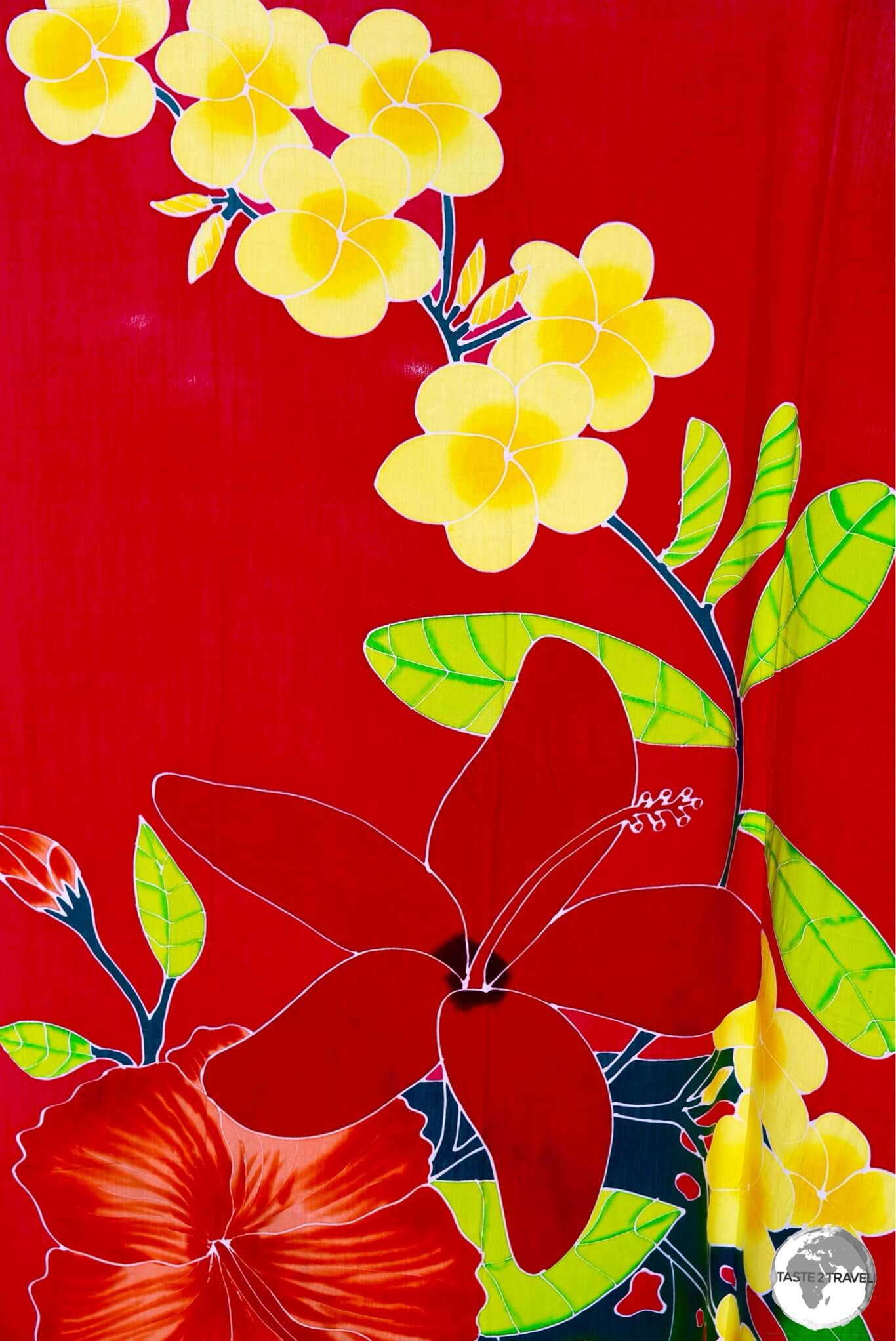
Hand-painted Batik on sale at Papeete Central market.
You could spend months exploring the 4,000 square kilometres of this vast territory, one which contains five separate archipelagos.
I have visited French Polynesia two times.
During my first visit in August 2018, I explored the main island of Tahiti and neighbouring Moorea.
Welcome to Tahiti and French Polynesia!
On my 2nd visit in June 2024, I explored the remote Gambier Islands, while en-route to the even remoter Pitcairn Island.
The Church of Saint-Gabriel, one of many historic churches on the remote Gambier Islands.
All of these destinations are covered in this French Polynesia Travel Guide.
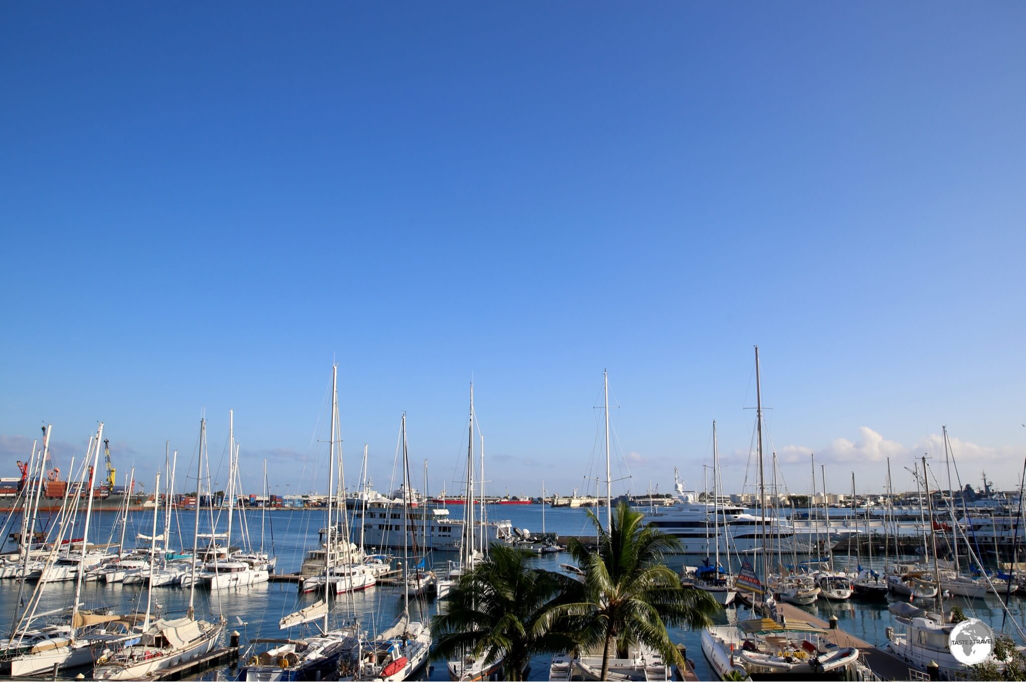
A view of Papeete harbour, the capital of French Polynesia.
I enjoyed my time French Polynesia and look forward to returning one day to explore the other archipelagos.
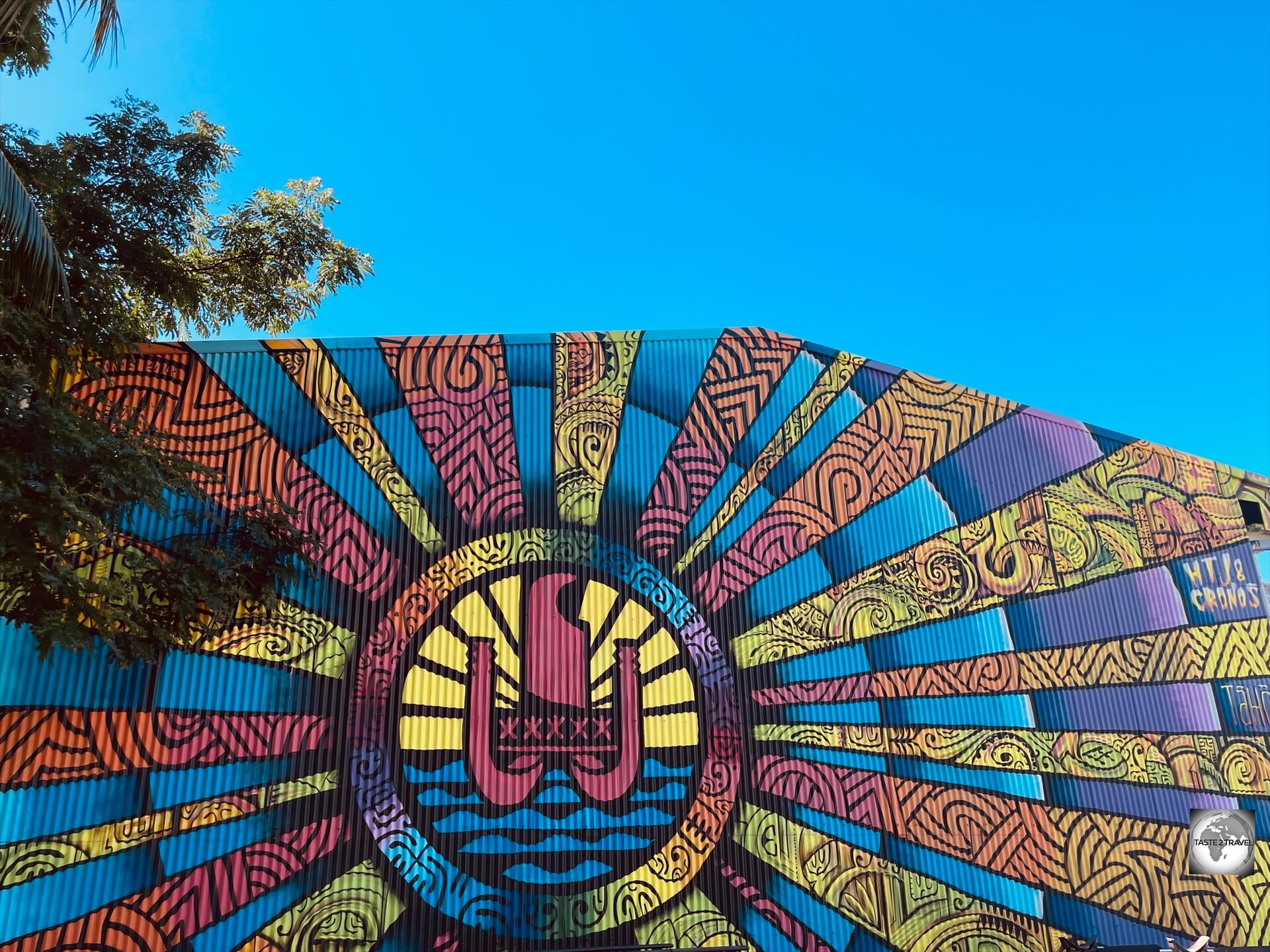
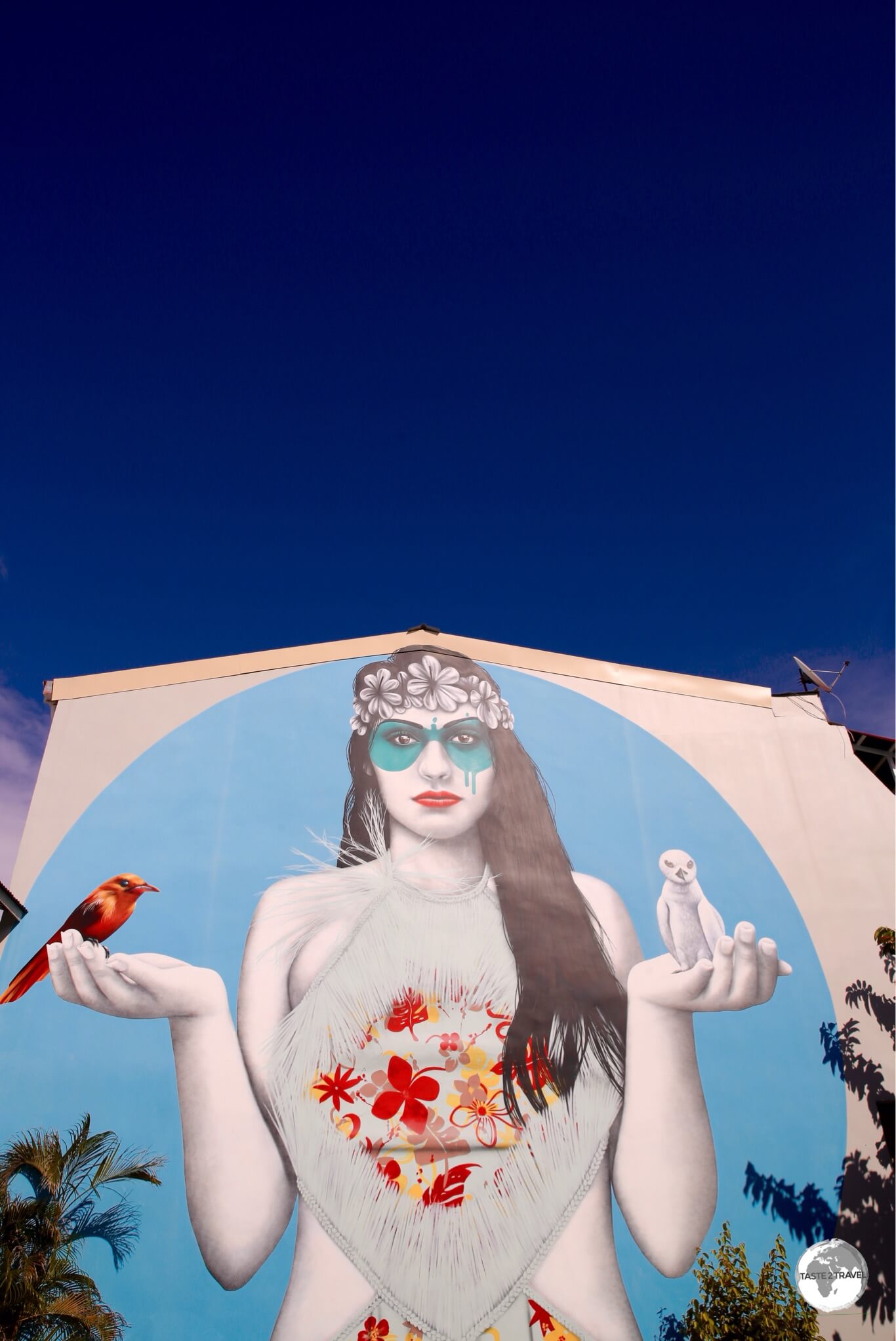
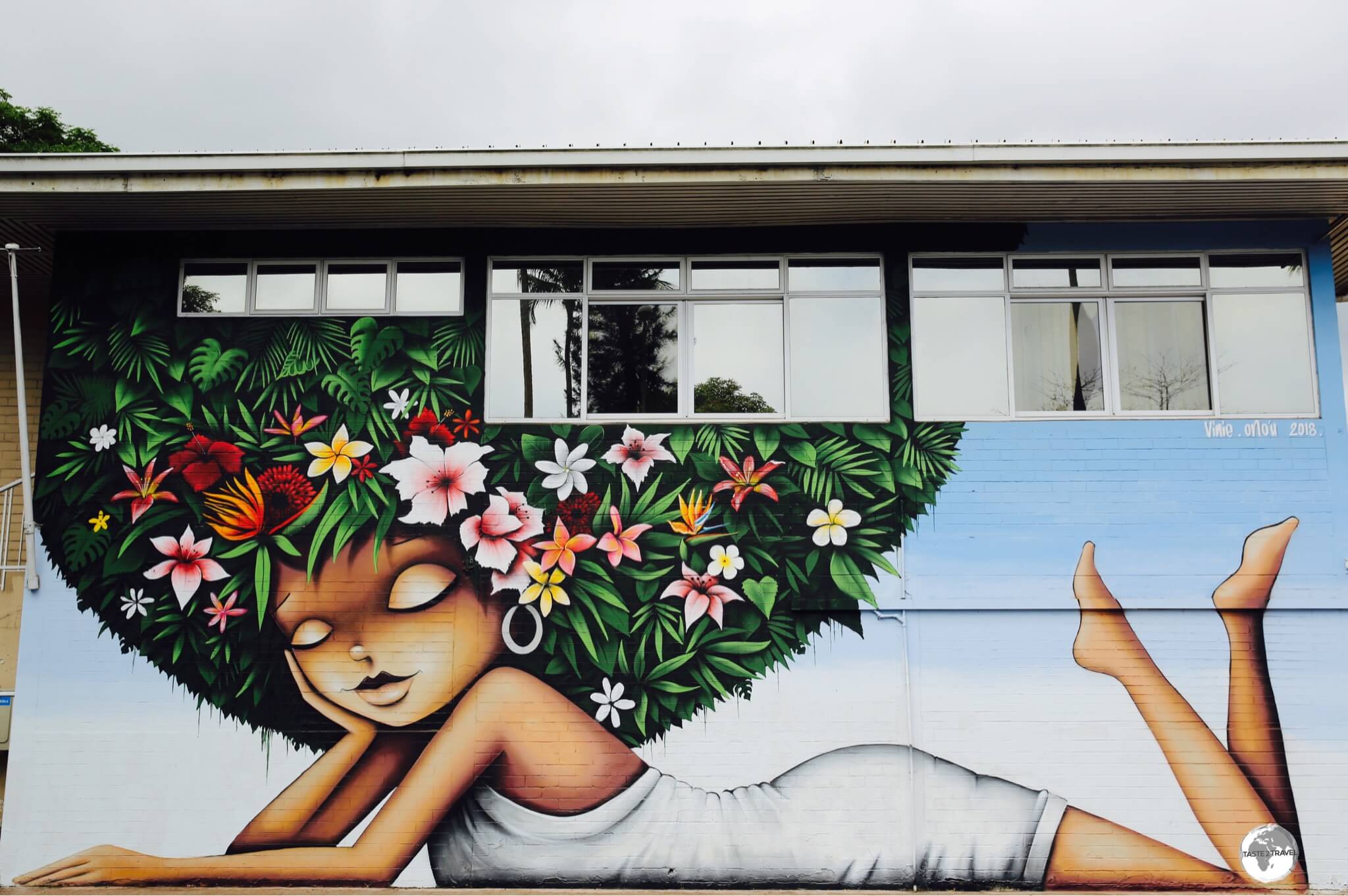
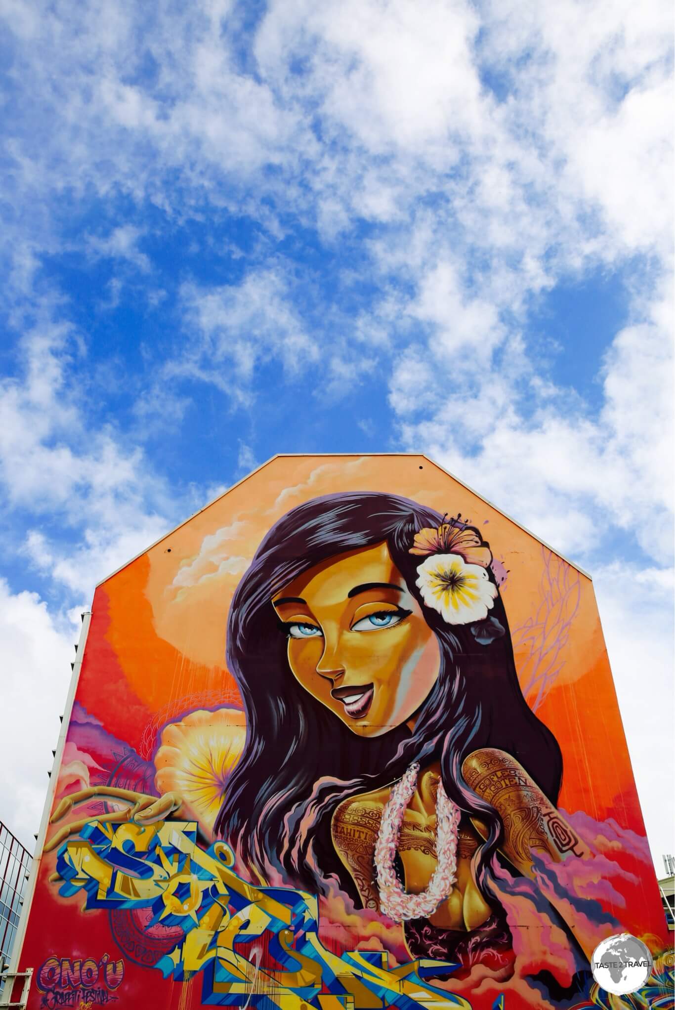
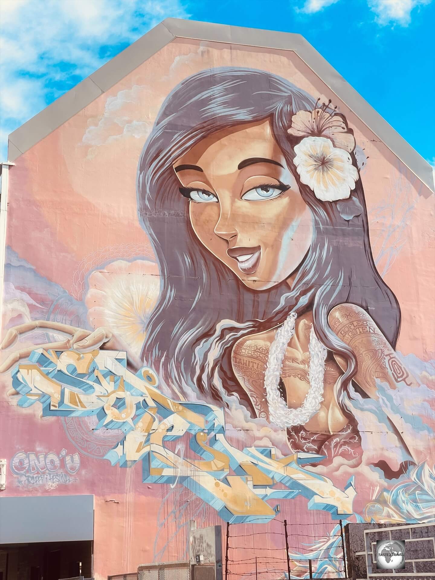
Street art in Papeete.
Location
Papeete 98714, French Polynesia
French Polynesia is located in the South Pacific, almost halfway between Australia (6,000 km to the west) and South America (7,500 km to the east).
Other nearby Pacific Island nations include (click the links to view my travel guides) American Samoa; 2,469 km (1,534 mi) to the northwest, Tonga; 2,733 km (1,698 mi) to the west, Tuvalu; 3,535 km (2,196 mi) to the northwest, New Caledonia; 4,717 km (2,931 mi) to the west and Pitcairn Island; 2,330 km (1,447 mi) to the south-east.
Bird Island, one of many islands in the Gambier Islands archipelago.
French Polynesia is comprised of 118 islands, of which 67 are inhabited.
The territory is divided into the Austral, Gambier, Marquesas, Society (home to the main island of Tahiti) and Tuamotu archipelagos, covering more than 4,000 square kilometres of Pacific Ocean – about the size of Europe!
The many islands of French Polynesia are volcanic in origin, including the main island of Tahiti Nui.
People
Polynesian Settlers
The original settlers to French Polynesia were Polynesian peoples who first migrated from Southeast Asia and Taiwan into present-day Polynesia.
It’s believed the original ancestors of the Polynesians left Taiwan 3,000 years ago, stepping from island to island across the Pacific, eventually reaching Easter Island around 700-800 AD.
A map showing the three distinct cultural regions of the Pacific. Source: Wikipedia.
These Polynesian explorers first reached the Marquesas Islands in about 200 BC, later ventured southwest, discovering the Society Islands around AD 300.
Colourful sarongs for sale in Papeete central market.
They are one of three distinct cultural groups in the Pacific Ocean, the other two being Micronesians and Melanesians.
Following are a list of travel guides I have written for each of these three regions:
The 283,000 inhabitants of French Polynesia are mostly (82%) Polynesian with the remainder of the population composed of European (i.e. French) and Asian immigrants.
Street art in Papeete.
According to the last census, 68.5% of the population lived on the main island of Tahiti with 50% of the territory’s population living in Papeete.
The buildings of the capital Papeete, feature street art which depict the local Tahitians.
Currency & Costs
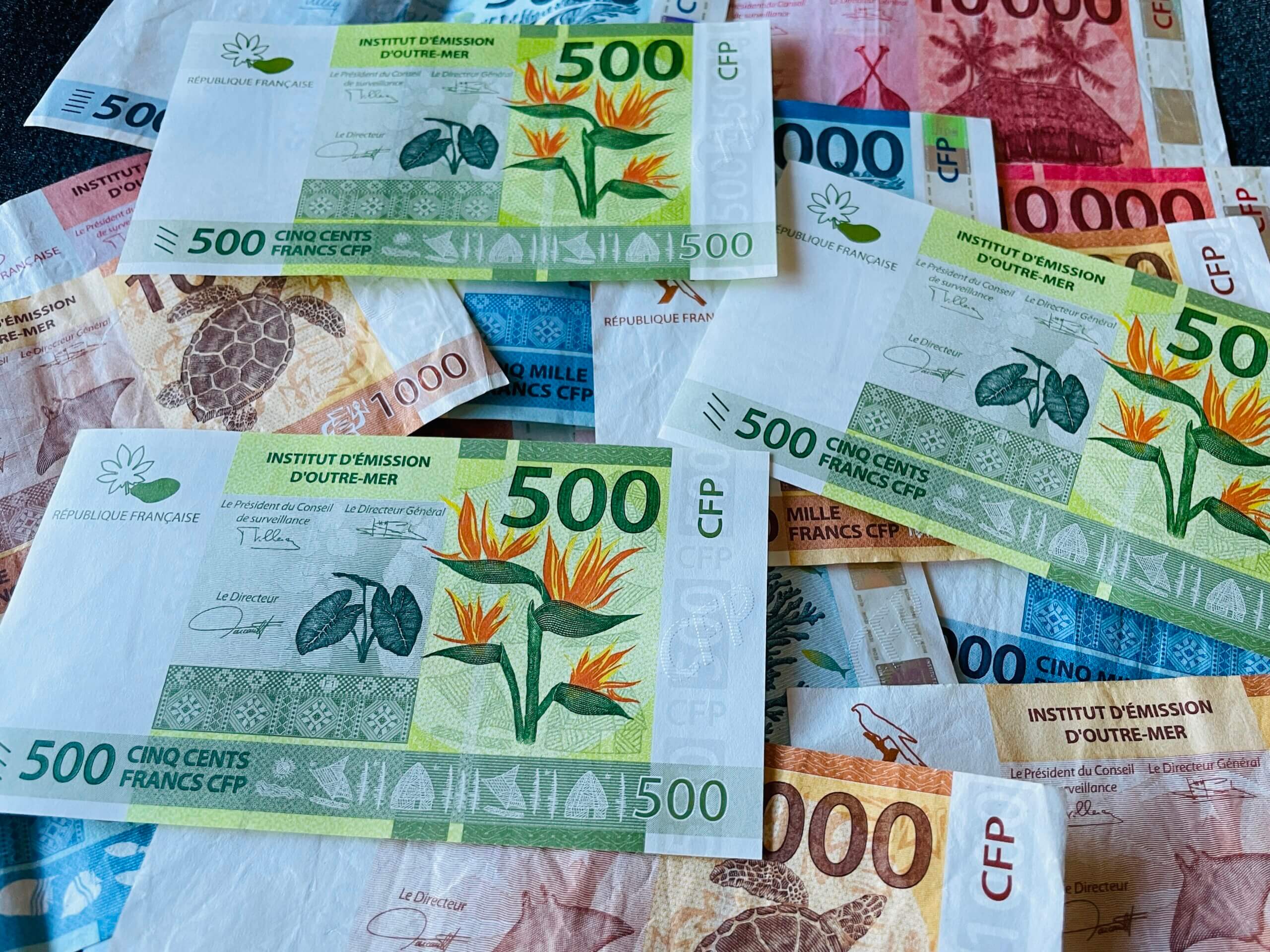
The Pacific Franc.
Currency
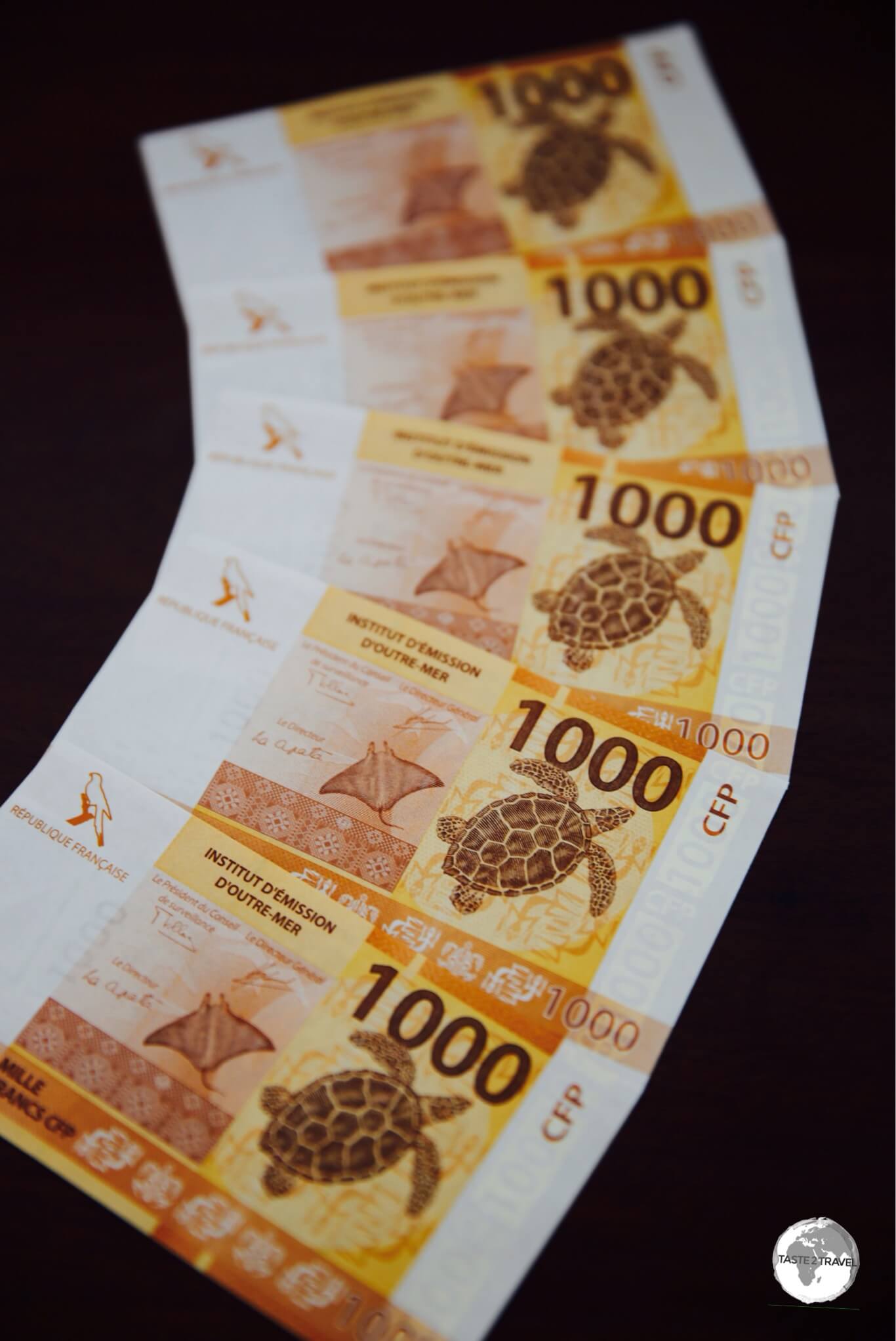
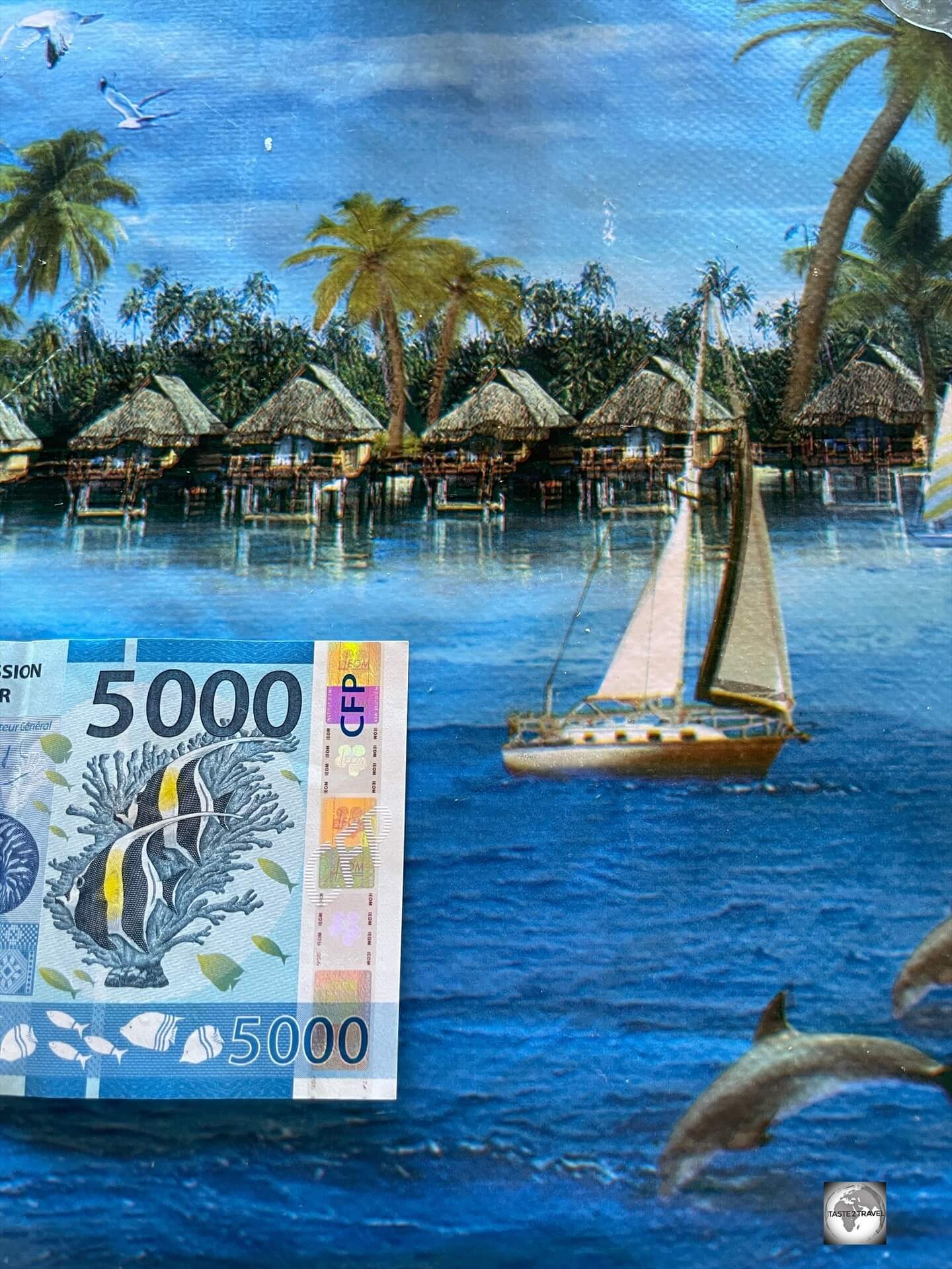
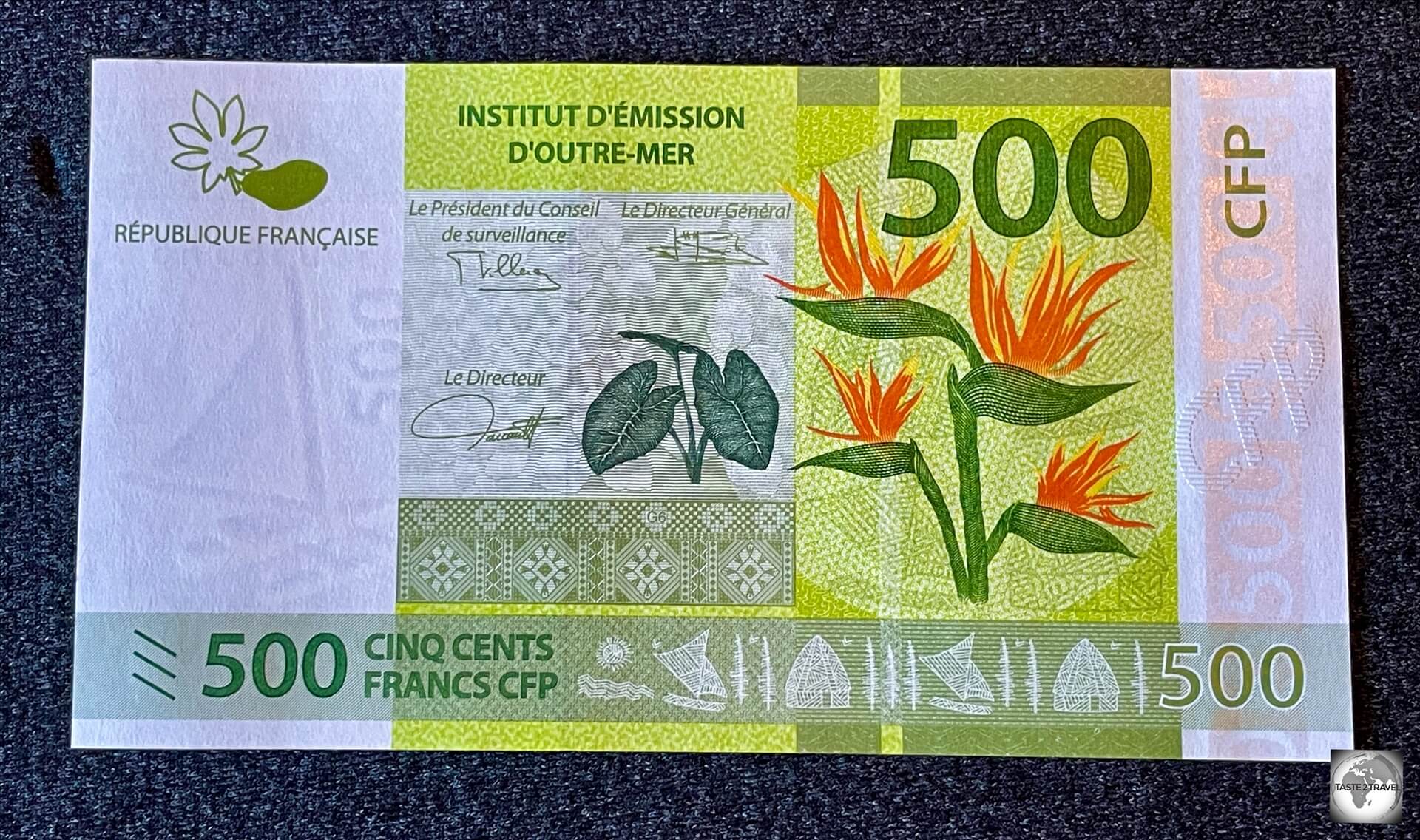
The Pacific Franc (CFP) is the currency of French Polynesia.
The unit of currency in French Polynesia is the cours de franc Pacifique (CFP), which is referred to as the ‘Pacific franc’.
The unit of currency French Polynesia is the Pacific franc.
Financial institutions abbreviate the currency “XPF“, but in this report I use ‘CFP’.
The 500-franc banknote is the lowest value note – equivalent to US$5/ EUR 5.
The same currency is used in the other French Pacific territories of New Caledonia and Wallis and Futuna.
The Pacific Franc.
Exchange Rates
The franc is pegged to the euro at a rate of 1 Euro = 119.33 CFP.
I met few budget travelers in French Polynesia and for good reason – travel costs are very expensive.
To really enjoy the territory, you’ll need a hefty travel budget.
Sample travel costs:
Room in a hostel: 7,000 CFP (USD$67)
Room in a Papeete apartment: USD$100
Room at the top-end Hilton Moorea Resort: 42,000 CFP (USD$400)
Entrée in a tourist restaurant: 1,800 CFP (USD$17)
Main course in a tourist restaurant: 2,800 + CFP (USD$27)
A pint (.5 L) of local beer: 900 CFP (USD$8.60)
A can of Coca Cola (.33 L): 475 CFP (USD$4.50)
Water (.33 L): 325 CFP (USD$3.10)
Cappuccino: 550 CFP (USD$5.26)
A combo meal at McDonald’s: 1,450 CFP (USD$14)
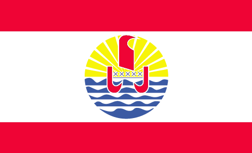
Flag
The flag of French Polynesia.
First adopted in 1984, the flag of French Polynesia consists of two horizontal red bands which surround a wider white band – the two colours being traditional Polynesian colours.
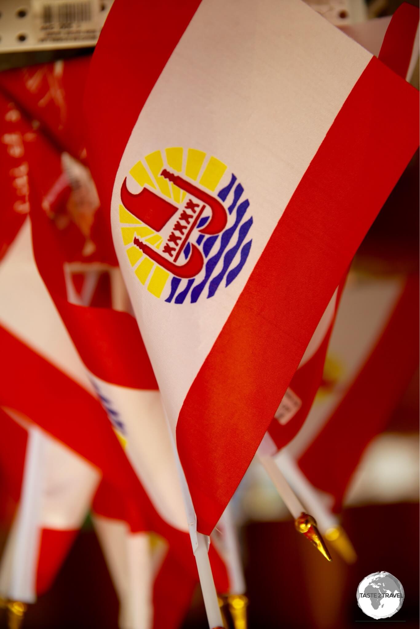
Souvenir flags of French Polynesia on sale in Papeete.
In the centre is a disk with a blue and white wave pattern depicting the sea on the lower half and a gold and white ray pattern depicting the sun on the upper half.
A Polynesian canoe, featured as street art in Papeete.
A Polynesian canoe (piroque) rides on the wave pattern; the canoe has a crew of five, represented by five stars, that symbolise the five island groups (Austral, Gambier, Marquesas, Society and Tuamotu) of French Polynesia.
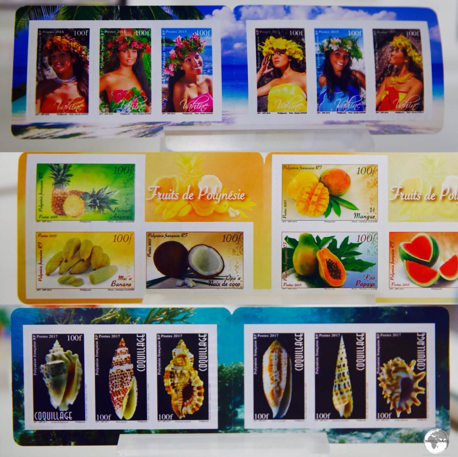
Philately
Postal services in French Polynesia are provided by the Office des Postes et Télécommunications (OPT), who produce colourful local stamps featuring the fauna, flora, culture (and pretty girls) of the territory.
The colourful stamps of French Polynesia feature local culture, fauna and flora.
Stamps can be purchased from the philatelic department of the main post office (OPT) in Papeete or online from the Tahiti Philately website.
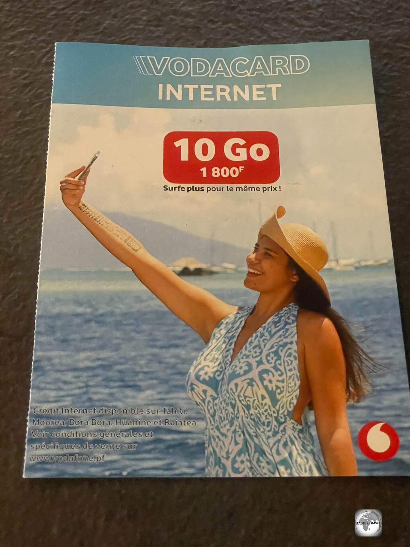
SIM Cards
A 10Gb Vodaphone SIM card can be purchased at the airport for 1,800 francs.
Local network connectivity is a must in French Polynesia, especially if you’ll be driving a rental car and using navigation.
The best deal is offered by Vodaphonewho sell a 10Gb SIM card outside the arrivals area at Papeete International Airport, for 1,800 CFP.
Sightseeing
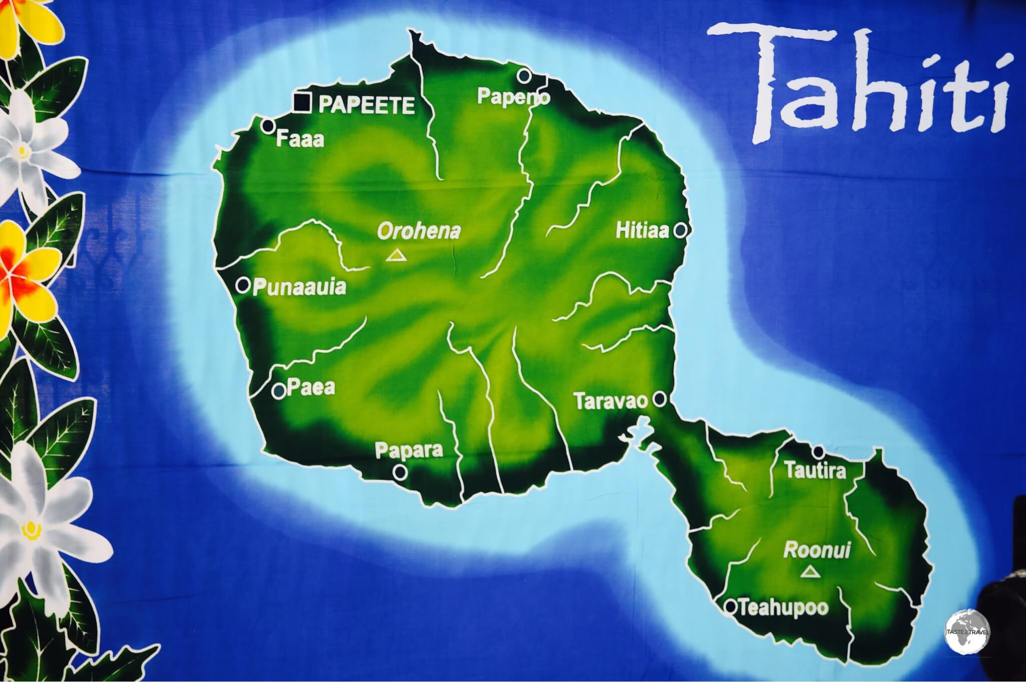
Tahiti
A map showing the larger ‘Tahiti Nui’ and ‘Tahiti Iti’ printed onto a sarong.
Tahiti is the largest island in French Polynesia and home to almost all the population. Shaped like a figure-8 (to me it looks like a turtle with Tahiti Iti forming the head), it’s divided into Tahiti Nui (the larger, western section) and Tahiti Iti (the smaller, eastern peninsula).
One of the many examples of incredible street art which adorn the buildings of Papeete.
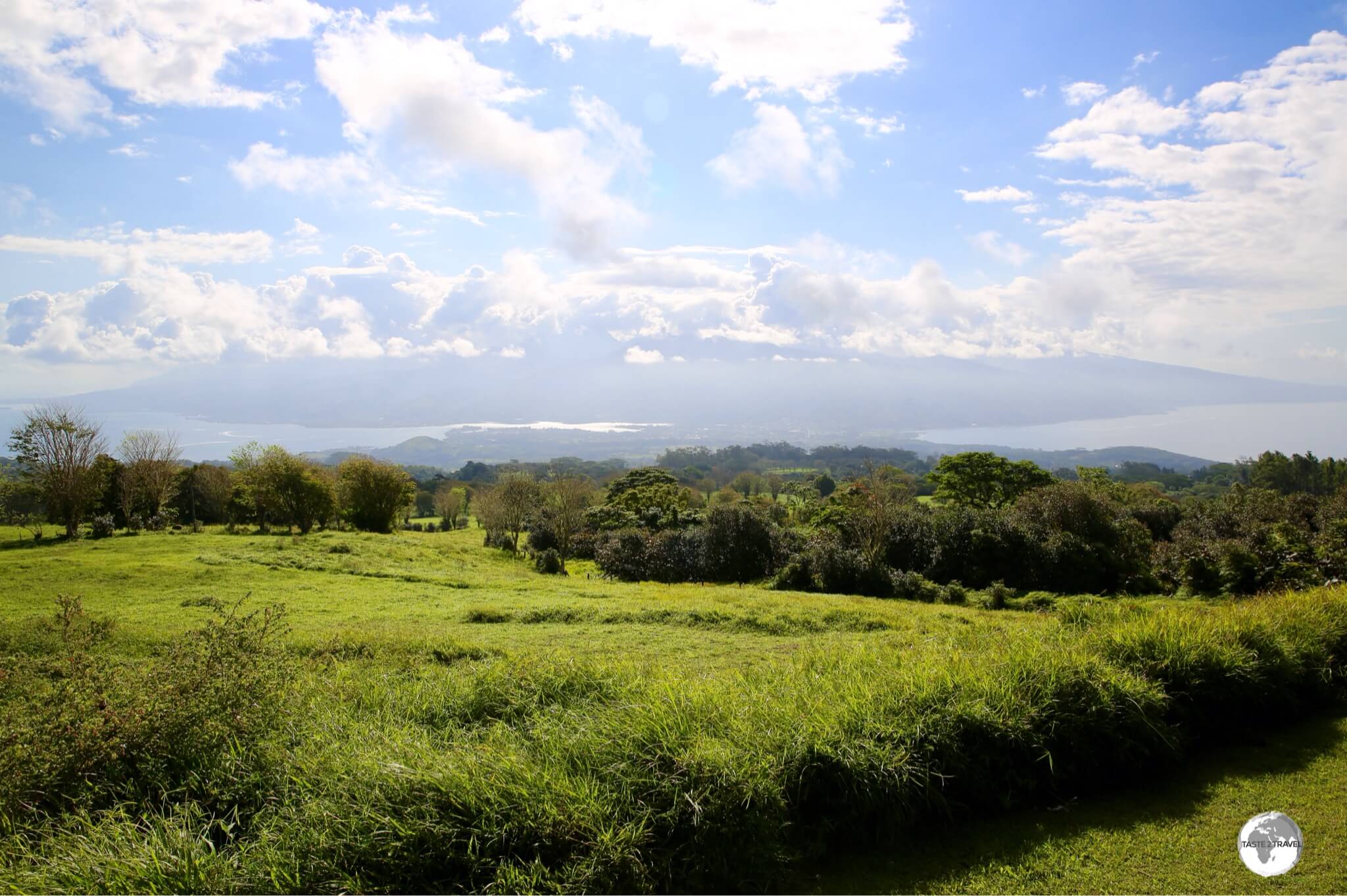
One of the highlights of Tahiti Iti was being able to climb up into the central plateau which offers panoramic views of both islands and lots of bucolic, rural scenes which are unexpected in this part of the world.
Souvenir shopping, at Papeete central market.
Papeete
Funky street art in Papeete.
With a population of 136,771 in its greater urban area, Papeete is home to 50% of the population of French Polynesia.
The city serves as the capital of the main island of Tahiti, and also as the capital of French Polynesia.
Street art adorns many buildings in downtown Papeete.
The same artwork six years later.
Offering good shopping, markets, gardens, a picturesque waterfront and a variety of cultural activities, this compact capital can easily be explored in half a day on foot.
Papeete Central Market
Locally made sarongs for sale at Papeete Central Market.
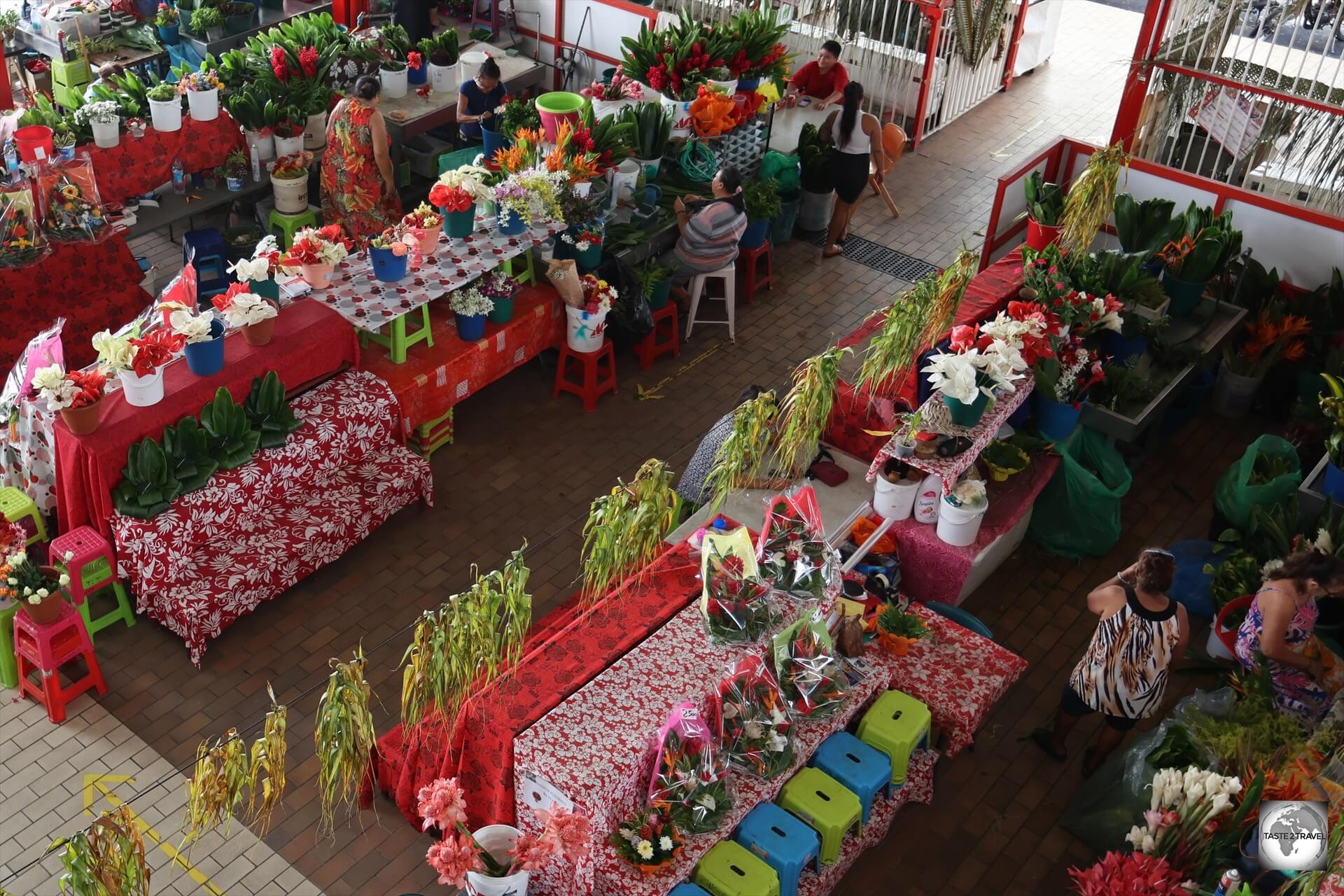
In the heart of the capital, Papeete central market should be the first stop on any walk around town.
A view of Papeete central market.
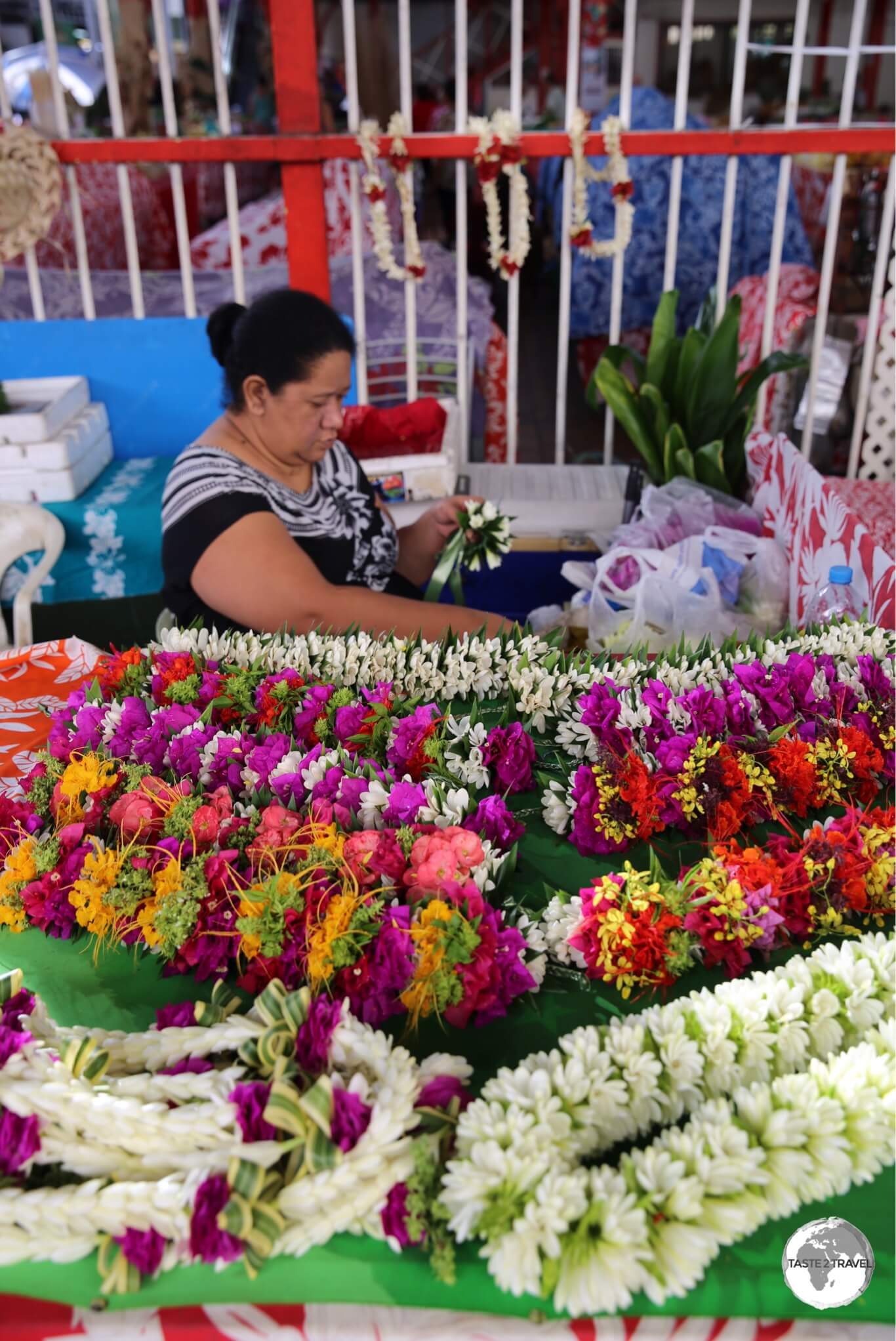
Apart from the usual fresh produce, there are plenty of souvenir stands, an upstairs foot court and flowers sellers who create spectacular boutiques using local tropical flowers and plants.
Flower seller at Papeete Central Market.
The market is lively and vibrant and a good place to meet friendly locals and is open on Sunday morning, when everything else in town is closed.
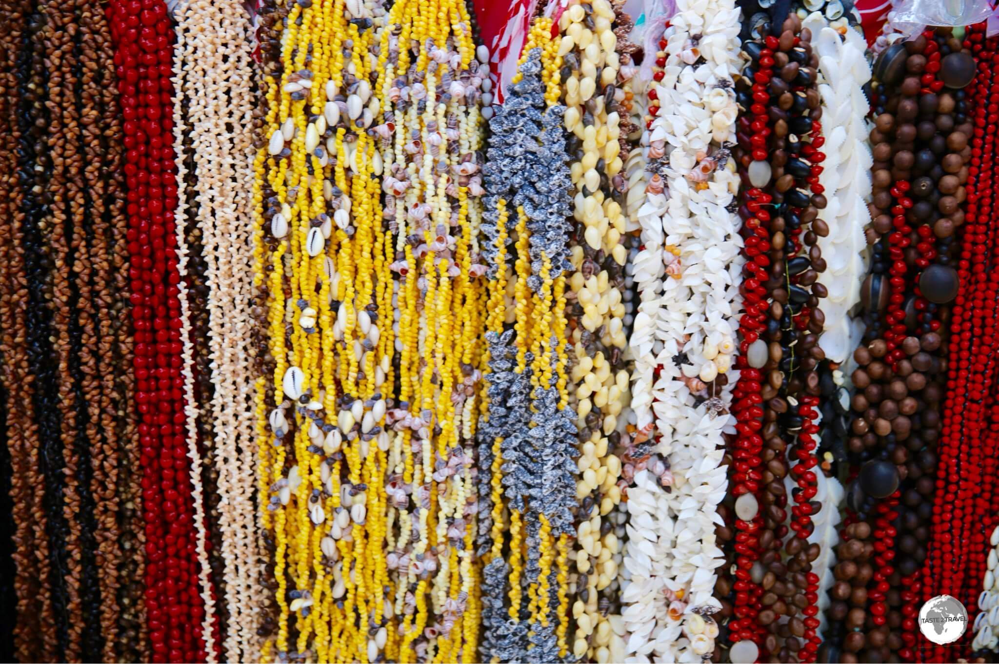
Souvenir shells on sale at Papeete Central Market.
If you wish to buy local souvenirs, clothing, fruit, vegetables, flowers, or a kilo of fresh tuna, this is the place to do it.
Flower sellers at Papeete central market.
As with everything else in this Pacific paradise, nothing is cheap, with a locally made sarong costing around US$28!
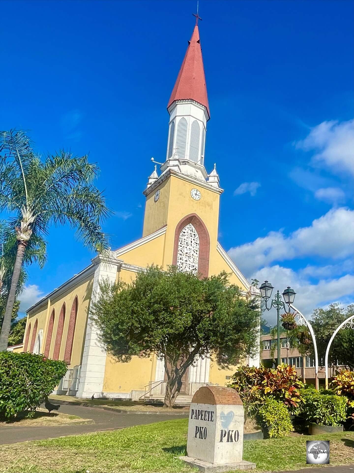
Papeete Catholic Cathedral
Papeete Catholic Cathedral.
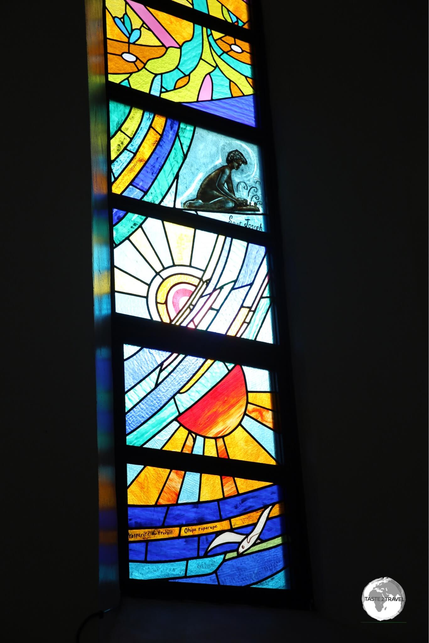
Across the road from the market, the Papeete Catholic Cathedral, known as Cathédrale Notre-Dame de Papeete, has a modest exterior which belies its richly decorated interior.
A wooden statue inside the Cathedral features ‘Madonna and Child’, the latter of whom is clutching a breadfruit.
Named after its famous Parisian counterpart, the cathedral, which was completed in 1875, includes artwork that features both European and Polynesian influences.
Notable is the statue of the Madonna and Child which includes the child clutching a Breadfruit, an integral part of the Polynesian diet.
Stained-glass windows inside Papeete Catholic Cathedral.
Stained-glass windows include artistic representations of the Stations of the Cross, which incorporate both Tahitian and Roman cultures but include only Polynesian people.
The artistic style of the artwork was influenced by Paul Gauguin.
Papeete cathedral.
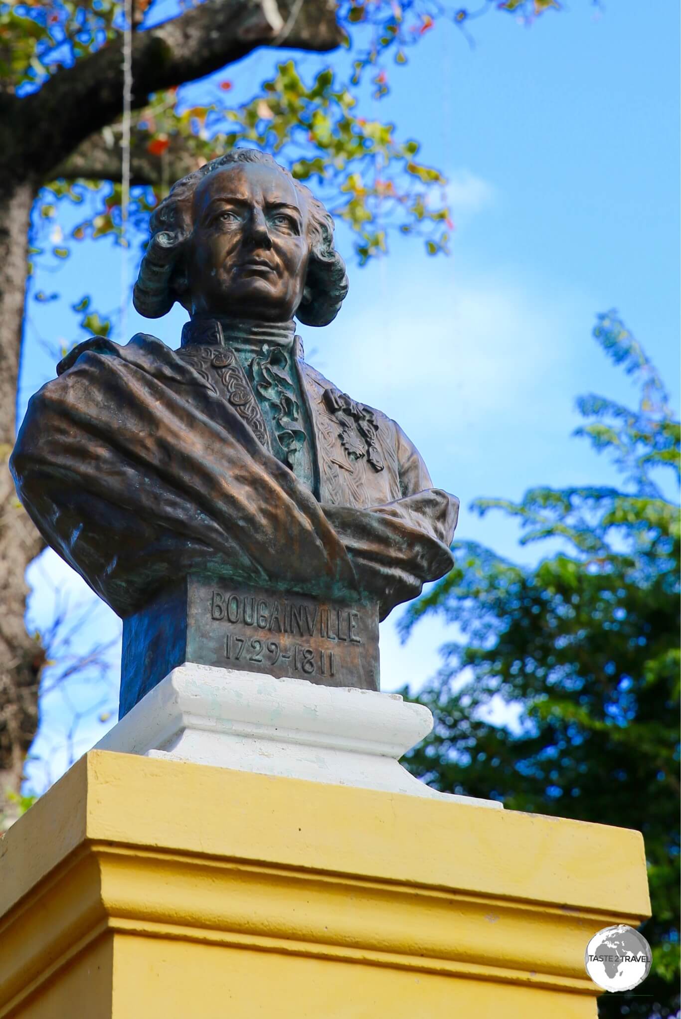
Bougainville Park
A bust of French explorer Louis Antoine de Bougainville, in the park named in his honour.
A short walk from the cathedral is Bougainville Park, which is dedicated to Louis Antoine de Bougainville– a French explorer who believed he had discovered Tahiti and claimed it for France, unaware that less than a year prior it had been discovered by the British explorer, Samuel Wallis.
In a strange twist of geographic-naming-irony, Wallis’s name is now used for one half of the French Territory – Wallis & Fortuna and Bougainville’s name is used for a key island in Papua New Guinea (formerly British New Guinea).
The park features a bust of Bougainville, a giant Banyan tree which provides ample shade, a tranquil stream, benches and lush vegetation.
A nice place to escape the midday heat!
Parliament House
The parliament of French Polynesia – the Territorial Assembly.
Across the road from the park is the Territorial Assembly building, the Parliament house for French Polynesia.
Around Tahiti Nui
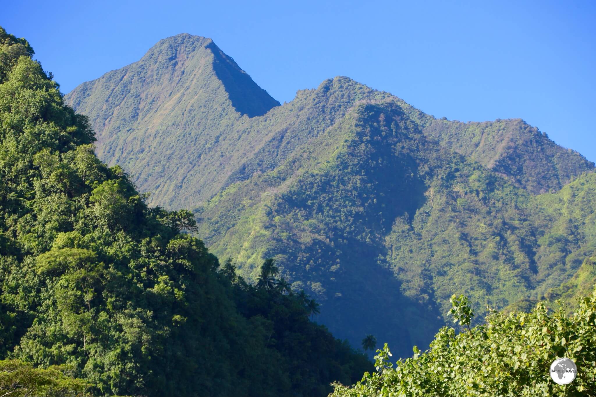
The mountainous, volcanic interior of Tahiti Nui is almost impenetrable.
Traveling around the main island is simply a matter of following the one ring road which circumnavigates the island.
The rugged and impossibly steep interior is almost without roads, which makes sightseeing very easy as everything is located along, or close to, the main ring road and everything is well signposted.
I drove a car around the island for two days which allowed ample time to visit all sights.
Traveling in an anticlockwise direction from Papeete, I visiting the following sights:
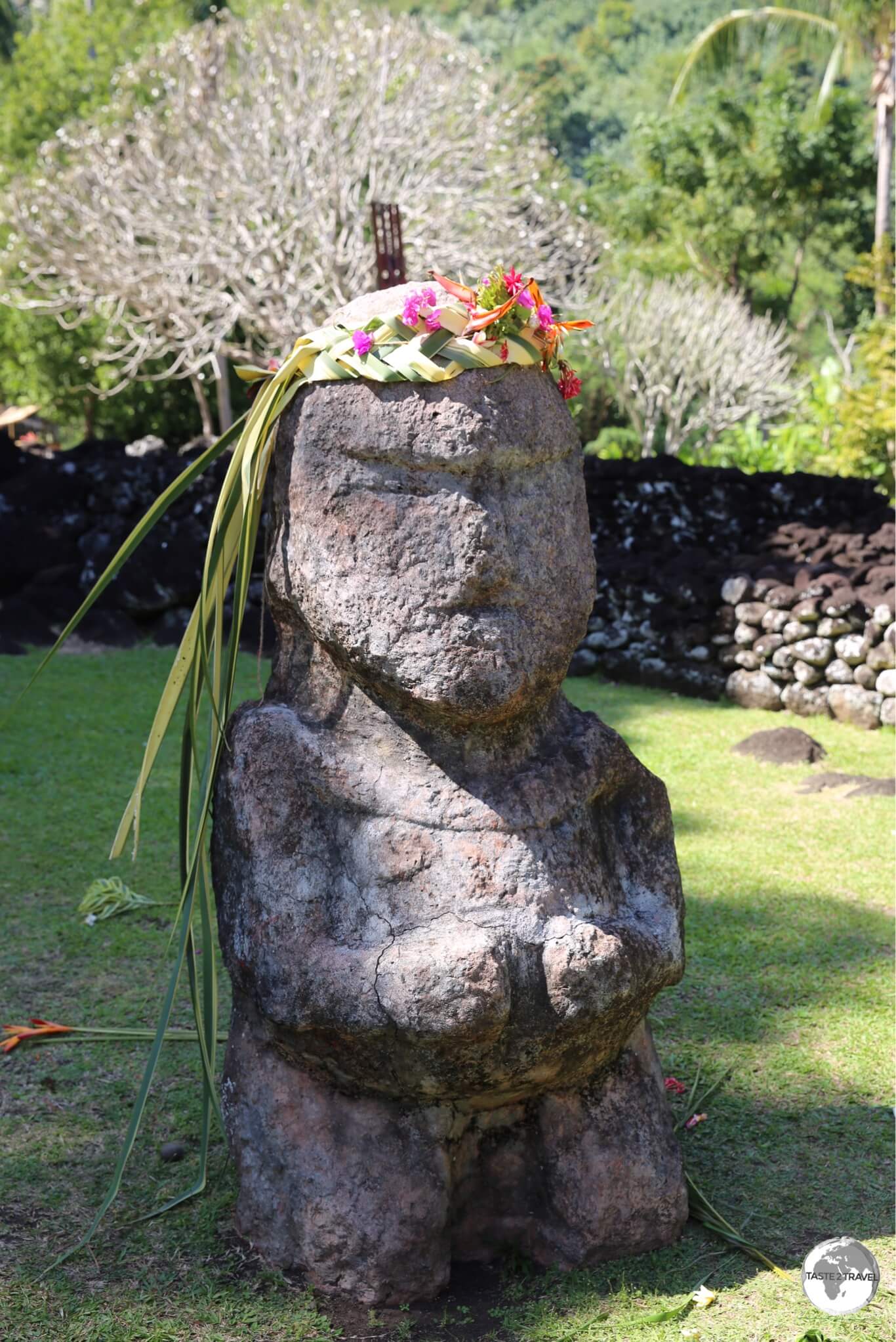
Arahurahu Marae
The Arahurahu Marae is located on the west coast, a short drive south of Papeete.
Located in the district of Pa’ea, the relaxing and beautifully maintained Arahurahu Marae is the largest Marae in French Polynesia.
Marae’s in French Polynesia consist of raised stone, rectangular platforms with a raised stone altar, ahu, at the centre of the rectangle.
A Tiki at the entrance to the Arahurahu Marae.
Marae’s were used by Polynesians for ceremonial gatherings, religious rituals and other important events.
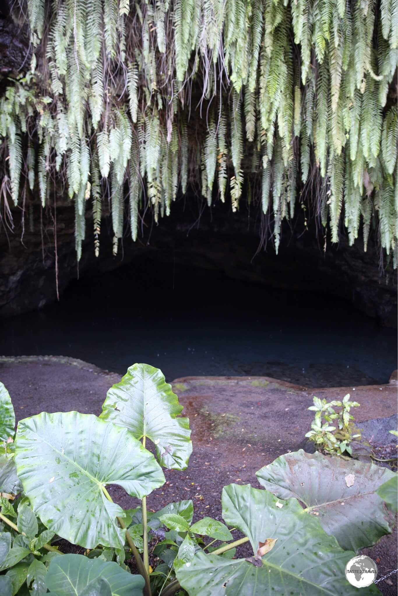
Maraa Grotto
The incredibly lush Maraa Grotto.
Continuing south along the west coast, my next stop was the beautiful Maraa Grotto.
Located directly on the side of the main road, a short walking trail leads you to this gloriously beautiful and lush freshwater grotto, the ceiling of which is covered with ferns dripping with water.
Paul Gauguin was also impressed, mentioning the grotto in his letters home.
Harrison Smith Botanical Garden
The grounds of the Harrison Smith Botanical Garden.
Located at the 51 km mark, the Harrison Smith Botanical Garden is a little forlorn and unloved but does boast a Giant Galapagos Turtle, which is apparently 90 years old.
You can photograph the poor captive turtle through the wire fence of its enclosure, but if you prefer your turtles ‘free-range’, you can view photos of happier ones in my Galapagos Islands Travel Guide.
Paul Gauguin Museum (Permanently Closed)
A sneak peek through the front gate of the now closed Paul Gauguin Museum.
Located next to the entrance of the botanical garden is the Paul Gauguin Museum, which closed its doors in 2015 and is not scheduled to reopen.
There is a security guard posted at the main gate, who kindly allowed me to take a photo of the museum grounds (from the gate).
Taravao
After the botanical garden, I reached the southern town of Taravao, which provides access to the adjoining island of Tahiti Iti (refer to the next section for more on Tahiti Iti).
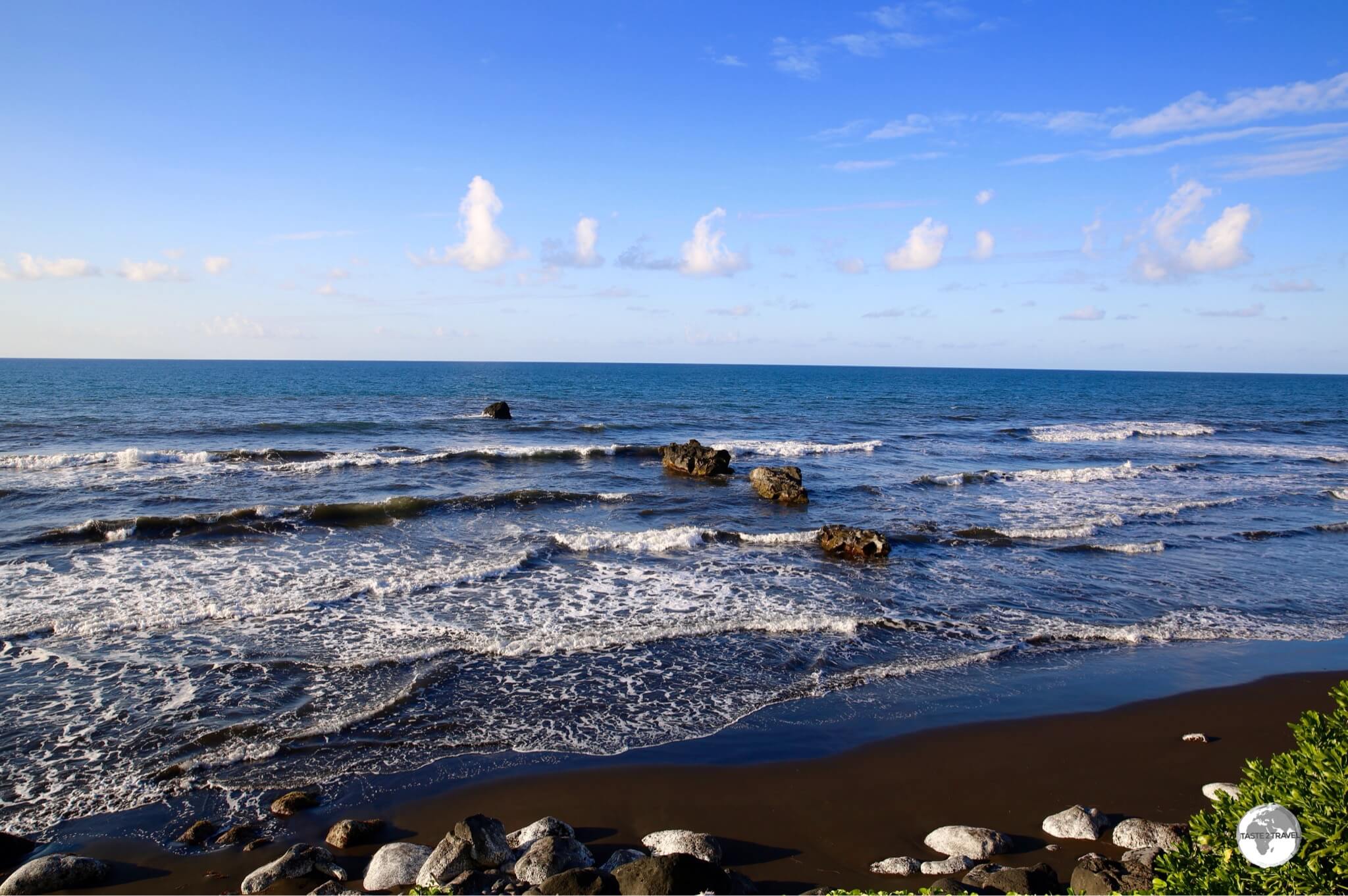
A black-sand beach on the east coast of Tahiti.
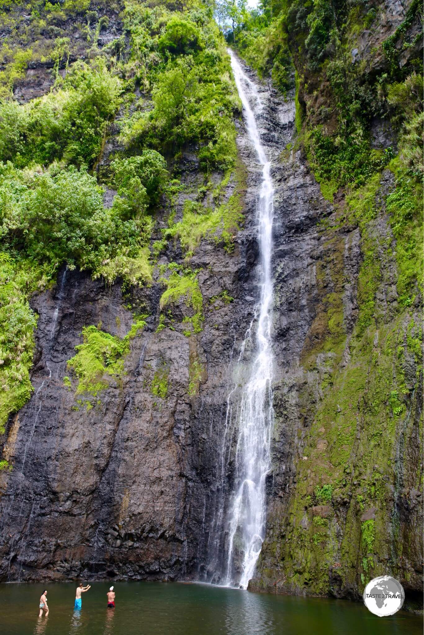
Continuing beyond Taravao, now traveling north, along the east coast of Tahiti Nui, a left turn past the village of Tiarei, leads to the parking lot of the incredibly high – Faarumai Waterfall.
Faarumai Waterfall
The incredibly high Faarumai waterfall is a spectacular sight.
The falls are a short walk from the car park along a well-maintained track but, since a tourist was hit on the head by a falling rock a few years ago, swimming is not allowed.
Venus Point
A marker at Venus Point commemorates the visit by Captain James Cook in 1769.
The last stop before returning to Papeete was Venus Point, which is located at the tip of a peninsula, 8 km east of Papeete.
The location was visited by Captain James Cook, who, on his first voyage to the Pacific, was tasked with observing the 1769Transit of Venus from the South Pacific.
Cook’s expedition was funded by the Royal Society of London for the primary purpose of viewing the transit of Venus.
After viewing this astronomical event, Cook got on with his ‘other’ mission which was to find the legendary Terra Australis Incognita – the great southern continent.
Less than a year later, on the 29th of April 1770, Captain Cook first set foot on Australia at Botany Bay in New South Wales and the rest is history.
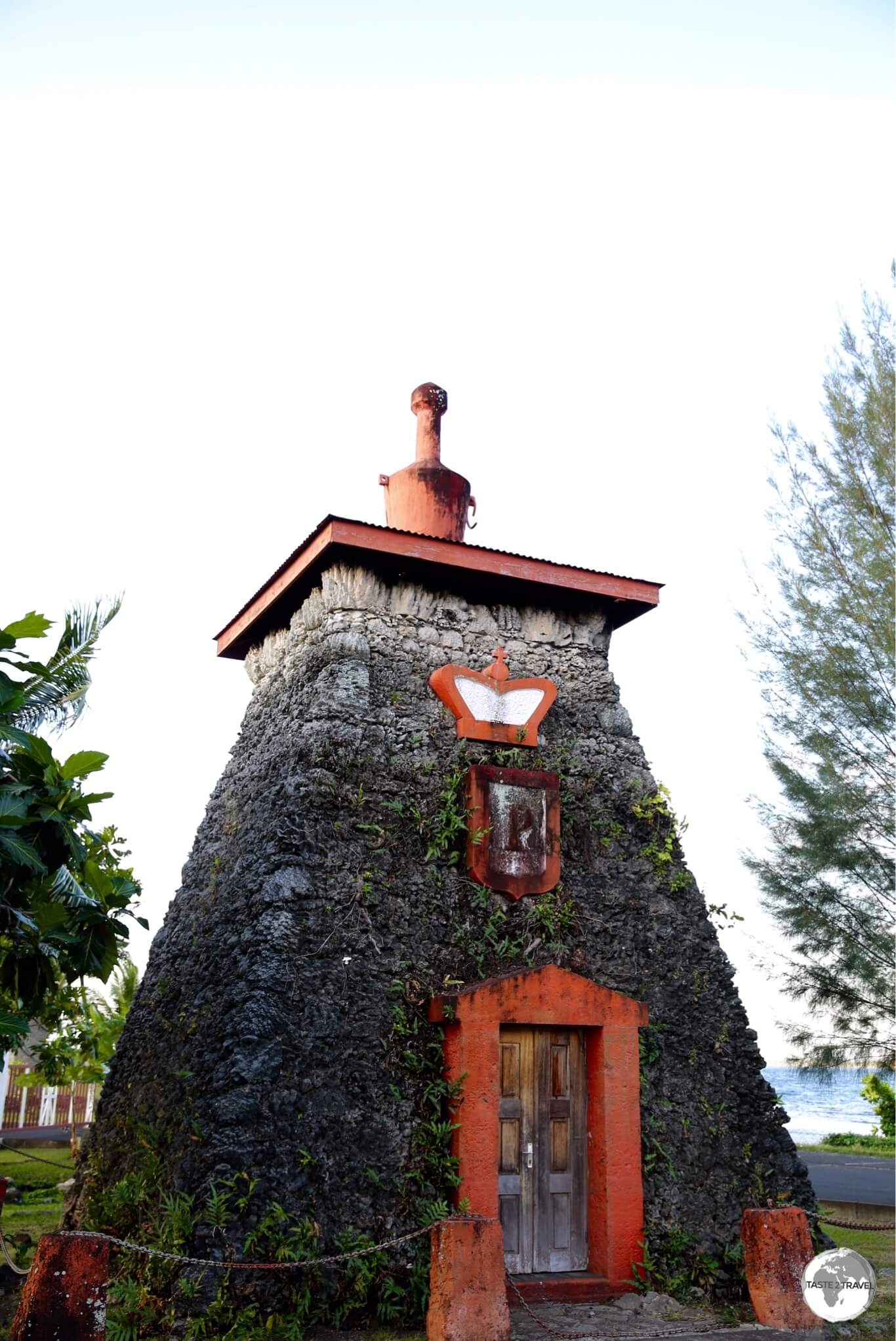
Tomb King Pōmare V Tahiti
The Tomb of King Pōmare V on Tahiti.
Located a short drive east of Papeete, the tomb of Tahiti’s last king, Pomare V (1839–1891), is built of coral stones in the shape of a small lighthouse, which has a red door and is topped with a red Grecian urn.
The tomb stands on a point at Arue just off the coastal road. Originally built for his mother Queen Pomare IV, Pomare V had her remains exhumed and his were interred instead when he died only a few years later.
Around Tahiti Iti
Tahiti Iti has two coastal roads which extend halfway down the east and west coast and one road which travels up to a central plateau, providing access to a very different part of the country – one which is rural and bucolic.
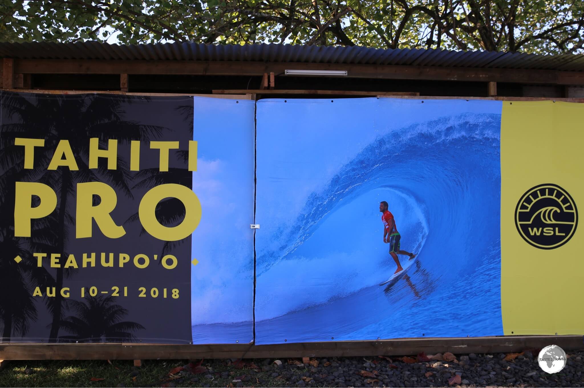
Teahupo’o
Getting ready for the Tahiti Pro surf competition which is held in August of each year.
The west coast road terminates in the village of Teahupo’o which is a famous surf spot and the venue for the annual Tahiti Pro surf competition which was due to commence a week after my visit.
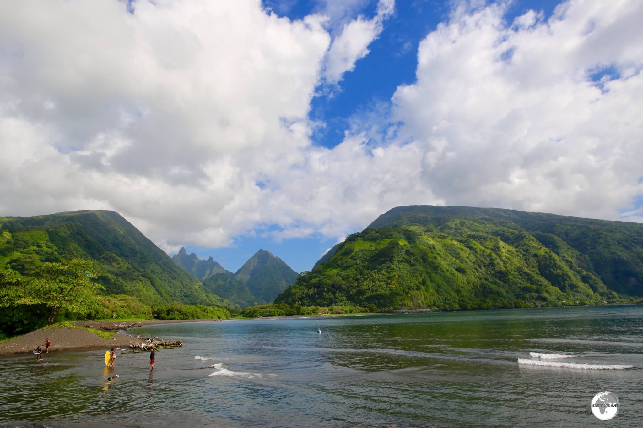
Tautira
The magnificent views from the village of Tautira.
The east coast road terminates in the picturesque, beachside village of Tautira, which is 49 km southeast of Papeete.
The village offers spectacular views of the surrounding mountains and was once used as a place of convalescence by Scottish author, Robert Louis Stevenson, who referred to it as “The Garden of the World”.
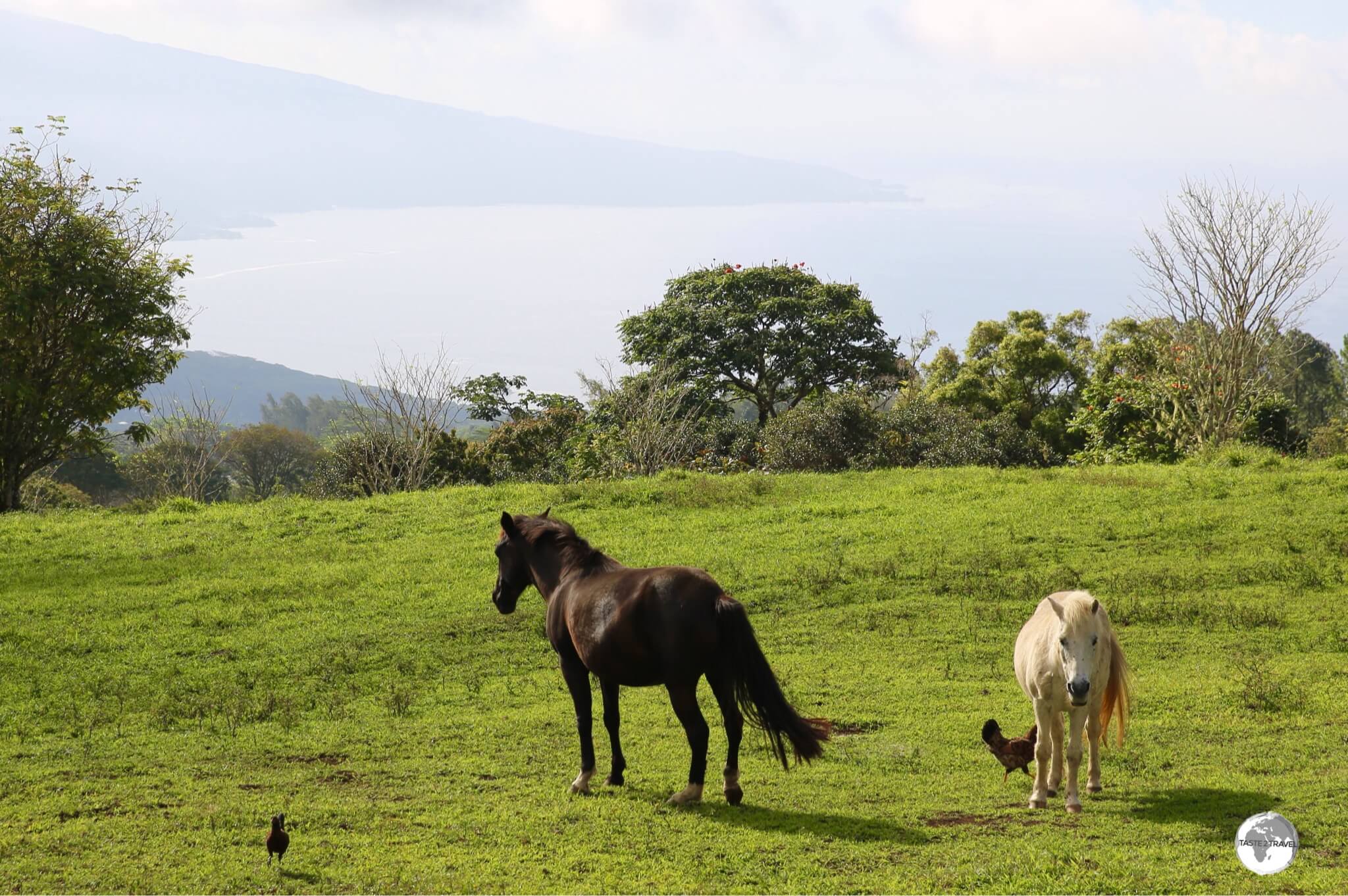
Belvédère de Taravao
A different view of Tahiti from the plateau on Tahiti Iti.
Before departing Tahiti Iti, it’s worth taking the one other road on the island which climbs up onto a large, central plateau (from Taravao), eventually arriving a panoramic lookout – the Belvédère de Taravao.
Belvédère de Taravao offers sweeping views of Tahiti Nui and Iti.
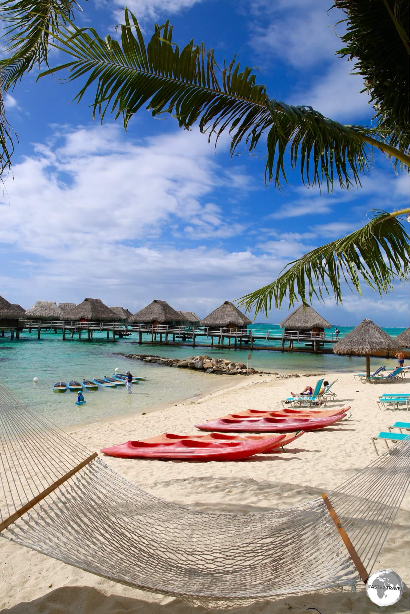
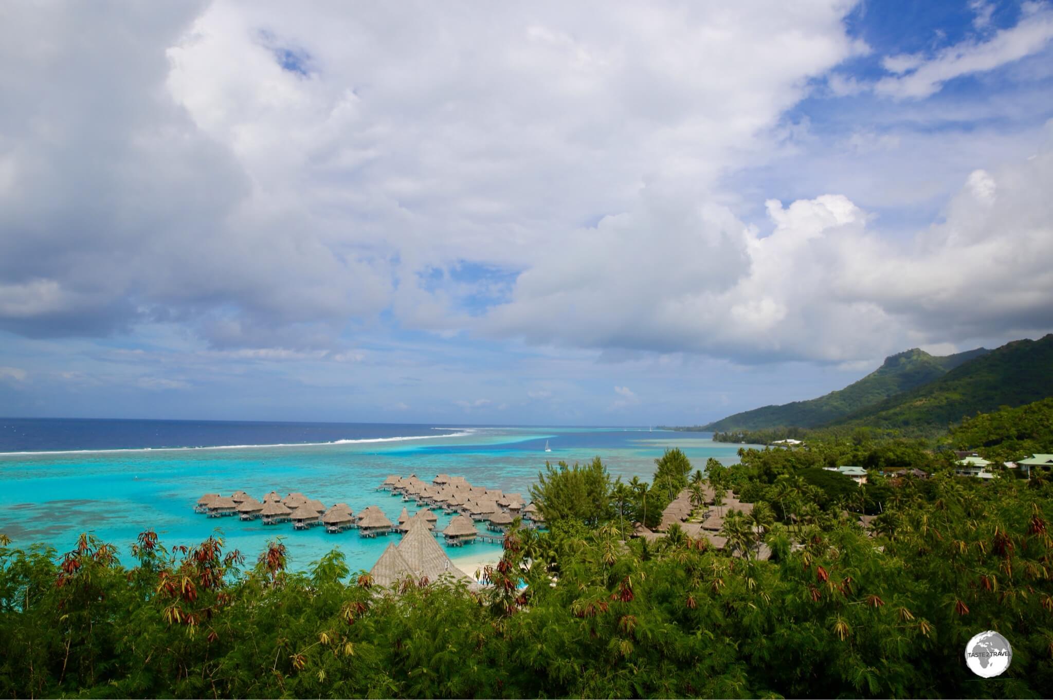
Moorea
The magical Moorea Lagoon.
Like Tahiti, exploring Moorea is made easy thanks to the islands impossibly steep interior.
A single ring road circumnavigates the island with a couple of short roads providing a glimpse of the interior.
Easy on the eye – the turquoise waters of the Moorea lagoon.
There is almost no public transport on Moorea so I hired a car (not cheap!) for the duration of my stay on the island.
Following the ring road in an anticlockwise direction from the ferry terminal in Vai’are, I visited the following sights:
A view of the Sofitel Moorea resort and the stunning lagoon from the lookout.
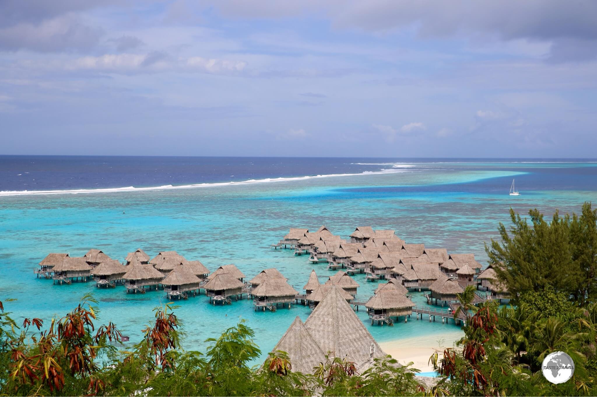
The first stop was the roadside lookout above the Hotel Sofitel Moorea which provides panoramic views of neighbouring Tahiti, the turquoise lagoon and the over-water bungalows of the resort.
A right-hand turn to a popular public beach lies just beyond the lookout.
Hand-printed sarong for sale on Moorea.
Beyond the lookout, the road curves to the left, passing the airport before arriving in the small village of Maharepa where I stopped (more than once) to eat at the amazing Café Caraméline (see the ‘Eating Out‘ section below for more on this delicious place).
After Maharepa, the road sweeps to the left, entering the incredibly scenic and narrow Cooks Bay (named after the man himself).
A Detour into the heartland of Moorea
Route des Ananas
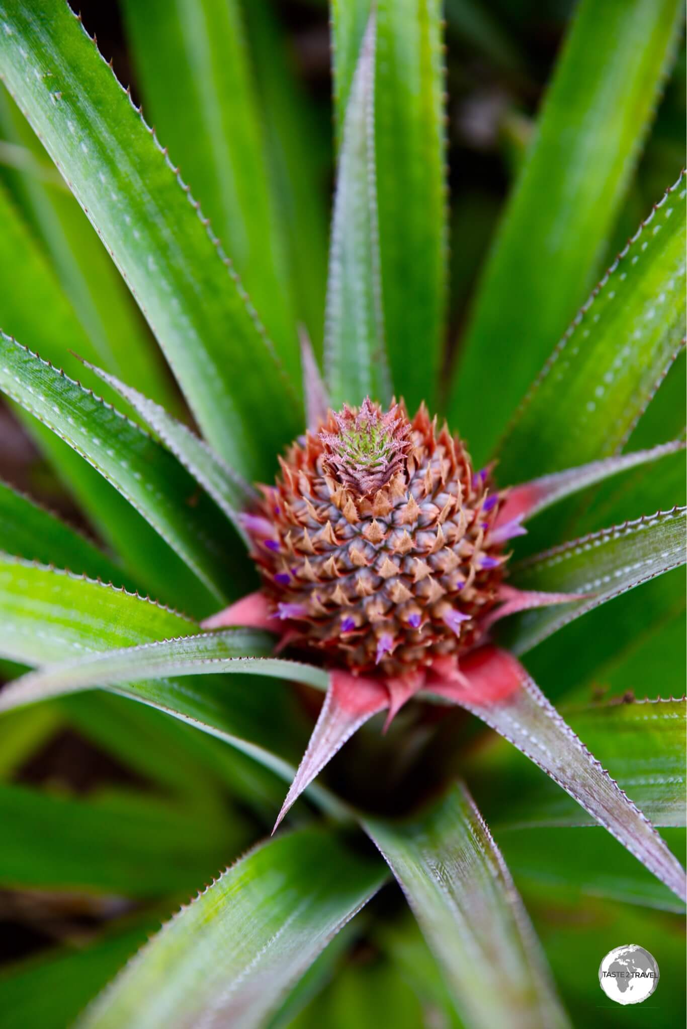
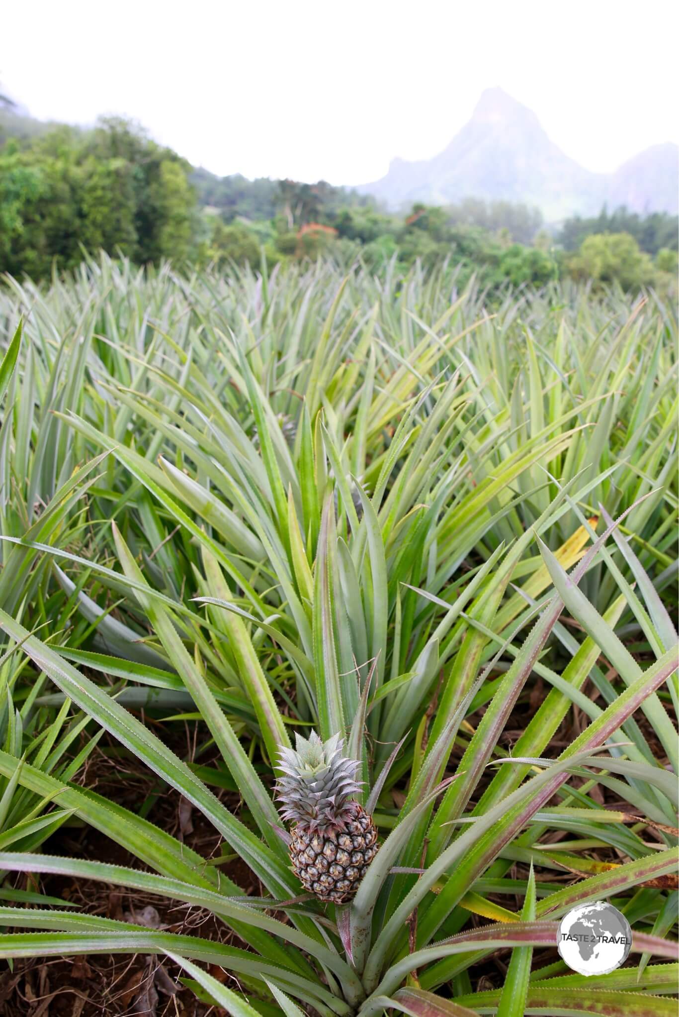
A young pineapple on one of the plantations that line the ‘Route des Ananas’.
From Cooks Bay, a left-hand turn leads off the main ring road and onto the signposted Route des Ananas (The Pineapple Route).
A pineapple plantation on the ‘Route des Ananas’.
Belvedere Lookout
This is one of two roads which provide access to the interior of the island, with the route passing through huge pineapple plantations before joining up with the one other interior road – which winds its way up through many switch-back turns to the lofty Belvedere Lookout.
Created by ancient volcanoes, Moorea is incredibly rugged and beautiful.
The lookout offers breath-taking views of the north coast of Moorea and is the starting point of numerous walking trails which provide access to the jagged peaks and ridges which form the craggy backbone of the island.
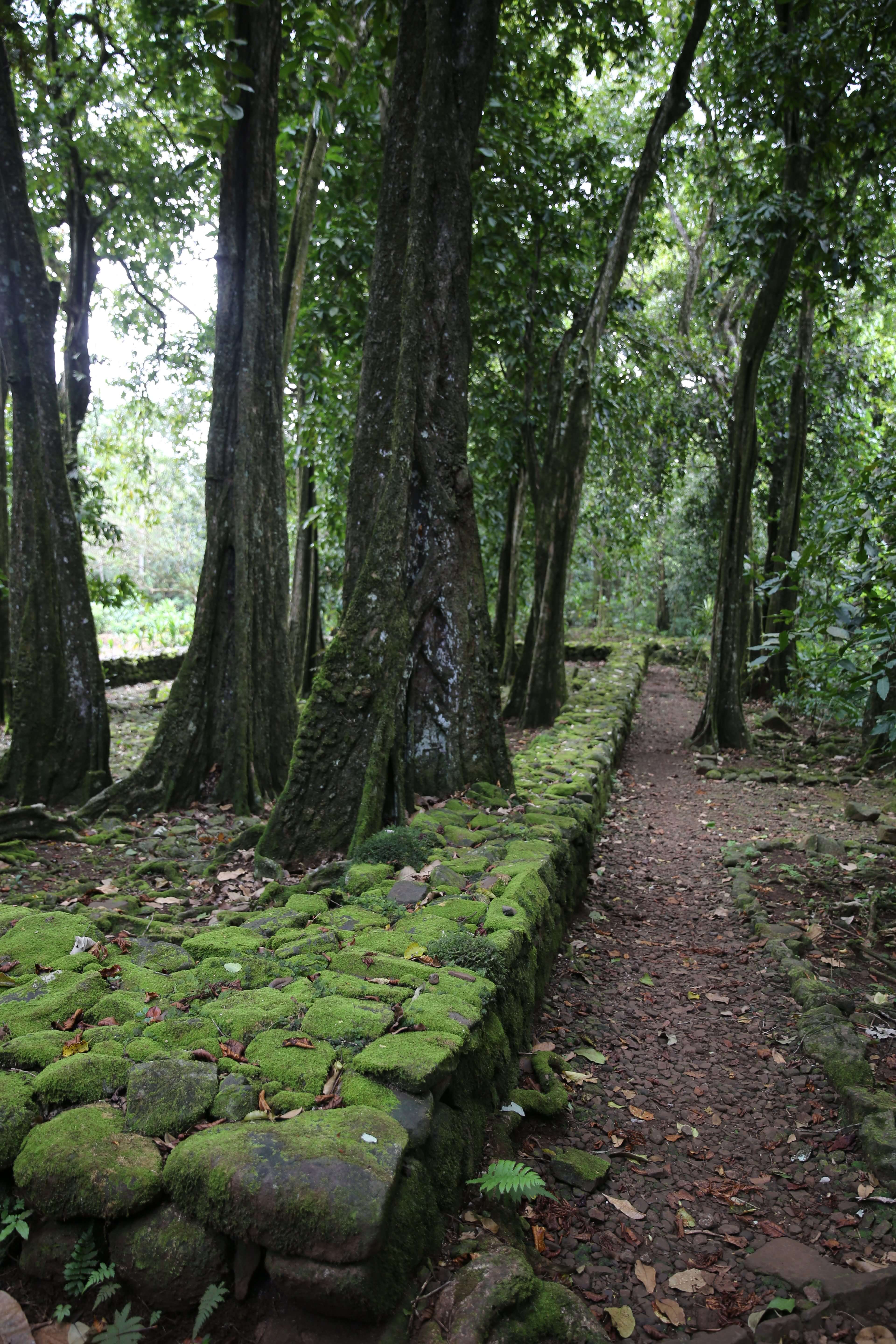
Marae Titiroa
The eerily beautiful Marae Titiroa.
Below the lookout, in the densely forested Opunohu Valley, lie an impressive collection of ruins, the largest of which is the (signposted) Marae Titiroa, which is located next to a roadside car park.
The marae, which is surrounded by overgrown Tahitian Chestnut trees, features a stone altar at one end; with small standing stones in the centre of the platform where the chiefs and priests once sat.
When I visited, I had the complex to myself since most visitors to the island are there to enjoy the beach.
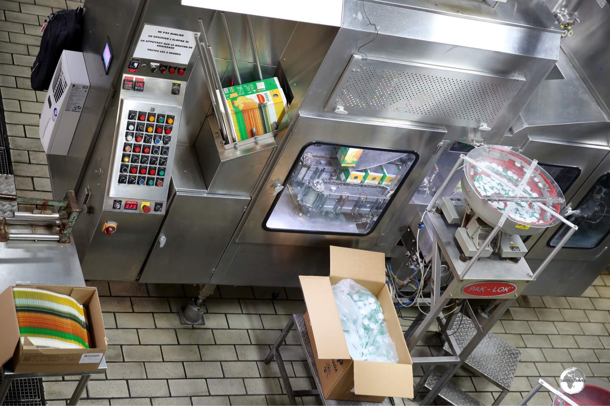
Rotui Juice Factory & Distillery
Promotional material at the Rotui Juice Factory.
Back on the main ring road beyond Cooks Bay, a side road in the village of Piha’ena leads to the foot of Mount Rotui and the industrial complex which is the Manutea Tahiti – Rotui Juice Factory & Distillery.
The production line at the Rotui Juice Factory.
This is the company responsible for all the concentrated fruit juice served throughout the territory and a factory visit will shed light on how fresh fruit is turned into carton juice.
Papetoai
The Hilton Moorea Lagoon Resort.
Back on the ring road, the next deluxe, ‘over-the-water bungalow’ accommodation option is the stunningly located Hilton Moorea Lagoon Resort which is located in the village of Papetoai.
If your budget can’t cover the Hilton, there are some backpacker lodges in the neighbourhood.
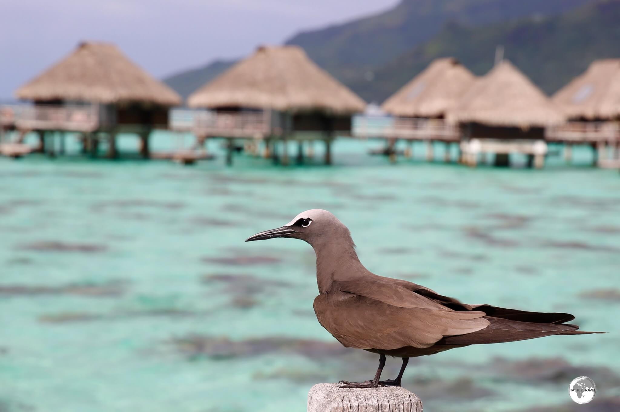
A Brown Noddy at the Hilton Moorea Lagoon Resort.
Further along the north coast, in the village of Tiahura, is the equally impressive Intercontinental ResortMoorea which is home to the highly recommended scuba diving operation – Top Dive (see the following section for more on Scuba diving).
Sunset on Moorea.
Scuba Diving
‘Top Dive’ did provide a top diving experience.
While on Moorea, I went scuba diving with the professional and competent team from Top Dive, who operate out of the Intercontinental ResortMoorea.
The warm waters of the lagoon offer an abundance of marine life, including Lemon sharks, lots of colourful coral and visibility that has to be seen to be believed – excuse the pun!
Video:
I filmed the following video of a cruising Lemon shark on one of my dives with Top Dive – magic stuff!
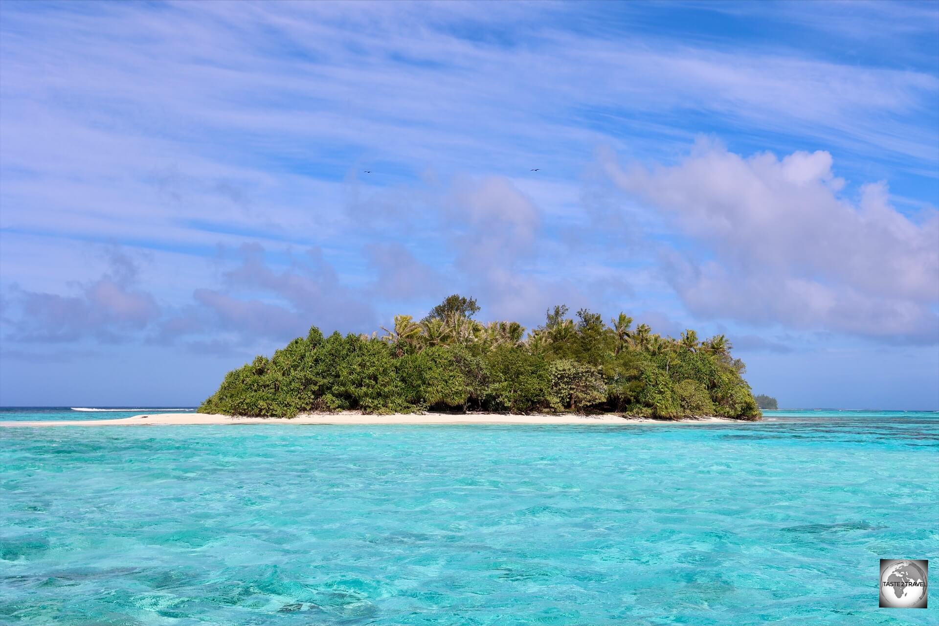
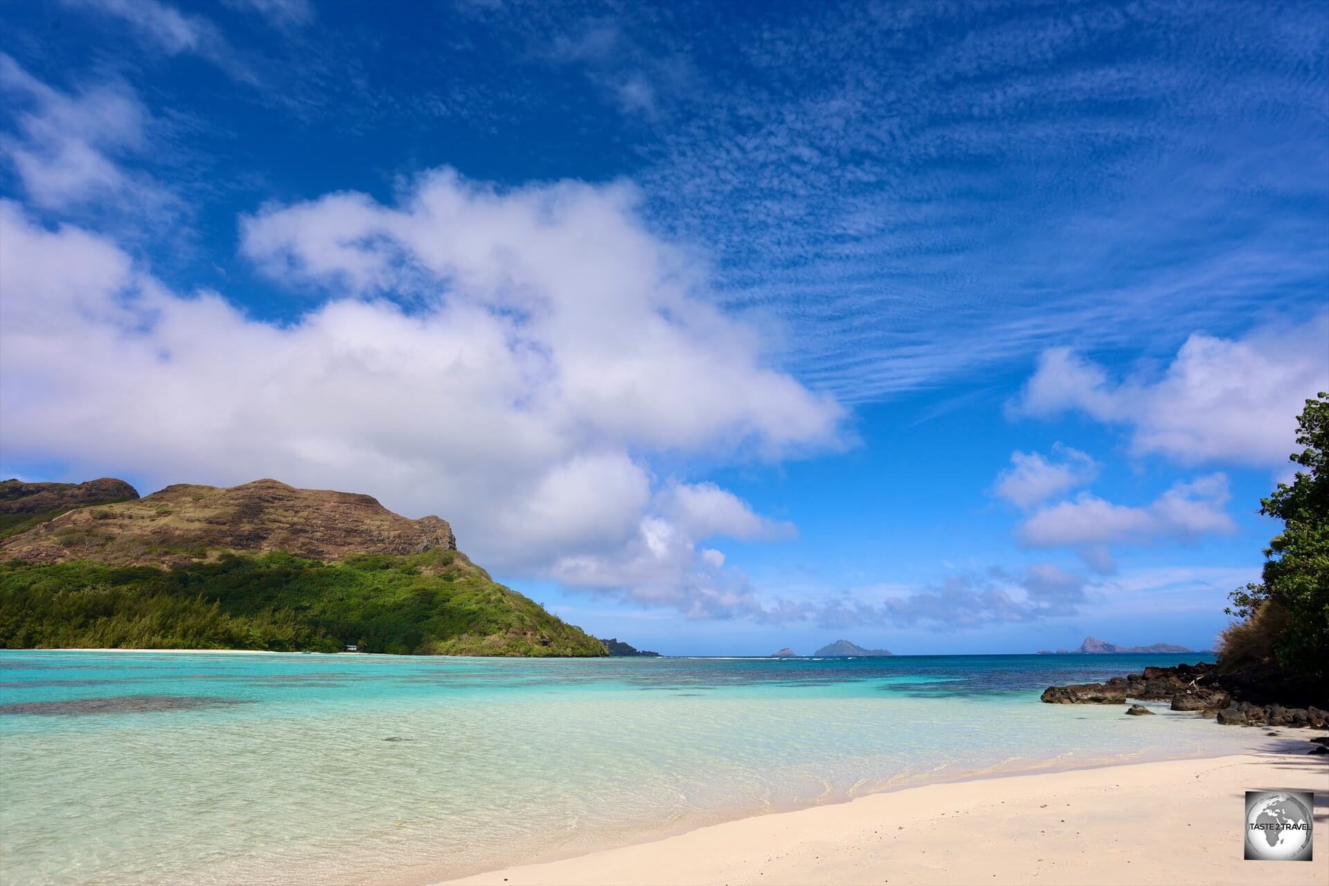
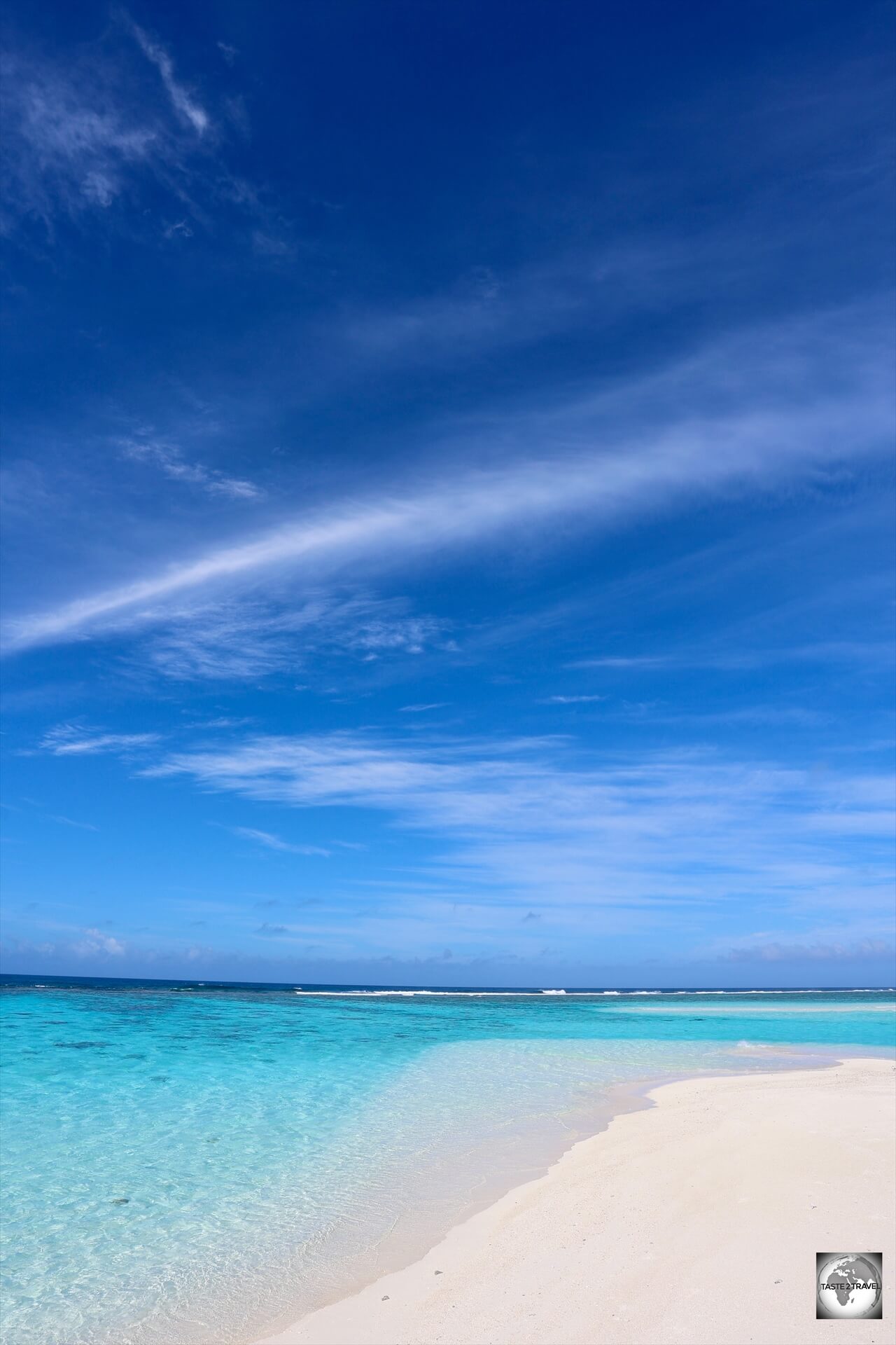
Gambier Islands
Bird Island, a small coral atoll, is one of the 14 islands which comprise the Gambier Islands.
Lying 1,674 km to the east of Papeete, the Gambier Islands are the furthest archipelago from Tahiti and the most isolated.
There is a one-hour time difference between the Gambier Islands (UTC-9) and Tahiti (UTC -10).
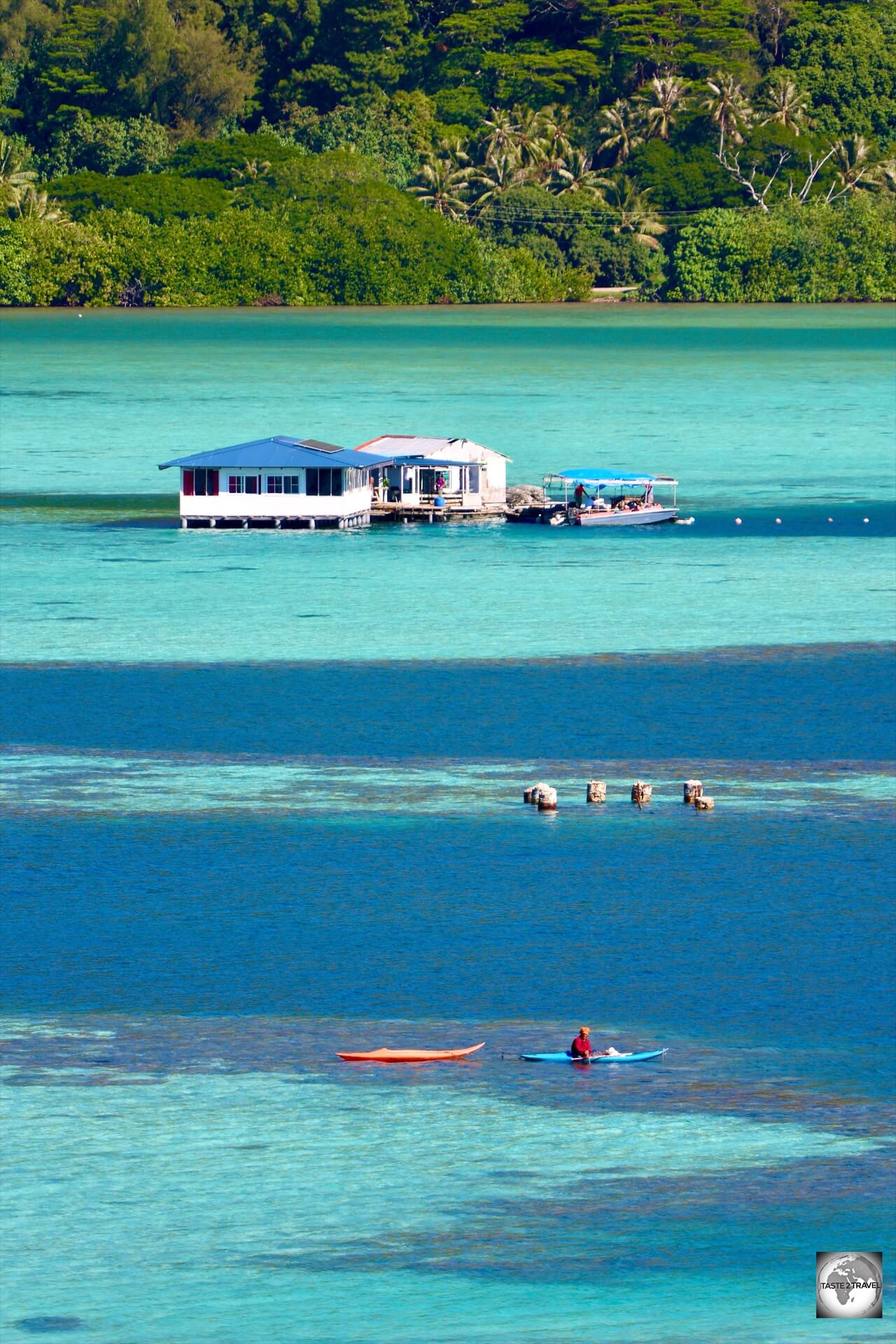
This group of, small, mostly uninhabited, islands occupy a 24 km2, turquoise, lagoon which is extraordinarily beautiful.
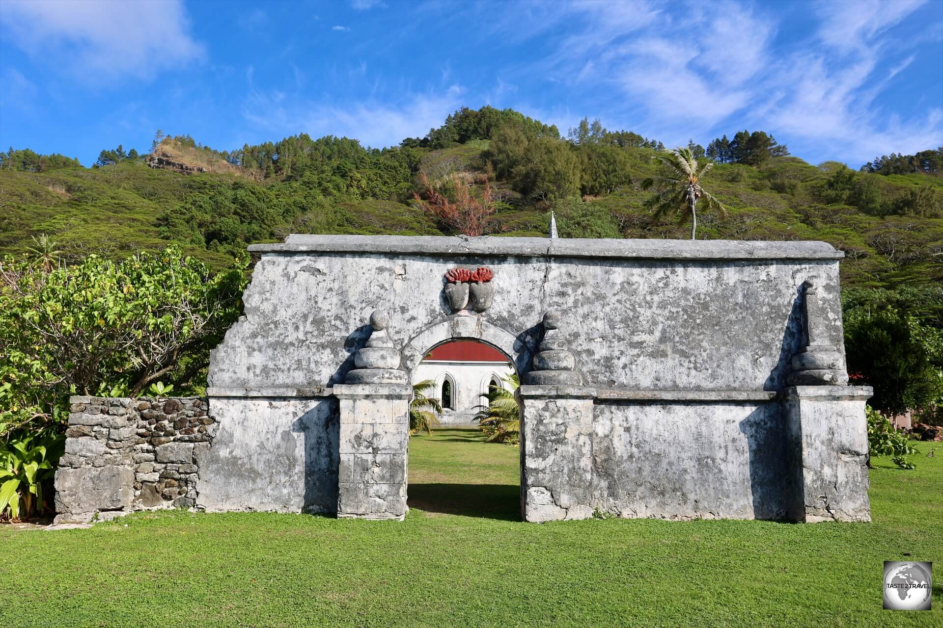
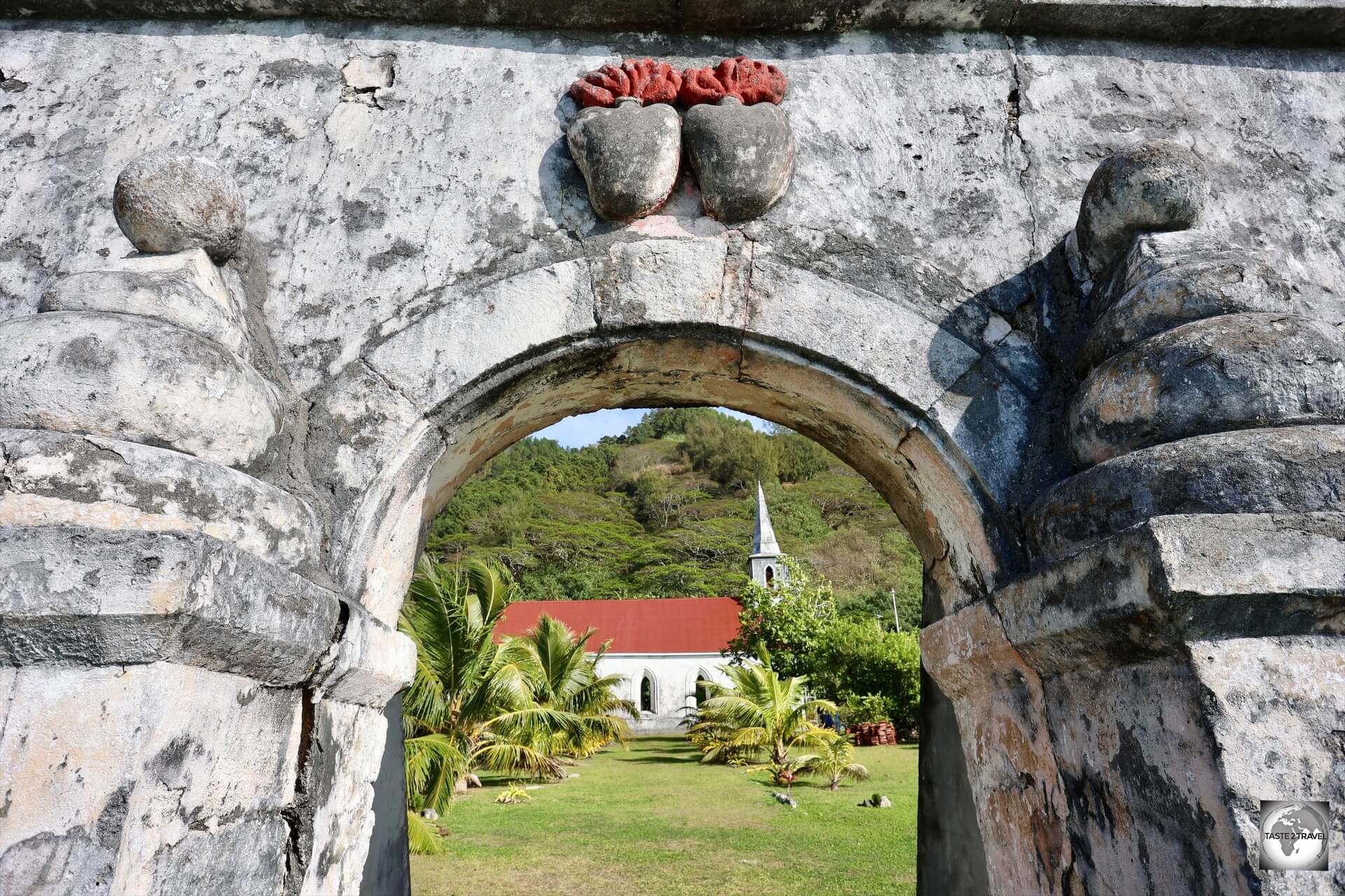
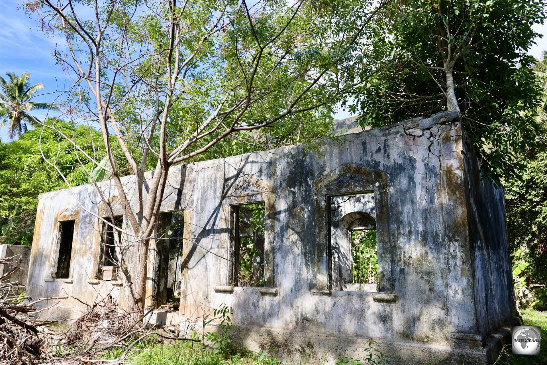
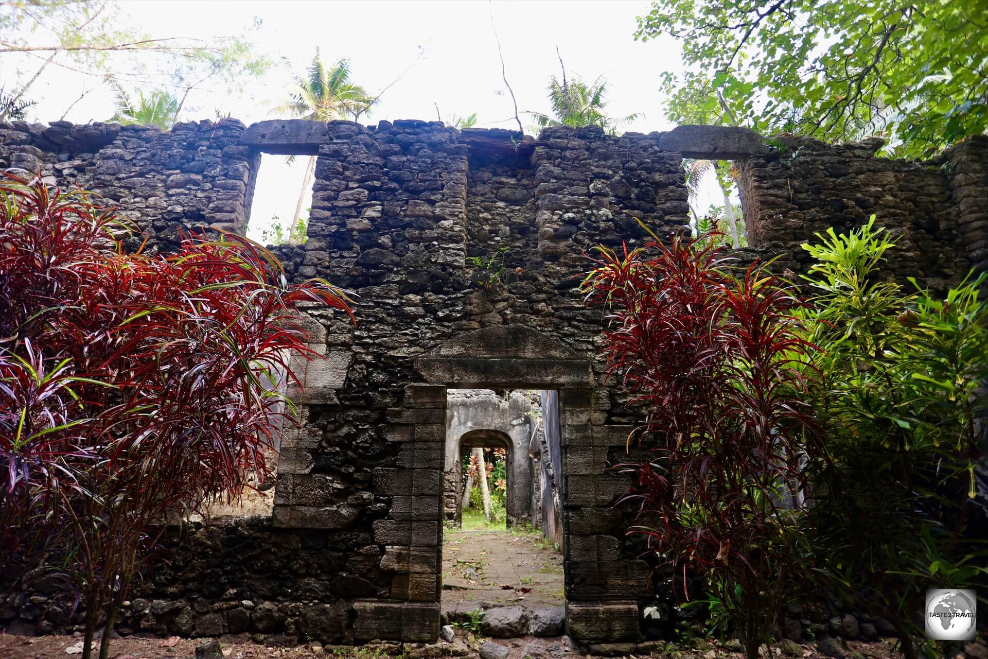
A fragment of an old wall on Taravai Island, which offers a view of the Church of Saint-Gabriel and the twin hearts of Les Sacrés-Coeurs de Picpus.
The lagoon is the centre of black pearl production in French Polynesia.
The only town in the archipelago is Rikitea (pop: 1,300 souls) which is located on the main island of Mangareva.
In terms of tourism, the Gambier Islands are the least visited islands in French Polynesia.
Reached on twice weekly flights (Tuesday and Saturday) from Papeete, the US$886 (return) flight ticket ensures that only the most dedicated visit this remote corner of French Polynesia.
The archipelago is served by Totegegie Airport (IATA: GMR) which is located on an uninhabited coral atoll, a 40-minute ferry ride from Mangareva.
There is also a complete lack of accommodation options on the islands, with just a few basic homestays available on Mangareva.
Mangareva Banking Services:
Bring all the cash you’ll need from Papeete.
There are no banks or ATM’s anywhere in the Gambier Islands and credit cards are not accepted anywhere.
Tip:
Since there’s no access to cash anywhere on Mangareva, it’s best to book and pay for your accommodation online, using Airbnb, thereby taking care of your major expense on Mangareva.
For more information, please refer to the ‘Accommodation‘ section below.
Mangareva Island
St. Michael’s Cathedral, the largest church in the South Pacific is a highlight of Mangareva.
Sleepy Mangareva is the central and largest island of the Gambier Islands in French Polynesia.
The island is approximately eight kilometres (5 mi) long and, at 15 km2 it comprises about 56% of the total land area of the Gambier Island group.
A view of the lagoon at Mangareva Island, the main island of the Gambier archipelago.
A single, 28-km long, road follows the coast around the island, offering stunning views of the lagoon and the many distant motu’s (flat reef islets).
Mangareva has a permanent population of 1,300 – with almost everyone living in the one town of Rikitea.
Everyone knows everyone here. It’s one big family!
One of many historic churches on Mangareva Island.
In terms of tourist infrastructure, there is hardly any!
A few family homestays provide basic accommodation, while the only dining options are a couple of rudimentary snack shops in Rikitea which close up at 1 pm.
If you are looking for an authentic French Polynesian travel experience, in a place far from the commercial trappings of Tahiti, then the Gambier Islands are the perfect destination.
A view of the turquoise waters of Mangareva Lagoon.
The easiest way to explore Mangareva is with a rental car which will cost €50 per day. I hired a car through my guest house.
The sights of the island can be easily covered in half a day.
Exploring the island of Mangareva in my rental car.
The highest point in the Gambier’s is Mount Duff, on Mangareva, rising to 441 metres (1,447 ft) along the island’s south coast.
Video:
Driving on Mangareva Island in my rental car.
The island is heavily wooded and is a favourite nesting site for migratory seabirds such as White terns, Frigate birds and Brown noddy’s.
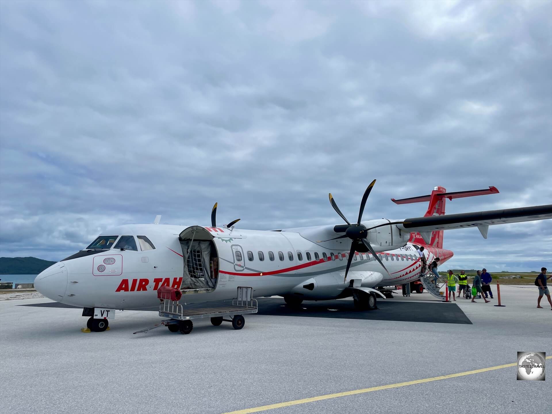
A view of Mangareva Lagoon from my Air Tahiti flight.
Mangareva is surrounded by a lagoon which is 24-km (15 mi) in diameter, containing reefs whose fish and shellfish helped ancient islanders survive much more successfully than on nearby islands with no reefs.
A view of the lagoon at Mangareva Island, the centre of black pearl production in French Polynesia.
The lagoon is the main centre of black pearl production in French Polynesia, with most pearls finding their way to expensive shops in Papeete.
A small number of retailers in Rikitea (opposite the Gendarmerie office) sell black pearls for prices much lower than what you’ll pay in Papeete.
European Influence
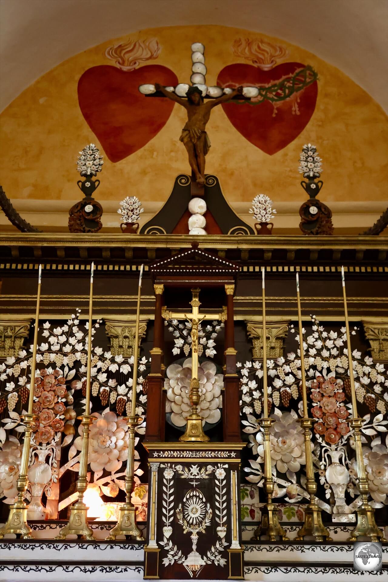
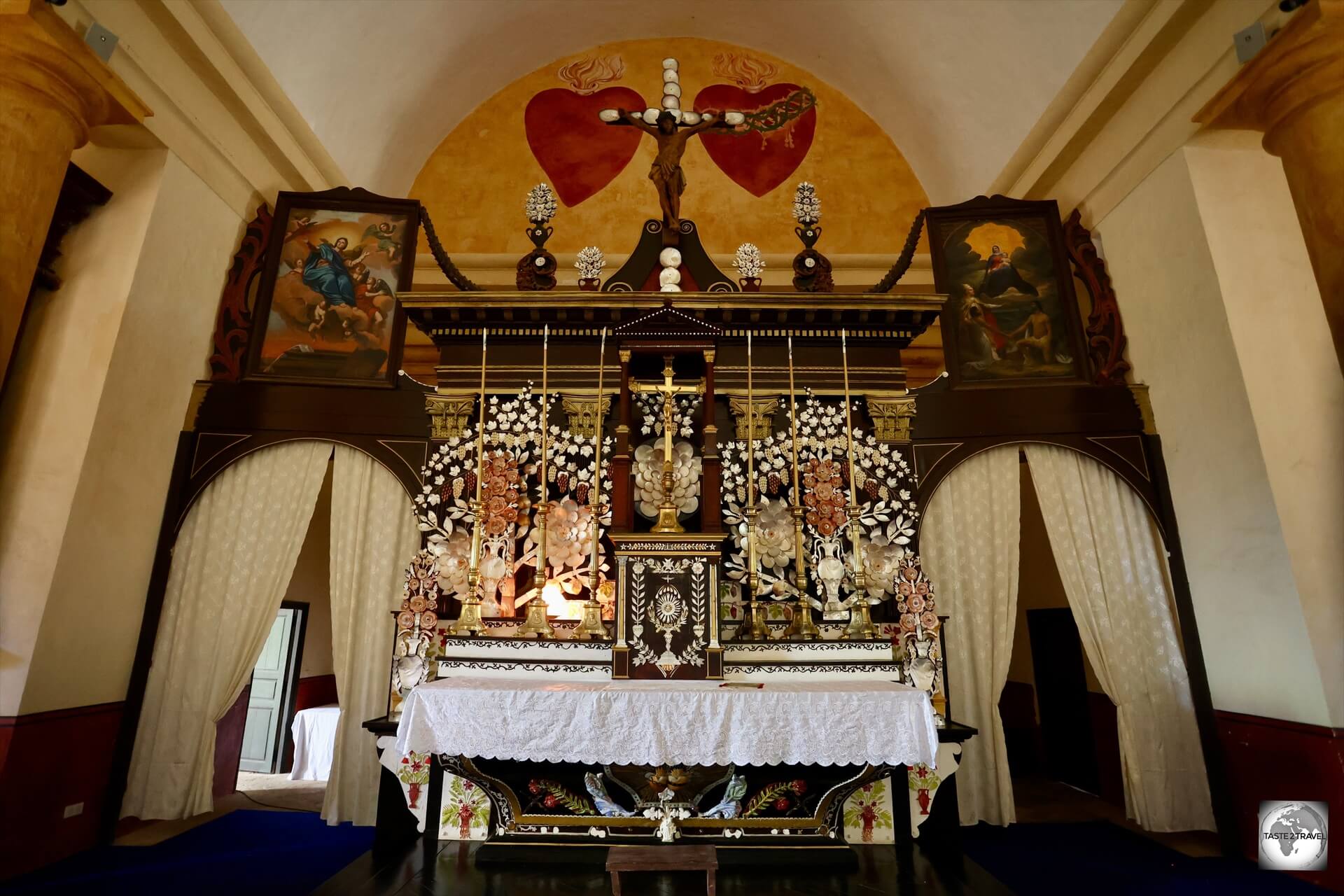
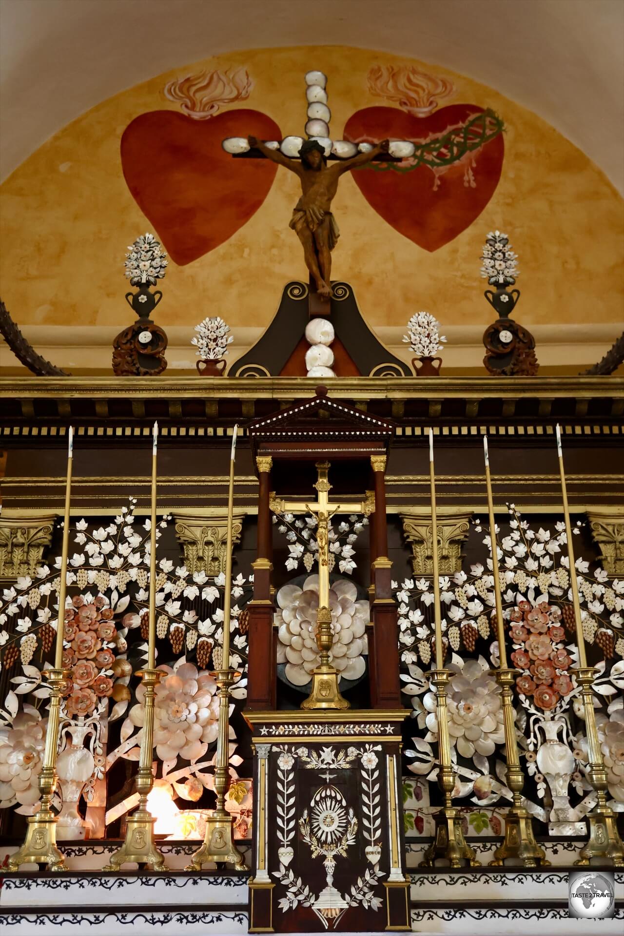
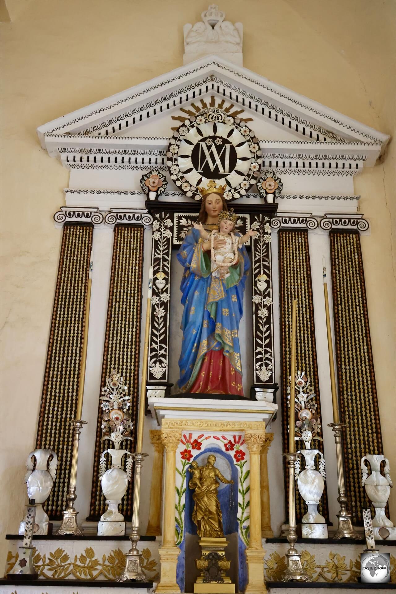
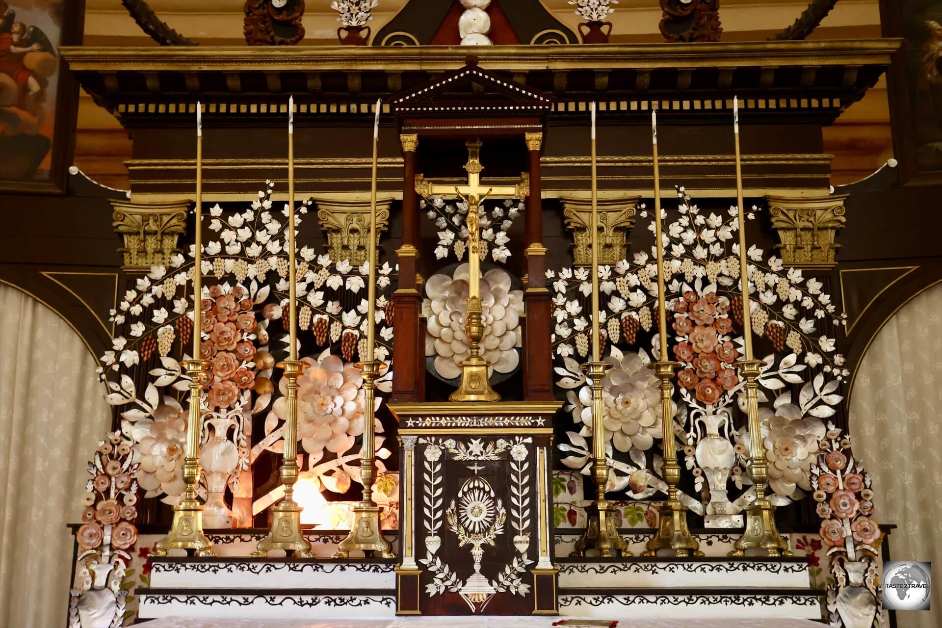
A highlight of Mangareva is the ornate altar at St. Michael’s Cathedral, which is adorned with mother-of-pearl and black pearls.
A significant change in the culture of the local Polynesian population in the Gambier archipelago was inaugurated by the French-Catholic missionaries, Father Honoré Laval and Father François Caret, of the Congregation for the Sacred Hearts who came to Mangareva in 1834.
When the missionaries arrived, they counted 2,124 souls. Increasing contact with the outside world brought contagious diseases to Mangareva savagely decimating the population.
There had already been several major epidemics before 1863, including one which is said to have killed half the population.
At first the missionaries met with opposition, but after King Te Ma-puteoa and his chiefs became converted, the whole population followed suit.
Father Laval acquired an extraordinary influence over the people. The traditional open temples were dismantled and the wooden images of their gods were burnt, except a few that were sent back to Europe.
Father Laval built 116 stone buildings and arches, and roads were laid.
Buildings included schools, convents, churches, a fortified palace as well as St. Michael’s Cathedral which has been characterised as a folly.
The structures were built with shaped coral stone blocks.
On the site of the former Te Keika marae in Rikitea, St. Michael’s Cathedral (the largest church in the South Pacific), was constructed in stone, and the cut coral blocks that had formed the bench along the front of the marae were included.
The local people became expert stone masons, and the chiefs had stone houses built for themselves.
Whenever Father Laval wanted to construct of a new church, in order to gain approval from King Te Ma-puteoa, he would offer to build the king a stone palace next to the church.
Such palaces can be seen today in Rikitea (in the adjacent school yard) and on Akamaru Island.
Stone is a fitting material for temples and churches but not for dwelling houses in the hot and humid climate of Polynesia.
St. Michael’s Cathedral still functions, but today the stone palace of Te Ma-puteoa and the stone houses of the chiefs in the various villages are roofless and deserted.
Father Caret is buried inside St. Michael’s Cathedral in Rikitea.
Sights
St. Michael’s Cathedral
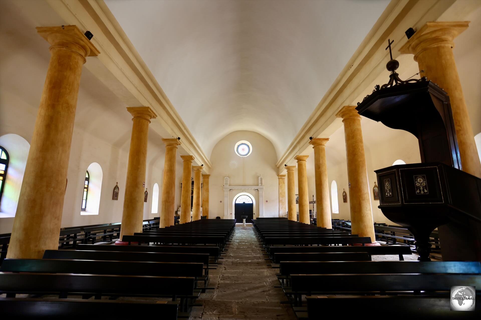
The largest church in the South Pacific, St. Michael’s Cathedral features 18 ochre columns which support the central vault.
The highlight of Rikitea is St. Michael’s Cathedral, the largest church in the South Pacific and the first church to be built in French Polynesia.
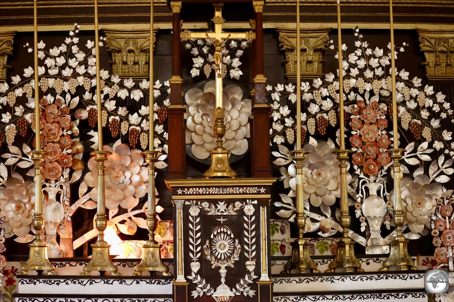
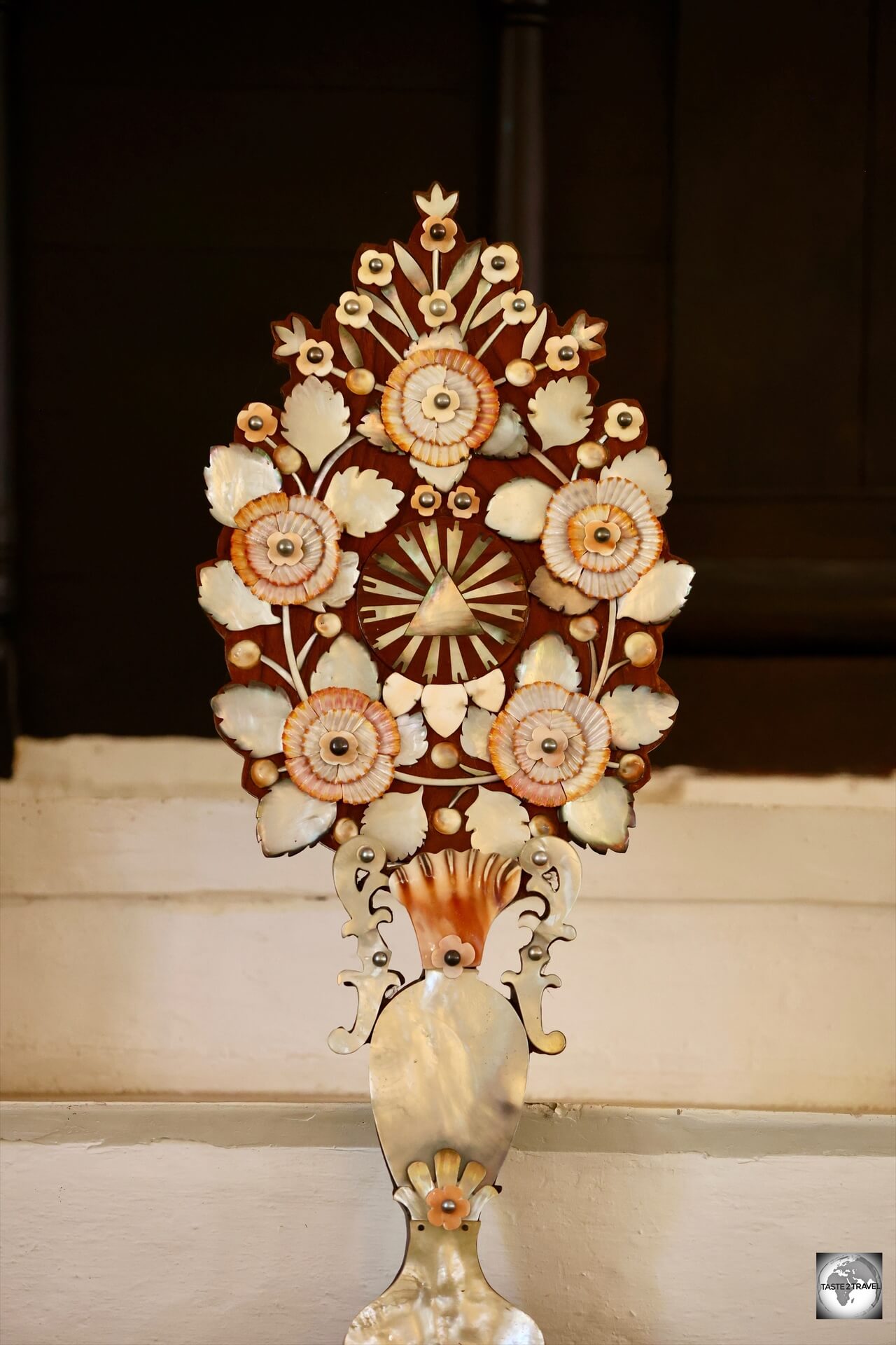
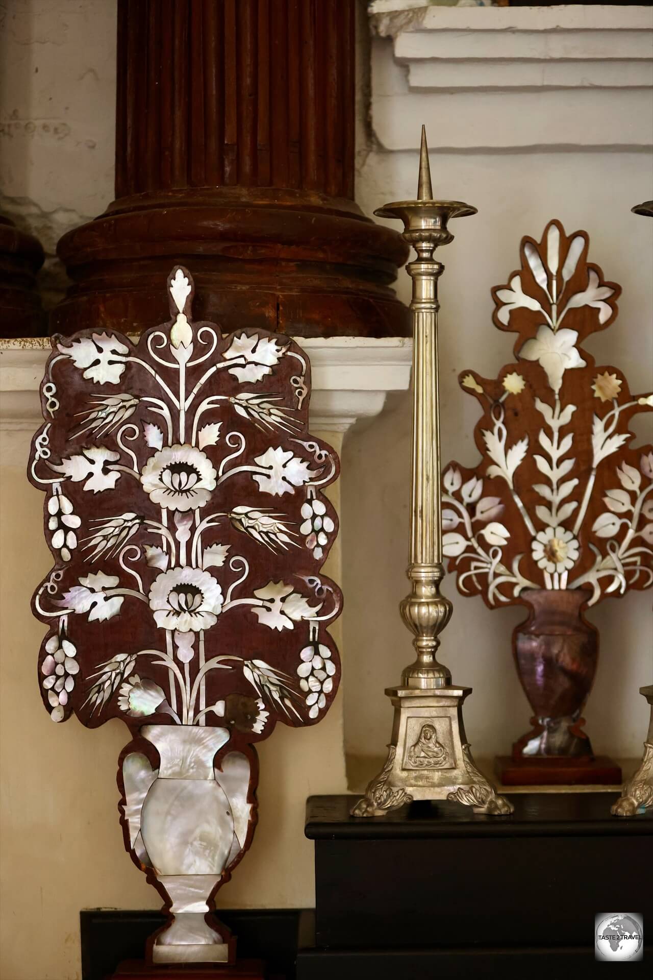
A highlight of St. Michael’s Cathedral in Rikitea is the ornate altar, which features Mother-of-pearl, shells and black pearls.
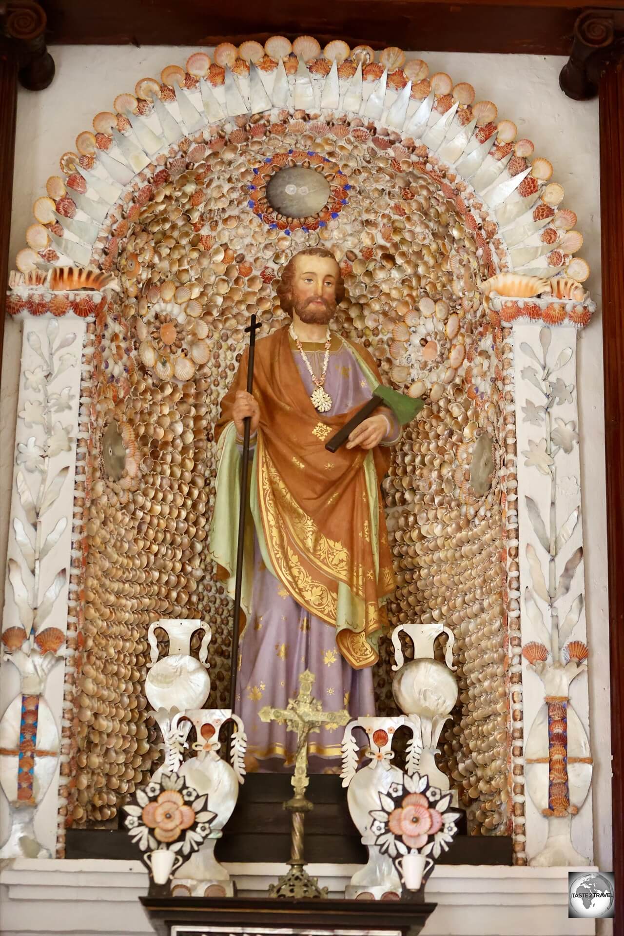
The islands are home to many historic churches, which were constructed by Father Laval and Father Caret, of the Congregation of the Sacred Hearts of Jesus and Mary.
The prized altar at St. Michael’s Cathedral features mother-of-pearl, black pearls, shells and more.
St. Michael’s Cathedral was built at a brisk pace between 1839 and 1848 and served as the principal church in the Gambier Islands and in all of French Polynesia.
St. Michael’s Cathedral was constructed by missionaries of the Congregation of the Sacred Hearts of Jesus and Mary.
Father Laval’s intention was to be able to gather the entire population of Mangareva under one roof for mass.
Laval managed to convince the local chief, King Te Ma-puteoa, of its necessity by using its construction to also erect the nearby palace.
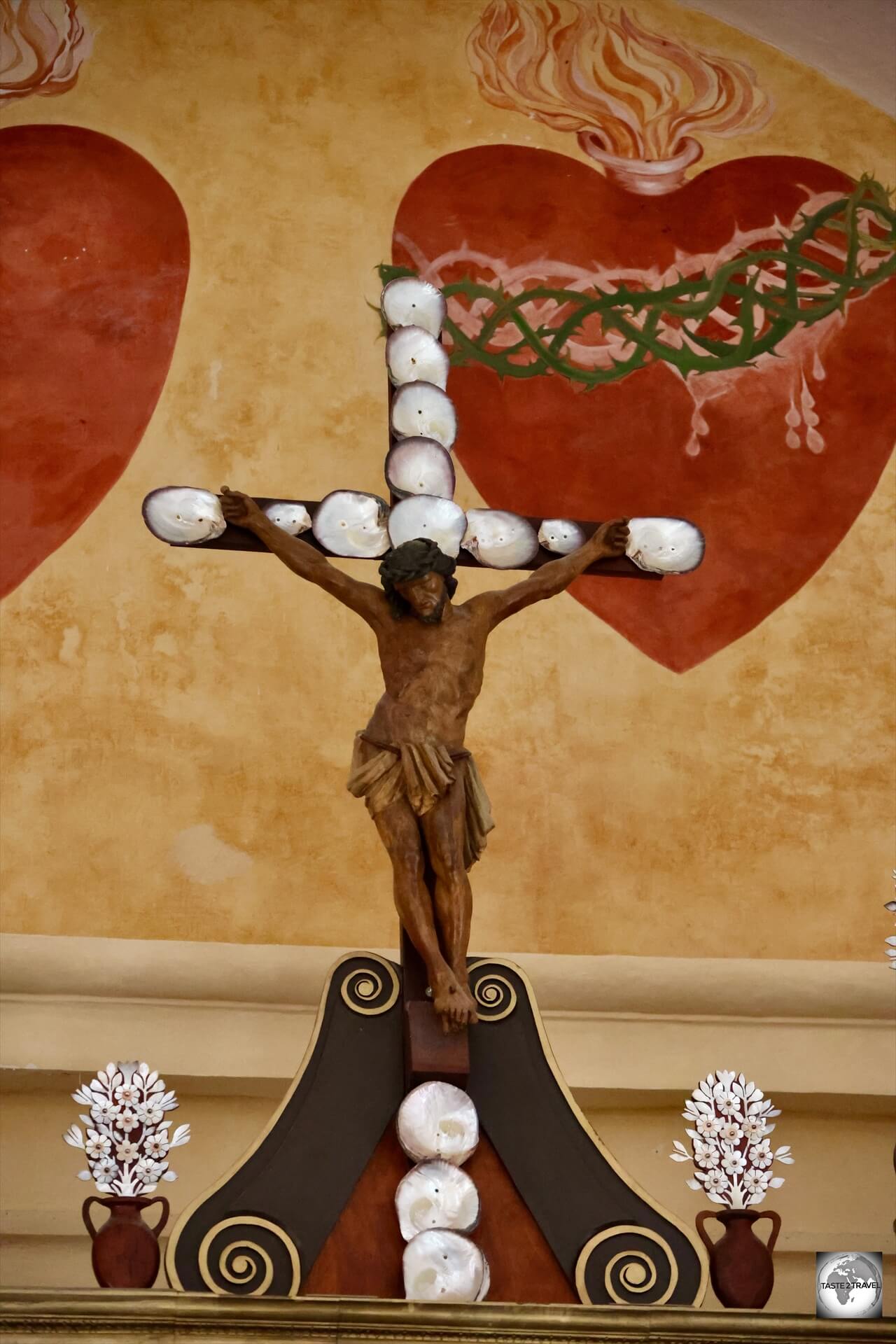
The cross which adorns the altar of St. Michael’s Cathedral is covered in oyster shells.
The cathedral is built entirely out of coral stone and lime from a quarry 16 km from Rikitea.
The building, which is built from coral rock, measures 48 metres (157 ft) in length, is 18 metres (59 ft) wide, and rises to a height of 21 metres (69 ft). It can seat 1200 people.
A statue of the Virgin Mary at St. Michael’s Cathedral, surrounded by mother-of-pearl, shells and black pearls.
The church is thrice the size of the Notre Dame Cathedral in Papeete!
The interior is composed of an impressively large vault which is constructed from reeds, coconut husks and coral lime.
A view of the ornate altar at St. Michael’s Cathedral on Mangareva.
What is especially striking about the cathedral is the decoration of its truly ornate altar.
Mother-of-pearl flowers, with black pearls at their centre, decorate the altar at St. Michael’s Cathedral in Rikitea.
Adorned by hundreds of black pearls and mother-of-pearl shells, there is nothing quite like it anywhere in the Pacific.
Mother-of-pearl, black pearls, shells and more are used for decoration at St. Michael’s Cathedral.
Originally, the altar was adorned by a 50-carat black pearl given to Laval by King Maputeoa.
When Laval was ordered back to Tahiti in 1871, he had the massive pearl shipped to Rome where it is now part of the Vatican collection, rumored to be the finest pearl in the Pope’s collection.
Mother-of-Pearl decoration on the altar of St. Michael’s Cathedral in Mangareva, Gambier Islands.
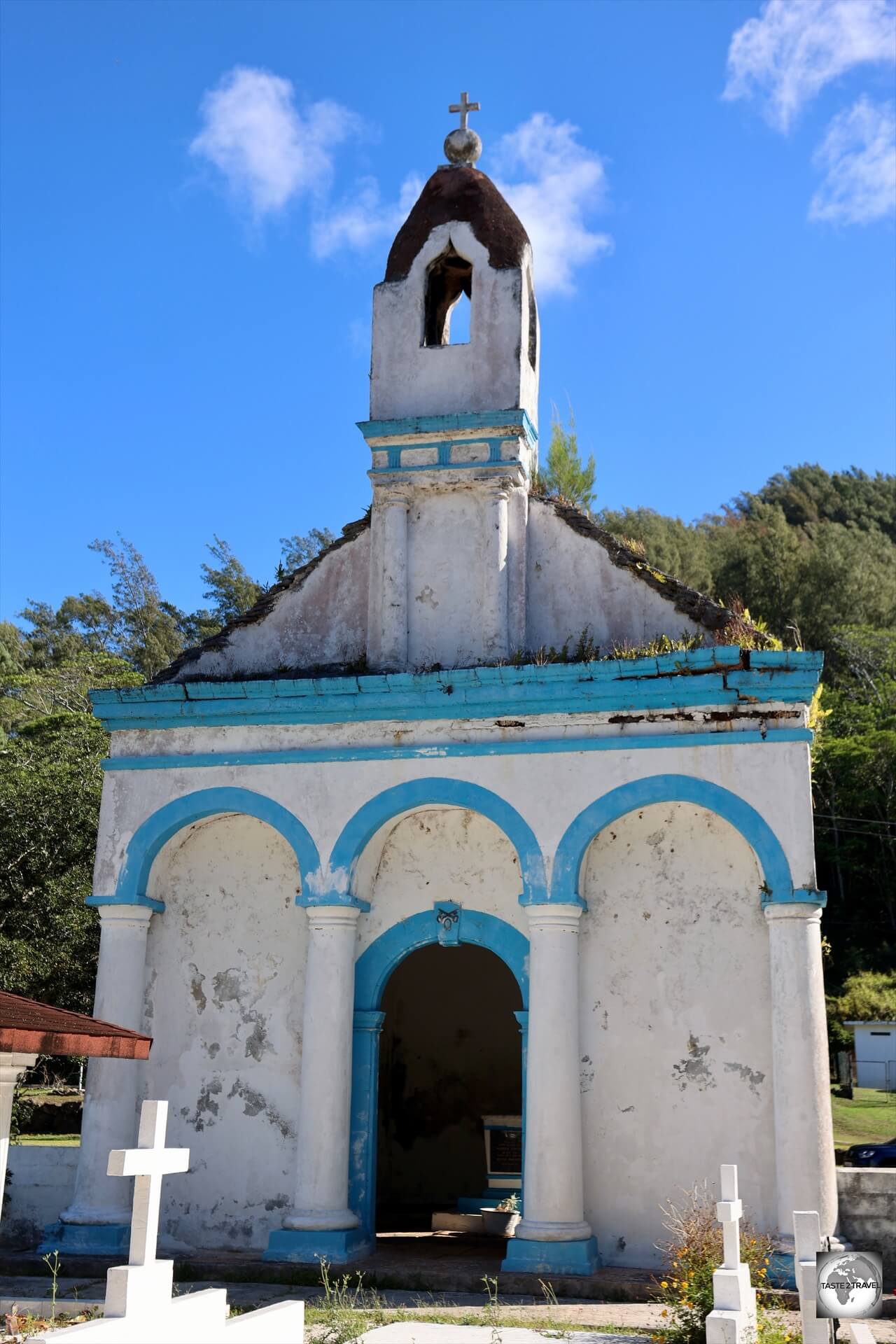
St. Pierre Cemetery
A view of St. Pierre’s Chapel, the burial site of King Te Ma-puteoa, and the cemetery in Rikitea.
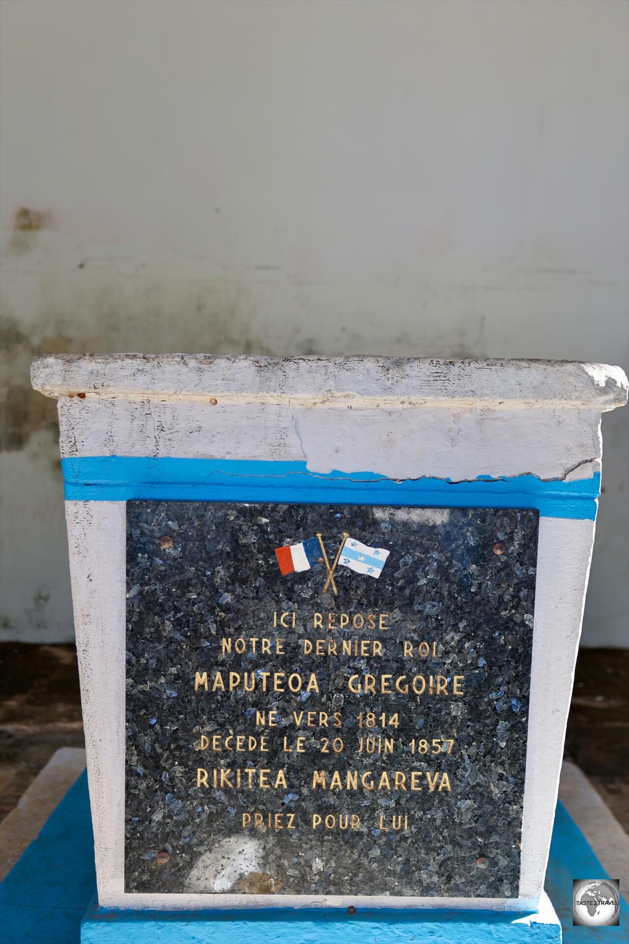
The last King of the Gambier Islands, King Te Ma-puteoa, is buried in a crypt in St. Pierre’s Chapel which is located on a hill above Rikitea, near to the meteorological station.
During Ma-puteoa’s reign, the country, which was deeply rooted in native beliefs and even cannibalism, became a Roman Catholic community.
St. Pierre’s Chapel, the burial site of King Te Ma-puteoa.
This was accomplished by removing all vestiges of native beliefs, including the building of churches over the top of native marae’s (meeting houses).
The tomb of King Te Ma-puteoa, who, after baptism changed his name to Gregorio in honor of Pope Gregory XVI.
The king was baptised into Catholicism on 25 August 1836.
He took the name Gregorio after baptism in honor of Pope Gregory XVI who had deputed the missionaries to eastern Oceania, and solemnly placed his islands under the protection of the Blessed Virgin Mary.
He learned about Christianity from the island’s missionaries, headed by Fathers Honoré Laval and François Caret.
Following the death of his father, King Te Ma-puteoa became King at the age of 10, but, due to poor health died at the age of 21!
St. Anne’s Chapel
Built in 1847, the gift-box sized St. Anne’s Chapel measures just 7×7 metres.
The smallest of all the churches in the Gambier Islands, the very cute St. Anne’s Chapel in Rikitea was constructed in 1847 and measures just 7×7 metres.
The chapel is located a short stroll from the port (turn right when leaving the port).
During my visit, it was closed for renovations.
Mangareva Lagoon Boat Trip
Exploring the sights of stunning Mangareva Lagoon, on a day trip with the friendly crew from Pension Maro’i.
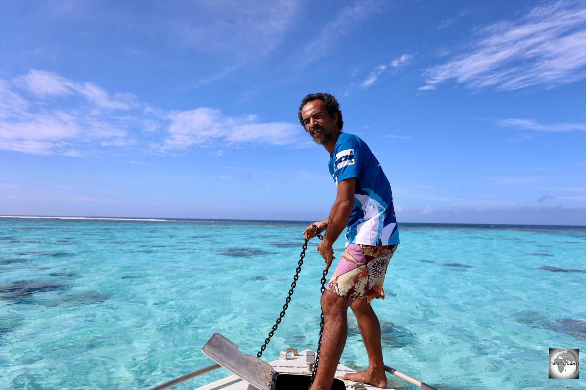
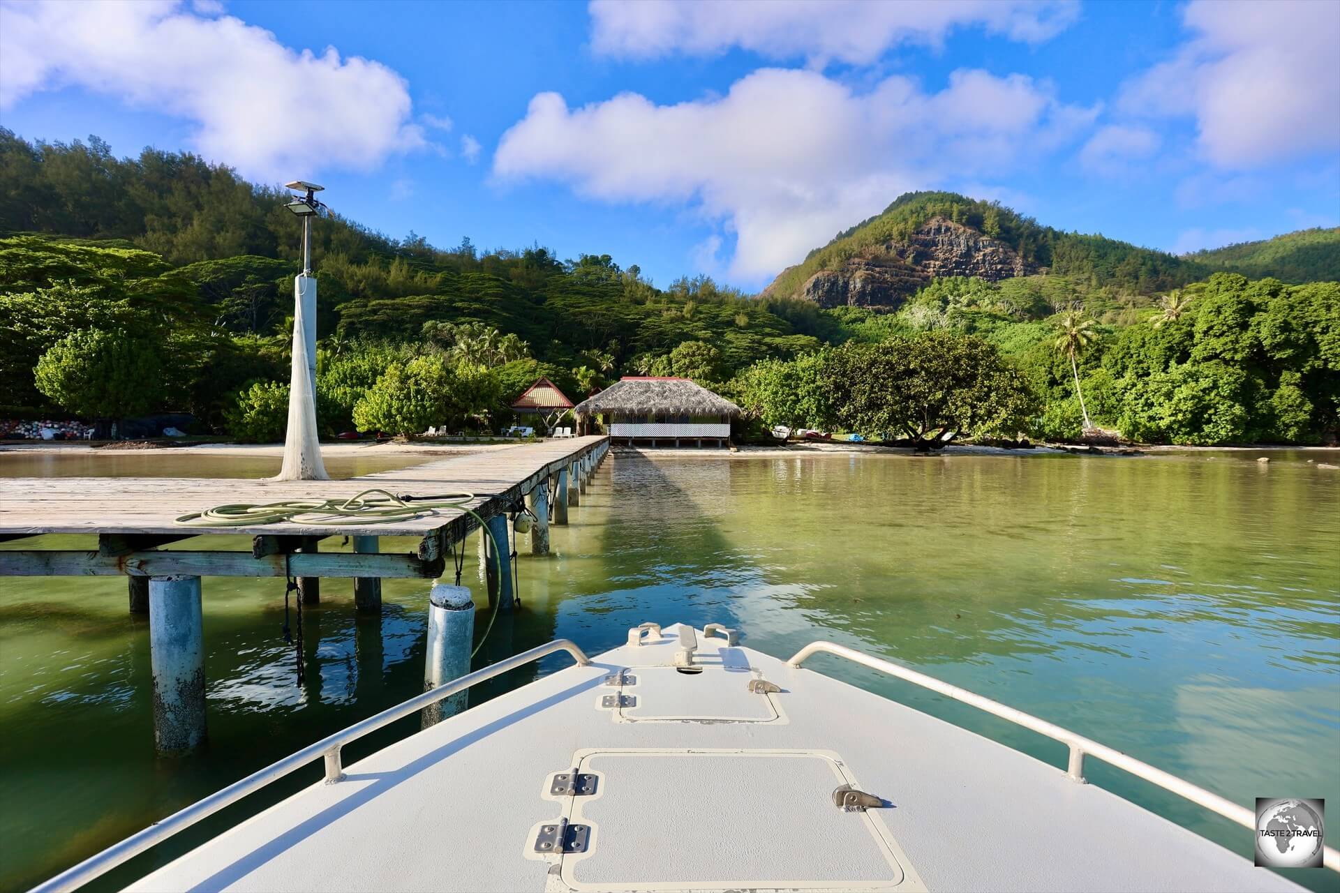
A highlight of my visit to the Gambier Islands was a full day spent on a small speed boat, exploring the various islands, and sights, of the stunningly beautiful Mangareva lagoon, with the incredible team from Pension Maro’i.
A weekly boat trip which visits the islands of Mangareva Lagoon is offered every Thursday by Pension Maro’i.
The tour is conducted every Thursday and will normally be joined by any of the small number of tourists on Mangareva.
On my trip, there were 5 other passengers.
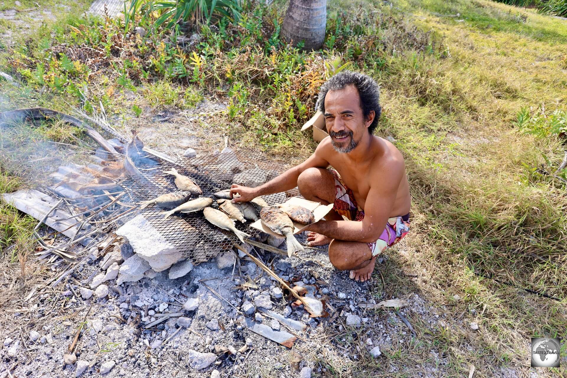
The trip costs 13,500 CFP (US$122) and includes a full day of touring, visiting all of the islands which are described below, plus a delicious lunch of BBQ fresh fish, salads and other local island specialties.
Our daytrip included an excellent lunch of BBQed fish on Bird Island.
In terms of foot wear, I would recommend bringing both flip flops and sturdy walking shoes as activities range from relaxing on stunning beaches, to hiking on some of the islands.
The beautiful beach at Motu Tauna (Bird Island).
Snorkeling equipment would also be beneficial as there are many amazing snorkeling spots. The boat didn’t carry any snorkeling equipment.
The 2-man crew provided commentary in French (of course!) with some basic English.
Highly recommended!
Taravai Island
The first island we visited on our boat trip was Taravai.
Taravai is the second largest of the Gambier Islands. Once home to over 2,000 inhabitants, today, it is home to one family who act as caretakers on the island.
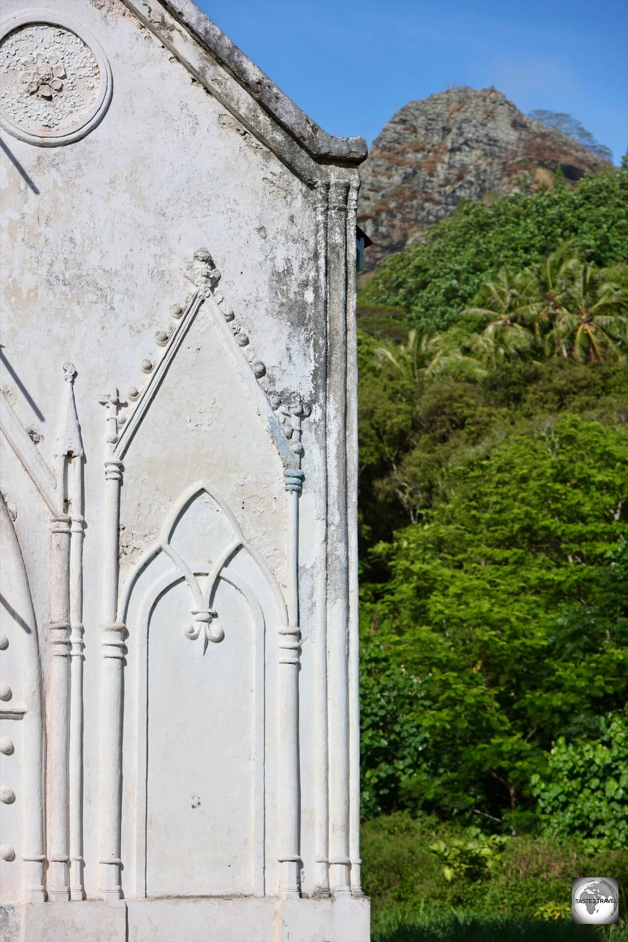
Church of Saint-Gabriel, and the archway with the twin hearts from ‘Les Sacrés-Coeurs de Picpus’, Taravai Island.
The island boasts a magnificent white sandy beach and a rather strange archway in the remains of an ancient wall.
Above the arch are two red hearts, the emblem of a religious order ‘Les Sacrés-Coeurs de Picpus’.
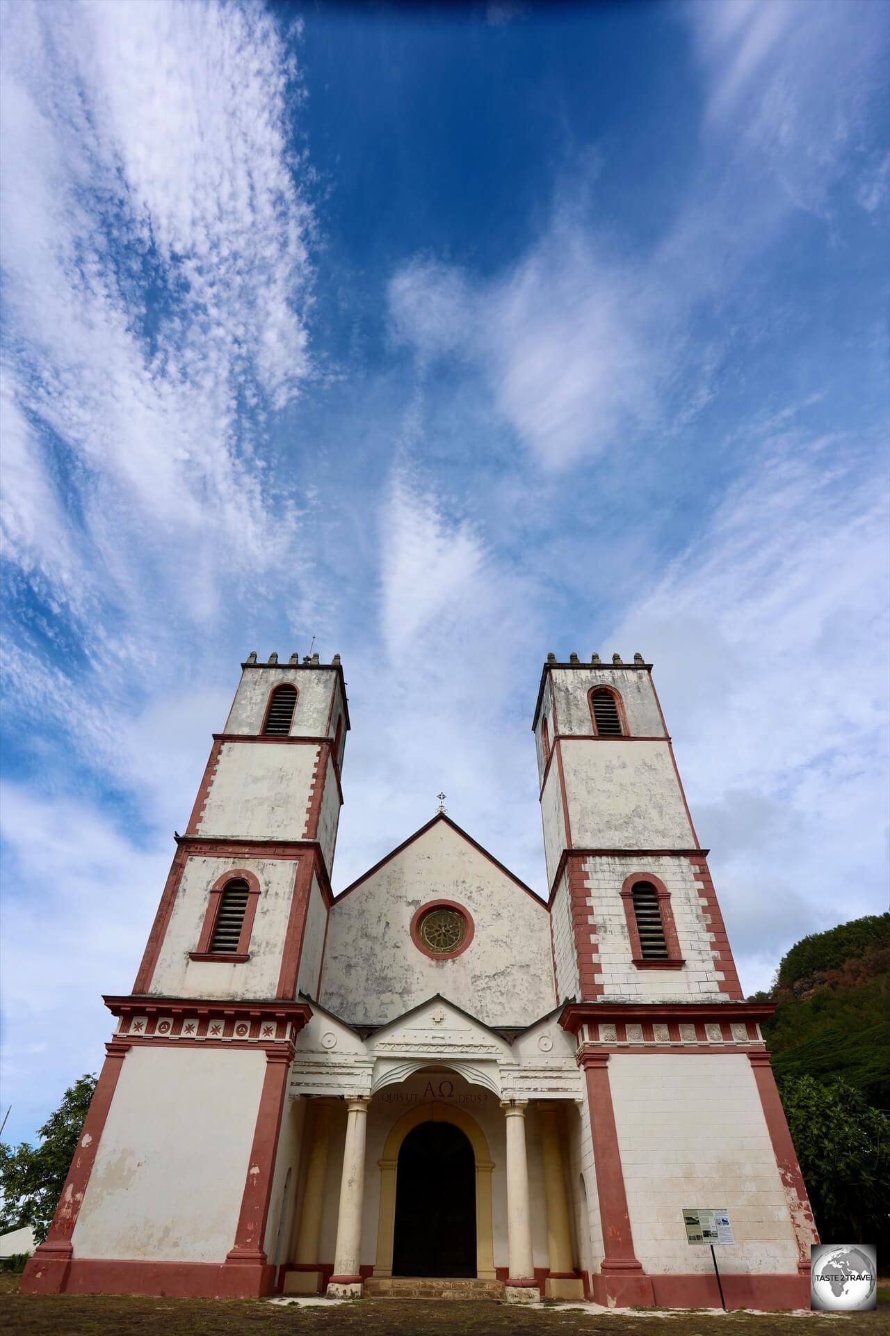
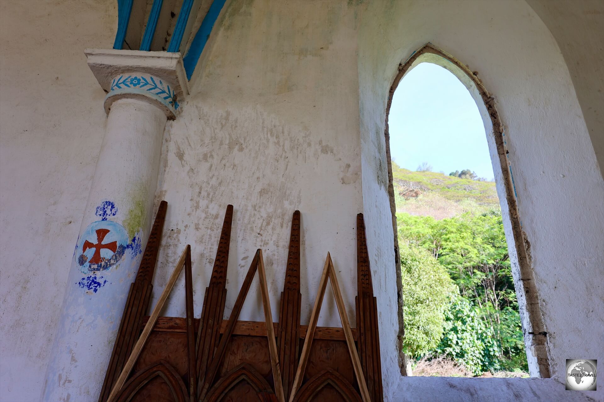
Church of Saint-Gabriel
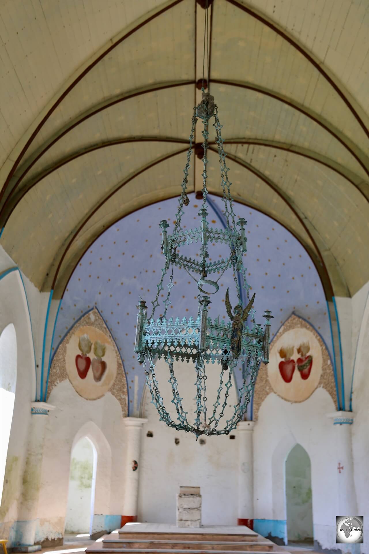
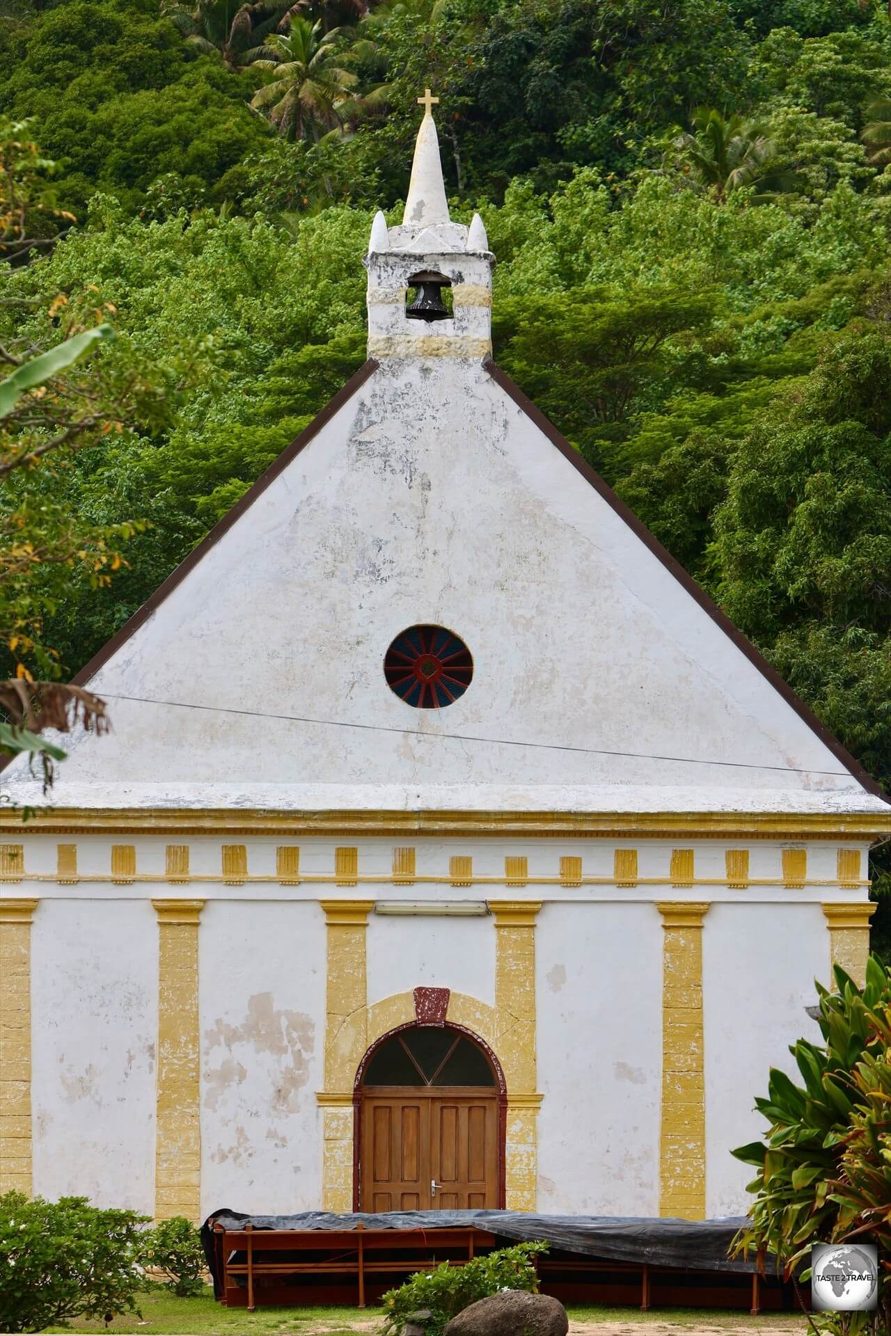
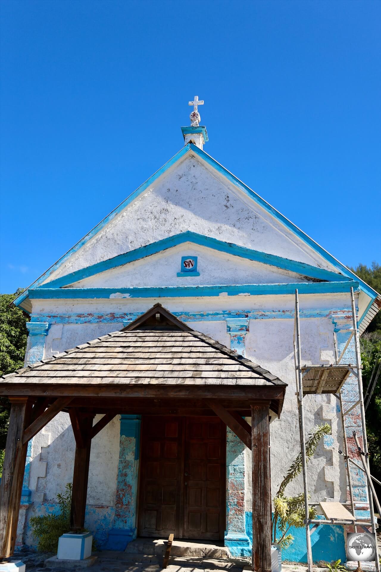
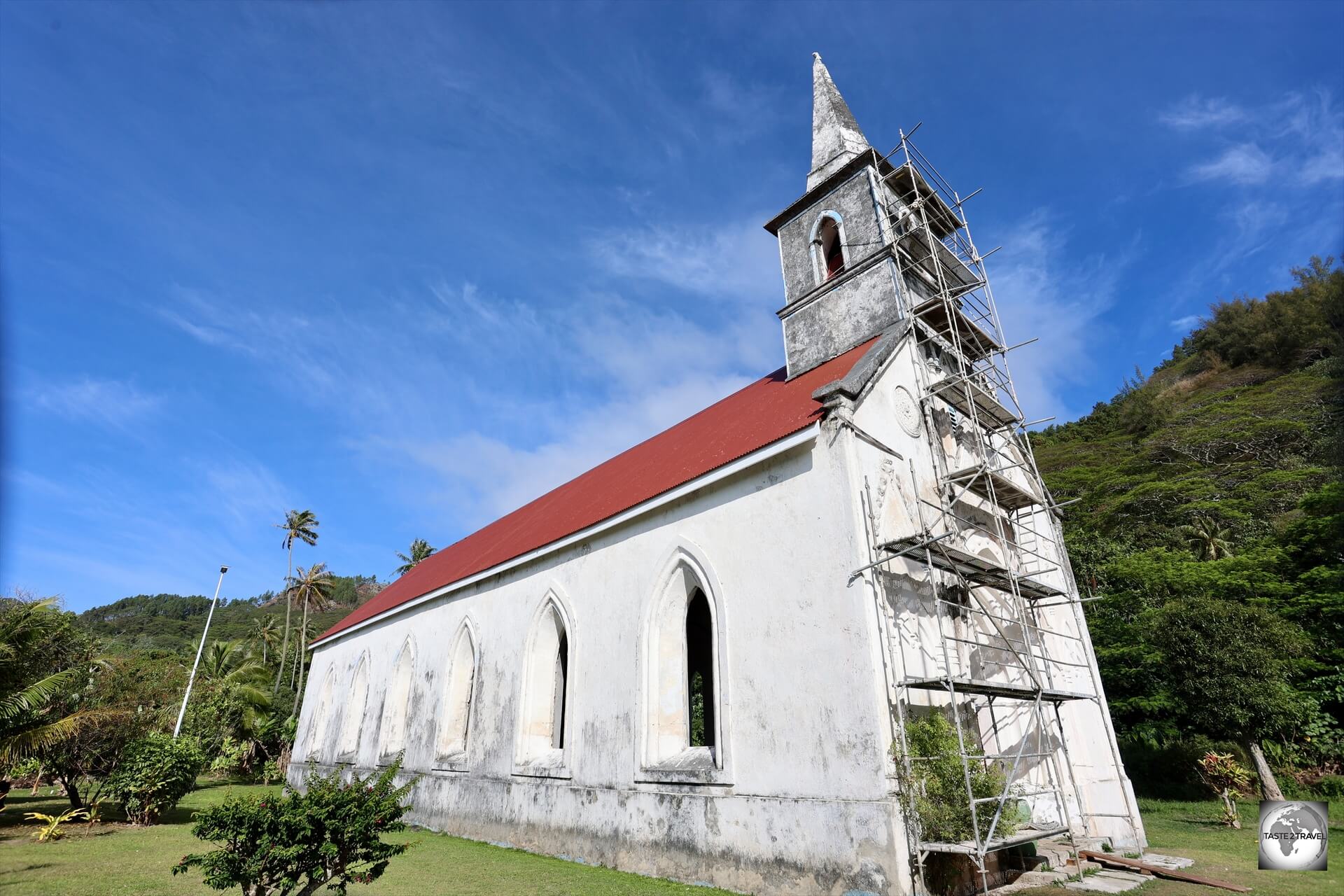
A highlight of Taravai Island, the Church of Saint-Gabriel, which was under renovation at the time of my visit.
The gothic-style Church of Saint-Gabriel was built in 1868 by Mangarevan islanders, under the direction of the Picpus missionary fathers, the same folks who built all the other churches in the Gambier Islands.
The white washed walls of the church contrast against the lush green scenery of Taravai Island.
At the time of my visit, the church was undergoing a very slow restoration and all of the furniture, including the altar, had been removed while the interior walls were being painted.
At the time of my visit in 2024, the Church of Saint-Gabriel was undergoing a slow renovation.
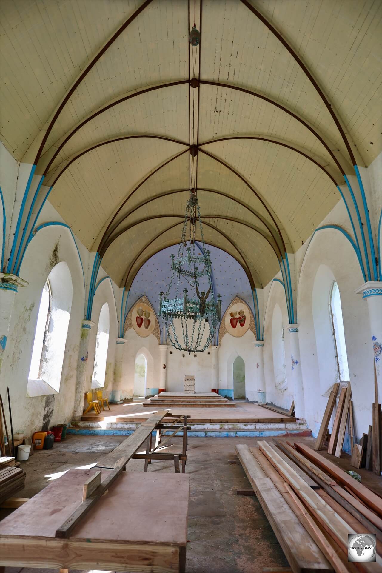
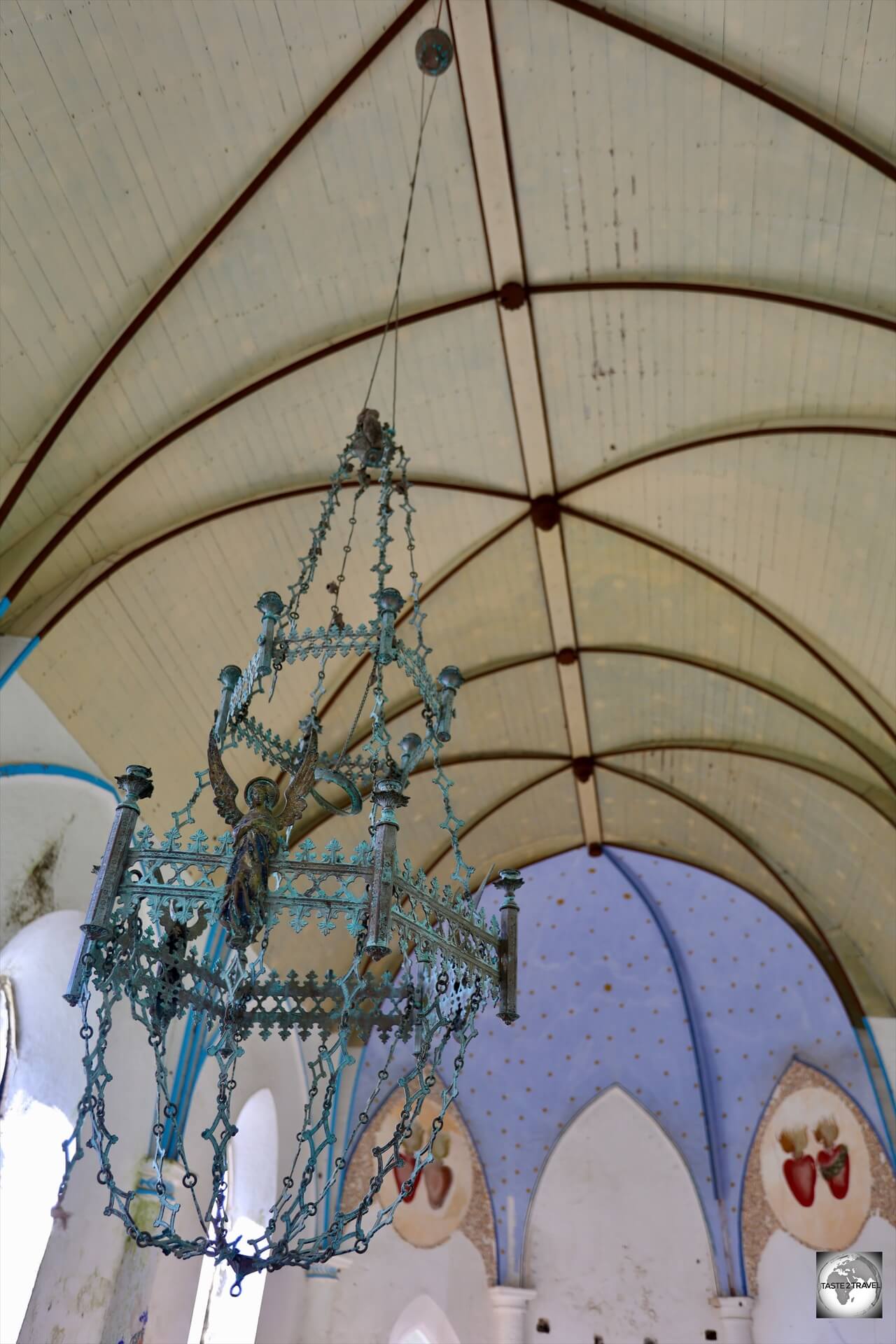
The interior of the Church of Saint-Gabriel is truly magnificent with the twin hearts of the religious order ‘Les Sacrés-Coeurs de Picpus’, displayed prominently behind the altar (currently removed due to the renovation).
The interior of the Church of Saint-Gabriel, Taravai Island.
The Gambier archipelago is the cradle of Catholicism in French Polynesia.
A view of the interior of the Church of Saint-Gabriel, Taravai Island.
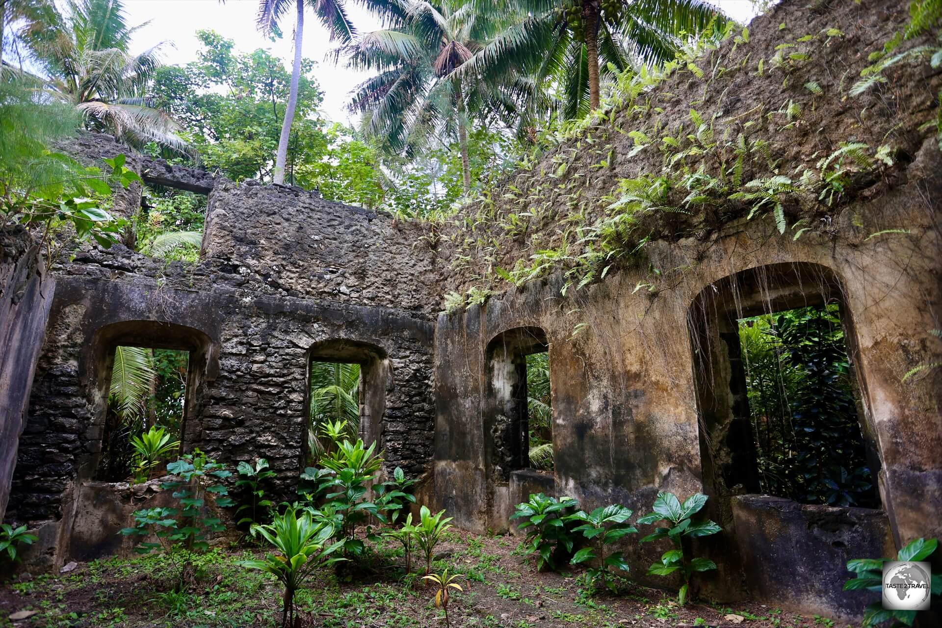
The islands feature more than one hundred stone buildings of the eighteenth and nineteenth century: churches, presbyteries, convents, schools, weaving workshops, bread ovens, lime ovens, and watchtowers.
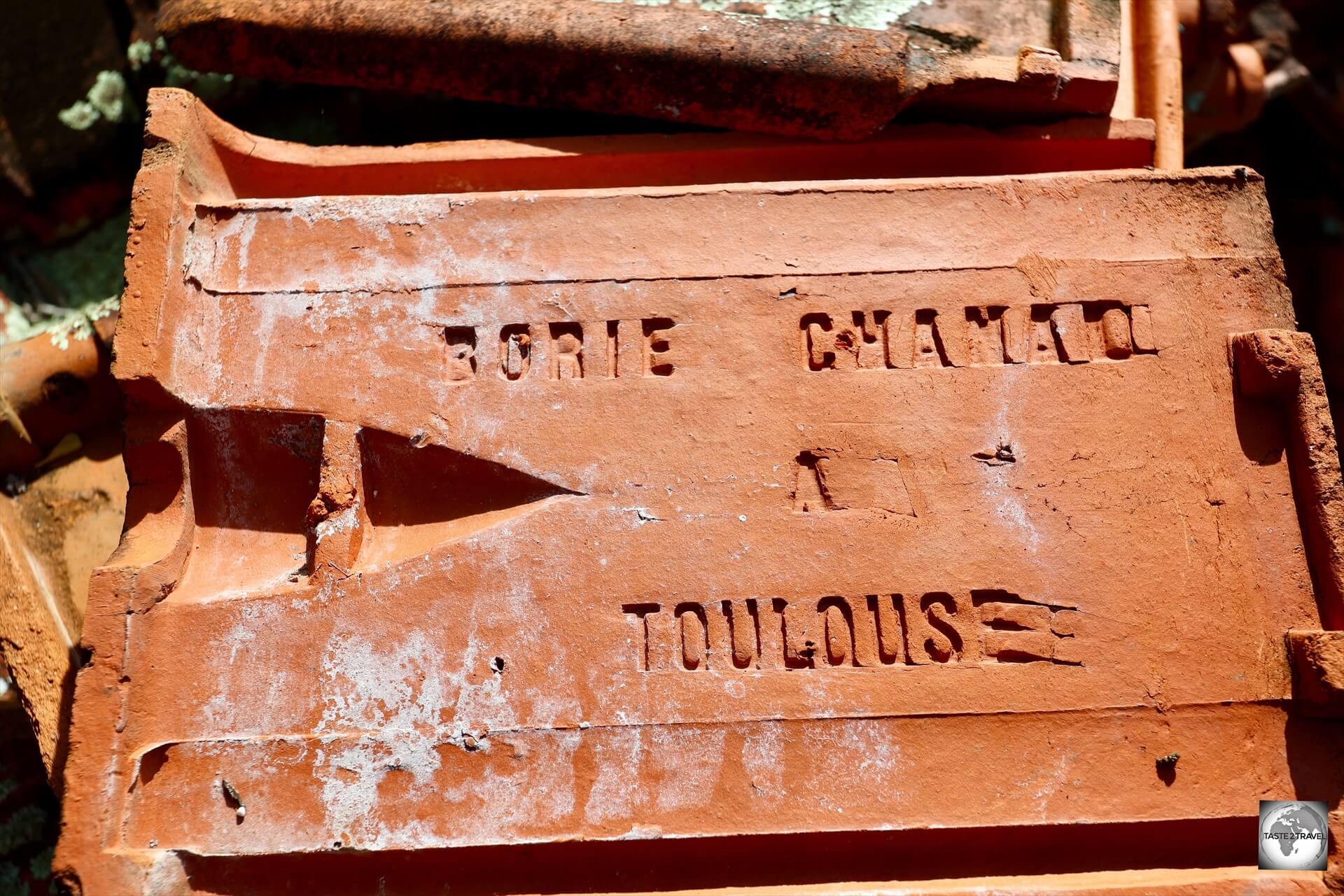
“Made in Toulouse’ – tiles from the roof of the Church of Saint-Gabriel, Taravai Island.
Mekiro Islet
The second island we visited on our boat trip was tiny Mekiro Islet.
A view of Akamaru Island from Mekiro Islet.
Mekiro is a small, hilly islet right next to Akamaru.
This lonely islet is inhabited by a herd of wild goats who can be observed, scaling the cliff-faces in search of food.
Our boat, from Pension Maro’i, anchored on a beautiful beach at Mekiro Islet with Akamaru Island in the background.
During our day trip of the lagoon with the folks from Pension Maro’i, we spent time at Mekiro Islet where I was able to swim on a beautiful white sand beach.
A lonely beach at Mekiro Islet, with Akamaru Island in the background.
If you have sturdy walking shoes (highly recommended for the day trip of the islands), a fabulous view of the lagoon can be seen from the top of Mekiro Islet.
I unfortunately only had my less-than-sturdy flip-flops so I spent my time relaxing on the beautiful beach pictured above.
Akamaru Island
The third island we visited on our boat trip was Akamaru.
Remnants of the former town on sleepy Akamaru Island, now home to 22 inhabitants.
Akamaru Island is the third largest island in the Gambier Islands.
It is a small, rocky island with an area of approximately 2.6 km2 (1.0 sq mi). The island is located approximately 7 km (4.3 mi) southeast of Mangareva.
A lonely outpost, in a lonely part of the world, Akamaru Island once supported a thriving population but is today home to just 22 souls.
A view of the beach at Akamaru Island with Mekiro Islet in the background.
Akamaru’s highest point rises to an elevation of 247 m (810 ft).
The first European to arrive was the navigator James Wilson in 1797.
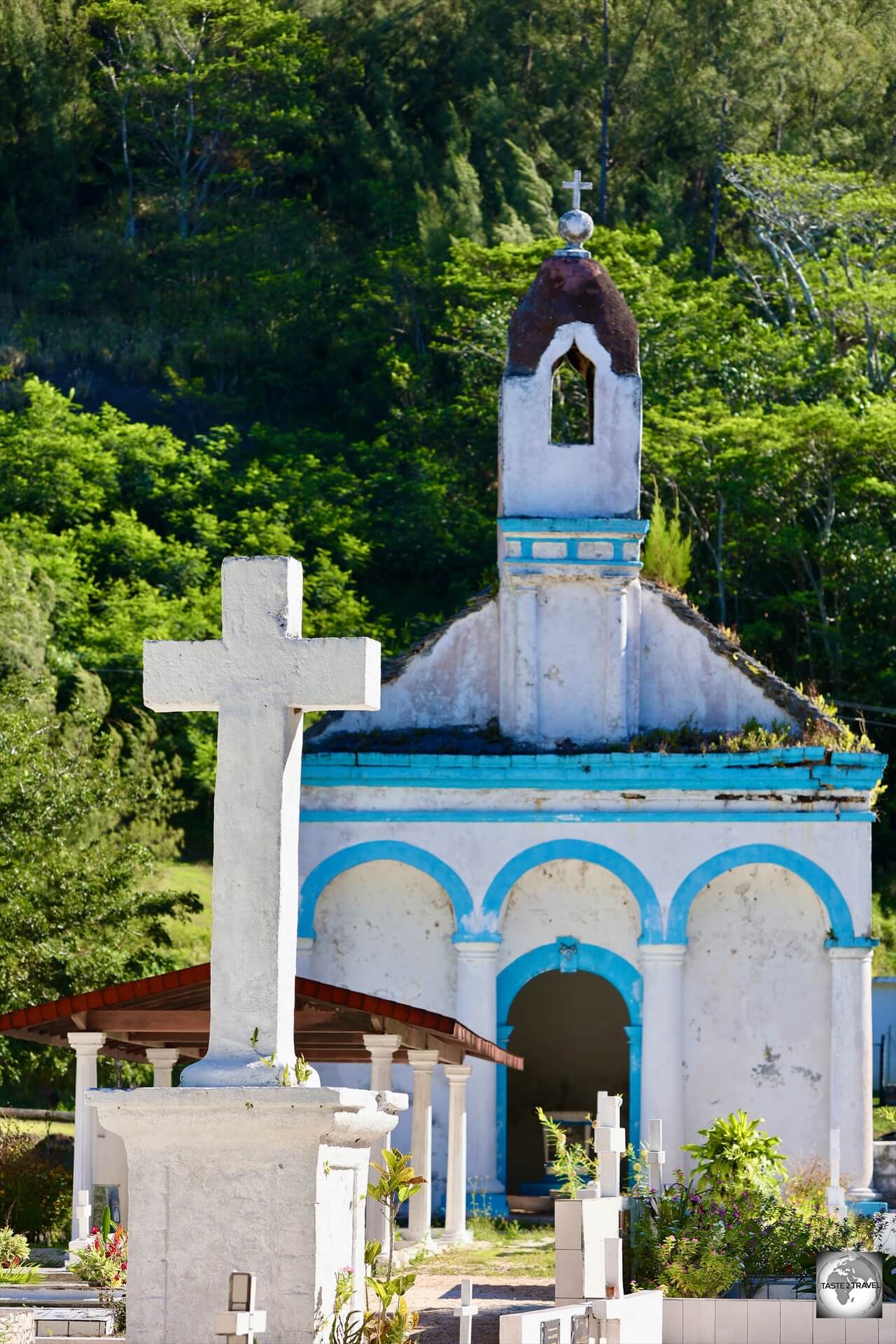
Notre-Dame de la Paix Church
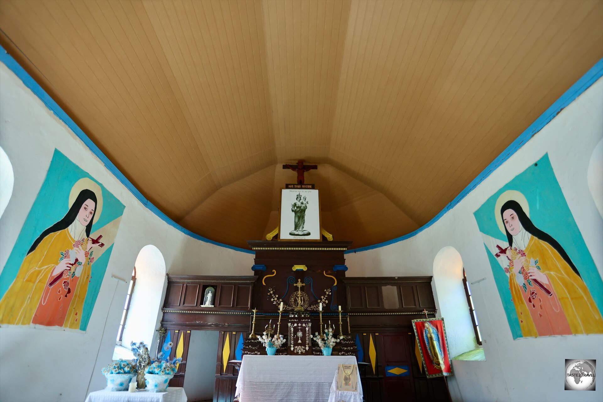
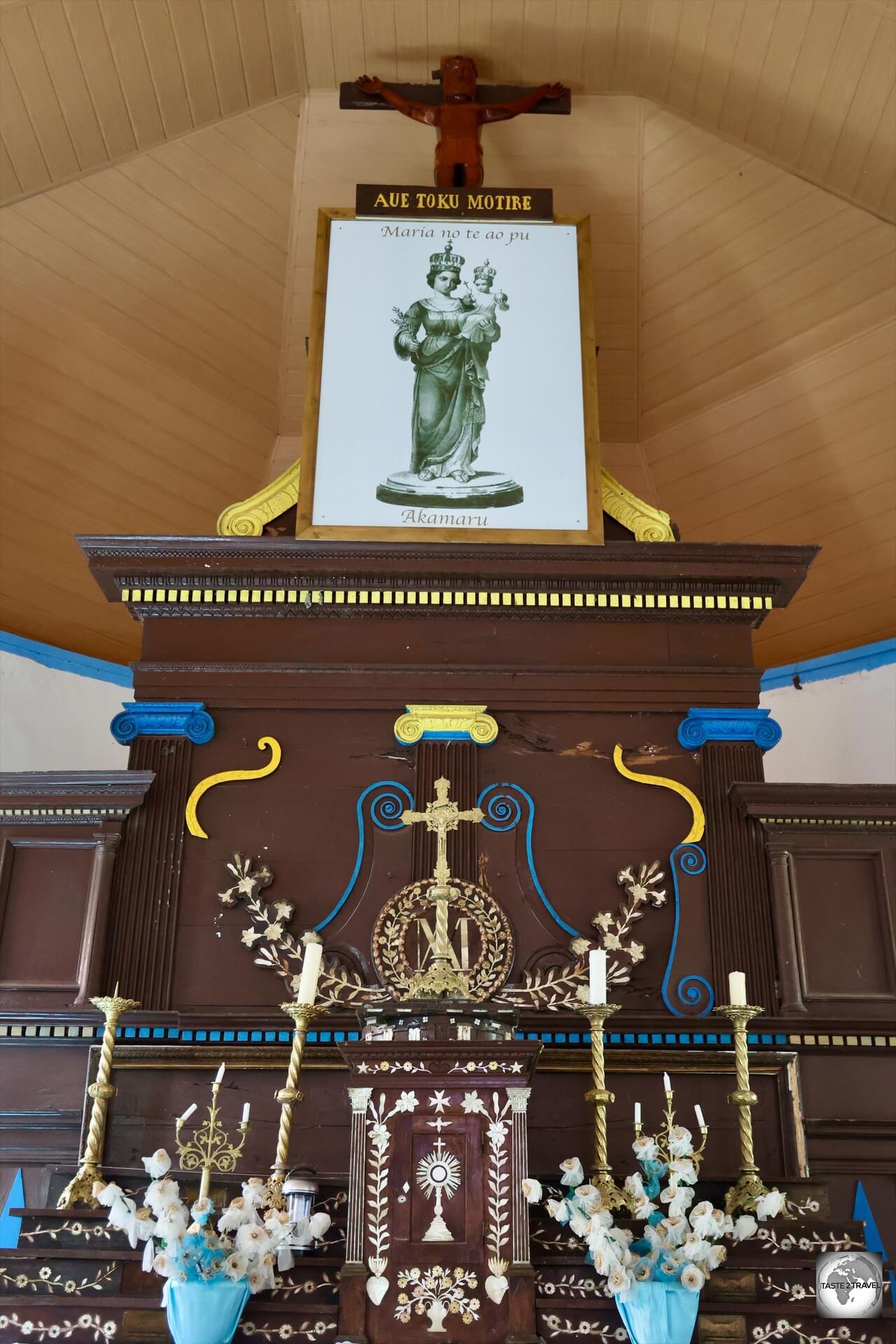
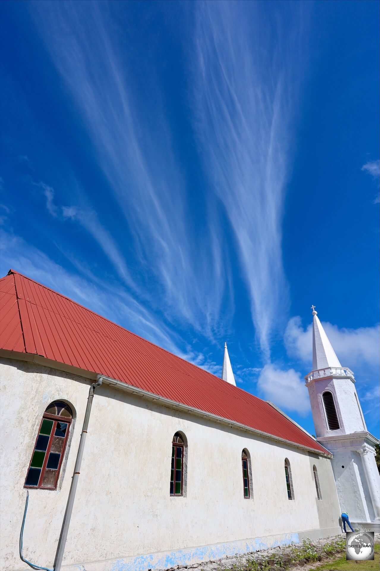
Dedicated to the Virgin Mary, Notre-Dame de la Paix church, is an important and historic Catholic church on Akamaru Island.
In 1834, the French missionary FatherHonoré Laval (who built St. Michael’s Cathedral on Rikitea) celebrated the first Mass on the island.
The altar at Notre-Dame de la Paix church, Akamaru Island.
The church of Notre-Dame de la Paix (translates as: Our Lady of Peace) was built between 1835 and 1862 and is dedicated to the Virgin Mary.
Mother-of-Pearl inlay features in the altar of Notre-Dame de la Paix Church.
Notre-Dame de la Paix was another project by the very busy Father Honoré Laval.
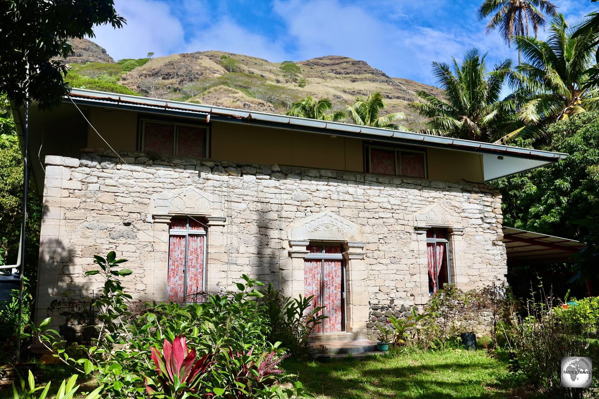
The former palace of King Te Ma-puteoa on Akamaru Island was built in exchange for his support of the construction of the nearby Notre-Dame de la Paix church.
The good father gained support for the construction of the church by offering to build a stone palace for King Te Ma-puteoa, which lies a short distance from the church.
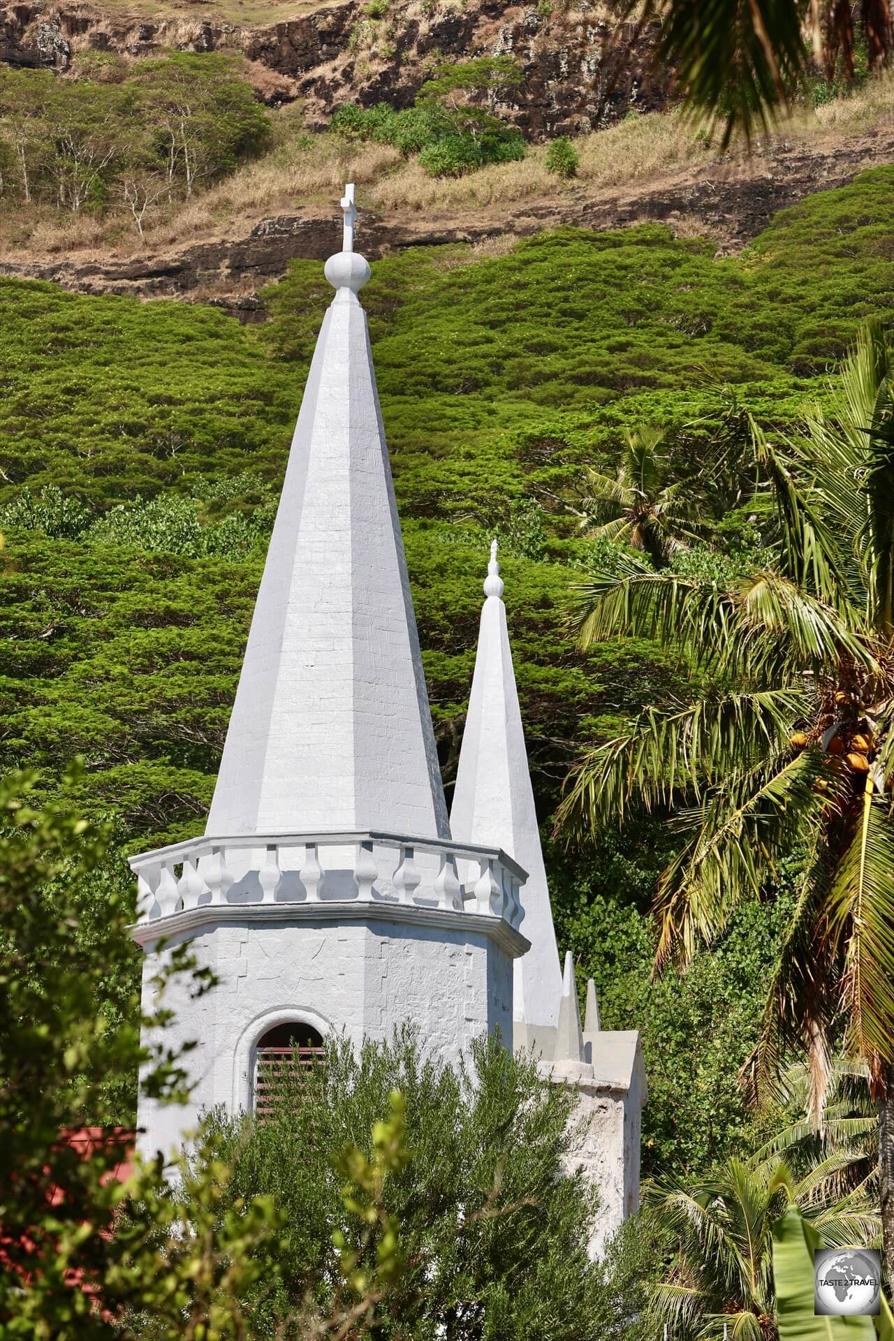
The twin, asymmetrical, spires of Notre-Dame de la Paix church, Akamaru Island.
Constructed from lime-coated coral, its distinctive feature is its two asymmetrical bell towers, which were inspired by the architecture of the French cathedral Notre-Dame de Chartres.
Like other churches in the Pacific region, the ceiling of Notre-Dame de la Paix resembles an upturned boat.
Every year, a pilgrimage takes the Virgin Mary, wearing a necklace of Tahitian pearls, to the cathedral of Saint-Michel de Rikitea at the end of July and brings her back to the church of Akamaru on August 15.
A view of Notre-Dame de la Paix church, on Akamaru Island.
Akamaru Vanilla Farm
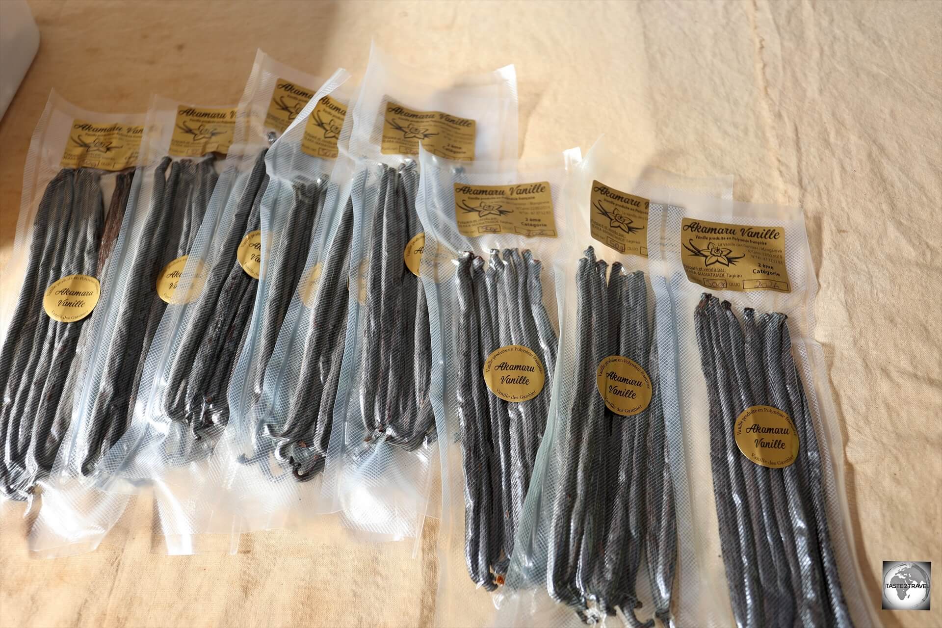
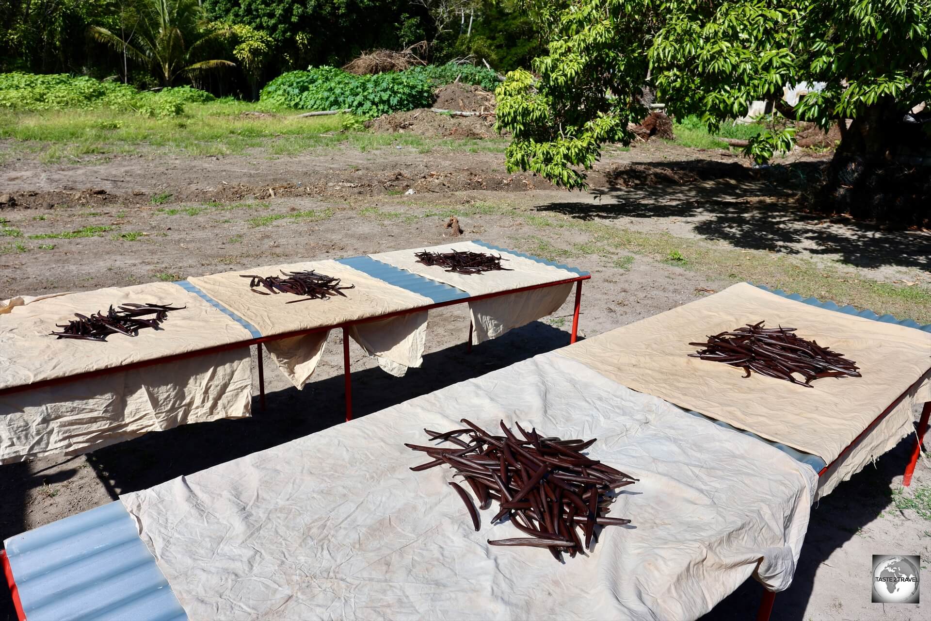
Packets of vanilla for sale at Akamaru Vanilla Farm – 50 grams for US$50.
Tiny Akamaru Island is home to just 22 souls, with several of those involved in the most amazing enterprise – a vanilla farm where the vanilla plants are hand-pollinated.
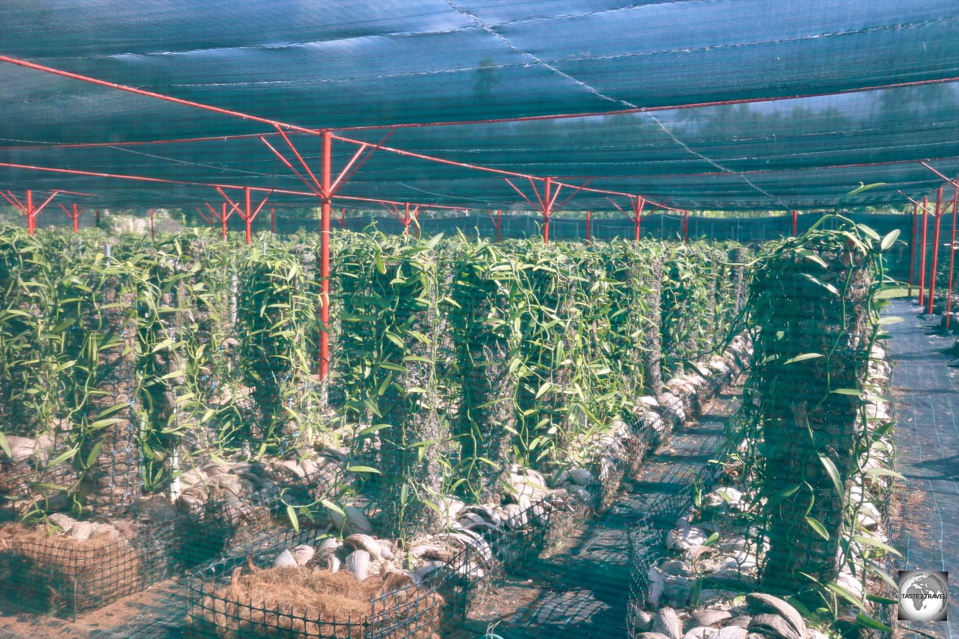
A real gold mine – the immaculate vanilla plantation at Akamaru Vanilla Farm.
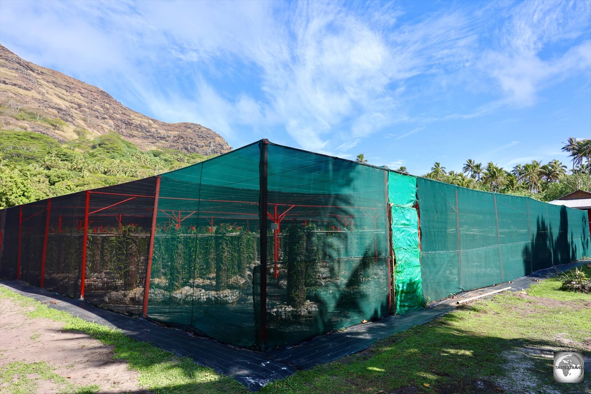
Akamaru Vanilla Farm is home to two large greenhouses which are perfectly laid-out and kept perfectly clean and ordered.
Akamaru Vanilla Farm features two large green houses which are perfectly arranged for the cultivation of vanilla pods.
Vanilla is one of the most expensive spices in the world, with packets of half a dozen pods from Akamaru Vanilla Farm selling for US$50!
This is a veritable gold mine!
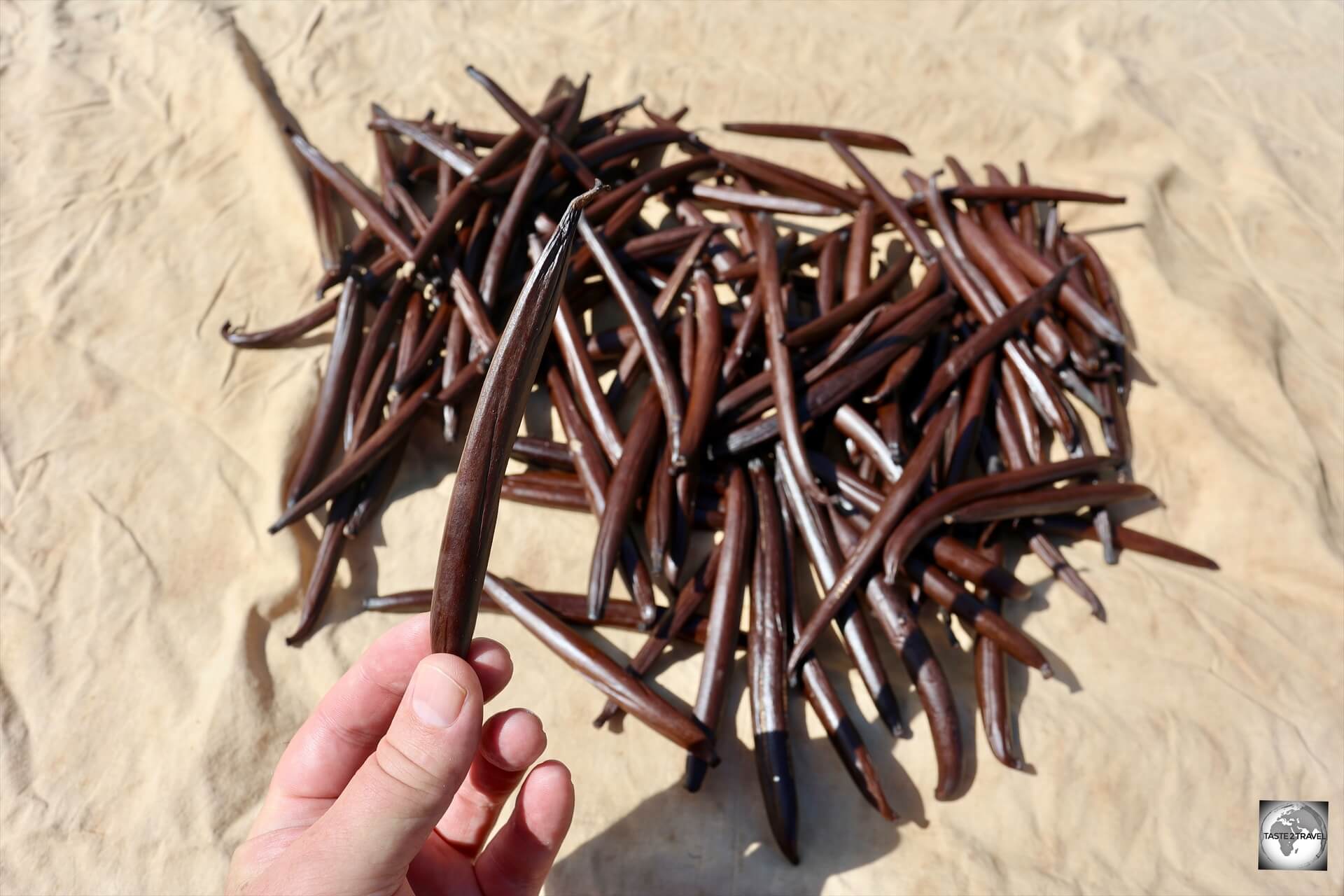
Vanilla pods at Akamaru Vanilla Farm, drying in the sun.
I did ask if I could photograph inside the enclosures but that wasn’t allowed since the plants are highly sensitive to any contamination.
Only a small number of staff are allowed inside the greenhouses.
Vanilla pods at Akamaru Vanilla Farm, drying in the sun.
We were however, able to get up close to the pods which had been picked and which were drying in the sun prior to be packaged.
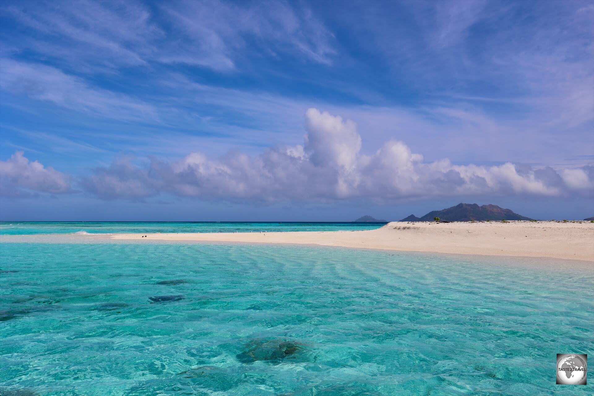
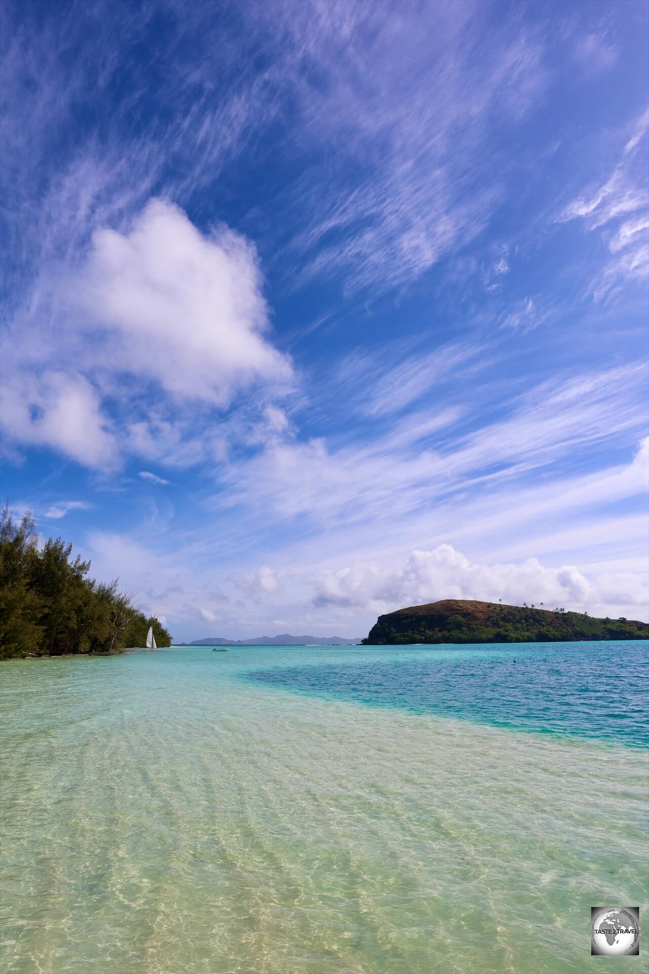
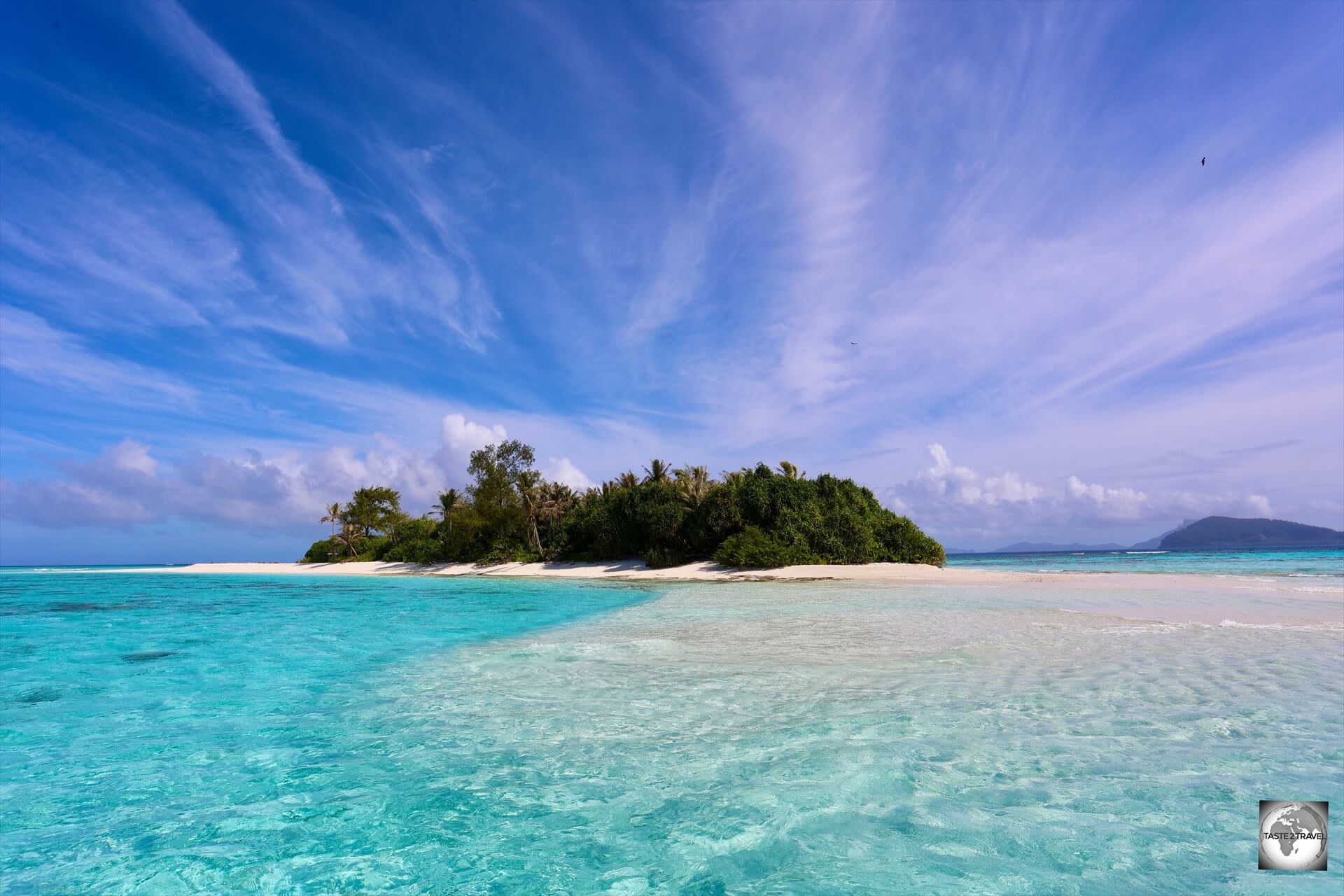
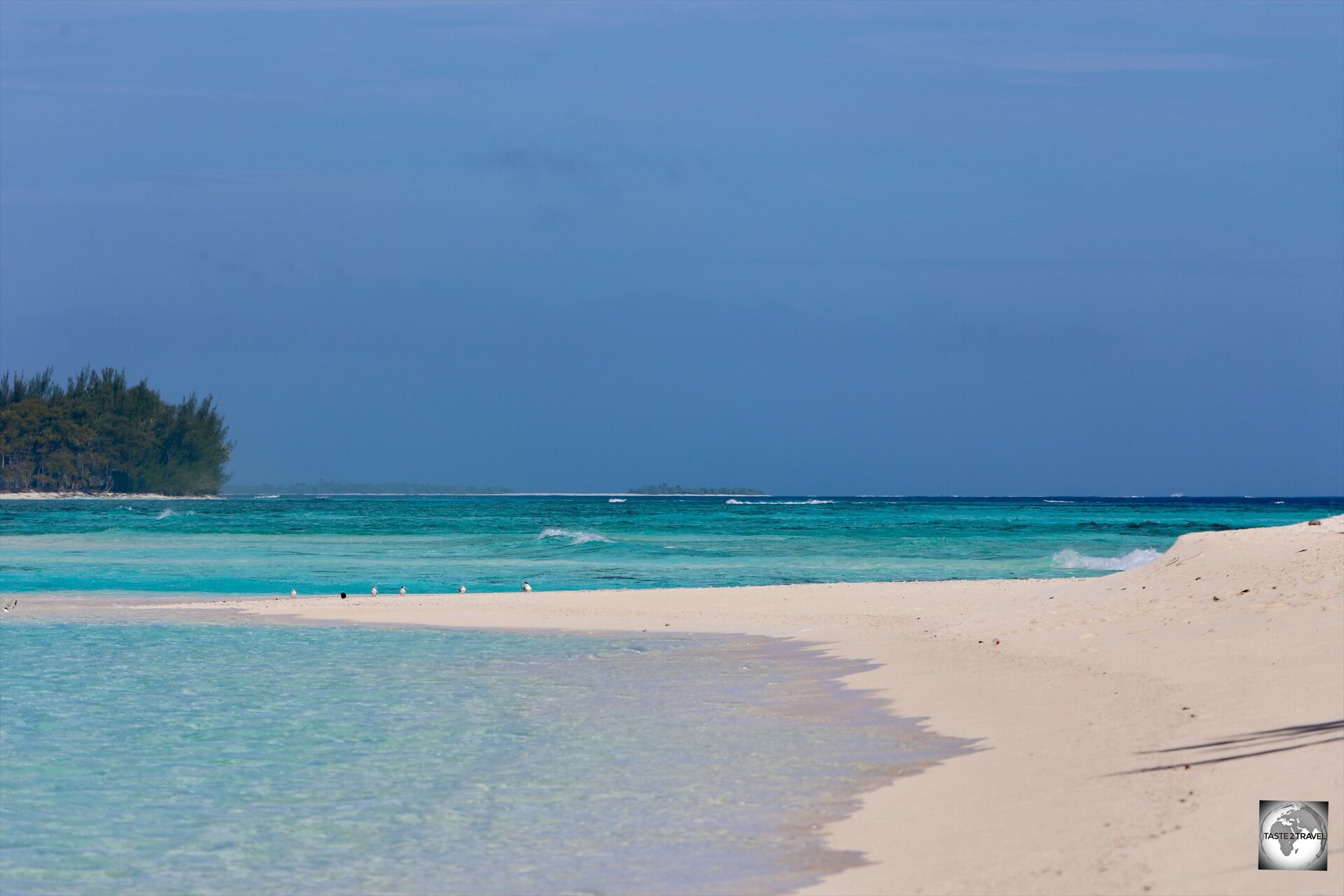
Motu Tauna (Bird Island)
The fourth island we visited on our boat trip was Motu Tauna (Bird Island) which served as our lunch stop.
The stunningly beautiful Motu Tauna (Bird Island).
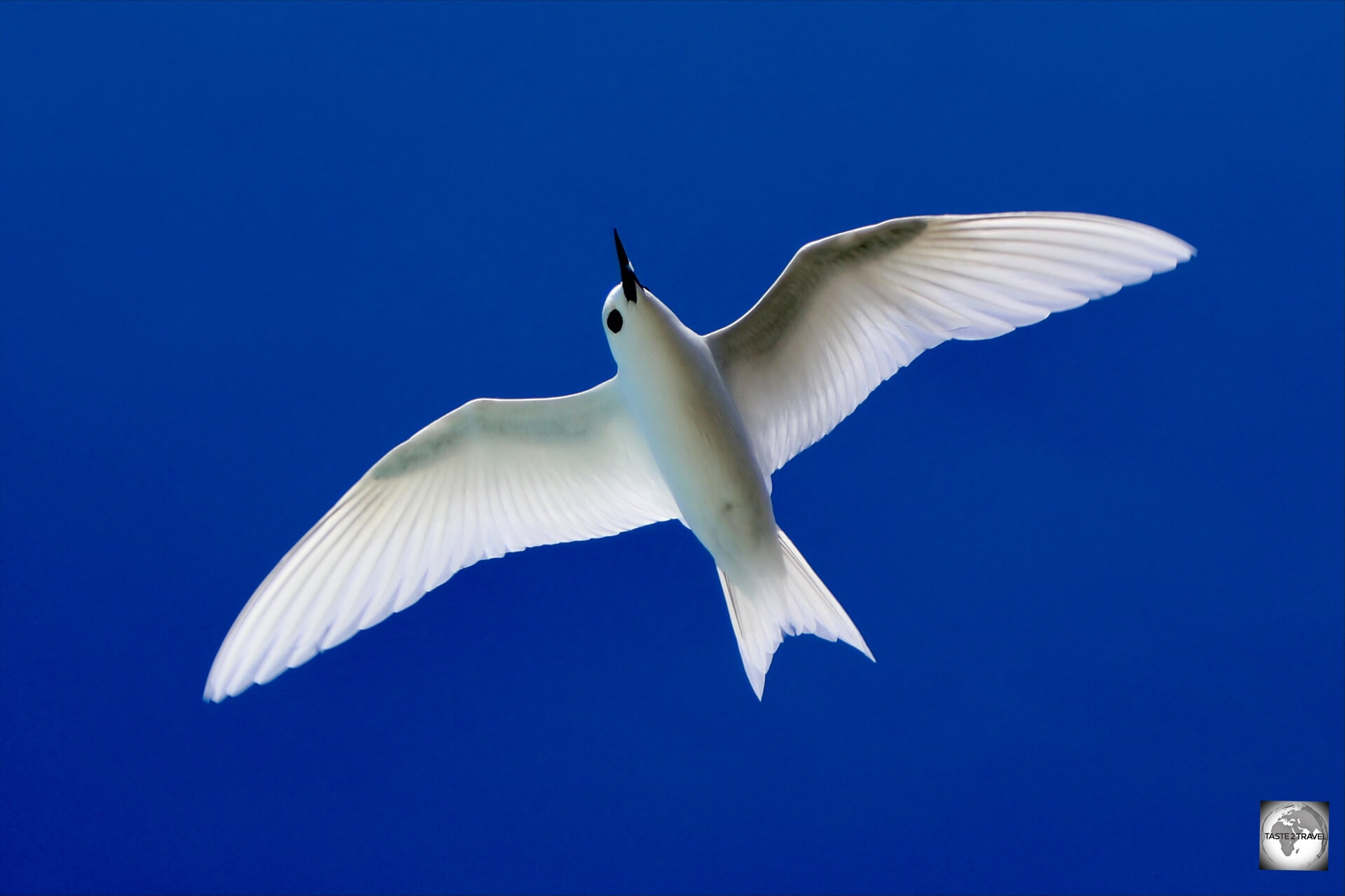
Motu Tauna (aka Bird Island), and pronounced ‘Ta-oo-nah’, is a small coral atoll which is home to nesting seabirds such as White terns and Brown noddy’s.
White Fairy tern on Bird Island.
Approaching Tauna is like something out of a dream.
A view of Motu Tauna (Bird Island) – paradise found!
Our boat weaved its way around the fringing coral reef, passing through the most incredible shades of clear blue water: teal, turquoise, cobalt.
A true paradise – the stunning beach at Motu Tauna (Bird Island).
Rising up in the distance was the lush green vegetation of Motu Tauna.
Brown noddy on Bird Island.
This was the definition of a paradise isle!
As we approached the island, we could see flocks of seabirds nesting in the trees.
The beach at Motu Tauna (aka Bird Island).
The island served as our lunch stop and was a great place to snorkel, with one juvenile black-tip reef shark swimming close to shore.
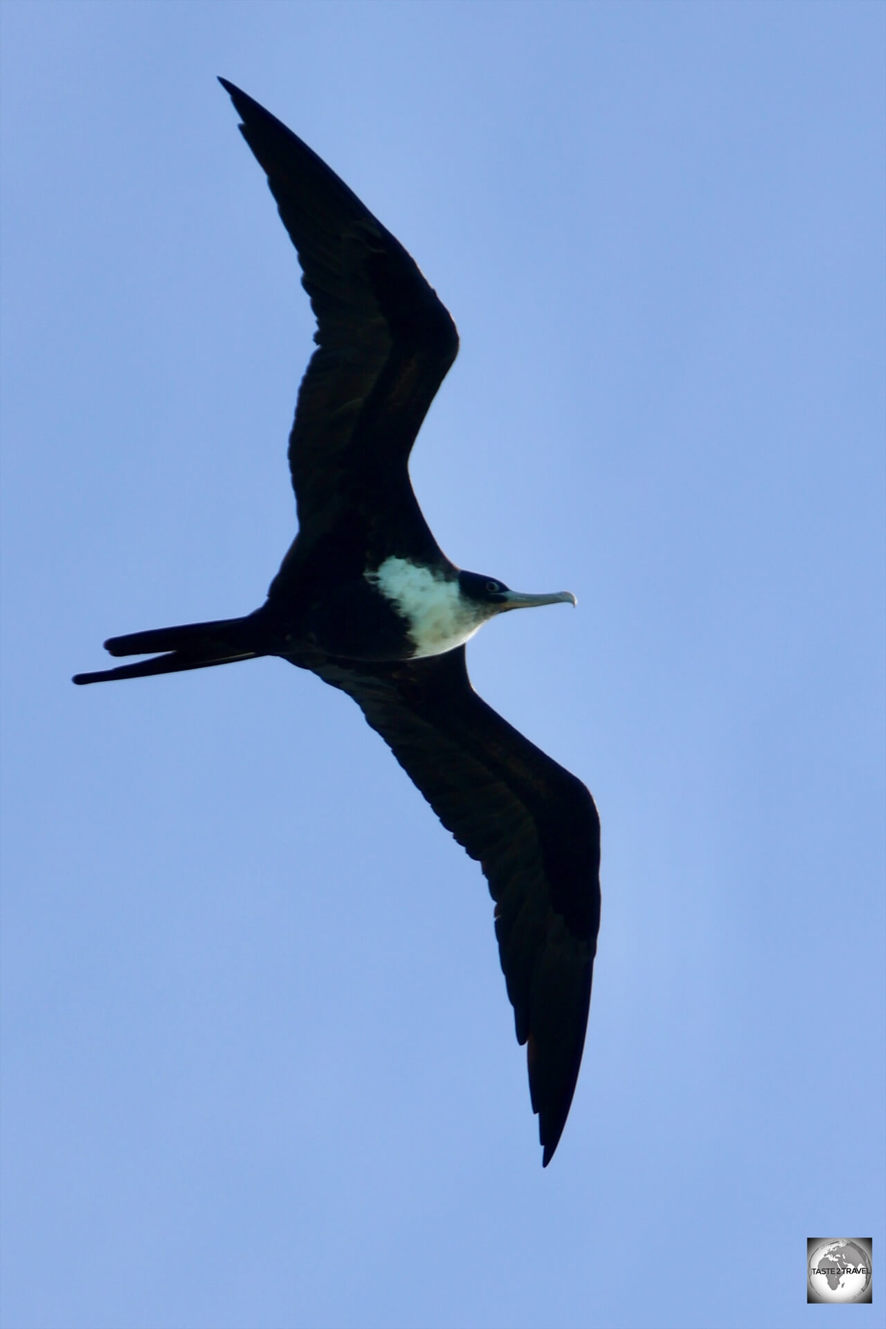
Frigate bird, soaring over Bird Island.
If you enjoy bird photography, the island allows you to get up close to the birds who are nesting in low trees.
Magical!
Aukena Island
The fifth, and last island, we visited on our boat trip was Aukena Island.
Ruins of Re’e Seminary College, the first college of French Polynesia, Aukena Island.
Located about 5 km southeast of Mangareva, Aukena measures 2.5 km in length and 0.5 km in width with a total area of just 1.35 km².
Aukena has reminders of the missionary period, including a hexagonal lookout tower, still used as a landmark, the former Re’e Seminary College and a huge lime kiln.
About 40 people live on Aukena Island and much of the island’s land (if not all) is privately owned by the Robert Wan pearl company.
As per the company website, the cooler waters which surround Aukena Island result in oysters producing darker shades of green and silver pearls.
Re’e Seminary College
Ruins of Re’e Seminary College, the first college of French Polynesia, Aukena Island.
Ruins of the Re’e Seminary College on Aukena, one of the earliest institutions of higher learning in French Polynesia, where King Te Ma-puteoa received his education.
Due to the death of his father, Te Ma-puteoa became King at the age of just ten.
His mother Queen Maria Eutokia Toaputeitou assumed the regency, although the French missionary Father Laval had extensive control over the royal mother and son and was considered the true power behind the throne.
During most of his reign, the young king was educated by the French missionaries at the Re’e Seminary College on Aukena Island.
He only left Aukena Island to visit Mangareva on ceremonial occasions. The young King died at the age of 21!
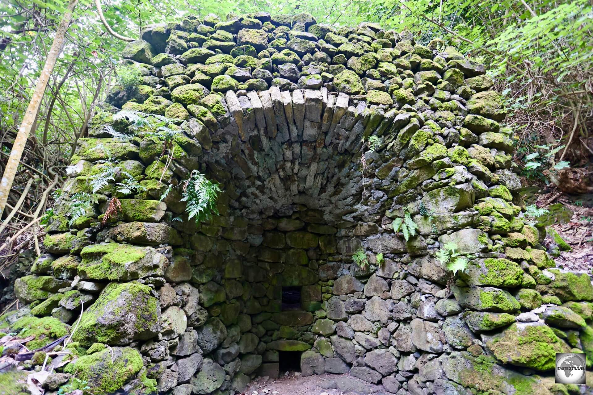
Lime Kiln
An old coral lime oven on Aukena Island.
A short walk from the abandoned seminary, hidden deep inside the tropical forest, is a huge lime kiln which was used to burn coral to produce the vast quantities of lime powder which was required for the construction of the many stone buildings which the French missionaries built.
Accommodation
There’s no shortage of deluxe accommodation options in French Polynesia, including the Sofitel resort on the island of Moorea.
Tahiti
Papeete
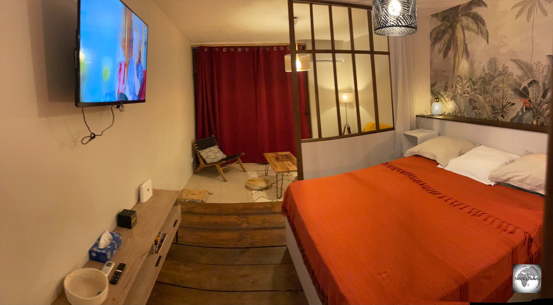
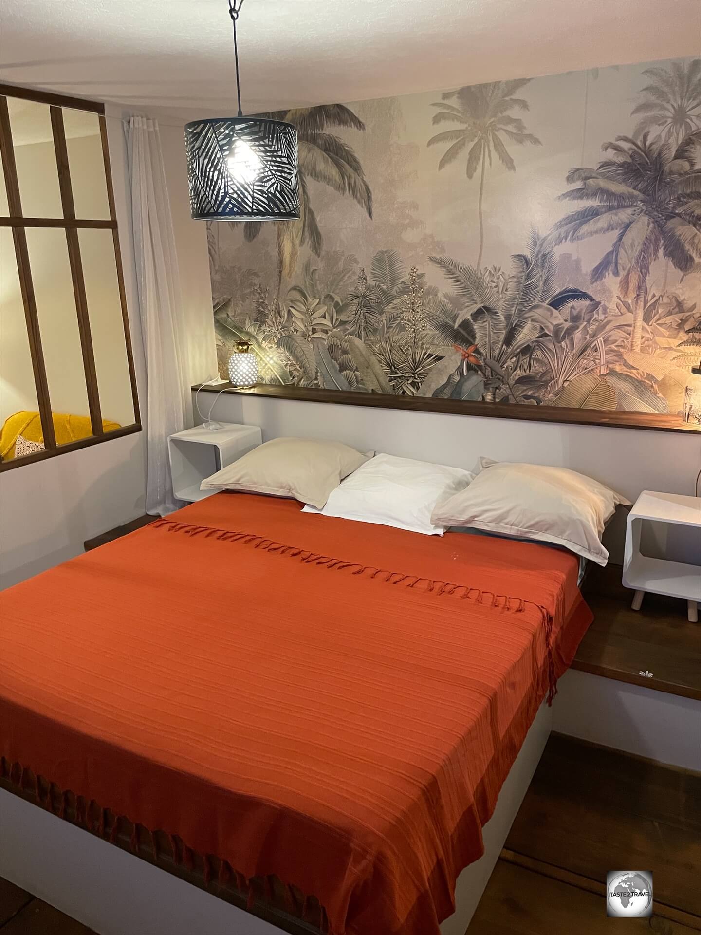
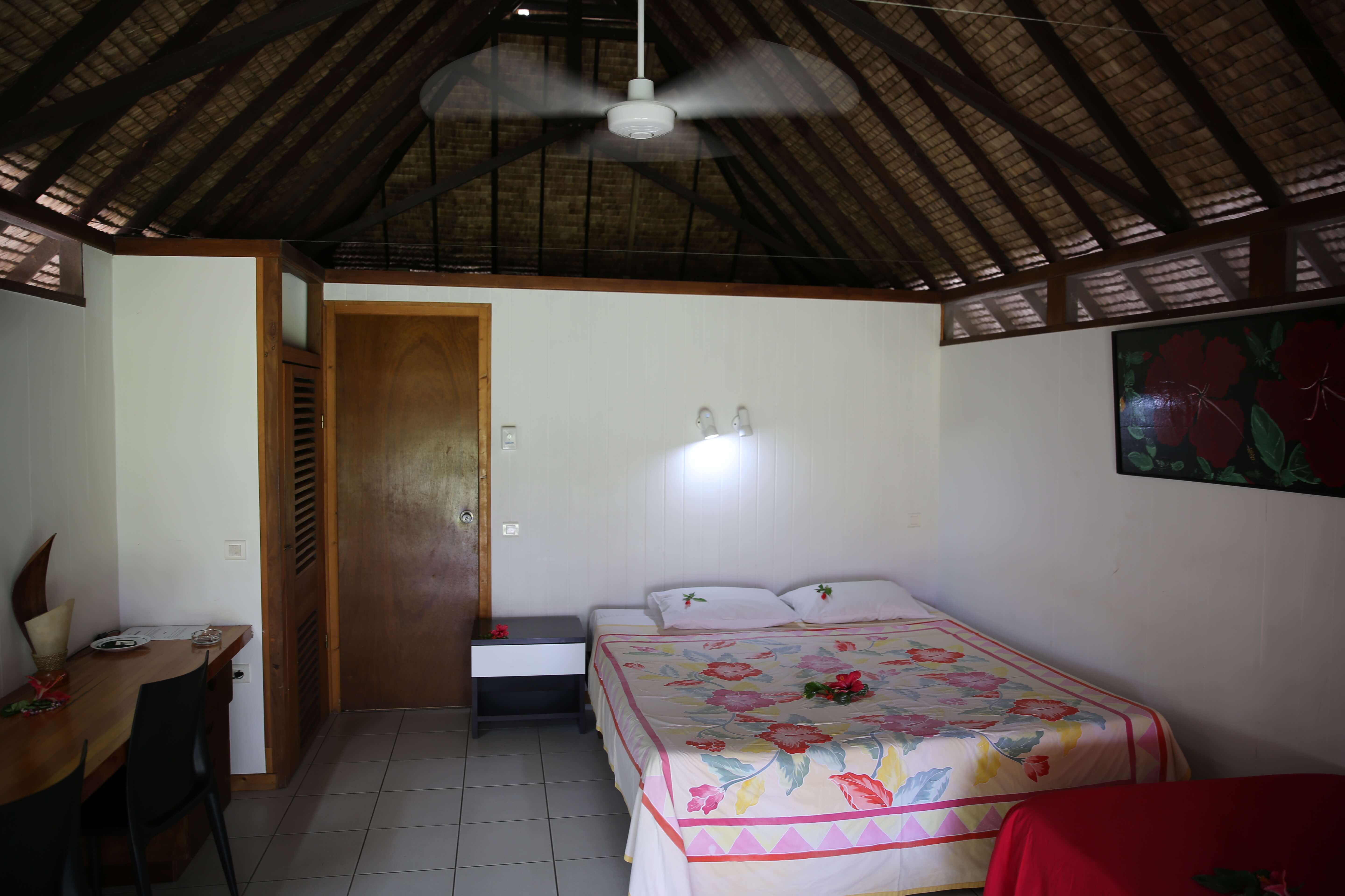
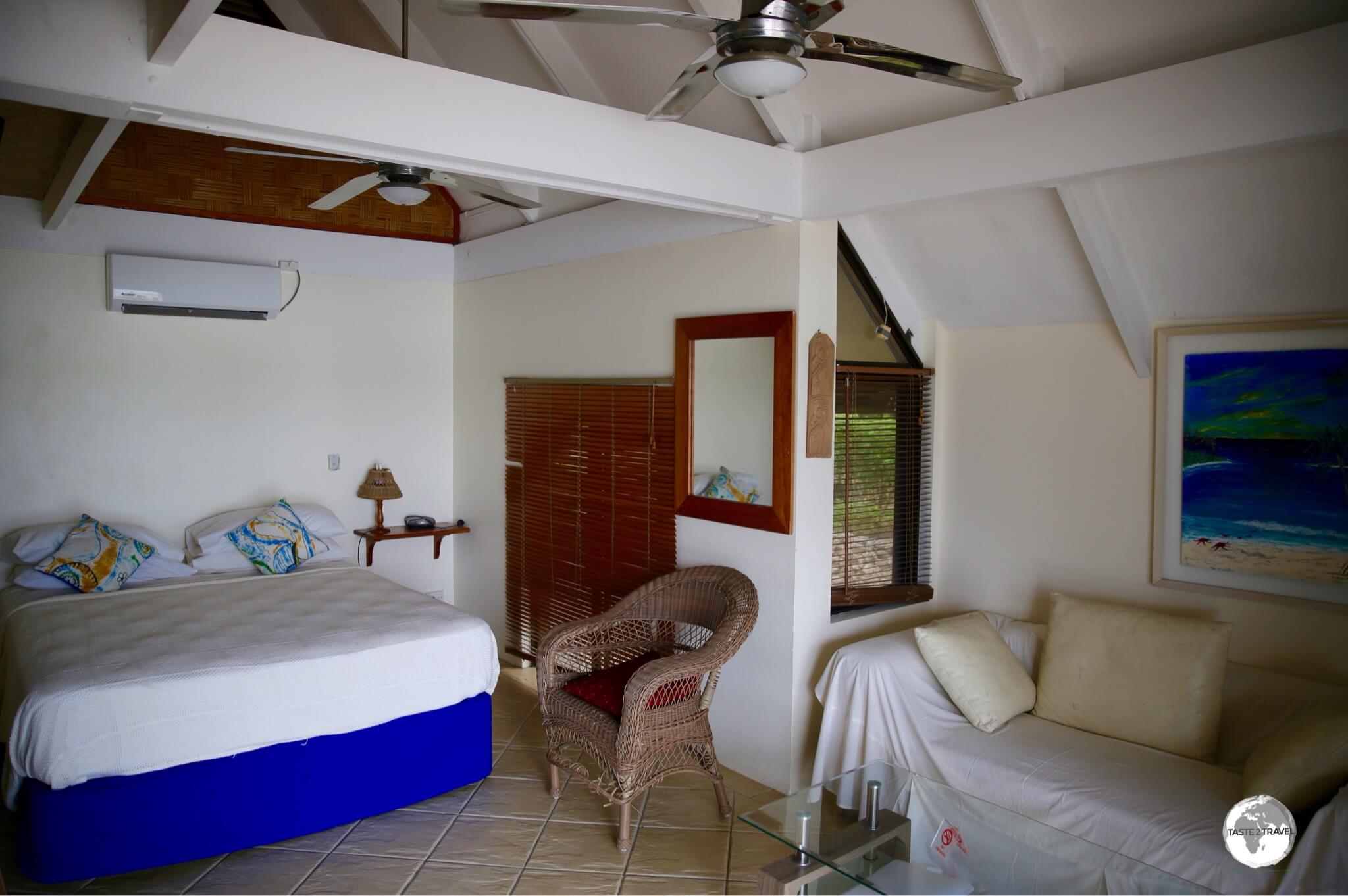
A view of the modern and stylish Studio Poe Rava in Papeete, my comfortable apartment during my last visit to Papeete.
Being home to almost 70% of the entire population, there’s no shortage of accommodation options on the main island and in the capital of Papeete.
Options range from the top-end Hilton Hotel Tahiti, where a standard room costs from US$330 per night, to a private apartment which will cost around US$100 per night.
I have yet to find a budget hostel in Papeete.
A view of my bedroom at Studio Poe Rava in Papeete.
On my last visit to Papeete (June 2024), I stayed at the beautiful and comfortable Studio Poe Rava which can be booked online on booking.com
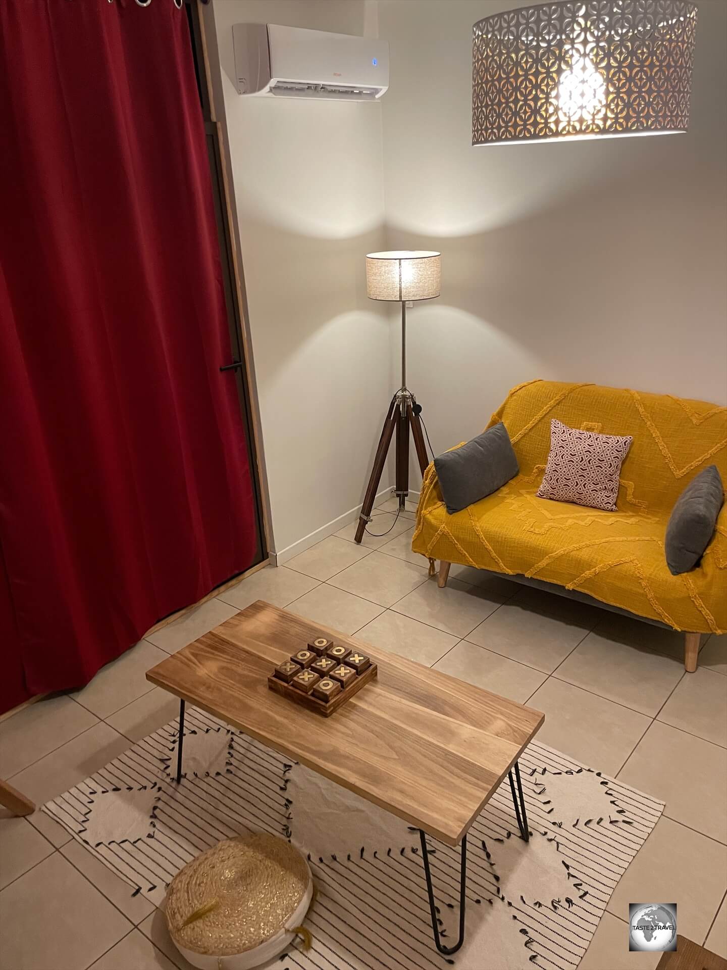
A view of the sitting room at Studio Poe Rava in Papeete.
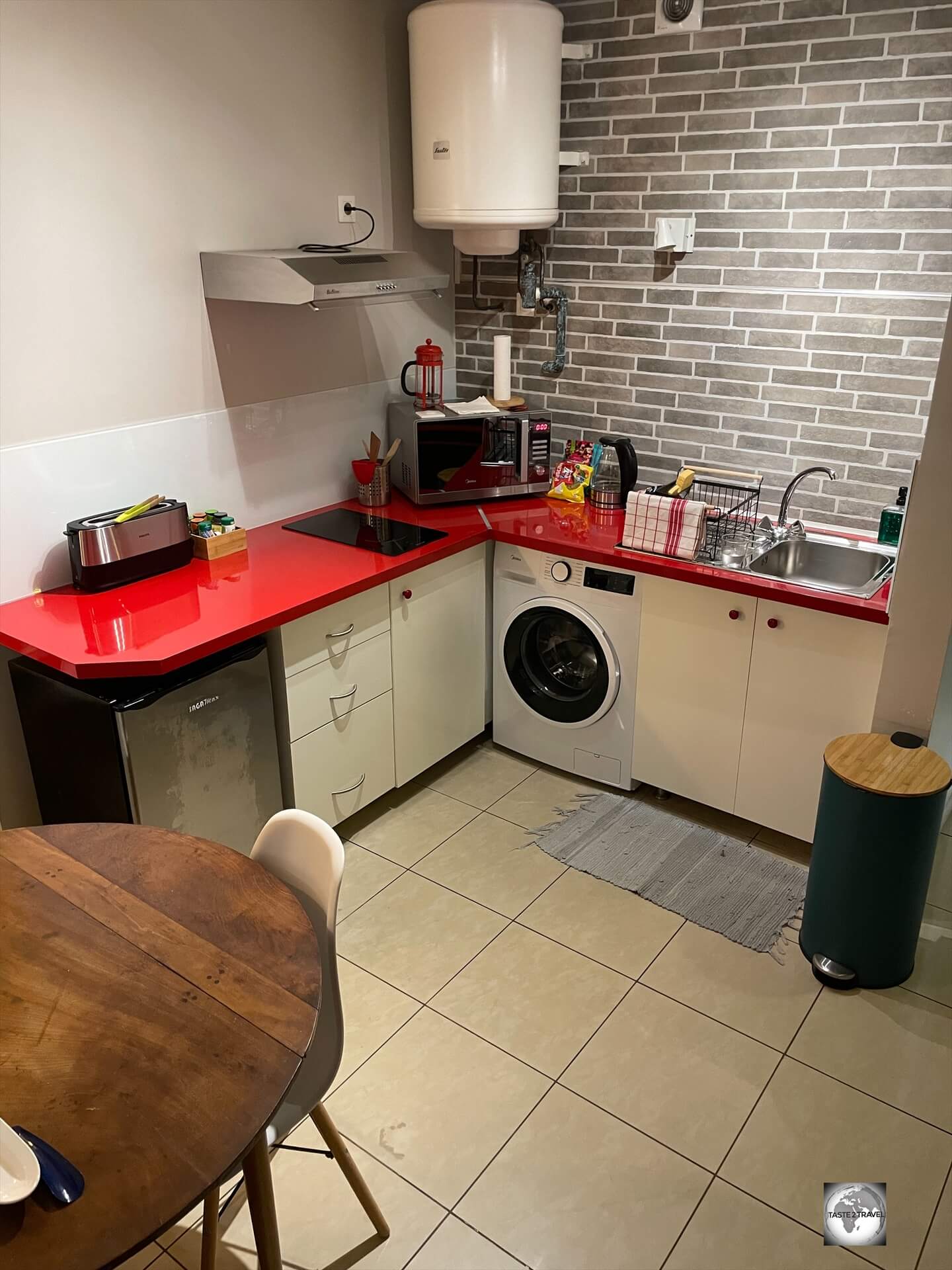
The apartment costs US$100 per night and includes a washing machine, kitchen, sitting area, WiFi and all the features you’d expect from a modern apartment.
The only quirk with this apartment is that the owner, Dorothée – a wonderfully friendly French lady – excepts payment in the form of cash or bank transfer only.
Dorothée has several apartments for rent in Papeete and can be contacted directly on WhatsApp at: +689 87 77 25 80.
A view of the kitchen, which included a washing machine, at Studio Poe Rava in Papeete.
The apartment is located on the main road which runs along the waterfront, a short walk from downtown Papeete.
It’s totally convenient for exploring all the sights of the city and a short walk from restaurants and cafes.
Highly recommended is La Pizzeria which is located next door and serves delicious wood-fired pizzas and traditional pasta dishes.
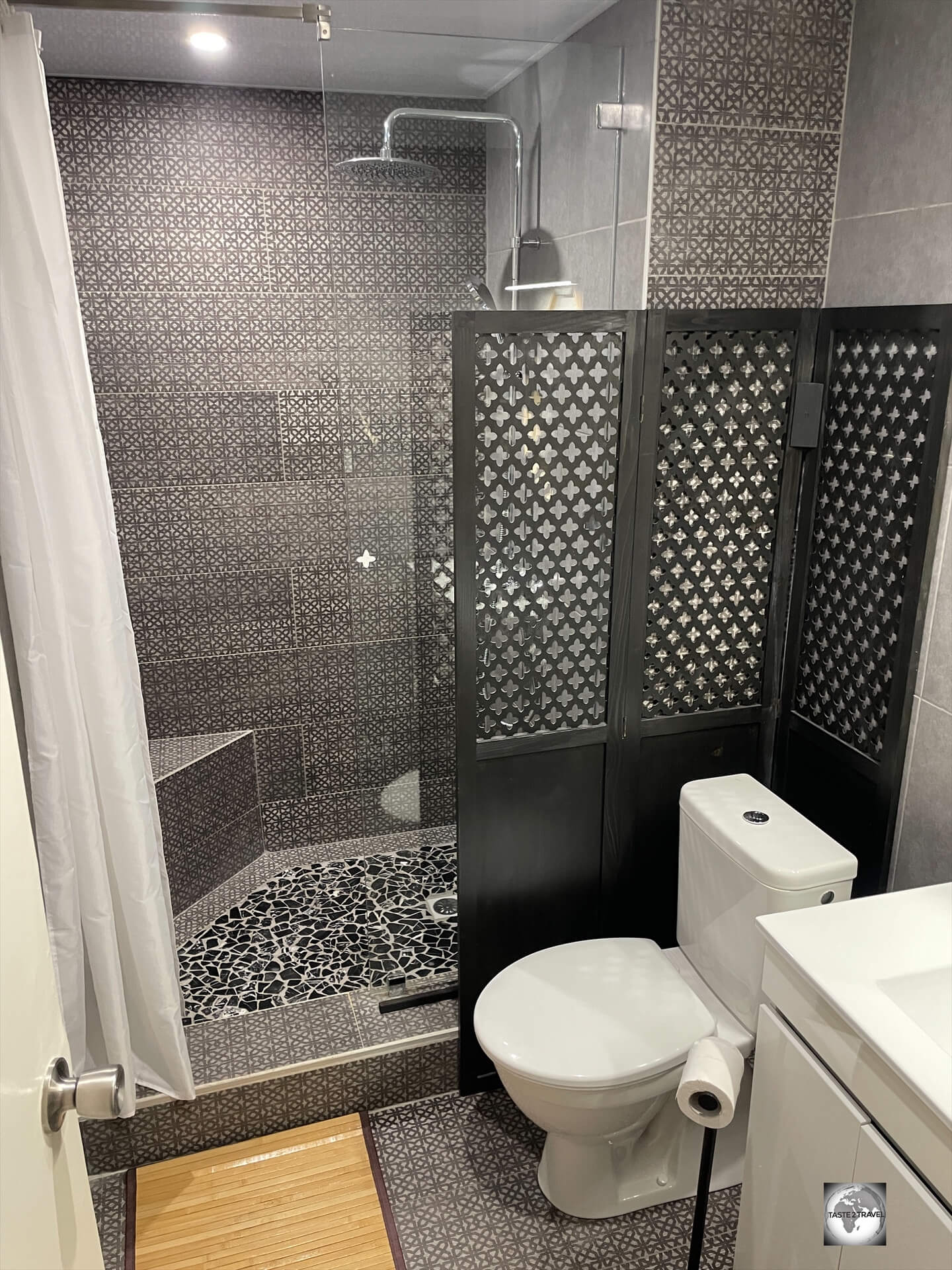
The bathroom at Studio Poe Rava in Papeete.
Studio Poe Rava is totally convenient for exploring all the sights of the city and a short walk from restaurants and cafes.
Highly recommended is La Pizzeria which is located next door and serves delicious wood-fired pizzas and traditional pasta dishes.
Moorea
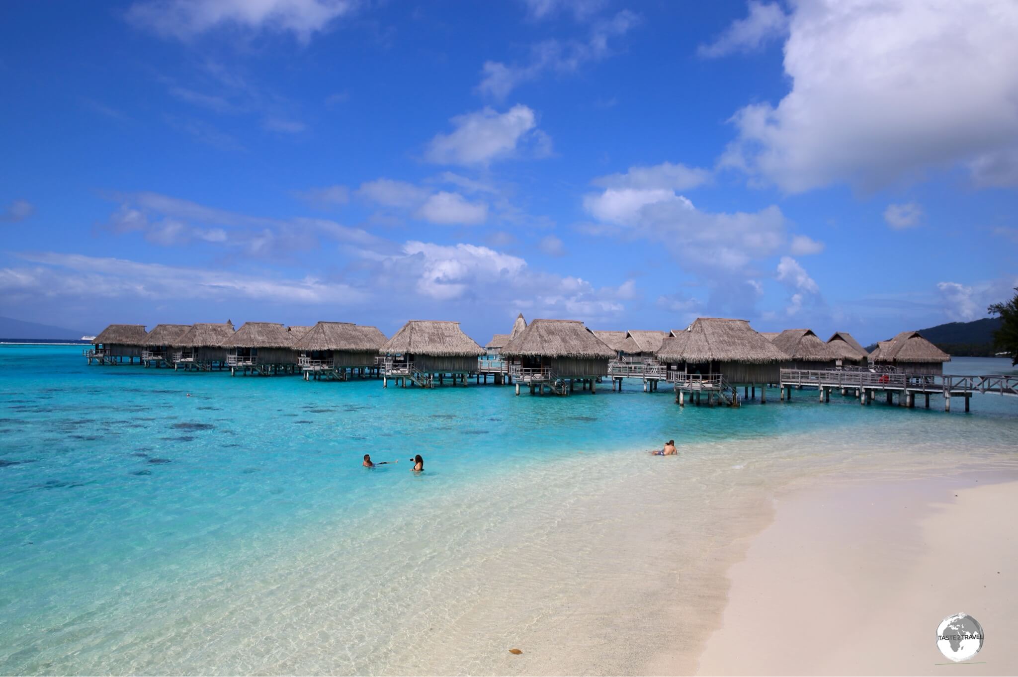
Both the Hilton and Sofitel offer ‘over-the-water’ bungalows at their Moorea resorts.
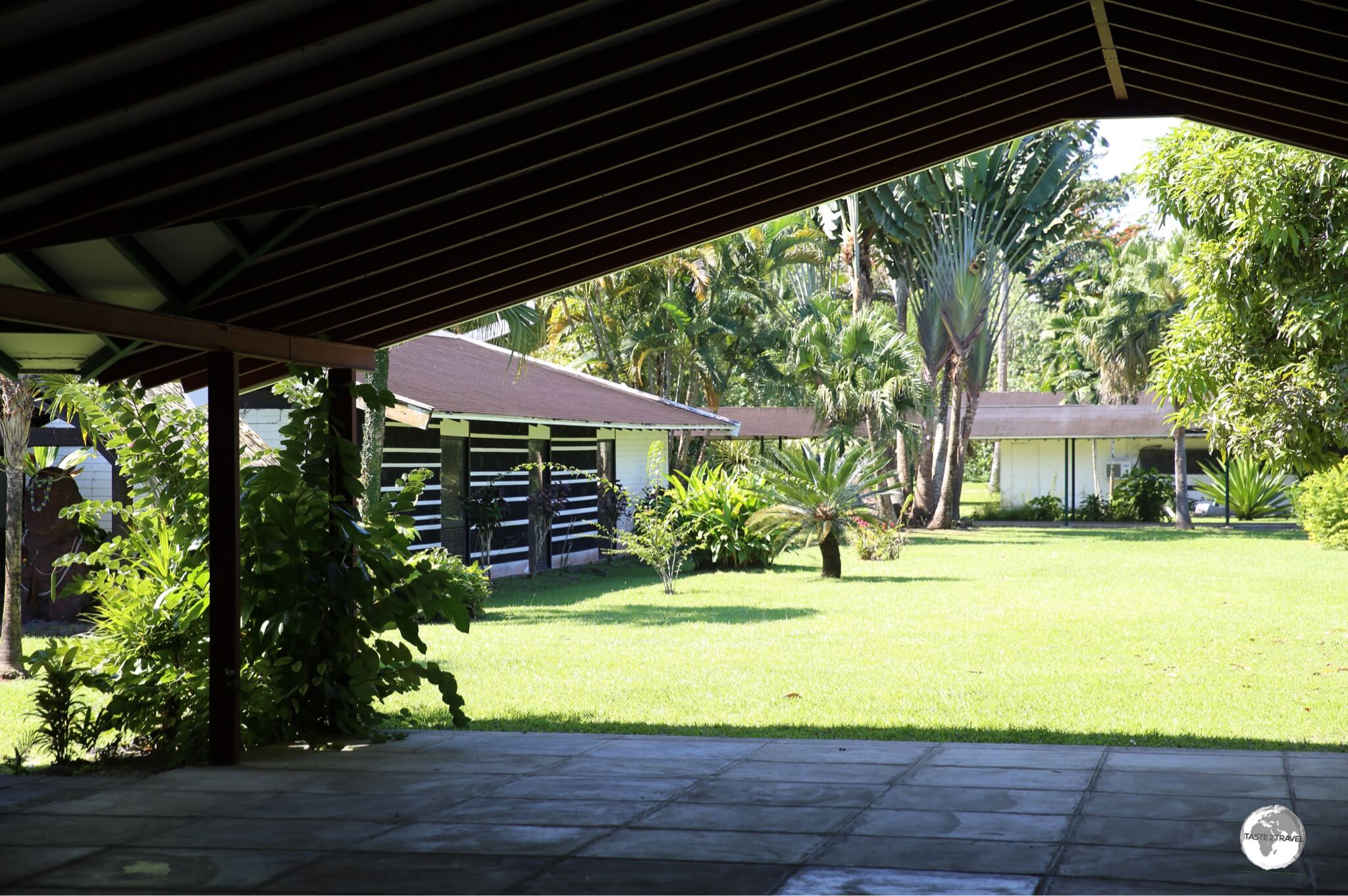
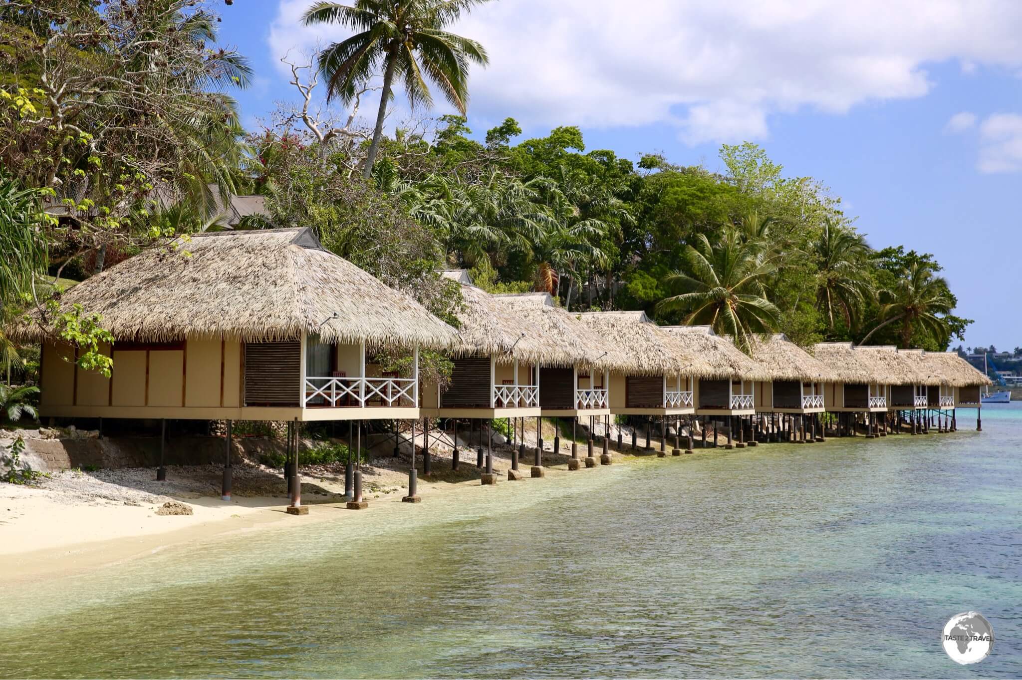
While there are more deluxe options on Moorea, I chose to stay at the relaxing and humbler Linareva Moorea Beach Resortwhich is a seaside lodge located in the remote west coast village of Haapiti.
If staying here, it’s best to have your own transport.
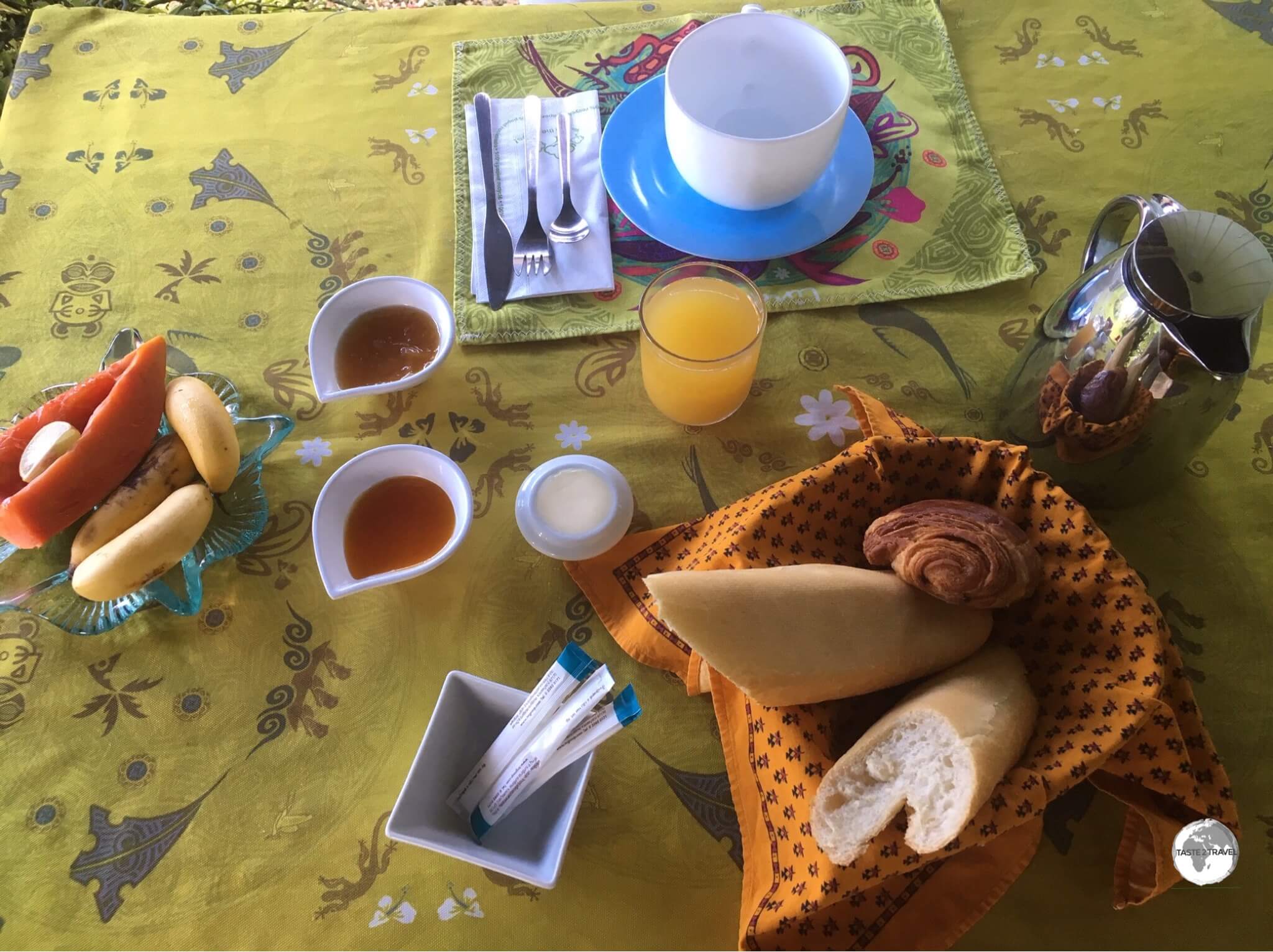
Breakfast at the Linareva Moorea Beach Resort.
Room rates are from USD$150 upwards, which is cheap for Moorea.
This doesn’t include breakfast which is available for an extra 1,500 CFP and includes fruit, coffee and a few pastries. A load of washing cost me USD$25.
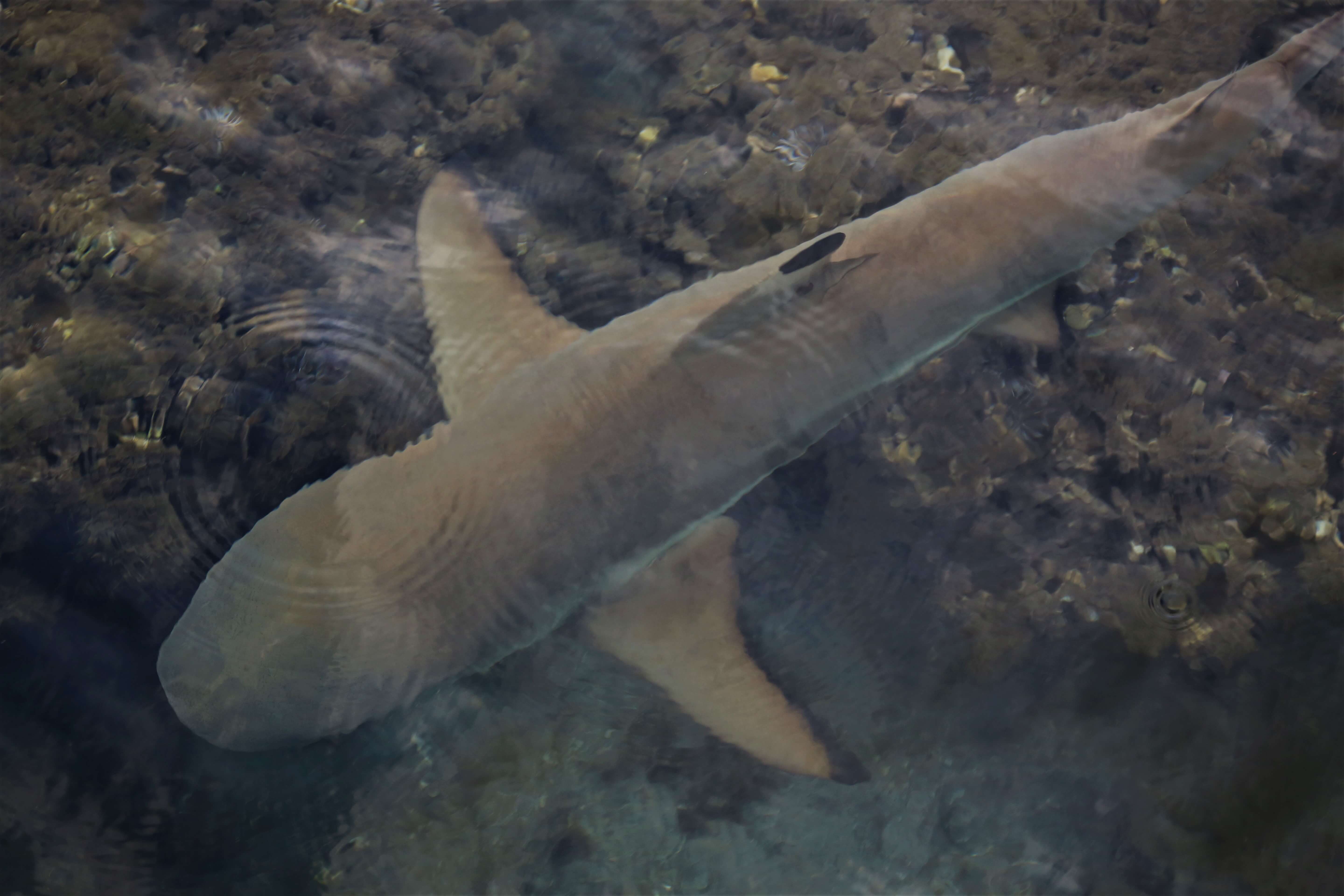
Just one of several large and friendly Nurse sharks which visited the jetty at Linareva Moorea Beach Resort each evening.
The owner of the resort, Roland, use to run the dive shop up the road and, over the years, has trained the local sharks to come to his wooden jetty (a little food doesn’t hurt).
Each evening, (large) Lemon, (numerous) Black-tip and several (huge) Nurse sharks appear from the murky depths.
All are very friendly and don’t mind you swimming around them.
A great snorkeling experience!
My bungalow at Hotel Hibiscus on Moorea.
Also on Moorea, I stayed at the Hotel Hibiscuswhich offers spacious bungalows arranged around a well-maintained garden (by the seaside) from USD$150.
The bungalows include a kitchenette which allow some self-catering and nearby restaurants offer free shuttle services for those wishing to dine.
Mangareva
The view of my very basic homestay on Mangareva.
While there are no hotels on Mangareva, several families rent out rooms in their homes.
These guesthouses can be found, and booked online, on Airbnb (click to view all guest houses), where the cost of a room averages around US$100 per night.
There are about 7 guesthouses listed on Airbnb!
I stayed in a very basic guesthouse which provided no meals – a real problem on an island without restaurants or cafes.
Recommendation: The best accommodation option on Mangareva is Pension Maro’i who do offer breakfast and dinner options and also operate a fantastic lagoon day trip each Thursday. Do not stay anywhere else on Mangareva!
Tip:
Since there are no banks or ATMs on Mangareva, and you need to carry enough cash from Papeete to cover your stay, it’s best to book and pay online in advance for your accommodation on Airbnb.
The advantage of booking online with Airbnb is that your biggest expense (accommodation) has been paid for – very important in a place where you have no access to cash!
You only need to ensure you carry enough CFP (Pacific Francs) to cover meals and other incidental costs – such as black pearls!
Eating Out
Tahiti
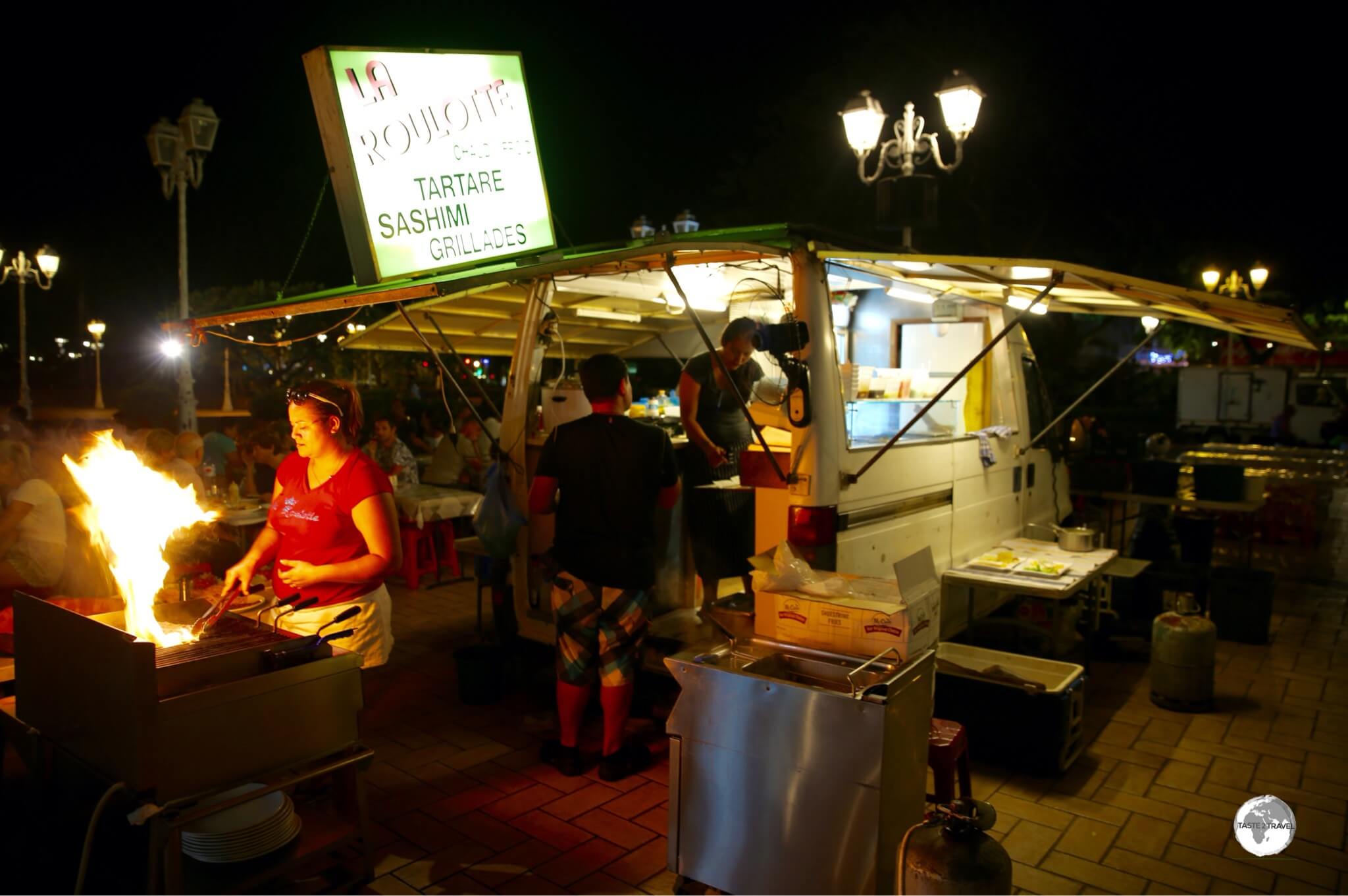
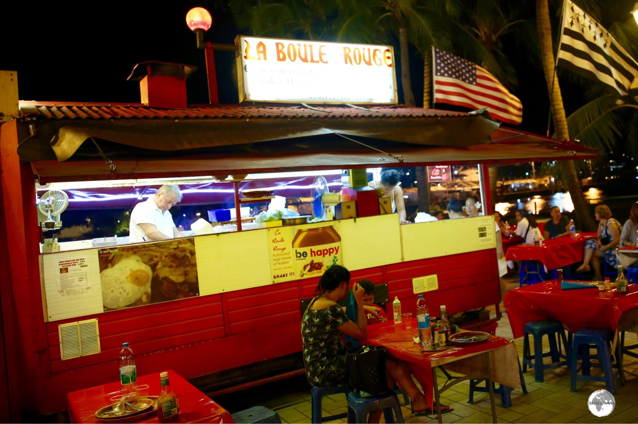
The budget-friendly meals served by the various Roulottes in Papeete each evening is the most popular dining experience in town.
Papeete is well endowed with cafes, bars and restaurants, offering plenty of opportunities to sample local and French cuisine.
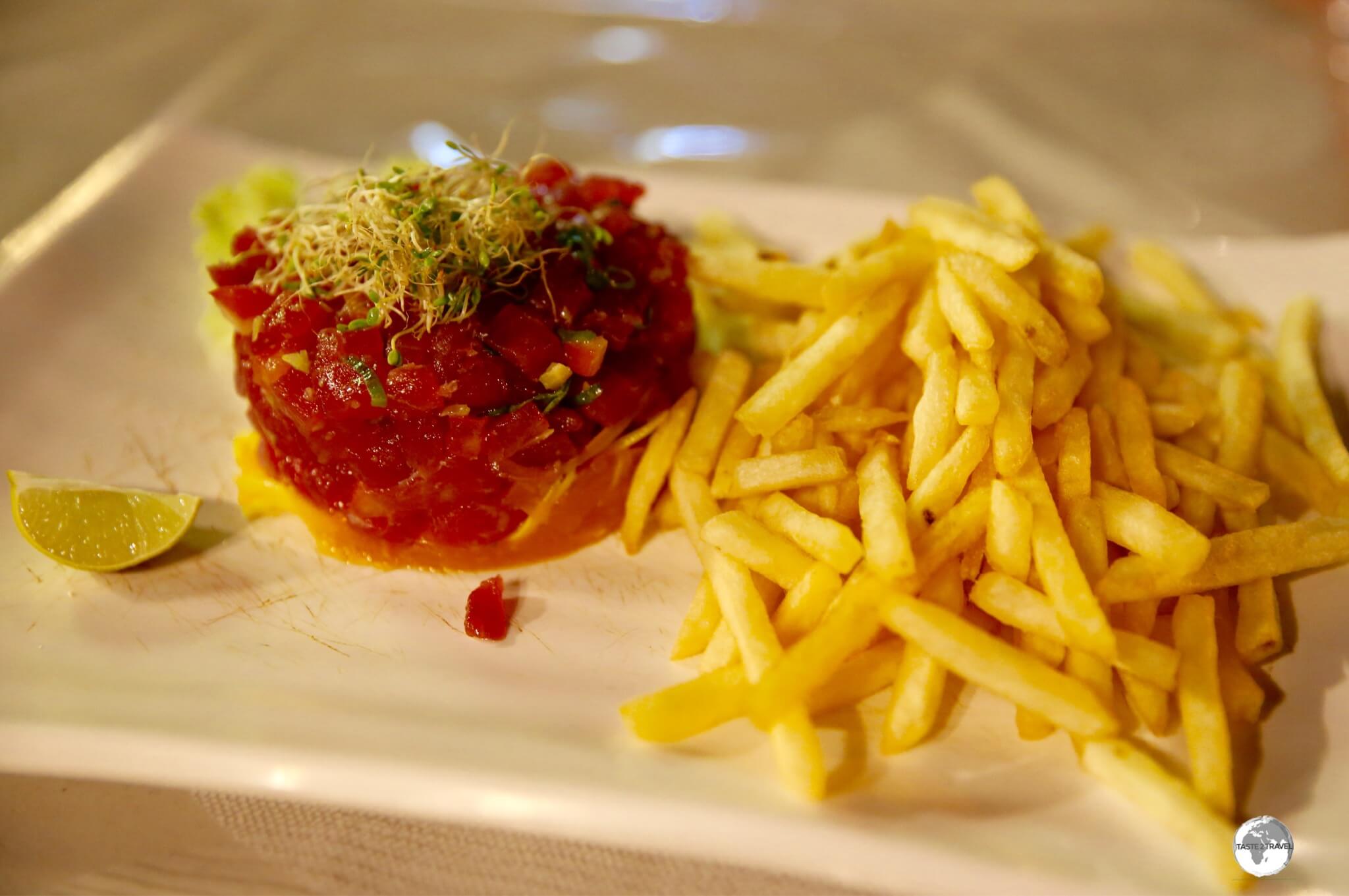
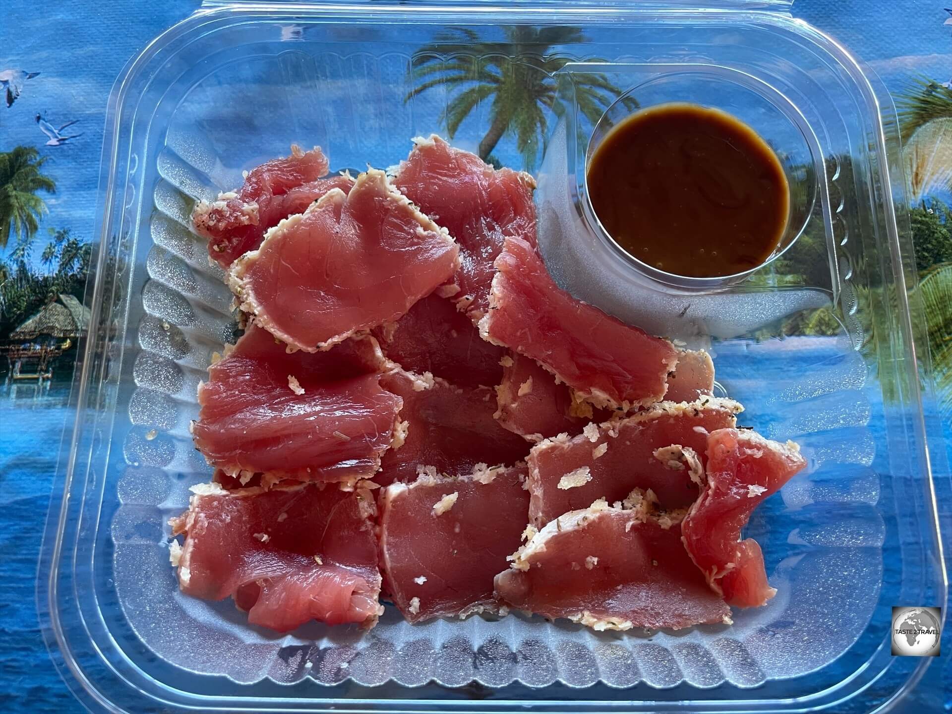
Tuna Tartare and French Fries, served up at a waterfront Roulotte in Papeete.
By far the most popular place for dinner is at Place Vaiete Roulottes, which is the public square in front of the Gare Maritime (ferry terminal).
The Roulottes offer a choice of different cuisines from local, International, Chinese and Thai.
Each evening, the country’s famous roulottes(mobile food vans) set up their plastic stools and tables, fire up their BBQ and grills and serve up a veritable feast of cultural and gastronomic delights – all under the starry, night sky.
Update (July 2024):
During my recent visit to Papeete, it was disappointing to see that most of the roulottes had closed for business.
This was due to an ongoing dispute with the city council who have decided to increase the taxes on these once-successful businesses.
Hopefully this dispute will be settled at some stage and the iconic roulottes will once again return.
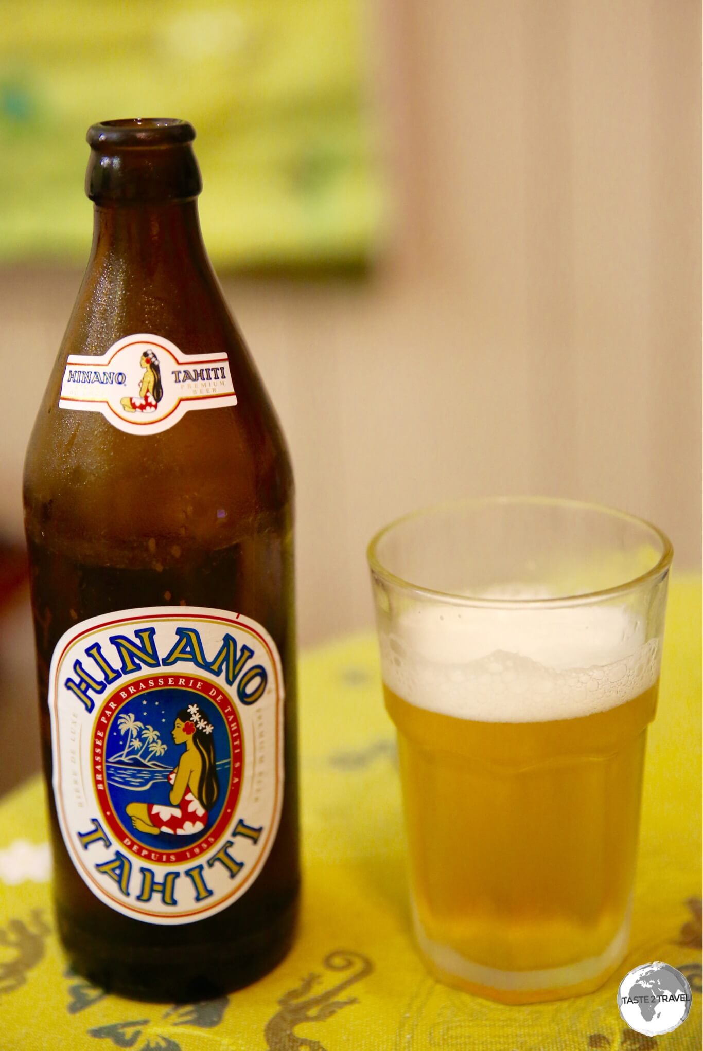
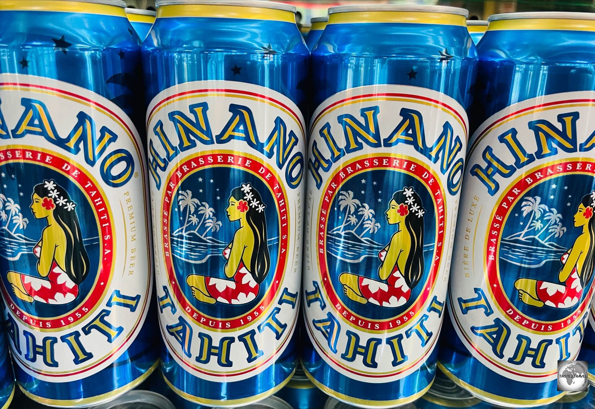
Hinano Beer
Hinano Beer has a wonderfully, light, delicate flavour.
Brewed by La Brasserie de Tahiti(owned by Heineken), the local beer is the perfect match for any meal served at the roulottes.
The beer is brewed longer than most, giving it a more delicate, distinct flavour.
The very quaffable – Hinano Beer – the beer of Tahiti.
It is possibly my number one favourite beer in the Pacific region and certainly very quaffable.
Moorea
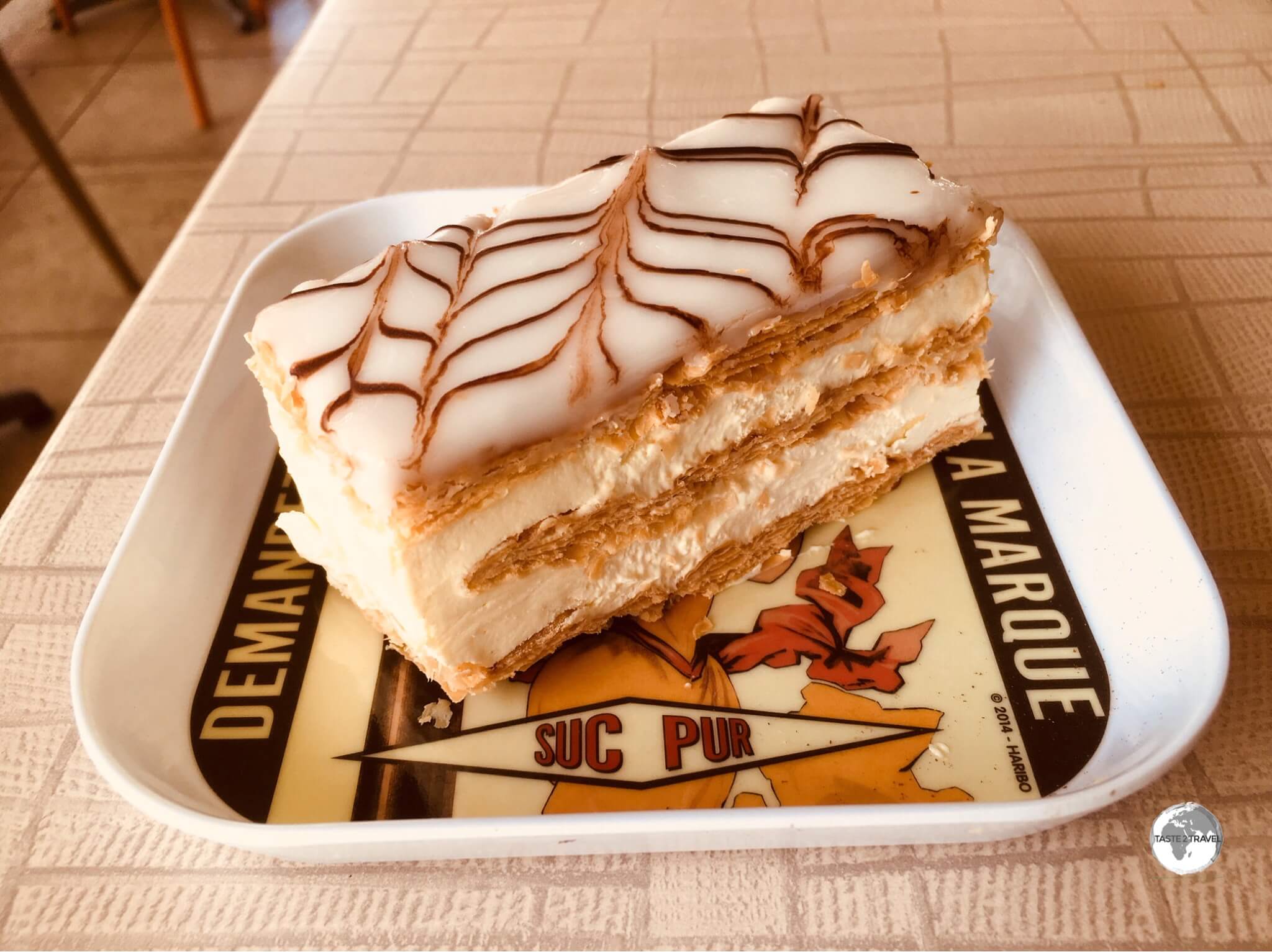
The best ‘mille-feuille’ on Moorea is served at Café Caraméline.
Where will you find the best mille–feuille on Moorea?
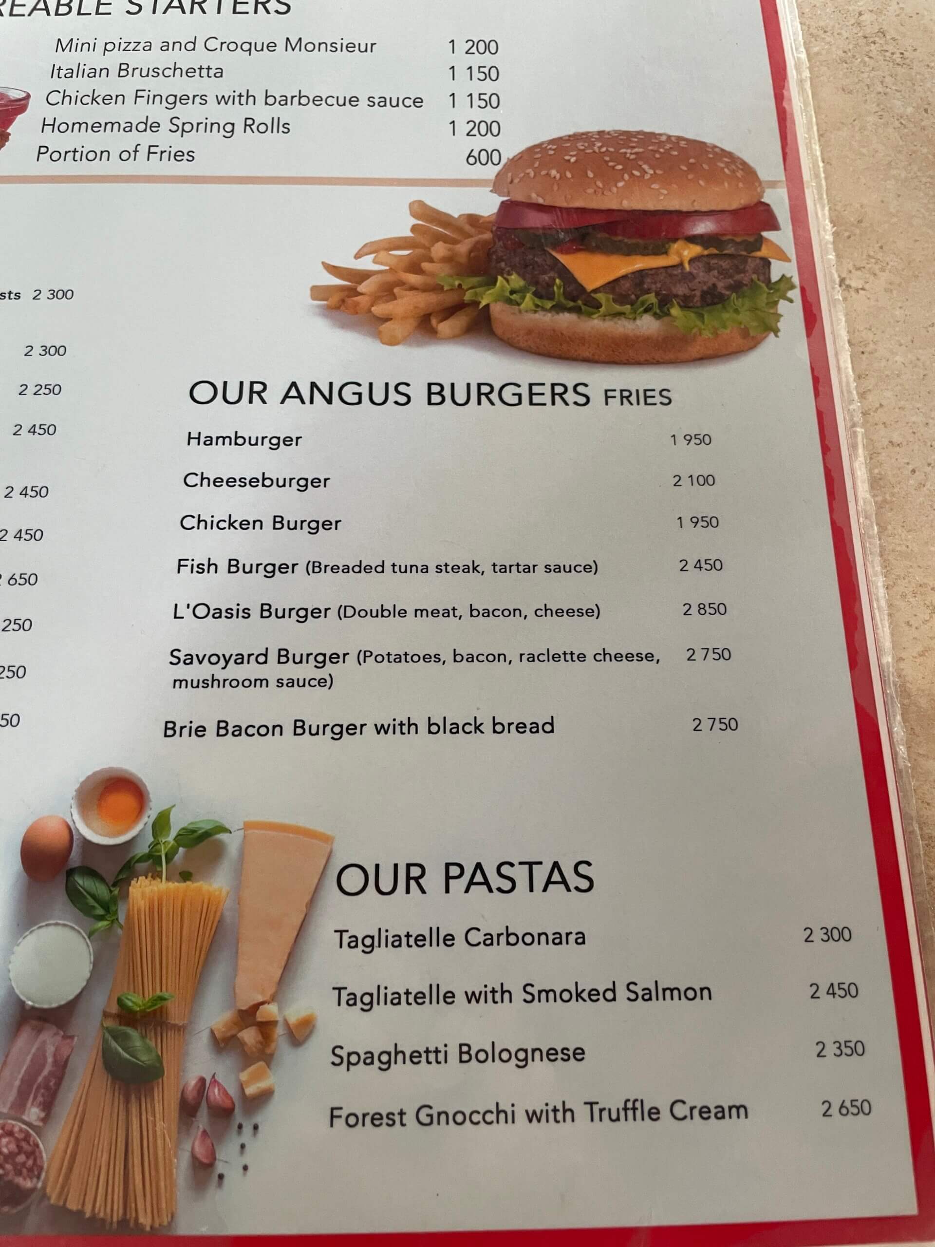
Located in a small shopping centre in the village of Maharepa, the always busy, Caraméline is renowned for its all-day American, French or Tahitian breakfasts and lunch menu which features burgers, pizzas, salads and fresh seafood.
The fine French pastries are the speciality of the house and are the perfect accompaniment to one of their freshly brewed coffees.
A roadside food stall on Moorea.
Driving further west along the north coast from Maharepa, you’ll eventually enter the sleepy village of Papeotai.
If it’s lunchtime, you’ll notice a long line of cars parked along the side of the road on the lagoon side.
This is the legendary and very worthwhile – Snack Mahana.
Open for lunch (and not accepting any credit cards) the restaurant is run by an industrious family who cook up a storm in their kitchen and provide seating in their breezy backyard which happens to look out over the spectacular lagoon.
The menu features the freshest seafood, including tuna sashimi and grilled mahi-mahi, burgers, steaks and more.
Continuing further west at Tiahura Beach, you’ll find the impeccable Restaurant Tiahura (Chez Irene), which offers a nightly dinner menu featuring the freshest of local seafood.
If you do not have your own transport, they offer a free shuttle service to/ from your hotel.
This is a local institution and is very cosy so reservations are essential.
Like so many other businesses on Moorea, payment is cash only.
Mangareva
Delicious Tuna Tataki, served at the snack shop, opposite the Gendarmerie office on Mangareva.
There is no dining-out scene on tiny Mangareva!
Locals either eat at home or grab takeaway meals at one of the two snack shops.
The two snack shops, which are open until around 1 pm most days, provide breakfast and lunch and can provide a take-away evening meal if required.
Of the two snack shops, Snack Jojo is the best, offering a good selection of food and the only espresso coffee on the island.
The other snack shop is located opposite the Gendarmerie office.
Note:
There are no options for food during most evenings on Mangareva.
If you wish to eat something in the evening, you will need to buy a takeaway meal from one of the snack shops before they close at 1pm.
Pension Maro’i
The one accommodation which does provide meals on sleepy Mangareva is Pension Maro’i which is located on the other side of the island, a short drive over the hill from Rikitea.
Visa Requirements
While French Polynesia is an overseas collectivity of France, it is not part of the Schengen Area and as such applies its own visa policy (which largely mirrors the Schengen Area policy).
Generally, EU citizens are free to enter and reside indefinitely while many other passport holders are granted a 3-month stay.
Immigration in the French territories is the breeziest of anywhere in the Pacific. No questions asked, no need to show a return ticket, nothing! Most visitors are processed in a matter of seconds – the way travel should be!
Getting There
French Bee have finally made flights to French Polynesia affordable.
Air
International flights to French Polynesia arrive at Faa’a International Airport (IATA: PPT), which is located in the municipality of Faa’a, 5 km (3.1 miles) southwest of the capital, Papeete.
The airport serves as the base for the domestic carrier, Air Tahiti, and the international carrier, Air Tahiti Nui.
Flights to French Polynesia are never cheap but, thanks to the recent introduction of thrice weekly (Sunday, Wednesday and Friday) flights from Paris (Orly) to Papeete via San Francisco by the excellent French low-cost carrier, French Bee, reaching paradise is now much more affordable.
Important Note:
French Bee flights from Paris to Papeete make a short transit stop in San Francisco.
Although transit passengers do not alight the aircraft, all passengers are required to have valid entry documents for the United States.
This exceptional requirement by the US government is due to the fact that airports in the United States do not have ‘sterile’ transit areas.
If you do not hold a valid ESTA or a valid US Visa, you will be denied boarding in Paris.
One-way fares from San Francisco start at US$375, which has forced other airlines flying from San Francisco and Los Angeles to drastically reduce their tickets prices in order to compete – a boon for travelers.
Despite being a low-cost carrier, French Bee are a slick operation which feels more like a full-service carrier, providing a comfortable seat on a brand-new Airbus A-350 with excellent service, tasty meals and a professional crew.
The following airlines provide connections to/ from Papeete:
Air France – flies to/ from Los Angeles, Paris–Charles de Gaulle
LATAM Chile – flies to/ from Easter Island, Santiago de Chile
Airport Transport
Taxis to downtown Papeete cost approximately 1,900CFP (USD$19) while bus #3 and #7 pass by the airport, stopping at the stop on the main road, before continuing to Papeete.
Onward Air Travel
New Caledonia
The Blue Hole of Voh, a highlight of New Caledonia.
The national carrier of New Caledonia, Aircalin, connects Papeete with Noumea every Friday and Monday, providing a useful (and sometimes affordable) connection between two far-flung French Pacific territories.
I paid just €350 for a one-way ticket between the two territories, a flight of 4,717 km (2,931 mi).
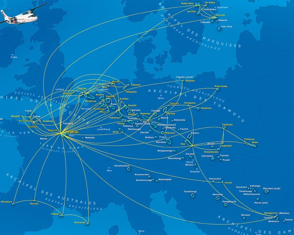
The Air Tahiti Route Map, superimposed on a map of Europe, illustrates the vastness of the territory.
Tahiti
French Polynesia covers a vast area of the Pacific – 4,167 sq km (1,609 sq mi) to be exact.
Domestic flights throughout this sprawling territory are operated by Air Tahiti, who operate from their base at Faa’a International Airport in Papeete.
The route map of Air Tahiti (shown above) is super-imposed on a map of Europe to show the vast extent of the territory.
Due to it being a monopoly operator, airfares on Air Tahiti are never cheap.
Air Tahiti offers services from Faa’a International airport to:
Ahe
Anaa
Arutua
Atuona
Bora Bora
Fakarava
Hao
Huahine–Fare
Kaukura
Makemo
Manihi
Mataiva
Maupiti
Moorea
Niau
Nuku Hiva
Papeete (hub)
Raiatea
Raivavae
Rangiroa
Rarotonga (Cook Islands)
Rimatara
Rurutu
Takaroa
Tatakoto
Tikehau
Totegegie (Mangareva)
Tubuai–Mataura
Mangareva
My Air Tahiti flight at Mangareva.
Air Tahiti connect Mangareva to Papeete twice a week – on Tuesdays and Saturdays.
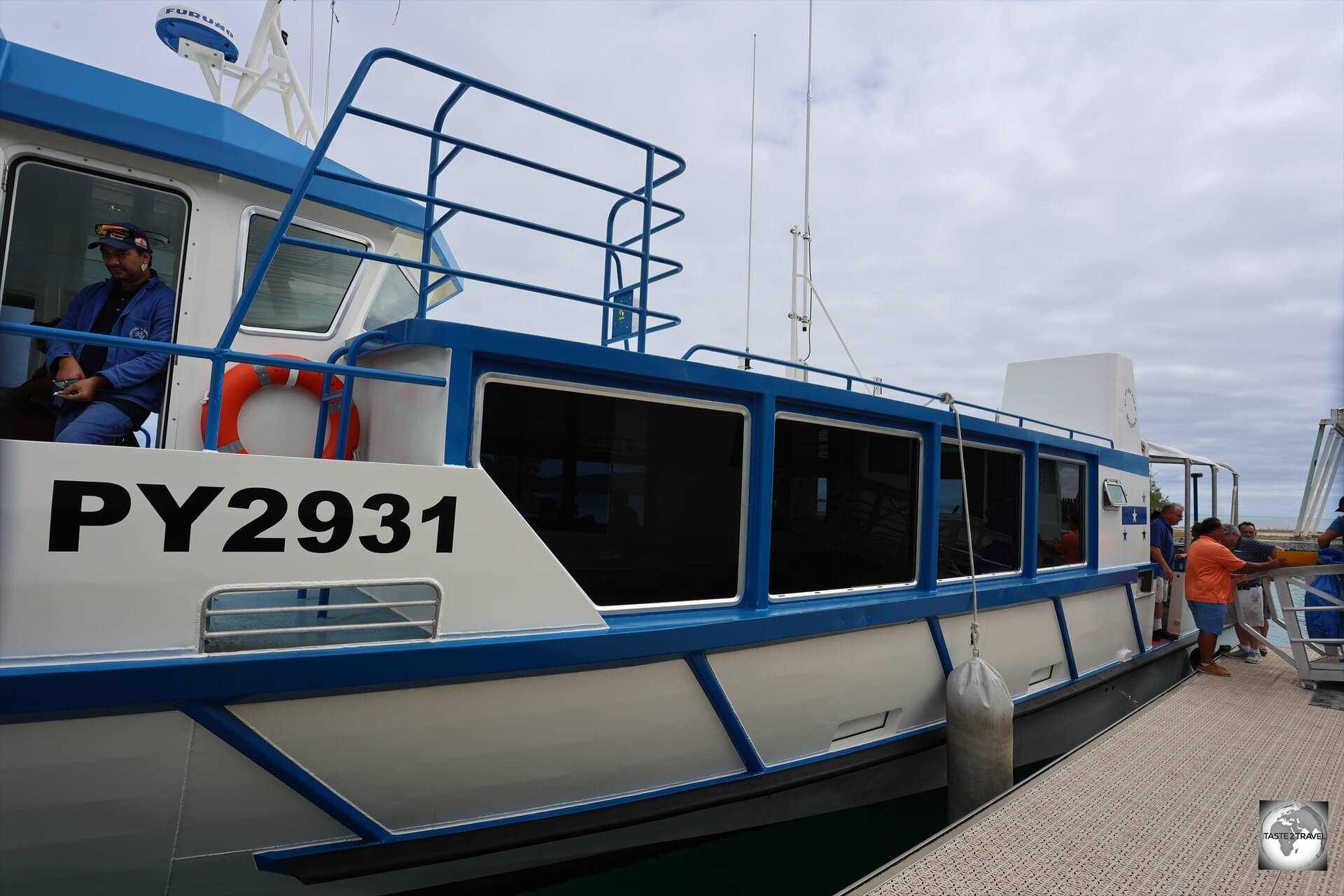
Flights land at Totegegie Airport (IATA: GMR) which is an uninhabited coral atoll, 9 km across the lagoon from Mangareva.
The municipal ferry which connects airport to Mangareva.
A municipal ferry, which meets all flights, provides the only transport service between the airport and Mangareva, with a ticket costing 1,000 CFP.
The ferry journey time to Mangareva is 40 minutes.
Pitcairn Island
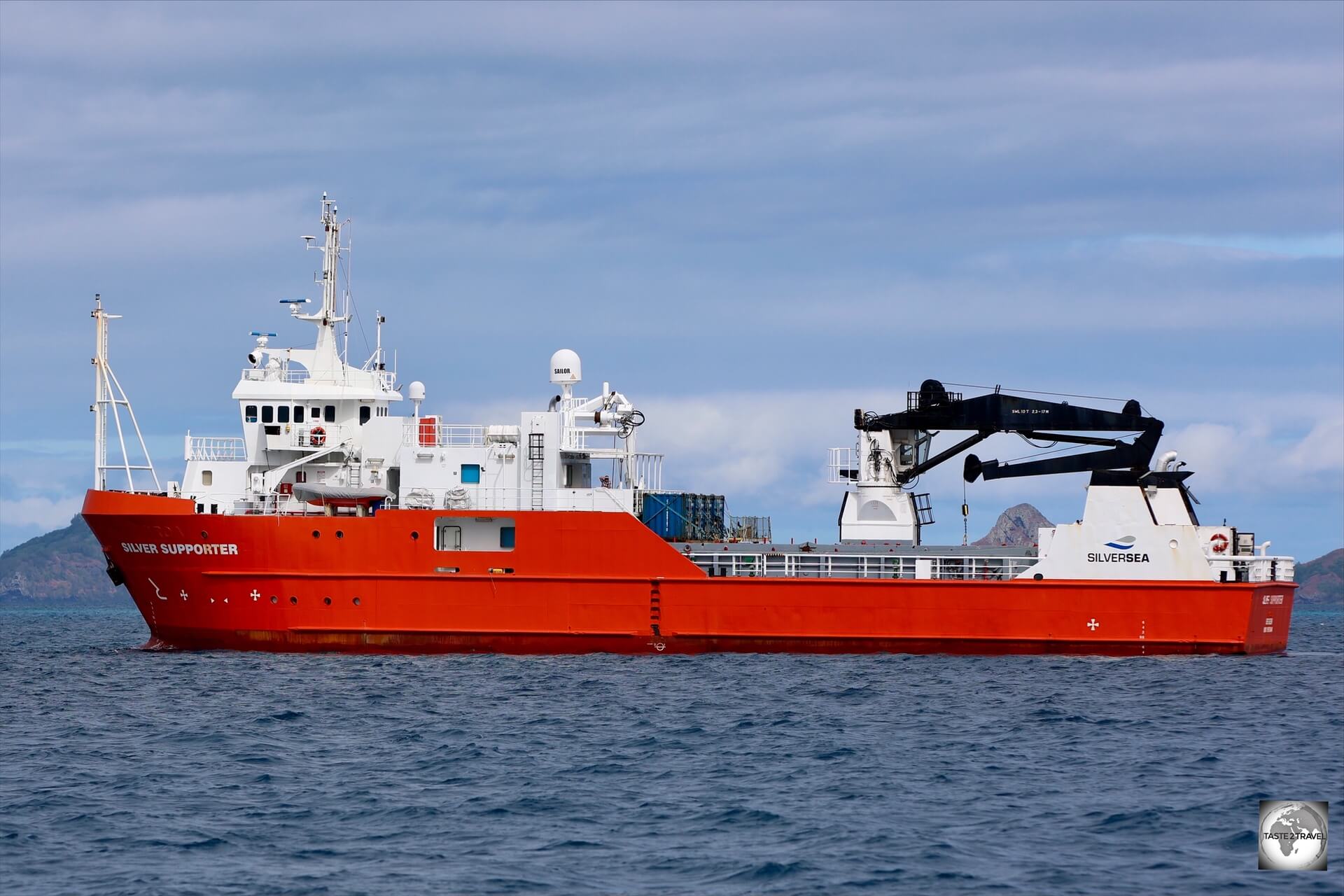
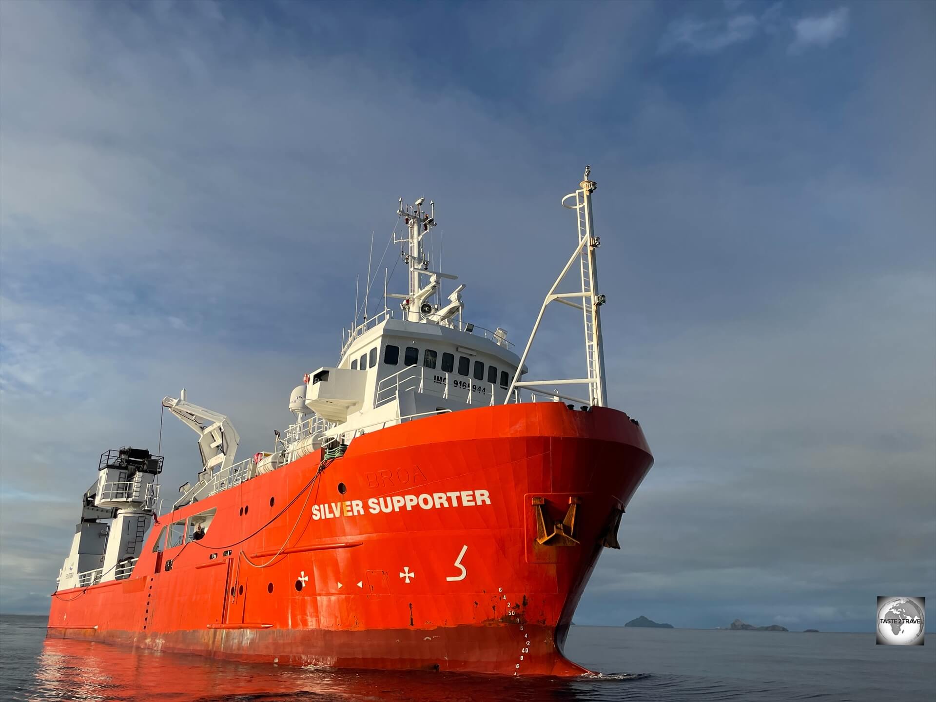
The MV Silver Supporter is a dedicated passenger and cargo supply ship chartered by the Pitcairn Island government.
Mangareva is an important travel link to Pitcairn Island and many visitors to this remote corner to French Polynesia are heading to the even remoter Pitcairn Island.
Pitcairn Island lies 540 km (335 mi) south-east of Mangareva, a sea voyage of 35-hours on board the MV Silver Supporter, the supply ship for Pitcairn Island.
The supply ship operates its schedule to coincide with the Air Tahiti Tuesday flight from Papeete.
The ship departs Mangareva each Tuesday afternoon, and returns the following Monday evening so that passengers can board the Tuesday flight back to Papeete.
The MV Silver Supporter is the dedicated supply and passenger ship for Pitcairn Islands.
There is a one-hour time difference between the Gambier Islands (UTC-9) and Pitcairn Island (UTC -8).
For those boarding the MV Silver Supporter, the crew will be waiting for you at the dock in Rikitea when you alight from the ferry.
You must first visit the Gendarmerie office in Rikitea where you’ll receive a French Polynesia exit stamp in your passport.
The Gendarmerie office is a 200-metre walk along the main road (turn left) when you exit the port.
Like everything in the French world, the office is closed for lunch from 12 noon until 2 pm.
Once all passports have been processed, all passengers will be transferred to the MV Silver Supporter, which is always moored offshore in the lagoon.
Upon arrival back at Mangareva, all passengers must again attend the Gendarmerie office to receive an entry stamp back into French Polynesia.
Public buses provide services from Papeete to points around the main island with bus #3 and #7 passing the airport.
Taxi
Tahiti
There’s no shortage of taxis in and around Papeete during business hours, but after-hours it’s best to book a taxi through your hotel. Meters are unheard of, so it’s best to confirm the fare (in French, if possible) before getting into a taxi. Current taxi tariffs are published here.
Papeete is very small and easily covered on foot so there’s no need to take a taxi anywhere downtown, however to the airport, the fare is about 1,900CFP (USD$19).
Moorea
There are very few taxi services on Moorea. One operator who has a published schedule of fares is Jo Faua of Moorea Jo Tours.
Mangareva
There are no taxis on Mangareva but guest houses will collect visitors from the port.
Rental Car
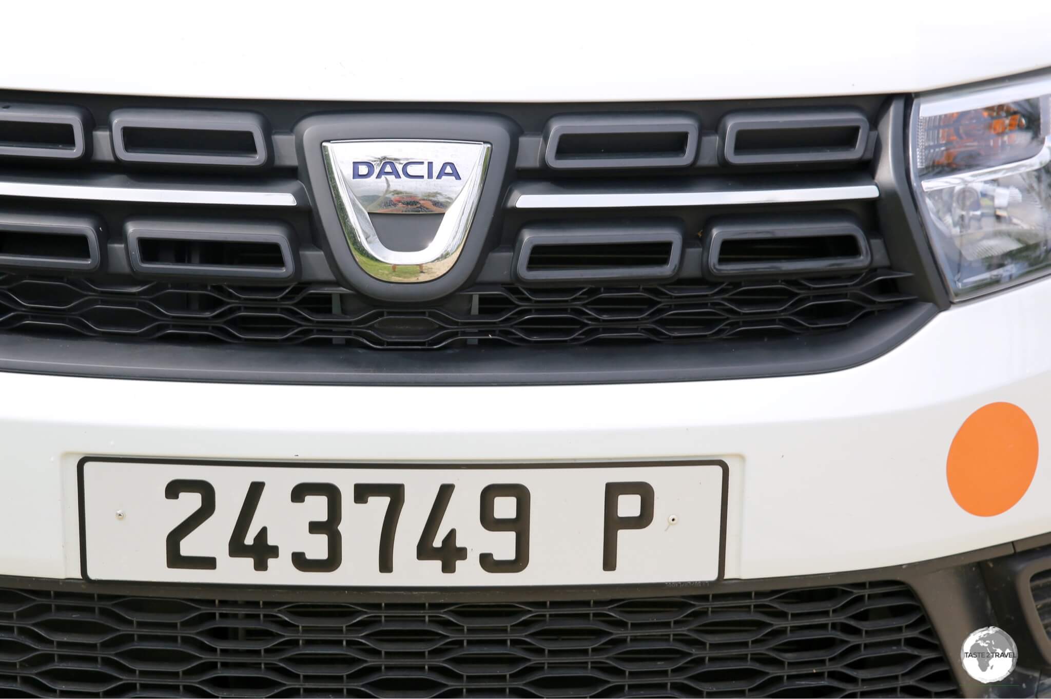
License plate from my rental car on Moorea.
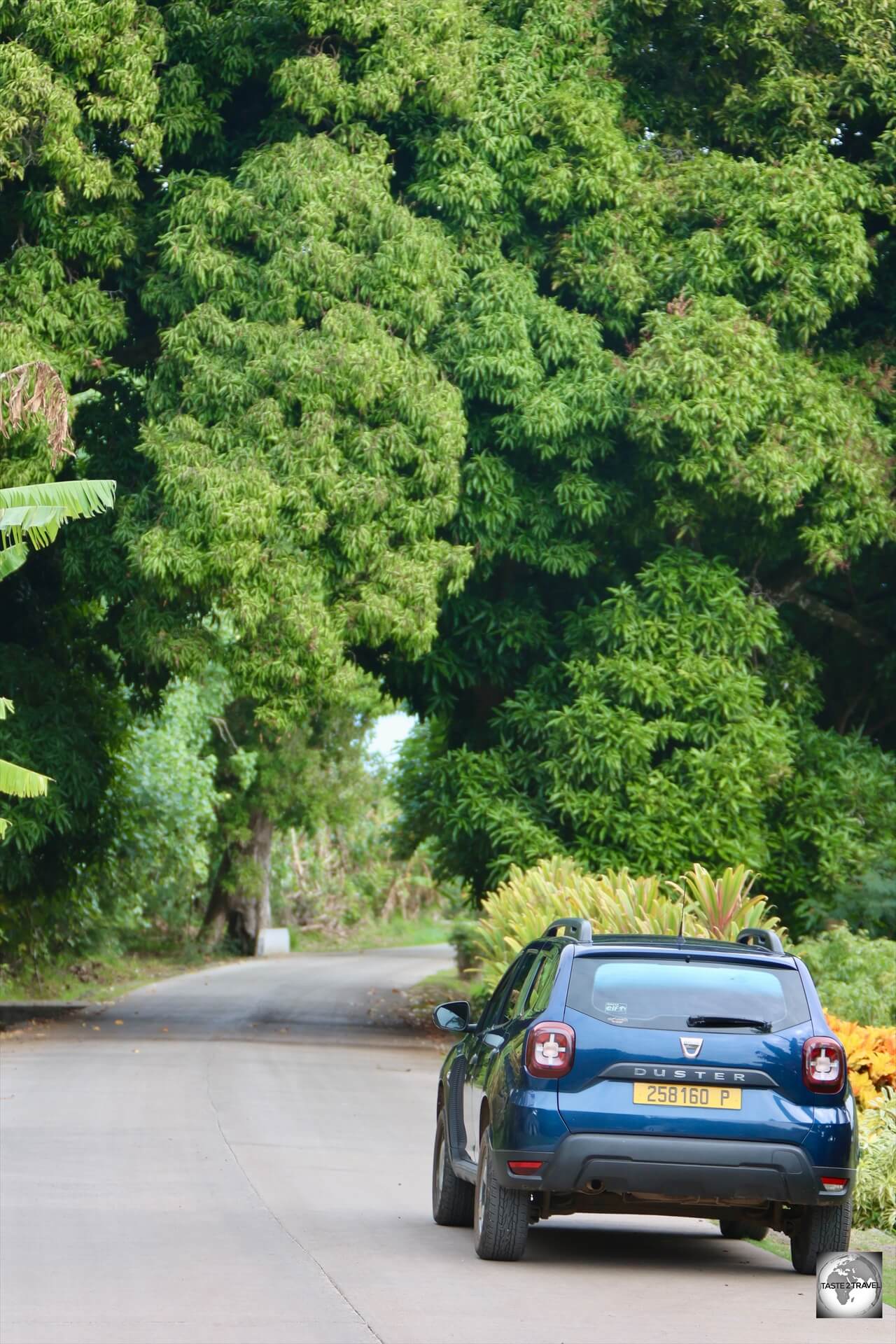
Tahiti
My rental car on Tahiti.
Cars on the main island can be rented from downtown offices in Papeete or from the airport. I comfortably circumnavigated the main island in 2 days (stopping at all sights) using a rental car.
Note: When renting in French Polynesia, you should check the fine print as some companies (Hertz) have very low daily kilometre limits with a high charge for excess kilometres. I booked a car through Rentalcars.com and was informed upon collecting the car that I had a limit of 45 km per day. I changed this to ‘Unlimited kilometres’ which tripled the cost of the rental! Ouch!
The following rental agents maintain and office at Faa’a International Airport:
Exploring the beautiful landscapes of Moorea in my rental car.
There are very few rental car agents on Moorea and, as can be expected in such a closed market, rates are not cheap with an economy-size car costing from 10,900 CFP (USD$100) per day.
Both Avis and Europcarhave branches conveniently located opposite the wharf in Vai’are but vehicles are limited so best to book in advance. Avis also have branches at Moorea airport and the Intercontinental resort which have limited operating hours.
On the northwest coast, a few companies rent out roadsters with a 4-hour rental from Moorea Fun Roadsters costing an eye-watering 15,000 CFP (US$150).
Mangareva
Exploring Mangareva in my rental car which i hired from my guest house.
The road around Mangareva runs along most of the coast, covering a distance of 28 kilometres (17 mi).
Most of the road is concrete, with a few unsealed, but completely passable, sections at the far eastern end of the island.
Rental cars can be hired through some of the guest houses on Mangareva for €50 per day, which includes the small amount of fuel which is needed to circumnavigate the island.
A one day rental is more than enough time to explore tiny Mangareva.
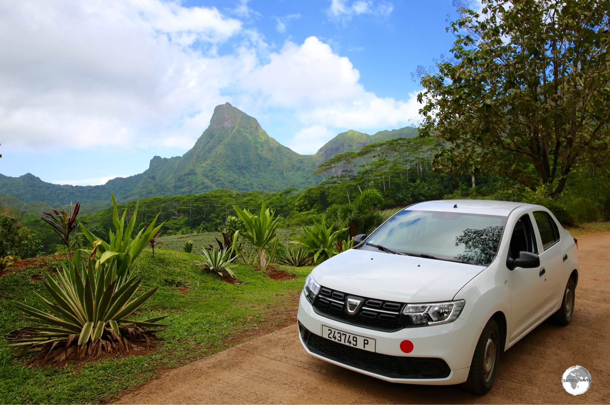
I rented my Dacia Duster rental car through my guest house.
A one-day rental is more than enough time to cover the sights on the island.
Ferry
The Aremiti car ferry at the ‘Gare Maritime’ in Papeete.
Papeete to Moorea
The Aremiti ferry company has regular sailings from the ‘Gare Maritime‘ (ferry terminal) in Papeete to Moorea (1,500 CFP one way), a distance of 17 km with a crossing time of 40 minutes.
Ferry boat ready to depart Moorea.
You can book tickets online and view the current sailing schedule here.
That’s the end of my French Polynesia Travel Guide.
Please feel free to leave a comment using the form below.
French Polynesia Travel Guide French Polynesia Travel Guide French Polynesia Travel Guide French Polynesia Travel Guide French Polynesia Travel Guide French Polynesia Travel Guide French Polynesia Travel Guide French Polynesia Travel Guide French Polynesia Travel Guide French Polynesia Travel Guide French Polynesia Travel Guide French Polynesia Travel Guide French Polynesia Travel Guide
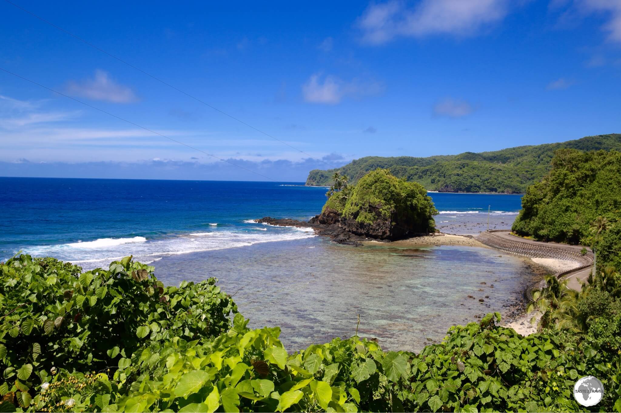
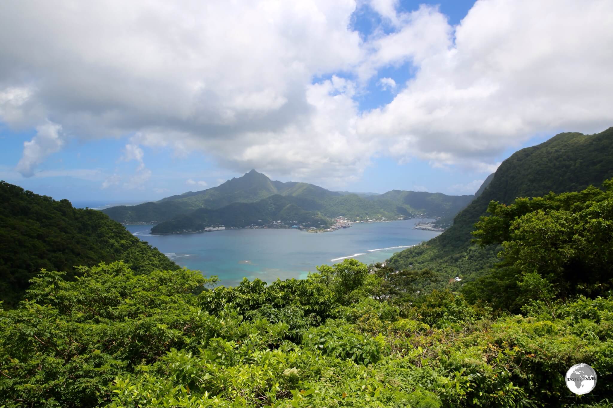
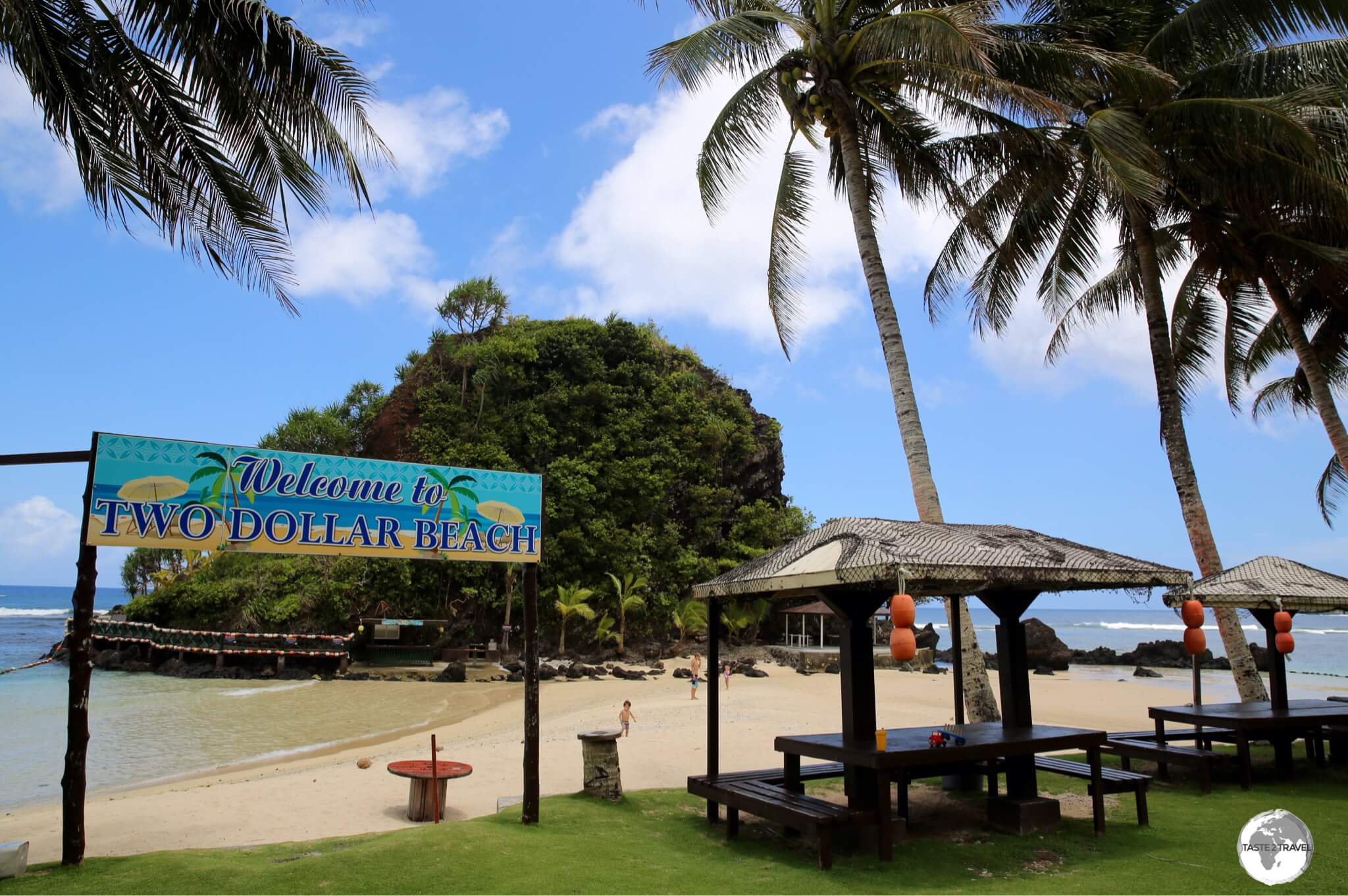
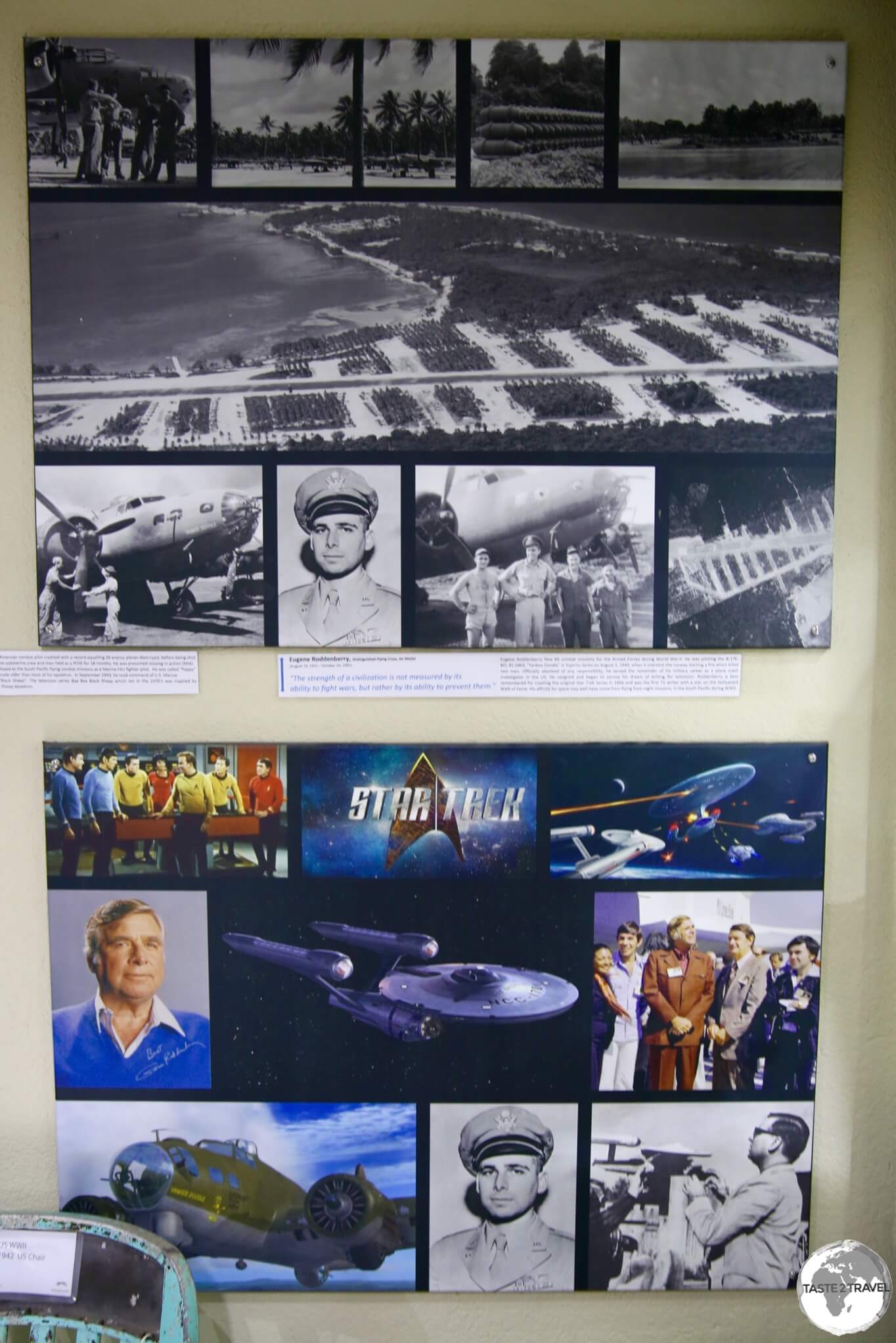
Welcome to the taste2travel American Samoa Travel Guide!
Date Visited: October 2018
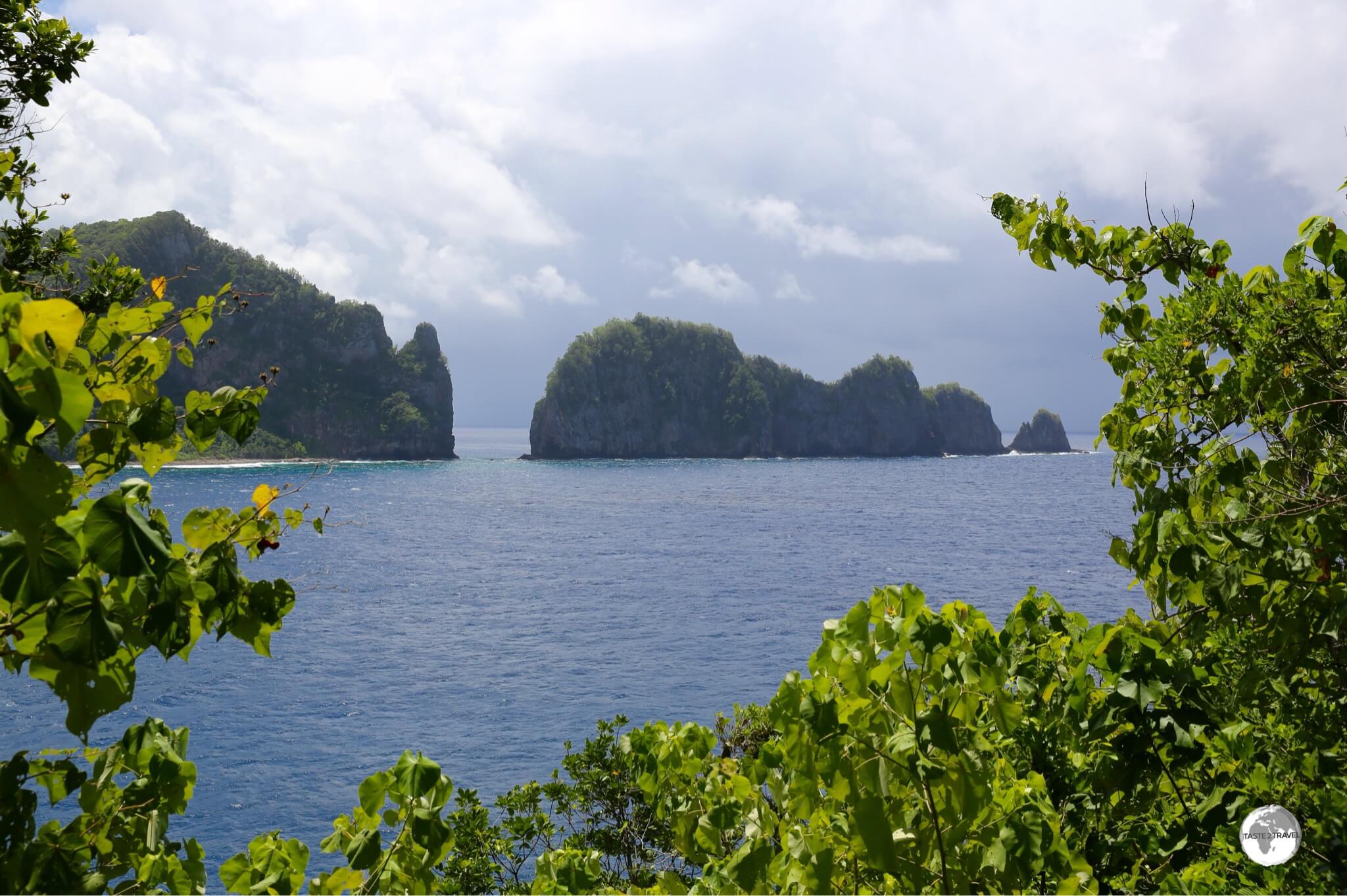
Introduction
American Samoa is an interesting anomaly, formerly part of a united Samoa, this US territory was created in 1899 (from the eastern islands of the Samoa archipelago) and ever since has belonged to, but isn’t a part of, the United States.
“Fatu ma Futi” is one of the most iconic sights in American Samoa.
Driving into the capital of Pago Pago from the airport, I was amazed by the incredible beautiful of the main island of Tutuila, which is the remnant of an ancient volcano that exploded millions of years ago. The landscape of Tutuila is spectacularly rugged and mountainous with everything clad in dense tropical rainforest vegetation.
A view along the south coast of Tutuila.
This narrow, emerald-coloured isle is home to 95% (56,000) of the total population, most of whom live on a narrow coastal plain along the south coast. The coast is dotted with sandy, palm-tree lined beaches, which are lapped by the pristine, translucent, blue waters of the Pacific ocean. It is a picture-postcard-perfect, south Pacific dream!
Tsunami evacuation points can be found on high ground, outside of every village in American Samoa.
Due to the topography, the residents of American Samoa are very vulnerable to Tsunamis, with the last one striking on the 29th of September 2009. It was reported that “four tsunami waves, measuring 15 to 20 ft (4.5 to 6 m) high, and reaching up to a mile (1.6 km) inland” struck the island, killing at least 22 people.
A beach in the village of Faleasao on the island of Ta’u.
I also spent time on the very remote island of Ta’u, which is part of the beautiful Manu’a Islands. Ofu is the top destination in the Manu’a islands with flights just once a week on Thursdays (see the ‘Getting Around‘ section below for more details).
A view of the north coast of Tutuila Island, the main island of American Samoa.
Tourism in the territory has been declining steadily over the years, with just 5,579 ‘genuine’ tourists visiting in 2017. The territory is very quiet, with tiny Pago Pago feeling more like a sleepy, provincial town than a capital. While in American Samoa, I met few other travelers and most places I visited, I had to myself. The locals are wonderfully friendly and welcoming and life is relaxed and unhurried, making American Samoa an easy and enjoyable destination to explore.
A view of the south coast of Tutuila island. American Samoa is an isolated, pristine environment.
Location
American Samoa is located in the centre of the South Pacific, east of the International Date Line and south of the equator. Its closest neighbour is Samoa which lies 125 km (78 miles) to the west, across the International Date Line.
Hawaii lies 4,000 km (2,500 miles) to the north; New Zealand, 2,888 km (1795 miles) to the southwest; Tonga, 898 km (558 miles) to the south; Tuvalu, 1553 km (965 mi) to the northwest; Australia, 4,077 km (2,533 mi) southwest while the US West Coast is 7,797 km (4,844 mi) to the northeast and Washington DC is 11,307 km (7026 mi) to the northeast.
A beach on the island of Ta’u.
American Samoa has the distinction of being the only U.S. territory located south of the Equator and is, geographically, the eastern part of the Samoa archipelago, with the western part of the archipelago being the independent state of Samoa. The main island of American Samoa is Tutuila, which is home to about 99% of the population.
The islands of Ofu and Olosega, as seen from the island of Ta’u.
A group of three, small, sparsely populated islands; Ta’u, Ofu and Olosega, collectively known as Manu’a, are located 65 miles east of Tutuila. All islands are volcanic in origin with spectacularly high mountains.
The International Date Line
The International Date Line separates the two Samoas. Source: https://www.worldatlas.com
The joys of time travel, flying east from today into yesterday and west from today into tomorrow…..
When it’s noon on Monday in American Samoa, it’s 1 pm on Tuesday in neighbouring Samoa, a time difference of 25 hours.
The two Samoa’s have not always been on different sides of the International Date Line (IDL). Up until the 29th of December 2011, they both sat in the last time zone, directly to the east of the IDL. It wasn’t until midnight on the 29th that Samoa jumped westwards across the International Date Line, losing the entire day of December 30, arriving into December 31st.
Flying from American Samoa to Samoa – from today into tomorrow.
Local time up to the 29th of December had been 23 hours behind Auckland – but following the change, it was one hour ahead. Samoa made the change in a bid to improve ties with major trade partners Australia and New Zealand. Prior to the change, the country shared three business days with the two trading partners, however, following the change, that increased to five business days.
A Tale of Two Samoa’s
A meeting house in Faleasao village on Ta’u island.
Once upon a time… there was one Samoa, where everyone lived happily together, sharing the same language, culture, traditions and beliefs.
Then in the 18th century, the first European explorers arrived – but then continued on their way. It wasn’t until the late 19th century that the Europeans (and the United States) really became interested in Samoa with Great Britain, Germany and the United States all claiming parts of the Kingdom of Samoa, and establishing trade posts.
Fales, like this one on Aunu’u island, are a common feature at the front of most properties in Samoa and American Samoa.
In 1886, Samoa entered a period of Civil war which lasted until 1894 and was fought mainly between rival Samoan factions. A 2nd Civil war reached a head in 1898 when Germany, Great Britain and the United States disputed over who should control the Samoan Islands.
Samoans in Samoa and American Samoa are deeply religious, with most attending church on Sunday.
To conclude the war, the Samoa Tripartite Convention of 1899, was convened between the United States, Great Britain and Germany and resulted in the partition of the Samoan islands into German Samoa and American Samoa. All of this was apparently done without consulting the Samoans. German Samoa was later renamed to Western Samoa which was then renamed to Samoa in July of 1997.
An American Territory
A campaign advertisement for upcoming ‘territorial’ elections.
Since 1900, American Samoa has been an unincorporated territory of the United States. According to the US Immigration and Nationality Act, American Samoans are “nationals but not citizens of the United States at birth”.
What’s the difference between the two? The only significant differences between a US citizen and a non-citizen US national are that a non-citizen US national may not vote in federal elections or hold any federally elected office.
This distinction causes many real life issues for AmericanSamoans living and working in the United States, as illustrated in this newspaper article.
Tourism
“Leisure Tourist” arrivals in the Samoa’s in 2017. Figures sourced from the ‘South Pacific Tourism Organisation’.
According to the Annual Review of Visitor Arrivals in Pacific Island Countries, which was published by the South Pacific Tourism Authority, American Samoa received a total of 19,987 visitors in 2017. Of these, just 5,579 visited for leisure purposes, while more than 50% were returning diaspora members who were visiting friends and relatives and the remainder were on business. The number of visitors in 2017 was lower than 2016 and is part of a long-term downward trend. Full details can be found on pages 22 and 23 of the report.
The coastal landscapes in American Samoa are magnificent.
Meanwhile, next door, Samoa received a total of 155,098 visitors in 2017, with 62,342 visitingfor leisure purposes and 50,407 visiting friends and relatives. This is part of a continuing upward trend and is helped in large part by frequent air connections with the United States, Fiji, New Zealand and Australia and the development of many beautiful resorts and hotels. Full details can be found on pages 34 and 35 of the report.
American Samoa is incredibly beautiful with much to offer visitors.
Why the low visitor numbers?
While the United States would be a natural source of tourists for this US territory, tourism is hardly encouraged with just one US carrier (Hawaiian Airlines) providing international connections twice a week from Honolulu and taking full advantage of their monopoly operation by charging extremely high ticket prices (refer to the ‘Getting There – Air‘ section below for more details). Only those that must fly, out of necessity, would pay such prices (i.e. locals or business people), while tourists can fly to many other destinations for a fraction of the cost. It’s a loss for American Samoa tourism.
‘Samoan’ souvenirs on sale at Fagatogo market.
Another natural tourist market would be Samoans from neighbouring Samoa, however they are required to apply for a visa to enter the territory and few Samoans I spoke to had ever visited the other Samoa. Despite the visa requirement, 49% of arrivals in 2017 came from ‘Other Pacific Islands‘ (most probably Samoa) to visit ‘friends and relatives’.
As for other nationalities, those who are on the US Visa Waiver list need to secure a travel authorisation, prior to travelling to American Samoa. Known as the ‘OK to Board‘ process, while not too arduous, it is an additional obstacle and one only required by the authorities in American Samoa!
Once on the island, there are just two top-end hotels to choose from and seven other, smaller properties.
People & Population
People
The Polynesian Triangle. Source: Wikipedia.
American Samoans are ethnically Polynesians and comprise 91.6% of the population. It is believed the original ancestors of the Polynesians left Taiwan 3,000 years ago, stepping from island to island across the Pacific, eventually reaching Easter Island.
Population
Population charts for American Samoa. Source: www.worldometers.info
The population of American Samoa in 2018 is approximately 56,000 people. In 2004 the population peaked at 59,264 but has been in a slow decline ever since.
The reason for this population decline is less births are being recorded and more residents are choosing to seek better work opportunities by relocating permanently to the US mainland where they are entitled to live and work. In most villages, there are houses which have been vacated permanently and many which are abandoned.
On the island of Ta’u, I spoke to local villagers who lamented the fact that many of the houses around them are empty, with their neighbours now residing and working in the United States. This has consequences for local communities and the economy. One direct consequence on Ta’u is that the only official accommodation option, Fiti’uta Lodge, has closed its doors following the relocation of its owner to the US.
Flag
The territorial flag of American Samoa flies underneath the US “Stars and Stripes” in Pago Pago.
Until 1960, the US “Stars and Stripes” was the only flag flown in American Samoa. However, as locals started to take a more active role in government, deliberations began over a new territorial flag and the Samoans were invited to propose ideas.
Design
The territorial flag consists of red, white and blue which are the colours traditionally used by the United States and Samoa. Although the bald eagle does not live in American Samoa, it is included as a tribute to the United States. The eagle clutches two Samoan symbols, alluding to America’s guardianship over American Samoa. The symbols are a uatogi (a war club, epitomising the government’s power) and a fue (a fly whisk, representing the wisdom of traditional Samoan leaders).
Currency & Costs
Currency
The US Dollar.
Not surprisingly, the currency of this US territory is the US dollar.
Banking Services
Banking services in American Samoa are very limited and most businesses do not accept credit cards (except the larger hotels). This is strictly a cash society!
There are no ATMs at the airport, just a couple of money changers and if your passport has required you to go through the ‘OK to Board‘ authorisation procedure (see the ‘Visa Requirements‘ section below for more details), you’ll be required to pay a US$20 processing fee (in USD cash) to immigration upon arrival. If you don’t have cash, immigration will retain your passport while you exit the terminal and exchange money at the money changer then return to collect your passport and receipt.
There is a branch of the Bank of Hawaii near the airport in Tafuna which has an ATM.
In downtown Pago Pago there are just two banks – a branch of the Australian bank, ANZ, and a branch of the Territorial Bank of American Samoa (TBAS). Each of these banks offers an ATM but on weekends they are often out of service. ANZ has an ATM at the Loufou Shopping Center in Tafuna, however this was out of service when I tried to use it.
In the lobby of the Government Executive building opposite TBAS is a Bank of Hawaii ATM (this was also out of service when I tried to use it).
There are no banks or ATMs on the Manu’aIslands (Ofu or Ta’u) and credit cards are not accepted anywhere, so you’ll need to ensure you have enough cash to cover your stay.
Costs
Travel costs in American Samoa are more expensive than the United States, owing to the fact that almost everything is imported into the country.
Postal Services
Despite the fact that American Samoa is 7,797 km (4,844 mi) from the west coast of the United States, US domestic postal rates apply! If you have anything to post to the United States, you will be charged the same domestic rates as anywhere else in the US. A real bargain!
Postal services are provided by the US Postal Service from their post office in downtown Pago Pago. The zip code for Pago Pago is 96799, while the state code for American Samoa is ‘AS‘.
Sights
Sunset on Tutuila Island.
Tutuila Island
Route AS001 runs along the southern shore of Tutuila, connecting the capital with all villages on the island.
Route AS001 winds its way along the entire southern shoreline of Tutuila, with half a dozen roads providing access across the island to the sparsely populated north coast.
Pago Pago
Downtown Pago Pago, the capital of American Samoa.
“It did not pour, it flowed,” wrote W. Somerset Maugham in his 1921 short story “Rain,” the famous tale of prostitute Sadie Thompson, who seduces a puritanical missionary while stranded in American Samoa. This description, however, applies mainly to Pago Pago, which, because of its location behind appropriately named Rainmaker Mountain, gets an average of over 500 cm (197 in) of rain a year.
Vendors at Fagatogo market in Pago Pago.
The sleepy capital is located on the shores of the fjord-like Pago Pago harbour, one of the most beautiful natural harbours in the world. The heavily indented harbour almost slices the island in two and is home to a tuna cannery which employs around 5,000 locals, making it the single largest, private, employer in American Samoa.
The Jean P. Haydon museum was closed for renovations during my visit.
Sights in Pago Pago include the small Fagatogo market, where souvenir sellers sell ‘Samoa’ souvenirs, most of which are imported from neighbouring Samoa, and the nearby Jean P. Haydon museum, which was closed for renovations at the time of my visit.
The ‘official’ residence of the Deputy Governor, with the Governor’s residence on the hill behind.
The white timber residences of the Governor and Deputy Governor are located around the corner opposite Sadie’s by the Sea, although I was told these are only used for ceremonial purposes with the Governor’s preferring to live in their own homes.
The interior of Pago Pago cathedral.
Fatu ma Futi
“Fatu ma Futi” – a beautiful sight outside of Pago Pago.
This iconic sight is located just offshore on the road from the airport into Pago Pago. Two limestone “sea stacks,” which are covered in lush vegetation, legend has it that a couple named Fatu and Futi had sailed from Samoa, looking for Tutuila. Their canoe sank, and the pair were transformed into these beautiful tree-topped mini-islands.
National Park of American Samoa
The National Park of American Samoa covers three of the islands of American Samoa.
Created in 1988, the territory’s sole national park protects huge swathes of pristine landscapes and marine environments on Tutuila and the Manu’a Islands and was the highlight of my visit to American Samoa. The park is one of the five least visited parks in the US National Park system and is often the last one visited by those who aim to visit all 59 USNPSparks.
A view of the north coast of Tutuila, part of the National Park of American Samoa.
Located in downtown Pago Pago, the National Park Visitor Information Center is the best place in American Samoa for tourist advice and information. The helpful and friendly staff provide excellent free maps and information on hikes and can book homestays on the Manu’aIslands.
Pola Island, Vatia and Afono
The view of Pago Pago harbour from Rainmaker Pass.
From Aua, a surfaced road switchbacks steeply up over Rainmaker Pass and down to Afono and Vatia. Before descending into Afono, it’s worth stopping at the pass to admire the incredibly panoramic views of Rainmaker mountain and Pago Pago harbour.
The stunning Afono Bay, part of the National Park.
Afono is a tiny, sleepy fishing village which is located on the beautifully pristine Afono bay. The cobalt-blue bay is surrounded by lush, green, verdant mountains, with sweeping views available from the roadside (out of town), towards Vatia.
A view of Pola Island from Craggy Point, part of the American Samoa National Park.
Halfway between Afono and the village of Vatia is a roadside NPS shelter and information area. From here a short (20 mins) trail leads down to the exposed and dramatic Craggy Point, which affords breathtaking views of the north coast and nearby Pola Island.
A view of the sheer cliffs of Pola Island from the village of Vatia.
Guarding the mouth of Vatia bay, tiny Pola Island has magnificent, sheer, 120m-high cliffs populated by seabirds. For a close-up of soaring rocks and birds, head through the village and park at the school, then walk 300m to reach the wonderfully isolated beach at the base of the cliffs.
Two Dollar Beach
Two Dollar beach on Tutuila.
One of the nicer beaches on Tutuila, $2 beach (now actually $5 beach) is a sand isthmus, which connects the main island to a small offshore island. The protected beach is popular with families with a bar serving drinks and snacks.
Aunu’u Island
Aunu’u Island lies a short boat ride from the the main island.
Located offshore from the eastern end of Tutuila is the beautiful, volcanic island of Aunu’u. At just 3-sq-km, the island can easily be explored on foot in half a day.
A view of Aunu’u Island from Tutuila.
The island is home to one small village of 476 inhabitants and a few friendly dogs, one of which joined me for my walk around the island.
The environment on Aunu’u island is pristine, including the pretty wharf.
The island is pristine and includes one of the better swimming beaches in American Samoa, which is located next to the shimmering, turquoise-blue waters of the wharf.
Swimming beach on Aunu’u island.
Walking trails lead out of the main village, allowing you to access all parts of the island. It’s impossible to get lost as the trail is a figure ‘8’, returning eventually to the village.
The dramatic coastline on Aunu’u Island.
At the back of the island is an extinct volcanic crater, the sides of which have produced dramatic sea cliffs.
Boats for Aunu’u island depart from the dock in the eastern village of Au’asi.
You can reach the island by taking one of the regular launches from the dock at Au’asi (at the eastern end of Tutuila) which cost US$2 each way. Boats don’t run on Sundays.
Lettuce being grown on Aunu’u island.
Ta’u Island
A view of Ta’u island.
While in the territory, I visited the outer Manu’a island of Ta’u, which is home to about 300 souls. Since the only lodge has closed its doors (see the ‘Accommodation‘ section below for more details), I organised a home-stay through the receptionist at Sadie’s by the Sea. You can also organise home-stays through the National Park Visitor Information Center.
This island is very quiet with no public transport, banks, shops, markets or anything else. You need to ensure you bring enough cash with you to cover your for your stay and a pair of good walking shoes.
I stayed a few nights and explored the villages of Faleasao, Luma, Ta’u and Siufaga and followed over-grown trails along the rocky shoreline to remote beaches. The airport on Ta’u is located in the remote, eastern village of Fiti’uta.
Hermit crabs having a party inside a coconut on an isolated beach on Ta’u.
If you wish to travel to nearby Ofu, boats can be chartered at around US$200 each way. Ouch! I met one traveller who had negotiated a fare of US$100.
Departing the island of Ta’u for the 30 minute hop to Tutuila with Samoa Airways.
Flights to the islands are operated by Samoa Airways (of Samoa) who fly to Ofu once a week and Ta’u four times a week (see the ‘Getting Around‘ section below for more details).
Accommodation
The Accommodation Directoryon the American Samoa Tourism website provides a list of properties in the territory.
Tutuila Island
While in American Samoa, I stayed at ‘Sadie’s by the Sea’.
There are two top-end hotels to choose from in American Samoa, Sadie’s by the Sea, which is located on its own private, sandy beach in downtown Pago Pago and Tradewinds, which is located closer to the airport.
I stayed at Sadie’s which originally opened its doors in the 1960’s as the Pago Pago Intercontinental hotel. The hotel was built by the United States government as part of an ambitious program to bring industry and tourism to American Samoa. Today, Sadie’s offers comfortable, but dated, rooms on the waterfront in Pago Pago.
My comfortable room at ‘Sadie’s by the Sea’ in Pago Pago.
I chose to stay at Sadie’s and would recommend this as an ideal place to base yourself. The hotel restaurant, Goat Island Cafe, is a favourite venue for any local celebrations and rental cars are also available for hire
At the other end of the main street is the smaller, Sadie Thompson Inn which is part of the same hotel group and is where, in 1916, the author W. Somerset Maugham resided for six weeks during an extended trip through the Pacific. While here is wrote the short story ‘Rain‘.
Who was Sadie Thompson?
Promotional poster for the 1928 silent film, “Sadie Thompson”.
Sadie Thompson was the main character in the short story, ‘Rain‘, which was written by author W. Somerset Maugham during a (forced) six-week stay in Pago Pago, which was caused by the quarantining of the ship upon which he was traveling.
Of the ships passengers, there was a “Miss Thompson” and a medical missionary and his wife, who were models for the characters in the story. While lodging in Pago Pago, the missionary suspects Miss Thompson is working as a prostitute and is determined to stop her.
The story was made into a silent film, “Sadie Thompson“, in 1928 and featured Gloria Swanson in the lead role.
Ta’u Island
My family homestay on the island of Ta’u. As is customary in Polynesia, deceased relatives are buried in the front garden.
The only accommodation options on Ta’u are family home-stays which can be booked online through the US National Park Service or from their office in Pago Pago. While on the island, I stayed with a wonderful family in the village of Faleasao.
My colourful room at the homestay.
Eating Out
Restaurant advertisement on Tutuila.
The American Samoa Tourism website contains a Restaurant Directory which lists restaurants on Tutuila.
Tutuila Island
‘Samoan Oka’ is raw fish cooked in lime juice with coconut milk.
While staying at Sadie’s by the Sea, I ate at the hotels’ excellent Goat Island Cafe, which is open from early morning to late evening. The menu features a mix of local dishes and American classics such as hamburgers and ribs. One of my favourite dishes was the Samoan Oka served with Taro chips. Oka is to Samoa what Poke is to Hawaii or Ceviche to Peru, raw fish cooked in lime juice – but what makes the Samoan Oka different is that a liberal amount of coconut milk is added. It tastes divine!
The wonderfully friendly staff at the Goat Island Cafe at ‘Sadie’s by the Sea’.
A short walk from Sadie’s, along the waterfront towards the airport, is the local favourite – DDW Beach Cafe. Attached to a sports club, this cafe is open from early morning until 3 pm (except on weekends) and serves huge portions of local and American favourites. Everything here is good!
Out near the airport is the tiny Loufou Shopping Center, which is the nearest thing to a mall on American Samoa. One place worth stopping at is the Koko Bean Cafe, which does good food and great coffee.
Ta’u Island
There are no restaurants on Ta’u. Meals are provided by the family who is hosting you.
Visa Requirements
US citizens and US nationals may enter and leave American Samoa freely, provided they do so using a valid US passport.
“OK to Board” Travel Authorisation Process
For everyone else, American Samoa has its own unique immigration requirements, which are very different to those of the United States. You will need to be granted a travel authorisation prior to landing in the territory, this authorisation is known as ‘OK to Board’. You should refer to this Immigration Department website and ensure you understand the requirements.
Citizens from countries which are covered by the current US visa waiver program (i.e. those passport holders who normally enter the United States using ESTA) must obtain an ‘OK to Board‘ authorisation prior to boarding their flight. In order to be granted this authorisation, the following documents need to be submitted, well in advance, via email to the American Samoa Attorney General’s Office at the following email address: okboard@la.as.gov
A copy of the photo page of your passport, which must be valid for no less than six (6) months from date of your departure from American Samoa.
A copy of a round-trip or onward ticket, leaving American Samoa within 30 days or less of arrival.
Once you have submitted these documents, you’ll receive a ‘OK to Board’ travel authorisation via email, which you should print and carry with you. A copy of my authorisation is included here for reference purposes:
Travel Authorisation for American Samoa.
Finally, upon arrival at Pago Pago Airport, you’ll be required to pay a USD$20 processing fee (in cash) to the immigration officer. There are no ATMs at the airport so its best to bring cash with you.
Simple really!
Getting There
Pago Pago International Airport.
Air
My Talofa Airways flight at Pago Pago International airport.
All flights to American Samoa arrive at Pago Pago International Airport, which is located in the neighbourhood of Tafuna, 11 Km (7 miles) southwest of downtown Pago Pago.
In aviation terms, American Samoa is well off the grid, which is really surprising for a territory of the US which is the #1 aviation market in the world. Apart from the daily inter-island flights between the Samoas (and a once a week flight to Tonga), there is just one other international service to Pago Pago, the twice weekly (Monday and Thursday) Hawaiian Airlines flight from Honolulu. The Hawaiian flights are the only flights that connect the territory to the United States.
Hawaiian operate in a monopoly environment and charge accordingly. No one I met on American Samoa is happy with the current arrangement, especially since most locals have friends and family living on the US mainland so have to pay, not only the extortionate airfare to reach Honolulu, but an add-on fare to reach the mainland. With the additional airfare (and depending on the season) I was told of people paying US$2,200 for round trip tickets to the US.
These high prices are also a deterrent to potential tourists who might visit from the US. Why spend so much to fly to American Samoa when there are much cheaper destinations elsewhere.
Departing Apia (Samoa) for Pago Pago on Talofa Airways.
Daily inter-island flights between the Samoas are provided two the two Samoan carriers, Talofa Airways and Samoa Airways, with regular flights departing from Apia’s Fagali’i Airport, which is located on the outskirts of town.
Talofa Airways offer an interesting connection from Pago Pago, with flight (TA407) departing each Tuesday morning for Tonga (Nuku’alofa-Tongatapu). The same plane returns to Pago Pago on the same day as flight TA408.
The following airlines provide services to/ from Pago Pago International Airport:
Samoa Airways – flies to/ from Apia (Fagali’i), Ofu, Ta’u
Airport Transport
There are buses and taxis (US$20) from the airport to downtown Pago Pago.
Intra-Samoa Ferry
The MV Lady Naomi, seen here in Apia harbour, was out-of-service due to ongoing maintenance during my visit.
The Samoa Shipping Company operates the MV Lady Naomi passenger ferry, which normally sails between Apia and Pago Pago once a week on Thursdays. At the time of my visit (October 2018), the fine lady was out-of-service due to ongoing repairs.
Cruise Ship
American Samoa lies well off the regular Pacific cruise ship circuit with just eight ships scheduled to arrive in 2018. You can check the current schedule on the crew-center.com website.
Getting Around
Samoa Airways ‘route map’ at Pago Pago airport.
Air
Arriving on Ta’u with Samoa Airways who provide all domestic flights in American Samoa.
American Samoa does not have its own airline, instead it relies on Samoa Airways for the provision of domestic services to the Mana’u islands of Ofu and Ta’u. For some strange reason, Samoa Airways do not include these domestic destinationson their online booking page. I had to make a manual booking using a travel agent in Pago Pago.
Breaking News: A new domestic carrier, Manu’a Airways is scheduled to commence service between Pago Pago and the Manu’a islands from late 2018. You can check for the latest updates on their website.
Arriving at Fitiuta airport on the island of Ta’u.
Samoa Airways performs a single round-trip (in between their regular shuttle service between Apia and Pago Pago) to this outer island group each weekday morning as follows:
Flights to Ofu, only on Thursday, departing from Pago Pago at 08:45.
Flights to Ta’u on Monday, Tuesday, Wednesday and Friday, departing from Pago Pago at 08:45
If you wish to visit Ofu, but don’t wish to be marooned there for an entire week, you could take the Monday flight to Ta’u, then charter a boat to take you across to Ofu, then fly on Thursday from Ofu back to Pago Pago. Boat charters from Ta’u to Ofu are quoted at US$200 for a one way trip but I met one traveller who had negotiated a fare for US$100.
Public Transport
‘Aiga’ buses at the terminus in Pago Pago.
Tutuila Island
Brightly painted aiga buses shuttle along the roads from early morning until sunset every day except Sunday. Basically they run from the villages to the market in Pago Pago and back, picking up anyone who signals the driver.
A friendly ‘aiga’ bus driver in Pago Pago.
Ta’u Island
There’s no public transport on Ta’u but the government has provided the island with a ‘Dial-a-Ride‘ minibus to transport seniors and people with disabilities. The bus meets all flights and provides a free shuttle service between the airport and the villages on the northwest coast.
An ‘Aiga’ bus in Pago Pago.
Taxi
Tutuila Island
There are plenty of taxis on Tutuila, which can be hailed on the street or booked through a hotel. There are no meters, so fares need to be negotiated in advance. Not all taxis are clearly marked but they are required to have either a T or TA prefix on their license plate.
Ta’u Island
There are no taxis on Ta’u, you either walk or hitch a ride.
Rental Car
My rental car on Tutuila was provided by Sadie’s by the Sea.
Tutuila Island
An American Samoa license plate.
The license plates of all rental cars in American Samoa are prefixed with an ‘R‘. I rented a car through my hotel, Sadie’s by the Sea for US$70 per day, which seems to be the going rate in American Samoa.
There are plenty of car rental agents on Tutuila with the following maintaining an office at Pago Pago airport:
The speed limit on the island ranges from a racy 20 mph up to a giddy 25 mph. Locals are extremely patient (no road rage in paradise) and rarely exceed the limit. There are often police radar patrols on the roadside to ensure you’re not doing 26 mph!
Driving on the overgrown road to the remote village of Fagamalo.
Ta’u Island
The one, concrete road on Ta’u runs along the north shore of the island, connecting the few villages on the island.
There are no rental cars or scooters on Ta’u, you either walk or hitch a ride.
American Samoa Travel Guide American Samoa Travel Guide American Samoa Travel Guide American Samoa Travel Guide American Samoa Travel Guide American Samoa Travel Guide American Samoa Travel Guide American Samoa Travel Guide American Samoa Travel Guide American Samoa Travel Guide American Samoa Travel Guide American Samoa Travel Guide American Samoa Travel Guide American Samoa Travel Guide American Samoa Travel Guide
Welcome to the taste2travel Solomon Islands Travel Guide!
Date Visited: September 2018
Introduction
Tourism in Solomon Islands is in its infancy. According to the Solomon Islands Visitors Bureau, the number of ‘tourists’ to the country is approximately 6,000 per year. Rugged and undeveloped, the Solomon Islands are not an easy or cheap travel destination but it does offer an abundance of rewarding travel experiences for intrepid travelers.
The Solomon Islanders are some of the friendliest people you will ever meet.
Apart from pristine nature, dazzling reefs, gin-coloured seas and a fascinating history, the real charm of the Solomon Islands are the incredibly friendly and engaging locals. The country promotes itself as The Hapi Isles and it’s no idle boast, the people are friendly, welcoming, polite and always offer the warmest of smiles. The children of SI are adorable and love posing for the camera.
So many sweet memories from the Solomon Islands.
Unfortunately, all visitors enter the Solomon Islands through the capital, Honiara, which is not the best introduction to the country. A charmless, dusty, noisy place, the best thing you can do in Honiara is take the first flight (not cheap!) to the beautiful provinces.
A volcano near Munda provides a dramatic backdrop to Roviana Lagoon.
It’s in the provinces that the real treasures of the Solomon Islands are revealed. The myriad islands in this archipelago nation remain undeveloped and untouched by tourism – emerald-coloured gems, scattered throughout turquoise-blue seas, all waiting to be explored by adventurous souls.
Location
Honiara, Solomon Islands
Located in the South Pacific, the Solomon Islands lie directly east of Papua New Guinea, 975 km north-west of Vanuatu – 1,381 km north of New Caledonia and 2,117 km north-east of Brisbane.
This archipelago nation consists of a double chain of volcanic islands and coral atolls. The country comprises most of the Solomons chain, with the exception of Buka and Bougainville, two islands at the north-western end that form an autonomous region of Papua New Guinea.
A map of the Solomon Islands painted on traditional Tapa cloth.
People
The real joy of travelling in the Solomon Islands is time spent with the friendly locals.
The 626,000 inhabitants of the Solomon Islands are predominantly Melanesian (94.5%), with a tiny Polynesian (3%), and Micronesian (1.2%) population.
A Map of Melanesia.
Historians believe that, along with Australian Aborigines, the Melanesians emigrated from Africa into southern Asia between 50,000 and 100,000 years ago. Using land bridges, which existed due to low sea levels, they eventually migrated east to Australia and Papua New Guinea (PNG), arriving there 40,000 years ago.
Children in the Solomon Islands love posing for the camera.
A further migration from PNG saw the first settlers arrive in the Solomon Islands approximately 30,000 years ago. DNA tests have shown that the Melanesians are distinctly different to Polynesians and Micronesians who it’s believed arrived in the Pacific from what is today Taiwan.
Flag
Solomon Islands Flag
The flag of the Solomon Islands consists of a blue upper triangle which represents the ocean, while a lower green triangle represents the land and the diagonal yellow stripe represents sunshine. The five white stars represent the five main island groups.
Souvenir flags of the Solomon Islands on sale in Honiara.
Currency
The colourful Solomon Islands dollar.
The currency of the Solomon Islands is the Solomon Islands dollar (SI$). Bank notes are issued in denominations of SI$5, 10, 20, 50 and 100,
The Solomon Islands $5 bank note.
Current exchange rates (October 2018):
US$1 = SI$7.86
AUD$1 = SI$5.59
To commemorate 40 years of independence in 2018, the Central Bank of the Solomon Islands commissioned a special, limited edition (100,000 notes) SI$40 polymer note which was designed and printed by De La Rue of the UK. The bank advised me that they plan to eventually convert all notes to polymer.
A limited edition $40 polymer bank note was released to commemorate 40 years of independence in 2018.
Philately
The stamps of the Solomon Islands often feature local marine life.
The stamps of the Solomon Islands can be purchased from the Philatelic counter, inside the main post office in Honiara. The website of Solomon Islands Post contains a link to their Lithuanian-based stamp printer’s online shop, from which you can purchase SI stamps online.
Solomon Islands stamps are produced in Lithuania by Stamperija and can be purchased from their online store.
Internet Speeds
Solomon Islands Blues – blue because there is no undersea internet cable.
Internet speeds in the Solomon Islands are some of the slowest in the Pacific region, all due to the fact that the country is yet to be connected to the outside world via an undersea internet cable.
The Chinese company Huawei offered to fund a cable, connecting Honiara to Sydney but the Australian government, sighting national security concerns, didn’t like the idea of a Chinese company connecting anything to Australia.
Artwork at the Solomon Islands Art Gallery in Honiara.
Guadalcanal
Honiara
Craft shop at the Solomon Islands Museum in Honiara.
With a population of 56,298, Honiara is the largest city in the country with a few sights of interest. The city is located on the waterfront but has its back firmly turned against it. Instead, the focus of the town lies one block inland where drab, cheap, Chinese shops line the dusty, pot-holed, congested main road – Mendana avenue.
Around Town
The Solomon Islands National Museum in Honiara.
Located downtown on Mendana avenue, the Solomon Islands National Museum complex consists of three buildings and a gift shop.
The RAMSI Mission exhibition at the National Museum.
The newest exhibition details the RAMSI mission from the recent political troubles. The other two older buildings provide an overview of the history and culture of the Solomon Islands and, if you’re heading out into the provinces, provides good background information on what you can expect to see and experience.
Local artist ‘Pollo’ explaining his works at the Art Gallery in Honiara.
Across the road from the museum, the Solomon Islands Art Gallery showcases art from local artists with most pieces available for purchase. At the time of my visit, work was being completed on the grounds with a series of new shops about to open which would house the numerous crafts stands which line the dusty footpath outside.
One of the many craft shops outside the Art Gallery of Honiara.
At the other end of Mendana avenue, the HoniaraCentral Market features produce from around the island. If you wish to sample some cheap, local fare, there are food stalls at the back where you can mix-it-up with the locals.
The relaxing Memorial Garden is adjacent to the airport terminal.
Next to the airport terminal is the small Honiara Memorial Garden, which honours US forces and their Pacific islander allies.
WWII History
The Guadalcanal American Memorial in Honiara.
Located on a remote hilltop on the outskirts of town, overlooking the suburbs of Honiara, is the impressive (and free) Guadalcanal American Memorial. This informative and interesting memorial is maintained by the American Battle Monuments Commission, which maintains US memorials and cemeteries in 15 different countries.
Dedicated to American and Allied troops who lost their lives during the Guadalcanal campaign, the memorial is built on Hill ’72’ which was a former WWII battle site. Details of the six key battles which took place between the US and Japanese during the campaign are etched into giant granite panels.
The open-air displays at the Vilu War Museum are slowly succumbing to the elements.
Guadalcanal was a major WWII battle sight between the Americans and the Japanese. Tours of battle sites and relics can be organised through Travel Solomons whose office is located downtown close to the museum.
One of the sights they include on their trips is the Vilu War Museum, which at SI$100 is not cheap. I made my own way to the museum in my Toyota RAV4, but of course got a little lost since there is no signage anywhere and the museum is located in the middle of the bush at the end of an overgrown dirt track, 24 km west of Honiara. Some helpful locals put me back on course!
Displays at the Vilu War Museum.
The museum features a collection of WWII relics (both US and Japanese) from planes to tanks to anti-aircraft guns which are arranged in an outdoor garden setting. The collection was accumulated by the late father of the current proprietor but the tropical weather is slowly taking its toll on the machinery, all of which is exposed to the elements.
Scuba Diving
With all the fighting that took place on Guadalcanal during WWII, the waters around the island are home to some impressive wrecks. Tulagi Dive organises dives from their dive shop, which is located next to the Point Cruz Yacht Club in downtown Honiara.
Carved masks, such as this one in Honiara, are popular souvenirs.
Western Province
Colourful woven bags make ideal souvenirs.
Munda
Young boy in Munda.
Scuba Diving
Dive Munda – possibly my favourite dive operation in the whole world!
There’s just one reason people flock to Magical Munda – the sublime Scuba Diving. It’s still a well-kept secret that the Solomons Islands offers some of the best scuba diving in the South Pacific and Munda is the place to experience the incredible underwater wonders of this off-the-beaten-track dive destination.
The team at Dive Munda (l-r) Jeno, myself, Euna, Belinda and Sunga.
Munda was a major battleground during WWII and the turquoise-coloured waters of the stunning Roviana Lagoon are littered with interesting wrecks from ships to downed fighter planes. The reefs around Munda are in pristine condition with an incredible amount of lush hard and soft corals and massive Elephant Ear sponges. Marine life is abundant with sight names such as ‘Shark Point‘ offering a hint of what lies below.
The two amazing local divemaster’s from Dive Munda, (l-r) Euna and Jeno.
Dive Munda is the only dive shop in town and is conveniently located inside the only hotel in Munda, the Agnes Gateway Hotel.Dive Munda is owned and operated by the enthusiastic, energetic, charming and engaging Belinda Botha who is a South African native who now calls Munda home.
The Dive Munda team (l-r), Sunga, Jeno and Euna made a beautiful flowery lei during our surface interval.
Belinda is a tour-de-force who has become Munda’s #1 fan and promoter and it’s leading environmental champion. She has employed an incredibly capable team of locals who are the dive masters, boat captain and (during surface intervals on remote islands) flowery-lei makers. They are a truly talented bunch and I loved spending time with them. Some of the best dive memories ever!
On our way to dive ‘Shark Point’.
Dive Munda offers in excess of 30 dive sites in and around Munda, with one of my favourites being ‘Alice in Wonderland’ which starts with a decent to 14 metres to view an upturned F4F-4 Wildcat – a US fighter jet which was shot down by Japanese fire. This wreck was only recently discovered and is in pristine condition.
Sea gulls flying over Roviana Lagoon at Munda.
The beautiful aspect of diving in Munda is that Dive Munda has all these amazing sights to itself. There are never any other groups on a dive site, never any other boats around. The sites are all yours to explore in peace. Magic!
Surface intervals with Dive Munda are always on uninhabited islands which feature wild orchids among other flora.
WWII History
Barney explaining Munda’s WWII history at his museum.
In between dives, there’s plenty to occupy your time on land. Munda has a wealth of fascinating WWII history which can easily be explored on foot. The best place to gain an understanding of Munda’s involvement in WWII is at the Peter Joseph WWIIMuseum which has been created by the knowledgeable Barney, who is the closest thing to a WWII Historian in these parts.
Some of the many Dog Tags found by Barney over the years.
The museum (SI$50) is housed in a shed in Barney’s front garden and is comprised of Barney’s vast, personal collection of WWII relics and memorabilia which he has accumulated over the years.
An article from an American newspaper tells of the return of missing Dog Tags from Barney’s collection to the original owner.
Barney has found many lost Dog Tags over the years, some of which have been reunited with their very grateful owners. There’s no signage for the museum but it’s located behind the only playing field in town.
Japanese anti-aircraft guns make for the coolest garden furniture at this Munda home.
Scattered around Munda are countless WWII relics and dumps. The front garden of one house features two Japanese anti-aircraft guns which remain where the Japanese left them when they fled from the Americans. And you thought your garden furniture was cool!
No shortage of smiles in Munda.
At the rear of the same house, just beyond the clothes line, is an overgrown WWII dump where US landing boats have been piled up.
Dumped US landing boats piled up in someone’s backyard.
Elsewhere anti-aircraft guns, tanks and other equipment can be found lying where it was left when troops departed after the war.
A WWII relic lies where it was left behind a house in Munda.
One of the more interesting sites is an old concrete bunker which was constructed by the US as an ammunition store. Today it houses a collection of WWII relics which have been collected by the traditional landowners.
A former US ammunition store in Munda houses one family’s collection of WWII relics.
Gizo
A seller at Gizo market.
Located a short boat ride from Munda is the regional centre of Gizo, the second largest town in the Solomon Islands, which can be covered on foot in under 10 minutes. The attractions of Gizo are limited to the Central market but the real attractions are offshore on the myriad islands which are a short boat ride away.
Produce at Gizo market.
Babanga Island
A view of paradise from Fatboys Resort.
Located 15 minutes by boat from Gizo, Babanga Island is surrounded by the most amazing gin-coloured waters. It’s here you’ll find the wonderful island getaway that is Fatboys Resort.
The view from the restaurant at Fatboys Resort with Kennedy Island in the background.
Fatboys offer five waterfront bungalows and an over-water bar/ restaurant. I visited as a day tripper from Gizo, which is not a problem provided you eat lunch in their restaurant, which is highly recommended as the fresh fish is divine. The snorkeling is incredible with a huge amount of marine life, including the occasional cruising black-tip reef shark. Fantastic!
Kennedy Island
The beach at Kennedy Island.
Kennedy Island is a small island located 15 minutes by boat from Gizo, directly opposite Fatboys Resort.
The island is named after then Lieutenant John F. Kennedy, who in August 1943 swam to the island with his crew of the PT-109 after their boat was rammed and wrecked by the Japanese destroyer, Amagiri. Two American sailors died in the incident. Kennedy later had the crew swim to the larger Olasana Island where they were eventually rescued.
The bar on Kennedy Island only ever gets busy when a cruise ship is in town.
Today, Kennedy island is home to a bar which is owned by Hotel Gizo who charge a SI$50 landing fee, which includes a complimentary drink. At the time of my visit, I had the island to myself.
Despite the fact that he bit me, I’m sure Kennedy and I would have become great friends eventually!
The only inhabitants on the island are the friendly caretaker, his wife and a semi-tamed Yellow-Bibbled Lory, fittingly named ‘Kennedy’. Kennedy has the island to himself and can be found flying among the many trees – but packs quite a bite if you get too close.
‘Kennedy’ is a cheeky Yellow-Bibbled Lory.
Accommodation
Accommodation options are limited in the Solomon Islands with many towns offering just one or two guest houses. In Honiara, the capital and largest city, you’ll find just six hotels listed on booking.com, most of which are old and in need of renovation and score low with reviewers. The exception to this is the flashy, new kid on the block, the Coral Sea Resort.
In Gizo, the second largest town in the country, there is one hotel and one lodge and in popular Munda there is one main accommodation option. This lack of competition is never going to be good for travelers with properties able to charge higher rates due to a lack of choice and under no pressure to improve their offering.
Honiara
Coral Sea Resort
My beautiful room at the Coral Sea Resort, which offers the highest standard of accommodation in the Solomon Islands.
Without a doubt, the flashiest hotel in Honiara and the most deluxe hotel anywhere in the Solomon Islands is the very new and wonderful Coral Sea Resort. Managed by a team of Australians, the hotel is located downtown on the waterfront, and features a swimming pool, casino, two restaurants with bars which are always lively with both tourists and visiting businessmen.
The hotel offers five different room types with a new wing currently under construction. Current rates on booking.com range from US$160 to US$350 with all rooms including breakfast. I stayed here on my first night in town and thoroughly enjoyed it – but then I awoke in the morning and remembered my travel budget!
Solomon Kitano Mendana Hotel
The Solomon Kitano Mendana Hotel is part of the Japanese Kitano group which is great news for no other reason than the hotel is home to a fantastic Japanese restaurant (see the ‘Eating Out‘ section below for more details).
The hotel is a solid Japanese construction with spacious rooms, some of which have recently been renovated while others are very dated. Current rates on booking.com range from US$142 – US$363 per night.
Access Units
Apartments at ‘Access Units’ are very spacious and comfortable – a real home away from home.
Located close to the airport, Access Units on Ramsi street is a block of secure, self-contained, modern, spacious apartments which can be booked through Airbnb.com. Airport transfers are provided free of charge and a free ‘wash and fold’ laundry service is included in the rate as is a selection of free provisions in the kitchen.
Due to its remote location on the outskirts of town, it’s best suited to guests who have their own transport. If you wish to rent a car, the owners (John and Zima) have a reliable Toyota RAV4 which they rent to guests.
The nearest public transport are the mini buses (SI$5 to town) that shuttle along the main highway, a 1.5 km walk from the apartments. Buses run during daylight hours only so a taxi is required after hours, with the fare costing SI$100 from the city.
Munda
Agnes Gateway Hotel
My room at Agnes Gateway Hotel in Munda.
There’s just one main accommodation option in tiny Munda – Agnes Gateway Hotel. Located a short walk from the airport and overlooking the beautiful Roviana Lagoon, Agnes offers a variety of accommodation options to suit all budgets. There is no other competition in town and their rates reflect that fact, with a bunk bed in a dorm costing US$43 and a deluxe room costing US$121. I stayed in both a budget room (old and tired) and deluxe room (much nicer) and would recommend spending the extra money for the deluxe experience.
The food and service at Agnes are very good and I would recommend it as a fine place to stay while in Munda, especially since it’s really the only place to stay. Some new competition in town would be good!
If you’re diving with the amazing Belinda and team from Dive Munda, Agnes Lodge is the best place to stay as the dive shop is located at the lodge.
Gizo
Rekona Lodge
A ‘no-frills’ budget room at Rekona Lodge.
Rekona Lodge was my accommodation choice while in Gizo and I would recommend this over the Gizo hotel. Located in a quiet backstreet, this lodge has a variety of rooms to suit all budgets. Their basic, budget room with shared bathroom costs US$35 while the same room with private bathroom costs US$50. Their deluxe rooms are the best in town (better than anything I saw at Hotel Gizo) and cost US$96.
Worth paying more for a deluxe room at Rekona Lodge.
Gizo Hotel
The Gizo Hotel is the only hotel in Gizo and, at the time of my visit, had no running water in the bathrooms.
Located opposite Gizo wharf, the Gizo Hotel is the only place in town which calls itself a ‘hotel’. This is the sister property of the King Solomon Hotel in Honiara, offering 51 rooms on two levels (although at the time of my visit the upstairs rooms had no running water) with rates ranging from US$87 – $100.
The hotel has the best restaurant in town (there is only one other) and features lively traditional dance shows on certain evenings. The wood-fired pizzas in the evening are excellent!
Fatboys Resort
All bungalows at Fatboys Resort face the spectacular reef.
Fatboys Resort overlooks the gin-coloured waters of Babanga Island which offers incredible snorkeling. The resort is a 15-minute boat ride from Gizo and offers 5 bungalows, all of which offer uninterrupted views over the stunning lagoon.
Bungalows cost around US$244 for a one night stay with cheaper rates for longer stays. The bar and restaurant are situated 100 metres out over the sparkling waters and serves wonderful local seafood and ice-cold drinks. Day visitors are welcome and the resort can organise a boat to collect you from Gizo.
Eating Out
Dining out is not an option for struggling locals so there are few restaurants in the Solomon Islands with most being located inside the various hotels. As for cafés, there are just two in the country, both of which are located in downtown Honiara.
Honiara
Cafés
With many locals earning a weekly salary of between SI$200 and SI$400, it’s not surprising that few venture into a cafe to pay SI$30 for a cappuccino. The two cafés in Honiara are the domain of tourists, expats and the wealthy elite. Both open early in the morning and close early in the afternoon.
Located across the road from the museum and next door to the art gallery, the sparkling clean, air-conditioned Breakwater Cafe is the perfect retreat from the heat, humidity and dust of Honiara. The cafe opens its doors early, serving a very good breakfast (until 9:30 am) then a wonderful lunch menu, before closing its doors promptly at 3:00 pm. The coffee is wonderful as is the selection of cakes – including the giant-size, freshly made Lamingtons! Wi-Fi is not available.
Coral Sea Resort
The best dining options in Honiara are at the brand new Coral Sea Resort, which offers two superb restaurants. Haydn’s Steakhouse is the main restaurant, which starts the day serving a wonderful breakfast menu and perfect coffee prepared by trained baristas. For lunch and dinner, the menu includes a choice of Australian and European cuisine.
The other dining option is The Boardwalk which specialises in South-East Asian street food, with an emphasis on Malaysian mamak food. Located at the waterfront bar, this restaurant is more casual than Haydn’s.
This Japanese-owned hotel is home to the wonderful ‘Hakubai’, the best Japanese restaurant in the Solomons. If you’re in the mood for some fine sashimi, sushi or ramen, you’ll satisfy your cravings at this excellent establishment, which feels like it has been transported straight from Tokyo.
Opposite Hakubai is the restaurant ‘Capitana‘, which serves more traditional fare including fresh local fish, seafood and pizzas. They offer a buffet dinner every Wednesday evening.
King Solomon Hotel
Hidden away in a downtown backstreet, the sprawling King Solomon Hotel is renowned for its wood-fired pizzas which are prepared in an outdoor clay oven. Traditional Polynesian dancing is offered on certain evenings and the popular and lively bar is a good place to meet expats and enjoy a cold Sol Brew.
Munda
There is just one restaurant in Munda, which can be found inside the only hotel in town, the Agnes Gateway Hotel. Open from early morning to late evening, the waterfront restaurant offers wonderful breakfasts and generous portions of fresh, local fish for lunch and dinner. Apart from local seafood, their hamburger ‘with the works‘ is very popular.
Gizo
There are two restaurant options in town, with the restaurant at the Gizo Hotel being the more popular. Open from early morning, this is the only place in town serving breakfast. Being the sister property of the King Solomon Hotel in Honiara, the Gizo Hotel also serves excellent wood-fired pizza in the evenings.
The other dining option is PT-109 which is a 5 minute walk along the main street from the Gizo Hotel. This is a family run restaurant which serves local cuisine in a casual waterfront setting.
Visa Requirements
Solomon Islands Passport Stamps.
Nationals of all countries in the Schengen Area, Israel and the UAE may enter the Solomon Islands visa-free for up to 90 days within a 180-day period. Forty-four other nationalities are entitled to a stay of 3 months in a 12-month period. To check your requirement, you should consult the current Visa Policy of the Solomon Islands.
Getting There
Arriving at Honiara International Airport.
Air
All international flights arrive at Honiara International Airport,which is located 8 kilometres (5 miles) west of downtown. The airport is the hub for Solomon Airlines, whose fleet consists of five planes – one Airbus A320 (used for international services), and their domestic fleet of three Twin Otters and one Dash-8.
Solomon Airlines’ sole international jet, its Airbus A320.
The following airlines provide services to/ from Honiara:
Although the airport is just 8 km from downtown, the one lane highway is often congested, with drivers serving to avoid the numerous deep potholes. The Japanese government is currently funding a project to upgrade the highway but in the meantime, it can take up to an hour to reach downtown if you get stuck in the morning rush hour.
Boarding my Solomon Airways flight from Honiara to Munda.
Air
Domestic flights are operated by Solomon Airlines, who offer services to 20 regional centres in various provinces. All flights have a baggage limit of 16 kg (35 lbs), although I never saw this being enforced.
Solomon Airlines operate in a monopoly environment and, like all good monopoly carriers, their ticket prices can only be described as extortionate. Airfares on the airlines’ website are quoted in Australian dollars (AUD$) with flights sold in one way segments. The cost of a one way ticket from Honiara to Munda (55 mins) is currently AUD$300 (USD$213).
Nusatupe airport in Gizo is built on its own island, requiring a boat transfer across a sometimes rough channel to Gizo.
The 4 planes which comprise the domestic fleet fly at 2000 m (6500 ft), providing spectacular views of the islands and lagoons. Despite the high prices, seats are limited and flights can be heavily booked so it’s best to book in advance.
Departing Gizo for Honiara with Solomon Airways.
Intra-Island Ferry
Intra-island ferries are the only mode of transport available to locals who could only ever dream of being able to afford a ticket on Solomon Airlines. Daily passenger ferries currently serve Auki (Malaita) while a weekly passenger ferry serves the Western Province towns of Noro (for Munda) and Gizo.
To Noro (for Munda) and Gizo, the MV Anjeanette departs Honiara for Gizo on Saturday evening, and departs from Gizo to Honiara on Monday.
All other provinces are served by less comfortable cargo ferries which make lots of stops along the way. Ferries to most places depart Honiara at least weekly while departures to the more remote Santa Cruz Islands are every two weeks.
Local Taxi Boats
Shared Banana boats, the local taxis, depart from Gizo for nearby, and more distant, villages.
Due to a complete absence of roads in many parts of the country, local shared taxi boats are used to access many towns and villages.
Public Transport
Mini buses operate from the main market in Honiara, charging SI$3 for a short drop and SI$5 for a long drop (e.g. to the Airport).
Taxi
Taxis in Gizo.
Taxis in Honiara are un-metered but charge SI$10 per kilometre with a trip to/ from the airport costing SI$100. Taxis can be found outside the International terminal or can be hailed on the street or booked through any hotel.
Rental Car
License plate of my rental car.
There are several car rental agents in Honiara, most of whom charge around SI$450-500 per day for a compact car. One such operator is Paradise Motors who are located on the main road towards the airport.
Roads on Guadalcanal are heavily pot-holed and best suited to high clearance vehicles.
I rented a Toyota RAV4 through my accommodation provider at Access Units (see the ‘Accommodation‘ section for more details). The roads on Guadalcanal are very rough and require a vehicle with high clearance and 4WD capability.
That’s the end of my Solomon Islands Travel Guide.
Welcome to the taste2travel New Caledonia Travel Guide!
Date Visited: August 2018
Introduction
The very French territory of New Caledonia offers a blend of Parisian chic, style and sophisticated ambience, mixed with laid-back Melanesian charm.
Due to its large French expat community, New Caledonia, and especially Nouméa, has a distinctly continental feel, especially in the ritzy beach side neighbourhoods of Baie des Citrons and Anse Vata, which feel more French Riviera than Pacific seaside.
The ‘Heart of Voh’ is a naturally occurring heart-shaped bog inside a mangrove swamp.
New Caledonia is uniquely classified as a “special collectivity of France” and while not a cheap destination, the territory offers many varied and rewarding travel experiences, both on the mainland and the smaller outer islands.
While many visitors choose to spend their time soaking up the agreeable atmosphere of the capital, there are a wealth of fascinating sights elsewhere which can easily be visited with a rental car.
La Grande Terre is an island of stark contrasts.
The main island and mainland, La Grande Terre, is a 400 km long, narrow slither of land which was formerly part of Australia (believed to have separated roughly 66 million years ago).
As a visiting Australian, I was often struck by the similarities in landscapes between New Caledonia and Australia. From the arid, red-earth expanses of Le Grand Sud (Great South region), which has a distinctly outback look and feel, to the green hills of the central agricultural belt, to the groves of paperbark and gum trees which line the highways – New Caledonia looks and feels like Australia!
The stunningly beautiful Kuto Bay, a highlight of the Isle of Pines.
South of the main island is the picturesque Isles of Pines, a popular tourist playground famed for its stunning white-sand beaches and towering Araucaria pine trees.
Nickel on display at the Maritime museum in Noumea.
New Caledonia is home to 10 percent of the world’s nickel deposits. As a result, nickel processing is the most important sector of the economy, and is the main source of revenue for New Caledonia.
Historic St. Louis church is located on a hill, on the outskirts of Noumea.
This, combined with annual fiscal transfers of more than one billion US dollars from the French government, have meant that the territory has never had to rely on tourism. However times are changing and tourism is now becoming more important to the economy, and the government – through New Caledonia Tourism – is actively promoting this magical corner of the South Pacific.
A hand-painted sarong showing traditional Kanak motifs.
I thoroughly enjoyed my time in New Caledonia and cannot wait to return to explore the Loyalty Islands and enjoy more fine French pastries at my favourite Nouméa pâtisseries.
Location
Noumea, New Caledonia
New Caledonia is located in the South Pacific – 1,210 km (750 miles) east of Australia, 630 km (392 miles) south of Vanuatu, 4,715 km (2,930 miles) west of French Polynesia and 20,000 km (12,000 miles) from France.
The territory is an archipelago, which is comprised of the main island of La Grande Terre, the Loyalty Islands to east, the Belep archipelago to the north and the Isle of Pines to the south.
People
Artwork depicting the faces of New Caledonia at the Museum of New Caledonia.
The Kanak are the indigenous Melanesian inhabitants of New Caledonia and today comprise 40% of the population. Historians believe that, along with Australian Aborigines, the Melanesians emigrated from Africa into southern Asia between 50,000 and 100,000 years ago.
A map of the Melanesian region of the Pacific Ocean. Source: Wikipedia
Using land bridges, which existed due to low sea levels, the Melanesians eventually migrated east to Australia and New Guinea, arriving there 40,000 years ago.
A traditional Kanak wood carving.
A further migration into the eastern islands of Melanesia (including New Caledonia) came much later, probably between 4000 B.C. and 3000 B.C.
DNA tests have shown that the Melanesians are distinctly different to Polynesians and Micronesians who it’s believed arrived in the Pacific from what is today Taiwan.
The phallus is of symbolic importance in the Kanak culture and today a popular souvenir item.
Since colonial times, immigrants have arrived from metropolitan France and various other francophone colonies. Of the current population of 278,000, two-thirds live in the greater Noumea area.
Flag
The flag of New Caledonia.
Until 2010, the French flag was the only flag flown in New Caledonia. However, in July of that year, the Congress of New Caledonia voted in favour of a motion to fly the Kanak flag alongside the French tricolor.
The Kanak flag has flown alongside the French flag since 2010.
The flag in use today features a bluehorizontal band which symbolizes both the sky and the ocean surrounding New Caledonia. The redsymbolises the blood shed by the Kanaks in their struggle for independence while the greensymbolises the land.
At its centre, the yellowdisc is a representation of the sun and the symbol upon it consists of a flèche faitière, a kind of arrow that adorns the roofs of Kanak houses.
Currency
The Pacific Franc is used in the French Pacific territories of New Caledonia, French Polynesia and Wallis and Fortuna.
The unit of currency in New Caledonia is the cours de franc Pacifique (CFP), which is referred to as the ‘Pacific franc’. Financial institutions abbreviate the currency “XPF“, but in this guide I use the locally used abbreviation – ‘CFP‘. The same currency is used in the other French Pacific territories of French Polynesia and Wallis and Futuna.
The franc is pegged to the euro at a rate of 1 Euro = 119.33 CFP ($1USD = 103.60 CFP).
‘1000 Pacific Franc’ bank notes.
Costs
Not cheap!
I met few budget travelers in New Caledonia, although, if you don’t mind camping and hitchhiking you could keep costs down. To really enjoy New Caledonia you should have a well-endowed bank account!
Some sample costs:
Coca Cola (0.33 litre): 350 CFP (US$3.35)
Cappuccino/ Cafe Latte: 500 CFP (US$4.82)
Domestic Beer (.5 litre): 725 CFP (US$7.00)
Combo meal at McDonalds: 1,150 CFP (US$11.10)
Entrée in a restaurant: 1,500-1,800 CFP (US$14.50 – $17.40)
Main course in a restaurant: 2,800+ CFP (US$27.00 +)
One-way shuttle bus from La Tontouta airport to downtown Noumea: 3,000 CFP (US$29.00)
Dorm bed at a backpackers in Nouméa: 1,900 CFP (US$18.40)
Room in the mid-range ‘Hotel Beaurivage’ in Nouméa: 8,000 CFP (US$77)
Room in the top-end ‘Hilton Hotel’ in Nouméa’: 19,000 CFP (US$185)
The Great Telco Robbery
While on the subject of costs, it’s worth mentioning that New Caledonia has just one monopoly telco provider whose extortionate charges reflect their monopoly pricing power.
Mobilisby OPT charge high rates for everything – including 3,195F (US$31.00) just to purchase a SIM card!
All SIM cards have a minimum contract period of 6 months, rendering them useless for tourists. One tourist package exists which costs 6195 CFP and includes just 3000 CFP of credit, which is valid for 90 days. Call and data charges are high and if staying in the country more than a week, you will find it necessary to top-up.
VoIP calls through popular applications such as Skype, WhatsApp or Viber are blocked, although I found I could make these calls if I connected to my hotel Wi-Fi.
Philately
Postal services in New Caledonia are provided by Office des Postes et Télécommunications (OPT).
Postal services are provided in New Caledonia by the Office des Postes et Télécommunications (OPT), who produce colourful local stamps featuring the fauna, flora and culture of New Caledonia.
Stamps on sale at Calédoscope, the OPT philatelic shop in downtown Noumea.
Stamps are popular with philatelists around the world and can be purchased directly from Calédoscope, a dedicated philatelic shop in downtown Nouméa, or onlinefrom the OPT website.
Stamp artwork from New Caledonia often features the colourful fauna and flora found throughout the archipelago.
Sightseeing
La Grande Terre
The Lagoon which surrounds La Grande Terre is the longest continuous barrier reef in the world and is UNESCO World-Heritage listed.
Measuring 400 km in length, La Grande Terre is the mainland of New Caledonia. Surrounded by a UNESCO-World Heritage listed lagoon, the longest continuous barrier reef in the world and the second largest after the Great Barrier Reef of Australia, the lagoon offers diving, snorkeling, abundant marine-life, pristine reefs, whale watching, one spectacular blue hole and lots of beautiful beaches.
The reef which surrounds La Grande Terre is the second largest in the world, after the Great Barrier Reef of Australia.
The sparsely populated east coast is characterised by towering, rugged mountains which plunge into the sea, while the west coast offers gentle plains and green, rolling hills and is the agricultural heartland of the country.
Exploring the Le Grand Sud region in my rental car.
Directly east of Nouméa is the spectacularly beautiful Le Grand Sud (The Great South) region, which looks like a slice of outback Australia which has been transplanted into the South Pacific. The sites of Le Grand Sud can easily be covered on a day-trip from Nouméa.
Nouméa
Street art in downtown Noumea.
With a population of 97,500, Nouméa is the largest city and capital of New Caledonia. Home to a large French expat population and known for its French influences from ritzy boutiques, fine dining restaurants, pâtisseries, boulangeries and cafés, the city feels like an outpost of France in the South Pacific.
Jean-Marie Tjibaou Cultural Centre
A display at the Jean-Marie Tjibaou Cultural Centre in Nouméa.
Opened in 1998, the magnificent Jean-Marie Tjibaou Cultural Centre, was designed by Italian architect Renzo Piano who incorporated Kanak design elements into the construction of the buildings.
The centre houses a number of galleries and uses a variety of artistic mediums to celebrate the cultural heritage of the indigenous Kanak people. Highly recommended!
St. Joseph Cathedral
St. Joseph Cathedral in Noumea.
This Roman Catholic church dominates the city skyline from its hilltop position above town. Built between 1887 – 1897 in the neo-Gothic style, the two 25 metre tall towers do not have spires, which is an anticyclone design feature.
The interior of St. Joseph’s Cathedral in Noumea.
Museum of New Caledonia
A display of Kanak artefacts at the Musée de Nouvelle-Calédonie (Museum of New Caledonia) in Nouméa.
The Musée de Nouvelle-Calédonie, which was founded in 1893, houses an extensive display of regional ethnography & visual arts. The museum includes displays of indigenous cultures and artefacts from the wider Pacific region.
Maritime Museum of New Caledonia
A display at the Maritime Museum of New Caledonia in Nouméa.
The engaging Musée maritime de Nouvelle-Calédonie is located opposite the Noumea container terminal, in a building that was formerly a maritime station.
The museum exhibits trace local maritime history from the first indigenous settlers, who reached New Caledonia in traditional canoes, to the arrival of Europeans, to the Pacific War, and the American presence in the territory during the WWII.
World War II Museum
Displays at the World War II Museum in Noumea.
The Musée de la Seconde Guerre Mondiale is housed inside a modern replica of a corrugated iron Quonset hut (the prefabricated building of choice used by the US Military during the Pacific war).
New Caledonia was essential to the United States’ prosecution of the Pacific war and the displays outline how the local population turned their backs on the far-off French (Vichy) regime and threw their support behind the Americans.
As a result of the American presence on the island during the war, local Kanaks started to agitate for independence from France, a movement which is still ongoing today.
Museum of the City of Nouméa
Displays at the Museum of the City of Noumea.
Located downtown on Place des Cocotiers, the Musée de la Ville de Nouméa is housed inside a charming colonial mansion which was originally the head office of the first bank established in the territory. Today, the museum features exhibits on three floors, which trace the history of Nouméa.
Place des Cocotiers
The Kiosque à Musique at Place des Cocotiers in Noumea.
Located in the heart of the city, Place des Cocotiers is the main square of Noumea.
Situated at the northern end of the square, the Kiosque à Musique is a pretty wooden rotunda which was constructed in 1878 from funds raised by the Union of Transportation Workers and today serves as a popular place for locals to relax and is also the venue for occasional concerts.
Baie des Citrons
Baie des Citrons is one of the most popular beaches in Noumea.
A popular, busy beachside suburb, Baie des Citrons (Lemon Bay) is located a short drive south of downtown Noumea. This is one big playground which draws those looking to swim, exercise, picnic.
Lining the beach is the largest collection of restaurants, bars and hotels in Noumea, making Lemon bay the liveliest neighbourhood in the capital.
The sweeping Baie des Citrons is a popular recreation area in Noumea.
The best news, a highly recommended mid-range hotel is located in the heart of this neighbourhood (see the ‘Accommodation‘ section below for more details).
Anse Vata
Anse Vata beach is popular with locals and tourists and is home to many hotels, restaurants and cafes.
A short stroll from Baie des Citrons, Anse Vata is a popular tourist hub. Framed by a wide, sandy, swimming beach, Anse Vata is home to numerous restaurants, cafés ,ice-cream shops, bars, boutiques and everything else a tourist might need while on holiday.
Amédée Island
The 56-metre high Amédée Lighthouse soars above the island of the same name.
Located 24 kilometres offshore of Nouméa, this tiny slice of paradise is home to the Amédée Lighthouse, the tallest metal lighthouse in the world.
The spiral staircase which climbs 56 metres to the top of Amédée Lighthouse.
At 56 metres tall, le Phare Amédée (Amédée Lighthouse) is one of the tallest lighthouses in the world. It was constructed from iron panels in Paris in 1862, then dismantled and shipped in crates to New Caledonia where it was re-assembled on the island.
A panoramic view from the top of Amédée Lighthouse.
A spiral staircase winds its way to the top from where you have panoramic views of the island and beyond.
Amédée Island is a nesting site for the highly venomous “Tricots Rayé” (Striped Sea Snake).
Amédée Island is a favourite nesting site for the Tricots Rayé, the Banded sea snake. Although highly venomous, their mouths are tiny and as such they are unable to bite a human. They are also very shy and will give you a wide berth.
A panoramic view from the top of Amédée Lighthouse shows the reef which surrounds the island.
Snorkelling is also excellent with lots of seagrass attracting feeding sea turtles.
I used an independent taxi service to travel to the island but all-inclusive day trips are offered by ‘Mary D‘, a family owned company who have been organising trips to the island for more than 30 years.
Mary D provide hotel transfers, transport to the island, snorkeling gear, lunch, entrance to the lighthouse and lots of fun activities.
Le Grand Sud Region
Mont-Dore
Free mineral water is available from the source at Mont Dore.
A short drive from bustling Noumea, the village of Mont-Dore is famous for its bottled mineral water, and if you’re in the area you can stop at the roadside fountain to fill any container you like with freshly piped mineral water – all free of charge. The locals bring bags of containers to refill!
Visitors to Mont Dore are able to fill their bottles with free mineral water direct from the source.
Yaté Dam
The impressive Yaté Dam was constructed in 1959 to provide power to the SLN Nickel plant in Ducos (Nouméa).
The impressive Yaté Dam was constructed to provide a reliable power source for the Nickel processing plant which is on the harbour in Noumea. The dam is 45 metres high and 641 metres long and is responsible for LakeYaté, which is approximately 40 Km2.
A view of the east coast from the mountains above Yate village.
The sleepy settlement of Yate lies on the remote east coast of La Grande Terre. There is very little in town with the best accommodation options being in distant Noumea. If you’re driving, this is the only place with a service station in the Grand South region.
The floating jetty at the 4-star Kanua Tera Ecolodge, which lies at the end of a very lonely road at Port Boise.
At the end of a rough, red-earth, gravel road is the very remote Port de Boise. The only thing here is the deluxe Kanua Tera Ecolodge, which offers the only accommodation and restaurant option in this part of the country. They have a sister property on the Isle of Pines – see that section for more details.
View of the south coast of La Grand Terre from Cap N’Dua.
Further along the south coast, an even rougher red-earth track leads out to the lonely lighthouse at Cap N’Dua, which is part of the Cap N’Dua Reserve. From here you have spectacular views over the south coast of la Grande Terre, including the treacherous Havannah Pass.
The arid, dry, red-earth landscapes of Le Grand Sud region are reminiscent of outback Australia.
West Coast
FortTéremba
The administrative building at Fort Téremba which now houses a museum.
Located near the town of Moindou, twenty minutes north of La Foa, FortTéremba was built to house convicts sent from France and its colonies. The construction of a military fort and a prison, overlooking Uarai bay, began in 1871 at the request of the Governor who received a contingent of twenty-five convicts, with two supervisors and three policemen. The fort was built by the convict labour.
Panoramic views of Uarai bay from the top of the watchtower at Fort Téremba.
The camp was renamed Fort Téremba by reference to the island Téremba which is in the middle of the bay. The fort overlooks Uarai bay, opposite the mouth of the La Foa River, 124 kilometres north of Noumea.
The once dilapidated watchtower at Fort Téremba has been renovated and now includes a spiral staircase.
During the Kanak revolt in 1878, the gendarmes inside the fort were killed. However, the fort was never taken and at the time it was still in very good condition. After the revolt, the military fort was redesigned and strengthened to serve as bunkers and possible refuge.
Convict graffiti decorates the wall of a cell at Fort Téremba.
By 1906, the fort had fallen into neglect and remained that way until 1984 at which point it was restored. As part of the restoration, the former administration building was converted into a museum and interpretation Centre.
The cellblock at Fort Téremba was formerly used to house convicts.
Apart from the museum, you can also visit the adjacent cellblock where original convict graffiti can be seen and climb the watchtower which offers panoramic views over the bay.
La Foa
La Passerelle Marguerite in La Foa was designed and built in Paris by students of Gustav Eiffel.
Located on the main highway, immediately south of La Foa, La Passerelle Marguerite (Margaret bridge) is a suspension bridge which was shipped out in pieces from France after being designed by students of Gustav Eiffel (of Eiffel Tower fame) in 1909. It was re-assembled on-site using convict labour.
Bourail
Located on the highway, south of town, the Bourail museum and visitors centre includes informative displays which explain the history of this agricultural region.
Bourail Museum (Le Musée de Bourail) is located on the main road south of town and is housed in a former “food store”. The museum focuses on the settlement of the region around Bourail, which today is the agricultural heartland of New Caledonia.
The tourist office also shares this building and can provide maps and useful information if you are heading further north.
New Zealand War Cemetery
Located south of Bourail, the New Zealand WWII cemetery is the final resting place for 200 Kiwi soldiers killed in the Pacific war.
Nine kilometres south of Bourail on RT1 is the very well tended New Zealand War Cemetery. The cemetery serves as the final resting place for 200 NZ soldiers who were killed in New Caledonia during WWII.
A view of the New Zealand WWII cemetery near Bourail.
Baie des Tortuges
The beautiful Baie des Tortues (Turtle Bay) is a popular nesting site for sea turtles.
Located on the coast near Bourail, Baie des Tortues (Turtle Bay) is a beautiful sandy beach which is popular with swimmers and nesting sea turtles.
Baie des Tortues is lined with wildly contorted Araucaria pine trees which are endemic to New Caledonia.
While Baie des Tortues offers a fine beach, its just as famous for its impressive stand of the very rare Araucaria luxurians, which are endemic to New Caledonia.
A seriously warped Araucaria pine tree at Baie des Tortues.
Araucaria luxurians is a species of conifer which grow to a height of 40 metres, but whose trunks are very narrow at just 70 centimetres. Due to their disproportion, the taller the tree, the greater the lean.
A view over Baie des Tortues.
Located a short hike along the coast from Baie des Tortuges, Bonhomme is a striking monolith rock formation sculpted by waves. ‘Bonhomme’ means gentleman in French and gets its name from its shape which is said to resemble the profile of a man wearing a hat (when viewed from the sea).
Adjacent to Baie des Tortues, ‘Bonhomme’ is a large eroded rock which looks like a gentleman wearing a hat (when viewed from sea).
Poe Beach
A view of the lagoon from Poe beach.
Located a short drive from Bourail, Poe Beach is located at the end of the long and windy Route de Poe. This protected, 13-km long, white-sand beach is very popular with families and features a campground and the luxurious Sheraton New Caledonia Deva Spa & Golf Resort.
Koné
A view of the ‘Heart of Voh’ from my microlight flight.
The Heart of Voh is a natural, heart-shaped, bog in the middle of a mangrove swamp, which was made famous by French photographer Yann Arthus-Bertrand who featured it on the front cover of his best-selling photography book – Earth from Above.
My microlight plane at Koné airport.
The best way to view the heart is from the sky. Most flights are operated by the Hotel Hibiscus in Koné who operate their own fleet of microlight planes, which are strictly reserved for guests and must be booked in advance.
With the wonderful and very capable Captain Rudy, flying over Voh.
If you are not a guest at Hotel Hibiscus, there are other options. I flew independently with the excellent Captain Rudy from Nord Ulm who was able to accommodate me at the last-minute with a 30 minute flight costing 11,000 CFP (USD$109). Not cheap, but an unforgettable experience!
Approaching the Blue Hole, which is protected by its own fringing reef.
While on the flight, we flew over the spectacular Blue Hole – a natural hole in the middle of the lagoon (apparently 200 m deep) which is surrounded by a fringing reef that acts as a natural protection barrier. The only way to appreciate this wonder is from the air.
Koumac
The Koumac caves are hidden away at the end of a forested pathway, a few kilometres east of Koumac.
The highlight of Koumac is the Koumac Caves, which are two limestone caves located at the end of the road on the eastern (inland) outskirts of town.
The main cave is around 2.2 miles (3.7km) long, although only the first 350m metres are accessible. Bring a flashlight (or ‘torch’ app on your phone) and sturdy shoes as you need to climb boulders to access the main cave.
The Seabreeze catamaran provides a regular connection between Koumac and the Belep archipelago.
If you wish to travel to the remote northern Belep Islands, you can take the daily Seabreeze catamaran from Koumac Marina.
The catamaran completes the 110-km journey in 4 hours, departing Koumac at 14:00 and arriving in Belep at 18:00. On the return journey, the catamaran departs Belep at 06:00, arriving in Koumac at 10:00. A one-way ticket costs 3,510 CFP (USD$35).
The far north of La Grande Terre is characterised by arid, hilly countryside, which reminded me of Australia.
The drive to the far northern tip of La Grand Terre takes you on an isolated road, through beautiful, hilly countryside to the small settlement of Poum after which the road becomes a dusty, gravel track to the most northern point on the mainland – Boat Pass.
Boat Pass is the most northern point on La Grande Terre.
It’s all very lonely at the top of the mainland but the beach-side Relais de Poingam offers a choice of accommodation (including camping) plus a restaurant.
In my rental car on the road to the far northern settlement of Poum.
The most luxurious accommodation at the top-end of the island can be found south of Poum. The beachside Hotel Malabou is part of the ‘Grands hotel‘ group and offers the usual level of high service and impeccable facilities for which this group is renown.
East Coast
A view of the rugged East Coast of La Grand Terre, north of Hienghène.
The drive from the west coast to the east coast between Koumac and Hienghène takes you high into the central mountain range from where you have spectacular views of the east coast before the road descends into the coastal village of Pouebo.
Cascade de Tao
Cascading 100 metres, ‘Cascade de Tao’ is the highest waterfall in New Caledonia.
With a drop of 100 metres, Cascade de Tao is the highest waterfall in New Caledonia as well as the most impressive, plunging in two dramatic leaps with several sloping tiers.
Hienghène
Hienghène is famous for its various funky limestone-rock formations.
Located in northeast New Caledonia, Hienghène is most famous for its incredible geological formations. These limestone rocks, with names such as ‘Sphinx’ and ‘La Poule de Hienghene’ (‘The Hen Of Hienghene’) are easily viewed from the highway.
A roadside cemetery on La Grand Terre.
The town itself is a very small, quiet village which offers very limited services (no supermarket, one gas station located miles from anywhere and one restaurant with limited opening hours).
If you are interested in Scuba Diving, their are several reefs offshore which provide interesting diving.
Isle of Pines
Vao
The Isle of Pines was named by Captain James Cook who was intrigued by the unique, towering Araucaria pine trees, which can be found all over the island.
The main settlement on the Isle of Pines, Vao is a sleepy village which is home to one school, one grocery store, a church, a government administration building and not much else!
Kuto Bay
A true paradise! Kuto Bay on the Isle of Pines.
One of the most stunning bays you’ll ever see, and home to a decent accommodation option and one of the few restaurants on the island – Hotel Kou Bugny (see the ‘Accommodation‘ section below for more details), Kuto bay is the best place to base yourself while on the Isle of Pines.
Kanumera Bay
The beautiful Kanumera Bay lies a short walk from Kuto bay.
Located around the corner from Kuto bay, the equally stunning Kanumera Bay is the perfect place to swim and snorkel. There are several accommodation options at the southern end of the bay.
Ouro
An abandoned penal cell block in the village of Ouro on the west coast of the Isle of Pines.
Penal Buildings – north of Kuto Bay, in the village of Ouro are the abandoned remains of various penal buildings, including cell blocks. The whole complex is very overgrown and deserted and at one point it did seem like I was on the set of an Indiana Jones movie. A very cool place to explore!
Baie de Gadji
A White-faced Heron, fishing for a meal, at Baie de Gadji.
Located on the northwest side of the Isle of Pines, Baie de Gadji is a protected bay which is a favoured anchorage for visiting yachts. With its bleached white beaches, uninhabited islands, turquoise blue water and world-class snorkelling, weary sailors tend to get stuck here.
Grotte de la Reine Hortense
The entrance to the impressive Grotte de la Reine Hortense on Isle of Pines.
Grotte de la Reine Hortense – Located near the airport, the impressive Grotte de la Reine Hortense is reached by a short pathway which meanders through a lush rainforest.
A lush forest surrounds the Grotte de la Reine Hortense.
The cave is named after Queen Hortense, the wife of a local chief, who is believed to have taken refuge here for several months during intertribal conflict in 1855.
Oro Bay
Situated on Oro bay, Le Meridien hotel offers the only 5-star accommodation on the Isle of Pines.
Set on the beautiful and remote, turquoise-coloured, crescent-shaped Oro Bay, Le Méridien Ile des Pinsis the only 5-star resort on the island. If you’re booking your honeymoon accommodation or looking for a dream escape, this is the place for you!
Piscine Naturelle
Araucaria pine trees provide the perfect backdrop for the Piscine Naturelle on the Isle of Pines.
A highlight of the Isle of Pines is the pristine, Piscine Naturelle (Natural Pool), which is located a short drive from Le Méridien.
This natural pool occupies a stunning setting which includes a backdrop of soaring Araucaria pine trees. The pool is cut-off from the nearby ocean so is very protected and includes a dazzling array of marine life – even a Lionfish or two!
There are no shops here, so you’ll need to bring your own snorkel equipment and anything else you may need.
A roadside Kanak cemetery on the Isle of Pines.
Accommodation
My room at the not-so-central “Hôtel du Centre” in Noumea.
Noumea
There’s no shortage of accommodation in Nouméa, with options to suit all budgets. Downtown is not too charming and offers few hotels, while the main tourist hubs are the two beachside neighbourhoods of Baie des Citrons and Anse Vata – a short drive south of downtown.
Hôtel du Centre – The name of this hotel is a bit of a misnomer as it’s located nowhere near the centre of anything! A modern, funky, well-designed hotel, this property would be perfect if it was located anywhere else in town, however its setting in a semi-industrial zone on the northern outskirts of town makes this option totally unappealing.
Hotel Beaurivage – Part of the national Grands Hotel group, Beaurivage is perfectly located on the beach in Baie des Citrons and always priced to sell. Overlooking the beach, this well-designed hotel features spacious rooms, plenty of parking and is a short walk from the many restaurants and bars of Baie des Citrons. A perfect option!
La Foa
Interior of my shipping container room in La Foa.
Like many towns outside of Nouméa, La Foa has limited accommodation options, with most places being private homes listed on Airbnb.
While in town, I stayed with the amazing Christophe (French expat) and Jenny (his Indonesian wife), a wonderful couple who have set up a guest room in a converted shipping container in the garden of their property on the outskirts of town.
The container has been furnished with wooden furniture imported from Indonesia and Jenny occasionally cooks Indonesian dinners for her guests. You can book their container through Airbnb.
Interior of my shipping container room in La Foa, complete with Indonesian furniture.
The only hotel option in La Foa is the colonial-era relic that is Hotel Banu. Located on the main road, it seems the hotel was last renovated during the colonial period and as such gets mixed reviews. It’s home to the only bar in town, which is very lively and features a ceiling plastered in baseball caps. It’s also home to one of two restaurants in town so all visitors end up here at some stage.
Koné
My beautiful and spacious room at La Nea hotel in Koné.
Popular Koné features a few fine hotel options, with the downtown Hotel Hibiscusbeing the pick of the bunch. If you plan on flying in an ultra-light over the ‘Heart of Voh‘ you should know that the Hotel Hibiscus have their own planes which are made available only to their guests. If you are staying elsewhere you’ll have to organise your flight through your hotel.
The national ‘Grands Hotel‘ group has two properties located a short drive north of town, the Hotel La Nea and the Koniambo, which is opposite the airport.
I stayed at HotelLa Nea, which consists of a barricaded, private street which is lined with thirty private, spacious bungalows. Apparently, the bungalows were originally built to house construction workers who worked on the massive Koniambo mine in nearby Voh.
Koumac
The bedroom of my shipping container guest house near Koumac.
Like most towns in New Caledonia, accommodation options in Koumac are very limited. I booked another shipping container guest house through Airbnb, which was located 10-km south of town on the main highway.
With the addition of a 2nd container, Claudia and Pascal have created a spacious shipping container experience which includes a kitchen and living area.
Located on a large country lot, which is owned by Claudia & Pascal, another French ex-pat couple, this shipping container experience has been improved considerably by joining two containers in an ‘L’ shape.
The exterior of my shipping container guest house at Koumac.
The addition of the 2nd container allows plenty of space for a bedroom, bathroom, kitchen and living area. The containers are surrounded by a private garden area with seating. It’s all very inviting and relaxing with the main family house located away from the container.
Despite being a popular tourist destination, the sleepy east coast settlement of Hienghène has few accommodation options. The national Grands Hotel chain once again saves the day by offering the wonderful Le Koulnoué Village which is located on a sandy beach south of town.
The resort is popular with visiting French families who book all-inclusive packages. The meals served in the restaurant are amazing, with French chiefs elevating buffet dining into an art form rarely seen. Like all other restaurants in New Caledonia, the doors are firmly closed in between meals so don’t arrive mid-afternoon looking for a snack.
Isle of Pines
Accommodation options on the Isle of Pines are limited and the island is popular so best to book well in advance.
Even on a stormy day, Kuto Bay is still magnificent.
I stayed at the wonderful Hotel Kou Bugny which is located across the road from the stunning Kuto Bay. The hotel has its own fleet of rental cars which is ideal as one is needed in order to fully explore this charming island (see ‘Rental Cars’ below for more details).
Located around the corner from Kou-Bugny, on picturesque Kanumera bay, is the very comfortable Oure Tera resort, which is owned by the same competent folks who run the deluxe Kanua Tera Ecolodgeat Port de Boise. The resort serves the best coffee on the island.
Eating Out
The popular ‘Number One’ beer really is #1 in New Caledonia.
Noumea
The capital of this French territory is home to many fine dining options with French chiefs regularly trading in the cold, European weather for a spell of balmy, tropical warmth. Europe’s loss is the Pacific’s gain.
Restaurants are concentrated in the southern beach side neighbourhoods of Baie des Citrons and Anse Vata where you’ll find a variety of establishments serving cuisine from around the world.
My regular breakfast café each morning was the wonderfully funky French café which is located around the corner from the Aquarium, on the beach at Anse Vata. The café is managed by the friendly and energetic duo or Max and Julien. Max recently finished a two-year contract, working in the mines of Western Australia and loves welcoming Aussies into the café and also loves practising his new-found Australian accent. G’day mate!
La Foa
Baseball caps line the ceiling of the bar at the Hotel Banu in La Foa.
There are two dining options on the main street in La Foa, the historic (1883) Hôtel Banu, which is an institution in these parts and is famous for its forest of baseball caps which are pinned to the ceiling of the main bar. Food and service here are very good.
Diagonally opposite Hôtel Banu is Le Jasmin, which serves Asian fusion and French crêpe’s . The old adage, ‘When in Rome‘, applies here and while the Asian menu items are terrible, the Crêpes are very good.
Koné
For fine dining in Koné, there is but one option, the wonderful restaurant at Hotel Hibiscuswhose menu features local ingredients including beef from Bourail.
Located on the southern outskirts of Koné, inside the modern Teari shopping mall, the Au Palais Gourmand is possibly the best patisserieand boulangerie outside of Noumea. Open from early morning to early evening, 7 days a week, this slice of heaven offers crusty, artisanal baguettes, the freshest, buttery croissants, pain au chocolat and an amazing selection of sandwiches and pastries.
Koumac
The best (and only) restaurant option in Koumac is the excellent, waterfront Le Skipper. Like most restaurants in New Caledonia, this one closes after lunch (I arrived at 1:30 pm and was too late) and reopens at 7:00 pm for dinner.
If you get stuck, there’s a small snackette on the main street near the Post Office which serves hamburgers etc. This roadside, converted shipping container, closes promptly at 2 pm and while I was there, some unlucky (hungry) tourists were turned away since they had arrived just after closing time.
Hienghène
I consumed all my meals at Le Koulnoué Village which offered buffet breakfast and dinner (no need for lunch in between the gluttonous buffets).
The only restaurant option in the village is at the hilltop Ka Waboana Lodge, which – like most establishments in New Caledonia – closes between meals – check their website for current operating hours.
Isle of Pines
Dining options on the Isle of Pines are very limited. Overlooking the stunningly beautiful Kuto Bay, the Hotel Kou-Bugnyrestaurant and terrace bar welcomes clients whether they’re staying in the hotel or not – since there are few other places to eat on the island. The restaurant serves buffet-style meals and is closed outside of mealtimes. The adjacent terrace bar serves snacks throughout the day.
The restaurant at Oure Tera resort serves meals to clients and outside guests while the restaurant at Le Méridien Ile des Pins is the only dining option on the east coast. Prices are not too scary but the food is hit and miss.
Visa Requirements
New Caledonia passport stamps.
While New Caledonia is an overseas collectivity of France, it is not part of the Schengen Area and as such applies its own visa policy (which largely mirrors the Schengen Area policy). Generally, EU citizens are free to enter and reside indefinitely while many other passport holders are granted a 3-month stay. To check your requirements, click here.
Immigration
Immigration in the French territories is the breeziest of anywhere in the Pacific. No questions asked, no need to show a return ticket, nothing! Most visitors are processed in a matter of seconds – the way travel should be!
Getting There
Located on the north coast, 50-km north of Noumea, the very quiet La Tontouta airport is the international gateway to New Caledonia.
Air
International flights at La Tontouta International Airport (IATA: NOU) which is located in the middle of the countryside 52-km northwest of Noumea.
Taxis rarely make it out to the airport as most people in the know avoid the unnecessary expense and take the airport shuttle service which is operated by Arc en Ciel, which is located outside the terminal doors, next to the rental car counters. A one way fare to Noumea is 3,000 CFP.
Sea
Cruise ships dock at the container terminal in Noumea and occasionally visit the Isle of Pines, where they dock in the very beautiful Kuto Bay.
Getting Around
My Air Caledonie flight from Noumea to the Isle of Pines.
Air
Domestic flights operate out of the much more conveniently located Nouméa Magenta Airportwhich is 3 km from downtown Noumea.
The airport serves as a base for the main domestic carrier – Air Calédonie – and the smaller Air Loyauté, which provides connections to the Loyalty islands.
The view from my flight to the Isle of Pines.
A word on baggage limits: Air Calédonie, provide you with the option to purchase a ticket allowing you to check in either 12 kg or 20 kg of baggage. You are only allowed one (1) carry-on item which must not exceed 5 kg.
They do weigh your carry-on and will charge excess fees if you’re overweight. The normal rule of one carry-on and one personal item does not apply for domestic flights in New Caledonia. I travel with a camera bag and laptop bag and was charged 3,500 CFP (US$34) at Magenta airport for excess ‘carry-on’ baggage.
An Air Caledonie flight, ready to depart Koné airport.
Air Calédonie – files to/ from Île-des-Pins, Koné, Koumac, Lifou, Maré, Ouvéa, Tiga, Touhoac
Air Loyauté – flies to/ from Lifou, Maré, Ouvéa, Tiga
Isle of Pines Airport.
Public Bus
There are three different bus companies offering connections around Noumea and throughout La Grand Terre:
Within Noumea: The very efficient, red-and-white, Karuia Buses operate throughout the capital, providing connections to most parts of the city. You can view their current route maphere and timetableshere.
Greater Noumea region: Carsudoperates 13 routes which connects the capital with the ever-sprawling greater Noumea region. Destinations served include Tontouta Airport, Dumbéa, Païta, Normandie, Boulari, Plum and Mont-Dore. A route map can be viewed here while detailed route plans and timetables can be viewed here.
Interurban Coach: The RAIbus company provides connections between the capital and 360 different destinations on La Grand Terre. You can check the current schedule and tariffs here, while route maps can be viewed here.
Taxi
Taxis are not always easy to find in Noumea, especially after-hours.
There are currently 65 taxis operating in Noumea and most of these are unavailable outside of business hours.
Taxi drivers in Noumea do not work hours to suit their customers’ needs but instead work to suit their own needs. If you need to take a taxi in the evening or anytime on a weekend, you should order one well in advance (I once waited 40 minutes for a taxi to arrive on a Saturday morning).
There are three different tariffs charged – A, B and C according to the time and day with a fare around town averaging 1,000 CFP (USD$10).
Taxis can be booked by calling +687 28 35 12. Full details on tariffs can be viewed here.
Rental Car
My rental car, crossing a river in a remote corner of Le Grand Sud region.
La Grand Terre
All the usual rental car companies are represented at Tontouta airport and in downtown Noumea.
A rental car is the best way to explore the many remote corners of La Grand Terre. The French government spends a healthy amount on infrastructure, making a road-trip on New Caledonia a pleasant experience.
Car rental offices often close for two hour lunch breaks so best to confirm their opening hours before you visit.
Isle of Pines
With a complete lack of public transport, a rental car is the best way to explore the Isle of Pines.
With a complete lack of public transport, if you wish to explore the Isle of Pines you’ll need to rent a car or take a guided tour.
The Hotel Kou Bugny has a small fleet of compact rentals with rates of around 6,500 CFP (USD$64) a day (not a 24-hour rental period) so if you take the car at lunchtime, you will be required to return it that evening at the same daily rate.
A New Caledonia license plate.
Ferry
Ferry Betico offers regular connections between their Gare Maritime in downtown Noumea and the Isle of Pines and the Loyalty islands of Mare and Lifou. Current schedules and tariffs are available on their website.
Unlike other Pacific nations, ‘rubber time’ does not exist in well-organised New Caledonia. The Betico is very punctual, so if your departure is for 7 am and you arrive at 7:05 am, you’ll get to wave as the boat sails away – without you on board.
New Caledonia Travel Guide New Caledonia Travel Guide New Caledonia Travel Guide New Caledonia Travel Guide New Caledonia Travel Guide New Caledonia Travel Guide New Caledonia Travel Guide New Caledonia Travel Guide New Caledonia Travel Guide New Caledonia Travel Guide New Caledonia Travel Guide New Caledonia Travel Guide New Caledonia Travel Guide New Caledonia Travel Guide New Caledonia Travel Guide New Caledonia Travel Guide New Caledonia Travel Guide New Caledonia Travel Guide New Caledonia Travel Guide New Caledonia Travel Guide New Caledonia Travel Guide New Caledonia Travel Guide New Caledonia Travel Guide New Caledonia Travel Guide New Caledonia Travel Guide
Home to some of the friendliest people on the planet, remote and rugged volcanic islands, an ancient culture, world-class diving, active volcanoes, pristine tropical beaches, rainforests, waterfalls, fine dining, quaffable organic coffee, melt-in-your-mouth chocolate and so much more, the Republic of Vanuatu offers a plethora of travel experiences for those willing to take the time to venture off the beaten track.
Mother and son relaxing on the beach on Tanna.
An archipelago of 83 islands (65 of which are inhabited and 13 of which are considered ‘main’ islands), most visitors first arrive on the island of Éfaté which is home to the capital and largest city, Port Vila, and the main international airport, Bauerfield International Airport. According to the Vanuatu National Statistics Office, 13,184 (53%) of visitors in 2017 arrived by air, while 11,662 (47%) arrived via cruise ship, spending just one day in Port Vila.
A smiley young girl, distracted in a church service on Tanna island.
During my time in the country, I explored the islands of Éfaté, Tanna and EspirituSanto, the highlights of which were standing on the edge of the very active Mount Yasur volcano on Tanna, diving on the world’s largest shipwreck, the SS Coolidge, on Espiritu Santo and enjoying fine dining in Port Vila.
Happy, free-range cows on Éfaté. The beef from Vanuatu is some of the best I’ve every tasted!
As someone who enjoys a good steak, I’m now a fully fledged fan of Vanuatu beef – some of the best beef I’ve ever tasted – incredibly tasty, tender, free-range and always organic. Most cows on Vanuatu graze in large, open coconut plantations where they keep the grass low between the rows of palms.
No such thing as a ‘bad hair day’ on Vanuatu.
If you’re looking for a tropical paradise which offers a range of incredible travel experiences, Vanuatu and its friendly inhabitants await!
Location
Port Vila, Vanuatu
Located in the South Pacific, 975 km south-east of the Solomon Islands, 800 km west of Fiji and 1,750 km east of Australia, Vanuatu is a Y-shaped archipelago of 83 volcanic islands which extend north-south for 650 km. The largest island is the sparsely populated Espiritu Santo while the main hub is the island of Éfaté.
People
Children in Port Vila central market.
The 270,000 inhabitants of Vanuatu are called ni-Vanuatu (often abbreviated to ‘Ni-Van’) and are predominately (98.5%) Melanesian. Historians believe that, along with Australian Aborigines, the Melanesians emigrated from Africa into southern Asia between 50,000 and 100,000 years ago.
A map of the Melanesian region of the Pacific Ocean. Source: Wikipedia
By using land bridges which existed due to low sea levels, they eventually migrated east to Australia and New Guinea, arriving there 40,000 years ago.
A young boy waiting on a boat in Port Vila harbour.
A further migration into the eastern islands of Melanesia (including Vanuatu) came much later, probably between 4000 B.C. and 3000 B.C. DNA tests have shown that the Melanesians are distinctly different to Polynesians and Micronesians, who it’s believed arrived in the Pacific from what is today Taiwan.
Blond Hair
A cool dude with a shock of blond hair in Port Vila.
Melanesians are one of a few groups of non-Caucasian people who have a gene which produces blond hair. It’s especially common among children and it’s not uncommon to see kids in Vanuatu sporting crazy, frizzy, blond hair.
The ni-Van are wonderfully friendly and the children very curious.
Flag
The flag of Vanuatu features a pig’s tusk which is deemed sacred and was traditionally used as a form of currency.
The flag of Vanuatu was adopted at the time of the nations independence in 1980. As for the design, the green represents the richness of the islands, the red symbolises blood which unites humanity as humans, and the black the ni-Vanuatu people.
The then Prime Minister of Vanuatu, Father Walter Lini, requested the inclusion of yellow and black fimbriations to make the black stand out. The yellow Y-shape represents the shape of Vanuatu islands on the map.
The emblem in the black is a boar’s tusk — the symbol of customs and tradition but also prosperity. Its worn as a pendant on the islands – along with two leaves of the local namele tree. These leaves are supposed to be a token of peace.
Currency & Costs
The front of the new 5,000 Vatu polymer banknote.
Currency
The currency of Vanuatu is the colourful Vatu (VT or VUV) – with notes in denominations of 200 VT, 500 VT, 1000 VT, 2000 VT, 5000 VT and 10,000 VT.
Despite being a developing country, Vanuatu is not a cheap destination with travel costs (hotels, airfares, restaurant meals etc) often costing more than in neighbouring Australia.
If you wish to travel between islands, inter-island flights are the only convenient option and all flights are operated by the monopoly carrier, Air Vanuatu, whose airfares fully reflect the lack of competition. Flights are sold in segments at the same price (no discount for return bookings) with a one way flight from Éfaté to Tanna (40 mins) costing US$115 with the return ticket costing double that amount. Ouch!
A Tusker Beer advertisement in Port Vila.
Some sample costs (as at October 2018):
Cappuccino/ Café latte: 500VT
Bottle of local Tusker beer: 500VT
Can of Coca Cola: 350VT
Meal in an inexpensive restaurant: 1,200VT
Pad Thai noodle in Port Vila: 1,500 – 2,000VT
Steak meal in a fine-dining restaurant: 4,500VT
Entrance to Mele Waterfalls: 2,000VT (USD$18)
At USD$18, the Mele waterfalls are wonderfully refreshing but not especially cheap!
Philately
The stamps of Vanuatu feature local fauna and flora.
The stamps of Vanuatu are printed in Dunedin, New Zealand and are popular with international collectors. You can view and purchase stamps online from the Vanuatu Post website or from the General Post Office (GPO) in Port Vila.
Vanuatu stamps are popular among philatelists around the world.
Post-Boxes
The folks at Vanuatu Post clearly have a sense of humour and have no problem thinking ‘outside the (post) box‘. As I travelled around the country, I noticed post boxes in some interesting and truly bizarre locations.
One which has made international headlines is to be found at Hideaway Island Marine Sanctuary, home to the world’s only underwater post office, which is located at a depth of 3 metres.
A post box, which is cleared twice daily, on the slopes of Mount Yasur Volcano on Tanna.
Elsewhere, you’ll find a post box living dangerously on the edge of the crater at Mount Yasur volcano on the island of Tanna and one very lonely post box located on a remote beach on the back of Lelepa island (not sure of the clearing times of this one!).
Can you spot the hidden post box? A lonely post box installed on an isolated beach on Lelepa Island.
Sightseeing
Sunset over Port Vila harbour.
Éfaté Island
Most visitors to Vanuatu first arrive on the main island of Éfaté which is home to the charming, waterfront capital of Port Vila and the main international airport.
A friendly boy near Takara Hot Springs on Efate.
Outside of the capital, Éfaté offers pristine nature, plunging waterfalls, a blue lagoon swimming hole, snorkeling, diving, abundant marine life, boiling hot thermal springs, WWII relics and so much more.
Local handicrafts, such as these on Tanna island, are popular and affordable souvenirs.
Nearby, offshore islands make for interesting day-trips, including Lelepa, which was used as one of the film locations for the US reality television show Survivor: Vanuatu.
Within sight of Lelepa, Hat island, is famous as the burial site of the great Vanuatu Chief, Roi Mata, who had members of his court and family (including 40 wives) buried alive at his side to accompany him on his final voyage. Today the islands are part of Vanuatu’s one and only UNESCO World Heritage Site.
A colourful restaurant in downtown Port Vila.
A 130 km, paved ring road around Éfaté makes exploring the island by rental car ideal. If you plan to visit different sights on Éfaté, you should ensure you bring sufficient cash.
There are no ATMs outside of Port Vila and credit card facilities are non-existent. Entrance fees can be surprisingly expensive (e.g. 2000VT to enter Mele Waterfalls, 1500VT to enter Raru Rentapau River waterfall,1500VT to bathe in the Takara Hot Springs and have a mud-bath) so a day spent visiting different sights can quickly burn through your cash.
Port Vila
Vanuatu Parliament House in Port Vila.
The capital and largest town of Vanuatu, charming Port Vila (pop: 44,000) is located on a picturesque, natural harbour which now (thanks to a recently completed, New Zealand-funded, aid project), is fully accessible via a wide concrete pedestrian promenade that includes many stylish features such as stainless-steel railings, wooden and concrete bench seats, sculptures and lots of grassy areas.
There are plenty of French influences in Vanuatu including the love of ‘Boules’, being played here in Port Vila.
A handicraft market, various restaurants, a ‘Boules‘ ground and the ever-popular Nambawan Cafe (which screens free movies on their large outdoor screen each Wednesday, Saturday and Sunday evening) makes the harbour front the perfect place to relax anytime during the day but especially in the evening when the sun sets majestically into the sea.
Flights with Vanuatu Helicopter depart from their floating helipad in the harbour.
Next to the Nambawan cafe, is the office for Big Blue Scuba Diving (single dive: 7,900VT/ two-tank dive: 14,900VT) who organise daily dives to nearby wrecks and reefs. Next to Big Blue, is the office of Vanuatu Helicopter who offers flights from their offshore helipad.
A wonderful way to spend an evening on Port Vila harbour is on a sunset cruise with Captain George.
If you wish to observe the sunset from the harbour, you can join Captain George of Meridian Charters for one of his regular sunset cruises aboard his beautiful old sailing boat. Captain George can be found during the day at Le Cafe du Village and charges 5,500VT per person, which includes two complimentary drinks (including Champagne) and finger food.
A selection of some of the fine organic chocolate available from Gaston Chocolat in Port Vila.
One block inland, the busy main street of Port Vila, the Kumul highway, is lined with souvenir and duty-free shops, cafés, restaurants and at least two organic chocolate shops.
One of these shops is Gaston Chocolat, which produces beautiful hand-crafted chocolate bars made from locally grown cocoa. The other, much smaller shop belongs to the very popular Aelan Chocolatewho have a much more interesting factory shop on the outskirts of town (see the ‘Around Éfaté‘ section below for more details).
The bustling Central market in Port Vila is open 24×7.
The main hub of activity in Port Vila is the colourful, busy and always open (yes – 24×7) Central Market, which is literally home to a small army of sellers who sleep on mats at their stalls.
The range and quality of produce is astounding and so plentiful that it’s stacked up in the aisles. There is no ‘organic‘ designation in Vanuatu as all produce is organically grown by small-scale farmers.
The National Museum of Vanuatu in Port Vila.
Port Vila has few sights to visit but one that shouldn’t be missed is the National Museum of Vanuatu (1,000VT), which is located on a hill opposite Parliament house.
A display at the National Museum of Vanuatu in Port Vila.
While the displays are dusty and tired, the real star of the museum is the amazing Edgar Hinge. Edgar, who is employed as a museum guide, is a keen ambassador and promoter of Vanuatu’s culture and history.
So much more than a guide, Edgar is a master storyteller and uses the ancient art of ‘Sandroing‘ (Sand-drawing) to tell stories of Vanuatu’s history and culture.
Edgar Hinge of the National Museum of Vanuatu, telling a story using the ancient art of Sand-drawing.
A sand-drawing is created using one finger which moves in a continuous, flowing movement over a grid to draw a graceful, often symmetrical composition of geometric patterns. The story relating to the drawing is told as the drawing is slowly revealed. After the sand-drawing, Edgar provides an entertaining demonstration of local instruments.
Video:
Edgar Hinge, of the National Museum of Vanuatu, uses sand-drawing to tell the story of Black-birding, which was the colonial practice of kidnapping Pacific Islanders and transporting them via ship to Australia to work as labourers on sugar plantations in Queensland.
The finished ‘Black-birding’ drawing by Edgar Hinge of the National Museum of Vanuatu.
I would describe Edgar as a national treasure. He has a special presence and energy and spending time with him was one of the highlights of my trip to Vanuatu.
Some of the delicious products produced by Vanuatu Craft using local fruits.
Located on the outskirts of Port Vila, next to the Tusker brewery (which does not offer tours), Vanuatu Craft is an association selling liqueurs and jams which are produced from local fruits. My favourite is their Raspberry jam, which is made from the native Vanuatu Raspberry – Rubus rosifolius.
Native Vanuatu Raspberries on sale at the Central market.
Mele Village
Mele waterfalls are the ideal place for a refreshing dip.
Located a short drive from Port Vila, tiny Mele is home to a few worthwhile attractions, including the beautiful Mele waterfalls (2,000VT). The falls are a 20 minute hike from the entrance point but, once there, they provide the ultimate refreshing escape from the sun and midday heat.
Amazingly fresh coffee served with a hint of friendly attitude at the Tanna Roasting Company.
Located in the village of Mele (10 minutes from Port Vila) is the Tanna Coffee Roasting Factory. Green beans are shipped from Tanna to Port Vila, where they are roasted and packaged by hand at this factory.
Tours of the factory are free, while a onsite cafe will satisfy any post-tour caffeine cravings. Light meals and superb cakes (the Lemon Meringue tart is highly recommended) are also available.
A display at the Secret Garden provides information on first European Contact with Vanuatu.
Also in Mele is the eclectic and engaging Secret Garden. Set in lush grounds, the Secret Garden is full of informative displays which covers the full gamut of Vanuatu history, culture and traditions.
If you wish to learn about head-hunters, cannibals, wives being buried alive alongside their dead husbands, first European-contact and so much more, then the Secret Garden is the place.
Cannibalism is just one of the many subjects covered at the Secret Garden in Mele.
Around Éfaté Island
Travelling anti-clockwise from Port Vila, I covered most sights on the 130 km circuit in a full day, although two days would allow a more relaxed pace. There are few restaurants outside of Port Vila, but the restaurant at The Havannah resort was recommended and did not disappoint. Definitely worth the stop!
Products at the Aelan Chocolate factory near Port Vila.
First stop after leaving Port Vila was the Aelan Chocolate factory which sources its cocoa beans from small producers located on 4 different islands – Malo, Epi, Santo and Malekula. Due to their different environments, each island produces a bean whose taste is very distinct from the others.
The beautiful waterfall at Raru Rentapau River.
Located near the village of Teouma, Raru Rentapau River waterfall (1,500VT) offers the opportunity to swim in the crystal-clear waters of the river which cascade over waterfalls and flow through various rock-pools. Very refreshing!
Blue Lagoon is a place to unwind and swing like a monkey!
Located south of Eton village, on the main road, is the very popular Blue Lagoon (500VT) – a saltwater swimming hole with ropes, swings, canoes and picnic areas.
Blue Lagoon is a protected salt-water inlet.
A short drive north of Blue Lagoon, Eton beach (500VT) is a popular white-sand beach.
The thermal pools at Takara Hot Springs which are located on the north-east coast of Efate.
On the north coast of Éfaté, 46 km from Port Vila is the TakaraHot Springs, a low-key thermal pool complex with one mud pond which you can roll around in. Entrance is 1,500VT for bathers or 500VT for onlookers.
The view of the north coast of Efate from the ‘Top Rock’ lookout in Saama village.
Continuing in an anti-clockwise direction, the village of Saama is home to ‘Top-Rock‘, a true hidden gem. Unlike most other sights in Vanuatu, Top Rock is well signposted.
From the main road, I turned onto a dirt track, entering the tiny village of Saama and was soon met by the custodian who jumped in my car and directed me to the entrance.
Once I had paid my fee, I was guided along hedged pathways to a beautiful seaside lookout which offered panoramic views of limestone cliffs, pristine reefs (perfect for snorkeling) and clear waters.
The kayak, seen here in the immediate foreground, can be used to explore the small underground lake inside Siviri Cave.
Beyond Saama is the small coastal village of Siviri, home to Siviri Cave. The cave features a small subterranean lake which you can kayak on for 1,000VT (non-kayakers pay 500VT).
The restaurant at The Havannah resort is a great place for lunch.
By the time I reached The Havannah resort I was starving! Overlooking Havannah harbour, the resort is one of the few options for lunch outside of Port Vila, and features an elegant beach-side restaurant which offers an international menu of culinary delights, including delicious fresh Vietnamese spring rolls.
A nice, chilled, laid-back place to take timeout from the rigours of a road-trip. What a tough life!
Very fine Vietnamese spring rolls for lunch at The Havannah resort.
Lelepa Island
A beach on Lelepa Island.
Just beyond The Havannah resort, Lelepa Island came into view. Used as the location for American Survivor: Vanuatu, this fascinating island deserves a full day trip, which can be arranged from Port Vila through Lelepa Island Day Tours.
Tours are operated by locals from Lelepa who picked us up in their boats from Éfaté, transported us across to the island then spent the day showing us their special piece of paradise.
The light wood of the Sycamore tree is ideal for carving canoes. Locals on Lelepa island ‘reserve’ their tree by carving their names into the trunk.
The trip included lots of snorkeling in pristine waters, lunch, a village tour, a walk into a large cave and explanations of WWII history (US troops used the island during the war) and why it is the locals carve their names into the many Sycamore trees.
A large cave on Lelepa island is illuminated by candlelight.
Tanna Island
Mount Yasur volcano on Tanna island – as viewed from the ash plain.
A short flight south of Éfaté is the rugged and largely undeveloped island of Tanna, which is home to the Mount Yasur volcano, the world’s longest continuously erupting volcano – 800 years and counting!
The night-time glow from the Mount Yasur volcano illuminates the night sky.
It was the night-time glow from Mount Yasur that first attracted Captain James Cook to the island and today attracts intrepid travellers. If you’ve ever wanted to stand on the edge of the crater of an explosive, magma-filled volcano, Mount Yasur should be on your bucket-list. A truly magnificent, and at times scary, experience!
Lenakel
The busy market in Lenakel is full of local produce.
The rich volcanic soil of Tanna is ideal for growing produce and the famous Tanna (Arabica) coffee. The main market in the administrative centre of Lenakel is overflowing with produce, including reasonably priced local crabs!
A roadside market on Tanna.
Apart from the market, Lenakel offers an ATM, an office of Air Vanuatu and a few general stores – the only ones on Tanna.
Around Tanna Island
A spectacular sight, an explosive burst of activity, as viewed from the edge of the rim of Mount Yasur Volcano on Tanna island.
Mount Yasur Volcano
Mount Yasur volcano is the most accessible, active volcano on earth. In the local native dialect, Yasur means ‘Old Man‘ and this was without a doubt the #1 highlight of my trip to Vanuatu.
Walking at dusk along the edge of the crater at Mount Yasur.
To be able to stand on the edge of the crater of such an active volcano, to stare into its molten heart, to feel the earth shake beneath your feet whenever it exploded (at least every 15 minutes), to feel volcanic ash raining down on you, to be overwhelmed by clouds of obnoxious sulphurous gas.
To be one step away from falling into the crater!
Mount Yasur commands your respect and absolute attention. It’s one very powerful experience – always engaging and never dull! One thing that’s guaranteed from a visit is that all your senses will be fully assaulted!
A glimpse into the heart of the volcano before the sun disappeared.
All visitors to the volcano must join an official tour which are conducted three times a day (early morning, daytime or evening) by the tribal custodians of the volcano.
The entrance fee is a whopping 9,760VT (US$86) with all proceeds retained by the tribe. Sometimes trips are cancelled due to bad weather or increased volcanic activity.
If you’re determined to visit the volcano you should plan several days on Tanna in order to maximise your chances of a visit in case of cancellations due to bad conditions.
Video:
What’s it like to stand so close to an erupting volcano?
I shot this video from my position on the edge of the crater rim.
It is generally agreed that Mount Yasur volcano is best viewed at night when the red-hot magma glows under the night sky. It was this glow which first attracted Captain James Cook to the island in 1774, the first European to discover Tanna. I did the evening tour and would certainly recommend it.
No shortage of loud explosions, volcanic-ash rain and sulphur-laden gas clouds stinging your eyes.
Once you have paid your entrance, you are treated to a small ceremony by the tribe then loaded into 4WD utilities and driven up to the volcano (past steaming vents) to a point just below the crater.
From here, a short stairway leads up to the craters’ edge. And – just in case you’re carrying any postal items at this point, you’ll be glad to know that Vanuatu Post have installed another of their post-boxes on the stairway. Volcano Post!
As the sun was setting, we moved into position on a narrow ridge which gave us an uninterrupted view of the incredible magma bubbling away inside the volcano.
We stood one step back from the edge of the crater. We spent more than an hour staring in awe at this mighty display of mother nature, truly a once-in-a-lifetime experience.
Fellow visitors, illuminated by the fiery glow from Mount Yasur volcano.
Once the sun disappears, the trail (and the edge of the crater) also disappears into the darkness of the night. Apart from the glow from the volcano, it’s very dark and you cannot afford to put one foot wrong (lest you end up falling into the crater).
I was happy to have a ‘torch’ app on my phone which was useful for lighting the trail on the return journey to the car park.
Blue Cave
The Blue Cave on Tanna. Source: https://vanuatuindependent.com
And now for something completely different…
The shoreline along the northwest coast of Tanna is composed of limestone cliffs and hidden away inside one of these cliffs, at the very north-western point of the island, is the magnificent ‘Blue Cave‘.
Myself, making a graceful entry into the Blue Cave on Tanna island.
The only way to access this part of the island is via boat and, from the ocean side, the presence of a cave is not immediately apparent. It’s only when you dive into the deep, clear ocean water (great snorkeling) and swim with a snorkel and mask to the limestone cliffs that a small slot becomes visible just below the waterline.
This is the obscure entrance to a vast, hidden cave, which is only accessible by diving under the water and passing through the narrow entrance into the cave.
Surreal lighting inside the Blue Cave.
Once inside, you’ll find yourself in a large expansive dome-shaped cave which is lit by rays of sunlight, which beam in through a small collapsed opening in the dome.
It’s this opening which has allowed the cave to form over millennia through water erosion. The seawater in the cave is a brilliant blue (hence the name) thanks to the sunlight beaming in from the ocean side. Boat trips can be organised by any of the hotels and guest houses along the west coast.
Tanna Coffee
Tanna Coffee Company.
“My only vice in life is my morning coffee.” Quote from Darren McLean.
As a self-confessed caffeine addict, I could not leave Tanna, without first paying a visit to the headquarters of the Tanna Coffee Company.
Green Arabica beans drying in the sun at the Tanna Coffee company, before being transported to Port Vila for roasting.
Tanna coffee is famous for its full-bodied Arabica bean, with the company sourcing its beans from more than 600 small-scale family farmers scattered all over the island.
The farmers are responsible for delivering green beans to the company headquarters on Tanna, which then ships the beans to the Tanna Coffee Roasting factory near Port Vila where they are roasted and packaged. You can purchase Tanna coffee via their online shop.
Traditional village housing on Tanna island.
Espiritu Santo
A one hour flight north of Éfaté lies the largest island in the archipelago – Espiritu Santo. ‘Santo’ is home to lush rainforests, aging coconut plantations, the world’s largest wreck dive – the SS Coolidge, the bizarre American WWII dumping ground – Million Dollar Point, crystal clear blue-water, swimming holes and powdery-white-sand beaches. Several nearby islands offer superb beaches, diving and snorkeling.
The provincial centre of Luganville (pop: 16,300) is located on the southeast coast and is the 2nd largest town in Vanuatu. It’s also home to the only other international airport in the country with regular flights to Brisbane (Australia) and Nouméa (New Caledonia). Most of the island is not connected to any road network, however a single (paved) road runs for 50 km along the east coast from Luganville to the northern beach settlement of Port Orly.
Luganville
Not the most charming town in the world – the drab downtown area of Luganville is dominated by cheap Chinese stores selling cheap Chinese imports to suit the needs of the local market. In between the Chinese shops are a few glitzy new banks, the old and dated Hotel Santo, the shiny and new The Espiritu Hotel (which has a popular restaurant serving some of the best meals in town) and the wonderful Attar Bakery and Café, where you’ll find the best coffee in town (although sadly – not Tanna coffee).
WWII
WWII, US military-built, Quonset huts are still in use today in Luganville.
During WWII, Santo was the second largest US base in the Pacific (after Hawaii), with more than 40,000 troops stationed permanently on the island, most of them in Luganville.
The current street plan of Luganville was created by the Americans who laid out the streets out using a typical grid pattern which you’ll find in most US towns and cities.
The streets were lined with military-built Quonset huts, some of which are still in existence and have been converted into industrial spaces by local businesses.
Displays at the development office of the South Pacific WWII Museum in Luganville.
A new addition to the town will be the South Pacific WWII Museum, which is currently in the development phase. A temporary development office has been established to showcase some of the relics which will grace the display cases of the completed museum (scheduled to be completed by 2022) and to allow organisers to coordinate fundraising efforts.
Gene Roddenberry in Luganville
The ‘Gene Roddenberry’ display at the South Pacific WWII museum in Luganville.
During the war, there were several aviation accidents on Santo, one of which happened on the 2nd of August 1943, when a B-17 bomber, “Yankee Doodle”, overshot the runway by 150 m (500 feet), impacted trees, crushing the nose, and starting a fire – killing two men.
The young Army pilot of that plane, Gene Rodenberry, survived and would later find worldwide fame as the creator of Star Trek. A display at the museum tells the story of Mr Roddenberry’s time on Santo during the war.
SS Coolidge
The SS Coolidge was an American luxury liner converted for military use in WWII. Due to poor communications, it was sunk by friendly mines while enter Luganville harbour and is today the world’s largest wreck dive.
The SS Coolidge shortly before it sank. Source: discovervanuatu.com
Next to the Attar Bakery and Cafe is the home and dive shop of Allan Power who is ‘Mr SS Coolidge’. If you plan to dive the SS Coolidge, you should do it with someone who has dived the wreck 15,000 times. Yes – 15,000 times!
Originally from Australia, where he use to spend his time photographing fish on the Great Barrier Reef, Allan has called Luganville home for the past 49 years and has made the Coolidge his life’s work. No one knows the SS Coolidge better than Allan who, now in his 80’s, still drives divers in his minibus each morning out to the wreck site but leaves the diving to his very capable team of dive-masters.
Diving the SS Coolidge. Source: discovervanuatu.com
Million Dollar Point
Today, reminders of the war can be found scattered around the island, nowhere more so than at Million Dollar Point, which is located on Segond Channel less than a kilometre to the east of the SS Coolidge.
Rusty WWII relics litter the beach at Million Dollar Point.
At the end of the war, the Americans had insufficient space on their ships returning to the US to fit all the masses of equipment that had accumulated on Santo. The priority for the US government was the safe return of its troops so it was decided to leave the equipment behind.
Million Dollar Point is an environmental catastrophe and also a popular dive and snorkel site.
The US offered to sell all the surplus equipment to the Colonial (French/ English) Government at a very low price. However the government refused to pay, believing the Americans would simply leave the equipment and they would acquire it free of charge. The Americans however had another idea. They lined up all the surplus equipment on the shore with engines running then placed bricks on the accelerators and let the equipment rumble into the channel, a channel which has a drop-off to 35 metres. It is believed about a million dollars worth of equipment was dumped, hence the name.
Tales of the South Pacific
Tales of the South Pacific was written by James A. Michener during his time on Espiritu Santo.
One of America’s favourite storytellers, James A. Michener wrote Tales of the South Pacific while stationed in Espiritu Santo during WWII. The book was later adapted as the Broadway musical ‘South Pacific‘ by Rodgers and Hammerstein. The musical was made into a feature film in 1958 and in 2001 it was made into a Film for Television.
Around Espiritu Santo
The one highway on Espiritu Santo runs along the east coast.
Touring Santo is easy really – there’s just one paved road along the east coast which connects Luganville with the settlement of Port Orly – a 50 km leisurely drive which passes a number of sights along the way.
A perfect swimming spot – Riri blue hole, one of several such natural pools on Santo.
Normally I would hire a rental car, but with the two rental companies in Luganville charging at least 10,000VT for a car, I decided to tour the island with the wonderfully charismatic and knowledgeable Esline Turner from Santo Seaside Villas. It was far cheaper and much more informative.
Together with two other guests from Santo Seaside Villas, I spent the day with Esline exploring such sights as:
A former US military vault which is hidden away in the back streets of Luganville.
A former US military vault which once stored the salaries of US troops.
Million Dollar Point, the ultimate WWII dumping ground and environmental disaster.
Million Dollar Point was used as a dumping ground for US equipment at the end of WWII.
The Wreck of a B-17 bomber which is now hidden in overgrown jungle near to Million Dollar Point
Located in the middle of the jungle on Espiritu Santo, this wreck of a B-17 bomber can only be found with a knowledgeable guide.
Riri Blue Hole (500VT) – one of a few blue holes on the island, Riri is the perfect place for a refreshing dip in a freshwater swimming hole.
Santo is home to several fresh-water blue holes, including beautiful Riri.
Champagne Beach (2,000VT per vehicle) – a secluded, undeveloped, stunningly beautiful white-sand beach which is occasionally visited by cruise ships.
A nice beach to have to yourself, Champagne Beach is the finest beach on Espiritu Santo.
Port Olry – a small settlement at the end of the road which offers two restaurants and limited accommodation overlooking a white-sand beach which is lapped by milky-blue surf.
The white-sand beach at Port Olry.
Malo Island
One of the many friendly village children on Malo Island.
Located 3 kilometres off the southern shore of Santo, sleepy Malo Island is home to a few thousand souls, coconut and cocoa plantations, incredible nature, lots of birds, beautiful wild orchids, pristine beaches and wonderful snorkeling. I visited Malo on a day trip with Esline Turner from Santo Seaside Villasaboard her glass-bottom boat.
Beautiful Malo Island.
On-route to Malo, we stopped to snorkel on a remote, pristine reef where the abundance of marine life was dazzling.
Once we reached Malo, we anchored at a remote, sandy beach which was shaded by giant, ancient Tamanu trees, which host many different types of plants on their huge branches, including native orchids. The trees extend outwards over the water, providing the perfect canopy and protection from the blazing sun.
Giant Tamanu trees provide ample shade on the beach at Malo Island and host several native species of wild orchids.
The local villagers had raked the sandy beach and had prepared a BBQ which Esline used to cook amazingly tender Santo steaks and grilled fish.
Our amazing guide, Esline Turner, preparing a delicious lunch on Malo Island.
After a delicious lunch we had time to relax and snorkel before Esline led us on a short island walk – Esline is a native of Malo and is proud to be able to show visitors her beautiful island. After the walk we boarded the boat and motored back to Luganville. A great day out!
A wild orchid on Malo Island.
Accommodation
Éfaté Island
Iririki Resort and Spa
Waterfront bungalows at the private island, Iririki Resort and Spa, in Port Vila.
Not many cities can boast having a 5-star private-island resort in the middle of their harbour. Located across a narrow channel from downtown Port Vila, Iririki Resort & Spa offers eight different types of rooms, swimming pools, restaurants, a casino, spa, snorkeling and everything else you would expect from a 5-star resort.
Access to the resort is via a free shuttle boat which departs from behind the Central market.
Seachange Lodge
The living room in ‘The Cottage’ at Seachange Lodge.
While in Port Vila, I stayed at the wonderful Seachange Lodge which is owned by the amazing Ian Kerr, a New Zealand expat who has settled in Vanuatu after many years of running successful businesses in New Zealand and Australia.
The kitchen in ‘The Cottage’ at Seachange Lodge.
Ian is a keen promoter of Vanuatu and was instrumental in the planning process of my trip, which was done on my first day using the hand-painted, wall-sized map of Vanuatu which decorates the reception area of his lodge.
One of the two spacious bedrooms in ‘The Cottage’ at Seachange Lodge.
Ian introduced me to everyone I needed to know and ensured I didn’t leave any stone unturned. I thank Ian for making my stay in Vanuatu a memorable one and recommend his wonderful guesthouse as THE place to stay while in Port Vila. Ian offers a range of accommodation at his lodge from cheaper backpacker rooms to deluxe, lagoon-side bungalows.
The bedroom in the ‘Lagoon bungalow’ at Seachange Lodge.
Seachange Lodge is a home away from home and I can’t wait to return!
The bathroom, with spa bath, in the ‘Lagoon bungalow’ at Seachange Lodge.
Tanna Island
Friendly Beach Resort
The comfortable interior of my bungalow at Friendly Beach Resort.
While on Tanna, I stayed at the Friendly Beach Resortwhich is located on an isolated, black-sand beach on the very remote east coast. Access to the resort is via a rough 4WD track through lush tropical rainforest.
My bungalow at the very remote Friendly Beach Resort.
The resort consists of four spacious beach-side bungalows, which have been constructed from wood and bamboo using traditional techniques. All bungalows were painstakingly rebuilt following the destruction wrought by cyclone Pam in 2015.
One of the friendly staff members at Friendly Beach Resort weaving a traditional basket.
The staff at ‘Friendly’ are very friendly and helpful and will ensure you get the most from your visit to Tanna. All staff are recruited from the nearby village of Louna Sunan which is a short walk up the 4WD track.
Attending a Sunday church service in the village of Louna Sunan on Tanna island.
The villagers are incredibly friendly and welcoming and on one Sunday, I attended a villagechurch service which was a very nice experience.
A young girl is distracted during a church service in the village of Louna Sunan.
If you wish to drop off the grid and escape from the world at large then this is your place. There is no Wi-Fi and leaving the resort requires you to hire the services of the resort taxi (it is a long way from anywhere!). Lighting is provided for 6 hours each evening via a generator.
My presence was a novelty for the children of Louna Sunan, who were clearly bored with the church service.
Meals are served three times a day and, upon request, can include such delicacies as local lobster (divine!).
Espiritu Santo
Santo Seaside Villas
My spacious, tastefully decorated villa at Santo Seaside Villas.
On Santo, I based myself in the main town of Luganville, at the very comfortable Santo Seaside Villas. Overlooking the Segond Channel, a few kilometres from town, the property features two spacious, well-appointed, villas and one smaller studio apartment.
Esline Turner provides a wonderful continental breakfast each morning at Santo Seaside Villas.
The property is owned by the wonderful Esline Turner and her husband John. This dynamic duo also offer snorkeling trips to Malo Island in their glass-bottom boat and full-day island tours of Santo.
The shipwreck at Santo Seaside Villas features a nice snorkeling reef.
Directly in front of the property is a beautiful wreck of an old trading boat which became marooned years ago during a cyclone. The wreck is surrounded by a small reef which makes for ideal snorkeling.
Bungalows at the Beachfront resort in Luganville.
I also stayed at the Beachfront Resort which offers beautiful, air-conditioned, bungalows which are surrounded by lush tropical gardens, overlooking the bay. The restaurant serves very fine meals and the swimming pool is one of the best in town.
The restaurant and pool area at the Beachfront resort in Luganville.
The best accommodation option downtown is the modern and new The Espiritu Hotel.
Eating Out
Éfaté Island
Port Vila is a foodies’ paradise, offering a good selection of restaurants from fine dining to casual takeaway, all in a small downtown area.
Fine Dining
If you’re celebrating a special occasion or wish to experience fine dining, the Blue Marlin Clubwill not disappoint. Located on a hill overlooking the harbour, everything about this gourmet heaven is elevated. The talented UK chief (Matt) is a master of his craft and prepared for me the most divine Vanuatu steak. This is the pinnacle of dining in Port Vila.
Not to be out-done is the legendary L’Houstalet which is the oldest restaurant in town. Founded in 1973 by French Chief, Clement Martinez, who still works in the restaurant each evening, the surroundings and décor are simple and unpretentious, but the food is anything but.
From Vanuatu steak with Roquefort sauce or Lobster Thermidor, the meals served by Clement are truly memorable. Clement has stated that his goal is to remain in the restaurant to celebrate its 50th anniversary in 2023. A speciality of the house is the roasted flying fox!
Cafés
Le Cafe du Village in Port Vila serves wonderful Tanna coffee.
I started most days in Port Vila with a leisurely breakfast at Le Cafe du Village which is located on the waterfront. The service, coffee and food are all divine with the breakfast menu offering everything from Eggs Benedict to muesli to pancakes. The cafe is open for breakfast, lunch and dinner and includes a cosy bar area.
A fine Vanuatu raspberry tart made by the French pastry chief at ‘Au Peche Mignon’ in Port Vila.
Another cafe which I frequented is the wonderfully French – Au Peche Mignon. From the fine French pastries to the French-speaking staff, it all feels like a slice of Nouméa in Port Vila. Despite being so French, they make a mean meat pie!
Coffee at ‘Au Peche Mignon’ in Port Vila.
Jill’s Cafeis always popular and, thanks to its American owner, offers a US-inspired menu. If you’re in the mood for a fully loaded sandwich or a milkshake this is your place. Jill’s is the only cafe in town which serves Tanna coffee.
On the waterfront near to Jill’s, the Nambawan Cafe & Baroffers meals, coffee, a full bar and a free outdoor cinema. In the same complex, Pad Thaiserves authentic Thai food which is prepared by the friendly Thai chief. His ‘chicken with ginger’ is straight from the streets of Bangkok.
Freshly roasted Tanna coffee on sale at the Tanna Coffee Roasting company in Port Vila.
For the absolute best coffee anywhere in Vanuatu, you’ll need to head outside of Port Vila towards the village of Mele where you’ll find the Tanna Coffee Roasting Company. Located on the main road, Tanna coffee provide visitors with a free guided tour of their small factory after which you can order a coffee at their cafe. Food and cakes are also available.
Other Restaurants
A short walk along the waterfront from Le Cafe du Village is the popular Waterfront Bar & Grill Restaurant where the beers are cold and the steaks and fish are always excellent.
A special dining experience is offered a short drive from Port Vila at the lagoon-side Vila Chaumières where the chief, Samson, has been cooking up a storm for more than 20 years. The eclectic menu includes culinary influences from around the world, including French, Cajun, Indian and local. I sampled the Coconut crab which was heavenly.
Cheap Eats
Cheap (but delicious) street food can be found at the Central market in Port Vila.
There are plenty of cheap eats in Port Vila, with the cheapest being the food stands inside the central market, where you can buy parcels of freshly cooked vegetables topped with a piece of grilled meat for just 200VT.
Tanna Island
Most guest houses on Tanna provide full board for their guests due to their remote locations. I ate all meals at my guest house – Friendly Beach Resort– which served filling, tasty meals which showcased local seafood and produce.
Espiritu Santo
Roadside food stand on Espiritu Santo.
Dining options in downtown Luganville include the wonderful restaurant at the shiny and new The Espiritu Hotelwhich offers a creative international menu. I enjoyed the local sweet potatoGnocchi served with pesto sauce.
Across the road from The Espiritu Hotel is the best cafe in town, the Attar Bakery and Caféwhich is open until late most evenings. The selection of food, freshly baked cakes and delicious coffee ensure this place is always busy.
Outside of town, the restaurant at the Beachfront Resort offers fine meals which feature delicious local produce including the famed Santo Beef.
Visa Requirements
Vanuatu Passport Stamp.
Currently 120 different nationalities can enter Vanuatu without a visa, either for a period of 30 days or 90 days, depending on your nationality. For more information, you should check the current Visa Policy of Vanuatu.
Immigration
The Vanuatu Immigration service require all visitors to show a return ticket upon arrival – and they do check!
Air Vanuatu – flies to/from Auckland, Brisbane, Dillon’s Bay, Emae, Honiara, Ipota, Lamap, Lamen Bay, Lonorore, Luganville, Nadi, Norsup, Nouméa, Paama, South West Bay, Suva, Sydney, Tanna, Tongoa, Ulei, Valesdir
From Bauerfield International Airport, taxis (2,500 VT) and public buses (1,000 VT) are available to downtown Port Vila.
Espiritu Santo
Santo-Pekoa International Airport (IATA: SON) offers the following connections:
Air Vanuatu– flies to/from Brisbane, Nouméa, Craig Cove, Gaua, Longana, Port Vila, Sola, Walaha
Airport Transport
From Santo-Pekoa International Airport, taxis (1,500 VT) and public buses (150 VT) are available to downtown Luganville.
Sea
A P&O cruise ship in Port Vila.
Éfaté Island
Cruise ships visit Port Vila every other day, docking adjacent to the (less-than-pretty) container terminal a few kilometres south of town. Most ships operate out of Australia, delivering hoards of Australian day-trippers to the capital. You can view the busy cruise ship schedulehere.
Eleven cruise ship arrivals are currently scheduled for 2018. There are no facilities on this remote (but incredibly beautiful) white-sand beach but locals setup pop-up shops to cater for the day-tripping hoards.
A P&O cruise ship departing Port Vila.
Getting Around
Éfaté Island
Public Transport
Public buses in Vanuatu sport a red ‘B‘ on their license plate and it seems every second vehicle on the streets of Port Vila is a public bus – all of which are either Japanese or Korean mini-vans.
Supply outstrips demand with drivers cruising around looking for passengers (and causing congestion!). Buses operate from point-to-point, charging 150VT for drops in the downtown area and more for longer rides – you need to negotiate the fare in advance.
Taxi
Like buses, taxis on Vanuatu display a red ‘T‘ on their license plate. Taxis are un-metered but cheap and plentiful.
Rental Car
The Vanuatu license plate of my rental car on Efate.
Just as buses and taxis are designated with a red ‘B‘ or ‘T‘, hire cars are designated with a green ‘H‘. The best way to maximise your time on Éfaté is by renting a car. Armed with a good (free) map from the tourist office, you’ll be able to discover most of the attractions on this fascinating island by yourself.
There are plenty of rental car agents in downtown Port Vila, most of whom are grouped together along Rue D’Artois.
Most roads on Tanna are un-signposted, rough, 4WD tracks. Not surprisingly, there are no rental cars on the island.
The road along the west coast of Tanna, which connects the airport to some of the resorts and Lenakel, is sealed while most other roads are unpaved, deeply rutted and adventurous.
Public Transport
There are no buses on Tanna but some pickups operate as shared taxis.
Taxi
4WD pickup trucks operate as shared taxis on the tough roads of Tanna with most shuttling between the main town of Lenakel and the various remote settlements. Most tourists engage private drivers to get from A to B, all of which can be organised by your guest house and will cost a small fortune.
Rental Car
There are no rental cars on Tanna and once you see the condition of the roads (and complete lack of signage) you’ll understand why!
Espiritu Santo
Public Transport
There are plenty of public buses shuttling along the main road in Luganville, operating from point to point, charging 150VT around town.
Taxi
There are plenty of taxis in Luganville, with fares as cheap as the buses, averaging 150VT for drops around town and 300 VT for longer drops.
Rental Car
Unlike the bargain taxis, rental cars on Santo are not cheap, starting at 10,000VT (USD$90) per day. Guest houses can normally offer cheaper guided tours of the island. I personally recommend the island tour conducted by Esline Turner of Santo Seaside Villas – cheaper than a rental car, much more informative and definitely more entertaining.
If you wish to splash some cash on an expensive rental, you can do so by contacting the following agents in Luganville:
How well do you know your World Territory Flags? Are you a true vexillologist?
Test your knowledge with this Territory Flags quiz from taste2travel.
How well will you score? Your result will be displayed at the bottom of the quiz – will you get to see the legendary Marco Polo?
Good luck!
01. This is the flag of which territory?
Correct!Wrong!
02. This is the flag of which territory?
Correct!Wrong!
03. This is the flag of which territory?
Correct!Wrong!
04. This is the flag of which territory?
Correct!Wrong!
05. This is the flag of which territory?
Correct!Wrong!
06. This is the flag of which territory?
Correct!Wrong!
07. This is the flag of which territory?
Correct!Wrong!
08. This is the flag of which crown dependency?
Correct!Wrong!
09. This is the flag of which crown dependency?
Correct!Wrong!
10. This is the flag of which territory?
Correct!Wrong!
11. This is the flag of which territory?
Correct!Wrong!
12. This is the flag of which territory?
Correct!Wrong!
13. This is the flag of which territory?
Correct!Wrong!
14. This is the flag of which territory?
Correct!Wrong!
15. This is the flag of which territory?
Correct!Wrong!
16. This is the flag of which territory?
Correct!Wrong!
17. This is the flag of which territory?
Correct!Wrong!
18. This is the flag of which territory?
Correct!Wrong!
19. This is the flag of which territory?
Correct!Wrong!
20. This is the flag of which territory?
Correct!Wrong!
Travel Quiz 08: Territorial Flags of the World
Sorry! You scored less than 50%. Why not try one of the other taste2travel trivia quizzes?
You scored less than 75%! Why not try one of the other taste2travel trivia quizzes?
Very Good - a gold star performance! Why not try one of the other taste2travel trivia quizzes?
Excellent result! You're a modern day Marco Polo. Why not try one of the other taste2travel trivia quizzes?
Share your Results:
Travel Quizzes on taste2travel
Welcome to taste2travel!
My name is Darren McLean, I’m the owner of taste2travel and I love travel trivia and I certainly enjoy creating travel quizzes.
There are a total of 80 different travel quizzes on taste2travel, with each quiz containing 20 questions.
That’s a total of 1,600 trivia questions waiting to challenge you.
You’ll find a range of quizzes covering such topics as:
Currencies
Flags
Capital Cities
UNESCO World Heritage Sites
World Museums
Map Quizzes
Continent-specific Quizzes
World Islands
Landlocked Countries and much more!
Don’t forget to share these quizzes with your family, friends and community using the social media buttons at the top of the quiz.
Apart from excellent travel quizzes, you’ll also find other outstanding content on taste2travel – such as travel guides, photo galleries and feature articles which provide tips on booking cheap flights and much more.
During my many years of living in Europe, I had the opportunity to explore most parts of the continent, however, there was one small stone which always remained un-turned, a country I’d passed many times without setting foot in – the Principality of Andorra. And so, on a recent trip to Europe, I took the opportunity to make the pilgrimage up into the Pyrenees mountains to explore this tiny alpine jewel, the world’s only predominately Catalan-speaking nation.
The flag of Andorra, a vertical tri-colour of blue, yellow, and red with the coat of arms of Andorra in the centre.
According to the constitution, Andorra is a Principality that retains the President of France and the Bishop of Urgell (Spain) as co-princes and heads of state.
The backbone of Andorra, the Pyrenees mountain range separates the Iberian Peninsula from the rest of Europe.
Located off the standard tourist trail, high in the southern Pyrenees mountains, wedged between two neighbouring giants (France and Spain), Andorra is a small country in terms of area and population (77,281) and one which is often overlooked on travel itineraries.
The white ski slopes of the Vallnord resort cut a clear path across the mountain.
Those travelers who do make the journey are rewarded with spectacular hiking trails, superb skiing, gourmet food, duty free shopping and time spent in picturesque towns and villages surrounded by towering, majestic peaks. Andorra is a stunningly beautiful, fascinating destination – one that should not be missed.
Location
Andorra is a landlocked Principality, located high up in the southern peaks of the Pyrenees Mountains, bounded by France to the north and east and by Spain to the south and west. With a total land area of 468 km2 (181 sq mi), Andorra is the sixth-smallest nation in Europe. The country consists predominantly of rugged mountains and has an average elevation of 1,996 metres (6,549 ft).
The towering Pyrenees mountain range, Andorra.
History
Originally built as a manor house, the 16th century “Casa de la Vall” previously housed the General Council (Parliament of Andorra).
In historical terms, Andorra as a country is a relic from a by-gone era when Europe was divided up into thousands of small sovereign nations – each no bigger than an average modern city. Over the centuries, this patchwork of micro-nations was unified into the larger nations which exist today.
Andorra, in its current form, has existed for more than a thousand years, with its independence accredited to the French King – Charlemagne – who took control of the country from Muslim invaders in AD 803. His son, Louis the Pious (aka Louis the Fair, and Louis the Debonaire), gave the Andorran’s a charter of liberties. In AD 843, Louis’ son, Charles II, gave control of Andorra to theCounts of Urgell (from nearby La Seu d’Urgell – now in Spain). The Counts passed control of Andorra to the Bishops of Urgell.
In the late 13th century a quarrel between the Spanish Bishops of Urgell and the French heirs to the Countship of Urgell led to Andorra’s dual allegiance to two princes – the Spanish Bishop of Urgell and the French head of state, each of whom received an annual payment of a token tribute.
Andorra Today
The New General Council – the parliament of Andorra.
This feudal system of government remained intact until March of 1993, when Andorrans voted to establish a new constitution that officially declared the country a “parliamentary co-principality“. A constitution was adopted that greatly reduced the power of the co-princes and established separate executive, legislative, and judicial branches of government. Andorra subsequently joined the United Nations in 1993.
Today, tourism is the main economic activity of the country with financial services also playing an important role. Andorra has the status of a ‘tax haven’ and, like Switzerland, has its own banking secrecy laws.
The busy land border between Spain and Andorra.
Because of the lack of customs duties and low or nonexistent taxes, Andorra has become an important international centre of retail trade and is a popular duty-free shopping destination for French and Spanish day-trippers. Due to its ‘duty free shopping paradise’ reputation, Spanish customs officials normally perform thorough searches on anyone entering Spain from Andorra.
Currency and Costs
Andorra Euro coins. Image Source: fleur-de-coin.com
Currency
An interesting fact: Prior to 2002, Andorra never had its own official currency. Historically it used the French franc and Spanish peseta but when they were replaced in 2002 by the Euro (€), Andorra adopted that currency.
While Andorra is not a member of the European Union, it has an agreement with the EU to use the Euro (€) as its official currency, and to mint it’s own Euro coins.
Costs
Due to its duty-free status, travelling in Andorra is reasonably cheap (for Europe)! My comfortable room at the decent (mid-range) Hotel Festa Brava cost me €54 per night, while breakfast in a nearby cafe cost me less than €10. Car rental through Goldcarcost me €22 per day (on a multiple day rental) while a main course in a restaurant (with a glass of wine) can cost as little as €10.
A reasonable daily budget allowance for Andorra would be:
Budget: €80
Mid-range: €80-175
Top-end: €175+
Sights
Andorra La Vella
A centre-piece of the old town, Sant Esteve church was built in the 11th-12th century.
Perched high in the eastern Pyrenees at an elevation of 1,023 metres (3,356 feet) above sea level, Andorra La Vella has the distinction of being the highest capital city in Europe. With a population of 22,000, the capital has the feel of a large, relaxed town and is compact enough to explore on foot in one day, with most of the sights concentrated in the old town and most of the shops in the adjacent new town.
Old Town
Sights within the old town include the historic Casa de la Vall, which was built in 1580 as a manor house for a rich family but was later converted for use by the General Council (Parliament of Andorra). In 2011, parliament relocated to the modern (adjacent) General Council building and the Casa was converted into a museum.
“Transparency” by Spanish artist Samantha Bosque.
On the wall of a nearby building is the Trompe l’oeil masterpiece “Transparency“, which was painted by the Spanish artist Samantha Bosque. The painting is an exact facsimile of the square which is located behind the building – hence the title. If you get the angle correct, you can perfectly align the left side of the painting with the top of the mountain in the background.
New Town
“7 Poetes” by Jaume Plensa.
Just below the new parliament building, in Plaça Lidia Armengol Vila is “7 Poetes“, a striking art installation by the Spanish artist Jaume Plensa. The seated seven figures (which are illuminated at night) represent the seven parishes that form Andorra and aim to offer an air of calm and reflection amid the hustle and bustle of the city.
“La Noblesse du Temps” by Salvador Dalí.
How many cities in the world can claim to have their own Salvador Dalí sculpture sitting on the sidewalk? Located in the new part of town, in Placa de la Rotonda (on the banks of the raging Valira river), is La Noblesse du Temps, a 16 foot bronze clock which has been created using Dalí’s unmistakable sinewy, surreal style. The sculpture symbolises the passage of time and features an elongated clock face on a tree trunk, topped by a crown. Ironically, the Cartier watch shop is located in close proximity.
The “Pont de Paris” in downtown Andorra La Vella.
A short walk from Dalí’s surreal installation is the much more sober Pont de Paris, a cable bridge which crosses the (always raging) Gran ValiraRiver.
Outside Andorra La Vella
The majestic Pyrenees Mountain Range, Andorra
The one excellent highway in Andorra takes you from the Spanish border to the French border in under an hour, passing through the urban centres of Sant Julia de Loria, Andorra La Vella, Encamp, Canillo then onto the French border town of Pas de la Casa.
A view of the picturesque Vall d’Incles.
While the drive is scenic (especially towards the French border), it’s the many side roads which lead off the highway, that offer the most spectacular scenery.
Western Andorra
A display of opulent cigarette boxes at the Museu del Tabak in Sant Julià de Lòria.
If you’re arriving from Spain, your introduction to Andorra will be the pleasant town of Sant Julia de Loria (elev: 935 m), which offers plenty of tourist services such as accommodation, restaurants and a beautiful old town.
Am antique cigarette-making machine at the Museu del Tabac.
In the heart of the old town is the engaging Museu del Tabac,which is housed in an old tobacco factory and tells the story of the local tobacco industry.
A display at the Museu del Tabac.
Prior to tourism and financial services, tobacco was an important industry for Andorra, with cigarettes being sold (and smuggled) into France and Spain.
The magnificent scenery on route CS-140 as I wind my way up to the “Coll de la Gallina” mountain pass.
South of Sant Julia de Loria a scenic side road, CS-140, winds 12 km up into the high heavens, climbing 975 metres to the mountain pass of Coll de la Gallina (elev: 1,910 m), which forms the border between Andorra and Spain. This route features steep gradients and forms stage 9 of the Tour de France and is the most popular form of punishmentfor visiting cyclists and Tour de France wannabe’s.
Route CS-142, a narrow, steep, one-lane and sometimes icy road which climbs up to the “Coll de la Gallina”.
As you climb, the CS-140 becomes the CS-142, at which point the road becomes very narrow, one-way, with steep drop-offs and no guard rails. This is not a route for less-confident drivers and on the day I drove it, there was the added challenge presented by patches of black, slippery ice.
“Road Closed Ahead”. The road on the Spanish side of the “Coll de la Gallina” was impassable.
To top it off, once I reached the pass, the road on the Spanish side was impassable, laying buried beneath metres of snow and ice. My only option was to do a U-turn and proceed back down the mountain, travelling the wrong way on the narrow, one way road. Luckily, I was the only fool on the road so I didn’t encounter any oncoming traffic.
The River Os cascades down a narrow gorge alongside route CG6.
Just north of Sant Julia de Loria, route CG6 follows the course of the narrow river – Rui d’Os – which roars down from higher elevations through a tight, winding gorge. The road connects the main highway to the Spanish border (immediately noticeable due to the sudden deterioration in road quality) then continues onto the sleepy Spanish town of Os de Civis. An interesting fact regarding ‘Os’ is that it is cut-off from the rest of Spain and is only accessible through Andorra along this route.
Pyrenees Mountain Range, Andorra.
While on route CG6, you’ll pass through the village of Bixessarri, where you have the option of taking two narrow, winding roads which switch-back their way up either side of the valley formed by the River Os.
The tiny chapel of Sant Joan d’Aixàs sits atop a ridge which offers panoramic views in all directions.
Route CS-112 climbs up to a ridge which is topped with a small chapel, Sant Joan d’Aixàs, from which you have magnificent views of all of southern Andorra. Climbing up even higher on the other side of the valley, route CS-111 is an alternative route to the pass at Coll de la Gallina.
The very narrow (but two way) route CS-112.
Northern Andorra
The picturesque village of Ordino.
From Andorra La Vella route CG3 follows a gentle valley north to the junction town of La Massana, before branching off to the historic town of Ordino. The town was first mentioned in documents in the 9th century and is today considered the cultural centre of Andorra.
Andorran drivers are adept at driving at speed through tight lane ways such as this one in Ordino.
The old town was constructed during the 12-13th centuries with narrow, cobbled, pedestrian-friendly streets. Andorrans are use to driving in tight spaces so it was no surprise to see drivers zipping through the narrow lane-ways.
The narrow lane ways of Ordino village.
Ordino is a popular base for people skiing in the Vallnord region and offers an abundance of accommodation and restaurant options.
The Església de Sant Martí de la Cortinada was originally built in the 11th century.
Continuing along CG3 north of Ordino, you’ll soon reach the village of La Cortinada, whose main claim is the beautiful Església de Sant Martí de la Cortinada, a stone church which was originally built in the 11th-12th century and later rebuilt in the 17th century.
A panoramic view from the Arcalis ski resort (the road tunnel can be seen below).
Continuing up the valley, CG3 becomes CS-380 at which point the road commences a steep climb through numerous hair-pin turns then enters a tunnel before arriving at the chairlift station of the VallnordArcalis ski resort.
The Vallnordski resort consists of three resorts which are (from north to south):
Arcalis
Arinsal
Pal
Arinsal and Pal are linked by chairlift while Arcalis is a separate resort.
The historic village of Pal.
Back at the junction town of La Massana, route CG4 provides access to the linked ski resorts of Arinsal and Pal. En-route to the Pal resort, the road passes through the quaint and historic village of the same name. With oodles of charm and a population of just 235 souls, Pal is worth exploring before you start the climb up the mountain to the Pal ski resort.
“No Through Road” – the road on the Spanish side of Port de Cabús was impassable.
Just when you think the road couldn’t possibly climb any higher, CG4 keeps climbing up to the mountain pass of Port de Cabús (elev: 2302 m) which marks the border with Spain. An (un-maintained) road continues into Spain but during my visit it was completely impassable due to a thick covering of snow and ice.
A novel way of walking the dogs at the Pal ski resort.
In the village of Erts, CG5 branches off of CG4, providing access to the lofty Arinsal ski resort. This is yet another spectacular alpine drive offering more incredible views. The windy road climbs through numerous hair-pin turns before terminating at the Arinsal resort (elev: 1900 m).
More incredible views – this time from the Arinsal ski resort.
Eastern Andorra
Majestic peaks line route CG2 near the French border.
The highway east of Andorra La Vella (CG2) passes through the busy towns of Encamp and Canillo then onto a junction where you have the choice of taking the scenic high road (yes please!) or the (subterranean) low road through a tunnel to the border town of Pas de la Casa. The views from the mountain pass on the high road are jaw-dropping and should not be missed. If you’re in a rush, the tunnel is much faster but far less scenic.
“A window onto the world” – a view from route CG2 on the way to Pas de la Casa.
Despite its location in a stunningly beautiful valley, surrounded on all sides by towering peaks, Pas de la Casa is essentially one large duty-free shopping centre for French day-tripper’s. The border is formed by the narrow Ariège river which flows through the town centre. Giant petrol stations on the outskirts of town are always busy with French motorists who cross to fill up at prices far below those in France.
A stone bridge crosses the River Incles in the pretty Vall d’Incles.
A worthwhile side trip in this part of Andorra is along the narrow country lane which follows the River Incles (Riu d’Incles) into the picturesque Vall d’Incles. The turn-off from the highway is between the villages of El Tartar and Soldeu after which you drive on a one lane (but two way) road into the charming valley.
The picture-postcard perfect Vall d’Incles.
Accommodation
With more than 300 properties, Andorra offers an abundance of accommodation options from cheap hostels to 5-star hotels. Accommodation can be found throughout the country but is concentrated in the capital. A good place to start your search is the accommodation directory on the Visit Andorra website.
While in Andorra la Vella, I stayed at the mid-range Hotel Festa Brava, which offers reasonably priced (€54 per night), comfortable rooms in the heart of the old town. From the hotel it’s a very short walk to the restaurants, cafes and bars of the old town, the main shopping street and most tourist attractions. As with everywhere else in the capital, car parking spaces are non-existent but the hotel has an arrangement with the parking garage at the nearby Centre Comercial Pyrénées, which allows guests to park overnight at a 50% discount.
Eating Out
Artwork at the Papanico restaurant.
Andorra is home to about 400 restaurants, and being surrounded by France and Spain – two of the world’s foremost gourmet destinations – there’s no shortage of fine cuisine on offer, especially in the capital. Eating fine quality food in Andorra does not mean emptying your wallet with humble cafes serving delicious ‘fixed menu’ three-course meals for less than €15. The Eating page on the Visit Andorra website provides an overview of Andorran cuisine and a restaurant directory.
My go-to place for breakfast was the Cafeteria La Terrassa, which is located on the third floor of the Centre Comercial Pyrénées (shopping mall) in downtown Andorra la Vella. Open 7 days a week, the cafeteria offers sweet and savoury crepes, fine french pastries, freshly squeezed (Valencia) orange juice and wonderfully strong coffee.
My favourite bar in Andorra La Vella was the lively Hostal & Pub Barri Antic which is located opposite the Parliament building in the old town. The pub, which is a favourite haunt for anyone on a biking trip to Andorra, offers quaffable craft beers and wonderful cocktails which are always served with olives or freshly popped popcorn, while upstairs, the hostal offers very cheap (€25), tastefully decorated rooms. In the early evening, outdoor tables fill the narrow lane-way and are always abuzz with locals and tourists enjoying the ambience. From here, most restaurants are a short stroll, making this an ideal place to start your evening out in the old town!
For dinner in the old town, the very memorableRestaurant Versailles offers gourmet food, impeccable service and a very agreeable ambience. I arrived without a reservation and was seated immediately. The friendly owner then presented me with a glass of a Cuvée on the house and some olives, then provided a comprehensive explanation of the menu. I ordered steak, which was served with mashed potatoes and fresh, wild asparagus – it tasted divine!
Delicious, good value meals can be found in many restaurants such as the Restaurant La Casa del Boeuf.
Nearby, the Restaurant La Casa del Boeuf offers decent French cuisine which is prepared by the friendly French chef – Joel. Daily special menus allow diners to choose one of four main courses which are served with a glass of house wine for just €10.50! The ‘Steak-frites‘ with red wine is highly recommended and (at €10.50) a real bargain.
Visa Requirements
A souvenir passport stamp, ‘Estampa Turista’, is available from the immigration office at the border.
The visa policy of Andorra is wonderfully simple – every passport holder on this planet is free to enter without needing a visa! However, since the country is only accessible via the Schengen countries of Spain or France, entrance is not possible without entering the Schengen area first and the Schengen visa rules can therefore be regarded to apply de-facto.
If you are travelling on a passport which requires a Schengen visa, you should know that because Andorra is not part of the Schengen area, a multiple entry visa is required to re-enter the Schengen area when leaving Andorra.
Immigration Formalities
Upon entering Andorra, there are no immigration formalities. If you wish to obtain a souvenir passport stamp, you can do so at any of the border posts.
Getting There
An Andorra Welcome Sign.
Air
Because of its impossibly mountainous terrain, there is no airport in Andorra. The two de-facto airports serving the principality are Spain’s Barcelona Airport and France’s Toulouse airport. Regular daily bus connections operate between these gateways and the bus station in Andorra La Vella, a journey of approximately 3 hours from either city. For details on the buses please refer to the ‘Getting There – Bus‘ section below.
Road
The only highway in Andorra cuts diagonally through the country from the Spanish to the French border.
Due mainly to the mountainous nature of Andorra, there is only one road entering the principality from France and only one (widely-used) road entering Andorra from Spain.
Almost all entry into the country happens at one of these two points which can be very congested when exiting Andorra as Spanish and French customs officials perform thorough checks on all the happy shoppers leaving the duty-free paradise that is Andorra.
Bus
The modern and efficient bus station in Andorra La Vella.
Comfortable coaches provide regular connections from Andorra to both Spain and France.Regular international buses connect Andorra to destinations in Spain and France. Following is a list of current operators (with links to online booking pages):
Spain
Direct Bus: Offers 10 daily return services between Andorra and Barcelona Airport – with some services also stopping at Barcelona (Sants) bus station. Timetables, fares and bookings available here.
ANDBUS (Andorra By Bus): Offers 7 daily return services between Andorra and Barcelona Airport. Timetables, fares and bookings available here.
Montmantell Bus: Offers 14 daily return services between Andorra and the nearby Spanish town of La Seu d’Urgell. The current timetable can be viewed here.
Montmantell Bus: Offers 6 daily return services between Andorra and the Spanish city of LLeida. The current timetable can be viewed here.
Montmantell Bus: Offers 1 daily return service between Andorra and the Spanish coastal region of Costa Daurada (i.e. Tarragona). The current timetable can be viewed here.
Comfortable coaches provide regular connections from Andorra to both Spain and France.
France
ANDBUS (Andorra By Bus): Offers 3 daily return services between Andorra and Toulouse Airport. Timetables, fares and bookings available here.
Montmantell Bus: Offers 2 daily return services between Andorra and the nearby French town of L’Hospitalet. The current timetable can be viewed here.
Smaller, faster minibuses also operate between Andorra and Barcelona.
Getting Around
Roads in Andorra are generally in excellent condition.
Bus
The national bus route map is available on the Interurbana website.
Public buses throughout Andorra are operated by the Cooperativa Interurbana Andorrana, providing regular connections between Andorra La Vella and the major urban centres. There are currently six routes in operation, with comprehensive route plans and timetables available from their website along with faresand details on season passes.
The company provides a handy route map (displayed above) which can downloaded, printed then folded to carry in your pocket.
Taxi
Taxis can be found on ranks in Andorra La Vella and are reasonably priced with a trip from the bus station to the old town costing about €5.
Rental Car
Exploring the Vallnord region in my rental car from Goldcar rental.
Many of the most scenic routes in Andorra are not covered by public transport. If you wish to maximise your time and fully explore this magnificent principality then hiring a rental car is the best option.
The national highway winds its way across Andorra, connecting the Principality to Spain and France.
If you’re staying in the capital, you’ll find almost no free parking, but ample municipal parking stations which charge around €28 for overnight parking. Most hotels have ‘validation’ arrangements with their nearest parking station, saving guests around 50%.
The Andorra license plate on my rental car.
If you’re driving into France or Spain, its worth noting that fuel is cheaper in Andorra (€0.20 cents per litre cheaper than France and €0.10 cents per litre cheaper than Spain) and this is evident by the number of French-registered cars filling up at the many service stations on the Andorran side of the French border.
In the distance, the ski slopes of the Vallnord resort looks like a giant white snake slivering along the side of the mountain.
For professional service and competitive rates, I would recommend using Goldcar Rental whose office is a short walk from the main bus station.
Welcome to the taste2travel Åland Islands Travel Guide!
Date Visited: May 2018
Introduction
Until recently, I had no idea of the existence of the Åland Islands – an autonomous, demilitarised, Swedish-speaking territory of Finland. After visiting them, I have become a fan but whenever I mention them, people have no idea where in the world I’m talking about.
Unlike other European territories, such as Denmark’s Faroe Islands or the UK’s Jersey, Guernsey or Isle of Man, the Åland Islands remain well off the radar.
Souvenir Åland Islands flags on sale in Mariehamn.
The only people who seem to be aware of Åland’s existence are its neighbours – the Swedes and Finns, who arrive in droves every summer to relax and chill-out on one of the many peaceful islands which can be found throughout the archipelago.
Åland islands Welcome sign.
The territory has its own government, produces its own stamps, issues its own passports (although, unlike other territories, the passport of the Åland Islands does not indicate a different nationality, with all holders being Finnish nationals), has its own internet top-level domain (.AX) and its own vehicle license plate.
The Åland Islands number plate on my rental car.
While Åland is an archipelago of more than 26,000 islands (yes, you’ve read that correctly), only 65 islands are inhabited. The mainland is known locally as Fasta Åland (“Main Island”) and its here you’ll find 90% of the population living on 70% of the total land area and its the focus of this travel guide.
There are an estimated 15,000 Roe deer on the Åland Islands.
If you’re looking to visit a place well off the standard tourist trail, a destination offering a unique culture, centuries of history, wildlife and beautiful nature then the Åland Islands are a place to add to your bucket list.
Location
Åland Islands
Located like a stepping stone between Sweden and Finland, the Åland Islands are an archipelago in the Baltic Sea. Fasta Åland is separated from the coast of Sweden by 38 kilometres (24 miles) of open water to the west. In the east, the Åland archipelago is contiguous with the Finnish Archipelago Sea.
Typical Åland landscape.
This autonomous territory lies at the entrance to the strategically important Gulf of Bothnia, the northern arm of the Baltic sea which separates Sweden from Finland.
The flag of the Åland Islands (centre) surrounded by the flags of its all important, powerful neighbours – Sweden and Finland.
History
Displays at the Åland Museum detail the history of the islands.
The first settlers arrived on the Åland Islands more than 6000 years ago, after the islands had begun to re-emerge from the sea following the end of the last ice age. Both Stone Age and Bronze Agepeople inhabited the archipelago, obtaining food by hunting seals and birds, fishing, and gathering plants.
During the Middle ages, Kastelholm Castle played a key role in the expansion of the Swedish Empire.
Due to its strategic location between Sweden and Finland, Åland was an important harbour and trading centre during the Viking age, and evidence has been found of six fortresses from that time. The islands were Christianised during the 12th century by Swedish missionaries and later became a part of the Swedish Empire, which exercised territorial control over much of the Baltic region during the 17th and early 18th centuries.
The walls of Bomarsund fortress were constructed using giant hexagonal-shaped granite blocks.
In September of 1809, following Russia’s victory over Sweden in the Finnish war, Sweden signed the Treaty of Fredrikshamn surrendering control of the Åland Islands, along with Finland.
The Russians then incorporated Åland into the larger, semi-autonomous Grand Duchy of Finland (the predecessor to modern Finland).
During the treaty negotiations, the Swedes failed to secure a provision from the Russians that the islands would never be fortified, which was important to the Swedes as the islands lie close to the Port of Stockholm.
Russia began fortification in the 1830’s, with the building of the gigantic Bomarsund fortress in Sund, which was then destroyed in 1854 during the Crimean War by Anglo-French troops.
The coast of Sweden is just 38 kilometres from Degersand beach.
Following Russia’s February Revolution in 1917, Finland declared independence from the Russian Empire. At this time, the Åland Islanders worked towards having their territory ceded to Sweden, their historical motherland.
During this dispute, a petition was signed by 95% of Ålanders who favoured secession from Finland and integration with Sweden. For the next four years, Sweden and Finland disputed the issue until in 1921, when Åland was given its status as an autonomous, demilitarised and neutral province within the Republic of Finland by a decision of the League of Nations.
On the 9th of June, 1922, the Ålanders elected a parliament, and this day is now celebrated as “Åland Autonomy Day“.
Although Åland joined the EU along with Finland in 1995, it was granted a number of exemptions, including duty-free tax laws that allowed the essential ferry services between the islands and mainland Finland and Sweden to continue operating profitably.
Today Åland is a Swedish-speaking enclave within Finland with Ålanders being more aware (and more interested) in events in Stockholm than Helsinki.
Flag
The flag of the Åland Islands.
In 1954, Åland received its own flag, which is a Swedish flag over-layed with a red cross.
The flag of the Åland Islands is a Swedish flag over-layed with a red cross.
Why a red cross? While today, blue and white are the Finnish colours, previously red and yellow (from the Finnish coat of arms) were used to symbolise Finland.
The flag of the Åland Islands flying outside parliament in Mariehamn.
Money & Costs
The Euro is the official currency of the Åland Islands.
Money
While the official currency of the Åland Islands is the Euro (€), the Swedish Krona is unofficially accepted by most businesses.
ATM’s (labelled as “OTTO“) are available in Mariehamn and can be found outside the four bank branches on the main shopping street, Torggatan.
Costs
What kind of daily travel budget do you need for the Åland Islands? Despite being tax-free, travelling on the Åland Islands is slightly more expensive than in neighbouring Sweden or Finland. As a rough guide:
Budget: €125
Mid-range: €125-250
Top-end: €250+
Philately
Maritime themes are popular subjects on Åland stamps.
Besides issuing its own passports, the Åland Islands also issues their own stamps which are popular with collectors worldwide. About sixteen sets of stamps are issued each year by Åland Post and can be purchased online via their website or from the main Post Office in Mariehamn. Being a maritime country, common themes include ships, fish and seascapes.
Åland Island stamps can be purchased from the main Post Office in Mariehamn.
Maypoles
Maypole at the Jan Karlsgården Open-Air Museum.
While travelling around Åland, it’s hard to miss the giant Maypoles which loom on the horizon and are a centre-piece of every village.
Diagram of a typical Åland Islands Maypole.
Despite their English name (the poles are known in Swedish as Mid-summer poles), they are decorated and raised as part of the all-important mid-summer festivities which take place each year at the time of the SummerSolstice (around the 19th-25th of June).
A Maypole painted in the colours of the Åland flag being prepared for the upcoming mid-summer festivities.
The poles, which are painted in bright colours and decorated with green leaves and flowers, are an ancient symbol of fertility and greenery and previously served as a tribute to the sun. The poles remain in place all year round until they are lowered and re-decorated in time for the next solstice.
Red, Red Everywhere
Almost all wooden buildings on the Åland Islands have been coated in ‘Falu Red’ paint.
Most houses, structures (and all windmills) on Åland are painted the same red colour, and for good reason. The paint, which is called ‘Falu Red’, contains a pigment which is derived from ‘red soil’, which is a by-product of the copper mining process.
Seeing (Falu) red everywhere on the Åland Islands.
The pigment gets its name from a well-known Swedish mine at Falun, in the province of Dalarna. It was discovered that the minerals in ‘red soil’ help preserve wood from rot, so it was turned into a weather-resistant paint and applied to buildings all over Scandinavia.
There are many windmills on the Åland Islands – all of them painted in ‘Falu Red’.
Sightseeing
There are just a handful of sites to visit on Åland with the quiet capital, Mariehamn, offering a couple of worthwhile museums and the municipality of Sund offering a medieval castle (Kastelholm Castle) and a destroyed Russian fortress (Bomarsund). All municipalities feature at least one imposing, historical church and a Maypole or two.
The landscapes and seascapes are the real attraction on the islands and it’s these that draw the Swedish and Finnish tourists each year.
Mariehamn
St. George church in Mariehamn.
Named after the Empress of Russia, Mariehamn is the centre of Åland and home to nearly half of the territories population (30,000). Feeling more like a sleepy village than a capital, Mariehamn is home to the Åland Parliament, which lies on the one small shopping street (Torggatan), where you’ll also find the banks, post office, restaurants, café’s and the Åland Museum & Åland Art Museum.
A display at the Åland museum in Mariehamn.
Located across the road from Parliament, the Åland Museum traces the history of the islands from prehistoric times up until the present day while the Art Museum houses a permanent collection of local art as well as interesting temporary exhibitions.
A photographic collage of Ålanders at the Åland art museum in Mariehamn.
Also in town, near to the ferry docks at the West harbour (Västerhamn), is the impressive Åland Maritime Museum, which offers a comprehensive history of the islands’ maritime heritage. Åland has a very deep-rooted tradition of seafaring, and this beautifully presented museum is the perfect place to get a sense of its maritime history.
A display at the Åland Maritime museum in Mariehamn.
Usually docked behind the museum is the four-mast barque Pommern, which was built in Glasgow in 1903 and was used to carry grain from Australia (Spencer Gulf) to harbours in England or Ireland until the start of World War II. At the time of my visit the Pommern had been moved slightly upriver awaiting completion of a new museum dock which was under construction.
Outside Mariehamn
From Mariehamn, an excellent network of roads crosses the mainland connecting the capital to the following municipalities:
Jomala
Finström
Lemland
Saltvik
Hammarland
Sund
Eckerö
Geta
Vårdö
Lumparland
Sund
Of these municipalities, the highlight for tourists is Sund which is home to the two main sights on Åland; – Kastelholm Castle and Bomarsund Fortress.
Kastelholm Castle
During the Middle ages, Kastelholm Castle played a key role in the expansion of the Swedish Empire.
The main tourist attraction outside of Mariehamn, Kastelholm Castle was constructed in the 14th century, originally on a small island surrounded by moats filled with water and planted with several rows of poles.
During the Middle Ages, the castle played a key role in consolidating Swedish authority throughout the Baltic region. The castle was gutted and ruined in 1745. Recently the castle has been renovated and is now an important part of the Åland tourist circuit in Åland.
A farm building and windmill at the Jan Karlsgården Outdoor Museum.
Next-door to the castle is the Jan Karlsgården Outdoor Museum which includes many 19th century Åland farm houses which have been relocated here from different parts of the archipelago.
The museum contains twenty different types of buildings, providing the visitor with a comprehensive view of the life and building traditions that existed on Åland at the time.
Bomarsund Fortress
Only partial pieces of the impressive walls which once surrounded Bomarsund fortress remain in place today.
After Sweden lost the Finnish War (1808–09) to Russia, the Russians took control of the Åland Islands and in 1830 started construction on the immense Bomarsund fortress.
The fortress was built in accordance with the orders of Emperor Nicholas I and was constructed by a small army of indentured labourers from various cultural backgrounds across the Russian empire (their separate cemeteries are located nearby).
A town, Gamla Skarpans, was built and another settlement, Nya Skarpans, was established inside the fortress. However, the fortress, designed for 5000 men and 500 cannons, was never finished because in 1854 during the Crimean War English and French troops invaded and blew it up.
Today, all that remains are fragments of the immense walls – all of which were constructed using uniquely carved hexagonal-shaped granite blocks.
The Sund church dates from medieval times.
Also in Sund is the impressive, medieval era (14th century), Sund church which is dedicated to John the Baptist and is the largest church on the Åland Islands.
Hammarland
Originally built in the 13th century, Hammarland church, dedicated to Saint Catherine of Alexandria.
In the municipality of Hammarland, you’ll find the impressive stone, medieval-era Hammarland church which is dedicated to Saint Catherine of Alexandria. Home to the largest cemetery on the Åland Islands, the church was originally built in the 13th century but later destroyed by fire, it was then totally reconstructed in the 1830’s.
Saltvik
The factory shop at the Taffel Potato Chip factory.
While driving through the municipality of Saltvik, you’ll pass the Taffel Potato Chip factory, which includes a shop where you can buy discounted snacks. A perfect stop for hungry travelers!
Finström
The Stallhagen Brewery offers tours, beer tastings and superb food.
In the municipality of Finström, you’ll find Godby – the 2nd largest town (pop: 1,300) in Åland. Located a short drive west of Godby on route 4 is the Stallhagen Brewery(see the ‘Eating out‘ section below for more detail), where you can organise a tour of the brewery. The food and beer here is not to be missed!
Vårdö
The medieval-era Vårdö church.
The island of Vårdö is reached by a short cable-ferry from neighbouring Sund. This is the end of the main road network with travel to islands further east requiring a longer ferry journey.
Besides lots of rural scenes and beautiful seascapes, Vårdö church is a highlight of a visit to this sleepy island. The church is dedicated to the apostle Matthias and was built from stone in the 15th century.
My rental car on a Cable ferry to Vårdö island.
Eckerö
Eckerö church is dedicated to St. Lawrence.
The most western municipality, the highlights of Eckerö are its impressive church (first built in 1280 and dedicated to St. Lawrence) and Degersand, the most beautiful sand beach on the Åland Islands where you have accommodation options.
Located on the south coast of Eckerö, Degersand is the most beautiful sand beach on the Åland Islands.
Lumparland
The steeple of Lumparland church, the oldest surviving wooden church in the Åland islands.
Lumparland is the smallest municipality on mainland Åland, supporting a population of 396. The Church of Lumparland, dedicated to St. Andrew, is the oldest surviving wooden church in Åland, dating back to the 1720’s.
The red circle indicates the body of water known as the Lumparn, a 9 km wide meteor impact crater. Source: somerikko.net
Lumparland borders the eastern edge of a body of water known as the Lumparn, a billion-year-old, 9 km wide meteorimpact crater. I’m glad I wasn’t around to witness that!
Accommodation
My comfortable room at the Hotel Arkipelag in Mariehamn.
There are many accommodation options on the Åland Islands from deluxe hotels to camping grounds and everything else in between, all of which can be found on the official VisitÅland.com website.
I stayed on the waterfront in Mariehamn at the Hotel Arkipelag which was wonderful. The hotel offers spacious, stylish rooms with harbour views, an excellent breakfast buffet (which always featured a gourmet selection of fine Åland produce), a bar and casino and everything else you would expect from a four star hotel.
The Australian flag flew outside the Hotel Arkipelag for the duration of my stay.
One thing I didn’t expect was to walk outside the hotel on my first morning and see the Australian flag fluttering in the cool, crisp breeze. The only other flags flying were those of the neighbouring Scandinavian countries and the Åland Islands. I asked the receptionist why they were flying the Australian flag and she confirmed my suspicion that it was to honour my visit. So – if you wish to stay somewhere that’ll fly your flag and leave you feeling like a VIP, then I recommend the Hotel Arkipelag.
Eating Out
The Åland Islands are one of the few places in Europe where you’ll find none of the regular international fast food restaurants. The only nod to fast food is one restaurant from the Finnish burger chain, Hesburger, who offer the ‘Double Burger’, which looks exactly like a Big Mac.
Mariehamn
Many tempting offerings to be found at Bagarstugan Café in Mariehamn.
Mariehamn is a wonderfully compact, pedestrian friendly capital and most restaurants, café’s and bars are located a short walk from each other. My go-to place while in town (and the best café I found anywhere in Åland) is the very cosy and inviting Bagarstugan Café & Vin.
Everything here is divine, from the coffee, cakes, food, service, décor and ambiance and I believe the world would be a much better place if every town had a Bagarstugan café!
Exterior of Bagarstugan café in Mariehamn.
Bagarstugan is strictly a daytime operation, however there are plenty of nocturnal dining options a few steps away. One of my favourites was the lively upstairs restaurant at Indigo Restaurant & Bar. Both the food and drinks selection were superb, with the talented bar staff able to create any cocktail one desires (the Pisco Sours were the best this side of Peru).
Located between Indigo and Bagarstugan is Dino’s Bar & Grill, which is an American-style sports bar featuring live music and a menu loaded with American classics (hamburgers, ribs etc).
Outside Mariehamn
Beer tasting at the Stallhagen Brewery.
Almost all dining/ bar options are located in Mariehamn but one worth journeying to (15 kilometres north of the capital) is the fantastic Stallhagen Brewerywhich is located a short drive west of Godby on route 4.
Stallhagen was the first micro-brewery on Åland and today produces a dozen different types of craft beers from pale ale’s to darker stouts to berry-infused (blueberry ale or raspberry stout) concoctions – all of which are very quaffable.
One of their more popular beers is Honungsöl, which includes local honey. The manager told me as a result of the popularity of this beer, Åland farmers are now increasing honey production to meet the demand from the brewery.
Home-made sausages are perfectly complimented with a selection of craft beers at Stallhagen Brewery.
The brewery restaurant produces an amazing selection of dishes which are nicely paired with different beers by the friendly, enthusiastic staff. I returned more than once for their lunch special which was home-made sausages served with mashed potatoes and sauerkraut.
This was paired with a small selection of their beers which were served in tasting glasses. By the end of my stay I had sampled their full range!
An Åland pancake paired with two different stouts at the Stallhagen brewery.
The brewery is a good place to try the famous Åland pancake which is semolina based and pairs very well with a full-bodied stout.
Visa Requirements
Being a territory of Finland, the visa policy of the Schengen area applies to the Åland Islands.
Immigration Formalities
All sea and air connections are with neighbouring Schengen members (Finland, Sweden or Estonia), hence there are no immigration checks upon arrival and no passport stamps issued.
Getting There
Air & sea routes to the Åland Islands. Source: www.Aland.com
Air
Flights to the Åland Islands arrive at the sleepy Mariehamn airport, which is located 3 kilometres (2 miles) north-west of the capital in the municipality of Jomala.
On the evening I arrived from Stockholm (on the last flight of the day), there were no taxis at the airport so I called for one using the free public phone. In the meantime, everyone else had left the terminal which left me and the security guard, who announced he was going home and left me alone inside the terminal to wait for my taxi. Crime is unheard of on the islands and the Ålanders are very laid-back and relaxed.
The following airlines provide connections with the outside world:
There are no airport bus services while a taxi from Mariehamns Taxi will cost between €15-20 to downtown.
Ferry
Most visitors to the islands arrive by sea from either Sweden, Finland or Estonia. Currently four ferry companies provide regular international services to the islands:
Buses connect Mariehamn to most parts of the ‘mainland’ and are operated by Williams Buss and Viking Lines Buss. The following routes allow visitors to reach most parts of the archipelago:
Route 1 – Is operated by Williams Buss and connects Mariehamn to Hammarland then Ekerö.
Route 2 – Is operated by Viking Lines Buss and connects Mariehamn to Godby then Geta.
Route 3 – Is operated by Viking Lines Buss and connects Mariehamn to Godby then Saltvik.
Route 4 – Is operated by Viking Lines Buss and connects Mariehamn to Godby then Sund then Vårdö.
Route 5 – Is operated by Williams Buss and connects Mariehamn to Lemland then Lumparland.
Route 6 – This circuitous route is operated by Williams Buss, connecting Mariehamn to Godby, Gölby, Emkarby, Pålsböle then back to Godby then Mariehamn.
A map showing domestic ferry routes. Source: Ålandstrafiken
There are four domestic ferry routes which are operated by Ålandstrafiken; the Northern line (Norra linjen), the Southern line (Södra linjen), the Cross line (Tvärgående linjen) and the Föglö line (Föglölinjen). You can view route information, timetablesand current fares on their website.
The Captain on the bridge of a Cable ferry on Vårdö Island.
In addition to these, a number of ‘cable ferries‘ (which run on a fixed cable) provide a connection between some of the islands.
The Cable ferries run on a submerged cable, which is strung between islands.
The Cable ferries are free of charge and run on demand (i.e. it only takes one vehicle to initiate a crossing) with one captain telling me that these state-run ferries never stop running and are hugely expensive (all that fuel!).
Crossing to Vårdö island on a cable ferry.
Taxi
A taxi in Mariehamn, nice to ride but expensive.
Mariehamns Taxi can be contacted locally on 018-10066 or from abroad on +358 18 26 000. With a flag fall of €6 and a per kilometre charge of €3, taxis are not cheap.
Rental Car
My rental car on the Åland Islands.
The best way to maximise your time on the islands is to rent a car. Many of the remote back-roads are not served by public transport and since traffic is light and the roads are (generally) in excellent condition, you can cover most of the archipelago in a few days.
Rundbergs (Tel: +358 (0) 18 525 505) are the only rental agent on the Åland Islands and are also the local representative for Europcar & Hertz. Their office is hidden away inside the ST1 service station, which is located on the waterfront in Mariehamn. You do not need to visit them as they will deliver your car to you.
Being a monoploy operator, rates are never going to be favourable and a compact car will set you back €82 per day (for multiple days hire) or €427 per week. If you wish to hire a car for just the day, they offer a special rate of €68.
Welcome to the taste2travel Montserrat Travel Guide!
Date Visited: June 2018
Introduction
Feel like visiting a modern-day Caribbean Pompeii? The volcanic island of Montserrat offers a very different travel experience from the usual sun, sand and beaches.
The former Government House in Plymouth lies abandoned, destroyed by pyroclastic flows.
Like a phoenix rising from the ashes, tiny Montserrat is slowly dusting itself off after recent volcanic eruptions decimated the southern part of the island (including the capital Plymouth), covering large areas in ash, mud and other volcanic debris.
Trolleys, covered in volcano ash, remain where they were left in the former Angelo’s supermarket in Plymouth.
While the Soufrière Hills Volcano is far from dormant (there has been no considerable activity since 2012) Montserrat is open for tourism and visitors are once again returning to the island that, due to its rich Irish heritage, bills itself as the ‘Emerald Isle of the Caribbean‘.
This mud and ash filled bathroom at the former Montserrat Springs hotel is definitely out-of-order.
Montserrat is one of 14 British Overseas Territories, governed by a locally elected Premier and Parliament and is the only place outside of Ireland where St. Patrick’s Day is a public holiday (and the biggest festival of the year).
Inundated by pyroclastic flows, only the roof of this building remains visible.
Whilst the island has a few nice (black sand) beaches, the main draw today is ‘volcano tourism‘, with a highlight of any visit being a tour of the fascinating, abandoned capital of Plymouth, which lies entombed under many metres of volcanic debris, inside a restricted exclusion zone.
The former ‘Economy Bakery’ in Plymouth.
Plymouth remains the capital of Montserrat, making it the only ghost town that serves as the capital of a political territory.
Files and paperwork remain where they were left in an abandoned office in Plymouth.
Due to the ongoing volcanic threat, the southern two-thirds of the island lie inside a restricted exclusion zone, leaving residents and tourists with the lush, green, northern third of the island to enjoy.
An abandoned office in Plymouth.
The population of the island has dropped from 12,000 at the time of the eruption to 4,900 today, with many former residents taking up UK resettlement packages.
The concrete supports on the roof of the former government administration building in Plymouth were built to withstand a category 5 hurricane but the building was no match against a volcanic eruption.
For a period of ten years from 1979 – 1989, the island was a magnet for many famous musicians who came to record at the legendary AIR Studios Montserrat, which was created by Sir George Martin – the renown English record producer who signed The Beatles and produced every album they made until they disbanded (see the ‘Musical Legacy‘ section below for more).
A photo of Paul and Linda McCartney on Montserrat.
Location
Plymouth, Montserrat
Located in the Caribbean Sea, Montserrat is part of the Leeward islands. Its nearest neighbours are Guadeloupe(86 km) to the south-east, Antigua(55 km) to the north-east and Nevis(62 km) to the north-west.
Flying over the north-west coast of Montserrat.
History
Artwork at the Hilltop Coffee House showing a typical Montserrat landscape.
Like neighbouring islands, the original inhabitants of Montserrat were native Arawak and Carib Indians who migrated up through the Antilles chain from South America. Archaeological digs in the Centre Hills area of the island have found evidence of human habitation extending back to 4000 BC.
As with every other island in the Caribbean, the first European to arrive was Christopher Columbus during his second voyageto the New World in 1493. Columbus named the island after the Virgin Mary and the Monastery of Montserrat, which is located in the hills outside of Barcelona, Spain.
Spain never attempted to take control of the island and it wasn’t until 1632 that the first Irish settlers arrived from neighbouring St. Kitts, some 80 km (50 miles) to the North. The Catholic settlers came to the island to escape Protestant intolerance and soon more Irish from Virginia joined the settlers. By 1648 there were ‘1,000 white families’ on the island, the vast majority of whom had a connection to Ireland.
The Irish established plantations and, being historical allies of France (and not being friendly towards the English), invited France to claim the island in 1666. The French took control but never sent any troops to protect the island, leaving it exposed to an English invasion, which took place later that same year.
Once the British gained control of the island, they imported African slaves to work on the various sugar plantations. Once slavery was abolished in 1833, a Quaker, Joseph Sturge, purchased a sugar estate on the island as part of his campaign to support freed slaves.
Souvenirs on sale at one of the few gift shops on the island.
More family members eventually joined him on the island and, in 1869, they established the Montserrat Company Limited, planting lime trees, which led to the commercial production of lime juice. They also established a school, and sold parcels of land to the inhabitants of the island.
From 1871 to 1958, Montserrat was administered as part of the federal crown colony of the British Leeward Islands. In 1958 it joined the short-lived West Indies Federation and, after the federation was dissolved in 1962, it became a Crown Colony.
Flag
The flag of Montserrat.
Being a British territory, the flag of Montserrat features the British Blue Ensign with the Montserrat coat of arms. The arms feature Erin, the female personification of Ireland, and the golden harp, another symbol of Ireland, all of which reflects the colony’s Irish ancestry.
Montserrat souvenir flags on sale at the Hilltop Coffee Shop.
While the Montserrat flag can be seen flying over most parts of the island, the Union Jack can be seen flying outside the Governors Office in Brades (the new capital).
The Union Jack flying outside the Governors Office in Brades.
Natural Disasters
Hurricane Hugo
Two recent natural disasters have had a devastating impact on the island which was once a tourist playground. The first was in 1989, when Hurricane Hugo (a category five storm) slammed into Montserrat, damaging 90% of all structures on the island, including AIR Studios Montserrat, which was then abandoned. Hugo left 11,000 out of 12,000 people homeless and set back the tourist industry considerably.
Soufrière Hills Volcano
The Soufrière Hills Volcano is very shy and normally shrouded in cloud and, due to ongoing activity, access anywhere near it is strictly prohibited.
The second (more cataclysmic) natural disaster commenced in 1995 when, after a long period of dormancy, the Soufrière Hills Volcano became active.
The nearby capital, Plymouth, was evacuated in 1995 and was abandoned permanently in 1997 after it was burnt and mostly buried by a series of pyroclasticflows (a fast-moving current of hot gas and volcanic matter that moves away from a volcano reaching speeds of up to 700 km/h (430 mph) and temperatures of about 1,000 °C) and lahars (volcanic mud flows).
Exclusion Zones
This map of Montserrat outside the airport terminal shows the Exclusion Zone.
While driving around the island, you need to be aware of the different Exclusion Zones. There are five defined zones, being A, B, C, F and V.
Roadside signs advise when you are entering a particular exclusion zone.
Zones A & B: Open 24 hours and inhabited.
Zone C & F: Open only during daylight hours and not inhabited.
The all important Zone V advisory sign is easily missed as it’s laying in grass on the side of the road.
Zone V: The main exclusion zone, which includes the city of Plymouth. Strictly forbidden to enter (without an authorised guide) and if you are caught inside the zone without the correct permit you are subject to prosecution. Unfortunately the roadside sign which announces the demarcation line for Zone V is currently laying in long grass on the side of the road and is easily missed.
Important signage inside the exclusion zone on Montserrat!
Montserrat Volcano Observatory
The Montserrat Volcano Observatory (MVO).
Perched high on the side of a hill in the village of Flemmings, and with a clear view of the Soufrière Hills Volcano, is the Montserrat Volcano Observatory (MVO). Staff at the observatory use a variety of instruments (and a sleek helicopter) to continuously monitor volcanic activity.
Scientists at the Montserrat Volcano Observatory monitor the volcano using different means including a helicopter.
Musical Legacy
‘The Police’ recorded the video for ‘Every Little Thing She Does is Magic’ on Montserrat.
Tiny Montserrat has had a huge impact on the world of music and it’s all thanks to the vision of one man, renown English record producer, Sir George Martin. Known as “the 5th Beetle‘, Sir George decided quiet Montserrat would be an ideal place to create a 2nd ‘away-from-it-all’ recording studio where artists could come and focus solely on their music.
Opened in 1979, AIR (Associated Independent Recording) Studios Montserrat offered all of the technical facilities of its London predecessor, but with the advantages of an exotic location and over the next 10 years attracted a string of world-famous musicians such as:
Boy George
Dire Straits (who recorded ‘Brothers in Arms‘ at the studio)
Jimmy Buffet (who recorded the album ‘Volcano‘ while looking at the then-dormant Soufrière Hills Volcano from the studio)
Little River Band
Lou Reed
Luther Vandross
Michael Jackson
Paul McCartney (who recorded the hit single ‘Ebony and Ivory‘ with Stevie Wonder at the studio)
Sheena Easton
Stevie Wonder
The Police (who recorded ‘Ghost in the Machine‘ and ‘Synchronicity‘ at the studio)
The Rolling Stones
Ultravox
The abandoned AIR Recording Studios on Montserrat.
At least 67 albums were recorded at the studio until, like everything else on the island, it was severely damaged in 1989 by Hurricane Hugo and was abandoned. Today, this icon from the pop era is quietly rotting away in the tropical heat, surrounded by fencing and signs warning people not to enter.
A display, created by David Lea of the Hilltop Coffee House, illustrates the musical legacy from the days of the Air Recording studios.
You can learn more about the musical legacy of Montserrat from the informative displays which have been arranged by David Lea at the Hilltop Coffee House.
A display, created by David Lea of the Hilltop Coffee shop, shows some of the albums which were recorded at the Air Recording studios.
Arrow
While almost all musicians who recorded on Montserrat were from more distant lands, one artist – Alphonsus Cassell (aka Arrow), was a homegrown talent who found worldwide fame with his famous Soca music hit ‘Hot, Hot, Hot’.
Currency
My collection of Eastern Caribbean Dollars.
The currency of Montserrat is the Eastern Caribbean Dollar (EC$), which is issued by the Eastern Caribbean Central Bank, whose headquarters are on neighbouring St. Kitts. Since 1976, the exchange rate has been pegged to the US$ at a rate of US$1 = EC$2.70.
Besides Montserrat, the EC$ is also the currency of:
Anguilla
Antigua & Barbuda
Grenada
St. Kitts & Nevis
Dominica
St. Lucia
St. Vincent and the Grenadines
The only ATMs available on the island are in Brades at the Royal Bank of Canada (all cards accepted) and Bank of Montserrat (only Visa accepted). Many places on the island do not accept credit cards.
The Great Montserrat Bank Robbery
A buried, blue concrete roof awning, is all that is now visible of the former Barclay’s Bank branch in Plymouth – scene of the great bank robbery.
In 1995, the reawakening of the Soufrière Hills Volcano sent pyroclastic flows and ash falls across a wide area of southern Montserrat including the capital, Plymouth. As the capital was quickly abandoned, a sum of nearly a million Eastern Caribbean dollars, worth about USD$300,000, was left laying in a bank vault at the Plymouth branch of Barclay’s Bank.
At some stage following the evacuation, locals – who had knowledge of the now buried treasure – returned to the bank premises, tunnelled through the volcanic rubble, then through the 20-inch reinforced concrete walls of the safe and stole the cash.
It took some time for the robbery to come to light and those implicated included a former bank employee and two local police officers. The Eastern Caribbean Central Bank, who belatedly reacted by cancelling a large range of Montserrat-registered bank notes (thereby leaving many people holding worthless pieces of currency) was criticised for its handling of the matter.
Philately
Stamps from Montserrat are popular with collectors around the world.
Like other small territories around the world, stamps issued by the Montserrat Post Office are popular with Philatelists word-wide. Currently the GPO (General Post Office) in Brades is operating out of temporary premises which are very claustrophobic and not worth visiting – unless you wish to feel like a sardine in a can.
The colourful fauna and flora of Montserrat are favourite subjects for stamp issues.
However, located on a breezy hill south of Brades (near Angelo’s supermarket), you’ll find the much more spacious and agreeable Montserrat Philatelic Bureau where the friendly staff (email: monphil@candw.ms) will happily assist you with your Philatelic needs. They previously operated a website (www.montserratstampbureau.com) but this is no longer available. The bureau is another branch of the post office and as such you can take care of regular postal business here without fighting the masses at the poky GPO.
The special commemorative booklet which was produced for the 30th Anniversary of the Philatelic Bureau.
To commemorate its 30th anniversary in 2006, the bureau produced a booklet which contains many pages of coloured photos of different stamp issues. This booklet is available from the bureau free of charge.
Sightseeing
View of the east coast of Montserrat from my FlyMontserrat flight.
Plymouth
The highlight of my visit to Montserrat was my tour inside the exclusion zone, which was conducted by the knowledgeable and informative Sun Lea, the owner of Montserrat Island Tours.
Touring the ruins of Plymouth with my guide, Sun, who always had radio contact with the MVO and the police.
The ruins of the capital can only be visited on a guided tour, conducted by a specially trained guide and requires the issue of a police permit.
A view of the buried capital. The white structure in the foreground is the rooftop terrace of a buried building.
Tours can remain in the city for one hour and during that time the guide is required to maintain constant radio contact with monitoring staff at the nearby Montserrat Volcano Observatory (MVO).
A photo of Plymouth in its heyday as the capital of Montserrat, before it was devastated by a pyroclastic flow.
Another requirement was that, even while walking about, the motor of our vehicle was always to be left running in case the MVO advised that we need to leave the area ASAP.
Trolleys remain where they were left at Angelo’s supermarket in Plymouth.
The half-day tour commenced at the Hilltop Coffee Shop (owned by Sun’s parents – David and Clover Lea), which was very convenient as I needed my morning coffee before going into the danger zone.
The former entrance to Angelo’s supermarket. A new branch has now opened in Brades.
The first stop was the Montserrat Volcano Observatory(MVO) where we had a view of the cloud-covered Soufrière Hills volcano and watched a documentary from the days following the initial eruption – most of the footage for which was filmed by David Lea.
Empty baby food bottles litter the ash-covered floor of Angelo’s supermarket.
From the observatory, we drove over the Pelham river into an eerie ash-covered landscape full of abandoned buildings. As we entered into Zone V, the exclusion zone, Sun contacted the local police patrol via radio to announce he was entering the zone “with four souls on-board“.
The ground floor of most buildings in Plymouth now lie below ground.
Plymouth was constructed on historical lava deposits in the shadow of the volcano and was evacuated when the volcano resumed erupting in 1995 and was abandoned permanently in 1997 after it was burnt and mostly buried by a series of pyroclastic flowsand lahars.
Pyroclastic flows and lahars inundated Plymouth with ash, mud and huge rocks.
After touring Plymouth we drove to a nearby former residential neighbourhood where we visited the ruined Montserrat Springs hotel – once one of the island’s finest.
The abandoned office at the Montserrat Springs hotel.
Like a cake dusted with icing sugar, the entire property is coated in volcanic ash and is entered through the reception where paperwork and a calculator still remain on the desk.
Valisha waiting a long time to check in at the Montserrat Springs hotel.
A calculator and ledger book remain on the reception desk of the abandoned Montserrat Springs Hotel.
Once past reception we visited the former pool area which has now been filled with volcanic mud as have all the rooms on the ground floor.
A ‘before and after’ photo of the pool area at the Montserrat Springs hotel.
In all the rooms, bedside lights remain attached to the walls (but now just inches off the new ground level), shower curtains and other bathroom fittings remain in place as do buried dressing tables and wardrobes. Walking the corridors of the old hotel was indeed eerie.
An old bedhead and bedside lights, which are now just above the new ground level at the Montserrat Springs hotel.
Buried furniture, entombed in the former rooms of the Montserrat Springs hotel.
All the ground floor rooms at the former Montserrat Springs Hotel have been inundated with volcanic ash and mud.
Garibaldi Hill
A view of Plymouth from Garibaldi Hill shows the path cut through the capital by the pyroclastic flows and lahars.
After crossing the Belham river, a steep, narrow, unmarked road leads to the top of Garibaldi Hill from where you have sweeping views of the southern part of the island, including the buried capital of Plymouth and the Soufrière Hills volcano, which looms over everything on this part of the island.
Montserrat National Trust
Artwork at the Montserrat National Trust.
The Montserrat National Trust is tasked with preserving and conserving the cultural, historical and archaeological heritage of the Island. Located on the main road in Olveston, the trust headquarters features a modest botanical garden, the Oriole gift shop (named after the national bird), a cafe (closed at the time of my visit) and historical and cultural displays.
A display at the Montserrat National Trust shows a glass bowl, bent out of shape by the heat of the pyroclastic flow which devastated Plymouth.
Runaway Ghaut
According to local legend, taking a sip of water from ‘Runaway Ghaut’ will ensure you return to Montserrat.
Located on the side of the main road south of Woodlands, is this natural gorge which is fed by a fresh water spring. Local legend has it that if you drink from here you will return to Montserrat. Interestingly the locals mispronounce the name as ‘runaway gut‘.
Woodlands Bay
Who needs a white-sand beach? Montserrat offers many beautiful volcanic-sand beaches such as Woodlands Bay.
This beautiful, black-sand beach, lies at the bottom of a steep, windy road and is often deserted. If you wish to snorkel there are a couple of reefs off the northern end of the beach.
Little Bay
Little Bay offers ideal swimming on a beautiful black-sand beach and great sunset views.
Located at the top of the west coast next to the ferry dock, Little Bay offers a nice black-sand beach, beautiful sunsets and a couple of restaurants/ bars (see the ‘Eating Out‘ section for more).
This has been designated as the new capital of Montserrat and is currently a work-in-progress. The National Museum of Montserrat is located here but has limited opening hours so best to call ahead.
Silver Hills
The panoramic view south from Silver Hills with the new settlement of ‘Lookout’ in the foreground and the remnants of a pyroclastic flow in the background.
Located at the top of the island and accessed via a very steep, one lane (but two-way) road behind the airport, Silver Hills affords panoramic views over the northern part of the island, including the new airport, the new settlement of Lookout, the east and west coasts and the Centre Hills and beyond.
Jack Boy Hill
A view into the exclusion zone from the Jack Boy Hill lookout. The old airport, W. H. Bramble, lies buried in the rubble below.
At the end of the road on the east coast is this lookout which provides panoramic views into the exclusion zone. The former airport, W. H. Bramble, lies buried under the huge pyroclasticflow directly below the hill.
Accommodation
A sweeping view of the west coast of Montserrat from the Gingerbread Hill Guest House.
There are just two hotels on Montserrat but many more guesthouses, B&B’s and apartments, all of which are listed on the Accommodation page of Visit Montserrat.
Gingerbread Hill
While on the island, I stayed at the wonderful Gingerbread Hill, which is owned by Clover and David Lea who are the creative force behind the nearby Hilltop Coffee Shop.
The Gingerbread Hill Guest House on Montserrat.
Perched on top of an exposed, breezy hill (no air-con needed!), the guest house offers four spacious apartments with the top-floor, Heavenly Suite, offering unbeatable views of the island and beyond.
By day you have stunning, uninterrupted, panoramic views of the mountains, rain forest and the sea (including the distant island of Nevis – i.e. St. Kitts & Nevis) and at night, incredible star-gazing from the private rooftop terrace (zero light pollution) and views of the lights of Nevis.
A friendly Green Anole lizard at Gingerbread Hill.
Clover and David can arrange car rental, airport transfers and tours of Plymouth and the Exclusion Zone, which are conducted by their son – Sun – through his company – Montserrat Island Tours (highly recommended).
The views from the ‘Heavenly Suite’ at the Gingerbread Guest house truly are heavenly. Source: Gingerbread Hill Guest House.
Eating Out
Bee Bee’s Bakery in Brades.
For an island of 4,900 souls, Montserrat offers a surprisingly good selection of dining options, serving everything from unpretentious local cuisine to more refined fine dining. A full list of dining options is available on the Visit Montserratwebsite while here I’ve listed some of my personal favourites (ordered from north to south).
Little Bay is home to Time Out Bar & Restaurant which is a great place to have a drink while watching the sunset.
Time Out Bar & Restaurant
At the northern end of the island, Little Bay is an ideal place to watch the sunset and it’s here you’ll find the beach-side Time Out Bar & Restaurant. Offering American favourites (burgers, barbecued ribs, wings etc) – I recommend their fresh Fish ‘n’ Chips. Their bar is one of the few places on the island where you can get a drink in the evening.
The People’s Place
Located south of Brades on Fogarty Hill, you’ll find a local culinary institution, which is housed inside a very simple turquiose-blue shack – The People’s Place. The host (John) prepares great tasting, simple Caribbean fare which is always served with a big smile (his roti are especially good). If you’re in town on Friday, this is the place to try Goat Water – a stew featuring goat meat which is the national dish.
Hilltop Coffee House
The Hilltop Coffee House at Fogarty Hill.
Directly next door to The People’s Place is the Hilltop Coffee House which is a must for anyone visiting the island. The cafe is a not-for-profit which was founded (and is run by) the energetic David Lea and his wife Clover (who also run the nearby Gingerbread Hill Guesthouse). Clover bakes the best brownies on the island and David brews a mean cup of coffee.
A wall display at the Hilltop Coffee House.
David has turned the cafe into a museum which covers all aspects of life on Montserrat from its musical heritage to the eruption of the Soufrière Hills Volcano (which David filmed and is available for purchase on DVD) to local art and much more.
David is known as Mr Volcano and filmed the entire eruption. You can purchase his DVD – The Price of Paradise – at the coffee-house.
Signs salvaged from Plymouth businesses are displayed at the Hilltop Coffee House.
An American native, David is very informative and enthusiastic about the island, offering visitors a free tour and explanation of his extensive collection of memorabilia.
If there’s one place on the island from which you can gain an understanding of everything Montserrat, it’s the Hilltop Coffee House.
Olveston House
Olveston House, the former winter residence of Sir George Martin.
If you’re looking for a fine dining experience, you’ll find it at Olveston House, the former winter residence of Sir George Martin, who purchased the estate in the early 1980’s. For many years, Olveston House hosted famous artists such as Sting, Eric Clapton, Elton John and Paul McCartney who came to Montserrat to record at AIR Studios.
It’s worth excusing yourself to use the toilet while dining here just to view the old black and white photos of Paul and Linda McCartney and John Lennon which line the hallway. Offering Caribbean-infused international cuisine, the restaurant is open for breakfast, lunch, dinner and ‘high tea’ with meals served on the breezy balcony, overlooking the garden.
LIAT Airline
From Olveston House to the Caribbean
If you’re spending anytime travelling around the Eastern Caribbean, there’s a good chance you’ll end up on a flight operated by the region’s dominate carrier – LIAT (Leeward Islands Air Transport). LIAT was founded in the 1950’s by Sir Frank Delisle from neighbouring St. Kitts, who lived at Olveston House and was the Managing Director of the Montserrat Company.
In 1953, the first flight touched down on the airstrip at Olveston House and LIAT airlines was born. Today LIAT serves 17 destinations throughout the region, including Guyanain South America.
The Attic
The Attic cafe serves up tasty local food and has the best homemade ginger beer on the island.
Housed in a cute wooden cottage, around the corner from Olveston House, is another local favourite – The Attic. Open for breakfast and lunch only, this cafe serves local fare (I especially recommend the grilled fish with rice and salad) and fresh juices, all of which are made in-house. The homemade ginger beer is especially good – so good I had to order a 2nd glass!
Visa Requirements
The clover leaf is an appropriate passport stamp for the Emerald Isle.
It’s appropriate that the passport stamp to the Emerald Isle is a green clover leaf.
Getting There
Air
Boarding the FlyMontserrat flight at Antigua airport.
All flights into Montserrat arrive at the small John A. Osborne Airport which is located in the village of Gerald’s. Constructed at a cost of approximately US$18.5 million, the airport was opened in July of 2005 by Princess Anne and was built as a replacement for the former airport – W. H. Bramble– which was completely destroyed in 1997 as a result of the eruption of the Soufrière Hills volcano.
Between 1997 and 2005, Montserrat had only been accessible by helicopter, boat and seaplane.
The terminal at John A. Osborne Airport on Montserrat.
The airport has the distinction of being the only one in the Caribbean with a public road tunnel under its runway and is the base for FlyMontserratAirways which flies three times a day between Montserrat and neighbouring Antigua(the only destination for flights to/from the island), with the 57 km hop taking 20 minutes in nine seater Britten-Norman Islander aircraft.
On final approach to John A Osborne airport, Montserrat.
The following airlines provide services to Montserrat:
Antigua Airport is the only gateway for flights to/ from Montserrat and if you’re staying on Antigua more than 24 hours, you will be required to pay an arrival tax of US$37.50 and also a departure tax of US$37.50 (a total of US$75 in taxes!).
Most airlines automatically include these horrendous taxes in their tickets, however FlyMontserrat annoyingly does not!
When you depart for Montserrat from Antigua, you’ll be required to pay the Antiguadeparture tax (cash or credit card) at the time of check-in.
When departing Montserrat, you’ll be required to pay the Antiguaarrival tax (cash or credit card) at the time of check-in.
You’re also required to pay the Montserrat departure tax (cash only) which is EC$45 per person. It would be so much easier if FlyMontserrat followed the example of all other airlines and included these taxes in its tickets.
Sea
The Antigua-Montserrat ferry, Jaden Sun, docked at Little Bay.
A regular ferry service operates five days a week between Port Little Bay in Montserrat and Heritage Quay Pier in Antigua with the 52 km crossing taking 90 minutes on the fast boat – Jaden Sun.
If you ever spent time in Saint Vincent & the Grenadines, you might recognise this boat as being the old inter-island ferry which was once captained by the famous Captain Elvis and connected the Grenadines to the main island of St. Vincent on a daily basis.
I’d always wondered where this boat (which was a lifeline for the Grenadines) had disappeared to and was very surprised to see it in its new role as the Antigua-Montserrat ferry.
An advertisement announces a day trip to neighbouring Guadeloupe on the Jaden Sun.
The ferry company also operates occasional charters to neighbouring St. Kitts, Nevis and Guadeloupe. You can view the current schedule and fares on the Montserrat Access Division Facebook page and you can make bookings on this website.
A view of the Jaden Sun, en-route from Antigua to Montserrat, cutting a path across giant Sargassum seaweed blooms.
Getting Around
Scenic flights over Montserrat can be arranged by helicopter.
Bus
A small fleet of mini-vans shuttle back and forth along the one main road, during daylight hours and to no fixed schedule, stopping wherever required, charging a fare of EC$3.
Taxi
There are approximately 30 taxis on Montserrat, all of whom are easily identifiable by their green license plates beginning with the letter ‘H‘. Taxis are available at the boat dock, airport or can be booked through your accommodation provider. You can view a complete listing of taxi operators on the Visit Montserrat website.
Rental Car
My temporary Monserrat drivers license.
Your best option for exploring Montserrat is to hire a car, most of which are aging 4WD vehicles, which are ideal on the tough island roads. Although none of the international car rental chains are represented, you can organise car hire through your accommodation provider or from the complete list of operators on the Visit Montserrat website.
If driving, you’ll need to purchase a temporary local Drivers License (EC$50/ valid for 90 days) from the immigration officer at the airport (if you’re collecting your car upon arrival) or a police station elsewhere.
It’s easy to know who the tourists are on the island, as all rental vehicles have special red license plates beginning with the letter ‘R‘. The roads are steep, narrow and full of hairpin turns but traffic is light and there are no traffic lights on the island. With just one main road meandering through the northern half of the island, navigation devices are definitely not required.
That’s the end of my Montserrat Travel Guide.
Safe Travels!
Darren
Follow me on Instagram:
[instagram-feed feed=1]
Further Reading
Other travel reports from the Caribbean region include: