Faroe Islands Travel Guide
Welcome to the taste2travel Faroe Islands Travel Guide!
Date Visited: May 2018
Introduction
Like its northern neighbour, Iceland, the Faroe Islands (Faroese: Føroyar) offer spectacular, eye-popping scenery and a unique travel experience far off the well-beaten, European tourist trail.

The, rugged, majestic and monumental scenery of the Faroe Islands offer excellent hiking possibilities.
A self-governing archipelago, which together with Greenland, forms a constituent part of the Kingdom of Denmark, the Faroe Islands are comprised of 18 inhabited islands with a scattered population of 50,000 (25% of whom live in the capital city of Tórshavn) and almost twice as many sheep.

Spectacular views in every direction on the Faroe Islands.
The islands are the exposed summits of deep, submerged volcanoes and are typically high and rugged with dramatic, perpendicular cliffs. The islands tend to be long and thin and are separated by narrow sounds or fjords, which are notorious for their strong currents.

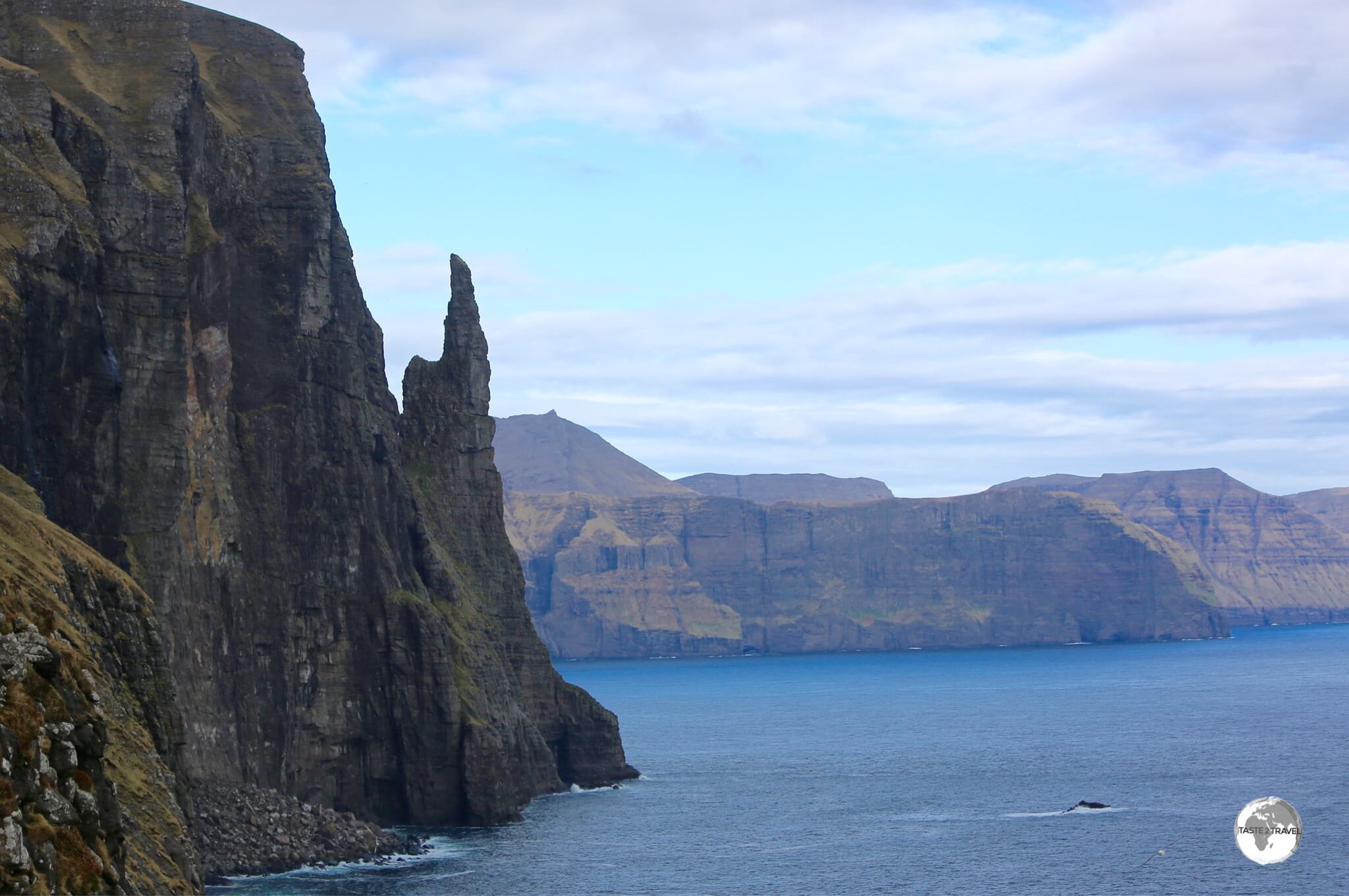
The precipitous cliffs of Ritubergsnøva soar a staggering 376 metres from the Atlantic.
Like Iceland, the Faroe Islands are treeless, being composed of hard volcanic (basalt) rock which is covered by a thin layer of moraine or peat soil. During periods of heavy rainfall, the rocky islands come alive with countless dramatic, plunging waterfalls which empty directly into the sea.

A dramatic waterfall on the road to Saksun.
Thanks to frequent flights from neighbouring countries, accessing this remote archipelago is surprisingly simple while a car/ passenger ship provides weekly connections between Denmark and Iceland (see the ‘Getting There‘ section below for more details).

Faroe Islands flags on sale in Tórshavn.
Travelling around the islands is made easy by a reliable bus network which connects the major urban centres. If you wish to maximise your time and explore the more remote corners of this incredible archipelago you will either need a rental car or a good pair of hiking boots.

The endemic Faroe Islands sheep are all free-range, able to wander wherever they please in order to consume the rich bounty the island provides.
If you wish to take to the air, the only option is the helicopter service provided by Atlantic Airways (see the ‘Getting Around‘ section below for more details).

The most spectacular drives are known as ‘Buttercup’ routes and are signposted with special signs. A rental car is the best way to explore these scenic back-roads.
How long to spend on the Faroe Islands? I would recommend one week (with a rental car) which will allow you plenty of time to explore those islands connected by road and under-sea tunnels and to make side trips to islands connected by ferry (see the ‘Getting Around‘ section below for more details).
Whatever amount of time you spend, you’ll find a visit to this magical archipelago surprising and rewarding and, maybe like me, you’ll be already planning your next visit while sipping a coffee in one of the quayside cafes in Tórshavn.
Location
Tórshavn, Faroe Islands
The Faroe Islands are located in the middle of the North Atlantic Ocean at 62º latitude North (4°33′ south of the Arctic Circle), about halfway between Iceland and Norway. The overall length of the archipelago north-south is 113 kilometres, and 75 kilometres east-west.
Although located close to the Arctic Circle, the islands generally have cool summers (average temperature: 11º C) and mild winters (3º C) due to the prevailing Gulf Stream.

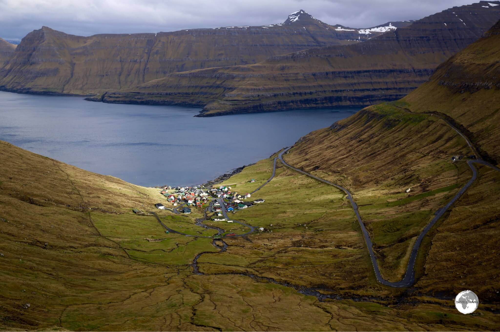
A boat (bottom left) is dwarfed by the towering peaks which surround the Funning’s Fjord on Eysturoy Island.
History
Ancient

The ancient Althing (parliament) was first convened on the rocky point which is today the Tinganes neighbourhood in Tórshavn.
Archaeological excavations on the island of Sandoy indicate that humans were present on the Faroe Islands as early as the 3rd century AD, however these excavations do not provide any clues as to who these people were.
The first known settlers were Irish monks, who in the 6th century AD told of the “Islands of the Sheep and the Paradise of Birds”.
In the 9th century, Viking settlers – who were escaping the tyranny of Norway’s first king, Harald I – arrived on the islands from Norway, naming them Føroyar which is derived from old Norse and means Sheep Islands, which is appropriate since today the sheep population is almost double the human population.
These Norse settlers brought with them their medieval culture, which included the establishment of their Althing (parliament), at Tinganes in Tórshavn. Tórshavn still is the capital city of the Faroe Islands, and it claims to hold the oldest parliament in the world.

The name ‘Faroe’ is an old Norse word for ‘Sheep’ which are plentiful on the islands.
During the Viking age, Norwegian Kings aspired to gain control over the islands, but for many centuries the Faroese managed to fight them off. However, in the 12th century the Faroe Islands eventually became a part of the Kingdom of Norway.
In the 14th century, the Faroe Islands joined Norway into a dual monarchy with Denmark. However, when this union was succeeded by a Norwegian-Swedish union in 1814 the Faroe Islands remained under the sovereignty of the Kingdom of Denmark. Due to its remoteness, distinct language and culture, the Faroe Islands always remained autonomous.
Modern
In 1940, when German forces invaded and occupied Denmark, British forces launched “Operation Valentine” to occupy the Faroe Islands in an effort to pre-empt a German invasion. The occupation lasted until the end of the Second World War, with the last British troops leaving in 1945. During this period, the Faroese flag was officially recognized for the first time by a foreign (British) government and the Faroese exercised a greater degree of autonomy over their affairs.
Following the war, a referendum regarding independence was held and while a small majority voted in favour of independence from Denmark, a subsequent parliamentary election saw the election of a majority of members who decide to remain under Danish rule.
Nevertheless, in response to growing calls for autonomy, the Home Rule Act of the Faroe Islands was passed in 1948, cementing the Faroe Islands’ status as a self-governing territory within the Danish Realm. The Act allows for the vast majority of domestic affairs to be controlled by the Faroese government.

Salmon farming is the main industry on the Faroe Islands with huge farms occupying most of the inter-island channels.
Today fisheries and aquaculture are the basis for the production and export of high quality Faroese fish products, which constitute 95 per cent of the total income of exported goods.
Most of the fjords and channels which separate the islands are home to huge Atlantic Salmon farms, with the salmon being exported around the world. Especially popular in Sushi restaurants, fresh Faroese Salmon is available for consumption in European and U.S. restaurants just 72 hours after being harvested.
People & Sheep

A view of Tórshavn, the capital and largest city in the Faroe Islands.
The islands are home to a population of 50,000 with 25% living in the capital (Tórshavn) and the remainder living in small, scattered coastal settlements. The official languages are Faroese (most closely related to Icelandic) and Danish.

My rental car surrounded by some curious Faroese Sheep.
With an estimated population of 80,000 – the endemic and ubiquitous Faroese sheep far outnumber the human population. Faroese sheep are highly adapted to their vertical environment and can be found grazing on the highest of cliffs and on the edge of impossibly steep ledges. While exploring the islands, you’ll pass sheep grazing along the sides of all roads and on the highest of mountain passes.
The Faroese pride themselves on doing things their way and, in 2016, enterprising locals – who had became impatient waiting for Google to complete ‘Street View’ mapping of the archipelago – strapped cameras to the backs of their wandering ovine population and used them to provide a unique street view experience.
Flag

The flag of the Faroe Islands.
Like the flags of neighbouring Scandinavian countries, the flag of the Faroe islands incorporates a red Nordic cross, which is offset to the left. The red cross is fimbriated azure and is set on a white field.

The Faroe Islands flag flying in downtown Tórshavn.
The flag design closely resembles that of the Norwegian flag, with white symbolising the foam of the sea and the pure, radiant sky of the Faroe Islands. The Faroese blue and red colours are reminiscent of other Scandinavian and Nordic flags; representing the Faroe Islands’ bonds with other Nordic countries.
Currency

Faroe Islands Krona bank notes are works of art.
There are two currencies of equal value in circulation on the islands: the Faroese Króna and the Danish Krone, both of which are printed in Copenhagen by the Danmarks Nationalbank. While two types of banknotes are in circulation, only Danish coins are used.
The Faroese Króna notes are beautiful works of art, featuring a fragment of a Faroese animal on the face side and watercolour Faroese landscapes by local artist Zacharias Heinesen on the reverse side. An interesting feature is the inclusion of a mother-of-pearl security strip on the reverse side of each note.
Faroese banknotes are regarded as a foreign currency in Denmark thus they are not legal tender in there, so it’s best to spend or convert your Faroese notes prior to departing the islands.
Tunnels

A map indicating road tunnels on the Faroe Islands.
Source: Wikipedia
While travelling around the Faroe Islands you will pass through many different road tunnels, some cut through mountains, while others pass under the sea. All tunnels are operated by a dedicated company – Tunnil. If you wish to download the above map, you can do so from Wikipedia.
Currently the longest tunnel on the Faroe Islands is the 6.3 km Norðoyatunnilin under-sea tunnel which connects Esturoy Island to Bordoy Island. This 2-lane, engineering marvel, reaches a depth of 150 metres below sea level and includes a sub-sea roundabout (the only roundabout beneath the Atlantic Ocean), which is very useful in the event you realise, mid-tunnel, that you forgot to buy the milk or bread and need to go back.
To keep motorists amused during the lengthy crossing, colourful light art by Faroese artist Tróndur Patursson has been installed.

Me yielding (who wouldn’t?) to an approaching truck, at the entrance of the 2-km long Hvannasundstunnilin (Hvannasund Tunnel) close to Norðdepil on the island of Borðoy.
In 2022, construction is scheduled to be completed on the biggest project of all time – the 11 km long Eysturoyartunnilin (Eysturoy Tunnel), which will also include a roundabout with two spur roads and will connect the island of Streymoy to Eysturoy, passing under the Tangafjørður (fjord).
Highlighted in red on the map above, the tunnel will not only be the longest in the Faroe Islands but the longest sub-sea road tunnel in the world.
The tunnel will shorten the travel distance from Tórshavn to Runavík from 55 kilometres (34 miles) to 17 kilometres (11 miles). The 64 minute drive will be shortened to 16 minutes. The drive from Tórshavn to Klaksvík will be shortened from 68 minutes to 36 minutes.
In terms of length, the 11 km long Eysturoy Tunnel is a minnow compared to the proposed 24 km long under-sea tunnel which will eventually join Streymoy Island with the southernmost island of Suðuroy.
While the newer tunnels offer pleasant driving experiences complete with wide lanes and artistic light installations, many older tunnels offer a more harrowing experience.
These tunnels are normally unlit, roughly cut, one-lane, narrow passageways, on a two-way road (with one direction having priority over the other) and range in length with the longest being the tunnel on Kunoy Island which is 3 km long.

Driving through the one-lane, unlit, 3-km long Kunoy tunnel. Passing bays allow for oncoming traffic to pass.
While driving through these dark, narrow caverns you need to watch for the headlights of oncoming vehicles and, if you are required to yield, pull into one of the regular passing bays.
You need to constantly stay alert and hope that anyone coming in the other direction got the message to yield, or maybe you are required to yield, or sometimes everyone is confused so everyone yields!
It’s all like a game of ‘chicken’ seeing how far you can drive towards the lights of an oncoming car, before yielding (it’s hard to gauge distances in these tunnels and sometimes what you think are the lights of an oncoming car is the daylight at the end of the tunnel).
It all makes for a ‘Mister Magoo’ type of adventure.

Driving through the 2.2 km long Hvannasundstunnilin (Hvannasund Tunnel) on Bordoy Island.
Sightseeing
The islands in the sightseeing section are ordered from west to east starting with Vágar Island (home to the airport and point of arrival for most visitors) and ending with Vidoy Island.
Vágar Island

The village of Gásadalur remained isolated from the world until the Gásadalur tunnel was completed in 2006.
Located at the end of the road on the northwest coast of Vágar Island, the tiny village of Gásadalur (population: 18) is nestled in a gentle, green valley, overlooking the Mykines Fjord and surrounded by the highest peaks on Vágar Island.

Completed in 2006, the 1.4 km single-lane Gásadalur tunnel was blasted through the mountain to provide access to the tiny village of Gásadalur.
Despite being located on the coast the village was isolated from the rest of the world for most of its existence due to the poor mooring sight which lies at the base of a cliff.
Previously, the only way of accessing the village was either by trekking over a 700-metre high mountain, taking a boat or flying via helicopter.
Not surprisingly, the population of the village dwindled over the years with just 16 residents remaining in 2002.
In 2004 construction started on a 1.4 km single-lane tunnel – the Gásadalstunnilin – which was blasted through the Knúkarnir mountain, finally opening the village to the outside world in 2006.
Since becoming more accessible, the population has increased by 2!

The breathtakingly beautiful Mulafossur Waterfall plunges 60 metres into the Atlantic Ocean near the village of Gásadalur.
There are several hiking trails in the area and the village offers panoramic views of neighbouring Mykines Island. The standout attraction is the magnificent Mulafossur Waterfall, which starts life as a trickle on the towering peaks above the village, eventually plunging 60 metres in a single drop into the Atlantic Ocean. A magnificent sight!

The picturesque village of Bøur.
South of Gásadalur (heading back towards the airport), is the quaint seaside village of Bøur (population: 75). This compact village has a long history, dating back to at least 1350 AD. The historic houses (and one very cute church) are bunched tightly together along the (black sand) bay.
While driving between Bøur and Gásadalur you should look for an unmarked left-turn (just before the Gásadalur tunnel) onto a gravel road which will dead-end at a parking lot close to the coast. From here, you can walk through the fields (full of friendly sheep) towards the sea where a stunning beach and waterfall can be seen (no idea what the name of this beach is).

I came across this incredible sight after walking through some fields north of the village of Bøur.
South of Bøur, the town of Sørvágur offers dining and accommodation options (5 minutes from the airport) and is the departure point for boats to Mykines Island. If you’re using public transport, bus #300 connects Sørvágur to the airport and Tórshavn.
While in Sørvágur, I stayed at (and dined at) Guest House Hugo which makes an ideal base for exploring the region and is a perfect option if you have an early morning departure from the airport. The guesthouse can also organise rental cars (see the ‘Accommodation‘ section below for more details).

An incredible sight – Sørvágsvatn is the largest lake in the Faroes and occupies the most dramatic setting high above the Atlantic.
Wow! Wow! Wow! What an amazing sight… located immediately south of the airport, Sørvágsvatn or Leitisvatn is the largest lake in the Faroe Islands and occupies what must be the most dramatic setting for any lake on this planet. If you see just one thing on the islands – this must be it.

A lone hiker lends a sense of scale to the magnificent scenery on the coast of Vágar island.
The lake lies in a depression 40 metres above the sea and empties into the Atlantic via a waterfall at it’s western end. However the perspective from the nearby 100 metre high sea cliffs makes for the most incredible (and vertigo inducing) photography.
How close do you dare get to the edge in order to get the perfect shot? Once you reach the coast, the views in either direction are stupendous.

Two hikers are dwarfed by the towering cliffs of the Vágar coast.
Access to the unmarked hiking trail is from a car park on the main airport road. If you’re using public transport, bus #300 will drop you at the trail head. The hike is along a muddy 4 km long track so bring some water and allow at least half a day here.
Located on the south coast of Vágar Island, Sandavágur has been voted the most well-kept village in the Faroes – twice.

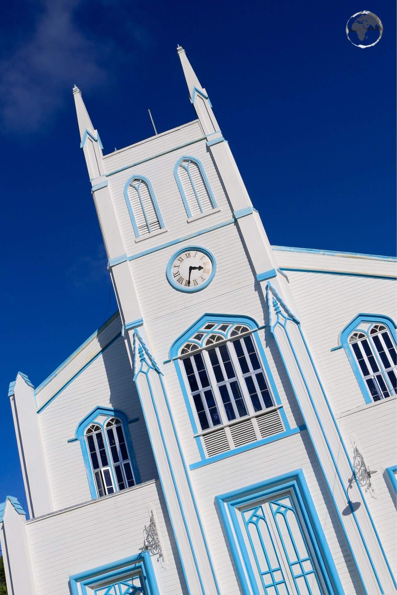
The striking church of Sandavá dominates the village of Sandavágur, which has twice been voted the best-kept village in the Faroe Islands.
While this quiet, sleepy village offers little in the way of distractions, it is the access point for visits to the nearby Trøllkonufingur (The Troll Finger) – an iconic 313 m high shard of volcanic rock which pierces the sky from the Atlantic.

A view of yet another Salmon farm, near to the town of Sandavágur.
While this dramatic monolith is the subject of many local legends (it’s also known as the Witches Finger), the only people known to have climbed it were a bunch of Kiwi climbers in 2016 – they recorded their experience on Instagram.
The dramatic Troll Finger soars skyward from the Atlantic.
The only road connection between Vágar Island and neighbouring Streymoy Island is via the 5 km long (16,210 ft) under-sea Vágatunnilin.
This two-lane tunnel reaches a depth of 105 metres (344 ft) below sea level and requires the payment of a toll, which can be made at the “Effo” service station which is on the main road on the Streymoy Island side of the tunnel.
Streymoy Island

Houses in the Tinganes district of Tórshavn.
As much as anywhere on an archipelago could be referred to as the ‘mainland’, the Faroese do indeed call Streymoy Island just that. Streymoy is the largest and most populated of all the islands and is home to the capital and largest city – Tórshavn (population: 13,089 with 21,000 living in the greater urban area).

Boats in Tórshavn harbour.
While hardly a big, bustling city (there are just three traffic lights on the Faroe Islands, all of which are in downtown Tórshavn), the capital is a charming place to spend some time and with most of the accommodation and dining options on the Faroe Islands (see those sections below) it makes for a logical base.

Despite being a treeless archipelago, many houses on the Faroe Islands are constructed from timber and painted glossy colours – including black. This makes for a nice contrasting background onto which colourful ornaments are added. Can you see the camouflaged mailbox?
The sights of Tórshavn can be enjoyed on a short, pleasant stroll around the compact downtown area. Here you’ll find the picturesque port area and the historic Tinganes neighbourhood (home to the oldest parliament in the world). There is one art gallery – Listasavn Føroya (National Gallery of the Faroe Islands) – which is located on a hill north of the city centre.
Travel Tip: One travel tip worth mentioning is that buses in Tórshavn are free of charge.

A view at the top of the steep road which descends into the tiny settlement of Norðradalur.
Elsewhere on Streymoy Island there are three outstanding Buttercup routes, one of which is the high road (route 10) which runs along the barren, central plateau of the island, connecting Tórshavn with the airport road (route 11) near the Vágar tunnel.
I often travelled on this road as there is very little traffic (most people use the busier coastal road) and the panoramic views are incredible.
While on this route, it’s worth making the short detour and taking the steep, hair-pinned, narrow road down to the coastal village of Norðradalur. Really beautiful!

A wind farm located alongside route 10 on the central plateau of Streymoy Island.
At the northern end of Streymoy Island, another Buttercup route (route 53) connects the main-road village of Hvalvik (reachable from Tórshavn on bus #400) with the stunningly beautiful village of Saksun.
The drive along this road is challenging – a one-lane (but two way) elevated road with no shoulders, no rail guards and a river flowing alongside. Thankfully it’s never too busy and there are passing bays along the way should you encounter an oncoming car.

On the road to the remote village of Saksun.
Saksun lies in the bottom of what used to be an inlet of the sea, surrounded by high mountains. On the day I visited, the weather was typically Faroese – howling winds and horizontal, pelting rain which created impossible conditions in which to photograph. The village was surrounded by gushing waterfalls which was exciting but made hiking impossible.

Old turf-roofed farmhouses in the village of Saksun.
From Saksun, there is a popular hiking trail which takes you over the mountain and down to the coastal village of Tjørnuvík, although walking anywhere was not possible on the day I visited.

A very wet day in the village of Saksun, with a view of Lake Saksun.
Video:
How is it to drive along Route 53 to Saksun?
I recorded this video (while of course focusing carefully on my driving).
The third Buttercup route (route 594) connects the main-road village of Oyrarbakki (reachable from Tórshavn on bus #400) to the stunningly situated village of Tjørnuvík (population: 64).
I visited on a stormy day, but even with washed out views, the scenery was magnificent with Tjørnuvík surrounded on all sides by gushing waterfalls.

A view of the very narrow route 594 as it makes its final descent into the coastal village of Tjørnuvík.
Route 594 follows the coast of Streymoy Island with spectacular views across the Sundini fjord to neighbouring Eysturoy Island, including the 343-metre-high promontory – Eiðiskollur – which seems to be guarded by two rocky sentinels – Risin og Kellingin (means: The Giant and the Witch) – two sea stacks which rise up 75 metres from the sea.

A hazy view of the soaring 343-metre-high Eiðiskollur promontory with the two 75-m high sea stacks – Risin og Kellingin.
Eysturoy Island
The village of Funningur (which lies on a Fjord of the same name) is illuminated by a late burst of sunlight.
Eysturoy Island (meaning ‘East Island’) is the 2nd largest of the Faroe Islands. The island is connected to the main island of Streymoy by the Streymin Bridge, which locals jokingly refer to as the only bridge over the Atlantic.

On the Buttercup route between Eiði and Funningur on Eysturoy Island.
The island is home to three Buttercup Routes with the most spectacular being the drive between the northern villages of Eiði and Funningur.
Before leaving the village of Eiði, it’s worth checking out the dramatic waterfall which crashes off the side of a high cliff into the sea. Depending on the time of the year, it will be either a trickle or a raging cascade.

Plunging hundreds of metres before becoming mist, yet another dramatic waterfall on the remote north coast of Eysturoy, near the village of Eiði.
The 12 km long road crosses a spectacular mountain pass (which is not maintained in winter) and passes directly under the summit of Slættaratindur, which – at an elevation of 880 m (2,887 ft) above the sea level – is the highest mountain in the Faroe Islands.

The highest mountain in the Faroe Islands, Slættaratindur (880 m), towers over the village of Funningur.
A turn (high above Funningur) allows you to make a detour into the popular tourist village of Gjógv, which comes into view after crossing yet another lofty mountain pass. This tiny village (population: 49) is incredibly scenic and makes a good base for hikes in the area.
The village is also popular as it features the only accommodation and restaurant option in this part of the world – the Hotel Gjáargarður (Guesthouse of Gjógv).

The view of the village of Gjógv from the restaurant at the Hotel Gjáargarður.
Nearby, a second buttercup route connects the villages of Funningsfjørður with charming Elduvik (population: 23). The drive along this road offers panoramic views of the dramatic coastline and the cobalt blue Funnings Fjord. When I arrived in Elduvik, the afternoon sun made an appearance (the first all day) which provided fantastic lighting.

A view of the picturesque village of Elduvik, which lies on the Funnings Fjord inlet.
The third Buttercup route is located at the southern end of Eysturoy Island, south of the main urban centre of Runavik. The route provides panoramic views of Toftavatn (Lake Toftir), the fourth-largest natural lake in the Faroe Islands.

A view of Toftavatn (Lake Toftir), with the town of Runavik in the background.
Borðoy Island
Borðoy Island (meaning ‘Headland Island’) is known for its nature, mountains, valleys and beautiful fjords.
While travelling around Borðoy, you’ll pass through two older tunnels; the 1,680-metre Árnafjarðartunnilin and the 2-km long Hvannasundstunnilin, which provide an east-west connection across the island. Both tunnels are unlit and feature a single lane (there’s one priority direction), with a series of passing bays.
The main town on Borðoy is Klaksvik which is the 2nd largest town on the Faroes (population: 4740) and is home to the vitally important Föroya Bjór brewery. The brewery produces a good range of craft beers and has a factory shop where you can stock up.

The craft beers produced by Föroya Bjór are very quaffable.
Apart from beer, the brewery produces a line of local soda drinks, including the popular Jolly Cola which is often the only cola available on the islands.

Feel like a Coca-Cola? The Faroese are keen supporters of their local Cola with many businesses only offering Jolly Cola rather than the more famous international cola.
Klaksvik offers a couple of accommodation options (see the ‘Accommodation‘ section below) and is the main access point for Kalsoy Island, with regular car ferries departing for the island from a dedicated dock – click here to view the current timetable.

The view across to Vidoy Island from the village of Múli.
The island is home to one Buttercup route which runs along its western shore from the village of Norðdepil (reachable by #500 bus from Klaksvik) to the abandoned village of Múli.
If you’re driving, the narrow road is paved most of the way with the last 20% being rough gravel as you descend into the village. The route provides panoramic views of neighbouring Viðoy Island and lots of opportunities to interact with friendly Faroese sheep.

The Faroe Islands are full of super-cute rural scenes such as this one at Múli village.
Kunoy Island

The remote village of Kunoy on Kunoy Island.
Kunoy Island (meaning ‘Woman Island’) is the highest island in the Faroes with six summits above 800 metres. This long, narrow, exposed, volcanic mountain range is home to just two small villages which cling to the narrow coastline; Kunoy (population: 64) on the west coast and Haraldsund on the east coast.

Hiking trail near Kunoy Village.
Hiking trails from Kunoy Village provide access to the loftier parts of the island and if you’re planning on hiking you should bring all supplies with you from Klaksvik as there are no shops anywhere on the island.

Entrance to the 3-km long Kunoyartunnilin which was completed in 1988, providing access to the previously isolated Kunoy village.
A causeway near to Haraldsund connects Kunoy Island to Bordoy Island and, immediately after crossing the causeway, you enter the 3-km long, one-lane, unlit Kunoyartunnilin (road tunnel) which was completed in 1988 and, for the first time, provided access to the previously isolated village of Kunoy.
How many governments around the world would build a 3-km long tunnel though hard volcanic rock to connect a village of 64 souls to the outside world? Not too many!
Viðoy Island

The circuitous, but narrow, road around Vidoy Island offers spectacular views.
Viðoy is the northernmost island of the Faroes and features two small villages – Viðareiði (population: 346) to the north and Hvannasund to the south.
Vidoy translates as ‘Wood‘ and despite the fact that no trees grow on the island; the name relates to the driftwood that floats in from Siberia and North America. A newly completed tunnel which cuts through the central spine of the island allows you to tour Viðoy following a circuitous route.

The 2-km long Viðareiðistunnilin was opened in 2016, cutting a path across the centre of Vidoy Island, connecting the east and west coasts.
Viðareiði has the distinction of being the northernmost village in the Faroe Islands. Located on an isthmus and surrounded by high mountains and spectacular views, the village makes an ideal base for hikes into the nearby countryside.

A view of the village of Viðareiði from neighbouring Bordoy Island.
Heading east out of Viðareiði, the nearby island of Fugloy (the eastern-most of the Faroe Islands) comes into view. Ferries to Fugloy depart from the dock in Hvannasund, click here to view the current timetable.

The view across to Fugloy Island from Vidoy Island.
Accommodation

While there are no 5-star hotels, the Faroe Islands offer all other accommodation options, including cute private houses.
While there are no 5-star hotels on the Faroe Islands, there’s a small selection of everything else, from camping grounds to guest houses to 4-star hotels, with the majority of options located in Tórshavn.
If you plan to stay outside of the capital you should book in advance as the limited number of options are often fully booked.
Vágar & Mykines Island

My room at guest house Hugo offered sweeping views of Sørvágur harbour.
The Visit Vágar website features an accommodation directory, which lists options on Vágar and Mykines Islands. While on Vágar I stayed at Guest House Hugo in Sørvágur, which offers 4 rooms (2 doubles and 2 singles) with one shared bath/toilet at the end of the hallway.
Streymoy Island

The spacious living room at Tora guest house offers panoramic views of the harbour and nearby Nolsoy Island.
A complete listing of accommodation options on Streymoy Island can be found in the accommodation directory of the Visit Tórshavn website. The capital features five hotels and numerous guesthouses, while elsewhere on the island, small apartments and guesthouses are available.

My cosy room at the very welcoming Tora Guest House in Tórshavn.
While in Tórshavn, I stayed at the wonderful Tora Guesthouse, which offers four rooms (with one shared bathroom), a small kitchen area and a spacious living room with panoramic views of the harbour and neighbouring Nolsoy Island.
The owners (Tora and her husband Samal) are incredibly friendly, helpful and kind and made me feel like a part of their family making this feel like a home away from home.
The couple have worked in the local tourism industry for decades and, upon my arrival, Samal (who is normally busy leading tour groups around the island and is a font of information) took me for an impromptu drive around town to point out the highlights.
Eysturoy Island

My comfortable room at the remote Hotel Gjáargarður in Gjógv.
There are two hotels on Eysturoy island; the Hotel Gjáargarður (Guesthouse of Gjógv). which overlooks the tiny, picturesque northern village of Gjógv (population: 49) and the Hotel Runavik. There are many other smaller options, all of which are listed in the accommodation directory on the Visit Eysturoy website.
While on Eysturoy, I stayed at the busy and efficient Guesthouse of Gjógv. The vertical countryside surrounding tiny Gjógv is ideal for hiking and the approach (over a steep mountain pass) is spectacular. The guesthouse is popular and often fully booked so best to book in advance. Meals are served in the restaurant – the only one in town.
Northern Isles
The Northern Isles consist of Borðoy, Kunoy, Kalsoy, Viðoy and Svinoy. Within the isles there is one hotel – Hotel Klaksvik – and numerous small guesthouses which are featured in the accommodation directory on the Visit Nordoy website.
Eating Out

While they are so cute, they are also so tasty and many restaurant menus feature delicious Faroese ‘free-range’ sheep.
Streymoy Island
As with accommodation, the majority of restaurants, cafés and bars are to be found in Tórshavn, which offers a surprisingly rich culinary experience. Most dining options are locally run and serve only fresh, local produce and, while international junk food outlets are refreshingly absent (the Faroe Islands are one of very few countries in Europe to have no McDonalds), there is now a Burger King in Tórshavn.
Throughout town there are a number of excellent cafés, with my personal favourite being the quayside Kaffihúsið (Coffee House), which offers great tasting coffee and a good breakfast selection. Open from 9 AM until 6 PM, 7 days a week, Kaffihúsið is especially popular during lunchtime. A small Faroese craft shop adjoins the cafe and is a great place to pick up a souvenir.
Another worthwhile haunt is the beautifully appointed Paname Café, which is a short walk uphill from the harbour and offers arguably the best coffee in town along with freshly baked cakes, sandwiches and local craft beers.

Potato farming on the Faroe Islands involves covering a potato (and some fertiliser) with a cut section of peat under which the potato incubates.
There is no shortage of standout restaurants in Tórshavn, with many offering only locally sourced, high quality produce. This is the land of sheep and salmon so it’s not surprising that they feature on many menus.
One of my favourite restaurants is Katrina Christiansen which is housed in a charming, timber building in the historic Tinganes neighbourhood of Tórshavn. The restaurant features a Spanish-style tapas menu using only Faroese products – the lamb is especially recommended.
Vágar Island

The cosy and charming Café Fjørðoy at guest house Hugo features a treasure trove of historical objects which have remained in the house over the decades.
Located on the waterfront in Sørvágur, Café Fjørðoy at Guest House Hugo is under the competent command of the owners (Kent and his wife) who serve up delicious meals using fresh local produce, including Salmon from a nearby farm. The coffee is the best in town and compliments their tasty desert selection.

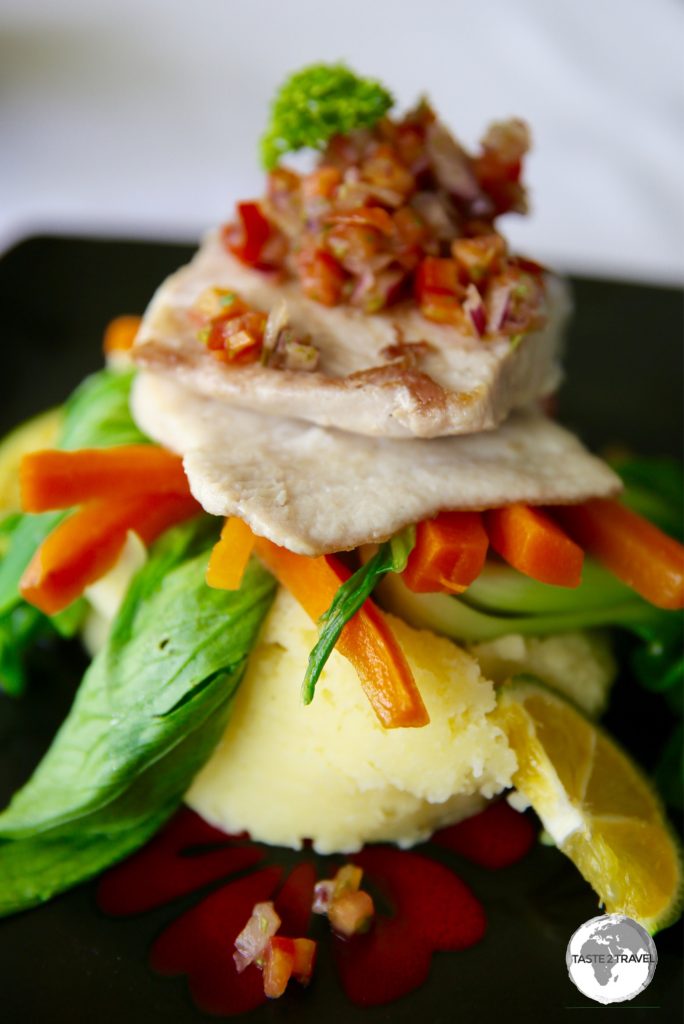
My delicious dinner at Guest House Hugo which featured a grilled fillet of local Salmon.
Eysturoy Island
If, like many tourists, you find yourself in the remote, tiny village of Gjógv, the only dining option for miles around is at the Hotel Gjáargarður (Guesthouse of Gjógv). Serving meals to visitors and guests, this cosy restaurant provides panoramic views of the village, sea and the surrounding (vertical) countryside.

No shortage of fresh Atlantic Salmon in the Faroe Islands.
Northern Isles
Within the Northern Isles, dining options are slim with the regional hub of Klaksvik providing the only real options. The most popular place (there are only two!) is the charming and friendly Café Frida whose slogan is “the best ingredients are local ingredients”. This excellent, cosy café, which overlooks Klaksvik port, is operated by an efficient and friendly team of staff who prepare the tastiest of meals (Faroese tapas lunch) using local products. The coffee is the best you’ll find this side of Tórshavn and the fresh cakes (Rhubarb cheesecake) are divine.
Visa Requirements

A Faroese passport stamp can be obtained from the police station at the airport.
Being a territory of Denmark, the visa policy of the Schengen area applies to the Faroe Islands.
Immigration Formalities
With the exception of the twice-weekly Atlantic Airways flight from Edinburgh, all other flights to the Faroe Islands originate from within the Schengen area, hence there are no immigration formalities upon arrival. If you’re not arriving from Edinburgh and wish to obtain a passport stamp, you can do so at the airport police station (turn right after exiting the terminal).
Getting There
Air

A view of the magnificent Sørvágsvatn from my SAS Airlines flight as we approach the Faroe Islands.
Flights to the Faroe Islands arrive at the brand new, modern terminal at Vágar Airport, which is located on the island of the same name. The airport is the only one on the Faroe Islands and serves as the main base for the Faroese national carrier – Atlantic Airways.
The following services are offered:
- Atlantic Airways – flies to Aalborg (Denmark), Bergen (Norway), Billund (Denmark), Copenhagen (Denmark), Edinburgh (Scotland) & Reykjavík (Iceland)
- Scandinavian Airlines – flies to Copenhagen
Airport Transport
Vágar island is connected to the other islands via the under-sea Vágatunnilin which is 4.9 km (3.0 mi) in length and reaches a depth of 105 metres (344 ft) below sea level. Tórshavn is 47 km (29 mi) east of the airport and can be reached in one hour on bus #300, which runs eleven times per day. Shared taxis to Tórshavn (45 mins) cost 200 DKK.
Sea

Smyril Line Route Map.
Source – smyrilline.com
The Tórshavn headquartered Smyril Line operates a weekly car/ passenger ferry service between Denmark, the Faroe Islands and Iceland. Current prices and the sailing schedule are available from their website.
The M/S Norröna sails from Hirtshals (Denmark), docking 36 hours later in Tórshavn before continuing onto Iceland, docking 19 hours later at the eastern port town of Seyðisfjørður. Lonely Planet wrote an article on a journey aboard the boat, which you can read here.
Getting Around
Bus

The SSL bus and ferry route map.
Source: http://www.ssl.fo/en/customer-service/travel-map/
Bus services are operated by Strandfaraskip Landsins (SSL), which is a nationally owned transportation company, providing bus and ferries services to all corners of the Faroe Islands. Their website provides the current bus timetable and details on Travel Cards, which are available for 4 or 7 days and provide unlimited travel on buses.
Despite providing a comprehensive service between the main urban centres, SSL buses do not reach the more remote areas of the Faroe Islands. If you wish to fully explore, your best bet is a rental car.
Ferry
Inter-island ferry services are provided by Strandfaraskip Landsins (SSL), who operate eight inter-island ferries (refer to the map above). Their website provides the current timetable and details on Travel Cards, which are available for 4 or 7 days and provide unlimited travel on ferries.
Air
Atlantic Airways – the national airline of the Faroe Islands.
If you wish to travel by air within the islands your only option is to use the helicopter service provided by Atlantic Airways. For current fares, timetables and bookings, please refer to their website.
Rental Car

My rental car, which allowed me to maximise my time on the Faroe Islands.
The best way to maximise your time on the islands is to rent a car. Roads are generally excellent, traffic is light and many of the more picturesque locations are remote and not served by public transport.
Despite their remote location, the Faroe Islands are popular with tourists and demand for cars can sometimes outstrip supply so its best to book in advance.
The following operators can be found at the airport:
The following operators can be found in other locations:
- Waag Rental – One of the larger car dealers on the Faroe Islands, Waag operates a side-line car rental business with an office in Miðvágur (a short drive from the airport) and from their main downtown office in Tórshavn.
- Guest House Hugo – Also a short drive from the airport in the town of Sørvágur, this cosy guest house can arrange car rental and will collect you from the airport upon arrival.
That’s the end of my Faroe Islands Travel Guide.
Safe Travels!
Darren
Follow me on Instagram:
[instagram-feed feed=1]
Further Reading
Other travel reports from the Nordic region:
Faroe Islands Travel Guide Faroe Islands Travel Guide Faroe Islands Travel Guide Faroe Islands Travel Guide Faroe Islands Travel Guide Faroe Islands Travel Guide Faroe Islands Travel Guide Faroe Islands Travel Guide Faroe Islands Travel Guide Faroe Islands Travel Guide Faroe Islands Travel Guide Faroe Islands Travel Guide Faroe Islands Travel Guide Faroe Islands Travel Guide Faroe Islands Travel Guide Faroe Islands Travel Guide Faroe Islands Travel Guide