There I was – on a dive, 20 metres below the surface of the Pacific Ocean, clinging to a large boulder that was firmly embedded in the seabed of the German channel. The current washing through the channel from the outgoing tide was strong but I was determined to keep my grip and await the arrival of a creature I had always dreamed of seeing up close. I would not be disappointed!
After some time a large shadow slowly loomed over me, blocking out the rays of the sun above, it was a large adult Manta Ray, a species which can grow to seven metres in width. It was soon joined by another – equally large – Manta Ray.
I was positioned at a cleaning station in the channel – the two giants floated two metres above me, being cleaned by an army of cleaner fish. To be so close to such magnificent creatures is an unforgettable experience – a highlight for any diver.
The Palau Ground Frog is endemic to Palau.
Diving is Palau’s main draw-card. The island nation is well known for its abundant marine life, anti-shark fishing policy and strict environmental regulations which apply inside the Palau National Marine Sanctuary – the world’s sixth largest sanctuary, covering an area twice the size of Mexico. At the centre of the sanctuary are the Rock Islands – 300 uninhabited limestone bumps surrounded by the most amazing turquoise water teeming with marine life.
The spectacular Rock Islands. Source: http://www.allamazingplaces.com/rock-islands-palau/rock-islands-southern-lagoon-chelbacheb-palau-pacific/
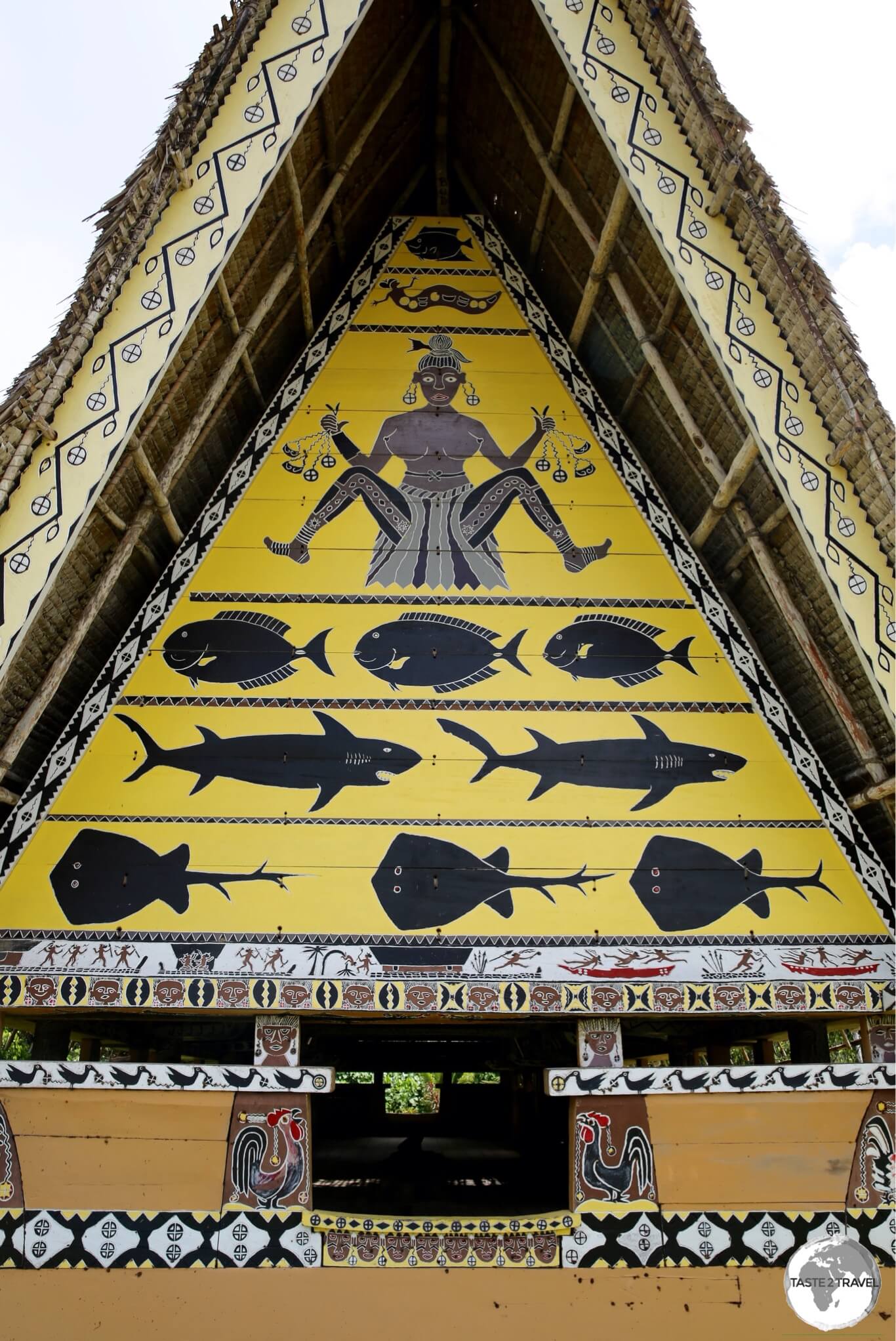
Palau also has a fabulously rich, complex and unique culture – one which is still actively practiced. Colourful, traditional meeting houses, known as Bai’s, dot the landscape. Wooden carvings, known as ‘storyboards’, tell traditional folk stories.
All of this makes Palau an interesting and engaging destination for those willing to get off the beaten track. This remote, pristine Pacific island nation is not easy to reach – and – once there, is very expensive – but – it’s definitely worth the effort and cost.
Detail of a traditional Bai at the Belau National museum.
Location
Palau is located in the middle of the Western Pacific, about 1,600 km (1,000 miles) southwest of Guam and 1,000 km (600 miles) east of the Philippines.
History
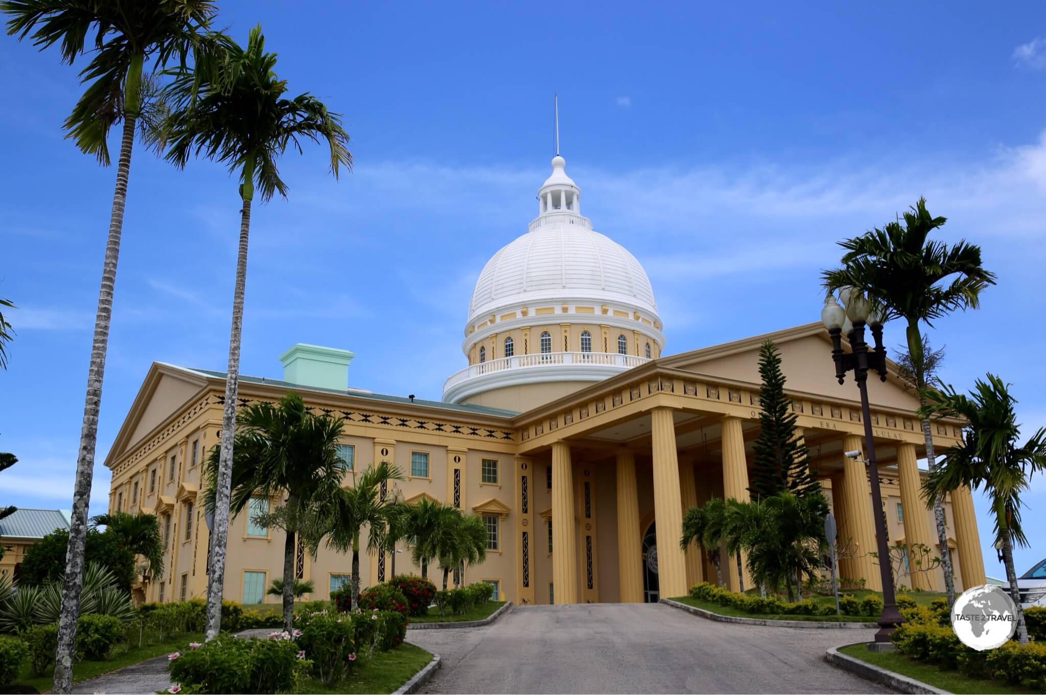
Palau’s Capitol Building.
The first inhabitants of Palau arrived 3,000 years ago from the Philippines. The first Europeans to make contact with the islands were the Spanish in the 16th century – they made Palau a part of the Spanish East Indies in 1574. Following Spain’s defeat in the Spanish-American war in 1898, the islands were sold to German who administered them as part of German New Guinea. The Japanese captured Palau during WWI and occupied them until their defeat in WWII by the United States.
Traditional Palau ‘storyboard’ wood carving.
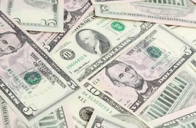
In 1947, Palau (along with the Northern Mariana Islands, Federated States of Micronesia and the Marshall Islands) was made part of the Trust Territory of the Pacific Islands, which was administered by the United States. In 1979 Palau voted against joining the newly independent Federated States of Micronesia, gaining full sovereignty in 1994 under a Compact of Free Association with the United States. The official currency of Palau is the US dollar.
Flag
The flag of Palau.
Introduced in 1981, the flag of Palau is wonderfully minimal but also strikingly beautiful. As with other Pacific island nations, the blue field represents the blue of the Pacific ocean while the yellow disk, which is slightly off-centre, represents the moon.
The Palauan’s consider the full moon to be the optimum time for human activity. At this time of the month, celebrations, fishing, sowing, harvesting, tree-felling, and the carving of traditional canoes are carried out. The moon is a symbol of peace, love, and tranquility.
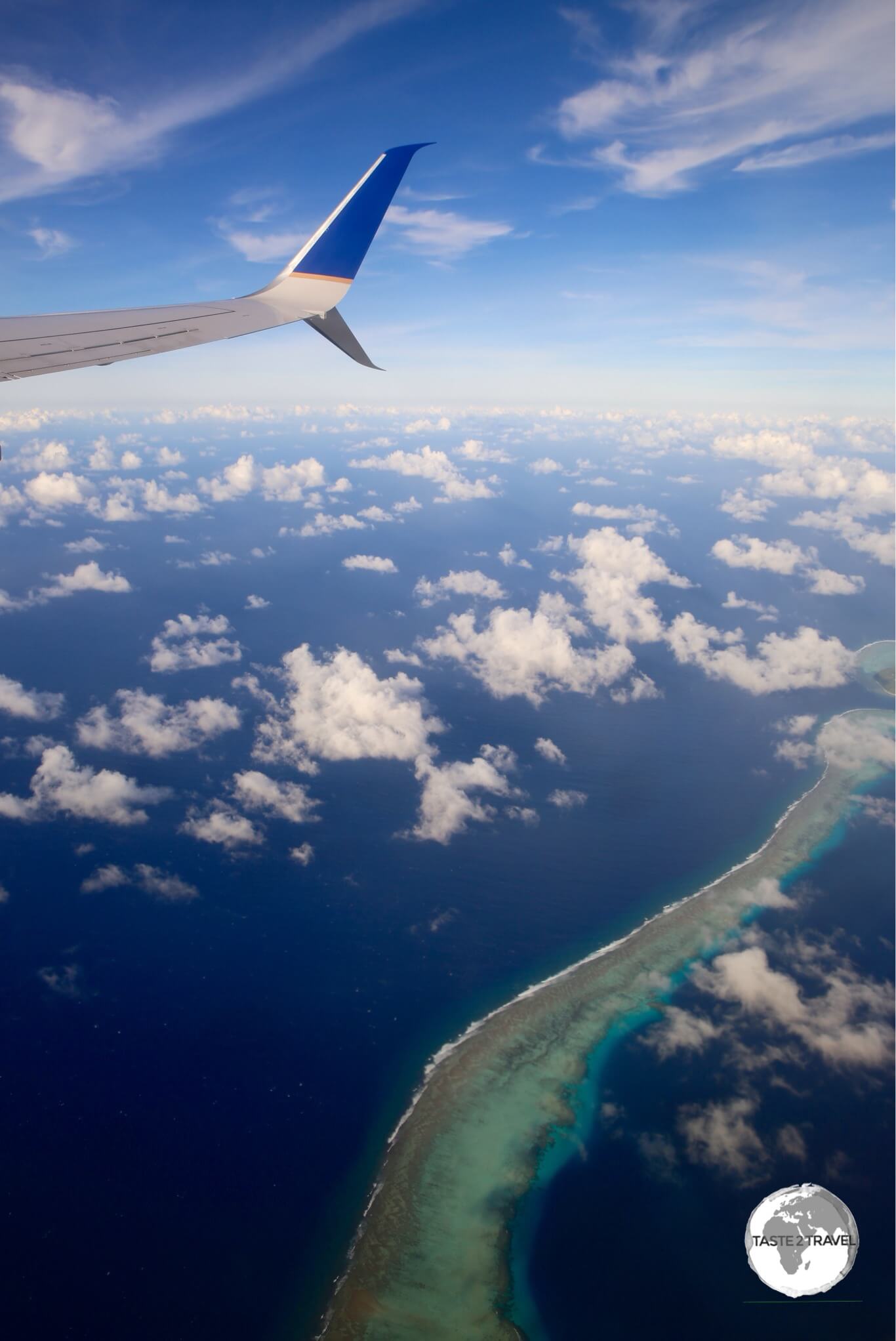
The star attraction of Palau are the incredibly beautiful (World Heritage listed) Rock Islands – 300 (uninhabited) emerald-coloured, limestone/ coral mounds sprinkled throughout the stunningly picturesque turquoise-coloured southern lagoon between the islands of Koror and Peleliu.
As part of the Palau National Marine Sanctuary, this pristine, virgin environment is protected by a host of regulations. It’s here that you’ll find Palau’s most popular dive sites such as Blue Corner, Blue hole, German Channel and the famous Jellyfish lake – a lake that was home to thousands of sting-less jellyfish. At the time of my visit (March 2017), there were no jellyfish present in the lake so snorkeling trips were not being offered. Scientists believe droughts caused by El Niño may be to blame – you can read more about this in this National Geographic article.
I did two dives – one at German Channel and one at Blue Corner – with local dive operator Fish ‘n Fins. Like everything else on Palau, diving does not come cheap, with a two tank dive (including full equipment rental and a permit to the Marine Sanctuary) costing me almost $300. Prices do become more reasonable if you book multiple days of diving.
German Channel – named after the Germans who blasted a channel through the reef to facilitate transportation of phosphate into Koror – is famous for it’s Manta Ray cleaning stations. The stations are located at a depth of 20 m and on my dive we saw several of these huge, majestic creatures receiving a clean. The current can be quite strong during tidal movements but there are plenty of rocky outcrops to hold onto. The rock I used as my anchor was home to a beautiful octopus who kept sticking his head out of his hiding hole to see if I was still there. Between him and the Manta Rays it was a wonderful hour-long interaction.
Blue Corner – one of my dive sights on Palau. Source: Kristine Barsky
Blue Corner is an underwater promontory sticking out of the reef like a triangular terrace twenty meters deep. Precipitous walls surround the terrace and are the favoured congregating ground for large schools of fish, including barracuda, jacks and lots of reef sharks. All of these schools attract plenty of predators and during our one hour dive I lost count of the number of sharks we saw. The abundance of marine life in this little corner of the Pacific is truly amazing.
Babeldaob
The Capitol Building at Ngerulmud, the tiny capital of Palau.
Back on land, I spent one day exploring the main (largest) island of Babeldaob in my rental car. Driving around the island is very pleasant thanks to the well-maintained, American-built Palau Compact road. The road circuits the island and can be easily driven in a few hours. Making stops at the various attractions along the way, you should allow half a day.
Babeldaob is home to Palau’s airport, it’s capital, Ngerulmud, and ten of the sixteen states. Each state on the island charges visitors an ‘entrance fee‘ to visit any sites within it’s boundaries. The fees can be up to $20 per person per state so it’s best to decide in advance which sites (and hence which states) you wish to visit. There are almost no restaurants on Babeldaob – the one place I was directed to was the wonderful seaside Okemii Deli & Internet Café in Melekeok. The café offers grilled local seafood along with other café staples.
Emerald tree skink at Papago International resort in Airai state.
The first state you enter after crossing the causeway from Koror to Babeldaob is Airai. Here you can decide to turn left onto the Palau Compact road and travel clock-wise around Babeldaob or turn right and travel anti-clockwise. Airai is home to the airport and several significant war ruins, including Kaigun Sho – a bombed Japanese communications centre. The state ‘entrance fee’ for visitors is $20 and eager government rangers are out in force patrolling sites to ensure tourists have paid their fee.
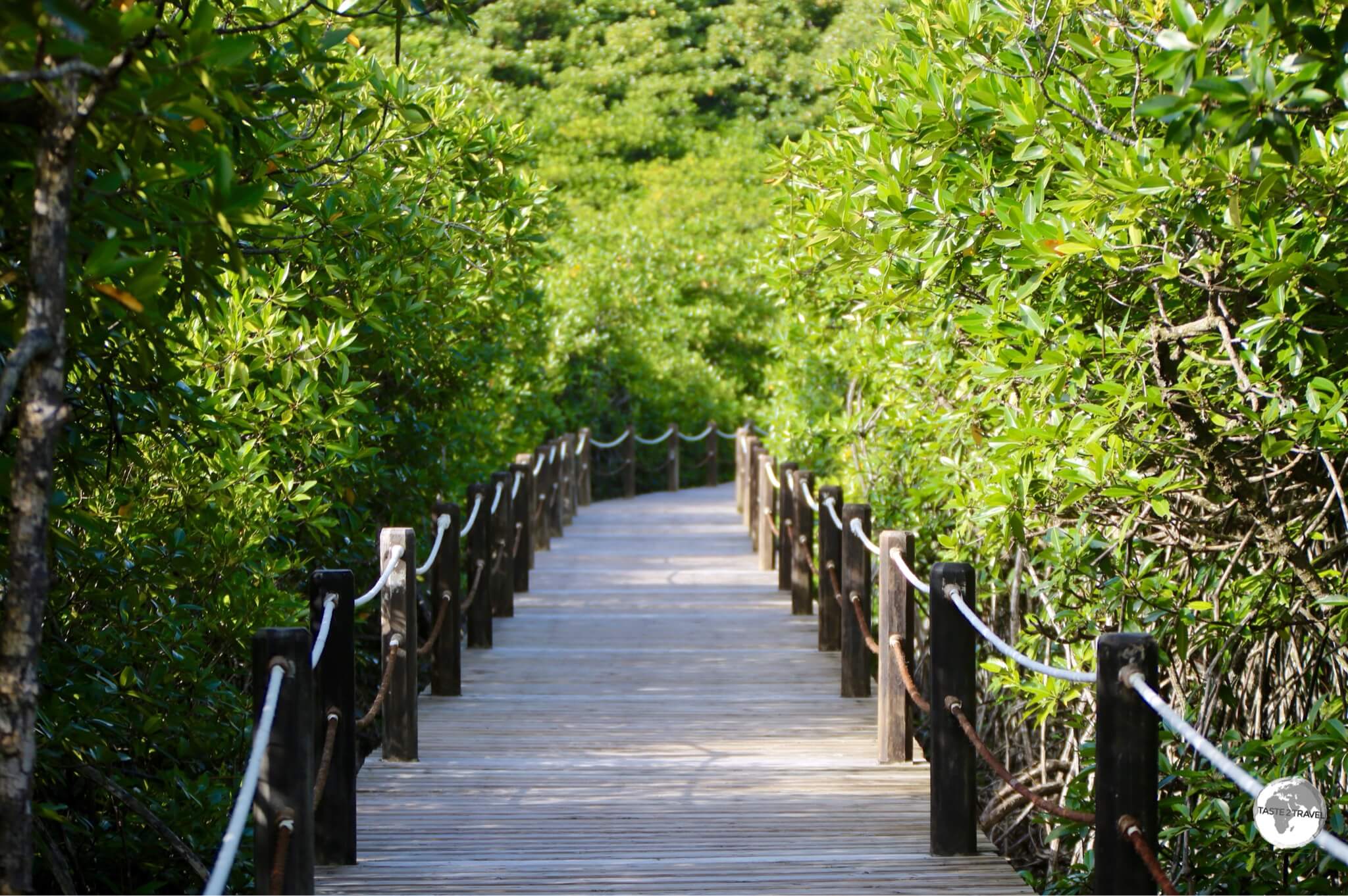
Mangrove walkway at Papago International Resort, Airai state.
One place worth visiting is the Mangrove walkway at the Papago International resort (5 minutes drive from the airport). For a small fee, visitors can access the resorts’ mangrove boardwalk. It’s a great place to spot birds and other wildlife.
Detail of Aimeliik Bai.
Travelling in a clockwise direction around the island, the next state you enter is Aimeliik – home to one of the oldest villages in Palau and also home to a beautiful hilltop Bai.
Interior of the Aimeliik Bai.
The state ‘entrance fee’ for visitors is $10 and can be paid at the ticket office next to the Bai.
Bai at Aimeliik.
At the northern end of the island, you can visit Badrulchau monoliths – 37 basalt stone pillars (believed to be foundations from a building) from around 100 AD. Just south of the monoliths – on the north-east coastis the tiny state of Ngiwal (population – 220) – home to one coastal village with sandy beaches.
Low tide at Ngiwal state beach.
Continuing south you will eventually reach Melekeok state, home to the national capital enclave of Ngerulmud. With a population of just 270, Melekeok is the least-populous capital in the world.
The capital complex at Ngerulmud, a purpose-built capital.
The capital complex is very grand and impressive but not too interesting. You are not allowed to access any of the buildings (I did try to enter the Capital building and was promptly asked to leave by security) but you can wander around the grounds and take photos.
Okemii Deli & Internet Café is located on the beach downhill from the capital complex. There is (apparently) an impressive Bai in Melekeok state but this was closed for renovation at the time of my visit.
Capital buildings, Ngerulmud.
Koror
Koror is the centre of action on Palau. With 70% of the population and almost all tourists services, Koror is where visitors spend most of their time. This narrow, busy island is traversed by one long, main (permanently congested) road. Along this road are hotels, dive shops, banks, shops, cafes, bars, restaurants, government offices etc. The southern end of the island is home to upmarket resorts, built around quiet, pristine coves.
Traditional Bai at the Belau National museum in Koror.
Belau National Museum
There are two museums on Koror – the older Belau National museum (oldest museum in Micronesia) is home to a beautifully painted Bai and two floors of exhibits, which detail the complete history of Palau.
Detail of Bai at the Belau National Museum.
Etpison Museum
The newer Etpison Museum(named after a former president) is the place to come if you are looking for somewhere to develop a better understanding of Palau culture. The admission cost of $10 is a little steep for such a small museum – but this is Palau.
A display at the Etpison Museum in Koror.
Displays include; a model of a bai; local tools; artefacts; money; clothing; photos showing the childbirth ceremony and more. For Australians visiting the museum – you might be surprised to be greeted by two friendly sulphur-crested cockatoo’s that are kept in a cage inside the front door. Cockatoos were previously introduced to Palau from Australia.
Translucent turtle-shell bowls at the Etpison museum in Koror.
Story Board Wood Carvers
A ‘story board’ wood carver at his workshop in Koror.
If you’re impressed by the traditional ‘storyboard’ wood carvings displayed at the Etpison museum, you should ask staff for directions to the resident expert carver. His roadside studio is located in a side street a short walk north of the museum (turn left at the Blue Bay petrol station).
A Palau ‘story board’ wood carver in Koror.
Storyboards were introduced into Palau by a Japanese artist during the Japanese occupation of Palau and adapted by the islanders to record their own traditions. The stories that are told on the Palau storyboards are usually old Palau-an legends. You can watch the carvers at work and purchase directly from them (no bargains here).
A traditional Palau ‘story board’ wood carving.
Accommodation
The Hotel Palau Royal Resort.
Most hotels can be found on the island of Koror – a 30 minute drive from the airport. Like everything else on Palau – accommodation is not cheap. I stayed at the Japanese-owned DW Motel, which is located on the main road close to downtown. The first half of my stay coincided with their peak season, which meant I was charged $140 per night for my single room (definitely not worth the money but it was the cheapest place I could find). The second half of my stay was charged at $70 per night which was more reasonable but still over-priced. Breakfast is not included but you are provided with a clean, small, spartan (TV-less) room.
On the south side of the island are larger, more upmarket resorts. Many of the hotels on the island are Taiwanese-run and not registered on popular OTA (Online Travel Agent) sites such as booking.com
You should ensure you organise airport shuttle transfers in advance – do not assume taxi’s will be available at the airport when you arrive.
Eating Out
While traditional island cuisine is based on root vegetables, pork, chicken, and seafood – there has been enough outside influence (especially from America, Japan and – more recently – Taiwan) on the island that ensures local restaurants cater to a variety of tastes. Strung along the main road of Koror is a good selection of restaurants.
One of my favourite places is the fabulous Rock Island Cafe, an American-diner inspired restaurant staffed by friendly Filipino’s (they constitute the main labour force on the island). The cafe is open from early morning, offering possibly the best (and most reasonably priced) breakfast on the island. They have a bakery next door which supplies the cafe with amazing cakes which are sold very cheaply along with their freshly brewed coffees.
In the south, on the small island of Malakal is the Drop Off Bar and Grill. This outdoor, waterfront venue is perfect for sipping drinks and enjoying fresh local seafood and more.
Visa Requirements
Palau passport stamps.
Some visitors require visas to enter Palau, check your requirements prior to arrival.
Palau Entry Form
All passengers flying into Palau must submit the Palau Entry Form at most 72 hours before departure.
This will generate a QR code, which must be presented on a mobile device or printed copy during check-in and upon arrival.
Getting There
By Air
Airport
Flights to Palau arrive at Palau International Airport (IATA: ROR), also known as Roman Tmetuchl International Airport.
The airport is located 6-km north of Koror.
Airlines
The following airlines provide connections to/from Palau (Updated: August 2024):
Air Niugini – flies to/ from Port Moresby, Tokyo–Narita (from 29 October 2024)
Belau Air – flies to/ from Angaur, Peleliu
Cambodia Angkor Air – flies to/ from Hong Kong, Phnom Penh
Caroline Islands Air – flies to/ from Yap
China Airlines – flies to/ from Taipei–Taoyuan
Jeju Air – flies to/ from Seoul–Incheon
Nauru Airlines Brisbane – flies to/ from Majuro, Nauru, Pohnpei, Tarawa
Pacific Missionary Aviation – flies to/ from Angaur, Peleliu, Yap
United Airlines – flies to/ from Guam, Manila
Departure Tax
Departure tax from Palau is a hefty $50 and is comprised of $25 terminal fee and $25 environmental fee.
An especially useful connection, for those already travelling in the South Pacific, is the airline’s regular flight from Nadi (Fiji) which offers connections to the Central Pacific.
Taxi’s are available around Koror – but almost non-existent elsewhere. It’s always best to book a taxi in advance rather than trying to hail one on the street. The fare from Koror to the airport is $25.
When I arrived at the airport (early evening flight from Guam) there were no taxis available. The friendly lady from the tourist information desk tried to arrange a taxi, but no drivers were willing to come out to the airport. She closed the information desk and drove me in her car to my hotel (providing me with a guided tour of the island along the way).
Car
Palau License Plates.
Hire cars are available, but like everything else on Palau – they’re not cheap. At the airport, Alamo quoted $70 a day for a compact car. I shopped around in Koror and found an old (compact) clunker which cost me $40 per day. Cars are often worn and old but the speed limit is 50 km/h and distances are not great.
Palau is divided into sixteen states (most states have just a few hundred residents) with each state having their own number plate.
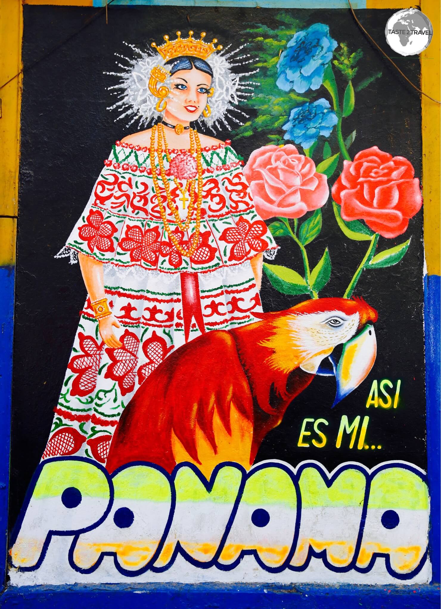
I’ve just completed a twelve day trip to Panama, my 4th visit to this dynamic Central American destination. For years the government has focused on building bigger and better infrastructure and the good news for travelers is that (due to it’s efforts) accessing Panama has never been easier.
One of the oldest cities in the Americas, Panama City is full of Spanish-style architectural gems.
The route network of Copa Airlines’ (the national carrier) continues to grow and today, the airline provides frequent connections to most major cities in the Americas (and to some European cities) from their hub at Tocumen airportin Panama City.
The new Norman Forster-designed airport terminal at Tocumen airport.
All of this increased aviation activity has resulted in Tocumen airport becoming the busiest in Central America – a true regional hub. It has also meant that the existing terminal is operating beyond capacity. To remedy this, a new Norman Forster designed terminal is currently being built. This is due to open later this year and will solidify Panama City’s regional ‘hub’ status.
Whenever I’m in Panama City, I treat myself to a new Panama hat.
Location
Panama
Located on the Isthmus of Panama, a narrow bridge of land that connects North and South America, Panama has always stood at a crossroads.
To the north lies Costa Rica and the countries of Central America. To the south lies Colombia and the continent of South America. On either side of the isthmus lie the Pacific ocean and the Caribbean sea.
The country is most famous for its canal which cuts through the isthmus at Panama City.
Panama City old town.
Flag
The flag of Panama.
The iconic flag of Panama is red, white and blue and is divided into four quarters with two white rectangles – one blue, and one red, with the white rectangles charged with a single red and blue star. As far as flag design is concerned, I believe the Panamanian flag is perfection!
The colours of course are very symbolic. The blue was intended to represent the Conservative Party and the red to represent the Liberal Party. The white was intended to stand for peace and purity; the blue star stands for the purity and honesty of the life of the country; the red star represents the authority and law in the country, and together the stars stand for the new republic.
Flag Day is celebrated every year on November 4, the day after Panama’s separation from Colombia.
Sights – Panama City
The Casco Antiguo (old town) of Panama City is full of Spanish architectural gems which are slowly being renovated.
Once on the ground, there are many attractions which make Panama appealing to tourists. Panama City offers a wealth of history and is the oldest continuously occupied European settlement on the Pacific coast of the Americas.
Antique Spanish religious art in the old town.
The city was founded by the Spanish in 1519, who were led by local Indians on the short crossing from the Caribbean Sea to the Pacific Ocean.
Panama flags for sale in Panama City old town.
The Spanish then used the crossing to transport their treasures from their new world Pacific-coast colonies in Central and South America back to Spain via the Atlantic.
Another renovated Spanish colonial-era gem in the Casco Antiguo, Panama City.
Today, the beautiful old town (Casco Antiguo) is my favourite place to spend time in the city. This UNESCO listed heritage site is slowly being renovated one building at a time, so with each return visit there’s always something new to explore.
Casco Antiguo, Panama City.
The narrow cobbled streets (hopefully one day they’ll make them traffic-free) are lined with historic churches and lead into quiet, leafy squares. Everywhere there are bars, cafes, restaurants, shops and artist studios – a great place to meander, sight-see, relax and pick up a souvenir or two. In between the renovated properties are old abandoned properties (their stone facades propped up by support beams) which await renovation. It’s all very photogenic.
Many buildings in Panama City old town are awaiting renovation.
Outside of the old town is the new town – a modern, bustling city – complete with shopping malls, soaring high-rise office towers, traffic-clogged streets and fancy hotels.
The Panama flag and the modern skyline of Panama City, a thriving metropolis.
The new town is made up of different districts, including the financial district. Construction cranes are a permanent feature on the Panama skyline as new buildings pop-up at a frenzied pace.
The F&F tower in the financial district of Panama City has won many architectural awards.
Sights – Outside Panama City
The Miraflores Locks (now the old locks) are located a short bus ride from Panama City.
Outside of the city, there are a plethora of travel options. Top of most visitors’ bucket list is a trip to the Panama Canal locks. There are three sets of locks between the Pacific Ocean and the Caribbean Sea. The closest to the capital (Miraflores locks) can be visited on an easy half-day trip.
The ‘sliding’ gates on the newly expanded Lake Gatun locks.
Here you’ll get to watch ships pass through the old historic locks, while the newer, larger locks are out or sight in the distance and not open to the public.
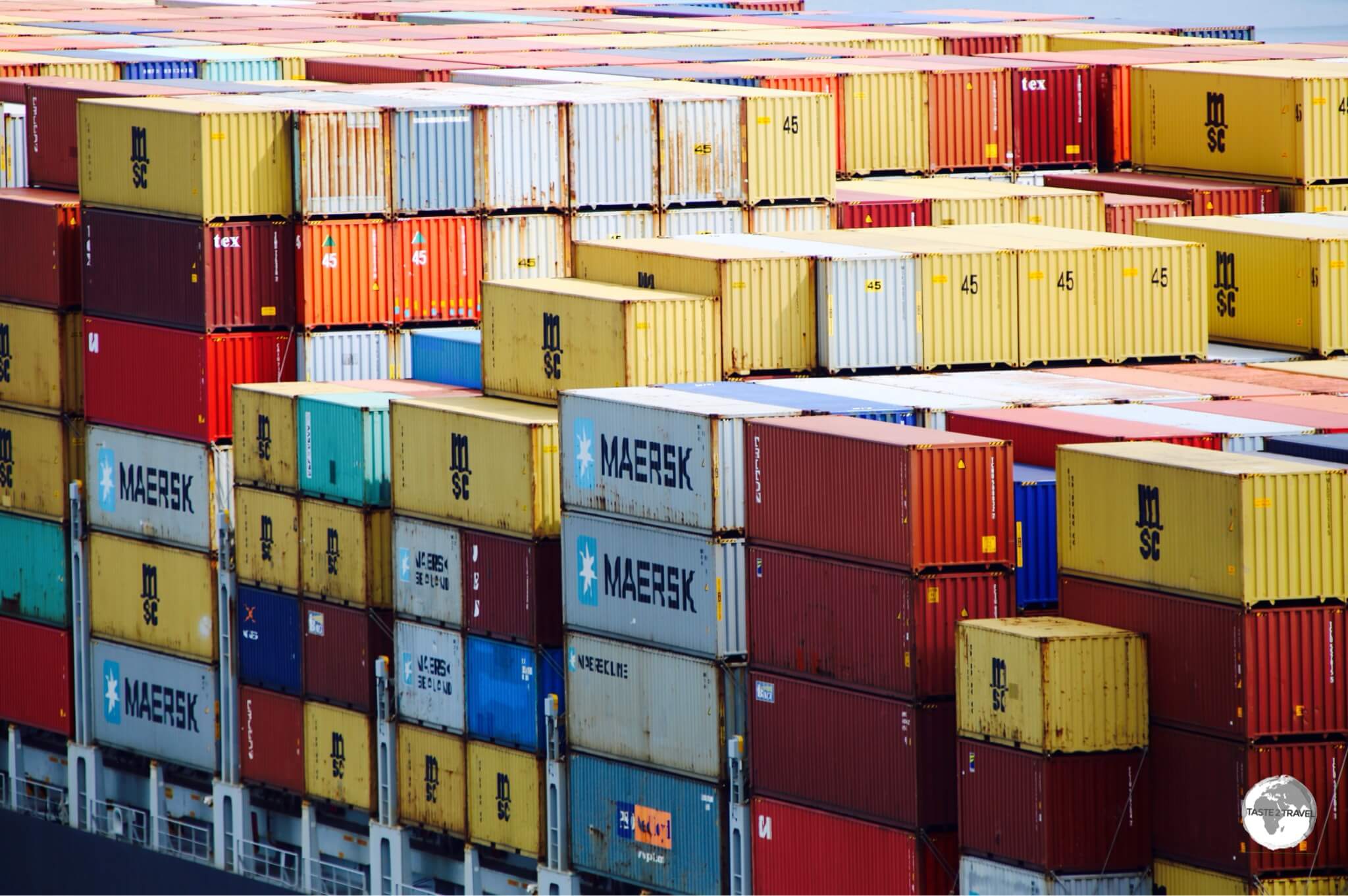
The gigantic MSC Antigua entering Lake Gatun locks.
However, if you visit the Gatun Lake locks (Caribbean coast) you will be able to see the mega-sized ships passing through the new locks (opened in 2016).
The MSC Antigua can carry almost 9,000 containers.
MSC Antigua, inside Lake Gatun lock, being lowered to the level of the Caribbean sea.
After the canal, you can spend your time relaxing on the Caribbean coast; sailing around the beautiful San Blas islands; exploring old Spanish coastal forts; diving/ snorkeling or heading to the other side of the country to spend time meandering along the Pacific coast.
Playa Blanca on the Caribbean island of Isla Grande.
Once you’ve had enough of sun, sand and beach you can venture into the central highlands, where you’ll find lush, green rainforests clinging to the sides of extinct volcanoes. It’s on the slopes of these volcanoes where you’ll find cafe fincas(coffee farms) growing the famous Geisha coffee bean (US$260/ kg), which Panama is famous for.
A Green violet-eared hummingbird at Finca Lerida.
A great base for exploring the highlands is the town of Boquete, which you can read more about in my report – Bird Watching in Panama.
Eating Out
Restaurant at the American Trade Hotel, Casco Antiguo – Panama City.
My favourite place to explore dining options is the old town of Panama City, where there’s always a new restaurant/ cafe opening somewhere.
On this trip I returned to my favourite old town cafe – Super Gourmet– which is especially good for breakfast and lunch. It’s owned by a friendly and informative American (Blaine) and it’s one place where you can try a cup of the famous Geisha cafe. I especially recommend a slice of their lemon pie while you sip on of their amazing Panamanian coffees.
My favouritebar in the old town is the newly opened The Strangers Club. The bar is part of a group of hipster cocktail bars, known as the ‘Employee Only’ bars which span the globe from New York City to Macau, Singapore, London and Miami. The cocktails, food and service are all amazing. If you are looking for a special night out then this is the venue.
Accommodation
Artwork in Panama City old town.
As for accommodation, Panama City offers the traveler two very different options – you can stay in a beautifully renovated guest house/ hotel in the old town or in a modern, high-rise hotel in the new town.
Many of the new hotels are located along the bay front, where – thanks to a 5 km long footpath/ cycle way – you can join locals in the evening to exercise/ promenade.
My pick of the modern bay front hotels is the Hard Rock Hotel, which combines 5-star accommodation with a themed experience (like staying at the Rock ‘n’ Roll hall of fame) and offers an amazing breakfast.
Shopping
Despite their name, Panama hats are actually made in Ecuador.
The old town offers wonderful shopping from upmarket boutiques, artist studio’s to cheap and cheery souvenir stalls. In the new town you’ll find the biggest and best shopping mall in Panama – the sprawling Albrook mall. This is popular with visitors from throughout the region who come here to shop in stores not available in their home countries (and at reasonably cheap prices).
An old advertisement for Panama Hats in Panama old town.
Also worth checking out is the Multicentro mall (in front of the Hard Rock Hotel) and the larger Multiplaza Pacific mall (more upscale with lots of branded shops), which is a short taxi ride from the Hard Rock.
Test your knowledge with this Pacific Islands quiz from taste2travel.
How well will you score? Your result will be displayed at the bottom of the quiz – will you get to see the legendary Marco Polo?
Good luck!
01. Which is a territory of New Zealand?
Correct!Wrong!
02. What is the capital of the Republic of the Marshall Islands?
Correct!Wrong!
03. Which country uses the Australian dollar as its official currency?
Correct!Wrong!
04. This island once served as a WWII base for the Japanese navy. Its lagoon is now home to a fleet of bombed warships, making it the best wreck diving location on the planet.
Correct!Wrong!
05. This atoll was used by the US military as a testing ground for its nuclear weapons program.
Correct!Wrong!
06. What is the capital of the Federated States of Micronesia?
Correct!Wrong!
07. This is the flag of which nation?
Correct!Wrong!
08. Which country uses the US dollar as its official currency?
Correct!Wrong!
09. On which island would you be if you were visiting Nan Madol (one of the most significant ruin complexes in the Pacific)?
Correct!Wrong!
10. This is the flag of which country?
Correct!Wrong!
11. Which country was formerly known as the Gilbert Islands?
Correct!Wrong!
12. This island is famous for its nearly 900 monumental statues called Moai.
Correct!Wrong!
13. The tiny atoll of Aitutaki is a part of which country?
Correct!Wrong!
14. Which one of the following is a French Territory?
Correct!Wrong!
15. If you were shopping on Guam which currency would you be using?
Correct!Wrong!
16. This is the flag of which country?
Correct!Wrong!
17. Which is the capital of Samoa?
Correct!Wrong!
18. If you paid for a meal on Rarotonga using the official currency, which currency would you have used?
Correct!Wrong!
19. This is the flag of which country?
Correct!Wrong!
20. Which is the capital of Papua New Guinea?
Correct!Wrong!
Travel Quiz 04: Pacific Islands
Sorry! You scored less than 50%. Why not try one of the other taste2travel trivia quizzes?
You scored less than 75%! Why not try one of the other taste2travel trivia quizzes?
Very Good - a gold star performance! Why not try one of the other taste2travel trivia quizzes?
Excellent result! You're a modern day Marco Polo. Why not try one of the other taste2travel trivia quizzes?
Share your Results:
Travel Quizzes on taste2travel
Welcome to taste2travel!
My name is Darren McLean, I’m the owner of taste2travel and I love travel trivia and I certainly enjoy creating travel quizzes.
There are a total of 80 different travel quizzes on taste2travel, with each quiz containing 20 questions.
That’s a total of 1,600 trivia questions waiting to challenge you.
You’ll find a range of quizzes covering such topics as:
Currencies
Flags
Capital Cities
UNESCO World Heritage Sites
World Museums
Map Quizzes
Continent-specific Quizzes
World Islands
Landlocked Countries and much more!
Don’t forget to share these quizzes with your family, friends and community using the social media buttons at the top of the quiz.
Apart from excellent travel quizzes, you’ll also find other outstanding content on taste2travel – such as travel guides, photo galleries and feature articles which provide tips on booking cheap flights and much more.
Test your knowledge with this South America quiz from taste2travel.
How well will you score? Your result will be displayed at the bottom of the quiz – will you get to see the legendary Marco Polo?
Good luck!
01. How many countries/ territories share a land border with Brazil?
Correct!Wrong!
02. What is the capital of Suriname?
Correct!Wrong!
03. In which country would you be if you were visiting Kaieteur falls - the world's tallest single drop waterfall.
Correct!Wrong!
04. Where is the Kourou space centre located?
Correct!Wrong!
05. In which country is the Panama hat made?
Correct!Wrong!
06. Easter Island is a part of which country?
Correct!Wrong!
07. In which country would you be if you were flying over the pre-Colombian Nazca lines?
Correct!Wrong!
08. The underground Salt Cathedral of Zipaquira (the world's largest) is located in which country?
Correct!Wrong!
09. This is the flag of which country?
Correct!Wrong!
10. Which country was formerly a Dutch colony?
Correct!Wrong!
11. The Galapagos Islands are a part of which country?
Correct!Wrong!
12. What is the approximate length of Chile in kilometres?
Correct!Wrong!
13. This is the flag of which country?
Correct!Wrong!
14. At 10,582 square kilometers (4,086 sq mi), the Salar de Uyuni is the world's largest salt flat. In which country is it located?
Correct!Wrong!
15. Which country uses the US dollar as its official currency?
Correct!Wrong!
16. In which capital would you be if you were spending Euro's (the official currency)?
Correct!Wrong!
17. Which is the longest river in South America?
Correct!Wrong!
18. Situated at 3,400 metres (11,152 feet), the Andean city of Cusco is located in which country?
Correct!Wrong!
19. Cerro Fitz Roy is the main star of the Fitz Roy National Park in Patagonia. The peak straddles the border of which two countries?
Correct!Wrong!
20. This is the flag of which country?
Correct!Wrong!
Travel Quiz 03: South America
Sorry! You scored less than 50%. Why not try one of the other taste2travel trivia quizzes?
You scored less than 75%! Why not try one of the other taste2travel trivia quizzes?
Very Good - a gold star performance! Why not try one of the other taste2travel trivia quizzes?
Excellent result! You're a modern day Marco Polo. Why not try one of the other taste2travel trivia quizzes?
Share your Results:
Travel Quizzes on taste2travel
Welcome to taste2travel!
My name is Darren McLean, I’m the owner of taste2travel and I love travel trivia and I certainly enjoy creating travel quizzes.
There are a total of 80 different travel quizzes on taste2travel, with each quiz containing 20 questions.
That’s a total of 1,600 trivia questions waiting to challenge you.
You’ll find a range of quizzes covering such topics as:
Currencies
Flags
Capital Cities
UNESCO World Heritage Sites
World Museums
Map Quizzes
Continent-specific Quizzes
World Islands
Landlocked Countries and much more!
Don’t forget to share these quizzes with your family, friends and community using the social media buttons at the top of the quiz.
Apart from excellent travel quizzes, you’ll also find other outstanding content on taste2travel – such as travel guides, photo galleries and feature articles which provide tips on booking cheap flights and much more.
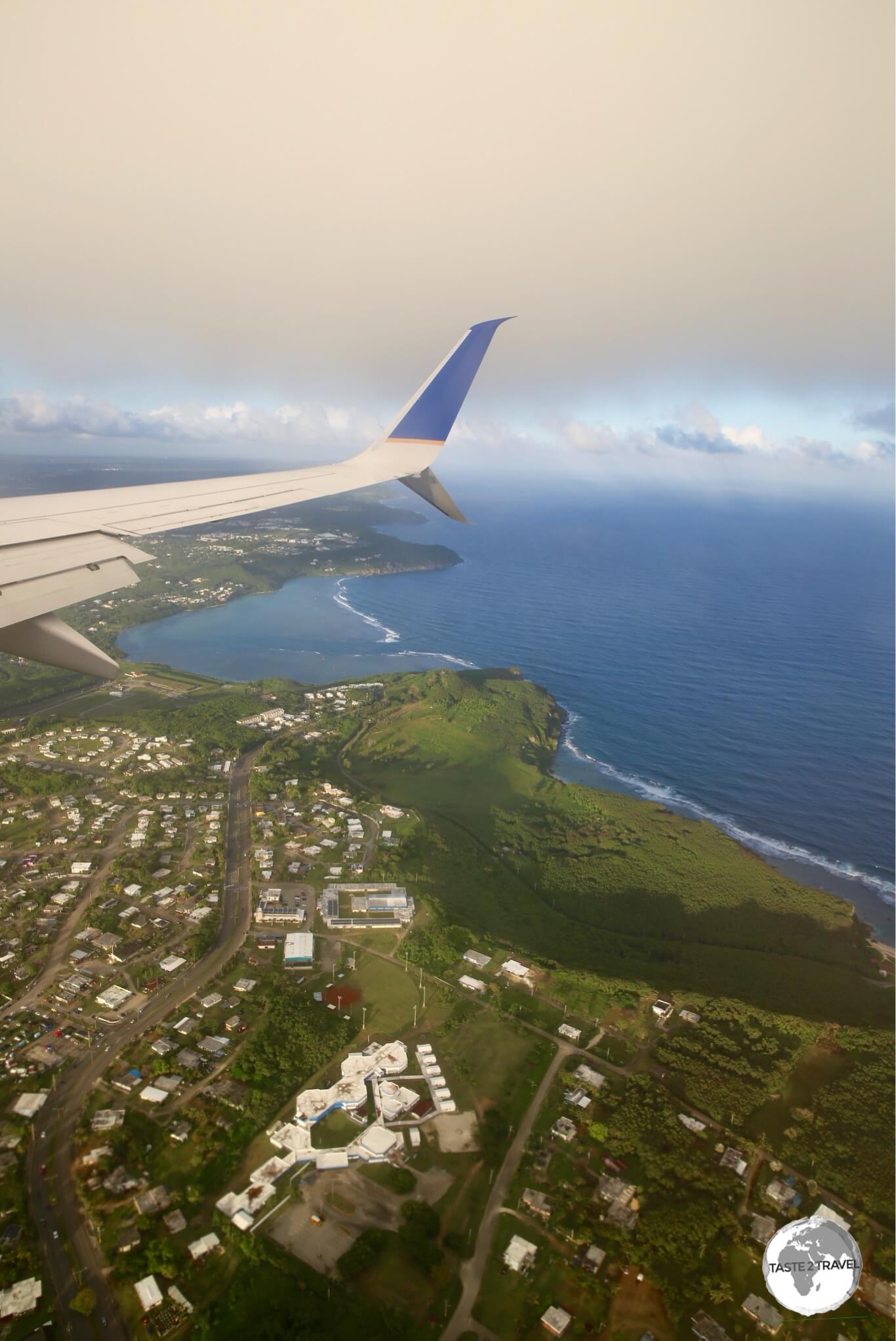
If you’ve spent time on neighouring islands in Micronesia, you will have become use to a sleepy, laid-back, slow-paced way of life. Guam however is bright lights, big city buzz – a mini Hawaii – and will snap you out of any relaxed, comatose state you may have gotten use to.
Here you will find busy, congested highways, lined with shopping malls (anchored by stores such as Macy’s) and all the usual US chain restaurants. Expensive, high-rise resorts, which cater to a throng of Japanese and Korean tourists, line the shore of emerald-coloured Tumon bay (Guam’s version of Waikiki).
View from Two Lovers Point.
Added into this mix are approximately 7,000 US military personnel (and their families) who are stationed at either Anderson Air Force basein the north or Naval Base Guam on the east coast.
While on Guam it is impossible to escape the US military presence – in any restaurant you will most likely be dining alongside soldiers and their families, bars are full of soldiers and to get to these places you travel along roads such as South Marine Corps Drive, Army Drive etc.
Souvenir of Guam.
Guam (population: 160,000) is the biggest and busiest island in Micronesia. The island is an unincorporated and organised territory of the United States (i.e. Guam is controlled by the US government but is not fully part of the United States – as such the US Constitution applies only partially). The official currency is the US dollar.
Guam is a fun place to spend a week, with many different attractions on land and in the pristine, tropical waters which surround the island. Being a US territory – services and infrastructure are well developed, which makes for easy travelling.
Location
Located in the western Pacific (north of the equator, three-quarters of the way from Hawaii to the Philippines), Guam is the southernmost island in the Mariana island chain.
Located off the east coast of the island is the Mariana Trench, which reaches it’s deepest point (10,911 metres/ 35,797 feet) atChallenger Deep, the deepest point on the planet.
In 2012, famous Canadian film maker, James Cameron, was the first human to travel 11 km (6.8 miles) down into the depths of Challenger Deep on a solo voyage in a specially built submarine.
History
Magellan’s obelisk at Umatac bay.
Guam was settled around 2,000 BC by native Chamorros who are believed to have come from Southeast Asia and today comprise 38% of the total population.
The first European contact was in 1521 when Ferdinand Magellan landed on the island – it is here where Magellan encountered the first “indios” since leaving South America.
Despite Magellan’s initial visit, the island was not colonised by Spain until the 17th century who then used it as a stopover point for their Spanish Manila Galleons, which sailed between Mexico and the Philippines.
During the Spanish period, many Filipinos settled on Guam and today comprise 27% of the population.
In 1898 the Spanish surrendered Guam to the United States as part of the settlement of the Spanish-American War. However, the island was then captured during WWII by Japan, just hours after the attack on Pearl Harbour.
The Japanese occupied Guam for the next two-and-a-half years, before U.S. troops were able to recapture the island in 1944. The Americans have been in control every since.
Today, Guam is supported by its tourism industry, with its second largest source of income coming from the United States Armed Forces.
Flag
The flag of Guam.
The flag of Guam is dark blue with a red border on all sides. At the centre, the coat of arms of Guam is an almond-shaped emblem, which depicts a proa (traditional sailing boat) sailing in Agana Bay and GUAM coloured in red letters.
The flag of Guam flying in the capital, Hagåtña.
Sightseeing
I too was a ‘fan’ of Guam beer!
For sightseeing, Guam can be split into three regions:
Northern Region
A large chunk of the northern region is off limits to visitors as its home of the Andersen Air Force Base (AFB), with the base stretching along the entire north coast. One place worth visiting is Ritidian beach on the the north-east coast.
The road to the beach is a pot-holed, rough, gravel road, which follows the perimeter fence of the AFB. While I was bouncing along this road I could look over into the base where I could see a perfectly paved road with absolutely no traffic.
While back-roads on the island can be rough, it seems roads on the bases are in perfect working order.
Ritidian beach is home to the Guam National Wildlife Refuge Unitwhich provides two miles of coastal walking trails. The refuge is open daily until 4pm. After this time, a locked gate on the main road prohibits any access to the entire area, so best to come during refuge opening hours.
Coco Palm Garden Beach
Another, much rougher, gravel road (left turn before the refuge gate) follows Ritidian beach.
I drove my (rental) car along this road but it really is only suited to 4WD. Most of the beachfront property is private with fences, gates and ‘no trespassing‘ signs lining the way.
There is nowhere along this road which provides public access to the beach. If you persevere, you’ll eventually reach Coco Palm Garden Beach. This is one over-priced tourist trap. For around $90 each, Japanese and Korean tourists are bussed in from their Tumon Bay resorts, provided a welcome drink, BBQ lunch, access to the beach (rocky/ coral reef), towel and fish food (?).
The whole place closes down early in the afternoon to ensure all tourists are back at their resorts in time for their dinner shows. I arrived at 4pm and was allowed 2 minutes of free access to take one photo of the beach. The staff were not at all welcoming and certainly not happy that I was getting free access.
On West Marine Corps drive in Dededo is the Micronesia Mall – the largest mall on the island.
Okay – if you have arrived on Guam from the real world then this mall will not seem to be anything special, but for those who have spent an inordinate amount of time on any of the sleepy, less-developed neighbouring islands – this is big deal.
Signed love hearts at Two Lovers Point
Just north of Tumon Bay is Two Lovers Point, a dramatic (400 ft) coastal cliff from which it is said two lovers jumped to their death as the father of the girl wanted her to marry a Spanish captain which she refused in the most dramatic way possible.
The views over the Philippine Sea and nearby Tumon Bay are spectacular, as are all the colourful love-heart shaped dedications written by visiting romantic tourists.
View south to Tumon Bay from Two Lovers Point.
Central Region
This is where all the action is and where you will spend most of your time. The central region is home to the tourist hub of Tumon Bay and to the island’s capital – Hagåtña.
Tumon Bay
View of Tumon Bay
With its stretch of high-rise resorts wrapping around the bay, Tumon is all about rest, relaxation, play and shopping. In between the resorts are large duty free shops catering to the needs of free-spending Japanese and Korean tourists.
It’s here you’ll find US chain restaurants, Sushi & Korean BBQ restaurants, bars & clubs, spas, dinner theatres, speciality shops an Underwater World and everything else package tourists might need to enhance their tropical escape experience.
Tumon Bay Beach
During the day, the bay offers fantastic snorkeling – once you get well offshore (unfortunately too many tourists standing on the flat coral heads has killed all the coral close to shore).
Although I wasn’t staying there, I was able to hire snorkel gear from the aquatic sports shop at the Hilton hotel and snorkel directly in front of the hotel (best snorkeling is out to sea from the cove).
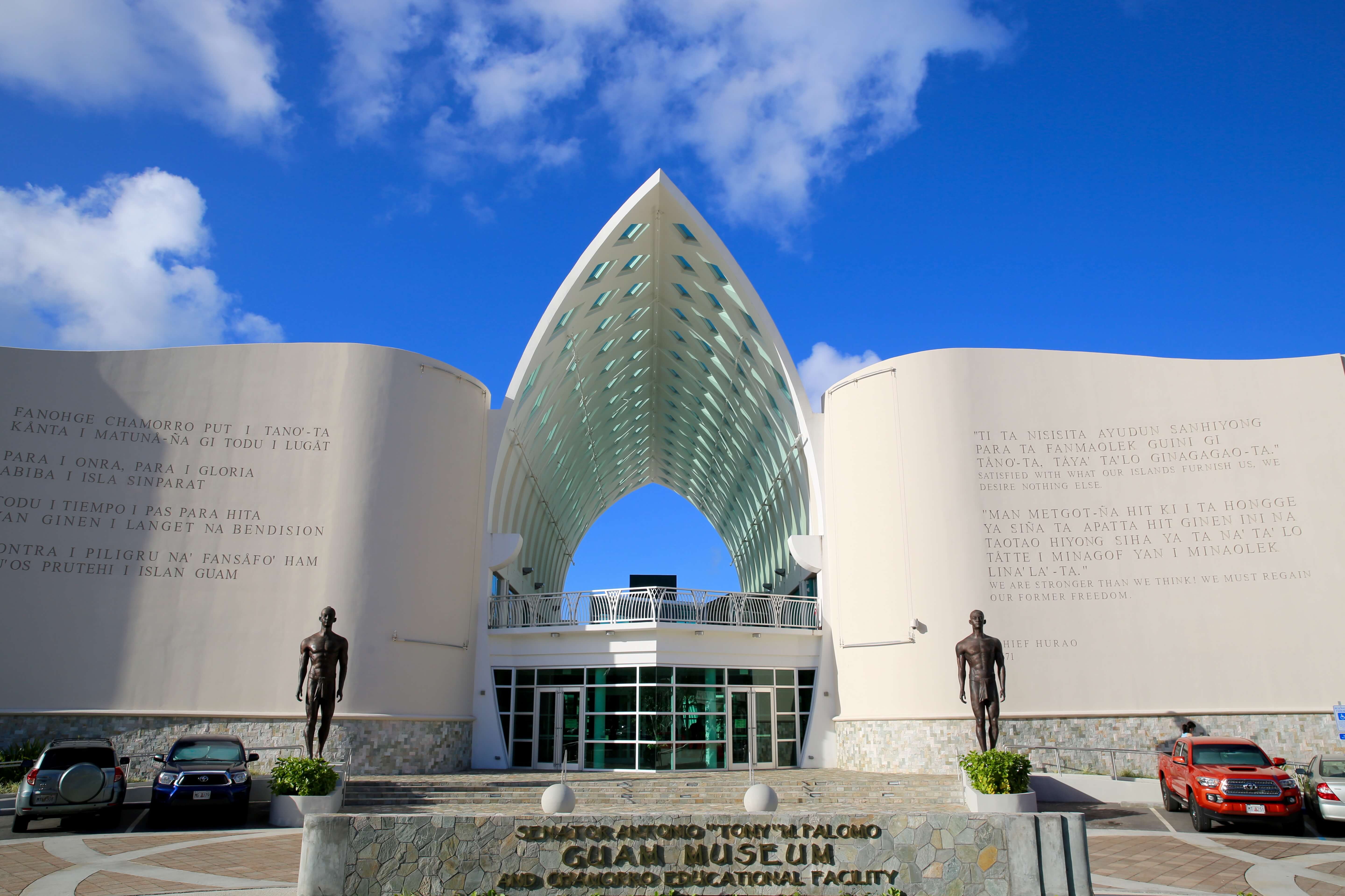
Hagåtña
The very modern, Guam Museum, is located in the heart of Hagåtña, the capital of Guam.
Guam’s capital is a small, relaxed, town which features a historic walking path, connecting all sights of interest. A good place to start is the impressive Guam Museum – the museum tells the history of the island. Directly outside the museum is a sculpture commemorating the visit of Pope John Paul II to the island in 1981.
Across the road from the museum is the historic Plaza de Espana, which was the location of the Governor’s Palace during the island’s period of Spanish occupation.
The palace housed the office and residence of the Spanish governor but was largely destroyed during the liberation of Guam in 1944. Today a few structures remain, including the the Chocolate House, the “Azotea” and the Almacen gate.
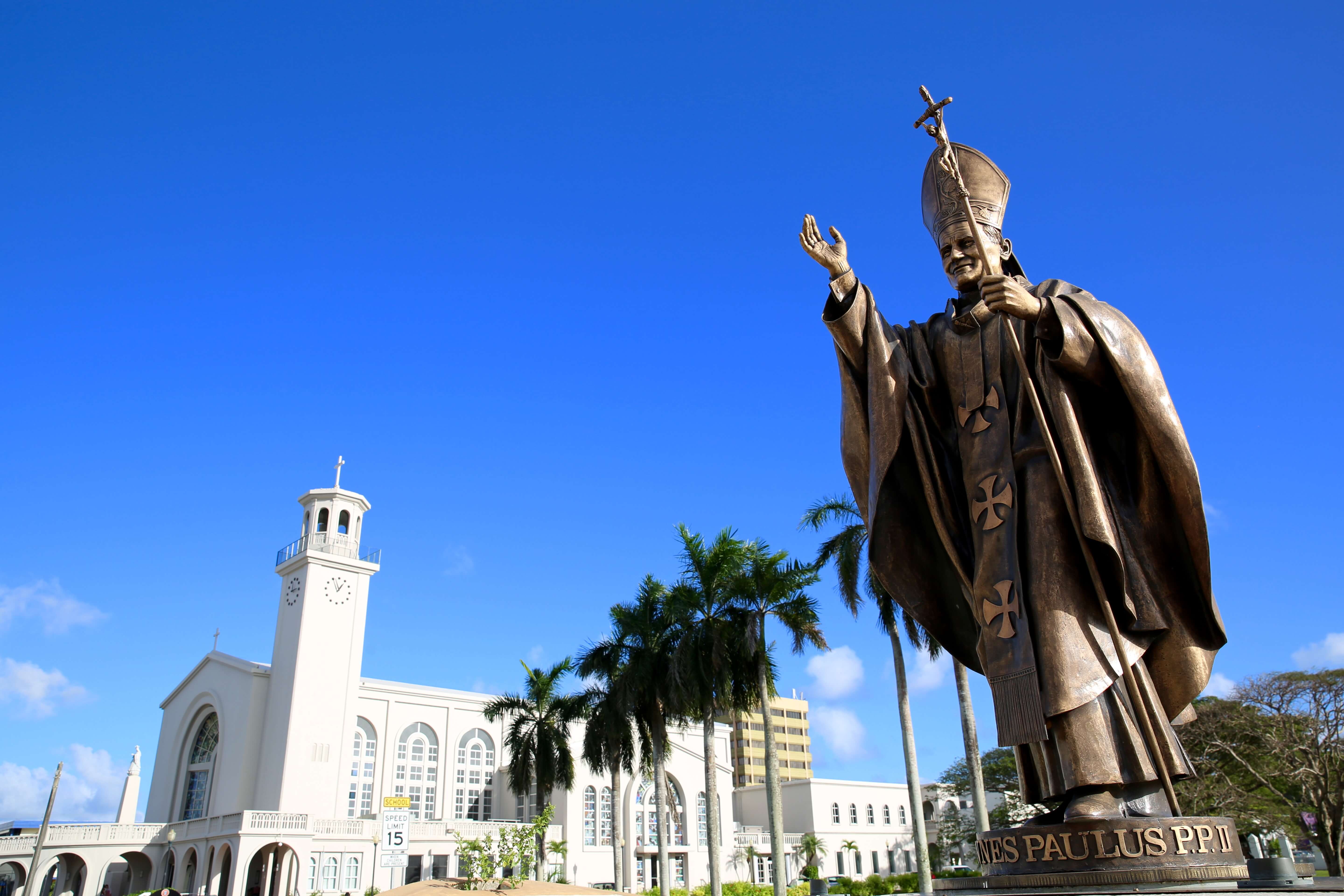
Statue of Pope John Paul II and Dulce Nombre de Maria Cathedral Basilica in Hagåtña
Next to Plaza de Espana, is the contemporary Dulce Nombre de Maria Cathedral-Basilicawhile behind the Plaza is the Senator Angel Leon Guerrero Santos Memorial Park.
The park contains 8 ancient lattes.Nothing to do with coffee – latte’s were used in the Mariana islands as house supports, with a cap at the top to discourage rats and other vermin climbing up into the house.
Weekly BBQ at the Chamorro village.
Towards the harbour, the Chamorro village is a great place for souvenir shopping and (only on Wednesday evenings) the best BBQ in town. The best time to visit is early in the evening with lots of pop-up shops and BBQ vendors.
The earlier you order food the better as the lines get progressively longer as the night goes on, with everyone from locals, tourists and military families turning out.
Southern Region
The southern part of the island features small, quiet coastal hamlets built around picturesque bays. I covered this part of the island on a leisurely day trip following a circuitous route from Hagåtña by first crossing the island on highway 4 to the east coast (Pago Bay) then travelling clockwise around the bottom of the island back to Hagåtña.
The east coast lies on the windward side of the island hence the beaches are much more dramatic and exposed than those on the west coast.
Talofofo Falls.
In Talofofo bay, Talofofo falls are worth the short detour off the coastal road. The falls consist of a series of scenic cascades on the Talofofo River and are reached by way of a very lazy cable car which transports you down into the gorge where the falls are located.
A series of paths and bridges leads you around the falls back to the cable car.
Entrance to Yokoi’s cave.
Also at the falls is “Yokoi’s Cave“, a replica of the original cave, which was located at the same sight but previously destroyed by a typhoon.
This fascinating survival story involves a Japanese soldier who survived the US liberation of the island in 1944 by hiding in a small cave in the jungle. Yokoi survived for the next 27 years, sourcing water from the river and food from the jungle until he was discovered in 1972 by two local hunters.
He believed Japan was still at war and didn’t want to surrender. He eventually returned to Japan to a hero’s welcome (and to receive $300 in back pay).
Fort Nuestra Senora de la Soledad.
As you travel around the southern tip of the island onto the west coast, highway 4 becomes highway 2 as you enter Umatac bay.
This picturesque bay was where Magellan landed in 1521. At the centre of the bay is an obelisk monument commemorating his landing, bearing the inscription, “Magellan landed here.”
It was also here in 1565 that Miguel Lopez de Legazpi dropped anchor and stayed for thirteen days, formally claiming Guam for Spain.
On either side of the bay are two forts (Fort Nuestra Senora de la Soledad and Fort Santo Angelo), which were built during the Spanish colonial period to protect the bay from pirates and other European explorers.
The friendly, informative staff can provide you with a map of the park and information on what to see. Most of the points of interest (former battlefields, trenches and historic structures) lie along the coast north of the Naval base. The park tells the story of war in the Pacific and details the US liberation of Guam in 1944, which resulted in the defeat of the Japanese.
Accommodation
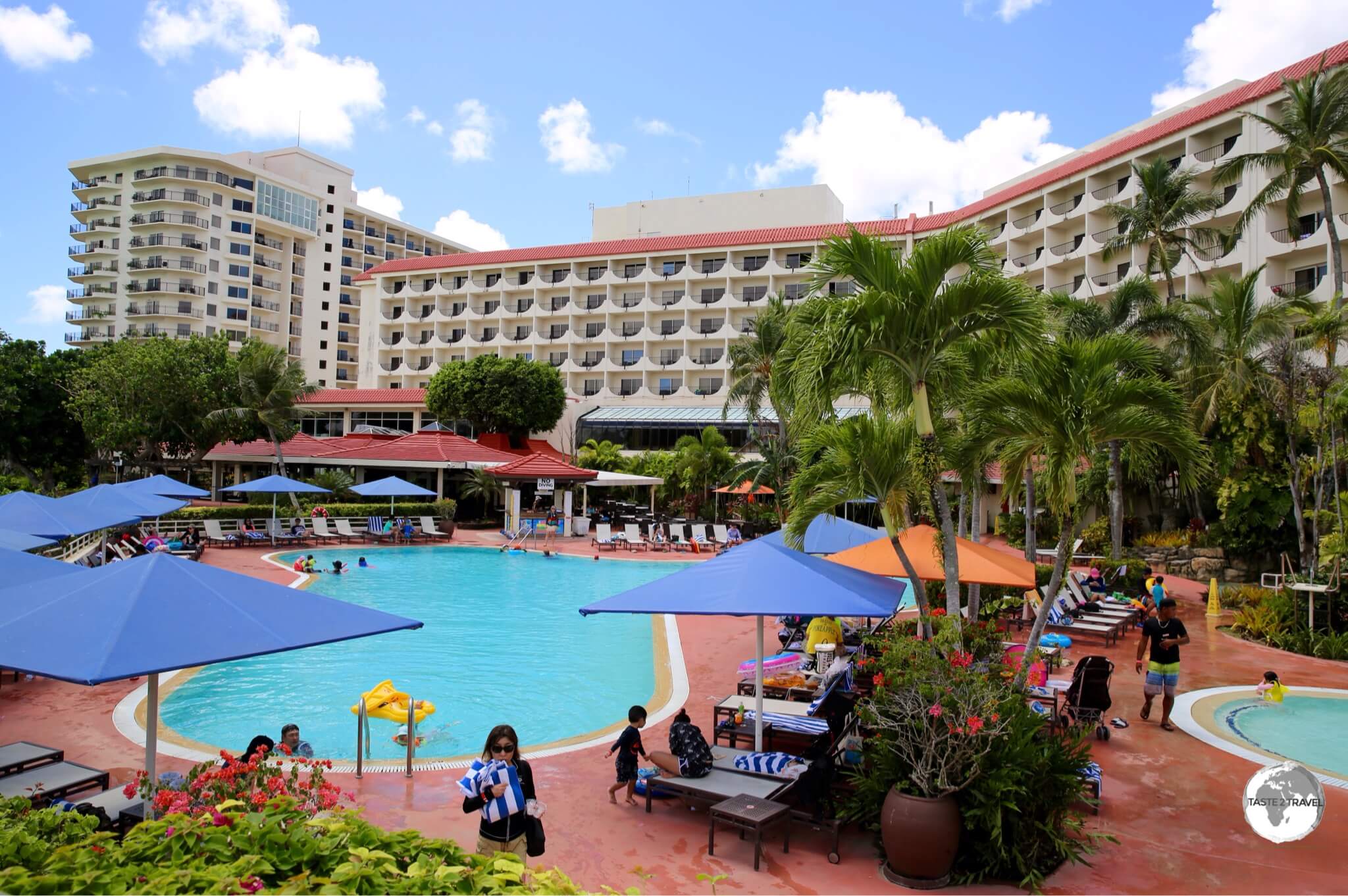
Most visitors to Guam stay in expensive resorts – such as the Guam Hilton – on beautiful Tumon Bay, the Waikiki of Guam.
Most hotels on the island are located along the long curving shore of beautiful Tumon bay, a short drive from the airport.
These hotels are large scale, high-rise resorts which cater to Japanese, Korean and (increasingly) Chinese tourists who jet in for a few days of rest and relaxation.
These tourists arrive on fully escorted tours with lots of money to spend in a short time, hence hotels around the bay are never cheap. If you wish to check these options, you will find them on sites such as booking.com
I used Airbnb to find a more reasonably priced apartment, which was perfect for my stay
Eating Out
Thanks to it being a US territory (and home-away-from-home for thousands of military personnel and their families), Guam offers more dining options than any other island in Micronesia.
All the usual US chain restaurants are represented on the island. You can start your day with breakfast at Denny’s, lunch at Apple-Bee’s and finish with dinner at the Texas Steakhouse. Its a glutton’s paradise!
Added into the mix are numerous Japanese and Korean restaurants in Tumon Bay, which cater to the throngs of Japanese and Korean tourists.
Lunch at McKraut’s German restaurant in Inarajan.
If you’re in the mood for fine German cuisine, you cannot go past the legendary McKraut’s German restaurant, which is located in the village of Inarajan on the remote south-east coast.
The drive from Tumon Bay is about an hour but if you are exploring the south east coast then this is the perfect place to stop for lunch or dinner.
One ‘must do’ culinary experience on the island is the weekly BBQ at the Chamorro village in Hagåtña (see that section for more details).
Bar at McKraut’s German restaurant
For a taste of local Chomoro cuisine, the Meskla Chamoro Bistro in Hagåtña is an excellent choice. The restaurant was founded by a local celebrity chief (Peter Duenas) who’s aim has been to highlight Chomoro cuisine. This is a popular place so reservations are recommended.
Visa Requirements
Entry requirements for Guam are the same as the USA . Check your visa requirements prior to arrival.
Getting There
The view from my flight on United Airlines “Island Hopper” (UA154) on final approach to Guam.
By Air
Flights to Guam arrive at Antonio B. Won Pat International Airport(named after the first delegate from Guam to the United States House of Representatives). The airport is built on a high ridge above Tumon Bay and is within a three hour flight of major Asian cities in Japan, Korea, China, Taiwan and the Philippines.
The airport serves as a regional hub for United Airlines, however most flights are operated by Korean and Japanese carriers who carry hoards of holiday-makers to the island each day.
Guam airport is the terminus for the epic United Airlines Island Hopper (UA154) – for more on this, please refer to my Central Pacific Island Hopping blog.
The following airlines provide connections to/from Guam:
Air Busan – flight to Busan
Cebu Pacific – flight to Manila
China Airlines – flight to Taipei–Taoyuan
Delta Air Lines – flight to Tokyo–Narita
EVA Air – flight to Taipei – Taoyuan
HK Express – flight to Hong Kong
Japan Airlines – flight to Tokyo–Narita
Jeju Air – flights to Busan, Seoul–Incheon
Jin Air – flights to Busan, Seoul–Incheon
Korean Air – flights to Osaka–Kansai, Seoul–Incheon
T’way Airlines – flights to Daegu, Osaka–Kansai, Seoul–Incheon
United Airlines – flights to Chuuk, Fukuoka, Hong Kong, Honolulu, Koror, Kosrae, Kwajalein, Majuro, Manila, Nagoya–Centrair, Osaka–Kansai, Pohnpei, Sapporo–Chitose, Sendai, Shanghai–Pudong, Tokyo–Narita, Yap
United Express – flights to Rota, Saipan
Getting Around
The license plate on my rental car.
Bus
The Guam Regional Transit Authority operates inexpensive public buses which cover most places on the island. Services are not very frequent and only operate Monday – Saturday (no service Sunday or public holidays). If you wish to maximise your time on the island then car rental is the best option.
Taxi
Taxis are available in the main tourist areas with a fare from the airport to Tumon Bay costing about $6.
Rental Car
The best way to explore Guam is with a rental car.
While public buses provide island-wide service, many attractions are off the beaten track, hence the best way to explore Guam is with a rental car.
Daily charges on Guam are much more reasonable than those on neighbouring islands, with all the main rental companies operating from the airport. I hired a car through Alamo at a very competitive rate. Signage on the island is poor (typical for the region) so either a good map or navigation device is recommended.
As my torchlight made a sweep of the dark, watery space, I could see five Japanese war planes – Zero bombers – parked side-by-side, disassembled to facilitate transportation. I was 26 metres below the Chuuk lagoon and had just descended into one of the holds of the wrecked Fujikawa Maru. Built in 1938 by the Mitsubishi Company as a passenger and cargo carrier, the Japanese Navy took possession of the Fujikawa in the early days of WWII and converted her into an aircraft ferry.
Fujikawa Maru
Just prior to “Operation Hailstone”, the Fujikawa Maru had arrived in Chuuk where she off-loaded thirty bombers at a Japanese airfield. She would never leave Chuuk and on the day of Operation Hailstone she was still carrying the Zero bombers in her hold – the bombers that I was now diving around.
A shop in downtown Weno, the capital of Chuuk.
Welcome to Chuuk, one of the states of the Federated States of Micronesia (FSM) and the premier wreck diving capital of the world. In other places you can dive a single wreck, on Chuuk you can dive a whole fleet.
Storm clouds over Chuuk Lagoon.
While Chuuk is another beautiful, remote, Pacific atoll, the main reason travellers come here is to dive the plethora of wrecks which lay at the bottom of the lagoon. Chuuk offers world-class wreck diving and with over 60 wrecks, from supply vessels (Maru) to planes and a submarine, there is plenty to keep divers busy.
Truk or Chuuk? What’s in a name? To the Chuukese, their home has always been ‘Chuuk‘. To the Germans (who once colonised the island), Chuuk was difficult to pronounce – to them it sounded like ‘Truuk‘. Once the American GI’s arrived, they pronounced it ‘Truk‘ and that name stuck during the many years that Truk was part of the (US-administered) Trust Territory of the Pacific Islands (TTPI). Following independence, the island reverted back to it’s original name of ‘Chuuk‘.
Stormy skies over Chuuk lagoon.
Location
Chuuk is located north of the equator, between Hawaii and the Philippines. It’s one of the four states of FSM, with the state of Yap to the west and Pohnpei and Kosrae to the east.
Chuuk, Federated States of Micronesia
At a circumference of 225 kilometres (140 mi), the lagoon is the world’s largest – it’s protective barrier reef (the remnants of an ancient volcano) enclose a cluster of small islands, which were once the mountain peaks on the volcano. All services (and infrastructure) are to be found on the administrative island of Weno, with everything being connected by one (not too long), main road.
Weno is the atoll’s capital and, with a population of 12,000 people, is the largest city in the FSM. The outer islands are either uninhabited or contain villagers living a subsistence lifestyle.
History
A Japanese WWII memorial in downtown Weno, Chuuk.
The early history of Chuuk is unknown but it is clear from archaeological digs that people have inhabited the area since the 1st or 2nd century BC. The first recorded sighting of the islands were made by the Spanish in 1528.
The Spanish would later claim the islands (by simply raising a flag) but never established any permanent settlement. In 1899, the Spanish sold the islands to the German empire, but following Germany’s defeat in WWI, the Japanese where given control of the islands under a mandate from the League of Nations.
During WWII, the Japanese used Chuuk as their main Naval base in the South Pacific. From here, they launched operations against Allied forces in the region. Japanese military engineers converted Chuuk into a formidable fortress, with roads, trenches, bunkers, caves, airstrips, seaplane bases, a torpedo boat station, submarine repair shops, a communications centre and a radar station. All of this came to a spectacular, fiery end on February 17, 1944 during Operation Hailstone (see following section).
Following WWII, Chuuk was made one of six districts of the Trust Territory of the Pacific Islands (TTPI), which were administered by the United States under a UN charter. Independence was finally granted to the Federated States of Micronesia (Kosrae, Pohnpei, Chuuk & Yap) in 1990.
More recently, a ‘Chuuk Independence’ movement has gained popularity which, if successful, could see the break up of the FSM.
Operation Hailstone
Operation Hailstone. Source: Wikipedia
If it wasn’t for Operation Hailstone, Chuuk would be just another quiet, remote backwater. On February 17, 1944, the island’s place in history would be ensured forever when American forces commenced a three day bombing campaign, the aim of which was to completely destroy the naval base and all ships in the lagoon.
The relentless aerial bombardment resulted in the sinking of more than 60 warships, planes and a submarine. A 10 minute propaganda film – Yanks Smash Truk (filmed by an embedded cameraman aboard one of the bombers), provides you with a sense of the ferocity of the bombardment.
Diving
A map showing the many Japanese wrecks in Chuuk Lagoon.
As a result of Operation Hailstone, Chuuk lagoon is the world’s largest ship graveyard, with the wrecked Japanese fleet now known as the ‘Ghost Fleet of Truk Lagoon‘. The fleet was first brought to the world’s attention in 1969 when Jacques Cousteau and the Calypso team explored the lagoon and it’s wrecks, producing the TV documentary “Lagoon of Lost Ships“. The documentary put Chuuk on the world diving map and changed the fortunes of the island.
A local diver, Kimiuo Aisek, who as a 17-year-old witnessed Operation Hailstone, opened the islands first dive shop in 1973 at the Blue Lagoon Resort. Today the dive shop is one of two on Weno offering dive trips. A museum at the resort displays artefacts salvaged from some of the wrecks.
Today the island is a magnet for divers with the majority of wrecks being within recreational diving limits (30-40 metres / 100-130 feet)and close to shore. For those who prefer zero commuting to their dive sites, a few live-aboard options are available, these include the SS Thorfin, Odysseyand the Truk Master.
The boat jetty at Truk Stop hotel.
An excellent map of the wreck’s is printed by Franko Map’s (see above image) and is available for purchase on Amazon. The Truk Lagoon Dive Centre offer an online, interactive map, which provides detailed information on various wrecks. I did four dives with Truk Lagoon Dive Centre, these were:
Heian Maru
The Heian Maru wreck which lies at the bottom of Chuuk lagoon.
The largest wreck (11,600 tons) I dived was the giant Heian Maru – this was featured by Jacques Cousteau in his original documentary. Located between 12 metres and 33 metres, the Heian carried supplies for Japanese submarines. We explored inside the forward hold’s, where we saw long lance torpedoes and then into the companionways, where we saw periscopes and other equipment.
Yamagiri Maru
The Yamagiri Maru wreck which lies at the bottom of Chuuk lagoon.
On the Yamagiri Maru (located at a depth of 15 metres – 33 metres) we explored a hold which contained a supply of huge 18.1″ armour piercing shells, with each shell weighing 1,400 kg. Also on-board was a steamroller and other construction equipment.
Fujikawa Maru
The Fujikawa Maru wreck which lies at the bottom of Chuuk lagoon.
Located at a depth of between 9 metres and 34 metres, the Fujikawa Maru is considered the best dive site in Chuuk – this is a ‘must dive’. The main smoke stack is reached at just 6 metres, with her deck at 18 metres. On the bow of the deck is an impressive (coral encrusted), 6-inch (152 mm) bow gun.
In one of the forward hold’s are four disassembled Mitsubishi fighter aircraft along with machine guns, shells and other ammunition. Other structures we explored included the galley, engine room, staterooms, bathrooms and the pilothouse. The entire ship is covered in an abundance of soft corals, which attracts a wealth of marine life. A magical diving experience.
Shinkoku Maru
The Shinkoku Maru wreck which lies at the bottom of Chuuk lagoon.
The Skinkoku Maru is one of the most popular dives in Chuuk. The ship served as a naval tanker and offers a myriad number of rooms (all largely intact) for the diver to explore. The ship was sunk upright with a large bomb hole visible in her port side.
Th ship lies between 12 metres – 38 metres, with her main deck at 18 metres. During the dive we explored the crew quarters, engine room, sick bay, wheelhouse, the galley (complete with porcelain dishes, stove, utensils and other kitchenware) and the deck. The deck is covered in an amazing array of soft corals which attracts a huge amount of fish.
Island Sights
A shop in Weno, the capital of Chuuk.
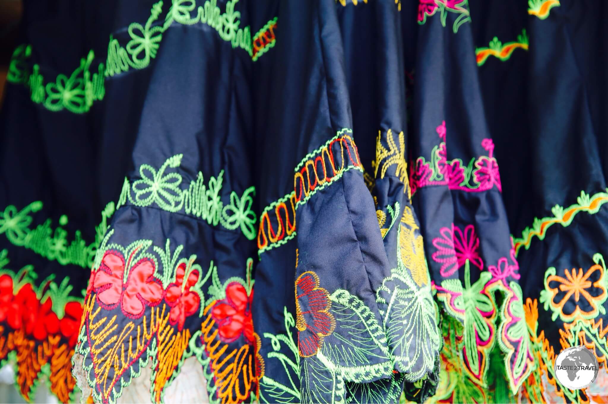
The terrestrial attractions on Chuuk are limited, which isn’t a problem since most visitors are here for the underwater attractions. A walk along the main street will hold your interest for about 1 hour, during which time you can check out the shops, purchase super cheap local coconut oil (US$2 for a one litre PET bottle) or buy some fresh fruit. All Chuukese ladies wear the traditional Chuukese dress, which are sold in shops along the main street.
A neighbourhood on Weno island flooded after a recent storm.
Outside of town there are some walking trails which will take you up onto the surrounding hilltops. The trails are rough and poorly marked so a local guide is recommended. You can also visit neighbouring atolls for the day, however there are no services or facilities available on these.
A bottle of locally made coconut oil costs US$2 in Weno.
Accommodation
United Airlines’ UA154 on the runway at Chuuk International Airport with my hotel, Hotel Level 5, visible in the background.
There are just a few hotels on Weno, but these are more than enough to cater to the small trickle of travellers who make it here.
Directly opposite the airport is the Level 5 Hotel. I stayed here and I’m glad I did. I visited every hotel on the island and, in my opinion, this is the best. The spacious, comfortable rooms are newly renovated and the ground floor features the best café/ restaurant on the island.
The hotel also features the only elevator on Chuuk but interestingly the locals avoid it – they are either afraid of it or just not use to using one. When it comes time to leave, the airport is across the road. Despite its close proximity to the airport, the hotel offers a shuttle service and will be waiting to pick you up when you arrive – the shortest shuttle connection I’ve ever had.
Also within walking distance of the airport is the High Tide Hotel. This family-run hotel offers older style rooms and a good restaurant, which serves reasonably priced, generous portions of local seafood.
The Truk Stop Hotel at Chuuk, one of the few hotels on Chuuk.
For divers who prefer to stay somewhere with an onsite dive shop, there are two options:
The closest to downtown is Truk Stop Hotel. This is a family run hotel, whose American owner has been a key proponent of the local tourism (i.e. diving) industry for many years. The 23 hotel rooms are old and dated but a new wing was under construction during my visit (Feb 2017). Besides being home to just one of two dive shops on the island, the hotel offers a restaurant and two bars. If you wish to socialise, this is the only real option on the island.
The other option, Blue Lagoon Resort, is the most upmarket property on the island and the most expensive, although rooms here are in need of renovation. The resort dive shop was the first established on the island by local diving pioneer Kimiuo Aisek. The resort is located 8 km south of the airport away from the downtown area. The shared ‘town’ taxis (which regularly shuttle along the main road) do not travel this far south (the road is in terrible condition) so you will need to hire a taxi to reach the resort.
Eating Out
Options are limited, with the few hotels providing the only restaurants. My favourite place (and the ‘go to’ place for the best coffee) is the restaurant/ café at the Level 5 Hotel. This is a sister operation of a café in Honolulu and features the only espresso machine on the island. The café is open for breakfast, lunch and dinner and is a popular spot for those waiting for the (often delayed) United Airlines Island Hopper.
The restaurant at Truk Stop Hotel is very popular, with a good selection of food and drinks and always a good ambience. There’s a restaurant at the Blue Lagoon Resort (the only dining option at this end of the island) and at High Tide Hotel.
Visa Requirements
Chuuk Passport Stamps.
Some nationalities require visas for the Federated States ofMicronesia – check your visa requirements prior to arrival.
Getting There
United Airlines’ UA154 departing from Chuuk.
By Air
The terminal building at Chuuk International airport.
Flights to Chuuk arrive at Chuuk International Airport on the island of Weno. This sleepy airport is a short walk from the downtown area and several hotels. For more details on UA154 and Chuuk Airport, refer to my Central Pacific Island Hopping blog.
United Airlines’ UA154 departing from Chuuk.
The following airlines provide connections to/from Chuuk:
Air Niugini – flights to Pohnpei and Port Moresby (with connections onto Australia, Singapore and Manila).
United Airlines – flights to Guam, Honolulu, Kosrae, Kwajalein, Majuro, Pohnpei
All freight in Micronesia arrives courtesy of two companies – Matson Shipping Line or Asia Pacific Airlines (seen here at Chuuk Airport).
Getting Around
Bus
There are no public buses on Weno.
Taxi
Taxi’s on Weno cost between $1 to $2 depending on distance travelled. The distance from the airport to the Blue Lagoon resort (one end of the island to the other) is about 5 miles.
Car
The Level 5 Hotel offers expensive (US$70 per day) car rental but there’s no need to hire a car on an island with one short road, which is covered by frequent (and cheap) shared taxis.
After an hour of climbing in the sweltering, humid, heat – under the direct glare of the tropical sun – I’d finally made it to the summit of Sokehs ridge – a point marked by a very unceremonious communications tower.
View of the fringing reef that protects Pohnpei from Sokehs Ridge.
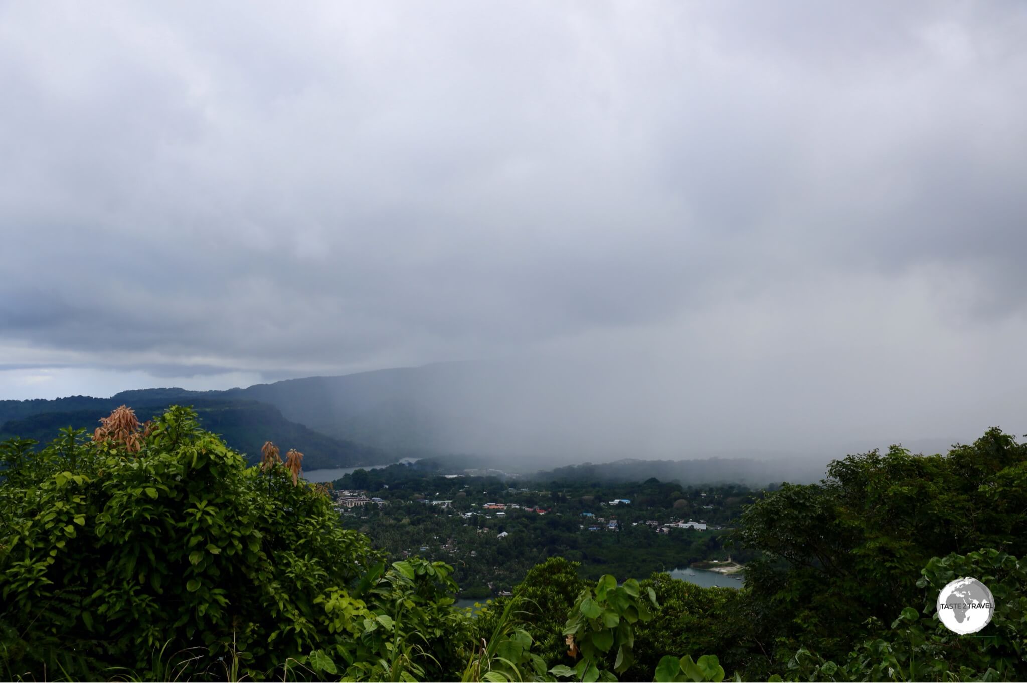
From here I had a panoramic view of the northern tip of Pohnpei. In the valley below, the capital – Kolonia – was slowly being enveloped by a fierce tropical storm. Like a deer staring into the headlights, I stood and watched as the storm clouds slowly rolled across the landscape towards me.
A storm moving over Kolonia, the capital of Pohnpei, as seen from Sokehs ridge.
Then the inevitable happened – first one drop, then another, then the heaven’s opened up – but after the long, hot climb, all that cool water was so refreshing. I had found a sheltered place for my camera bag, but as for me – I stood out in the open with my arms and mouth open, getting soaked and slurping the tropical rainwater.
After the storm cleared, I had a magnificent view of Sokehs rock, a 100m high exposed basalt volcanic plug that shoots up out of the lush green landscape and is the most striking feature of Pohnpei’s topography. The island gets it’s name from this feature – “upon (pohn) a stone altar (pei)”.
Just a few days earlier I had had a bird’s eye view of the rock from my seat (32D) on board United Airlines’ Island Hopper (UA154) as we passed by the rock on our final approach to Pohnpei airport.
Nature abounds on Pohnpei – the ‘garden of Micronesia’.
Pohnpei (formerly ‘Ponape’) is one of the four states, which comprise theFederated States of Micronesia(FSM) and bills itself as ‘the Garden of Micronesia‘. You don’t need to spend much time on the island to realise this is not some over-hyped slogan created by local tourism officials.
Due to it being one of the wettest places on earth (annual recorded rainfall exceeding 76-cm/ 300-in), Pohnpei is full of lush, tropical, vegetation, a place where colourful, flowering plants frame every view. Visiting Pohnpei is like holidaying on an over-sized botanical garden – it’s that beautiful.
These handmade decorations are made by a woman’s coop in Kolonia.
The island is surrounded by a fringing reef, which provides protection and so much more for the island. Surfing is popular on the reef and more and more intrepid surfers are finding their way to this remote island to ride the famed waves of Palikir pass. The reef also offers diving, snorkeling and fishing opportunities.
The view of the fringing reef which surrounds Pohnpei from my seat on United Airlines’ Island Hopper.
Almost all services on Pohnpei are located in the capital of Kolonia so this is the place to base yourself during your visit. The town has a population of 6,000 (almost the entire population of neighbouring Kosrae) so if you are coming from quiet Kosrae you will notice the hustle and bustle. There’s one road which circumnavigates the island and provides access to all the sights of interest.
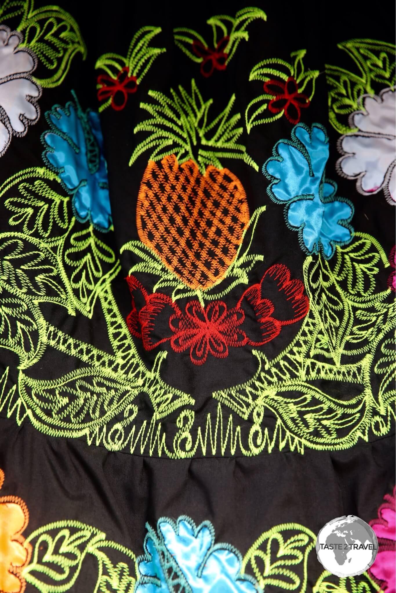
Traditional embroidered ‘Pohnpei’ dresses. These are worn by almost every girl on the island.
The island has many natural attractions and many good restaurants and bars in Kolonia – enough to keep you busy for a few days.
Very cute! Flower Girl on Pohnpei.
Location
Federated States of Micronesia
Pohnpei is located in the middle of nowhere, midway between Hawaii and The Philippines. It’s part of the Federated States of Micronesia, being located at the eastern end of the Caroline Islands group.
Distance marker in Kolonia – everywhere is a long way from Pohnpei.
The island is volcanic and mountainous, with those mountains being covered in verdant rainforests and cascading waterfalls.
History
Archaeologists estimate that people came to Pohnpei between 2,000 and 3,000 years ago from Southeast Asia. The first European contact was with the Spanish in 1529.
The Spanish made the island part of the Spanish East Indies (along with The Philippines) and founded the city of Santiago de la Ascension. This city was later renamed Colonia (Spanish for colony) which was in turn renamed to today’s Kolonia.
The elusive Pohnpei Lorikeet seen on Sokehs ridge.
Rule of the island passed from Spain to Germany to Japan then (following the defeat of the Japanese during WWII) to the United States. The US administered the island (under UN auspices) as part of the Trust Territory of the Pacific Islands until 1986 at which point the island obtained independence as one of four states (along with Yap, Chuuk, and Kosrae) comprising The Federated States of Micronesia.
Shipping containers on Pohnpei are used in creative ways.
The standout historical feature of the island (and it’s top attraction) is the impressive ancient ruins of Nan Madol – the most impressive ruins complex in the Pacific. For more on Nan Madol, refer to the sightseeing section below.
Flag
The flag of Micronesia.
The flag of the Federated States of Micronesia (FSM) was adopted on 30 November 1978. The blue field represents the Pacific Ocean, while the four stars represent the states in the federation: Chuuk, Pohnpei, Kosrae and Yap.
Currency
The US Dollar.
In centuries past, the islands of FSM, notably Yap, used stone currency, which was referred to as “Rai” or “Fei”. Impossibly large and too heavy to carry, this traditional currency, which seemed to be more suited to a giant, was crafted from Calcite, which was carved into doughnut-shaped disks.
Yap Stone Currency. Source: https://medium.com/the-mission/the-island-of-yap-and-the-idea-of-money-9f570421d854
Today, along with all former members of the Trust Territory of the Pacific Islands, the official currency of FSM is the US dollar which is so much easier to carry.
Betel-Nut
Betel-Nut for sale at a shop in Kolonia.
Betel nut is a popular stimulant on Pohnpei and can be found in shops and markets across the island.
A form of local chewing tobacco, the betel nut is split open and powdered with lime, wrapped with pepper plant leaf and then placed in the mouth where it is chewed. Am indicator of beetle nut use is an orange mouth a result of chewing
It’s a practice found throughout the FSM, but Pohnpei and Yap have it in abundance and it is a relatively important exported cash-crop for the local economies.
Sights
With the exception of Nan Madol and a few colonial relics scattered around Kolonia, most sights on the island are of the natural kind. The other joy of travelling on Pohnpei are the locals. Without exception, they are friendly, warm and welcoming.
Traditional embroidered ‘Pohnpei’ dresses.
Due to the complete lack of transport on the island you will need to hire a car if you wish to explore beyond Kolonia (you should definitely get out of town). There is one ring road around the island which is 130-km in length. You can cover all sights in one full day.
There are very few petrol stations outside of Kolonia so better to have a full tank before leaving town. I’ve covered the sights as you will approach them if you travel in an anti-clockwise direction around the island, with Kolonia at the 12 o’clock position.
No shortage of smiles on Pohnpei.
Kolonia
With a population of 6,000, Kolonia is the capital and main city of Pohnpei. With a few roads, a handful of shops and all of the (limited) tourist services on the island, the town is the centre of action but very quiet and relaxed. There are few sights (a German clock tower and a Spanish stone wall) but it is a pleasant place to spend an hour or two exploring.
Sokehs Ridge
Sokehs Rock, a gigantic exposed basalt volcanic plug is the most striking feature of Pohnpei’s topography.
Overlooking Kolonia is the impressive Sokehs Ridge. The hike up to the top of the ridge offers a good workout and is best done early morning or late afternoon. If you have a car you can park it in the car park of the police station at the start of the tarmac road which leads part way up the ridge.
Eventually the tarmac road becomes a dirt road (still passable in a 4WD) before reaching a level ridge from which point you must walk. This is the start of a very steep trail which climbs up to the ridge from where you will have the most amazing views of Kolonia and the Pacific. This is a long, sweaty slog on a remote ridge so ensure you are carrying ample water.
Japanese war memorial on Sokeh’s ridge.
Once you reach the top of the ridge (you’ll probably have the ridge to yourself) you can follow trails which take you to Japanese WWII ruins and eventually onto the communications tower from where you have panoramic views of the northern side of the island.
Palikir
The FSM capital, Palikir, is located in a small administrative enclave on a side road of Pohnpei.
The capital is a tiny planned enclave of little consequence, with uniformly designed buildings arranged around a small park area. I visited on a weekend and had the place to myself – there was no sign of life – no cafes, restaurants or services of any kind.
Nan Madol
The impressive walls of Nan Madol.
Located in a remote coastal setting, about 90 minutes south of Kolonia (along the east coast), Nan Madol is the one ‘must see’ attraction on Pohnpei. If this was anywhere else in the world you would be lining up to buy a ticket and jostling with hoards of tourists who would be constantly photo-bombing your shots.
But here – on remote Pohnpei – you will probably have the sight to yourself. The ruined city is very impressive and extensive, but the addition of being in such a remote place makes a visit a truly unique experience.
You reach the ruins after a 10 minute walk along a track, which leads you through a steamy mangrove forest. You have to pay three different property owners an ‘access’ fee along the way, the last payment (US$5) is to the man who transports you across a narrow channel in his kayak, dropping you at the main entrance to the ruins.
A diagram of the sprawling Nan Madol complex.
It is believed Nan Madol was constructed by the same people who built the Leluh site on Kosrae (for more on that refer to my Kosrae blog). The city was constructed in a lagoon and consists of a series of small artificial islands (nearly 100) spread over an area of 1.5 km by 0.5 km.
There is no public transport to Nan Madol, you can reach the ruins either by car or by joining a tour.
Kepirohi Waterfall
Kepirohi waterfall is located a short drive from Nan Madol.
Located north of the Nan Madol turnoff (look for the roadside sign) is this beautiful Basalt waterfall. To access the falls, you first pay an ‘access’ fee to the property owner who occupies a shed by the main road.
You then have a 5 minute walk along a lush, forested trail to the falls. This is a great place to cool off after a sweaty day of sightseeing so don’t forget your swimmers.
Accommodation
7-stars Inn
Like everything else, Kolonia is where it’s at in terms of accommodation options on Pohnpei. I stayed in the conveniently located 7-stars Inn, a short walk from the downtown area. Rooms here are spacious and comfortable and include free Wi-Fi.
One of the more popular restaurants in town, The Riverside Restaurant, is located in the basement of the hotel, along with one of the only sports bars on the island. The hotel provides a free airport shuttle service.
Joy Hotel
Another mid-range option in downtown Kolonia is the Joy Hotel which is run by a Japanese family.
The Suzuki family offers basic rooms and a restaurant which, naturally, specialises in Japanese cuisine.
Mangrove Bay Hotel
Another popular (but more expensive) option is the Mangrove Bay hotel. The hotel is a little further from downtown Kolonia but is more relaxing and includes a PADI dive shop and boat transport for surfers wishing to catch a ride to Palikir pass. For all hotels it’s best to book using booking.com
Eating Out
The fiery Pohnpei pepper is grown in the south of the island at a garden owned by Sei.
There are plenty of wonderful restaurants, bars and cafes on Pohnpei – all located in Kolonia.
One place which deserves a special mention is the friendly, Japanese owned Sei Pepper shop. Mr Sei grows his pepper on a farm located on the southern side of Pohnpei, however the only place to buy his pepper is from his shop on the main street of Kolonia (located a short walk from the 7-stars Inn).
The delicious organic Pohnpei coffee available at Sei.
The cafe is a meeting place for the local Japanese community who come together to sip the local Pohnpei coffee, which has a very bold, robust flavour. Attached to the cafe is a curry house where you can sample tasty curries made with Pohnpei pepper and other locally grown spices.
The amazing pepper donuts at Sei Cafe – a fiery experience!
A specialty of the restaurant are the fiery Pohnpei Pepper Donuts, which you can wash down with a cup of Pohnpei coffee.
The Japanese Community in Micronesia
The Sei cafe serves as a meeting place for the Japanese community on Pohnpei.
Japan has enjoyed close ties with Micronesia throughout history, and, at the time of WWII in 1942, there were 96,000 Japanese who called Micronesia home.
After the war, the Japanese population were repatriated back to Japan, however most people of mixed Japanese–Micronesian ethnicity remained in the islands and constituted a substantial percentage in the islands’ population. They became assimilated with the Micronesians, and in all official census they are identified by their Micronesian heritage.
If you’re interested to learn more about the Japanese connection to Micronesia, the Sei cafe in Kolonia is a good place to start your enquiries.
There are numerous restaurants in Kolonia – my favourite was the restaurant at the Joy Hotel. This restaurant serves amazing Japanese food (including the freshest sushi and sashimi) at very reasonable prices. All ingredients were fresh and nicely presented. I ate here more than once and would especially recommend ordering the ‘Joy special’.
For more upscale dining, there is the waterfront restaurant at the Mangrove Bay hotel.
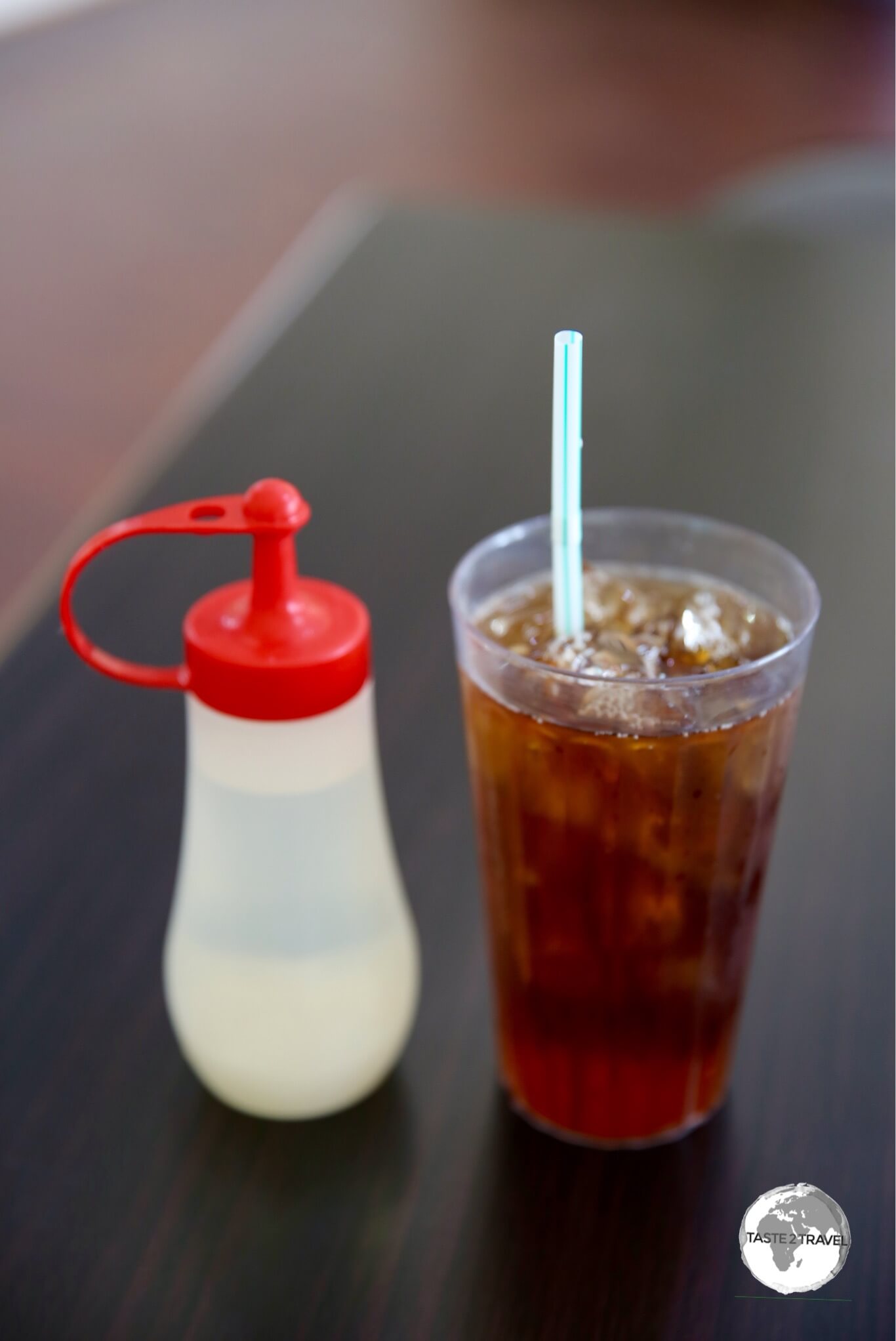
A refreshing drink throughout FSM is iced tea – always made from fresh black tea, which is served in a glass with lots of cool ice. The sweetener (always simple syrup) is served on the side so you can decide on your level of sweetness.
Iced Tea served with simple syrup on the side in a cafe in Kolonia.
Visa Requirements
Some nationalities require visas for the Micronesia– check your visa requirements prior to arrival.
Getting There
Boarding United Airlines’ Island Hopper (UA154) at Pohnpei airport.
If you are seated on the right side of the plane you will have a spectacular view of Sokehs Ridge on the final approach. For more on Pohnpei airport, refer to my Central Pacific Island Hopping blog.
Like many islands within the region, commercial air service is rather limited due to small population and tourist traffic.
The following airlines provide connections to/from Pohnpei (Updated: August 2024):
An especially useful connection, for those already travelling in the South Pacific, is the airline’s regular flight from Nadi (Fiji) which offers connections to countries in the Central Pacific.
There are very few rental companies on Pohnpei but you will need a car if you wish to explore on your own.
I hired a car through my hotel at US$65 a day.
Although expensive – I had a very nice, brand new, KIA Sportage – perfect for the bumpy, potholed roads outside of Kolonia. I felt like a ‘boss’ cruising around in my SUV and definitely didn’t want to give it up but United couldn’t fit it on the island hopper flight. :-))
As mentioned previously, fuel supply outside of Kolonia is limited so best to ensure you have a full tank prior to leaving town. If you do get stuck you can find roadside stalls selling fuel by the gallon ($5/ gallon).
I saw just one petrol station outside of Kolonia. Elsewhere you can purchase fuel from small roadside stalls.
Test your knowledge with this Caribbean quiz from taste2travel
How well will you score? Your result will be displayed at the bottom of the quiz – will you get to see the legendary Marco Polo?
Good luck!
01. Which is the capital of St. Lucia?
Correct!Wrong!
02. On which Caribbean island would you be if you were laying on the beach at Boca Chica?
Correct!Wrong!
03. How many countries use the Eastern Caribbean Dollar (EC$)?
Correct!Wrong!
04. Windwardside is a town located on which Dutch Territory?
Correct!Wrong!
05. Which country is the only source of the gemstone 'Larimar'?
Correct!Wrong!
06. Which is the capital of Cuba?
Correct!Wrong!
07. Which is the capital of Turks & Caicos?
Correct!Wrong!
08. Which one of the following is NOT a British Territory?
Correct!Wrong!
09. Which Caribbean island claims to be the birthplace of the Piña Colada?
Correct!Wrong!
10. On which island would you be if you had just landed at Princess Juliana International Airport?
Correct!Wrong!
11. This island used to be a Swedish colony but is now a French Territory.
Correct!Wrong!
12. The island of St. Eustatius (Statia) is a territory of which country?
Correct!Wrong!
13. Nassau is the capital of which country?
Correct!Wrong!
14. Which is the capital of Puerto Rico?
Correct!Wrong!
15. Coffee is grown on the slopes of the Blue Mountains in which country?
Correct!Wrong!
16. Which is the capital of Anguilla?
Correct!Wrong!
17. Which country would you be visiting if you were snorkeling on Tobago Cay?
Correct!Wrong!
18. On which island would you be if you were visiting The Pitch Lake (the largest natural deposit of asphalt in the world).
Correct!Wrong!
19. Which country is a member of CARICOM (Caribbean Community)?
Correct!Wrong!
20. Road Town is the capital of which British territory?
Correct!Wrong!
Travel Quiz 02: Caribbean
Sorry! You scored less than 50%. Why not try one of the other taste2travel trivia quizzes?
You scored less than 75%! Why not try one of the other taste2travel trivia quizzes?
Very Good - a gold star performance! Why not try one of the other taste2travel trivia quizzes?
Excellent result! You're a modern day Marco Polo. Why not try one of the other taste2travel trivia quizzes?
Share your Results:
Travel Quizzes on taste2travel
Welcome to taste2travel!
My name is Darren McLean, I’m the owner of taste2travel and I love travel trivia and I certainly enjoy creating travel quizzes.
There are a total of 80 different travel quizzes on taste2travel, with each quiz containing 20 questions.
That’s a total of 1,600 trivia questions waiting to challenge you.
You’ll find a range of quizzes covering such topics as:
Currencies
Flags
Capital Cities
UNESCO World Heritage Sites
World Museums
Map Quizzes
Continent-specific Quizzes
World Islands
Landlocked Countries and much more!
Don’t forget to share these quizzes with your family, friends and community using the social media buttons at the top of the quiz.
Apart from excellent travel quizzes, you’ll also find other outstanding content on taste2travel – such as travel guides, photo galleries and feature articles which provide tips on booking cheap flights and much more.
Test your knowledge with this world travel quiz from taste2travel.
How well will you score? Your result will be displayed at the bottom of the quiz – will you get to see the legendary Marco Polo?
Good luck!
01. What's the capital of Barbados?
Correct!Wrong!
02. In terms of area, what's the smallest Republic on the planet?
Correct!Wrong!
03. What's the capital of North Korea?
Correct!Wrong!
04. In terms of area, which is the 2nd largest country in South America?
Correct!Wrong!
05. What's the name of the currency of Turkey?
Correct!Wrong!
06. The Hindu Kush mountain range can be found in which country?
Correct!Wrong!
07. Which country is home to the Salar de Uyuni, the World's largest salt plain?
Correct!Wrong!
08. Which country would you be in if you were visiting the Galápagos Islands?
Correct!Wrong!
09. Which country shares a land border with Papua New Guinea?
Correct!Wrong!
10. How many countries does China share a border with?
Correct!Wrong!
11. What's the capital of Guyana?
Correct!Wrong!
12. The world's 2nd longest river flows through which country?
Correct!Wrong!
13. Which country would you be in if you were visiting the ancient city of Samarkand?
Correct!Wrong!
14. What's the name of the highest mountain in New Zealand?
Correct!Wrong!
15. What's the capital of Tajikistan?
Correct!Wrong!
16. Which is the most populous city in Ecuador?
Correct!Wrong!
17. Which country would you be in if you were watching the sunset from the capital of Port-au-Spain?
Correct!Wrong!
18. Cayenne is the capital of which territory?
Correct!Wrong!
19. Which country is considered an 'atoll' nation?
Correct!Wrong!
20. In which US city would you find Anish Kapoor's 'The Bean'?
Correct!Wrong!
Travel Quiz 01: Worldwide
Sorry! You scored less than 50%. Why not try one of the other taste2travel trivia quizzes?
You scored less than 75%! Why not try one of the other taste2travel trivia quizzes?
Very Good - a gold star performance! Why not try one of the other taste2travel trivia quizzes?
Excellent result! You're a modern day Marco Polo. Why not try one of the other taste2travel trivia quizzes?
Share your Results:
Travel Quizzes on taste2travel
Welcome to taste2travel!
My name is Darren McLean, I’m the owner of taste2travel and I love travel trivia and I certainly enjoy creating travel quizzes.
There are a total of 80 different travel quizzes on taste2travel, with each quiz containing 20 questions.
That’s a total of 1,600 trivia questions waiting to challenge you.
You’ll find a range of quizzes covering such topics as:
Currencies
Flags
Capital Cities
UNESCO World Heritage Sites
World Museums
Map Quizzes
Continent-specific Quizzes
World Islands
Landlocked Countries and much more!
Don’t forget to share these quizzes with your family, friends and community using the social media buttons at the top of the quiz.
Apart from excellent travel quizzes, you’ll also find other outstanding content on taste2travel – such as travel guides, photo galleries and feature articles which provide tips on booking cheap flights and much more.
Welcome to the taste2travel North Korea Travel Guide!
Date Visited: May 2017
Introduction
It’s been a few weeks since I departed North Korea and in that time I have been trying to digest all that I felt and experienced. Only now do I feel I’ve reached a point where I can write about my experience. North Korea (or DPRK – Democratic People’s Republic of Korea) was country #170 for me and to say it is unlike anywhere else that I’ve travelled is an understatement.
An early morning view, from my room at the Yanggakdo International Hotel, of the Taedong River, which passes through downtown Pyongyang.
DPRK is not a regular holiday destination – actually you would never come here on a regular holiday. During my eight-day trip, I felt emotionally overwhelmed, confused and surprised.
Traffic policewoman in Pyongyang. Most drivers are male so the state employs young, attractive female officers as they believe the male drivers pay them more respect.
What I experienced certainly challenged my pre-conceptions about the country.
Just as the North Koreans face a lifetime of propaganda through their government-controlled media outlets (all four of them), so too, we in the west are exposed to a very biased, exaggerated, negative view of the DPRK – the more negative and sensational – the better.
Video:
A traffic officer directing traffic near Kim Il-Sung square in downtown Pyongyang.
North Korean propaganda posters on sale at the Foreign Language Bookshop in Pyongyang.
Whenever a foreigner is arrested and detained in North Korea, it makes headline news around the world; foreigners are arrested and detained everyday in different countries for breaking the law but we never hear about those arrests. It’s only a headline because we view North Korea with such suspicion and mistrust, all of which is borne from complete ignorance and misunderstanding.
An idealised image of the former DPRK leaders, Kim Il-sung (left) and his son, Kim Jong-il.
Propaganda works both ways and during our trip we were shepherded by our North Korean government guide from one dazzling monumental showpiece to another. For eight days, we visited one incredible museum after another and were led from a ‘model school’ to a ‘model farm’ to ‘model factories’.
The Legend of Chollima
The legendary winged horse Chollima was said to have been able to gallop 400 km in one day, and appears in a number of East Asian traditions. In the DPRK, the name is synonymous with speed and efficiency.
The legendary winged horse Chollima featured on a propaganda poster.
Whilst the government does it’s best to ensure tourists see only the biggest, brightest and the best that the country has to offer, there are plenty of cracks in the shiny veneer, which offer a glimpse of an otherwise less-than-model reality.
Newlyweds visiting a park near Pyongyang.
Like everywhere else, there are plenty of social issues affecting the DPRK, but it’s not all negative, as we are constantly led to believe in the West.
Propaganda posters are available from the Foreign Language Bookshop in Pyongyang.
If you’ve ever had an inclination to travel to North Korea, then I would encourage you to do so. While the country is viewed in the West as an evil pariah state, ruled by extreme ideological policies (which I in no way support), there’s no greater way to gain a better understanding and put things into context than through your own first-hand travel experience.
Organising a trip is easy and straight-forward (see next section). Once there, you too might find your pre-conceptions challenged. If the hounds of war were replaced by tourist hoards, relations between the DPRK and the rest of the world could be very different.
A young boy enjoying the Pyongyang zoo.
Location
North Korea
North Korea is located in East Asia on the northern half of the Korean Peninsula. It shares a land border with China (separated by the Yalu river), Russia and South Korea (separated by the heavily fortified Korean Demilitarised Zone –DMZ). The country is largely mountainous (70%) with heavily farmed coastal plains.
Rice seedlings being harvested near Nampo. All arable land in North Korea is intensely farmed – mostly by hand.
Getting to North Korea
There are no independent travel options for North Korea – you can only travel here on a fully-escorted tour. I chose to travel with Young Pioneer Tours – a China based travel company established by some travel-loving expats to cater for people who would not usually do “group tours”.
Propaganda posters are a common sight throughout North Korea.
YPT specialises in budget travel for back-packers and older flash-packers, offering a variety of itineraries to the DPRK. YPT is always creating new and interesting tours, from the Pyongyang Marathon tour to Farming tours and even a Scuba Diving tour.
Tour prices include transport, accommodation, all meals plus the services of a YPT guide and your DPRK tour crew. YPT also take care of the DPRK visa application. It’s completely hassle free, with everything being arranged online.
One thing I would not recommend are their is short four day trips. People who do these trips often regret it because they only spend two days in DPRK with the other two days involving train travel between Pyongyang and Beijing.
How often will you visit a country like North Korea?
DPRK is a fascinating destination which deserves more than a couple of days of your time, hence it’s better to book a longer trip.
I travelled with YPT for a total of ten days – two days in transit from Beijing to Pyongyang and eight days inside the DPRK. I felt eight days was the optimum amount of time to spend on a tour where you have little freedom of movement.
A cyclist in Nampo passes in front of a giant propaganda image.
Beijing to Dandong
On day one of the tour, everyone met at the assigned meeting point in a hotel adjacent to the Beijing Railway station. Here we received a tour briefing from the YPT guides who would accompany us. The first part of the journey to North Korea was on a fast bullet train that departed from Beijing Railway station at 17:15 for the northern city of Shenyang. The 780 km journey took six hours.
From Shenyang, a bus drove us along a brand new six lane expressway to Dandong – completing the 252 km journey in just over two hours. All of this would be a stark contrast to the slow journeys we would make in the following week on the crumbling, archaic DPRK infrastructure.
A DPRK flag flying outside the Science & Technology centre in Pyongyang.
We arrived in Dandong at 2 am where we checked into our hotel with alarms set for an early morning breakfast of Rice Porridge and Tofu at 7 am.
Our first view of North Korea – the spotlessly clean promenade on the banks of the Yalu river – opposite Dandong, China.
After breakfast on day two, our group was led though the streets of Dandong to a very nondescript Chinese immigration building on the banks of the Yalu river. Here, we cleared immigration and boarded a North Korean bus for the short ride across the Sino-Korean Friendship Bridgeto the North Korean immigration post.
Border Crossing
Our first view of North Korea – the banks of the Yalu river with the Chinese city of Dandong in the background.
In terms of modernisation and development, there can be no greater contrast than that which exists today between booming China and the slumbering DPRK.
In China, we sped through the countryside on newly built, impressive infrastructure, whilst in North Korea we trundled along on rickety, broken infrastructure. The two countries are not just world’s apart, they exist in different ages – one modern and one medieval.
The stark contrasts are unbelievable and confounding at times and nowhere more so than on the banks of the Yalu river, which forms the border between China and North Korea.
The river separates the bustling Chinese city of Dandong from the quiet, sleepy North Korean city of Sinuiju. Access between the two is via the restricted Sino-Korean Friendship Bridge, which has a single lane for traffic and a rail line.
A North Korean tour boat on the Yalu river passing in front of waving Chinese tourists on the Broken Bridge in Dandong.
Just to the south of the bridge, is an old iron truss bridge, which was built by the Japanese during their period of occupation. The bridge was bombed and destroyed by the Americans during the Korean war and never repaired by the North Koreans so that the U.S. could not deny they destroyed it.
Known today as the Broken Bridge, it spans 3/4 of the river from the Chinese side. Tourists can walk out on the bridge to a viewing platform where they can almost reach out and touch North Korea. North Korean tour boats pass directly below the viewing platform although the North Koreans are not free to travel to the Chinese side of the river.
Entering North Korea
Surprisingly straight-forward!
My DPRK loose-leaf tourist visa, which is retained by immigration upon departure.
After crossing the Sino-Korean Friendship Bridge, you reach the North Korean immigration post, where the first thing you notice are giant portraits of the former leaders – President Kim Il–sungand General Kim Jong–ilfixed to the exterior wall of the Customs building. These are the first of many images of the leaders which you see while travelling around North Korea, where the leaders are treated as gods.
It’s interesting to note that there are no images of the current leader, Marshall Kim Jong-un displayed in public. Our guide explained this was due to the fact that the leaders are very humble people and as such their images are only displayed when they have passed away.
Although current leader Kim Jong-un’s image is not displayed publicly, there are photos and paintings of him featured in galleries. Notice the children behind him are crying tears of joy.
The immigration process was very straight-forward and hassle free. We handed over our passports, a completed Arrivals Form and our loose-leaf visa. Our passports and visa were retained by our guides throughout the tour. On the last day everything was returned to us prior to boarding the train to Dandong. The loose-leaf visa is retained when you exit the country, so there is no evidence in your passport that you ever visited DPRK – except for the Chinese stamps on the Dandong border.
Video:
A view of the North Korean countryside from the train which connects Sinŭiju (on the Chinese border) to Pyongyang.
The customs process was equally hassle-free. The only difference here, was that all printed publications had to be handed in for review (you can not bring any religious texts/ books or guidebooks which mention North or South Korea into the country – this is because the North Koreans believe there is only ‘one’ Korea).
We were also required to hand over all electronic devices. A count/ inventory was made of all devices carried into the country by the group, which had to tally with the number of devices taken out of the country. It’s forbidden to leave any electronic devices in the country.
Touring North Korea
Artwork depicting Kim Il-Sung and Kim Jong-Il on Mount Paektu, which has always been considered sacred by Koreans throughout history.
There are currently five different state-run tour companies offering tours of North Korea. You can not visit the country unless you join a tour with one of these companies. Like everything else in North Korea, they are all government owned but compete against each other. YPT uses the services of the Korea International Travel Company (KITC).
Our KITC tour guide (left) and our minder – Mrs Park.
Currently about 4,000 to 6,000 Western tourists visit North Koreaeach year, with everyone staying in the same few hotels, following the same sightseeing circuit and eating in the same restaurants. After a while, you start to notice the same familiar faces turning up in different places.
Ryomyong Street is the third prestige project in as many years in Pyongyang, and by far the largest, offering thousands of new apartments for party elites.
While on tour, all groups are assigned a Driver, Guide and a Minder who chaperone you the entire time.
The Guide is always at the front of the group delivering a well rehearsed commentary and is the unlucky one who gets to answer all the inevitably sticky questions.
The Minder is always at the rear – keeping a close eye on everyone. If you photograph the wrong thing, the Minder is the one who will ask you to erase the photo and she’ll check to ensure you do.
You will spend most of your day on the bus travelling to a handful of selected sights, stopping for meals at government-run restaurants, where you are fed an amazing bounty of local food (see Eating Out below). Evenings are spent in large hotel complexes, which you are not allowed to leave (see Accommodation below).
There are certain subjects you can not photograph in North Korea – the most obvious being anything to do with the military. Currently 25% of the population (6,000,000 recruits), are actively serving in the armed forces so it’s hard to take a photo without getting someone in uniform in the frame.
The one exception to this rule is the Demilitarised Zone (DMZ), where you are allowed to photograph the soldiers. All construction in DPRK is performed by soldiers – often in record time using whole battalions. For this reason you are not allowed to photograph construction sites.
North Korean soldiers visiting a statue of Kim Il-Sung in a park on the outskirts of Pyongyang.
While in DPRK, you give up your right to freedom of movement. If you have a problem being told you can not cross to the other side of the street to take a photo then North Korea is not for you. You are thattightly controlled!
As required, newlyweds arrive at a park near Pyongyang to pay their respects at a statue of Kim Il-Sung.
Order & Cleanliness
Despite having a population of 3 million, the streets of Pyongyang are normally very quiet and always perfectly clean.
One thing you notice about North Korea, is how spotlessly clean everything is. Our guide told us that everyone is required to start their day by cleaning up public spaces around their home or office.
Often you’ll see locals sweeping a footpath that is already spotlessly clean. This is a requirement that should be implemented in other countries.
The streets of Pyongyang are lined with huge, anonymous and monotonous apartment buildings.
Strangely you can never find a bin when you need one. One day we passed a large work crew which was carefully arranging the track ballast underneath the railway lines so that not a stone was out of place. This is order and cleanliness on a fanatical scale.
Like all North Koreans, our minder, Mrs Park, was always elegantly dressed and wearing her party badge.
Order and cleanliness extend to all aspects of life. Jeans and other casual ‘western’ clothing are not available in North Korea. While tourists dress casually in t-shirts, shorts and flip-flops, North Koreans dress in smart elegant suits or traditional dresses. There are no messy or alternative hairstyles here as the state has approved 28 different ‘acceptable’ styles.
Many woman in North Korea wear the traditional Choson-ot.
Are North Koreans Brainwashed Robots?
A propaganda-poster-in-a-photo, a Korean girl in the town of Sariwon.
Yes and no – but we are all products of our environment. We are all shaped by the ideology of the society we were brought up in. If you had spent a lifetime under an extremely repressive regime, isolated from the outside world, receiving your information from state-controlled media, then you too would be brainwashed.
North Korean stamps feature striking propaganda artwork and make for interesting souvenirs.
It is clear that North Koreans live in a vacuum and know of no other way of life or no other system of government. They are completely isolated from the outside world and hence totally ignorant so they can make no comparison from which to become despondent.
They believe their world is normal and the outside world is full of aggressive enemies, whose only desire is to destroy North Korea. They are told the leadership will protect them and they honestly believe it.
On their wedding day, all newlyweds are required to pay their respects to the Dear Leader, Kim Il-sung, by laying flowers at their nearest statue.
The North Korean’s have a genuine love for the Kim’s, with everyone wearing a pin badge bearing images of both the former leaders, Kim Il-sung, the founder of DPRK and his son, Kim Jong-Il.
They line up to bow in front of grand statues of the leaders and, on their wedding day, newlyweds lay flowers at the feet of statues of the leaders. The leaders are treated as gods.
Is it a cult? Absolutely! But if it was all you knew and you had no means to find out anything different – how would you be?
Are the North Korean’s robots? At times you see them going about their business in a very robotic way. There were times when I felt I was on the movie set of The Stepford Wives. Often, they don’t look at you – they look through you! They don’t smile, react or respond. They are somehow disengaged.
Like everywhere else in the world, Spring is a popular time for North Koreans to wed.
However – just as you think you can pigeon-hole them, they surprise you. Join them in a bar, in a park, at an amusement park, the zoo or anywhere else where they are celebrating or relaxing and you’ll see a more human side to them.
The party badge, which features images of Kim Il-sung and Kim Jong-il, must be worn by North Korean adults at all times.
Robots they are not!
The North Koreans are friendly, happy, kind, curious and love to party and have fun like anyone else on this planet. In the end, they proved that there are so many commonalities among humanity, no matter where you live or which system of government you live under.
Soldiers salute in front of a statue of Kim Il-sung, in a park on the outskirts of Pyongyang.
Flag
The flag of North Korea.
The national flag of the Democratic People’s Republic of Korea (DPRK) consists of a central red panel, bordered both above and below by a narrow white stripe and a broad blue stripe. The central red panel bears a five-pointed red star within a white circle near the hoist.
DPRK souvenir flags for sale at the Foreign Language bookstore in Pyongyang.
According to the Korean Friendship Association, the red star represents revolutionary traditions and the red panel is indicative of the patriotism and determination of the Korean people. The white stripes symbolize the unity of the Korean nation and its culture. The blue stripes represent the desire to fight for independence, peace, friendship, and international unity.
Our wonderfully unflappable KITC guide, holding my souvenir DPRK flag, at Pyongyang Zoo.
Currency
The front view of my North Korea Won bank notes, which I purchased from the currency exchange counter at Kwanbok department store in Pyongyang.
The official currency of North Korea is the North Korean won which has the international currency code of KPW but isn’t traded, or available, outside of the DPRK.
The won is issued by the Central Bank of the Democratic People’s Republic of Korea, which is based in Pyongyang. Bank notes are issued in denominations of 5-, 10-, 50-, 100-, 200-, 500-, 1,000-, 2,000-, and 5,000- won.
The rear view of my North Korea Won bank notes.
International tourists to DPRK do not normally handle local currency since all expenses are covered as part of the all-inclusive tour and any incidental purchases are paid for using hard currency (USD, EUR) at specially designated ‘foreigner’ stores.
I once tried to purchase a drink from a kiosk on the street in Pyongyang but was told by the minder that tourists weren’t allowed to purchase anything from regular shops.
One exception is offered at the Kwanbok department store in Pyongyang where tourists are allowed to purchase local currency from the exchange counter in order to make purchases from the store.
Sightseeing
Pyongyang
An early morning view, from my hotel room, of the Taedong River in Pyongyang, with the Juche Tower standing sentinel on the right bank.
Each of the eight days was exhausting, with early morning starts and late evening returns. This was no tour for slouches! The tour started in Pyongyang which is an incredibly clean, ordered, pleasant, un-rushed, city of 3-million inhabitants, who live in colourful apartment blocks.
A view of downtown Pyongyang and the Taedong River from my hotel room at the Yanggakdo International Hotel.
There’s no denying that the capital is a big show piece with grand, imposing buildings in the communist style and the tour company ensures you visit as many of these sights as possible.
The tallest skyscraper on Pyongyang’s landmark Mirae Future Scientists street.
Most evenings, we drove down the show-piece Mirae Future Scientists street which is lined with recently completed apartment towers, one of which is 53 levels and was completed in just one year under orders from Kim Jong-un. The tower was opened by the leader on time, but apparently was incomplete and remained empty at the time of our visit.
Video:
Crossing the Taedong river in Pyongyang as seen from our tour bus with commentary provided by our KITC guide.
Due to the absence of cars in the country, the streets of Pyongyang are very quiet, giving the city a relaxed (clean) air. Ample green spaces and the mighty Taedong river (which bisects the city) add to the relaxed ambience.
Kim Il-sung square
A cyclist passes in front of images of the former leaders, Kim Il-Sung and Kim Jong-Il which overlook Kim Il-Sung square.
Kim Il-sung square is the main square of Pyongyang and the place where everything happens, including the big military parades.
The impressive edifice of the State Central Historical museum overlooks Kim Il-sung square in Pyongyang.
Located in the central district of Pyongyang, and named after the country’s founding leader, Kim Il-sung, the square was constructed in 1954 according to a master plan for reconstructing the capital after the destruction of the Korean War.
Named after the country’s founding leader, Kim Il-sung square is the main square in Pyongyang and the venue for the annual military parades.
The square is located at the foot of Namsan Hill, alongside the west bank of the Taedong River, directly opposite the Juche Tower, which lies on the opposite side of the river.
A cyclist on Kim Il-sung square, passing in front of Juche tower.
Foreign Language Bookshop
Hand-painted propaganda posters at the Foreign Language bookstore in downtown Pyongyang.
Located a short walk from the square, this bookshop stocks a range of books about DPRK. If you every wanted to learn more about Juche or the history of the country then you’ll find your reading material here.
Colourful DPRK propaganda postcards, on sale at the Foreign Language Bookshop in Pyongyang.
Books on the DPRK are published in many different languages. The highlight is the selection of hand-painted propaganda posters, which you can purchase.
Juche Tower
Located in downtown Pyongyang, the 170-metre Juche Tower is the world’s tallest stone tower.
Located on the east bank of the Taedong river, directly opposite Kim Il-sung square, Juche Tower is the world’s tallest stone tower, soaring 170 metres above the river.
A view of the colourful apartment blocks of Pyongyang from the top of the Juche tower.
Built from granite blocks in 1995 to celebrate the 50th anniversary of the founding of the Worker’s Party, the tower represents the eternally burning Korean Juche Ideology.
A North Korean family enjoying the panoramic views of Pyongyang from the top of the Juche Tower.
You can pay 5 Euros to take an elevator to the top of the tower from where you have spectacular outdoor panoramic views of Pyongyang. When we visited there was a local family enjoying the views.
Young girls enjoying the views of Pyongyang from the top of the Juche Tower.
Monument to Party Founding
The Monument to Party Founding in Pyongyang.
Located a short distance from the Juche Tower, the Monument to Party Founding was built to symbolise the 50-year anniversary of the founding of the Workers’ Party of Korea.
The monument is rich in symbolism: the hammer, sickle and calligraphy brush symbolise the workers, farmers and intellectuals.
Detail of one of the large bronze panels which surround the Monument to Party Founding in Pyongyang.
The element is 50 metres high to symbolise the 50-year anniversary of the founding of the Workers’ Party of Korea. The number of slabs comprising the belt around the monument and its diameter stand for the date of birth of Kim Jong-il.
An old man relaxing at the Monument to Party Founding in Pyongyang.
Victorious Fatherland Liberation War Museum
Our military guide at the Victorious Fatherland Liberation War Museum in Pyongyang.
The Victorious Fatherland Liberation War Museum is North Korea’s museum dedicated to the Korean War. We were assigned a military guide for our visit with the highlight being a visit to the museum’s prize exhibit – the captured USS Pueblo – the only US Naval Ship still held captive by another country.
A giant tiled-mosaic depicting Victory at the Victorious Fatherland Liberation War Museum in Pyongyang.
This is a huge, sprawling museum, which covers everything from captured US weapons, to locally used weapons, to an amazing diorama (the Battle of Taejon) and so much more.
Mansudae Art Studio
The Mansudae Art Studios in Pyongyang are home to the only equestrian statue of the two former leaders in North Korea.
As you travel around North Korea, you can not help but be impressed by the monumental statues and works of art that adorn every corner of the country.
One of the resident artists at the Mansudae Art Studios in Pyongyang.
Many of these works are created at the vast Mansudae Art Studio in downtown Pyongyang. We had a studio guide assigned to us for a tour where we got to meet some of the resident artists and view new works being created.
A painting at Mansudae Art Studio, showing a wintry Mirae Future Scientists street in Pyongyang.
On the grounds of Mansudae Art Studio is an impressive statue of the two former leaders on horseback – the only one of its kind in North Korea.
A night time view of Mirae Future Scientists street, a showcase neighbourhood in Pyongyang.
Mangyongdae Schoolchildren’s Palace
A girls choir at Mangyongdae Schoolchildren’s Palace performs in front of a propaganda poster.
Kim Il-sung, the first leader of North Korea said “children are the kings of the country” and this remark is repeated throughout the DPRK.
The first schoolchildren’s palace in North Korea was opened in Kaesong, a city located near to the DMZ. Pyongyang has two schoolchildren’s palaces, the Pyongyang School Children’s Palace, located in central district, and the Mangyongdae School Children’s Palace.
Young girls performing at the Mangyongdae Schoolchildren’s Palace in Pyongyang.
This is the largest of the various schoolchildren’s palaces in North Korea. It is managed by the Korea Youth Corps and is dedicated to extra-curricular activities such as singing, dancing, music, handicrafts, computing skills etc.
Nothing like a North Korean rocket launch to enhance a children’s performance at the Mangyongdae Schoolchildren’s Palace in Pyongyang.
Every Tuesday and Thursday evening, the students of the school perform in the 2,000-seat theatre, with most tourists in the capital attending the shows.
Young performers at the Mangyongdae Schoolchildren’s Palace in Pyongyang.
It was all very perfect and you couldn’t help but think there is a lot of pressure on them to perform at the highest possible level.
Girls at the Mangyongdae Schoolchildren’s Palace in Pyongyang, performing a choreographed flight routine in front of a screen displaying North Korean fighter jets.
Korean Film Studio
Touring the Korean Film Studio with our KITC guide (right) and a studio guide.
The Korean Film Studio is located in Hyongjesan district in Pyongyang, which is about 16km outside of the city centre. Founded in 1947, the studio has produced hundreds of films over the years, including several which have won prizes in international film festivals. The studio is the principal producer of films in North Korea.
The Japanese film set at the Korea Film Studios.
While at the studio, we had the chance to visit the various sets (Seoul, China, Japan and Europe) and some of the group dressed up in costumes for photos.
Pyongyang Metro
At a depth of 110 metres, the Pyongyang Metro is the deepest in the world, with extra long escalator rides allowing commuters enough time to sit and relax.
We were fortunate to be able to spend an hour riding to three selected stops on the Pyongyang Metro – Puhung, Yonggwang and Kaeson.
The metro stations were built in different phases, with a first series opening between 1969 and 1972, and later stations opening in 1987. Containing sixteen stops and two lines, the Pyongyang Metro is the deepest metro in the world, lying 110-metres below street level.
The headlight from a locomotive illuminates one of the bronze panels at Puhung station on the Pyongyang metro.
First constructed in the 1960’s, the stations have been built in a grand style, similar to the Moscow metro, with stops featuring elaborate murals, mosaics and sculptures alongside ornate pillars and chandeliers.
Riding the Pyongyang metro during the morning rush hour, in a carriage full North Korean commuters, who were polite, curious and always keen to offer their seats.
Riding the metro allows you to get up close to the North Koreans as they go about their daily commute. It’s a fascinating experience!
A train arrives at Puhung station on the Pyongyang metro, passing in front of a mosaic propaganda mural.
The Pyongyang metro is the cheapest in the world for locals to ride, making it accessible to the entire population. It costs just 5 Korean Won (approximately 0.05 USD) with students receiving free tickets.
One of the key stations on the Pyongyang metro, Puhung station features a mural entitled The Great Leader Kim Il-Sung Among Workers.
The mural of Kim Il-sung at Puhung Station shows the eternal president and loyal workers during the reconstruction of Pyongyang after the Korean war.
A boy waiting for his train at Yonggwang metro station.
Yonggwang (Glory) station, one of the most palatial stations on the network, opened in April 1987. Its chandeliers are designed to recall the fireworks of victory celebrations, while the huge marble columns are sculpted in the shape of victorious flaming torches.
Ornate blown-glass chandeliers line the platform of Yonggwang station on the Pyongyang metro.
Yonggwang station features elaborate mosaics on either side of the platform which depict Pyongyang as seen from the Taedong River.
Metro guard on Yonggwang metro station. The walls of the platform are adorned with 80-metre-long mosaics depicting the Taedong river, which flows through Pyongyang.
Like metro systems in other former-socialist metropolises, such as Moscow, the stations on the Pyongyang metro are ornate works of art, full of impressive mosaics and statues of the dear leader, Kim Il-sung.
A Pyongyang metro guard, standing at attention, on a departing train at Yonggwang metro station.
Kaeson station, which translates as Triumph, features a bronze statue of Kim Il-sung giving his 1945 speech upon returning to Korea from Manchuria.
Kaeson station features a bronze statue of Kim Il-sung giving his 1945 speech upon returning to Korea from Manchuria.
Elsewhere in the station, there are portraits of the leader giving a speech “after he liberated the country through the arduous and bloody anti-Japanese war and returned home in triumph” as explained by our KITC guide.
The North Koreans are incredibly curious, friendly and polite and were always eager to give up their seats for us. Such interactions were a welcome change from the usual ‘rigidness’ of the tour.
The platforms at Puhung station are adorned with 80 metre long tiled mosaics.
The Arch of Triumph
The Arch of Triumph in Pyongyang, which our Korean guide was proud to tell us, is taller than the one in Paris.
From the last stop on our Pyongyang metro tour, Kaeson station, we surfaced next to the 60-metre high Arch of Triumph, the 2nd tallest in the world. Our guide was happy to point out the local Arch is taller than the one in Paris – and was built in just one year (like so many other monuments in DPRK).
The Arch of Triumph is a vast structure, its imposing nature only enhanced by the relative isolation in which it sits, alone on an expansive square surrounded by roads that see little traffic.
The arch was built to celebrate the victory over the Japanese and the return of General Kim Il-sung to his home city.
Pyongyang Circus
Acrobats perform at the Pyongyang circus
Another highlight of the trip was being able to attend a performance of the Pyongyang Circus, for which tickets cost 20 Euros. Thankfully there are no animals in this show, just an amazing line-up of incredible acts by acrobats, a strongman, jugglers, clowns etc.
Kwanbok Department Store
The Kwanbok Department Store is Pyongyang’s largest department store and the one place where tourists can change their hard currency into North Korean Won and shop alongside the locals.
It was wonderful to be able to take a break from the touring and do something regular like shopping and eating in a food court alongside North Korean shoppers. The store includes a food court on the top floor and a hot dog and waffle stand on the ground floor plus a supermarket where you can stock up on cheap but good Soju.
You can view a Japanese news report on the store here.
Taesongsan Fun Fair
North Koreans enjoying a free roller coaster ride at Taesongsan Fun Fair.
Another trip highlight was our visit to the Taesongsan Fun Fairduring the May day public holiday. During the holiday, North Koreans flock to Mt. Taesong for folk games, picnics, relaxing and fun.
Father and son riding the bumper cars at Taesongsan Fun Fair in Pyongyang.
For the first time since entering North Korea, we were allowed to wander freely, without any guides or minders, and mingle with North Koreans who were enjoying the free rides and amusements at the park. In a country where the state provides everything, amusement rides are also free!
A family enjoying the splash boat ride at Taesongsan Fun Fair in Pyongyang
The Taesongsan Fun Fair is an amusement park located in at the foot of Mount Taesong, 12-km from Pyongyang. The park was opened in 1977 by Kim Il-sung and receives more than a million visitors each year.
A young school boy tries his luck at a shooting alley at Taesongsan Fun Fair in Pyongyang.
All rides at the park are free, with a priority line available for tourists should they wish to ride a North Korea roller-coaster. The park is huge and it was packed due to the holiday.
A father and son enjoying a roller coaster ride at Taesongsan Fun Fair on a busy May day public holiday.
There were 1000’s of locals enjoying the rides, picnicking, singing Karaoke, dancing and playing sports (football, volleyball, tug-of-war, sack races).
Pyongyang Central Zoo
The entrance to the Pyongyang Central zoo at Mt. Taedong.
The Korea Central Zoo, also referred to as the Pyongyang Central Zoo, is the national zoo of North Korea. It is located near Mt. Taesong in downtown Pyongyang.
A young girl playing at the Pyongyang Central zoo.
We visited the zoo during the May day public holiday, after our visit to the nearby Mount Taesong Amusement Park.
One of the more unusual exhibits is the ‘dog house’ which houses an impressive collection of dogs, including eight dogs raised by Kim Il-sung and given to the zoo after his death in 1994. A truly unique exhibit!
A father and son at the Pyongyang Central zoo.
All exhibits have a sign, in English, stating that the animal in the cage was kindly donated to the zoo by one of the leaders.
Young cadet girls enjoying their May day holiday at the Pyongyang Central zoo.
The zoo is home to over 5,000 wild animals, comprising a total of 650 species, and covers an area of roughly one square kilometre. It’s a popular place for North Koreans and a great place to see the locals relaxing in an informal, fun atmosphere.
North Koreans are always smartly dressed, even at the zoo.
Moran Hill
A group of friendly and welcoming North Koreans, enjoying a picnic lunch at Moran hill during the May day public holiday.
Located in central Pyongyang, Moranbong or Moran Hill, which translates as Peony hill, is clearly the venue of choice for Pyongyang families when they want to kick-back, relax, picnic, BBQ, dance, sing Karaoke and enjoy themselves.
Moran Hill is the place Pyongyang residents flock to during the May Day holiday to picnic, dance, sing Karaoke or spend time relaxing with their favourite companions.
We visited Moran hill during the May day holiday and were again allowed time to wander and mingle freely with the hordes of North Koreans who had come to the park to relax, picnic, sing karaoke, dance and drink ample Soju (rice wine).
Moran Hill was impossibly crowded on May Day but the North Koreans were out to relax and enjoy celebrating their holiday. They’re always keen to get tourists involved in their activities, whether it’s dancing, karaoke or joining in their picnic.
The North Koreans love to interact with tourists and were always insistent that we join in their drinking and celebrating.
North Koreans enjoy a May day holiday picnic on Moran Hill in Pyongyang.
It was on Moran Hill that I realised that the North Koreans definitely aren’t robots – just like anyone else, they are spontaneous and enjoy having fun.
There were sparks in the eyes of the people on Moran hill that day and it is something I’ll always remember. It was a wonderful moment and a great day to be in North Korea!
International Friendship Exhibition Hall
The International Friendship Exhibition Hall in Pyongyang.
The very austere looking International Friendship Exhibition Hall is home to a collection of halls that house gifts presented to former leaders Kim Il-sung and Kim Jong-il from various foreign dignitaries.
The museum is said to act as propaganda, giving the impression of worldwide support for the DPRK government. It’s one big display aimed at legitimising the regime.
The display halls are filled with works of art which span the spectrum from impressive/ incredible to cheap/ tacky. Absolutely no cameras or other recording devices are allowed inside the building.
We were free to take a photo of the exterior of the building but we were not free to turn around and take a photo of the country lane which leads to the exhibition hall. When asked why, our guide could provide no explanation but told us the guards will not allow it.
DPRK Science & Technology Complex
The DPRK Science and Technology complex in Pyongyang.
Opened in 2015, the DPRK Sci-Tech Complex is a science and technology centre housed in a large atom-shaped building which is located on the Ssuk islet in the Taedong River in Pyongyang. This massive showpiece was built in a year (of course!) by the The Korean People’s Army who were drafted in to speed up construction.
Users at the DPRK Sci-Tech Complex accessing the Kwangmyong, the North Korean version of the internet.
While internet access is blocked in North Korea, local visitors to the DPRK Sci-Tech Complex are able to use computer terminals to access the Kwangmyong(translates as ‘light‘), which is a North Korean (sanitised) intranet which provides access to a few government-controlled websites.
An idealised portrait of the DPRK leadership at the Science & Technology complex in Pyongyang.
The DPRK Sci-Tech Complex was not originally on our itinerary, but when we learnt that the centrepiece of the complex was a life-size replica of the rocket that launched North Korea’s first satellite, we all wanted to visit.
School girls explore a nature exhibit at the DPRK Science & Technology complex in Pyongyang.
The centre serves as a museum and educational facility as well as an e-library. During our visit, there was a school group in attendance who were enjoying the exhibits.
School girls exploring the interactive displays at the DPRK Sci-Tech Complex in Pyongyang.
While the complex houses scientific displays, it also includes interactive displays for children.
A school group at the DPRK Sci-Tech Complex in Pyongyang.
Like nearby projects such as Ryomyong Street and Mirae Scientists Street, the DPRK Sci-Tech Complex was designed in a modern semi-futuristic style.
Outside Pyongyang – Korean Demilitarised Zone (DMZ)
A propaganda billboard at the DMZ depicts a reunified North and South Korea. The Korea’s are often depicted as brother and sister in North Korean propaganda.
On a trip that was full of many amazing moments, our visit to the DMZ stands out as something truly special. Technically speaking, the Demilitarised Zone (DMZ) is a 4 km wide buffer zone that spans the border, running from coast to coast. The actual border is known as the Military Demarcation Line (MDL) and runs through the centre of the DMZ.
Understanding the DMZ
A map showing the DMZ slicing its way across the Korean peninsula. Source: Smithsonianmag.com
In most places, the MDL is not accessible due to active minefields. We visited the Joint Security Area(JSA), also known as the “Truce Village”. The JSA is the only place where the two Korea’s are accessible.
A map of the Joint Security Area (JSA). Source: lifeinkorea.com
The DMZ is a 2-hour (180 km) drive south of Pyongyang at the end of the (eerily quiet) Reunification highway.
On the outskirts of Pyongyang, we passed under the imposing granite Arch of Reunification, which was opened in 2001 to commemorate reunification proposals put forward by Kim Il-sung.
Located on the outskirts of Pyongyang, the Reunification Arch spans the Reunification highway which connects the capital with the DMZ.
At the halfway point, we stopped at a roadside service centre, the Sohung Rest House, which consisted of a few outdoor tables and chairs setup in a car park.
Service centre staff at the Sohung Rest House.
In this North Korean version of a service centre, there was a small kiosk selling tea, coffee and snacks and a few souvenir stands. This was purely a convenience for tourists with the only locals in attendance being the service centre staff.
As you get closer to the DMZ, military checkpoints begin to appear in rapid succession. Strictly no photography is allowed around the checkpoints. Ninety-nine percent of visitors to the DMZ visit from the South Korean side. Being able to visit from the North is something truly special.
Our bus parked at the main gate, on a sunken section of concrete road, which is where the DMZ access road cuts across the minefield which the North Koreans have installed along the length of the DMZ.
As the road is the only break in the minefield, it is lined with huge concrete blocks which are supported by wooden supports. In the event of an invasion, the wooden supports can be quickly removed, sending the concrete blocks crashing onto the road, blocking the only route across the minefield. Photography here is strictly prohibited!
Our military guide at the DMZ, providing an overview of the Joint Security Area.
At the main gate, we were led into a reception hall which is where we were assigned our guide – a young military officer. This was one DPRK soldier which we had permission to photograph.
After the guide explained the layout of the DMZ, we re-boarded our bus (along with our guide) and drove a short distance to the North Korea Peace Museum–the venue for the signing of the Armistice Agreementon 27 July 1953.
A North Korean soldier conducting a tour of the DMZ with a group of Chinese tourists.
Next stop was the Joint Security Area (JSA) – where we were able to enter one of the huts which lie directly on the MDL. In the centre of the hut, is a table which sits on the border – this is used for any discussions between the two sides.
Guarded by two North Korean soldiers, the blue door is the exit to the South Korean side of the JSA.
A row of microphones on the table mark the MDL. Inside the hut, visitors are able to move freely between North and South Korea. Two North Korean soldiers guard the South Korean exit door, ensuring no one leaves through the wrong door.
This table sits directly on the border between North and South Korea, with the line of microphones marking the border. While in the room you are free to move around the table, from North to South Korea.
After visiting the hut, we visited Panmungak Pavilion, where we were led to a balcony from which we had a view of the JSA, including the opposing South Korean pavilion – Freedom house. From here we returned to the main gate, dropped off our DMZ guide and continued north to the city of Kaeson.
The concrete strip running between the huts marks the border between North and South Korea.
JSA – the movie!
JSA (Joint Security Area) movie poster.
JSAis one of the most popular and highest grossing movies in South Korea.
This moving story focuses on an investigation into the circumstances surrounding a fatal shooting incident within the DMZ and the friendship that develops between two soldiers – one from the North and one from the South.
Kaeson
The 6-lane, main street of Kaeson, which was completely free of traffic, as is typical in North Korea.
After touring the DMZ, we back-tracked to the southern city of Kaeson(pop: 200,000). While today the city serves as a provincial capital, it was once the capital of a united Korea, during the Koryo (from where the name Korea is derived) kingdom.
Video:
A view of Kaeson city from our North Korea tour bus with commentary provided by our KITC Guide.
The city is a short drive north of the DMZ and during the initial partitioning of the peninsula along the 38th parallel, Kaesong was on the southern side of the line (within South Korea).
However during the first days of the Korean war, North Korean forces captured the city. As part of theKorean Armistice Agreement, North Korea was handed control of the city.
Statues of Kim Il-sung and Kim Jong-il, which overlook the city of Kaeson.
Overlooking the city are two giant statues of the former leaders, Kim Il-sung and Kim Jong-il. Despite the statues being just 100 metres from our lunch restaurant our guide advised that we were not allowed to visit the statues. I snapped this photo from outside the restaurant.
Koryo Museum
The Koryo Museum in Kaeson.
During our time in Kaeson, we visited the Koryo Museum (Korea’s first university and now a museum of history and culture).
Detail of temple awning at the Koryo Museum in Kaeson.
The Museum covers the site of what was the Songgyungwan Academy, a centre of ancient learning and instruction during the Koryo Dynasty in the 11th century AD. Kaesong was at this point in time the capital of all Korea and consequentially, the museum reflects that legacy.
Garden at the Koryo Museum in Kaeson.
The museum is a UNESCO approved world heritage site. The facility is normally always visited as part of North Korea tours after the group has visited the DMZ. It provides a refreshing, historical alternative to sites more affiliated with the regime.
Detail of ceiling inside a pavilion at the Koryo Museum in Kaeson.
Following our museum visit, we dined at the Thongil Restaurant where we were able to try their signature Dog soup (see the ‘Eating out‘ section below for more on this experience).
Phyongsong
While in Pyongyang, we made a half day trip to Phyongsong, which is located 32 km northwest of the capital and is famous as a centre for scientific learning and education generally. During our half day trip to the town we visited a model school and food processing plant.
Kim Jong Suk Middle School Number 1
The principal showing us a ‘model’ of the model school – the Kim Jong Suk Middle School Number 1 in Phyongsong.
Named after Kim Il-sung’s first wife, we toured this school with the principal who showed us a “model” of the model school and introduced us to an English language class where we had an “impromptu” interaction with the students.
The spotlessly clean corridor inside the Kim Jong Suk Middle School Number 1 in Phyongsong.
We were free to interact with them, ask questions etc.
A maths lesson at the the Kim Jong Suk Middle School Number 1 in Phyongsong.
Paeksonri Foodstuffs factory
While in Pyhongsong, we toured the Paeksonri Foodstuffs factory, a factory which supposedly produces a wide variety of goods, however the production lines were idle at the time of our visit.
We were able to purchase food products from the factory shop.
A propaganda poster at the Paeksonri Foodstuffs factory in Pyhongsong.
Nampo
Colourful apartment buildings line one of the many avenues in the city of Nampo.
Located on the west coast of the DPRK, 50km southwest of Pyongyang is the major port city of Nampo(pop. 366,000). We visited the region for two days, staying overnight at the Ryonggang Spa Resort.
Rice paddy fields located outside of Nampo city.
Chongsan-ri Cooperative Farm
Vegetable gardens at the Chongsan-ri Cooperative Farm.
Located just 8-km south of Pyongyang, on the highway which connects the capital to Nampo, the Chongsan-ri Cooperative Farm is the most famous farm in North Korea and has been declared a model farm by the state.
The farm produces crops, vegetables, fruits, rice, corn and beans. We toured a number of green houses where vegetables were being grown.
A tile mosaic at the Chongsan-ri Cooperative Farm commemorates the visit of Kim Il-sung to the farm in 1960.
The farm became famous in 1960 when Kim Il-sung spent 15 days on the farm and, supposedly developed agricultural techniques and delivered ‘direct advice’ to the farmers.
Often, when our guides mentioned that a leader visited a certain place, the reason for the visit was to give ‘direct advice’. The leaders are regarding by the people as being truly omnipotent.
Nampo Kangso Mineral Water Factory
Bottles of mineral water at the Nampo Kangso Mineral Water Factory.
Located a short drive from the Chongsan-ri Cooperative Farm, the NampoKangso Mineral Water Factory is considered North Korea’s treasured resource, the San Pellegrino of the DPRK.
Hundreds of metres beneath the factory are large aquifers of pure water that have been naturally carbonated by carbon dioxide (Co2) trapped deep underground. The factory bottles this naturally carbonated water and exports it to China.
The idle bottling plant at the Nampo Kangso Mineral Water Factory.
At the time of our visit the bottling line was idle but we were assured the plant had already met it’s daily quota of 30,000 bottles prior to our arrival. Of all the factories we visited in the DRPK, none of them were working during our visit.
We were able to photograph the idle production line and sample a bottle of water which could be described as the ‘San Pellegrino‘ of North Korea.
West Sea Barrage
A model of the West Sea Barrage at the visitors centre.
Located 15-km from Nampo city, the massive West Sea Barrage was built to separate the Taedong River (which passes through Pyongyang) and the West Sea, thus protecting the inland from floods and ensuring the fresh river water is not contaminated by salt water.
The 8-km long barrage has effectively turned the river into a large lake, which provides a sustainable water supply for local agriculture. We visited the visitor centre, which is located on a nearby hill, where a guide showed us a model of the dam and then we watched a propaganda video on the ‘almighty effort‘ involved in the construction of the dam.
Sariwon
A cyclist in downtown Sariwon city.
On the return journey to Pyongyang from Nampo, we visited Sariwon city where we toured Sariwŏn Folklore Street. The street was constructed during Kim Jong-il’s reign with the aim of displaying an ideal picture of ancient Korea. It was one of the least interesting sights we visited during our 8 days.
You’re able to walk up to a small hilltop pagoda, which provides a panoramic view of the city. Tourists are kept in one small enclosed compound and are not allowed to walk around the busy, bustling town.
Accommodation
During our trip, we spent six nights in Pyongyang, where we stayed in two different hotels; the Yanggakdo International Hotel and the Sosan Hotel.
We also spent one night at the Ryonggang Spa Resort, which is located on the outskirts of the seaside city of Nampo.
While in North Korea, all hotel arrangements are made by the local tour company. Each evening you are delivered back to your hotel where you are required to remain until you’re collected the following day by the tour guide.
Pyongyang
Yanggakdo International Hotel
The Yanggakdo International Hotel is located on an island, in the middle of the Taedong river, in Pyongyang.
We stayed at three different properties, the most impressive was the Yanggakdo International hotel, which is located at the end of an island in the middle of the Taedong river in downtown Pyongyang.
The view out of my window on the 23rd floor was incredible. With more than 1,000 rooms, the hotel is the biggest in North Korea and has the best facilities by far.
The morning view of the Taedong river and Mirae Future Scientist street from the Yanggakdo International Hotel in Pyongyang.
On the 47th floor there is a revolving restaurant and bar. In the lobby there are more bars, restaurants, post office, mini-market, book shop, handicraft store and more. In the basement there’s a Karaoke lounge, ten-pin bowling lanes, swimming pool, ping-pong, gym, swimming pool, sauna and more. It’s surprising to see North Koreans (the privileged few) also enjoying these facilities. They are very competitive at bowling and ping-pong.
Breakfast was served each morning in a huge Barbie-pink dining hall, which featured an immense wood panelled scene of a typical North Korean forest setting on one of it’s walls.
Sosan Hotel
After returning to Pyongyang from Nampo, we stayed at the smaller (510 rooms) Sosan Hotel.
The hotel is located in the sports village which makes it a popular hotel for visiting sports teams (mainly African). Unlike the Yanggakdo, there are few facilities so evenings are quieter and more relaxed.
Breakfast each morning was pretty woeful, consisting of a selection of overly-processed Asian breakfast options.
Nampo
The wonderfully retro interior of the Ryonggang Spa Resort in Nampo.
For our one evening away from Pyongyang, we stayed at a wellness hotel, the Ryonggang Spa Resort, which is located 20-km northwest of Nampo.
Upon arrival, we were once again advised that we had to remain in the hotel complex, which (no doubt for our safety) is surrounded by a high concrete security wall with a guard posted at the main gate.
This wellness resort is set in a tranquil, natural setting with lots of trees, walking trails and a pond where some of the staff enjoy fishing. There’s a tennis court and night time activities include billiards, ping-pong and a video shooting game.
My chalet at the Ryonggang Spa Resort in Nampo.
The décor is so retro its kind of cool. The bathrooms contain a private mineral spa, which apparently supplies piping hot mineral water. I tried the spa but only ever got spurts of cold water.
The rooms are centrally heated, with the heating dialled up to ‘sauna hot’. I could not find any control button in the room to adjust the heat so I slept with the balcony door open.
The grounds at the Ryonggang Spa Resort in Nampo.
This fierce heating is supplied to every part of the room, including under the floor and in your bed (these are as hard as a marble slab). I left my bag on the floor overnight, by morning it was cooked. It was here that we got to try Petrol Clams (see the ‘Eating Out‘ section below for more on this).
Ryugyong Hotel
The 105-story Ryugyong Hotel dominates the skyline of Pyongyang.
While driving around Pyongyang it’s impossible to miss the towering Ryugyong Hotel. Looking more like a futuristic tower from a Star Wars movie, the Ryugyong hotel is cloaked in secrecy. We were never allowed near it, and our guide was reluctant to answer any questions regarding it.
When I asked our guide when the hotel was due to open, she smiled and replied “In time for your next visit“.
At105-stories (330-metres), this pyramid-shaped glass skyscraper dominates the skyline of the capital. Construction commenced in 1987 and has been halted twice. At the time of my visit (May 2017) construction was still ongoing, which – in a country that’s obsessed with completing grand projects in just 12 month is certainly odd!
Eating Out
Farming in DPRK has hardly changed over the centuries, with most of it done manually.
Cuisine
From fried chicken to dog soup to petrol clams….
As with hotels, you have no say as to where you eat while in North Korea. Everything is organised in advance by your tour company – the Korean International Travel Company (KITC).
One day we had lunch at KITC Restaurant #1, another day we had dinner at KITC Restaurant #3. We always had plenty of food on the table – lots of fresh salads, ample meat, the ubiquitous kimchi and plenty of rice. Throughout the country you see people working by hand in the fields.
Rice seedlings being prepared for transplanting into nearby paddies outside of Nampo city.
All arable land is under cultivation and, because it’s done by hand, every little corner or land is farmed. There is very little machinery involved, save for the odd tractor, all of which were relics from a previous age.
Any mechanised farm equipment in North Korea is very antique.
One of the odd things about dining in North Korea is that after most meals the restaurant staff dim the lights, turn on the mirror ball, crank up the sound system and perform North Korean karaoke hits.
North Koreans love to sing and often have amazing voices. Our guide would occasionally sing Korean folks songs for us on the bus while on the way back to our hotel after dinner – she had a beautiful singing voice.
Breakfast each morning was served at the hotel. Lunch and dinner were always served in a pre-arranged restaurant. During our 8 days we were treated to many fine meals. The one thing lacking in North Korea is fresh fruit- occasionally we were served slices of apple for desert.
For lunch at the Thongil Restaurant in Kaeson, we were treated (?) to dog soup.
Culinary highlights included the opportunity to eat dog soup at the Thongil Restaurant (Reunification Restaurant) in Kaeson. The soup was spicy, which hid the real taste of the meat and distracted you from the fact that you were eating a puppy. Everyone ordered the soup but I believe no one finished it.
Petrol Clams
A highlight of our dinner at the Ryonggang Spa Resort were Petrol clams, seen here, arranged on the grill, prior to ignition.
Another culinary highlight was served at the Ryonggang Spa Resortin Nampo, where we were offered the chance to try Petrol Clams.
Our driver, Mr Lee, firing up the petrol clams, while our guide and minder look on from a safe distance.
What are Petrol Clams?
Clams cooked with petrol of course!
Why steam or bake when you can douse your clams in fuel and scorch them! It was a lot of fun and our driver of many talents – Mr Lee – was our chef extraordinaire.
As the sunset at the Ryonggang Spa Resort in Nampo, the shells of the petrol clams had become blackened and were almost ready to savour!
The clams were carefully laid out on a hot plate (with their mantles turned upwards so no petrol would seep in), then covered with petrol and ignited.
More and more petrol was added by the skilful Mr Lee, who seemed to enjoy this act of arson! Eventually, as darkness descended upon Nampo, the shells of the clams become blackened which we were assured was a sign that they were ready to enjoy!
As for the taste, once you got beyond the petrol soaked shell, the meat tasted interesting!
Bars
The craft beer selection at Taedonggang Brewery #3 in Pyongyang.
North Koreans love their beer and on two occasions we had the chance to sample local craft beers (all excellent) at two different microbreweries in Pyongyang; Taedonggang Brewery #3and the Rakwon Microbrewery. Pints, which cost just 50 cents, included ales, pilsners, lagers and stouts.
While at the Yanggakdo Hotel, my nightly ritual included a pint of Yanggakdo Hotel Draught Beer (a very smooth, golden-blonde, ale) which was always served nice and chilled at the lobby bar. This was the perfect way to unwind after a long day of sightseeing.
Newlyweds performing Karaoke at their wedding reception which was held in a private room at a bar in Pyongyang.
North Koreans love celebrating and will always encourage you to join in – whether it’s a wedding party, karaoke or dancing. The North Koreans are not shy!
Visa Requirements
My North Korean tourist visa, which was retained upon my exit from the country.
Everyone needs a visa to visit North Korea. If you apply at an embassy in a foreign country you will be issued with a visa in your passport and that visa will be stamped.
If you apply through a tour operator such as YPT, your visa will be issued on a loose-leaf sheet, which will be stamped and retained when you exit, leaving no evidence in your passport that you ever visited North Korea.
Getting There
Deep in thought – a North Korean passenger on the train from Sinuiju to Pyongyang,
By Air
Air Koryo is the airline of the DPRK.
International flights arrive at Pyongyang Sunan International Airport, which is located 24 kilometres from downtown Pyongyang.
It’s the hub for Air Koryo, the national airline of North Korea who, due to US and EU sanctions, maintains a fleet of ageing Russian Antonov aircraft and has the unfortunate distinction of being rated the worlds only one-star airline by Skytrax.
The following airlines offer flights to/ from Pyongyang:
Air Koryo – Flights to Beijing–Capital, Shanghai–Pudong, Shenyang, Vladivostok
By Rail
The North Korean Railways train which transported us from Sinuiju to Pyongyang.
Rail transport in North Korea is provided by Korean State Railway which is the only rail operator in North Korea.
The country is covered by more than 6,000 km of track of which the vast majority is standard gauge; there is, however, nearly 400 km of narrow-gauge lines in various locations.
The lace-filled waiting room at Pyongyang railway station.
The one line which is used by tourists connects the border town of Sinuiju (located across the Yalu river from Dandong, China) to Pyongyang.
North Korean students waiting to depart on a local train at Pyongyang railway station.
Beijing to Pyongyang Train Schedule
Train Number: K27 (In China)/ 51 (In North Korea)
Departs: Beijing Railway Station every Monday, Wednesday, Thursday and Saturday at 17:27.
Arrives: Pyongyang Railway Station at 18:15 the following day.
Stations
Arrival
Departure
Beijing
—
17:27
Shenyang
03:18
03:40
Dandong
07:22
10:00
Sinuiju
10:40
12:39
Pyongyang
18:15
—
A map of the rail journey from Beijing to Pyongyang.
Pyongyang to Beijing Train Schedule
Train Number: K28 (In China)/ 52 (In North Korea)
Departs: from Pyongyang Railway Station every Monday, Wednesday, Thursday and Saturday at 09:55.
Arrives: Beijing Railway Station at 08:38 the following morning.
Stations
Arrival
Departure
Pyongyang
—
09:55
Sinuiju
15:02
16:43
Dandong
16:23
18:31
Shenyang
22:07
22:24
Beijing
08:38
—
The North Korean Railways sleeper train, which transported us from Pyongyang back to Dandong, China.
Getting Around
The traffic police officers in Pyongyang are always beautiful young girls.
Bus
As in any other country, there are public buses operating in North Korea but tourists don’t get to ride them. However, you will spend a lot of time on your private tour bus.
Taxi
There are some taxis operating in Pyongyang, but like the buses, tourists don’t get to use them.
Car
The wide, empty expressway connecting Pyongyang to Nampo is typical of roads in North Korea – completely free of traffic.
Forget about renting a car!
There is little private car ownership in North Korea, which means the streets are eerily quiet. Often we were travelling on empty 8-lane expressways (such as the one pictured above) when outside Pyongyang. It’s estimated that there are just 30,000 vehicles in this country of 25,000,000!
The few cars that do exist tend to belong to the military and government-run companies. There is an automotive industry, with Pyeonghwa Motors (Korean for peace), in the city of Nampo, producing 1,600 vehicles a year.
A North Korean car produced by Pyeonghwa Motors in Nampo.
That’s the end of my North Korea travel guide. I look forward to hearing from anyone who manages to travel to this fascinating destination.
Safe Travels!
Darren
North Korea Travel Guide North Korea Travel Guide North Korea Travel Guide North Korea Travel Guide North Korea Travel Guide North Korea Travel Guide North Korea Travel Guide North Korea Travel Guide North Korea Travel Guide North Korea Travel Guide North Korea Travel Guide North Korea Travel Guide North Korea Travel Guide North Korea Travel Guide North Korea Travel Guide North Korea Travel Guide North Korea Travel Guide North Korea Travel Guide North Korea Travel Guide North Korea Travel Guide North Korea Travel Guide North Korea Travel Guide
North Korea Travel Guide North Korea Travel Guide North Korea Travel Guide North Korea Travel Guide North Korea Travel Guide
Looking out the window from my usual seat (32D) on the United Airlines Island Hopper, I saw a spectacular sight rising up out of the cobalt blue depths of the Pacific – a magnificent emerald-coloured, volcanic pinnacle.
This must be Kosrae (pronounced “Kosh-rye“), the island of the sleeping lady – the most easterly state in the Federated States of Micronesia.
The profile of the main mountain range, which is said to resemble a ‘sleeping lady’.
Remote, raw, spectacular–a lush, green, veritable ‘paradise lost‘. There is no doubting from the moment you set foot on the tarmac at Kosrae International Airport that you have arrived somewhere special.
Despite being a nearly full flight only half a dozen passengers disembarked at Kosrae. Clearing immigration and customs took just a few minutes. Outside the airport, there was an air of relaxed calm with a few people waiting around to collect arriving family members.
There was also the representative from my hotel – the Pacific Treelodge Resort, one of just two hotels on the island. It was clear I was the only tourist arriving today.
I was later told that the island receives around 300 visitors per year. As is custom when someone arrives on Kosrae, the friendly hotel representative placed a flowery lei on my head. We then set off on a very leisurely drive to the hotel, which was located on the other side of the island.
All visitors to Kosrae receive a flowery lei at the airport.
The first thing you notice on Kosrae is how quiet it is. With a total population of 6,600 inhabitants, the whole island is one big village with very little traffic. The speed limit is set at 25 mph (40 km/h) but locals tend to drive much slower. It’s life in slow motion. And why not? Where are you rushing to?
The only paved road runs along part of the coast, from the airport in the north-west, over the top of the island, down the east coast, through the tiny state capital of Tofol, to the southern town of Utwe. It’s a leisurely one hour drive.
A curious local boy on Kosrae.
There is something magical about tiny Kosrae, a magic that comes from the remote, spectacular beauty of the island – a remoteness that ensures you will have the island almost to yourself.
The ‘magic’ comes from the relaxed, slow pace of life, the warmth and gentle nature of the friendly locals. There is an innocence to life on Kosrae which has long been lost in most other parts of the world.
After five days on Kosrae, the island had worked it’s magic on me and if you ever have the chance to visit you too will no doubt experience the magic that is Kosrae.
Whatever you do – don’t rush your stay here!
Location
Located in the central Pacific region, 600 km north of the equator, Kosrae is the most easterly of the four states which comprise the Federated States of Micronesia.
Federated States of Micronesia
Kosrae’s land area is 110 square kilometres sustaining 6,600 people. The population has been declining steadily over the years as more people move elsewhere to find work – especially the USA where Micronesians have the right to live and work. Tofol is the state capital. Mt. Finkol is the highest point at 634 metres.
History
Kosrae hasn’t always been so quiet. The ruined city of Leluwas established around 1250 AD, reaching it’s heyday during the 14th and 15th centuries with a population of 1,500 and covered some 27 hectares. The rulers of Lelu conquered and unified the whole of Kosrae. They ran the island under a hierarchical monarchy system similar to Tonga.
The first Europeans to make contact with the island were the Spanish in 1529 who were sailing from Indonesia to their colony of New Spain in present day Central America. At the time the population of Kosrae was estimated at 6,000 persons. The Spanish took nominal control of the island and since that time the island has passed from Spanish control to German to Japanese to US.
Following the end of WWII in 1945 and the defeat of the occupying Japanese, administration over Kosrae passed to the United States, which ruled the island as part of the Trust Territory of the Pacific Islands.
In 1979 Kosrae joined with the states of Pohnpei, Chuuk and Yap to form a constitutional government, becoming a sovereign state (Federated States of Micronesia) after independence was attained on November 3, 1986 under a Compact of Free Association with the United States.
Flag
The flag of Micronesia.
The flag of the Federated States of Micronesia (FSM) was adopted on 30 November 1978. The blue field represents the Pacific Ocean, while the four stars represent the states in the federation: Chuuk, Pohnpei, Kosrae and Yap.
Currency
The US Dollar.
In centuries past, the islands of FSM, notably Yap, used stone currency, which was referred to as “Rai” or “Fei”. Impossibly large and too heavy to carry, this traditional currency, which seemed to be more suited to a giant, was crafted from Calcite, which was carved into doughnut-shaped disks.
Yap Stone Currency. Source: https://medium.com/the-mission/the-island-of-yap-and-the-idea-of-money-9f570421d854
Today, along with all former members of the Trust Territory of the Pacific Islands, the official currency of FSM is the US dollar which is so much easier to carry.
Sights
The mangrove walkway at Senny’s Treelodge Hotel.
The best way to get to know the island is to first book a tour with the local fauna and flora expert – Carlos. I organised the tour through Maria at the Island Hopper Resort.
Carlos is a native of Puerto Rico who came to Kosrae many years ago as a Peace Corps volunteer.
He fell in love with the island and its people and has stayed ever since. Carlos’ enthusiasm for Kosrae’s natural attractions is infectious, and it won’t take long before he has roped you into helping him find the elusive small blue-faced parrot finch (after a day spent searching, I still never spotted one).
Curious green lizard.
Wiya Bird Cave
Inside Wiya Bird Cave.
The first stop on our tour was the Wiya Bird Cave, located in Tafunsak (about three miles from the airport).
Swiftlets at the entrance of Wiya Bird cave.
The mouth of the cave has a large opening that goes back about 20 metres and is home to thousands of Island Swiftlet birds who have built their nests on the roof of the cave.
Swiftlet nests on the ceiling of Wiya Bird cave.
There ceiling is covered in nests and, while these are out of reach, others can be easily found littering the floor of the cave, having become dislodged.
As is the custom in Micronesia, there is an entrance fee payable to the family ($2) whom own the land where the cave is located. You must pay before you enter – their house is along the road from the cave entrance.
A fallen Swiftlet nest collected from the cave floor.
After the cave Carlos took me down some back roads in search of local wildlife and bird life.
Carlos drives a little red Hyundai and it doesn’t take long to realise that this small car seems to possess 4WD capabilities.
Carlos loves bouncing along muddy, dirt tracks, pointing out majestic examples of the soaring native almond tree (used to build the long canoes unique to Kosrae) and other amazing plant life.
Touring the forested interior of Kosrae with Carlos.
After showing me some towering Almond trees, Carlos took me to a place where I could see two of the famed Kosrae canoes.
Kosrae canoes are renown in Micronesia as they are much longer than those on other islands since the trees on other islands do not grow as tall and as straight as the Almond tree.
Kosrae canoes are renown for their length as they are constructed from the trunk of the native Almond tree.
After he had driven me the length of the island, I invited Carlos to join me for a late lunch at the restaurant at Kosrae Nautilus Resort (see ‘Eating out’ below for more details), where his wife is one of the cooks. He convinced me to order the deluxe burger, which she prepared. It was amazing.
Lelu Ruins
After lunch, Carlos drop me at the nearby Lelu ruins, the main historical and archaeological site on Kosrae. Similar to Nan Madol on neighbouring Pohnpei, Lelu was once a thriving city. The city is built of blocks of coral and basalt. It consists of housing, royal tombs and sacred spaces. Today it’s completely overgrown and visiting it requires you to have a little bit of an Indiana Jones spirit – at least there are no snakes on the island.
The very over-grown Lelu ruins, Kosrae’s version of Nan Madol.
Once you find your way into the complex you will find sections of the old stone walls which are still visible but most of the complex has been reclaimed by nature.
Lelu reached its zenith during the 14th and 15th centuries, with elements still visible at the time of European contact in the early 19th century. The rulers of Lelu gradually conquered and thus unified the island of Kosrae. From their capital, they ruled Kosrae with a monarchy that archaeologists believe was similar to the kingdoms of Tongaand Hawaii.
Since its decline, materials from Lelu have been recycled for other uses throughout Kosrae.
Diving
If you’re interested in diving while on the island I would recommend contacting (and diving with) Mark at the Island Hopper Resort.
Mark has been diving on the island for years and is a PADI Dive Instructor who runs the dive shop out of the Island Hopper Resort, of which he is the owner, along with wife Maria.
Mark took me on two dives at Hiroshi’s Point on the south side of the island. Because of the topography of the island (i.e. underwater drop-offs), dives on Kosrae tend to be drift dives along walls.
Everything, from the equipment, to Mark’s guidance and expertise, and the fresh tuna steak sandwich for lunch (prepared by the chef at Bully’s) was fantastic.
It was a great day of diving and, due to the low visitor count on the island, we had the reef to ourselves.
There is also a dive operation at the Kosrae Nautilus Resort with a resident Dive Master.
Green Banana Paper Company
Once I had finished my dives I treated myself to a screen printed “Dive Kosrae” t-shirt from the Green Banana Paper Company.
My “Dive Kosrae” t-shirt, which was screen-printed by the Green Banana Paper Company.
During my meander around the island with Carlos, we stopped by the Green Banana Paper Company. This fascinating enterprise was created by Matt Simpson, a young American who originally came to Kosrae as a teaching volunteer. In between teaching and surfing, Matt developed a vision – “to create a company that could help the local community by creating jobs and sustainable products from renewable materials”.
The following images describe the paper making process:
Step 1. Banana plants arrive at the factory for processing – a sustainable use of old banana trees.
Matt certainly has realised his dream and today, the factory produces quality recycled paper which is made using old banana plants (they are plants and not trees).
Step 2. Once unloaded, the banana plants are taken for shredding.
Today, the company produces paper from various local plant fibre (banana, taro and pineapple) and recycled paper. This paper is then turned into an array of beautiful items by the company artisans.
Step 3: The shredded plants are laid out to dry.
Step 4: The dried plant fibre is pulped with recycled paper and laid out to dry on wooden frames.
Step 5: Once dried, the company artisans transform the paper sheets into wallets, stationary, cards etc.
Step 6. The final product, ready for sale at https://greenbananapaper.com/
Matt has also installed screen-printing equipment and has used his graphic-design skills to design his own range of ‘uniquely Kosrae’ t-shirts. The shirt designs are beautifully unique – a great souvenir of Kosrae.
The factory is located on the main road in the village of Finaunpes and is open for free tours during weekdays. There is an onsite gift shop where you can purchase the beautiful handmade products. The following images provide an overview of the paper making process:
The making of a ‘Dive Kosrae’ t-shirt:
The screen printers’ colour palette.
The screen featuring the ‘Dive Kosrae’ design.
`
Screen printing the design onto the t-shirt.
The applied design on the back of the t-shirt.
The final step – ‘curing’ the design.
Accommodation
There are just three accommodation options on Kosrae which is more than enough to accommodate the trickle of visitors who make it to this remote outpost.
Island Hopper Hotel
The most recent addition to the accommodation scene on Kosrae, the Island Hopper Hotel is owned by Maria and Mark, who were the former owners of the Pacific Tree Lodge Resort (now rebranded as Senny’s Treelodge Hotel).
While I have not stayed at the hotel a recent traveller reported that the rooms are superb and spotlessly clean.
The hotel includes a free shuttle service to and from the airport.
Senny’s Treelodge Hotel
The sprawling mangrove swamp at Senny’s Treelodge Hotel.
I chose to stay at Senny’s Treelodge Hotel which, during my visit, was known as the Pacific Tree Lodge Resort.
The resort was owned and operated bywife and husband team – Maria (Italian) and Mark (American) who now operate the Island Hopper Hotel.
Located on the main road on the north-east coast, facing the ocean and surrounded by a mangrove swamp, the resort offers spacious rooms laid out around the edge of the mangrove.
It is also home to the #1 restaurant/ bar on Kosrae – Bully’s Bar –(see the ‘Eating out‘ below for more details). Bully’s is also used as a venue for other activities. On the day I arrived, Maria invited me to join the weekly yoga class on the deck of Bully’s overlooking the mangrove. There is a movie night held once a week at Bully’s – complete with popcorn. Basically everything you need is in one place.
The warm, friendly staff at the resort ensure your stay is a memorable one.
In between keeping the place spotlessly clean, they use the flowers from the garden to prepare floral lei’s for arriving guests, flower arrangements for the rooms and when in the mood will strum the ukulele in Bully’s and sing enchanting local folk songs.
It all forms part of the magic of the island.
Kosrae Nautilus Resort
Joshua, by the pool at his ‘raffle-ticket-winning’ property – Kosrae Nautilus Resort.
Kosrae Nautilus Resort made worldwide headlinesin 2016 when the original Australian owners, who had spent 20 years building up the business, decided to raffle the resort instead of selling it to a rich developer. This created a worldwide frenzy which resulted in the sale of 75,485 tickets at US$49 per ticket in 150 countries.
The lucky winner was Joshua, a 27 year old accountant from Wollongong, Australia.
On the evening the owners called Joshua to inform him that he had won a multi-million dollar, 18 room resort, he was at the pub having drinks with some friends. He thought his mates were on the phone playing a joke on him.
Little did he realise that at that moment his life was about to change in a monumental way.
Joshua had just been handed the keys to a resort which is free of debt, profitable and has more than 20 years remaining on its lease. Joshua first had to look on a map to check where in the world Kosrae was located, then hopped on a plane and the rest is history.
KNR offers an air-conditioned restaurant (important in this part of the world) and the only swimming pool on Kosrae. Surrounding the pool are lush tropical gardens, a vegetable garden (used to supply the restaurant) and eighteen fresh, modern rooms. For those interested in diving, KNR has a dive operation, Nautilus Divers, staffed by a resident Dive Master.
When it comes to produce, Kosrae is blessed in many ways. Because of the rich volcanic soil, the whole island is one big fertile garden. Everywhere you look, you’ll see fruit trees, vegetable gardens and so much more.
A freshly picked Kosrae Tangerine.
The ocean waters surrounding the island provide an abundant supply of fish and as such, are favoured fishing grounds for countries such as Japan, Taiwan, Korea and the US. Tuna is king here but you will also find lobster everywhere on the menu. Whilst I was on the island, I enjoyed the freshest of sushi and sashimi at least once a day.
The awesome ‘Sushi Deluxe’ special at Bully’s – incredible value!
There are just two restaurants on Kosrae, one at the KosraeNautilus Resort and one at the Pacific Treelodge Resort. The most popular of the two is Bully’s Bar. This restaurant/ bar is named after Bully Hayes, a notorious American-born ship’s captain who was variously described as a pirate, cheap swindler, bully, con man, thief and bigamist. Bully Hayes operated in the Pacific in the mid 19th century and always evaded capture. However he was eventually killed by his cook off the coast of Kosrae in 1877.
The tranquil view of the mangrove from the deck of Bully’s restaurant.
Located on the edge of a lush, green mangrove, Bully’s is adjacent to Senny’s Treelodge Hotel.
The head chef at Bully’s is a local man who worked for many years in a Japanese restaurant in Waikiki. He returned to Kosrae armed with a whole lot of talent and ideas.
His creations are amazing (especially his freshly prepared ‘sushi deluxe’ platter) and the portions very generous. You can be sure that the sushi/ sashimi at Bully’s is prepared using fresh, local tuna, which is something everyone should get to tantalise their taste buds with at least once in their lifetime.
Pathway through the mangrove to Bully’s Bar.
The restaurant can be reached along an elevated pathway, which takes you through the mangrove swamp. The pathway is constructed from concrete slabs, which contain colourful shards of locally recycled glass – another recycling project from Mark and Maria.
Located at the front of Kosrae Nautilus Resort, andfacing the ocean, is the one other dining option on Kosrae.
Food here is also very good and since there are just two choices on the island there is a good chance you’ll end up eating here at some stage. At KNR, you have the choice of dining in air-conditioned comfort inside the restaurant or outside by the swimming pool. As with Bully’s, you will dine on the freshest of local seafood. The resort has its own vegetable garden to supply the restaurant with the freshest produce possible.
Visa Requirements
Kosrae Passport Stamps.
Some nationalities require visas for the Federated States ofMicronesia – check your visa requirements prior to arrival.
Getting There
By Air
Kosrae International Airport.
Flights to Kosrae arrive at Kosrae International Airport, which is dramatically located on a slice of reclaimed land across a channel from the main island.
The airport is connected to the mainland by an ornate, balustraded, white-marble bridge which was a ‘gift’ of the government of China since the government of the FSM chooses to do business with China, rather than Taiwan.
The United Airlines ‘Island Hopper’ – UA154 – at Kosrae International Airport.
United Airlines’ Island Hopper
There is only one way to reach Kosrae and that’s aboard United Airlines famous ‘Island Hopper‘ – flight UA154.
The Island Hopper essentially performs a huge milk run across the central pacific, connecting Hawaii with the Marshall Islands, Kosrae, Pohnpei, Chuuk then finally Guam – a journey of 6,117 kilometres (3801 miles) stopping at some of the remotest islands on planet earth.
The ‘Island Hopper’ departure board at Kosrae airport.
It’s an essential service, but also a monopoly operation, so tickets are not cheap. United Airlines are part of the Star Alliance network. If you’re a member of a Star Alliance program, using points instead of paying cash can be a lot more reasonable.
Departing Kosrae on United Airlines “Island Hopper” UA154.
Getting Around
Bus
There are no buses on Kosrae.
Taxi
There are three small taxi companies operating on the island.
Car
Cars can be rented through either of the two hotels or through agents in Tofol. I rented a car through Pacific Tree Lodge Resort at $30 per day. One day is sufficient to explore the entire island.
The license plate of my rental car on Kosrae.
One quirk on the island is that cars are never refuelled directly from a petrol pump, but rather from one gallon containers, which have been filled from the pumped. It was explained to me that locals don’t trust what they can’t see so they will not use a pump.