
Somaliland Travel Guide
This is a Somaliland Travel Guide from taste2travel.
Date Visited: April 2023
Introduction
I have long had the dream to travel overland from Djibouti City to Hargeisa, the capital of Somaliland. I admit, my dreams are a little bizarre and often end up placing me in enduring situations.
While on a recent trip to Djibouti, I decided to realise this travel dream…
Overland from Djibouti to Somaliland
Video: Goats on the road in Somaliland.
I’ve always said “Plain sailing is plain boring!“.
When it comes to travel journeys, those that are most vivid in my memory are ones which were painful, enduring, uncomfortable, eventful, and even somewhat tortuous!
The sort of journeys, that, while you are in the middle of them, you just want to escape from!
Of all the flights I’ve ever taken, I remember very few, because they were normally smooth, easy and uneventful.
The smooth journeys – i.e., plain sailing – tend to be unmemorable, while the painful journeys burn brightest in our memories, a reward for the suffering we experienced.

On the road, 5 AM somewhere in the middle of the Somaliland desert.
One such memorable journey is offered in the form of the nightly 4WD taxis which connect Djibouti City to Hargeisa – a journey of 410 km, almost entirely along desert tracks, a seemingly never-ending, 17-hour, marathon journey.
I have provided full coverage of this ordeal in the ‘Getting There‘ section below.
As for Somaliland, in 1991, it declared itself independent from a troublesome Somalia. However, the nations of the world were not willing to recognise its independence and, as of 2023, no country recognises the independence of Somaliland.
However, as I’ve outlined in the ‘History of Somaliland‘ section below, up until 1960, Somaliland existed as its own state, albeit controlled by the British, and known as British Somaliland.
It was only in 1960 that the British, who had recently won control of Italian Somaliland (present-day Somalia) decided to unite the two Somaliland’s into the Republic of Somalia.
Following years of civil war in Somalia, the political leaders in Somaliland, in 1991, declared independence. They simply wanted to go back to their pre-1960 living arrangement.
However, the international community isn’t onboard and wants the two regions to reunite.
Despite not being internationally recognised as an independent country, Somaliland has a functional government, established institutions, and a growing economy.

One unlikely tourist attraction in Hargeisa are the money changers in the central market.
Somaliland is known for its rich culture, history, and natural beauty, including stunning coastlines, rugged mountains, and ancient rock art sites.
The Somali’s are very friendly and welcoming and the country is very safe. Never did I feel threatened or in danger (except for the reckless driving through the desert).
While Somaliland has faced challenges such as droughts, poverty, and political instability, it remains an intriguing destination for adventurous, intrepid, travellers seeking to discover a unique and lesser-known part of the world.
The government is keen to encourage tourism and I was made to always feel welcome! Highly recommended!
Location
Hargeisa, Somalia
Somaliland is located in the Horn of Africa, in the eastern part of the continent. Its coastline faces the Gulf of Aden to the north and the east. Overall, Somaliland’s location is strategic, as it lies at the intersection of key trade routes and is a gateway to the Red Sea and the Indian Ocean.
Somaliland borders Djibouti to the northwest, Ethiopia to the west, and Somalia to the east and south. The capital city of Somaliland is Hargeisa, which is located in the northwestern interior part of the country.
The country covers an area of approximately 137,600 square kilometres (53,100 square miles), making it slightly larger than England.
History of Somaliland
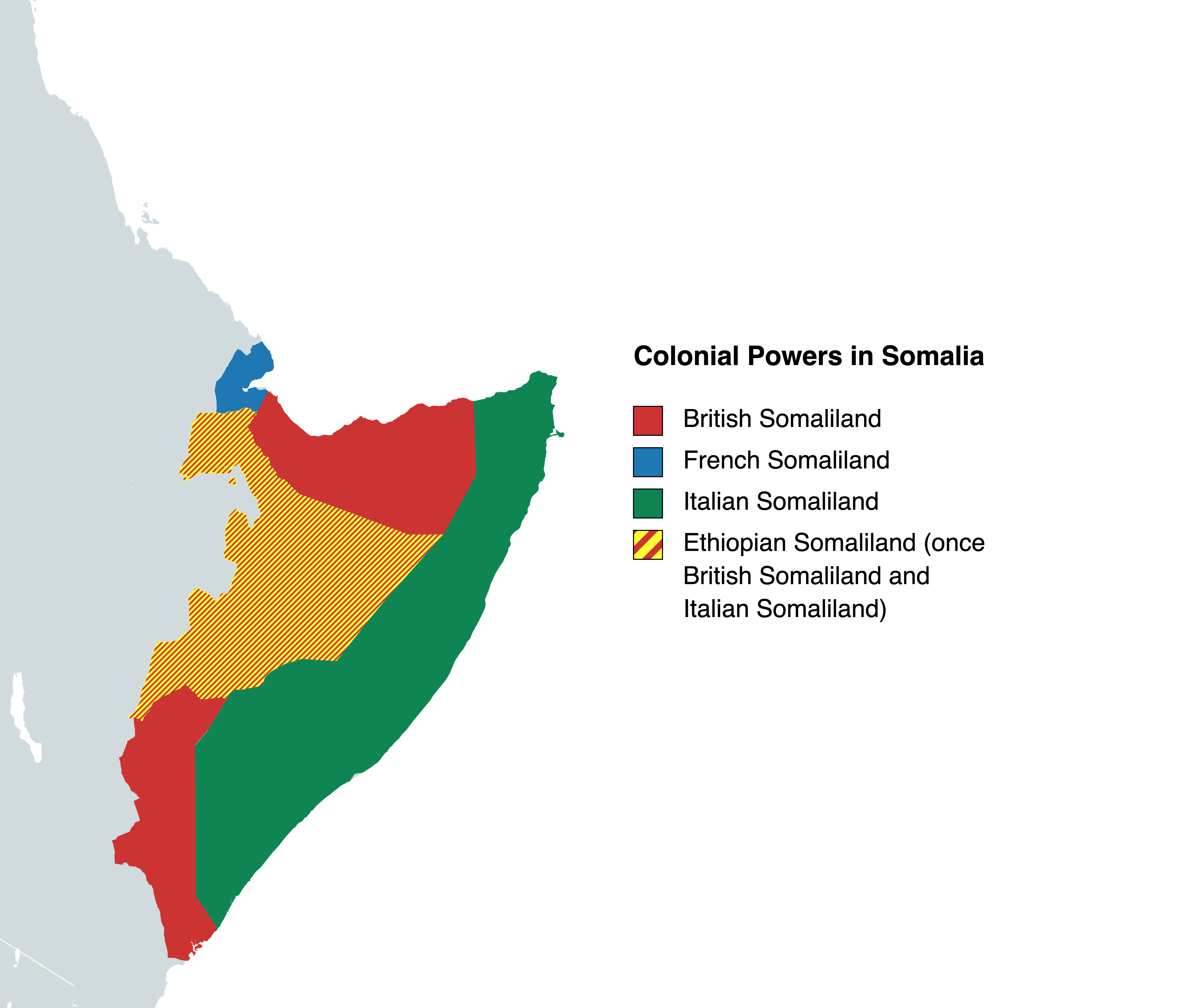
A map showing the former colonial Somaliland’s.
Source: Wikipedia
The region of Somaliland was originally known by the ancient Egyptians as the “Land of Punt”. It was known for its medieval port cities from which gums, resins, ostrich feathers, and slaves were exported. These ports, such as modern-day Berber, flourished between the 7th and the 12th century CE.
When the European nations began to partition Africa among themselves in the late 19th century, France already possessed (from 1862) a coaling station at Obock (present-day Djibouti) near the mouth of the Red Sea.
By the end of the 1880s, France had expanded its holdings to the area of present-day Djibouti, Britain had established a protectorate over the north coast, opposite its base at Aden (Yemen), and Italy controlled the remainder of the region (present-day Somalia).
These regions were known (from west to east) as French Somaliland, British Somaliland and Italian Somaliland.
Following Italy’s defeat during WWII, the British won control of Italian Somaliland.
In 1960, the British colonial authorities united British and Italian Somaliland to form the independent Republic of Somalia.
French Somaliland became independent as the Republic of Djibouti in 1977.
Did You Know?

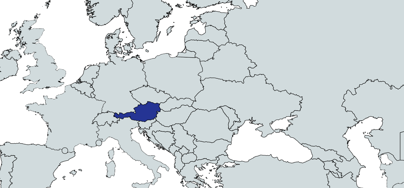
A map, showing the five colonial Guianas in South America.
Just as the colonial powers had three Somaliland’s in Africa, they also had five Guiana’s in South America.
The five Guiana’s were located on the north-east coast of South America and were bound between the mouths of two important rivers – the Orinoco River in Venezuela (which defined the western limit of the Guiana’s) and the mouth of the Amazon River in Brazil (which defined the eastern limit).
The five Guiana’s were (from west to east):
- Spanish Guiana – now the Guayana region of Venezuela
- British Guiana – now the sovereign nation of Guyana
- Dutch Guiana – now the sovereign nation of Suriname
- French Guiana – still called French Guiana but known to the French as ‘Guyane’
- Portuguese Guiana – now the Brazilian state of Amapa
You can read more about the Guiana’s in my Brazil and Guiana’s Travel Guide.
Other taste2travel guides for the Guiana’s include:
- Venezuela (Gran Sabana Region) Travel Guide
- Guyana Travel Guide
- Guyana (Essequibo Region) Travel Guide
- Suriname Travel Guide
- French Guiana Travel Guide
- Amazon River Travel Guide
Independent Somaliland
Following the civil war that began in Somalia in the 1980s and the subsequent overthrow of that country’s government in 1991, a government opposition group, the Somali National Movement, secured the region comprising the former British Somaliland.
In May 1991 they announced that the 1960 federation was no longer valid and declared their region to be an independent state, henceforth to be known as the Republic of Somaliland.
Though not internationally recognised, Somaliland experienced relative stability, a sharp contrast to the civil war that continued to engulf Somalia.
Taking advantage of that stability, the Somaliland government was able to rebuild much of the region’s infrastructure, which had been damaged by years of warfare.
In 2001, 10 years after breaking away from Somalia, Somaliland still was not internationally recognised as an independent country.
Undeterred, the government held a referendum that year, the results of which clearly showed that Somaliland’s inhabitants supported the region’s claim of independence.
As it had in the past, in 2003 the Somaliland government rejected invitations to participate in peace talks aimed at reunifying Somalia, maintaining that its independent status precluded it from being a party to such discussions.
As of 2023, no foreign power recognises Somaliland’s sovereignty!
Ongoing Fighting
Most recently, clan elders in the eastern region of Sool, which borders Somalia’s semi-autonomous Puntland state, have expressed a desire to reunite with Somalia.
In February of 2023, heavy fighting broke out between Somaliland forces and militiamen in and around the town of Las Anod, the administrative centre of the Sool region.
Despite a cease fire being brokered at the time, intermittent clashes have occurred between Somaliland forces and militiamen and the issue remains unresolved.
People

A friendly Somali in Hargeisa.
The people of Somaliland are primarily ethnic Somali, with a few minority groups such as the Arab, Bantu, and Ethiopian Somali communities.
The Somali people in Somaliland are divided into various clans, which play a significant role in their society and culture. The largest clans in Somaliland include the Isaaq, Dir, and Darod clans.
The Isaaq clan is the dominant clan in Somaliland and holds political power in the region. The majority of the people in Somaliland practice Sunni Islam and the religion plays a significant role in their daily lives. Compared to neighbouring Djibouti, the brand of Islam in Somaliland is much stricter.
Family and community are highly valued in Somaliland, and there is a strong sense of community and social responsibility.
Somalilanders are known for their resilience and determination, having endured many years of conflict, poverty, and drought. Despite the challenges they have faced, Somalilanders remain proud of their cultural heritage and continue to strive for progress and development.
Flag

The flag of Somaliland.
The flag of Somaliland consists of three equal horizontal stripes of green, white, and red. In the centre of the white stripe, there is a black star.
The green stripe represents the region’s vegetation and agriculture, while the white stripe represents peace and purity. The red stripe symbolizes the blood shed by the people in their struggle for independence. The black star represents the Somali people.

The flag of Somaliland, flying in front of a wall of Somaliland shillings, at a money exchange in Hargeisa.
The flag was adopted on October 14, 1996, after Somaliland declared independence from Somalia in 1991. The flag is a powerful symbol of the region’s identity and sovereignty.
Currency

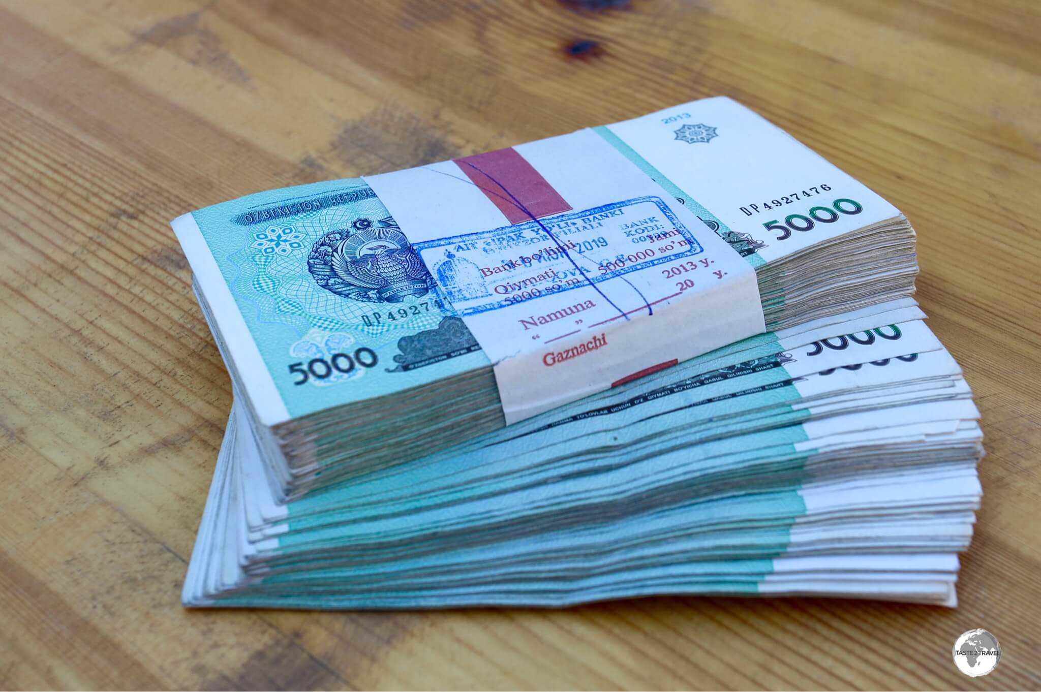
The currency of Somaliland is the Somaliland shilling, whose bank notes are normally old, dusty, dirty and musty in smell.
The currency of Somaliland is the Somaliland shilling (SLSH), which is not internationally recognised, and as such, not exchangeable outside of the country.
The Somaliland shilling was introduced in 1994 as a replacement for the Somali shilling, which was no longer being issued in Somaliland due to political instability and currency devaluation.

The Somaliland shilling is rarely used by the Somali’s, who prefer digital payment platforms instead.
The Somaliland shilling is issued by the Central Bank of Somaliland (Baanka Somaliland) and comes in denominations of 500, 1000 and 5000.
Exchange Rate
Travellers to Somaliland are advised to bring US dollars or euros and exchange them for Somaliland shillings locally.
At the time of my visit (April 2023) the exchange rate against the US dollar was:
US$1 = 8,500 SLSH
Unlike in neighbouring Ethiopia or Eritrea, there is no official / unofficial money market in Somaliland. Money can be exchanged freely, on the street.
The main place to exchange money is with the numerous money changers in Hargeisa central market (see the ‘Money Exchange Market‘ section below).
Digital Payments

A fruit stand in Hargeisa market displays a telephone number where digital payments can be sent.
With the highest denomination bank note of 5,000 SLSH currently worth just US$0.58, most locals prefer to make payments using digital payment services, rather than carrying around bricks of dirty, dusty, musty-smelling bank notes.
Everyone, from market stall owners, to beggars in the street, display phone numbers where digital payments can be sent.
Money Exchange Market

A money changer in Hargeisa central market.
There are numerous money changers which sit in one area of the sprawling central market in Hargeisa. If you are looking for them, anyone can point you in the right direction.

Money, money, money! The red notes (1,000 shillings) are each worth USD$0.11, while the green notes (5,000 shillings) are worth US$0.58.
The money changers can be found perched behind money walls, which are made from bricks of 1,000 and 5,000 shilling bank notes. These wads are secured in place with high-tech, flimsy, tennis nets.

It’s strange to hand over one crisp USD bank note and receive a wad of dirty, musty-smelling Somaliland shillings in return.
The money changers accept a variety of hard currencies, with USD or Euro preferred. It’s all very informal and many other currencies are accepted. These guys are the ultimate currency collectors!

A money changer, retrieving a wad of 1,000 uncirculated bank notes from his safe box.
Out of curiosity, I asked one money changer if he had any uncirculated notes, since I hadn’t seen any new notes in Somaliland.

Straight from the Central Bank – an impressive wad of one thousand, uncirculated, 5,000 shilling bank notes – worth US$588.
He reached into his safe box and produced a wrapped packet of one thousand, uncirculated, 5,000 shilling bank notes – worth 5,000,000 shillings (US$588).

Money changers in Hargeisa central market.
It’s strange to see tennis netting being used to secure wads of cash – only in Somaliland.

In a country where bank notes are near worthless, most locals have no desire to carry wads of cash.
The money exchange market also speaks to how safe Somaliland is as a travel destination. There is no fear of robbery in Hargeisa. I felt completely safe at all times while in Somaliland.

Even the money changers have abandoned cash, with all of them displaying telephone numbers where digital payments can be made.
This open display of large sums of unsecured cash on the streets of Hargeisa reminded me of similar scenes I witnessed in Iraq and Iraqi Kurdistan (click to read my guides for these destinations).
On the streets of Sulaymaniyah, Erbil and Baghdad, money changers displayed wads of USD cash and other currencies, all of which were completely unsecured. There too, crime rates are very low.
It’s ironic that the city streets in former conflict zones, such as Iraq and Somaliland, are safer than the streets of European or North American cities, yet governments from western countries classify places such as Iraq and Somaliland as ‘High Risk / Do not Travel‘.
Credit Cards
Credit cards are rarely accepted in Somaliland.
However, as per the following section, you can use your credit card to withdraw USD cash from ATMs in Hargeisa.
ATMs

This ATM from Premier Bank, which only dispensed USD cash, and was located in the lobby of my hotel, the Maamuus Hotel.
ATMs, which only dispense USD cash, are available in Hargeisa and accept all major credit cards such as Visa and Mastercard. The ATMs are also on the Cirrus and Maestro networks.
The ATMs charge an additional 4% fee for their service.
One ATM from Premier Bank was located in the lobby of my hotel, the Maamuus Hotel.
My hotel room cost me US$20 per night with payment accepted only in USD cash. When I needed to pay, I simply withdrew USD cash from the ATM and handed it to reception staff. Easy!
Money Matters
In terms of hard currency, (i.e., USD cash), travelling in the Horn of Africa can be problematic. In countries such as Ethiopia and Eritrea, the purchase of hard currency is illegal, yet many payments (visa’s etc.) need to be made in USD cash.
If travelling to Eritrea (click to read my guide), you will need to carry enough USD cash to cover all expenses since credit cards are not accepted anywhere.
If travelling in Ethiopia, you can affectively halve all costs by changing USD cash “unofficially”.
Officially in Ethiopia, USD$100 = 5,400 ETB, while on the black market, USD$100 = 10,000 ETB (as of March 2023).
Unofficial transactions should never be conducted on the street, but in a safe, secure, indoor environment, such as a hotel lobby.
If you are travelling to Ethiopia after Somaliland, you should stock up on USD cash before you leave Hargeisa – but you should also read the following warning.
Warning: Carrying USD cash into Ethiopia
If you are planning to travel overland into Ethiopia from Hargeisa, you should be warned that Ethiopian customs have very rigorous checkpoints on the side of the road between the border town of Wajale and Jijiga.
I passed through at least two such checkpoints between Wajale and Jijiga and then one more checkpoint between Jijiga and the city of Harar.
At these checkpoints, you are required to present all of your belongings for a thorough inspection.
Prior to your belongings being inspected, you will undergo a rough, body frisking. The guards were always looking for money, which they seize, and then extract bribes in order to return (most) of the money.
Even if you have a concealed money belt, they will find this during the pat-down.
One guard tried to rip my wallet, which contained USD cash, out my hands but I wouldn’t let go. If locals tried such a thing they could be arrested.
If you are carrying USD cash, and you don’t want some guard hassling you for a bribe, it’s best to hide your cash in your shoes. They never look there!
It should be noted that Ethiopian law requires anyone entering Ethiopia via a land border to declare any cash exceeding USD$500 (or the equivalent in other foreign currency).
These controls exist because Ethiopia has a closed economy and the Ethiopian Birr, is weak and is unofficially worth twice as much as the official rate.
As for my luggage – I carry a camera bag, laptop bag and a travel bag. All three bags were thoroughly pulled apart, with every single compartment checked, every bit of camera equipment, and other electronic item, inspected.
The authorities were especially looking for drones. It seems these are banned in Ethiopia. They were always suspicious of my Canon camera and my three lenses and always referred me to a superior officer for further inspection.
The guards are rough, rude, disrespectful and have no regard for your belongings.
Costs

Coffee menu (prices in USD) at Café Barbera in Hargeisa, the finest café in Hargeisa.
Somaliland is a cheap travel destination which will be agreeable for even the most frugal of travellers.
I stayed in a comfortable hotel in Hargeisa which cost me just US$20 per night. A real bargain!
SIM Cards
![]()
There is just one telco in Somaliland – Telesom!
The company was established in 2002 by local entrepreneurs in Hargeisa and is today the leading provider of ICT services in Somaliland.
While waiting for 4 hours at the Djibouti / Somaliland border, the one thing I did was purchase a Telesom SIM card from a small kiosk.
The SIM card cost me just US$3 and included enough data to last for the entirety of my time in Somaliland.
The network coverage is especially impressive, with my phone receiving messages in the middle of the dessert, miles from anywhere!
Sightseeing

A map of Somaliland, at the Somaliland Mission in Djibouti.
Somaliland is a region with a rich cultural heritage and natural beauty, although its tourism industry is still developing and permits are required when travelling into the countryside.
Tour Companies
![]()
Due to the challenges of travelling in Somaliland, a local tour company can make life easier when taking trips into the countryside. One company which was recommended by my hotel is Somaliland Travel.
I was quoted US$250 for the 47 km trip to Laas Geel, the sight of ancient cave paintings which date back to 9,000 BCE.
Due to the cost, I decided to pass on the trip.
Hargeisa

A view of downtown Hargeisa, the capital of Somaliland.
Hargeisa isn’t a city which offers many established tourist sights. Rather, this is a city which is best explored on foot, especially the large sprawling central market which covers most of the streets in the downtown area.
Hargeisa Central Market

Shoe shops are especially popular in Hargeisa Central market.
A highlight of the central market are the numerous money changers, who sit behind walls of cash. Please refer to the previous ‘Money Exchange Market‘ section for more on this.

Hargeisa Central Market sprawls throughout the side streets of downtown Hargeisa.
Elsewhere, the market is home to shops selling everything imaginable from shoes, clothing, appliances, produce, and much more.

Hargeisa Central Market is the beating, chaotic, bustling heart of the capital.
Hargeisa War Memorial

The Hargeisa War Memorial features a MiG-17 fighter jet of the Somali Air Force, which crashed nearby.
The Hargeisa War Memorial is located in Hargeisa’s Freedom Square, which lies on the main street of Hargeisa.
The newly built memorial consists of a MiG-17 fighter jet of the Somali Air Force, which crashed nearby during an unprecedented bombing campaign in 1988.
During the campaign, Somali fighter jets simply departed from nearby Hargeisa airport, turned, then bombed the city, which was then the second largest city in Somalia. Once the bombs had stopped falling, 90% of the city lay in ruin.
Strangely, it seems the MiG-17 has been installed facing the wrong way, with the front of the jet facing the back of the monument.
Tank Sculpture

A tank sculpture in downtown Hargeisa.
Located a short walk from the Hargeisa War Memorial is an interesting tank sculpture.
Eating Out

A restaurant in Hargeisa.
Cuisine
Somaliland cuisine is flavourful and diverse, and it reflects the region’s unique cultural heritage.
Due to its location on the Red Sea, and its history as a centre for trade, Somaliland cuisine features a mix of African, Middle Eastern, and Indian influences.

Bread for sale at the central market in Hargeisa.
One thing that differentiates Somaliland cuisine from its neighbours is that the ubiquitous regional staple – Enjera – features less in Somaliland.
The standard staple is either pasta, or rice, which is normally topped with a tomato-based meat stew.

Sambusa for sale in Hargeisa central market.
One of the most popular local snack foods, Sambusa, isn’t at all local, but has been introduced from southern Asia, where it is known as Samosa.
Restaurants/ Cafes
Cafè Barbera

Located in downtown Hargeisa, Café Barbera is a popular café with local expats.

The best coffee in Hargeisa is served at Café Barbera.
Tucked away on the 1st floor of a downtown mall, Café Barbera specialises in Italian cuisine and serves the best coffee in town.
Bars
There are absolutely no bars in Somaliland, which is a strict Islamic country.
Accommodation

The perfectly adequate Maamuus Hotel in Hargeisa.
With a complete lack of international hotel brands, accommodation options in Somaliland have been built by locals and tend to be more basic with limited amenities.
While in Hargeisa, I stayed at the more than adequate Hotel Maamuus which is located on the main street, east of the centre.

My room at the Maamuus Hotel in Hargeisa.
The entire hotel complex, which includes a gym, restaurant and two accommodation blocks, is housed inside a secured compound.
I paid US$20 per night for a ‘Standard single‘. Other room categories, such as ‘Deluxe’ and ‘Suite’, include double beds.
To pay for my room, I simply withdrew USD cash from the ATM which is conveniently located in front of the reception desk.
Breakfast is normally available in the popular hotel restaurant, but, during my visit, this was closed due to Ramadan.
Visa Requirements

My visa for Somaliland, which was issued at the Somaliland Mission in Djibouti.
The visa policy of Somaliland is outlined on the Visa Section page of the Somaliland Immigration website.
Currently, citizens of the following countries are able to apply for a Visa-on-Arrival (VOA) at all Somaliland Ports of entry:
- Bahrain
- Brazil
- Canada
- China
- Djibouti
- Egypt
- Ethiopia
- EU Citizens
- Kenya
- Kuwait
- Morocco
- Oman
- Qatar
- Russia
- Saudi Arabia
- Somalia
- South Africa
- South Sudan
- Sudan
- Taiwan
- Tunisia
- Turkey
- UAE
- Uganda
- USA
All other nationalities are required to apply for a visa in advance from a Somaliland mission.
The best places to apply are either Djibouti or Addis Ababa.
Somaliland Visas in Djibouti

The entrance of the Somaliland Mission in Djibouti.
Somaliland tourist visas are issued without fuss at the Somaliland Mission in Djibouti at a cost of US$60, which can be paid in USD of DJF.
The visa processing time is 24 hours, although the mission is closed on Friday and Saturday for the Islamic weekend. If you submit your application on a Thursday, you’ll have to wait until Sunday to receive your passport.

A display at the Somaliland mission in Djibouti.
The very helpful staff member actually completed the application form for me and was happy that I had chosen to visit Somaliland. The government is keen to encourage tourism.
The mission is located in the Plateau du Serpent neighbourhood of Djibouti City. Most taxi drivers know the mission and should charge a fare of DJF 500 from downtown.
Note:
When you pay for your visa, you’ll be handed a receipt.
It was explained to me at the mission that you need to keep this receipt safe as immigration will ask for it upon entry and exit from Somaliland.
If you are unable to produce your receipt, you’ll be required to pay the visa fee again!
When I exited from Somaliland, immigration kept the receipt.
Getting There
Air
Hargeisa
Flights to Hargeisa arrive at Egal International Airport (IATA: HGA) which is located six kilometres southwest of downtown Hargeisa.
Named after Somaliland’s second president, Muhammad Haji Ibrahim Egal, the airport underwent major renovations in 2012–2013.
The following airlines provide scheduled flights to/ from Egal International Airport:
- Air Arabia – flies to/ from Sharjah
- African Express Airways – flies to/ from Berbera, Cairo, Dubai–International, Mogadishu, Nairobi–Jomo Kenyatta, Sharjah
- Daallo Airlines – flies to/ from Djibouti, Dubai–International, Jeddah, Mogadishu
- Ethiopian Airlines – flies to/ from Addis Ababa
- flydubai – flies to/ from Dubai–International
- Jubba Airways – flies to/ from Bosaso, Dubai–International, Jeddah, Mogadishu
- Kenya Airways – flies to/ from Nairobi–Jomo Kenyatta
Berbera
Additionally, Ethiopian Airlines operate international flights to Berbera International Airport (IATA: BBO).
Land
The land borders between Somaliland and Djibouti / Ethiopia are currently open.
Djibouti Border Crossing

Somaliland Toyota Land Cruisers at the Somaliland/ Djibouti border.
The border between Djibouti and Somaliland is located in the Djibouti town of Loyada, which is a 20 to 30-minute drive from Djibouti City. The only section of sealed road on the entire trip is on the Djibouti side of the border.
Toyota Land Cruisers

My Toyota Land Cruiser ‘taxi’, getting ready to depart from Djibouti City.
Old, beat-up, Toyota Land Cruisers (1990’s models) shuttle daily between Djibouti City and Hargeisa.
These vehicles are well beyond their expiry date and are prone to constant breakdowns in the middle of the desert, in the middle of the night.
True workhorses, these vehicles have spent almost all of the lives bouncing along rough desert tracks.

Early morning view of the long and windy track which leads through the desert to Hargeisa.
Our vehicle broke down several times in the middle of nowhere, in the middle of the night.
The drivers are all expert mechanics, with our driver using bits of rags and plastic bags to fix our engine problems. Amazing to watch!

A rest stop, in a small town in the middle of nowhere, the only town we passed through during the entire journey.
Also amazing are the stars in the night sky!
A breakdown provides a welcome break from the manic driving and blaring, non-stop music (noise).
It’s pitch black out there, and the night sky is truly dazzling.

Taking a break so my fellow passengers, all of whom were Muslims, could observe the sunrise pray.
Seat Prices
Each car carries up to 11 paying passengers.
The two seats up front, next to the driver, cost US$40, while the seats in the middle row (seats 4) cost US$30.
In the very rear, floor space costs less. On my trip, the rear section was occupied by a family of 4.

When bouncing for 17-hours along desert tracks, I recommend paying extra to ride up front next to the driver.
Since I was carrying my laptop bag and camera bag, plus a bag of breakable items which had been removed from my travel bag, I paid US$80 to have the two front seats. The driver seemed also to appreciate the extra space!
All fares are paid to the driver in cash (USD of DJF).
Leaving from Djibouti City

Somaliland 4WDs, waiting on Avenue 26 in Djibouti City.
If leaving from Djibouti City, you’ll find the Somaliland 4WDs lined up each afternoon along the side of Avenue 26, which lies 2 km south of downtown Djibouti.
Every taxi driver in Djibouti City knows the location of the Somaliland taxis and should only charge you a fare of DJF 500 to deliver you there.
When you arrive, you’ll notice nothing is organised. There is no set taxi station, no office, not even a desk. Just a few people standing about.

Somaliland 4WD’s on Avenue 26 are easily identified by their Somaliland license plates.
Rather, what you will see are clusters of Somaliland-registered Toyota Land Cruisers parked on the side of the road, with many being loaded up with bags of freight.
Video: Packing the 4WD for our trip from Djibouti City to Hargeisa, Somaliland.
The 4WD’s normally depart around 5pm, but the schedule depends on passengers. Once a car fills up, it departs. There are plenty of cars waiting around. I counted maybe 30 on the day I travelled.

A Somaliland 4WD, being readied for its overnight journey from Djibouti City to Hargeisa.
The 410 km journey from Djibouti City to Hargeisa takes about 17 hours.
Video: The road to the Djibouti/ Somaliland border post at Loyola.
The only comfortable part of the journey is the first 20km to the Djibouti/ Somaliland border, which is the only section of sealed road on the entire trip.

My beautiful Osprey travel bag, covered in desert dust and crushed under a heavy white sack.
Tip:
Prior to your main bag (backpack) being strapped onto the roof of the 4WD, you should remove anything valuable or breakable, including all toiletries.
While on the roof, your bag will be crushed under the weight of boxes and other heavy items. Your bag will be walked on, stepped on, thrown around. It will be tied on so tightly that your bag will be contorted into a completely different shape.

When first loaded in Djibouti City, my Sojourn travel bag was placed on top of the load. At the border, it was repacked and moved to the bottom of the pile.
I only left clothes and shoes in my bag and was glad I did. My bag was completely pummeled during the journey.
I carried toiletries, and anything else which was breakable, in the cabin with me.
Video: Leaving from Avenue 26 in Djibouti City, the start of a 17-hour journey to Hargeisa, Somaliland.
Border Crossing
Upon arrival at the Djibouti border, which is in the coastal town of Loyada, I was told that I should carry all my valuables which were riding in the cabin with me. My main bag, which was secured on the roof, was to remain there.

My first view of Somaliland, at the border crossing.
It took me about 20 minutes to walk across the border, with immigration officials on both sides being friendly and relaxed. At no stage were any of my bags checked.
When I entered Somaliland, and as previously advised by the Somaliland Mission in Djibouti, immigration wanted to see my visa receipt.
After I had completed formalities, I asked immigration where I should wait for my 4WD, they simply pointed to the dusty road outside.
About 2 hours later, with the sun having set, I was still waiting on the side of the dusty road, with no sign of my 4WD, which had my main travel bag strapped to its roof – at least I hoped that was still the case.
After some time, I saw a crazy man running around yelling at different people – he looked familiar.
Yes – it was my driver. I was travelling with a crazy man!
Video: Night time driving through the desert of Somaliland. Most of the journey takes place at night!
I asked him about the 4WD (and my bag) and he assured me that we would leave at 9pm. We had arrived at the border shortly after 5 pm!
He then found a plastic chair and asked me to sit and wait, before he sauntered off!
At 9pm, he re-appeared and asked me to follow him. He took me to a different 4WD which was already loaded up.
I checked to confirm that my bag was onboard and saw that my beautiful Osprey Sojourn Travel Bag was tied onto the roof, crushed under the weight of a heavy sack with the roof porters walking all over the bags, tying on rope to secure the load.
Tip:
You should ensure that nothing valuable is left in anything placed onto the roof of the 4WD since you will be separated from your bag for about 4 hours during border formalities.
Travelling to Hargeisa
Video: The long and winding road to Hargeisa.
The moment we sped off from the border crossing, it was clear that my driver was truly a crazy man!
He was driving like a reckless kamikaze! Foot flat to the floor, he launched us out into the darkness of the desert.

There are many goats on the road in Somaliland.
For the next 12 hours, with music constantly blaring, we raced at break-neck speeds along poorly defined tracks, with lights that hardly lit up the track ahead.
On more than one occasion, realising he had taken the wrong track, he made abrupt about-turns and doubled back to take a different track.
Video: Early morning driving through Somaliland.
Unlike the locals behind me, who were often yelling at the driver to slow down, I had full confidence in my driver since he never stopped consuming khat (or qat), which is the local stimulant of choice in the Horn of Africa.
Video: No shortage of goats on the road in Somaliland.
Khat, which is said to cause excitement and euphoria, is the drug of choice for all the drivers. It keeps them awake and buzzing! At around 4am, I suggested to him that he should stop and take a break.
He looked at me, with his glazed eyes, and said he will sleep once he reached Hargeisa.
Onward he sped…
Video: Yet more goats on the road in Somaliland.
Arrival in Hargeisa
At around 10 am, we finally arrived in Hargeisa, pulling up outside the office of a transport company.

My Osprey travel bag joined me in the shower at my hotel. It survived to live another adventure.
I was happy to climb into a waiting taxi, which spirited me away to the safety and comfort of the Hotel Maamuus and a much-needed shower – for me and my dusty Osprey travel bag.
Ethiopia Border Crossing
The border crossing between Ethiopia and Somaliland is located in the town of Wajale which lies about 100 km due west of Hargeisa. The journey time from Hargeisa to the border is about 2 hours, on a good quality, sealed road.
Along the way, there are five checkpoints which are manned by officials whose only real task is to extract bribes from the drivers of public service vehicles such as taxis and minibuses.
I organised for a private taxi to drive me from Hargeisa to the border for the usual fare of US$30.
By the time we had arrived at the border, the driver had handed out more than half of the fare in the form of bribes to corrupt officials. Such a shame!
At the time of my visit to Wajale, the road across the border was being completely rebuilt. The entire area was a muddy quagmire with everything dug up but no construction work to be seen anywhere.
From the Ethiopian side, frequent minibuses (400 birr) connect to the city of Jijiga. From there, frequent minibuses connect to the popular tourist destination of Harar (also 400 Birr).
I departed from Hargeisa at around 9 am and arrived in Harar around 4 pm.
Getting Around
Public transportation in Somaliland consists of taxis (both shared and private) and minibuses.
Taxis
Taxis are the most common form of public transportation in Somaliland. They are typically small, older vehicles that are privately owned and operated.
Fares are negotiable and often shared among passengers. Taxis around Hargeisa should cost US$1-2.
Minibuses
Minibuses are small vans that are used for public transportation in Somaliland. They are often overcrowded and uncomfortable, but they can be a more affordable option for longer trips.
Rental Car
There are a few rental car companies in Hargeisa, although local traffic conditions and the many checkpoints make independent driving a potential nightmare. It would be best to hire a car with a driver.
If you are determined to drive in Somaliland, you can contact Royal Car Rental in Hargeisa.
That’s the end of my travel guide for Somaliland. If you wish to leave feedback, please use the comment form below.
Safe Travels!
Darren
Further Reading
You might be interested in reading my:


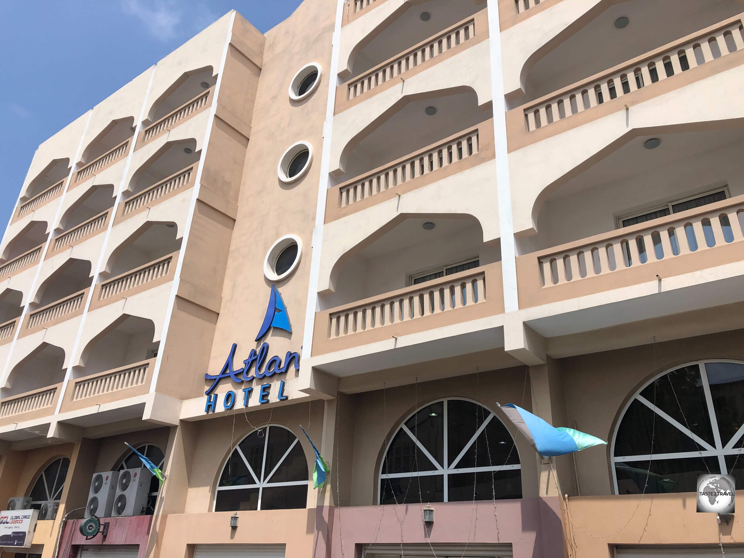
 in Djibouti City.")


 in height.")


 with two fellow guides at the Buddha Dordenma temple.")


 and driver. Thukten.")


 was reopened in 2020.")
.")


, posing next to a giant phallus in a Lobesa giftshop.")


.")


 is a highlight of Bhutan.")


 in length.")
.")


.")
.")
.")
.")


.")


 at the Sangchhen Dorji Lhuendrup Nunnery.")
 in the background.")


 from across the Paro River.")
 and guide (right) – Thukten and Jamyang respectively.")


