Tag - Asia

Iraqi Kurdistan Travel Guide

The dazzling interior of the Jalil Khayat Mosque in Erbil.

Iraqi Kurdistan Travel Guide

This is an Iraqi Kurdistan Travel Guide from taste2travel.

Date Visited: August 2022

Introduction

Unfortunately, for the past few decades, Iraq has been in the news headlines for all the wrong reasons. However, peace and stability have been the norm, for many years, in the autonomous region of Iraqi Kurdistan.

I first got the idea to visit Iraqi Kurdistan while having breakfast in a hotel in Singapore in 2019. I was sat next to a Kurdish father and daughter who had fled from Iraqi Kurdistan, to the safety of Australia, to avoid persecution during the rule of Saddam Hussein.

They were returning to Australia following a visit to see family and friends in Iraqi Kurdistan. They assured me that the region was safe to visit and that I would receive a warm welcome from the Kurds!

How right they were!

Erbil Citadel has been the site of human settlement for more than 6,000 years.

Erbil Citadel has been the site of human settlement for more than 6,000 years.

Of all the places I have visited on planet Earth, Iraqi was country/ territory # 213, I can say that the Kurds are some of the friendliest people I have every had the pleasure to spend time with.

Every day, I was overwhelmed by Kurdish hospitality. Whether paying for a glass of tea, a taxi ride or even a meal – payment was often refused as I was a guest in the land of the Kurds.

The staff at my hotel in Erbil – the wonderful Erbil View Hotel – assured me that the hotel was my home away from home. They even surprised me by getting my crumpled jacket dry-cleaned! Truly amazing hospitality!

One of many gold shops at Sulaimaniyah souk.

One of many gold shops at Sulaimaniyah souk.

For those who wish to visit Iraq, but are not keen on venturing into federal Iraq (which will be covered in my next Travel Guide), Iraqi Kurdistan offers a ‘lite’ version of Iraq. Security and safety are not an issue here.

Whereas there is still a heavy military presence on the streets of federal Iraq, you will see little military in Iraqi Kurdistan. If you are comfortable travelling in places like Jordan, Turkey or Egypt, you’ll feel totally comfortable travelling in Iraqi Kurdistan.

An elderly Kurdish porter at Sulaimaniyah souk.

An elderly Kurdish porter at Sulaimaniyah souk.

Crime is non-existent in Iraqi Kurdistan! Never did I feel unsafe or threatened!

Money changers at Erbil and Sulaimaniyah souks sit on the footpath with glass cabinets full of wads of currency, including bundles of US$100 notes. Never is crime a concern in this part of the world!

As was explained to me by a Kurd, over one of many glasses of sweet tea, you could leave your car unlocked, on the street, all night and no one will touch it!

Whenever shopkeepers inside the souk leave their shop for lunch or prayer, they never lock-up but simply place an object in the doorway to indicate that the shop is temporarily closed. No one would ever think of entering the shop!

The Grand Mosque of Sulaimaniyah during the magical blue hour.

The Grand Mosque of Sulaimaniyah during the magical blue hour.

As an autonomous region, Iraqi Kurdistan has its own government – the Kurdistan Regional Government (KRG) and has its own immigration policy, which is separate to that of Iraq.

If you enter Iraqi Kurdistan, you will receive a visa which is only valid for travel inside Iraqi Kurdistan. You cannot enter federal Iraq using this visa.

You must also be careful when taking long distance taxis in Kurdistan as some of them transit through federal Iraq – which you cannot do if you are travelling on a Kurdistan visa.

An Iraqi visa however, is valid for travel everywhere inside Iraq – including Iraqi Kurdistan. If you plan to travel to both Iraq and Iraqi Kurdistan, it makes sense to first enter through federal Iraq where you will only need to purchase one visa (US$77), rather than two! More on this in the ‘Visa Requirements‘ section below.

Location

Erbil, Iraq


Iraqi Kurdistan, also known as Southern Kurdistan, refers to the Kurdish-populated region of northern Iraq.

A map showing Iraqi Kurdistan, in red, and its neighbours.

A map showing Iraqi Kurdistan, in red, and its neighbours.

An autonomous region, which functions separately to ‘Federal’ Iraq, Iraqi Kurdistan is comprised of the four governorates of Erbil, Sulaymaniyah, Duhok and Halabja.

A map of Western Asia, which highlights the region of Kurdistan in beige. <br /> <i>Source: Wikipedia.</i>

A map of Western Asia, which highlights the region of Kurdistan in beige.
Source: Wikipedia.

Located in Western Asia, Iraqi Kurdistan is one of the four parts of the trans-national “Kurdistan”, which also includes Northern Kurdistan in south-eastern Turkey, Western Kurdistan in northern Syria and Eastern Kurdistan in north-western Iran.

People

Young Kurdish boys visiting Erbil citadel.

Young Kurdish boys visiting Erbil citadel.

Iraqi Kurdistan is home to approximately six million Kurds, who represent 15% of the total population of Iraq (40,000,000).

Completed in 2007, the striking, Jalil Khayat Mosque, is a Sunni Islamic Mosque in Erbil.

Completed in 2007, the striking, Jalil Khayat Mosque, is a Sunni Islamic Mosque in Erbil.

Nearly all Iraqi Kurds consider themselves Sunni Muslims, with 98% of Kurds in Iraq identifying themselves as Sunnis and only 2% identifying themselves as Shias.

Apart from the Kurds living in Iraqi Kurdistan, around 300,000 Kurds live in the Iraqi capital Baghdad – 50,000 in the city of Mosul and around 100,000 elsewhere in Federal Iraq.

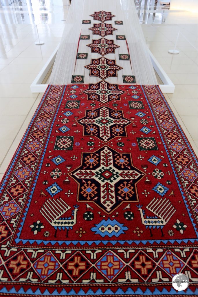
The 'Story of Iraqi Kurdistan' as illustrated on a hand-woven carpet at the Kurdish Textile Museum in Erbil.

The ‘Story of Iraqi Kurdistan’ as illustrated on a hand-woven carpet at the Kurdish Textile Museum in Erbil.

The total population of greater Kurdistan is estimated to be between 25 and 35 million, making the Kurds the fourth-largest ethnic group in the Middle East.

A tailor, with his two sons, inside Erbil souk.

A tailor, with his two sons, inside Erbil souk.

The Iraqi Kurds have historically enjoyed more national rights than Kurds living in neighbouring states.

Kurdish skullcaps on display at the Kurdish Textile Museum in Erbil.

Kurdish skullcaps on display at the Kurdish Textile Museum in Erbil.

Meanwhile, across the border in Turkey, the Turkish government continues a 40+ year battle against the Kurdistan Workers’ Party (PKK), a rebel group who are fighting for an independent Kurdistan state within Turkey.

A Kurdish tailor at Erbil market, wearing traditional clothing.

A Kurdish tailor at Erbil market, wearing traditional clothing.

One security threat to Iraqi Kurdistan today comes from the Turkish military, who occasionally launch attacks against supposed PKK bases which are located inside Iraqi Kurdistan.

Kurdish Cinema
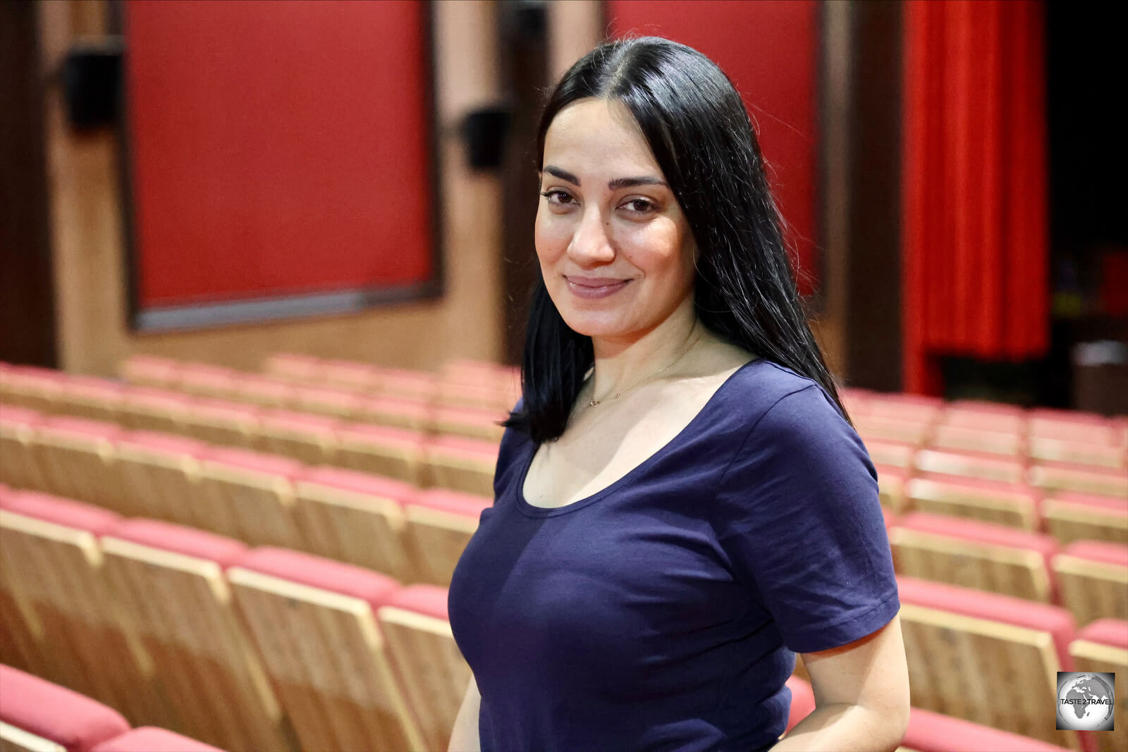
Lina Raza, the Program Director of the Slemani International Film Festival, inside Cinema Salim.

Lina Raza, the Program Director of the Slemani International Film Festival, inside Cinema Salim.

Kurdish arthouse cinema is centred around the Cinema Salim in Sulaimaniyah (Slemani).

The driving force behind Kurdish films, and documentaries, is the wonderful Lina Raza, an Iraqi Kurd who maintains residences in Sulaimaniyah, London and Stockholm.

When she’s not treading the red carpet at the Cannes Film Festival, Lina is the Program Director of the annual Slemani International Film Festival which showcases both World and Kurdish cinema.
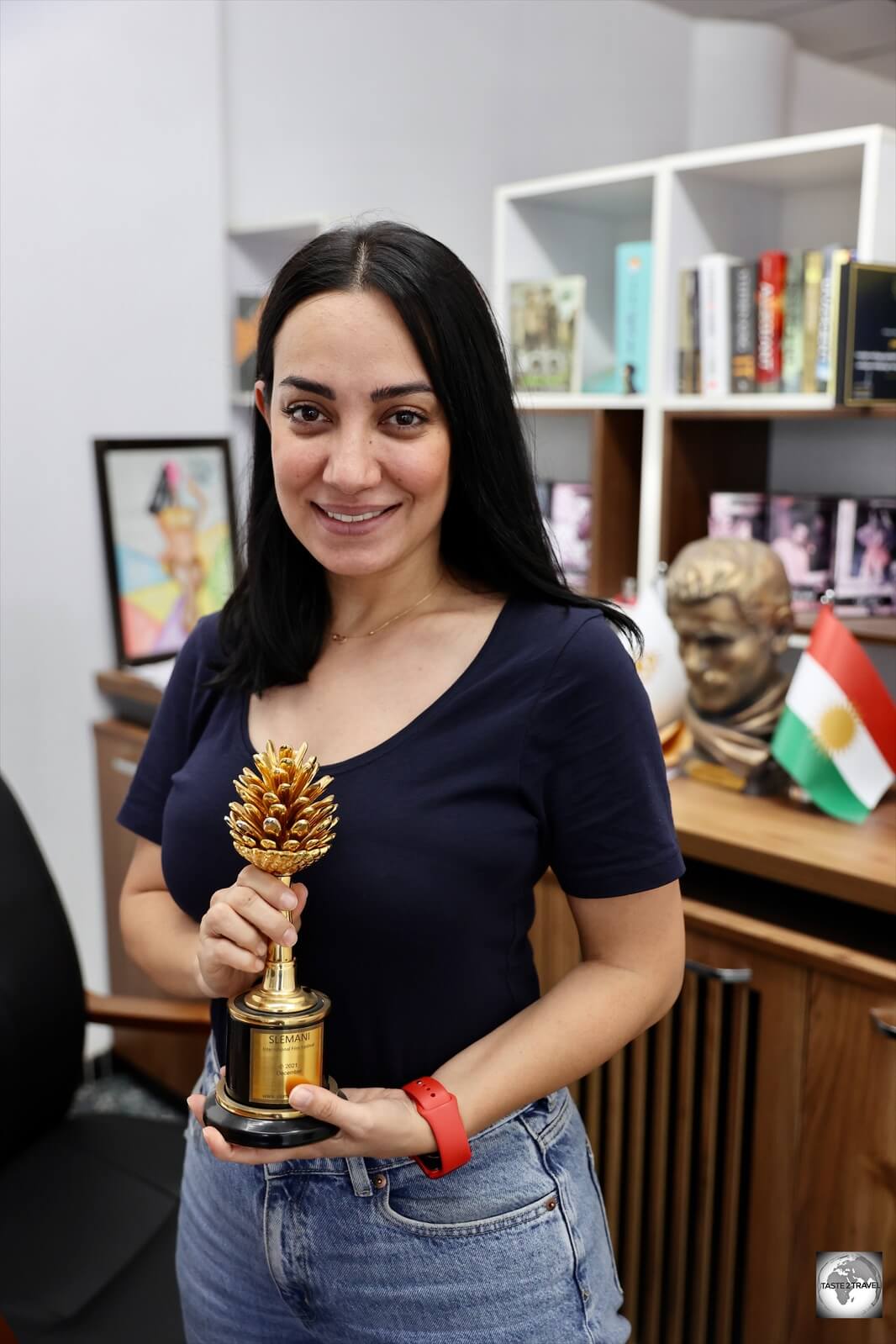
Lina Raza, displaying the Golden Pine Cone which is awarded at the Slemani International Film Festival.

Lina Raza, displaying the Golden Pine Cone which is awarded at the Slemani International Film Festival.

While Cannes awards its Palme d’Or (“Golden Palm”), the Slemani festival awards a Golden Pine Cone.

If you’re interested in catching the latest Kurdish arthouse offerings, movies are screened every day at Cinema Salim.

History

Settled more than 6,000 years ago, Erbil Citadel is thought to be one of the longest continuously inhabited sites in the world.

Settled more than 6,000 years ago, Erbil Citadel is thought to be one of the longest continuously inhabited sites in the world.

Ancient Iraq 

During ancient times, lands that now constitute Iraq were known as Mesopotamia (“Land Between the Rivers”), a region whose extensive alluvial plains gave rise to some of the world’s earliest civilizations and empires since the 6th millennium BC.

The “Cradle of Civilisation” is a common term for the area comprising modern Iraq and was the birthplace of many valuable inventions and discoveries, including writing system, mathematics, time, calendar, astrology and law code.

The capital of Iraqi Kurdistan, Erbil, is centred around Erbil Citadel which has been the sight of settlement for more than 6,000 years.

Kurdistan and the Kurds

A statue, in Erbil, of Masoud Barzani, president of Iraqi Kurdistan from 2005 to 2017.

A statue, in Erbil, of Masoud Barzani, president of Iraqi Kurdistan from 2005 to 2017.

The Kurdish people are originally an Iranian ethnic group who are native to the mountainous region of Kurdistan in Western Asia, which spans south-eastern Turkey, north-western Iran, northern Iraq, and northern Syria.

After World War I and the defeat of the Ottoman Empire, the victorious Western allies made provision for a Kurdish state in the 1920 Treaty of Sèvres.

However, that promise was broken three years later, when the Treaty of Lausanne set the boundaries of modern Turkey and made no provision for a Kurdish state, leaving Kurds with minority status in all of the new countries.

The Kurds of Iraq came under British colonial rule after the defeat of the Ottoman Empire in 1918. Frustrated in their hopes for independence, Kurdish leaders launched a series of rebellions against British and subsequent Iraqi rule.

These rebellions were ruthlessly quashed, most notoriously in the late 1980s when Saddam Hussein attacked the Kurds with armed forces. This involved the deliberate targeting of civilians with chemical weapons, most notoriously in the town of Halabja in 1988.
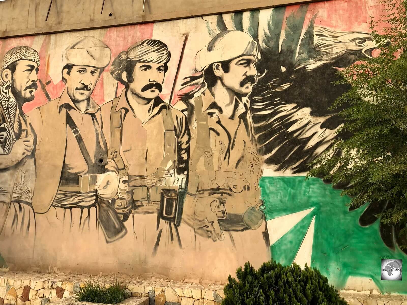
Street art in Erbil speaks of a turbulent history.

Street art in Erbil speaks of a turbulent history.

US-led Invasion

Throughout history, various Iraqi governments promised autonomy to the Kurds, but none of these promises came to fruition until the anti-Saddam international coalition, led by the United States, established a partial no-fly zone in northern Iraq in 1991 after the first Gulf War.

This allowed Kurdish leaders, and their Peshmerga armed forces, to consolidate their hold on the north after Iraqi forces withdrew, and provided the basis for the 2005 constitutional settlement, which recognised an autonomous Kurdistan region in the north of the country, run by the Kurdistan Regional Government.

Iraqi Kurds played an important role in the Iraq War and were important allies of the US military. Kurdish parties joined forces against the Iraqi government during the war in the Spring of 2003, with Peshmerga forces playing an important role in the overthrow of the Iraqi government.

Pro-Independence Vote

On the 25th of September 2017, Iraqi Kurds voted overwhelmingly (92.73%) for independence in a non-binding referendum.

This angered Baghdad, which moved to reassert its authority by recaptured territory held by the Kurds outside their autonomous region. It also seized control of oilfields that are the lifeblood of the Kurdish economy and imposed an air blockade that held for six months.

Flag
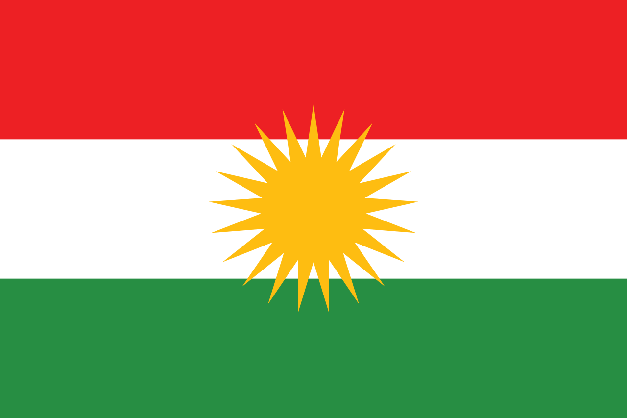
The flag of Kurdistan.

The flag of Kurdistan.

The flag of Kurdistan was created by the Society for the Rise of Kurdistan in 1920. The Kurdish flag is the most important symbol of Kurdish identity and, since it was first hoisted in 1946, has become a symbol of the national identity of the Kurds.

The flag of Kurdistan, flying over Erbil citadel.

The flag of Kurdistan, flying over Erbil citadel.

The design of the flag includes:

  • A red field which symbolises ‘the blood of the martyrs and the continued struggle for freedom and dignity‘.
  • A white field which symbolises ‘peace and equality‘.
  • A green field which symbolises ‘the beauty and landscapes of Kurdistan‘.
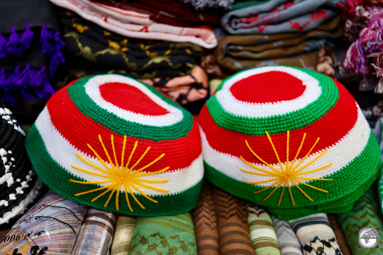
Kurdistan flag skullcaps, on sale at Erbil souk.

Kurdistan flag skullcaps, on sale at Erbil souk.

Superimposed over the top of the three bands is a golden, 21-ray sun, a symbol which has been used by Kurds since antiquity. The number ’21’ is a venerated number by the Kurds, representing rebirth/ renaissance in the ancient and native Kurdish religion of Yazdanism.

Currency

My 100 uncirculated, IQD 250, bank notes.

My 100 uncirculated, IQD 250, bank notes.

The official currency of Iraqi Kurdistan is the Iraqi dinar (IQD).

Current bank notes, which are issued by the Central Bank of Iraq, include IQD 250; 500; 1,000; 5,000; 10,000; 25,000 – and the rarely seen 50,000.

Iraqi dinar bank notes.

Iraqi dinar bank notes.

If you’re interested in getting your hands on a brand-new IQD 50,000 note, I often received these from Bank of Baghdad ATMs.

Iraqi IQD 50,000 bank notes.

Iraqi IQD 50,000 bank notes.

The Iraqi dinar isn’t a free-floating currency, with the exchange rate set by the Iraqi government at US$1 = IQD 1,460. This exchange rate is factored into government budgets until at least 2026.

Iraqi IQD 25,000 bank notes.

Iraqi IQD 25,000 bank notes.

Exchange Rates

The current exchange rate of the Iraqi dinar against US $100 and €100 are:

USD $100 = IQD 146,000

EUR €100 = IQD 149,300

Saddam Hussein Dinars

Saddam Hussein dinars make for an interesting souvenir.

Saddam Hussein dinars make for an interesting souvenir.

Prior to the 1st Gulf War in 1990, high quality Iraqi dinar bank notes were printed in the United Kingdom by Thomas De La Rue.

Following the introduction of United Nations sanctions after the war, Iraq was no longer able to place currency orders with Thomas De La Rue.

A new series of bank notes were printed locally, which featured a portrait of Saddam Hussein. Known as “Saddam dinars”, the notes were of inferior quality, compared to the former UK-made bank notes, which then become known as “Swiss dinars”.

Due to prolonged international sanctions on Iraq, along with excessive government currency printing, the Saddam dinar quickly became worthless.

After Saddam Hussein was deposed in the 2003 invasion of Iraq, the Iraqi government printed more Saddam dinar notes as a stopgap measure to maintain the money supply until a new currency could be introduced.

The market had become flooded with worthless Saddam dinars. 

Wads of Saddam Hussein diners at a money exchange in Erbil souk.

Wads of Saddam Hussein diners at a money exchange in Erbil souk.

Between 2003 and 2004, the Coalition Provisional Authority issued new Iraqi dinar notes, which were printed, once again, by Thomas De La Rue in the UK.

Trillions of new dinars were shipped to Iraq and exchanged for the old Saddam dinar notes at par value.

Today, wads of Saddam Hussein dinar notes can be found at money changers at Erbil and Sulaimaniyah souks and are popular souvenirs.

Each note can be purchased for IQD 1,000 (USD$0.68), making them more valuable as a souvenir than what they were when in circulation.

Banking Services

Credit Cards
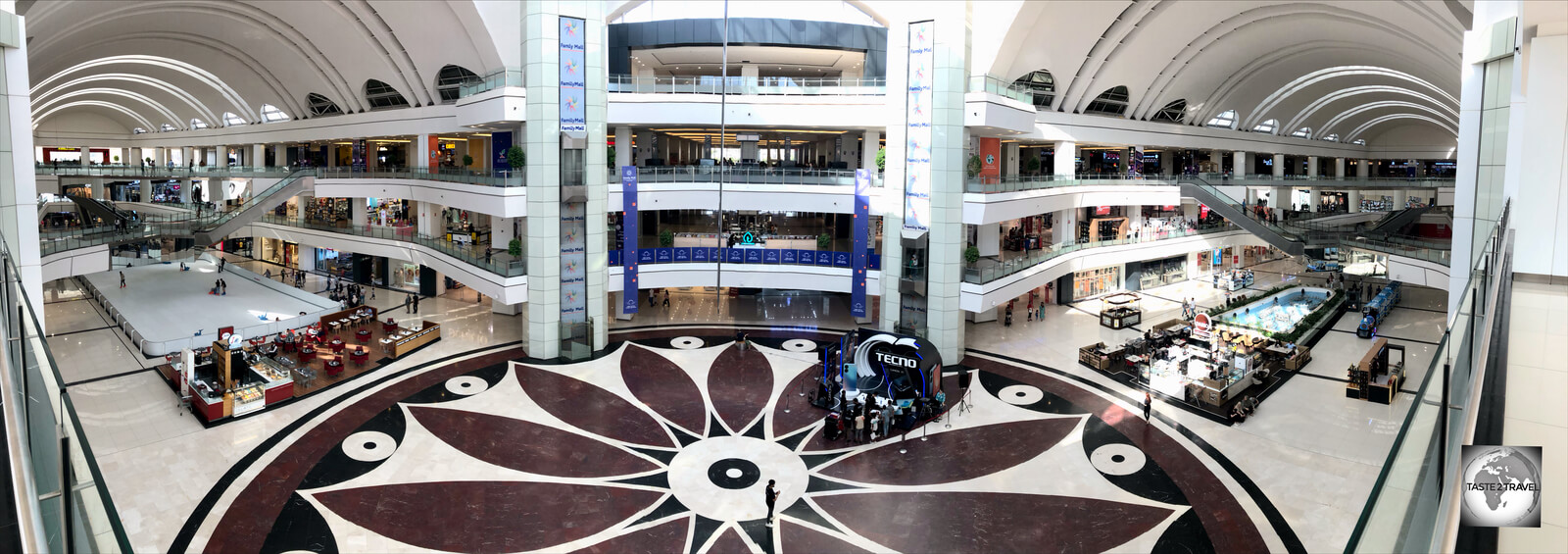
The Family Mall in Sulaimaniyah, where almost all stores, including department stores, accept cash only!

The Family Mall in Sulaimaniyah, where almost all stores, including department stores, accept cash only!

Iraqi Kurdistan is a cash society. Credit cards are accepted almost nowhere!

While shopping malls in Erbil and Sulaimaniyah feature prominent international brands like Blackberry, GEOX, Samsonite, Merrell, DKNY, Armani, Levi’s and Mango, none of these stores accept credit cards. All payments are to be made in cash!

The only place I was able to use my credit card in Iraqi Kurdistan was at the Erbil View Hotel, my wonderful hotel in Erbil.

ATMs

ATMs at the Family Mall in Erbil are hidden away inside the cinema complex.

ATMs at the Family Mall in Erbil are hidden away inside the cinema complex.

You will never find an ATM on the street in Iraqi Kurdistan. ATMs are only found inside the larger shopping malls and at the two international airports – Erbil and Sulaimaniyah.

In all malls, the ATMs are hidden away in an obscure corner – finding them is like a treasure hunt!

A rare sight in Iraqi Kurdistan - a bank branch inside Family Mall in Erbil.

A rare sight in Iraqi Kurdistan – a bank branch inside Family Mall in Erbil.

Bank branches are also non-existent, with informal money changers providing money exchange services on the street.

I did find a branch of the Kurdistan International Bank inside the Family mall in Erbil, although their ATM’s do not accept foreign credit cards.

Not all banks are on the international network. The two banks which I found to be most reliable, and whose ATM’s accept international credit cards (i.e. Mastercard and Visa), are the Bank of Baghdad and Cihan Bank.

ATM’s can be found inside the Family Mall in Erbil and Sulaimaniyah, and inside most other large malls.

Sightseeing

Erbil

Souvenir shops opposite Erbil souk.

Souvenir shops opposite Erbil souk.

Home to 1.5 million friendly souls, Erbil is the capital and largest city of Iraqi Kurdistan. The city is centred around the ancient Erbil Citadel which has been occupied for more than 6,000 years!

Tailors, inside Erbil souk.

Tailors, inside Erbil souk.

Alongside the citadel are the Ottoman-era Erbil souk, the centre of commercial activity and the popular Fountains of Shar Park which comes to life around sunset.

Erbil Citadel

Settled for more than 6,000 years, Erbil Citadel is one of the longest, continuously inhabited, places on Earth.

Settled for more than 6,000 years, Erbil Citadel is one of the longest, continuously inhabited, places on Earth.

Located at the heart of Erbil city, Erbil Citadel is located atop an ancient tell, or occupied mound, which has been the scene of continuous settlement for more than 6,000 years. Archaeologists believe that layers of history lay buried beneath the tell.

The earliest evidence for occupation of the citadel mound dates to the 5th millennium BC, and possibly earlier. The citadel gained particular importance during the Neo-Assyrian period.

A giant flagpole stands at the centre of Erbil Citadel.

A giant flagpole stands at the centre of Erbil Citadel.

Erbil Citadel thrived until the Mongols arrived in 1258 CE. They captured the citadel and sacked the city, sending it into decline.

The citadel, which is a UNESCO World Heritage site, has, unfortunately, been reconstructed in many places.

This reconstruction is currently ongoing, which seems to go against the rules for a World Heritage Site. The government plans to have 50 families live in the citadel once it is renovated.

Historic buildings inside Erbil Citadel.

Historic buildings inside Erbil Citadel.

The citadel is home to the Kurdish Textile Museum which shouldn’t be missed. Also nearby is the Erbil Stones and Gemstones Museum which features both local and international gemstones.

Opening Times:

Entrance to the citadel, which is free of charge, is possible via two ramps between the hours of 9 am and 7 pm.

Kurdish Textile Museum

The Kurdish Textile Museum is a museum devoted to textiles produced in Iraqi Kurdistan.

The Kurdish Textile Museum is a museum devoted to textiles produced in Iraqi Kurdistan.

Located inside a renovated mansion at Erbil Citadel, the Kurdish Textile Museum displays a collection of Kurdish textiles, including a dazzling array of carpets.

As a keen collector of handwoven, oriental carpets, I found the Kurdish Textile Museum to be fascinating.

As a keen collector of handwoven, oriental carpets, I found the Kurdish Textile Museum to be fascinating.

As a keen collector of oriental carpets, I found the displays here to be fascinating, especially the collection of truly unique felt carpets.

The carpets are from a private collection, which is owned by a Kurdish family, who have sourced much material from Iranian Kurdistan, since carpet production is limited in Iraqi Kurdistan.

Flat weave, kilim carpets, at the Kurdish Textile Museum in Erbil.

Flat weave, kilim carpets, at the Kurdish Textile Museum in Erbil.

Opening Times: The Kurdish Textile Museum is open every day, except Friday, between 9 am and 6 pm. Entrance costs IQD1,000.

Erbil Stones and Gemstones Museum
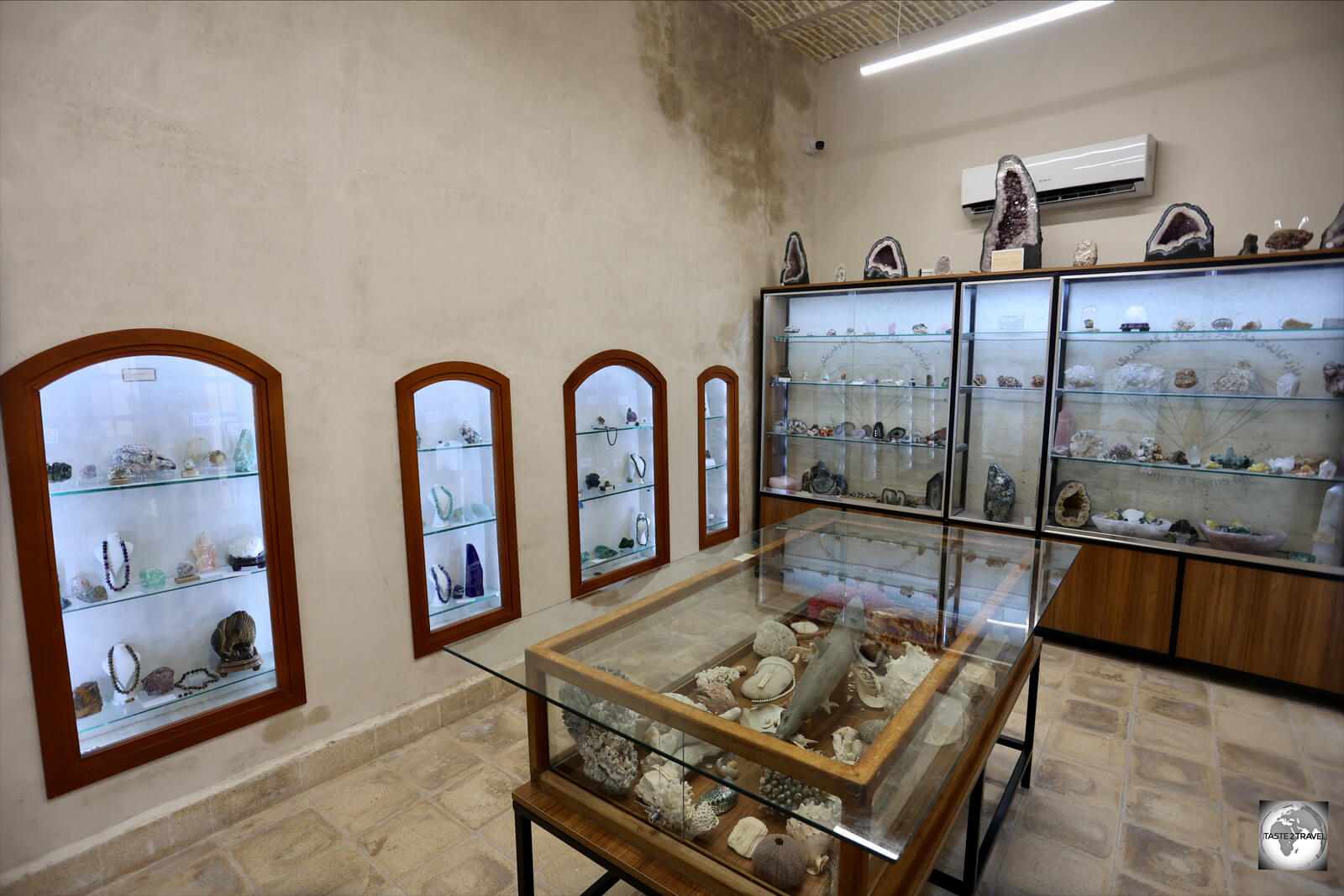
One of the display rooms at the Erbil Stones and Gemstones Museum, which is located inside Erbil Citadel.

One of the display rooms at the Erbil Stones and Gemstones Museum, which is located inside Erbil Citadel.

Located across from the Kurdish Textile Museum, the Erbil Stones & Gemstones Museum is literally the ‘jewel’ of Erbil Citadel.

Souvenir gemstone keyrings for sale in the gift shop at the Erbil Stones and Gemstones Museum.

Souvenir gemstone keyrings for sale in the gift shop at the Erbil Stones and Gemstones Museum.

This small museum is home to a collection of stones and gemstones which have been found in Kurdistan and further afield. The air-conditioned display rooms offer a wonderful respite from the blistering heat of Erbil.

Opening Times: Like the adjacent Kurdish Textile Museum, the Erbil Stones and Gemstones Museum is open every day, except Friday, between 9 am and 6 pm. Entrance costs IQD1,000.

Erbil Souk

Built during the Ottoman era, Erbil souk is the centre of commercial activity in the capital.

Built during the Ottoman era, Erbil souk is the centre of commercial activity in the capital.

Lying in the shadow of Erbil Citadel, the sprawling Erbil Souk has been the commercial heart of Erbil for centuries. The current, charming bizarre, dates from the more recent Ottoman era.
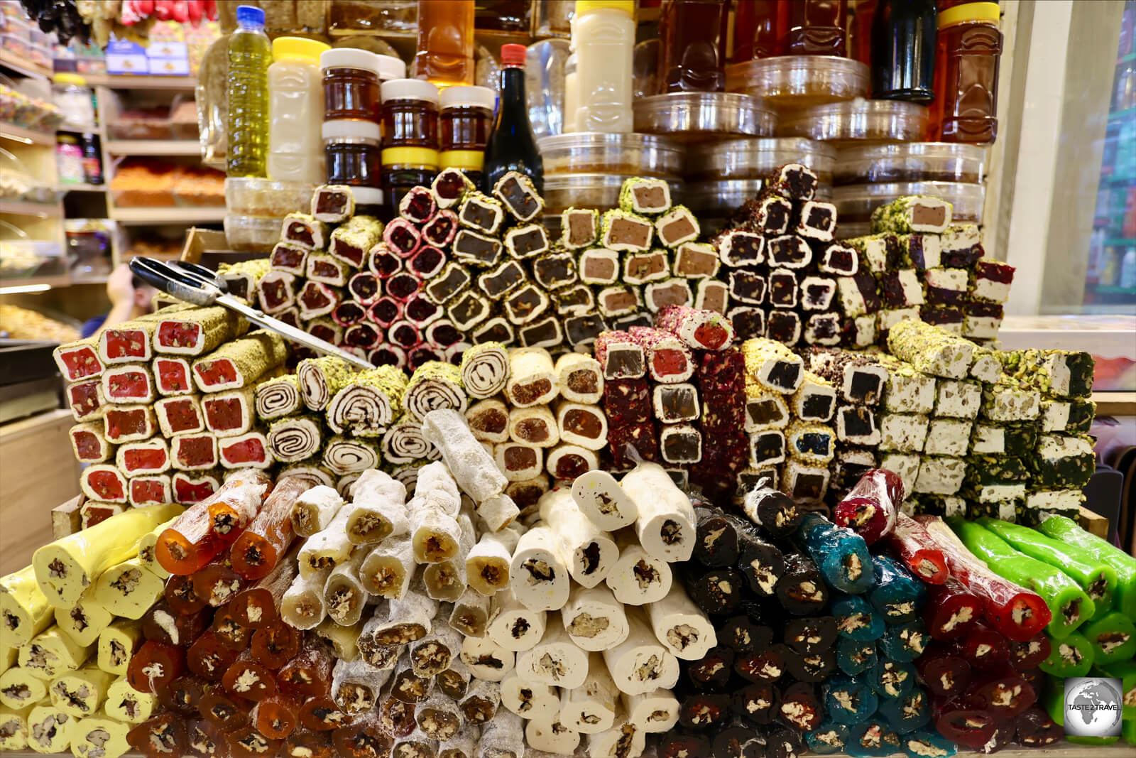
Turkish delight is a popular product at Erbil souk.

Turkish delight is a popular product at Erbil souk.

Tucked away in the rabbit-warren of cool, covered laneways are shops selling absolutely everything. The souk is open all day and it a great place to escape the blistering midday heat.

Shops selling nuts and dried fruit are very popular at Erbil souk.

Shops selling nuts and dried fruit are very popular at Erbil souk.

Especially popular are shops which sell mountains of freshly made Turkish Delight (lokum), dried fruits, nuts, local goat cheese, honey, homemade yoghurts and much more.

Due to the charm, variety and reasonable prices found at both Erbil and Sulaimaniyah souks, the modern malls which have recently been built, are normally deserted, with local shoppers clearly preferring to shop at the more traditional souk.

One of the many entrances to Erbil souk.

One of the many entrances to Erbil souk.

While the souk is crammed with stores selling modern appliances and gadgets, there are areas where traditional crafts, such as woodworking, and goldsmithing are still practiced.
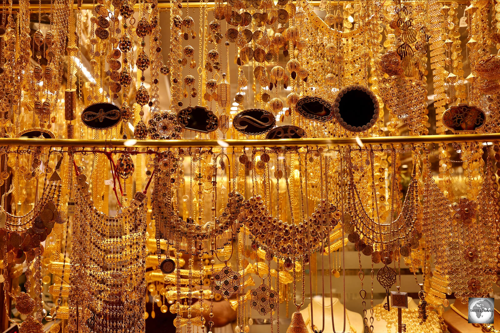
One section of Erbil souk is home to many gold shops.

One section of Erbil souk is home to many gold shops.

The gold souk is lined with many shops, whose dazzling window displays entice keen shoppers.
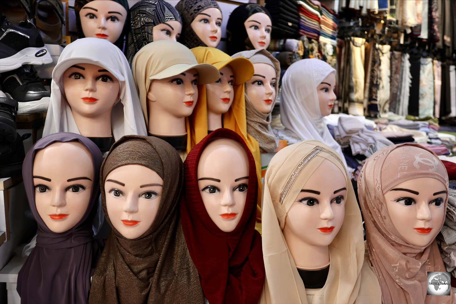
A hijab (head scarf) shop inside Erbil souk.

A hijab (head scarf) shop inside Erbil souk.

Another large section of the souk includes the textile section where you can find woman shopping for clothes and head dresses.

Fountains of Shar Park

A view of the Fountains of Shar Park from Erbil Citadel.

A view of the Fountains of Shar Park from Erbil Citadel.

The small, but hugely popular, Fountains of Shar Park lie in the shadow of Erbil Citadel and across the road from the bustling souk.

Normally quiet during the day, the fountains are turned on around 5 pm, in time for the masses who arrive prior to sunset, to appreciate the cool breezes which are generated by the fountains.

A girl feeding pigeons in the Fountains of Shar Park.

A girl feeding pigeons in the Fountains of Shar Park.

As the sun sets, the park becomes a veritable carnival, complete with balloon sellers, fairy-floss sellers and coffee vendors, who pour coffee from large brass pots which are strapped to their backs.

Jalil Khayat Mosque

The stunning interior of the Jalil Khayat Mosque in Erbil.

The stunning interior of the Jalil Khayat Mosque in Erbil.

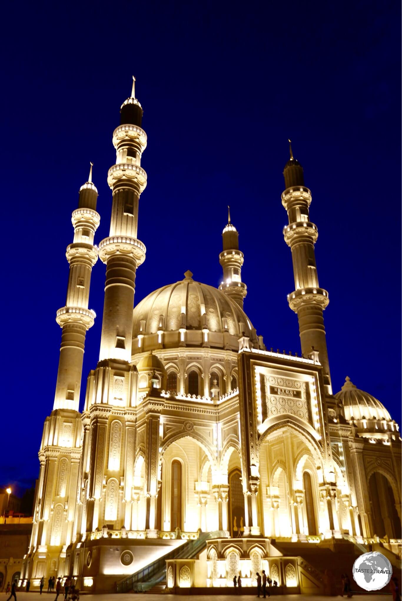
A definite highlight of Erbil is the truly dazzling Jalil Khayat Mosque, which was completed in 2007.

The exterior of the Jalil Khayat Mosque in Erbil.

The exterior of the Jalil Khayat Mosque in Erbil.

A Sunni Islamic Mosque, it was begun by Jalil Khayat who died in 2005. The mosque was completed two years later by his sons in memory of their father.

A photographer's dream - the incredibly ornate Jalil Khayat Mosque in Erbil.

A photographer’s dream – the incredibly ornate Jalil Khayat Mosque in Erbil.

With a jaw-droppingly beautiful interior, the mosque’s style resembles the Mosque of Muhammad Ali in Cairo and the Blue Mosque in Istanbul.

When I visited, the mosque was closed but the caretaker opened it so I could take some photos.

When I visited, the mosque was closed but the caretaker opened it so I could take some photos.

Widely regarded as having one of the most beautiful interiors of any mosque, the Jalil Khayat Mosque is 15,000 square metres (160,000 square ft) and holds up to 2,000 people.

Stained-glass windows at the Jalil Khayat Mosque in Erbil.

Stained-glass windows at the Jalil Khayat Mosque in Erbil.

Access:

The entire mosque complex is enclosed inside a high, ornate, cast-iron fence. When I visited, all gates were locked and there wasn’t a soul in sight.

I found a small entrance gate on the main street (opposite the mall) which was open. Inside this gate is a small air-conditioned office which is where the caretaker can be found. He opened the mosque for me so I could take photos. Normally the mosque is only open at prayer times.

This was a highlight of Erbil! 

Mudhafaria Minaret

The 36-metre high Mudhafaria Minaret dates from the 12th century CE.

The 36-metre high Mudhafaria Minaret dates from the 12th century CE.

Located in Minaret Park, the 36-metre high Mudhafaria Minaret dates from the late 12th century AD. It features an octagonal base decorated with two tiers of niches, which is separated from the main shaft by a small balcony.

Sulaymaniyah

One of many honey sellers at Sulaimaniyah souk.

One of many honey sellers at Sulaimaniyah souk.

Known as Sulaymaniyah, Slemani, Suli, Sulaimaniyah and even Sulaimani, the 2nd largest city of Iraqi Kurdistan (population: 740,000) is a charming and inviting place.

If you have to give preference to either Erbil or Sulaymaniyah, I would spend more time in Sulaymaniyah. Whenever you mention Suli to Iraqi Kurds, they will beam with pride and tell you about their ‘city of learning and culture’.

Turkish Delight seller in Sulaimaniyah souk.

Turkish Delight seller in Sulaimaniyah souk.

While Erbil is a big, bustling capital, and is located on a very hot, desert plain, Sulaimaniyah is a leafy, green city, where large, green parks, provide breathing space and the surrounding mountains provide the occasional cool breeze.

Spice seller at Sulaimaniyah souk.

Spice seller at Sulaimaniyah souk.

Sulaymaniyah is home to the University of Sulaimani, one of the most important scientific and cultural institutions in Iraqi Kurdistan. The American University in Iraq also has its campus in Sulaimaniyah.

A vendor at a fruit juice shop, hidden by a wall of fruit, in Sulaimaniyah souk.

A vendor at a fruit juice shop, hidden by a wall of fruit, in Sulaimaniyah souk.

This university town is home to a sizeable student population, who infuse the city with a certain, funky flair. It has a very different ambiance from Erbil.

The cafe at Cinema Selim in Sulaimaniyah - home to the annual Slemani International Film Festival.

The cafe at Cinema Selim in Sulaimaniyah – home to the annual Slemani International Film Festival.

Slemani is also home to a budding Kurdish arthouse cinema scene – please refer to the previous ‘Kurdish Cinema‘ section for more.

Cinema Selim, which is ground zero for Kurdish cinema, plays daily arthouse features. The cinema also serves as the venue for the annual Slemani International Film Festival.

In between screenings, the cinema cafe is a great place to relax, serving very good barista-made coffee.

Sulaimaniyah is home to one of two international airports in Iraqi Kurdistan – see the ‘Getting There‘ section below for more details.  Frequent shared taxis connect Sulaimaniyah with Erbil and most other cities in federal Iraq.

Amna Suraka (Red Jail) Museum

The Hall of Mirrors at the Amna Suraka Museum in Sulaimaniyah.

The Hall of Mirrors at the Amna Suraka Museum in Sulaimaniyah.

A highlight of Sulaimaniyah is the Amna Suraka (Red Jail) Museum which once served as the northern headquarters (from 1979 to 1991) of Saddam Hussein’s Intelligence Service, known as the Mukhabarat but colloquially referred to as ‘Amn‘.
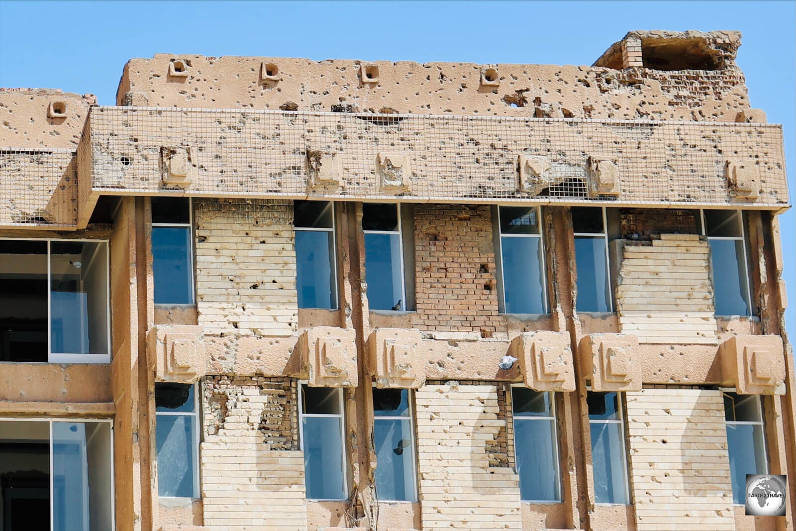
The buildings at the Amna Suraka Museum are riddled with bullet holes, a reminder of the fierce battle which took place in 1991 between Iraqi and Peshmerga forces.

The buildings at the Amna Suraka Museum are riddled with bullet holes, a reminder of the fierce battle which took place in 1991 between Iraqi and Peshmerga forces.

The buildings on the site, which are riddled with pockmarks from gun fire, were built in 1979 by an East Germany construction company, with many of the buildings looking like they were transplanted from communist East Berlin.

Iraqi tanks, which were captured by Peshmerga fighters, are parked in the courtyard of the Amna Suraka Museum.

Iraqi tanks, which were captured by Peshmerga fighters, are parked in the courtyard of the Amna Suraka Museum.

The grounds of the museum contain tanks and other weapons which the Kurdish Peshmerga forces captured from the Iraqi Army during their liberation of the complex in 1991.

One of the memorial halls at the Amna Suraka Museum is lined with photos of the victims of the Al-Anfal Campaign.

One of the memorial halls at the Amna Suraka Museum is lined with photos of the victims of the Al-Anfal Campaign.

During the Al-Anfal Campaign, in which Saddam Hussein tried to wipe out the Kurdish population, the headquarters were used to imprison and torture thousands of Kurds.

During the 1991 Battle of Sulaimaniyah, Iraqi security officials and soldiers retreated to the Amn headquarters which served as the Baathist stronghold in the city.

After two days of intense fighting, Kurdish Peshmerga forces overran the headquarters. Rebels executed 300 Amn agents, with angry civilians killing many others.

In 2003, the Amna Suraka Museum was opened at the site, to serve as a reminder of the atrocities which had taken place under Saddam’s rule.

Of the various buildings in the museum complex, a highlight is the Hall of Mirrors which is lined with 182,000 shards of glass, each commemorating Kurds killed during the genocidal Al-Anfal Campaign. The hall also contains 4,500 backlights to represent the number of Kurdish villages destroyed during the campaign.

Other memorial halls contain photos and the names of thousands of Kurds who died as a result of the Al-Anfal Campaign.

A memorial hall at the Amna Suraka Museum lists the names of tens of thousands of Kurds killed during the Al-Anfal Campaign.

A memorial hall at the Amna Suraka Museum lists the names of tens of thousands of Kurds killed during the Al-Anfal Campaign.

At the rear of the complex is the former jail house which has been left largely untouched.

What could be described as a ‘house of horrors’, the former jail house is lined with small cells which were crammed beyond capacity.

A former jail cell inside the prison house. Cells designed to accommodate 10 prisoners were often crammed with 50 prisoners.

A former jail cell inside the prison house. Cells designed to accommodate 10 prisoners were often crammed with 50 prisoners.

Each cell had just one small window for ventilation near the ceiling. On the day I visited, the temperature outside was close to 50 degrees Celsius.

Cells, which were designed to hold 10 people, often held 50, with prisoners taking it in turns to sleep on the floor.

This wood-panelled room, inside the jail house, was used to torture prisoners.

This wood-panelled room, inside the jail house, was used to torture prisoners.

While all the walls of the prison are cold, exposed concrete, one room stands out due to its warm, wood panelling.

Rather than being an inviting space, this room was used to torture prisoners.

A house of horrors - the former jail house at the Amna Suraka Museum.

A house of horrors – the former jail house at the Amna Suraka Museum.

The museum is a necessary, albeit harrowing, reflection of the large-scale oppression that the Kurds suffered under the rule of Saddam Hussein.

One of the most important museums in Iraqi Kurdistan! 

"Vase of Flowers" graffiti, drawn by a former prisoner on the wall of one of the cells inside the jail house at the Amna Suraka museum.

“Vase of Flowers” graffiti, drawn by a former prisoner on the wall of one of the cells inside the jail house at the Amna Suraka museum.

Access:

Located in the suburbs of Sulaimaniyah, the museum is free of charge and is open six days a week, but closed each day for lunch from 12 pm to 1 pm.

Sulaymaniyah Souk

The large and sprawling Sulaimaniyah souk covers all of the downtown area.

The large and sprawling Sulaimaniyah souk covers all of the downtown area.

Sulaymaniyah’s souk (bazaar) is without a doubt, the largest traditional market in Iraqi Kurdistan.

Textile shop at Sulaimaniyah souk.

Textile shop at Sulaimaniyah souk.

The souk covers the entire downtown area of the city, with covered laneways stretching for kilometres in every direction.
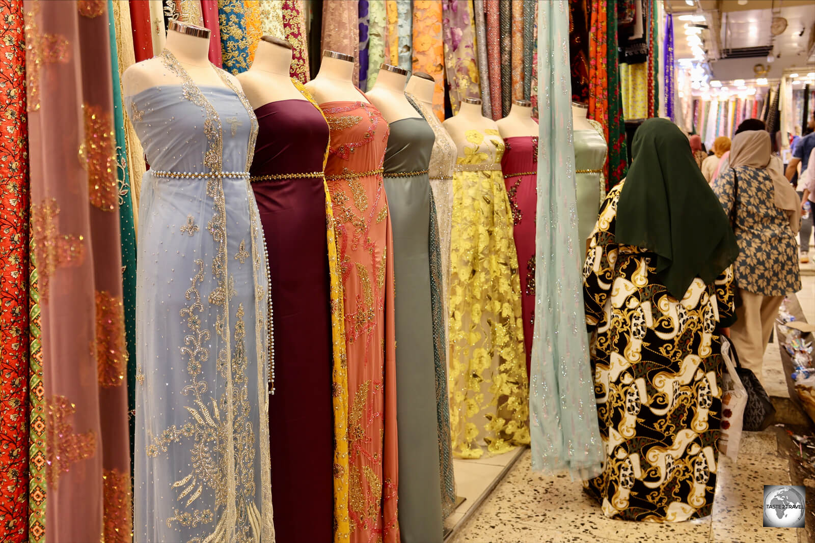
Women, shopping for clothes and textiles at Sulaimaniyah souk.

Women, shopping for clothes and textiles at Sulaimaniyah souk.

Outside on the busy streets, the souk spreads its tentacles even further, with vendors selling fruits, vegetables, pets, clothing, shoes and so much more.

Small trucks, laden with melons and other produce occupy any available parking spaces. It’s a wonderfully intoxicating scene and, if you walk around with your camera out, everyone will be asking for their photo to be taken.

A tomato vendor in Sulaimaniyah, who really wanted his photo taken.

A tomato vendor in Sulaimaniyah, who really wanted his photo taken.

The busiest time for the market is later in the afternoon once the blistering heat has waned.

At around 7 pm, the evening ‘call to prayer’ rings out over the city, marking the official closing time for the market.

Another produce vendor, who wouldn't let me pass until I had taken his photo.

Another produce vendor, who wouldn’t let me pass until I had taken his photo.


Perfume shops in Sulaimaniyah souk offer the bases for all famous perfume brands, with a 50 ml bottle costing US$10.

Perfume shops in Sulaimaniyah souk offer the bases for all famous perfume brands, with a 50 ml bottle costing US$10.


A nut roaster at the Sulaimaniyah souk.

A nut roaster at the Sulaimaniyah souk.


The gold market Sulaimaniyah souk is comprised of many laneways of goldsmiths.

The gold market Sulaimaniyah souk is comprised of many laneways of goldsmiths.


Spices for sale at Sulaimaniyah souk.

Spices for sale at Sulaimaniyah souk.

Grand Mosque of Sulaimaniyah

The minaret of the Grand Mosque of Sulaimaniyah reminded me of minarets I'd seen in Uzbekistan.

The minaret of the Grand Mosque of Sulaimaniyah reminded me of minarets I’d seen in Uzbekistan.

Located in the heart of the old town, the Grand Mosque of Sulaimaniyah is one of the oldest mosques in the city.

It’s partially-tiled minaret is especially beautiful and is best photographed around sunset.

Chavi Land

"Chavi Land" is less 'fun park' and more 'forlorn park'.

“Chavi Land” is less ‘fun park’ and more ‘forlorn park’.

Located on a hill overlooking Sulaimaniyah is the rather depressing Chavi Land. What bills itself as a family ‘fun park’ has a distinctly forlorn feel to it. It’s all a little run down and poorly maintained. The toilets definitely should be avoided!

I arrived at 5 pm, in order to ride the teleferic (cable car) up onto the nearby mountain to take photos of the sun setting over Sulaimaniyah.

One way to beat the intense heat, amusements at Chavi Land are housed inside a large, air-conditioned, hall.

One way to beat the intense heat, amusements at Chavi Land are housed inside a large, air-conditioned, hall.

Due to yet another power outage (they occur regularly, about every hour, in Iraqi Kurdistan), nothing in the park was operating. An amusement park without any amusements!

I waited at the cable car station until the sun had set before returning to the city.

Halabja

Halabja Monument and Peace Museum

Halabja Monument and Peace Museum pays homage to the victims of this horrific attack.

Halabja Monument and Peace Museum pays homage to the victims of this horrific attack.

Located in a far corner of Iraqi Kurdistan, close to the Iranian border, the otherwise non-descript town of Halabja made world news headlines in 1988, during the closing days of the Iran-Iraq war.

A display at the Halabja Monument and Peace Museum.

A display at the Halabja Monument and Peace Museum.

The town was the scene for a truly crazy act carried out by a crazed dictator, Saddam Hussein, who ordered the Iraqi Air Force to drop bombs containing lethal chemical weapons on the civilian population.

The main hall of the Halabja Monument and Peace Museum.

The main hall of the Halabja Monument and Peace Museum.

The attack, which took place on the 16th of March 1988, was part of the Al-Anfal Campaign, a campaign conducted by Saddam Hussein who was determined to exterminate the entire Kurdish population – who numbered around 8,000,000 at the time!

The attack was also an attempt to repel the Iranian Army, who had captured Halabja just 48 hours prior.

The incident was the largest chemical weapons attack directed against a civilian-populated area in history, and resulted in the deaths of between 3,200 and 5,000 people and injured 7,000 to 10,000 more.

A UN investigation concluded that mustard gas, along with other unknown chemical weapons, had been used in the attack.

Located on the outskirts of town, as you drive in on the main road from Sulaimaniyah, the Halabja Monument and Peace Museum pays homage to the victims of this horrific attack.

The original fighter jet, which dropped the chemical weapons on Halabja, is one of the displays at the museum.

The original fighter jet, which dropped the chemical weapons on Halabja, is one of the displays at the museum.

The main hall of the museum contains the names of the victims, while outside, the original fighter jet which dropped the chemical bombs is on display.

Access:

The Halabja Monument and Peace Museum, which is free of charge, is open every day between 8 am and 12 pm, and then from 1 pm to 5 pm.

Getting There:

Halabja is located at the end of the road in Iraqi Kurdistan, inside a wide valley, surrounded by Iran.

Shared taxis from Sulaimaniyah cover the 73 km distance in one hour. It’s an easy day trip from Sulaimaniyah! A single seat, in a 4-seater taxi, costs IQD 10,000.

Accommodation

There’s no shortage of excellent mid-range and top-end hotels in Erbil and Sulaymaniyah. For backpackers, there is just one hostel in Iraqi Kurdistan which is the Dolphin hostel in Sulaymaniyah.

Due to the compact size of Iraqi Kurdistan, it’s possible to base yourself in the two main cities and then do day trips from there.

Many accommodation OTA’s (Online Travel Agents) do not cover Iraq. Booking.com is one OTA which does provide coverage of Iraq. 

Erbil

My room at the Erbil View Hotel.

My room at the Erbil View Hotel.

While in Erbil, I stayed at the excellent Erbil View Hotel. I rated this hotel 10/10 on booking.com – it is excellent in every respect.

The breakfast buffet at the Erbil View hotel.

The breakfast buffet at the Erbil View hotel.

The friendly and helpful staff at the hotel assured me that the Erbil View Hotel was my home away from home. I was made to feel welcome at all times. The rooms are comfortable and included a daily breakfast buffet.

While there are no restaurants in the area, the hotel restaurant serves excellent meals in the evening and also offers room service.

Erbil citadel and souk are a 10-minute walk from the hotel.

Sulaymaniyah

My room at the Khan Saray Hotel in Sulaimaniyah.

My room at the Khan Saray Hotel in Sulaimaniyah.

Located in the heart of Sulaimaniyah old town, the excellent Khan Saray Hotel is the kind of hotel you never want to leave. I extended my stay several times.

The beautiful Khan Saray Hotel where I paid just US$28 per night!

The beautiful Khan Saray Hotel where I paid just US$28 per night!

I booked the 1st night on booking.com at US$40. I then negotiated a direct rate of US$28 for subsequent nights. This represented excellent value, and included an amazing breakfast in the hotel restaurant.
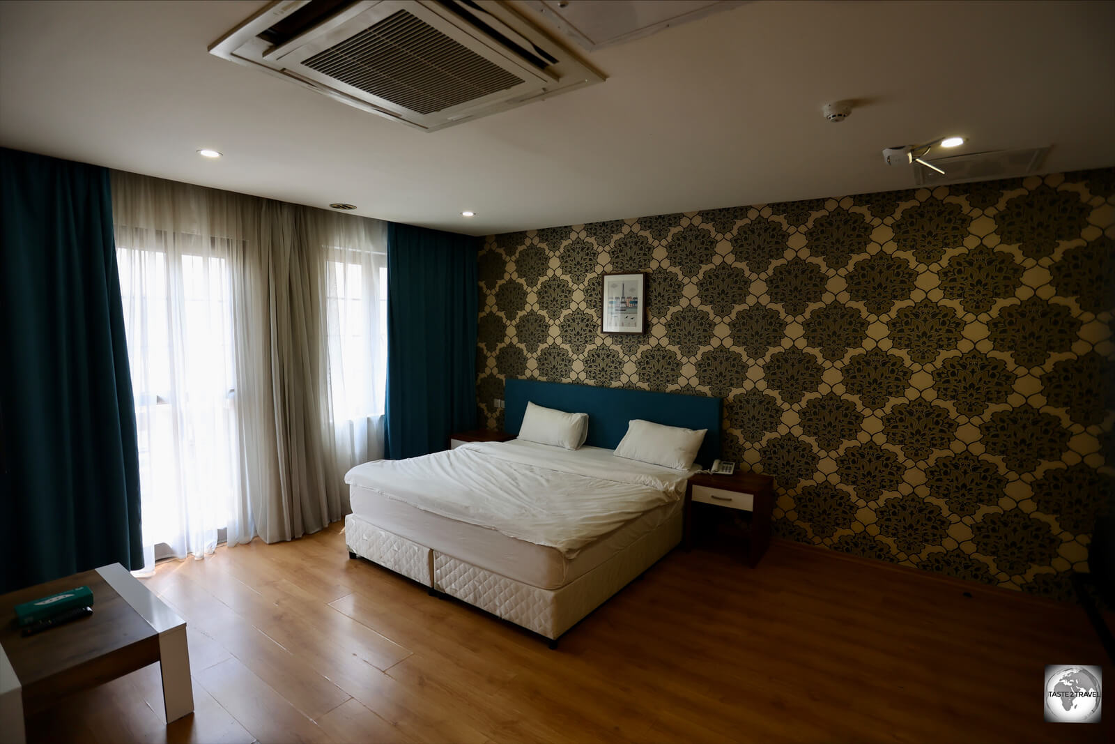
My spacious room at the Khan Saray Hotel in Sulaimaniyah.

My spacious room at the Khan Saray Hotel in Sulaimaniyah.

My large, spacious room faced inward to a shopping mall, which ensured that the room was nice and quiet. Outside, the sprawling souk surrounds the hotel. Everything is within walking distance from the hotel.

Highly Recommended!

Eating Out

Produce vendor at Sulaimaniyah souk. Iraqi Kurdistan has an abundance of fresh, tasty produce!

Produce vendor at Sulaimaniyah souk. Iraqi Kurdistan has an abundance of fresh, tasty produce!

The cuisine of Iraqi Kurdistan is the same as that found throughout the region – lots of kebabs, and other grilled meats, served with freshly baked Khubz (flatbread), pickled vegetables and salad.

Kebabs are served for lunch and dinner, either as Shish kebab or as a sandwich.

Baking Khubz (flatbread) in a traditional tannour (Tandoor oven) in Sulaimaniyah.

Baking khubz (flatbread) in a traditional tannour (tandoor oven) in Sulaimaniyah.

Popular breakfast items include lentil soup, boiled eggs, tomatoes, cucumber, freshly made local yoghurt (often served with a drizzle of locally sourced honey), goat’s cheese and much more.

I could happily eat a Kurdish breakfast every day!

Truly unique! A honeycomb flatbread bakery in Sulaimaniyah souk.

Truly unique! A honeycomb flatbread bakery in Sulaimaniyah souk.

All of this is served with an ample amount of warm, freshly baked Khubz.


Khubz tannour (flatbread)

What rice is to the Asians, Khubz (flatbread) is to the Kurds – a staple which is served, always freshly baked, at all meals.

Most bakeries in Iraqi Kurdistan bake their Khubz using traditional tandoor ovens, known locally as tannour. The bread spends less than one minute inside the oven before its ready to serve!

The following video was taken in a bakery in Sulaimaniyah, where the baker’s worked non-stop, throughout the day, producing a mountain of Khubz.

The finished bread is always laid out on a table at the front of the bakery and disappears as quickly as it’s produced – snapped up by hungry locals.


Restaurants

Typical meal of shish kebab, salad, pickled vegetables and flat bread.

Typical meal of shish kebab, salad, pickled vegetables and flat bread.

Erbil

Mince-meat shish kebabs, being prepared for lunch, in a restaurant inside Erbil souk.

Mince-meat shish kebabs, being prepared for lunch, in a restaurant inside Erbil souk.

Strangely, the streets of downtown Erbil seem to lack restaurants. The best place to look for a meal is inside the souk where a number of restaurants serve typical Kurdish food.

Sulaimaniyah

The friendly server at a restaurant in Sulaimaniyah.

The friendly server at a restaurant in Sulaimaniyah.

While restaurants are scarce in Erbil, there’s no shortage of places to eat in Sulaimaniyah. The standard food is minced-meat shish kebabs which are always served with a side salad of tomatoes and white onions, served both grilled and raw.

Apart from kebabs, many restaurants offer freshly roasted chicken which makes for a nice break.

Freshly baked flatbread is served with all meals, and is used instead of utensils, to either scoop up or pull food apart.

Halabja

Lunch in Halabja - roast chicken, served with stewed apricots and other sides.

Lunch in Halabja – roast chicken, served with stewed apricots and other sides.

Tiny Halabja offers at least one amazing restaurant which is located in the centre of town – every taxi driver knows the place and will drop you there!

Since the genocide museum is closed between 12 pm and 1 pm, the restaurant is a great place to relax and unwind.

The proud chef, at my lunch restaurant in Halabja.

The proud chef, at my lunch restaurant in Halabja.

My lunch consisted of the most succulent roasted chicken which was served with various sides, including stewed apricots. Delicious!

Cafés/ Tea Shops

Erbil

One of many cups of sweet tea which I drank while in Iraqi Kurdistan.

One of many cups of sweet tea which I drank while in Iraqi Kurdistan.

The staple refresher in Iraqi Kurdistan is sweet black tea, which is always served boiling hot, in small glasses.

This historic, and popular, tea shop is built into the walls of Erbil Citadel.

This historic, and popular, tea shop is built into the walls of Erbil Citadel.

If you try to pick up the glass too soon, you’ll burn your fingers. Locals get around this by pouring a small portion of tea into the plastic saucer and slurping it from the there.

Before pouring the tea, two heaped spoons of sugar are added!

Wonderful coffee can be enjoyed at the tiny 'Yolo Coffee', which is hidden away inside Erbil souk.

Wonderful coffee can be enjoyed at the tiny ‘Yolo Coffee’, which is hidden away inside Erbil souk.

Hidden away inside the busy laneways of Erbil souk are numerous coffee and tea houses which offer respite from all the hustle and bustle.

I especially recommend the excellent Yolo Coffee which is operated by a team of friendly Indians, who loved to talk about cricket with their regular Australian customer. I stopped by most days for my caffeine fix!

Coffee shop in Erbil souk.

Coffee shop in Erbil souk.

Not to be outdone, the many tea houses inside Erbil souk are a great place to rub shoulders with the locals.

One of numerous tea sellers inside Erbil Souk. Notice that he can pour while posing for the camera. Talented!

One of numerous tea sellers inside Erbil Souk. Notice that he can pour while posing for the camera. Talented!

I always had my camera out while in Erbil souk and everyone wanted their photo taken. Thanks to WhatsApp and Instagram, I’m able to send people their photos which is highly appreciated.

Sulaimaniyah

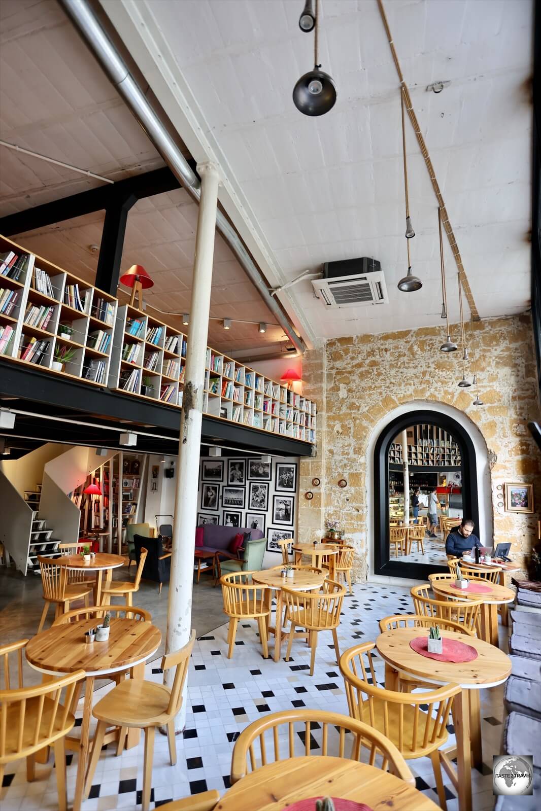
The walls of this groovy downtown cafe in Sulaimaniyah are decorated with books.

The walls of this groovy downtown cafe in Sulaimaniyah are decorated with books.

As with Erbil, there are many coffee and tea shops hidden away inside the rabbit-warren of covered laneways which comprise Sulaimaniyah souk.

The student population is responsible for many fine cafes in Sulaimaniyah, which is possibly the most cosmopolitan city in all of Iraq.

Tea sellers at Sulaimaniyah souk.

Tea sellers at Sulaimaniyah souk.

A line of locals outside one cafe in Sulaimaniyah souk led me to discover the most divine desert – a piece of freshly baked baklava, crumbled into a bowl of freshly made, warm custard.

Truly divine! Baklava crumbled over a bowl of warm custard at Sulaimaniyah souk!

Truly divine! Baklava crumbled over a bowl of warm custard at Sulaimaniyah souk!

Truly divine and, as is common in Iraqi Kurdistan, the cafe owner refused to accept payment from me.

Bars/ Alcohol

While there are no bars in Iraqi Kurdistan, there are some bottle shops where alcohol can be purchased.

Visa Requirements

My Iraqi Kurdistan visa-on-arrival.

My Iraqi Kurdistan visa-on-arrival.

As an autonomous region of Iraq, Iraqi Kurdistan enforces its own visa policy, with nationals of many countries able to apply for a Visa on Arrival (VOA) which is valid for 30-days.

Visas are issued at Erbil and Sulaimaniyah International airports from the Visa desk in the immigration hall. A 30-day visa costs US$77 which can be paid in either USD or Euro cash. Credit cards are not accepted!

It’s important to note that a visa issued in Iraqi Kurdistan is only valid for travel within Iraqi Kurdistan. However, a visa issued in federal Iraq is valid for travel everywhere in Iraq, including Iraqi Kurdistan.

You cannot travel into federal Iraq using an Iraqi Kurdistan visa.  

If you are planning to visit both Iraqi Kurdistan and federal Iraq, it is best that you make your first entry into federal Iraq since your Iraqi visa is good for travel in all of Iraq, therefore you’ll only need to pay for one visa at US$77.  

If you first enter Iraq through Iraqi Kurdistan, and wish to travel into federal Iraq, you will need to fly into federal Iraq and purchase an additional Iraqi visa at US$77 – i.e., you will need to pay for two visas at US$77 each.  

Note: Many shared taxis in Iraqi Kurdistan transit through federal Iraq during their journey’s. A prime example of this is the journey from Erbil to Sulaymaniyah. There are two ways to travel on this route; either via Tikrit (which is in federal Iraq) or via the town of Dukan (which is in Iraqi Kurdistan).

If you are travelling on an Iraqi Kurdistan visa, you are not allowed to transit through federal Iraq. You need to ensure you travel via Dukan and not Tikrit.

Prior to travelling, you should consult the Iraq Visa Policy.


Important Note Regarding the United States Visa Waiver Program

For non-U.S. passport holders, who normally travel to the United States under the Visa Waiver Program (VWP), aka ESTA, the following should be noted:

Travelers in the following categories are no longer eligible to travel or be admitted to the United States under the Visa Waiver Program (VWP):

  • Nationals of VWP countries who have traveled to or been present in Iran, Iraq, North Korea, Sudan, Syria, Libya, Somalia and Yemen on or after March 1, 2011 (with limited exceptions for travel for diplomatic or military purposes in the service of a VWP country).
  • Nationals of VWP countries who are also nationals of Iran, Iraq, North Korea, Sudan, or Syria.

Anyone who has travelled to any of the above listed countries will need to apply for a visa from a United States embassy before being able to visit the United States.


Getting There

Air

Erbil International Airport is one of two international airports in Iraqi Kurdistan.

Erbil International Airport is one of two international airports in Iraqi Kurdistan.

There are currently two international airports operating in Iraqi Kurdistan; Erbil International Airport and Sulaimaniyah International Airport – with a third, Duhok International Airport, under construction.

Airport Security Checks

Due to the special security situation in Iraq, entering an Iraqi airport requires passing through several security checkpoints, before you even reach the terminal. Due to the time involved at each checkpoint, it’s wise to arrive at least 4 hours prior to your departure.

The following steps describe the process for accessing Erbil International airport:

Step 1: All arriving vehicles must first stop at a covered roadside checkpoint.

Everyone must exit the vehicle, all doors must be opened, along with the hood and bonnet.

Security personnel, with sniffer dogs, will inspect the contents of the car, check the engine and the boot compartment to ensure no weapons or bombs are being carried into the airport complex. All passengers receive a pat-down from security staff.

Step 2: Once cleared through the vehicle checkpoint, all passengers travel next to a security screening building which is located about 2 km from the airport terminal. No vehicles are allowed to proceed further beyond this point.

At this point, passengers undergo the first of three full airport security screenings, with all luggage being x-rayed.

Once cleared through security, passengers make their way onto shuttle buses which are parked at the rear of the building. These buses then transfer passengers to the actual terminal.

Step 3: Upon arrival at the terminal, passengers must once again pass through another security screening before entering the terminal.

Step 4: Once inside the terminal, you can check in for your flight.

Step 5: Once you have your boarding pass you can proceed to immigration and then the 3rd, and final, security screening!

Bring your patience!

Erbil International Airport

The departure hall at Erbil International Airport.

The departure hall at Erbil International Airport.

The main gateway to Iraqi Kurdistan is Erbil International Airport (IATA: EBL) which boasts a modern terminal which was completed in 2010. The airport has the distinction of having one of the longest runways in the world at 4,800 m (15,748 ft).

Visas-on-arrival are issued at the airport for certain nationalities (see the ‘Visa Requirements‘ section above for more details).

The following airlines provide services to/from Erbil International Airport:

  • Air Arabia – flies to/from Sharjah
  • AnadoluJet – flies to/from Adana, Diyarbakir, Gaziantep, Istanbul–Sabiha Gökçen
  • Austrian Airlines – flies to/from Vienna
  • Cham Wings Airlines – flies to/from Damascus
  • Egyptair – flies to/from Cairo
  • Emirates – flies to/from Dubai–International
  • Eurowings – flies to/from Düsseldorf
  • Fly Baghdad – flies to/from Aleppo, Ankara, Baghdad, Damascus, Istanbul, Medina
  • flydubai – flies to/from Dubai–International
  • FlyErbil  – flies to/from Baku, Cologne/Bonn, Copenhagen, Düsseldorf, Hanover, Istanbul, Yerevan
  • Iraqi Airways Amman–Queen Alia, Ankara, Baghdad, Baku, Berlin, Cairo, Copenhagen, Dubai–International, Düsseldorf, Frankfurt, Istanbul, Munich, Sulaymaniyah
  • Lufthansa – flies to/from Frankfurt
  • Mahan Air – flies to/from Tehran–Imam Khomeini
  • Middle East Airlines – flies to/from Beirut
  • Pegasus Airlines – flies to/from Ankara, Gaziantep, Istanbul–Sabiha Gökçen
  • Qatar Airways – flies to/from Doha
  • Royal Jordanian – flies to/from Amman–Queen Alia
  • Turkish Airlines – flies to/from Istanbul
The modern terminal at Erbil International airport was inaugurated in 2010.

The modern terminal at Erbil International airport was inaugurated in 2010.

Sulaimaniyah International Airport

The 2nd international airport in Iraqi Kurdistan, Sulaimaniyah International Airport (IATA: ISU) is located 14 km (9 mi) outside the city of Sulaimaniyah.

Visas-on-arrival are issued at the airport for certain nationalities (see the ‘Visa Requirements‘ section above for more details).

The following airlines provide services to/from Sulaimaniyah International Airport:

  • Condor – flies to/from Düsseldorf
  • flydubai – flies to/from Dubai–International
  • FlyErbil – flies to/from Düsseldorf
  • Iraqi Airways – flies to/from Amman–Queen Alia, Baghdad, Baku, Basra, Beirut, Cairo, Dubai–International, Erbil, Frankfurt, London–Gatwick, Najaf, Tehran–Imam Khomeini
  • Mahan Air – flies to/from Kish Island, Tehran–Imam Khomeini
  • Pegasus Airlines – flies to/from Istanbul–Sabiha Gökçen
  • Qatar Airways – flies to/from Doha
  • Royal Jordanian – flies to/from Amman–Queen Alia
  • Turkish Airlines – flies to/from Istanbul

Land

It’s possible to travel overland into Iraqi Kurdistan from either Iran, Turkey or federal Iraq.

Getting Around

Important Note:

Whenever travelling on highways in Iraqi Kurdistan, you must carry your passport. This can be requested at the numerous military checkpoints, although many times you will be simply waved through. 

Taxis

Taxis parked outside Erbil Citadel.

Taxis parked outside Erbil Citadel.

The easiest way to get around cities in Iraqi Kurdistan is by taxi. Although not metered, most drivers are honest and charge around IQD 4-5,000 for any trip around town. You should always agree on the fare prior to commencing your journey.

Taxis in Iraq can be identified by their red license plates.

Taxis in Iraq can be identified by their red license plates.

Taxis in Iraqi Kurdistan are easily identified thanks to their large red license plates.

Long-distance Taxis

Long-distance shared taxis waiting at Sulaimaniyah taxi station.

Long-distance shared taxis waiting at Sulaimaniyah taxi station.

The best way to travel between cities in Iraqi Kurdistan is with shared taxis, which depart from long-distance taxi garages.

Taxis carry four passengers, with the fare between Erbil and Sulaimaniyah costing IQD 20,000 per seat.

In Sulaimaniyah, a new taxi garage has recently been opened, but is inconveniently located 10 km outside of town, on the main road to Erbil. The cost of reaching the garage from downtown Sulaimaniyah is IQD 10,000.

Rental Car

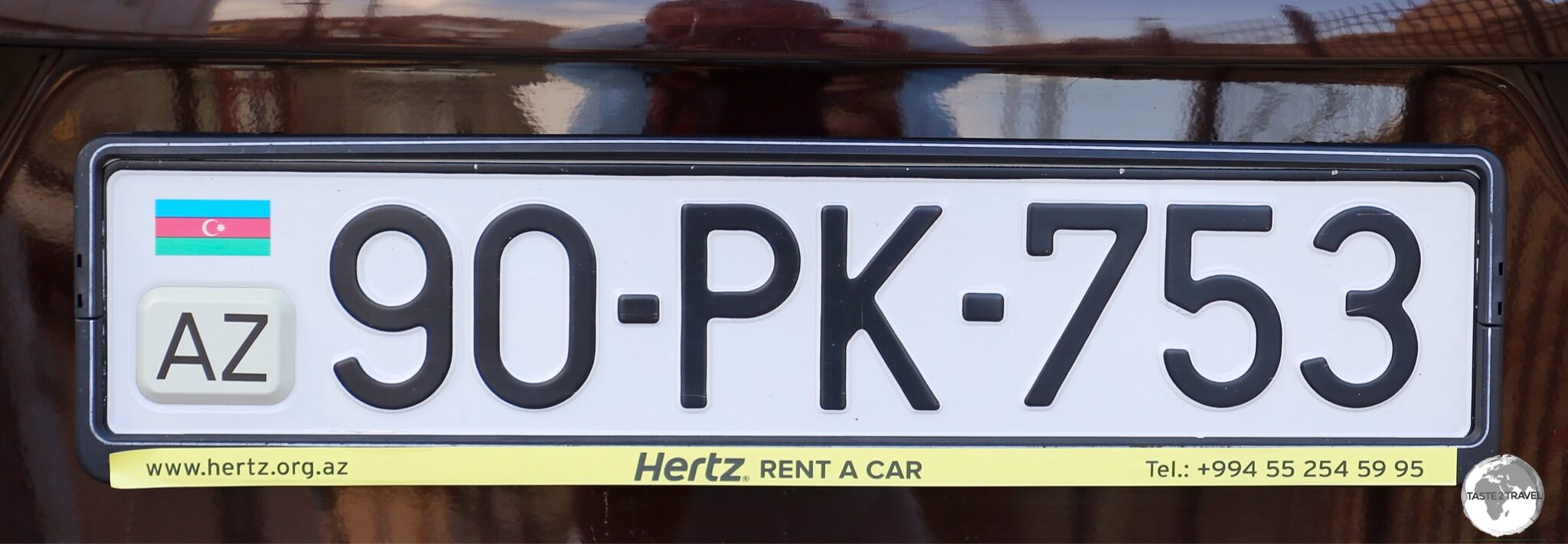
An Iraqi Kurdistan car license plate.

An Iraqi Kurdistan car license plate.

There are many rental car companies in Erbil and Sulaimaniyah, although hiring a private driver for the day is possibly cheaper than renting a car and allows you to leave the driving to a local who knows the roads.

The following car rental companies are located in Erbil:


That’s the end of my travel guide for Iraqi Kurdistan.

If you wish to provide any feedback on this guide, you can leave a comment below.

Safe Travels!

Darren


Follow me on Instagram

[instagram-feed feed=1]

Iraqi Kurdistan Travel Guide Iraqi Kurdistan Travel Guide Iraqi Kurdistan Travel Guide Iraqi Kurdistan Travel Guide Iraqi Kurdistan Travel Guide

Iraqi Kurdistan Travel Guide Iraqi Kurdistan Travel Guide Iraqi Kurdistan Travel Guide Iraqi Kurdistan Travel Guide Iraqi Kurdistan Travel Guide
Iraqi Kurdistan Travel Guide Iraqi Kurdistan Travel Guide Iraqi Kurdistan Travel Guide Iraqi Kurdistan Travel Guide Iraqi Kurdistan Travel Guide

Iraqi Kurdistan Travel Guide Iraqi Kurdistan Travel Guide Iraqi Kurdistan Travel Guide Iraqi Kurdistan Travel Guide Iraqi Kurdistan Travel Guide

Northern Cyprus Photo Gallery

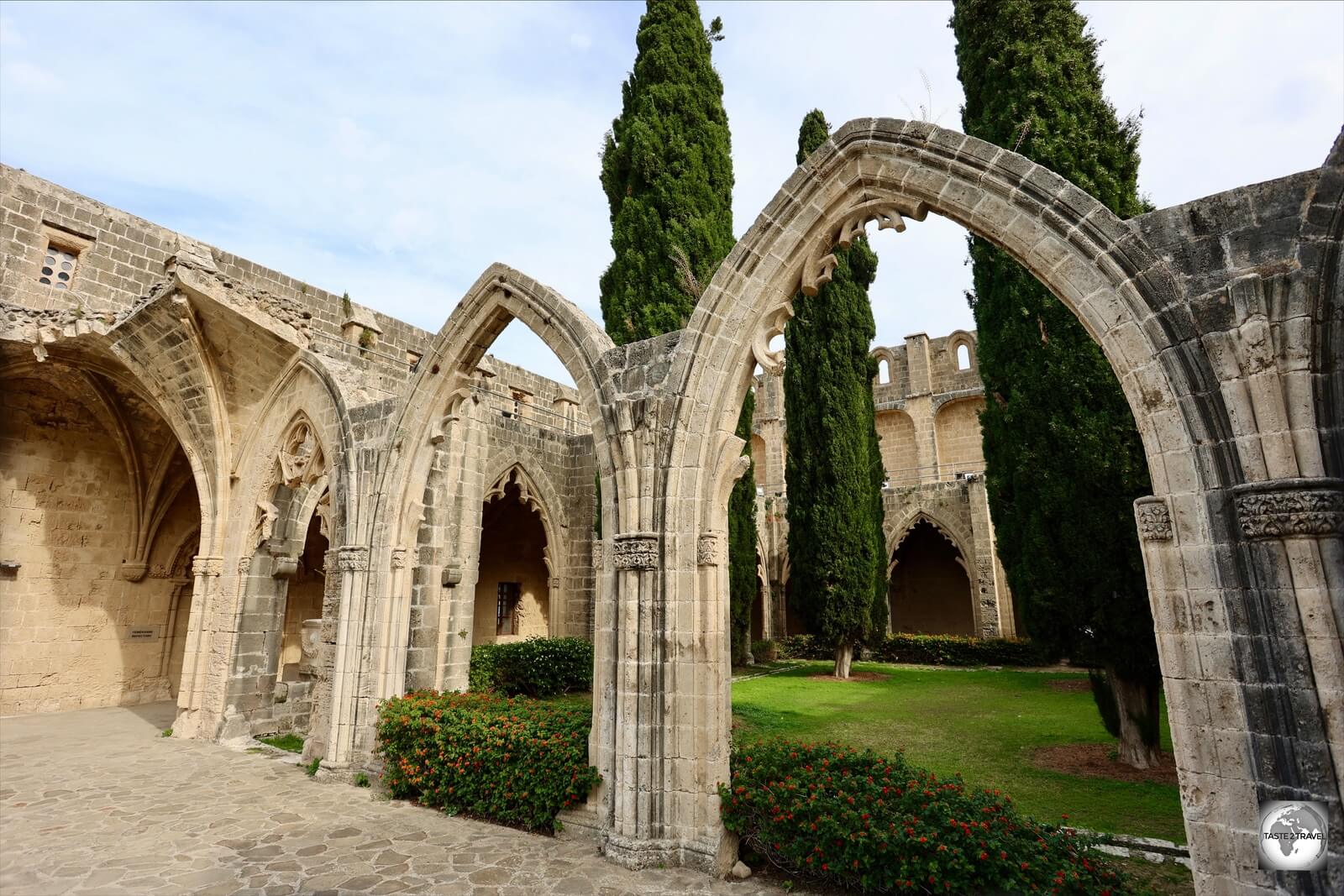
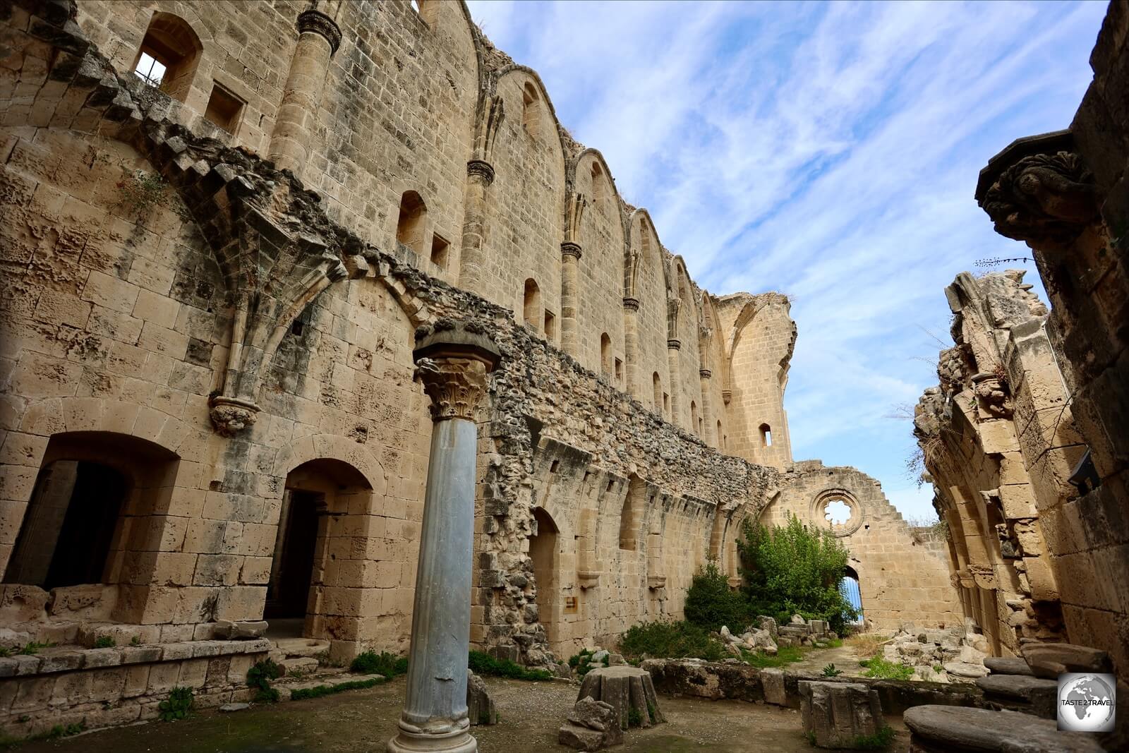
Bellapais Monastery is a highlight of Kyrenia.

Northern Cyprus Photo Gallery

This is a Northern Cyprus Photo Gallery. To read about this destination, please refer to my Northern Cyprus Travel Guide.


All images are copyright! If you wish to purchase any images for commercial use, please contact me via the Contact page.


About taste2travel!

Hi! My name is Darren McLean, the owner of taste2travel. I’ve been travelling the world for 33 years and, 209 countries and territories, and – seven continents later, I’m still on the road.

Taste2travel offers travel information for destinations around the world, specialising in those that are remote and seldom visited. I hope you enjoy my content!

Ever since I was a child, I have been obsessed with the idea of travel. I started planning my first overseas trip at the age of 19 and departed Australia soon after my 20th birthday. Many years later, I’m still on the road.

In 2016, I decided to document and share my journeys and photography with a wider audience and so, taste2travel.com was born.

My aim is to create useful, usable travel guides/ reports on destinations I have visited. My reports are very comprehensive and detailed as I believe more information is better than less. They are best suited to those planning a journey to a particular destination.

Many of the destinations featured on my website are far off the regular beaten tourist trail. Often, these countries are hidden gems which remain undiscovered, mostly because they are remote and difficult to reach. I enjoy exploring and showcasing these ‘off-the-radar’ destinations, which will, hopefully, inspire others to plan their own adventure to a far-flung corner of the planet.

I’m also a fan of travel trivia and if you are too, you’ll find plenty of travel quizzes on the site.

Photography has always been a passion and all the photos appearing in these galleries were taken by me.

If you have any questions or queries, please contact me via the contact page.

I hope you this gallery and my website.

Safe travels!

Darren


Follow me on Instagram: 

[instagram-feed feed=1]


Northern Cyprus Travel Guide

Kyrenia castle guards the entrance to Kyrenia harbour.

Northern Cyprus Travel Guide

This is a Northern Cyprus Travel Guide from taste2travel.

Date Visited: November 2021

Introduction

Often overlooked by the hordes of tourists which descend upon the modern, (Greek) Republic of Cyprus, the Turkish Republic of Northern Cyprus (TRNC) is a much quieter backwater, a charming version of a more traditional Cyprus.

While the Republic of Cyprus receives an average of 4,000,000 visitors per year (mostly from Europe), TRNC receives around 1,000,000 visitors per year, with about 900,000 of those coming from Turkey.

A map of Cyprus which shows Northern Cyprus in yellow.

A map of Cyprus which shows Northern Cyprus in yellow.
Source: Nations Online Project.

Following intercommunal violence in 1974, which saw the Greek Cypriot majority fighting against the Turkish Cypriot minority, Turkey invaded Cyprus, annexing the top third of the island, creating a safe haven for Turkish Cypriots. After almost 50 years, this division remains, and shows no sign of ending anytime soon.

Separating the two sides is the UN Green Line – so named after the original dividing line was drawn on a map using a green pen.

The only country which recognises the TRNC is Turkey. Due to its lack of recognition, Northern Cyprus is heavily dependent on Turkey for economic, political and military support.

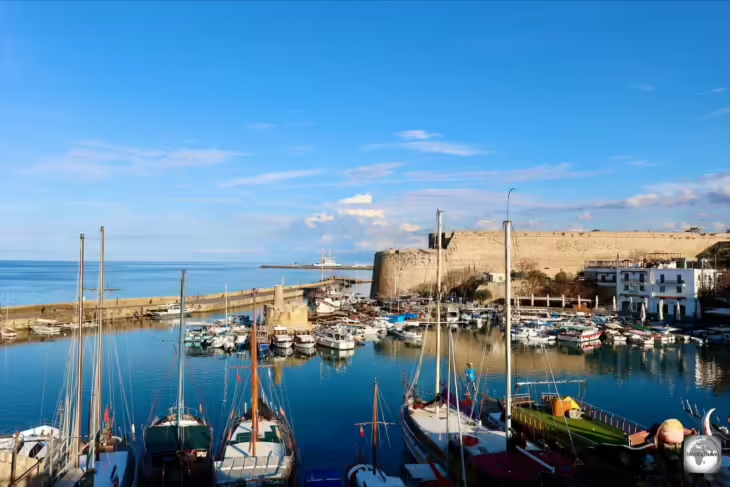
A view of Kyrenia port.

A view of Kyrenia port.

Not flush with funds itself, and facing its own financial issues, Turkey has provided minimal investment into Northern Cyprus since its invasion in 1974.

A makeshift barrier on the Greek side of the UN Green Line blocks a street in the old town of Nicosia.

A makeshift barrier on the Greek side of the UN Green Line blocks a street in the old town of Nicosia.

Meanwhile, across the UN Green Line, a much more confident, cosmopolitan and modern, Republic of Cyprus, joined the European Union on the 1st of May 2004.

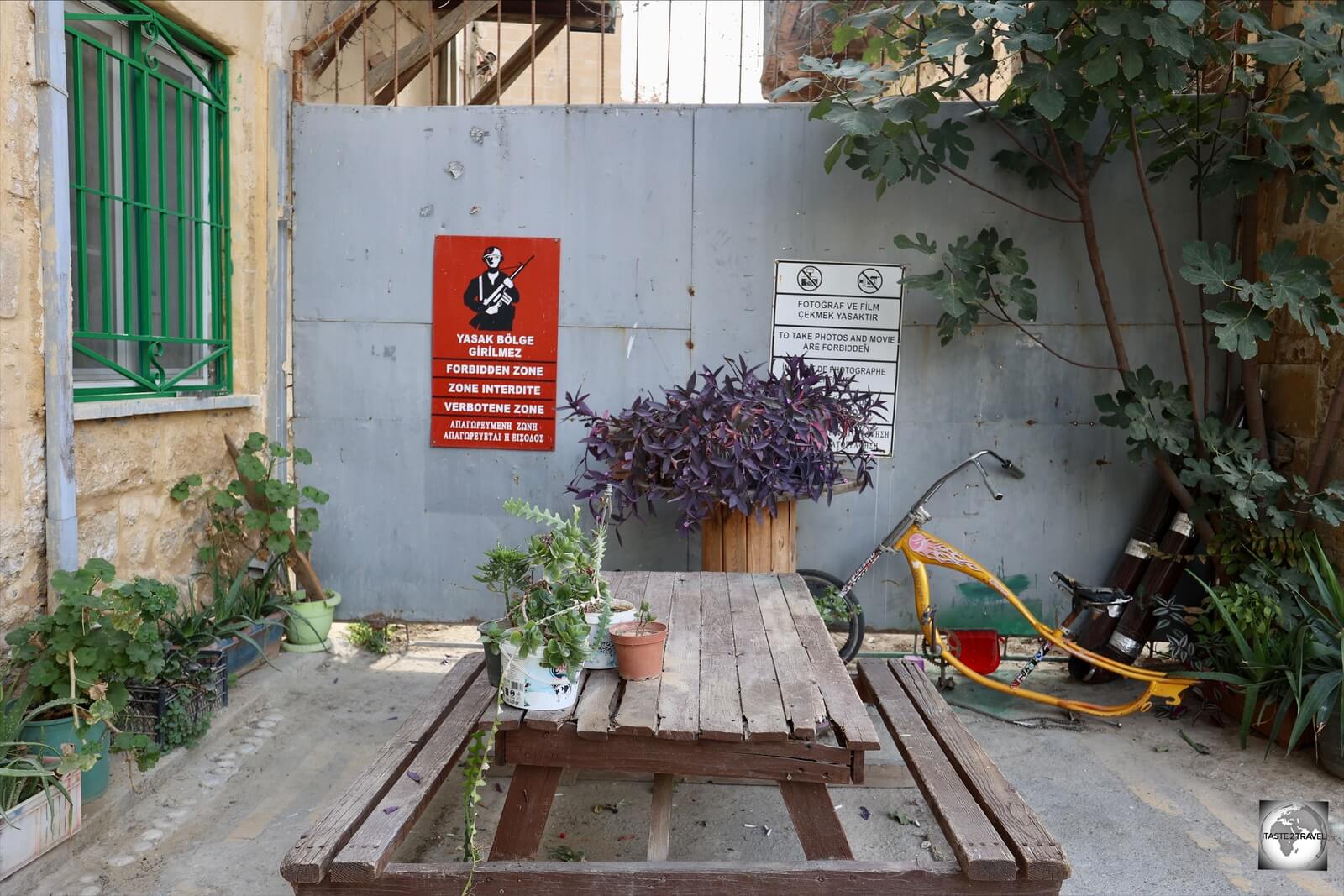
Garden furniture outside a residential building in North Nicosia softens the effect of the steel wall of the UN Buffer zone.

Garden furniture outside a residential building in North Nicosia softens the effect of the steel wall of the UN Buffer zone.

At the time, the EU wanted a united Cyprus to join the Union. However, despite joining the EU as a de-facto divided island, the whole of Cyprus is considered EU territory, with Turkey as an occupier. EU law is suspended in areas where the Cypriot government (Government of the Republic) does not exercise effective control.

Membership of the EU, and generous EU subsidies, has allowed the Republic of Cyprus to develop at a much faster rate than the TRNC.

Passing through a UN Green Line checkpoint from the Greek to the Turkish side of the island is like passing through a worm-hole, transporting you from a modern, 21st century, 1st world experience to a 20th century, 2nd world experience.

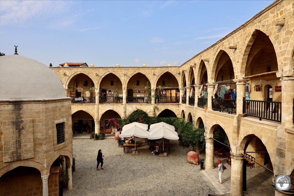
A highlight of North Nicosia, Büyük Han is an Ottoman-era caravanserai which dates from 1572.

A highlight of North Nicosia, Büyük Han is an Ottoman-era caravanserai which dates from 1572.

Despite the differences TRNC is a charming destination, home to historic towns, medieval castles, vast archaeological sites, beautiful beaches and a capital city with a distinct Ottoman feel.

The use of the weaker Turkish lira as the official currency also makes the TRNC a much cheaper travel destination, compared to the more expensive Greek side of the island, which uses the Euro (€).


Important Note: 

If you enter TRNC from Turkey, you will not be able to cross the UN buffer zone into southern Cyprus, nor will you be able to depart from any airport in the south.

This is due to the fact that TRNC is not recognised by the international community and as such, entering Cyprus through TRNC is not recognised as a valid entry point.   

If you enter TRNC from Turkey, you will have to exit TRNC back to Turkey. 


Location

North Nicosia, Nicosia


Northern Cyprus occupies the top one third of the island of Cyprus, which is located in the Eastern Mediterranean Sea 75 kilometres (47 mi) south of Turkey and 97 kilometres (60.3 mi) west of Syria.

History

Overlooking the north coast of Cyprus, Kantara castle dates from the Byzantine period.

Overlooking the north coast of Cyprus, Kantara castle dates from the Byzantine period.

Famous as the mythical birthplace of the goddess Aphrodite, Cyprus was first settled by Mycenaean Greeks in the 2nd millennium BC.

Due to its location at the crossroads of many ancient empires, Cyprus was subsequently occupied by the Assyrians, Egyptians and Persians, from whom the island was seized in 333 BC by Alexander the Great.

Following in the footsteps of Alexander, Cyprus was occupied by the Egyptians, the Roman Empire, the Arab caliphates, and eventually by the Ottomans who ruled the island over three centuries between 1571 and 1878.

A view of the interior of Kumarcilar Han, an Ottoman-era caravanserai (inn), located in North Nicosia old town.

A view of the interior of Kumarcilar Han, an Ottoman-era caravanserai (inn), located in North Nicosia old town.

Prior to the Ottoman conquest of 1571, there were no Muslims living permanently on Cyprus. At the time of the Ottoman takeover, about 30,000 Turkish settlers were resettled on Cyprus.

During the years of Ottoman rule, the migration of Turkish (Muslim) settlers to Cyprus, from Anatolia (modern day Turkey), continued, forever changing the ethnic makeup of Cyprus and laying the seeds for the ethnic conflict which would eventually result in the island being divided.

An old 'GR' (George Royal) post box in Famagusta serves as a reminder of the British colonial period.

An old ‘GR’ (George Royal) post box in Famagusta serves as a reminder of the British colonial period.

Following the Ottoman period, Cyprus became a British colony. Known as British Cyprus, the island formed part of the British Empire from 1878 to the 16th of August, 1960 at which point the island became independent.

At the time of independence, Cyprus had a total population of 573,566; of whom 442,138 (77.1%) were Greeks, 104,320 (18.2%) Turks, and 27,108 (4.7%) were other nationalities.

A power-sharing arrangement between the Greek and Turkish sides quickly fell apart, resulting in legal impasses and discontent on both sides. Nationalist militants started training, with the military support of Greece and Turkey respectively.

Intercommunal violence erupted on the 21st of December 1963, when two Turkish Cypriots were killed at an incident involving the Greek Cypriot police. Intercommunal violence ensured and, in 1964, Turkey threatened to invade Cyprus in order to protect the Turkish minority.

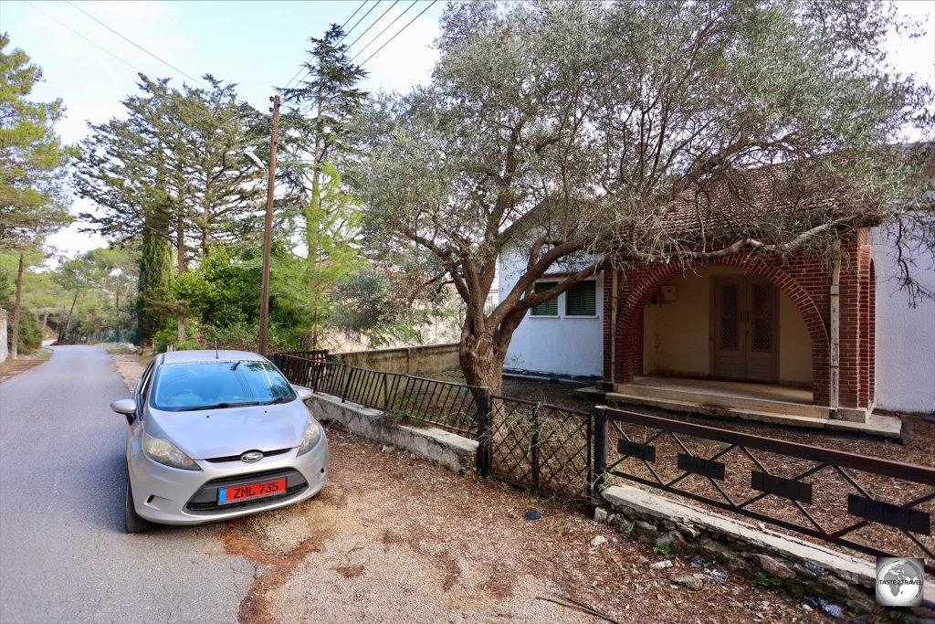
An abandoned Greek Cypriot home in the Northern Cyprus village of Kantara.

An abandoned Greek Cypriot home in the Northern Cyprus village of Kantara.

On the 15th of July 1974, the Greek military junta carried out a coup d’état, to unite Cyprus with Greece.

Turkey then launched an invasion, seizing the top third of the island and creating the Turkish Republic of Northern Cyprus (TRNC) as a safe zone for Turkish Cypriots.

Now off limits, a former park on the city walls in North Nicosia is now part of the UN Buffer zone.

Now off limits, a former park on the city walls in North Nicosia is now part of the UN Buffer zone.

As a result of this action, Greek Cypriots who lived in the north of Cyprus, were forced to abandon their homes and relocate south of the dividing line, while Cypriot Turks in the south moved north.

People

At the time of partition in 1974, Turkish Cypriots, who lived all over Cyprus, were forced to relocate north of the UN Green Line into what is now Northern Cyprus. Many chose to leave Cyprus instead!

Likewise, Greek Cypriots, who lived throughout the island, were forced to relocated south of the UN Green Line. It’s estimated that 162,000 Greek Cypriots were forcibly evicted from their homes in the North by the invading force of the Turkish army.

This mass relocation resulted in many properties being abandoned. Today, these properties remain shuttered, and in legal limbo, ghostly reminders of an unresolved conflict.

Today, Northern Cyprus is home to more than 326,000 Turkish Cypriots, with 99% practicing Islam. However, much larger numbers live abroad with the diaspora found in countries such as Turkey (300,000), the United Kingdom (130,000), Australia (30,000) and Canada (6,000).

Flag

The flags of Turkey and Northern Cyprus inside the Saint Peter and Paul Church (Sinan Pasha Mosque) in Famagusta.

The flags of Turkey and Northern Cyprus inside the Saint Peter and Paul Church (Sinan Pasha Mosque) in Famagusta.

The flag of Northern Cyprus is based on the flag of Turkey, with the colours reversed and two additional horizontal red stripes at the top and bottom. Adopted in 1984, the stripes indicate Turkey (top) and Northern Cyprus (bottom).

Hanging from the balcony of a house in North Nicosia, the flag of Turkey always flies alongside the flag of Northern Cyprus.

Hanging from the balcony of a house in North Nicosia, the flag of Turkey always flies alongside the flag of Northern Cyprus.

Everywhere throughout the TRNC, the flag of Turkey flies alongside the flag of Northern Cyprus.

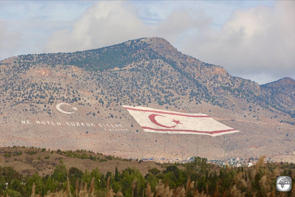
Located on the slopes of the Kyrenia Mountains, a giant flag of Northern Cyprus covers an area of four football fields, and is clearly visible from the Greek side of the island.

Located on the slopes of the Kyrenia Mountains, a giant flag of Northern Cyprus covers an area of four football fields, and is clearly visible from the Greek side of the island.

Even before you cross into Northern Cyprus, a TRNC flag looms large on the horizon, clearly visible from space and, more importantly for the TRNC government, from the Greek side of the island.

Located on the slopes of Mount Pentadaktylos (Turkish: Beşparmaklar Mountain), the highest point on the Kyrenia mountain range, a flag the size of four football fields can be seen from across the UN Green Line in Nicosia.

Illuminated at night, the flag was first lit up on Greek National Day on the 28th of October, 2003. Today, this massive flag is a permanent reminder of a divided island and considered a provocation by the Greek Cypriots.

Special teams from Turkey regularly bring in red and white dyes to maintain the flag, which appears next to a slogan from Kemal Ataturk, the founding father of modern Turkey: “How happy is he who calls himself a Turk!

Currency

The official currency of Northern Cyprus is the Turkish Lira.

The official currency of Northern Cyprus is the Turkish Lira.

The currency of Northern Cyprus is the Turkish Lira, although it should be the Euro!

Northern Cyprus is legally part of the EU, but EU law is suspended due to the north being under the control of the Turkish Republic of Northern Cyprus, which the EU does not recognise.

As a consequence, the currency of Turkey, the only state to recognise the TRNC, is the de-facto currency, although the Euro circulates freely.

The Turkish lira (international currency code: TRY, but usually abbreviated as TL) is the currency of Turkey and Northern Cyprus. One Turkish lira is subdivided into one hundred kurus.

All Turkish Lira banknotes feature the smiling face of Kemal Atatürk, the father of modern Turkey.

All Turkish Lira banknotes feature the smiling face of Kemal Atatürk, the father of modern Turkey.

In recent times, the lira has been weakening, which has resulted in cheaper prices for visitors, but increasing prices for locals.

Exchange Rates


Did you know? Due to the ever-weakening Turkish Lira, property leases in Northern Cyprus are often denominated in either US$, Euro (€) or Pound Sterling (£).

Of course, locals don’t have access to hard currencies and so must pay their rents in Turkish lira at the current (ever-weakening) exchange rate. Ouch!

Bad news for tenants, great news for landlords who receive ever-increasing rental income.


Shopping

The streets of downtown Kyrenia are lined with bottle shops which offer famous alcohol brands at bargain prices!

The streets of downtown Kyrenia are lined with bottle shops which offer famous alcohol brands at bargain prices!

Northern Cyprus is a shopper’s paradise, offering a range of international items at bargain prices.

The streets of downtown Kyrenia are lined with branded boutiques and scores of bottle shops which offer famous brands of alcohol at prices far below airport Duty Free shops.

A sign in a Burberry outlet in Kyrenia illustrates the conundrum which is TRNC!

A sign in a Burberry outlet in Kyrenia illustrates the conundrum which is TRNC!

How cheap is alcohol in Northern Cyprus? The following prices were being charged by bottle shops in Kyrenia at the time of my visit (November 2021):

Bottle Shop prices in Kyrenia, Northern Cyprus.

Bottle Shop prices in Kyrenia, Northern Cyprus.

  • Absolut Vodka 70 cl: 94 TL (US$6.77)
  • Bombay Sapphire Gin 70 cl: 150 TL (US$10.84)
  • Tanqueray Gin 70 cl: 180 TL (US$12.97)
  • Jack Daniels 70 cl: 170 TL (US$12.25)
  • Jack Daniels 1L: 220 TL (US$15.86)
  • Jim Bean 1.5L: 180 TL (US$12.97)
  • Olmeca Tequila Gold 1L: 215 TL (US$15.50)

Costs

A Litre of unleaded fuel in Northern Cyprus cost me 9.14 TL (€0.58)

A Litre of unleaded fuel in Northern Cyprus cost me 9.14 TL (€0.58)

With most things denominated in (the very weak) Turkish lira, costs in Northern Cyprus are much cheaper than in neighbouring Cyprus where Euro prices are much higher.

While shopping is a bargain; meals, drinks, fuel and almost everything else is much cheaper in TRNC. The two exceptions are hotel and car rental rates which are comparable to Cyprus.

Fuel prices are especially cheap in Northern Cyprus with a litre of unleaded petrol costing 9.14 TL (€0.58), while over the border in Cyprus, the same litre of fuel costs €1.32! No wonder many Greek Cypriots cross the border to refuel their cars.

Sample costs:

  • Meal (inexpensive Restaurant): 25 TL (€1.60)
  • Efes Beer (330-ml bottle): 6 TL (€0.38)
  • Cafe Latte at Mensure’s Coffee & Chocolate in Kyrenia: 23 TL (€1.47)
  • Chocolate dessert at Mensure’s Coffee & Chocolate in Kyrenia: 40 TL (€2.56)
  • Coca Cola (330-ml bottle): 7 TL (€0.45)
  • Water (330-ml bottle): 5 TL (€0.32)
  • Hotel room at the Sofia Boutique Hotel in Kyrenia: 860 TL (€55.00)
  • Rental Car (daily rate): 375 TL (€24.00)
  • Unleaded petrol (1 litre): 9.14 TL (€0.58)
A 70 cl bottle of Absolut Vodka for 94 TL (€6. 00)? Alcohol is especially cheap in Northern Cyprus!

A 70 cl bottle of Absolut Vodka for 94 TL (€6. 00)? Alcohol is especially cheap in Northern Cyprus!

Sightseeing

North Nicosia

Former medieval fortifications which were originally built to defend Nicosia are now used to divide the city.

Former medieval fortifications which were originally built to defend Nicosia are now used to divide the city.

Nicosia (Turkish: Lefkoşa) is the largest city, capital, and seat of government of Cyprus. It has the distinction of being the southeasternmost of all EU member states’ capitals.

The city has been continuously inhabited for over 4,500 years and has been the capital of Cyprus since the 10th century. Today North Nicosia is the capital of Northern Cyprus, a state recognized only by Turkey, that is considered to be occupied Cypriot territory by the international community.

UN Green Line

A view of the Greek side of the Ledra Palace crossing point in Nicosia.

A view of the Greek side of the Ledra Palace crossing point in Nicosia.

The Greek Cypriot and Turkish Cypriot communities of Nicosia segregated into the south and north of the city respectively in early 1964, following the fighting of the Cyprus crisis of 1963–64 that broke out in the city.

Frozen in time, an abandoned building inside 'no-mans-land' still bears the scars of battle.

Frozen in time, an abandoned building inside ‘no-mans-land’ still bears the scars of battle.

This separation became a militarised border (UN Green Line) between the Republic of Cyprus and the Turkish Republic of Northern Cyprus (TRNC) after Turkey invaded the island in 1974, occupying the north of the island, including northern Nicosia.

Ottoman-era homes in North Nicosia overlook the medieval fortifications which now form part of the UN Buffer zone.

Ottoman-era homes in North Nicosia overlook the medieval fortifications which now form part of the UN Buffer zone.

At its heart, Nicosia old town is enclosed by a circular defensive wall which was built by the Venetians in the 16th century. With a circumference of 5 km (3 miles), the wall contains eleven pentagonal bastions.

The UN Green Line bisects this circular enclosure, with the Greek half of the old town to the south and the Turkish half to the north. The two main crossing points lie within the walled old town. Despite many attractions, the biggest tourist draw is the UN Green Line.

A map showing a divided Nicosia. <br><i>Source: BBC.

A map showing a divided Nicosia.
Source: BBC.

Despite its many attractions, the biggest tourist draw in Nicosia is the eerie UN Green Line – also known as the UN Buffer zone.

A sign in Nicosia old town warns against entering the UN Buffer zone.

A sign in Nicosia old town warns against entering the UN Buffer zone.

Within Nicosia, the UN Green Line is an almost total exclusion zone and is contained behind high walls, metal gates, barbed wire and concrete-filled oil drums.

A former residential building on the UN Buffer zone in Nicosia is boarded up to prevent unauthorised entry into the zone.

A former residential building on the UN Buffer zone in Nicosia is boarded up to prevent unauthorised entry into the zone.

The Green Zone is policed by United Nations troops, amid barbed wire and dilapidated buildings with sand bags still sitting in the windows.

Either side of this dividing line, whole city blocks lay abandoned since 1974, frozen in time, stuck inside ‘no-mans-land’ with former residents and business owners locked out until a solution can be found to reunite the island.

A laneway in North Nicosia is blocked by a section of wall which includes a ladder and two peep holes.

A laneway in North Nicosia is blocked by a section of wall which includes a ladder and two peep holes.

Either side of this dividing line, whole city blocks layed abandoned since 1974, frozen in time, stuck inside ‘no-mans-land’ with former residents and business owners locked out until a solution can be found to reunite the island.

Often, while walking through the maze of laneways in the old town, your way is blocked by a section of the buffer zone.

A residential building in North Nicosia lies directly on the UN Green Line.

A residential building in North Nicosia lies directly on the UN Green Line.

After almost 50 years of division, residents on both sides of the buffer zone have become use to living with a hard border passing through their front gardens.

Some have installed garden furniture or sit and play backgammon or chat in streets which have become quiet cul-de-sacs due to access being blocked by the wall.

Residents on the Greek side of the UN Green Line sit and chat in front of a section of wall.

Residents on the Greek side of the UN Green Line sit and chat in front of a section of wall.

Selimiye Mosque

Selimiye Mosque is a former Christian cathedral converted into a mosque under the Ottomans.

Selimiye Mosque is a former Christian cathedral converted into a mosque under the Ottomans.

North Nicosia’s most prominent landmark, which can also be seen from the Greek side of the city, the Selimiye Mosque started life in 1209 as a Christian cathedral.

After 78 years of construction, the cathedral was consecrated in 1326 as the Church of Agia Sofia (meaning “Holy Wisdom” in Greek). It was the largest church in the eastern Mediterranean and was used as the coronation church of the kings of Cyprus.

When the Agia Sofia cathedral was converted into a mosque by the Ottomans, minarets were installed in place of the bell towers.

When the Agia Sofia cathedral was converted into a mosque by the Ottomans, minarets were installed in place of the bell towers.

When the Ottomans arrived in 1571, they stripped the building of its Christian contents and added two minarets, between which the Turkish Cypriot and Turkish flags now flutter.

At the time of my visit, the Selimiye Mosque was closed for renovations.

At the time of my visit, the Selimiye Mosque was closed for renovations.

At the time of my visit in November 2021, the mosque was closed for extensive renovations.

Büyük Han

A view of Büyük Han, an Ottoman-era caravanserai which dates from 1572.

A view of Büyük Han, an Ottoman-era caravanserai which dates from 1572.

Lying at the heart of North Nicosia old town, Büyük Han, is an Ottoman-era caravanserai.

Giftshops occupy the many rooms of Büyük Han, a former caravanserai.

Giftshops occupy the many rooms of Büyük Han, a former caravanserai.

One of the first building projects by the Ottomans, construction of Büyük Han was commenced in 1572 by the first Ottoman governor of Cyprus, Lala Mustafa Pasha. It served as an inn for travellers.

A view of Büyük Han, one of the main sights of North Nicosia.

A view of Büyük Han, one of the main sights of North Nicosia.

The building was renovated in the early 1990s and is today a tourist magnet, offering cafes, restaurants and workshops which are housed in the small cells leading off the 1st-floor balcony that originally served as the inn’s sleeping areas.

North Cyprus postcards for sale at a giftshop inside Büyük Han.

North Cyprus postcards for sale at a giftshop inside Büyük Han.

Kumarcılar Han

An Ottoman-era Caravansarai in the heart of North Nicosia old town, the Kumarcilar Han is surrounded by cafés and restaurants.

An Ottoman-era Caravansarai in the heart of North Nicosia old town, the Kumarcilar Han is surrounded by cafés and restaurants.

This caravanserai is a smaller version of the neighbouring Büyük Han and was built in the early 18th century. Today its courtyard hosts cafes, and the surrounding cells, where merchant goods were once stored, are today home to local craft shops.

Ottoman Architecture

The streets of North Nicosia old town are lined with Ottoman-style buildings.

The streets of North Nicosia old town are lined with Ottoman-style buildings.

One of the noticeable differences between the Greek and Turkish sides of Nicosia are the number of beautifully restored Ottoman-style buildings which line the streets of North Nicosia old town.

Oddly, there are very few Ottoman-style buildings remaining on the Greek side of the city!

Nicosia Market

The covered market in North Nicosia offers everything from plastic combs, souvenirs to produce.

The covered market in North Nicosia offers everything from plastic combs, souvenirs to produce.

No Turkish city is complete without a covered market and North Nicosia market lives up to all expectations. Located around the corner from the Selimiye mosque, the market is housed inside a huge, sprawling hall and is an Aladdin’s cave of everything imaginable.

From plastic combs to fresh produce, souvenirs and Cyprus (Turkish) delight, the market is a great place to shop!

Kyrenia (Girne)

A very golden statue of Kemal Atatürk, the father of modern Turkey, graces the waterfront in Kyrenia.

A very golden statue of Kemal Atatürk, the father of modern Turkey, graces the waterfront in Kyrenia.

The northern port city of Kyrenia (Turkish: Girne) is the main tourist hub of North Cyprus, offering a good selection of accommodation, shopping, sightseeing, dining and entertainment options. This is the place to base yourself with all other cities within daytrip distance.

Kyrenia Castle

Kyrenia castle guards the entrance to Kyrenia harbour.

Kyrenia castle guards the entrance to Kyrenia harbour.

Built during the Byzantine period, the large looming hulk that is Kyrenia castle guards the narrow entrance to Kyrenia harbour.

A view of Kyrenia harbour from Kyrenia castle.

A view of Kyrenia harbour from Kyrenia castle.

A large rectangular structure, the castle contains a cistern, dungeon, chapel and two small museums, including the fascinating Shipwreck Museum.

The flags if Turkey and Northern Cyprus flying on top of the ramparts at Kyrenia castle.

The flags if Turkey and Northern Cyprus flying on top of the ramparts at Kyrenia castle.

A highlight of the castle is a walk (sometimes precarious), along the top of the ramparts, which offers panoramic view of Kyrenia harbour and the old town – the best views in town.

Shipwreck Museum

The Kyrenia Shipwreck Museum contains the remains of the oldest shipwreck recovered from Cypriot waters.

The Kyrenia Shipwreck Museum contains the remains of the oldest shipwreck recovered from Cypriot waters.

Housed inside one of the castle ramparts, the Kyrenia Shipwreck Museum contains the remains of the oldest shipwreck recovered from Cypriot waters.

Built of Aleppo pine, this Greek merchant ship sank off the Kyrenia coast around 300 BC, and was discovered by a local diver in 1967.

The recovered wooden hull of the Greek merchant ship which sunk in 300 BC.

The recovered wooden hull of the Greek merchant ship which sunk in 300 BC.

Its cargo consisted of amphorae (ancient vessel form used as a storage jar), almonds, grain, wine and millstones from the Greek islands of Samos, Rhodes and Kos. In an upstairs room is the remains of the wooden hull.

Bellapais Abbey

Bellapais Abbey is a highlight of Kyrenia.

Bellapais Abbey is a highlight of Kyrenia.

Founded in the early 13thC by the Augustinian friars who had been evicted from the city of Jerusalem, after it fell to Saladin, Bellapais Abbey was established under Aimery Lusignan who ruled Cyprus from 1194-1205.

The abbey consists of a church and a cloister, with most of the monastic buildings surrounding the cloister. The name “Bellapais” derives from the French name “Abbaye de la paix” which means “Abbey of Peace”.

Located on a hill, 6 km south-west of Kyrenia town, Bellapais is home to the only functioning church in Northern Cyprus – the church of Ayia Asprophorusa, “Our Lady of the White Garments”.

A view of the interior of Ayia Asprophorusa church at Bellapais Abbey.

A view of the interior of Ayia Asprophorusa church at Bellapais Abbey.

While all other churches in Northern Cyprus were converted into mosques during the Ottoman period, the small church of Ayia Asprophorusa was deemed to be of such importance that it was spared!

The church was once said to have been endowed with a piece of the True Cross from Jerusalem, a gift from a crusading Knight. This relic was stolen by invading Genoese in the 14th century.

Ayia Asprophorusa church at Bellapais Abbey was converted into an orthodox church.

Ayia Asprophorusa church at Bellapais Abbey was converted into an orthodox church.

Built in the 13th century building, the church is the oldest surviving building of the abbey. It has three aisles and inside the church there are chandeliers and impressive arches with pillars that support the roof.

The altar of Ayia Asprophorusa church, the only functioning church in Northern Cyprus, where 99% of the population are Muslim.

The altar of Ayia Asprophorusa church, the only functioning church in Northern Cyprus, where 99% of the population are Muslim.

After the Ottomans conquered Cyprus, they handed Bellapais monastery to the Orthodox Church. The Orthodox Church only made small changes, mainly to the interior of the church. They added features like the wooden altar and icons.

A view of the cloister at Bellapais Abbey.

A view of the cloister at Bellapais Abbey.

The beautiful, 18-arch, cloister and the refectory surrounding the courtyard area were completed between 1324 and 1359 AD. There are several stairs from the cloisters which provide access to the roof from where you have sweeping views of the north coast and Kyrenia.

A Byzantine column in the Chapter House at Bellapais Abbey.

A Byzantine column in the Chapter House at Bellapais Abbey.

Located on the eastern side of the cloister, the Chapter House functioned as the abbey’s administrative section. The column in the centre of the Chapter house may have come from a Byzantine church.

Saint Hilarion Castle

Saint Hilarion castle offers panoramic view of Kyrenia and the north coast of Cyprus.

Saint Hilarion castle offers panoramic view of Kyrenia and the north coast of Cyprus.

Saint Hilarion Castle lies on the Kyrenia mountain range, directly overlooking the port city. This strategic location provided the castle with command of the pass road from Kyrenia to Nicosia.

It is the best-preserved ruin of the three former strongholds in the Kyrenia mountains, the other two being Kantara and Buffavento.

Constructed in the 11th century by the Byzantines, Saint Hilarion Castle was part of a defensive system, together with the castles of Buffavento and Kantara, to guard the island against Arab pirate attacks.

A view of Kyrenia from Saint Hilarion Castle.

A view of Kyrenia from Saint Hilarion Castle.

Used as a summer residence by the ruling Lusignans, the castle was divided into three sections, with the lower and middle sections serving economic purposes, while the upper section housed the royal family.

Today, the Turkish army maintains a military base (one of many in Northern Cyprus) nearby along with firing ranges and other practice areas. Photography along the approach road to the castle is forbidden (guards maintain watch over passing motorists) but, once at the castle, you have a clear view of their installations and photography isn’t a problem.

Kantara Castle

Kantara Castle occupies a lofty position high in the Kyrenia mountain range.

Kantara Castle occupies a lofty position high in the Kyrenia mountain range.

Another of the defensive installations, Kantara Castle is located at an elevation of 550–600 metres (1,800–1,970 ft) above sea level, in the Kyrenia mountain range, 66 km east of Kyrenia.

Kantara Castle is located at an elevation of 550–600 metres (1,800–1,970 ft) above sea level.

Kantara Castle is located at an elevation of 550–600 metres (1,800–1,970 ft) above sea level.

While the exact date of its construction remains unknown, although most probably during the Byzantine period, the castle became derelict in 1525 and was dismantled in 1560.

Perched on a high peak in the Kyrenia mountains, Kantara castle offers sweeping views of the north coast of Cyprus.

Perched on a high peak in the Kyrenia mountains, Kantara castle offers sweeping views of the north coast of Cyprus.

The castle is surrounded by ridges of barren granite and sandstone bedrock which were used as the main building materials for the castle’s construction.

A view of the Kyrenia mountain range, looking east towards the panhandle of Cyprus.

A view of the Kyrenia mountain range, looking east towards the panhandle of Cyprus.

The lack of local water sources necessitated the collection of rainwater through the use flat roofs which were connected to the cisterns through a drainage system.

Famagusta

City Walls

A view of the western side of the immense city walls which surround Famagusta. A pathway now lies in the former moat.

A view of the western side of the immense city walls which surround Famagusta. A pathway now lies in the former moat.

Nowhere else in Cyprus is the heavy burden of history so apparent than in the port city of Famagusta (Turkish: Gazimağusa).

With its old town completely surrounded by huge walls which were built by the Venetians during the 15th- and 16th-century, Famagusta draws a steady stream of tourists who make day trips across the UN Buffer zone from nearby Larnaca and Ayia Napa.

During the Middle Ages, Famagusta was the island’s most important port city and a gateway to trade with the eastern Mediterranean ports, from where Silk Road merchants carried their goods to Western Europe.

A gateway in the city walls of Famagusta.

A gateway in the city walls of Famagusta.

Dating from 274 BC, Famagusta is nicknamed “the city of 365 churches” owing to a legend that at its peak, Famagusta boasted one church for each day of the year.

When the Ottomans took control of the city after a long battle with the ruling Venetians, all Christians were expelled from the city and were replaced by settlers from Anatolia.

In the following years, the many churches were either destroyed or converted to mosques.

Today, Famagusta’s star has fallen with many buildings in the old town closed or abandoned. While it makes for a great day trip, Famagusta old town offers few accommodation and dining options and is very quiet in the evenings, once all the day trippers have left. Famagusta is located 61 kilometres (38 miles) south-east of Kyrenia.

Lala Mustafa Pasha Mosque (St. Nicholas Cathedral)

Consecrated in 1328, St. Nicholas cathedral was converted into the Lala Mustafa Pasha Mosque after the Ottoman Empire captured Famagusta in 1571.

Consecrated in 1328, St. Nicholas cathedral was converted into the Lala Mustafa Pasha Mosque after the Ottoman Empire captured Famagusta in 1571.

The Lala Mustafa Pasha Mosque, originally known as the Saint Nicholas Cathedral is the largest medieval building in Famagusta.

Built between 1298 and 1400, it was consecrated as a Catholic cathedral in 1328. The cathedral was converted into a mosque after the Ottoman Empire captured Famagusta in 1571 and it remains a mosque to this day.

A view of the mihrab inside Lala Mustafa Pasha Mosque, formerly St. Nicholas cathedral, Famagusta.

A view of the mihrab inside Lala Mustafa Pasha Mosque, formerly St. Nicholas cathedral, Famagusta.

At the time of its conversion to a mosque, nearly all statuary, stained-glass and other artworks were removed or plastered over, as well as most tombs and the altar. A minaret was added to one of the former bell towers.

A large mihrab (facing Mecca) has been installed on the southern wall of the former church, which completely changes the orientation of the building.

A view of the vaulted ceiling inside Lala Mustafa Pasha Mosque.

A view of the vaulted ceiling inside Lala Mustafa Pasha Mosque.

The Gothic structure, including the impressive vaulted ceiling, was preserved, although the interior is now very minimal with all pews removed and replaced by carpet.

Sinan Pasha Mosque (Saint Peter and Paul Church)

Due to its height, the walls of the Sinan Pasha Mosque (Saint Peter and Paul Church) are supported by flying buttresses.

Due to its height, the walls of the Sinan Pasha Mosque (Saint Peter and Paul Church) are supported by flying buttresses.

Originally consecrated in 1359 as the Saint Peter and Paul church, this massive structure was financed with funds donated by a successful merchant. Because of its height, the church walls had to be supported by impressive flying buttresses.

A worshipper inside the Sinan Pasha Mosque, formerly the Saint Peter and Paul church.

A worshipper inside the Sinan Pasha Mosque, formerly the Saint Peter and Paul church.

The building became disused during the Venetian period, as it escaped the attention of the Ottoman bombardment of the city in 1571. After their conquest, the Ottomans added a minaret to the south west corner (since destroyed) and renamed the edifice Sinan Pasha Mosque, after “Sinan the Great” who served five times as Grand Vizier in the Ottoman empire.

Worshippers inside the Sinan Pasha Mosque in Famagusta.

Worshippers inside the Sinan Pasha Mosque in Famagusta.

During the British era of the island, the mosque was used as a potato and grain store and so is also locally referred to as the “Bugday Cami” (wheat mosque).

Like the nearby Lala Mustafa Pasha Mosque, the interior of the former church has had all religious artwork removed and is now very minimal with just a mihrab installed on the southern wall underneath the flags of Turkey and Northern Cyprus.

St. George’s of the Greeks Church

The ruins of St. George's of the Greeks church in Famagusta.

The ruins of St. George’s of the Greeks church in Famagusta.

Consecrated in 1360, and today a magnificent ruin, the Church of St. George of the Greeks is believed to have been the seat of Famagusta’s Orthodox bishopric during medieval times.

A view of the former interior of St. George's of the Greeks church in Famagusta.

A view of the former interior of St. George’s of the Greeks church in Famagusta.

Although structural unsound, with a roof that was too heavy for the supporting columns, the church stood for little over one hundred years and was destroyed during the Ottoman siege of Famagusta in 1571.

Accommodation

The pool and breakfast area at the Sofia Boutique Hotel in Kyrenia.

The pool and breakfast area at the Sofia Boutique Hotel in Kyrenia.

The best range of accommodation options in Northern Cyprus are to be found in the tourist hub of Kyrenia.

While hotel options exist in North Nicosia and Famagusta, the picturesque port city of Kyrenia is the place for shopping, dining and entertainment, with everything open late into the evening.

I stayed at the wonderful Sofia Boutique Hotel (room rate 860 TL/ €55.00) which is located at 7 Atilla Street in the heart of Kyrenia old town, a 3-minute walk from the old port and castle.

My room at the Sofia Boutique hotel in Kyrenia.

My room at the Sofia Boutique hotel in Kyrenia.

Each of the nine rooms at the Sofia Boutique hotel are nicely decorated, featuring cosy interiors which are welcoming and homey.

While situated in the heart of Kyrenia old town, a short walk from the dining and entertainment hub around the port, the hotel is an oasis of calm and serenity.

Breakfast at the Sofia Boutique hotel in Kyrenia.

Breakfast at the Sofia Boutique hotel in Kyrenia.

Breakfast, which is made to order, is served each morning poolside.

A high level of service was provided by the small team of staff who had emigrated to Northern Cyprus from CIS countries such as Russia, Turkmenistan and Kazakhstan. It seems Northern Cyprus is an employment destination of choice for those nationalities who would have difficulty gaining an EU work visa.

I enjoyed my stay at the Sofia Boutique hotel and look forward to visiting again! The hotel is a real gem and one I would highly recommend!

Eating Out

The interior of a colourful café in the old town of North Nicosia.

The interior of a colourful café in the old town of North Nicosia.

While Cyprus may be a divided island, when it comes to cuisine, the island is very much united!

The same, delicious, food which is served on the Greek side of the island is also to be found on the Turkish side, with a standard meal consisting of grilled meat, fresh salad, grilled halloumi and fresh, warm, flat-bread.

Where the cuisine of the TRNC differs slightly from the Greek side is the presence of Turkish restaurant chains.

Restaurants

A view of the TRNC checkpoint on Ledra Street, North Nicosia, from the Simit Dünyası restaurant.

A view of the TRNC checkpoint on Ledra Street, North Nicosia, from the Simit Dünyası restaurant.

North Nicosia

One popular Turkish restaurant chain – Simit Dünyası – serves delicious food from its North Nicosia branch, which is located directly opposite the TRNC (Ledra Street) checkpoint.

A grilled halloumi sandwich for lunch at Simit Dünyası in North Nicosia, with the TRNC checkpoint in the background.

A grilled halloumi sandwich for lunch at Simit Dünyası in North Nicosia, with the TRNC checkpoint in the background.

As soon as you exit the Turkish side of the crossing, your first stop should be this restaurant/ café. The first thing you’ll notice is the price difference, compared to the, more expensive, Greek side.

Offering a front row view of the Turkish side of the Ledra Street checkpoint, it’s not often you can sit and enjoy lunch while watching the comings and goings of a border crossing. Photography of the checkpoint isn’t a problem!

Most visitors to Northern Cyprus are day-trippers who walk across the Ledra Street crossing to spend a day shopping and eating in the old town of North Nicosia.

The streets of the old town are lined with cafés and restaurants, all serving tasty food at very reasonable prices.


A bridge-builder in a divided city and a unique dining experience! 

The 'Home for Co-operation' restaurant and café offers a unique dining location inside the UN Buffer zone in Nicosia.

The ‘Home for Co-operation’ restaurant and café offers a unique dining location inside the UN Buffer zone in Nicosia.

For a truly unique dining experience, it’s hard to beat the Home for Co-operation restaurant and café, which is located inside the UN Buffer zone, opposite the abandoned Ledra Palace hotel in downtown Nicosia.

Where else in the world do you have the opportunity to dine inside ‘no-mans-land’?

Open Monday to Friday from 9:00 to 21:00, the Home for Co-operation acts as a meeting place for people from both sides of the buffer zone. Signs on either side of the buffer zone provide directions to the cafe which is an institution in the divided capital.

To access this uniquely placed café, you simply need to present your passport at either the Greek or Turkish checkpoints which lie just 100-metres from the café.

In addition to serving freshly roasted coffee and tasty meals, the Home for Co-operation also features exhibitions and provides meeting spaces for people from either side of the buffer zone to work on collaborative projects.

A beacon of hope in a divided city!


Cafés

North Nicosia

Café No.3 is located a short walk from the Ledra Street crossing in North Nicosia.

Café No.3 is located a short walk from the Ledra Street crossing in North Nicosia.

The streets of North Nicosia old town are lined with traditional Ottoman-style houses which are home to both retro and modern cafés and restaurants. One popular cafe is Café No.3 which is located a short walk from the Ledra Street checkpoint.

Located in the heart of North Nicosia old town, the Kumarcilar Han is the setting for many cafes and restaurants.

Located in the heart of North Nicosia old town, the Kumarcilar Han is the setting for many cafes and restaurants.

Located in the heart of North Nicosia old town, the beautifully restored Kumarcilar Han (Gambler’s Inn), an Ottoman-era Caravansarai, is the setting for many cafes and restaurants.

Famagusta

Located within the walled old town of Famagusta, Petek Pastanesi is famous all over Cyprus for its divine pastries and sweets, including a tempting selection of Cyprus (Turkish) delight. This is an ideal place for lunch or coffee and cake in between visiting the many ruined churches of Famagusta.

Kyrenia

A selection of very affordable hand-made chocolates at Mensure's Coffee &amp; Chocolate café in Kyrenia.

A selection of very affordable hand-made chocolates at Mensure’s Coffee & Chocolate café in Kyrenia.

For those who appreciate hand-made chocolates and good coffee, the ground floor of the Sofia Boutique hotel in Kyrenia is occupied by the delectable Mensure’s Coffee & Chocolate café.

With a warm and inviting interior, soft, calm music (Sade is especially popular!) and relaxed ambiance, this emporium of sweetness is a great place to unwind.

The menu features both sweet and savoury options but is especially strong on chocolatey desserts. The perfect accompaniment to a coffee, hand-made Belgium chocolates, which cost about €0.20 each, are offered in a variety of flavours.

Bars

A great place for sunset drinks, the rooftop bar at the White Pearl Hotel in Kyrenia offers a panoramic view of the old port and castle.

A great place for sunset drinks, the rooftop bar at the White Pearl Hotel in Kyrenia offers a panoramic view of the old port and castle.

Kyrenia

There are many bars in Northern Cyprus, with most serving inexpensive Turkish beer and cheap, international-brand spirits.

A large concentration of bars can be found around the old port in Kyrenia. A favourite place for sunset viewing was the rooftop bar at the White Pearl hotel, which overlooks the port.

The view of Kyrenia port and castle from the rooftop bar at the White Pearl Hotel in Kyrenia old town.

The view of Kyrenia port and castle from the rooftop bar at the White Pearl Hotel in Kyrenia old town.

The brainchild of Birol Bebek, a local professional photographer, this groovy, chilled space, serves cold Turkish beers and fabulous cocktails to the sound of mellow jazz classics.

A great place to watch the sunset and the flurry of activity in the restaurants below.

Visa Requirements

A view of the main crossing point (from the Greek Cypriot side) on Ledra Street, Nicosia.

A view of the main crossing point (from the Greek Cypriot side) on Ledra Street, Nicosia.

Almost everyone is entitled to a 30-day tourist visa which is issued without fuss at either Ercan International airport or any of the land crossings. If you can provide proof of booked, long-term, accommodation, you can apply for a 90-day tourist visa.

Click here to view the current TRNC visa policy.

At the time of my visit, extra requirements were in place due to the ongoing Covid-19 pandemic, with a vaccination certificate and a negative ART (Antigen Rapid test) required.

No passport stamps are issued by TRNC immigration and no visa documents are provided. Instead, entry and exit records are recorded by TRNC immigration on a computer database.

Crossing the UN Green Line in Nicosia is a very straight-forward affair, requiring just your passport. Greek officials are very casual with formalities because they don’t recognise TRNC. As far as they are concerned, you are simply crossing to an occupied part of Cyprus.

Tourists in Nicosia (Greek side) photographing across the UN Green Line.

Tourists in Nicosia (Greek side) photographing across the UN Green Line.

On the TRNC side, they are a little more serious but they love welcoming the steady stream of tourists which visit. Most visitors to the TRNC are day-trippers who walk across the UN Green Line and spend a day shopping and eating in North Nicosia (much cheaper than the Greek side). Most visitors do not stray beyond the walls of North Nicosia old town which is unfortunate!

Getting There

Air

Flights into Northern Cyprus arrive at Ercan International Airport (IATA: ECN), which is located 13 kilometres (8 miles) east of North Nicosia, 40 kilometres west of Famagusta and 44 kilometres south of Kyrenia.

All flights into and out of Northern Cyprus operate to/ from Turkey.

The following (Turkey-based) airlines operate scheduled services to/from Northern Cyprus:

  • AnadoluJet: Adana, Ankara, Antalya, Gaziantep, Hatay, Istanbul–Sabiha Gökçen, Izmir, London–Stansted (via Istanbul)
  • Pegasus Airlines: Adana, Ankara, Antalya, Gaziantep, Hatay, Istanbul–Sabiha Gökçen, Izmir, London–Stansted (via Istanbul)
  • SunExpress: Izmir
  • Turkish Airlines: Istanbul

Airport Transport

From the airport, bus services are offered by the Kibhas company to bus stations in the following destinations:

  • Kyrenia (Girne)
  • Nicosia (Lefkoşa)
  • Famagusta (Gazi Mağusa)
  • Lefka (Lefke)
  • Omorfo (Güzelyurt)

Taxi services can be booked through the Ercan Airport website.

Land

Once the grandest hotel in Nicosia, the abandoned Ledra Palace hotel is frozen in a time-warp, stuck in the middle of no-mans-land in the middle of the UN buffer zone.

Once the grandest hotel in Nicosia, the abandoned Ledra Palace hotel is frozen in a time-warp, stuck in the middle of no-mans-land in the middle of the UN buffer zone.

There are a total of nine land border crossings between Northern Cyprus and Cyprus, with two being located in downtown Nicosia (Ledra Street and the nearby Ledra Palace Hotel).

Sea

Frequent ferry services between mainland Turkey and Northern Cyprus are operated by Akgunler Denizcilik. With three different vessels (2 slow RO-RO ships and one fast passenger catamaran), the company connects the Turkish port cities of Mersin and Taşucu with Kyrenia and Famagusta.

For reservations and schedules, please refer to the Akgunler Denizcilik website.

Getting Around

A TRNC car license plate.

A TRNC car license plate.

The best way to maximise your time in Northern Cyprus is with a rental car. The crumbling infrastructure in the north is inferior to the south, where a lack of proper highways makes for much slower journey times.

While car license plates on the Greek side of the island feature three letters and three numbers and a CY designation on the blue EU field, cars from TRNC feature two letters, three numbers and a blue field which contains the seal of the Motor Vehicles Registrar.

Public Transport

Kyrenia Gate in North Nicosia is the main terminus for buses to Kyrenia and other towns.

Kyrenia Gate in North Nicosia is the main terminus for buses to Kyrenia and other towns.

The backbone of public transport in Northern Cyprus are the many minibuses, which operate on fixed routes from North Nicosia, stopping anywhere along the way to pickup and drop-off passengers.

Buses depart from Kyrenia Gate which is the old northern gateway into Nicosia old town. Prices are inexpensive at approximately 1 TL for trips within the capital and 2.50 TL – 5 TL for inter-city trips. Buses run frequently but to no fixed timetable.

Taxi

There are numerous taxi companies operating in Northern Cyprus with tariffs being very reasonable at 10-20 TL (within town) to 40-70 TL (between towns)

Taxis are often best booked by phone. You can view a list of taxi companies here.

Rental Car

My rental car parked in the village of Kantara.

My rental car parked in the village of Kantara.

It should be noted that most rental cars in Cyprus cannot be driven across the UN buffer zone. This is due to insurance coverage being invalid on the other side of the buffer zone.

If you wish to rent a car which can be driven from south to north you should contact one of the larger, international operators such as Hertz or Europcar. I did see Cyprus-registered rental cars from these companies while in Northern Cyprus.

Rental cars from Northern Cyprus cannot be taken across the UN Buffer zone! If you have your own vehicle, you are allowed to take it across the border.

While in the north, I saw many private cars from the south, full of Greek Cypriots visiting the sites of the north or checking on their abandoned properties.

I rented a car through my hotel in Kyrenia, which cost me £20 per day. Car rental rates in Northern Cyprus are normally quoted in Pound sterling.

The license plate of my rental car. All rental car license plates in TRNC are coloured red and prefixed with a 'Z'.

The license plate of my rental car. All rental car license plates in TRNC are coloured red and prefixed with a ‘Z’.

Speed Cameras

As with everything else in Northern Cyprus, a lack of investment in infrastructure makes for much slower journey times compared to the southern side of the island where EU subsidies have been used to build a modern, fast, highway network.

Most towns in the north are connected by old-style highways which are two-lane main roads with lots of junctions and round-a-bouts. At every single junction you will find an (annoying) speed camera. They are everywhere and often requiring you to slow from 100 km/h to 50, 60 or 70km/h! Cameras occur every few kilometres!

One especially annoying camera is located on a downhill stretch of highway near Kyrenia, requiring you to slow down to 50km/h on a dual carriageway highway. Argh!


That’s the end of my travel guide for Northern Cyprus.

If you wish to provide feedback on this, or any other content on taste2travel, please leave a comment.

Safe Travels!

Darren


Follow me on Instagram: 

[instagram-feed feed=1]


Northern Cyprus Travel Guide Northern Cyprus Travel Guide Northern Cyprus Travel Guide Northern Cyprus Travel Guide 

Northern Cyprus Travel Guide Northern Cyprus Travel Guide Northern Cyprus Travel Guide Northern Cyprus Travel Guide 

Northern Cyprus Travel Guide Northern Cyprus Travel Guide Northern Cyprus Travel Guide Northern Cyprus Travel Guide 

Northern Cyprus Travel Guide Northern Cyprus Travel Guide Northern Cyprus Travel Guide Northern Cyprus Travel Guide 

North Korea Photo Gallery

Propaganda posters are a common sight throughout North Korea.

North Korea Photo Gallery

This is a North Korea Photo Gallery. To read about this destination, please refer to my North Korea Travel Guide.


All images are copyright! If you wish to purchase any images for commercial use, please contact me via the Contact page.


About taste2travel!

Hi! My name is Darren McLean, the owner of taste2travel. I’ve been travelling the world for 33 years and, 209 countries and territories, and – seven continents later, I’m still on the road.

Taste2travel offers travel information for destinations around the world, specialising in those that are remote and seldom visited. I hope you enjoy my content!

Ever since I was a child, I have been obsessed with the idea of travel. I started planning my first overseas trip at the age of 19 and departed Australia soon after my 20th birthday. Many years later, I’m still on the road.

In 2016, I decided to document and share my journeys and photography with a wider audience and so, taste2travel.com was born.

My aim is to create useful, usable travel guides/ reports on destinations I have visited. My reports are very comprehensive and detailed as I believe more information is better than less. They are best suited to those planning a journey to a particular destination.

Many of the destinations featured on my website are far off the regular beaten tourist trail. Often, these countries are hidden gems which remain undiscovered, mostly because they are remote and difficult to reach. I enjoy exploring and showcasing these ‘off-the-radar’ destinations, which will, hopefully, inspire others to plan their own adventure to a far-flung corner of the planet.

I’m also a fan of travel trivia and if you are too, you’ll find plenty of travel quizzes on the site.

Photography has always been a passion and all the photos appearing in these galleries were taken by me.

If you have any questions or queries, please contact me via the contact page.

I hope you this gallery and my website.

Safe travels!

Darren


Follow me on Instagram: 

[instagram-feed feed=1]


Timor-Leste Photo Gallery

Friendly Timorese youth selling traditional Tais cloth in the Tais market in central Dili.

Timor-Leste Photo Gallery

This is a Timor-Leste Photo Gallery. To read about this destination, please refer to my Timor-Leste Travel Guide.


All images are copyright! If you wish to purchase any images for commercial use, please contact me via the Contact page.


About taste2travel!

Hi! My name is Darren McLean, the owner of taste2travel. I’ve been travelling the world for 33 years and, 209 countries and territories, and – seven continents later, I’m still on the road.

Taste2travel offers travel information for destinations around the world, specialising in those that are remote and seldom visited. I hope you enjoy my content!

Ever since I was a child, I have been obsessed with the idea of travel. I started planning my first overseas trip at the age of 19 and departed Australia soon after my 20th birthday. Many years later, I’m still on the road.

In 2016, I decided to document and share my journeys and photography with a wider audience and so, taste2travel.com was born.

My aim is to create useful, usable travel guides/ reports on destinations I have visited. My reports are very comprehensive and detailed as I believe more information is better than less. They are best suited to those planning a journey to a particular destination.

Many of the destinations featured on my website are far off the regular beaten tourist trail. Often, these countries are hidden gems which remain undiscovered, mostly because they are remote and difficult to reach. I enjoy exploring and showcasing these ‘off-the-radar’ destinations, which will, hopefully, inspire others to plan their own adventure to a far-flung corner of the planet.

I’m also a fan of travel trivia and if you are too, you’ll find plenty of travel quizzes on the site.

Photography has always been a passion and all the photos appearing in these galleries were taken by me.

If you have any questions or queries, please contact me via the contact page.

I hope you this gallery and my website.

Safe travels!

Darren


Follow me on Instagram: 

[instagram-feed feed=1]


Bangladesh Photo Gallery

Docked wooden ferries at Sadarghat boat terminal.

Bangladesh Photo Gallery

This is a Bangladesh Photo Gallery. To read about this destination, please refer to my Dhaka Travel Guide.


All images are copyright! If you wish to purchase any images for commercial use, please contact me via the Contact page.


About taste2travel!

Hi! My name is Darren McLean, the owner of taste2travel. I’ve been travelling the world for 33 years and, 209 countries and territories, and – seven continents later, I’m still on the road.

Taste2travel offers travel information for destinations around the world, specialising in those that are remote and seldom visited. I hope you enjoy my content!

Ever since I was a child, I have been obsessed with the idea of travel. I started planning my first overseas trip at the age of 19 and departed Australia soon after my 20th birthday. Many years later, I’m still on the road.

In 2016, I decided to document and share my journeys and photography with a wider audience and so, taste2travel.com was born.

My aim is to create useful, usable travel guides/ reports on destinations I have visited. My reports are very comprehensive and detailed as I believe more information is better than less. They are best suited to those planning a journey to a particular destination.

Many of the destinations featured on my website are far off the regular beaten tourist trail. Often, these countries are hidden gems which remain undiscovered, mostly because they are remote and difficult to reach. I enjoy exploring and showcasing these ‘off-the-radar’ destinations, which will, hopefully, inspire others to plan their own adventure to a far-flung corner of the planet.

I’m also a fan of travel trivia and if you are too, you’ll find plenty of travel quizzes on the site.

Photography has always been a passion and all the photos appearing in these galleries were taken by me.

If you have any questions or queries, please contact me via the contact page.

I hope you this gallery and my website.

Safe travels!

Darren


Follow me on Instagram: 

[instagram-feed feed=1]


Azerbaijan Photo Gallery

Heydar Aliyev Centre Baku

Azerbaijan Photo Gallery

This is an Azerbaijan Photo Gallery. To read about this destination, please refer to my Azerbaijan Travel Guide.


All images are copyright! If you wish to purchase any images for commercial use, please contact me via the Contact page.


About taste2travel!

Hi! My name is Darren McLean, the owner of taste2travel. I’ve been travelling the world for 33 years and, 209 countries and territories, and – seven continents later, I’m still on the road.

Taste2travel offers travel information for destinations around the world, specialising in those that are remote and seldom visited. I hope you enjoy my content!

Ever since I was a child, I have been obsessed with the idea of travel. I started planning my first overseas trip at the age of 19 and departed Australia soon after my 20th birthday. Many years later, I’m still on the road.

In 2016, I decided to document and share my journeys and photography with a wider audience and so, taste2travel.com was born.

My aim is to create useful, usable travel guides/ reports on destinations I have visited. My reports are very comprehensive and detailed as I believe more information is better than less. They are best suited to those planning a journey to a particular destination.

Many of the destinations featured on my website are far off the regular beaten tourist trail. Often, these countries are hidden gems which remain undiscovered, mostly because they are remote and difficult to reach. I enjoy exploring and showcasing these ‘off-the-radar’ destinations, which will, hopefully, inspire others to plan their own adventure to a far-flung corner of the planet.

I’m also a fan of travel trivia and if you are too, you’ll find plenty of travel quizzes on the site.

Photography has always been a passion and all the photos appearing in these galleries were taken by me.

If you have any questions or queries, please contact me via the contact page.

I hope you this gallery and my website.

Safe travels!

Darren


Follow me on Instagram: 

[instagram-feed feed=1]


Maldives Photo Gallery

Young girl on Maafushi Island.

Maldives Photo Gallery

This is a Maldives Photo Gallery. To read about this destination, please refer to my Maldives Travel Guide.


All images are copyright! If you wish to purchase any images for commercial use, please contact me via the Contact page.


About taste2travel!

Hi! My name is Darren McLean, the owner of taste2travel. I’ve been travelling the world for 33 years and, 209 countries and territories, and – seven continents later, I’m still on the road.

Taste2travel offers travel information for destinations around the world, specialising in those that are remote and seldom visited. I hope you enjoy my content!

Ever since I was a child, I have been obsessed with the idea of travel. I started planning my first overseas trip at the age of 19 and departed Australia soon after my 20th birthday. Many years later, I’m still on the road.

In 2016, I decided to document and share my journeys and photography with a wider audience and so, taste2travel.com was born.

My aim is to create useful, usable travel guides/ reports on destinations I have visited. My reports are very comprehensive and detailed as I believe more information is better than less. They are best suited to those planning a journey to a particular destination.

Many of the destinations featured on my website are far off the regular beaten tourist trail. Often, these countries are hidden gems which remain undiscovered, mostly because they are remote and difficult to reach. I enjoy exploring and showcasing these ‘off-the-radar’ destinations, which will, hopefully, inspire others to plan their own adventure to a far-flung corner of the planet.

I’m also a fan of travel trivia and if you are too, you’ll find plenty of travel quizzes on the site.

Photography has always been a passion and all the photos appearing in these galleries were taken by me.

If you have any questions or queries, please contact me via the contact page.

I hope you this gallery and my website.

Safe travels!

Darren


Follow me on Instagram: 

[instagram-feed feed=1]


Philippines Photo Gallery

On our way to our first snorkeling spot for the day.

Philippines Photo Gallery

This is a Philippines Photo Gallery. To read about this destination, please refer to my Palawan Travel Report.


All images are copyright! If you wish to purchase any images for commercial use, please contact me via the Contact page.


About taste2travel!

Hi! My name is Darren McLean, the owner of taste2travel. I’ve been travelling the world for 33 years and, 209 countries and territories, and – seven continents later, I’m still on the road.

Taste2travel offers travel information for destinations around the world, specialising in those that are remote and seldom visited. I hope you enjoy my content!

Ever since I was a child, I have been obsessed with the idea of travel. I started planning my first overseas trip at the age of 19 and departed Australia soon after my 20th birthday. Many years later, I’m still on the road.

In 2016, I decided to document and share my journeys and photography with a wider audience and so, taste2travel.com was born.

My aim is to create useful, usable travel guides/ reports on destinations I have visited. My reports are very comprehensive and detailed as I believe more information is better than less. They are best suited to those planning a journey to a particular destination.

Many of the destinations featured on my website are far off the regular beaten tourist trail. Often, these countries are hidden gems which remain undiscovered, mostly because they are remote and difficult to reach. I enjoy exploring and showcasing these ‘off-the-radar’ destinations, which will, hopefully, inspire others to plan their own adventure to a far-flung corner of the planet.

I’m also a fan of travel trivia and if you are too, you’ll find plenty of travel quizzes on the site.

Photography has always been a passion and all the photos appearing in these galleries were taken by me.

If you have any questions or queries, please contact me via the contact page.

I hope you this gallery and my website.

Safe travels!

Darren


Follow me on Instagram: 

[instagram-feed feed=1]


Timor-Leste Travel Guide

A view of the wonderfully isolated and pristine 'Back Beach'.

Timor-Leste Travel Guide

Welcome to the taste2travel Timor-Leste Travel Guide!


Date Visited: March 2020

Introduction

Located far off the well-beaten tourist track which meanders its way through southeast Asia, remote and isolated Timor-Leste (East Timor), is a rewarding and surprising travel destination.

A view from the north coast of Timor-Leste with Atauro island in the background.

A view from the north coast of Timor-Leste with Atauro island in the background.

One of the world’s newest countries, Timor-Leste offers plenty of rewarding experiences for those intrepid travellers willing to make the journey. From mountainous, ancient volcanic landscapes, to pristine beaches which are fringed by spectacular coral reefs, Timor-Leste offers so much to outdoor enthusiasts.

Friendly Timorese youth selling traditional Tais cloth in the Tais market in central Dili.

Friendly Timorese youth selling traditional Tais cloth in the Tais market in central Dili.

A long, bloodied history has left its mark on the country in many ways, with museums in Dili offering insights into Timor-Leste’s dark past.

A former Portuguese colony (which was then invaded and occupied by Indonesia shortly after the Portuguese departed), the country is full of reminders of its colonial past, from beautiful colonial-era buildings, many of which are decaying gracefully along the shady streets of Dili, to fine dining Portuguese restaurants which can be found on along the Rua’s of downtown Dili.

Timor-Leste souvenirs for sale in Dili, one of the world's youngest countries, having gained independence in 2002.

Timor-Leste souvenirs for sale in Dili, one of the world’s youngest countries, having gained independence in 2002.

Unfortunately, the country hasn’t gone out of its way to promote tourism and currently has several obstacles in place which prevent it from developing tourism. Those obstacles include:

  • Limited and expensive flights to the country by a few airlines, which operate on monopoly routes. As an example, a return flight from Singapore (one of just three gateway cities) will cost you around US$1,600! If you’re a oneworld frequent flyer, with points to spare, there is good news. For more on flight options and details, please refer to the ‘Getting There‘ section below.
  • Financial services in Timor-Leste are totally undeveloped and hardly conducive to tourism. Please refer to the ‘Banking Services‘ section below and be better prepared than I was!

My journey to Timor-Leste was unfortunately cut short by the Covid-19 pandemic, which meant I only had time to explore the sights of Dili and partake in some diving. Of what I saw and experienced, I cannot wait to return to complete my journey – once travel restrictions are lifted.

A colourful, traditional, wooden fishing boat on a beach east of Dili.

A colourful, traditional, wooden fishing boat on a beach east of Dili.

Location

Dili, Timor-Leste

Timor-Leste (East Timor) occupies the eastern half of the island of Timor, with the Indonesian province of West Timor occupying the western half. Timor-Leste includes the enclave of Oecussi, which is located within West Timor (Indonesia).

A political map of Timor showing the Indonesian province of West Timor, East Timor and the exclave of Oecusse. Source: Wikipedia.

A political map of Timor showing the Indonesian province of West Timor, East Timor and the exclave of Oecusse.
Source: Wikipedia.

This newly independent country, one of the youngest on earth, lies at the southernmost edge of the Indonesian archipelago, northwest of Australia. Darwin is located 722 km to the south-east of Dili, a flight time of 1 hour, 20 minutes.

A map of the Lesser Sunda Islands, an Indonesian island chain, with independent Timor-Leste clearly indicated. Source: Wikipedia.

A map of the Lesser Sunda Islands, an Indonesian island chain, with independent Timor-Leste clearly indicated.
Source: Wikipedia.

The island of Timor is the largest and easternmost of the Lesser Sunda Islands, an Indonesian archipelago. Some of the main Lesser Sunda Islands are, from west to east: Bali, Lombok, Sumbawa, Flores, Sumba and Timor.

A view of a typical north coast beach, east of Dili.

A view of a typical north coast beach, east of Dili.

Timor-Leste has volcanic origins which have produced a rugged terrain, characterised by a central spine of steep mountains that cascade to the sea in the north while giving way to a gentler decline in the south.

People

A Timorese family enjoying sunset on the waterfront in Dili.

A Timorese family enjoying sunset on the waterfront in Dili.

With a population of around 1.3 million, the Timorese are one big community with that sense of community having been reinforced and strengthened in recent years following their struggle for independence from firstly Portugal, their former colonial master, and Indonesia, their former occupier.

Artwork at the Xanana Gusmão Reading room illustrates the young countries struggle for independence.

Artwork at the Xanana Gusmão Reading room illustrates the country’s struggle for independence.

The Timorese are a friendly, hospitable, happy, gregarious people who always made me feel welcome. Despite living hard lives, they like to laugh and will always greet you with a warm smile.

The Timorese are very religious with 98% of the population being Catholic and everything shutting down on Sundays so everyone can attend church. Roads around churches in Dili are blocked to traffic during Sunday services.

History of Migration

A young Timorese girl attending a birthday party at Cristo Rei in Dili.

A young Timorese girl attending a birthday party at Cristo Rei in Dili.

Due to different waves of migration, Timor-Leste is a patchwork of many different indigenous groups, each with its own language and cultural practices. The most popular of the indigenous languages spoken is Tetun, an Austronesian language, which is spoken by just 25% of the population.

Humans first settled in Timor-Leste around 42,000 years ago. Descendants of at least three waves of migration are believed still to live in East Timor.

Children playing in the Tais market in Dili.

Children playing in the Tais market in Dili.

The first wave, 42,000 years ago, was comprised of people described by anthropologists as Veddo-Australoid, who settled not just in Timor-Leste but continued wandering, where they eventually settled in Australia and the Pacific, as Papuans in Papua New GuineaAboriginal Australians; and the Melanesians of Fiji, New Caledonia, Solomon Islands and Vanuatu (click links to view my travel reports from those countries).

A group of Timorese celebrating a birthday at Cristo Rei.

A group of Timorese celebrating a birthday at Cristo Rei.

Around 3000 BC, a second migration brought Melanesians, who like their earlier predecessors, eventually settled the islands of the Pacific. Their arrival forced the earlier settlers to retreat to the mountainous interior of Timor-Leste, where their descendent still remain. Finally, the third migration saw proto-Malays arrive from south China and Indochina.

Did you know? Timor” derives from the Malay word ‘Timur‘, which means “east”. This was then translated by the Portuguese as “Timor“.

Flag

The flag of Timor-Leste.

The flag of Timor-Leste.

The flag of East Timor was adopted in 2002 and is the same as the flag that was originally adopted when the country declared its independence from Portugal in 1975 – nine days before being invaded by Indonesia.

The flag consists of a red field with a black isosceles triangle based on the hoist-side, bearing a white five-pointed star in the centre. This is superimposed on a larger yellow isosceles triangle, also based on the hoist-side, that extends to the centre of the flag.

A flag of Timor-Leste at the Tais Market in Dili.

A flag of Timor-Leste at the Tais Market in Dili.

The flag, which is a national symbol, is full of meaning with the yellow triangle representing “the traces of colonialism in East Timor’s history”.

The black triangle representing “the obscurantism that needs to be overcome”; the red base representing “the struggle for national liberation”; while the star, or “the light that guides”, is white to represent peace.

Souvenir model boats for sale at the Tais market, featuring Timorese-flag sails.

Souvenir model boats for sale at the Tais market, featuring Timorese-flag sails.

The national flag was first raised during the first moments of Independence Day on the 20th of May 2002, at which point, the United Nations Flag was lowered.

Currency

The United States Dollar has been the official currency of Timor-Leste since 2003.

The United States Dollar has been the official currency of Timor-Leste since 2003.

The U.S. Dollar is the official currency of Timor-Leste. The dollar was introduced in 2003, to replace the Indonesian Rupiah, during the United Nations administration period and has remained in place ever since. Currently, there is no plan to introduce a local currency.

The decision to adopt the US$ was made by the National Consultative Council (NCC) who stated that the dollar was chosen due to the fact that it is a strong and stable currency and is widely accepted around the world.

An almost complete set of Timorese Centavo coins.

An almost complete set of Timorese Centavo coins.

While the country doesn’t issue its own bank notes, it does issue its own coins, which are minted in Lisbon by the Imprensa Nacional-Casa da Moeda, the Portuguese national mint.

Uncirculated sets of centavo coins can be purchased, at a premium, from the Banco Central de Timor-Leste.

Uncirculated sets of centavo coins can be purchased, at a premium, from the Banco Central de Timor-Leste.

The Timor-Leste centavo, which was introduced in 2003, is issued in denominations of 1, 5, 10, 25, 50, 100 and 200 centavos and feature images of local plants and animals. While the coins are equal in value to US cents, only centavo coins are used in Timor-Leste. Sets of uncirculated coins are sold at the Central Bank in Dili for the princely sum of USD$25 per set!

Important: US Dollar banknotes issued prior to the year 2000 are not legal tender in Timor-Leste.

If bringing USD cash to Timor-Leste, you should check each note to ensure they are all post-2000 series notes. The year of issue is printed on each note under the heading ‘Series‘ (as highlighted on the image below).

Only post-2000 US dollar bank notes are legal tender in Timor-Leste.

Only post-2000 US dollar bank notes are legal tender in Timor-Leste.

Banking Services

Despite displaying foreign exchange rates, the main branch of Bank Mandiri does not change foreign currency.

Despite displaying foreign exchange rates, the main branch of Bank Mandiri does not change foreign currency.

Terrible!

Banking services in Timor-Leste are very undeveloped and of little use to visitors. It’s important to note that no banks offer currency exchange services. While many banks offer ATM’s, these accept VISA card only.

If you’re travelling with MasterCard, American Express or any other non-Visa credit card, you will not be able to withdraw money from any ATM in Timor-Leste. You will not be able to use your credit card to access funds anywhere or to pay for expenses such as hotels etc.

I arrived in Dili from Darwin, carrying Australian dollars cash plus my MasterCard and American Express card. None of these were of any use to me in Timor-Leste! Argh!

I asked my hotel where I could exchange my AUD into USD, a standard request in most countries. They directed me to the main branch of Mandiri bank, an Indonesian bank, which was a short walk away. As I entered the bank, unofficial money-changers on the street outside the bank, offered to change my dollars, all of them offering a different rate.

Upon entering the bank, I saw an illuminated currency exchange board, fixed to the wall, which displayed the current exchange rates. I asked a staff member where I could change my Australian dollars. I was then informed that the bank didn’t have a license to perform foreign exchange and that no bank in Timor-Leste is licensed to conduct foreign exchange! Huh??

I asked the bank staff where I could change my money, they directed me to the unofficial money changers on the street.

Apart from the guys on the street, you can exchange foreign currency at the Dili branches of Western Union and MoneyGram , which are located on the ground floor of the Timor Plaza shopping centre. While both allow you to exchange your cash in the security of an office setting, their rates are abysmal compared to those offered on the street.

e.g. 

  • On the street: A$100 = US$62
  • At MoneyGram: A$100 = US$55

It’s very important that you prepare your finances prior to arriving in Timor-Leste.

You should bring enough, post-year-2000, USD cash, to cover all your travel expenses while in the country. If you do not have a Visa card you will need to settle all bills (including hotels), in USD cash. There are some work-around’s for paying hotel bills, which I cover in the ‘Accommodation‘ section below.

The now-closed Dili branch of the Australian bank, ANZ, which once offered services for MasterCard credit card holders.

The now-closed Dili branch of the Australian bank, ANZ, which once offered services for MasterCard credit card holders.

The only bank, which once offered services for MasterCard credit card holders, was ANZ, an Australian bank. Sadly, the bank has now closed its only branch, which is still in place on the ground floor of Timor Plaza, and shut down its ATM (which use to accept MasterCard). The bank still offers banking services to Timorese account holders but no branch service.

Credit Cards

Visa card is the only credit card which is accepted in Timor-Leste.

Visa card is the only credit card which is accepted in Timor-Leste.

As mentioned, VISA credit card is the only credit card accepted in Timor-Leste! If you rely on your trusty MasterCard, American Express card or any other credit card for withdrawing cash from ATM’s and paying travel expenses, you will instead need to use USD cash.

Bring lots of USD cash – do not bring any other currency! 

Alternative Money Options

If you are short of cash and cannot access your hard-earned savings, there are a couple of options which can save the day:

  1. Use the online service of Western Union or MoneyGram to transfer money to yourself.
  2. Use your online banking service to transfer funds from your bank account to your hotel’s bank account.

Costs

The drinks menu at the Spa Cafe in Dili.

The drinks menu at the Spa Cafe in Dili.

One thing you can be sure of in any country which uses U.S. dollars, no matter how poor the country, the cost of everything will be higher because everything is priced in dollars rather than a local currency.

It’s much easier for a taxi driver in Dili to quote USD$5 for a short journey around town, whereas, next door in Indonesia, a taxi driver would find it difficult asking a customer to pay 78,000 Rupiah, the equivalent amount, for the same journey.

Likewise, hotels, restaurant and travel agents are all able to quote higher prices thanks to everything being priced in dollars.

For many years, Dili was home to a small army of high-earning UN consultants and aid workers who had money to burn. During this time, locals learnt that easy money could be made from foreigners. Today, anything geared towards foreigners is expensive, including cafes, restaurants, hotels.

Daily Travel Budgets

The following provides a rough indication of daily travel budgets:

  • Budget: Less than USD$50
  • Mid-range: Between USD$50 – 150
  • Top-End: More than USD$150

Sample Travel Costs

The menu at Burger King in Dili.

The menu at Burger King in Dili.

Sample costs: 

Some of the best bargains in Timor-Leste are the hand-made crafts, such as this basket at the Tais market.

Some of the best bargains in Timor-Leste are the hand-made crafts, such as this basket at the Tais market.

Shopping

Colourful hand-woven Tais cloth for sale at the Tais Market in Dili.

Colourful hand-woven Tais cloth for sale at the Tais Market in Dili.

Affordable, beautiful, hand-made local crafts can be found at two outstanding boutiques in Dili and the ever-popular Tais Market.

Boneca de Ataúro

The wonderful staff at the Boneca de Ataúro boutique in Dili. A 'must-visit' shop for anyone spending time in the capital.

The wonderful staff at the Boneca de Ataúro boutique in Dili. A ‘must-visit’ shop for anyone spending time in the capital.

A village cooperative from the offshore island of Ataúro, the beautiful, hand-sewn crafts which are sold at the Boneca de Ataúro boutique in downtown Dili are made by a team of marginalised women on the island.

'Resistance Leaders in Camouflage' dolls, only available at Boneca de Ataúro in Dili.

‘Resistance Leaders in Camouflage’ dolls, only available at Boneca de Ataúro in Dili.

The co-op currently employs 60 women, who manufacture a range of merchandise, including some unique dolls, with my favourites being ‘resistance leaders in camouflage‘.

The project, which is now 10 years old, has opened a boutique in downtown Dili (next to Fatima Cafe on Rua José Maria Marques) which is staffed by some of the friendly woman from the co-operative.


Besides making dolls, the creative folks at the co-op have also made an award-winning short-film, which you can view here:


According to the company website, the ‘Boneca‘ is a rag-doll born on the island of exile; a doll that crossed the sea and many borders to travel around the world.

The staff at the Boneca de Ataúro boutique in downtown Dili.

The staff at the Boneca de Ataúro boutique in downtown Dili.

It’s a wonderful story and a great cause, with the shop selling a range of unique gifts which make for the best souvenirs of Timor-Leste. You can view their full range of products in their online catalogue.

'Palm-Leaf' boy and girl dolls sell for US$25 each at Boneca de Ataúro.

‘Palm-Leaf’ boy and girl dolls sell for US$25 each at Boneca de Ataúro.

Things and Stories Boutique

Ana, one of the friendly staff members at Things and Stories boutique, modelling a beautiful dress made from Timorese Tais cloth.

Ana, one of the friendly staff members at Things and Stories boutique, modelling a beautiful dress made from Timorese Tais cloth.

Not to be outdone, ‘Things and Stories‘ offer a carefully curated selection of high quality Timorese products through their boutiques at the Hotel Timor, Dili International Airport, Museum of Resistance and Timor Plaza.

Tais Market

Bundles of colourful Tais cloth for sale in Dili.

Bundles of colourful Tais cloth for sale in Dili.

The big daddy of craft markets in Timor-Leste, the popular Tais market is a great place to pick up a bargain piece of colourful Tais cloth. You should always check the provenance of any piece before you buy as many are made in Indonesia. 

A store owner weaving Tais cloth at the Tais market in Dili.

A store owner weaving Tais cloth at the Tais market in Dili.

Tais cloth is a form of traditional weaving created by the women of East Timor. An essential part of the nation’s cultural heritage, Tais weaving’s are used for ceremonial adornment, a sign of respect and appreciation towards guests, friends, relatives, home decor, and personal apparel.

Tais is an object of great importance to the Timorese and something that is used on many different occasions.

Colourful Tais cloth at the Tais market in Dili.

Colourful Tais cloth at the Tais market in Dili.

The stores at the Tais market are stacked high with piles of colourful, hand-woven Tais cloth – it’s a photographer’s dream. The many children at the market love to pose for the camera as are the weavers, who spend their time demonstrating their craft.

My very special 'Oecussi-style' Tais cloth which I purchased at the Tais Market in Dili.

My very special ‘Oecussi-style’ Tais cloth which I purchased at the Tais Market in Dili.

Of all the colourful pieces, I was most attracted to a subtle, almost monochrome piece of ‘Oecussi-style’ Tais. Each region in Timor-Leste possesses its own distinctive style of tais.

A piece of Tais cloth featuring a Salt-water crocodile, which are common in the waters surrounding Timor.

A piece of Tais cloth featuring a Salt-water crocodile, which are common in the waters surrounding Timor.

Sightseeing

The wonderfully retro 'Centro de Informação Turística' (Tourist Information office), which is located on the waterfront in Dili.

The wonderfully retro ‘Centro de Informação Turística’ (Tourist Information office), which is located on the waterfront in Dili.

Note: Due to my trip to Timor-Leste being cut short by the COVID-19 pandemic, the only part of the country I was able to explore was the capital, Dili. Once the world returns to normal, I will return to Timor-Leste to explore other parts of this wonderful country.

Dili

Dili, also known as the City of Peace, is the capital, largest city, main port, and commercial centre of Timor-Leste.

Dili Waterfront

The Monument to Our Lady in Fatima Park is surrounded by a slurry of mud which washed down from the mountains during a flash flood the day before. The mud covered the entire city.

The Monument to Our Lady in Fatima Park is surrounded by a slurry of mud which washed down from the mountains during a flash flood the day before. The mud covered the entire city.

Dili waterfront is the centre of life in the capital, attracting hordes of locals who come to exercise, watch the sunset, relax on shady park benches and shop at the fruit and vegetable markets.

Portuguese cannons line the waterfront in Dili.

Portuguese cannons line the waterfront in Dili.

The centre of action is the Largo de Lecidere, a park area which boasts shady trees and free Wi-Fi. Across the road, another park, Fatima park is a formal garden which has a Portuguese-era monument, the Monument to Our Lady (pictured above) as its centrepiece.

Cristo Rei

The iconic statue of Cristo Rei, which is located on the summit of Cap Fatucama.

The iconic statue of Cristo Rei, which is located on the summit of Cap Fatucama.

Just as Rio has its Christ the Redeemer statue, so too, Dili has its Cristo Rei monument. Located on the summit of Cap Fatucama, the 27-m high statue of Christ standing on a world globe is the landmark of Dili with the statue being the most popular tourist attraction in the country.

The height of 27-metres is full of symbolism, a reference to the integration of Timor-Leste as the 27th province of Indonesia. The statue was constructed in 1996, when Timor-Leste was then a province of Indonesia. The then-President of Indonesia, President Suharto, unveiled the monument as a gift to appease the predominantly Catholic Timorese.

A view of Back Beach (left side) and Areia Branca (right side), two dazzling beaches which can be visited from Cristo Rei.

A view of Back Beach (left side) and Areia Branca (right side), two dazzling beaches which can be visited from Cristo Rei.

A staircase to the summit passes fourteen ‘Stations of the Cross’, which attracts a steady stream of locals on weekends. Visit during the week and you’ll have the place to yourself.

A view of Areia Branca, the terminus for the #12 mikrolets and the starting point for the climb to the summit.

A view of Areia Branca, the terminus for the #12 mikrolets and the starting point for the climb to the summit.

The views of the beaches either side of the cape are stunning, with the isolated Back Beach being accessible from a path which leads down from the statue. If you’re looking for somewhere to swim, this is the place, with both beaches offering pristine water and few crowds.

A view of the wonderfully isolated and pristine 'Back Beach'.

A view of the wonderfully isolated and pristine ‘Back Beach’.

Mikrolet #12 shuttles between Dili and Cristo Rei, costing just 25 cents.

Archives & Museum of East Timorese Resistance

The lobby of the Timorese Resistance Archive and Museum.

The lobby of the Timorese Resistance Archive and Museum.

Housed in the former Portuguese ‘Timor Court of Justice’ building, which was burnt down during the 1999 Timor-Leste crisis, the Archives & Museum of East Timorese Resistance documents the Indonesian invasion of Timor-Leste, the country’s subsequent occupation and finally its bloody struggle for liberation.

While the displays are interesting and engaging, photography is not allowed inside the museum. The staff did allow me to take one photo of the museum lobby which I’ve included above.

Church de Santo António de Motael

The most popular place for Sunday mass in Catholic Timor-Leste is the Church de Santo António de Motael.

The most popular place for Sunday mass in Catholic Timor-Leste is the Church de Santo António de Motael.

Overlooking the port, the Church de Santo António de Motael is the oldest Roman Catholic church in East Timor. While the current church dates from 1955, the original church was built around 1800 by the Portuguese.

If you attend one Sunday service in Dili, this is the place to do it, with the surrounding streets being barricaded by police to keep the masses of worshippers safe from traffic.

The church has been at the centre of many events during the struggle for independence from the Portuguese and the Indonesians. At the time of my visit, the Holy See (Vatican) were busy constructing an Embassy next door.

Farol do Porto de Díli (Dili Harbour Lighthouse)

Storm clouds gather over the Farol in Dili.

Storm clouds gather over the Farol in Dili.

Located around the corner from the church, the Farol do Porto de Díli (Dili Harbour Lighthouse) is a colourful lighthouse next to the beach on the west side of the harbour.

Constructed by the Portuguese in 1889, this simple construction consists of a concrete base, upon which a 17-m metal tower supports a lantern gallery, which is accessed via an exposed spiral staircase which winds its way up around the centre of the metal tower.

Arte Moris

The entrance to Arte Moris which is fronted by a Portuguese-era cannon.

The entrance to Arte Moris which is fronted by a Portuguese-era cannon.

Housed on the former premises of the National Museum in Comoro, a short distance from Dili airport, Arte Moris is the first fine arts school, cultural centre and artists’ association in Timor-Leste.

The campus at Arte Moris is full of colourful, surreal artworks which use everyday objects as their canvas.

The campus at Arte Moris is full of colourful, surreal artworks which use everyday objects as their canvas.

The school was founded following the violent Indonesian occupation. Its aim was to use art as a building block in the psychological and social reconstruction of a country devastated by violence.

Xanana Gusmão Reading Room

The museum at the Xanana Gusmão Reading Room complex is housed in a Portuguese-era building.

The museum at the Xanana Gusmão Reading Room complex is housed in a Portuguese-era building.

Established in 2000 by the wife of Xanana Gusmão, the Xanana Gusmão Reading Room (XGRR) is a complex which is comprised of a museum, which is housed in a Portuguese-era colonial building, and a modern reading room, which is located at the rear of the property.

A portrait of Xanana Gusmão dominates the displays in one of the rooms at the Xanana Gusmão Reading Room complex.

A portrait of Xanana Gusmão dominates the displays in one of the rooms at the Xanana Gusmão Reading Room complex.

The museum houses memorabilia of Timor-Leste’s first president, Xanana Gusmão, and includes artworks he painted while imprisoned in Jakarta.

Not so spacious! A replica of the tiny prison cell in which Xanana Gusmão was imprisoned.

Not so spacious! A replica of the tiny prison cell in which Xanana Gusmão was imprisoned.

Other displays include a replica of the tiny prison cell (the size of a cupboard) in which he was detained by the Indonesians; his two presidential cars (he modestly chose to drive regular cars rather than anything presidential as the country couldn’t afford anything else); artworks, sculptures and photography.

The two, very unpretentious, Presidential cars which were once owned by Xanana Gusmão. The one on the left still bears the scars (and bullet marks) of a failed ambush.

The two, very unpretentious, Presidential cars which were once owned by Xanana Gusmão. The one on the left still bears the scars (and bullet marks) of a failed ambush.

At the rear of the complex, a modern building houses a library (the ‘Reading Room’) which is open to all and provides free Wi-Fi, reference and reading material.

The Xanana Gusmão Reading room is a free library, which is popular with young Timorese students.

The Xanana Gusmão Reading room is a free library, which is popular with young Timorese students.

National Parliament

The National Parliament building in Dili. Not open to visitors, photography is only allowed from the street.

The National Parliament building in Dili. Not open to visitors, photography is only allowed from the street.

Located in the heart of Dili, The National Parliament is the single chamber (unicameral) legislature. It was created in 2001 as the Constituent Assembly while the country was still under the supervision of the United Nations.

Visitors are not welcome and any photography must be done from the street.

Scuba Diving

This stock photo, supplied by Dive Timor, provides a glimpse of the amazing amount of marine life which awaits divers to Timor-Leste.

This stock photo, supplied by Dive Timor, provides a glimpse of the amazing amount of marine life which awaits divers to Timor-Leste.

There are a few dive operators in Dili. I chose to dive with the excellent team from Dive Timor Lorosae who operate out of a waterfront dive shop which is attached to Timor Backpackers, a hostel offering a range of accommodation options.

While in Timor-Leste, I did two dives with the excellent Dive Timor Lorosae.

While in Timor-Leste, I did two dives with the excellent Dive Timor Lorosae.

Most of the dive sites near Dili are easily accessible from the beaches which are strung along the east and west coasts. The best diving in Timor-Leste is said to be on Atauro Island. I did plan to spend time on the island but, due to Covid-19 travel restrictions, I instead had to quickly leave Timor-Leste. In the words of General MacArthur – “I shall return“!

A view from the north coast of Timor-Leste with Atauro island in the background.

A view from the north coast of Timor-Leste with Atauro island in the background.

Because of the limited number of tourists in Timor-Leste, dive shops tend to dive only on weekends when local expats organise dive trips. I went diving with 6 other divers, all of whom were local expats, who often went diving together with Dive Timor. It was the local dive club and I was the token ‘tourist’.

Dive Timor Logo

We travelled in a mini-bus, one hour east of Dili, to a stretch of the north coast which is lined with pristine beaches and colourful, onshore reefs.

A view of the Dive Timor van parked on the beach at the very remote 'Dirt Track' dive site.

A view of the Dive Timor van parked on the beach at the very remote ‘Dirt Track’ dive site.

The first dive of the day was at a dive site known as ‘Dirt Track‘, which gets its name from the short dirt track which leads to the entry point – a remote pebbly beach. A one-hour drive east of Dili, the site is considered to be one of the most beautiful reefs along the coast. The reef lies just a few metres from the pebbly beach with good diving down to 20-25 metres.

Getting ready for our dive at the 'Dirt Track' dive site.

Getting ready for our dive at the ‘Dirt Track’ dive site.

While the harbour water in Dili is heavily polluted and full of muddy run-off from the rivers which pour down from the mountains which surround the capital, the water at the dive sites is totally pristine and especially clear due to the lack of sand and total lack of rivers in the area.

The beautiful 'Dirt Track' dive site is located a short paddle from the shore.

The beautiful ‘Dirt Track’ dive site is located a short paddle from the shore.

The second dive of the day was conducted at a site known as ‘Secret Garden‘. This unmarked site is accessible from a beach (30 km east of Dili) which is lined with a dense forest of towering palm trees.

As with the first site, Secret Garden is a short walk from the shore and is easily accessed during high tide. The site is a colourful, sloping reef which descends to 40 m, offering a profusion of hard and soft corals.

A stock photo, supplied by Dive Timor, shows the kind of reefs which can be seen along the coast of Timor-Leste.

A stock photo, supplied by Dive Timor, shows the kind of reefs which can be seen along the coast of Timor-Leste.

I enjoyed my diving with Dive Timor Lorosae and look forward to one day returning to explore more of their pristine sites.

Accommodation

There’s a good range of accommodation options in Dili, although rates in Timor-Leste are higher than in neighbouring Indonesia.


Note:

It’s important to note that hotels accept payment only in USD cash or with a VISA credit card. 

If you do get caught, you can transfer funds to your hotel via inter-bank transfer, Western Union or MoneyGram wire transfer. 

In the case of the Timor Plaza Hotel & Apartments, the hotel will allow guests to settle their bill using a MasterCard, with payments being processed in their Darwin office.


While Booking.com offer 22 properties in Dili, none of these can be paid for online. Hotels.com offer no properties, while Airbnb.com offer 50 properties which can be paid for online.

Discovery Inn

My spacious and comfortable room at the Discovery Inn.

My spacious and comfortable room at the Discovery Inn.

While in Dili, I stayed at the charming Discovery Inn which is conveniently located downtown, a short walk from all the sights and all the worthwhile cafes and restaurants. For those who love to start their day with a freshly brewed coffee, a branch of Gloria Jean’s Coffees is conveniently located at the hotel.

While a standard room is quoted online at US$80 per night, management were able to offer me a reduced rate for a longer-term stay.

The hotel is home to a popular outdoor bar and the very good Diya Restaurant, whose head chef hails from Pakistan. A good restaurant for those looking for something spicy!

Hotel Timor

The lobby of the Hotel Timor features displays of Timorese art and photography.

The lobby of the Hotel Timor features displays of Timorese art and photography.

Located in the heart of Dili, the 88-room Hotel Timor is the iconic hotel in Dili. Built in 1972, in a prime location, as the premiere hotel in the country, the hotel formerly operated under the name of Hotel Mahkota between 1976 and September 1999, when it was burned and abandoned during the uprising against Indonesian rule.

As a sign of a resurgent Timor-Leste, the fully renovated hotel was opened on the 20th of May, 2002, the day the country became independent. The lobby, which features displays of Timorese arts, crafts and photography, includes a popular cafe and several shops, including a branch of Things and Stories.

A standard double room at the hotel costs US$90 per night.

Timor Plaza Hotel & Apartments

While the Hotel Timor is one of the leading hotels in Dili, the much newer Timor Plaza Hotel & Apartments offers the most expensive rooms in the country with a superior double room costing US$170 per night.

The hotel is conveniently located above the Timor Plaza shopping centre. Unlike all other hotels in Dili, the Timor Plaza hotel will allow guests to settle their bill using a MasterCard credit card. This is done by completing a ‘Credit Card Authorisation’ form, which then authorises the hotel’s Darwin office to process the payment.

DTL Guest House

DTL Guest House, which is the accommodation part of Dive Timor Lorosae is a popular option for backpackers. Offering two different guest houses, rates are posted on their website.

Eating Out

Fruit and vegetables for sale at the waterfront market in Dili.

Fruit and vegetables for sale at the waterfront market in Dili.

The cuisine of Timor-Leste has influences from Southeast Asian foods (notably neighbouring Indonesia) and from Portuguese dishes from its colonisation by Portugal.

Thanks to its Portuguese expat community, Dili is home to some fine Portuguese restaurants including the popular Restaurante Tavirense whose menu is only available in Portuguese and whose, almost 100%, Portuguese clientele can be heard complimenting the chef with the words “Muito boa comida!” The restaurant is especially known for its bacalao, a traditional Portuguese Salted-Cod Stew.

Fish in Dili are sold by roadside vendors who balance their produce on a carrying stick.

Fish in Dili are sold by roadside vendors who balance their produce on a carrying stick.

Thanks to its rich volcanic soil and pristine oceans, Timor-Leste is abundant in produce, all of which can be found in the various markets around the capital. Around dusk, fish sellers line the main road along the waterfront where they sell local fish to passing motorists.

A fish vendor, on the waterfront in Dili.

A fish vendor, on the waterfront in Dili.

Restaurants

Discovery Inn

Chicken tandoori, served with salad and Raita at the Diya Restaurant in Dili.

Chicken tandoori, served with salad and Raita at the Diya Restaurant in Dili.

Located at the Discovery Inn, The Diya Restaurant offers a menu of international favourites along with some Indian-inspired curry dishes, all of which are prepared by the Pakistani head chef. Prices are not cheap, with main courses between US$20-25.

I ate here a few times and the food is OK, although I once ordered Risotto which was made using Pakistani Basmati rice! Not quite the same thing.

If you’re staying at the Discovery Inn, a (mediocre) complimentary breakfast is served at the Diya restaurant each morning. The best part of breakfast is that your coffee is made at the Gloria Jeans Coffees cafe which is located on the street-side of the hotel.

Timor Plaza

My chicken satay lunch at Timor Plaza, which cost me US$6.

My chicken satay lunch at Timor Plaza, which cost me US$6.

The greatest concentration of restaurants in Dili can be found at the Timor Plaza shopping complex. Here you will find American-style fast food outlets, Indonesian, Japanese, Indian, Chinese restaurants, kebab houses and more.

Starco Cafe

My lunch at the Starco Cafe, which offers Padang cuisine at a very reasonable price.

My lunch at the Starco Cafe, which offers Padang cuisine at a very reasonable price.

Some of the best dining deals in Dili can be found at the numerous Indonesian Padang Restaurants. These are the restaurants where the locals dine, and one of the most popular among the locals is the very clean and friendly Starco Cafe. For just a few dollars you can fill your plate with great-tasting Padang-style food.

Padang food is famous for its use of coconut milk and spicy chilli. The cuisine originated in West Sumatra, Indonesia but has now become one of the most popular cuisines throughout Indonesia and south-east Asia, including Singapore and Malaysia.

Cafés

Now onto my favourite topic – Coffee!

Timor-Leste has a big secret which I am about to share with you! The highlands of the country are home to numerous coffee plantations, where Arabica coffee plants produce the most amazingly flavoured beans. How important is the coffee industry? It’s the national economy’s largest non-oil export.

Coffee plants were introduced by the Portuguese in the early nineteenth century, and while the country’s output accounts for less than 0.2% of the global coffee trade, it is the largest single source, organic, coffee producer globally.

There are a number of fine cafes in Dili where you can sample the local product. In fact, all cafes in Dili, including the Gloria Jeans Coffees chain use only local beans.

If you forget to buy some coffee to take home, a cafe at Dili airport will save the day, with their packs of coffee beans.

My delicious Timor coffee which I carried back to Australia. This was a last-minute purchase from the airport cafe.

My delicious Timor coffee which I carried back to Australia. This was a last-minute purchase from the airport cafe.

Fatima Café 

The best coffee in town is served at Fatima Café.

The best coffee in town is served at Fatima Café.

The award for ‘Best Coffee in Dili‘ goes to Fatima Café which is owned by the wonderful Fatima, who is the best Barista in Dili.

The wonderfully friendly, energetic and entrepreneurial Fatima, owner of Fatima Café.

The wonderfully friendly, energetic and entrepreneurial Fatima, owner of Fatima Café.

While the food selection at Fatima cafe is non-existent, the coffee is the main star of the show and provides all the sustenance required by caffeine addicts. I especially recommend their double-shot Flat white. While you’re sipping your coffee, you can peruse the artworks which adorn the cafe walls. All works, which are produced by local artists are for sale.

A selection of excellent Timorese coffee and the (less-than-wonderful) local chocolate at Fatima Café.

A selection of excellent Timorese coffee and the (less-than-wonderful) local chocolate at Fatima Café.

Apart from selling excellent coffee, the Fatima also sells bars of local chocolate which re worth trying but were not my favourite. The folks at Lindt certainly do not need to fear this competition! I tried a bar which featured almonds on the packaging, however, I found not one almond in the chocolate. Stick to the coffee!

An interior view of Fatima Café, whose walls serve as an art gallery, with works by local artists available for purchase.

An interior view of Fatima Café, whose walls serve as an art gallery, with works by local artists available for purchase.

Fatima Café is a warm and friendly café and is popular with both expats and locals. The cafe is located next to the amazing Boneca de Ataúro boutique, the best place in town for gift shopping.

The Spa Café 

The friendly staff, who always prepared the healthiest of lunches and good coffee at the Spa Café.  

The friendly staff, who always prepared the healthiest of lunches and good coffee at the Spa Café.

Located across the road from the Xanana Gusmão Reading Room, The Spa Café is owned by an Australian expat who has called Dili home for many years. The cafe is attached to a spa/ salon which offers pedicure, manicure, massage, hair cutting and other salon services.

The cafe is something of an oasis in downtown Dili, offering good coffee and lots of healthy menu options, including fresh juices, delicious salads, wraps, smoothies and more.

Hotel Timor Café

The cafe at the Hotel Timor is set in one corner of the up-market hotel lobby, which is less lobby and more art gallery.

The cafe at the Hotel Timor is set in one corner of the up-market hotel lobby, which is less lobby and more art gallery.

Set in a corner of the salubrious lobby of the Hotel Timor is the hotel’s cafe, which is one place in town where you are always guaranteed to find a Pastéis de Nata – a Portuguese egg tart to English-readers.

A very fine Portuguese egg tart, served at the Hotel Timor cafe.

A very fine Portuguese egg tart, served at the Hotel Timor cafe.

No visit to an ex-Portuguese colony would be complete without having consumed one of these egg-y tarts, which are always served slightly warm. From Mozambique, Brazil, Macau and Timor-Leste, I’ve always been able to find a tasty Portuguese egg tart!

Gloria Jeans Coffees 

A branch of Gloria Jean's Coffees at the Discovery Inn in Dili.

A branch of Gloria Jean’s Coffees at the Discovery Inn in Dili.

This popular Australian-owned coffee chain (a better version of Starbucks), Gloria Jeans Coffees has two branches in Dili, one at the Discovery Inn and one at Timor Plaza. Like all other cafes in town, the coffee served here is brewed using local beans.

Bars

Unfortunately, the only beer which is brewed in Timor-Leste is Heineken, which is brewed at the new Heineken brewery, which is located on the eastern outskirts of town. There are no groovy craft beers, or anything more interesting than Heineken and a few other (generic) international beers from the Heineken stable.

As for bars in Dili, the main hotels offer a place to sit and relax and drink a beer, but the price of a beer is not cheap at about US$5 and most bars were very quiet.

One of the most popular expat bars in town can be found at Moby’s Hotel and Restaurant which is located on the waterfront, around the corner from the Xanana Gusmão Reading Room.

Visa Requirements

My visa which I purchased on arrival at Dili airport.

My visa which I purchased on arrival at Dili airport.

Visitors to Timor-Leste are required to obtain a visa, unless they are travelling on passports from the Schengen Zone, Indonesia or Cape Verde.

All other passport holders can apply for a Visa on Arrival at Presidente Nicolau Lobato International Airport in Dili. The visa, which is valid for a single entry, for 30 days, costs USD$30, which must be paid for in cash.

Note: There are no money exchange facilities at the airport, if you’re applying for a visa on arrival, it’s imperative that you arrive with USD$30 in cash.

Arrival forms for Timor-Leste.

Arrival forms for Timor-Leste.

Visas on arrival are not available at land borders, instead a Visa Application Authorisation must be obtained in advance.

To check your requirements, please refer to the Visa Policy of Timor-Leste.

Getting There

A final view of Dili on my Airnorth flight back to Darwin.

A final view of Dili on my Airnorth flight back to Darwin.

Air

Dawn arrival at Dili airport. Airnorth connect Darwin to Dili on a daily basis, a flight time of 1 hour, 20 minutes.

Dawn arrival at Dili airport. Airnorth connect Darwin to Dili on a daily basis, a flight time of 1 hour, 20 minutes.

All flights into Timor-Leste arrive at Presidente Nicolau Lobato International Airport in Dili. The airport, which is located 6-km west of downtown Dili is a quiet, single-runway aerodrome which receives little traffic.

There are few facilities, with a Burger King, located adjacent to the terminal, a small cafe, one small duty-free shop and one boutique which sells high quality Timorese handicrafts.

Boarding my Airnorth plane at Dili airport for my flight to Darwin.

Boarding my Airnorth plane at Dili airport for my flight to Darwin.

Timor-Leste has no national carrier, with Air Timor operating flights to/from Singapore and Kupang using chartered aircraft. The weekly flight which connects Singapore to Dili, with the return flight to Singapore departing an hour later, is operated by the national carrier of Bhutan, Druk Air, whose Airbus A319 aircraft would otherwise be parked at Singapore’s Changi airport overnight. Once the flight returns to Singapore, it recommences its usual Singapore to Bhutan flight.

The very quiet arrival area at Presidente Nicolau Lobato International Airport in Dili.

The very quiet arrival area at Presidente Nicolau Lobato International Airport in Dili.

Flights to Timor-Leste are not cheap! A round-trip ticket from Darwin to Dili (a distance of 722 km) with Airnorth, costs around A$660.

The good news for oneworld frequent flyers with points to burn is that Airnorth is a subsidiary of QANTAS (a oneworld carrier). Flights from Darwin to Dili, although operated by Airnorth, can be purchased on the QANTAS website using points from QANTAS, or another oneworld carrier.

The average cost of a one-way flight from Singapore to Dili is US$646, while the average price for a round-trip is US$1,657. Such high-ticket prices dissuade visitors from travelling to Timor-Leste. 

The following airlines operate scheduled services to/from Dili:

  • Airnorth – flies to/from Darwin
  • Air Timor (operated by Druk Air) – flies to/from Singapore
  • Air Timor (operated by TransNusa) – flies to/from Kupang
  • Citilink – flies to/from Denpasar/Bali
  • NAM Air – flies to/from Denpasar/Bali
  • Sriwijaya Air – flies to/from Denpasar/Bali, Surabaya
  • TransNusa – flies to/from Kupang

Airport Transport

Most hotels in Dili provide free airport transfers which you must request in advance.

The airport is located on the edge of Dili, just off the main road, with plenty of taxis and mikrolets (micro-buses) available.

Taxis are plentiful but fares must be negotiated before starting your journey, as they are not metered. The fare to any downtown location should cost around USD$5. All taxis in Dili are old, well-beaten, clunkers!

Land

The main land border crossing with Indonesia is at Mota’ain (or Motain), 115 km west of Dili. There are also land border crossings at Salele (near Suai) on the south coast, and into Oecussi at Bobometo (north of Kefamenanu on the Indonesian side) and Wini on the north-east coast of Oecussi.

‘Visa on Arrival’ is not available at land borders, apart from those holding passports of Indonesia, Cape Verde and the Schengen countries.

Sea

There are no regular international passenger ferries servicing Timor-Leste. 

Just four cruise ships were scheduled to visit Timor-Leste in 2020, but these have been cancelled due to the COVID-19 pandemic. To view the current cruise ship schedule, please refer to the following website.

Getting Around


Public Transport

All mikrolets are 'Suzuki Carry Futura' micro-vans.

All mikrolets are ‘Suzuki Carry Futura’ micro-vans.

Mikrolets (micro-vans) are the main form of transport in Dili with a trip anywhere costing just 25 cents. The vehicle of choice for Mikrolet owners is the Suzuki Carry Futura, a ‘micro-van’, which is not even large enough to be classed as a ‘mini-van’. With a 2nd-hand Suzuki Carry costing less than US$8,000, it’s an affordable way to start your own business.

Interior view of a Mikrolet, which includes a tribute to the former colonial motherland.

Interior view of a Mikrolet, which includes a tribute to the former colonial motherland.

These owner-operated vans trawl the streets of Dili, on set routes, picking up and dropping off passengers wherever required. These compact little Japanese vans, which would be spacious enough for one sumo wrestler, can carry a dozen or more Timorese, with passengers squeezed in along two side benches in something that resembles a sardine can.

The Timorese are super friendly, and curious, and it’s all great fun and a wonderful way to meet the locals. Any foreigner riding a mikrolet will attract a lot of smiles and laughter.

The interiors of most mikrolets are often adorned with colourful, plush toys.

The interiors of most mikrolets are often adorned with colourful, plush toys.

Mikrolets operate during daylight hours with services being scare after sunset or on Sundays – when everyone attends church. If you want to board a mikrolet, you wave it down. If you want it to stop so you can disembark, you tap metal on metal. Easy!

The most useful routes are the #10 which runs along the waterfront, connecting the airport to downtown Dili, while the #12 connects downtown Dili to the Cristo Rei monument.

Taxi

A taxi and mikrolet, the main forms of transport in Dili.

A taxi and mikrolet, the main forms of transport in Dili.

Like mikrolets, taxis operate throughout Dili during daylight hours but are scare after hours and on Sundays.

While I rode in many taxis, I never rode in a nice one. Without exception, they are all old, beaten-up clunkers which lack any sort of safety features.

Despite this, the drivers will always try to overcharge foreigners. The is a legacy from the days of the UN administration, when the city was full of over-paid UN workers. The locals learnt that foreigners had money to spend!

Dili taxi drivers are normally friendly and courteous but will attempt to overcharge foreigners.

Dili taxi drivers are normally friendly and courteous but will attempt to overcharge foreigners.

A fare around town should cost around US$3, although drivers will always quote US$5! You need to negotiate and settle on the price before you hop in.

Rental Car

A small sedan car from Rentlo Car Rental in Dili costs around US$35 per day, with a larger 4WD costing US$160 per day.

Tip: Rather than renting your own car, it is often cheaper, and safer, to organise a car with a driver through your hotel in Dili.

Motorbike

A Timor-Leste motorbike license plate.

A Timor-Leste motorbike license plate.

At the Hotel Timor, one company advertises motorbikes for rent for US$25 per day or US$50 per day with a local rider/ guide. The company can be contacted via the reception desk or by telephoning +670 7714 6858.

Ferry

Storm clouds looming over the Berlin Nakroma ferry in Dili harbour.

Storm clouds looming over the Berlin Nakroma ferry in Dili harbour.

The Berlin Nakroma ferry links Dili with Pante Macassar, in the East Timorese exclave of Oecusse, and with Atauro Island. The ferry, which is owned and operated by the Government of Timor-Leste was gifted to the country in 2007 by the German government.

The ferry departs for Atauro island every Saturday at 8:30 am, arriving at the island settlement of Beloi beach 3 hours later. The ferry returns to Dili at 3:00 pm the same day. A one-way ticket costs US$4 and can be purchased directly at the port.

On other days, private companies operate (much faster) speed boats between Dili and Atauro Island. One company which was recommended to me is Compass Diving, who run daily shuttles for US$45 one-way or US$80 return, with the trip taking around 1.5 hours.


That’s the end of my travel guide for Timor-Leste. I look forward to hearing from anyone who uses this guide in planning a trip to this wonderful country – one of the world’s newest countries. 


Safe Travels!

Darren


Follow me on Instagram: 

[instagram-feed feed=1]


Further Reading

Although not a part of the Pacific region, Timor-Leste lies on the doorstep of the Pacific. Maybe you could be inspired to continue your journey further east.

Following is a list of my travel reports from the Pacific region:

Timor-Leste Travel Guide Timor-Leste Travel Guide Timor-Leste Travel Guide Timor-Leste Travel Guide Timor-Leste Travel Guide Timor-Leste Travel Guide Timor-Leste Travel Guide Timor-Leste Travel Guide Timor-Leste Travel Guide

Timor-Leste Travel Guide Timor-Leste Travel Guide Timor-Leste Travel Guide Timor-Leste Travel Guide Timor-Leste Travel Guide Timor-Leste Travel Guide Timor-Leste Travel Guide Timor-Leste Travel Guide Timor-Leste Travel Guide

Timor-Leste Travel Guide Timor-Leste Travel Guide Timor-Leste Travel Guide Timor-Leste Travel Guide Timor-Leste Travel Guide Timor-Leste Travel Guide Timor-Leste Travel Guide Timor-Leste Travel Guide Timor-Leste Travel Guide

Azerbaijan Travel Guide

Capital Cities Quiz: A masterpiece of architecture, the Zaha Hadid-designed Heydar Aliyev Centre, Baku.

Azerbaijan Travel Guide
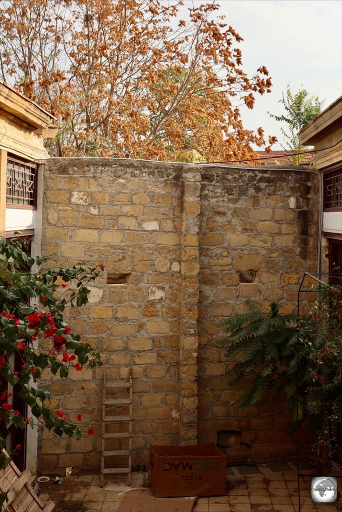
Welcome to the taste2travel Azerbaijan Travel Guide!

Date Visited: August 2019

Introduction

Located on the shores of the Caspian Sea, at the crosswords of Europe and Asia, the Land of Fire is a country of many contradictions and contrasts.

Neither Europe nor Asia, Azerbaijan is a country of two halves – “the have’s and the have not’s”. While the capital, Baku, offers all the facilities and services you’d expect to find in any cosmopolitan, international city – life in the countryside remains largely unchanged from the slumbering Soviet era.

The lights of Baku Bay - on a slow exposure!

The lights of Baku Bay – on a slow exposure!

Apart from a brief period of independence in the early 20th century, Azerbaijan spent most of the last 100 years hidden away behind the iron curtain, a composite part of the former Soviet Union. After years of unrest in the outlying republics, the Soviet Union was finally dissolved in 1990. Azerbaijan declared Independence the following year in August of 1991.

Shebeki Window Pane, Sheki, Azerbaijan.

A fine example of the craft of ‘Shebeki’, a window pane made of coloured glass and wood, all held together without nails or glue.

Despite being independent, the country remained closed off to the world and very difficult to access. I first tried to visit in 1995, but the visa process was very cumbersome and seemed designed to dissuade visitors. However, in January of 2017, the government, in a bid to increase revenue from tourism, relaxed its visa requirements, allowing 95 nationalities to apply for an e-Visa (see the ‘Visa Requirements‘ section below for more on this).

Today, the country is firmly open and tourists are coming, however the hordes have yet to arrive. As a majority Muslim nation (97%), Azerbaijan is a favoured destination for visitors from the Middle East, most of whom spend their time in Baku shopping, sightseeing and dining. If you escape into the countryside, you’ll often have sights to yourself.

Turshu lavash is a popular snack made from fruits which are cooked into a liquid form, then laid out like pancakes and sun-dried.

Very colourful Turshu Lavash – a popular snack made from fruits which are cooked into a liquid form, then laid out like pancakes and sun-dried.

In order to raise its international profile, the country hosts a Formula-1 race each year, the Azerbaijan Grand Prix, it recently hosted the 2019 UEFA Europa League Final and, in 2012, it hosted the Euro-vision song contest.

As a destination, Baku has plenty to offer and most visitors to Azerbaijan never leave the capital, apart from a short half-day trip to see the nearby petroglyphs at Gobustan or the mud volcanoes.

Azerbaijan Travel Guide: Funky artwork and the amazing Zaha Hadid-designed Heydar Aliyev Centre in Baku.

Funky artwork and the amazing Zaha Hadid-designed Heydar Aliyev Centre in Baku.

The city has a medieval Islamic core, which is a UNESCO World Heritage site, surrounded by lavish late 19th and early 20th-century European style buildings which grace wide, tree-lined boulevards. These building were built, in the pre-Soviet days, by wealthy landowners who imported whole teams of architects and designers from Paris, and other European cities, to design and build the most ornate residences. Many streets in Baku look like they have been transplanted from Paris. In between these architectural gems, you’ll find equally ornate mosques and other oriental influences.

Azerbaijan Travel Guide: Azerbaijan Carpet Museum.

In November 2010 the Azerbaijani carpet was proclaimed a Masterpiece of Intangible Heritage by UNESCO.

Being an oil producing nation, the country generates significant revenue (about USD$13 billion per year) from oil exports. Much of this has been used to modernise and transform the landscape of Baku, with lots of glitzy show-piece projects à la Dubai. If you spend time driving in Azerbaijan, you’ll realise that all roads lead to Baku, which is a perfect metaphor for the country – it’s all about Baku!

"Nodding Donkey" oil pumps on the outskirts of Baku.

“Nodding Donkey” oil pumps on the outskirts of Baku.

If you wish to visit Azerbaijan, now is the time! This once-slumbering country is awake, and on the move, the bargain-value hotels and restaurants are ready to serve and it won’t be long before the hordes discover this gem on the Caspian.

Republic of Artsakh

A map showing the occupied territory of Nagorno-Karabakh. Source: Wikipedia

A map showing the occupied territory of Nagorno-Karabakh. Source: Wikipedia

As the Soviet Union began to unravel in the mid 1980’s, Azerbaijan entered into a messy and protracted war with neighbouring Armenia over the enclave of Nagorno-Karabakh, a territory of Azerbaijan whose population was mostly ethnic Armenians. The war raged until 1994 at which point Armenia had gained full control of the territory and had expelled the minority Azerbaijani population.

Today, the Republic of Artsakh, as it is known, is unrecognised by most nations, who consider it a part of Azerbaijan. Currently, all borders between Azerbaijan and Armenia / Artsakh are firmly closed.

When entering Azerbaijan, it’s NOT a problem to have Armenian immigration stamps in your passport, but it IS a problem to have Artsakh immigration stamps and you will be denied entry into Azerbaijan. Armenian passport holders are barred from entering Azerbaijan.

Location

Baku, Azerbaijan

Along with Georgia and Armenia, Azerbaijan is one of three countries which comprise the Caucasus region, a region which is situated between the Black sea and the Caspian Sea.

Azerbaijan shares land borders with Turkey, Russia, Iran, Armenia and Georgia. The Caspian Sea forms the entire eastern border of the country.

Nakhchivan

The small Azerbaijani enclave of Nakhchivan is separated from the rest of the country by Armenia. The only way to access Nakhchivan, from Azerbaijan proper, is via one of the regular flights from Baku airport. By land, it’s possible to enter Nakhchivan from Turkey or Iran.

The capital of Azerbaijan, Baku, is situated on the wide Baku Bay.

The capital of Azerbaijan, Baku, is situated on the wide Baku Bay.

People

The Azerbaijani diaspora is considerable with large populations living around the world (e.g. an estimated 400,000 live in the United States). Within Azerbaijan, the population is around 10 million, however the largest population (13 million) live south of the border in northern Iran with Azerbaijani’s comprising 25% of Tehran’s population.

The reason so many Azerbaijani’s live in Iran is due to recent history, which saw Russia and Iran divide the former, much larger, territory of Azerbaijan between them, with Russia claiming the northern half and Iran the southern half. The Russian claim included the rich oil fields around Baku, a resource which would be crucial for the Soviet Union. When the Soviet Union collapsed, the northern half claimed independence, while the southern half remains under the control of Iran.

Flag

The flag of Azerbaijan.

The flag of Azerbaijan.

The flag of Azerbaijan consists of three horizontal bands of light blue, red, and green which mean:

  • Light Blue: symbolises Turkic Multi-nationalism, a movement which was started during the Ottoman empire.
  • Red: a symbol for the ongoing development of Azerbaijani culture.
  • Green: a symbol of Islam, the pre-dominate religion of the country.

In the centre of the flag is a white crescent moon, another Islamic symbol, and an eight-pointed star which relates to the eight letters in the word “Azerbaijan” as written in Arabic.

A gigantic Azerbaijan flag flying in downtown Baku.

A gigantic Azerbaijan flag flying in downtown Baku.

Now that you know a little about the flag of Azerbaijan, you have the answer to at least one of the questions, which you’ll find in my ‘Crescent Flags of the World‘ travel quiz. Good Luck!

Currency

Azerbaijan Manat banknotes.

Azerbaijan Manat banknotes were designed by the same person who designed the Euro banknotes.

The currency of Azerbaijan is the Manat (code: AZN/ symbol:) which is derived from Moneta, who was the Roman Goddess of Memory and from which the word ‘Money’ is derived.

The Manat is issued by the Central Bank of Azerbaijan and shares some design similarities with the Euro (€), both having been designed by the same designer, Robert Kalina of Austria.

At the time of my visit, USD$1 = 1.70 AZN – to check the current exchange rate with the USD, click here

Costs

A Parisian-style street kiosk in downtown Baku.

A Parisian-style street kiosk in downtown Baku.

Like other countries in the region, travel costs in Azerbaijan are very reasonable (50% less than what you’d pay in Europe). A cosmopolitan capital, Baku caters for all types of travel budgets with lots of accommodation options, fine restaurants, cafes and glitzy malls.

Suggested daily budgets: 

  • Backpacker: Up to USD$30 per day.
  • Flashpacker: Between USD$60 -$100 per day.
  • Visiting Oil Executive: The sky’s the limit.

Sample costs: 

  • Coca Cola (0.33 litre bottle): 0.80 ₼ (US$0.46)
  • Water (0.33 litre bottle): 0.40 ₼ (US$0.23)
  • Cappuccino: 4 ₼ (US$2.35)
  • Metro Ticket in Baku: 0.30 ₼ (US$0.18)
  • Taxi within downtown Baku: 5-10 ₼ (US$3-6)
  • Car Rental (daily compact through Hertz): 48 ₼ (US$28)
  • Litre of fuel: 0.95 ₼ (US$0.56)
  • Combo Meal at McDonald’s in Baku: 8 ₼ (US$4.70)
  • Meal (inexpensive restaurant): 10 ₼ (US$5.87)
  • Meal for 2 (mid-range restaurant): 40 ₼ (US$23.50)
  • Dorm bed in a budget hostel (Kaha Hostel, Baku):  27 ₼ (US$16)
  • Room in a mid-range hotel (Radisson Park Inn, Baku): 170 ₼ (US$100)
  • Room in a top-end hotel (Four Seasons, Baku ):  600 ₼ (US$350)

Politics

An exhibition at the Heydar Aliyev Centre details the life of the former President.

An exhibition at the Heydar Aliyev Centre details the life of the former President.

Azerbaijan became an independent state in 1991, after gaining its sovereignty from Russia. Like other post-Soviet republics, modern Azerbaijan was shaped by one, long-term President, Heydar Aliyev, who served as President from 1993 until his death in 2003.

The regime of Heydar Aliyev has been described as dictatorial, authoritarian, and repressive – typical of all other regimes in the Post-Soviet world. For more of the same politics, you can refer to my Uzbekistan, Tajikistan and Kazakhstan Travel Guides.

Prior to his death, Heydar Aliyev nominated his son, Ilham Aliyev, to be his successor as President, a role which he still occupies. The official results of the October 15, 2003, elections gave victory to Ilham Aliyev, who earned 76.84% of the votes. In all other successive elections, he has won a majority of the votes with 87% in 2008, 85% in 2013 and 86% in 2018 – figures which would be truly stunning in a genuine democracy! In all elections, independent monitors have flagged serious voter irregularities.

Despite the rotten politics, Azerbaijan continues to develop, modernise and move forward, thanks in whole to the annual revenue earned from its oil exports. Because of this, locals are happy to maintain the status quo – for the time being.

Sightseeing

Souvenirs on sale in the old town of Baku.

Souvenirs on sale in the old town of Baku.

While most visitors to Azerbaijan don’t leave the capital, or maybe dip their toes into the countryside by venturing 50 km south to Gobustan, there’s plenty to see and do outside of Baku.

Thanks to an ongoing, ambitious, highway building program, getting around the country can be done quickly and efficiently with your own rental car (see the ‘Rental Car‘ section) or by public transport.

For those who like to visit UNESCO World Heritage Sites, there are three in Azerbaijan:

  • Gobustan Rock Art Cultural Landscape (2007)
  • Historic Centre of Sheki with the Khan’s Palace (2019)
  • Walled City of Baku with the Shirvanshah’s Palace and Maiden Tower (2000)

Baku

Heydar Aliyev Centre

Heydar Aliyev Centre Baku

The Zaha Hadid-designed Heydar Aliyev Centre is a landmark building in Baku.

Without a doubt, the jaw-droppingly beautiful, and totally original, Heydar Aliyev Centre is the highlight of any visit to Baku. This award-winning, iconic building, was designed by the famous British-Iraqi architect, Zaha Hadid and opened in 2013. Zaha Hadid passed away in 2016, but will forever be known as the “Queen of the curve” thanks to her fluid designs. No straight line was used in the project of the complex.

Heydar Aliyev Centre, Baku.

Curved spaces inside the centre have allowed for the creation of separate exhibition spaces.

Located next to the highway, as you drive in from the airport, this stunning vision in white is impossible to miss – it’s a sight which would impress even the most jaded of traveller.

The centre has become a signature landmark of modern Baku. The interior features eight levels and includes an auditorium (only accessible at performance times to ticket holders), exhibition spaces, a conference hall, workshops and a museum.

For those who are fans of Anish Kapoor, you’ll find one of his ‘reality-bending’ works installed on the ground floor.

Deconstructed Azerbaijani Carpet at the Heydar Aliyev Centre.

Deconstructed Azerbaijani Carpet at the Heydar Aliyev Centre.

While the centre features interesting and engaging displays, the main star of the show is the building itself, which is set on a green hill surrounded by parkland in which giant rabbits graze. It’s all very ‘Instagram-able!

Access: Open every day from 11 am to 7 pm (6 pm on Saturday and Sunday), except Monday. Tickets cost 12 AZN.

Old City

Rugs for sale in the old town of Baku.

Rugs for sale in the old town of Baku.

Baku grew up around the walled old city, which is known locally as İcheri Sheher. This is one of three World Heritage sites in the country and is believed to date from the 12th century, although some researchers believe it to be much older. Listed on the register in the year 2000, the old city became the first location in Azerbaijan to be classified as a World Heritage Site by UNESCO. The two main sites are the Shirvanshah’s Palace and the Maiden Tower.

Located in the heart of Baku, a short walk from waterfront, İcheri Sheher is an oasis of calm, being surrounded by thick, high stone walls which keep the noise, and most of the traffic, out. It’s a pleasant place to spend time wandering, with many mosques, restaurants, cafes, shops and hotels hidden away in its cobbled lane-ways.

Maiden Tower

The rooftop of the Maiden Tower provides some of the best views in town.

The rooftop of the Maiden Tower provides some of the best views in town.

Built in the 12th century, the 29-metre-tall, Maiden Tower, is one of Baku’s most famous landmarks, offering panoramic views of the old city and the waterfront from its rooftop viewing deck. A distinctive feature of the tower is the unusual projecting spine-buttress. The climb to the top leads you through a number of galleries which feature displays on the history of the tower and the old town.

As for the name, the Azeri name for the tower is Qız Qalası, which in English is translated as Maiden’s Tower, however the term most probably refers not to any female maiden but the fact that the tower was never captured (or touched) by invaders.

Access: The Maiden tower is open every day from 9 am to 6 pm. Tickets cost 15 AZN and are sold at the small kiosk opposite the tower entrance.

Museum Centre

The imposing edifice of the Museum Centre, which overlooks Baku bay.

The imposing edifice of the Museum Centre, which overlooks Baku bay.

The impressive and imposing Museum Centre, was originally opened in 1955 as the Lenin Museum. Located on the waterfront, this neoclassical building has an imposing facade and contains 4 floors which houses two different museums:

  • Museum of Musical Culture: Located on the 2nd floor, this museum features dated and dusty displays detailing the musical heritage of Azerbaijan. Concerts are occasionally organised and CD’s of Azerbaijani folk music are available for purchase.
  • Museum of Independence: Located on the 3rd floor, this museum also features old and dated displays which provide an un-engaging political history of the nation.

Access: The Museum Centre is open every day from 9 am to 5 pm. A combination ticket for both museums costs 6 AZN and are sold at the kiosk on the ground floor.

Azerbaijan Flag, National Museum, Baku.

The Azerbaijan Flag at the Museum Centre in Baku.

National Museum of History of Azerbaijan

The National Museum of History of Azerbaijan is located a short walk from the Museum Centre but was closed for renovation at the time of my visit.

Azerbaijan National Museum of Art

Each of the 60 rooms of the Azerbaijan National Museum of Art feature incredible parquet flooring.

Each of the 60 rooms of the Azerbaijan National Museum of Art feature incredible parquet flooring.

Despite being located downtown, on a busy road, opposite the walls of the Old City, the impressive, and worthwhile, Azerbaijan National Museum of Art is off the tourist radar. During my visit, I was the only visitor. This impressive museum is housed inside two opulent buildings which were built by wealthy oil barons in the 19th century and have since been joined by a glass entrance.

The main building is the lavishly designed – Palace of De Boure – which was originally built by order of Mr Leo De Boure. The museum contains 60 rooms which displays 3,000 different artworks and while I found the displays to be interesting, the highlight for me was the intricate design of the parquet flooring. In each room, the flooring is different, with each piece laid separately to form exquisite floral designs and geometric shapes.

The rooms of the museum contain some incredible works of art which are mostly from Azerbaijani artists. I happily spent 2 hours browsing the exhibits.

Access: The Azerbaijan National Museum of Art is open every day from 10 am to 6 pm, except Monday. Tickets cost 10 AZN with an extra 5 AZN payable if you wish to take photos, which I would recommend.

Azerbaijan National Carpet Museum

Azerbaijan National Carpet Museum.

The Azerbaijan National Carpet Museum was designed to resemble a rolled carpet.

Located on the waterfront, the Azerbaijan National Carpet Museum houses the largest collection of Azerbaijani carpets in the world. While carpets had, formerly, been displayed in other museums, it was decided to construct a dedicated carpet museum following the 2010 proclamation by UNESCO that Azerbaijani carpets were “a Masterpiece of Intangible Heritage“.

The museum was opened in August of 2014 and was designed to resemble a rolled carpet. While this sounds wonderful from a design point of view, it has made the displaying of carpets, on the curved interior walls, a little difficult.

How to display a flat carpet on a curved wall? Carpets on display at the Carpet Museum.

How to display a flat carpet on a curved wall? Carpets on display at the Carpet Museum.

The museum features an incredible array of carpets from all regions of the country. One of the most interesting exhibits is a hand-woven carpet which features a map of Azerbaijan which is over-laid with examples of different carpet styles typical of each region. A true work of art!

Can you imagine weaving this by hand? An incredible example of weaving.

Can you imagine weaving this by hand? An incredible example of weaving.

In addition to traditional carpets, the top floor showcases modern, contemporary designs, some of which are breath-taking. One of my favourites from this collection is pictured below – it’s simply called ‘Rebellion’.

"Rebellion" - one of my favourite carpets in the modern collection of the museum.

“Rebellion” – one of my favourite carpets in the modern collection of the museum.

It should be noted that if you plan to buy and export an Azerbaijani carpet, you will first need to obtain an export permit (applies to any carpet larger than 1 sq metre). The easiest place to obtain such a permit is from museum carpet shop which is located on the ground floor.

Access: The Azerbaijan National Carpet Museum is open every day from 10 am to 6 pm, except Monday. Tickets cost 7 AZN with an extra 5 AZN payable if you wish to take photos, which I would recommend.

Baku Funicular

The Baku funicular is a nice way to ascend the steep hill to Highland Park.

The Baku funicular is a nice way to ascend the steep hill to Highland Park.

Located opposite the Carpet Museum, the modern, clean and comfortable Baku funicular whisks you up from near the waterfront to Highland Park in just 3 minutes.

The funicular is the only one of its kind in the country and operates between two stations – the lower “Bahram Gur” and the upper “Martyrs’ Lane”.

Access: The funicular operates between 10:00 and 22:00 with a single ride costing 1 AZN.

Flame Towers

A symbol of a modern and confident city, the Flame Towers dominate the skyline of Baku

A symbol of a modern and confident city, the Flame Towers dominate the skyline of Baku

Completed in 2012, and befitting of a country which calls itself the ‘Land of Fire’, the three Flame Towers, dominate the Baku city skyline. Located on a hill, overlooking Baku bay, the three towers range in height from 28 to 33 storeys, and are most impressive when viewed from a distance rather than up close.

Once the sun sets the towers come to life, with the facades functioning as large, illuminated display screens thanks to more than 10,000 high-power LED lights. One of the towers is home to the Fairmont Baku hotel while the others are occupied by corporate offices.

Highland Park

The Martyrs' Lane memorial, Highland Park, Baku.

The Martyrs’ Lane memorial, Highland Park, Baku.

Located next to the upper funicular station, Highland park offers the best views of Baku and is a great place to watch the sunset over the city and bay. The park features gardens, fountains and a huge balcony which overlooks the city.

One of the most moving monuments in Baku is Martyrs’ Lane, a memorial which is dedicated to those who lost their lives (at the hands of the Soviet Red Army) in one single day – the 20th of January 1990 – during the country’s struggle for independence.

The eternal flame memorial at Highland park, Baku.

The eternal flame memorial at Highland park, Baku.

The central avenue is lined with a wall of white marble into which polished black marble stones are set with the names of the martyrs. One of the memorial markers (pictured above) features a married couple who were killed together.

The eternal flame memorial at Highland park.

The eternal flame memorial at Highland park.

At the end of the avenue, set in a round open plaza, is a large eternal flame.

Baku Eye

The 60-metre-tall 'Baku Eye' Ferris wheel on Baku bay.

The 60-metre-tall ‘Baku Eye’ Ferris wheel is located on Baku bay.

It seems these days that any city that wants to be taken seriously needs to have their own ‘eye’. Baku Eye is located on the waterfront, a short walk south of the Carpet Museum. This 60-metre-tall Ferris wheel does one revolution every 40 minutes and features large, air-conditioned cabins. George Washington Gale Ferris Jr., who invented the first Ferris wheel for the World Fair in Chicago in 1893, would be proud!

Crystal Hall & National Flag Square

The Crystal hall is located on the waterfront in downtown Baku.

The Crystal hall is located on the waterfront in downtown Baku.

Baku Crystal Hall is a large indoor arena which is located on the waterfront, a short walk south of the Ferris wheel. Built to host the 2012 Eurovision Song Contest, the arena today is used to host concerts and other events.

The hall is only during performances, but the staff at the Crystal Cafe (see the ‘Cafe‘ section below) can organise a sneak peek for paying customers. The coffee and cake at the cafe are divine!

Sharing the same piece of bay side real-estate, the huge raised platform in front of the Crystal Hall is National Flag Square, which is currently without a flag and is closed to visitors.

In September of 2010, the world’s tallest flagpole (then 162 metres) was installed on top of the platform. Then, in the ultimate game of one-upmanship, the government of Tajikistan installed a 165-metre flagpole in Dushanbe! Ouch! You can read all about the Dushanbe flagpole in my Tajikistan Travel Report.

To make matters worse, the same San Diego-based company (Trident Support), who constructed the flagpole in Azerbaijan also built the flagpole in Tajikistan. Then to top everything, the Saudis unveiled a 171-metre flagpole in Jeddah, which still remains the World’s Tallest Flagpole.

As for the Azerbaijan flagpole – rumour is that it will return soon, bigger and better – and most probably taller than 171 metres.

Bibi-Heybat Mosque

Bibi-Heybat Mosque, Baku.

The modern incarnation of the Bibi-Heybat Mosque.

Located on the main road, a short distance south of the Crystal Hall, the modern version of the Bibi-Heybat Mosque was constructed in the 1990’s and is a re-creation of the mosque with the same name which was built on the same site in the 13th century. The old mosque was blown up by the Soviets in 1937 ‘for road widening’.

Heydar Mosque

Heydar Mosque, Baku, Azerbaijan.

An impressive site, the Heydar Mosque illuminated during the Blue Hour.

Opened in 2014, the Heydar Mosque, is the largest in the Caucasus region. Built in the local Shirvan – Absheron architectural style, the mosque features four 95-metre-high minarets and covers an area of 12,000 square metres.

It’s best to visit the mosque just before sunset so you’re in position to photograph it during the magical ‘blue hour‘ which generally lasts the 20 to 30 minutes just after sunset. The mosque is fully illuminated once the sunsets.

Access: The mosque is located in a non-descript suburb, 8 km inland from the waterfront. I reached the mosque with a taxi which charged me 15 AZN.

Gobustan Petroglyph Reserve

Gobustan Petroglyph Reserve, Azerbaijan.

The Gobustan Petroglyph Reserve is set on an escarpment overlooking the Caspian Sea.

Almost all visitors to Azerbaijan spend their time in Baku, however the most popular (half-day), trip out of the capital is to the Gobustan Petroglyph Reserve, which is located 50 km south of Baku on a fast highway.

The site is one of three UNESCO world Heritage sites in Azerbaijan and attracts hordes of tour groups. Set on an escarpment overlooking the Caspian Sea, a few kilometres inland from the coastal highway, the petroglyphs were first discovered by a local miner in 1939-40 and are believed to be 40,000 years old.

Petroglyphs at Gobustan, Azerbaijan.

A prehistoric version of the “Family Diagram” bumper sticker!

The rock art represents flora and fauna, hunting, lifestyles, and culture of pre-historic with many of the petroglyphs well worn by the ravages of time. An easy way to find them is to look for the newly engraved serial numbers which have been carved into the rock near to the drawings.

It’s believed that the drawings were originally carved inside caves which early man inhabited, but over time, the caves have collapsed, leaving the former walls now exposed to the elements. While the drawings are fascinating, the sweeping views from the escarpment are just as engaging.

A visit to the complex starts 3 km down the road at the visitors centre which outlines the history of the complex. The ticket office is located in a booth outside the visitors centre.

The petroglyphs of Gobustan feature diagrams representing flora and fauna.

The petroglyphs of Gobustan feature diagrams representing flora and fauna.

Access: The reserve is open every day from 9:00 am to 5:00 pm with tickets for foreigners costing 10 AZN. You can check all ticket and tour prices here.

I drove my rental car which took me about 45 minutes from downtown Baku along the fast coastal highway. If you don’t have transport, there are plenty of affordable day tours (80 AZN) from Baku which also include additional sites, such as the Mud volcanoes. If you really wish to attempt public transport, bus #195 from Baku stops at the southern end of Gobustan from where taxi drivers wait to take you to the visitors centre and the reserve.

Mud Volcanoes

One of many mud volcanoes which can be seen at Daşgil Hill.

One of many mud volcanoes which can be seen at Daşgil Hill.

Located 20 km down the road from the petroglyphs, on top of the utterly remote and bleak Daşgil Hill is a weird collection of baby mud volcanoes.

The access road to the site is a very poor, rough, gravel road which is un-signposted. I reached the site in my rental car using Google Maps, which led the way, although I thought Google was leading me astray until came across a group of strange conical mounds that were gurgling and spitting cold, wet, grey, mud.

The mud from the volcanoes is cool rather than hot and slowly gurgles its way to the surface.

The mud from the volcanoes is cool rather than hot and slowly gurgles its way to the surface.

The poor accessibility of the site means that the tour buses are unable to visit, which offers some respite after dealing with the masses at Gobustan.

There are an estimated 800 mud volcanoes in the world, with Azerbaijan containing the largest collection with 300 – there are at least 20 at this site.

Rich oil and gas fields are always found in the vicinity of mud volcanoes and nearby, one oil seep can be viewed near to the mud volcanoes. A seep is the result of oil flowing to the surface through faults in the earth’s crust.

An oil seep near to the mud volcanoes.

An oil seep near to the mud volcanoes.

Access: Due to its remote location, there’s no ticket office, no visitor centre or any other infrastructure. The site is completely open and can be visited at any time.

Quba

Located in the north of Azerbaijan, in the foothills of the Caucasus mountain range, a short drive from the Russian Republic of Dagestan, Quba is famous for its apples which are the sweetest apples you’ll ever taste. As you approach town, the frequency of apple sellers along the highway increases. Apples are sold by the bucket and so, when I stopped at one stall and asked for a measly two apples, the kind old lady simply handed them to me and refused payment. I insisted on giving something so I left her with a nice tip!

Quba is a popular getaway in itself but more particularly a gateway to the villages in the Caucasus mountains. The town is sleepy and quiet but is home to one important site – the Quba Genocide Memorial Complex.

Quba Genocide Memorial Complex

Quba Genocide Memorial, Azerbaijan.

The striking Quba Genocide Memorial Complex is located on the outskirts of town.

The complex, which sits on the grounds of a former sports field, was constructed following the discovery of a mass burial site in 2007, which was unearthed by construction works. The striking site features two large concrete pyramids which rise dramatically above a subterranean museum. Surrounding the pyramids is an apple orchard, a memorial marking the location of the burial site and a flagpole.

My apple which was carefully selected from the orchard by my friendly guide. It tasted so good!

My apple which was carefully selected from the orchard by my friendly guide. It tasted so good!

You must be accompanied by a guide while inside the museum, which is included in the ticket price. Prior to entering the museum, I asked my guide about the apples which were hanging on the trees and looked very tempting. He carefully selected the best one for me and I can attest, it was the most superb tasting apple.

Quba Genocide Memorial.

The interior of the subterranean museum at the Quba Genocide Memorial.

The memorial commemorates the massacres of April and May 1918, when Armenian (Christian) Bolshevik forces invaded the area and massacred some 16,780 civilians, almost all Muslim and some local Jews. Many of those killed were buried in the mass grave. The museum displays, which are moving and engaging, provides information on the history of the region and the events during the time of the Armenian invasion.

Access: The complex is open every day from 9:00 am to 6:00 pm with tickets for foreigners costing 10 AZN. The complex is located on the western outskirts of town.

Çuxur Hamam

The Çuxur Hamam in Quba.

The ancient Çuxur Hamam in Quba.

Apart from the Genocide complex, one other site in town is the Çuxur Hamam. When I arrived (around 4 pm), the museum was closed. I was able to access the roof from where I took this photo.

Sheki

Located 300 km northwest of Baku, the popular tourist destination of Sheki is located on the slopes of the Caucasus mountain range, close to the border with Georgia. Sheki is considered to be the loveliest town in Azerbaijan, and was once a residence for the ruling Sheki Khans. The town has one of the greatest densities of cultural resources and monuments in Azerbaijan which include 2700 years of Azerbaijani history.

Sheki was once an important stopover point on the Silk Road and today several caravansaries still exist in the old town, one of which has been converted into a hotel and is open to visitors.

Palace of Sheki Khans

Palace of the Sheki Khans, Sheki, Azerbaijan.

The exterior of the Palace of the Sheki Khans – photos are not allowed inside.

The main attraction in town is the hilltop Palace of the Sheki Khans which was once a summer residence for the Khans and is one of three UNESCO World Heritage site in Azerbaijan.

The palace was built in 1762 by Huseyn Khan and sits among huge Chinar trees within the fortress complex. Every available inch of the palace interior is covered in the most ornate artwork and features vivid murals and dazzling coloured light streaming through Shebeki windows (see the following section). The windows in the palace are the best examples of Shebeki that exist anywhere.

The exquisite interior is a photographer’s dream, however photos are only allowed if you purchase a 300 AZN (USD$175) photography license.

Craft Centre Wall, Sheki, Azerbaijan.

The wall of the Sheki arts and craft centre features locally made ceramic artwork.

Access: The Palace is open every day from 10:00 am to 6:00 pm with tickets for foreigners costing 10 AZN. The fortress complex is a short walk uphill from the old town.


Shebeki

Unique to Azerbaijan, Shebeki (stained-glass windows) can be viewed in all their colourful glory at the Palace of the Sheki Khans. If, like me, you fall in love with these amazing creations, you can see how they are made at a workshop which is inside the craft centre by the main entrance to the fortress complex.

Here an expert craftsman will show you how the panels are made which is:

  • Step 1: Cut a piece of coloured glass to fit the panel section.
  • Step 2: Cut a piece of wood to act as a frame for the glass piece.
  • Step 3: Insert the glass piece into the larger panel.
  • Step 4: Insert the supporting wooden retainer which will hold the glass in place.
  • Step 5: Repeat all of the above steps until you have finished your panel, then enclose all the pieces in a wooden frame. No nails, no glue.

The following photos illustrate the process.

Shebeki Window Pane Making Process - 1.

Step 1: Cutting the glass.


Shebeki Window Pane Making Process - 3

Step 3: Insert the glass piece into the larger panel.


Shebeki Window Pane Making Process - 4.

Step 4: Insert the supporting wooden retainer which will hold the glass in place.


Shebeki Window Pane Making Process - 5

Step 5: Enclose all the pieces inside a wooden frame. No nails, no glue.


Caravansary

Courtyard of the Sheki caravansary.

The courtyard of the old caravansary, which today is welcoming a new type of guest.

Once a Silk Road caravansary, this impressive building has been renovated and converted into the Karavansarai Hotel. Even if you’re not staying here, you are free to visit and photograph the beautiful courtyard. The best coffee in town can be found at the Illy Cafe (see the ‘Cafe‘ section below), which is located outside on the main road.

Caravansaries once served as ancient roadside inns, where travellers could rest and recover from the day’s journey. They supported the flow of commerce, information and people across the network of trade routes covering Asia, North Africa and Southeast Europe, most notably the Silk Road.

Accommodation

Like everything else in Azerbaijan, visitors are spoilt for choice when it comes to accommodation options in Baku. However, elsewhere, while options exist, they are more limited.

Baku

My room at the Radisson Park Inn, Baku.

My room at the Radisson Park Inn, Baku.

My room at the Radisson Park Inn in Baku.While in Baku, I stayed downtown at the excellent Radisson Park Inn, where rooms cost around US$100 per night, although sometimes cheaper if booked through an OTA such as Booking.com or Hotels.com.

The reason I selected the Park Inn was that, at the time of making my reservation, I was staying in Tashkent at the excellent Tashkent Radisson Blu hotel, which is included in my Uzbekistan Travel Guide. I simply wanted to soak up more Radisson hospitality!

The Park Inn is centrally located on the waterfront, opposite the Park Bulvar mall, which offers plenty of dining and shopping options. Everything of interest in Baku is within walking distance of the hotel.

Quba

Kvartira - my wonderful apartment in Quba.

Kvartira – my wonderful apartment in Quba.

The northern city of Quba has limited accommodation options, however I found a gem! I booked an amazing apartment, Kvartira, through booking.com, which cost me US$50 per night which is about average in the provinces.

My spacious, clean apartment included a washing machine (always appreciated!), a kitchen, cable TV and two large bedrooms which could easily accommodate the Brady Bunch, should they ever come to town.

The apartments are located on the 1st floor of a non-descript, modern building in a non-descript side street of Quba. The building has no signage suggesting that there are rental apartments in the building and Google maps couldn’t locate the address. I had to phone the owner who directed me to the premises. It’s all very, well, non-descript but the apartment is wonderful, especially if you need to do some laundry.

The owner is very enthusiastic and helpful and speaks a little English. Due to the location, it’s best suited to people who have their own transport.

Sheki

My comfortable room at the Sheki Saray hotel in Sheki.

My comfortable room at the Sheki Saray hotel in Sheki.

Having once accommodated the Khans of Sheki, this popular tourist town offers plenty of good accommodation options, catering to all budgets.

I stayed at the very good, Sheki Saray hotel which is located in the heart of the downtown area and offers comfortable rooms from US$65 per night. It’s always nice, while in town, to be able to leave the rental car parked in the hotel car park while you explore on foot. Everything of interest is a short walk from the hotel.

Eating Out

A typical meal in Azerbaijan - BBQ'd meat, salad, bread and some rice.

A typical meal in Azerbaijan – BBQ’d meat, salad, bread and some rice.

As with accommodation, and everything else, when it comes to dining options, visitors are spoilt for choice in Baku. However, elsewhere, options are far more limited and normally restricted to ‘national’ cuisine which is best illustrated in the photo above.

Qutab is a popular snack in Azerbaijan.

Qutab is a popular snack in Azerbaijan which is grilled flatbread stuffed with cheese and herbs. The same as Turkish Gözleme!

The cuisine of Azerbaijan is typical of the region, with an emphasis on kebabs, BBQ’d meat, salads and bread – all washed down with pots of black tea. If you’re arriving in the country from any of the neighbouring countries, or Central Asia, the cuisine of Azerbaijan will be very familiar to you. However, in Baku, you have a great variety of international cuisines available, plus all the regular fast food chains, coffee houses etc.

Restaurants

A roadside restaurant meal in Azerbaijan.

A delicious meal at a roadside restaurant on the road to Sheki.

Baku

Colourful food trucks can be found throughout the downtown area of Baku.

Colourful food trucks can be found throughout the downtown area of Baku.

While in Baku, I took advantage of the variety of cuisines to take a break from the daily diet of shashlik, salad and bread to instead enjoy some fiery Indian, tasty Chinese and deliziosa Italian!

If you’re craving Italian, the global franchise, Vapiano, (actually a German company) have opened a new branch of their amazing casual dining restaurant in Baku, opposite one of the best cafes in town, the Baku Book Centre (see the ‘Cafe‘ section below for more on BBC).

Both the 28 mall, which is located opposite the main train station, and the Park Bulvar mall, which is located on the waterfront opposite the Park Inn hotel, offer a good variety of dining options and coffee chains. If you’re craving fast food, Starbucks, or the Australian chain – Gloria Jean’s Coffees, these malls are your best bet.

Quba

There are limited dining options in Quba with almost all specialising in ‘national’ cuisine. Most restaurants outside of Baku offer al-fresco dining, which is wonderful on a starry night.

While in town, I ate at the Palma restaurant which is located on Molla Pənah Vaqif Küçəsi – a short walk from Kvartira apartments. The speciality of the restaurant is shashlik, the most amazing, fresh salads and freshly baked bread.

Sheki

Being the main tourist draw-card outside of Baku, Sheki offers plenty of dining options. I ate at the popular Restoran Çələbi Xan which is conveniently located opposite the Sheki Saray hotel. The menu features BBQ’d meats, salads, soups and is a good place to try Sheki baklava, which is best washed down with an espresso from their Italian coffee machine. 

Cafés

A great place to chill and enjoy a delicious coffee - Baku Book Centre Cafe.

A great place to chill and enjoy a delicious coffee – Baku Book Centre Cafe.

Baku

Cafe Latte at the Baku Book Centre Cafe.

Cafe Latte at the Baku Book Centre Cafe.

Caffeine addicts are totally spoilt for choice in Baku! I did my best to sample a multitude of cafes, and would nominate Bliss Cafe as one of my favourites. The cafe is located around the corner from the Hilton hotel at #3 Azadliq Ave. The cafe offers one of the few breakfast menus in Baku, with an emphasis on healthy options, low on fat and sugar. The porridge is amazing as are the poached eggs.

Another favourite cafe is the very hip and stylish cafe at the Baku Book Centre (BBC) which is located opposite Vapiano and the lively Molokan Gardens. This spacious cafe features funky artworks, great coffee and tasty food.

Creative artwork on the wall of the BBC Cafe.

Creative artwork on the wall of the BBC Cafe.

Another worthwhile cafe is the Crystal Cafe, which is located inside the Crystal Hall. The cheesecake (pictured above), was served to me on one of my visits along with an excellent flat white. If you wish to view the Crystal Hall (which is always closed accept during performances), the friendly staff can escort you to the auditorium for a sneak peak, but photography is not allowed.

Cheesecake served at the Crystal cafe, Crystal Hall, Baku.

An amazing cheesecake, served at the Crystal cafe at the Crystal Hall in Baku.

Quba

There are no good cafes in Quba. If you really need a caffeine fix, the best option is to drive back to Baku, a drive of 159 km (99 mi)!

Sheki

There are a few cafes in Sheki which are equipped with an Italian espresso machine. The Illy Espresso House, which is part of the Karvansaray hotel complex, offers the best coffee in town. The Restoran Çələbi Xan also offers decent Italian espresso coffee as does the Sheki Saray hotel.

Bars

Xirdalan is the national beer of Azerbaijan.

The national beer of Azerbaijan, Xirdalan, is very smooth on the palette.

Despite being a predominately Muslim country, alcohol is readily available in Azerbaijan, a legacy of years spent in the Soviet Union where religion was banned and alcohol consumption was an integral part of the culture.

A product of Carlsberg, the light and very quaffable, Xirdalan, is the most popular beer in Azerbaijan, and can be found in most restaurants throughout the country. While dedicated bars can only be found inside top-end hotels, most restaurants serve alcohol.

Visa Requirements

Azerbaijan passport stamps.

Azerbaijan passport stamps.

In January of 2017, Azerbaijan significantly relaxed its visa requirements for 95 different nationalities, who are able to apply for a 30-day e-Visa. The system is called ASAN Visa and has been recognised as one of the easiest e-visa processes in the world.

My Azerbaijan e-Visa.

My Azerbaijan e-Visa.

The application process is simple and quick, with a payment of USD$23 (USD$20 + USD$3 service fee) required. Visas are issued via email within 3 working days. The visa needs to be printed and presented upon arrival. You can apply for the visa at the ASAN Visa website.

To check your requirements, please refer to the Visa Policy of Azerbaijan.

Getting There

Buta Airways at Heydar Aliyev International Airport.

Buta Airways at Heydar Aliyev International Airport.

Air

There are six international airports in Azerbaijan, with the main one being Heydar Aliyev International Airport in Baku. The airport is located 20 kilometres northeast of Baku, and is connected to the city by a modern highway. The airport serves as the base for the national carrier, Azerbaijan Airlines, and its low-cost subsidiary Buta Airways.

The following airlines provide scheduled services to/ from Heydar Aliyev International Airport:

  • Aeroflot – flies to/ from Moscow–Sheremetyevo
  • Air Arabia – flies to/ from Sharjah
  • Air Astana – flies to/ from Almaty, Nur-Sultan
  • Al Naser Wings Airlines – flies to/ from Erbil
  • Azerbaijan Airlines – flies to/ from Almaty, Ankara, Beijing–Capital, Berlin–Tegel, Delhi, Dubai–International, Erbil, Ganja, Geneva, Istanbul, Kiev–Boryspil, Kuwait, London–Heathrow, Milan–Malpensa, Moscow–Domodedovo, Moscow–Vnukovo, Nakhchivan, New York–JFK, Paris–Charles de Gaulle, St Petersburg, Tashkent, Tel Aviv
  • Belavia – flies to/ from Minsk
  • Buta Airways – flies to/ from Ankara, Astrakhan, Batumi , Dammam, Istanbul–Sabiha Gökçen, Izmir, Kazan, Kharkiv, Kiev-Zhuliany, Mineralnye Vody, Moscow–Vnukovo, Odessa, Riyadh, St. Petersburg, Tbilisi, Tehran–Imam Khomeini, Ufa
  • China Southern Airlines – flies to/ from ÜrümqiEtihad Airways – flies to/ from Abu Dhabi
    flydubai – flies to/ from Dubai–International
  • Gulf Air – flies to/ from Bahrain
  • IrAero – flies to/ from Chelyabinsk, Orenburg, Rostov-on-Don
  • Iran Air – flies to/ from Tabriz, Tehran–Imam Khomeini
  • Iraqi Airways – flies to/ from Baghdad, Erbil, Sulaymaniyah
  • Jazeera Airways – flies to/ from Kuwait
  • Kuwait Airways – flies to/ from Kuwait
  • Lufthansa – flies to/ from Frankfurt
  • Mahan Air – flies to/ from Tehran–Imam Khomeini
  • NordStar – flies to/ from Samara, Ufa
  • Pegasus Airlines – flies to/ from Ankara, Izmir
  • Qatar Airways – flies to/ from Doha
  • S7 Airlines – flies to/ from Novosibirsk
  • SCAT Airlines – flies to/ from Aktau
  • Smartavia – flies to/ from St Petersburg
  • Turkish Airlines – flies to/ from Ankara, Istanbul
  • Ukraine International Airlines – flies to/ from Kiev–Boryspil
  • Ural Airlines – flies to/ from Samara, Yekaterinburg
  • Utair – flies to/ from Moscow–Vnukovo, Surgut
  • Uzbekistan Airways – flies to/ from Tashkent
  • Wizz Air – flies to/ from Budapest

Airport Transport

Taxi: A regular metered London Baku taxi to downtown will cost between 20-25 AZN with a journey time of 25-45 mins, depending on (usually heavy) traffic.

Bus: The public bus company, Baku Bus, operates an express airport shuttle (route H1), 24-hours a day, which departs every 30 minutes from 06:00 to midnight and every hour between midnight and 06:00. The shuttle runs between the airport and 28 May metro stop which is near the main railway station.

In order to use the bus, you’ll first need to purchase a stored-value BakuCard from the kiosk in the arrivals hall, as you cannot buy tickets on the bus. A single ride on the bus costs 1.30 AZN (USD$0.75) plus 2 AZN for the card, which is non-refundable.

Land

Map of Azerbaijan. Source: https://www.nationsonline.org

Map of Azerbaijan. Source: https://www.nationsonline.org

It’s possible to enter Azerbaijan overland from Russia, Iran, Georgia and Turkey (only Nakhchivan). Due to the ongoing dispute with Armenia over Nagorno-Karabakh, all land borders between the two countries are closed.

A description of all land borders:

  • Georgia: situated to the west of Azerbaijan, shares a land border of 428 km (265 mi) which includes two international crossings.
  • Russia: situated to the north of Azerbaijan, shares a land border of 338 km (210 mi) which includes three international crossings and one crossing for locals only (Garax-Zukhul).
  • Iran: situated to the south of Azerbaijan, shares a land border of 1,132 km (703 mi) with Azerbaijan proper and 429 km (266 mi) with Nakhchivan. There is a total of two international crossings with Azerbaijan proper and one crossing with Nakhchivan at Culfa.
  • Turkey: shares a very short, 17 km (10 mi), border with Nakhchivan with one international crossing.

Rail

The historic Baku Central Train Station.

The historic Baku Central Train Station.

Azerbaijan is connected by rail to Russia, Georgia and Ukraine (via Russia). There’s a rail connection with Armenia but this is presently closed due to the ongoing dispute over Nagorno-Karabakh. The governments of Iran and Azerbaijan are currently working on connecting the two countries by rail. There was a rail service which connected Nakhchivan with Iran, but this has, apparently, been terminated.

The interior of the glitzy and sparkling clean main hall of Baku Central Station.

The interior of the glitzy and sparkling clean main hall of Baku Central Station.

Tickets for international trains departing from Baku station can be purchased from the international ticket desk at the main station.

The following International services depart from Baku station:

  • Russia: Train #55 leaves Baku every Thursday at 01:30 for the 53-hour odyssey north to MoscowKursky, arriving two days later at 03:20 in the morning. The cheapest online ticket on this service costs 183 AZN (USD$107).
  • Georgia: Train #38 departs Baku each evening at 20:40, arriving in Tbilisi the following morning at 08:55, a journey of 12 hours. If you wish to do the same journey in 8 hours, you should take a shared taxi (see the ‘Shared Taxi‘ section below for more details). The cheapest online ticket on this service costs 24 AZN (USD$14).
  • Ukraine: Azerbaijan Railways operate a train once a week to Kiev, departing Baku on Thursdays at 01:35, and arriving in Kiev on Monday at 11:46. On the same day, at 14:37, the train returns to Baku, arriving on Thursday at 04:10. The train passes through Russian territory between Azerbaijan and Ukraine, so you should ensure you have a Russian visa if required.

Bus

International buses depart from the Baku International Bus Station, which is known as the Avtovaghzal, serving destinations in Turkey, Georgia and Russia.

There are no direct buses from Baku to Iran, but you can take buses from Astara (on the Iranian side of the border) to Tehran.

Sea

Cargo boats, which also carry paying passengers, depart on an irregular basis from Baku International port, which is located at Alat, 80 km south of Baku.

Boats sail across the Caspian sea to the Kazakhstan port city of Kuryk (30 hours), which is located 70 km south of the city of Aktau. Beds in a 2-bed cabin cost US$80 per person or US$70 in a 4-bed cabin.

Getting Around

Baku Metro

Baku Metro Map

Baku Metro Map

The efficient and punctual Baku metro is the best way to travel around the capital. In order to use the system, you’ll need to pre-purchase a stored value BakuCard. The system has 36 kilometres (22.76 mi) of track, with three lines serving 25 stations.

A Baku metro train.

A Baku metro train.

Opened in 1967, during the days of the Soviet Union, the metro is typical of other metros built in the former USSR, with deep central stations and exquisite decorations.

Tile mosaics, Nizami Metro Station, Baku.

Tile mosaics line the walls of Nizami Metro Station.

One of the most beautiful stations on the system is Nizami metro station, which is named after the great Azerbaijani poet and philosopher Nizami Ganjavi. The station is decorated with mosaic panels which feature subjects from his works.

Public Buses

Buses, which are operated by Baku bus, are the most used form of public transport in the capital. In order to ride any of the buses, you’ll first need to purchase a stored-value BakuCard which costs 2 AZN (USD$1.17), which is non-refundable. A single journey costs 0.30 AZN (USD$0.17).

Inter-city buses depart from the Baku International Bus station, which is known as the Avtovaghzal. If you don’t wish to wait for a bus, you’ll find plenty of, faster, shared taxis at the entrance to the station.

Taxi

Known locally as 'Eggplants', the streets of Baku are home to a fleet of London taxis which are all painted in 'Eggplant' purple.

Known locally as ‘Eggplants’, the streets of Baku are home to a fleet of London taxis which are all painted in ‘Eggplant’ purple.

If you’re a Londoner feeling homesick in Baku, you only need to hail a cab! The Baku Taxi fleet is comprised of Eggplant-coloured London cabs which were originally ordered by the government when the country hosted the Euro-vision song contest in 2012. The colour choice apparently came direct from the president and the cabs are commonly referred to as ‘eggplants’ by the locals.

A London taxi in Baku, where they are branded as "Baku Taxi".

A London taxi in Baku, where they are branded as “Baku Taxi”.

The initial order was for 1000 cabs, which were to replace an ageing fleet of Lada taxis, but this number has since grown, with ‘eggplants’ now whizzing everywhere around the capital.

Unlike their London counterparts, Baku Taxis can be hired for off-road adventures.

Unlike their London counterparts, Baku Taxis can be hired for off-road adventures.

While London taxis would never dare venture off-road, I saw at least one Baku taxi driving customers along the remote and rough, gravel road to the Mud Volcanoes, which are located 50 km south of the capital.

Shared Taxis

If you don’t have your own transport, the fastest and most convenient way to travel around Azerbaijan is with a shared taxi. If you’re travelling to any of the borders, shared taxis are the way to go.

Taxis leave frequently, once all places have been filled, from outside the International Bus station in Baku. Drivers will often inflate prices for tourists (or encourage you to take a private hire by purchasing all 4 places) so it’s best to confirm the correct price in advance from someone other than the driver.

Shared taxi rates are very reasonable with the six-hour journey from Baku to the Georgian border (“Red Bridge” border crossing) costing me 40 AZN (USD$23). The one-hour taxi ride from the Georgian side of the border into Tbilisi cost me US$20 for a private hire. I completed the 570 km journey from Baku to Tbilisi in 8 hours (which included an hour at the border).

Rental Car


And the award for “Most Speed Cameras in the world” goes to…. Azerbaijan!

While other countries (e.g. Brazil) are much larger than Azerbaijan and have way more cameras – for a small country, Azerbaijan is swamped with speed cameras.

I would estimate that, based on per kilometre travelled, Azerbaijan has more speed cameras than any other country in the world – they are everywhere.

As the government builds newer, faster highways, it is also installing speed cameras, on average, every 2 km, although sometimes they are just 1 km apart. Often you can see from one camera to the next!

The cameras are installed so that they are focused on the road immediately in front of the camera – rather than a longer field of focus. This has led to locals adopting a driving rhythm of speeding up between cameras then slowing down. Most cameras are mounted on a high stand in the middle of the highway, so they are easy to spot in advance.

It’s fair to assume that, if you spend any amount of time driving on the highways of Azerbaijan, you will be photographed.


Azerbaijan Travel Guide: Rental Car, Azerbaijan.

Off-roading in my rental car in Azerbaijan.

I am a fan of rental cars! They allow you to maximise and prioritise your time in a country. I rented a car through Hertz Baku, which cost me USD$28 per day.

I would highly recommend Hertz who allow you to pick up and return their cars at any of their three locations in Baku, without incurring any silly ‘one-way rental’ fees.

Azerbaijan License Plate.

The license plate on my rental car.

The government is currently busy, spending some of their oil revenue, on building excellent 4-lane highways throughout the country so journey times are being reduced, however many regions are still a long way from seeing any of the new infrastructure.


That’s the end of my Azerbaijan Travel Guide.

Safe Travels!

Darren


Follow me on Instagram: 

[instagram-feed feed=1]


Further Reading

Other travel reports from the Central Asia region:

Additional blogs, articles and information on Azerbaijan are available on the Indy Guide website.

Azerbaijan Travel Guide Azerbaijan Travel Guide Azerbaijan Travel Guide Azerbaijan Travel Guide Azerbaijan Travel Guide 
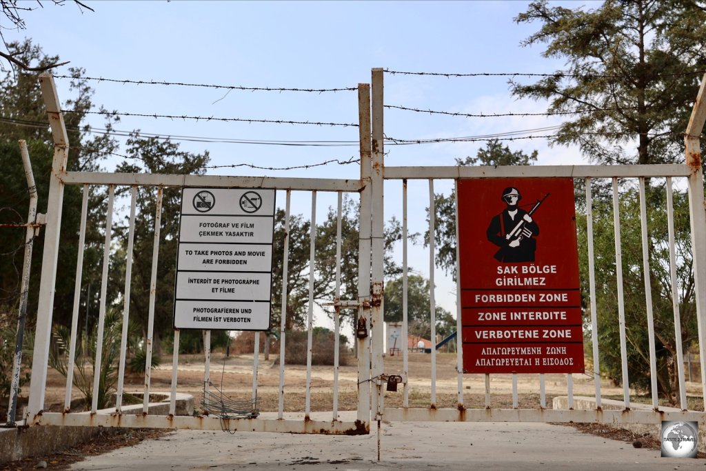
Azerbaijan Travel Guide Azerbaijan Travel Guide Azerbaijan Travel Guide Azerbaijan Travel Guide Azerbaijan Travel Guide 

Azerbaijan Travel Guide Azerbaijan Travel Guide Azerbaijan Travel Guide Azerbaijan Travel Guide Azerbaijan Travel Guide 
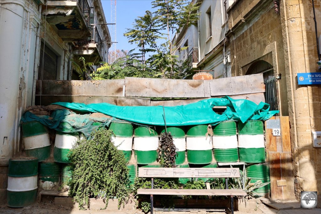
Azerbaijan Travel Guide Azerbaijan Travel Guide Azerbaijan Travel Guide Azerbaijan Travel Guide Azerbaijan Travel Guide 

Azerbaijan Travel Guide Azerbaijan Travel Guide Azerbaijan Travel Guide Azerbaijan Travel Guide Azerbaijan Travel Guide 

Azerbaijan Travel Guide Azerbaijan Travel Guide