Tag - Caribbean

Bahamas Travel Guide

Horse and carriage pass by Parliament Square, Nassau.

Bahamas Travel Guide

Welcome to the taste2travel Bahamas Travel Guide!

Date Visited: April 2015

Introduction

After months of island-hopping from south to north through all (but one) of the 33 countries and territories of the Caribbean, I was excited to be on my last and final hop – from the British Overseas Territory of Turks & Caicos Islands (TCI) north to The Bahamas.

Located a short flight off the coast of Florida and officially known as the Commonwealth of the Bahamas, this former British colony consists of more than 700 islands and 2,400 uninhabited islets and cays spread throughout the Lucayan Archipelago, an archipelago it shares with the TCI.

Jellyfish at Atlantis Resort.

A jellyfish at Atlantis Resort, Nassau.

My visit took me to the main island of New Providence, home to 70% of the country’s population (250,000) and the capital city – Nassau – hence this blog focuses only on New Providence. The currency of The Bahamas is the Bahamian Dollar (BSD), which is pegged to the US dollar at a rate of 1:1.

During my flight to The Bahamas, I flew over miles of turquoise-coloured sea, dotted with hundreds of cays and larger islands. All the islands in the Lucayan archipelago are made of calcium carbonate (dead coral organisms) which means lots of white-sand beaches and azure-blue, crystal-clear waters – the perfect tourist playground.

Giant Aquarium, Atlantis Resort, Nassau.

The lobby of the Atlantis Resort in Nassau features a giant aquarium.

Thanks to an annual invasion of millions of (mainly American) tourists, tourism is the most important economic sector for The Bahamas, providing 60% of GDP and employing around 50% of the population.

Bahamas Travel Guide: Policemen in downtown Nassau.

Policemen in downtown Nassau.

Travel costs on The Bahamas are extortionate, so travelling on a budget is definitely a challenge. I paid US$100 per day for a compact rental car and stayed in a rental apartment (well out of town) for about the same amount each night – this was the cheapest option I could find.

If you’re on a tight budget, you can access many parts of the island using public buses (see the ‘Getting around‘ section below) and you can find cheap(er) accommodation through Airbnb.

Hand-printed textiles at Bahamas Hand Prints, Nassau.

Hand-printed textiles at Bahamas Hand Prints, Nassau.

Location

The Bahamas

The Bahamas is located in the Atlantic ocean, just 50 miles off the coast of Florida. It’s the most northerly Caribbean Island nation and hence was the logical end-point to my long, meandering island hop which had started months earlier on the island of Aruba.

History
Colonial-era graffiti in Nassau.

Colonial-era graffiti in Nassau.

Like all other Caribbean islands, The Bahamas was first settled by native (Arawak) Indians who rowed across the sea from Cuba. The first European contact occurred on the very day Columbus first discovered the New World – the 12th of October, 1492. He landed on the Bahamian island of San Salvador but never settled, instead continuing south to the larger island of Hispaniola – present day Dominican Republic. It was Columbus who gave the country it’s name – inspired by the surrounding shallow sea, he described the islands as “islands of the baja mar” (shallow sea), which became “The Islands of The Bahamas”.

Fort Charlotte, Nassau.

Fort Charlotte is a British-colonial era fort built on a hill over-looking the harbor of Nassau.

The British were the first to settle the islands, with English Puritans – known as “Eleutheran Adventurers” – arriving in 1649 in search of religious freedom. The Bahamas became a Crown colony in 1717 but for many years, Nassau was a lawless settlement and during the late 1600’s to early 1700’s, it was home to many privateers and pirates who used it as their base and with more than 700 islands in close proximity, there were plenty of places to hide treasure.

Control was eventually restored in 1718 after the appointment of the first Royal Governor – Woodes Rogers – who offered amnesty to those pirates who surrendered and hung those who refused. His statue stands today outside the Pirates Museum in Nassau.

The country remained a British colony until 1973, when – under the leadership of Prime Minister Lynden O. Pindling – it gained full independence, ending 325 years of peaceful British rule.

If you wish to read more on the history of The Bahamas you can do so on Wikipedia.

Sightseeing

Nassau

Hand-carved by convicts from the cliff-face, the rock-solid 'Queens Staircase'.

Hand-carved by convicts from the cliff-face, the rock-solid ‘Queens Staircase’.

Named in honour of King William III (King of England and Prince of Orange-Nassau), the capital of The Bahamas is the country’s largest city, commercial hub and home to 70% of the entire population. Nassau was founded as ‘Charles Town’ in 1670 by English noblemen and was once a haven for pirates so there’s plenty of history and sights to explore.

Built around an attractive harbour and close to the tourist playground of Paradise Island, the city can be impossibly crowded most days with visiting cruise ship passengers (mostly American day-tripping tourists) and lots of traffic. Whenever I visited Nassau, I would park my car in the quiet streets on the outskirts of town and walk into the centre.

A view of Nassau from Fort Fincastle.

A view of Nassau from Fort Fincastle.

I started my exploration of the city at Fort Fincastle, which is built on a hill south of town and provides panoramic views of the city and north coast. Shaped like a giant wedge atop the hill, the fort was built in 1793 to protect Nassau harbour and to defend the north coast. I accessed the fort using the adjacent Queens Staircase (named in honour of Queen Victoria) which is comprised of 65 steps hewn out of a natural limestone wall by slaves between 1793 and 1794.John Watling’s Distillery

Pina Colada sampler at John Watlings rum distillery.

Pina Colada sampler at John Watlings rum distillery.

Set on more than two acres of lush tropical gardens, the historic Buena Vista Estate is home to the John Watling’s Distillery (Watling was a famous English pirate – known as the ‘pious pirate’). Over the years, there have been many famous visitors to the estate and it made its Hollywood debut when it was featured in the James Bond film Casino Royale.

John Watlings Rum Nassau

John Watlings dark rum, on sale at the distillery store in Nassau.

The visitor’s centre offers free rum tours (self-guided, very short and not too informative) and you can sample their three different rums – blonde, amber and dark. I recommend trying the Pina Colada.

National Art Gallery of the Bahamas

National Art Gallery of the Bahamas

The National Art Gallery of the Bahamas, Nassau.

Around the corner from the distillery is the National Art Gallery of The Bahamas, which showcases Bahamian art and is housed in a beautiful, pastel-yellow, 19th century mansion.

Graycliff Hotel
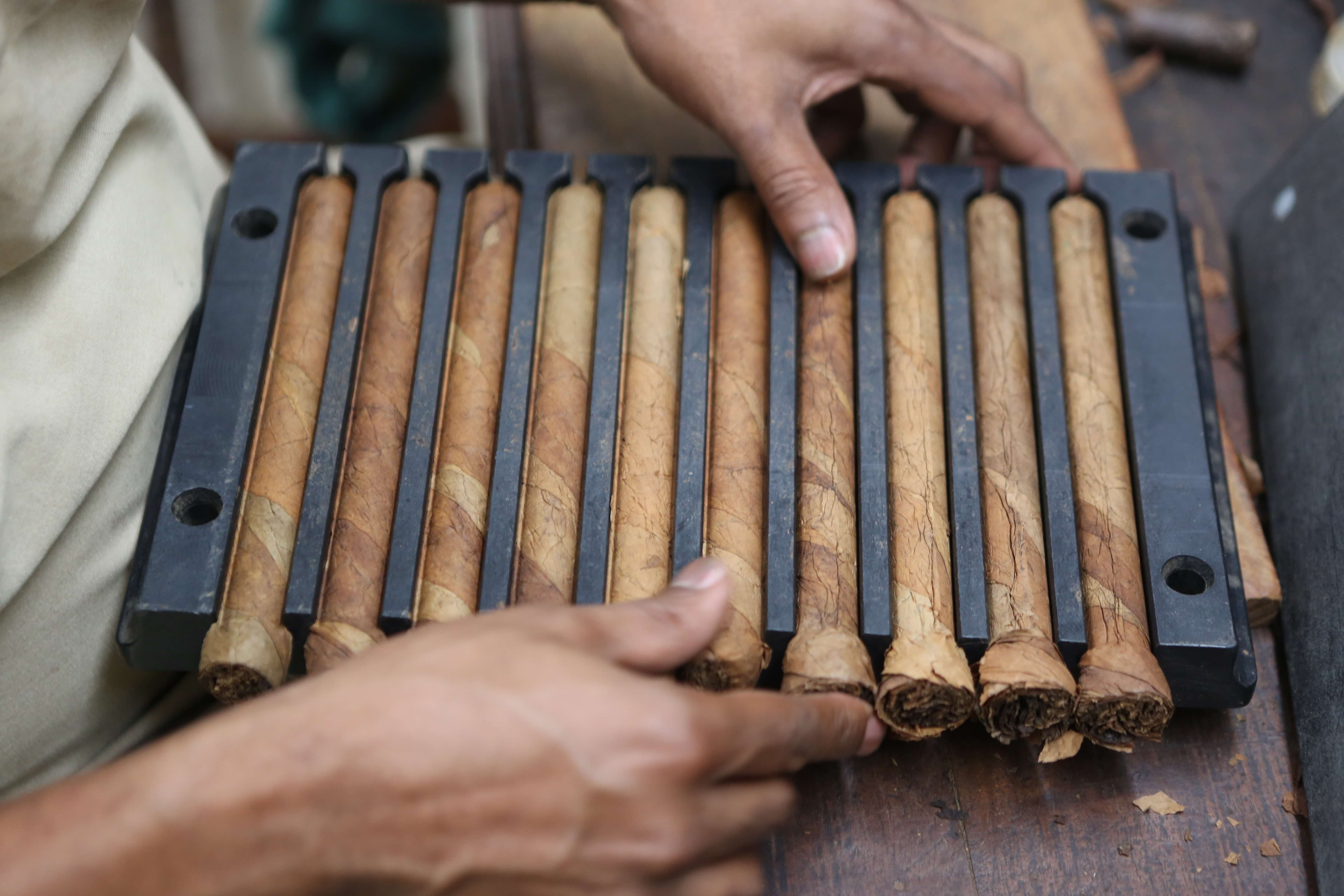
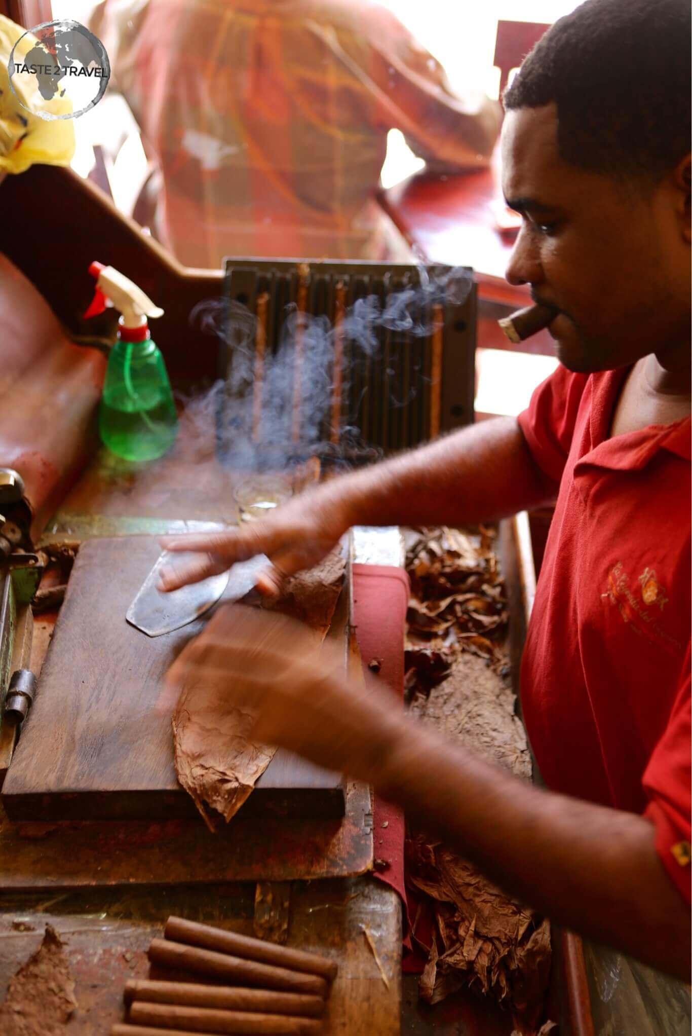
Cigar maker at the Graycliff hotel.

Cigar maker at the Graycliff hotel.

Located on the same street as the gallery, the Graycliff Hotel & Restaurant is also a sight worth visiting – especially to view the resident cigar makers performing their craft, to walk around the beautiful garden, think about jumping into the amazing pool with its hand-painted tiles, then onto the chocolate shop to sample something sweet.

Freshly rolled cigars at the Graycliff Hotel in Nassau.

Freshly rolled cigars at the Graycliff Hotel in Nassau.

Government House
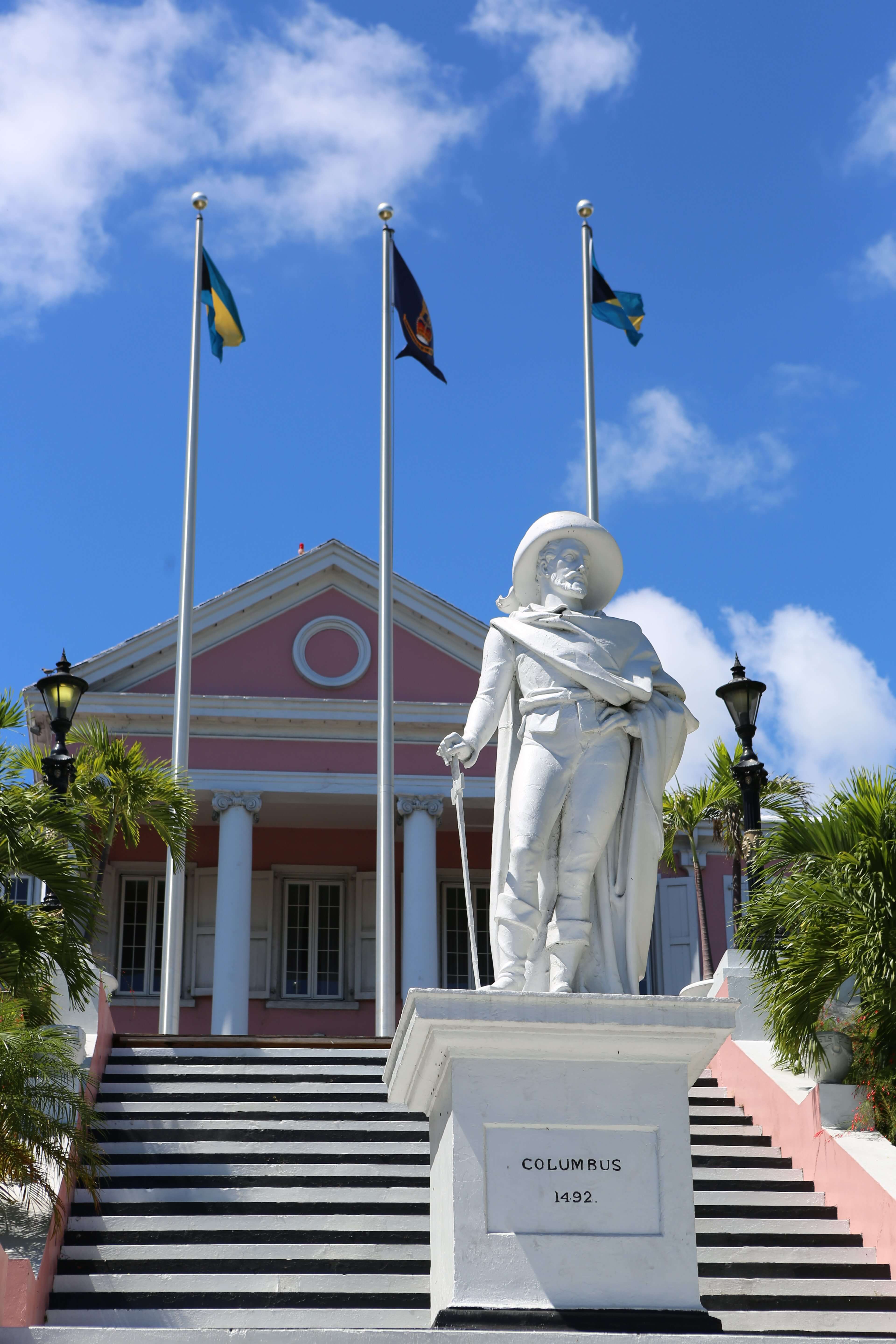
British Governor General's Residence, Nassau.

Statue of Columbus outside the British Governor General’s residence.

Across the road from the hotel is the stately Government House – residence of the British Governor General, which features a statue of Columbus out front.

Nassau Library and Museum
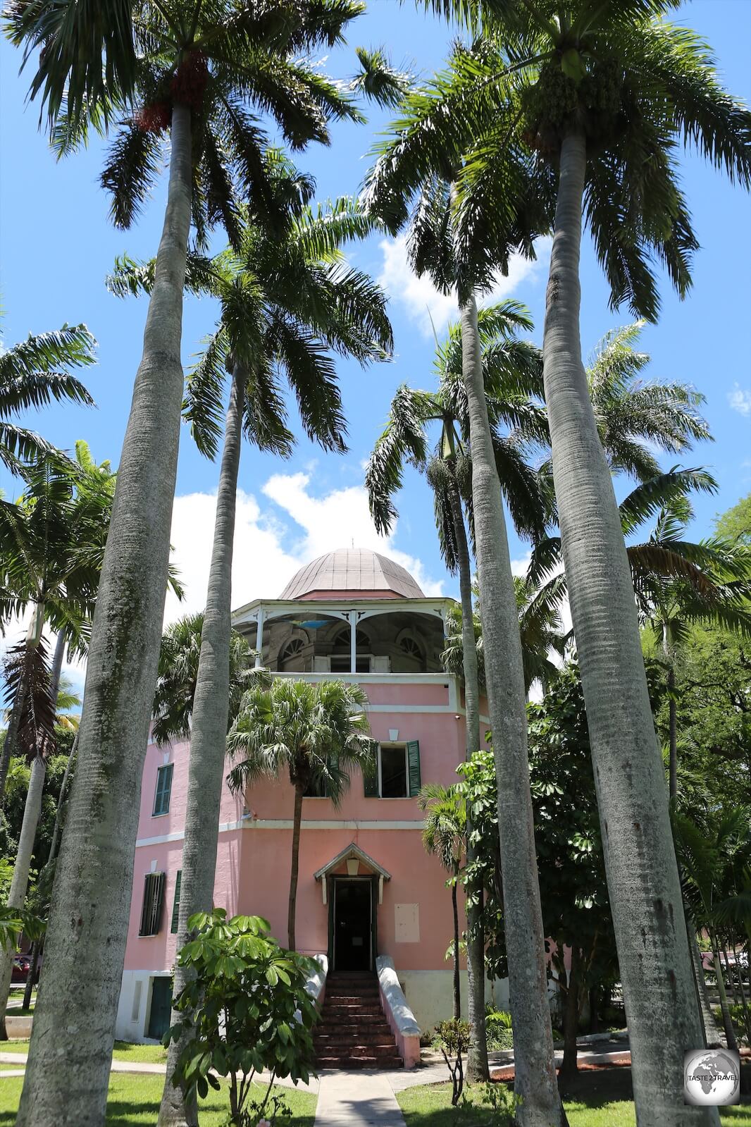
Nassau Library and Museum, Nassau.

The Nassau Library and Museum, Nassau.

Said to be inspired by a gunpowder magazine, the cylindrical-shaped Nassau Public Library and Museum, once served as a colonial jail. The building is open to visitors who can view the old holding cells (which now serve as document archives).

Government Buildings 

Government building on Parliament square, Nassau.

Government building on Parliament square, Nassau.

Downhill from the library are two squaresParliament and Rawson, which forms the centre of the government district. All government buildings in Nassau are painted pastel pink with green shutters.

Parliament Square, Nassau

Parliament square faces the main shopping street of Nassau – Bay street, which is always busy with hordes of cruise ships passengers shopping at the many duty free stores.

On Bay Street I visited the Nassau Straw Market, an open-air market selling hand-woven straw products and lots of tacky Bahamian souvenirs. This is a popular stop with the cruise ship crowd.

Bahamas Hand Prints, Nassau.

A mannequin sporting hand-made printed textile at the Bahamas Hand Prints shop in Nassau.

Also on Bay street is the excellent Pompey museum. Housed in Vendue house, which was once used as a venue for slave sales, the museum focuses on the impact of slavery in The Bahamas.

Pirates of Nassau Museum

Replica ship at Pirates of Nassau museum.

Replica ship at the Pirates of Nassau museum.

Just off Bay Street, the Pirates of Nassau Museum is an interactive museum (fun for families), dedicated to the life and times of the Pirates who once called Nassau home. Fittingly, there’s a statue of former Governor Woodes Rogers (he who ended piracy in The Bahamas) outside the museum.

Outside of Nassau

Atlantis Resort, Paradise Island, Nassau.

Atlantis Resort, Paradise Island.

A short drive across a toll bridge from downtown Nassau brings you to Paradise Island. Formerly known as Hog Island, it was once a private estate until 1959 when American – Huntington Hartford – (A&P supermarket heir) purchased the island, changed its name to Paradise Island and opened it to tourism by building a resort and installing a golf course. The centre piece of the island is the giant, sprawling Atlantis Resort  (see the ‘Accommodation‘ section below).

Cable beach, New Providence island.

Cable beach is one of the finest sand beaches on New Providence island.

Driving west along the north coast from Nassau, I arrived at Cable Beach, which is rightly famous for it’s pure white sand and crystal clear water. The beach stretches for 6 km and is lined with upscale resorts, restaurants, bars etc. If you’re in the neighbourhood for dinner, there’s a good variety of international (expensive) restaurants along the main road.

At the western end of the island is the ominously sounding Jaws beach. I never saw a shark here, but the beach got it’s present name after it was used as a filming site for the final instalment in the “Jaws” movie series. The beach is part of the larger Clifton Heritage Park. It’s very isolated so you’ll need a car to reach it.

Accommodation
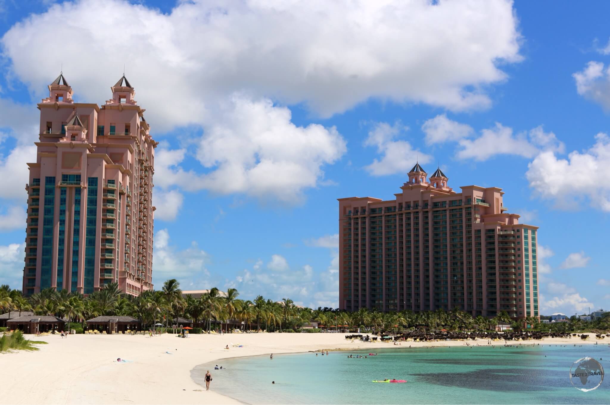
Bahamas Travel Guide: The Atlantis Resort on Paradise Island

The largest resort in the Caribbean, the Atlantis Resort, Paradise Island, Nassau

Like so many other Caribbean destinations, accommodation on the Bahamas is expensive – the main focus being on large, deluxe resorts which serve as playgrounds for well-heeled Americans seeking a little R&R. The main resort on the island is the Atlantis Resort on Paradise island, which bills itself as the “Caribbean’s top vacation resort“.

The resort features six different accommodation options arranged around Aquaventure  a 141 acre water-scape, which includes fresh and saltwater lagoons, pools, marine habitats, water slides, river rides and a string of gorgeous (protected) beaches which offer fantastic snorkeling. Outside guests are able to use all facilities for a fee and I would recommend spending a full day here.

Hand-painted pool at the Graycliff hotel.

Hand-painted pool at the Graycliff hotel.

If you prefer to stay somewhere with a little history (300 years of it), romance and old-world charm then the Graycliff Hotel & Restaurant is the place for you. The hotel is housed in several historical houses along a hilltop street, overlooking downtown Nassau and is set amid a beautiful garden which has a hand-painted pool as it’s centre piece.

There are two restaurants which serve fine, gourmet food – I would recommend eating at least once at either the Brazilian steakhouse or the Pizzeria. There is a humidor and resident cigar makers (apparently the master cigar maker used to roll cigars for Fidel Castro) and possibly the only Cognateque in the Caribbean.  If you have a sweet tooth, there is an amazing chocolate shop in the grounds. Although I wasn’t staying here I was a frequent visitor.

While a few nights at Atlantis will cost you up to $1,000, there are budget options available for around $100 per night. I found a comfortable apartment (30 minutes drive outside of Nassau) using Airbnb.com

Eating Out

As with everything else in The Bahamas, a meal at a restaurant is not cheap. There are ways to reduce costs with one of the stand-out options being Arawak Cay. Located on the north coast, west of Nassau – this is home to the “Fish Fry” and countless bars and restaurants. Although it’s a bit of a tourist trap, Arawak Cay is popular with the locals and a great place to try affordable, local cuisine. Best time to visit is in the evening when it’s busiest.

Cigar maker at the Graycliff hotel.

Cigar maker at the Graycliff hotel.

In downtown Nassau, the Graycliff Hotel & Restaurant offers fine dining options and a pizzeria – I ate here more than once. I also enjoyed exploring the different restaurants in the Cable Beach neighbourhood, my favourite being the Social House Sushi & Grill. If you’re on Paradise Island you’ll find plenty of dining option at the Atlantis Resort and the adjacent mall – Paradise Shopping Plaza.

Visa Requirements

Some nationalities require visas for the Bahamas – check your visa requirements prior to arrival.

Getting There

By Air

Despite being a busy, modern airport, only 20% of tourists visiting The Bahamas arrive via plane. Flights to New Providence arrive at Lynden Pindling International Airport (LPIA) – named after the first Prime Minister of the Bahamas. The airport is located 13 kilometres (20 minutes) west of downtown Nassau and in 2015 served over with 3.3 million passengers, making it the 4th busiest airport in the Caribbean. The airport contains US border pre-clearance facilities allowing all US flights to operate as domestic flights upon arrival at their destination.  The airport serves as the hub for Bahamasair.

The following airlines provide connections to Lyndon Pindling International airport:

  • Air Canada Rouge – flight to Toronto–Pearson
  • American Airlines – flights to Charlotte, Dallas/Fort Worth, Philadelphia, Washington–National
  • American Eagle – flights to Miami, Washington–National
  • Bahamasair – flights to Arthur’s Town, Cockburn Town, Colonel Hill, Deadman’s Cay, Fort Lauderdale, Freeport, George Town, Governor’s Harbour, Havana, Marsh Harbour, Matthew Town, Miami, New Bight, North Eleuthera, Orlando–MCO, Providenciales, Rock Sound, Spring Point, Treasure Cay, West Palm Beach
  • British Airways – flights to Grand Cayman, London–Heathrow
  • Caribbean Airlines – flights to Kingston–Norman Manley, Montego Bay, Port of Spain
  • Copa Airlines – flight to Panama City
  • Delta Air Lines – flights to Atlanta, New York–JFK
  • Flamingo Air – flight to Staniel Cay
  • IBC Airways – flights to Cap-Haitien, Fort Lauderdale
  • InterCaribbean Airways – flight to Providenciales
  • JetBlue Airways – flights to Boston, Fort Lauderdale, New York–JFK, Orlando–MCO, Washington–National
  • Pineapple Air – flights to Chub Cay, Colonel Hill, Deadman’s Cay, Long Island, Spring Point
  • Silver Airways – flights to Fort Myers, Jacksonville (FL), Tampa, West Palm Beach
  • SkyBahamas Airlines – flights to Arthur’s Town, Fort Lauderdale, Freeport, George Town, Marsh Harbour, New Bight, San Salvador
  • Southern Air Charter – flights to Deadman’s Cay, Governor’s Harbour, Long Island, North Eleuthera
  • Southwest Airlines – flights to Baltimore, Fort Lauderdale
  • Sunwing Airlines – flight to Toronto–Pearson
  • United Airlines – flights to Houston–Intercontinental, Newark
    Western Air – flights to Andros Town, Congo Town, Freeport, George Town, Mangrove Cay, Marsh Harbour, San Andros, South Bimini
  • WestJet – flight to Toronto–Pearson

By Sea

Cruise Ships

With approximately 80% of tourists (almost 5 million in 2013) arriving in the Bahamas on a cruise ship, Nassau harbour is normally a busy place. The harbour is capable of handling seven cruise ships at a time and when the port is busy (most days), tiny Nassau is very busy.

Cruise ships in Nassau harbour.

Cruise ships in Nassau harbour.

Getting Around

Ferry

Inter-island ferry services are provided by Bahamas Ferry Services  who offer frequent sailings from downtown Nassau to seven destinations in the Family Islands.

Bus

Public buses or “jitneys” (32-seater mini-buses) provide limited service around Nassau, Paradise Island and other parts of the island. Not known for their promptness, buses operate from 6:30 a.m. to 7:00 p.m. daily, except on Sundays when there is reduced service. Fares ranges from $1.25 per person to $3.50 – exact fares are required when boarding.

Taxi

Lot’s of taxi’s are available at the airport, downtown Nassau and on Paradise Island and can be hailed from the street. Elsewhere on the island it’s best to call ahead to book one:

  • Meter Cabs: Davis Street, Nassau – 242-323-5111
  • Bahamas Taxi Cab Union: Nassau Street – 242-323-4555

Car

Rental cars are available from car agencies located at the airport and in downtown Nassau. Daily rates are not cheap with a compact car from Avis costing me $100 per day. Ouch!


That’s the end of this Bahamas Travel Guide.

Safe Travels!

Darren


Follow me on Instagram: 


Further Reading

Other travel reports from the Caribbean region include:

Bahamas Travel Guide Bahamas Travel Guide Bahamas Travel Guide Bahamas Travel Guide Bahamas Travel Guide Bahamas Travel Guide Bahamas Travel Guide Bahamas Travel Guide  Bahamas Travel Guide 
Bermuda Travel Guide

Bermuda Travel Guide: A White-tailed Tropicbird or Longtail, landing at it nest.

Bermuda Travel Guide

Welcome to the taste2travel Bermuda Travel Guide!

Date Visited: July 2017

Introduction

Exploring Bermuda has been on my bucket list for some time, so when I found a cheap flight from New York City I snapped it up. I then turned to booking.com to book my accommodation and saw the few hotels on the island were charging upwards of $600 per night. Ouch! Where were the cheap guest houses and hostels? I turned to Airbnb.com and found a wonderful, comfortable room in a family home for less than $100 per night – a real bargain for this island.

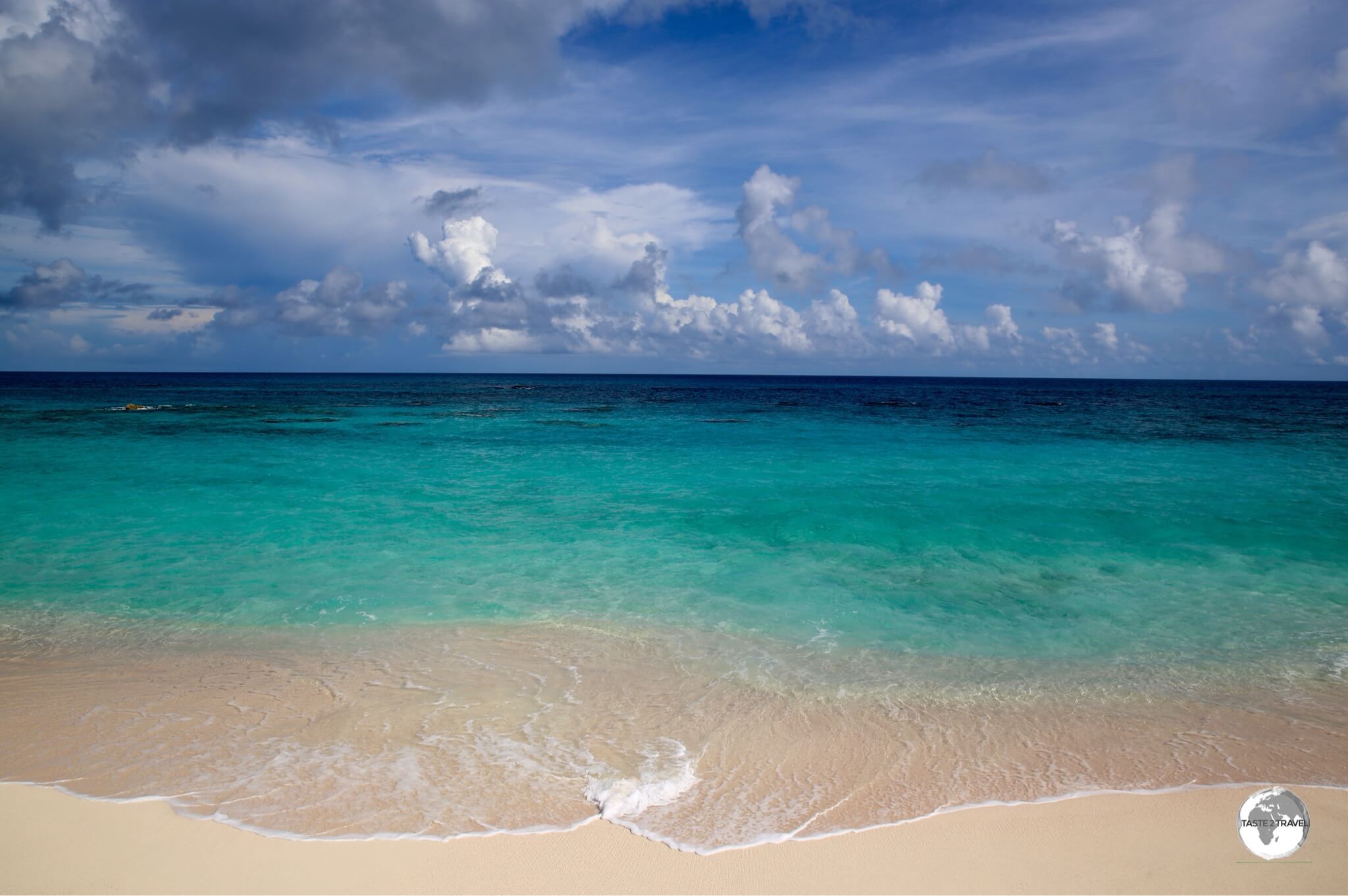
Warwick beach on the south coast.

Warwick beach on the south coast.

Bermuda is one very expensive travel destination – a real challenge for those travelling on a budget. This British Overseas Territory doesn’t market itself as a budget-friendly destination, the island is all about 5-star resorts, fine dining restaurants and expensive boutique shopping – a destination for the well-heeled.

Today a UNESCO world Heritage site, St. Georges served as the capital of Bermuda for the first 200 years.

Today a UNESCO world Heritage site, St. Georges served as the capital of Bermuda for the first 200 years.

I originally planned to visit during June of 2017 but the already high prices were in the stratosphere thanks to Bermuda being the venue for the Americas Cup. I arrived two weeks after the cup and found retailers in town were still selling surplus clothing (from the cup) at full retail prices – there are never any bargains on this island.

South Coast beach.

South Coast beach.

Despite the scary prices, there are ways to keep costs down – such as eating in local cafes (where you can get a meal for around $12), or by shopping in supermarkets and self-catering.

If you choose to eat in tourist/ ex-pat restaurants, you should always be prepared for ‘sticker shock‘ when you receive the bill. In one cafe I paid $20 for a sandwich, which then came close to $30 once the gratuity and my drink was added.


Stormy Skies Over St. Georges


At the North Rock Brewing company, a small glass of one of their fine craft beers cost me $13.80 – that left a nasty aftertaste! I met a vacationing American family who had dinner one evening in a hotel restaurant. During their dinner the servers kept pouring water, which the family thought was house water. In the end they had a charge on their bill of $130 for water. You can read more about the high cost of living here.

South Coast beach

Typical South Coast beach

If you can live with the high costs then Bermuda is a beautiful, engaging and rewarding destination and one not to be missed. On this well-ordered island, there is something for everyone – from a pristine environment, lots of history, a rich culture and so much more.

Then there are the wonderful Bermudans – friendly, welcoming and always hospitable. Despite the budget-busting costs, Bermuda is a veritable paradise, one which I enjoyed and hope to return to again one day.

Bermuda Shorts

“The short-pant is a terrible fashion choice, unless it is from Bermuda.”

So said Winston Churchill after a visit to Bermuda in the 1940’s.

Bermuda shorts in every colour of the rainbow at 'Tabs' in Hamilton.

Bermuda shorts in every colour of the rainbow at ‘Tabs’ in Hamilton.

Bermuda shorts were originally designed by the British Army for wear in tropical and desert climates. During WWII, there was a shortage of clothing in Bermuda. At the time, the General Managers of two local banks (who were concerned that their male employees would not have suitable clothing to wear) arranged for a local tailor to make two pairs of formal shorts (modelled on the shorts of the British military), for each of their male employees.

This was the beginning of Bermuda shorts as acceptable business attire in Bermuda. Since their inception, local designers have improved the design of the shorts, using better materials and brighter colours.

Bermuda shorts on sale at Tabs in Hamilton.

Bermuda shorts on sale at Tabs in Hamilton.

One thing I noticed while on the island is how popular the shorts are with local businessmen and government employees. Bermudans wear their shorts for all occasions – including weddings.

"How to wear your Bermuda Shorts"

“How to wear your Bermuda Shorts” by Tabs of Hamilton
Source: “Tabs” – Authentic Bermuda Shorts

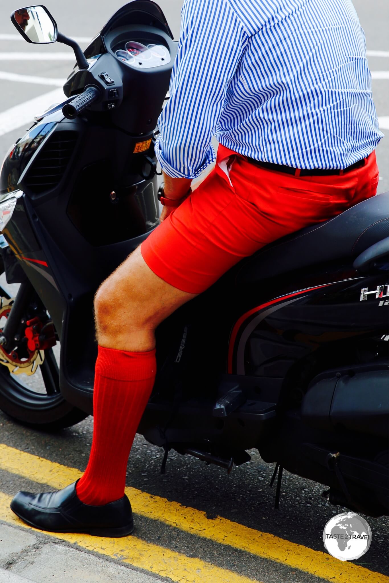
Men on Bermuda wear their Bermuda shorts in a variety of bright colours, always with long (knee-length) woollen socks – often in the same colour as their shorts. The look is completed with formal (black/ brown) shoes, a freshly ironed dress shirt with tie and a navy blue jacket.

Bermuda shorts come in a variety of colours, with 'Bermuda red' (same colour as the flag) being especially popular.

Bermuda shorts come in a variety of colours, with ‘Bermuda red’ (same colour as the flag) being especially popular.

Bermuda Triangle

Boundaries of the fictitious Bermuda Triangle. Source: Wikipedia

Boundaries of the fictitious Bermuda Triangle.
Source: Wikipedia

A travel guide about Bermuda wouldn’t be complete without mention of the Bermuda Triangle. Since the 1950’s, writers have written fictional stories about ships and aircraft mysteriously disappearing in the vicinity of the triangle. The boundaries of the triangle were defined in a pulp fiction publication – Argosy  – in 1964.

The area defined by the triangle is one of the busiest shipping lanes on the planet and while ships have become wrecked/ disappeared, there is no evidence to suggest that paranormal activity was responsible for any of these misfortunes. Either way, the story of the triangle has sold lots of books over the decades and (today) lots of tacky ‘I went to Bermuda and survived the Bermuda Triangle..’ souvenirs.

Heather Nova

Heather Nova in concert.

Heather Nova in concert.

It would be amiss of me not to make mention of one of my favourite musicians, who happens to be a native of Bermuda – Heather Nova. I first saw Heather in concert in Zurich, Switzerland in 2009.

The concert was a magical experience – from her enchanting, mystical voice, to the meaningful lyrics of each of her carefully composed songs.

Heather was touring Europe while I was visiting Bermuda so no chance of seeing her perform at home. If you ever have the chance to attend one of her concerts (she is often touring Europe) I would recommend you do so, but be warned, there is a magical quality about her music and she will put you under her spell.

Location

Hamilton, Bermuda

Bermuda is an extinct, isolated volcano, located atop a seamount, far from anywhere, in the middle of the North Atlantic ocean. The closest landmass is Cape Hatteras (North Carolina), on the east coast of the United States – approximately 1,070 km (665 mi) to the north-east.

"Bermuda Blues".

“Bermuda Blues”.

At different periods in history, the seamount has been completely submerged which has allowed marine organisms to form a limestone cap which covers the entire island and provides the white/ pink powdery sand beaches and turquoise water for which Bermuda is famous.

History

The Bermudan flag flying alongside the Union Jack.

The Bermudan flag flying alongside the Union Jack.

Unlike its Caribbean neighbours to the south, remote and isolated Bermuda was never settled by indigenous Indians from the Americas. The island remained undiscovered until 1505 when Spanish navigator Juan de Bermudez passed by, while sailing back to Spain from a provisioning voyage to Hispaniola (present day Dominican Republic/ Haiti).

The island was named after Bermudez who returned again in 1515 dropping off some pigs who could be used as food by anyone unlucky enough to be wrecked on the isolated outpost.

Martello Tower in St. Georges parish, part of line of defensive forts built by the British.

Martello Tower in St. Georges parish, part of line of defensive forts built by the British.

Bermuda continued to remain off the radar until 1609, when an English provisioning ship – the Sea Venture (captained by Sir George Somers) – would be deliberately ship wrecked on its reef.

The ship was en-route to the new English colony of Jamestown, Virginia when it became caught in a fierce storm and was blown off course. When the reefs of Bermuda were spotted days later, the ship was deliberately run aground in order to save all survivors and allow them to salvage parts from the ship.

The survivors spent ten months on Bermuda, where they found plenty of food – including a thriving pig population. During this time, they were able to use tools and parts from the Sea Venture to build two new ships – Perseverance and Deliverance – one of which they filled with food stores sourced from the island.

When the two new vessels were complete, most of the survivors set sail, completing their journey to Jamestown. Upon arrival they found a starving colony, which they were able to save using the supplies from Bermuda. Had this not happened, England’s new colony of ‘America’ would most likely have failed.

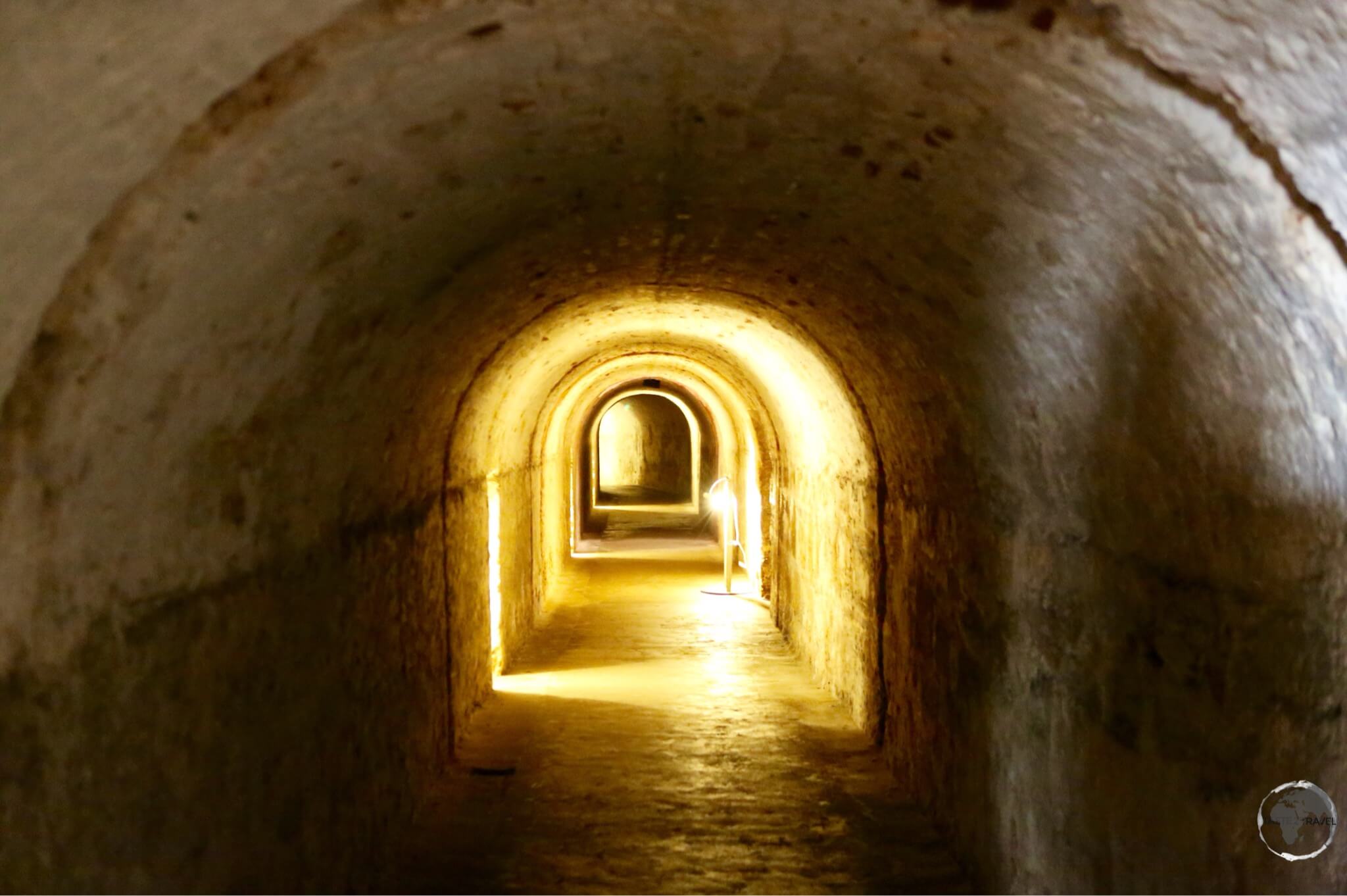
A tunnel underneath Fort St. Catherine, which is located in the parish of St. Georges.

A tunnel underneath Fort St. Catherine, which is located in the parish of St. Georges.

When Somers departed Bermuda for Virginia, he left two volunteers on the Island to maintain Britain’s territorial claim. As a result, Bermuda has been continuously inhabited as a British territory since the wrecking of the Sea Venture in 1609, and claims its origin from that date, and not the official settlement of 1612.

Initially the island was run as a company, with land divided up between shareholders. Tobacco was the only agricultural crop grown but wasn’t profitable due to the small size of landholdings. Due to the lack of agriculture, slavery was not as important to Bermuda as it was on the ‘plantation’ islands in the Caribbean.

The streets of historic St. Georges are lined with beautifully renovated stone buildings all of which are topped with white limestone-slab roofs.

The streets of historic St. Georges are lined with beautifully renovated stone buildings all of which are topped with white limestone-slab roofs.

With almost no natural resources, Bermudans would eventually turn their attention to other sources of income. For centuries, Bermudan salt traders would spend six months of each year in the Turk & Caicos islands (click to read my TCI Travel Guide) where they harvested salt, which was then transported and sold in America.

Due to the Bermudan presence on the islands, Britain claimed TCI as a territory – a claim which continues today. Following territorial disputes with the Bahamas over the TCI, and a change in salt markets, the Bermuda salt trade ended.

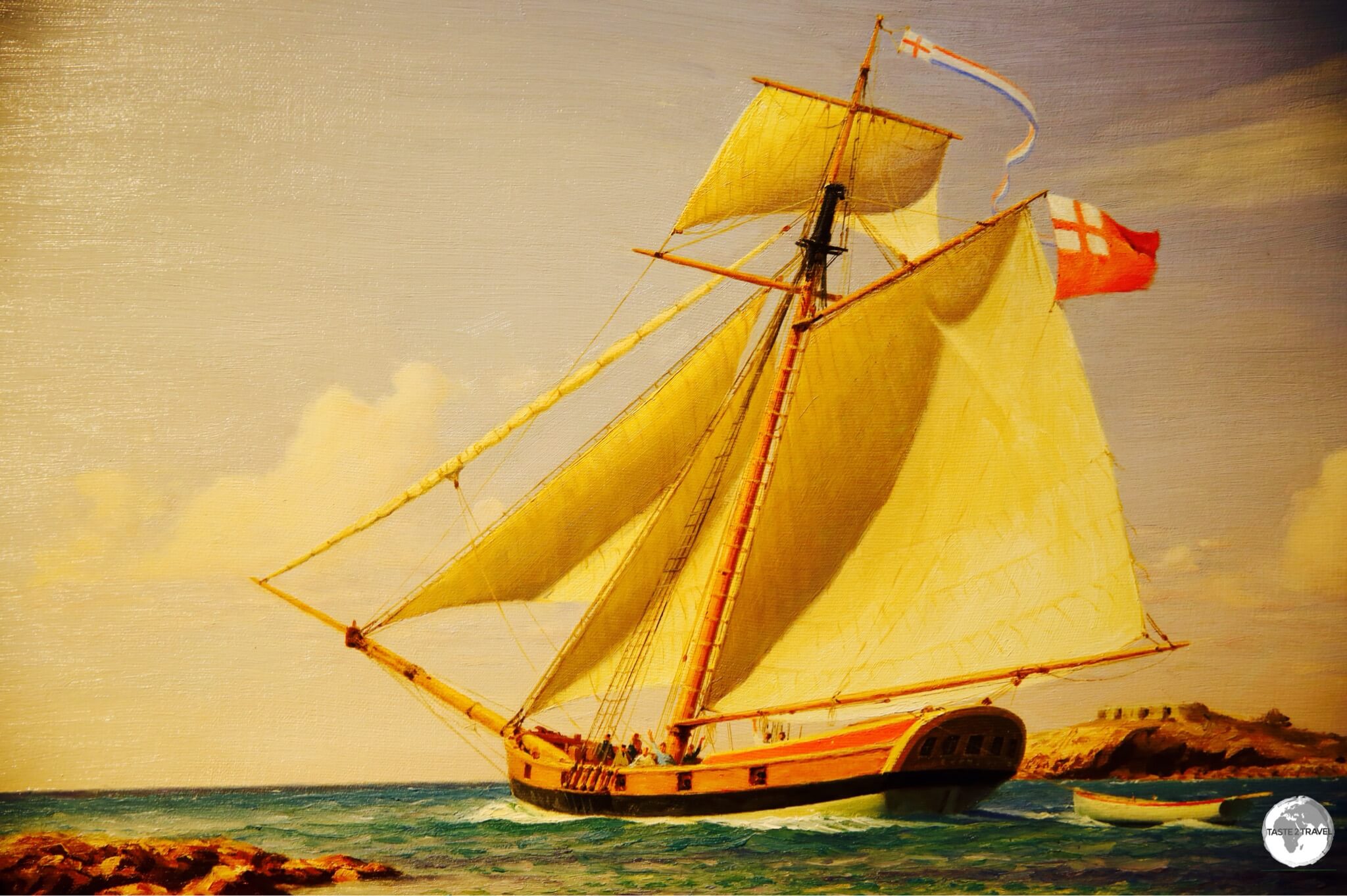
A painting of a Bermudian Sloop.

A painting of a Bermudian Sloop.

In the 17th century, the islanders gave up on agriculture and instead turned their attention to the sea and everything maritime. For years, Bermuda Cedar had been used for ship building and the island had become famous for its shipyards.

Design refinements led to the development of the famous ‘Bermuda Sloop‘ which sailed faster than any other boat at the time. These speedy sloops were perfect for pirates and privateers and Bermudian merchant vessels turned to privateering at every opportunity during the 18th century – preying on the shipping of Spain, France and other nations.

During the American War of independence, Bermudian sympathisers sold sloops to American rebels through third-country ports. It’s said these sloops greatly aided the American war effort, allowing the Americans to defeat the British.

The massive Bermuda Floating Dockyard being transported from London to Bermuda.

The massive Bermuda Floating Dockyard being transported from London to Bermuda.

After the war, Britain (who had lost control of all it’s ports on the US east coast) turned it’s attention to fortifying Bermuda and creating a strategic regional Naval Dockyard on the island, the centre piece of which was the world’s 2nd largest floating dockyard, which was constructed on the River Thames (London) over a period of three years then towed across the Atlantic to Bermuda in 1869. Today you can view the semi-submerged rusty remains of the dockyard in the mouth of Spanish Point.

Since WWII, Bermuda has positioned itself as a centre for Offshore Banking – the main industry on the island – with tourism being second. The official currency of the island is the Bermudan Dollar, which is pegged to the US dollar. Businesses on the island accept payment in both currencies.

The Bermuda Blue Bird is featured on the Bermuda $2 bank note.

The Bermuda Blue Bird is featured on the Bermuda $2 bank note.

Architecture

Shops in St. Georges town with their white 'rainwater catchment' limestone rooftops.

Shops in St. Georges town with their white ‘rainwater catchment’ limestone rooftops.

As I flew into Bermuda, I couldn’t help but notice all the blindingly white rooftops reflecting the dazzling tropical sunlight. White rooftops are a unique architectural feature of the island, with every type of building sporting the same white pointy cap.

The reason for this is a very practical one – besides the fact that it also looks very pretty. On an island which lacks rivers or any other fresh water source, rainwater is the only source of fresh water and all rooftops are required (by law) to serve as rainwater catchments.

Painting at the Masterworks Art Gallery showing workers constructing a Bermudan rooftop.

Painting at the Masterworks Art Gallery showing workers constructing a Bermudan rooftop.

Roofs are constructed using limestone slabs (a natural filter), which step down to a trough which then directs water into underground holding tanks. All homes are painted in pretty pastel colours with thick stone walls designed to withstand hurricane-strength winds.


Bermuda Architecture


Sights

A map of Bermuda showing the different Parishes.

A map of Bermuda showing the different Parishes.

For a small island, Bermuda packs in a lot of sights – from historical towns, museums, galleries, gardens, old forts, stunning beaches, diving, snorkeling, sailing, hiking, bird watching and so much more. After ten days of zipping around on my scooter I still hadn’t covered everything.

Included here is a brief overview of sights from the most northern parish (St. Georges) to the most southern (Sandy’s):

St. Georges Parish

Today, a UNESCO world Heritage site, St. Georges served as the capital of Bermuda for the first 200 years.

Today, a UNESCO world Heritage site, St. Georges served as the capital of Bermuda for the first 200 years.

The UNESCO World Heritage listed St. Georges town was Bermuda’s first English settlement and served as the capital of Bermuda for its first 200 years. The town today is pleasantly renovated and offers a wealth of sights for visitors to explore:

  • St. Peters Church – the oldest Anglican church in the New World, which includes a segregated Slave Graveyard.
  • Somers Garden – where the heart of George Somers is buried.
  • Tucker House Museum – once home to Henry Tucker (former president of the Governors Council), this museum provides a view of life in a typical home from the 1700’s
Colourful St. Georges, the former capital of Bermuda.

Colourful St. Georges, the former capital of Bermuda.

  • Kings Square – the main square which includes the historic town hall.
  • Bermuda National Trust Museum – housed in the former Globe Hotel, this museum highlights Bermuda’s role in the American Civil War.
  • World Heritage Centre – Located on the waterfront, this renovated, former warehouse provides an overview of the history of St. Georges.

Apart from sightseeing, the town offers lots of boutique shopping, restaurants and cafes.

The Unfinished Church in St. Georges.

The Unfinished Church in St. Georges.

The Unfinished Church

Located on a hill overlooking St. George’s Town, construction of the Gothic-style Unfinished Church was commenced in 1874 but never completed due to lack of funds and disagreements between local parishioners. The site is administered by the Bermuda National Trust who have closed the grounds due to structural deterioration causing risks to visitors. You can walk around the perimeter fence from where you can take photos. The church is located on the aptly named Church Folly Lane.

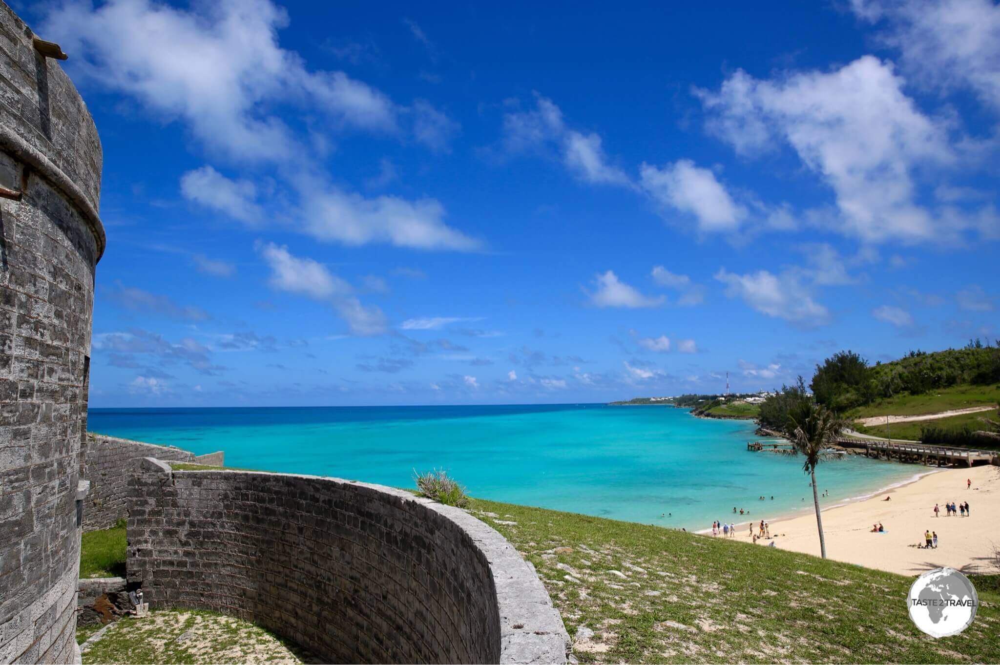
Fort St. Catherine

Fort St. Catherine.

View of Catherine’s Beach from Fort St. Catherine.

Located over the hill from St. Georges town is beautiful St. Catherine’s Bay and Fort St. Catherine. The impressive fort is surrounded by a dry moat and accessed by a drawbridge and contains a large number of tunnels, towers and ramparts.

Today, the fort houses a museum, which is one of the more interesting on the island. It was just offshore from the fort that the Sea Venture was wrecked in 1609. The entire crew came ashore where the Fort St. Catherine now stands. Further along the north coast are several smaller forts which you can visit.

St. Catherine’s Bay

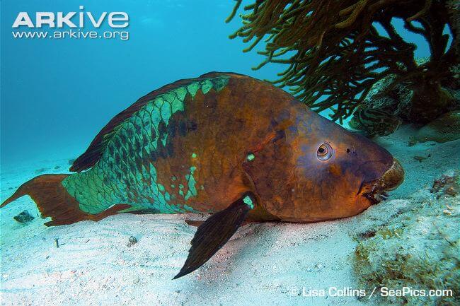
The Rainbow Parrot-fish is the largest herbivorous fish in the Atlantic with males reaching 1.2 metres.

The Rainbow Parrot-fish is the largest herbivorous fish in the Atlantic with males reaching 1.2 metres.
Source: www.arkive.org

The protected cove at St. Catherine’s Bay is ideal for swimming and offers good snorkeling. On the other side of the fort is the small, protected Achilles Bay. The bay offers good snorkeling and it’s here you have a chance of spotting the giant Rainbow Parrot fish. Further along the coast is the much more developed (and busier) Tobacco Bay.

Hamilton Parish

Crystal Cave

 Fantasy Cave, Bermuda.

The main chamber of Fantasy Cave.

The Crystal Cave complex is comprised of two caves (tickets sold separately) – Crystal Cave and Fantasy Cave. The caves were discovered in 1905 by two 12-year-old boys searching for a lost cricket ball and have been a tourist attraction ever since.

Native to Bermuda, the White-tailed Tropicbird or Longtail, seen here on the north coast of Hamilton parish.

Native to Bermuda, the White-tailed Tropicbird or Longtail, seen here on the north coast of Hamilton parish.

A great place to photograph the Longtail birds is along the north coast of Hamilton Parish – just to the north of Flatts village. This part of the coast is comprised of small cliffs where the birds have their nests.

Flatts Village

The colourful and very picturesque 'Flatts Village'.

The colourful and very picturesque ‘Flatts Village’.

Beautiful Flatts Village is located in a small inlet and is home to the Bermuda Zoo and Aquarium. It’s also home to the Village Pantry – a great place for breakfast and coffee (see ‘Eating Out‘ below).

Smiths Parish

Spittal Pond Nature Reserve

A Jamaican Anole at the Spittal Pond Nature Reserve.

A Jamaican Anole at the Spittal Pond Nature Reserve.

Located on the south coast of Smiths Parish, Spittal Pond Nature Reserve is the largest reserve on the island and is a great place to see the fauna of Bermuda. The reserve stretches along south shore and features an 8-acre Spittal Pond, a large brackish pond (home to Egrets, Herons etc), surrounded by marsh and woodland areas.
A recent introduction to Bermuda, the Yellow-crowned night heron at Spittal Pond Nature Reserve.

A recent introduction to Bermuda, the Yellow-crowned night heron, at Spittal Pond Nature Reserve.

Devonshire Parish

Arborteum

A Jamaican Anole at the Arborteum.

A Jamaican Anole at the Arborteum.

One sight worth visiting in Devonshire Parish is the Arborteum. Once British army property, this national park covers 22 acres of trees, shrubs, meadows and forest. If you wish to photograph the Bermuda Eastern Blue Bird, you’ll find them here.

The star of the $2 bank note, the Bermuda Eastern Blue Bird, at the Arborteum.

The star of the $2 bank note, the Bermuda Eastern Blue Bird, at the Arborteum.

Pembroke Parish

Hamilton – the bustling capital of Bermuda. 

Bermuda Travel Guide: Front street, the main street in downtown Hamilton.

Front street, the main street in downtown Hamilton.

Capital of the island since 1815, Hamilton is a small, vibrant and a friendly city. It’s the heart and commercial hub of the island. Front Street runs along the waterfront and is the life and soul of the city. It’s here you’ll find shops, bars, cafes and restaurants.

The Cathedral of the Most Holy Trinity in Hamilton.

The Cathedral of the Most Holy Trinity in Hamilton.

Away from the waterfront,  you’ll find the Bermuda Cathedral of the Most Holy Trinity, City Hall and Bermuda Art Gallery.

The Cenotaph and the Cabinet Building in Hamilton.

The Cenotaph and the Cabinet Building in Hamilton.


The Sessions House houses the chambers for Bermuda's House of Assembly & the Supreme Court.

The Sessions House houses the chambers for Bermuda’s House of Assembly & the Supreme Court.

Bermuda Underwater Exploration Institute

Artwork at the Bermuda Underwater Exploration Institute.

Artwork at the Bermuda Underwater Exploration Institute.

Located on the outskirts of Hamilton is the Bermuda Underwater Exploration Institute (BUEI), whose aim is to enhance understanding (through interactive exhibits) of the ocean including its diverse marine life, corals etc. The museum also includes information on Bermuda ship wrecks, including treasure found from diving expeditions.

Masterworks Art Gallery

Artwork at the Masterworks Art Gallery.

Artwork at the Masterworks Art Gallery.

Located inside the Bermuda Botanical Garden, Masterworks Art Gallery is a non-profit organization dedicated to art made in and inspired by Bermuda. The gallery displays some 1400 masterpiece collections including paintings, photographs, drawings and maps. The gallery cafe is a wonderful place for lunch.

Warwick Parish

Warwick Long Bay Beach

A view of Warwick Long Bay beach on the south coast.

A view of Warwick Long Bay beach on the south coast.

Located on a quiet stretch of the south coast, Warwick Long Bay Beach is a fabulous, beautiful half-mile stretch of pink sand. The pink hue is caused by the crushed shells of a microscopic organism called foraminifera. 

Storm clouds over Warwick Beach, one of the finer beaches on the south coast of Bermuda.

Storm clouds over Warwick Beach, one of the finer beaches on the south coast of Bermuda.

The turquoise water is ideal for swimming and there are plenty of quiet little coves either side of the main beach.

Southhampton Parish

Horseshoe Bay Beach

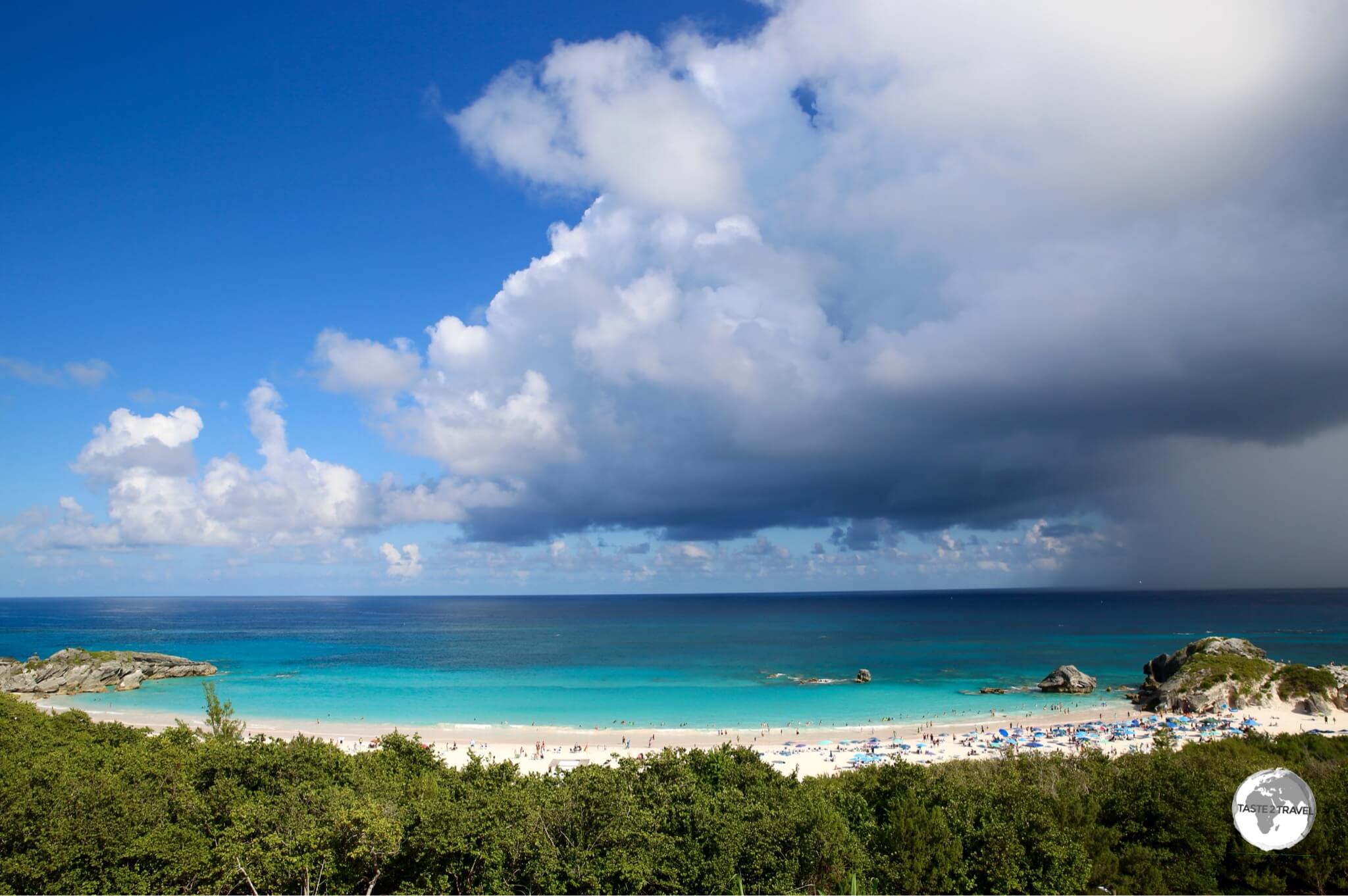
Storm approaching Horseshoe Bay Beach

Storm approaching Horseshoe Bay Beach.

Ranked in 2016 by Conde Nast Traveller as one Top 20 beaches in the world – stunning Horseshoe Bay Beach features a curved stretch of pink sand against the blue waters of the Atlantic.

Gibbs Hill Lighthouse

Gibbs Hill Lighthouse is the tallest lighthouse on Bermuda and was one of the first lighthouses in the world to be made of cast-iron.

Gibbs Hill Lighthouse is the tallest lighthouse on Bermuda and was one of the first lighthouses in the world to be made of cast-iron.

Perched high on a hill, overlooking everything in Southhampton Parish, is the Gibbs Hill Lighthouse – the tallest lighthouse on Bermuda and was one of the first lighthouses in the world to be made of cast-iron. For the most panoramic view of Bermuda, you can climb the 185 steps to the top outdoor viewing platform.

Sandy’s Parish

Royal Naval Dockyard

View of the Royal Naval Dockyard precinct from the Bermuda National Museum.

View of the Royal Naval Dockyard precinct from the Bermuda National Museum.

The Royal Naval Dockyard was once used as a British navy base but today plays hosts to cruise ships and hoards of cruise ship passengers.

The historic area around the dockyard is home to the National Museum of Bermuda and the Clock-tower Shopping mall, where you’ll find lots of tacky souvenir shops housed inside an impressive British Navy warehouse, restaurants and cafes.

National Museum of Bermuda

Set in the old Commissioners House, the National Museum of Bermuda provides a comprehensive history of the Island.

Set in the old Commissioners House, the National Museum of Bermuda provides a comprehensive history of the Island.

The best museum on the island, the National Museum of Bermuda is housed inside an old fortress – The Keep – and provides a comprehensive history of the island and it’s culture.

The centre-piece of the museum is the Old Commissioners House, the oldest cast iron house in the world, which was built in 1820 in the Georgian style.

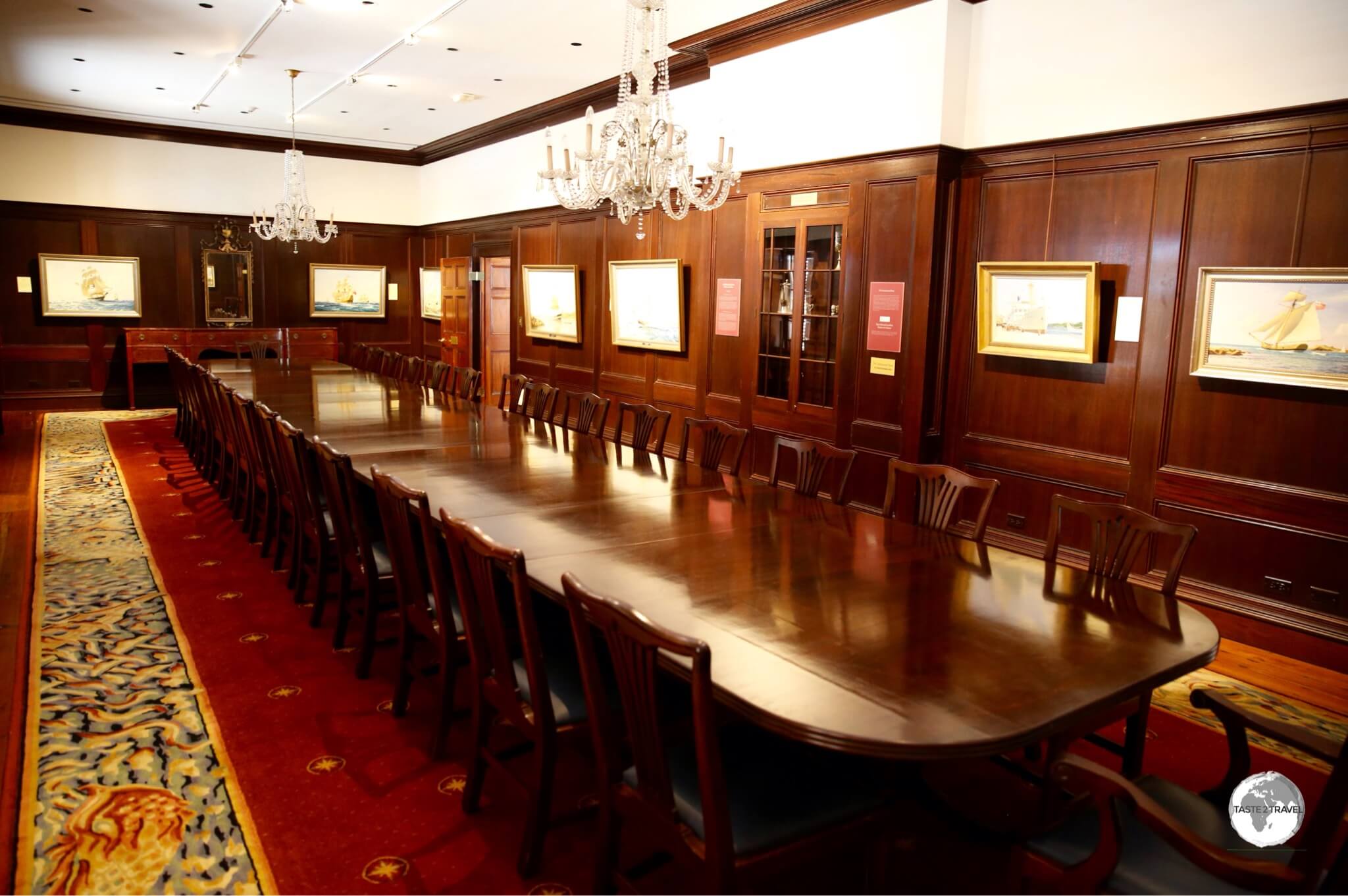
The former State Dining Room inside the Old Commissioners House.

The former State Dining Room inside the Old Commissioners House.

The house contains two floors of exhibits, including a photographic exhibit of the Long-tail bird by former Bermuda resident (and famous Australian TV producer) Reg Grundy.

Somerset Bridge

Somerset Bridge - The world's smallest drawbridge.

Somerset Bridge – The world’s smallest drawbridge.

Also in Sandy’s Parish, built in 1860, the quirky Somerset Bridge is the world’s smallest drawbridge.

A taxi crossing Somerset Bridge.

A taxi crossing Somerset Bridge.

The bridge is made up of two halves with an 18-inch wide piece of timber placed between the spans to bridge the gap between the two. This piece of timber can be opened (by hand) to allow the mast of a small sailing boat to pass through.

Scuba Diving

While it looks ideal, Bermuda is surrounded by a treacherous fringing reef which has claimed many ships in the past.

While it looks ideal, Bermuda is surrounded by a treacherous fringing reef which has claimed many ships in the past.

The fringing reef which surrounds Bermuda has claimed many ships over the centuries – all of which has created a diving playground. I did a two-tank dive with Dive Bermuda who have their shop at the Grotto Bay Resort in Hamilton Parish.

The dives cost just under $200 which included all equipment, boat transfers and as much water as you care to drink. Food is not provided on the (half-day) trip so if you get peckish between dives you should bring something along.

Our two dives were at the wreck of the Cristobal Colon (very fragmented/ dispersed wreck) and then North Rock, both a 50 minute boat ride from the island on the north-west side of the seamount. 

Accommodation

In a word – expensive! Most hotels on the island are upscale resorts/ hotels catering to tourists with deep pockets. There are no budget hotels or hostels. If you are on a budget it’s best to look at options on either Couchsurfing.com or Airbnb.com

Eating out

There are a variety of restaurants on the island catering for all budgets. Most places which serve mainly tourists/ ex-pats charge high prices and additionally add a 17% gratuity to the bill. You can avoid all of this by eating in local cafes.

Local Restaurants

Of the local ‘cheapies’, my favourites include:

  • Rotisserie Grill (South road in Smith’s Parish) – Always popular, this restaurant offers roast chicken meals with mashed potato and salads for under $15. Homemade desserts are also available.
  • Pizza House Restaurant (several branches on the island) – makes a mean pizza and roast/ fried chicken meals with salads and vegetables.
  • The Spot Restaurant (Cedar Avenue in downtown Hamilton) – cooking here is hit and miss but its hard to beat their prices. One of the cheapest places in the heart of Hamilton.

Tourist Restaurants/ Bars

The most interesting bar on Bermuda has to be the Swizzle Inn, where the legendary national cocktail was created.

The most interesting bar on Bermuda has to be the Swizzle Inn, where the legendary national cocktail was created.

Of the tourist restaurants, the Swizzle Inn is a local institution, which was responsible for developing the national cocktail – the Rum Swizzle. For those who are thirsty, the good news is – there are two branches on the island – one in the north at Baileys Bay (the original pub – located across the road from the Crystal Cave) and one in the south on the South Shore Road.

Apart from great cocktails, the food menu is very good with blackboards dinner specials every evening and trivia and other activities during the week – plus you can leave a permanent mark on the island by adding your scrawl to the walls.

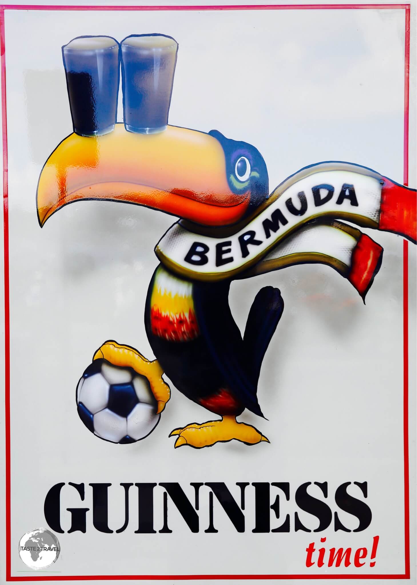
A Guinness promotional poster at Flanagan's Irish Bar in Hamilton

A Guinness promotional poster at Flanagan’s Irish Bar in Hamilton

Located on Front street in downtown Hamilton, Flanagan’s Irish Bar is popular with tourists and locals for its extensive food and drinks menu. A great way to soak up the ambiance of Hamilton is to have dinner on the balcony overlooking the harbour.

If you are looking for dinner or drinks in St. Georges, I would highly recommend the waterfront Wahoo’s Bistro & Patio. The menu at Wahoo’s combines local and European influences from the Austrian-born head chef (and joint owner) Alfred Konard. The fish here is especially good.

Cocktails

The national drink of Bermuda is the Rum Swizzle, which was developed by the folks at the Swizzle Inn but is sold all over the island.

How to prepare a Rum Swizzle:

The national cocktail of Bermuda, the 'Rum Swizzle', which was created at the Swizzle Inn.

The national cocktail of Bermuda, the ‘Rum Swizzle’, which was created at the Swizzle Inn.

Ingredients (makes 6):

  • 4 oz Gosling’s Black Seal Rum
  • 4 oz Gosling’s Gold Rum
  • 5 oz Pineapple Juice
  • 5 oz Orange Juice
  • ¾ oz Grenadine or 2 oz Bermuda Falernum
  • 6 Dashes of Angostura Bitters

Method: 

  • Into a pitcher ⅓ full of crushed ice – add Gosling’s Black Seal Rum, Gosling’s Gold Rum, pineapple juice, orange juice, Grenadine or Bermuda Falernum and Angostura bitters.
  • Churn vigorously until a frothing appears or mix in a cocktail shaker.
  • Strain into a martini glass.

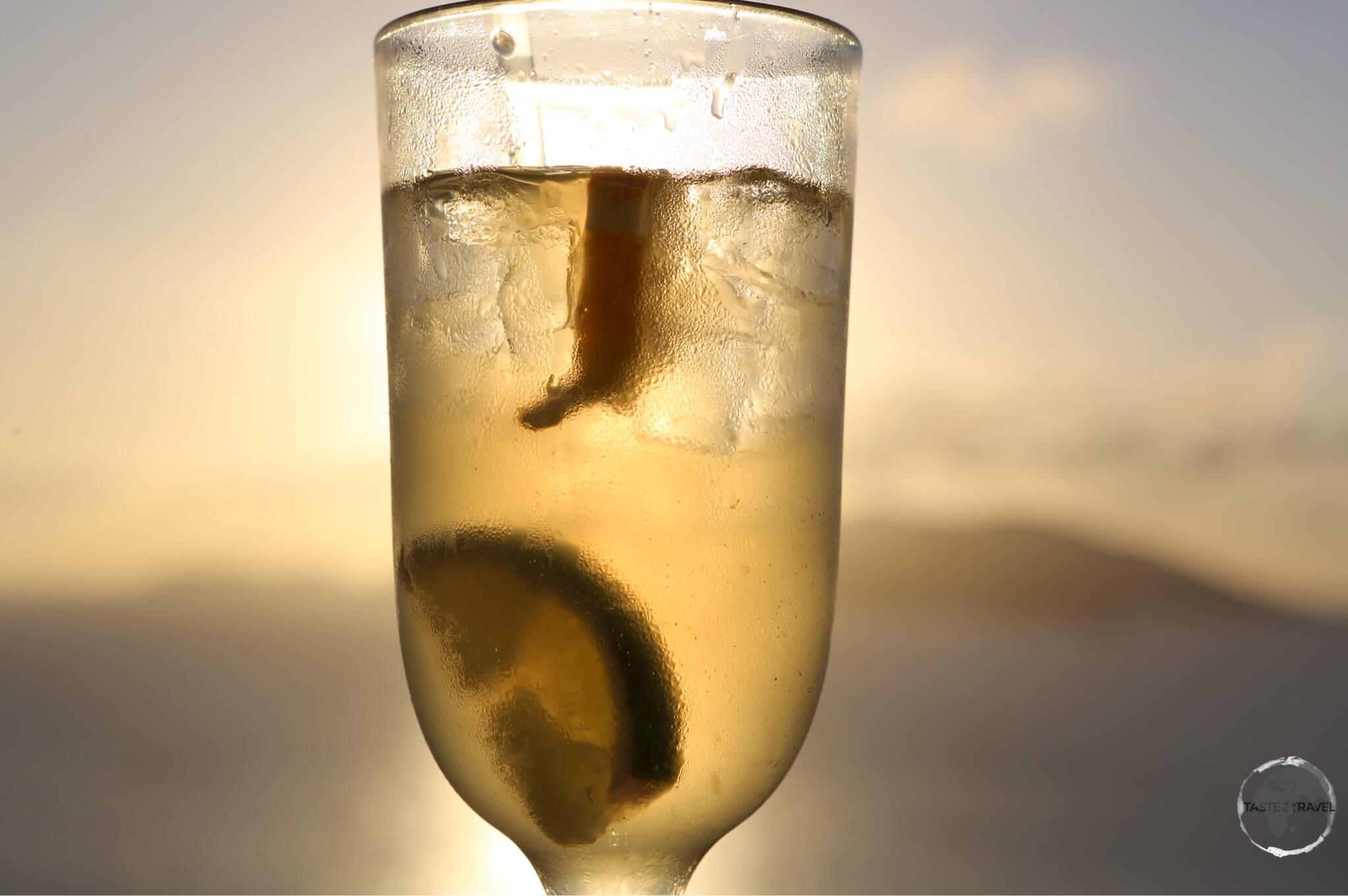
Another favourite cocktail is the simple but tasty Dark ‘N’ Stormy – made with dark rum (the ‘dark’) and ginger beer (the ‘stormy’) served over ice and garnished with a slice of lime.

An island staple - the Dark 'n' Stormy cocktail.

An island staple – the Dark ‘n’ Stormy cocktail.

Cafes

As with every other destination, I was on a mission during my 10 days to find the best coffee on Bermuda. Finding a good coffee is not easy but after an exhaustive search, I can say the best coffee is served at the Devils Isle Cafe in downtown Hamilton. The cafe is open from early morning, which is a good thing since their breakfast offering is also one of the best on the island.

If you’re anywhere near the Flatts village, you’ll be happy to know the folks from Devils Isle Cafe are also responsible for the Village Pantry. I was staying up the road, so I started most days with breakfast here and would recommend the Avocado Crush (like guacamole on toast) with a poached egg added on top.

The best coffee in St. Georges is served at the CV Cafe in downtown St. Georges.


Visa Requirements

Bermuda Passport Stamp.

Bermuda Passport Stamp.

Despite being a British Overseas Territory, Bermuda maintains it’s own visa policy. All flight and cruise ship arrivals into Bermuda are from just three countries – United States, Canada and the United Kingdom. All visitors to Bermuda must have a return ticket and the right to re-enter one of those three countries. You can check your requirements here.

Getting There

By Air

Around 1/3 of tourists (235,000 in 2015) to Bermuda fly into LF Wade International Airport – the only airport on the island. The airport is located in the northern parish of St. Georges and (due to the fact that most flights are between the US and Bermuda) offers US immigration/ customs pre-clearance, which means US-bound passengers clear Customs & immigration in Bermuda so flights arriving in the US from Bermuda are thus treated as domestic flights. At the time of my visit a new, bigger terminal was being constructed.

The following airlines provide flights to the island:

  • Air Canada – Flight to Toronto–Pearson
  • American Airlines – Flights to Miami, New York–JFK, Philadelphia
  • British Airways – Flight to London-Gatwick
  • Delta Air Lines – Flights to Atlanta, Boston, New York–JFK
  • JetBlue Airways – Flights to Boston, New York–JFK
  • WestJet – Flight to Toronto–Pearson

By Sea

Carnival Cruise Ship, Bermuda

Most tourists to Bermuda arrive on a cruise ship from the United States.

Around 2/3 of tourists (385,000 in 2015) to Bermuda arrive on cruise ships, with most being American tourists on ships from the east coast of the US. All ships berth at either the Royal Naval Dockyard (2 berths) or, for smaller ships in downtown Hamilton (2 berths).

The two berths at Royal Naval Dockyard, Kings Wharf and Heritage Wharf, occupy the same long pier, and is where most cruise ship passengers will find themselves.

The other two berths are located in downtown Hamilton, alongside Front street but due to overcrowding in town (when ships are docked), authorities allow few ships to berth in the capital.

A Norwegian Cruise Line ship, docked at the Royal Naval dockyard.

A Norwegian Cruise Line ship, docked at the Royal Naval dockyard.

Bermuda is a sailing paradise and attracts yachts from around the world, hence a small number of visitors (less than 1%) arrive by private yacht.

Getting Around

Ferry

A map showing the four different Bermuda Ferry Routes.

A map showing the four different Bermuda Ferry Routes.
Source: http://www.bermudaforvisitors.com

There are four ferry routes operating in Bermuda – a Blue, Pink, Green and Orange route. While I was exploring the island on my scooter, I always looked to incorporate a ferry trip into my journey.

Ferry journeys save a lot of time as distances across the water are considerably shorter than those on land where roads are narrow, windy and long.

Passengers pay $5 a ticket and you are able to take your bike or scooter on-board for an extra $5. The ferry journey from Hamilton to Royal Navy Dockyard is 20 minutes, versus the road journey of almost an hour.

Bus

Bermuda bus routes

Bermuda bus routes
Source: https://www.bermudayp.com

Government-operated pink (inspired by the colour of the pink sand beaches) public buses provide comprehensive coverage across the entire island on 11 different routes from the main terminal in Hamilton.

Fares are very reasonable, buses run frequently (i.e. until 7-pm) and service is very good. Since there is no car hire on Bermuda and taxi’s can be expensive, bus is a good transport option for visitors who do not want to hire a scooter.

Taxi

Taxi’s are available for hire, but like everything else on Bermuda, they’re not cheap. A taxi from one end of the island (St. Georges) to the other (Royal Navy Dockyard) will cost around $78.

Car

A fleet of Renault Twizy's, at the Hamilton Princess Hotel in Bermuda.

A fleet of Renault Twizy’s, at the Hamilton Princess Hotel in Bermuda.

There is no car rental on Bermuda, however a small fleet of electric Renault Twizy’s are now available for rent from Current Vehicles, located in the car park at the front of the Hamilton Princess hotel in downtown Hamilton. 

The Twizy is an over-sized shopping trolley, able to carry two (smallish) passengers, with the second passenger tucked tightly in behind the driver. The cars were originally bought onto the island as support vehicles for the America’s Cup (June 2017).

An interior view of the cosy Renault Twizy.

An interior view of the cosy Renault Twizy.

Scooter

A scooter is the best way to explore an island where rental cars are banned.

A scooter is the best way to explore an island where rental cars are banned.

In the absence of car rental options (and apart from the recently introduced Twizy’s), scooter is the only rental option for those who wish to explore the island independently.

There are various scooter rental companies around Bermuda, all of whom seem to charge similar (i.e. high) rates. Prices start at $55 per day and reduce on a sliding scale, so the longer you hire the cheaper it becomes. I rented my bike through (and would recommend) Oleander Cycles – my ten day rental averaged out at $30 per day.

All companies will drop-off and pick-up their scooters from anywhere on the island and they require all drivers to do a short driving test before they will agree to rent you a scooter – they will not rent you a scooter if you appear to be less-than-confident on two wheels.


That’s the end of my Bermuda Travel Guide.

Safe Travels!

Darren


Follow me on Instagram: 


Further Reading

Other travel reports from the Caribbean region include:


Bermuda Travel Guide Bermuda Travel Guide Bermuda Travel Guide Bermuda Travel Guide Bermuda Travel Guide Bermuda Travel Guide Bermuda Travel Guide Bermuda Travel Guide Bermuda Travel Guide Bermuda Travel Guide Bermuda Travel Guide Bermuda Travel Guide Bermuda Travel Guide Bermuda Travel Guide Bermuda Travel Guide Bermuda Travel Guide

Turks and Caicos Travel Guide

A Tour boat on Provo Island.

Turks and Caicos Travel Guide

Welcome to the taste2travel Turks and Caicos Travel Guide!

Date Visited: June 2015

Introduction

Located north of the well-beaten ‘Caribbean-island-hopping’ trail, the Turks and Caicos Islands (TCI) are a British Overseas Territory who share the tail-end of the Lucayan Archipelago with neighbouring Bahamas. The islands reputedly get their name from the Turk’s Head Cactus, which can be found growing in the arid soil.

A raised limestone shelf, Provo island is surrounded by pristine turquoise water.

A raised limestone shelf, Provo island is surrounded by pristine turquoise water.

TCI consists of 40 islands and cays spread over 60-km of brilliantly azure turquoise waters. Only eight of the islands are inhabited. The islands have a total population of 31,000 residents but welcome about 450,000 air travelers and 650,000 cruise ship passengers per year.

The two main islands are Grand Turk and Providenciales. This report covers Providenciales Island – more commonly known as Provo Island.

Stormy skies over ‘The Bight' beach, one of the best beaches on Provo island.

Stormy skies over ‘The Bight’ beach, one of the best beaches on Provo island.

Provo is the most developed of the islands and is where most international passengers arrive. The island consists primarily of low, flat limestone and is ringed by white sand beaches. Provo is 37-km long and 7-km wide. Getting around is a breeze thanks to light traffic, courteous drivers, excellent roads and lots of signage. There is no public transport so a car is essential if you wish to explore.

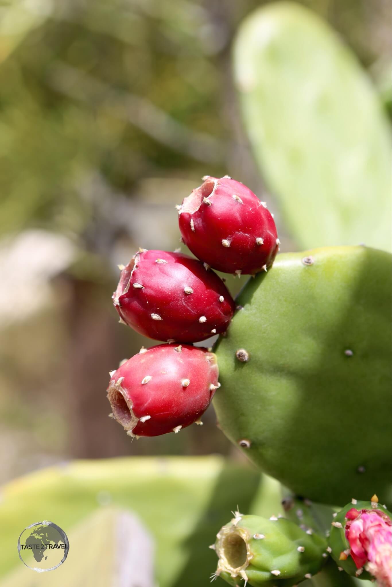
Turks head cactus on Provo island.

Turks head cactus on Provo island.

Location

TKCA 1ZZ, Turks and Caicos Islands

The Turks and Caicos Islands are located in the Atlantic Ocean and not the Caribbean sea. The islands lie 925-km south-east of Florida, 144-km north of the island of Hispaniola and are separated from the closest Bahamian islands (Mayaguana and Great Inagua) by the Caicos Passage.

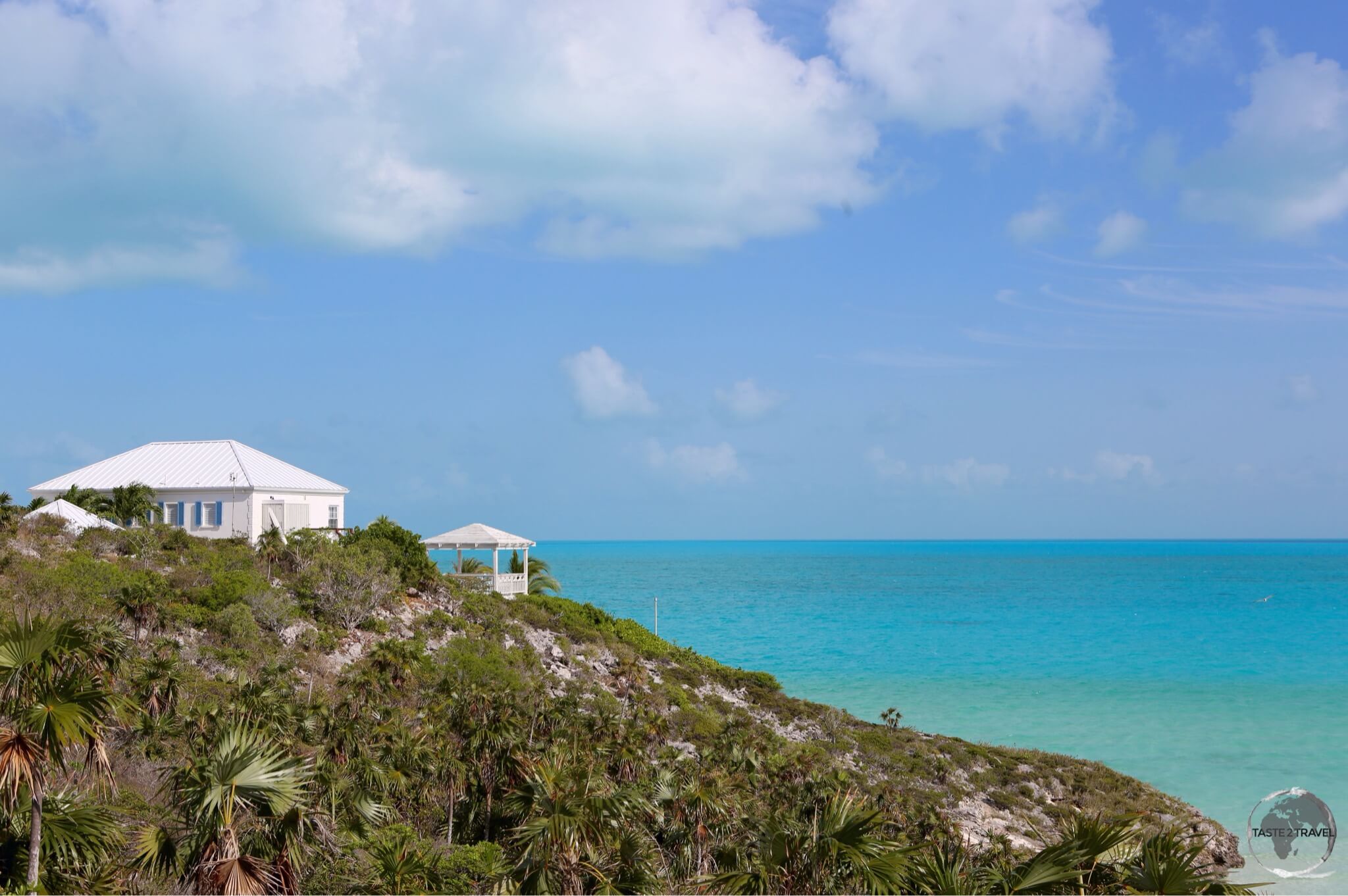
A view over the south coast of Provo island.

A view over the south coast of Provo island.

History

A British canon on Provo Island.

A British canon on Provo Island.

As with most other islands in the region, the first inhabitants of TCI were the indigenous Taino Indians. These were Arawak-speaking Indians who migrated through the Antilles islands from present day Venezuela. The Taino crossed to TCI from neigbouring Hispaniola sometime between AD 500 to 800. Together with Taino who migrated from Cuba to the southern Bahamas around the same time, these people developed as the Lucayan.

The first European to visit the islands was Christopher Columbus who set foot on Grand Turk during his first voyage to the Americas in 1492. No settlement was made and the next contact would not come until 1512, when Juan Ponce de Leon visited the islands. Once discovered, Spanish slavers from neighbouring Hispaniola frequently raided the islands, enslaving the Tainos to replace the largely depleted native population of Hispaniola. Due to these raids, the southern Bahama Islands and the TCI were completely depopulated by 1513, and remained so until the 17th century.

Dry and arid, Provo island is covered with different species of cacti.

Dry and arid, Provo island is covered with different species of cacti.

During the 16th, 17th and 18th centuries, the islands passed from Spanish, to French to British control, but none of the three powers ever established any settlements.

The first temporary settlements on the island were made by seasonal salt workers from Bermuda in 1681. The salt collectors were drawn by the shallow waters around the islands that made salt mining a much easier process than in Bermuda. They occupied the islands for six months a year, returning to Bermuda when it was no longer viable to harvest salt. Their early presence established the British dominance of the archipelago that has lasted into the present day. Huge numbers of trees were felled by the Bermudians to discourage rainfall that would adversely affect the salt mining operation. This deforestation has yet to be repaired.

Salt mining on TCI was a key industry for both Bermuda and the Bahamas. During much of the 18th century a virtual ‘state-of-war’ existed between the two British colonies, both of whom were involved in a protracted legal battle over ownership of TCI and hence it’s salt pans.

A view over the south coast of Provo Island.

A view over the south coast of Provo Island.

Due to a series of events, such as incursions by French privateers who raided salt-ladened ships, a couple of powerful hurricanes (which destroyed settlements, salt pans and ships) and the loss of their key U.S. market, the Bermudians slowly withdrew from TCI. The British government eventually assigned political control of the islands to the Bahamas.

The islands remained part of the Bahamas until 1848, when the inhabitants successfully petitioned to be made a separate colony governed by a council president under the supervision of the governor of Jamaica.

The islands continued to be a dependency of Jamaica until 1959 at which point they received their own administration. When Jamaica was granted independence from Britain in August 1962, the Turks and Caicos Islands became a crown colony.

The TCI coat of arms features the Turks Head cactus.

The TCI coat of arms features the Turks Head cactus.

Until the 1960’s the islands had little economic activity and little population growth. At this time, a small trickle of tourists began to arrive, supplementing the salt economy. A group of American investors funded the construction of an airport on Provo (now the international gateway to the islands). They also built the island’s first hotel. This was the start of the tourism industry, which is now the main economic activity on the islands.

Another beautiful day on TCI.

Another beautiful day on TCI.

Today the islands are a modern, developed and safe (with one of the lowest crime rates in the Caribbean) destination, albeit an expensive one. With a population of just 24,000, Provo is a relaxed, laid back place. The locals are respectful and courteous, traffic is never heavy and the magnificent white sand beaches are normally uncrowded.

TCI is a special destination – one for which it is definitely worth straying off the beaten track.

Flag

The flag of Turks and Caicos Islands.

The flag of Turks and Caicos Islands.

The flag of the Turks and Caicos Islands features a blue background with the Union Jack on the upper hoist side. The flag is defaced with the coat of arms of the Turks and Caicos Islands in the centre-right.

The flag of TCI flying on Provo Island.

The flag of TCI flying on Provo Island.

The coat of arms, which was granted on 28 September 1965, takes the shape of a yellow shield which contains a conch shell, lobster, and a Melocactus. The Melocactus, which is visually similar to the traditional Turkish fez, give the islands the first half of their name.

Currency

US Dollar

The US Dollar.

Despite being a British territory, the currency used on TCI is the US dollar. There are no Foreign exchanges or Bureau de Changes at the airport or anywhere apart from local banks. While ATMs are available, they are not always reliable.

It’s best to exchange any currency prior to arriving on the islands.

Offshore Finance

offshorebank222

The Turks and Caicos have become a popular place for offshore investments. As a zero tax jurisdiction, investors incur no taxes and few restrictions on any monetary exchanges.

However, such lax laws have caused these islands (ultimately ruled by her Majesty) issues in the past. In the 1990’s, the islands gained negative press as the result of money laundering. However, after intervention by the British government, these problems have subsided.

Around Providenciales Island

Fringed by white sand beaches, Provo island is surrounded by the most dazzling, azure blue seas.

Fringed by white sand beaches, Provo island is surrounded by the most dazzling, azure blue seas.

Grace Bay

Grace Bay is the main tourist centre on Provo. It all started in 1984 when Club Med opened a resort on the beautiful white sand beach. Grace Bay features a beautiful, white sand beach which stretches along the coast for 20-km. Most of the beach is occupied by exclusive resorts – a playground for wealthy holidaymakers. In the village you will find the largest concentration of restaurants, bars, cafés and shops on Provo. This is the place to come in the evening.

The Bight

The stunningly beautiful 'The Bight' beach, was located a short walk from my condo.

The stunningly beautiful ‘The Bight’ beach, was located a short walk from my condo.

Located on the central north coast between Grace Bay and Turtle Cove is The Bight. This beach (2.5-km long) offers a wide sweep of white sand with calm, clear, turquoise water. There is little development along the beach so it’s never crowded.

Adjacent to one of the car parks is a small garden showcasing shrubs and plants native to TCI.

Stormy skies over The Bight beach.

Stormy skies over The Bight beach.

Turtle Cove

Located on the north coast to the west of The Bight is Turtle Cove. The best beach snorkeling on Providenciales can be found 50-m offshore at Smith’s Reef. The reef is in protected, shallow water so is suitable for beginner snorkelers, but has enough sea life and reef to be of interest to any level of snorkeler.

Long Bay

Kite surfing is a popular activity on windy Long Bay.

Kite-boarding is a popular activity on windy Long Bay.

Located on the more exposed windward (southern) side of the island, Long Bay, is still largely undeveloped save for a large luxury resort at the northern tip of the beach. Due to its steady wind and relatively isolated location, Long Bay is rapidly becoming a popular kite-boarding destination in the Caribbean.

Conch shell decoration on Long Bay.

Conch shell decoration on Long Bay.

The beach offers 5-km of uninterrupted fine white sand. The water is shallow (one to two metres), crystal clear and calm. There are no facilities on the beach so you’ll need to bring everything you require. Parking can be found at the northern end of the beach, where a boardwalk leads from a car park to the beach.

Sapodilla Bay

The calm waters of Sapodilla Bay are popular with families.

The calm waters of Sapodilla Bay are popular with families.

Located on the south coast, in a wide, protected bay, Sapodilla Bay is a 275-metre long white sand beach. The water is very shallow, calm and clear and is a popular choice for families.

Colonial-era graffiti at Sapodilla Bay.

Colonial-era graffiti at Sapodilla Bay.

From the beach-side car park you can climb a small hill where you’ll see boulders which were graffiti-ed in the 19th century by shipwrecked sailors.

Accommodation

The balcony of my comfortable Condo on Provo island.

The balcony of my comfortable Condo on Provo island.

Ouch! Accommodation on TCI is not cheap. The islands have branded themselves as a luxury destination for the wealthy and romantic honeymooners. There are few budget options here. You can choose between an all-inclusive hotel, a resort, a condo or private villa. Don’t bother looking for a cheap hostel.

A view of my comfortable condo on Provo Island.

A view of my comfortable condo on Provo Island.

While on Provo, I stayed at La Vista Azul Resortwhich is a condo complex located at beautiful Turtle Cove. The Bight and Smith’s Reef is a short walk away. The owners of the condo’s rent their properties out to visiting holiday makers. All of this is managed by the friendly onsite property manager.

The bedroom of my condo.

The bedroom of my condo.

If you are keen to invest in a nice condo in a modern, developed, conducive tax-haven then you should consult him. I would totally recommend staying here if your budget can afford it. You can check current rates on booking.com

Eating Out

There are many restaurant options around the island, most of them concentrated in the tourist hub of Grace Bay. If there is a national food on TCI it must be Conch. Most restaurants offer Conch in different forms (fritters, salad etc).

Local cuisine mostly revolves around seafood, with many restaurants serving local fish. There are many international restaurants catering to the tastes of tourists, especially in Grace Bay. No matter what cuisine you are in the mood for – you will find it on Provo. One thing you will not find are American fast food chains (McDonald’s, KFC, Burger King etc).

Conch

Turks and Caicos Travel Guide: A very slimy adult conch at the Caicos Conch Farm.

A very slimy adult conch at the Caicos Conch Farm.

Popular throughout the Caribbean, Conch is a large sea snail which lives inside a shell. Caribbean Queen Conchs are farmed on Provo (the only commercial farm in the world) where they are raised to 4-years of age before being harvested. The meat is removed from the shell and traditionally used to make conch fritters.

Breeding enclosures at the Caicos Conch Farm.

Breeding enclosures at the Caicos Conch Farm.

The polished shell is used to make ornaments, jewellery and souvenirs, which you can buy from the gift shop at the farm.

Turks Head Beer

Turks Head beer logo

While on the island you should sample the offerings from the folks of the Turks Head Brewery. The brewery produces Lager, Amber and Stout beer using imported ingredients and desalinated island water. You can find the beers on tap at a number of bars in Grace Bay and around the island.

Visa Requirements

Some nationalities require visas for Turks & Caicos – check your visa requirements prior to arrival.

Getting There

By Air

Providenciales International Airport is the main international airport serving TCI and the main hub for the national carrier – InterCaribbean Airways.

There is an international airport on Grand Turk – JAGS McCartney International Airport – but it currently receives no scheduled international flights.

The following airlines provide international connections to TCI:

  • Air Canada – services to Toronto (Pearson), seasonal service to Ottawa
  • Air Canada Rouge – seasonal service to Montréal (Trudeau)
  • American Airlines – services to Charlotte, Miami, New York (JFK), seasonal services to Boston, Dallas/Fort Worth, Philadelphia
  • American Eagle – service to Miami
  • British Airways – services to Antigua, London (Gatwick)
  • Caicos Express Airways – services to Haiti (Cap-Haïtien), TCI (Grand Turk), TCI (Salt Cay)
  • Delta Air Lines – service to Atlanta, seasonal services to Boston, New York (JFK)
  • InterCaribbean Airways – services to Bahamas (Nassau), Cuba (Havana), Cuba (Santiago de Cuba), Dominican Republic (Puerto Plata), Dominican Republic (Santiago de los Caballeros), Dominican Republic (Santo Domingo), Haiti (Cap-Haïtien), Haiti (Port-au-Prince), Jamaica (Kingston), Puerto Rico, TCI (Grand Turk), TCI (South Caicos)
  • JetBlue Airways – services to Fort Lauderdale, New York (JFK), seasonal service to Boston
  • United Airlines – service to Newark, seasonal service to Chicago (O’Hare), Houston (Intercontinental)
  • WestJet – service to Toronto (Pearson), seasonal service to Montréal (Trudeau)

By Sea

Ferry

There are no scheduled international ferry services.

Cruise Ships

Visiting cruise ships dock at the Grand Turk Cruise Centre on Grand Turk island.

No cruise ships dock on Provo.

Getting Around

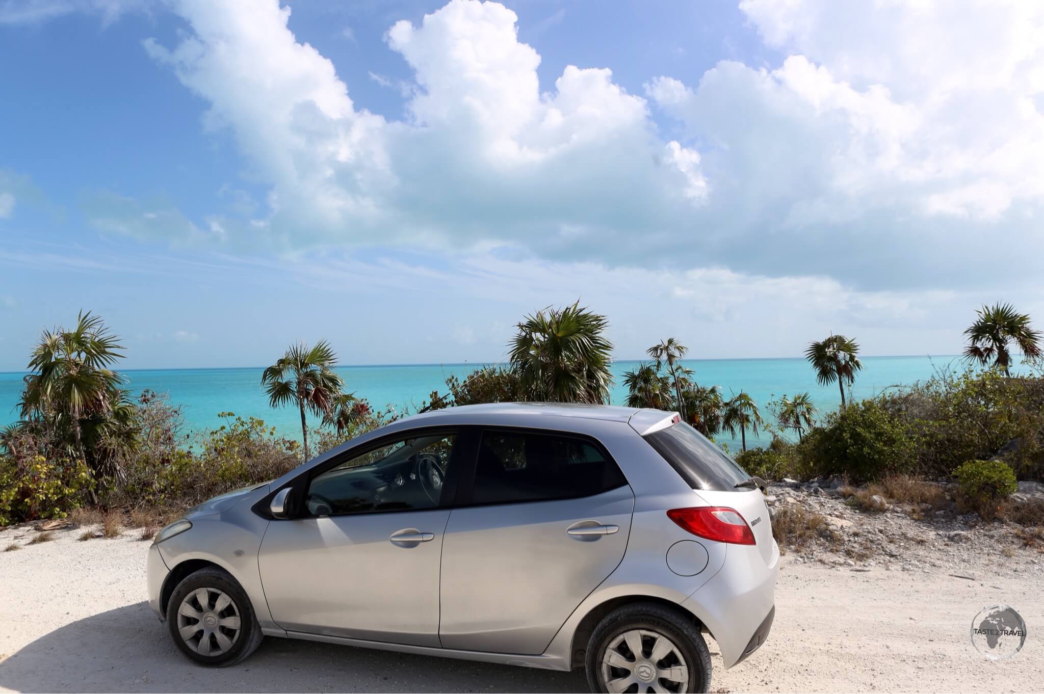
Exploring the south coast of Provo island in my rental car.

Exploring the south coast of Provo island in my rental car.

Bus

There’s no organised public transportation on Providenciales.

Taxi

Taxis are metered and can be found on ranks at the airport or at the major resorts. If you require a taxi anywhere else you will have to call one.

Car

The license plate of my rental car on TCI.

The license plate of my rental car on TCI.

This is the best way to explore the island. Without a car you will not get far. You can collect a car upon arrival at the international airport.

Driving conditions on the island are perfect – excellent roads, light traffic, good signage and (generally) courteous drivers.

Being a small narrow island it’s impossible to get lost. There is no need for navigation here.

Ferry

A regular ferry service operates from the eastern end of Provo (near to the Conch farm) to all three of the Caicos islands (North, Middle and South). The service is operated by TCI Ferries, check their website for the current schedule and fares.


That’s the end of my Turks and Caicos Travel Guide.

Safe Travels!

Darren


Follow me on Instagram: 


Further Reading

Other travel reports from the Caribbean region include:

Turks and Caicos Travel Guide Turks and Caicos Travel Guide Turks and Caicos Travel Guide Turks and Caicos Travel Guide Turks and Caicos Travel Guide Turks and Caicos Travel Guide
Jamaica Travel Guide

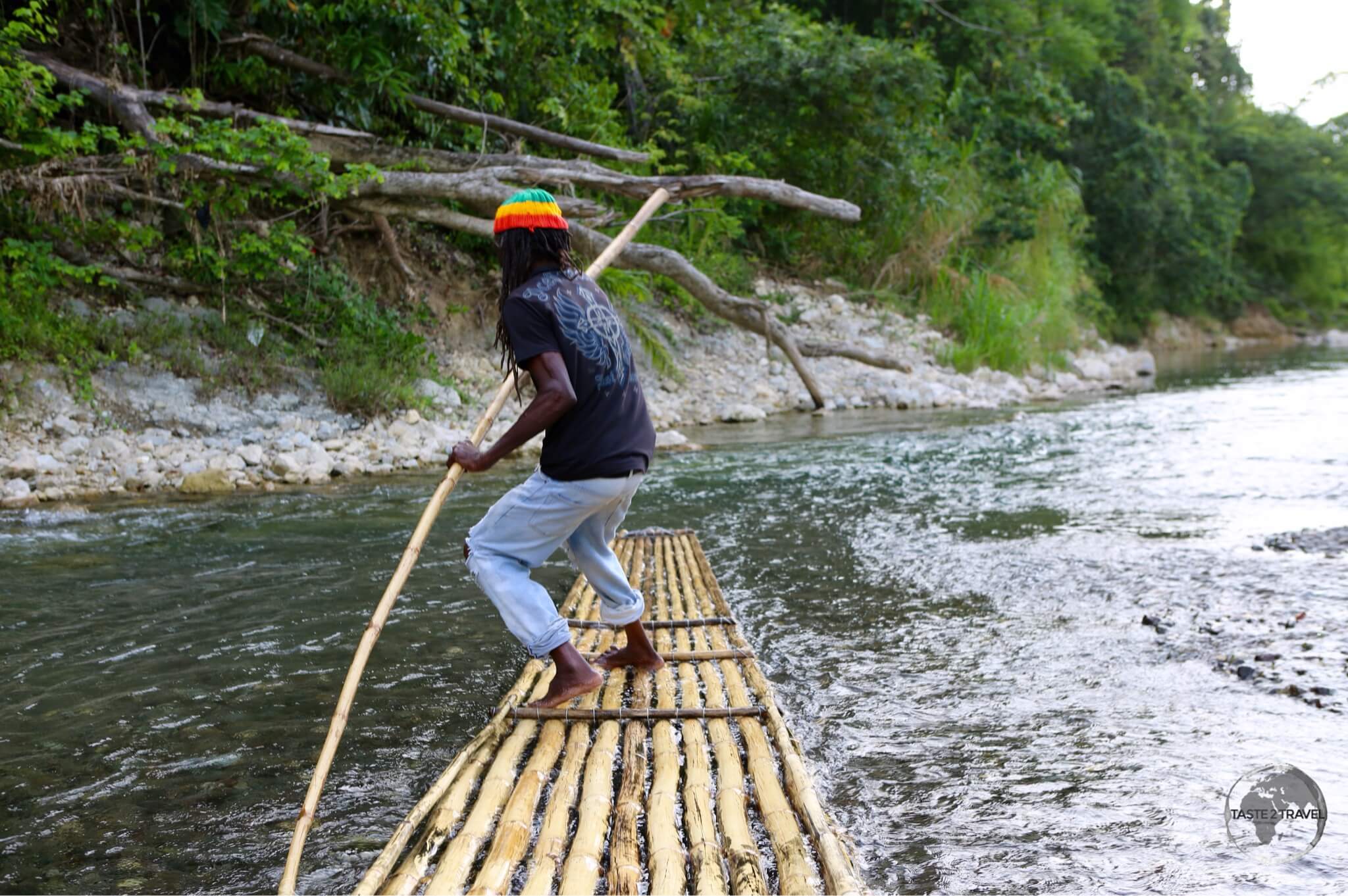
Jamaica Travel Guide: Rasta rafting guide on the Rio Grande.

Jamaica Travel Guide

Welcome to the taste2travel Jamaica Travel Guide!

Date Visited: June 2015

Introduction

There is much more to Jamaica than quintessential tropical beaches and sunsets. The third largest island in the Caribbean (after Cuba and Hispaniola), offers an abundance of culture from Reggae music to Rastafarians, a unique cuisine in the form of ‘Jerk’, lush tropical rain forests, misty blue mountains, superb coffee, hidden waterfalls, meandering rivers, famous dark rums and so much more.

A display at the Bob Marley museum at Nine Mile.

A display at the Bob Marley museum at Nine Mile.

Jamaica is as smooth as its rums and as spicy as its Jerk – a rewarding destination for those willing to pull themselves away from the legendary beaches and venture off the beaten track.

Location

Part of the Greater Antilles, Jamaica is surrounded by the Caribbean sea. Cuba is located 145-kilometres to the north while the Jamaica channel separates Jamaica from the island of Hispaniola, 191-kilometres to the west.

With 2.8 million people, Jamaica is the third most populous Anglophone country in the Americas (after the United States and Canada).

History

Like other islands in the region, Jamaica was originally settled by indigenous Arawak Indians – known as Taino’s – who island hopped through the Antilles from modern day Venezuela, arriving on Jamaica around 650 AD. They called the island ‘Xaymaca‘ (land of wood and water). The Spanish gradually changed the name to ‘Jamaica‘.

Marley Coffee shop in Kingston.

Marley Coffee shop in Kingston.

At the time of European contact, the Taino were waging a war against the more aggressive Carib Indians. About one-hundred years after European arrival, the Taino population had been decimated due to forced slavery (by the Spanish) and the introduction of foreign diseases.

The first European to arrive on the island was Christopher Columbus in 1494, during his second voyage to the Americas. Columbus claimed the island for the Spanish crown but never settled it.

In 1503 (during his fourth voyage to the Americas), Columbus was forced to return to Jamaica when a storm beached his ships in St. Ann’s Bay. Columbus and his men remained stranded on the island for one year, finally departing in 1504. The Spanish crown granted the island to the Columbus family, but for decades it was something of a backwater.

The first permanent settlement was established by the Spanish on the north coast in 1509. In 1534 the capital was moved to Villa de la Vega, now called Spanish Town. This settlement served as the capital of Jamaica under both the Spanish and English, from 1534 until 1872, after which the English moved the capital to Kingston. The Spanish were the first to introduce African slaves to Jamaica, after the native Taino population became extinct.

The 'Doctor Bird' Hummingbird in the Blue Mountains.

The ‘Doctor Bird’ Hummingbird in the Blue Mountains.

By 1655, the British – concerned about Spain’s growing influence in the Caribbean – launched a poorly executed attack on the fort at Santo Domingo (Spain’s strong-hold on neighbouring Dominican Republic). After the Spanish repulsed the attack, the British force sailed for Jamaica, the only Spanish West Indies island that did not have new defensive works.

In May 1655, seven thousand British soldiers landed near Spanish Town and easily overwhelmed the small number of Spanish troops stationed on Jamaica. Despite several battles, Spain was never able to recapture the island. By signing the Treaty of Madrid in 1670, Britain gained formal possession of Jamaica from Spain.

In order to repeal any further attacks by the Spanish, the British authorities invited pirates and privateers (who preyed on Spanish ships) to establish a base on the south coast at Port Royal (close to present-day Kingston). Jamaica soon became a home base for privateers and pirates, including Henry Morgan.

Once the treaty had been signed and the threat of war removed, the British focused on establishing plantations on the island. They encouraged new settlers to come to the island through gifts of land. These settlers established sugarcane plantations, which allowed the economy to boom. At one point, Jamaica was the world’s largest producer of sugar, yielding 22 percent of the world’s supply during the 1700’s. The British also produced cocoa and coffee plants for trade.

While the English imported many African slaves to work on the plantations, the number of slaves on Jamaica was considerably less than other islands. This is in part due to Jamaica’s more westerly location in the Caribbean. Slave ships sailing from West Africa preferred to unload their human cargo as soon as possible and hence islands in the Eastern Caribbean received larger numbers of slaves than those in the west. By 1800, black Jamaicans outnumbered whites by a ratio of twenty to one. Enslaved Jamaicans mounted over a dozen major uprisings during the eighteenth century.

Jamaican boy on the Rio Grande.

Jamaican boy on the Rio Grande.

Following the abolition of slavery (1834), and the subsequent loss of its labour source, the island’s plantation economy suffered. The second half of the nineteenth century was a period of severe economic decline for Jamaica. Low crop prices, droughts, and disease led to serious social unrest and rebellions. Throughout, the British managed to maintain control.

Jamaica finally became an independent nation on the 6th of August 1962.

Despite all the marketing and branding of Jamaica as a tropical paradise for tourists (which it is), the country does have serious social and economic problems. The island is currently burdened with a huge amount of foreign debt, a debt which has gradually built up over decades. In 2012 more than 54% of the country’s JMD $612-billion budget was spent on servicing this debt. In addition to the debt, high unemployment (averaging 12.5%), rampant under-employment, and high interest rates are the most serious economic problems.

Rafting the Rio Grande river.

Rafting the Rio Grande river.

Violent crime is one of many serious social problems, particularly in Kingston. You need to be careful when moving around the capital, no matter what time of the day. Other large cities (Ocho Rios) are also gritty and threatening. Jamaica has one of the highest homicide rates in the world, an ineffective justice system, ‘patchy’ law and order, ‘indifferent’ education system and is perceived by it’s residents as being an ‘overwhelming’ corrupt country.

In 2011, in the lead-up to the 50th anniversary of independence, a poll conducted on behalf of the Gleaner newspaper found that 60% of those polled held the view that “Jamaica would be better off under British rule”.

Tourism is the most important economic activity on the island today. Most tourism is concentrated on the island’s northern and western coasts in the beach-side communities of Port Antonio, Ocho Rios, Montego Bay and Negril.

Bob Marley

Bob Marley tribute at the Bob Marley museum in Kingston.

Bob Marley tribute at the Bob Marley museum in Kingston.


Robert Nesta “Bob” Marley is Jamaica’s most famous son and one of its most famous exports. Born on the 6th of February 1945 in the small town of Nine Mile (St. Anne parish), Marley grew up playing music at school with his childhood friend Neville Livingston (later known as Bunny Wailer).

Following the death of his father when he was 10 years-old, Bob relocated to Trench-town (Kingston) with his mother, her new partner Thadeus Livingston (Bunny Wailer’s father) and Neville Livingston. Now that Marley and Bunny were living in the same house, their musical exploration intensified. They focused on the latest R&B from American radio stations whose broadcasts reached Jamaica, and the new Ska music.

While in Trench-town, Marley found himself in a vocal group with Bunny Wailer, Peter Tosh, Beverly Kelso and Junior Braithwaite. At this time Marley was only interested in being a vocalist. Marley then met Joe Higgs, who resided on the next block. Higgs helped Marley with his vocals but more importantly, taught him how to play guitar – thereby creating the foundation that would later allow Marley to construct some of the biggest-selling reggae songs in the history of the genre.

In 1963, Bob Marley, Bunny Wailer, Peter Tosh, Junior Braithwaite, Beverley Kelso, and Cherry Smith formed a band called The Teenagers. They later changed the name to The Wailing Rudeboys, then to The Wailing Wailers, then finally to The Wailers. The Wailers would go on to release some of the earliest reggae records.

After the Wailers disbanded in 1974, Marley pursued a solo career upon his relocation to England. It was during this time that he produced the album Exodus (1977), which established his worldwide reputation and produced his status as one of the world’s best-selling artists of all time, with sales of more than 75 million records. Exodus stayed on the British album charts for fifty-six consecutive weeks.

Diagnosed with a type of malignant melanoma in 1977, Marley died on 11 May 1981 in Miami at the age of 36. He was a committed Rastafari who infused his music with a sense of spirituality. He is considered one of the most influential musicians of all time and credited with popularising reggae music around the world, as well as serving as a symbol of Jamaican culture and identity. A visit to Jamaica would not be complete without spending some time gaining an understanding of its most famous son.

Sightseeing

Kingston

A tree painted in the Rasta colours at the Bob Marley museum in Kingston.

A tree painted in the Rasta colours at the Bob Marley museum in Kingston.

With a population of 580,000, Kingston is the largest city and capital of Jamaica. The city is located on the south-eastern coast, facing a natural harbour. It is protected by a long sand spit, which connects the historical town of Port Royal and the Norman Manley International Airport to the rest of the island.

The majority of the population is Afro-Caribbean, descendants from former slaves. The British also imported large numbers of indentured Indians who today run many of the businesses in Kingston (along with Chinese immigrants).

Despite being home to historic buildings, museums, banks and street markets – downtown Kingston feels shabby, dangerous and run-down. To the west of the downtown area lie the ghetto’s of Trench Town and Tivoli Gardens. This is not a place to be walking after dark. Many of the houses in the area lack basic services and the rule of law is thin on the ground.

The uptown area is located to the north of downtown and is known as New Kingston. At its heart is the modern and clean Emancipation park, kept safe by a legion of security guards. Located around the park you will find the city’s best hotels and restaurants. This is a good neighbourhood to stay in if you wish to be able to venture out after dark without a private army.

There are few sites of interest in downtown Kingston, the city can be covered in one day. Sites are spread around town so it’s best to take one of the many buses or a taxi.

Sites in Kington include:

Bob Marley Museum

Housed in a large old colonial-era wooden house on Hope Rd, this is where Bob Marley lived and recorded from 1975 until his death in 1981. It is the city’s most visited site. You must join a guided tour to view the house. Tours last for one hour.

Devon House

The tree-shaded lawns of Devon house are a favourite meeting place for Kingstonians. This beautiful old colonial house was built in 1881 by George Stiebel, the first black millionaire in Jamaica. You must join a guided tour to view the interior of the house. The best ice-cream in town is served by Devon House I-Scream. Locals rave about this place and you will too once you have tried their offerings. They use real Jamaican rum in their ‘Rum & Raisin’ ice-cream.

Emancipation Park

This green lung in the middle of New Kingston was opened in 2002 and features a controversial sculpture of a couple of nude, 3-metre tall slaves gazing to the heavens. The park is a favourite place for locals to relax, unwind or exercise. There is a good ‘Jerk’ stand on the north side of the park.

Port Royal

Founded in 1518 and located at the end of the Palisadoes (sand spit) at the mouth of Kingston Harbour, Port Royal was once the largest city in the Caribbean. The port provided a safe haven for English and Dutch privateers and pirates but was destroyed by an earthquake and accompanying tsunami in 1692. Today the town is a pleasant place to visit, offering seafood restaurants and a few preserved historical sites such as Fort Charles, the old British Naval hospital and Cemetery.

Around the Island

Negril

My favourite beach Jamaican beach - Seven Mile Beach at Negril.

My favourite beach Jamaican beach – Seven Mile Beach at Negril.

Located in the far western parish of Westmoreland and known for its miles of uninterrupted white-sand beaches, Negril is the perfect seaside playground – my favourite Jamaican beach.

Picture post-card perfect Seven Mile Beach is the place to base yourself while in Negril. The beach is located on a shallow bay, its  waters are normally calm and ideal for swimming and other water sports. Along the length of the beach you will find restaurants, bars, hotels, resorts and smaller guest houses.

Seven Mile Beach is a great place to watch the sunset and after dark there are plenty of nightlife options with the ubiquitous sounds of reggae music emanating from bars along the beach.

Montego Bay

Located in St. James’ Parish on the north coast, Montego Bay is ‘tourist central’. The city is served by Sangster International Airport, the island’s busiest airport and one which delivered four million tourists to the city in 2015. The city is also a major cruise ship port offering numerous beach resorts and other tourist attractions.

Popular beaches include Doctor’s Cave Beach and Walter Fletcher Beach, home to an amusement park. There’s snorkeling and diving at coral reefs in the protected waters of Montego Bay Marine Park.

Falmouth

Located on the north coast a short drive east from Montego Bay, Falmouth is the chief town and capital of the parish of Trelawny. It is noted for being one of the Caribbean’s best-preserved Georgian towns.

The downtown area is a pleasant place to spend an hour strolling. There is a nice café on the main square where you can get a good coffee and sample some typical Jamaican food.

A new cruise ship port has been built in the centre of town but provides little benefit to local businesses as the port is isolated behind a security fence and the tourists (and their dollars) are bussed in an out to attractions outside of town.

Nine Mile

Museum display at the birthplace of Bob Marley in the village of Nine mile.

Museum display at the birthplace of Bob Marley in the village of Nine mile.

Nine Mile is a village located in the green hills of Saint Ann Parish, inland from the north coast. The town is famous for being the birthplace of Reggae legend Bob Marley, who was born here on February 6, 1945. 

Today his birthplace has been turned into a tourist attraction and shrine – a place of pilgrimage for dedicated fans who make the trek into the hills from all corners of the planet. The museum is owned and operated by Bob’s family and includes a small museum displaying memorabilia from his career.

Nine Mile was not only the place where Marley’s journey began but it was also the inspiration for many of his songs. You can sit at “Mt. Zion Rock”, a small rock in the garden adjoining Marley’s house where Bob used to meditate and write his lyrics.

You can only visit the museum on a fully guided tour. Tours are conducted frequently throughout the day. In order to ‘get closer to Bob’, the smoking of marijuana is encouraged. The guide on my tour was an avid fan of the ‘green weed’ and insisted on smoking it during the entire tour. Tours last about 90-min and culminate with a visit to the mausoleum of Bob and his mother.

Mausoleum of Bob Marley at the Bob Marley museum in Nine Mile.

Mausoleum of Bob Marley at the Bob Marley museum in Nine Mile.

Reaching Nine Mile is not easy. It’s only feasible with your own car or by joining an organised tour. The small town is located at the end of a long (really long), windy, pot-holed road. Local touts outside the museum will insist you park your car on the street and pay them to guard it. Ignore them! There is a free, secure car park at the museum entrance.

Ocho Rios

Dunn's River falls cascading onto the beach near Ocho Rios.

Dunn’s River falls cascading onto the beach near Ocho Rios.

Located on the north coast, in the Parish of St. Ann, Ocho Rios (English: Eight Rivers) started life as a quiet fishing village. Today it is a gritty, bustling port town.

The town is known for it’s picturesque sandy bay, which is lined with hotels, bars and restaurants. Unfortunately this little piece of paradise is isolated from everything else, fenced off behind a high razor-wire security fence. The beach is owned by a private consortium, who charge admission, and close the gates before sunset. The admission price is set sufficiently high enough to keep local touts (and locals generally) off the beach. Crazy!

The surrounding countryside is home to rain forests, rivers and waterfalls, with Dunn’s River Falls being the number one attraction in the area.

Dunn’s River Falls

A highlight of Jamaica - Dunn's river waterfalls.

A highlight of Jamaica – Dunn’s river waterfalls.

Located on the main coast road a short drive west of Ocho Rios is the beautiful and popular Dunn’s River Falls. This is one of the most popular tourist attractions on Jamaica.

The falls are fed by spring water, which is rich with calcium carbonate. This deposits travertine, which is a form of limestone. The falls are described as a ‘living phenomenon’ because the travertine is continuously rebuilt by the sediments in the spring water.

The falls are 55-m high and cascade gently over limestone for 180-m before emptying onto a beautiful sandy beach and into the Caribbean sea. The falls is one of the very few travertine waterfalls in the world that empties directly into the sea.

The waterfalls are terraced like giant natural stairs with several small lagoons interspersed among the vertical sections. The lagoons are the perfect place to take a dip on a hot day.

A popular activity is to join a guided tour and climb up the falls. This takes about 1-1.5 hours to climb with short breaks for photographs and video recordings taken by the guides. There are also stairs, alongside of the falls, for those who do not want to get wet or are unable to manage the rocky, uneven terrain of the actual waterfall.

Portland Parish

Manchioneal

True bliss in the steamy, tropical heat - the Reach Falls at Manchioneal.

True bliss in the steamy, tropical heat – the Reach Falls at Manchioneal.

Manchioneal is a small town located in Portland parish at the eastern end of the island. The town, named after the poisonous Manchioneel tree (which lines the coast) is famous for the nearby Reach Falls.

The falls are located 1-km east of town on a side road. They are described as one of the most spectacular natural waterfalls that Jamaica has to offer and are a ‘must’ if you are in the area. The falls are nestled in a lush, green, serene setting. Their remote location ensures that they are never too busy. The water is crystal clear and refreshing so bring your swimmers.

At the falls, you can choose to take it easy by relaxing and swimming in the natural pools at the base of the main falls. If you have more energy, you can hike along the river, climbing cascades, swimming in gorges, exploring caves and admiring the virgin rain forest.

Frenchman’s Cove

The stunning, and secluded, Frenchman's Cove.

The stunning, and secluded, Frenchman’s Cove.

Located on the north coast in Portland parish is magical Frenchman’s Cove. A serene place where a tributary of the Rio Grande enters the Caribbean sea at a small sandy beach. The cove is surrounded by lush, tropical rain forest. Swimming between the cold river water and the warm sea water is a sensation to experience. A beach-side restaurant and bar provides meals and snacks.

Blue Lagoon

The enchanting Blue Lagoon, Portland parish.

The enchanting Blue Lagoon, Portland parish.

Located on the north coast, next to Frenchman’s Cove, the Blue Lagoon is a natural lagoon whose water is a mystical shade of blue. Depending on the angle of the sun, the water changes shade throughout the day from turquoise to deep blue. It was once believed the lagoon was bottomless but divers have since determined it’s depth to be around 55-metres.

The site was originally called The Blue Hole. However, following the success of the Brooke Shields film “The Blue Lagoon” which was filmed here, the site was re-named “The Blue Lagoon”.

Part of the magic of the lagoon is the mixing of salt water from the Caribbean sea and fresh water from the underground streams which feed the lagoon. For a truly unique and memorable experience, you should swim in the lagoon. You’ll be able to feel the mixture of fresh (cold) and salt (warm) water while swimming under a canopy of lush trees and vegetation.

Rio Grande

Rafting the Rio Grande with my 70-year old Rasta guide.

Rafting the Rio Grande with my 70-year old Rasta guide.

Located on the north coast in the parish of Portland, the Rio Grande (English: Big River) was named when the Spanish occupied Jamaica in the 15th and 16th centuries. One of the largest rivers in Jamaica it is today a popular destination for rafting.

The river is fed by rainwater flowing down from the Blue Mountains. The bamboo rafts, which today carry paying tourists, were originally used to transport produce, especially bananas, from the interior of the island. The ‘rafting for fun’ craze was started by Hollywood star, Errol Flynn, who made Port Antonio his home and wanted something fun to do when his friends visited.

Bamboo rafts on the Rio Grande, a great way to explore the river.

Bamboo rafts on the Rio Grande, a great way to explore the river.

Each bamboo raft can accommodate two passengers. The journey downriver to the coast takes between 2-3 hours. The banks of the river are lined with lush, green rain forests, bamboo and banana groves. The river is very calm and shallow in most places with a few small rapids to add some excitement. My guide was a 70-year old Rasta who had spent most of his life on the river.

My Rasta guide, negotiating the swift waters of the Rio Grande.

My Rasta guide, negotiating the swift waters of the Rio Grande.

Rafting trips begin inland at the village of Berridale and end at Rafter’s Rest at St. Margaret’s Bay on the coast. This is directly next to the main coast road. The best option if you are using your own car or public transport is to travel to Rafter’s Rest and take one of the waiting taxis one-way to Berridale (about 40 mins). You then return back to Rafter’s Rest via the river.

Blue Mountains

Blue Mountains, home to Jamaica's famous Arabica coffee plantations.

Blue Mountains, home to Jamaica’s famous Arabica coffee plantations.

Located between Kingston to the south and Port Antonio to the north and deriving their name from the azure haze which hangs over them, the Blue Mountains are the longest mountain range in Jamaica and include some of the highest peaks in the Caribbean. The highest point is Blue Mountain Peak, at 2256-m.

Today, the mountains are renown as being the place where the famous Jamaican Blue Mountain Coffee is cultivated. Coffee plants were first introduced to Jamaica by a former British governor in 1728. Their cultivation started in a field near a parish in Kingston before eventually being extended into the Blue mountains where they flourished.

Blue Mountains coffee.

Blue Mountains coffee.

Jamaican Blue Mountain Coffee is a special classification of coffee grown in the mountains and is noted for it’s mild flavour and lack of bitterness. In recent years, the coffee has developed a reputation for ‘smoothness’, which has made it one of the most expensive and sought-after coffees in the world.  Blue Mountain Coffee beans are used as the flavour base for Tia Maria coffee liqueur.

A good place to learn about coffee production is Craighton Estate Coffee Plantation. Headquartered in a 200 year-old Georgian style ‘great house’, which was once used to house visiting dignitaries, Craighton Estate is today a working coffee farm.  The farm was purchased by the Ueshima Coffee Company (UCC) of Japan in 1981. Most of the coffee produced here is exported to Japan.

Roasting coffee at a coffee shop in the Blue Mountains.

Roasting coffee at a coffee shop in the Blue Mountains.

You can visit the company museum and walk through the plantation. On the porch of the house, you will be given a sit-down lesson on coffee and its importance to Jamaica. You will be able to taste a freshly brewed cup of coffee.

For birding enthusiasts you should keep an eye out for Jamaica’s national bird – the spectacular ‘Doctor Bird’ Hummingbird, recognisable from it’s long swallow-tail. The following photo was taken from the balcony of the house.

The national symbol of Jamaica - the long-tailed 'Doctor Bird' Hummingbird.

The national symbol of Jamaica – the long-tailed ‘Doctor Bird’ Hummingbird.

Accommodation

Trident Castle, Baroness Thyssen's 1980's folly, overlooks the north coast of Jamaica at Port Antonio.

Trident Castle, Baroness Thyssen’s 1980’s folly, overlooks the north coast of Jamaica at Port Antonio.

There is a huge variety of accommodation all over Jamaica for all budgets. Refer to individual sections of this blog for recommendations.

Jamaica can get busy in the peak season (mid-December through to mid-April) and at this time it’s best to book in advance using an online site such as booking.com

Kingston

While in Kingston I stayed at the centrally located Jamaica Pegasus Hotel. This is one of the best options in Kingston, offering facilities and a level of service, which is a cut-above the rest. The coffee shop in the lobby brews some of the best coffee (Jamaican of course!) in town. I managed to book this 5-star hotel at a discounted rate using booking.com.

Negril

While in Negril I stayed directly on the beach at the beautiful Coco La Palm resort. The resort features a swimming pool and beach side restaurant and bar.

Montego Bay

While in Montego Bay I stayed across the road from Doctor’s Cave Beach at the Gloucestershire Hotel. A European style hotel, the property is in the heart of the tourist district.

Port Antonio

While in Port Antonio, I stayed at the Frenchman’s Cove Resort which is located on the stunning Frenchman’s Cove. Although an aged and dated property, the grounds, and location (directly on the cove), are unbeatable.

Eating Out

Throughout the centuries, Jamaica has been occupied by indigenous Indians, the Spanish, the French and the British (who brought African slaves to the island). Jamaican cuisine includes influences from all of these cultures.

There is an abundance of seafood, meats, tropical fruits and vegetables on the island and a wealth of restaurants where you can sample the local cuisine.

Jamaica is famous for jerk and its patties. The Jamaican patty is based on the Cornish pasty, which was introduced in colonial times by the British. Over time, local ingredients, such as the Scotch Bonnet pepper, have been added to make the Jamaican patty more fiery.

Jerk

'Jerk' BBQ is the most popular cuisine on Jamaica, seen here at Boston Bay.

‘Jerk’ BBQ is the most popular cuisine on Jamaica, seen here at Boston Bay.

Jerk is a style of cooking native to Jamaica, but now popular throughout the Caribbean region and beyond. The cuisine has it’s roots in West Africa, being introduced to Jamaica by former slaves.

Jerk involves marinating meat (normally chicken or pork) with either a wet marinade or by dry-rubbing. The secret to good Jerk is in the seasoning. This principally relies upon two key ingredients: allspice (called “pimento” in Jamaica) and Scotch bonnet peppers. Other ingredients may include cloves, cinnamon, scallions, nutmeg, thyme, garlic, brown sugar, ginger, and salt.

The meat is then slowly cooked over an open pit fire, giving the meat a distinctly smoky flavour. Jerk is usually served with a selection of sides, including ‘festival‘ (sweet flavoured fried dumplings), roasted breadfruit, deep-fried cassava and fried dumplings.

You will find Jerk stands all over the island. The roadside stands in Boston Bay on the northeast coast (above photo) are famous for their Jerk. Competition among the stands is fierce, allowing you to sample the meat before you buy.

Rum

Appleton Rum is one of the most iconic of Jamaica's dark rums.

Appleton Rum is one of the most iconic of Jamaica’s dark rums.

Jamaica is famous for it’s bold, pungent dark rums. The lion’s share of rum is produced by the consolidated Appleton Estate and J. Wray & Nephew Ltd.

Appleton Estate traces its history back to 1655 when the estate was granted to Frances Dickinson’s heirs for their grandfather’s service to England during England’s successful capture of Jamaica from Spain. Rum production began in 1749 from local sugar cane and today the rums are distilled from molasses produced at the adjoining sugar mill. You can tour the distillery, which is located in the Nassau Valley in the parish of St. Elizabeth, on the South Coast.

Visa Requirements

Some nationalities require visas for Jamaica – check your visa requirements prior to arrival.

Getting There

The gigantic 'Oasis of the Seas' cruise ship, which can carry 5,484 passengers, docked at Falmouth harbour.

The gigantic ‘Oasis of the Seas’ cruise ship, which can carry 5,484 passengers, docked at Falmouth harbour.

By Air

There are two international airports that are operational on Jamaica:

There is a third international airport on the island, the Ian Fleming International Airportlocated on the north coast 10-km east of Ocho Rios. This airport currently has no scheduled international services. 

Norman Manley International Airport

Norman Manley International Airport is located on a peninsula 19-km from downtown Kingston. Journey time into the city is twenty minutes. It’s the second busiest airport in the country serving 1,500,000 arriving passengers in 2015.

The following airlines provide international connections to Kingston:

  • Air Canada Rouge – provides service to Toronto (Pearson)
  • American Airlines – provides service to Miami
  • British Airways – provides service to London (Gatwick)
  • Caribbean Airlines – provides service to Antigua, Fort Lauderdale, Montego Bay, Bahamas (Nassau), New York (JFK), Orlando (MCO), Trinidad, Sint Maarten, Toronto (Pearson)
  • Cayman Airways – provides service to Grand Cayman
  • Copa Airlines – provides service to Panama City
  • Delta Air Lines – provides service to Atlanta, seasonal service to New York (JFK)
  • Fly Jamaica Airways – provides service to Guyana, New York (JFK), Toronto (Pearson)
  • Insel Air – provides service to Curaçao
  • InterCaribbean Airways – provides service to Montego Bay, Haiti (Port-au-Prince), Turks & Caicos (Providenciales)
  • JetBlue Airways – provides service to Fort Lauderdale, New York (JFK)
  • Spirit Airlines – provides seasonal service to Fort Lauderdale
  • WestJet – provides service to Toronto (Pearson)

Sangster International Airport

Sangster International Airport is located 5-km east of Montego Bay and serves as the most popular airport for tourists visiting the north coast of Jamaica. It is the busiest airport in the country, serving 3.8 million passengers in 2015. Many flights to this airport only operate during the high season (mid-December through to mid-April).

The following airlines provide international connections to Montego Bay:

  • Air Canada – services to Montréal (Trudeau), seasonal services to Halifax, Ottawa, Winnipeg
  • Air Canada Rouge – service to Toronto (Pearson)
  • Air Transat – services to Montréal (Trudeau), Toronto (Pearson), seasonal services to Calgary, Edmonton, Halifax, Hamilton, Ottawa, Regina, Saskatoon
  • American Airlines – services to Charlotte, Chicago (O’Hare), Dallas/Fort Worth, Miami, Philadelphia, seasonal services to Boston, Los Angeles
  • Blue Panorama Airlines – service to Milan (Malpensa)
  • Caribbean Airlines – services to Fort Lauderdale, Kingston, Bahamas (Nassau), New York (JFK)
  • Cayman Airways – service to Grand Cayman
  • Condor – services to Frankfurt, Munich
  • Copa Airlines – service to Panama City
  • Delta Air Lines  – services to Atlanta, Detroit, New York (JFK), seasonal service to Minnepolis/St. Paul
  • Delta Connection  – service to Atlanta
  • Frontier Airlines  – seasonal services to Philadelphia, St. Louis
  • InterCaribbean Airways – services to Kingston
  • International AirLink – services to Negril
  • Jetairfly – services to Brussels
  • JetBlue Airways – services to Boston, Fort Lauderdale, New York (JFK), Orlando(MCO)
  • Skylan Airways – service to Kingston
  • Southwest Airlines – services to Baltimore, Chicago (Midway), Houston (Hobby), Orlando (MCO), seasonal service to Milwaukee
  • Spirit Airlines – service to Fort Lauderdale
  • Sun Country Airlines – seasonal services to Dallas/Fort Worth, Minneapolis/St. Paul
  • Sunrise Airways – service to Port-au-Prince
  • Sunwing Airlines – services to Calgary, Edmonton, Montréal (Trudeau), Toronto (Pearson), seasonal services to Moncton, Ottawa, Québec City, St. John’s, Winnipeg
  • Thomas Cook Airlines – services to Manchester (UK)
  • Thomson Airways – services to Birmingham (UK), London (Gatwick), seasonal services to Cardiff, Copenhagen, Glasgow, London (Stansted), Manchester (UK), Newcastle
  • TUI Airlines – service to Amsterdam
  • United Airlines – services to Chicago (O’Hare), Houston (Intercontinental), Newark, Washington (Dulles)
  • Virgin Atlantic – service to London (Gatwick)
  • WestJet – service to Toronto (Pearson), seasonal services to Halifax, Montréal (Trudeau), Ottawa, Winnipeg

By Sea

International Ferry Services

There are no scheduled international ferry services.

Cruise Ships


Cruise ships dock at the following north coast ports:

  • Ocho Rios
  • Falmouth
  • Montego Bay

Getting Around

Buses

There are lots of buses on Jamaica. Exploring the island using public transport is totally feasible. Buses are cheap and frequent but it’s always best to use official buses operated by the Jamaican Union of Travelers Association (JUTA). These are indicated by a red Public Passenger Vehicle (PPV) license plate.

Most buses on the island are speedy mini-buses, which depart when the driver is happy he has a full load. These buses do not operate to a timetable and stop along the way to collect and deposit passengers.

In larger urban areas, such as Kingston and Montego Bay, you also have the choice of using larger municipal buses, which operate on fixed routes but never to the published timetable.

Taxi

While taxis on Jamaica are fitted with meters, drivers rarely use them. It is important you negotiate the fare in advance.

Like buses, official taxis on Jamaica are registered with the Jamaican Union of Travelers Association, or JUTA. These licensed cabs are indicated by a red Public Passenger Vehicle (PPV) license plate.

There are many unofficial taxis, which are referred to by Jamaicans as ‘pirate‘ taxi’s.

Car

My rental car in the Blue Mountains, north of Kingston.

My rental car in the Blue Mountains, north of Kingston.

Renting a car is the best option if you wish to explore off the beaten track. There are many agents on the island with the usual choice of international agents at the international airports (Kingston and Montego Bay).

Due to the high crime rate on Jamaica it takes longer to collect your car compared to other countries. Rental staff will do a full inventory check of all parts on the car and you sign to say you will return the car with all parts included. During the handover of my car it was pointed out to me that each of the wheels were engraved with the license plate number and that the same wheels needed to be returned at the end of the rental. Many other parts on the car were also engraved with the plate number. This prevents people swapping out parts.

Rental rates vary greatly between seasons – the same compact car that costs US$25 per day in the low season can cost US$80 per day in the high season (mid-December through to mid-April).


That’s the end of my Jamaica Travel Guide.

Safe Travels!

Darren


Follow me on Instagram: 


Further Reading

Other travel reports from the Caribbean region include:

Jamaica Travel Guide Jamaica Travel Guide Jamaica Travel Guide Jamaica Travel Guide Jamaica Travel Guide Jamaica Travel Guide Jamaica Travel Guide Jamaica Travel Guide Jamaica Travel Guide Jamaica Travel Guide Jamaica Travel Guide Jamaica Travel Guide Jamaica Travel Guide Jamaica Travel Guide Jamaica Travel Guide Jamaica Travel Guide Jamaica Travel Guide 

Haiti Travel Guide

Haiti Travel Guide: Tap-Tap in Port-au-Prince.

Haiti Travel Guide

Welcome to the taste2travel Haiti Travel Guide!

Date Visited: May 2015

Introduction

With a GDP (Gross Domestic Product) of US$1,846 in 2015, Haiti has the unfortunate distinction of being ranked the poorest country in the Western Hemisphere.

The old town of Cap-Haïtien was built by the same French settlers who later settled in New Orleans.

The old town of Cap-Haïtien was built by the same French settlers who later settled in New Orleans.

It was once regarded as a gem of the Caribbean but today is a dysfunctional, failed state and not a place for tourists seeking a relaxing Caribbean holiday. Haiti is a country with a troubled past and a future which remains uncertain.

A view of slum housing from Pétion-Ville, PAP.

A view of slum housing from Pétion-Ville, PAP.

Location

Haiti occupies the western 1/3 of the island of Hispaniola. The eastern two-thirds of the island is occupied by the Dominican Republic. The North Atlantic Ocean lies to the north, while the Caribbean Sea lies to the south. Cuba lies 144-km to the west across the Windward passage.

Young boy in downtown Port-au-Prince (PAP).

Young boy in downtown Port-au-Prince (PAP).

History

One of 15 Italian-marble statues which once adorned the garden at San-Souci palace.

One of 15 Italian-marble statues which once adorned the garden at San-Souci palace.

Pre-Colombian History

The original inhabitants of Hispaniola were the native Taino Indians, an Arawak Indian race from present day Venezuela. The Taino called the island ‘Ayiti‘ (land of high mountains). These were the people Christopher Columbus first made contact with in 1492 when he landed on the island. At the time of European contact, the Taino’s inhabited all of the Greater Antilles islands and were battling against the more aggressive Carib Indians who had managed to conquer all of the Lesser Antilles islands. When Columbus arrived, the island was inhabited by hundreds of thousands of Taino people but the population declined rapidly, due to diseases brought by the Europeans.

Colonial History

Columbus originally called the island ‘La Española’, meaning The Spanish Island. Later translations altered the name to HispaniolaColumbus claimed Hispaniola for Spain and returned a year later (1493) on his second voyage to establish the first Spanish colony – La Isabela – on the northeast shore of the island. La Isabela nearly failed because of hunger and disease, which prompted the Spanish authorities to develop a new colony at present day Santo Domingo (Dominican Republic).

Originally the Spanish claimed ownership of the whole of Hispaniola but they settled mainly in the east, in what is now the Dominican Republic. The west of the island (present day Haiti) was left largely empty until the French arrived in the 17th century and started a settlement on Tortuga island. Once this toehold had been established, the French founded larger settlements on Hispaniola. The Spanish resisted these moves and battled against the French. A resolution was agreed upon in 1697 with the Spanish and French signing the Treaty of Ryswick – this gave France the western 1/3 of the island and Spain the eastern 2/3’s.

Through the development of sugar and coffee plantations, the French colony of Saint-Domingue flourished, becoming one of the wealthiest in the Caribbean. African slaves were brought in large numbers to work the vast plantations. Work conditions for slaves in Haiti were harsh as the work was intensive. The French imported an enormous slave labour force, which ultimately outnumbered the French planters 10 to 1.

The UNESCO-listed old town of Cap-Haïtien.

The UNESCO-listed old town of Cap-Haïtien.

Founded in 1711, the northern city of Cap-Haïtien served as the capital of Saint-Domingue. Today, the UNESCO-listed old town has a wealth of French colonial architecture, which has been well preserved.

By 1791, there were 500,000 slaves in Haiti, vastly outnumbering the white population. Inspired by the French Revolution, the slaves staged a revolt, burning many plantations to the ground and killing many whites. The revolution lasted 13 years and only ended once most of the whites had been evicted from the island (many fled to neighbouring Cuba and to New Orleans).

During and after the Haitian Revolution, many craftsmen from Cap‑Haïtien, who were free people of colour, fled to French-controlled New Orleans as they were under attack by the mostly African slaves. As a result, the two cities share many similarities in styles of architecture. Especially notable are the gingerbread houses lining the city’s older streets.

Piles of cannon balls outside Citadelle Laferrière, which was built by King Henri I.

Piles of cannon balls outside Citadelle Laferrière, which was built by King Henri I.

Haiti became the first black republic in 1804, one with a constitutional prohibition against white people owning land. After independence any remaining whites were killed and whites were banished from the island for many decades after the revolution.

Following the revolution, France imposed a huge indemnity on Haiti, forcing the small nation to pay the equivalent of US$12.7 billion (2014 dollars) to France for lost property due to the revolution.

The first president of Haiti was Jean-Jacques Dessalines. Despite evicting the French, Dessalines modelled himself after the French Emperor Napoleon Bonaparte. He proclaimed himself Emperor Jacques I. Two years after coming to power, two of his own advisers, Henri Christophe and Alexandre Pétion helped provoke his assassination.

Christophe and Pétion divided the country into two rival regimes. In the north, Christophe created the Kingdom of Haiti (an authoritarian state where slavery was replaced by an oppressive serfdom). In the south, Pétion established the Republic of Haiti, breaking up former colonial estates and parcelled out the land into small holdings.

In 1811, Christophe proclaimed himself King Henri I and commissioned several extraordinary buildings, including Sans-Souci Palace and Citadelle Laferrière (see ‘Milot‘ section below). The new King Henri I, created a nobility class in the fashion of European monarchies and lived largely a European lifestyle, complete with impressive European-style palaces. In 1820, weakened by illness and with decreasing support for his authoritarian regime, he killed himself with a silver bullet. The two Haitis were then reunited with the government from the south ruling the country until 1843.

In the following years, Haiti was marred by instability, chaos, political power struggles, bloodshed and coups d’état. Since its revolution, Haiti has had at least 32 coups.

Modern Haiti

The constant lack of government and civil unrest led to a U.S. occupation, which lasted from 1915 to 1934. During their occupation the U.S. managed to restore order and developed extensive infrastructure. However the Haitians resented the occupation of their country. The withdrawal of the Americans in 1934 left a power vacuum that was filled by Haitian military elites.

The following 20 years saw further instability, turmoil and ruthless power struggles. This ended with the ascension of François (Papa Doc) Duvalier. Duvalier’s brutal dictatorship lasted nearly thirty years. Upon his death in 1971 his son, Jean-Claude (Bébé Doc) Duvalier, assumed power. The dictatorship of Bébé Doc ended when he was ousted in 1986.

A period of bloodshed, military rule and instability ensued. Peace finally returned with the election in 1990 of former priest, Jean-Bertrand Aristide.

A 'Tap-Tap' in Port-au-Prince.

A ‘Tap-Tap’ in Port-au-Prince.

Peace was short-lived and following a coup, Aristide went into exile. Most of his term was usurped by a military takeover, but – with help from the U.S. government – a deal was negotiated with the military elite and he returned to office in 1994. Aristide won a second term as president in 2000, and took office early in 2001. However, accusations of corruption were followed by a paramilitary coup that ousted Aristide in 2004.

Since 2004, Haiti has been occupied by UN peacekeeping troops (MINUSTAH). The current population of Haiti is roughly 7,500,000, with another 1,000,000 Haitians living abroad.

Flag

Haiti Flag.

Flag of Haiti.

The flag of Haiti is a bi-colour flag featuring two horizontal bands coloured blue and red, with a white panel at the centre, bearing the national coat of arms. The coat of arms depicts a trophy of weapons atop a green hill and a royal palm, symbolising independence.


Did you know?

Liechtenstein Flag

The Liechtenstein Flag.

The flags of Haiti and Liechtenstein were once identical. It was discovered at the 1936 Summer Olympics in Berlin that Haiti and Liechtenstein were using the same flag. This led to the addition of a crown to the design of the flag of Liechtenstein. The coat of arms is only used on the national flag of Haiti, with the civil flag consisting solely of the two un-augmented horizontal bands.


Currency

The 'gourde' is the official currency of Haiti.

The ‘gourde’ is the official currency of Haiti.

The official currency of Haiti is the ‘gourde‘ which has the international currency code of HTG. The currency, which is divided into 100 centimes, is issued by the Banque de la République d’Haïti.

Banknotes are currently issued in denominations of 10, 20, 50, 100, 250, 500 and 1,000 gourde, with images for all notes available on the website of the Haiti Central bank.

2010 Earthquake

Downtown PAP, destroyed in 2010 by a powerful earthquake.

Downtown PAP, destroyed in 2010 by a powerful earthquake.

On the 12th of January 2010, a devastating earthquake struck Haiti. The earthquake, measuring 7.0 on the Richter scale and with an epicentre 25-km west of the capital, affected three million people. The death toll from the quake (figures range from 100,000 to 316,000) was exacerbated due to pre-existing poverty and poor housing conditions.

The downtown area of the capital was devastated and has yet (2016) to be rebuilt. Whole city blocks in the downtown area are currently barricaded, the Presidential Palace is in ruin and there are few functioning services. The government of Haiti estimated that 250,000 residences and 30,000 commercial buildings had collapsed or were severely damaged. But life goes on and while most downtown shops were destroyed, those same shops have set up business outside on the footpath and street.

At the time of my visit, most of downtown PAP layed in ruin, five years after the 2010 earthquake.

At the time of my visit, most of downtown PAP layed in ruin, five years after the 2010 earthquake.

Encircling the capital are huge slums, home to most of the inhabitants of this city. Port-au-Prince is about the size of Chicago, but most parts of the capital do not have a functioning sewer system.

Sightseeing

A 'Tap-Tap' (public minivan) driver in downtown PAP.

A ‘Tap-Tap’ (public minivan) driver in downtown PAP.

Port-Au-Prince

Port-au-Prince (PAP) was founded in 1742 during the boom years of French rule, when it was decided that the colony of Saint-Domingue needed a new central port. The capital was relocated from CAP to PAP.

A roadside bookshop in downtown PAP.

A roadside bookshop in downtown PAP.

The city is located on the broad Golfe de la Gonâve and gets it’s name from the French ship Prince that had first moored there in 1706.

The exact population of the city is unknown due to the fact that most inhabitants live in large sprawling slums, which are constantly growing. It is believed up to half the population of the country (3,500,000) could be living in PAP.

A seller of fresh sugarcane in downtown PAP.

A seller of fresh sugarcane in downtown PAP.

The wealthiest neighbourhood in town is the hillside Pétion-Ville. Here you will find the largest range of hotels, bars and restaurants in the city. Compared to the rest of the city, Pétion-Ville is reasonably safe but you should exercise caution in the evenings. This is the poshest neighbourhood in the country but anywhere else it would be described as ‘edgy’ and ‘gritty’.

A Mobile pharmacy, which is designed to be carried on the head of the vendor, Port-au-Prince.

A Mobile pharmacy, which is designed to be carried on the head of the vendor, Port-au-Prince.

The city is built in a basin around the bay with the commercial district located around the harbour and the residential neighbourhoods built on the slopes of the surrounding hillsides. The city was devastated by the earthquake in 2010 and has yet to be rebuilt. Most of the downtown area lacks any kind of services (sewage, electricity, running water) and many important buildings (Presidential Palace, National Assembly and Cathedral of Our Lady of the Assumption) are still in ruin.

Passport photos line the wall of a photo studio in downtown PAP.

Passport photos line the wall of a photo studio in downtown PAP.

Downtown PAP looks like a post-apocalyptic scene from a Mad Max film but some semblance of normalcy is slowly returning. The city is at once chaotic, exhilarating and compelling. Recovery from the earthquake is slow but the city is open to visitors and the staff at the city tourist information office are keen to see more tourists in town.

Sights of Port-au-Prince

Marche de Fer (English: Iron Market)

The Marche de Fer (Iron Market), Port-au-Prince.

The Marche de Fer (Iron Market), Port-au-Prince.

This is the main market in town and features an iconic red metal edifice built in Paris in 1890 for a railway station in Cairo, Egypt. When the Egyptians cancelled their order the Haitian president (Florvil Hyppolite) purchased the structure and shipped it to Haiti. The market was devastated in the 2010 earthquake, but – being a building designated as historically important – it was renovated and re-opened 12-months later. It is one of the few functioning places downtown.

Shopping at the Marche de Fer in PAP.

Shopping at the Marche de Fer in PAP.

Musée du Panthéon National Haïtien (MUPANAH)

The Musée du Panthéon National Haïtien (MUPANAH), Port-au-Prince.

The Musée du Panthéon National Haïtien (MUPANAH), Port-au-Prince.

MUPANAH provides an overview of Haitian history and culture and pays homage to the heroes of the independence movement. The onsite restaurant is the best in town (see the ‘Eating Out‘ section below).

Cathedral of Our Lady of the Assumption

The ruined 'Cathedral of Our Lady of the Assumption' in Port-au-Prince.

The ruined ‘Cathedral of Our Lady of the Assumption’ in Port-au-Prince.

Often called Port-au-Prince Cathedral, the cathedral was built between 1884 and 1914, and was dedicated on December 13, 1928, becoming the cathedral church of the Roman Catholic Archdiocese of Port-au-Prince. The cathedral was destroyed in the 12 January 2010 earthquake.

Cap-Haïtien

Founded in 1711, Cap-Haïtien served as the capital of the French colony of Saint-Dominique.

Founded in 1711, Cap-Haïtien served as the capital of the French colony of Saint-Dominique.

With a population of 200,000, Cap-Haïtien (CAP) is the 2nd largest city in Haiti. The city is located on the north coast and was once known as the Paris of the Antilles. During the colonial period the city served as the capital of the French colony of Saint Dominque.


Did you know?

On the night before Christmas in 1492, the flagship of the explorer, Christopher Columbus, the Santa Maria, ran aground on a reef off the coast of present-day Cap-Haïtien.

Forced to abandon ship, Columbus and his men established the first Spanish settlement in the new world, La Navidad, 10 miles east of Cap-Haïtien.


The picturesque old town of Cap-Haïtien.

The picturesque old town of Cap-Haïtien.

CAP has long had a reputation for being an incubator of independent thought and anti-establishment movements. In 2004, the city was taken over by militants who opposed the rule of the Haitian president Jean-Bertrand Aristide. They eventually created enough political pressure to force him out of office and the country.

A barber shop in the old town of Cap-Haïtien.

A barber shop in the old town of Cap-Haïtien.

There is one main site to see in CAP and that is the old town itself. The historic centre has a wealth of French colonial architecture, which has been well preserved. The original craftsmen who built the houses in the old town of CAP fled to French-controlled New Orleans during and after the Haitian revolution, hence the two cities share many similarities in styles of architecture.

Rainbow over a heavily polluted beach in Cap-Haïtien.

Rainbow over a heavily polluted beach in Cap-Haïtien.

At the centre of the old town is the main square which is dominated by the Cathedral Notre-Dame of Cap‑Haïtien.

Notre-Dame Cathedral, CAP

Notre-Dame Cathedral, CAP

Milot

Nineteen kilometres from CAP is the town of Milot. Milot served as Haiti’s first capital under the self-proclaimed King Henri Christophe, who ascended to power following the revolution in 1807. He constructed the impressive Sans-Souci Palace in Milot and the massive Citadelle Laferrière atop a nearby mountain.

Both sites were added to the UNESCO World Heritage list in 1982, with UNESCO describing the two complexes as “one of the most remarkable attractions in the Western Hemisphere”

Sans-Souci Palace

The ruined, Sans-Souci palace, which is located in the town of Milot.

The ruined, Sans-Souci palace, which is located in the town of Milot.

Located in the town of Milot, Sans-Souci Palace was the royal residence of King Henri I of Haiti (aka Henri Christophe).  It was the most important of nine palaces built by the king. Construction of the palace started in 1810 and was completed in 1813. King Henri was known for his ruthlessness and an unknown number of labourers died building the palace.

The impressiveness of Sans-Souci was part of Henri Christophe’s program to demonstrate to foreigners, particularly Europeans and Americans, the power and capability of the black race. One American visitor described the palace as “having one of the most magnificent edifices of the West Indies.”

Local boys playing among the ruins of Sans Souci Palace.

Local boys playing among the ruins of Sans Souci Palace.

During King Henri’s reign the palace was the site of opulent feasts. The palace featured extensive gardens, fountains and statues but was destroyed in 1842 by an earthquake.

The easiest way to reach the palace is by taxi or ‘tap-tap’ from CAP.

Citadelle Laferrière

The impressive hilltop Citadelle Laferrière, near Cap‑Haïtien.

The impressive hilltop Citadelle Laferrière, near Cap‑Haïtien.

Another of King Henri’s grand projects, Citadelle Laferrière is a large mountaintop fortress located 27-km south of CAP and 8-km from Milot. It has the distinction of being the largest fortress in the Americas.

The fortress was built by 20,000 workers between 1805 and 1820 as part of a system of fortifications designed to keep the newly independent country safe from French incursions.

Haiti Travel Guide: Panoramic views from Citadelle Laferrière.

Panoramic views from Citadelle Laferrière.

The fortress was outfitted with an impressive arsenal of 365 cannons of varying size. Enormous stockpiles of cannonballs still sit in stacks at the base of the fortress walls. Since its construction, the fortress has withstood numerous earthquakes, though a French attack never came and it was eventually abandoned.

The steep and windy path which climbs to Citadelle Laferrière.

The steep and windy path which climbs to Citadelle Laferrière.

The easiest way to access the fort is to take a motorbike taxi from Milot to the car park at the base of the mountain. The ride along the steep cobbled road, which winds its way up the mountain is a teeth-jarring one. From the ticket office a steep access path winds its way up to the fort (elevation 910-m). You can either walk from the car park (like exercising in a sauna) or pay to ride a horse.

A panoramic view of the north coast of Haiti from Citadelle Laferrière.

A panoramic view of the north coast of Haiti from Citadelle Laferrière.

Accommodation

My spacious room at the NH Haiti El Rancho hotel in Petion-Ville, Port-au-Prince.

My spacious room at the NH Haiti El Rancho hotel in Petion-Ville, Port-au-Prince.

In PAP I treated myself and stayed at the amazing NH Haiti El Rancho hotel in Pétion-Ville. This is a true oasis of calm in an edgy city. I secured a discount rate using booking.com

In Cap-Haïtien I stayed on the outskirts of town at Auberge Villa Cana. I would not recommend staying here. Service is terrible, staff are unfriendly and disinterested and the hotel is located in a remote location on the outskirts of the city. There are better options downtown.

Eating Out

The cuisine of Haiti is a blend of several culinary styles including French, African, Taino and Spanish. The cuisine is comparable to that of creole cooking, unpretentious and simple but with bold and spicy flavours.

Dining options are limited. Downtown PAP was destroyed in the 2010 earthquake and most buildings are still in ruin.

One of the best dining options downtown is Les Jardins du MUPANAH, located on the grounds of the recently re-developed MUPANAH (Musée du Panthéon National Haïtien).

There are several popular dining options in Pétion-Ville and this is the safest neighbourhood to be out in after dark, although you need to be very vigilant. If you are in the mood for fine Lebanese cuisine, you should head to Magdoos (30 Rue Oge). The tabbouleh, hummus, kebabs and cocktails are the best in town.

Visa Requirements

Most nationalities do not require visas for Haiti – check your visa requirements prior to arrival.

Getting There

By Air

There are two international airports in Haiti:

The following airlines provide international connections to Port-au-Prince:

  • Air Canada Rouge – services to Montréal (Trudeau)
  • Air Caraïbes – services to French Guiana, Martinique, Paris (Orly), Guadeloupe, Dominican Republic (Santo Domingo), St. Maarten
  • Air France – services to Miami, Guadeloupe
  • Air Transat – service to Montréal (Trudeau)
  • American Airlines – services to Fort Lauderdale, Miami, New York (JFK)
  • Copa Airlines – service to Panama City
  • Delta Air Lines – service to Atlanta
  • Insel Air – services to Curaçao, Miami, St. Maarten
  • InterCaribbean Airways – services to Jamaica (Kingston), Providenciales, Dominican Republic (Santo Domingo)
  • JetBlue Airways – services to Fort Lauderdale, New York–JFK, seasonal service to Boston
  • Spirit Airlines – services to Fort Lauderdale
  • Sunrise Airways – services to  Dominican Republic (Santiago de los Caballeros), Dominican Republic (Santo Domingo), Jamaica (Montego Bay), Bahamas (Nassau), Cuba (Camagüey), Cuba (Santiago de Cuba)

The following airlines provide international connections to Cap-Haïtien:

  • American Airlines – service to Miami
  • InterCaribbean Airways – service to Providenciales
  • IBC Airways – services to Fort Lauderdale, Miami, Nassau
  • SALSA d’Haiti – service to Port-au-Prince
  • Sunrise Airways – service to Port-au-Prince

By Sea

There are no scheduled international ferry services from Haiti.

By Road

There are daily international bus connections between PAP and Santo Domingo (Dominican Republic). These are run by the following companies:

  • Caribe Tours – Dominican company which runs two buses a day from its terminal in Pétion-Ville.
  • Capital Coach Line – Haitian company which runs buses from three terminals in PAP – 102 Route Frere, Pétion-Ville, Tabarre Blvd (next to the U.S. Embassy)

There is one daily international bus connection between Cap-Haïtien and Santiago (Dominican Republic) then onto Santo Domingo (Dominican Republic). This service is run by:

  • Caribe Tours – Dominican company which runs one bus a day from it’s terminal in downtown Cap-Haïtien.

Getting Around

Tap-Tap

A 'Tap-Tap' in Port-au-Prince pays tribute to Nelson Mandela.

A ‘Tap-Tap’ in Port-au-Prince pays tribute to Nelson Mandela.

The most common form of public transportation in Haiti are the brightly painted pickup trucks called ‘tap-taps‘. They are named this because when a passenger needs to be let off they use their coin money to tap the side of the vehicle. You will find these in all urban areas. They don’t run to any fixed timetable and pick up and drop off on request.

Buses

Buses are the best option for getting around the country. Security is an issue with robberies occasionally occurring on the main highway – RN-1.

The journey time from PAP to CAP is 7-hours, I travelled with Blue Sky Logistics who operate comfortable, safe buses.

Taxis

Taxis in Haiti are run by private companies and individuals. There are no meters, fares are negotiated before the journey and are expensive. A good, reliable company in Pétion-Ville is Nick’s Taxis (Tel: +509 29 48 7777).

Car

There are rental agents located at the airport in PAP and downtown in Pétion-Ville. Driving in PAP and CAP is best described as erratic and dangerous – not for the faint-hearted.


That’s the end of my Haiti Travel Guide.

Safe Travels!

Darren


Follow me on Instagram: 


Further Reading

Other travel reports from the Caribbean region include:


Haiti Travel Guide Haiti Travel Guide Haiti Travel Guide Haiti Travel Guide Haiti Travel Guide Haiti Travel Guide Haiti Travel Guide Haiti Travel Guide Haiti Travel Guide Haiti Travel Guide

Dominican Republic Travel Guide

Broad-billed Tody, Punta Cana.

Dominican Republic Travel Guide

Welcome to the taste2travel Dominican Republic Travel Guide!

Date Visited: May 2015

Introduction

Discovered by Columbus on his first voyage to the Americas. Home to the oldest continuously inhabited city in the Americas and today the most popular tourist destination in the Caribbean region.

Stained-glass window inside the 'Capilla de los Remedios', Santo Domingo.

Stained-glass window inside the ‘Capilla de los Remedios’, Santo Domingo.

There is good reason the masses flock to the Dominican Republic (DR). The country is a unique destination, offering an abundance of history, culture, charming colonial cities, white sandy beaches, unspoilt nature, soaring mountain ranges (including the highest peak in the Caribbean) and a friendly and welcoming population.

A storm approaches Las Terrenas beach.

A storm approaches Las Terrenas beach.

Add to this a stable political environment, good infrastructure, reliable and modern transportation options and a booming economy. It’s easy to see why the country is the preferred choice for so many visitors. There is something for everyone in the DR – no matter your interest or budget.

Location

Once ruled by Spain, the Dominican Republic shares the island of Hispaniola with Haiti, a former French colony. Haiti makes up roughly the western 1/3 of the island, with the DR comprising the eastern 2/3 of the island.

Hispaniola is one of two Caribbean islands in which there are two countries; the other is Saint Martin. With a population of 9,980,000, DR is the third most populated country in the Caribbean (after Cuba and Haiti).

Map of Hispaniola in the Museo de las Casas Reales, Santo Domingo.

Map of Hispaniola in the Museo de las Casas Reales, Santo Domingo.

History

The original inhabitants of Hispaniola were the native Taino Indians, an Arawak Indian race from present day Venezuela. The Taino called the island ‘Ayiti‘. These were the people Christopher Columbus first made contact with in 1492 when he landed on the island. At the time of European contact, the Tainos inhabited all of the Greater Antilles islands and were battling against the more aggressive Carib Indians who had managed to conquer all of the Lesser Antilles islands.

Ceiling of the Catedral Primada de América, Santo Domingo.

Ceiling of the Catedral Primada de América, Santo Domingo.

When Columbus arrived, the island was inhabited by hundreds of thousands of Taino people but the population declined rapidly, due to diseases brought by the Europeans.

Columbus originally called the island ‘La Española’, meaning The Spanish Island. Later translations altered the name to HispaniolaColumbus claimed Hispaniola for Spain and returned a year later (1493) on his second voyage to establish the first Spanish colony – La Isabela – on the northeast shore of the island. La Isabela nearly failed because of hunger and disease, which prompted the Spanish authorities to develop a new colony at present day Santo Domingo.

Located on the northeast coast of DR, Las Terrenas is a beautiful, uncrowded beach.

Located on the northeast coast of DR, Las Terrenas is a beautiful, uncrowded beach.

Santo Domingo was founded in 1496 by Bartholomew Columbus, the younger brother of Christopher Columbus and an explorer in his own right. Today Santo Domingo remains the oldest continuously inhabited European city in the Americas. The city was the first Spanish settlement in the region and would be used as a base for conducting further exploration of the new world. From Santo Domingo, Juan Ponce de León colonised Puerto Rico, Diego Velázquez de Cuéllar colonised Cuba, Hernando Cortes conquered Mexico, and Vasco Núñez de Balboa sighted the Pacific Ocean.

Peacock in the garden of the Museo de las Casas Reales.

Peacock in the garden of the Museo de las Casas Reales.

The first sugar cane introduced to the new world arrived on Hispaniola from the Canary islands. The first sugar mill in the new world was built on Hispaniola in 1516. Sugar cane would become the most important cash crop on almost every Caribbean island, a crop valued by all the European powers at the time. A crop which would cause much conflict between nations. A crop which would fuel a new type of culture in the Caribbean – rum culture.

In no time the Caribbean became one big sugar plantation and all these plantations required an army of workers to operate them. The need for a labour force to meet the growing demands of sugar cane cultivation led to an exponential increase in the importation of slaves. Today the majority of inhabitants in the Caribbean are Afro-Caribbean, descendants of former slaves brought to the islands to work on sugar plantations.

Antique draw in the Museo de las Casas Reales.

Antique draw in the Museo de las Casas Reales.

Originally the Spanish claimed ownership of the whole of Hispaniola but they settled mainly in the east, in what is now Dominican Republic. The west of the island (present day Haiti) was left largely empty until the French arrived in the 17th century and started a settlement on Tortuga island. Once this toehold had been established, the French founded larger settlements on Hispaniola. The Spanish resisted these moves and battled against the French. A resolution was agreed upon in 1697 with the Spanish and French signing the Treaty of Ryswick – this gave France the western 1/3 of the island and Spain the eastern 2/3’s.

Ever since the signing of the treaty relations between the two countries have been unfriendly, largely due to cultural differences. Haiti is primarily populated by Afro-Caribbean people with a history of French colonialism. The Dominican Republic is made up of Afro-European people with a history of Spanish colonialism. At various stages Haiti has invaded the Dominican Republic and vice-versa. Relations hit an all-time low in 1937 when the Dominican Republic reportedly massacred 30,000 Haitians living in or near it’s borders. Today it is possible to travel by bus between the two countries – see the ‘Getting There‘ section below for more details.

Dominican Republic Flag

The flag of the Dominican Republic.

The Dominican Republic became independent in 1844, however the party didn’t last long. The country’s first president (Pedro Santana) effectively made himself a dictator. This was the start of a long period of political instability, internal disorder and dictatorships, which included the Spanish returning to restore order at one stage.

During WWI the American government, concerned the Germans would intervene in the affairs of DR, staged an invasion of the country. The Americans would remain in DR until 1924 at which point elections were held and the country returned to civilian rule. This lasted until 1930 at which point the next strong-man (Rafael Trujillo) would stage a coup. His dictatorship lasted until he was assassinated in 1961. During his rule Santo Domingo was renamed Ciudad Trujillo. 

The political situation today is much more stable and the economy is growing strongly. The DR still exports sugar and coffee but tourism is a rapidly growing industry. Today tourism is a vital component of the economy. DR is the most visited destination in the Caribbean, receiving 4,306,000 visitors in 2014. The second most popular destination – Puerto Rico – received 3,048,000 visitors during the same period.

Larimar

Larimar is only found in the Dominican Republic

Larimar is only found in the Dominican Republic

Larimar is a rare blue variety of pectolite – a volcanic rock formed from calcium and sodium. Pectolites are found in many places around the world but none have the unique blue coloration of Larimar. Furthermore, the mineral is only found in one small area in the DR, south of the city of Barahona.

Larimar was used thousands of years ago by the native Taino’s and was only rediscovered in 1974, on a beach at the foot of the Bahoruco Range by Miguel Méndez and an American peace corps volunteer. The name Larimar was created by Méndez who combined his daughter’s name – Larissa – and the Spanish word for sea (mar).

There are many shops in the DR where you can purchase your own piece of Larimar.

If you wish to learn more about the stone, you can visit the Larimar Museum (actually a shop fronting as a museum) in the old town of Santo Domingo.

Larimar Museum
Calle Isabel La Católica
Santo Domingo

Sightseeing

Freshly rolled cigars at the Boutique del Fumador, Santo Domingo.

Freshly rolled cigars at the Boutique del Fumador, Santo Domingo.

Sant Domingo

With a population of 965,040 (rising to 2,908,607 when its surrounding metropolitan area is included), Santo Domingo is the capital and largest city in the DR. It is also the most populous city in the Caribbean. Santo Domingo is the cultural, financial, political, commercial and industrial centre of the DR.

Founded in 1496 by Bartholomew Columbus (the younger brother of Christopher Columbus), Santo Domingo has the distinction of being the oldest continuously inhabited European city in the Americas. The old town, known as the ‘Zona Colonial‘, has been designated a UNESCO World Heritage site and is a charming place to base yourself while you’re in Santo Domingo.

At the centre of the Zona Colonial is the Parque Colon (Columbus Park). Here you will find a statue of Christopher Columbus and the Catedral Primada de America – America’s First Cathedral. A short stroll from the cathedral will bring you to a host of other ‘first in America‘ sites. The first road in America, the first castle in America, the first monastery in America, the first hospital in America, the oldest fortress in America.

The sites of the Zona Colonial can be easily covered on foot in a few days. When you wish to take a break, there are plenty of tree-lined plazas and pedestrian zones where you can relax. The pace of the old town is calm and relaxed, with horse-drawn carts plodding along cobbled streets.

A peacock at the Museo de las Casas Reales, Santo Domingo.

A peacock at the Museo de las Casas Reales, Santo Domingo.

Currently there is a huge restoration program underway in the Zona Colonial with whole streets being renovated, new limestone footpaths being installed, building façades receiving a fresh lick of paint, derelict colonial gems being converted into chic restaurants, shops and boutique hotels.

Sites in the Zona Colonial include:

  • Catedral Primada de América – Located on the main square and also known as the Cathedral of Santa María la Menor, this is the oldest cathedral in the Americas. Construction began in 1512 and was completed in 1540. The cathedral combines Gothic and Baroque elements and contains an impressive collection of antique religious art. The remains of Christopher Columbus were once buried here.
Interior of the first Cathedral built in the Americas - Catedral Primada de América, Santo Domingo.

Interior of the first Cathedral built in the Americas – Catedral Primada de América, Santo Domingo.

  • Parque Colón (Columbus Park) – This is the main square of the old town, a leafy green, quiet space where you can relax and watch the world go by. If you are looking for a shoe-shine, you will find it in this square. The square is dominated by a statue of Christopher Columbus. The Catedral Primada de América occupies one side of the square.
  • Museo de las Casas Reales (Royal Houses) – Located a short walk from Parque Colón, this fine Renaissance style building was built in the 16th century and served as the seat of Spanish power for the entire Caribbean region. It once housed the governor’s office and the Audiencia Real (Royal Court). Today the building serves as a museum, showcasing colonial-period objects, including treasures recovered from wrecked Spanish galleons.
Courtyard of Museo de las Casas Reales in Santo Domingo.

Courtyard of Museo de las Casas Reales in Santo Domingo.

  • Alcázar de Colón (Columbus Palace) -The Alcázar is the most visited museum in Santo Domingo. Designed in the Gothic-Mudéjar style and built under Diego Colón, the son of Christopher Columbus; when he became Viceroy of La Española in 1509. The building is constructed from coral-line blocks and once served as the residence for Diego and his wife, Doña María de Toledo, during the early 16th century. The building today houses the Museo Alcázar de Diego Colón, whose collection exhibits an ensemble of European Medieval and Renaissance art and includes items that once belonged to the Columbus family.
The Alcazar de Colon in Santo Domingo, built as a residence for the son of son of Christopher Columbus.

The Alcazar de Colon in Santo Domingo, built as a residence for the son of son of Christopher Columbus.

  • Plaza de España – The largest square in the old town and a pleasant place to relax and unwind is the Plaza España (Plaza of Spain). The plaza is surrounded by historic colonial buildings, including the Alcázar de Colón and has a row of pleasant outdoor restaurants and cafes along one side. This is a great place for al-fresco dining in the evenings.
  • The National Pantheon – Located on Americas first street – Calle las Dames – the National Pantheon was built from 1714-1746 as a Jesuit church. Today it serves as a national symbol of the DR and is the final resting place for many of the Republic’s heroes. There is a very low-key ‘changing of the guard‘ ceremony daily at 11:00 am.
A guard at the National Pantheon in Santo Domingo.

A guard at the National Pantheon in Santo Domingo.

  • Capilla de los Remedios – This small Gothic-style chapel is located across the street from the National Pantheon. It was built during the 16th century to serve as a private chapel and family mausoleum. The chapel features a barrel-vaulted ceiling and beautiful stained-glass windows. Opening hours are erratic.
A stained-glass window at the Capilla de los Remedios in Santo Domingo.

A stained-glass window at the Capilla de los Remedios in Santo Domingo.

  • Fortaleza Ozama – Located on Calle de las Dames, this fort was constructed by the Spanish, who started work on it in 1502 and completed it two centuries later. The fort overlooks the Ozama river and is the oldest European fort in the Americas.
  • Calle Las Damas (Ladies street) – is the first paved street in the Americas and dates from 1502. The street gets its name from the fact that noblewomen of Santo Domingo, including Maria of Toledo, wife of Diego Colón, would stroll along the street every evening. Many important buildings are located along this street.
  • Monasterio de San Francisco – Located on Calle Hostos, this is the oldest Franciscan monastery in the Americas. It was built in 1508 but severely damaged during the invasion led by Sir Francis Drake in 1586. The monastery was rebuilt but later destroyed by an earthquake. It was then rebuilt as a mental hospital but then reduced to a ruin by a hurricane. Today the monastery lies in ruin and is normally closed. You can view it from outside the wire perimeter fence.
Monasterio de San Francisco, Santo Domingo.

Monasterio de San Francisco, Santo Domingo.

  • Ruinas del Hospital San Nicolás de Bari – Also located on Calle Hostos, this hospital, constructed in 1503, was the first hospital in the Americas. The hospital survived the invasion by Sir Francis Drake and earthquakes but was eventually destroyed in 1911 by a hurricane. The ruins are open for visits.
  • El Convento de los Dominicos (Convent of the Dominican Order) – Located on Calle Padre Bellini, construction of this monastery began in 1510. In 1538, it became the first university in the Americas. The building’s distinctive Baroque facade is striking, especially when it’s illuminated by the late afternoon sun.
Convent of the Dominican Order, Santo Domingo.

Convent of the Dominican Order, Santo Domingo.

  • Parque Duarte – Located opposite the convent on Calle Padre Bellini, this small, leafy park is a good place to relax. The sculpture in the centre of the park depicts Juan Pablo Duarte, one of the founding fathers of the Dominican Republic.
  • Parque Independencia – Located behind the Puerta del Conde (Count’s Gate – part of the original city wall) at the western end of the pedestrian shopping street – El Conde – this park is not only a nice place to relax but features the impressive marble monument known as La Altar de la Patria (Altar of the Fatherland), a monument to the founding fathers of the Dominican Republic.
  • Iglesia de Nuestra Senora de Las Mercedes – Located on Calle Las Mercedes, and dedicated to the country’s patron saint, construction of the church began in 1527 and was completed in 1555. The church was damaged during the attack of Santo Domingo by Sir Francis Drake in 1586. Over the years it has suffered damage from various earthquakes and hurricanes but has always been repaired.
  • Boutique del Fumador – The Dominican Republic is famous for its cigars and this shop, located on the main pedestrian shopping street – Calle El Conde, is the ‘go-to’ place for everything to do with cigars. There is always a cigar-roller in residence at the front of the shop, who puffs while he rolls.
Cigar rolling at Boutique del Fumador in Santo Domingo.

Cigar rolling at Boutique del Fumador in Santo Domingo.

  • Choco Museo  – Who doesn’t like chocolate? At this shop/ museum you can not only purchase fresh, hand-made chocolates but you can learn the history of chocolate and even participate in a chocolate workshop.
Chocolate making during my workshop at the Choco Museo in Santo Domingo.

Chocolate making during my workshop at the Choco Museo in Santo Domingo.

The workshop is a whole lot of fun and at the end of the class you get to take home your own hand-made chocolates. The shop is located just off the main square on Calle Arzobispo Meriño 254.

Chocolates which I made during my workshop at the Choco museo in Santo Domingo.

Chocolates which I made during my workshop at the Choco museo in Santo Domingo.

  • Larimar Museum – Also located off the main square on Calle Isabel la Catolica, this is the place to come to learn about Larimar. It’s more shop than museum but the displays are interesting and you can purchase a piece of Larimar to take home.
  • Museo Mundo de Ambar – Just like the Larimar Museum, the Amber museum is more shop than museum but the displays are interesting and there are guides on hand to explain everything you need to know about Amber. The museum includes a selection of rare blue amber.
Blue amber

Blue amber vs. traditional amber

Around the Island

Boca Chica

Vendors on the beach at Boca Chica

Vendors on the beach at Boca Chica

Located 30-km east of Santo Domingo, Boca Chica is a beach-side town of 70,000 inhabitants, which lies on a beautiful fine white-sand beach in a calm bay with crystal clear water. At weekends this is the most crowded beach in the DR.

The city offers a wide range of accommodation, bars, restaurants and shops and is very popular with tourists from Europe and North America. At night there is a lively bar scene. Peak season is from December through April.

Fisherman at Boca Chica

Fisherman at Boca Chica

Located across from the main square in Boca Chica, and a short walk from the beach, is the Parco Del Caribe apart-hotel. This hotel offers reasonably priced apartments with balconies all arranged around a well maintained garden.

Punta Cana

Broad-billed Tody in the 'Indigenous Eyes National Park', Punta Cana

Broad-billed Tody in the ‘Indigenous Eyes National Park’, Punta Cana

With 50 mega-resorts offering more than 40,000 hotel rooms and an airport serving more than 6 million holiday makers each year, Punta Cana is tourist central. The city has a population of 100,000, with most inhabitants involved in the tourism industry. Punta Cana sprawls along the coast and consists of different towns which have been swallowed up by rampant development.

Fresh-water turtle in the 'Indigenous Eyes National Park', Punta Cana.

Fresh-water turtle in the ‘Indigenous Eyes National Park’, Punta Cana.

The focus of this development are the miles of fine white-sand beaches, which are lapped by calm, turquoise waters. The ocean waters along the coast are mainly shallow, with several natural marine pools in which visitors can bathe.

Fresh-water turtle in the 'Indigenous Eyes National Park', Punta Cana

Fresh-water turtle in the ‘Indigenous Eyes National Park’, Punta Cana

Unfortunately public access to the beaches is restricted with most of the shoreline occupied by large, walled resorts. The road along the coast runs inland behind the resorts so you rarely see the beach, however there are a few roads which provide access to some public beaches.

Natural springs in the 'Indigenous Eyes National Park', Punta Cana

Natural springs in the ‘Indigenous Eyes National Park’, Punta Cana

One non-beach highlight is the Indigenous Eyes National Park.  This is a private forest reserve operated by the Punta Cana Ecological Foundation. The reserve features walking trails, which lead you through the forest, past twelve crystal-clear, freshwater lagoons.

Gecko at Punta Cana.

Gecko at the Indigenous Eyes National Park, Punta Cana.

Five of the lagoons are open to visitors for swimming, a great way to cool off on a hot day. The lagoons are home to fish and turtles and the trails provide good bird watching opportunities and will eventually lead you onto the beach.

Noni Fruit, Punta Cana

Noni Fruit, Punta Cana

Samaná

Located in the northeast of DR, Samaná was the last stop made by Christopher Columbus on his first voyage to the Americas. Today it is an important tourism destination and is the main centre for whale watching (season runs from January to March).

A nice day trip from Samaná is to the most northeasterly point in the DR, where you will find Rincon beach and the town of Las Galeras, which is also located on a fine sandy beach. The region is famous for its beautiful palm beaches.

Las Terrenas

Stormy skies over the beach at Las Terrenas, which lies on the north-east coast of the Dominican Republic.

Stormy skies over the beach at Las Terrenas, which lies on the north-east coast of the Dominican Republic.

Las Terrenas is a town on the northeast coast of the Dominican Republic, located north of Samaná. The town is nestled among green hills and started life as a quiet fishing village. However it was only a matter of time before developers would exploit its fine white sand beaches. Today the beaches are lined with hotels, restaurants and bars but there are far less tourists here than Punta Cana or Boca Chica, which makes Las Terrenas a more relaxing destination. The town makes a good base for exploring the northeast corner of DR.

The beautiful beach at Las Terrenas, which is free of the tourist hordes found at Punta Cana.

The beautiful beach at Las Terrenas, which is free of the tourist hordes found at Punta Cana.

In Las Terrenas I managed to get a heavily discounted rate (through booking.com) at the beautiful and opulent Xeliter balcones del atlantico. This condominium complex is a nice place to lay your hat for a few days and is located directly across the road from sandy Las Terrenas beach. 

Jarabacoa

Baiguate Waterfall, Jarabacoa

Baiguate Waterfall, Jarabacoa

Located in the central range at an elevation of 525-m, Jarabacoa has a tropical rainforest climate. Evenings here are cool and require warm clothes. In the surrounding area you will find mountains, waterfalls and lots of natural beauty.

The view of the Rio Jemenez in Jarabacoa.

The view of the Rio Jemenez in Jarabacoa.

I stayed outside of town on the Río Jimenoa at the Hotel Gran Jimenoa, which offers comfortable accommodation with a swimming pool, Jacuzzi and an onsite restaurant overlooking the river.

Accommodation

Being the most popular tourist destination in the Caribbean, DR offers ample accommodation options for all budgets scattered around the island.

Deluxe, but affordable, condo-style accommodation in Las Terrenas.

Deluxe, but affordable, condo-style accommodation in Las Terrenas.

Whether you wish to stay in an opulent, well-appointed colonial-style hotel in the old town or in a cheap hostel in a back lane-way, you are spoiled for choice in the charming old town of Santo Domingo. Outside of the capital you will find a wealth of options in the beach-side tourist havens of Punta Cana and Boca Chica. No matter where the road leads you in DR you will find a range of accommodation options to suit your budget.

When I’m in Santo Domingo I always choose to stay in the old town.

Located on Calle Sanchez in the heart of the Zona Colonial, the Casa Sanchez Boutique hotel is a fine option, which I would definitely recommend. The hotel includes a pool in a cool courtyard, which is a great way to cool off after a day of sightseeing in the heat.

Just off the main square, the Casa del Sol is a small, French-run, guest house loaded with soul and charm. The casa is located at the quiet end of Calle Isabel la Catolica. Breakfast is served each morning on the rooftop terrace – a perfect way to start your day.

If you wish to book in advance, you will find plenty of choice on booking.com

Eating Out

Being a former Spanish colony, there are many influences in the cuisine of DR from the old motherland. The influx of African slaves has also had an influence on the cuisine as has the original indigenous inhabitants – the Taino. The cuisine of DR resembles that of other countries in Latin America and of its Latin neighbours such as Puerto Rico.

Due to the topography of the country, a variety of produce can be grown – from tropical fruits and vegetables along the hot and humid coastal plains to cooler climate produce in the central highlands. Markets in DR are a treat to visit. Seafood is abundant as is meat from local farms.

The dining scene in Santo Domingo is slowly being transformed with a good selection of options from inexpensive street food to fine dining restaurants and wine bars. The Zona Colonial is one of the best places in the Caribbean for wining and dining. Here you’ll find fine old colonial mansions that have been transformed into beautiful restaurants, funky bars and welcoming cafés. A popular location for dinner in the evening is Plaza de España. Restaurants line one side of the square with beautiful views across the square to Columbus’ house.

Visa Requirements

Some nationalities require visas for Dominican Republic – check your visa requirements prior to arrival.

Tourist Card

Most tourists arriving at an airport in DR will need to purchase a tourist card for US$10 before proceeding through immigration. This is simply a tourist tax – you do not need to show your passport, you just need to hand over $10 to the cashier at the desk in front of immigration who will issue you with a paper receipt. You should ensure you have US$10 in cash on hand and that you get your receipt before you join the immigration queue. You will not be allowed to proceed to passport control unless you produce your receipt.

Getting There

By Air

There are seven international airports in the Dominican Republic:

  • Las Américas International Airport, Santo Domingo City
  • Punta Cana International Airport, Punta Cana
  • Cibao International Airport, Santiago City
  • Gregorio Luperón International Airport, Puerto Plata
  • La Romana International Airport, La Romana City
  • Samana El Catey International Airport, Sanchez, Samana
  • María Montez International Airport, Barahona City

The two main gateways are covered here – they are:

  • Las Américas International Airport, Santo Domingo City
  • Punta Cana International Airport, Punta Cana

Las Américas International Airport

Las Américas International Airport is the second busiest in the country (after Punta Cana International Airport) and one of the largest and busiest airports in the Caribbean, handling 3.5 million passengers in 2015. The airport is located on the coast, 45-mins east of downtown Santo Domingo.

The following airlines provide international connections to Santo Domingo:

  • Aeroméxico – services to Mexico City
  • Air Antilles Express – services to Martinique, Guadeloupe
  • Air Caraïbes – services to Martinique, Guadeloupe, Paris (Orly)
  • Air Europa – services to Madrid
  • Air France – services to Paris (Charles de Gaulle)
  • American Airlines – services to Miami, Philadelphia
  • Aruba Airlines – services to Aruba, Curaçao
  • Aserca Airlines  – services to Caracas
  • Avianca – services to Bogotá
  • Condor – services to Frankfurt, San José de Costa Rica
  • Copa Airlines – services to Panama City
  • Cubana – services to Havana, Holguín, Santiago De Cuba
  • Delta Air Lines – services to Atlanta, New York (JFK)
  • Iberia – services to Madrid
  • Insel Air – services to Curaçao, St. Maarten
  • Insel Air Aruba – services to Aruba, St. Maarten
  • InterCaribbean Airways – services to Antigua, Providenciales, Port-au-Prince
  • Jetairfly – services to Brussels
  • JetBlue Airways – services to Boston, Fort Lauderdale, New York (JFK), Orlando (MCO), Puerto Rico
  • LASER Airlines – services to Caracas
  • PAWA Dominicana – services to Antigua, Aruba, Curacao, Havana, St. Maarten
  • Seaborne Airlines – services to Puerto Rico
  • Sky High Aviation Services – services to Antigua, Tortola
  • Spirit Airlines – services to Fort Lauderdale
  • Sunwing Airlines – seasonal services to Montreal (Trudeau)
  • United Airlines – services to Newark
  • Venezolana – services to Caracas, Maracaibo
  • Wamos Air – seasonal services to Madrid

To/ From the airport

Taxis charge anywhere from US$25 to US$40 for the drive from the airport into Santo Domingo. Alternatively, go upstairs to the second floor of the terminal (departures level) and at the very end of the concourse you will find a minivan, which charges 70 pesos or US$2 to the Zona Colonial. The van can accommodate a maximum of 8 passengers.

Punta Cana International Airport

Punta Cana International Airport is the busiest airport in the Caribbean, serving over 6 million passengers in 2014. Most passengers are holiday makers from Europe and North America who come to spend a week or two in one of the many mega-resorts that line the white-sand beaches.

Most flights to Punta Cana are seasonal, with the high season running from mid-December to the end of July and low season running from August to mid-December.

The following airlines provide international connections to Punta Cana:

  • Aerolíneas Argentinas – services to Buenos Aires (Ezeiza)
  • Aerolíneas Mas – services to Santiago de los Caballeros, Santo Domingo
  • Air Antilles Express – seasonal service to Guadeloupe
  • Air Berlin – services to Düsseldorf, seasonal service to Berlin (Tegel)
  • Air Canada – seasonal services to Halifax, Ottawa
  • Air Canada Rouge – services to Montreal (Trudeau), Toronto (Pearson)
  • Air Europa – services to Madrid
  • Air France – services to Paris (Charles de Gaulle)
  • Air Transat – services to Montréal (Trudeau), Québec City, Toronto-Pearson, seasonal services to Calgary, Edmonton, Halifax, Hamilton, London (ON), Ottawa, Regina, St. John’s, Thunder Bay, Vancouver, Windsor, Winnipeg
  • American Airlines – services to Charlotte, Miami, Philadelphia, seasonal services to Boston, Chicago (O’Hare), Dallas/Fort Worth, New York (JFK)
  • Apple Vacations (operated by Allegiant Air) – seasonal service to Pittsburgh
  • Apple Vacations (operated by Swift Air) – seasonal service to Cincinnati
  • Avianca – services to Bogota
  • Avianca Ecuador Charter – services to Quito
  • Avianca Peru – services to Lima
  • Azur Air – services to Moscow (Domodedovo)
  • British Airways – services to London (Gatwick)
  • Condor – services to Frankfurt, Munich, seasonal service to Vienna
  • Copa Airlines – services to Panama City
  • Copa Airlines – services to Colombia Bogota, Panama City
  • Corsair International – services to Paris (Orly)
  • Delta Air Lines – services to Atlanta, New York (JFK), seasonal service to Cincinnati, Detroit, Minneapolis/St. Paul
  • Dynamic Airways – services to Chicago O’Hare, New York (JFK)
  • Edelweiss Air – services to Zürich
  • El Al Charter – services to Tel-Aviv
  • Eurowings (operated by SunExpress Deutschland) – services to Cologne/Bonn
  • Evelop Airlines – services to Madrid
  • French Blue – services to Paris (Orly)
  • Frontier Airlines – seasonal services to Chicago (O’Hare), Cincinnati, Cleveland, Philadelphia
  • Fly All Ways – services to Paramaribo
  • Gol Transportes Aéreos – services to São Paulo (Guarulhos)
  • Insel Air – services to Curaçao
  • Insel Air Aruba – services to Aruba
  • InterCaribbean Airways – services to Puerto Rico
  • Icelandair – services to Boston, Detroit
  • Jetairfly – services to Brussels
  • JetBlue Airways – services to Boston, Fort Lauderdale, New York (JFK), San Juan
  • LATAM Argentina – services to Buenos Aires (Ezeiza), Miami
  • LATAM Brasil – services to Brasília
  • LATAM Chile – services to Miami, Santiago de Chile
  • LATAM Colombia – services to Bogotá
  • LATAM Perú – services to Lima
  • Latin American Wings (operated by Chilejet) – services to Santiago de Chile
  • Nordwind Charter – seasonal services to Moscow (Sheremetyevo)
  • Orbest – services to Lisbon
  • Rutaca Airlines – services to Caracas
  • Servicios Aéreos Profesionales Charter – services to Antigua, Aruba, Barbados, Curaçao, Holguin, Guadeloupe, Port of Spain, St. Maarten, Santo Domingo, Varadero
  • Seaborne Airlines – services to Puerto Rico
  • Southwest Airlines – services to Atlanta, Baltimore, Chicago-Midway, seasonal service to Milwaukee
  • Spirit Airlines – seasonal services to Fort Lauderdale
  • Sun Country Airlines – seasonal services to Minneapolis/St. Paul
  • Sunwing Airlines – services to Montreal (Trudeau), Québec City, Toronto (Pearson), seasonal services to Bagotville, Calgary, Gander, Halifax, Hamilton, Kitchener, London (ON), Milwaukee, Moncton, Ottawa, Saint John, St. John’s, Val-d’Or, Vancouver, Winnipeg
  • Swift Air (operated by Vacation Express) – seasonal service to Pittsburgh
  • Thomas Cook Airlines Charter – services to London (Gatwick), Manchester (UK)
  • Thomas Cook Airlines Scandinavia Charter – services to Copenhagen, Stockholm
  • Thomson Airways Charter – services to Birmingham, London-Gatwick, Manchester, seasonal service to Glasgow
  • TUI Airlines Netherlands – services to Amsterdam, seasonal services to Basel/Mulhouse, Katowice, Warsaw-Chopin
  • TUIfly (operated by Thomson Airways) – seasonal services to Hamburg
  • TAME Charter – services to Quito
  • United Airlines – services to Houston (Intercontinental), Newark, seasonal services to Chicago (O’Hare), Washington (Dulles)
  • Vacation Express (operated by Sunwing Airlines) – seaonal services to Baltimore, Buffalo, Charlotte, Cincinnati, Columbus (OH), Nashville, New Orleans, Newark
  • Vacation Express (operated by Swift Air) – seasonal services to Cleveland, Columbus (OH), Indianapolis, Houston (Intercontinental), Miami
  • Wamos Air – services to Madrid
  • WestJet – services to Montreal (Trudeau), Toronto (Pearson), seasonal services to Halifax, Hamilton, Ottawa, St. John’s
  • White Airways – seasonal service to Lisbon
  • XL Airways – services to Marseille, Paris (Charles de Gaulle), seasonal services to Bordeaux, Lyon, Nantes, Toulouse

By Sea

Ferries

There is a regular scheduled international ferry service between Santo Domingo (Dominican Republic) and San Juan (Puerto Rico), which is operated by America Cruise Ferries. The service runs three times a week with the crossing taking 14-hours. Check their website for current schedule and fares.

Caribbean Fantasy (also operated by America Cruise Ferries) offers a weekly ferry service between Mayaguez (west coast of Puerto Rico) and Santo Domingo (Dominican Republic). The ferry sails every Wednesday from Puerto Rico, returning the following Tuesday from Santo Domingo. Crossing time is 12-hours.

Cruise Ships

Visiting cruise ships to Santo Domingo dock at the San Souci terminal, located to the east of the Zona Colonial. You will need to take a taxi from the dock into the Zona Colonial.

Getting Around

Buses

There are several inter-city bus operators who provide regular, reliable, fast, inexpensive service to all points in the country plus daily international connections to Haiti (Port-au-Prince and Cap-Haïtien). Buses are popular so it’s recommended to book your ticket in advance. Air-con on the buses is usually set to ‘arctic-blast’ so best to bring something to keep yourself warm.

The major operators are:

  • Caribe Tours – Provides comfortable, reliable bus services to many destinations throughout DR – and daily international services to Haiti. All services depart from their modern bus terminal at Av. 27 de Febrero Esq. Leopoldo Navarro, Ensanches Miraflores in Santo Domingo.
  • Metro Buses – Another reliable operator, Metro buses provide bus services from their terminal in Santo Domingo to cities in the north of the country and also a daily service to Haiti.
  • Espreso Bávaro – Offers regular services to Punta Cana from Santo Domingo.

Within all major cities you will find mini-buses that run on fixed routes to no fixed timetable. These buses stop to collect and drop passengers wherever required. Larger urban buses run on fixed routes and to fixed timetables, although little information is posted at bus stops.

Metro

Santo Domingo metro map.

Santo Domingo metro map.

Santo Domingo is home to only the second underground rail system in the Caribbean — the first is in San Juan, Puerto Rico. This is still very much a ‘work in progress’ – you can access all information on the metro website.

Car

Rental Car is a good option for exploring all that this magical country has to offer

Rental Car is a good option for exploring all that this magical country has to offer

If you wish to maximise your time on the island and explore off the beaten track you will need to hire a car. There are agents at both Santo Domingo and Punta Cana airports.

Driving in the DR is not for the feint-hearted with the local driving style best described as ‘obnoxious and aggressive’. Road rules are very flexible and you’ll need to adapt your driving style in order to get anywhere, especially in the busy urban areas. Not surprisingly, the purchase of comprehensive insurance is mandatory for all rental cars. This can add a considerable amount to rental costs.

The 4-lane freeway between Santo Domingo and Punta Cana is in excellent condition. Infrastructure is generally very good throughout the country and is continually being improved so getting around in your own car is not a problem.

Taxis

Taxi drivers in DR are generally friendly and courteous and while all taxis are fitted with meters, drivers normally prefer to negotiate a flat fee for the journey. Always ensure you either agree on a fare or agree that the driver uses the meter prior to commencing your journey.

Ferry

There are limited domestic ferry services in DR. One useful ferry – ‘El Bote‘ – connects Samana to Sabana De La Mar several times a day. The crossing time is one hour, which is short compared to the driving time.


That’s the end of my Dominican Republic Travel Guide.

Safe Travels!

Darren


Follow me on Instagram: 


Further Reading

Other travel reports from the Caribbean region include:


Dominican Republic Travel Guide Dominican Republic Travel Guide Dominican Republic Travel Guide Dominican Republic Travel Guide Dominican Republic Travel Guide Dominican Republic Travel Guide Dominican Republic Travel Guide Dominican Republic Travel Guide Dominican Republic Travel Guide Dominican Republic Travel Guide Dominican Republic Travel Guide Dominican Republic Travel Guide Dominican Republic Travel Guide Dominican Republic Travel Guide Dominican Republic Travel Guide

Puerto Rico Travel Guide

A view of the Santa Maria Magdalena De Pazzis Cemetery in San Juan.

Puerto Rico Travel Guide

Welcome to the taste2travel Puerto Rico Travel Guide!

Date Visited: May 2015

Introduction

If you’re arriving in Puerto Rico from one of the smaller Lesser Antilles islands, you could be forgiven for thinking that you have landed on the U.S. mainland. As you fly in over the bustling capital of San Juan, you will see multi-lane freeways full of traffic, huge mega malls, giant sports stadiums and miles of busy golden-sand beaches.

Your gateway to the island will most probably be Luis Muñoz Marín International Airport (San Juan), the biggest and busiest airport in the Caribbean. It all feels like Florida but it’s not – you are 2,000-km to the southeast of Miami. Welcome to Puerto Rico!

Currently the island is an unincorporated territory of the United States, which according to the U.S. Supreme Court is “a territory appurtenant and belonging to the United States, but not a part of the United States within the revenue clauses of the Constitution.” The basic question regarding it’s status is whether Puerto Rico should remain a U.S. territory, become a U.S. state or become an independent country. In a non-binding referendum in 2012, 61% of the population favoured full statehood. 

Location

Puerto Rico is composed of one large island and several smaller islands. It is bordered on the north by the Atlantic Ocean, on the east by the Virgin Passage (which separates it from the Virgin Islands), on the south by the Caribbean Sea, and on the west by the Mona Passage (which separates it from the Dominican Republic).

Artwork at the Museo de Arte de Ponce.

Artwork at the Museo de Arte de Ponce.

Like all of it’s neighbours, Puerto Rico is a volcanic island with a mountain range running through it’s centre. The island lies directly in the path of trade winds, which deliver huge quantities of rainfall north of the ranges. Here you’ll find lush, tropical rainforests. Conditions south of the ranges are much drier – a place where the landscapes resemble African savanna and you have the opportunity to hike in the world’s largest dry-forest reserve.

History

The beautifully restored San Juan old town, which was founded by Spanish colonists in 1521.

The beautifully restored San Juan old town, which was founded by Spanish colonists in 1521.

Puerto Rico was originally settled by Arawak Indians who sailed up through the Lesser Antilles from present day Venezuela. The Arawak were eventually replaced by the Taino Indians – descendants of the Arawak and enemies of the Carib Indians (who conquered most of the Lesser Antilles islands). At the time of Columbus’ voyages, the Taino occupied most of the Greater Antilles (Cuba, Jamaica, Hispaniola and Puerto Rico).

Antique map of Puerto Rico

Antique map of Puerto Rico

The first European to land on Puerto Rico was – no surprise – Christopher Columbus, during his second voyage in 1493. He claimed the island for Spain. Columbus named the island San Juan Bautista (English: Saint John the Baptist). Later, Spanish traders began calling the island Puerto Rico (English: Rich Port). Everyone seemed to prefer this name as it stuck.

One of the men who landed in Puerto Rico with Columbus was Juan Ponce de León. He was a true opportunist – looking for the Fountain of Youth and gold. While he was based on neighbouring Hispaniola, he heard reports from local Indians that the rivers of Puerto Rico were lined with gold deposits.

The Spanish crown gave approval for Ponce de León to conduct an exploration of the island, where he did find gold. Ponce de León was rewarded for his efforts by being made first governor of Puerto Rico, at which point he established a settlement (in 1508) named Caparra – located at present day old San Juan.

A colourful shop-front in old San Juan.

A colourful shop-front in old San Juan.

Ponce de León was still determined to find the Fountain of Youth, a quest which would lead him on an expedition to the coast of present day Florida, becoming the first European to land in the south-east of the United States.

He named Florida because of the flowery shrubs he found there and was later made it’s first military governor. Puerto Rico was the historic first gateway to the discovery of Florida, which opened the door to the settlement of the south-eastern United States.

San Juan became a key trading and warehousing centre for the Spanish empire in the new world. Large quantities of gold and silver from it’s South America colonies were stored here to await shipment onto Spain. Because of it’s importance and wealth, San Juan was considered a prize takeover target by other foreign powers.

To defend the city, the Spanish built many impressive fortifications, most of which still stand today. The most famous of English privateers – Sir Francis Drake – who had already organised a tactically brilliant attack on neighbouring Santo Domingo (Dominican Republic) attempted to invade and loot the city. He was repelled.

Further attacks by the English and Dutch were all repelled due to the strong defences of San Juan.

Doorways in the beautifully restored old town of San Juan.

Doorways in the beautifully restored old town of San Juan.

Following it’s revolution, a young United States was keen to develop trading ties with anyone other than Britain. Due to its close proximity, the U.S. favoured trade relations with Puerto Rico. Trade between the two countries developed so quickly that the United States soon rivalled Spain in trade importance with the island.

After an earlier failed attempt at independence, Spain finally granted autonomy to Puerto Rico in 1897. This gave governing power to an island government. However, during the Spanish-American War of 1898, American troops invaded and Puerto Rico subsequently became a possession of the United States.

In 1917 Puerto Ricans were granted American citizenship and were provided protection under the Bill of Rights. In 1947 the American government gave Puerto Rico the right to elect its own governor with Luis Munoz Marin becoming the first elected governor.

In 1950 Puerto Rico was authorised by the United States Congress to draft its own constitution. Finally on July 25, 1953, Puerto Rico was transformed from an American territory to a commonwealth, a status it still retains.

Artwork depicting the Capitol Building of Puerto Rico.

Artwork depicting the Capitol Building of Puerto Rico.

Commonwealth status links Puerto Rico to the United States through common citizenship, common defence, common currency, and a common market. However, Puerto Ricans do not pay federal taxes, and are denied voting representation in the U. S. Congress. Almost without exception, the same federal rules and regulations apply to Puerto Rico as a commonwealth as to the States.

Flag

The flag of Puerto Rico.

The flag of Puerto Rico.

The flag of Puerto Rico consists of five stripes that alternate from red to white. Three of the stripes are red, and the other two are white. To the left, on the hoist side, is a light blue triangle that houses one white five-pointed star.

Born at a time of revolution in the 1890’s, each part of the flag has its own meaning. The three red stripes represent the blood from those who fought for independence. The two white stripes represent the victory and peace that they would have after gaining independence. The white star represents the island of Puerto Rico, while the blue represents the sky and blue coastal waters. The triangle represents the three branches of government.

It’s no mistake the the flag of Puerto Rico is identical in design to the Cuban flag (shown below), except that the colours are inverted. The revolutionaries who designed the Puerto Rican flag were ‘brothers-in-arms‘ with their Cuban counterparts, especially Jose Marti, who was impressed with the new design.

The flag of Cuba.

The flag of Cuba.

Currency

US Dollar

The US Dollar.

It goes without saying that as a part of the US Commonwealth, the official currency of Puerto Rico is the US dollar.

ATM’s are plentiful, making Puerto Rico a great place to stock up on dollars if you are heading to other Caribbean nations which use the dollar (and where ATM’s are scare and bank queues are long).

Piña Colada

A commemorative plaque, celebrating the creation of the Piña colada, at the Barrachina Restaurant in San Juan old town.

A commemorative plaque, celebrating the creation of the Piña colada, at the Barrachina Restaurant in San Juan old town.

The name piña colada literally means “strained pineapple”, a reference to the freshly pressed and strained pineapple juice used in the drink’s preparation.

As to the creation of the famous drink, there are two competing claims, both from San Juan:
1. Ramón Portas Mingot claims to have created the drink in 1963 while working as a bartender at the Barrachina Restaurant in old San Juan. The restaurant stands by his claim to this day and has installed a marble plague by the main entrance commemorating the fact.

2. Ramón ‘Monchito’ Marrero Pérez, a bartender who worked at the Caribe Hilton Hotel’s Beachcomber Bar in San Juan, claims to have invented the drink in 1954.

Either way – the Piña Colada has been named the national drink of Puerto Rico and is celebrated each year on the 10th of July during Piña Colada Day.

Piña Colada Recipe

Puerto Rico is the birthplace of the famous Piña colada.

Puerto Rico is the birthplace of the famous Piña colada.

There are many ways to prepare a Piña Colada but the original recipe used by Monchito at the Caribe Hilton was:

  • Mix 3 ounces of coconut cream, 6 ounces of pineapple juice and 112 ounces of white rum into a blender with crushed ice, and blend until smooth.
  • Pour into chilled glass, garnish with pineapple wedge.

Sightseeing

San Juan

The colourful and historic old town of San Juan has been beautifully restored.

The colourful and historic old town of San Juan has been beautifully restored.

With a population of almost 400,000 – San Juan is the capital and most populous city on Puerto Rico.

The history of the city starts with Columbus, who landed here during his second voyage to the Americas in 1493. The first settlement was made in 1508 by it’s first governor – Juan Ponce de León who called the settlement Caparra.

Due to defence reasons, the original settlement was relocated in 1521 by Juan Ponce de León, and the settlement was renamed City of Puerto Rico (Rich Port). Sometime during the 1520’s, confusion over the names led to a switch, the island took the name of Puerto Rico and the town became San Juan.

San Juan is the second oldest European-founded city in the Americas (after Santo Domingo, Dominican Republic). San Juan is the oldest city under U.S. jurisdiction, but St. Augustine, on the coast of Florida – is the oldest city in the ‘continental‘ United States.

Old San Juan has undergone extensive renovations and has a wealth of attractions to explore. It is one of the more interesting and charming cities in the Caribbean. In order to visit all the sites and indulge in some of the fine restaurants, bar and cafés you will need a few days.

The sites of the old town can be easily covered on foot, with the many pedestrian streets and green squares making strolling enjoyable.

The very photogenic old town of San Juan.

The very photogenic old town of San Juan.

The following sites are located within old San Juan:

Old San Juan

Colourful houses line the streets of old San Juan.

Colourful houses line the streets of old San Juan.

The old town is located on an island along the Atlantic coast and is connected to the rest of the city by three bridges. The old town was registered as a Historic Site in 1949, allowing the preservation of historic buildings and other fortifications and putting a halt to any new development.

With its abundance of shops, historic monuments, museums, cafés, restaurants and tree-shaded plazas – the beautifully restored old town is today one of the most pleasant in the Americas.

Castillo San Felipe del Morro

Castillo San Felipe del Morro guards the entrance to San Juan harbour.

Castillo San Felipe del Morro guards the entrance to San Juan harbour.

Also known as Fuerte San Felipe del Morro or Morro Castle, is a 16th-century citadel located at the entrance to San Juan harbour. The castle has been designated a UNESCO World Heritage site and was the scene of many battles waged over the centuries, the last being between Spain and America during the Spanish-American war in 1898.

Today the castle is administered by the U.S. National Parks service who have installed static displays to allow visitors to follow their own private tour.

Castillo San Cristóbal

Colonial-era graffiti at San Cristobal fort in San Juan.

Colonial-era graffiti at San Cristobal fort in San Juan.

Located a short walk along the coast from Morro Castle is this second fortification,  also known as Fort San Cristóbal. It was built by Spain to protect against land based attacks, something the English had managed to successfully achieve prior to the building of San Cristóbal.

Inside one of the tunnels underneath San Christobal fort in San Juan.

Inside one of the tunnels underneath San Christobal fort in San Juan.

The fort is the largest built by the Spanish in the new world and once completely encircled the old town.

Santa Maria Magdalena De Pazzis Cemetery

Santa Maria Magdalena De Pazzis Cemetery in San Juan.

Santa Maria Magdalena De Pazzis Cemetery in San Juan.

A beautiful cemetery set in a stunning seaside location, a short walk from Morro castle. You can access the grounds by walking through the adjacent tunnel.

Plaza de Armas

Originally designed to serve as the main square for the city. The City Hall is located on the north side of the square.

Casa Blanca

Built in 1521 and located in the heart of the old town, this historic home was the first fortification for San Juan and was built to serve as the residence of the first governor – Juan Ponce de León. Today it is open to visitors as a museum, containing  a collection of 16th and 17th century artefacts.

La Fortaleza

Now the official residence of the Governor of Puerto Rico, this was originally built as a fortress to defend the harbour from attack. It is today the oldest executive mansion in continuous use in the New World. Free guided tours are held hourly.

Restaurant Barrachina

Located in old San Juan, one block from La Fortaleza, this is the restaurant where it is claimed the world famous piña colada was created by Don Ramon Portas Mingot in 1963. It’s a good place to take timeout from a busy day of sightseeing and relax over a cool, refreshing piña colada.

For more on this, please see the ‘Piña Colada‘ section above.

Museo de las Americas

Located a short walk from Morro castle, this large museum is housed in a former army barracks and presents exhibits from pre-Columbian to modern art from various countries of the Americas.

San José Church

Located in the heart of the old town and constructed between 1532 and 1735, this is one of the oldest structures on the island. Juan Ponce de León, was buried in the crypt of the church from 1559 to 1836, when his remains were exhumed and later transferred to the Cathedral of San Juan Bautista.

Cathedral of San Juan Bautista

Virgin of Providence, Cathedral of San Juan Bautista, San Juan.

Virgin of Providence, Cathedral of San Juan Bautista, San Juan.

Originally constructed from wood in 1521 and later destroyed by a hurricane, this cathedral is one of the oldest buildings in San Juan and is the second oldest cathedral in the Americas.  Juan Ponce de León is buried here.

Paseo de la Princesa

This tree-lined walkway connects the old town with the waterfront. On the weekends there is a market here.

Pigeon square

If your idea of fun is being pooped on by thousands of excited pigeons then this is the place for you. Located in the heart of the old town at the end of Calle del Cristo, vendors will happily sell you a bag of pigeon food so you can have your photo taken covered in a cloak of pigeons.

The following sites are located outside of old San Juan:

Capitol Building of Puerto Rico

View of the dome inside the Capitol Building, San Juan.

View of the dome inside the Capitol Building, San Juan.

Located outside the walls of Old San Juan, the Capitol building is home to the Legislative Assembly, composed of the House of Representatives and Senate. You are free to enter and tour the building. 

Puerto Rico Museum of Contemporary Art

Artwork at the Museum of Contemporary Puerto Rican Art, San Juan.

Artwork at the Museum of Contemporary Puerto Rican Art, San Juan.

Located outside the old town in the suburb of Santurce, this museum showcases contemporary Puerto Rican art.

Museum of Art of Puerto Rico

Located outside the old town in the suburb of Santurce, this museum is housed in a former municipal hospital and features displays by local artists.

Beaches

San Juan has some of the finest beaches of any metropolitan area in the world. A good strategy is to base yourself close to one of the beaches so you can cool off after a long day of sightseeing in the old town.

Around the Island

Ponce

With a population of almost 200,000, Ponce is Puerto Rico’s second largest city after San Juan.

Located on the south-west coast, two hours drive from San Juan on a fast multi-lane expressway, Ponce makes for a nice escape from the capital.

The city is known by several names: La Perla del Sur (Pearl of the South) or La Ciudad de los Leones (City of Lions). The old town contains many beautiful neo-classical buildings and facades, all of which are slowly being renovated.

Sites include:

Museo de Arte de Ponce

A highlight of Puerto Rico - the Museo de Arte de Ponce.

A highlight of Puerto Rico – the Museo de Arte de Ponce.

Housed in a modern building and without doubt the number one attraction in town – this is the largest art museum in the Caribbean and has also been called one of the best museums in the Americas. There is a good onsite café for lunch.

A highlight of Puerto Rico, the incredible Museo de Arte de Ponce.

A highlight of Puerto Rico, the incredible Museo de Arte de Ponce.

Parque de Bombas

It's hard to miss the very striking 'Parque de Bombas' in downtown Ponce.

It’s hard to miss the very striking ‘Parque de Bombas’ in downtown Ponce.

This striking historic firehouse is located at the Plaza Las Delicias, in the heart of the old town. The building once housed the city’s fire station but is now a museum.

Museo de la Historia de Ponce

Housed in an historic casa in the old town, this museum provides an overview of the history of the city.

Ponce Historic Zone

La Zona Histórica de Ponce is an historic district covering the historic downtown area. The centre contains buildings and structures with architecture that date to the late nineteenth and early twentieth centuries. It’s a pleasant place to spend some time strolling the quiet streets.

Castillo Serralles

There is just one rum of choice in Ponce and much of Puerto Rico – Don Q. The distillery has been owned for generations by the very prominent Serralles family. Castillo Serralles, an elegant Spanish revival castle built in the 1930’s, is the former family home but is today open to the public who can view the opulent rooms on a guided tour. The house is located on a hillside a short drive out of town.

Guanica

Hiking trail through the Guanica dry forest.

Hiking trail through the Guanica dry forest.

Located on the southwest coast, a short drive west of Ponce, Guanica is the town where historians believe Christopher Columbus first made landfall on Puerto Rico. It is also the town where American troops first invaded during the Spanish-American war in 1898.

While Guanica is a popular beach-side town, the main attraction for visitors is the opportunity to hike in the 10,000 acre Guanica Dry Forest. The forest is the largest remaining tract of dry forest in the world and exists because Guanica lies in a rain shadow. There are many kilometres of walking trails but the heat can be punishing so best to hike early or late in the day and bring at least 2 Litres of water.

Nearby Guanica is Parguera Phosphorescent Bay, where millions of luminescent dinoflagellates light up in the waters of the bay when disturbed by movement. Boat tours are run in the evening with crew members jumping into the dark waters of the bay to help ‘disturb’ the tiny marine life. When disturbed the tiny creatures produce electric-blue sparks of chemical light, lighting up the water.

Rincon

Located in the northwest corner of the island, Rincon is a popular beach-side municipality. Locals flock here on weekends to swim at the golden-sand beaches and watch the spectacular sunsets.

Arecibo (Permanently Closed)

It's not surprising that the Arecibo observatory has featured in a James Bond film.

It’s not surprising that the Arecibo observatory has featured in a James Bond film.


Update (June 2024):

Four years ago one of the most iconic telescopes in the world came crashing down on itself.

The Arecibo telescope—located in Arecibo, Puerto Rico—was the world’s largest single-dish telescope for most of its more than half-century of existence.

A series of cable failures caused the telescope’s 817-metric-ton receiver platform to collapse onto the dish below on December 1, 2020, putting the telescope out of commission.

The National Science Foundation (NSF)—which owns and finances the Arecibo Observatory—announced that it would not be funding the telescope’s reconstruction.

It is now permanently closed. 


Located in the northwest of Puerto Rico, Arecibo was home to the Arecibo Observatory, the main attraction being the huge radio telescope.

Until May 2016, the 305-metre diameter telescope was the world’s largest single-aperture telescope. China now claims the #1 title with it’s new 500-metre diameter telescope.

The climatic scenes for the 1995 James Bond film ‘Golden-Eye‘ were filmed at the observatory.

Following a catastrophic incident in 2020, the observatory is now permanently closed.  

Accommodation

There is no shortage of accommodation options on the island. All the usual American hotel chains are well represented and bargains can be found using online booking sites such as booking.com

In San Juan you have the choice of staying in a stylish guest house in the beautiful old town or in one of the quieter beach-side neighbourhoods. I stayed beach-side at the modern, charming and well designed Dream Inn PR. This inn – which is owned by a friendly, enthusiastic couple – is located on a main road with easy access to buses, restaurants and bars and a short walk from sandy Ocean Park beach.

A good hotel option on the southwest coast is the Costa Bahia Hotel & Convention Center, located next to the expressway in the town of Guayanilla, the hotel provides easy access to the sites around Ponce and Guanica.

Eating Out

Fresh pasta being prepared in old San Juan.

Fresh pasta being prepared in old San Juan.

In this U.S. territory there is no shortage of places to eat out. You have all of the regular U.S. chain restaurants plus lots of local dining options.

Obama being served at Kasalta. Source: Kasalta.com

Obama being served at Kasalta.
Source: Kasalta.com

A great dining institution in San Juan is the Kasalta Bakery. Located almost across the road from Dream Inn PR, this is the place Obama chose to eat at when he visited San Juan. The bakery is open from early morning for breakfast until late in the evening.

There are many fine restaurants and bars within the walls of the old town.

Visa Requirements

Some nationalities require visas for Puerto Rico – check your visa requirements prior to arrival.

Getting There

By Air

International flights arrive at Luis Muñoz Marín International Airport, which is located 5-km from downtown San Juan. The airport has the distinction of being the busiest airport in the Caribbean region, serving more than 4 million passengers a year. The airport serves as a gateway to the Caribbean islands.

The following airlines provide international connections:

  • Air Antilles Express – services to Martinique, Guadeloupe, St. Maarten
  • Air Canada – seasonal service to Toronto (Pearson)
  • Air Europa – services to Madrid
  • Air Flamenco – services to Culebra, Vieques
  • Air Sunshine – services to Anguilla, Dominica, Nevis, St. Maarten, St. Thomas, Tortola, Vieques, Virgin Gorda
  • American Airlines – services to Charlotte, Chicago (O’Hare), Dallas/Fort Worth, Miami, New York (JFK), Philadelphia
  • Avianca – services to Bogotá
  • Cape Air – services to Culebra, Mayagüez, St. Croix, St. Thomas, Tortola, Vieques, Virgin Gorda
  • Condor – services to Frankfurt
  • Copa Airlines – services to Panama City
  • Delta Air Lines – services to Atlanta, New York (JFK)
  • Dynamic Airways – services to Los Angeles
  • Iberia – seasonal service to Madrid
  • Insel Air Aruba – services to Aruba
  • InterCaribbean Airways – services to Providenciales, Dominican Republic (Punta Cana), Tortola
  • JetBlue Airways – services to Boston, Chicago (O’Hare), Fort Lauderdale, Hartford, New York (JFK), Newark, Orlando (MCO), Dominican Republic (Punta Cana), Dominican Republic (Santo Domingo), St. Croix, St. Thomas, Tampa, Washington (National)
  • LIAT – services to Antigua, Dominica, Tortola
  • National Airlines – services to Orlando/Sanford
  • Norwegian Air Shuttle – services to Copenhagen, London (Gatwick), Oslo (Gardermoen), Stockholm (Arlanda)
  • Seaborne Airlines – services to Anguilla, Antigua, Dominica, Martinique, La Romana, Nevis, Guadeloupe, Dominican Republic (Punta Cana), Dominican Republic (Santo Domingo), St. Croix, Saint Kitts, St. Thomas, St. Maarten, Tortola
  • Southwest Airlines – services to Baltimore, Fort Lauderdale, Houston (Hobby), Orlando (MCO), Tampa
  • Spirit Airlines – services to Fort Lauderdale
  • Sun Country Airlines – services to Fort Myers, Minneapolis/St. Paul
  • Tradewind Aviation – services to Anguilla, Nevis, Saint Barthélemy
  • United Airlines – services to Chicago (O’Hare), Houston (Intercontinental), Newark, Washington (Dulles)
  • Vieques Air Link – services to Vieques
  • Volaris – services to Cancún
  • WestJet – services to Toronto-Pearson
  • Winair (operated by Air Antilles Express) – services to St. Maarten

By Sea

Ferries

There is a regular scheduled international ferry service between San Juan (Puerto Rico) and Santo Domingo (Dominican Republic), which is operated by America Cruise Ferries. The service runs three times a week with the crossing taking 14-hours. Check this website for current schedule and fares.

Caribbean Fantasy (also operated by America Cruise Ferries) offers a weekly ferry service between Mayaguez (west coast of Puerto Rico) and Santo Domingo (Dominican Republic). The ferry sails every Wednesday, returning the following Tuesday (giving return passengers one week to enjoy the Dominican Republic). Crossing time is 12-hours.

Cruise Ships

Visiting cruise ships dock directly in front of the old town in San Juan. No need to take a taxi anywhere – everything is a short walk from the dock.

Getting Around

Metro

Puerto Rico Travel Guide: A map of the San Juan metro.

A map of the San Juan metro.

The San Juan metro, also known as Tren-Urbano, was the first metro system in the Caribbean — a second has recently opened in Santo Domingo (Dominican Republic). The fully automated metro covers a distance of 17-km and includes 16 stations.

Buses

Puerto Rico has an abundance of buses, from the free shuttle buses that ply the streets of old San Juan to regular urban buses that crisscross the capital. All bus times are available from the free trenurbano app.

Taxis

Metered taxis are available in San Juan but local cabbies are reluctant to use the meters, instead offering you a flat fee to your destination. Best to always negotiate in advance.

Car

Once you leave San Juan, public transport options become more limited. If you wish to explore the island beyond the the capital it’s best to hire a car. There are plenty of agents at Luis Muñoz Marín International Airport and in downtown San Juan. Rental rates are some of the cheapest in the Caribbean.


That’s the end of my Puerto Rico Travel Guide.

Safe Travels!

Darren


Follow me on Instagram: 


Further Reading

Other travel reports from the Caribbean region include:


Puerto Rico Travel Guide Puerto Rico Travel Guide Puerto Rico Travel Guide Puerto Rico Travel Guide Puerto Rico Travel Guide Puerto Rico Travel Guide Puerto Rico Travel Guide Puerto Rico Travel Guide Puerto Rico Travel Guide Puerto Rico Travel Guide 

U.S. Virgin Islands Travel Guide

Frangipani blossoms on St. Johns.

U.S. Virgin Islands Travel Guide

Welcome to the taste2travel USVI Travel Guide!

Date Visited: May 2015

Introduction

The territory of the United States Virgin Islands (USVI) consists of three large islands (St. John, St. Thomas and St. Croix) and fifty smaller islands and cays. Along with neighbouring British Virgin Islands, St. Thomas and St. John are part of the Virgin islands archipelago, with St. Croix lying 70-km to the south.

Location

The USVI is located in the Lesser Antilles of the Eastern Caribbean, a few kilometres west of the British Virgin islands and 65-km east of Puerto Rico.

A US territory, the USVI is comprised of three islands – St. Thomas and neighbouring St. John and the more distant St. Croix, which is located 72 km south of St. Thomas.

History

The original settlers on the USVI were the Arawak Indians who sailed up from present day Venezuela. The Arawak’s were a peaceful lot who developed intricate social and cultural lives. Their civilisation flourished for hundreds of years until the more aggressive Carib Indians arrived.

The Caribs were not as peace-loving as the Arawak, normally destroying everything they found. They also had a reputation for eating their victims and this is where the word ‘cannibal’ comes from.

A view across the Sir Francis Drake Channel from St. John (USVI) to Tortola (BVI).

A view across the Sir Francis Drake Channel from St. John (USVI) to Tortola (BVI).

However, not even the Caribs were a match for the Europeans. Christopher Columbus first landed on St. Croix after being blown off course during his second voyage to the Americas in 1493. He then continued his explorations, stopping at St. Thomas and St. John. He named the islands, Santa Cruz, San Juan and San Tomas. The collection of tiny islets and cays dotting the sea around them reminded Columbus of Saint Ursula and her 11,000 virgin martyrs, inspiring the name Las Once Mil Virgenes (the 11,000 Virgins). Columbus found the Caribs to be hostile so he left the islands without attempting to establish a settlement.

In the early 1600’s many countries coveted the Virgin islands. Holland, France, England, Spain, Denmark, even Malta sought colonies.

The Danish West India Company first attempted to settle St. Thomas in 1665. They successfully established a settlement on St. Thomas in 1672 and quickly set about establishing sugar and cotton plantations. Following early success, they expanded and settled on St. John in 1694. After the Danes settled St. John plantation agriculture developed rapidly.

The Danish West India Company purchased St. Croix from the French in 1733 bringing St. Thomas, St. Croix and St. John together as the Danish West Indies.

Like most other islands, large numbers of slaves were imported from Africa to work on the cotton and sugar plantations. Plantations covered all the islands. Following the abolition of slavery, the planters began to abandon their estates and the population and economy in the islands declined.

The islands remained under Danish rule until 1917, when the United States purchased them for $25 million in gold in an effort to improve military positioning during critical times of World War I.

St. Croix, St. Thomas and St. John became the US Virgin Islands.

Today the USVI is a U.S. territory, run by an elected governor. The territory is under the jurisdiction of the president of the United States of America and residents are American citizens.

Tourism is the number one revenue generator for the USVI and its islands are considered premiere destinations for tourists visiting the Caribbean.

Currency

US Dollar

The US Dollar.

Being a US territory, the official currency of the US Virgin Islands is the US dollar.

Flag

Flag of USVI.

Flag of USVI.

The flag of the United States Virgin Islands was adopted on May 17, 1921. It consists of a simplified version of the coat of arms of the U.S. which is set between the letters ‘V’ and ‘I’ (for ‘Virgin Islands’).

The yellow-coloured eagle holds a sprig of laurel in one talon, which symbolises victory, and three blue arrows in the other (unlike the thirteen arrows in the US coat of arms), which represent the three major islands that make up the U.S. Virgin Islands: Saint Croix, Saint Thomas, and Saint John.

Sightseeing

St. Thomas

With a population of 51,634 (about 49% of the USVI total), Saint Thomas is the main island of the USVI. Here you will find the busiest airport, largest cruise ship terminal and the territorial capital and largest city – Charlotte Amalie. 

Christopher Columbus was the first European to sight the island during his second voyage to the Americas in 1493. However, the Dutch were the first to settle the island in 1657 but they were expelled by the Danish following their conquest of the island 1666. The Danish West India Company divided the island into sugar plantations and imported vast numbers of African slaves as a labour pool.

In 1691, the primary settlement on the island was renamed Charlotte Amalie in honour of the wife of Denmark’s King Christian V. In 1917, St. Thomas was purchased (along with St. John and St. Croix) by the United States government for US$25 million in gold.


My 2 cents worth:

St. Thomas is much more developed and much busier than neighbouring St. John. If your time is limited I would allocate more time on St. John, a much more agreeable island with amazing beaches, nature, snorkeling and diving. 


Charlotte Amalie

A laneway in Charlotte Amalie.

A laneway in Charlotte Amalie.

The capital and largest city (population: 18,481) of the USVI, Charlotte Amalie is located on the southern shore of St. Thomas at the head of Saint Thomas Harbour.

The deep-water harbour was once a haven for pirates but is today the busiest port of call for cruise ships in the Caribbean, receiving more than 1.5 million passengers per year.

Not surprisingly most of the city is a large shopping mall catering to the needs of visiting day-trippers, who come to shop in the city dubbed “the duty-free capital of the world“.

Apart from it’s shops, the city is known for its Danish colonial architecture and Danish influence. The downtown area is compact and most sites can be visited on foot in less than a day. The following sites are located in Charlotte Amalie:

Fort Christian

U.S. Virgin Islands Travel Guide: Fort Christian, Charlotte Amalie, St. Thomas.

Fort Christian, Charlotte Amalie, St. Thomas.

Located on the harbour-front, this is the oldest standing structure in the Virgin Islands archipelago. Built between 1672-1680, early in the first successful colonial establishment on the island, the fort served as a critical point of defence and government during the entire period of Dano-Norwegian, and later Danish, administration, which ended in 1917 with the sale of the islands to the United States.

The fort currently holds the St. Thomas Museum, which houses artefacts and art of the Dano-Norwegian period.

St. Thomas Synagogue

U.S. Virgin Islands Travel Guide: St. Thomas Synagogue in Charlotte Amalie is famous for it's sand floor.

St. Thomas Synagogue in Charlotte Amalie is famous for it’s sand floor.

Located at Crystalgade #16AB, Saint Thomas Synagogue was built in 1833, and is the second-oldest synagogue on United States soil (after the 1763 Touro Synagogue in Newport, Rhode Island).

It also has the longest history of continuous use by a Jewish congregation in the United States. It was built for a congregation founded in 1796 by Sephardic Jews who had come to the Caribbean Basin to finance trade between Europe and the New World.

A beautiful, serene place of worship which is definitely worth a visit. One of the most unusual features of the synagogue is the sand floor. There are two theories behind this unusual occurrence. One is to represent the Israelite journey through the desert. Another theory is that it represents the Conversos who were forced to convert to Catholicism. Many continued to observe Judaism, so they usually met in their cellars and would use sand to muffle their prayers.

Government House

The historic Government house, Charlotte Amalie, St. Thomas.

The historic Government house, Charlotte Amalie, St. Thomas.

Constructed in 1867 as the meeting place for the Danish Colonial Council, Government House is used today as the office for the governor of the U.S. Virgin Islands.

Several works by Impressionist master Camille Pissarro, a native of St. Thomas, is one highlight of a visit. The building, open to the public on weekdays, is a five-minute walk from the centre of historic Charlotte Amalie at Kongensgade 21-22.

Frederick Lutheran Church

Established in 1666, this is the oldest Lutheran Church in the Western Hemisphere.

Blackbeard’s Castle

Built by the Danes during the 17th century as a military watch-tower. The tower was later renamed Blackbeard’s Castle possibly because Edward Teach (Blackbeard) used it as a lookout during his days of piracy.

Bluebeard’s Castle

Not to be confused with Blackbeard’s Castle, this watchtower was built by the Danes in 1689 and was apparently used by the pirate Bluebeard.

Camille Pissarro Gallery

Entrance to the Camille Pissarro Gallery in Charlotte Amalie.

Entrance to the Camille Pissarro Gallery in Charlotte Amalie.

Located on Main street, this small gallery is housed in the birth home of the famous impressionist painter.

Market Square
Once the venue for the biggest slave market auctions in the Caribbean, today the square serves as a local farmers market.

French Heritage Museum

Located in Frenchtown, the French Heritage Museum tells the story of French settlers who migrated to St. Thomas from St. Barthelemy. The museum is run by a group of enthusiastic volunteers who will happily guide you around the single room of displays.

Frenchtown

This small fishing community was established in the late 1800’s by French settlers from St. Barthelemy. Today the French community has preserved a high degree of cultural identity. You can visit French bakeries and you’ll hear French Creole being spoken on the streets. There is a good selection of bars, cafes and restaurants here – an ideal place for lunch.

Around St. Thomas

Like all other islands in the Virgin Islands archipelago, St. Thomas is volcanic in origin. As such it is largely mountainous, with many roads around the island offering terrific panoramic views in every direction. There are more than 40 beaches on the island, many of them with white powdery sand.

Red Hook

Red Hook is a town located on the east side of Saint Thomas, overlooking neighbouring St. John. The main reason to come here is to take one of the frequent ferries, which make the crossing to St. John or to the British Virgin Islands (see the ‘Getting Around‘ and the ‘Getting There‘ sections below for more details).

Apart from the ferry terminal, there is a marina, a dive shop, supermarket and a few restaurants and bars.

Coki Beach

Coki is a small, pretty beach located on Coki Point on the north coast of St. Thomas. The crystal clear water is usually very calm with a near shore reef offering great snorkeling. There is a dive shop here offering one-tank shore dives.

Magens Bay

Located on the north coast, this sweeping bay is St. Thomas’ most popular beach. It is the only beach on St. Thomas that has an entry fee; with the funds being used to maintain the facilities and the beach. The bay is very protected so the water is usually very calm with no waves or current.

Hull Bay

Just along from Magens Bay, Hull Bay is a tranquil little beach and, due to it’s more difficult access road, much quieter than neighbouring Magens Bay.

St. John

Located just 4-miles east of St. Thomas, the history of St John is very similar to the history of St. Thomas.

The British originally claimed St. John, especially in 1684 when Denmark tried to take possession of the island. Although they never settled the island, the British authorities on neighbouring Tortola considered St. John to be their possession.

On March 25th, 1718 a group of twenty Danish planters from St. Thomas raised their flag at the first permanent settlement in Coral Bay. The first settlers had already established sugar plantations on neighbouring St. Thomas and wanted to do the same on St. John. Within the first fifteen years of settlement, 109 cotton and sugar cane plantations were created and covered almost all of St. John.

View over Coral Bay, St. John

View over Coral Bay, St. John

African slaves were introduced to the island to work on the plantations. By 1733, the number of the slaves on the island hugely outnumbered free-men. This led to a revolt against plantation owners, which lasted seven months and left a quarter of the island’s population dead.

Slavery was abolished in 1848 at which point the plantations went into decline and the island’s population decreased by 50%. At around 1913, there were fewer than 1000 people living on the island.

In 1917 the United States purchased St. John from Denmark. Years later, news of this beautiful American island spread to the United States mainland, setting the seeds of what would become a tourism boom.

In 1956, Laurence Rockefeller donated 5000 acres of island real-estate to the Federal Government, allowing the government to establish the Virgin Islands National Park. Today the park covers 60% of the area of the island.

Today St. John is a thriving tourist destination, with pristine beaches, untouched reefs and forests. If you enjoy nature and the outdoors this is a little slice of heaven.

Cruz Bay

With a population of 2,743, Cruz Bay is the main town on St. John. It is also where ferries arrive from St. Thomas and the British Virgin Islands and is the main tourist centre with most of the island’s restaurants, hotels etc.

There are no tourist sites to see in town but it is a pleasant place to spend time strolling. The National Park Service has its headquarters near the waterfront, which includes an informative visitors centre with information on the Virgin Islands National Park.

Honeymoon Beach

Just around from Cruz Bay, Honeymoon Beach is another perfect white-sand beach and a great introduction to the beaches on the island.

Hawksnest Beach

Next beach along the coast from Honeymoon beach, the water here is normally calm and crystal-clear. There is good snorkeling just offshore.

Trunk Bay

Trunk Bay is a beautiful, long, white-sand beach and is one of the most popular beaches on the island. At one end of the beach is an island, which you can snorkel around. There’s also an underwater snorkeling trail with signs providing information on local marine biology.

Cinnamon Bay

Next-door to Trunk Bay, Cinnamon Bay offers excellent snorkeling with the chance to see sea turtles feeding on the grassy seafloor and sting rays cruising the sandy bottoms.

Maho Bay

This is a good beach for swimming and snorkeling. Like neighbouring Cinnamon Bay, the seafloor is full of sea grass so there’s a good chance to see sea turtles while snorkeling.

Annaberg Sugar Plantation

A ruined windmill at the Annaberg Sugar Plantation on St. John.

A ruined windmill at the Annaberg Sugar Plantation on St. John.

The Annaberg Sugar Plantation Ruins are the most intact plantation ruins in the Virgin Islands and keep the memory of the days of slavery alive. The U.S. National Parks service maintains the site and has prepared a self-guided tour of the ruins using signboards, which leads you through the slave quarters, village, windmill, rum still and dungeon.

Waterlemon Cay

Located a 30-minute along the bay from the Annaberg sugar plantation ruins, this beautiful little cay is a short swim offshore and offers good snorkeling with a tiny strip of sand that is just big enough to allow tired snorkelers to rest. The currents around the cay can be strong so caution is needed.

Hanson Bay Beach

Fantastic snorkeling in crystal-clear waters in this protected bay.

United States Virgin Islands Travel Guide: The elusive White-tailed deer on St. John.

The elusive White-tailed deer on St. John.

Accommodation

There are many accommodation options available on both St. John and St. Thomas. Best to book in advance using booking.com

Eating Out

This is an American territory so there is no shortage of places offering generous portions of North American dishes with tropical twists as well as local cuisine.

St. John

On St. John there is a good selection of restaurants in Cruz Bay. This is my favourite place in the USVI for wining and dining.

I especially recommend The Longboard. Located on Prince street, the cocktails here are legendary – a frozen ‘Painkiller‘ is a great way to start your evening. The food is the main event and could be described as inventive, fresh and tasty. One of the culinary highlights of the USVI.

The selection of craft beers from St. John Brewers.

The selection of craft beers from St. John Brewers.

Located downtown in Mongoose Junction plaza and run by the good folks at St. John Brewers, The Tap House is a micro-brewery where you can sample the product from this favourite local institution. The Tropical Mango Pale ale is their best seller. The delicious food selection is also worth checking out – from burgers to fish tacos.

Located on the waterfront in Coral Bay, Miss Lucy’s is a great place to stop for lunch. The food is North American style with Caribbean influences. The ice-cold drinks are very refreshing after a hot morning of snorkeling at nearby Salt Pond.

St. Thomas

There are plenty of options on St. Thomas, especially in Charlotte Amalie. In the evening I recommend heading to Red Hook where you will find a good selection of restaurants and bars.

My personal favourite is Duffy’s Love Shack. Described as ‘The best parking lot bar in the world‘, this restaurant is located in a parking lot on the main road of Red Hook. The service, food and over-sized cocktails (complete with take-away ornaments) are all memorable.

Visa Requirements

Some nationalities require visas for USVI – check your visa requirements prior to arrival.

Getting There

By Air

All flights into St. Thomas arrive at Cyril E. King Airport, 3-km from downtown Charlotte Amalie. The airport also serves as the gateway to St. John and is used as an access point for the British Virgin Islands.

Airlines providing international connections include:

  • Air Sunshine – services to Anguilla, Dominica, Nevis, Puerto Rico, St. Maarten, Tortola, Virgin Gorda
  • American Airlines – services to Charlotte, Miami, New York (JFK), Philadelphia
  • Cape Air – services to Saint Croix, Puerto Rico, Tortola
  • Delta Airlines – services to Atlanta, New York (JFK)
  • Hummingbird Air – services to Dominica, Nevis, Saint Kitts
  • JetBlue Airways – services to Puerto Rico, Boston
  • LIAT – services to Antigua, St. Maarten
  • Seaborne Airlines – services to Saint Croix, Puerto Rico
  • Sea Flight Airlines – services to Saint Croix
  • Spirit Airlines – services to Fort Lauderdale
  • Sun Country Airlines – services to Minneapolis/Saint Paul
  • Tradewind Aviation – services to Saint Barthélemy
  • United Airlines – services to Washington-Dulles, Chicago-O’Hare, Houston-Intercontinental, Newark

By Sea

Ferries

There are regular international ferry connections between the US Virgin Islands of St. John (Cruz Bay) and St. Thomas (Red Hook Bay and Charlotte Amalie) and the British Virgin Islands of Tortola (Road Town and West End Ferry Terminal), Jost Van Dyke (Great Harbour) and Virgin Gorda (Spanish Town).

For current schedules, refer to the following website.

Cruise Ships

United States Virgin Islands Travel Guide: Cruise ship anchored at Charlotte Amalie.

Cruise ship anchored at Charlotte Amalie.

Charlotte Amalie is the most popular cruise ship destination in the Caribbean. Visiting cruise ships dock at Havensight, a huge port which has the capacity to handle up to eleven cruise ships simultaneously and is a short walk from downtown.

You can access the current cruise ship schedule here.

Getting Around

The license plate of my rental car on St. John.

The license plate of my rental car on St. John.

Public Transport

There are buses operating on both St. Thomas and St. John, however the service is limited. If you wish to fully explore these islands you will need your own wheels.

On St. John, VITRAN (Virgin Islands Transit Service) operates one bus route (hourly) from Cruz Bay to Coral Bay then onto Salt Pond Bay, which covers most of the island.

On St. Thomas, there are regular buses operating between Charlotte Amalie and Red Hook.

Car

The best option for exploring the islands is to hire a car. On St. Thomas, you can collect a car upon arrival at Cyril E. King Airport or in downtown Charlotte Amalie. On St. John, there are numerous rental agencies located in Cruz Bay.

Driver’s holding international licenses must purchase a temporary foreign driver’s permit from the rental agent, while those holding U.S. driver’s licenses can drive for up to 90 days without a permit.

An oddity in the USVI is that driving is on the left side of the road (only place in the U.S.), a legacy from the Danish colonial era. However, all vehicles are American imports with left-hand steering so all drivers are sitting on the outside of the lane rather than on the inside of the lane. This does make a difference on the narrow windy roads.

Taxi

There are taxi operators available on both St. Thomas and St. John. Fares are based on a fixed tariff:

  • For the current tariff schedule of St. Thomas, refer to the following website.
  • For the current tariff schedule of St. John, refer to the following website.

Ferries

Frequent, fast and reliable inter-island ferries connect St. Thomas, St. John and St. Croix. All schedules are available on the following website.


That’s the end of my USVI Travel Guide.

Safe Travels!

Darren


Follow me on Instagram: 


Further Reading

Other travel reports from the Caribbean region include:


USVI Travel Guide USVI Travel Guide USVI Travel Guide USVI Travel Guide USVI Travel Guide USVI Travel Guide USVI Travel Guide

USVI Travel Guide USVI Travel Guide USVI Travel Guide USVI Travel Guide USVI Travel Guide USVI Travel Guide USVI Travel Guide

British Virgin Islands Travel Guide

A panoramic view of Brewers Bay, where lush rain forest meets the sea.

BVI Travel Guide

Welcome to the taste2travel BVI Travel Guide!

Date Visited: May 2015

Introduction

With more than 60 islands and cays, the British Virgin Islands (BVI) offers something for everyone. Once a haven for pirates, today this stunningly beautiful archipelago is not only a welcoming place for visitors, but one of the world’s premier sailing destinations. This British Overseas Territory offers a truly unique travel experience for those fortunate enough to find their way to it’s shores.

A view of Savannah Bay, Virgin Gorda Island, British Virgin Islands.

A view of Savannah Bay, Virgin Gorda Island, British Virgin Islands.

The islands make up part of the Virgin Islands archipelago, with the remaining islands constituting the U.S. Virgin Islands (USVI). Almost all the islands are volcanic in origin with only four of them being of any significant size – the main islands of Tortola, Virgin Gorda, Jost van Dyke and Anegada.

A view of Road Town, the capital of BVI.

A view of Road Town, the capital of BVI.

Distances between the islands are short, each of them separated by the calm, azure-blue waters of the Caribbean sea, making BVI a sailor’s paradise.

For those without their own yacht, there is plenty to do on land from hiking lush, green volcanic peaks to exploring secluded coves and bays.

The pristine waters of 'The Baths' on Virgin Gorda island offer some of the best snorkelling in the BVI.

The pristine waters of ‘The Baths’ on Virgin Gorda island offer some of the best snorkelling in the BVI.

Location

BVI is located immediately to the east of the USVI islands of St. John and St. Thomas and 96-km to the east of Puerto Rico. Frequent boats connect BVI to USVI with many tourists preferring to fly into the much larger airport on St. Thomas.

History

Like almost all other islands in the Caribbean, the original settlers on BVI were the native Arawak Indians who arrived around 100-BC from present day Venezuela. They were eventually replaced during the 15th century by the more aggressive Carib Indians.


The flag of the British Virgin Islands which features Saint Ursula.

The flag of the British Virgin Islands which features Saint Ursula.

Did you know? 

The flag of BVI features the Union Jack and the coat of arms of BVI, which feature Saint Ursula holding a flaming gold oil lamp which is surrounded by a further eleven lamps, which represent her 11,000 virgin followers. The islands were named after these virgin followers by Christopher Columbus when he discovered the islands in 1493.


As with almost every other piece of real-estate in the Caribbean, the first European to sight the islands was – yes – Christopher Columbus, during his 2nd voyage to the Americas in 1493. While he never landed on the islands, he gave them the fanciful name Santa Ursula y las Once Mil Vírgenes (Saint Ursula and her 11,000 Virgins), shortened to Las Vírgenes (English: The Virgins), in honour of the feast day of Saint Ursula and the 11,000 virgins who were martyred with her.

The Spanish empire initially claimed the islands but never attempted to settled them. However, in subsequent years the islands proved to be very popular with the English, Dutch, French, Spanish, and Danish all jostling for control.

The many hidden bays and coves in the BVI archipelago have always attracted pirates and privateers seeking refuge and shelter. Sir Francis Drake visited the area on four separate occasions. Today the main channel through the archipelago is called the Sir Francis Drake Channel.

White Bay Beach, Jost Van Dyke Island, BVI.

White Bay Beach, Jost Van Dyke Island, BVI.

Another privateer who played a key role in the history of the islands was the Dutchman Joost van Dyk, who organised the first permanent settlement in the territory in Soper’s Hole, on the west end of Tortola. After he provided some (non-military) support to a Dutch admiral who later sacked San Juan (Puerto Rico), the Spanish retaliated by laying waste to everything on Tortola. Joost van Dyk managed to escape to a nearby island, which now bears his name.

A view of White Bay Beach, Jost Van Dyke Island, BVI.

A view of White Bay Beach, Jost Van Dyke Island, BVI.

The Dutch West India Company considered the BVI to be of important strategic value, due to their central geographical location. They built large stone warehouses east of Road Town to facilitate exchanges of cargo between North and South America.

England seized control of the BVI in 1672 and have retained influence since.

Beach on Virgin Gorda Island.

Beach on Virgin Gorda Island.

The British established sugar plantations on the islands, with slaves being imported from Africa as a source of labour. Once slavery was abolished (1834), the plantations went into decline. Today the population of BVI is 28,000, with 83% being Afro-Caribbean, descended from slaves brought to the islands by the British.

The mainstays of the economy today are tourism and offshore banking.

Financial Services

Offshore Banking Image

Photo source: International Man

A report in 2000 by KPMG concluded that nearly 41% of all offshore companies in the world were incorporated in the British Virgin Islands, making the BVI one of the world’s leading offshore financial centres.

The biggest selling point of a BVI company is corporate secrecy. Over the years there have been numerous scandals but the UK government has been reluctant to introduce any sort of meaningful reform to the industry.

The Territory, presided over by a British governor and ultimately the Queen, collected $180-m from registration fees in 2012. This represented more than 60% of total revenue for BVI.

Due to the success of the financial services sector, the BVI boasts one of the highest incomes per capita in the Caribbean.

Sightseeing

Tortola Island

Tortola is the main island of the BVI, and home to 87% of it’s population. This lush, mountainous, volcanic island is 19-km long and 5-km wide. It’s main town, and the capital of the BVI, is Road Town.

Legend says Christopher Columbus named the island ‘Tortuga(Spanish for ‘turtle’), due to the presence of Turtle Doves on the island. However it was the Dutch who named the island ‘Ter Tholen‘ after a coastal island in the Netherlands. The British later renamed the island ‘Tortola‘.

The Northern coast has the best beaches on the island, including Smuggler’s Cove, Long Bay, Cane Garden Bay, Brewer’s Bay, Josiah’s Bay, and Lambert beach. There are mountains running along the spine of the island which are ideal for hiking and provide great vantage points. The highest peak is Mount Sage at 530-m.

Road Town

A colourful shopfront in Road Town, the capital of BVI.

A colourful shopfront in Road Town, the capital of BVI.

The capital and largest city (population: 9,400) of the BVI, Road Town is built around the horseshoe-shaped Road Harbour.

The city centre is small and compact and most sites can be visited in half a day.

They include:

  • J.R. O’Neal Botanic Gardens – A small botanic garden, located a short stroll from downtown.
  • Old Government House Museum – Located at the end of Main street, this whitewashed manor is a classic example of British colonial architecture. It served as the former residence to past British Governors and was where visiting royalty would stay. The old Government house has now been renovated and converted into a museum (the new Government house is located next door). One of the highlights are the beautiful murals painted on the walls of the dining room by local artists, which depict life around Road Town at the turn of the 19th century.
  • BVI Folk Museum – A small museum located on Main street which provides an overview of the history of the island, including slavery.
  • HM Prison – Located on Main street but now closed, this is the oldest structure in Road Town.
  • Main Street – The ‘main’ street is worth a stroll. Here you will find most sights and the best cafe in town.
Artwork inside Government House, Road Town, BVI.

Artwork inside Government House, Road Town, BVI.

For the best coffee in town, this caffeine freak recommends you head straight to Island Roots Cafe on Main. Apart from great coffee, lunch here is very good and there is a small shop selling artworks from local artists.  

Further along Main street, overlooking the harbour, you’ll find the large Pusser’s Road Town Pub. This place is famed for it’s Caribbean cuisine such as Jerk chicken and pork but they also offer more standard fare such as pizzas and hamburgers.  There is also a large gift shop onsite.

Main entrance to the Road Town prison - complete with a polite door knocker.

Main entrance to the Road Town prison – complete with a polite door knocker.

Frenchman’s Cay

This is the jumping off point for those travelling to and from the USVI. Regular ferries depart from the West End ferry terminal for St. John and St. Thomas (see the ‘Getting There‘ section below for more details).

'Pusser's Landing' at Frenchman's Cay, BVI.

‘Pusser’s Landing’ at Frenchman’s Cay, BVI.

Smuggler’s Cove

At the island’s northwestern tip, Smuggler’s is a gorgeous cove with a bar, kiosk and good snorkeling off the beach. You will need your own transport to reach this remote beach.

Apple Bay

This beautiful bay on the north coast of Tortola is home to the Sugar Mill Hotel – a beautiful boutique hotel housed in the grounds of an old sugar mill. The Sugar Mill restaurant is one of the best on the island. If you have the opportunity to dine here you should do so. The bar is an ideal place to watch the sunset.

Windy Hill

Sunset drink at the Bananakeet bar which is located on Windy Hill.

Sunset drink at the Bananakeet bar which is located on Windy Hill.

Separating Apple Bay and Cane Garden Bay is Windy Hill, a steep hill which rises up directly out of the sea. Located on the roadside at an elevation of 120-m, the Bananakeet cafe is without a doubt the best place on Tortola to watch the sunset. From the terrace bar, you have a view along the north coast and across to other islands in the BVI and USVI archipelago.

Cane Garden Bay

Brown Booby at Cane Garden Bay, BVI.

Brown Booby at Cane Garden Bay, BVI.

Cane Garden Bay is picture-postcard perfect. The bay is one of the most popular beaches on the island and is overwhelmed when visiting cruise ship passengers are bussed in from Road Town. The protected bay is a popular anchorage for yachts, while the white sandy beach hosts plenty of beach-side bars and water-sports vendors.

A panoramic view of Cane Garden Bay, BVI.

A panoramic view of Cane Garden Bay, BVI.

Callwood Rum Distillery

Located just off the North Coast Rd at Cane Garden Bay, this family-run distillery is the oldest continuously operated distillery in the Eastern Caribbean. The Callwood family has been producing Arundel rum here for more than 300 years, using copper vats and wooden ageing casks.

Tours are available of the very rustic premises and a small store sells the local product and sample shots.

Brewers Bay

A sweeping view of Brewers Bay, BVI, where lush rain forest meets the sea.

A sweeping view of Brewers Bay, BVI, where lush rain forest meets the sea.

Over a steep hill from Cane Garden Bay you will find the beautiful palm-fringed Brewers Bay. The journey here is spectacular including a brake-smoking drive down a very steep road full of sharp switchback turns.

Nicole’s beach bar rents chairs and sells snacks. Due to it’s isolated location and difficult access road, the beach is normally blissfully quiet.

Palm Trees at sunset, Brewers Bay, Tortola Island, BVI.

Palm Trees at sunset, Brewers Bay, Tortola Island, BVI.

Josiah’s Bay

Located at the end of a long, quiet country lane is the best surf beach on Tortola. Josiah’s Bay is a beautiful sandy beach with good wave action when the swell is right. There are a couple of beach-side restaurants serving meals and drinks.

As with most places on the island you need your own transport to reach here.

Aragorn’s Studio

Meanwhile… on neighbouring Beef Island, a local metal sculptor – Aragorn Dick-Read – started a studio under the sea-grape trees fronting Trellis Bay, the broad beach just east of the airport. Soon he was joined by a community of local artists who have now setup a sprawling arts centre.

You can access Trellis Bay by taking the road that skirts around the runway behind the airport.

Jost Van Dyke Island

The stunning White Bay Beach on Jost Van Dyke Island, BVI.

The stunning White Bay Beach on Jost Van Dyke Island, BVI.

Located 8-km northwest of Tortola and St. John (USVI) and weighing in at just 8-square kilometres, Jost Van Dyke (JVD) is the smallest of the four main islands of the BVI. The full time population of the island is just 298.

The island was once the refuge of the Dutch privateer, Joost van Dyk, who used the island to wait out a Spanish sacking of Tortola. Today the island is instead invaded by beach-loving tourists from both the BVI and USVI who come to bathe on it’s beautiful beaches.

Frequent ferries connect Tortola (West End Ferry Terminal) and St. John (Cruz Bay) with JVD (Grand Harbour). See the ‘Getting Around’ section below for more details.

From Grand Harbour a taxi will take you up over the steep hill to stunning White Bay.

White Bay

A slice of heaven - White Bay Beach on Jost Van Dyke island, BVI.

A slice of heaven – White Bay Beach on Jost Van Dyke island, BVI.

This stunningly beautiful white sand beach is lapped by the most incredibly clear, turquoise waters. The beach is hugely popular with sailing tour groups and with the hundreds of do-it-yourself charter boats floating around this part of the world.

The beach is lined with a number of bars, the most famous of which is the Soggy Dollar Bar, so named because most of the patrons anchor off the beach, swim to shore, and pay for their drinks with wet money.

One of the many beach-side bars on White Bay Beach, BVI.

One of the many beach-side bars on White Bay Beach, BVI.

Virgin Gorda Island

Savannah Bay Beach on Virgin Gorda island, BVI.

Savannah Bay Beach on Virgin Gorda island, BVI.

At 21-square kilometres, Virgin Gorda is the third largest of the BVI islands, and the 2nd most populous. Christopher Columbus is said to have named the island “The Fat Virgin”, because the island’s profile on the horizon looks like a fat woman lying on her side. The island is a laid back place where you could easily spend a day or more exploring beautiful natural attractions – including the BVI’s number one tourist attraction – The Bath’s.

Frequent ferries connect Tortola (Road Town) and Beef Island (Trellis Bay) with Virgin Gorda (Spanish Town). See the ‘Getting Around’ section below for more details.

Public transport on the island is very limited. The best way to get around is to hire a car from one of the agents in Spanish Town.

Spanish Town

The main town on the island and the 2nd largest town in the BVI, Spanish Town was originally settled by Cornish miners who worked in the local copper mine. The town is small with little to offer the visitor. All ferries from Tortola arrive at the dock in Spanish Town, while a small airport (for private charters) is located just outside of town.

Virgin Gorda Island is surrounded by the turquoise waters of the Caribbean sea.

Virgin Gorda Island is surrounded by the turquoise waters of the Caribbean sea.

The Baths

British Virgin Islands Travel Guide: Fantastic snorkeling awaits at The Baths, the most popular tourist destination on Virgin Gorda island.

Fantastic snorkeling awaits at The Baths, the most popular tourist destination on Virgin Gorda island.

Located 2-km south of Spanish Town at the southern tip of the island, this collection of over-sized granite boulders is the number one tourist attraction in the BVI’s. These old volcanic rocks form a series of grottoes that flood with sea water. The snorkeling in Devil’s Bay is superb due to the fact that the seafloor is more rock and less sand so visibility is perfect.

When you wish to take a break from the snorkeling you can following a 20-minute trek, where you’ll get to clamber over boulders, wade through tidal pools and squeeze into impossibly narrow spaces before being spat out onto a white-sand beach.

This is a popular place and by 9-am each morning fleets of boats have moored off the coast, disgorging snorkelers and swimmers into the azure blue waters. If you come earlier or later in the day you will have more room to move.

Copper Mine National Park

British Virgin Islands Travel Guide: Ruins from a former copper mine in the Copper Mine National Park, Virgin Gorda, BVI.

Ruins from a former copper mine in the Copper Mine National Park, Virgin Gorda, BVI.

Located on a lonely bluff at the southwestern tip of the island is a set of ruins from an old Copper Mine. The mine was created by Cornish miners who worked the area between 1838 and 1867 and extracted as much as 10,000 tons of copper.

Accommodation

I stayed at the beautiful Sebastian’s on the Beach, which is located in Apple Bay on the north coast or Tortola. The hotel is located on a stretch of white sandy beach and is the perfect place to watch the sunset.

There are many other options for all budgets available on online sites such as booking.com

Eating Out

There is no shortage of good restaurants in the BVI. A dining highlight was dinner at the Sugar Mill Restaurant in Apple Bay (mentioned above).

For an amazing lunch on Virgin Gorda it’s hard to beat the BBQ at the wonderfully unpretentious and super friendly Hog Heaven. The views from the terrace overlooking Mosquito and Necker islands are breathtaking as is the flavour of the BBQ.

Visa Requirements

Some nationalities require visas for the British Virgin Islands – check your visa requirements prior to arrival.

Getting There

By Air

International flights arrive at the small Terrance B. Lettsome International Airport, which is located on Beef Island, which is connected to Tortola by the Queen Elizabeth II bridge.

Long distance direct flights are not available due to the short runway. The runway can currently handle small regional planes, the largest being the 64 passenger ATR-72 operated by LIAT.

The following airlines provide international connections to BVI:

  • Air Sunshine – services to Anguilla, Dominica, Nevis, Puerto Rico, Saint Thomas, Sint Maarten
  • BVI Airways – services to Dominica, Sint Maarten
  • Cape Air – services to Puerto Rico
  • LIAT – services to Antigua, Puerto Rico, Sint Maarten, Saint Kitts
  • Seaborne Airlines – services to Puerto Rico
  • Winair – services to Sint Maarten

By Sea

Ferries

There are regular international ferry connections operating between Tortola (Road Town and West End Ferry Terminal) and the US Virgin Islands of St. John (Cruz Bay) and St. Thomas (Red Hook Bay and Charlotte Amalie).

International services also operate between Great Harbour on Jost Van Dyke and St. John and St. Thomas.

Click to view current ferry schedules for BVI.

Cruise Ships

Visiting cruise ships dock at a large pier near the entrance to the inner harbour at Road Town – a short walk from downtown.

Getting Around

Public Transport

Public transport on the islands is non-existent.

Car

The best option for exploring Tortola and Virgin Gorda is to hire a car. You can collect a car upon arrival at Terrance B. Lettsome International Airport or in Road Town. On Virgin Gorda there are rental agents located a short walk from the dock in Spanish Town. No

Taxi

There are taxi operators available on both Tortola and Virgin Gorda. Fares are based on a fixed tariff – best to confirm the price prior to commencing your journey.

Ferries

Frequent, fast and reliable inter-island ferries connect Tortola, Jost van Dyke, Virgin Gorda and Anegada islands. All schedules are available on the following website.

Private Yacht

Road Town is home to The Moorings – one of the largest yacht charter businesses in the world. At their marina on the outskirts of Road Town is a fleet of more than a hundred yachts and catamarans available for hire.

You can either choose to hire a boat and sail it yourself – bareboat – or you can pay extra to have a crew manage the sailing for you.


That’s the end of my BVI Travel Guide.

Safe Travels!

Darren


Follow me on Instagram: 


Further Reading

Other travel reports from the Caribbean region include:


BVI Travel Guide BVI Travel Guide BVI Travel Guide BVI Travel Guide BVI Travel Guide BVI Travel Guide BVI Travel Guide BVI Travel Guide BVI Travel Guide BVI Travel Guide

Saint Martin Travel Guide

Caribbean Travel Quiz: Air France flight on final approach to Sint Maarten airport, flying low over Maho Beach.

Saint Martin Travel Guide

Welcome to the taste2travel Saint Martin Travel Guide!

Date Visited: May 2015

Introduction

At just 87-square kilometres, Saint Martin/ Sint Maarten has the distinction of being the world’s smallest inhabited island, which is divided between two nations – France (Saint Martin) and The Kingdom of the Netherlands (Sint Maarten). The division dates to 1648, with the island being divided roughly 60/40 between France and the Kingdom of the Netherlands.

While there is a border on the island, there are no border controls. People and goods are able to move freely between the two sides. The island is a duty-free zone and as such, is a major trading and commercial centre for the region.

The very low-key border marker between the Dutch and French side of the island. This is the only border the two countries share anywhere in the world.

The very low-key border marker between the Dutch and French side of the island. This is the only border the two countries share anywhere in the world.

Dutch Sint Maarten is one of the four constituent countries that form the Kingdom of the Netherlands – the others being Aruba, Curaçao and the Netherlands.

French Saint Martin is one of five overseas collectivities of France. The others being (click the links to view my Travel Guides) French PolynesiaSaint Barthélemy, Saint Pierre and Miquelon and Wallis and Futuna Islands.

Location

Saint Martin is located 15-km south of the British territory of Anguilla, 24-km northwest of Saint Barts and 51-km and 62-km north of the Dutch municipalities of Saba and Statia respectively. 

Due to its central location and well developed infrastructure, the island is a key regional transportation hub, offering frequent sea and air connections to neighbouring islands.

History

Like all the islands in the region, the first inhabitants of St. Martin were native Arawak Indians who arrived from present day Venezuela. They called the island ‘Sualouiga‘ or ‘Land of Salt‘ due to the numerous salt ponds scattered around the island. The Arawak’s were eventually replaced by the more aggressive Carib Indians.

The first European to sight the island was Christopher Columbus during his second voyage to the Americas in 1493. He named the island Isla de San Martín after Saint Martin of Tours because it was November 11 – St. Martin Day. Columbus claimed it as a Spanish territory although he never actually landed on the island. Spain made the settlement of the island a low priority.

However, both the Dutch and French coveted the island and in 1631 the Dutch founded a settlement and erected Fort Amsterdam. At this time the Dutch East India Company began salt mining operations on the island. In the pre-refrigeration age, the Dutch required salt in large quantities to preserve meat and fish.

A colourful and funky 'Welcome' sign on the Dutch side of the island.

A colourful and funky ‘Welcome’ sign on the Dutch side of the island.

At this time British and French settlements also developed on the island. All this changed in 1633 when the Spaniards, who were determined to maintain a tight control over the salt trade, invaded the island. Attempts by the French and Dutch to protect their settlements were futile, so they retreated, returning only after Spanish troops vacated the island in 1648.

On the 23rd of March 1648, the French and Dutch signed the Treaty of Concordia, agreeing to partition the island and co-exist together in a co-operative manner. Despite the signing of the treaty, both sides continuously jostled for more control of the island. This continued until 1817 when eventually the Treaty of Concordia was enforced, at which point the border that exists today was agreed upon.

In addition to salt mining, the French and Dutch developed sugar plantations, employing African slave labour. Once slavery was abolished, the sugar plantations went into decline with the island now dependent on it’s salt mines. At the height of the industry (1850), more then 330,000 barrels were produced and a third of the island’s population was employed in the industry.

Salt mining eventually declined and most inhabitants left the island to build a life elsewhere. At one point there were just 2000 people living on the island.

The islands’ fortune changed during the second world war when the US Air Force built a base on St. Martin (at present day Princess Juliana International Airport). This provided a gateway to the rest of the world and would allow the island to develop tourism – an industry that is today the mainstay of the economy.

A much more subdued (boring!) 'Welcome' sign on the French side of the border.

A much more subdued (boring!) ‘Welcome’ sign on the French side of the border.

The island’s duty-free status and white sandy beaches proved popular with tourists, resulting in a period of economic growth, fuelled by commercialism and development.

Today the much busier Dutch side of the island has a more American feel to it. Here you will find large resorts, shopping malls, casinos, cinema complexes, fast food restaurants and lots of duty free shops.

The quieter French side of the island, with it’s more relaxed, quaint towns, fine dining gourmet restaurants and hedonistic nudist beaches has a more distinctly European feel too it.

This mix adds something special to the island, offering visitors two very different travel experiences in one compact destination.

Currency

The Antilles Guilder is the official currency in the Dutch-controlled Sint Maarten.

The Antilles Guilder is the official currency in the Dutch-controlled Sint Maarten.

The two official currencies on St. Martin are the Euro on the French side and the Florin (Netherlands Antillean guilder or florin) on the Dutch side. To make life easier for the tourist hordes, US dollars are also accepted across the island. 

The Antillean guilder is the currency of Curaçao and Sint Maarten, which until 2010 formed the Netherlands Antilles along with Bonaire, Saba, and Sint Eustatius. The guilder was replaced by the United States dollar on 1 January 2011 on Bonaire, Saba and Sint Eustatius.

The Euro is the official currency in French St. Martin.

The Euro is the official currency in French St. Martin.

Flags

The flag of Sint Maarten.

The flag of Sint Maarten.

As with everything on this divided island, there is a Dutch flag for Sint Maarten and a French flag for St. Martin.

Sint Maarten

On August 19, 1983 the government of Sint Maarten issued a notice in which residents were invited to submit a design for a new flag. The design of 17 year old, Roselle Richardson, was chosen.

Very similar to the flag of the Philippines, the design features a horizontal bicolour of red and blue with the coat of arms of Sint Maarten on a white chevron, thus incorporating the colours of the Dutch flag. The red symbolises solidarity and courage, the blue peace and assurance of pardon, and the white purity and faith.

Set in the centre of the white chevron is the coat of arms of Sint Maarten which features a shield with a rising sun and the motto “Semper Pro Grediens” (English: always progressing).

Saint Martin

Flag of France

Flag of France

As an overseas collectivity of France, St Martin flies the French tricolour.

Sightseeing

Around Saint Martin

Marigot

With its streets lined with Belle Époque style lamp posts, fine cafés, pâtisseries, boulangeries and a produce market, Marigot has a very European feel to it. This charming waterfront town is the main town and capital on the French side of the island.

Apart from a hillside fort, there is not much to see but it is a pleasant place to spend some time wandering around.

The Anguilla ferry departs from the town dock (see the ‘Getting There‘ section below for more details).

Grand Case

The beach at Grand Case, one of several excellent beaches on the French side of St Martin.

The beach at Grand Case, one of several excellent beaches on the French side of St Martin.

The small beach-side town of Grand Case has been dubbed the ‘Gourmet Capital of the Caribbean’. The town’s Creole architecture evokes the feel of other French colonial New World towns such as New Orleans. Each evening, the fine-dining restaurants along the beachfront road place their menus and specials out front. Would-be diners stroll along the strip until they find a place that strikes their fancy. You should ensure that you eat at least one meal here during your stay – you will not be disappointed.

While dining is the premier attraction, there’s also a decent sandy beach, which is an ideal place to swim and watch the sunset. The town offers several affordable places to stay – mainly small guest houses and inns.

Orient Bay Beach

The most dazzling beach on St. Martin - Orient Bay Beach.

The most dazzling beach on St. Martin – Orient Bay Beach.

Orient Beach is the most developed, most popular and the busiest beach on the island and is especially known for its ‘swimsuit optional’ section. There’s also a naturist resort located at the southern end of the beach. The beach is the only one on the island with a large number of beach bars and restaurants.

Bay Rouge

The red sand of Bay Rouge, St. Martin.

The red sand of Bay Rouge, St. Martin.

Located west of Marigot, quiet Bay Rouge (also spelled Baie Rouge) is the perfect place to escape the crowds and spend a relaxing afternoon. There is a beach bar and restaurant available for fuelling.

Around Sint Maarten

Philipsburg

The historic Philipsburg Court House, the centre of the capital of Sint Maarten.

The historic Philipsburg Court House, the centre of the capital of Sint Maarten.

With a population of 1,327 inhabitants, Philipsburg is the largest town and capital of Dutch Sint Maarten. It is the main commercial centre on the island and the place where visiting cruise ships dock. The large cruise ship facility can cater for several enormous cruise ships at any one time, disgorging their passengers who head straight to Front street to enjoy duty-free shopping.

The town is located on a wide sandy bay and is characterised by its many shops catering to cruise ship passengers. There are a number of bars and restaurants along the waterfront.

Philipsburg beach, the centre of action in downtown Philipsburg.

Philipsburg beach, the centre of action in downtown Philipsburg.

Maho Beach

Saint Martin/ Sint Maarten Travel Guide: Air France flight on final approach to Sint Maarten airport, flying low over Maho Beach.

Air France flight on final approach to Sint Maarten airport, flying low over Maho Beach.

Welcome to plane-spotting heaven and jet-blast central. 

Maho Beach is a small stretch of white beach which is famous for its position at the end of the runway of Princess Juliana International Airport. Planes have a low approach to the runway, passing just over the heads of beach-goers. The best time to see the big planes land and take off is between 13:30 and 17:00.

At the end of the beach is the Sunset Bar and Grill, which offers a prime viewing spot. Flight arrivals are posted on a board outside the restaurant.

Maho beach is heaven for plain-spotters and attracts enthusiasts from around the world who gather on the beach to photograph the huge planes approaching to land just over the heads of relaxing holiday makers.

When the larger planes take-off, you can expect to receive a good amount of jet-blast. If your car is stuck on the road directly behind the runway (as does happen as drivers stop to watch the planes land and take off) you can expect to receive a beach full of sand in your car. Best to wind up the windows.

Oyster Pond

Located on the border between the French and Dutch side of the island is tiny Oyster Pond. There is no beach here but rather a picturesque harbour that includes a marina and several restaurants and bars.

The St. Barts ferry departs from here (see the ‘Getting There‘ section below for more details).

Accommodation

There is ample accommodation options on both sides of the island for all budgets. Due to its compact size, everything is a short drive so it doesn’t matter where you base yourself.

I stayed at Princess Heights Luxury Condo Hotel, which is located on a hill overlooking Oyster Pond and Dawn beach. The views from the hotel are spectacular.

I also stayed on the beach at beautiful Simpson Bay at the Atrium Beach Resort & Spa.

There are numerous options available on booking.com

Eating Out

There is no shortage of restaurants, cafes and bars on the island. Restaurants on the Dutch side cater more to visiting American tourists while those on the French side offer a finer European style dining experience.

A highlight is dinner on the beach-front street in Grand Case.

Visa Requirements

There is no physical border between the French and Dutch territories – people and goods may travel freely between the two sides of the island.

Some nationalities require visas for Sint Maarten – check your visa requirements prior to arrival.

Some nationalities require visas for Saint Martin – check your visa requirements prior to arrival.

Getting There

St. Martin is a major transport hub for this part of the Caribbean. The island provides frequent sea and air connections to neighbouring islands.

By Air

On final approach to St. Martin with Winair - passing over Maho beach.

On final approach to St. Martin with Winair – passing over Maho beach.

There are two airports on the island, Princess Juliana International Airport  located on the Dutch side and L’Espérance Airport  located on the French side.

The main airport is Princess Juliana International Airport (also known as Saint Maarten International Airport), named after Juliana of the Netherlands, who, as Crown Princess, landed here in 1944 – the year after the airport opened. The airport serves as the base for Winair. Almost all international flights arrive and depart from here. The airport is one of the biggest and busiest in the Caribbean and is best known for its very low-altitude flyover landing approach due to one end of its runway being adjacent to the shoreline of Maho Beach.

The second and much smaller airport is L’Espérance Airport, also known as Grand Case Airport, located on the French side of the island. The airport is used only for smaller aircraft for regional flights to other French islands.

Princess Juliana International Airport

The following airlines provide international connections to Princess Juliana International Airport:

  • Air Antilles Express (operated by Winair) – services to Dominica, Guadeloupe, Puerto Rico
  • Air Caraïbes – services to Paris (Orly), Haiti (Port-au-Prince), Guadeloupe (seasonal)
  • Air France – services to Paris (Charles de Gaulle)
  • Air Transat – services to Montréal (Trudeau), Toronto (Pearson)
  • American Airlines – services to Charlotte, Miami, Philadelphia, New York (JFK)
  • BVI Airways – services to British Virgin Islands (Tortola)
  • Caribbean Airlines – services to Jamaica (Kingston), Trinidad
  • Copa Airlines – services to Panama City
  • Delta Air Lines – services to Atlanta, New York (JFK), Minneapolis/St. Paul (seasonal)
  • Fly All Ways – services to Paramaribo
  • Insel Air – services to Curaçao, Haiti (Port-au-Prince), Dominican Republic (Santo Domingo)
  • Insel Air Aruba – services to Aruba, Dominican Republic (Santo Domingo)
  • JetBlue Airways – services to Boston, New York (JFK)
  • KLM – services to Amsterdam
  • LIAT – services to Antigua, Barbados, British Virgin Islands (Tortola), Puerto Rico, Saint Kitts, Saint Lucia, US Virgin Islands (Saint Croix & Saint Thomas)
  • PAWA Dominicana – Dominican Republic (Santo Domingo), Antigua
  • Seaborne Airlines – services to Puerto Rico
  • Spirit Airlines – services to Fort Lauderdale
  • Sunwing Airlines – services to Montréal (Trudeau), Toronto (Pearson), Québec City (seasonal)
  • TUI Airlines Netherlands – services to Amsterdam
  • United Airlines – services to Newark, Washington (Dulles), Chicago (O’Hare) (seasonal)
  • WestJet – services to Toronto (Pearson), Montréal (seasonal)
  • Winair – services to Antigua, British Virgin Islands (Tortola), Dominica, Nevis, Saba, Saint-Barthélemy, Saint Kitts, Sint Eustatius.

L’Espérance Airport

The following airlines provide international connections to L’Espérance Airport:

  • Air Antilles Express – services to Guadeloupe
  • Air Caraïbes – services to Guadeloupe
  • St Barth Commuter – services to Saint Barts

By Sea

The 'Ovation of the Seas' cruise ship, docked offshore at Philipsburg.

The ‘Ovation of the Seas’ cruise ship, docked offshore at Philipsburg.

Cruise ships visiting the island dock at the large (offshore) Dr. A. C. Wathey Cruise & Cargo Facility in Philipsburg. Passengers are transferred to the island aboard tender boats.

Inter-Island Ferries

Due to its central location, St. Martin is a hub for ferry services to Anguilla, St. Barts and Saba.

Anguilla

The Anguilla ferry docked at Marigot, St. Martin.

The Anguilla ferry docked at Marigot, St. Martin.

The most popular way to reach Anguilla is via the frequent ferry service which connects Marigot (Saint Martin) with Blowing Point (Anguilla). The service runs every 45 minutes – with the crossing taking 25-minutes. You need to clear customs and immigration at both docks. Currently, schedules and fares are posted on the Anguilla Tourist Board website.

Charter services can also be booked from Blowing Point to Princess Juliana Airport (Dutch St. Maarten)

St. Barts

The Voyager fast ferry (seen here at its dock at Oyster Pond, St. Martin) offers the best connection between St. Martin and St. Barts.

The Voyager fast ferry (seen here at its dock at Oyster Pond, St. Martin) offers the best connection between St. Martin and St. Barts.

There are daily fast ferry connections between Saint Martin and Saint Barts – operated by the Voyager ferry company. Services run between Gustavia (Saint Barts) and Marigot (Saint Martin), and between Gustavia and Oyster Pond (Saint Martin). From Marigot, the journey is 90-minutes; from Oyster Pond, the ride is 30-minutes.

I travelled to St. Barts from Oyster Pond with Voyager. It’s a fast, reliable and comfortable journey across the Saint Barthélemy Channel.

From Philipsburg (Sint Maarten), Great Bay Express offers a daily fast ferry service (40-min) to Gustavia. Check their website for schedule and fares.

Saba

A ferry service connects Saba with Sint Maarten/ Saint Martin three times a week. The 45-km journey takes one and a half hours. The service is operated by Saba Transport using the vessel Dawn II.

Check their website for current schedules and fares.

Getting Around

As with everything else on St. Martin, there are lots of options when it comes to ‘getting around’.

The best option for exploring the island is to hire a car upon arrival at the airport. Unlike Anglo-Caribbean islands, drivers are not required to pay for a temporary driving permit. Driving is on the right-hand side of the road, with the roads being in very good condition. St. Martin’s road system essentially comprises a ring road that skirts the island’s coastline and smaller roads linking the built-up areas.

Shared minibuses cover most areas of the island. There is no fixed time table however there are dedicated bus stops.

Taxis are also available for hire but do not have meters, instead charging according to a tariff schedule.


That’s the end of my Sint Maarten/ Saint Martin Travel Guide.

Safe Travels!

Darren


Follow me on Instagram: 


Further Reading

Other travel reports from the Caribbean region include:


Saint Martin/ Sint Maarten Travel Guide Saint Martin/ Sint Maarten Travel Guide Saint Martin/ Sint Maarten Travel Guide Saint Martin/ Sint Maarten Travel Guide Saint Martin/ Sint Maarten Travel Guide Saint Martin/ Sint Maarten Travel Guide

Anguilla Travel Guide

Villas, Shoal Bay West Beach, Anguilla.

Anguilla Travel Guide

Welcome to the taste2travel Anguilla Travel Guide!

Date Visited: April 2015

Introduction

As other Caribbean islands succumb to rabid consumerism, commercialism and development, tiny Anguilla has chosen to remain a quiet, charming, serene up-market playground for wealthier, more discerning tourists.

Unlike neighbouring St. Martin, you will not find brash casinos, cruise ship terminals nor shopping malls here. Instead, you will find a small island (26-km long and 4.8-km wide), which is ringed by stunning powdery-white sandy beaches and turquoise waters.

The island was once part of a Federation with St. Kitts and Nevis but is today a British overseas territory.

Location

Anguilla is a flat, low-lying slab of raised coral and limestone seabed which is located a short distance across the Anguilla Channel from St. Martin. The most popular way of reaching Anguilla is via the frequent ferry service, which connects the island to St. Martin (see the ‘Getting There‘ section below for more details).

History

Like neigbouring islands, the original inhabitants of Anguilla were native Arawak Indians who migrated in dug-out canoes from present day Venezuela thousands of years ago. Eventually, they were replaced by the fiercer Carib Indians.

Shoal Bay East Beach is just one of many stunning beaches on Anguilla.

Shoal Bay East Beach is just one of many stunning beaches on Anguilla.

Christopher Columbus sailed past Anguilla on his second voyage to the Americas in 1493 but never landed. The Spaniards named the island ‘Anguila‘, which means Eel, due to its long eel-like shape. The English anglicised the name to Anguilla.

The first Europeans to settle on the island were English settlers who arrived from St. Kitts in the year 1650. In the preceding years, numerous battles were waged between the French and the British for control of the island. However, the British always managed to maintain control.

Anguilla Flag

Anguilla Flag

The British attempted to develop Anguilla into a plantation-based economy by importing African slaves. Unfortunately, the island’s soil and climate were unfavourable and the plantations were largely unsuccessful. Today, 90% of the population of 13,500 is comprised mostly of the descendants of former slaves.

Anguilla Travel Guide: Shoal Bay East Beach

Shoal Bay East Beach is one of the main swimming beaches on pristine Anguilla.

In 1871, the British forced Anguilla into a Federation with St. Kitts. The capital of the Federation was located in Basseterre (currently the capital of St. Kitts). In 1882, the island of Nevis was forced into the Federation. At no time was the Federation popular. Hence, all three islands petitioned for direct and separate rule. During this time, the affairs of Anguilla were managed from St. Kitts. During the 1960’s, two referendums were held whereby the population voted almost entirely to separate from the Federation.

Anguilla was eventually allowed to secede from the Federation thereby receiving its first constitution in 1976. However, it was not until 1980 that Anguilla was formally disassociated from the Federation (at which point it became a separate British dependency).

Today, Anguilla is an up-market tourist destination with the industry being one of the mainstays of the economy.

Sightseeing

The Valley

Anguilla Travel Guide: St Gerard's Catholic Church, The Valley, Anguilla.

St Gerard’s Catholic Church, The Valley, Anguilla.

The island’s capital (and also it’s largest city), The Valley (population: 1,067), is a nondescript provincial town that is located in the centre of the island.

The Valley has little history and few examples of colonial architecture due to the relocation of Anguilla’s administration to Basseterre (St. Kitts) in 1825. The town became the capital in 1980 after the island was formally separated from the Federation with St. Kitts and Nevis.

The town is small and compact, there are only a couple of sites which can be seen in half an hour.

  • Wallblake House – located at Cross Roads, this plantation house was built in 1787 and is now owned by the Catholic Church who use it to house the parish priest.
  •  St. Gerard’s Catholic Church – located next door to Wallblake house, this church has an interesting facade decorated with pebbles, stones, cement, wood and tiles.
St Gerard's Roman Catholic Church, Anguilla.

St Gerard’s Roman Catholic Church is one of the few sights in The Valley, the capital of Anguilla.

If you are hungry or in need of a caffeine fix while you’re in The Valley, I highly recommend Valley Bistro. It is located at Government Corner which is a short walk from Wallblake house. The menu features both French and British cuisine. A good choice for breakfast, lunch or dinner.

Next door to the bistro is the Stone Cellar Art Gallery, which showcases works from local artists.

Around the Island

On Anguilla, there are 30 amazing beaches to explore. If your perception of Paradise is miles of white powdery sand, lapped by warm crystal clear turquoise waters, then this island is close to Heaven.

You can drive around the island in under 2 hours without stopping. However, you should plan to make plenty of stops to enjoy time at the many beautiful beaches. The best beaches are located along the northern coast and here you will find most of the accommodation and dining options.

East End Village

For those who wish to gain an understanding of the island, it’s people, culture and history your first stop should be at the Heritage Collection. Located in the tiny settlement of East End Village, this is the best museum on the island.

This small museum is crammed full of everything to do with Anguilla (including a collection of postage stamps). The museum is the life-long labour of love of Mr. Colville Petty, who has amassed a huge collection of items relating to Anguilla and has arranged them in topical sections. The engaging Mr Petty is not only the owner but also the curator and an enthusiastic guide. Depending on your level of interest you could spend an hour or two here.

Mead’s Bay

If you are in search of lots of white powdery sand, crystal clear, turquoise water with few people then Mead’s Bay is the beach for you. Located on the north-west coast, it is one of the best beaches in the Caribbean.

If you are hungry, you can refuel at the amazing Blanchards Beach Shack – see the ‘Eating Out‘ section below for more details.

Mead's Bay Beach, Anguilla.

Mead’s Bay Beach, Anguilla.

Shoal Bay East

On an island that boasts one amazing beach after another, Shoal Bay East is my pick as the best beach…. A stunning sweep of fine, white powdery sand, lapped by calm, turquoise water. The beach is located on the north-east coast and is never crowded.

Shoal Bay East Beach, Anguilla

Shoal Bay East Beach is one of the main swimming beaches on Anguilla.

Rendezvous Bay

Another stunning beach located on the south-west coast offering more white powdery sand and calm turquoise waters.

Palm trees on Rendezvous Bay, Anguilla.

Palm trees on Rendezvous Bay, Anguilla.

Accommodation

There is a range of accommodation options catering for all budgets but the island has a reputation as an up-market tourist destination and as such most of the options come with a high-end price tag. Despite it’s reputation you can find rooms for under $100 per night on sites such as booking.com

For those on a tight budget neighbouring St. Martin offers cheaper accommodation options and the frequent ferry service allows visitors to visit Anguilla on day trips.

Eating Out

The cuisine of Anguilla has been influenced by the cuisines of Africa, Britain and France. As with other Anglo-Caribbean islands, Callalloo soup (made from a green leaf introduced from Africa) is a popular starter.

Seafood is abundant and is featured on most menus. However this small, arid island is not suited to raising livestock so most meat (and other produce) is imported.

Blanchards Beach Shack

Blanchards Beach Shack

On an island catering to wealthy tourists, there is no shortage of fine dining options, but it is easy to find more reasonably priced options.

One such option is Blanchards Beach Shack (BBS), located on the beach at Mead’s Bay. BBS offers fantastic, tasty food at reasonable prices and is a local favourite for lunch. Their tacos, jerk chicken sandwiches and lobster rolls are especially popular. After lunch you can roll into the turquoise waters of Mead’s Bay.

Visa Requirements

Some nationalities require visas for Anguilla – check your visa requirements prior to arrival.

Getting There

By Air

The Clayton J. Lloyd International Airport is a small airport located a short drive from The Valley and the beautiful white sand beaches.

The following airlines provide international connections:

By Sea

The Anguilla ferry docked at Marigot (St. Martin)

The Anguilla ferry docked at Marigot (St. Martin)

The most popular way to reach the island is via the frequent ferry service which connects Blowing Point (Anguilla) with Marigot (Saint Martin).

The service runs every 45 minutes, with the crossing taking 25-minutes. You need to clear customs and immigration at both docks. Currently schedules and fares are posted on the Anguilla Tourist Board website.

Charter services can also be booked from Blowing Point to Princess Juliana Airport (Dutch St. Maarten).

Getting Around

Anguilla License Plate

The license plate on my Anguilla rental car.

There is no public transport on Anguilla. The best option for exploring the island is to rent a car, which you can do at the airport or at the Blowing Point ferry terminal.

I used Andy’s Auto Rentals, which I would recommend. Andy offers competitive rates and goes the extra mile to provide you with good service.

Like other Anglo-Caribbean islands, the government raises money from tourists by requiring all drivers to purchase a temporary drivers permit – this can be purchased through the rental agencies.

Driving is on the left-hand side of the road. You could drive a circuit around the island in a couple of hours. Thanks to British subsidies the roads are in better condition compared to other Caribbean islands.

Taxi’s are available and charge based on a fixed tariff schedule.


That’s the end of my Anguilla Travel Guide.

Safe Travels!

Darren


Follow me on Instagram: 


Further Reading

Other travel reports from the Caribbean region include:


Anguilla Travel Guide Anguilla Travel Guide Anguilla Travel Guide Anguilla Travel Guide Anguilla Travel Guide