Tag - Caribbean

Barbados Travel Guide

Barbados Travel Guide: Mount Gay Rum

Barbados Travel Guide

Welcome to the taste2travel Barbados Travel Guide!

Date Visited: April 2015

Introduction

In the days when royalty and the rich and famous could fly Concorde to their favourite holiday destination there was just one regularly scheduled destination – Barbados!

Typical Bajan artwork for sale at a gallery in Bridgetown.

Typical Bajan artwork for sale at a gallery in Bridgetown.

The island has always marketed itself as a playground for the rich and famous and as such is not considered a budget destination – but, despite the marketing, you can still have an affordable holiday here. A very pleasant destination, Barbados (population: 280,000) is 34 km in length and up to 23 km wide and is easily explored with a rental car.

Colourful Chattel Houses, Barbados.

Colourful Chattel Houses, Barbados.

Location

Unlike most Caribbean nations, Barbados does not form part of any other island chain – it stands alone, and sets itself part, in many respects.

The island is located 168 km east of the windward islands of Saint Vincent and the Grenadines and 400 km north-east of Trinidad and Tobago. It is a huge chunk of raised limestone seabed located in the middle of nowhere. Barbados also lies outside of the hurricane belt.

Beach on Barbados.

An inviting west coast beach on beautiful Barbados.

History

The island was originally inhabited by native Kalingo until the Spanish arrived in the 16th century. The British arrived in 1625 and claimed the island.
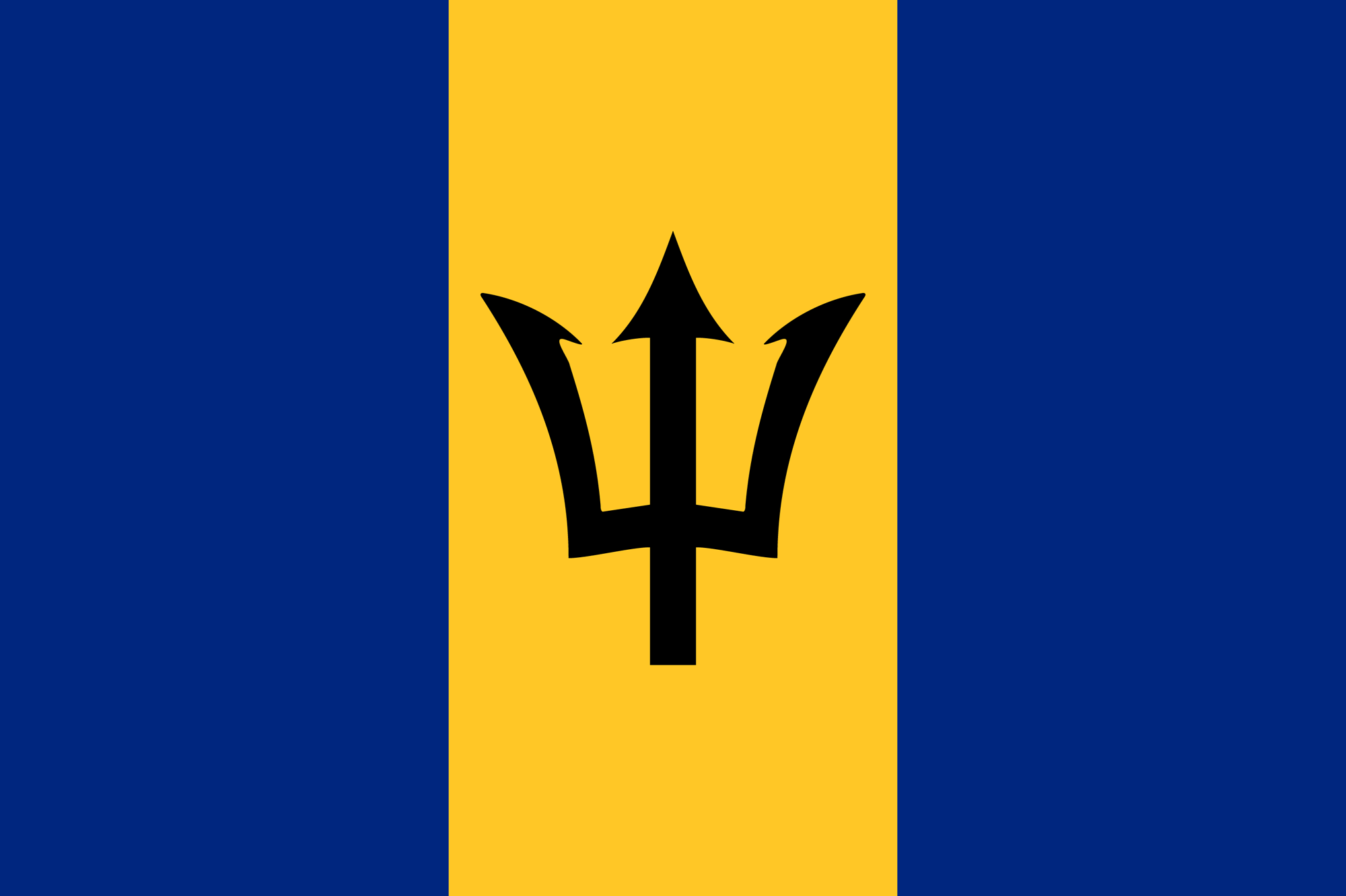
Barbados Flag

The flag of Barbados features Neptune’s Trident at its centre.

The British ran the island as a plantation. Most of the population today are descendant from the slaves who were brought to the island from Africa to work on the plantations.

Violet Chattel House, Barbados.

A violet ‘Chattel’ house, a uniquely Barbadian word for a small move-able wooden house.

One of the legacies from the slavery era is the Chattel house, these can still be found all over the island. They are small, collapsible wooden houses that can be transported easily and were used by the slaves who would often move between different plantations.
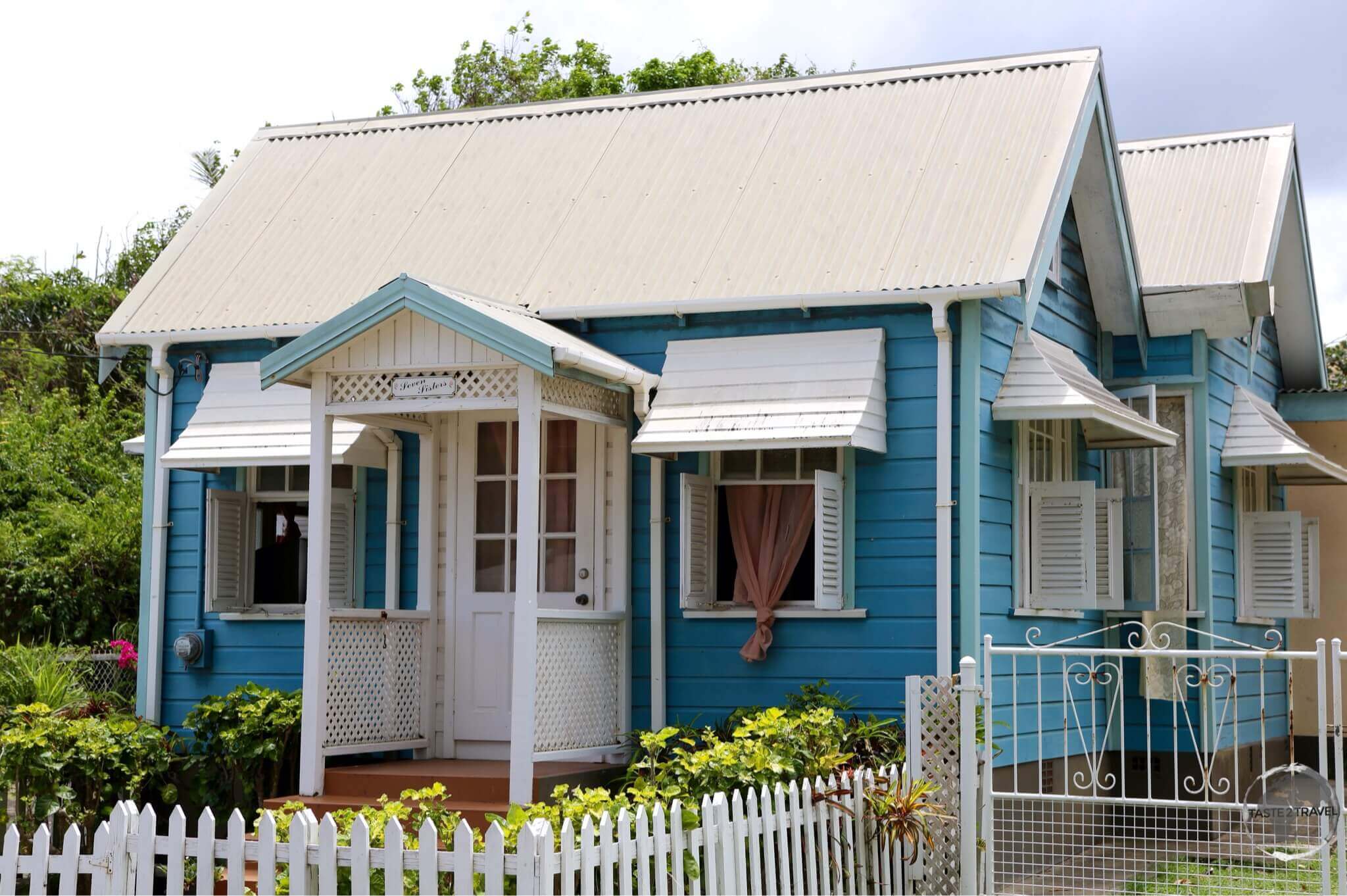
A typically cute Chattel House on Barbados.

A typically cute Chattel House on Barbados.

Barbados remained in British hands until independence in 1966. Due to its historical ties to the UK, Barbados today remains more ‘British’ than any other Caribbean island and is often referred to as ‘Little England’.

Pink Chattel House, Barbados.

This renovated pink Chattel house now serves as an artist’s studio near Bridgetown.

Sightseeing

Bridgetown

The coral-limestone clock tower of the Parliament Building, Bridgetown, Barbados.

The coral-limestone clock tower of the Parliament Building, Bridgetown, Barbados.

The capital and largest city (population: 110,000), Bridgetown is listed as a UNESCO World Heritage site. At the centre of this compact capital, the Parliament Building is the seat of the Parliament of Barbados. Built between 1870 and 1874, the buildings have been the meeting place for both chambers of Parliament since 16 June 1874, and a former site of Colonial administration of Barbados. It consists of two buildings in the neo-Gothic architectural style, and are reminiscent of the Victorian era of Great Britain.

Government Buildings, Bridgetown, Barbados.

Reflection shot of the coral-limestone government buildings in Bridgetown, Barbados.

The buildings are situated along the north bank of the Constitution River and are bordered by Upper Broad Street and National Heroes Square to the south; strategically at the heart of the capital city Bridgetown. Prior to the establishment of the buildings the legislature met at the Town Hall building on Coleridge Street.

Parliament Buildings, Bridgetown, Barbados.

The Bajan parliament building in Bridgetown is constructed from coral limestone rock.

Downtown you will find many fine coral-limestone buildings, one of which houses the Barbados museum. Bridgetown is a busy, bustling city but most sites and can be covered on foot in one day.

The best coffee in Bridgetown is available from the cafe on the 1st floor of the Cave Shepherd department store on Broad Street.

A gift shop on Barbados.

A gift shop on Barbados.

George Washington House

The George Washington House Museum, Barbados.

The George Washington House Museum, Barbados.

George Washington House in Barbados is a historic house where the future first U.S. President George Washington visited, in 1751. He was 19 years old at the time and travelling with his ailing half-brother, Lawrence Washington. Barbados was the only country Washington ever visited outside colonial America.

The House, which is now operated by the Barbados National Trust, provides a glimpse into the Barbados of 250 years ago. The museum cafe, Coffee Barbados Cafe, serves some of the best coffee and brunches on the island.

Funky Rastafarian hats for sale on Barbados.

Funky Rastafarian hats for sale on Barbados.

Barbados Museum and Historical Society

The Barbados Museum and Historical Society In Bridgetown.

The Barbados Museum and Historical Society In Bridgetown.

Established in 1933 in the old Military Prison at the historic Garrison, the Barbados Museum & Historical Society is a private museum which houses 500,000 artefacts which depict the islands rich history and natural history.

Displays range from Bajan fauna and flora, natural history and Amerindian artefacts from the original settlers of the Barbados.

Around the Island

An antique mileage indicator on Barbados.

An antique mileage indicator on Barbados.

Mount Gay Rum

Mount Gay rum selection, Barbados.

Mount Gay rum selection, Barbados.

Barbados is a rum lover’s paradise. Rum is an integral part of Barbadian culture and with 12,000 rum shops scattered across the island, you are never far from your next drink.

Barbados claims to be the birthplace of rum. It is the home of several brands, including Malibu.

Mount Gay XO Rum.

The deluxe, Mount Gay XO, too smooth to be used in a rum punch.

Established in 1703, the Mount Gay company has spent over 300 years perfecting rum. It is the oldest commercial rum distillery in the world. The rum is distilled in the north of the island but the visitor centre is on the northern outskirts of Bridgetown and is open to visitors Monday – Friday. The distillery offers a choice of a standard tour or you can join a cocktail making class, which is a lot of fun.

There’s a restaurant onsite offering lunch and of course, the rum never stops flowing. My favourite is the XO, which is nice and smooth and should be drunk neat – too good to be wasted in a rum punch. All details regarding visits are available on the Mount Gay website.

Harrison’s Cave

Barbados Travel Guide: One of the many vast underground caverns at the Harrison's cave complex.

One of the many vast underground caverns at the Harrison’s cave complex.

Located in the interior uplands in the parish of St. Thomas, Harrison’s cave is worth a visit. Barbados is a raised slab of limestone so there are numerous caves on the island but this is the most impressive. Unfortunately you are not able to walk through the cave. Visitors are instead shuttled around on solar-powered trams.

Animal Flower Cave

A view of the sea on the north coast of Barbados from inside the Animal Flower cave.

A view of the sea on the north coast of Barbados from inside the Animal Flower cave.

The Animal Flower cave is located in the cliffs at North Point at the northern tip of the island in St. Lucy’s parish. The cave is accessible via a series of coral steps, which descend through what use to be the blowhole.

A view of the north coast of Barbados from North Point.

A view of the north coast of Barbados from North Point.

‘Animal Flower’ is a local term for a sea anemone, which lives in the salt water pools in the cave. The cave looks out onto the sea but during high tide the cave is closed as waves come crashing in through the entrance.

Colourful ceramic houses for sale at a souvenir shop on Barbados.

Colourful ceramic houses for sale at a souvenir shop on Barbados.

Concorde Experience

Concorde experience

Concorde experience

Parked in a custom-made hangar just off the runway at Grantley Adams International airport is Concorde G-BOAE, which used to fly weekly from London to Barbados until 2003. When BA ended the Concorde program this one was donated to Barbados.

The British Airways Concorde which is open to visitors at the Barbados Concorde Experience.

The British Airways Concorde which is open to visitors at the Barbados Concorde Experience.

A visit to the museum includes a guided tour inside the plane – the only chance for mere mortals to view the interior of the Concorde and to sit in one of its seats – and dream.

Sunbury Plantation House

The historic Sunbury Plantation House, Barbados.

The historic Sunbury Plantation House, Barbados.

Located in the parish of St. Philip, and dating from the 1600’s, Sunbury Plantation House is a renovated former ‘great’ house which, today, serves as a period museum, filled with majestic furniture and a bevy of antiques. In the late 1800’s, the Barbados Railway included a stop at Sunbury Plantation, one of four train stations in St.Philip parish

St. Andrews Parish Church

St. Andrew's Parish Church, Barbados.

St. Andrew’s Parish Church, Barbados.

Located on the east coast of Barbados, St. Andrew Parish is dominated by the historic St. Andrew’s Parish Church. The original church was established circa 1630, but was destroyed by a hurricane in 1831 – the current church dates from 1846.

Morgan Lewis Windmill

The Morgan Lewis windmill is the oldest windmill on Barbados.

The Morgan Lewis windmill is the oldest windmill on Barbados.

Located in the parish of St. Andrew, the Morgan Lewis windmill has the distinction of being one of just two working sugar windmills in the world today. The mill stopped operating in 1947 and, in 1962, was gifted to the Barbados National Trust for preservation as a museum.

Codrington College

Codrington College, Barbados.

Codrington College, Barbados.

Located on a hill in the parish of St. John, overlooking the Atlantic ocean, Codrington College offers one of the most spectacular views of the East Coast of Barbados. One of the oldest colleges in the Caribbean, Codrington College was founded with the profits from the bequest of Christopher Codrington, the former owner of Codrington Plantations, after his death in 1710.

Barbados Travel Guide: Water Lily at Codrington College, Barbados.

Water Lily at Codrington College, Barbados.

The setting of Codrington College is especially beautiful with a large garden, magnificent lily pond and a driveway lined with palm trees.

East Coast

Bathsheba Beach, Barbados.

Bathsheba Beach is a typical east coast beach on Barbados.

Beaches on the east coast of Barbados are exposed to the rough Atlantic Ocean and are not as ideal for swimming. It is much quieter on this coast with most people swimming on the calmer leeward side of the island.

Andromeda Gardens

The alluring Jade Vine Flower at the Andromeda Gardens, Barbados.

The alluring Jade Vine Flower at the Andromeda Gardens, Barbados.

Located in the parish of St Joseph, a short drive from Bathsheba Beach, the Andromeda Gardens started life as a private plant collection around the home of Iris Bannochie, a leading horticulturalist.

The garden today, which is operated by the Barbados National Trust, is considered the most attractive gardens on the island. Named after the Greek mythological figure of Andromeda, one of the highlights of the garden is the trellis covered with the very unique Jade Vine Flower.

Barbados Beaches

Typical west coast beach

Typical west coast beach

Barbados has more than 110 km of beaches and being a huge slab of limestone, the beaches are often white powdery sand (from crushed coral) with turquoise waters.

The beaches on the west coast are amazing and it’s here you’ll find most of the hotels and tourist infrastructure. Wherever you are on the west coast the view is of a quintessential Caribbean beach.

Sunset on the west coast of Barbados.

Sunset on the west coast of Barbados.

Accommodation

There is a range of accommodation options for all budgets on the island from deluxe resorts to hostels.

High season prices apply from mid-December to mid-April.

I stayed in two different hotels on the island:

Barbados is a busy island so best to book ahead using an online agent such as booking.com

Eating Out

Like other Anglo-Caribbean islands, Bajan cuisine contains English, Indian and African influence, which has been fused with the local seafood and produce.

In downtown Bridgetown there are many restaurants offering lunch specials to the local office workers. Here you can sample local specialities at local prices.

Visa Requirements

Some nationalities require visas for Barbados – check your visa requirements prior to arrival.

Getting There

By Air

All flights arrive at Grantley Adams International Airport, which is located 13 km south of Bridgetown in the parish of Christ Church.

The airport has direct service to destinations in the Caribbean, United States, Canada, Central America, South America and Europe.

It also serves as the second hub for LIAT (hopefully you are not subjected to the terrible service of this Caribbean monopoly airline too often).

By Sea

There are no scheduled ferry services connecting Barbados to any other island. The only way to arrive by sea is by private yacht or cruise ship.

Getting Around

Public transport on Barbados is excellent. Frequent buses connect most places of interest. You can check routes on the Barbados transport board website

Hiring a car will allow you to explore the more remote parts of the island. The island can be covered in 2-3 days.

Safe Travels!

Darren


Follow me on Instagram: 

[instagram-feed feed=1]


Further Reading

Other travel reports from the Caribbean region include:


Barbados Travel Guide Barbados Travel Guide Barbados Travel Guide Barbados Travel Guide Barbados Travel Guide

Trinidad & Tobago Travel Guide

White-necked Jacobin hummingbird at Asa Wright nature centre.

Trinidad & Tobago Travel Guide

Welcome to the taste2travel Trinidad & Tobago Travel Guide!

Date Visited: March 2015

Introduction

Trinidad and Tobago (TT) is a two-island country offering the visitor two very different destinations in one and, due to the diversity of its fauna, flora and people, one of the more interesting destinations in the Caribbean.

Trinidad is a peculiar Caribbean destination due to the fact that historically, it formed part of the South American mainland. Because of this the fauna and flora on Trinidad is similar to that of Venezuela and the Amazon and hence unique for a Caribbean island. Here you will find Howler and Capuchin monkeys, ocelots, Scarlet Ibis, Tree boas and so much more. A trip into the mangroves of the Caroni Bird sanctuary feels much more ‘Amazonian’ then ‘Caribbean’.

Both Trinidad and Tobago are two delightful islands and well worth exploring.

Location

Trinidad and Tobago

Trinidad and Tobago

Trinidad has more in common with the South American continent than its neighbouring Caribbean islands. At its closest point Trinidad is located just 11-km off the coast of Venezuela and, as recently as 1,500 years ago, was part of the South American mainland.

The two islands are separated by 83 km (52 mi) of azure-blue, Caribbean sea, with Trinidad being more mountainous and forested while Tobago attracts the tourist hordes with its laid-back tempo and its idyllic beaches.

History

Trinidad & Tobago were two separate, independent territories until the British joined them as one administrative region in 1889.

Previously, Trinidad was a Spanish colony from the time Christopher Columbus landed in 1498 until a British invasion in 1797. Columbus named the island after he saw what appeared to him as a trinity of hills along the south-eastern coast.

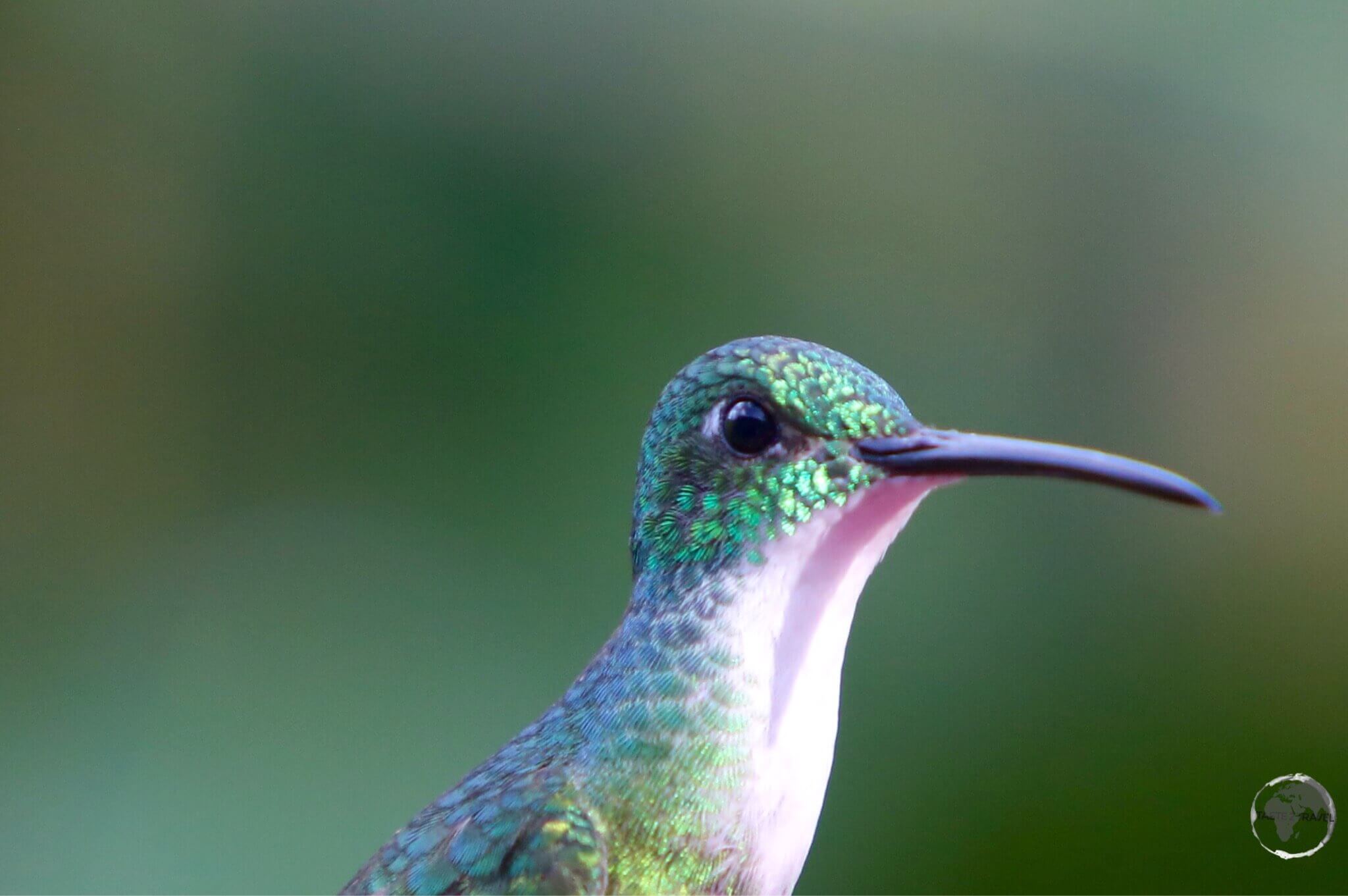
White-necked Jacobin hummingbird at Asa Wright nature centre.

White-necked Jacobin hummingbird at Asa Wright nature centre.

The British occupied Trinidad until independence in 1962. During this period slaves were imported from Africa to work on the many plantations. Once slavery ended indentured labourers from India were brought in to replace the freed slaves. Today the largest population group on Trinidad are the Indo-Trinidadians (37%), followed by the Afro-Trinidadians (36%). Making up the rest of the population are descendants of European settlers, Chinese, Arabs and more.

Trinidad is a veritable melting-pot and this is reflected in the rich and varied cuisine and culture. Carnival is the main cultural event – see ‘Carnival‘ below – and from this Calypso music developed. Today Soca music (mix of Calypso, dance / Indian music) is popular and can be heard throughout the English-speaking Caribbean.

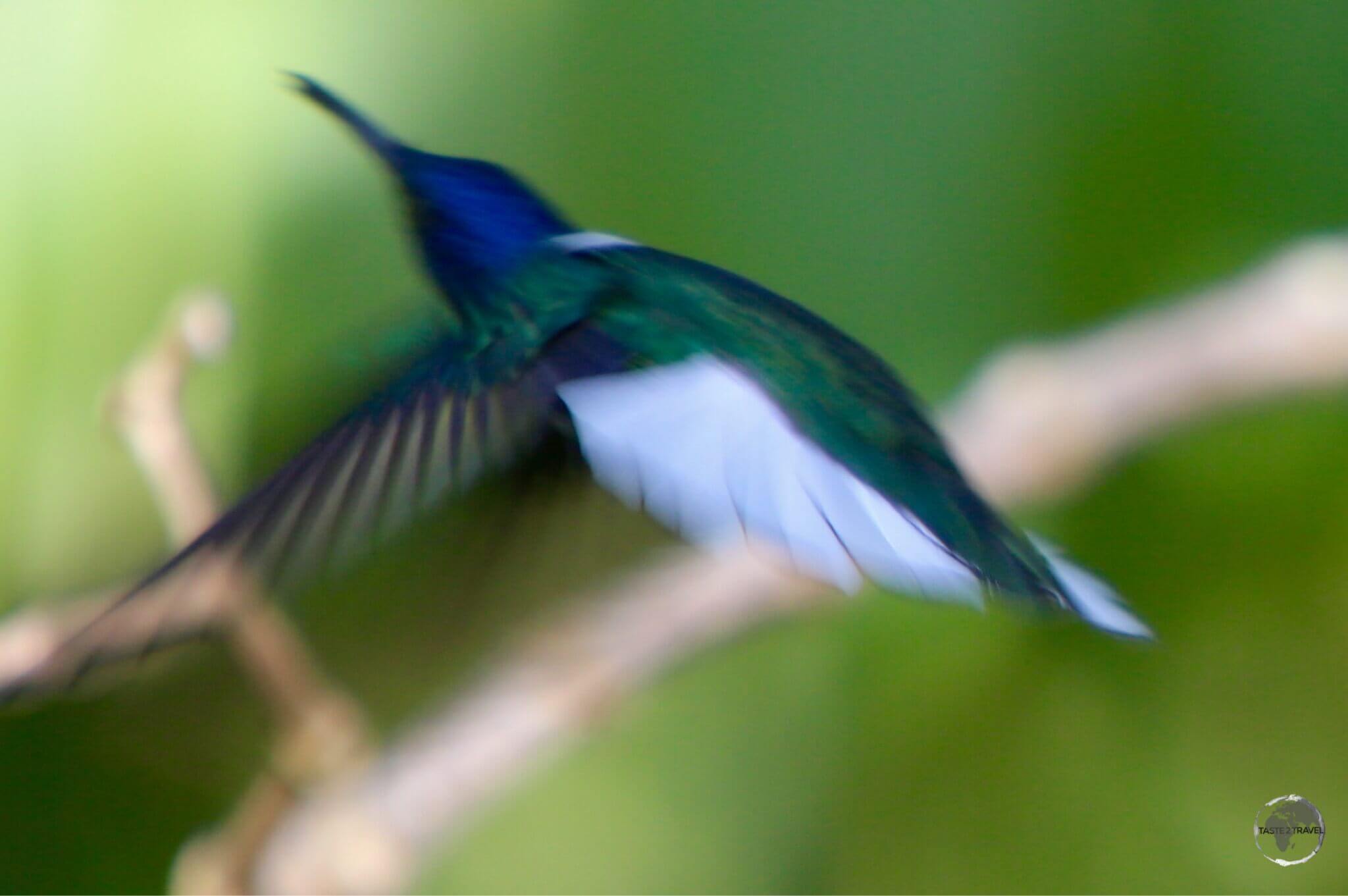
White-necked Jacobin hummingbird in flight at the Asa Wright nature centre.

White-necked Jacobin hummingbird in flight at the Asa Wright nature centre.

Over the centuries Tobago has been occupied by the Dutch, English, Spanish, Swedish and French. The island has changed hands no less than 33 times – more than any other Caribbean island. It was ceded to the British in 1814.

Under British rule the island was run as a plantation, producing sugar, indigo and cotton. Slaves were imported from Africa to work the plantations and today the majority of the population are descendants from those slaves.

The beach at Pigeon Point is one of the finest on the island of Tobago.

The beach at Pigeon Point is one of the finest on the island of Tobago.

Flag

Flag of Trinidad and Tobago.

Flag of Trinidad and Tobago.

The flag of Trinidad and Tobago, which was selected from a series of designs created by the Independence Committee in 1962, features a red field with a white-edged black diagonal band from the upper hoist side to the lower fly-side.

As per the designer, the colour black represents the dedication of the people joined together by one strong bond. It is the colour of strength, of unity of purpose, and of the wealth of the land.

Red represents the fire element. It is the colour most expressive of Trinidad & Tobago; the vitality of the land and its peoples; the warmth and energy of the sun, the courage and friendliness of the people.

White is the sea by which these lands are bound; the cradle of the nation’s heritage; the purity of aspirations and the equality of all men under the sun.

Currency

Currency of Trinidad and Tobago.

Currency of Trinidad and Tobago.

The official currency of T&T is the Trinidad and Tobago dollar (TT$), which trades under the international currency code of TTD.

Issued by the Central Bank of Trinidad & Tobago, bank notes are printed in denominations of $1, $5, $10, $20, $50 & $100. Both the $50 and $100 are polymer notes. You can view specimens of current bank notes on the Central Bank website.

The dollar is subdivided into 100 cents (¢), with coins issued in denominations of 5¢, 10¢, 25¢ and 50¢. You can view specimens of current coins on the Central Bank website.

The current exchange rate against the US dollar is US$1 = TT$6.77

To view the current exchange rate, please click here.

Sightseeing

Trinidad

Port of Spain

Sunset over Port-of-Spain.

Sunset over Port of Spain.

Originally the site of an Amerindian fishing village, the capital of TT – Port of Spain (POS) – was founded by Spanish settlers who established a port here: “Puerto de los Hispanioles”, later renamed to “Puerto de España”.  A Spanish garrison first established a presence here in 1560. The British invaded and claimed the country in 1797.

With a population of 600,000 (greater urban area), POS is the 2nd largest city in the English-speaking Caribbean – after Kingston, Jamaica.

POS is an important commercial and financial centre for the Caribbean region and home to its biggest stock exchange. You’ll meet many different Caribbean ex-pats working here. Its airport is an important hub in the Caribbean, its port one of the biggest.

The downtown area is compact and the few sites of interest can be seen on foot in a day. It’s worth starting your day with a walk around Queens Park Savannah. This is the green lung of the city, a huge park lined with historical buildings that are all architecturally different.

On one side of the park you will find the Royal Botanical gardens. These well tended gardens are a good place to see native plants and trees.

Due to the multi-racial population, there are a variety of churches and other places of worship to visit.

Downtown POS has a gritty, rough edge to it. You should exercise caution when walking around. Crime is an issue here. Always take taxis in the evenings.

Carnival

Each year on the Monday and Tuesday before Ash Wednesday (February) the city celebrates Carnival. It’s the biggest of its kind in the Caribbean and the most significant event on the islands’ cultural and tourism calendar.

Carnival was originally brought to Trinidad by French settlers from Martinique in the 18th century. Originally the celebration was for the ruling class, but it was imitated and adapted by their slaves and, after the abolition of slavery in 1838, the practice became wide-spread.

The main venue is Queens Park Savannah in downtown POS. Carnival was traditionally associated with calypso music (developed in TT); however, recently Soca music (also developed in TT) has replaced calypso as the music of choice.

Bitter(s) in Trinidad

Angostura Bitters - proudly made in Trinidad.<br /> <i>Source: http://angosturabitters.com/</i>

Angostura Bitters – proudly made in Trinidad.
Source: http://angosturabitters.com/

Famous the world over, Angostura bitters is a concentrated bitters, or botanically infused alcoholic mixture, made by the House of Angostura in POS.

The secret recipe was first formulated by a German doctor who was the Surgeon-General in Simon Bolivar’s army in Venezuela. It was first produced in the town of Angostura (Ciudad Bolívar, Venezuela). The company later relocated operations to POS.

Visits are possible but must be organised in advance by contacting the House of Angostura. Don’t even try asking them about their secret recipe.

La Brea Pitch Lake

The surface of the 75-metre deep La Brea Pitch Lake, the largest natural deposit of asphalt in the world.

The surface of the 75-metre deep La Brea Pitch Lake, the largest natural deposit of asphalt in the world.

An interesting anomaly on the south coast of Trinidad is La Brea Pitch lake, which has the distinction of being the largest natural deposit of asphalt in the world, estimated to contain 10 million tons.

The lake is what is known as a bitumen seep. It’s the result of a fault in the sandstone bedrock 75 metres below, which allows bitumen to seep to the surface. The lake covers about 40 hectares (100 acres) and is 75-m (250 feet) deep.

My guide demonstrating how easy it is to sink into the gooey asphalt Lake.

My guide demonstrating how easy it is to sink into the gooey asphalt Lake.

The surface of the lake looks like a car park and is firm enough that you can walk on it. You should only ever do this with a knowledgeable guide as there are many places where the surface is soft and gooey. If you stray into these areas you risk getting stuck and possibly sinking into the gooey depths.

Wandering tourists have died here!

For decades the pitch has been mined and exported for use on roofs and roads.

The very sticky, La Brea Pitch lake.

The very sticky, La Brea Pitch lake.

By car the lake can be reached on a day trip from Port of Spain. The road from POS to San Fernando is a fast dual-lane highway. South of San Fernando the one lane road is slow, windy and busy.

Lake guides will be waiting around in the nearby car park and will find you before you find them!

Caroni Bird Sanctuary

Due to the fact it was sleeping, I was almost able to reach out and touch this Tree Boa in Caroni Bird Sanctuary.

Due to the fact it was sleeping, I was almost able to reach out and touch this Tree Boa in Caroni Bird Sanctuary.

The Caroni Bird Sanctuary is located on the west coast of Trinidad, a short drive south of POS. The sanctuary is centred around the Caroni Swamp, which is an estuarine system of mangrove forest and marshes.

The Caroni Bird Sanctuary is famous for its huge numbers of the striking, but shy, Scarlet Ibis.

The Caroni Bird Sanctuary is famous for its huge numbers of the striking, but shy, Scarlet Ibis.

The sanctuary is home to the Scarlet Ibis – the national bird of Trinidad. The highlight of a visit is to witness thousands of these birds returning to their roosting site at sunset on one central island.

Each evening at sunset, thousands of Scarlet Ibis return to Caroni Bird Sanctuary to roost for the evening.

Each evening at sunset, thousands of Scarlet Ibis return to Caroni Bird Sanctuary to roost for the evening.

The mangrove swamps in the sanctuary are a rich source of food for the Scarlet Ibis.

Like flamingos, the Scarlet Ibis obtains its brilliant colour from pigments in its food, which includes the mangrove crab.

Like flamingos, the Scarlet Ibis obtains its brilliant colour from pigments in its food, which includes the mangrove crab.

You can visit the sanctuary on a tour from POS or you can drive or take a bus. The entrance to the sanctuary is just off the main highway between POS and San Fernando.

If you travel to the sanctuary independently you can join one of the many boats that depart from the sanctuary entrance at around 3:30pm each afternoon.

North Coast and Northern Range

White-necked Jacobin hummingbird at Asa Wright nature centre.

White-necked Jacobin hummingbird at Asa Wright nature centre.

If you have a car, a nice day trip from the capital is a circuitous route from Port of Spain to Maracas Bay on the north coast then onto the beautiful, isolated beach at Blanchisseuse. This is the end of the road along the north coast.

From here you turn south and cross the lush Northern Range, stopping at the Asa Wright nature centre before meeting the main highway at the town of Arima then heading back into Port of Spain.

A colourful male Violaceous Euphonia at the Asa Wright Nature Centre.

A colourful male Violaceous Euphonia at the Asa Wright Nature Centre.

Total driving time is about 4-hours but with stops along the way it will take you a full day.

North Coast

A view over the north coast of Trinidad from the Maracas lookout.

A view over the north coast of Trinidad from the Maracas lookout.

The drive from Port of Spain takes you first through the picturesque Maraval valley before eventually bringing you to the north coast. The coast road was built by US troops during WWII and hugs the Northern range high above the sea.

The best panoramic views are from Maracas lookout. On weekends Indian sweet sellers set up food stands here.

The road then descends into Maracas Bay, which is a popular swimming beach. If you want to try Shark and Bake (fried piece of flat-bread – bake – filled with pieces of fried shark) this is the place to do it.

Carib beer is one of the more popular beers in T&T and other Caribbean countries.

Carib beer is one of the more popular beers in T&T and other Caribbean countries.

Continuing until you reach the end of the coast road will bring you to the small village of Blanchisseuse. Here you’ll find a nice beach and a couple of waterfalls, which are popular swimming spots for locals on weekends. There are some beach-side restaurants here offering lunch.

Blanchisseuse Beach on the north coast of Trinidad.

Blanchisseuse Beach on the north coast of Trinidad.

From the coast you now head inland on the narrow, windy, mountainous road over the Northern Range. This is a beautiful drive through lush countryside. The locals advise to take extra caution when driving this road.

Asa Wright Nature Centre

A male White-necked Jacobin hummingbird at Asa Wright nature centre.

A male White-necked Jacobin hummingbird at Asa Wright nature centre.

On the other side of the range, as the road descends through the Arima valley, Asa Wright nature centre is a birdwatchers’ paradise. The original estate was purchased by Dr. Newcome Wright and his Icelandic wife Asa in 1947.

A female White-necked Jacobin hummingbird at Asa Wright nature centre.

A female White-necked Jacobin hummingbird at Asa Wright nature centre.

The original house has been preserved, and houses a dining hall, guest rooms and an open verandah for observing birds. There is a photo of Prince Charles and Camilla visiting the centre displayed in the hallway.

A male Purple Honey Creeper at Asa Wright nature reserve.

A male Purple Honey Creeper at Asa Wright nature reserve.

If you are not a guest you are able to visit the house and use the verandah for observation after paying an admission fee.

A Copper-rumped hummingbird at the Asa Wright nature reserve.

A Copper-rumped hummingbird at the Asa Wright nature reserve.

Tobago

Named for the tobacco plant that the Carib Indians used to harvest,  Tobago is an autonomous island within the Republic of Trinidad and Tobago. It is located 32-km northeast of Trinidad, but is a world away from the bustling ‘mainland’.

The island is known for its laid-back tempo, it’s many fine beaches, rain-forest, excellent snorkeling and diving and so is a popular tourist destination. The island relies more on the tourist dollar than Trinidad does.

Tobago has a population of 62,000, its capital and largest city is Scarborough (pop: 25,000).

The island is 40-km long and 10-km wide. There is almost no public transport on the island so you will need a hire car if you wish to explore – see the ‘Getting Around‘ section below for more details.

The roads on the island are asphalt but are narrow, windy and single lane, hugging the coastline most of the time. Driving conditions require that you slow down and take your time. It is a beautiful island with many spectacular views. A complete circuit could be done in one rushed day but two or three is better.

The island is connected to Trinidad by regular fast ferry services and frequent air shuttles – see the ‘Getting There’ section below for more details.

A view over the mountainous north coast of Tobago.

A view over the mountainous north coast of Tobago.

I stayed in the town of Speyside, which is on the quiet, remote north coast. If you wish to snorkel or dive, this is the place to be, but you’ll need your own transport here.

Most tourist infrastructure (hotels, resorts, restaurants, bars etc) is concentrated in the southwest corner of the island around Pigeon Point, Crown Point and Store bay. This area is walking distance from the airport. If you want to be close to sandy beaches, nightlife etc – this is the place to be.

Trinidad & Tobago Travel Guide: Sunset from Pigeon Point beach, Tobago.

Sunset from Pigeon Point beach, Tobago.

 Accommodation

There are a range of accommodation options on Trinidad and Tobago. High season prices apply from January to May.

Unlike other Caribbean destinations, hotels in POS rely less on tourists and more on the business traveler. Accommodation is usually more reasonably priced, with bigger chain hotels offering bargains during the weekends. I stayed on the cheap at the Hilton.

Accommodation on Tobago caters for all budgets and is geared to the holiday maker. I stayed in an apartment in Speyside and self-catered. Be prepared for ‘sticker-shock’ when looking at resort / hotel prices.

Best to book in advance using an online agent such as booking.com

Eating Out

Trinidad & Tobago Travel Guide: Fish market at Speyside, Tobago.

Fish market at Speyside, Tobago.

Like other Anglo-Caribbean countries, the cuisine of Trinidad and Tobago has been influenced by its diverse multicultural, multiracial population. It is a unique blend of African, Indian, Chinese, European and Latin American influences. Curry and roti can be found everywhere as can Chinese.

The fishing industry is key on Tobago so you will find lots of fresh seafood on the menu there.

Visa Requirements

Some nationalities require visas for Trinidad & Tobago – check your visa requirements prior to arrival.

For some nationalities (e.g. Australians), you can purchase your visa upon arrival.

Getting There

By Air

Trinidad

Flights into Trinidad arrive at Piarco International Airport. The airport is located in the town of Piarco, 30-km east POS.

The airport is the main hub for the national carrier, Caribbean Airlines.

The following airlines provide international connections to / from:

  • American Airlines – Miami
  • British Airways – London (Gatwick)
  • Caribbean Airlines – Antigua, Barbados, Caracas, Fort Lauderdale, Georgetown, Grenada, Kingston, Miami, Nassau, New York (JFK), Orlando, Paramaribo, St. Lucia, St. Maarten, Tobago, Toronto
  • Copa Airlines – Panama City
  • Insel Air – Curaçao
  • JetBlue Airways – Fort Lauderdale, New York (JFK)
  • LIAT – Antigua, Barbados, Georgetown (Ogle), Grenada, St. Lucia, St. Vincent
  • Surinam Airways – Curaçao, Paramaribo
  • United Airlines – Houston (Intercontinental), Newark
  • WestJet – Toronto

Tobago

Flights into Tobago arrive at A.N.R. Robinson International Airport.

The following airlines provide international connections to/ from:

  • British Airways – London (via Antigua)
  • Virgin Atlantic – London (via St. Lucia)
  • Condor – Frankfurt
  • Gol – São Paulo
  • American Airlines and Caribbean Airlines – New York (JFK)

Trinidad ⬅️➡️ Tobago

Caribbean Airlines operates an air bridge between Trinidad and Tobago. There are about 20 daily flights, with the first leaving Trinidad at 6 am.

By Sea

Trinidad ⬅️➡️ Venezuela

Scheduled ferry services between Trinidad (POS) and Venezuela (Guiria) are currently suspended.

For those independent adventurers, there are other options if you are determined to make the short crossing. One detailed account is outlined here.

Trinidad ⬅️➡️ Tobago

The Trinidad & Tobago Inter-Island Ferry Service operates two fast ferries, which complete the 32 km crossing from POS to Scarborough in 2 and a half hours. There are multiple sailings 7-days a week. All details are available on their website.

Getting Around

Trinidad

Public transport on Trinidad is better than Tobago due to its larger population.

You have a choice of buses, maxi taxis (shared mini buses), taxis or ferries (e.g. POS – San Fernando).

Hiring a taxi in POS will cost you around USD$15 flat fare anywhere downtown.

The best option for exploring the island is to hire a car. You should book in advance as demand often outstrips supply. The island can be covered in 4-5 days.

Tobago

Public transport on Tobago is very limited – you will see most locals trying to hitch rides.

The best option for exploring the island is to hire a car. You should book in advance to avoid disappointment. The island can be covered in a day if you rushed around but at a more leisurely pace would require a few days.


Safe Travels!

Darren


Follow me on Instagram: 

[instagram-feed feed=1]


Further Reading

Other travel reports from the Caribbean region include:

Trinidad & Tobago Travel Guide Trinidad & Tobago Travel Guide Trinidad & Tobago Travel Guide Trinidad & Tobago Travel Guide Trinidad & Tobago Travel Guide Trinidad & Tobago Travel Guide Trinidad & Tobago Travel Guide
Bonaire Travel Guide

A Caribbean Flamingo on Lake Gotomeer, Bonaire.

Bonaire Travel Guide

Welcome to the taste2travel Bonaire Travel Guide!

Date Visited: March 2015

Introduction

When your plane pulls up outside the small terminal building of Bonaire’s Flamingo International Airport (painted Flamingo pink) you’ll know you’ve landed somewhere special.

Dutch-style buildings in downtown Kralendijk, the capital of Bonaire.

Dutch-style buildings in downtown Kralendijk, the capital of Bonaire.

Located at the eastern end of the ‘ABC‘ (Aruba, Curaçao and Bonaire) island chain, Bonaire prides itself on being an environmentalists’ paradise.

The island has focused on preserving its nature beauty, with an emphasis on its stunning marine environment, and has over the years taken steps to accomplish this.

All the waters surrounding the island are 100% protected, which means this is a diver & snorkeler’s paradise!

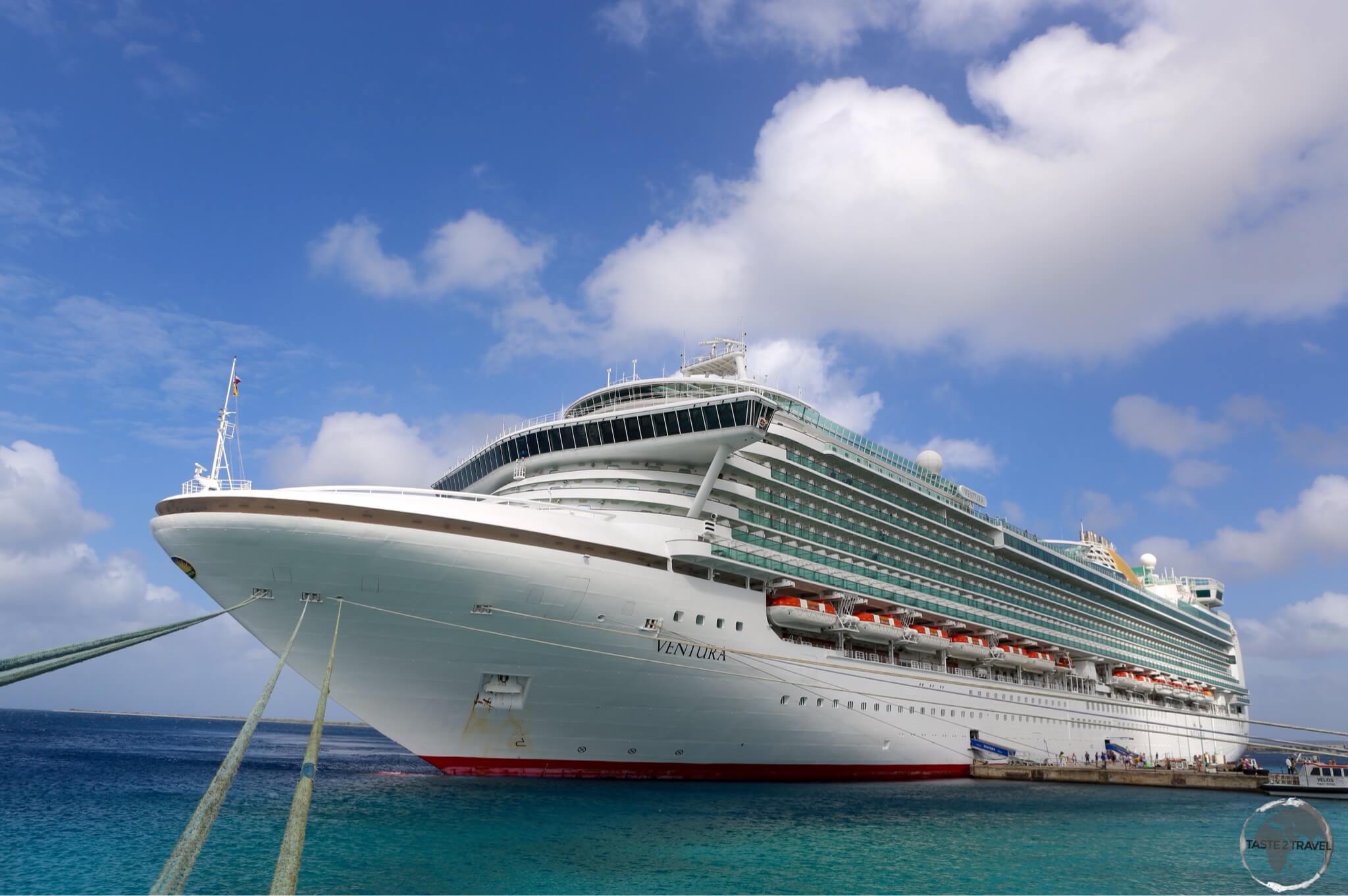
Visiting cruise ships are forced to employ long ropes in order to tie up to the wharf rather than dropping anchor and damaging the pristine reef which runs along the entire west coast of the island.

Cruise ships at Bonaire are tied to the shore as they are not allowed to drop anchor on the protected reef.

Cruise ships at Bonaire are tied to the shore as they are not allowed to drop anchor on the protected reef.

There are 63 dive sites on Bonaire itself with an additional 26 on Klein Bonaire. Thanks to its constant trade winds, the island is also a popular destination for wind-surfing and kite-surfing, with most of the action taking place on the south-west coast.

Bonaire Flag

The flag of Bonaire.

Even if you’re not a diver or windsurfer, Bonaire offers other attractions, such as Flamingo watching by the shores or Lake Gotomeer and sipping vodka produced from a cactus!

Location

The island lies 48-km east of Curaçao and 140-km east of Aruba. It is the smallest of the ABC islands in terms of population (16,500) and 2nd smallest in terms of area (38-km long, 8-km wide).

However, what the island lacks in size it makes up for in charm and soul. Bonaire is enchanting. A large number of visitors to the island are return visitors. It is also outside of the Caribbean hurricane belt.

A Caribbean Flamingo on Lake Gotomeer, Bonaire.

A Caribbean Flamingo on Lake Gotomeer.

History

The name Bonaire is thought to have originally come from the native Indian Caiquetio word ‘Bonay’, a name that meant low country. The early Spanish and Dutch modified its spelling to Bojnaj and also Bonaire.

An antique promotional poster for Bonaire.

An antique promotional poster for Bonaire.

While Curaçao emerged as a centre of the slave trade, Bonaire became a plantation of the Dutch West India Company. A small number of African slaves were put to work cultivating dye-wood and maize and harvesting solar salt – see ‘Salt Mining’ below.

Slave Huts, Bonaire.

Dating from 1850, these slave huts served as camping facilities for slaves working in the salt ponds on the south coast of Bonaire.

Bonaire is one of three islands that constitute the Caribbean Netherlands, along with Saba and Sint Eustatius (click on the links to read my guides to these islands). They are the three special municipalities of the Netherlands that are located in the Caribbean Sea.

A perfect east coast sunset on Bonaire.

A perfect east coast sunset on Bonaire.

Today tourism is the main industry, this island of 16,500 receives over 100,000 tourists a year. Most come as day-trippers on cruise ships, others come to dive in the Bonaire Marine Park. The largest group of visitors are Dutch and American.

A P&O cruise ship docked at Kralendijk.

A P&O cruise ship docked at Kralendijk. Bonaire has a total population of 20,000 while some large cruise ships bring 5,000 passengers to the island.

Sightseeing

Kralendijk

Bonaire Travel Guide: Dutch-style buildings in downtown Kralendijk, the capital of Bonaire.

Dutch-style buildings in downtown Kralendijk, the capital of Bonaire.

Kralendijk is the capital and largest city (population: 3000) of Bonaire. When a 5000-passenger cruise ship is in port this small town is overwhelmed.

The town developed around Fort Oranje, originally under the English as the settlement of “Playa”. The town was renamed “Kralendijk” by the Dutch colonial rulers in about 1840.

The flag of Bonaire, flying in downtown Kralendijk.

The flag of Bonaire, flying in downtown Kralendijk.

The language spoken in the town is Papiamentu (a creole language indigenous to the Dutch Antilles) but Dutch and English are widely used. In Dutch, Koralendijk (of which the name Kralendijk is a degeneration) means “coral reef” or “coral dike”.

Exploring the south coast of tiny Bonaire, including Willemstoren Lighthouse, in my rental car.

Exploring the south coast of tiny Bonaire, including Willemstoren Lighthouse, in my rental car.

There’s not much going on in this small town. The tourist information office has a walking tour brochure, which covers all of the sites of interest. You could see everything in half a day.

For the best coffee (and ice cream) in town, I recommend Gio’s Gelateria and Caffe, located on the main street – Kaya Grandi.

The Dutch-style town hall in Kralendijk.

The Dutch-style town hall in Kralendijk.

Whenever cruise ships are in town there is a market held on the Wilhelmina square. The BBQ sold here makes for a tasty lunch.

Off the coast of Kralendijk lies the uninhabited island of Klein Bonaire, a diving and snorkeling paradise. This small island can be reached by water taxi, or, for divers, by the local dive operators.

Flamingos

Caribbean Flamingos on Lake Gotomeer, Bonaire.

Caribbean Flamingos on Lake Gotomeer, Bonaire.

Bonaire is famed for its flamingos. They are drawn to the brackish water of the island’s lagoons, which harbour the shrimp upon which they feed. You can see flamingo populations at the northern and southern ends of the island.

The best viewing is at lake Gotomeer, either at sunrise or sunset.

Bonaire Travel Guide: A Caribbean Flamingo on Lake Gotomeer, Bonaire.

A Caribbean Flamingo on Lake Gotomeer, Bonaire.

The Pekelmeer Flamingo Sanctuary (southern end of the island) is one of only four areas in the world where flamingos breed. Pekelmeer means “salt lake” in Dutch.

Entry is not allowed in the sanctuary, but the birds can be watched with binoculars from the road.

A Caribbean Flamingo filter-feeding on Lake Gotomeer, Bonaire.

A Caribbean Flamingo filter-feeding on Lake Gotomeer, Bonaire.

Cactus Vodka

If you are passing through the town of Rincon, you should stop in at the Cadushy distillery.

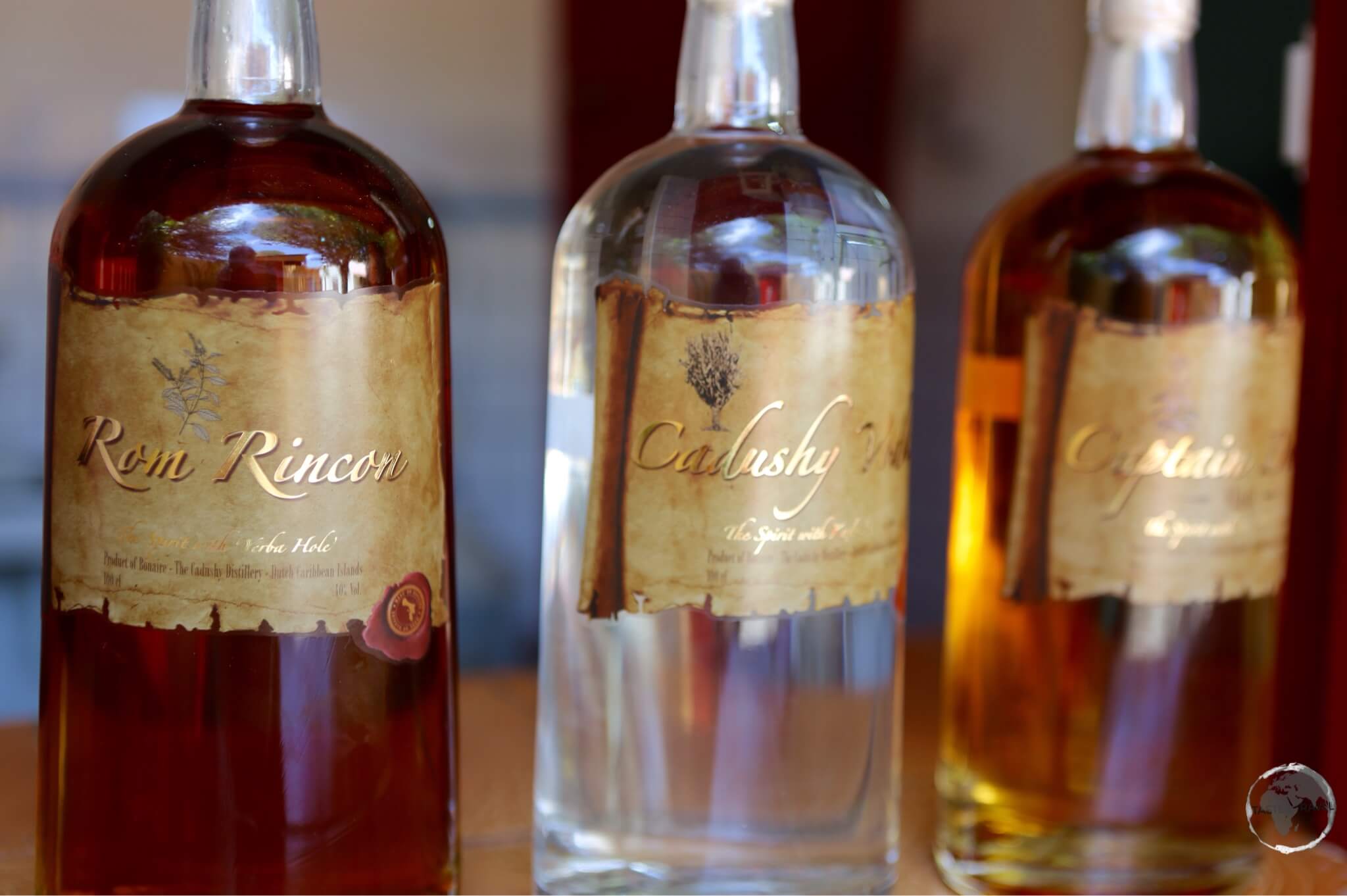
Cactus vodka from the Cadushy distillery.

Cactus vodka from the Cadushy distillery.

A variety of products are made here including the only vodka in the world to be made from a cactus – the Kadushi Cactus.

image

The Kadushi cactus – the key ingredient for Cadushy vodka.

Bonaire Beaches

Most of the coastline of Bonaire is rocky with a reef running along the entire shoreline, not an island for a beach vacation.

Most of the coastline of Bonaire is rocky with a reef running along the entire shoreline, not an island for a beach vacation.

For beach lovers, there are a choice of 22 beaches which offer small strips of sand ranging from soft to larger, coarser grains. The island is primarily a diving destination but a beach holiday is also possible. While on the beach, you should keep an eye out for the curious and not-too-shy Green Iguana which was introduced to the island in colonial times.

Introduced to the island, the Green Iguana is a common sight on Bonaire and is featured in local cuisine.

Introduced to the island, the Green Iguana is a common sight on Bonaire and is featured in local cuisine.

The focus on the environment on Bonaire ensures pristine waters full of coral, fish and sea life. Bonaire is a “Green Destination”, with the best beaches found on the protected, leeward side of the island (i.e. the west coast).

Diving and Snorkelling

Bonaire Travel Guide: A reef runs along the entire Leeward coast, making Bonaire a diver's paradise.

A reef runs along the entire Leeward coast, making Bonaire a diver’s paradise.

Bonaire is known for having some of the best diving in the world! This is the reason most people come to Bonaire…

Bonaire is essentially a coral reef that has been geologically pushed up and out of the sea. This has resulted in the natural fringing reef system you see today, in which the coral formations start at the shoreline. At any point along the coast you can step into the water and start snorkeling or diving. Just beyond the shoreline is a drop-off.

Bonaire markets itself as a divers paradise!

The Bonaire license plate - 'Divers Paradise'.

The Bonaire license plate – ‘Divers Paradise’.

The entire coastline of the island was designated a marine sanctuary in 1979 in an effort to preserve and protect the delicate coral reef and the marine life that depends on it.

If you are diving on the island you will be required to purchase the Bonaire Marine Park tag for US$25.00. The tag is valid for one year. SCUBA divers are obliged to display the dive tag on their BCD.

Dive operators can be found along the coast, especially north of Kralendijk.

Salt Mining

The purple briny water of a salt-water pond contrasts against the mounds of white salt at the Cargill Salt Mine.

The purple briny water of a salt-water pond contrasts against the mounds of white salt at the Cargill Salt Mine.

If you drive south on the island, you will see a series of white hills looming on the horizon. This is the Bonaire salt mine, which is today operated by the American company Cargill.

Salt mining has always been an important industry on the island. Fort Oranje was built by the Dutch in 1639 to defend the harbour, from which the main export was salt. The capital then developed around the fort.

The salt heaps at the Cargill Salt Mine look like snow covered mountains.

The salt heaps at the Cargill Salt Mine look like snow covered mountains.

During the era of slavery, the Dutch West India Company used African slaves to harvest salt. Salt was one commodity that Bonaire had in endless supply, although it took back breaking slave labour to produce it. In the early days of the industry, the most important use for salt was in the preservation of food, since refrigeration was still centuries away.

At this ‘solar salt mine’ seawater is pumped into evaporation ponds where the water is evaporated through the action of the sun and wind. As the water becomes more briny the level of algae increases and this results in the vivid pink colour. Once all the water has evaporated the remaining salt crystals can be harvested.

Salt piles at the Cargill salt mine, Bonaire.

Salt piles at the Cargill salt mine, Bonaire.

Most of the salt produced here is for industrial use, you will not find shops on the island selling cute souvenir packets of locally produced salt for you to use in your cooking.

Accommodation

Bonaire offers a range of accommodation options, especially dive resorts. Many hotels are located on the coast and allow guests direct access to the reef. High season prices apply from December to April. With limited options on the island, it’s best to book ahead using an online agent such as booking.com

I stayed on the coast, just south of the airport, at Bellefonte Oceanfront Hotel. The hotel has a wooden jetty, which provides direct access to the reef. 

Eating Out

There are restaurants catering for all budgets scattered around the island, especially in Kralendijk.

The best supermarket on the island is Van Den Tweel, located at 39 Kaya Industria, Kralendijk.

Visa Requirements

Some nationalities require visas for Bonaire – check your visa requirements prior to arrival.

Getting There

By Air

Flights into Bonaire arrive at Flamingo International Airport. Previously, Insel Air provided most connections between its hub at Curaçao airport and Bonaire, however, since its demise, other carriers have taken up the slack. The airport serves as a hub for Divi Divi Air and EZAir.

The following airlines provide services to/ from Flamingo International Airport:

Airport Transport

From the airport, taxis are available. There is no public transport on the island, your best option is to hire a car from the airport.

By Sea

There are no scheduled ferry services connecting Bonaire to any other island. The only way to arrive by sea is by private yacht or cruise ship.

The current Cruise Ship schedule is available here.

Getting Around

Rental car on Bonaire.

My rental car on the west coast of Bonaire.

There is no public transport on the island. You either hire a car, take a taxi or walk. The best option for exploring the island is to hire a car. You should book in advance as demand sometimes outstrips supply. The island can be circumnavigated in just a few hours or in one day at a more relaxed pace.

Visiting the Slave Huts in my rental car.

Visiting the Slave Huts in my rental car.


Follow me on Instagram: 

[instagram-feed feed=1]


Further Reading

Other travel reports from the Caribbean region include:


Bonaire Travel Guide Bonaire Travel Guide Bonaire Travel Guide Bonaire Travel Guide Bonaire Travel Guide

Curaçao Travel Guide

Penha House and the colourful Handelskade line the waterfront in downtown Willemstad.

Curaçao Travel Guide

Welcome to the taste2travel Curaçao Travel Guide!

Date Visited: March 2015

Introduction

Curaçao lies just to the north of the coast of Venezuela, east of Aruba and west of Bonaire and is one of the three ‘ABC’ islands (Aruba, Bonaire & Curaçao), which are all former Dutch colonies and are now part of the Dutch Caribbean.

Old Town of Willemstad, Curaçao.

Old Town of Willemstad, Curaçao.

Location

Curaçao forms part of the southwestern arc of the Lesser Antilles island chain and is located just 60 km (37 mi) north of the South American mainland and Venezuela (click the link to view my Venezuela Travel Report).

Aruba lies 113 km (70 mi) to the west, while Bonaire lies 82 km (51 mi) to the east.

A colourful map of Curaçao adorns a souvenir beach towel.

A colourful map of Curaçao adorns a souvenir beach towel.

History

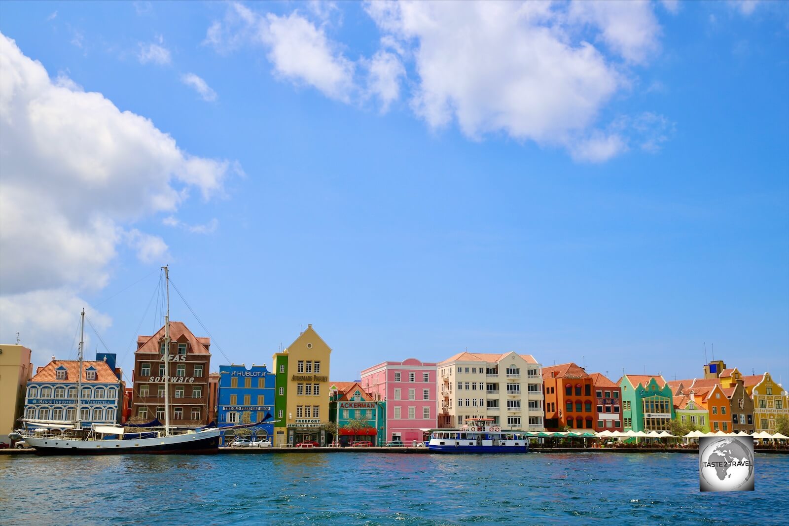
Colourful Dutch-style buildings line the iconic Handelskade in Willemstad, the capital of Curaçao.

Colourful Dutch-style buildings line the iconic Handelskade in Willemstad, the capital of Curaçao.

The island was originally inhabited by Arawak Indians until the Spanish arrived in 1499 and enslaved them. The Dutch then took control of the island in 1634.

The Dutch East Indies Company founded the capital, Willemstad. The island had always been ignored because it lacked gold deposits but the natural harbour at Willemstad was ideal for trade.

Curaçao Flag.

The flag of Curaçao.

Commerce, shipping and piracy became the most important activities on the island and the island became a centre of the slave trade in the Caribbean. When slavery was abolished, many former slaves remained on the island and today Curaçao is the only one of the ABC islands with a substantial Afro population.

Sunset at Jan Thiel beach, which lies on the south coast of Curacao.

Sunset at Jan Thiel beach, which lies on the south coast of Curacao.

Curaçao is the largest and most populated (150,000) of the ABC islands. Public transport is available but limited. The best way to explore is to hire a car. I spent five days touring the island but you could cover all the sites in 2-3 days at a relaxed pace.

While Aruba attracts mainly American tourists, Curaçao attracts mainly Dutch tourists, who account for 32% of arrivals.

The Melocactus is a cactus species common to Curaçao.

The Melocactus is a cactus species common to Curaçao.

Curaçao Liqueur

image

The name “Curaçao” has become associated with a shade of blue, because of the deep-blue version of the liqueur named Curaçao.

Curaçao’s most popular alcoholic beverage was discovered by accident when the Spanish Valencia orange was brought to the island, but unable to flourish in the climate. Instead, a bitter-tasting orange – the Lahara – was spawned.

The genuine Curaçao liqueur is made of the peels of the Laraha. It is produced in 5 different colours, the original clear liqueur, the famous Blue, Green, Red and Orange.

The Laraha plantation is on the east side of the island and has just 45 trees. Each tree produces on average 150 to 200 fruits and are harvested twice a year.

Free factory visits are available at Landhuis Chobolobo in Willemstad from Monday to Friday.

Sightseeing

Willemstad

A view of the colourful Handelskade, Willemstad.

A view of the colourful Handelskade, Willemstad.

Formerly the capital of the Netherlands Antilles (dissolved in 2010), the capital and largest city of Curaçao (population: 125,000), Willemstad is located on a deep natural harbour.

Many Dutch colonists grew affluent from the slave trade, and the city built impressive colonial buildings. Curaçao architecture blends Dutch and Spanish colonial styles. The wide range of historic buildings in and around Willemstad has resulted in the capital being designated as a UNESCO World Heritage Site.

The iconic, Dutch-style, Penha House dominates the Handelskade in downtown Willemstad.

The iconic, Dutch-style, Penha House dominates the Handelskade in downtown Willemstad.

The historic city centre is small and compact and can be explored easily on foot in a day. The downtown area consists of two districts: Otrobanda, the cultural centre of the city and Punda, they are separated by the St. Anna bay inlet. Willemstad is build around a natural harbour called the ‘Schottegat’.

The St. Anna bay inlet is bridged by the Queen Emma Pontoon bridge. This floating bridge pivots open to allow small and large (container ships) to pass through into the harbour. This is a great place for photography.

The Dutch-style Penha House stands out like a yellow beacon on the colourful Handelskade in downtown Willemstad.

The Dutch-style Penha House stands out like a yellow beacon on the colourful Handelskade in downtown Willemstad.

In Punda you will find the colourful Handelskade, Amsterdam Fort, the main shopping area, the old food market (Plaz Bien), the oldest surviving (sand floor) synagogue in the Caribbean and the floating market, where boats come over from Venezuela to sell their produce. It’s all very lively and vibrant and worth the majority of your time in the city.

Display at the Kurá Hulanda Museum in Willemstad.

Display at the Kurá Hulanda Museum in Willemstad.

The highlight of Otrabanda (English: Other side) is the Kurá Hulanda Museum aka “Slave Museum”. The museum chronicles the origin of man, the African slave trade and West African empires. It is situated on the site of a former slave yard and merchant’s home.

Curaçao Beaches

The protected waters of Playa Lagun are popular with families and provide excellent snorkelling.

The protected waters of Playa Lagoon are popular with families and provide excellent snorkelling.

Like Aruba, the best swimming beaches are located on the protected leeward side of the island (west coast) rather than the exposed windward side (east coast).

Unlike Aruba, the Curaçao coastline is made up of many protected coves rather than long stretches of white sandy beaches. All of these coves provide excellent snorkeling and diving opportunities.

Shete Boka National Park

Curaçao Travel Guide: Natural limestone bridge in Shete Boka National Park, Curaçao.

Natural limestone bridge in Shete Boka National Park, Curaçao.

Worth a stop on the rugged east coast is this national park. Trails lead from a parking area to natural limestone bridges on the shore, sea-turtle sanctuaries, a big blowhole and isolated little beaches in narrow coves. Boka Tabla, a cave in the cliffs facing the water, is the most popular and closest walk.

The limestone here is razor sharp so good walking shoes are recommended – not your favourite pair of Havaianas.

Hato Caves

The interior of the Hato cave on Curaçao.

The interior of the Hato cave on Curaçao.

Located on the north side of the island, a short drive from the airport, the small Hato Cave is more than 300.000 years old, and has the distinction of being the largest cave on the island.

The cave has been open to visitors since 1990 and can be accessed by foot, after climbing 49 steps. Over millions of years, the island was formed in ‘terraces’ and while most caves are to be found in the second terrace, the Hato Cave is uniquely found in the third terrace of the island.

Accommodation

Sunset at Jan Thiel beach Curaçao.

Sunset at Jan Thiel beach Curaçao.

Like neighbouring Aruba, this tourist haven is loaded with accommodation options catering for all budgets. Unlike Aruba accommodation is scattered around the island rather than concentrated in one beach-side location.

High season prices apply from December to April. Willemstad is far more interesting than Oranjestad (Aruba) so staying in the capital is worth considering. While on the island, I stayed at Jan Thiel beach which is located at the southern end of the island. The Hibiscus Beach House is a friendly Dutch-run B&B, which I would highly recommend.

Best to book ahead using an online agent such as booking.com

Eating Out

There are restaurants catering for all budgets scattered around the island.

One place worth exploring for cafes, bars, restaurants and nightlife is the trendy Willemstad neighbourhood of Pietersmaai

Visa Requirements

Some nationalities require visas for Curaçao – check your visa requirements prior to arrival.

Getting There

By Air

Flights into Curaçao arrive at Curaçao International Airport (IATA: CUR) which is located on the north coast of Curaçao, 12 kilometres (7.5 mi) from Willemstad. The airport serves as a main base for Divi Divi Air as well as EZAir and offers daily connections to many islands in the Caribbean region, South America, North America and Europe.

The following airlines provide scheduled services to/ from CUR:

Airport Transport

From the airport, taxis are available to any point on the island. There is no public transport from the airport but shuttle services can be booked. Your best option is to hire a car from the airport as public transport on the island is very limited.

By Sea

There are no scheduled ferry services connecting Curaçao to any other island. The only way to arrive by sea is by private yacht or cruise ship.

Cruise Ships dock at one of two terminals (Mega Pier Cruise-Terminal and Mathey Wharf) which are relatively close to each other, both at walking distance to the main attractions of Willemstad. You can view the current Cruise Ship Schedule here.

Getting Around

Curaçao License Plate

The license plate of my rental car on Curaçao.

Bus services on the island are provided by Autobusbedrijf Curaçao. Public transport on Curaçao is very limited. The two major bus stations are at Punda and Otrobanda.

The best option for exploring the island is to hire a car. The island can be covered in a day if you rushed around but at a more leisurely pace would require 2-3 days.

Safe Travels!

Darren


Follow me on Instagram: 

[instagram-feed feed=1]


Further Reading

Other travel reports from the Caribbean region include:


Curaçao Travel Guide Curaçao Travel Guide Curaçao Travel Guide Curaçao Travel Guide Curaçao Travel Guide

Aruba Travel Guide

Dutch-style architecture in Oranjestad, Aruba.

Aruba Travel Guide

Welcome to the taste2travel Aruba Travel Guide!

Date of Visit: March 2015

Introduction

Aruba has branded itself “One Happy Island”. The island lies just north of the coast of Venezuela, and is one of the three ‘ABC’ islands (Aruba, Bonaire & Curaçao), which are all former Dutch colonies and are now part of the Dutch Caribbean.

Aruba Party Bus

An Aruba party bus.

A tourist haven, which is especially popular with American vacationers, the west coast (on the leeward side) is home to fine white, sand beaches and many large resorts. The east coast (on the windward side) is less popular due its exposed position with few sandy beaches and rough seas with treacherous currents.

Aruba Flag

The flag of Aruba.

The year-round temperature is almost constant at about 27°C with little rainfall. Aruba lies outside the Caribbean hurricane belt, making it the perfect playground for the sun-worshipping tourist.

Aruba Travel Guide: Eagle beach, Aruba.

The inviting white sands of Eagle beach, Aruba.

Location

Part of the ABC islands, along with Curaçao and Bonaire, Aruba lies 113 km (70 mi) to the west of Curaçao, and 189 km (102 mi) to the west of Bonaire.

A flat, dry, arid island (there are no rivers), Aruba is the 2nd smallest of the ABC islands (after Bonaire), being 30 km in length and 9 km wide at its widest point.

Turks Head Cactus, Aruba.

Turks Head Cactus, Aruba.

Sightseeing

Oranjestad

Dutch-style Architecture Aruba

Dutch-style architecture in downtown Oranjestad.

The capital and largest city on the island, Oranjestad (English: Orange Town) was built around Fort Zoutman shortly after it was built in 1796. The city was named in 1820 after King William I of the Netherlands. The compact city centre is a pleasant place to stroll and can easily be covered in half a day.

Aruba Flag Oranjestad

The flag of Aruba flying in downtown Oranjestad.

The port is able to accommodate three mega cruise ships at a time. This delivers up to 15,000 day-tripping tourists into the city of 35,000. Not surprisingly the main activities in the city are duty free shopping.

When ships are in town the crowded downtown area is best avoided.

Stadhuis (Town Hall), Oranjestad, Aruba.

The Dutch-style Town Hall (Stadhuis) in Oranjestad.

My favourite cafe in Oranjestad is De Suikertuin located at Wilheminastraat 64. This is a Dutch cafe offering a very good breakfast and lunch menu and excellent coffee.

De Suikertuin Cafe Aruba

The perfect cage, with the door always open, in the garden of ‘De Suikertuin’ cafe in Oranjestad.

Arikok National Park

Arawak Cave Paintings, Fontein Cave, Aruba.

Arawak cave paintings inside Fontein Cave.

The Arikok National Park takes up approximately 18 percent of the island and was one of the highlights of my visit. You should allow half a day in the park. The best way to see the park is with a hire car or by joining a local tour.

A view of Fontein cave, Aruba.

A view of Fontein cave, Aruba.

Inside the park are some of the island’s oldest Arawak cave paintings, which can be seen inside Fontein Cave.

Aruba Travel Guide: Aruban Whip-tail Lizard.

Indigenous Aruban whip-tail lizard

Some of the most visible of all the wildlife on the island are the lizards. The Aruban Whip-tail lizard can be seen in the National Park and elsewhere on the island.

Vader Piet Wind Farm, Aruba.

Wind turbines at the Vader Piet Wind Farm.

Beaches

Most visitors come to the island for one reason – the white powdery sand beaches. They mostly stay in the big resorts that are concentrated in one small area of the island from Palm Beach to Eagle Beach (featured on the main photo).

At the southern end of the island is Baby beach, which is situated in a protected cove and offers good snorkeling.

At the northern end of the island is Malmok beach, which is located in a residential neighbourhood and also offers good snorkeling.

Eagle Beach is one of the most inviting beaches on Aruba.

Eagle Beach is one of the most inviting beaches on Aruba.

Hiring snorkel gear on the island is not easy. Most resorts and hotels will lend equipment to their guests but do not rent. I found an aquatic shop on Eagle beach, which allowed me to hire gear, otherwise your only option is to purchase your equipment from a local dive shop.

The beaches on the windward side of the island are not protected and as such are exposed to fierce weather, strong currents and have mostly rocky shorelines.

Accommodation

This tourist haven is loaded with accommodation options catering for all budgets, from the huge five-star resorts strung along the white sand beaches of  Palm Beach and Eagle Beach to hostels in downtown Oranjestad.

High season prices apply from December to April.

I stayed inland at Paradera Park Apartments, which I would recommend for those who wish to self cater.

Best to book ahead using an online agent such as booking.com

Eating Out

There are lots of restaurants around the island, especially in the beach-side resort areas of Palm Beach and Eagle Creek. In these areas you will find many American chain restaurants such as Hooters, Hard Rock Cafe etc.

Due to the presence of ostrich farms on the island, ostrich meat is also available.

Aruba Travel Guide: A curious ostrich at the Aruba Ostrich farm.

A curious ostrich at the Aruba Ostrich farm.

Visa Requirements

Some nationalities require visas for Aruba – check your visa requirements prior to arrival.

Getting There

Interior of Insel air flight from Manaus to Aruba.

Interior view of my Insel air flight from Manaus to Aruba, on which I was one of just two passengers.

By Plane

Flights into Aruba arrive at Queen Beatrix International Airport (IATA: AUA), which is located on the coast, 3 km south of Oranjestad. The airport serves as a hub for Aruba Airlines.

AUA has flight services to the United States, most countries in the Caribbean, the northern coastal countries of South America, Canada and some parts of Europe, notably the Netherlands. The airport offers US Border Pre-clearance facilities with American tourists accounting for 55% of all arrivals.

The following airlines provide scheduled services to/ from AUA:

Airport Transport

From the airport, taxis are available to any point on the island.

If you wish to take a bus downtown you can do so at the bus stop on the main road outside the airport. Bus services on the island are provided by Arubus.

By Sea

There are no scheduled ferry services connecting Aruba to any other island. The only way to arrive by sea is by private yacht or cruise ship.

All cruise ships dock at the busy cruise ship port in downtown Oranjestad, a modern facility which can accommodate up to five ships at a time. The current Cruise Ship schedule is available here.

Getting Around

Aruba Travel Guide: My rental car on Aruba.

My rental car on Aruba.

Bus services on the island are provided by Arubus, however the network is not very comprehensive and does not cover the remote parts of the east coast.

Aruba License Plate

The license plate on my Aruba rental car.

The best option for exploring the island is to hire a car. The island can be covered in a day if you rushed around but at a more leisurely pace would require 2-3 days.

Safe Travels!

Darren


Follow me on Instagram: 

[instagram-feed feed=1]


Further Reading

Other travel reports from the Caribbean region include:


Aruba Travel Guide Aruba Travel Guide Aruba Travel Guide Aruba Travel Guide