
Kazakhstan Travel Guide
Welcome to the taste2travel Kazakhstan Travel Guide!
Date Visited: June 2019
Introduction
I first visited Kazakhstan in 1995, arriving in Almaty (which was then known as Alma-Ata) after a 77-hour meandering odyssey of a train ride from Moscow. I stayed for a few days, in what was then the capital of Kazakhstan, the most populous city of one of the largest (and emptiest) land-locked countries on earth.

A panoramic view of Almaty Big Lake, which is a short drive from Almaty.
The country had only recently been released from the long, slumbering embrace of the Soviet Union, but there was a buzz in the air. Kazakhstan was on the threshold of monumental change, but I had to continue my overland meandering so I took a bus to Ürümqi in western China, vowing to one day return.

A view of the Tian Shan mountains from Almaty.
And so it was, 24 years later, I flew into Almaty International Airport, to spend time in a city which has been transformed into a busy, bustling, confident, modern metropolis.

During my visit in July, the Kazakh countryside was carpeted with colourful wildflowers.
Almaty today is brimming with a lively arts scene, funky cafes, gourmet restaurants, shopping malls and all the other trappings of a developed, modern city. As part of the modernisation of the country, the government announced in 2017 that the Kazakh language will be converted from Cyrillic to Latin script, which will allow easier trade ties with a world where 70% of countries use Latin script. It’s also seen as a way for the country to distance itself further from Russia.

The eerie looking Lake Kaindy is famous for it’s submerged forest.
However, while cities such as Almaty are being transformed, the countryside remains largely unchanged with people living in something of a time warp. While services and facilities are top-notch in Almaty, they are non-existent in the countryside.
In areas of interest to visitors, there is a distinct lack of accommodation options, restaurants, shops, banks etc. This is a challenge for the country if it wishes to develop tourism beyond the large cities.

Fruit in Kazakhstan is locally grown on family farms, tastes amazing and is very affordable.
The Kazakhs themselves are very warm and welcoming and, despite the language barrier (few speak anything other than Russian or Kazakh), I was always made to feel welcome.
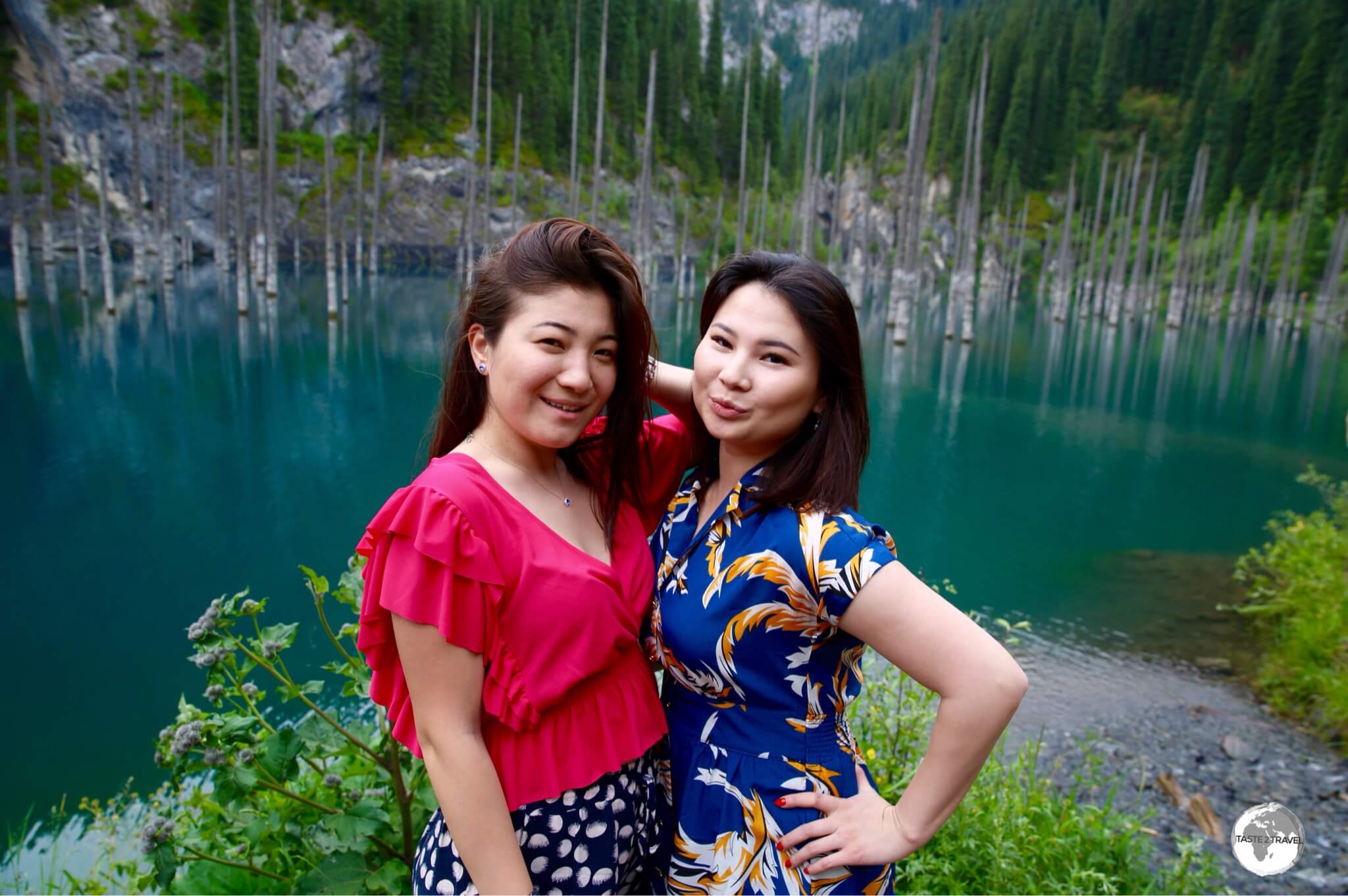
Kazakh girls posing at Lake Kaindy.
Those who do speak English are very eager to practice and I found if I greeted people first in Kazakh then English, those who spoke some English would often stop me to ask questions or strike up a conversation. Most were curious to know what my impression was of their country.

A smile and ‘peace’ from a charming young girl who was selling drinks at a kiosk in the Kolsoi Lakes National Park. No language needed here!
To this question I could honestly answer that I loved being in Kazakhstan, that I enjoyed spending time among the friendly Kazakhs, and that the country itself was an incredibly beautiful and interesting destination. I cannot wait to return to explore more of this vast land. If you have ever thought about visiting Kazakhstan, now is a great time to visit.
Location
Almaty, Kazakhstan
With an area of 2,724,900 square kilometres (1,052,100 sq. mi), Kazakhstan has the distinction of being the world’s largest landlocked country, and the ninth largest in the world. Thanks to vast reserves of oil and most other valuable minerals, Kazakhstan is the most economically advanced of the ‘stans’.
Distances are vast, with the driving distance between the north-eastern city of Atyrau and Almaty in the southwest at 2,744 km (1,705 mi). The country shares land borders with Russia, China, Kyrgyzstan, Uzbekistan and Turkmenistan.

Wide open plains meet the towering Tien Shan mountains near Almaty.
Kazakhstan bridges both Asia and Europe, but is mostly located in Asia, with a small section, west of the Ural mountains, in Europe. A large part of northern Kazakhstan is comprised of the Kazakh Steppe – the largest dry steppe region on earth, covering approximately 804,450 square kilometres, which is almost completely uninhabited.

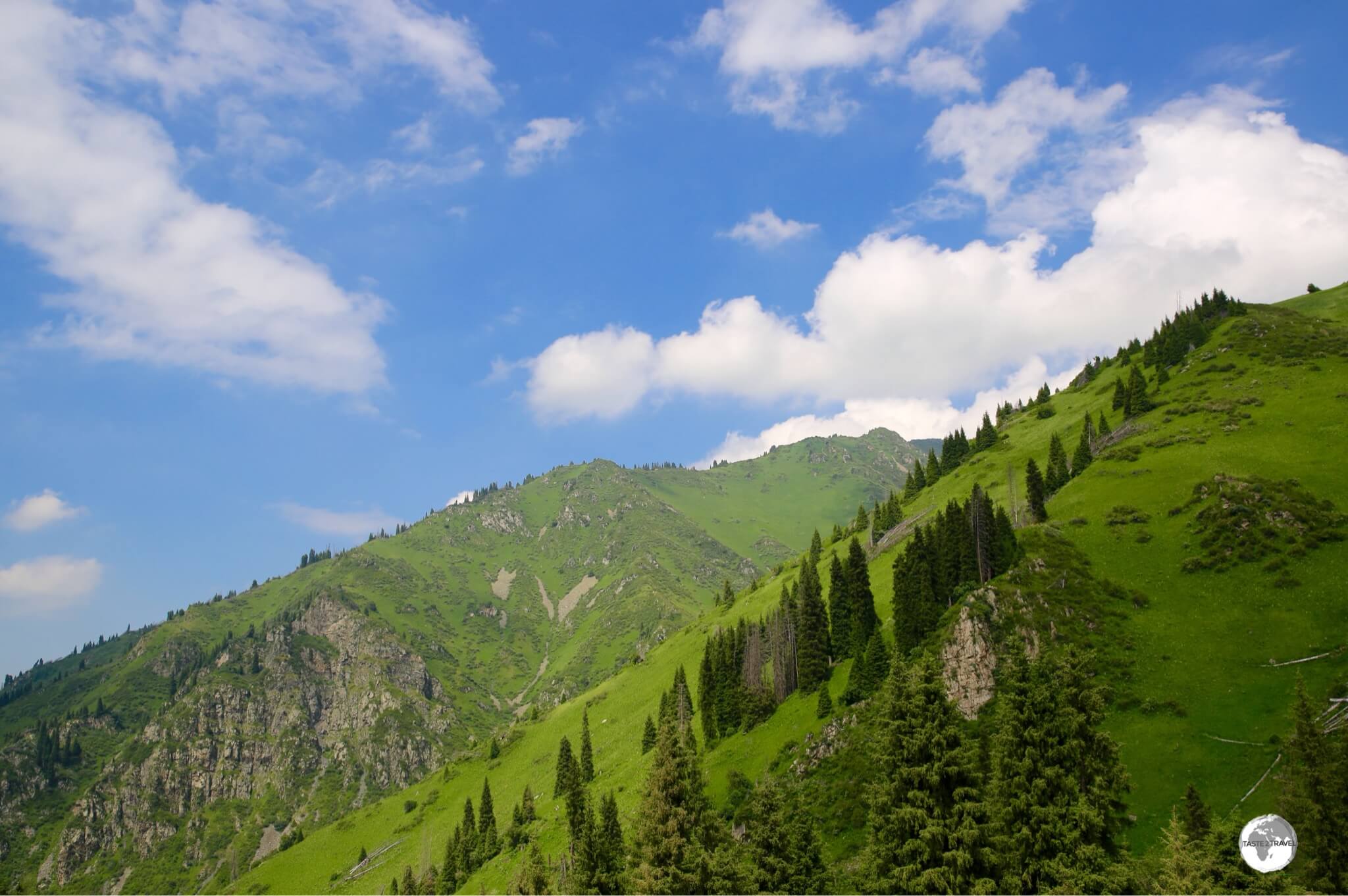
Ideal for hiking and day trips, the Tien Shan mountain range on the outskirts of Almaty.
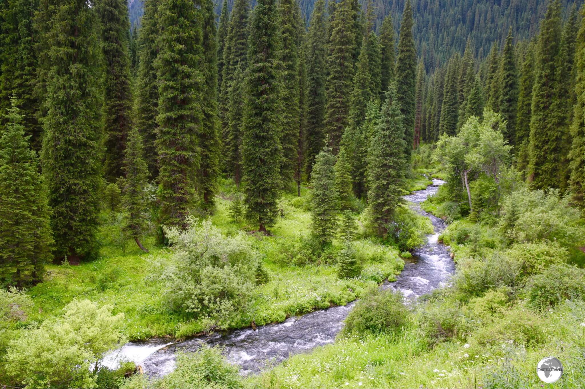
The peaks of the Tien Shan mountain range, which forms the border between Kazakhstan and Kyrgyzstan, are covered with snow, year-round, and their runoff is the source for most of Kazakhstan’s freshwater rivers, streams, and lakes.
People

Two fellow passengers (and my translators) on my weekend trip to Kolsoi Lakes National Park – a wonderful mother and daughter team from Almaty.
The Kazakhs are amazing! Some of the friendliest people I have ever met! A fun-loving, warm, caring, proud, polite people who went out of their way to welcome me to their country. They are reserved at times and, despite the huge language barrier, I was always made to feel welcome. At times, a smile or a look says more than a thousand words!

A newlywed Kazakh couple enjoying an outing on the shores of Big Almaty Lake.
With a population of 18.3 million people (as of 2018), Kazakhstan has one of the lowest population densities on earth with less than 6 people per square kilometre (15 people per sq mi).

During the heat of summer, the many fountains of Almaty provide an ideal way to cool off.
Originally nomadic herders, whose culture and language is Turkic in origin, most Kazakhs today live in sophisticated urban centres such as Almaty and Astana (recently renamed to Nursultan).

Artwork in Almaty.
From the 1930’s up to the 1950’s, the leader of the Soviet Union, Joseph Stalin, ordered the forced transfer of millions of European Russians to Central Asia. This forced population transfer has today resulted in a mixed Eurasian race in the countries of Central Asia. Kazakhstan has more than its fair share of Eurasian beauties, which can be seen parading around the streets of Almaty.
Photography

“Reflection” – Lake Kolsai National Park, which lies in Southern Kazakhstan near the border of Kyrgyzstan.
From spectacular landscapes to photogenic locals, Kazakhstan is a photographer’s paradise. Stunning vista’s are to be found everywhere, with dramatic canyons, towering, snowy mountains, placid, emerald-coloured lakes and endless, grassy plains, the country offers incredible landscapes and panorama’s which are often lit with the most amazing light.

Another fellow tour passenger from Almaty, striking a pose in the spectacular Kolsai National Park.
The Kazakhs love striking a pose for the camera and love taking selfies of themselves. During one weekend away in the Kolsai Lakes National Park, with a bus load of local Kazakh tourists, my fellow passengers were keen to have me photograph them posing in the beautiful nature.
Flag

The flag of Kazakhstan flying in Almaty.
The national flag of Kazakhstan features a gold sun with 32 rays above a soaring golden Steppe eagle, both of which are centred on a sky blue background, a colour which is of religious significance to the Kazakhs. Running down the hoist side is a national ornamental pattern
“koshkar-muiz” (the horns of the ram) in gold.
Currency

The 10,000 tenge banknote, issued in 2011 to commemorate the 20th anniversary of independence from the Soviet Union.
Issued by the National Bank of Kazakhstan, the tenge (sign: ₸ / code: KZT) is the currency of Kazakhstan and is issued in coins in the denominations of ₸1, 2, 5, 10, 20, 50, 100 and notes in denominations of ₸200, 500, 1000, 2000, 5000, 10000, 20000. The tenge is divided into 100 tiyn, but you’ll rarely see these coins.

Tenge exchange rates displayed in Almaty.
At the time of my visit (July 2019), US$1 was buying 384 tenge – to check today’s USD rate, please click here.
Costs

The breakfast menu at Nedelka Cafe in Almaty provides an example of typical restaurant prices.
Travel costs in Kazakhstan are surprisingly low! This is one destination where you can afford to indulge without fear of damaging your budget.
Typical daily travel budgets:
- Budget: Up to 8000 kzt (USD$21)
- Mid-Range: 8000 – 28,000 kzt (USD$21 – US$73)
- Top-End: 28,000+ kzt (USD$73+)
Sample costs:
- Coca Cola (0.33 litre bottle): 180 kzt (US$0.47)
- Water (0.33 litre bottle): 120 kzt (US$0.30)
- Cappuccino: 700 kzt (US$1.80)
- Metro Ticket within Almaty: 80 kzt (US$0.20)
- Bus Ticket within Almaty: 150 kzt (US$0.39)
- Car hire (compact car per day with Hertz Almaty): 23,000 kzt (US$60)
- Litre of fuel: 187 kzt (US$0.49)
- Meal (inexpensive restaurant): 2,000 kzt (US$5.00)
- Meal for 2 (mid-range restaurant): 10,000 kzt (US$25)
- Big Mac Combo Meal at McDonald’s in Almaty: 1,250 kzt (US$3.25)
- Room in a budget hostel (DimAL Hostel): 2,000 kzt (US$5)
- Room in a mid-range hotel (Holiday Inn Almaty): 20,000 kzt (US$52)
- Room in a top-end hotel (Rahat Palace): 30,000 kzt (US$78)
Laundry Services

One of the Speed Queen laundromats in Almaty.
The curse of all modern travellers is dirty laundry! At some stage, even a busy nomad needs to take timeout from exploring the world to do laundry.
Laundromats are not easy to find in Almaty, however, one international chain – Speed Queen – saves the day. Speed Queen is a US-based manufacturer of washing machines and dryers, who operate a network of franchised laundromats in various countries.
The company operates, clean, professional laundries in six locations across Almaty, with all laundries located inside shopping malls. I paid 2,000 kzt (US$5) for one load of washing and drying which was completed in under 2 hours by a helpful attendant.
Telephone Numbers

Telephone nostalgia!
I don’t normally include a section on telephone numbers in my reports, but Kazakhstan does not follow international numbering convention, so some explanation is warranted.
In most countries, converting a local number to an international number is a simple case of dropping the leading ‘0’ and adding the country code. This is not the case in Kazakhstan, where an ‘8’ is used instead of a ‘0’.
To convert a Kazakh mobile number (e.g. 8775 123 45 67) to an international number, you need to remove the preceding ‘8’ and add the country code for Kazakhstan (+7), so the number becomes +7 (775) 123 45 67.
Sightseeing
Sightseeing in Kazakhstan is a breeze, in the larger cities, where you have all of the usual tourist services in abundance.
However, once you leave the big cities, all services disappear. If you wish to venture into the countryside, you either need to be self sufficient or join a local tour company. Transport can be non-existence to many rural areas (including places of immense interest to tourists), then – when you arrive – there are few accommodation options, no restaurants, banks, shops etc.
I spent a weekend in the stunningly beautiful Kolsoi Lakes National park, which was only made possibly by joining a local tour group, which left Almaty on a Friday evening. It was a wonderful weekend, travelling on a bus full of Kazakh tourists with me being the only international guest.
We stayed in a small village, near the lakes, where we were billeted out to family home-stays, which were extremely basic – but there were no other options. During the weekend, the national park was packed with thousands of local visitors, but, apart from a few locals selling BBQ lunches or drinks from small kiosks, there were no facilities.
Tourism officials in Almaty recognise the problem and assure that the government is working to resolve the issue. Until services are provided (I saw one hotel under construction in the regional hub of Saty), tourism in the Kazakh countryside will remain undeveloped.
Almaty

Apple tree’s are everywhere in the city of apples, including this stained-glass artwork at the “Almaly” metro station.
Almaty, which means ‘Apple‘ in Kazakh, is the former capital of Kazakhstan and the nation’s largest city, with a population of 1,472,866 (9% of the country’s population). The city is located in the mountainous area of southern Kazakhstan, near the border with Kyrgyzstan.
Did you know? The common supermarket apple can apparently be traced to one specific region of the world. The first apple seeds were transported out of the wild groves of Almaty by birds and bears before humans began to cultivate them.

Almaty used to be called Alma-Ata, meaning ‘father of apples’.
Even though no longer the capital, Almaty is still the country’s largest metropolis, offering a sophisticated atmosphere and lots of sights to explore. Forming a dramatic backdrop to the city is the towering Tian Shan mountain range, which offers easy access to an alpine paradise, with miles of hiking and skiing trails.

Artwork on Almaty.
Almaty is located on a gentle slope of the Tian Shan range, which makes orientation very easy. If you’re walking uphill, you’re heading south – if you’re walking downhill, you’re heading north and if you’re walking along a flat street, you’re heading either east or west.
Almaty is a sprawling city which is laid out on a simple grid. Distances can be deceiving with a single block often more than a kilometre in length. The best way to get around is to utilise the metro (one line only) which connects most sights of interest. There is plenty of green space and generally, Almaty exudes a pleasant and relaxed atmosphere.

The streets of Almaty are lined with architectural reminders of the city’s Soviet past.
The city streets are lined with many examples of Soviet-era architecture – what I like to call ‘Brutalist architecture’. The reason the city has been ‘blessed’ with so many eye-sores is all thanks to one local, very powerful, politician by the name of Dinmukhamed Kunayeva, who was part of the Soviet ruling elite back in the 1970’s and ‘80’s. He used his powerful connections to ensure plenty of roubles flowed into Almaty for grandiose construction projects.
Big Almaty Lake

Stunning views are to be found everywhere at Big Almaty Lake.
If there is one ‘must see’ sight in Almaty, it is Big Almaty Lake, which is located outside of the city, high up in the Tian Shan mountains. The lake is a natural alpine reservoir which provides the drinking water for Almaty, which is very safe to drink and very sweet.
Located at 2,511 metres (8,238 ft) the lake is 15 km from the centre of Almaty and close enough to the Kyrgyzstan border, that it is within the sensitive, demarcated, ‘Border Zone‘. Due to its location, soldiers patrol the area, and can request to see your passport so you should ensure you carry it with you at all times.

Big Almaty lake is best visited on a clear day.
The colour of the lake water changes throughout the year, from milky to teal, depending on the water depth. These photos were taken during my visit in June when the water level was low and the colour was milky. The best time to visit is in September when annual rains replenish the lake, changing the water colour to teal.

Colourful wildflowers are omnipresent in the Kazakh countryside and always look great in the foreground of photos.
Weather Considerations
Prior to departing Almaty, you should check the weather conditions on the mountains. If the mountains are shrouded in cloud, the lake will be invisible and your journey wasted! You should only head up the mountain on a perfectly fine day.
Getting There
Reaching the lake from Almaty was very simple, with a return private taxi costing me 16,000 tenge (USD$40) which included hotel pick-up, the one hour drive up to the lake, an hour of hiking, then the return trip back to my hotel.
I used the services of Issatay, who was recommended by the Almaty Tourism authority. Issatay speaks English, is a careful driver and offers private taxi hire to various locations around Almaty. You can contact Issatay via WhatsApp on +7 701 188 44 40 or email at IssatayBurkhanov@gmail.com and, since his wife has just given birth to a baby, he will be appreciative of any business he can get.
If your budget is not up to the taxi fare, you can take city bus #28 (150 tenge) which connects downtown Almaty with the park. The bus terminates inside the main gate, from where you can either walk or hitch a ride to the lake – which is a long, 10 km uphill walk.
The lake is within the Ile-Alatau National Park which requires the payment of a 500 tenge entrance fee.
The Medeu

The entrance of the Medeu Alpine arena.
The Medeu, is an outdoor speed skating and ice-skating rink which is located in a mountain valley on the south-eastern outskirts of Almaty at an elevation of 1,691 metres (5,547 ft) above sea level.
Originally built in the 1950’s, the complex was fully renovated for the hosting of the Asian Winter Games in 2011 and claims to be the world’s largest mountain complex for winter sports, and is home to the world’s largest artificial ice-skating rink at 10,500 square metres. During the summer months, after the ice has melted, the rink is converted for use as a go-kart track.

During the summer months, the Medeu arena is used for Go-karting, while in winter it serves as an ice-skating rink.
The complex can be reached by city bus (#12) from the “Abai” metro station, with tickets costing 150 tenge. The bus terminates at the stadium, which is one stop beyond the Shymbulak cable car station.
Shymbulak

The stunning alpine countryside around the Shymbulak resort makes for ideal hiking during the summer months.
Shymbulak, also known as Chimbulak, is a popular ski resort in the winter and a favourite hiking area during the summer. Located above the Medeu sports complex, the resort is accessible by road or cable car and makes an ideal day-trip from Almaty.
Views of the alpine landscape from the Shymbulak cable car.
Shymbulak is the largest ski resort in Central Asia and is serviced by three cable cars which transport you from the Medeu gondola station to the Shymbulak gondola station (2,260 m). From there, and provided you have purchased a combination ticket, you can ride up to a further two stations:
- Combi-1 – climbs from 2,260 m up to 2,860 m
- Combi-2 – climbs from 2,860 m to the highest point at 3,200 m
The combination ticket costs 4,500 tenge with all return rides being free. Operating times are generally 10:00-17:00 (weekdays) and 10:00-18:00 (weekend).

I was surprised to find a branch of my favourite French cafe – Paul – next to the cable car station at Shymbulak.
At the Shymbulak station (i.e. the 1st station), you’ll find a good selection of restaurants, bars and cafes, including a branch of “Paul“, the French cafe/ patisserie chain. The 2nd and 3rd stations do not offer food, so if you’re hungry, it’s best to dine here.

Inclement weather closing in on the 3rd station of the Shymbulak cable car, which lies at 3,200 metres above sea level.
From the 2nd and 3rd stations, there are a network of hiking trails which lead to various peaks and a glacier.
Weather Considerations
Temperatures at the top of the 3rd cable car station can be freezing, even during the summer months when Almaty is sweltering. Best to bring warm weather clothing with you. I sensibly wore a pair of shorts and a t-shirt and froze!
Getting There
There is enough to the do on the mountain to warrant a full day trip. If you haven’t left Almaty by 2 pm, you’ll be too late as the #12 bus journey to the cable car station is about 45 mins, then you have the long cable car rides with the last cars running at 5 pm.
Kok Tobe

Panoramic views of Almaty from the Kok Tobe cable car station.
Perched above Almaty at a height of 1,100 metres, Kok Tobe is the highest point in the city and offers the best views in town, especially at sunset. Reaching Kok Tobe is made very simple thanks to the cable car which departs from the station next to the Palace of the Republic, which is a short walk from “Abai” metro station.

An upside down house at Kok Tobe! The Kazakhs have a quirky sense of humour.
Kok Tobe is home to a small amusement park, a strange memorial to the ‘The Beatles‘, where you can pose for photos on a bench surrounded by the Fab Four, while Beatles music plays over a loud speaker system and other amusements.

A view of the 372-metre TV tower and the Tian Shan mountains from Kok Tobe.
The most dominate feature of Kok Tobe is the Almaty Television Tower, a 371-metre-high (1,219 ft) steel television tower built between 1975 and 1983. The tower, which is not open to visitors, is a steel tubular structure, the tallest free-standing tubular steel structure in the world.
Palace of the Republic
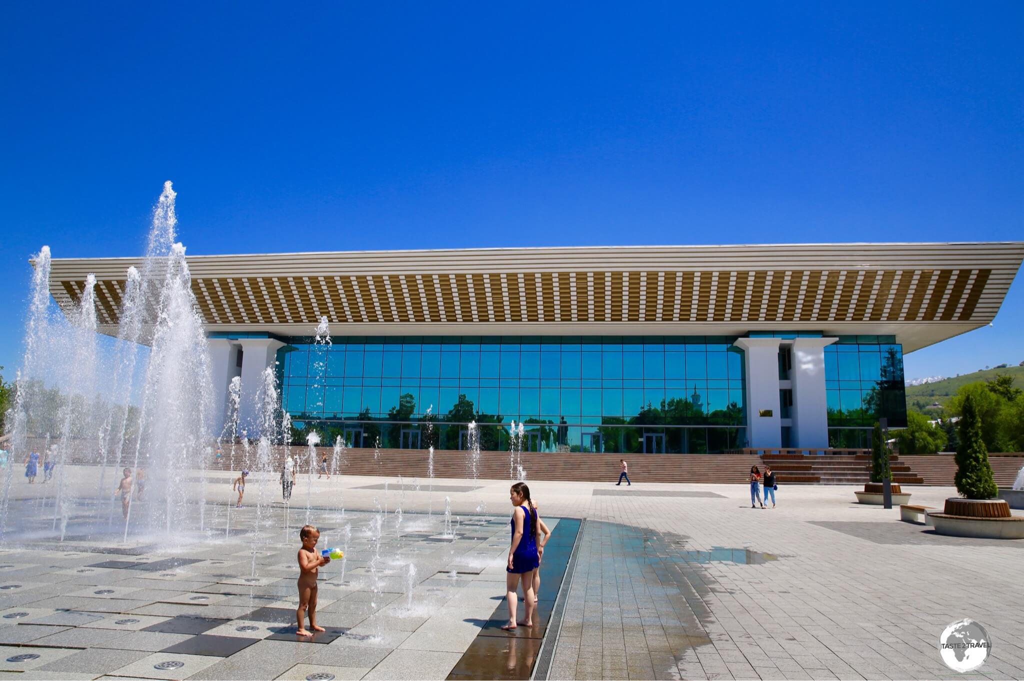
Fountains outside the Palace of the Republic provide cooling relief on a hot summer day.
Located next to the Kok Tobe cable car station, at the end of Abai avenue, previously known as the Lenin Palace of Culture, the Palace of the Republic was opened during the celebration of the 100th anniversary of the birth of Lenin.
Lenin is nowhere to be found in Almaty these days, and the palace has since been renamed. The venue is used for concerts, festivals and other cultural events.
The Ascension Cathedral

The very ornate Ascension Cathedral, which is located in the centre of Panfilov park.
What a surprise to stumble upon the strikingly beautiful, Russian orthodox, Ascension Cathedral, while meandering through Panfilov park in downtown Almaty.

Sunlight illuminates the foyer of the Ascension cathedral on Almaty.
Completed in 1907, the cathedral is built of wood with no nails and has recently been fully renovated with “modern” bright colours, although the central nave is still wrapped in scaffolding.

The five-domed, three-aisled Ascension Cathedral is one of the largest wooden buildings in the world.
During the Soviet era, the cathedral was used for non-religious purposes, serving as the Central Museum of Kazakhstan until 1994, after which, it was re-converted for use for religious purchases.
Zelyony (Green) Bazaar

A vendor at the Green Bazaar selling dried fruits and nuts at bargain prices.
Green Bazaar is the central market of Almaty. Located downtown, the main food hall is an emporium of local (and some imported) produce with the dried fruit and nuts stalls being the highlight.
If you’re travelling anywhere, the market is a great place to stock up on healthy travel snacks, with a mixed bag of fruit and nuts costing just a couple of dollars. The vendors are friendly and enthusiastic but you need to negotiate.
Locals always sample produce before they buy, making the market an ideal place to try local specialities. For those tired and hungry during shopping, there are various restaurants and cafes located on the mezzanine levels.

A view of one of the stalls at Green Bazaar from the Bowler Coffee Roasters cafe.
Photography is forbidden in the market and security guards on the floor enforce this strange rule. You can however get some great, panoramic, shots from the balcony of the Bowler Coffee Roasters cafe, which is located on one of the mezzanine levels (the guards never look up!). The cafe offers some of the best coffee in Almaty (refer to the ‘Eating Out‘ section for more) using locally roasted beans.
Almaty Central Mosque

The large gold dome of the Almaty Central Mosque is decorated with verses from the Quran.
Located one block north of Green Bazaar, the Almaty Central Mosque is hard to miss with its large, gold, domes glistening in the bright sunlight. The mosque was designed to house 7,000 worshippers and was built on the site of a former mosque that was destroyed by fire in 1987.
Central State Museum of Kazakhstan

The Central State Museum of Kazakhstan is the main museum in Almaty.
The Central State Museum of Kazakhstan (open everyday, except Tuesday), is the largest museum in Almaty and covers every aspect of Kazakh culture and history. Previously housed in another location, the current museum was inaugurated in 1985 and, judging by the dusty, faded displays and threadbare carpet, has not been renovated anytime since.
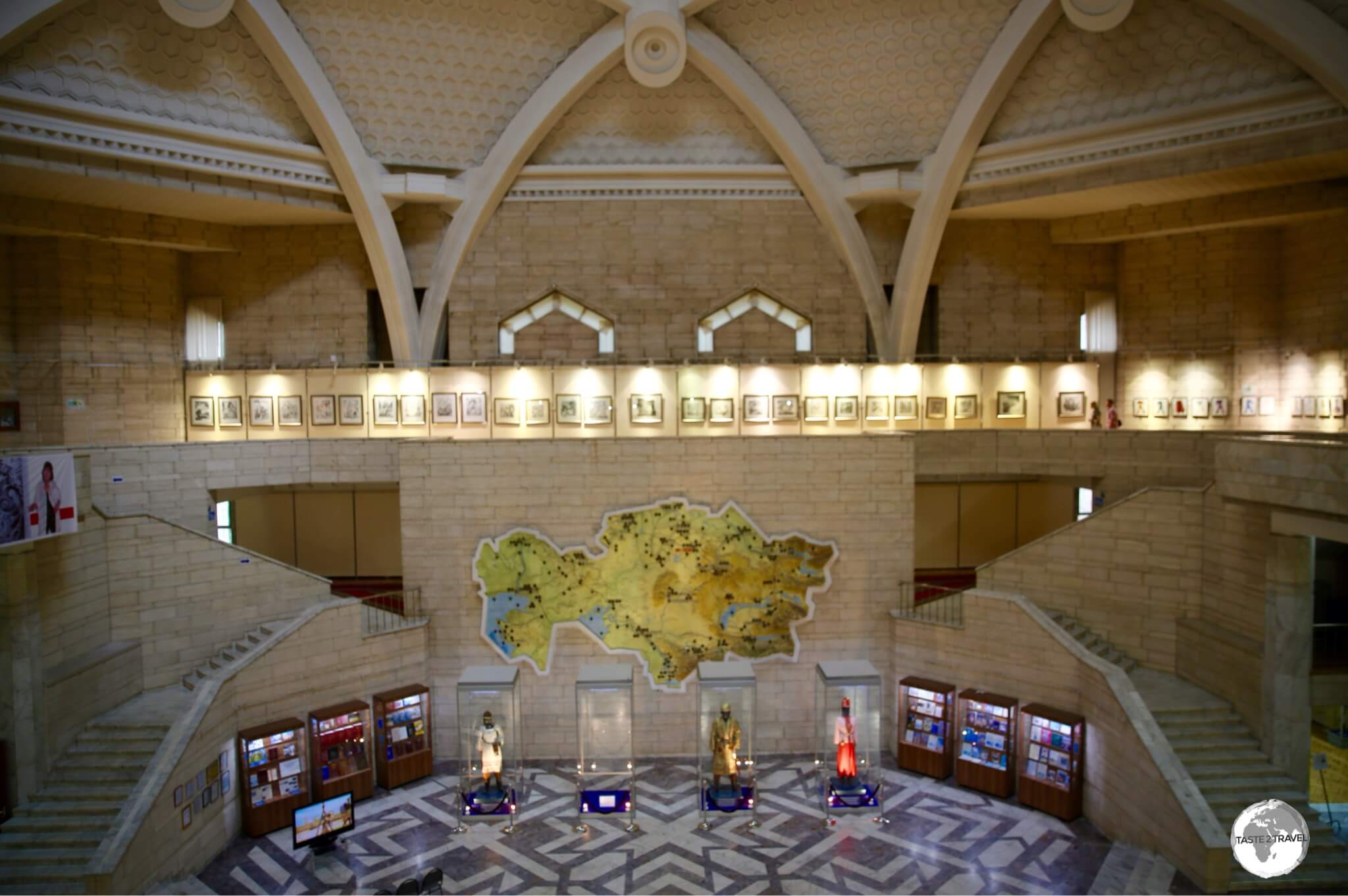
The lofty lobby of the Central State Museum of Kazakhstan.
The most impressive aspect of the museum is the large, open, central lobby which is capped with a vaulted ceiling.
Republic Square

Republic Square is the main square in Almaty.
Located around the corner from the Central State Museum of Kazakhstan, and across the street from the former presidential palace, Republic Square features the towering Golden Warrior Monument.
Abay Opera House

The majestic Abay Opera House overlooks Panfilov street.
Crowning the southern end of the pedestrian-friendly Panfilov street, the Abay Opera House was opened in 1934 and is named after the Kazakh poet and composer, Abay Qunanbayuli
The theatre is closed during the summer months (July and August), but at other times it stages three or four performances a week at 5 pm or 6.30 pm.
Panfilov Street Promenade

Colourful street art decorate Panfilov Street Promenade.
Connecting various sights within the historical heart of Almaty, the current incarnation of the Panfilov Street Promenade was built in 2017 based on a design by Danish urban designer Jan Gehl.
The peaceful, shady and green promenade runs from the Abay Opera House, north to the Mukagali Makataev (shopping) street and is lined with bars, restaurants, cafes and recreation spaces.
Kazakh State Circus

The Kazakh State Circus in Almaty.
Looking like either a space ship, circus tent or a spinning top, the Kazakh State Circus features regular circus performances throughout the day except on weekends.
Next door to the circus is Fantasy World Almaty, the city’s main amusement park, which is open 7 days a week until sunset.
Almaty Street Art
Almaty is home to some impressive street art, with some of the more striking works being intricate, Soviet-era, tile mosaics.

A mosaic dedicated to the ‘The Hunt’ adorns the wall of the KIMEP University on Abai avenue.
The first Soviet mosaics appeared in the 1930s, adorning the grand Stalinist neo-classical train stations, theatres and the stations of the Moscow metro.
It then fell out of fashion in the 1950s under Nikita Khrushchev, but the monumentalist art aesthetic reappeared under Leonid Brezhnev in the late 1960s and 1970s. This was when most of the art appeared in Central Asian cities.
Located on Abay avenue, Kazakhstan’s most prestigious university, KIMEP, features a mosaic dedicated to ‘The Hunt’ which has been pieced together using coloured glass.

Adorning the wall of the Hotel Almaty, the ‘Enlik-Kebek’ mosaic tells a Kazakh folk tale of star-crossed lovers.
In the late Soviet period, any new public building automatically had 5% of the budget earmarked for “artistic elements”. If the project was a prestigious building, these would be designed bespoke by local artists.

”The Girl with the Souvenir” is a tile mosaic which has been installed at Kok Tobe.
Many of the mosaics in Almaty were created by Vladimir Tverdokhlebov who graduated from the Mukhina Institute in Leningrad in 1967. Following his graduation, he was dispatched to Almaty, where over the next decade he worked on a number of mosaics, murals and stained glass windows to adorn prestigious newly constructed buildings.
Kolsai Lakes National Park
An excellent weekend away from Almaty is to the stunningly beautiful Kolsai Lakes National Park, which lie close to the Kyrgyzstan border, 290 km east of Almaty.
Kolsai Lakes National Park

There are three lakes in the Kolsai Lakes National Park, this is the first and lowest of the three.
There are three lakes in the Kolsai Lakes National Park, all of which are connected by challenging hiking trails which are completely undeveloped. During our day at the park, we hiked two of the three lakes, the lower (1st) and middle (2nd) lakes. Most visitors to the park do not progress beyond the first lake.
Kolsai Lakes National Park Hiking

The gruelling 20-km return hike from the 1st to the 2nd Kolsai lake is a regular obstacle course!
Despite the fact that an entrance fee is charged to access the National Park and that hundreds of local tourists visit each weekend, the trails are in no way maintained. There are plenty of steep, slippery, gravel descents which see people slipping and sliding and many other obstacles. The walk to the 2nd lake is a 20 km (return) endurance course!

Horses are available for those who don’t wish to do the gruelling hike but they are very pushy on the narrow trail.
Added into the mix, horses are available for rent (4,000 tenge/ USD$10) for those who don’t wish to hike the 20 km round trip to the 2nd lake, which involves a climb of 434 metres. The horses dig up the track and force hikers to move off the trail as they barge through.
Lower Kolsai Lake

“Reflection” – Lower Kolsai Lake.
Located at an altitude of 1,818 metres, the first and lowest lake is accessible by road and has a few guest-houses and campsites.
Measuring 1-km in length, 400-metres in width and 80-metres in depth, the lake is a natural mountain reservoir formed by landslides that block the Kolsai River and is popular with locals who stream into the park on the weekend to picnic, party, row boats, swim etc.
Middle Kolsai Lake

The breathtakingly beautiful Kolsai Middle (2nd) Lake is worth the gruelling hike.
Located at an altitude of 2,252 metres, the hike to the 2nd lake is challenging (well – for me of very average fitness). The lake lies 5-km upstream from the lower lake (with an altitude difference of 434 metres/ 1,423 ft) , and is the largest of the three lakes, reaching a depth of 50 metres. (altitude: 2,252 meters).
Meandering its way through heavily wooded pine forests, the Kolsai river connects all three lakes.
The third lake lies 6 km above the middle lake at a height of 2,850 metres. Visiting all three on a day trip would be a super-human feat. If you spend some days camping in the park, you could visit all three lakes.
Lake Kaindy
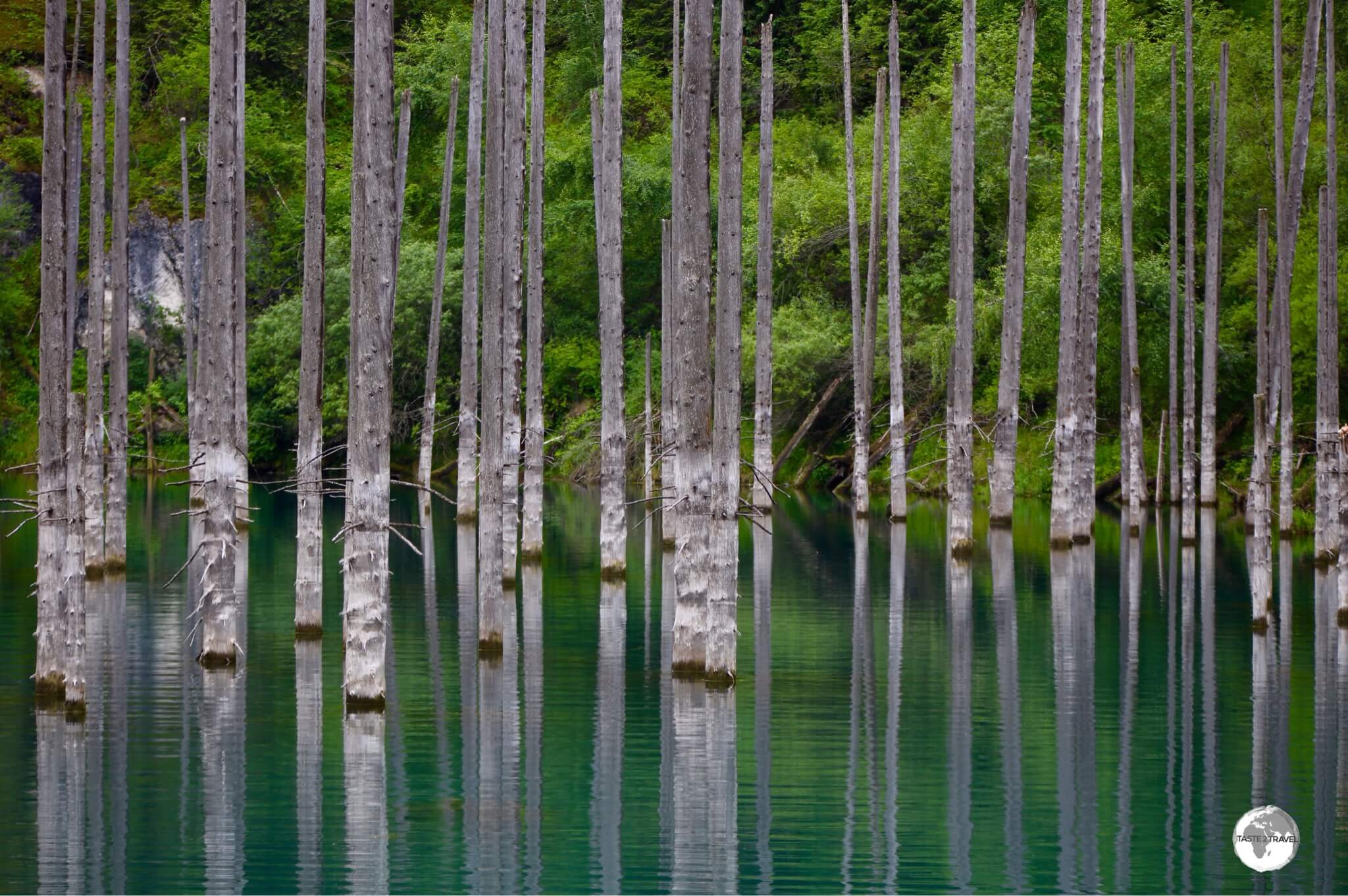
Lake Kaindy is a spectacular sight, famous for its sunken forest.
Located at a height of 2,000 metres, and also part of the Kolsai Lakes National Park, the incredibly beautiful, and somewhat eerie, Lake Kaindy is accessed via a very rough (4WD only) road from the regional centre of Saty.

Our Russian-made UAZ 4WD was as comfortable as a tank but delivered us, relatively unscathed, to Lake Kaindy.
The journey there required us to be transferred to an assortment of Russian-made 4WD relics for the rough ride to the lake. I was park of a group which squeezed into the back of a grey, UAZ combi, which was fitted with hand-made wooden bench seats, installed along the walls. It was far from comfortable with my head hitting the low (wooden) ceiling every time we went over a bump.

The very surreal and peaceful Lake Kaindy.
Once near the lake, there was more hiking involved with a steep, uphill, 2 km hike from the car park. However, the view of the emerald-coloured lake with its sunken forest of submerged Picea schrenkiana trees was worth the effort. It really is a surreal sight!
The lake was formed as the result of a major limestone landslide forming a natural dam which was triggered by an earthquake in 1911. Below the waterline, you can still see the branches attached to the trees.
Black Canyon

A panoramic view of Black Canyon.
One the return trip back to Almaty, our tour made a brief stop at the spectacular Black Canyon. It really was a weekend of one ‘wow’ after another. The canyon runs for many miles and I would have loved to have spent much more time photographing it, but Almaty was calling!
Touring Kolsai Lakes National Parks
To tour the lakes, I joined a local, weekend, tour group from Almaty as there was no independent way of visiting this part of the country. I toured with Blast Tours, but if I toured again I would join Campit who are much better organised, more professional and have English speaking guides. The full weekend tour was bargain, costing just 16,000 tenge (US$40), which included all transport, accommodation and meals.
I travelled on a coach (a 2nd-hand relic from a French tour company), full of local Kazakh tourists, which left Almaty late on a Friday evening. I was the only international tourist and the only non-Russian speaker. Luckily some friendly locals, who spoke English, provided translation services during the course of the weekend since the guide only spoke Russian.

My family home stay in the small village of Karabulak.
At 4 am on Saturday morning, our bus came to a halt in the small, and very dark, settlement of Karabulak where we were divided into small groups and billeted out to different family homes.

The ‘bathroom basin’ at my family home stay, with our tour bus in the background.
My home, typical of the village, had no running water and a filthy out-house toilet, which was installed next to the animal pen. The bathroom basin consisted of a pale of water attached to the front fence, this was used for teeth cleaning, face washing etc.

My cosy room in the family home stay in the village of Karabulak.
My room consisted of a bed which was a wooden board covered with foam all of which was covered with a carpet. It was surprisingly comfortable.

Breakfast time at my family home stay, which was shared with my fellow Kazakh tour members and house guests.
All meals were served at the family home (I didn’t see any restaurants anywhere), which was an ideal opportunity to sample typical Kazakh specialities. At all meals, plates of candy, biscuits and pots of homemade jams were served.
Accommodation
The accommodation scene in Kazakhstan is well developed in the main cities, where visitors are spoilt for choice with plenty of properties to suit all budgets. However, outside the cities, options are non-existent, which is a major hindrance for the development for tourism in the countryside. Not only are hotels missing but all vital services such as transport, restaurants, shops, banks etc.

My hotel of choice in Almaty, the wonderful Rahat Palace Hotel, was originally opened as the Hyatt Regency Almaty.
During my time in Almaty, I stayed at the 292-room, Rahat Palace Hotel, which was originally opened in 1995 as the Hyatt Regency Almaty and was the first luxury hotel in Central Asia. The Hyatt sold the hotel in 2011, with the name being changed to Rahat Palace and today the hotel is a little old and tired. Some rooms have been renovated while others feature, drab, faded carpet and furnishings.
However, all is about to change, with Hyatt recently announcing that they will be returning and re-branding the hotel with a full renovation planned. Currently rooms can be purchased on any of the leading booking sights (booking.com or hotels.com) for around US$80 per night, which is a bargain for such an establishment.

The central lobby of the Rahat Palace Hotel.
Despite the hotel being a little faded, the staff are helpful, enthusiastic and professional. The rooms are comfortable and include king-sized beds. The soaring, central atrium, which features a bar set inside a yurt, is impressive, while the pool area is expansive and inviting.
As for food – the breakfast buffet is wonderful, and very affordable – if you book a room online with breakfast included. During my stay, a section of beehive took pride of place on the buffet, allowing guests to help themselves to fresh honeycomb which was wonderful a fresh baguette. The garden restaurant is a great place to relax, after a day of running around town, with main courses costing just US$5.

My comfortable room at the Rahat Palace Hotel.
Almaty’s sights are easy to reach from the hotel, with one of the city’s metro stations, Auezov Theatre, just 200 metres away. Almaty Airport is a 30-minute drive from the hotel.
Eating Out

Menu at Batyr Burger in Almaty.
As with accommodation, there are lots of amazing restaurant and cafe options in cities like Almaty, but once you leave town you are stuck. On my weekend away at Kolsai Lakes National Park, our bus stopped at a roadside service centre, on the outskirts of Almaty, where we were advised to stock up on anything we might need to for the weekend. Once in the countryside, I saw no restaurants, cafes and very few shops.
Restaurants

Burgers in Kazakhstan are always served with a pair of latex gloves – to keep your hands clean.
There are many fine restaurants in Almaty, serving local and international cuisine. All of the usual fast food players are present, from McDonald’s, KFC, Burger King and more.
If you’re in the mood for a burger, may I suggest you skip the international chains and try the amazingly tasty and juicy burgers from the local chain – Batyr Burger. One quirk in Kazakhstan is that burgers are normally served with a pair of latex gloves which keep your hands clean.

This delicious BBQ chicken dinner at the five-star Rahat Palace Hotel cost me just US$5.
In many parts of the world, you can experience mild shock when you ask for the bill at the end of a meal. How could what you ate cost so much? In Kazakhstan, I always experienced the opposite reaction, a pleasant surprise at how little my meals cost. Normally, one way to kill your budget, would be to dine at a 5-star hotel. However, in Almaty, I regularly dined at the 5-star Rahat Palace hotel where a main course cost just US$5.
A short walk from the Rahat Palace is the excellent Qaimaq which offers authentic Kazakh, Uzbek and Uygur cuisine (again at very reasonable prices) in a relaxed garden setting. The ceiling of the restaurant is strung with giant red apples – a celebration of Almaty – the apple city.
Cafés

The Abay avenue branch of Cafe Nedelka is always inviting and offers some of the best coffee in Almaty.
You’ll find all of the international coffee chains in Almaty, from Starbucks to Gloria Jeans. However, there are many superior local chains, with the my favourite being Cafe Nedelka, who have three branches throughout the city.
My favourite (and the most convenient to reach) is their branch on the leafy and green – Abay Avenue, which is a 2-minute walk from Abay metro station.

Cafe Nedelka offers amazing coffee, the freshest of cakes and a menu full of options for breakfast, lunch and dinner.
With English speaking staff, Barista’s who know how to prepare a decent ‘flat white’, a menu which is affordable and full international and local specialities, Nedelka is justifiably very popular with locals and visitors. Their selection of fresh cakes is very wicked and tempting and best to be avoided – right!

The small, but excellent, coffee shop at the Green Bazar, which is owned and operated by Bowler Coffee Roasters.
Not to be out-done, the small, one-man, hole-in-the-wall, cafe at the Green Bazar, which is operated by Bowler Coffee Roasters, offers a robust cup of excellent coffee.

The barista from Bowler Coffee Roasters, preparing the perfect Flat White.
Originally from the Netherlands, Bowler Coffee Roasters have set up two cafes in Almaty and have recently put local Burger King staff through a Barista training course.

Artwork at the Bowler Coffee Roasters cafe in the Green Bazar.
The cafe at the bazar occupies one of the 1st floor viewing platforms from which you have an eagle-eye view of the busy market below. It’s an ideal place to take photos of the market, since photography is strangely prohibited and, if you are seen on the floor of the market taking photos, you will be accosted by the security guards. The guards have their office directly below the cafe and never look up, leaving you free to snap away.
Bars

An ice-cold mug of local beer, very refreshing on a hot summer’s day.
It’s estimated that 70% of the Kazakh population are practising Muslims, but Kazakhs are relatively big drinkers despite of the Muslim prohibition on alcohol. Alcohol is regarded as an integral part of the culture. Toasts are features of big events and declining a drink is considered rude. Almaty is full of bars, many of which can be found along Panfilov street.

Kazakhstan Cognac sells for just a few dollars a bottle in most supermarkets.
In Kazakhstan men mostly drink vodka. Straight. Cognac is considered a ladies drink. Kazakhstan makes its own version which you can find on all supermarket shelves, costing just a few dollars a bottle.
Visa Requirements

Kazakhstan passport stamp.
In an effort to encourage more tourism to the country, visa requirements for Kazakhstan have been relaxed in recent years with citizens of many countries now able to enter Kazakhstan without a visa. To check your current visa requirements, you should consult the visa policy of Kazakhstan.
Migration Card

The Kazakhstan migration form.
Upon entering the country, you’ll need to complete a white migration form which will be stamped twice and handed back to you for safekeeping.

The Kazakhstan migration form – which must be stamped twice!
It’s important that you retain this form and hand it in upon departure – failure to do so can result in a fine! It’s also important that the form is stamped twice which indicates that you do not need to register with the authorities. One stamp on the form however indicates that you need to register – a requirement you should avoid.
Getting There
Air
The two main international gateways to Kazakhstan are Almaty International Airport (IATA: ALA) and Nursultan Nazarbayev International Airport in Astana (IATA: TSE).
Additionally, many other airports provide connections to Russian cities, while four other airports provide international connections elsewhere:
- Aktau International Airport – offers connections to Baku, Istanbul, Sharjah, Tbilisi and Yerevan.
- Atyrau International Airport – offers connections to Frankfurt, Amsterdam and Istanbul.
- Oral Ak Zhol Airport – offers a connection to Frankfurt.
- Shymkent International Airport – the main base for SCAT Airlines, offering connections to Dubai, Phuket and Istanbul.
Almaty International Airport
Almaty International is the largest airport in Kazakhstan and receives the most traffic, handling over three million passengers a year. Despite this, the baggage carousels are extremely small which results in lots of people crammed into a small area, pushing and shoving, vying to retrieve their bags. Not a good introduction to the country!
The airport serves as the primary hub for the national carrier, Air Astana, which handles most flights into Kazakhstan. The airport also serves as the main hub for Qazaq Air which operates domestic flights.
The following airlines provide scheduled flights to/ from Almaty:
- Aeroflot – flies to/from Moscow–Sheremetyevo
- Air Arabia – flies to/from Sharjah
- Air Astana – flies to/from Aktau, Aktobe, Atyrau, Baku, Bangkok–Suvarnabhumi, Beijing–Capital, Bishkek, Delhi, Dubai–International, Dushanbe, Ho Chi Minh City, Hong Kong, Istanbul, Karaganda, Kazan, Kiev–Boryspil, Kuala Lumpur–International, Kyzylorda, Moscow–Sheremetyevo, Nur-Sultan, Oral, Oskemen, Pavlodar, Saint Petersburg, Seoul–Incheon, Sharm El Sheikh, Shymkent, Tashkent, Tbilisi, Ürümqi
- Angara Airlines – flies to/from Krasnoyarsk–Yemelyanovo
- Asiana Airlines – flies to/from Seoul–Incheon
- Azerbaijan Airlines – flies to/from Baku
- Belavia – flies to/from Minsk
- China Southern Airlines – flies to/from Ürümqi
- FlyArystan – flies to/from Karaganda, Nur-Sultan, Oral, Pavlodar, Shymkent, Taraz
- flydubai – flies to/from Dubai–International
- Hainan Airlines – flies to/from Beijing–Capital
- Kam Air – flies to/from Kabul
- Lufthansa – flies to/from Frankfurt
- Mahan Air – flies to/from Tehran-Imam Khomeini
- Nordwind – flies to/from Samara
- Pegasus Airlines – flies to/from Istanbul–Sabiha Gökçen
- Qazaq Air – flies to/from Bishkek, Nur-Sultan, Osh, Pavlodar, Shymkent, Kostanay, Kyzylorda
- Rossiya – flies to/from Saint Petersburg
- S7 Airlines – flies to/from Novosibirsk
- SCAT Airlines – flies to/from Aktau, Aktobe, Atyrau, Karagandy, Kokshetau, Kostanay, Mineralnye Vody, Nur-Sultan, Oral, Oskemen, Petropavl, Semey, Shymkent, Taraz, Usharal, Xi’an, Zhezkazgan
- Turkish Airlines – flies to/from Istanbul
- Turkmenistan Airlines – flies to/from Ashgabat
- Ukraine International Airlines – flies to/from Kiev–Boryspil
- Ural Airlines – flies to/from Moscow-Zhukovsky, Saint Petersburg
- Uzbekistan Airways – flies to/from Tashkent
Airport Transport
The airport is located six miles northeast of Almaty city centre and there are two main modes of transportation for the 20 minute journey – bus or taxi.
Metered taxis can be hired from the official taxi stand inside the arrival’s hall, with the 20 minute trip into downtown Almaty costing about 10,000 kzt (USD$26). Bus #3 connects the airport with downtown Almaty
Land
You can cross into Kazakhstan using a variety of land borders between Russia, China, Kyrgyzstan, Uzbekistan and Turkmenistan. For a comprehensive list of all borders, you should refer to the following website.
Train
On my first trip to Kazakhstan in 1995, I embarked on a 77-hour train journey from Moscow to Almaty, a journey which could only be described as an odyssey.
During the trip, I shared a four-bed compartment with various locals. During the Russian segment of the journey, I was offered straight vodka for breakfast by my fellow Russian passengers. Once in Kazakhstan, I was offered Cognac for breakfast by my fellow Kazakh passengers. I rolled off the train in Almaty! There are many epic train journey’s which one can make across the vast, empty countryside of Kazakhstan.
There are two main stations in Almaty; Almaty-1 & Almaty-2, from which international trains depart for Urumqi (China), Tashkent (Uzbekistan), Moscow (Russia) and other Russian cities.
Tickets can be purchased from the Kazakh website – tickets.kz,
Taxi – Almaty to Bishkek
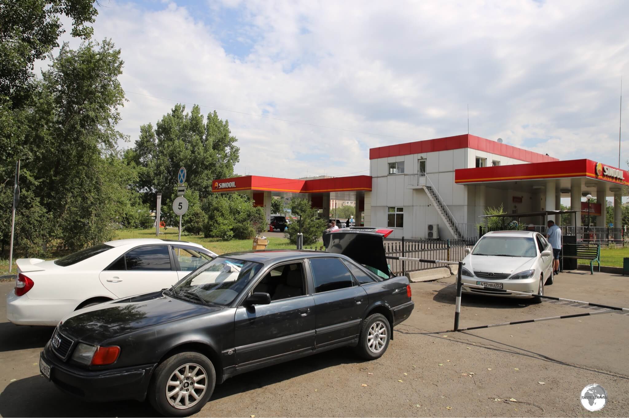
Shared taxis for Bishkek waiting at Sayran bus station in Almaty.
The fastest and most convenient way to travel between Almaty and Bishkek (Kyrgyzstan) is via one of the frequent shared taxis which depart, when full, from the Sayran bus station in Almaty. The 235 km journey takes approximately 5 hours, depending on the amount of congestion at the border.
Taxis park alongside the Sino Oil petrol station on Utegen Batyr street and carry four passengers, charging 4,000 kzt (USD$10) per place. I always pay for a 2nd place which provides a little more breathing room for everyone plus the taxi gets to leave earlier since it waits for one less passenger.

On the road to Bishkek from Almaty.
Taxis from Almaty carry passengers to the border crossing which is in the bustling border town of Korday. The two immigration complexes are next to each other and are quick and straight-forward. I crossed at lunchtime during a weekday, which took about 15 minutes in total.
On the Kyrgyzstan side of the border, taxis wait to carry you into Bishkek, which is a 20 minute drive and costs about 400 krygyz som.
Bus
Long distances buses depart from Sayran bus station in Almaty. The bus station is easily reached via the Sayran metro station. Buses depart for cities in Kazakhstan with international departures for Kyrgyzstan, Uzbekistan, Tajikistan and China.
Sea
A ferry service connects the Kazakh port city of Kuryk (70 km south of Aktau) to Baku in Azerbaijan, leaving every 3-5 days. The ferries are actually cargo boats, which leave when they are full. They do not operate to any timetable and delays are common but, once underway, the journey time between Kuryk and Baku is 30 hours.
Getting Around

Street signage in Almaty.
Public Buses

The Almaty bus route map.
There are a total of 125 bus routes and 8 trolleybus routes which cover Almaty and beyond. A single ride on a bus costs 150 kzt, when tickets are purchased from the driver, or 80 kzt when using the stored value Onay Card.

A sprawling city, Almaty is connected by a comprehensive network of bus routes.
Detailed route maps (only in Cyrillic) can be viewed on the Alatransit website. One key route for visitors is bus #12, which connects Abay metro to Medeu, from where you can take the Shymbulak cable car into the mountains.

The Almaty “Hop-on / Hop-Off” bus leaves from Republic square.
A Hop-on / Hop-off sightseeing bus departs from a dedicated stop at Republic Square.
Metro

A metro train ready to depart from Baikonur station.
Almaty’s metro is comfortable, reliable, shiny and kept spotlessly clean by a small army of cleaners who continuously mop and polish all surfaces. Opened in December of 2011, after more than 23 years of construction, the metro consists of one single line with nine stations spread over a distance of 11.3 km (7.0 mi).

Almaty Metro route map.
With clean, comfortable trains arriving punctually, every 10 minutes from 6.30 am to 11.30 pm, the Metro is the best way to travel around Almaty.

Locals often sit while riding the incredibly long escalators on the Almaty metro.
There are currently a total of seven trains running on the network. The list of stations are:
- Raiymbek batyr (stop for: Almaty 2 Railway station)
- Zhibek Zholy (stop for: Green Bazar, Zenkov’s Cathedral, shopping street)
- Almaly (stop for: restaurants, cafes, shops)
- Abay (stop for: Koke Tobe cable car, Nedelka Cafe and Bus #12 to Medeu)
- Baikonur (stop for: Almaty Tourist Office)
- Auezov Theater (stop for: Almaty Circus, Rahat Palace Hotel, Auezov Theater)
- Alatau
- Sayran (stop for: Sayran inter-city bus station)
- Moskva
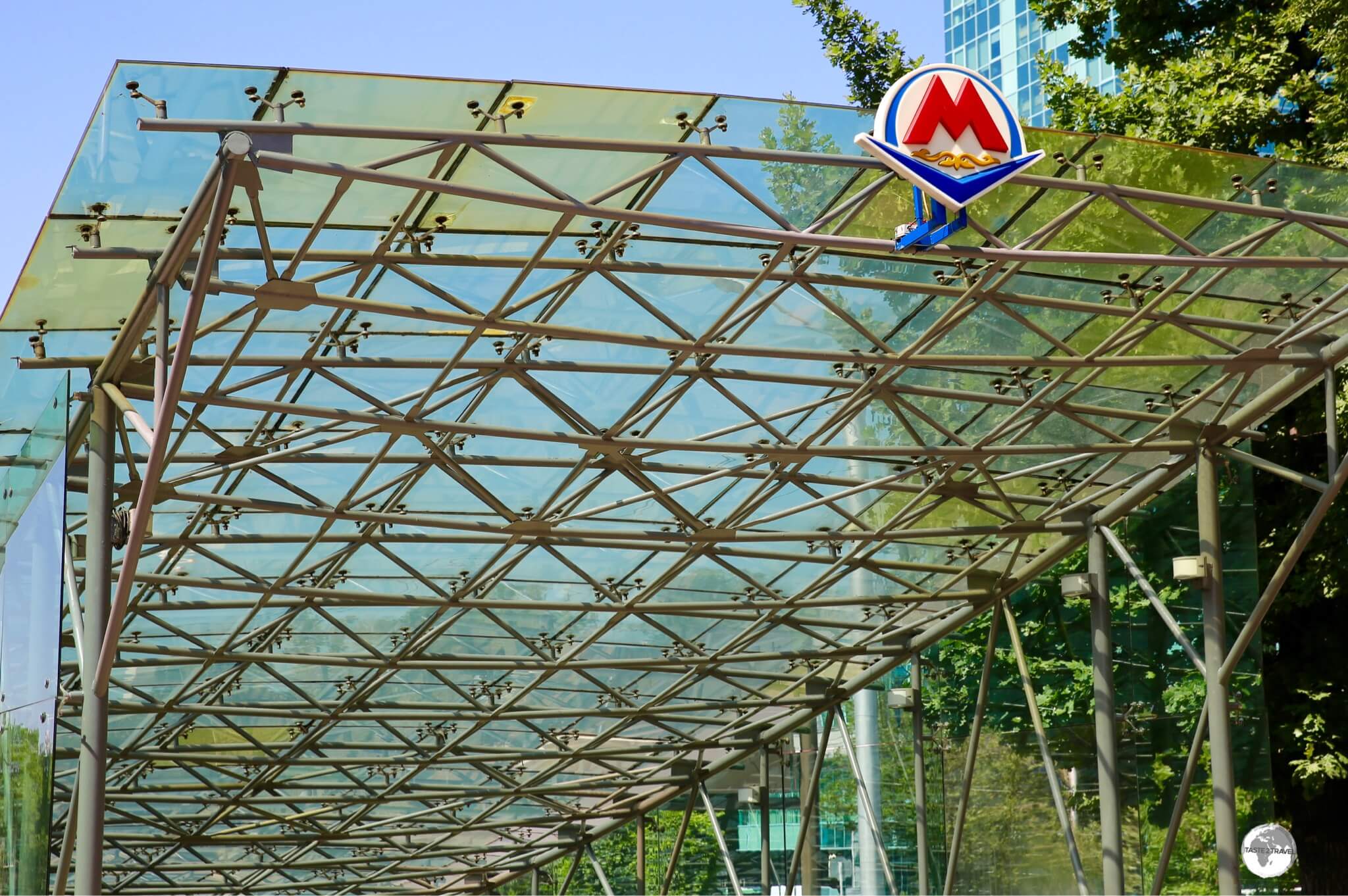
All metro entrances features the same glass canopy and the red ‘M’ metro logo.
With their entrances covered by a sweeping glass canopy, which are fronted by the red ‘M’ metro logo, the nine stations are easily identified. Upon entering the station, you pass through airport-style security screening before proceeding to the ticket window where you purchase a plastic yellow token for 80 tenge (US$0.21) from the friendly (always female) attendants. If you’ll be travelling frequently, you can purchase a ‘stored value‘ Onay Card from any station.

The futuristic Baikonur station on the Almaty metro.
There are no indicators advising when the next train is due but a timer above the entrance to each tunnel counts up to 10 minutes, at which point a train should be approaching.

Platform signage at “Raiymbek batyr” station, one of the terminus stations.
The stations of the Almaty metro feature decorative artwork which is worth investigating while you’re waiting for your train to arrive.

A ceramic mural depicts scenes from the Silk Road at Zhibek Zholy (Silk Road) Metro Station.
The headquarters of the Metro company is housed above the Zhibek Zholy (Silk Road) station which is decorated with ceramic artwork depicting scenes from that infamous route.

Zhibek Zholy, the Silk Road metro station.
Taxi
Yandex Taxi is an online ride-sharing service which was launched in 2011 and is now present in most of Central Asia. In 2018, Yandex and Uber merged their operations in the region. The Yandex app can be downloaded onto a smartphone and, in terms of functionality, is very similar to Uber.
Bicycle

The flat and shady cycle lane which runs the length of Abay avenue.
With a network of cycle lanes installed along shady, tree-lined avenues, exploring Almaty by bicycle is ideal! Almaty Bike operate a network of shared bikes which can be found in different downtown locations. Prior to using the service, you need to register for a chip card from one of their many booths which requires you presenting your passport.

Shared Almaty bikes can be found at various locations in downtown Almaty.
Rental Car

A view of a highway in Almaty with the Tien Shan mountains in the background.
Not really recommended unless you can read Cyrillic! Most signs are in Russian and Kazakh (which are written in Cyrillic) with few signs written in the Latin alphabet, however, signs on the main highways are always written in the Cyrillic and Latin form.

A Kazakhstan license plate.
Hertz Almaty (Tel: +7 707 695 3808) maintain an office inside the lobby of the Rahat Palace Hotel and charge 23,000 kzt (US$60) per day for a compact car. If you wish to drive a rental car across an international border, the rental company will need to organise insurance paperwork which will attract an additional fee.
That’s the end of my Kazakhstan Travel Guide.
Safe Travels!
Darren
Follow me on Instagram:
[instagram-feed feed=1]
Further Reading
Other travel reports from the Central Asia region:
Additional blogs, articles and information on Kazakhstan are available on the Indy Guide website.
Kazakhstan Travel Guide Kazakhstan Travel Guide Kazakhstan Travel Guide Kazakhstan Travel Guide Kazakhstan Travel Guide Kazakhstan Travel Guide Kazakhstan Travel Guide Kazakhstan Travel Guide Kazakhstan Travel Guide Kazakhstan Travel Guide Kazakhstan Travel Guide Kazakhstan Travel Guide Kazakhstan Travel Guide Kazakhstan Travel Guide Kazakhstan Travel Guide Kazakhstan Travel Guide Kazakhstan Travel Guide Kazakhstan Travel Guide Kazakhstan Travel Guide Kazakhstan Travel Guide Kazakhstan Travel Guide Kazakhstan Travel Guide Kazakhstan Travel Guide Kazakhstan Travel Guide Kazakhstan Travel Guide