Tag - Micronesia

Chuuk Travel Guide

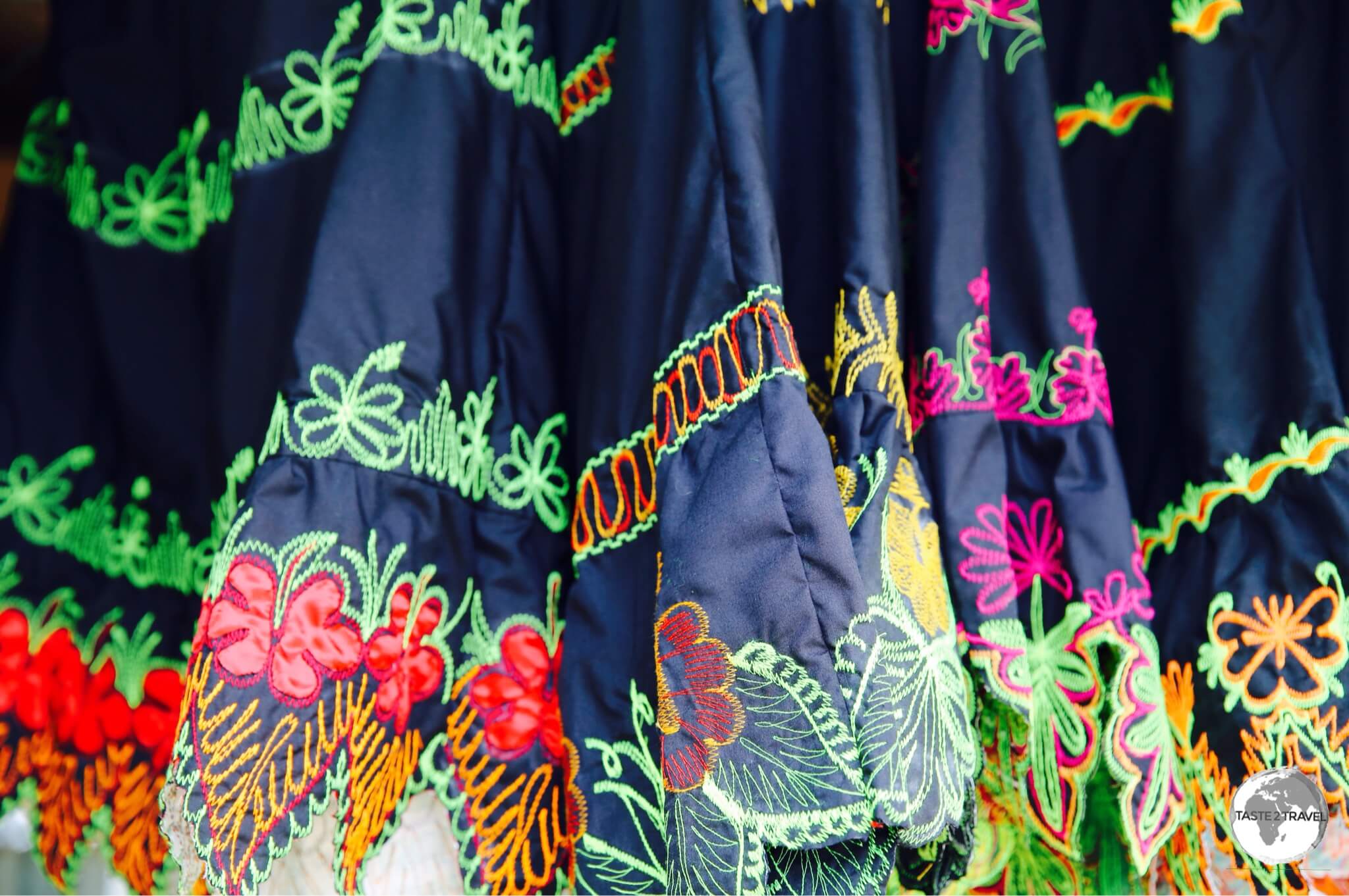
A shop in Weno town selling traditional Chuukese dresses.

Chuuk Travel Guide

Welcome to the taste2travel Chuuk Travel Guide!

Date Visited: February 2017

Introduction

As my torchlight made a sweep of the dark, watery space, I could see five Japanese war planes – Zero bombers – parked side-by-side, disassembled to facilitate transportation. I was 26 metres below the Chuuk lagoon and had just descended into one of the holds of the wrecked Fujikawa Maru. Built in 1938 by the Mitsubishi Company as a passenger and cargo carrier, the Japanese Navy took possession of the Fujikawa in the early days of WWII and converted her into an aircraft ferry.

Fujikawa Maru

Fujikawa Maru

Just prior to “Operation Hailstone”, the Fujikawa Maru had arrived in Chuuk where she off-loaded thirty bombers at a Japanese airfield. She would never leave Chuuk and on the day of Operation Hailstone she was still carrying the Zero bombers in her hold – the bombers that I was now diving around.

Chuuk Travel Guide: A shop in downtown Weno, the capital of Chuuk.

A shop in downtown Weno, the capital of Chuuk.

Welcome to Chuuk, one of the states of the Federated States of Micronesia (FSM) and the premier wreck diving capital of the world. In other places you can dive a single wreck, on Chuuk you can dive a whole fleet.

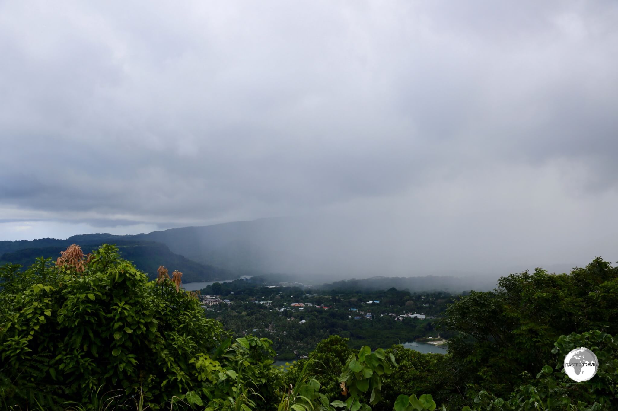
Chuuk Travel Guide: Storm clouds over Chuuk Lagoon.

Storm clouds over Chuuk Lagoon.

While Chuuk is another beautiful, remote, Pacific atoll, the main reason travellers come here is to dive the plethora of wrecks which lay at the bottom of the lagoon. Chuuk offers world-class wreck diving and with over 60 wrecks, from supply vessels (Maru) to planes and a submarine, there is plenty to keep divers busy.

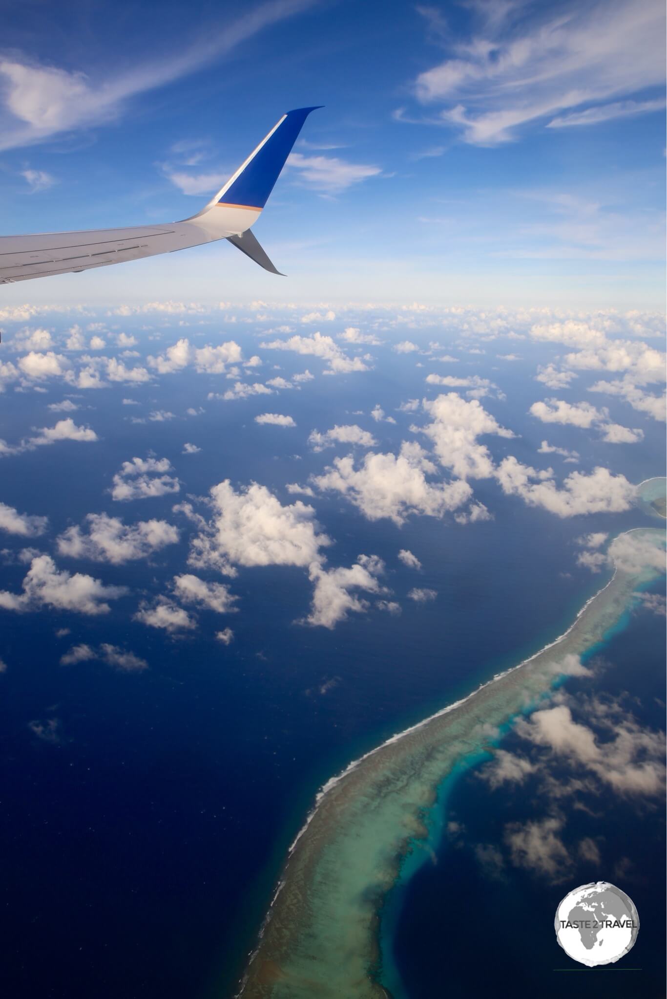
United Airlines' UA154 on approach to Chuuk International Airport.

Truk or Chuuk? What’s in a name?  To the Chuukese, their home has always been ‘Chuuk‘. To the Germans (who once colonised the island), Chuuk was difficult to pronounce – to them it sounded like ‘Truuk‘. Once the American GI’s arrived, they pronounced it ‘Truk‘ and that name stuck during the many years that Truk was part of the (US-administered) Trust Territory of the Pacific Islands (TTPI). Following independence, the island reverted back to it’s original name of ‘Chuuk‘.

Stormy skies over Chuuk lagoon.

Stormy skies over Chuuk lagoon.

Location

Chuuk is located north of the equator, between Hawaii and the Philippines. It’s one of the four states of FSM, with the state of Yap to the west and Pohnpei and Kosrae to the east.

Chuuk, Federated States of Micronesia

At a circumference of 225 kilometres (140 mi), the lagoon is the world’s largest – it’s protective barrier reef (the remnants of an ancient volcano) enclose a cluster of small islands, which were once the mountain peaks on the volcano. All services (and infrastructure) are to be found on the administrative island of Weno, with everything being connected by one (not too long), main road.

Weno is the atoll’s capital and, with a population of 12,000 people, is the largest city in the FSM. The outer islands are either uninhabited or contain villagers living a subsistence lifestyle.

History

A Japanese WWII memorial in downtown Weno, Chuuk.

A Japanese WWII memorial in downtown Weno, Chuuk.

The early history of Chuuk is unknown but it is clear from archaeological digs that people have inhabited the area since the 1st or 2nd century BC. The first recorded sighting of the islands were made by the Spanish in 1528.

The Spanish would later claim the islands (by simply raising a flag) but never established any permanent settlement. In 1899, the Spanish sold the islands to the German empire, but following Germany’s defeat in WWI, the Japanese where given control of the islands under a mandate from the League of Nations.

During WWII, the Japanese used Chuuk as their main Naval base in the South Pacific. From here, they launched operations against Allied forces in the region. Japanese military engineers converted Chuuk into a formidable fortress, with roads, trenches, bunkers, caves, airstrips, seaplane bases, a torpedo boat station, submarine repair shops, a communications centre and a radar station. All of this came to a spectacular, fiery end on February 17, 1944 during Operation Hailstone (see following section).

Following WWII, Chuuk was made one of six districts of the Trust Territory of the Pacific Islands (TTPI), which were administered by the United States under a UN charter. Independence was finally granted to the Federated States of Micronesia (Kosrae, Pohnpei, Chuuk & Yap) in 1990.

More recently, a ‘Chuuk Independence’ movement has gained popularity which, if successful, could see the break up of the FSM.

Operation Hailstone 

Operation Hailstone

Operation Hailstone. Source: Wikipedia

If it wasn’t for Operation Hailstone, Chuuk would be just another quiet, remote backwater. On February 17, 1944, the island’s place in history would be ensured forever when American forces commenced a three day bombing campaign, the aim of which was to completely destroy the naval base and all ships in the lagoon.

The relentless aerial bombardment resulted in the sinking of more than 60 warships, planes and a submarine. A 10 minute propaganda film – Yanks Smash Truk (filmed by an embedded cameraman aboard one of the bombers), provides you with a sense of the ferocity of the bombardment.

Diving

A map showing the many Japanese wrecks in Chuuk Lagoon.

A map showing the many Japanese wrecks in Chuuk Lagoon.

As a result of Operation Hailstone, Chuuk lagoon is the world’s largest ship graveyard, with the wrecked Japanese fleet now known as the ‘Ghost Fleet of Truk Lagoon‘. The fleet was first brought to the world’s attention in 1969 when Jacques Cousteau and the Calypso team explored the lagoon and it’s wrecks, producing the TV documentary “Lagoon of Lost Ships“. The documentary put Chuuk on the world diving map and changed the fortunes of the island.

A local diver, Kimiuo Aisek, who as a 17-year-old witnessed Operation Hailstone, opened the islands first dive shop in 1973 at the Blue Lagoon Resort. Today the dive shop is one of two on Weno offering dive trips. A museum at the resort displays artefacts salvaged from some of the wrecks.

Today the island is a magnet for divers with the majority of wrecks being within recreational diving limits (30-40 metres / 100-130 feet) and close to shore. For those who prefer zero commuting to their dive sites, a few live-aboard options are available, these include the SS Thorfin, Odyssey and the Truk Master.

Chuuk Travel Guide: The boat jetty at Truk Stop hotel.

The boat jetty at Truk Stop hotel.

An excellent map of the wreck’s is printed by Franko Map’s (see above image) and is available for purchase on Amazon. The Truk Lagoon Dive Centre offer an online, interactive map, which provides detailed information on various wrecks. I did four dives with Truk Lagoon Dive Centre, these were:

Heian Maru

The Heian Maru wreck which lies at the bottom of Chuuk lagoon.

The Heian Maru wreck which lies at the bottom of Chuuk lagoon.

The largest wreck (11,600 tons) I dived was the giant Heian Maru – this was featured by Jacques Cousteau in his original documentary. Located between 12 metres and 33 metres, the Heian carried supplies for Japanese submarines. We explored inside the forward hold’s, where we saw long lance torpedoes and then into the companionways, where we saw periscopes and other equipment.

Yamagiri Maru

Chuuk Travel Guide: The Yamagiri Maru wreck which lies at the bottom of Chuuk lagoon.

The Yamagiri Maru wreck which lies at the bottom of Chuuk lagoon.

On the Yamagiri Maru (located at a depth of 15 metres – 33 metres) we explored a hold which contained a supply of huge 18.1″ armour piercing shells, with each shell weighing 1,400 kg. Also on-board was a steamroller and other construction equipment.

Fujikawa Maru

The Fujikawa Maru wreck which lies at the bottom of Chuuk lagoon.

The Fujikawa Maru wreck which lies at the bottom of Chuuk lagoon.

Located at a depth of between 9 metres and 34 metres, the Fujikawa Maru is considered the best dive site in Chuuk – this is a ‘must dive’. The main smoke stack is reached at just 6 metres, with her deck at 18 metres. On the bow of the deck is an impressive (coral encrusted), 6-inch (152 mm) bow gun.

In one of the forward hold’s are four disassembled Mitsubishi fighter aircraft along with machine guns, shells and other ammunition. Other structures we explored included the galley, engine room, staterooms, bathrooms and the pilothouse. The entire ship is covered in an abundance of soft corals, which attracts a wealth of marine life. A magical diving experience.

Shinkoku Maru

The Shinkoku Maru wreck which lies at the bottom of Chuuk lagoon.

The Shinkoku Maru wreck which lies at the bottom of Chuuk lagoon.

The Skinkoku Maru is one of the most popular dives in Chuuk. The ship served as a naval tanker and offers a myriad number of rooms (all largely intact) for the diver to explore. The ship was sunk upright with a large bomb hole visible in her port side.

Th ship lies between 12 metres – 38 metres, with her main deck at 18 metres. During the dive we explored the crew quarters, engine room, sick bay, wheelhouse, the galley (complete with porcelain dishes, stove, utensils and other kitchenware) and the deck. The deck is covered in an amazing array of soft corals which attracts a huge amount of fish.

Island Sights

Chuuk Travel Guide: A shop in Weno, the capital of Chuuk.

A shop in Weno, the capital of Chuuk.

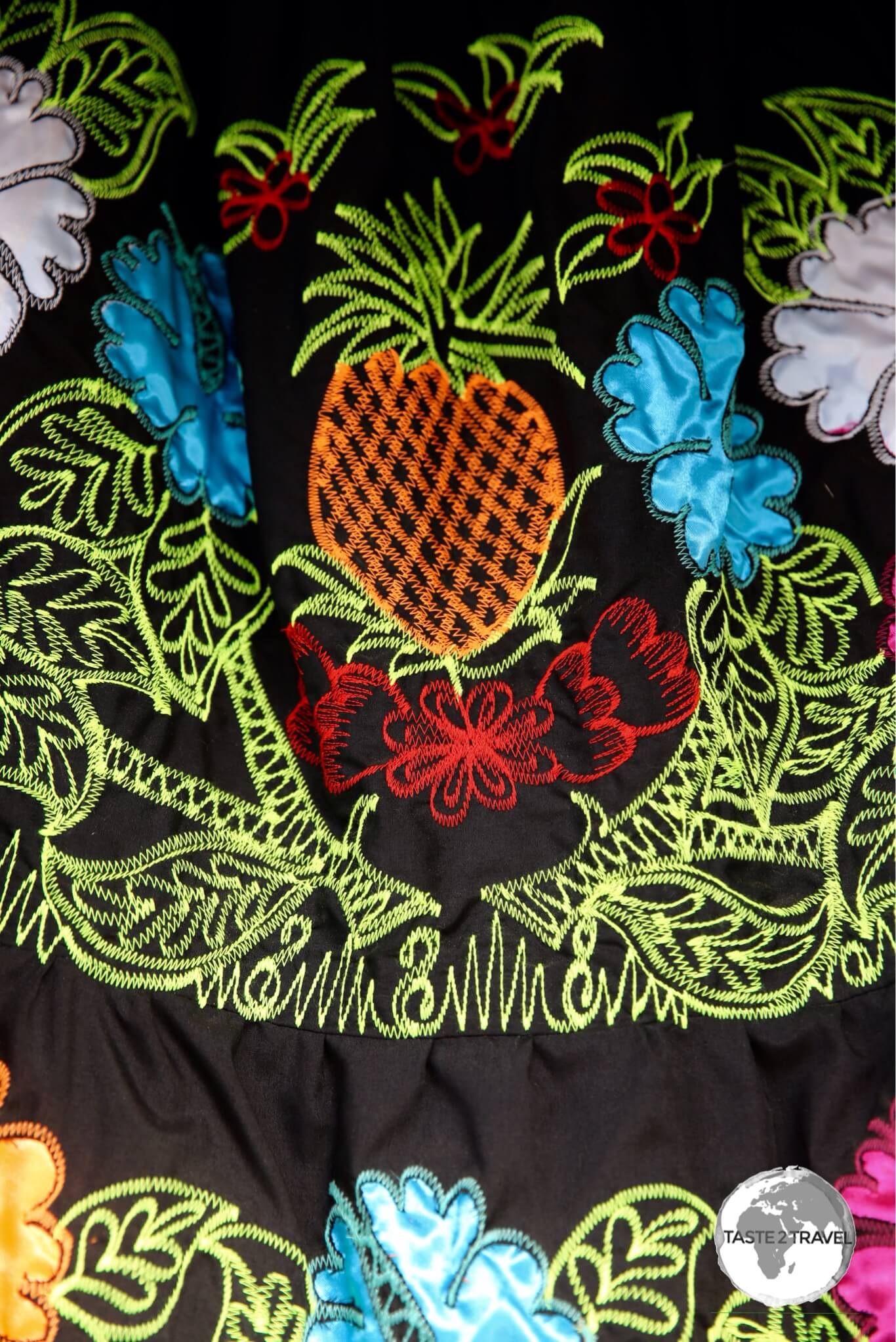
The terrestrial attractions on Chuuk are limited, which isn’t a problem since most visitors are here for the underwater attractions. A walk along the main street will hold your interest for about 1 hour, during which time you can check out the shops, purchase super cheap local coconut oil (US$2 for a one litre PET bottle) or buy some fresh fruit. All Chuukese ladies wear the traditional Chuukese dress, which are sold in shops along the main street.

A neighbourhood on Weno island flooded after a recent storm.

A neighbourhood on Weno island flooded after a recent storm.

Outside of town there are some walking trails which will take you up onto the surrounding hilltops. The trails are rough and poorly marked so a local guide is recommended. You can also visit neighbouring atolls for the day, however there are no services or facilities available on these.

A bottle of locally made coconut oil costs US$2 in Weno.

A bottle of locally made coconut oil costs US$2 in Weno.

Accommodation

United Airlines' UA154 on the runway at Chuuk International Airport with my hotel, Hotel Level 5, visible in the background.

United Airlines’ UA154 on the runway at Chuuk International Airport with my hotel, Hotel Level 5, visible in the background.

There are just a few hotels on Weno, but these are more than enough to cater to the small trickle of travellers who make it here.

Directly opposite the airport is the Level 5 Hotel. I stayed here and I’m glad I did. I visited every hotel on the island and, in my opinion, this is the best. The spacious, comfortable rooms are newly renovated and the ground floor features the best café/ restaurant on the island.

The hotel also features the only elevator on Chuuk but interestingly the locals avoid it – they are either afraid of it or just not use to using one. When it comes time to leave, the airport is across the road. Despite its close proximity to the airport, the hotel offers a shuttle service and will be waiting to pick you up when you arrive – the shortest shuttle connection I’ve ever had.

Also within walking distance of the airport is the High Tide Hotel. This family-run hotel offers older style rooms and a good restaurant, which serves reasonably priced, generous portions of local seafood.

Chuuk Travel Guide: The Truk Stop Hotel at Chuuk, one of the few hotels on Chuuk.

The Truk Stop Hotel at Chuuk, one of the few hotels on Chuuk.

For divers who prefer to stay somewhere with an onsite dive shop, there are two options:

  1. The closest to downtown is Truk Stop Hotel. This is a family run hotel, whose American owner has been a key proponent of the local tourism (i.e. diving) industry for many years. The 23 hotel rooms are old and dated but a new wing was under construction during my visit (Feb 2017). Besides being home to just one of two dive shops on the island, the hotel offers a restaurant and two bars. If you wish to socialise, this is the only real option on the island.
  2.  The other option, Blue Lagoon Resort, is the most upmarket property on the island and the most expensive, although rooms here are in need of renovation. The resort dive shop was the first established on the island by local diving pioneer Kimiuo Aisek. The resort is located 8 km south of the airport away from the downtown area. The shared ‘town’ taxis (which regularly shuttle along the main road) do not travel this far south (the road is in terrible condition) so you will need to hire a taxi to reach the resort.

Eating Out

Options are limited, with the few hotels providing the only restaurants. My favourite place (and the ‘go to’ place for the best coffee) is the restaurant/ café at the Level 5 Hotel. This is a sister operation of a café in Honolulu and features the only espresso machine on the island. The café is open for breakfast, lunch and dinner and is a popular spot for those waiting for the (often delayed) United Airlines Island Hopper.

The restaurant at Truk Stop Hotel is very popular, with a good selection of food and drinks and always a good ambience. There’s a restaurant at the Blue Lagoon Resort (the only dining option at this end of the island) and at High Tide Hotel.

Visa Requirements

Chuuk Passport Stamps.

Chuuk Passport Stamps.

Some nationalities require visas for the Federated States of Micronesia – check your visa requirements prior to arrival.

Getting There

United Airlines' UA154 departing from Chuuk.

United Airlines’ UA154 departing from Chuuk.

By Air

Chuuk Travel Guide: The terminal building at Chuuk International airport.

The terminal building at Chuuk International airport.

Flights to Chuuk arrive at Chuuk International Airport on the island of Weno. This sleepy airport is a short walk from the downtown area and several hotels. For more details on UA154 and Chuuk Airport, refer to my Central Pacific Island Hopping blog.

Chuuk Travel Guide: United Airlines' UA154 departing from Chuuk.

United Airlines’ UA154 departing from Chuuk.

The following airlines provide connections to/from Chuuk:

  • Air Niugini – flights to Pohnpei and Port Moresby (with connections onto Australia, Singapore and Manila).
  • United Airlines – flights to Guam, Honolulu, Kosrae, Kwajalein, Majuro, Pohnpei
Asia Pacific Air Airlines, Chuuk Airport.

All freight in Micronesia arrives courtesy of two companies – Matson Shipping Line or Asia Pacific Airlines (seen here at Chuuk Airport).

Getting Around

Bus

There are no public buses on Weno.

Taxi

Taxi’s on Weno cost between $1 to $2 depending on distance travelled. The distance from the airport to the Blue Lagoon resort (one end of the island to the other) is about 5 miles.

Car

The Level 5 Hotel offers expensive (US$70 per day) car rental but there’s no need to hire a car on an island with one short road, which is covered by frequent (and cheap) shared taxis.

Chuuk promotes itself as a Diver's Haven.

Chuuk promotes itself as a Diver’s Haven.


That’s the end of my Chuuk Travel Guide.

Safe Travels!

Darren


Follow me on Instagram: 

[instagram-feed feed=1]


Further Reading

Other travel reports from the Pacific region:

Chuuk (Truk) Travel Guide Chuuk (Truk) Travel Guide Chuuk (Truk) Travel Guide Chuuk (Truk) Travel Guide Chuuk (Truk) Travel Guide Chuuk (Truk) Travel Guide  Chuuk (Truk) Travel Guide Chuuk (Truk) Travel Guide

Pohnpei Travel Guide

Smiling girl on Pohnpei.

Pohnpei Travel Guide

Welcome to the taste2travel Pohnpei Travel Guide!

Date Visited: February 2017

Introduction

After an hour of climbing in the sweltering, humid, heat – under the direct glare of the tropical sun – I’d finally made it to the summit of Sokehs ridge – a point marked by a very unceremonious communications tower.

View of the fringing reef that protects Pohnpei from Sokehs Ridge.

View of the fringing reef that protects Pohnpei from Sokehs Ridge.

From here I had a panoramic view of the northern tip of Pohnpei. In the valley below, the capital – Kolonia – was slowly being enveloped by a fierce tropical storm. Like a deer staring into the headlights, I stood and watched as the storm clouds slowly rolled across the landscape towards me.

A storm moving over Kolonia, the capital of Pohnpei, as seen from Sokehs ridge.

A storm moving over Kolonia, the capital of Pohnpei, as seen from Sokehs ridge.

Then the inevitable happened – first one drop, then another, then the heaven’s opened up – but after the long, hot climb, all that cool water was so refreshing. I had found a sheltered place for my camera bag, but as for me – I stood out in the open with my arms and mouth open, getting soaked and slurping the tropical rainwater.

After the storm cleared, I had a magnificent view of Sokehs rock, a 100m high exposed basalt volcanic plug that shoots up out of the lush green landscape and is the most striking feature of Pohnpei’s topography. The island gets it’s name from this feature – “upon (pohn) a stone altar (pei)”.

Just a few days earlier I had had a bird’s eye view of the rock from my seat (32D) on board United Airlines’ Island Hopper (UA154) as we passed by the rock on our final approach to Pohnpei airport.

Nature abounds on Pohnpei - the 'garden of Micronesia'.

Nature abounds on Pohnpei – the ‘garden of Micronesia’.

Pohnpei (formerly ‘Ponape’) is one of the four states, which comprise the Federated States of Micronesia (FSM) and bills itself as ‘the Garden of Micronesia‘. You don’t need to spend much time on the island to realise this is not some over-hyped slogan created by local tourism officials.

Due to it being one of the wettest places on earth (annual recorded rainfall exceeding 76-cm/ 300-in), Pohnpei is full of lush, tropical, vegetation, a place where colourful, flowering plants frame every view. Visiting Pohnpei is like holidaying on an over-sized botanical garden – it’s that beautiful.

These handmade decorations are made by a woman's coop in Kolonia.

These handmade decorations are made by a woman’s coop in Kolonia.

The island is surrounded by a fringing reef, which provides protection and so much more for the island. Surfing is popular on the reef and more and more intrepid surfers are finding their way to this remote island to ride the famed waves of Palikir pass. The reef also offers diving, snorkeling and fishing opportunities.

The view of the fringing reef which surrounds Pohnpei from my seat on United Airlines' Island Hopper.

The view of the fringing reef which surrounds Pohnpei from my seat on United Airlines’ Island Hopper.

Almost all services on Pohnpei are located in the capital of Kolonia so this is the place to base yourself during your visit. The town has a population of 6,000 (almost the entire population of neighbouring Kosrae) so if you are coming from quiet Kosrae you will notice the hustle and bustle. There’s one road which circumnavigates the island and provides access to all the sights of interest.

Traditional embroidered ‘Pohnpei’ dresses. These are worn by almost every girl on the island.

The island has many natural attractions and many good restaurants and bars in Kolonia – enough to keep you busy for a few days.

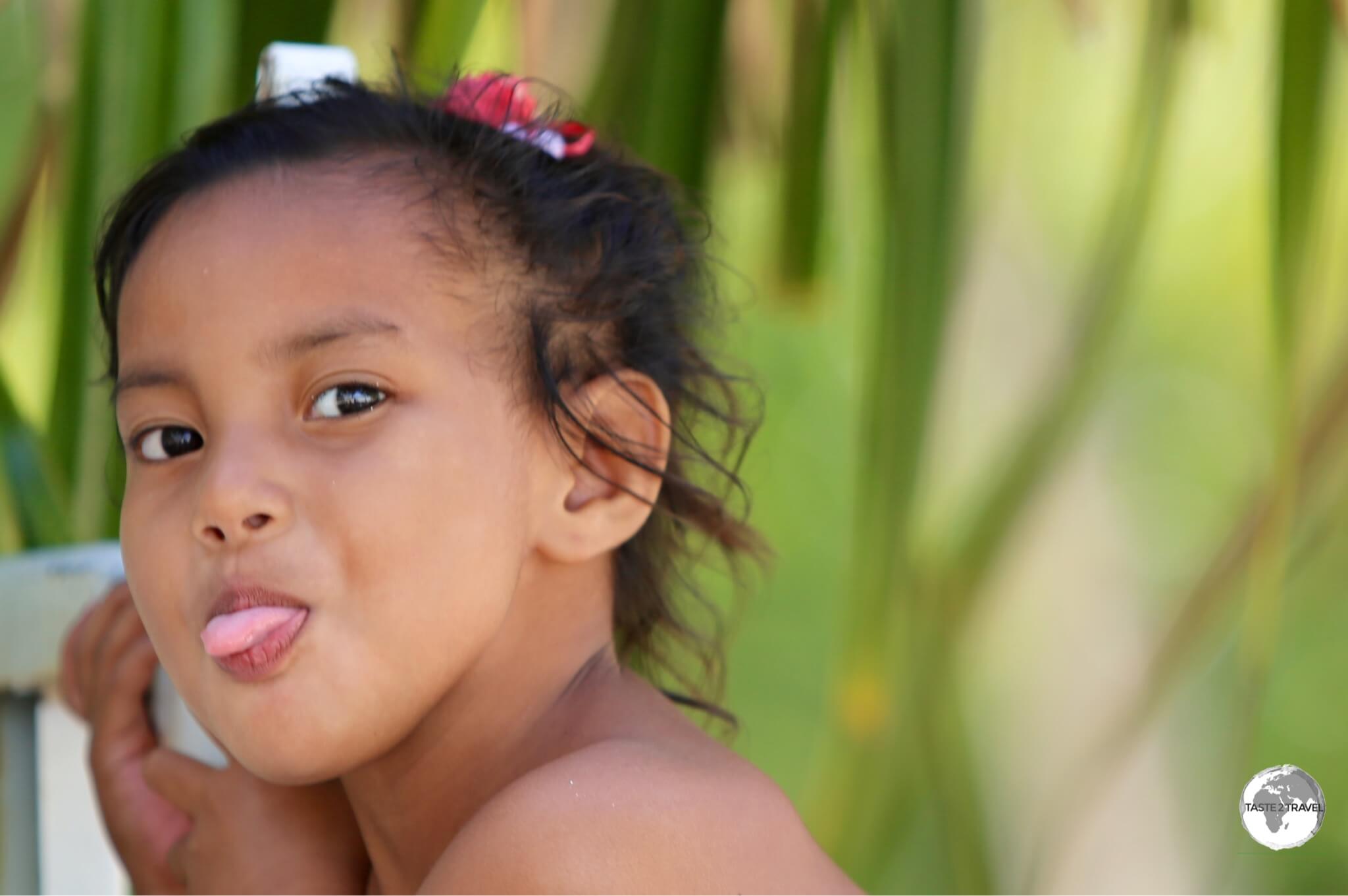
Very cute! Flower Girl on Pohnpei.

Very cute! Flower Girl on Pohnpei.

Location

Federated States of Micronesia

Pohnpei is located in the middle of nowhere, midway between Hawaii and The Philippines. It’s part of the Federated States of Micronesia, being located at the eastern end of the Caroline Islands group.

Distance marker in Kolonia - everywhere is a long way from Pohnpei.

Distance marker in Kolonia – everywhere is a long way from Pohnpei.

The island is volcanic and mountainous, with those mountains being covered in verdant rainforests and cascading waterfalls.

History

Archaeologists estimate that people came to Pohnpei between 2,000 and 3,000 years ago from Southeast Asia. The first European contact was with the Spanish in 1529.

The Spanish made the island part of the Spanish East Indies (along with The Philippines) and founded the city of Santiago de la Ascension. This city was later renamed Colonia (Spanish for colony) which was in turn renamed to today’s Kolonia.

The elusive Pohnpei Lorikeet seen on Sokehs ridge.

The elusive Pohnpei Lorikeet seen on Sokehs ridge.

Rule of the island passed from Spain to Germany to Japan then (following the defeat of the Japanese during WWII) to the United States. The US administered the island (under UN auspices) as part of the Trust Territory of the Pacific Islands until 1986 at which point the island obtained independence as one of four states (along with Yap, Chuuk, and Kosrae) comprising The Federated States of Micronesia. 

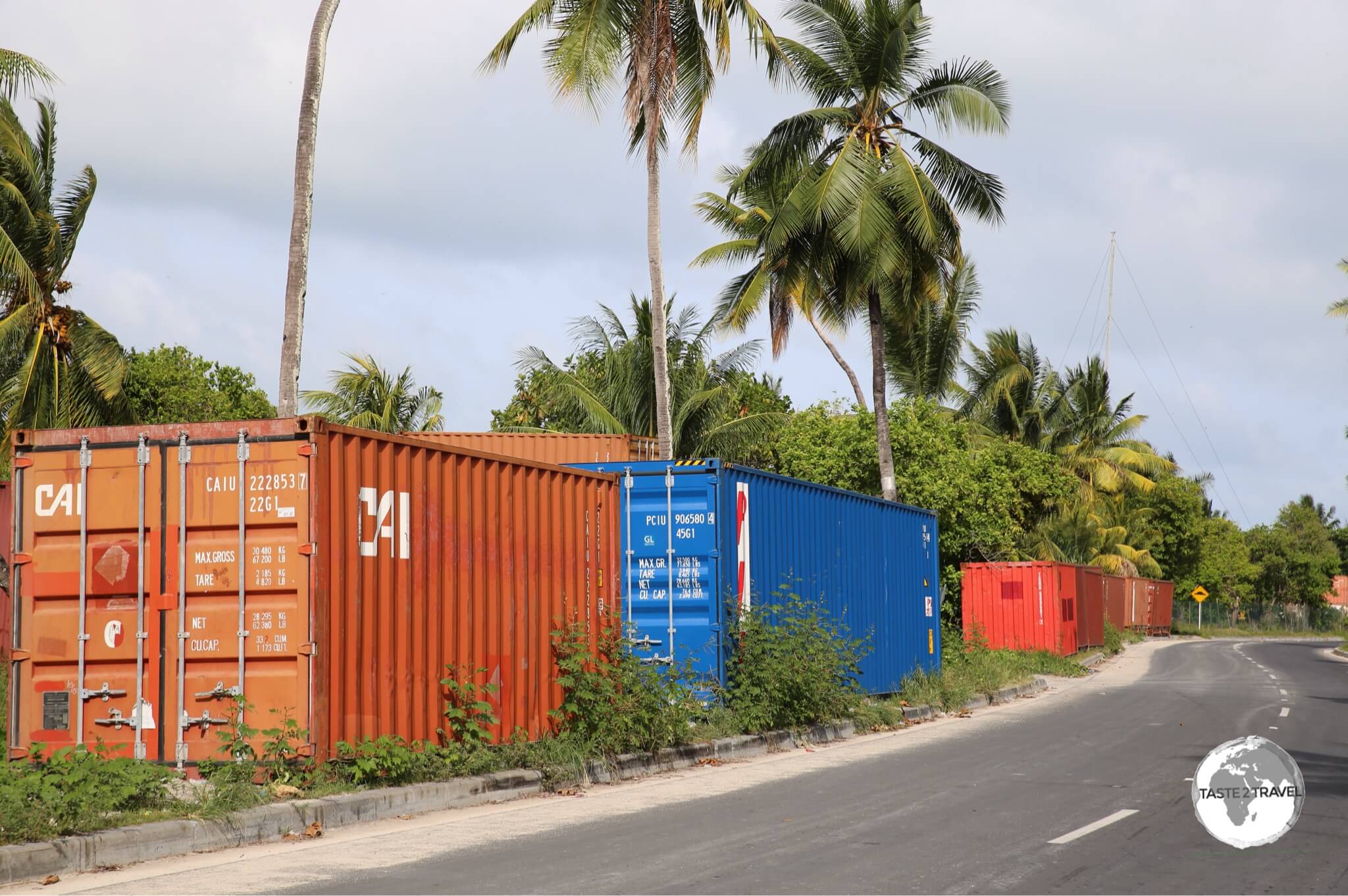
Shipping containers on Pohnpei are used in creative ways.

Shipping containers on Pohnpei are used in creative ways.

The standout historical feature of the island (and it’s top attraction) is the impressive ancient ruins of Nan Madol – the most impressive ruins complex in the Pacific. For more on Nan Madol, refer to the sightseeing section below.

Flag

The flag of Micronesia.

The flag of Micronesia.

The flag of the Federated States of Micronesia (FSM) was adopted on 30 November 1978. The blue field represents the Pacific Ocean, while the four stars represent the states in the federation: Chuuk, Pohnpei, Kosrae and Yap.

Currency

US Dollar

The US Dollar.

In centuries past, the islands of FSM, notably Yap, used stone currency, which was referred to as “Rai” or “Fei”. Impossibly large and too heavy to carry, this traditional currency, which seemed to be more suited to a giant, was crafted from Calcite, which was carved into doughnut-shaped disks.

Yap Stone Currency.

Yap Stone Currency.
Source: https://medium.com/the-mission/the-island-of-yap-and-the-idea-of-money-9f570421d854

Today, along with all former members of the Trust Territory of the Pacific Islands, the official currency of FSM is the US dollar which is so much easier to carry.

Betel-Nut

Betel-Nut for sale at a shop in Kolonia.

Betel-Nut for sale at a shop in Kolonia.

Betel nut is a popular stimulant on Pohnpei and can be found in shops and markets across the island.

A form of local chewing tobacco, the betel nut is split open and powdered with lime, wrapped with pepper plant leaf and then placed in the mouth where it is chewed. Am indicator of beetle nut use is an orange mouth  a result of chewing

It’s a practice found throughout the FSM, but Pohnpei and Yap have it in abundance and it is a relatively important exported cash-crop for the local economies.

Sights

With the exception of Nan Madol and a few colonial relics scattered around Kolonia, most sights on the island are of the natural kind. The other joy of travelling on Pohnpei are the locals. Without exception, they are friendly, warm and welcoming.

Traditional embroidered ‘Pohnpei’ dresses.

Traditional embroidered ‘Pohnpei’ dresses.

Due to the complete lack of transport on the island you will need to hire a car if you wish to explore beyond Kolonia (you should definitely get out of town). There is one ring road around the island which is 130-km in length. You can cover all sights in one full day.

There are very few petrol stations outside of Kolonia so better to have a full tank before leaving town. I’ve covered the sights as you will approach them if you travel in an anti-clockwise direction around the island, with Kolonia at the 12 o’clock position.

Girl on Pohnpei.

No shortage of smiles on Pohnpei.

Kolonia

With a population of 6,000, Kolonia is the capital and main city of Pohnpei. With a few roads, a handful of shops and all of the (limited) tourist services on the island, the town is the centre of action but very quiet and relaxed. There are few sights (a German clock tower and a Spanish stone wall) but it is a pleasant place to spend an hour or two exploring.

Sokehs Ridge

Sokehs Rock, a gigantic exposed basalt volcanic plug is the most striking feature of Pohnpei's topography.

Sokehs Rock, a gigantic exposed basalt volcanic plug is the most striking feature of Pohnpei’s topography.

Overlooking Kolonia is the impressive Sokehs Ridge. The hike up to the top of the ridge offers a good workout and is best done early morning or late afternoon. If you have a car you can park it in the car park of the police station at the start of the tarmac road which leads part way up the ridge.

Eventually the tarmac road becomes a dirt road (still passable in a 4WD) before reaching a level ridge from which point you must walk. This is the start of a very steep trail which climbs up to the ridge from where you will have the most amazing views of Kolonia and the Pacific. This is a long, sweaty slog on a remote ridge so ensure you are carrying ample water.

Japanese war memorial on Sokeh's ridge.

Japanese war memorial on Sokeh’s ridge.

Once you reach the top of the ridge (you’ll probably have the ridge to yourself) you can follow trails which take you to Japanese WWII ruins and eventually onto the communications tower from where you have panoramic views of the northern side of the island.

Palikir

FSM capital, Palikir

The FSM capital, Palikir, is located in a small administrative enclave on a side road of Pohnpei.

Just 8-km south of Kolonia is a right-hand turn off the main road, which leads to Palikir – the capital of the Federated States of Micronesia.

Government buildings in sleepy Palikir.

Government buildings in sleepy Palikir.

The capital is a tiny planned enclave of little consequence, with uniformly designed buildings arranged around a small park area. I visited on a weekend and had the place to myself – there was no sign of life – no cafes, restaurants or services of any kind.

Nan Madol

The impressive walls of Nan Madol.

The impressive walls of Nan Madol.

Located in a remote coastal setting, about 90 minutes south of Kolonia (along the east coast), Nan Madol is the one ‘must see’ attraction on Pohnpei. If this was anywhere else in the world you would be lining up to buy a ticket and jostling with hoards of tourists who would be constantly photo-bombing your shots.

But here – on remote Pohnpei – you will probably have the sight to yourself. The ruined city is very impressive and extensive, but the addition of being in such a remote place makes a visit a truly unique experience.

You reach the ruins after a 10 minute walk along a track, which leads you through a steamy mangrove forest. You have to pay three different  property owners an ‘access’ fee along the way, the last payment (US$5) is to the man who transports you across a narrow channel in his kayak, dropping you at the main entrance to the ruins.

A diagram of the sprawling Nan Madol complex.

A diagram of the sprawling Nan Madol complex.

It is believed Nan Madol was constructed by the same people who built the Leluh site on Kosrae (for more on that refer to my Kosrae blog). The city was constructed in a lagoon and consists of a series of small artificial islands (nearly 100) spread over an area of 1.5 km by 0.5 km.

There is no public transport to Nan Madol, you can reach the ruins either by car or by joining a tour.

Kepirohi Waterfall

Pohnpei Travel Guide: Kepirohi waterfall is located a short drive from Nan Madol.

Kepirohi waterfall is located a short drive from Nan Madol.

Located north of the Nan Madol turnoff (look for the roadside sign) is this beautiful Basalt waterfall. To access the falls, you first pay an ‘access’ fee to the property owner who occupies a shed by the main road.

You then have a 5 minute walk along a lush, forested trail to the falls. This is a great place to cool off after a sweaty day of sightseeing so don’t forget your swimmers.

Accommodation

7-stars Inn

Like everything else, Kolonia is where it’s at in terms of accommodation options on Pohnpei. I stayed in the conveniently located 7-stars Inn, a short walk from the downtown area. Rooms here are spacious and comfortable and include free Wi-Fi.

One of the more popular restaurants in town, The Riverside Restaurant, is located in the basement of the hotel, along with one of the only sports bars on the island. The hotel provides a free airport shuttle service.

Joy Hotel

Another mid-range option in downtown Kolonia is the Joy Hotel which is run by a Japanese family.

The Suzuki family offers basic rooms and a restaurant which, naturally, specialises in Japanese cuisine.  

Mangrove Bay Hotel

Another popular (but more expensive) option is the Mangrove Bay hotel. The hotel is a little further from downtown Kolonia but is more relaxing and includes a PADI dive shop and boat transport for surfers wishing to catch a ride to Palikir pass. For all hotels it’s best to book using booking.com

Eating Out

The fiery Pohnpei pepper is grown in the south of the island at a garden owned by Sei.

The fiery Pohnpei pepper is grown in the south of the island at a garden owned by Sei.

There are plenty of wonderful restaurants, bars and cafes on Pohnpei – all located in Kolonia.

One place which deserves a special mention is the friendly, Japanese owned Sei Pepper shop. Mr Sei grows his pepper on a farm located on the southern side of Pohnpei, however the only place to buy his pepper is from his shop on the main street of Kolonia (located a short walk from the 7-stars Inn).

The delicious organic Pohnpei coffee available at Sei.

The delicious organic Pohnpei coffee available at Sei.

The cafe is a meeting place for the local Japanese community who come together to sip the local Pohnpei coffee, which has a very bold, robust flavour. Attached to the cafe is a curry house where you can sample tasty curries made with Pohnpei pepper and other locally grown spices.

The amazing pepper donuts at Sei Cafe - a fiery experience!

The amazing pepper donuts at Sei Cafe – a fiery experience!

A specialty of the restaurant are the fiery Pohnpei Pepper Donuts, which you can wash down with a cup of Pohnpei coffee.


The Japanese Community in Micronesia

The Sei cafe serves as a meeting place for the Japanese community on Pohnpei.

The Sei cafe serves as a meeting place for the Japanese community on Pohnpei.

Japan has enjoyed close ties with Micronesia throughout history, and, at the time of WWII in 1942, there were 96,000 Japanese who called Micronesia home.

After the war, the Japanese population were repatriated back to Japan, however most people of mixed Japanese–Micronesian ethnicity remained in the islands and constituted a substantial percentage in the islands’ population. They became assimilated with the Micronesians, and in all official census they are identified by their Micronesian heritage.

If you’re interested to learn more about the Japanese connection to Micronesia, the Sei cafe in Kolonia is a good place to start your enquiries.


There are numerous restaurants in Kolonia – my favourite was the restaurant at the Joy Hotel. This restaurant serves amazing Japanese food (including the freshest sushi and sashimi) at very reasonable prices. All ingredients were fresh and nicely presented. I ate here more than once and would especially recommend ordering the ‘Joy special’.

For more upscale dining, there is the waterfront restaurant at the Mangrove Bay hotel.

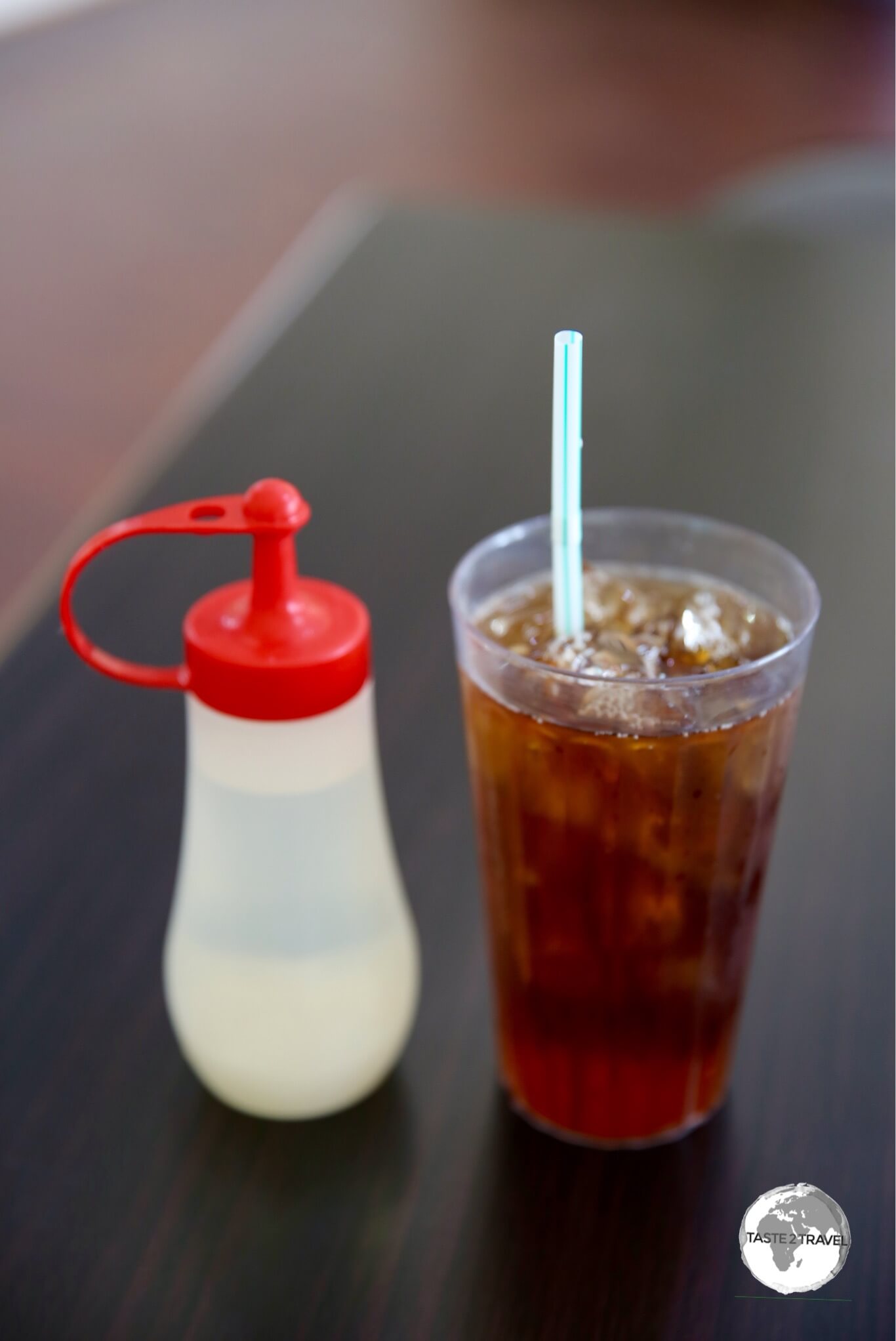
A refreshing drink throughout FSM is iced tea – always made from fresh black tea, which is served in a glass with lots of cool ice. The sweetener (always simple syrup) is served on the side so you can decide on your level of sweetness.

Iced Tea served with simple syrup on the side in a cafe in Kolonia.

Iced Tea served with simple syrup on the side in a cafe in Kolonia.

Visa Requirements

Some nationalities require visas for the Micronesia – check your visa requirements prior to arrival.

Getting There

Boarding United Airlines' Island Hopper (UA154) at Pohnpei airport.

Boarding United Airlines’ Island Hopper (UA154) at Pohnpei airport.

By Air

Arriving at Pohnpei Airport.

Arriving at Pohnpei Airport.

Flights to Pohnpei arrive at Pohnpei International Airport (IATA: PNI), .

If you are seated on the right side of the plane you will have a spectacular view of Sokehs Ridge on the final approach.  For more on Pohnpei airport, refer to my Central Pacific Island Hopping blog.

Like many islands within the region, commercial air service is rather limited due to small population and tourist traffic.

The following airlines provide connections to/from Pohnpei (Updated: August 2024):

  • Caroline Islands Air (Charter flights only) – flies to/ from Chuuk, Enewetak, Kapingamarangi, Kosrae, Mwoakilloa Airfield, Nukuoro, Pingelap, Sapwuahfik, Mortlock Islands Airfield (Ta), Woleai, Yap
  • Nauru Airlines – flies to/ from Palau, Majuro, Nauru, Tarawa
  • United Airlines – flies to/ from Chuuk, Guam, Honolulu, Kosrae, Kwajalein, Majuro
A view of the terminal at Pohnpei airport.

A view of the terminal at Pohnpei airport.

Nauru Airlines

Nauru Airlines route map - as of August 2024.

Nauru Airlines route map – as of August 2024.

Nauru Airlines offer regular connections to many destination in the Central Pacific region, including Pohnpei, from their base at Brisbane International Airport.

An especially useful connection, for those already travelling in the South Pacific, is the airline’s regular flight from Nadi (Fiji) which offers connections to countries in the Central Pacific.

Email address of the Brisbane office: book@ourtravel.com.au

Getting Around

Bus

There are no buses on Pohnpei.

Taxi

There are a few taxis available in Kolonia.

Car

The license plate of my rental car on Pohnpei.

The license plate of my rental car on Pohnpei.

There are very few rental companies on Pohnpei but you will need a car if you wish to explore on your own.

I hired a car through my hotel at US$65 a day.

Although expensive – I had a very nice, brand new, KIA Sportage – perfect for the bumpy, potholed roads outside of Kolonia. I felt like a ‘boss’ cruising around in my SUV and definitely didn’t want to give it up but United couldn’t fit it on the island hopper flight. :-))

As mentioned previously, fuel supply outside of Kolonia is limited so best to ensure you have a full tank prior to leaving town. If you do get stuck you can find roadside stalls selling fuel by the gallon ($5/ gallon).

I saw just one petrol station outside of Kolonia. Elsewhere you can purchase fuel from small roadside stalls.

I saw just one petrol station outside of Kolonia. Elsewhere you can purchase fuel from small roadside stalls.


That’s the end of my Pohnpei Travel Guide.

Safe Travels!

Darren


Follow me on Instagram: 

[instagram-feed feed=1]


Further Reading

Other travel reports from the Pacific region:

Pohnpei Travel Guide Pohnpei Travel Guide Pohnpei Travel Guide Pohnpei Travel Guide Pohnpei Travel Guide Pohnpei Travel Guide Pohnpei Travel Guide Pohnpei Travel Guide

Kosrae Travel Guide

View of Kosrae Island.

Kosrae Travel Guide

Welcome to the taste2travel Kosrae Travel Guide!

Date Visited: February 2017

Introduction

Looking out the window from my usual seat (32D) on the United Airlines Island Hopper, I saw a spectacular sight rising up out of the cobalt blue depths of the Pacific – a magnificent emerald-coloured, volcanic pinnacle.

This must be Kosrae (pronounced “Kosh-rye“), the island of the sleeping lady  the most easterly state in the Federated States of Micronesia.

The profile of the main mountain range, which is said to resemble a 'sleeping lady'.

The profile of the main mountain range, which is said to resemble a ‘sleeping lady’.

Remote, raw, spectacular  a lush, green, veritable ‘paradise lost‘. There is no doubting from the moment you set foot on the tarmac at Kosrae International Airport that you have arrived somewhere special.

Despite being a nearly full flight only half a dozen passengers disembarked at Kosrae. Clearing immigration and customs took just a few minutes. Outside the airport, there was an air of relaxed calm with a few people waiting around to collect arriving family members.

There was also the representative from my hotel – the Pacific Treelodge Resort, one of just two hotels on the island. It was clear I was the only tourist arriving today.

I was later told that the island receives around 300 visitors per year. As is custom when someone arrives on Kosrae, the friendly hotel representative placed a flowery lei on my head. We then set off on a very leisurely drive to the hotel, which was located on the other side of the island.

All visitors to Kosrae receive a flowery lei at the airport.

All visitors to Kosrae receive a flowery lei at the airport.

The first thing you notice on Kosrae is how quiet it is. With a total population of 6,600 inhabitants, the whole island is one big village with very little traffic. The speed limit is set at 25 mph (40 km/h) but locals tend to drive much slower. It’s life in slow motion. And why not? Where are you rushing to?

The only paved road runs along part of the coast, from the airport in the north-west, over the top of the island, down the east coast, through the tiny state capital of Tofol, to the southern town of Utwe. It’s a leisurely one hour drive.

A curious local boy on Kosrae.

A curious local boy on Kosrae.

There is something magical about tiny Kosrae, a magic that comes from the remote, spectacular beauty of the island – a remoteness that ensures you will have the island almost to yourself.

The ‘magic’ comes from the relaxed, slow pace of life, the warmth and gentle nature of the friendly locals. There is an innocence to life on Kosrae which has long been lost in most other parts of the world.

After five days on Kosrae, the island had worked it’s magic on me and if you ever have the chance to visit you too will no doubt experience the magic that is Kosrae.

Whatever you do – don’t rush your stay here! 

Location

Located in the central Pacific region, 600 km north of the equator, Kosrae is the most easterly of the four states which comprise the Federated States of Micronesia.

Federated States of Micronesia

Kosrae’s land area is 110 square kilometres sustaining 6,600 people. The population has been declining steadily over the years as more people move elsewhere to find work – especially the USA where Micronesians have the right to live and work. Tofol is the state capital. Mt. Finkol is the highest point at 634 metres.

History

Kosrae hasn’t always been so quiet. The ruined city of Lelu was established around 1250 AD, reaching it’s heyday during the 14th and 15th centuries with a population of 1,500 and covered some 27 hectares. The rulers of Lelu conquered and unified the whole of Kosrae. They ran the island under a hierarchical monarchy system similar to Tonga.

The first Europeans to make contact with the island were the Spanish in 1529 who were sailing from Indonesia to their colony of New Spain in present day Central America. At the time the population of Kosrae was estimated at 6,000 persons. The Spanish took nominal control of the island and since that time the island has passed from Spanish control to German to Japanese to US.

Following the end of WWII in 1945 and the defeat of the occupying Japanese, administration over Kosrae passed to the United States, which ruled the island as part of the Trust Territory of the Pacific Islands.

In 1979 Kosrae joined with the states of Pohnpei, Chuuk and Yap to form a constitutional government, becoming a sovereign state (Federated States of Micronesia) after independence was attained on November 3, 1986 under a Compact of Free Association with the United States.

Flag

The flag of Micronesia.

The flag of Micronesia.

The flag of the Federated States of Micronesia (FSM) was adopted on 30 November 1978. The blue field represents the Pacific Ocean, while the four stars represent the states in the federation: Chuuk, Pohnpei, Kosrae and Yap.

Currency

US Dollar

The US Dollar.

In centuries past, the islands of FSM, notably Yap, used stone currency, which was referred to as “Rai” or “Fei”. Impossibly large and too heavy to carry, this traditional currency, which seemed to be more suited to a giant, was crafted from Calcite, which was carved into doughnut-shaped disks.

Yap Stone Currency.

Yap Stone Currency.
Source: https://medium.com/the-mission/the-island-of-yap-and-the-idea-of-money-9f570421d854

Today, along with all former members of the Trust Territory of the Pacific Islands, the official currency of FSM is the US dollar which is so much easier to carry.

Sights

The mangrove walkway at Senny's Treelodge Hotel.

The mangrove walkway at Senny’s Treelodge Hotel.

The best way to get to know the island is to first book a tour with the local fauna and flora expert – Carlos. I organised the tour through Maria at the Island Hopper Resort.

Carlos is a native of Puerto Rico who came to Kosrae many years ago as a Peace Corps volunteer.

He fell in love with the island and its people and has stayed ever since. Carlos’ enthusiasm for Kosrae’s natural attractions is infectious, and it won’t take long before he has roped you into helping him find the elusive small blue-faced parrot finch (after a day spent searching, I still never spotted one).

Curious green lizard.

Curious green lizard.

Wiya Bird Cave

Inside Wiya Bird Cave.

Inside Wiya Bird Cave.

The first stop on our tour was the Wiya Bird Cave, located in Tafunsak (about three miles from the airport).

Swiftlets at the entrance of Wiya Bird cave.

Swiftlets at the entrance of Wiya Bird cave.

The mouth of the cave has a large opening that goes back about 20 metres and is home to thousands of Island Swiftlet birds who have built their nests on the roof of the cave.

Swiftlet nests on the ceiling of Wiya Bird cave.

Swiftlet nests on the ceiling of Wiya Bird cave.

There ceiling is covered in nests and, while these are out of reach, others can be easily found littering the floor of the cave, having become dislodged.

As is the custom in Micronesia, there is an entrance fee payable to the family ($2) whom own the land where the cave is located. You must pay before you enter – their house is along the road from the cave entrance.

A fallen Swiftlet nest collected from the cave floor.

A fallen Swiftlet nest collected from the cave floor.

After the cave Carlos took me down some back roads in search of local wildlife and bird life.

Carlos drives a little red Hyundai and it doesn’t take long to realise that this small car seems to possess 4WD capabilities.

Carlos loves bouncing along muddy, dirt tracks, pointing out majestic examples of the soaring native almond tree (used to build the long canoes unique to Kosrae) and other amazing plant life.

Touring the forested interior of Kosrae with Carlos.

Touring the forested interior of Kosrae with Carlos.

After showing me some towering Almond trees, Carlos took me to a place where I could see two of the famed Kosrae canoes.

Kosrae canoes are renown in Micronesia as they are much longer than those on other islands since the trees on other islands do not grow as tall and as straight as the Almond tree.

Kosrae canoes are renown for their length as they are constructed from the trunk of the native Almond tree.

Kosrae canoes are renown for their length as they are constructed from the trunk of the native Almond tree.

After he had driven me the length of the island, I invited Carlos to join me for a late lunch at the restaurant at Kosrae Nautilus Resort (see ‘Eating out’ below for more details), where his wife is one of the cooks. He convinced me to order the deluxe burger, which she prepared. It was amazing.

Lelu Ruins

After lunch, Carlos drop me at the nearby Lelu ruins, the main historical and archaeological site on Kosrae. Similar to Nan Madol on neighbouring Pohnpei, Lelu was once a thriving city. The city is built of blocks of coral and basalt. It consists of housing, royal tombs and sacred spaces. Today it’s completely overgrown and visiting it requires you to have a little bit of an Indiana Jones spirit – at least there are no snakes on the island.

The very over-grown Lelu ruins, Kosrae's version of Nan Madol.

The very over-grown Lelu ruins, Kosrae’s version of Nan Madol.

Once you find your way into the complex you will find sections of the old stone walls which are still visible but most of the complex has been reclaimed by nature.

Lelu reached its zenith during the 14th and 15th centuries, with elements still visible at the time of European contact in the early 19th century. The rulers of Lelu gradually conquered and thus unified the island of Kosrae. From their capital, they ruled Kosrae with a monarchy that archaeologists believe was similar to the kingdoms of Tonga and Hawaii.

Since its decline, materials from Lelu have been recycled for other uses throughout Kosrae.

Since its decline, materials from Lelu have been recycled for other uses throughout Kosrae.

Diving

If you’re interested in diving while on the island I would recommend contacting (and diving with) Mark at the Island Hopper Resort.

Mark has been diving on the island for years and is a PADI Dive Instructor who runs the dive shop out of the Island Hopper Resort, of which he is the owner, along with wife Maria.

Mark took me on two dives at Hiroshi’s Point on the south side of the island. Because of the topography of the island (i.e. underwater drop-offs), dives on Kosrae tend to be drift dives along walls.

Everything, from the equipment, to Mark’s guidance and expertise, and the fresh tuna steak sandwich for lunch (prepared by the chef at Bully’s) was fantastic.

It was a great day of diving and, due to the low visitor count on the island, we had the reef to ourselves.

There is also a dive operation at the Kosrae Nautilus Resort with a resident Dive Master.

Green Banana Paper Company

Once I had finished my dives I treated myself to a screen printed “Dive Kosrae” t-shirt from the Green Banana Paper Company

My "Dive Kosrae" t-shirt, which was screen-printed by the Green Banana Paper Company.

My “Dive Kosrae” t-shirt, which was screen-printed by the Green Banana Paper Company.

During my meander around the island with Carlos, we stopped by the Green Banana Paper Company. This fascinating enterprise was created by Matt Simpson, a young American who originally came to Kosrae as a teaching volunteer. In between teaching and surfing, Matt developed a vision – “to create a company that could help the local community by creating jobs and sustainable products from renewable materials”.

The following images describe the paper making process:  

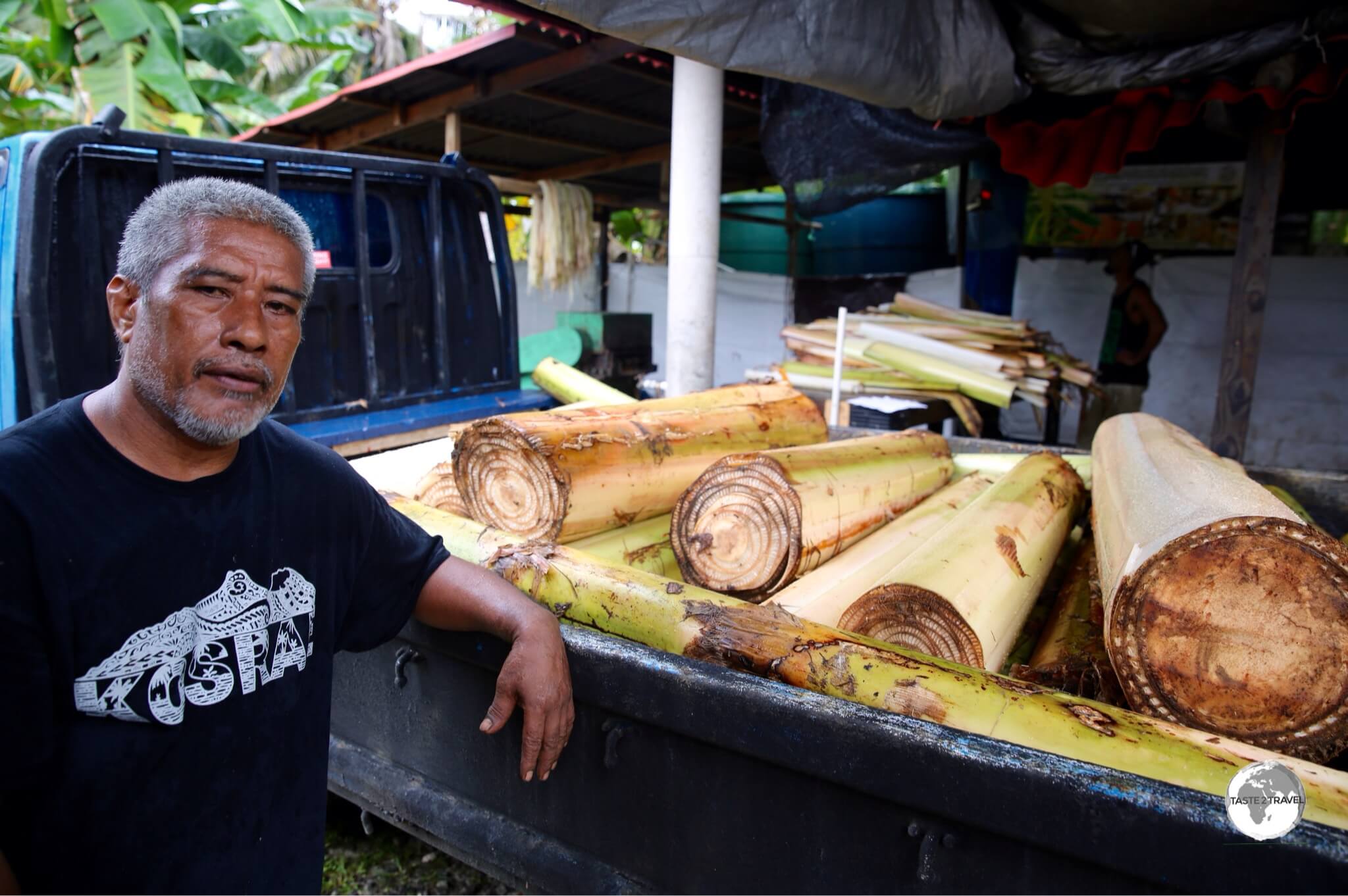
Step 1. Banana plants arrive at the factory for processing - a sustainable use of old banana trees.

Step 1. Banana plants arrive at the factory for processing – a sustainable use of old banana trees.

Matt certainly has realised his dream and today, the factory produces quality recycled paper which is made using old banana plants (they are plants and not trees).

Step 2. Once unloaded, the banana plants are taken for shredding.

Step 2. Once unloaded, the banana plants are taken for shredding.

Today, the company produces paper from various local plant fibre (banana, taro and pineapple) and recycled paper. This paper is then turned into an array of beautiful items by the company artisans.

Step 3: The shredded plants are laid out to dry.

Step 3: The shredded plants are laid out to dry.


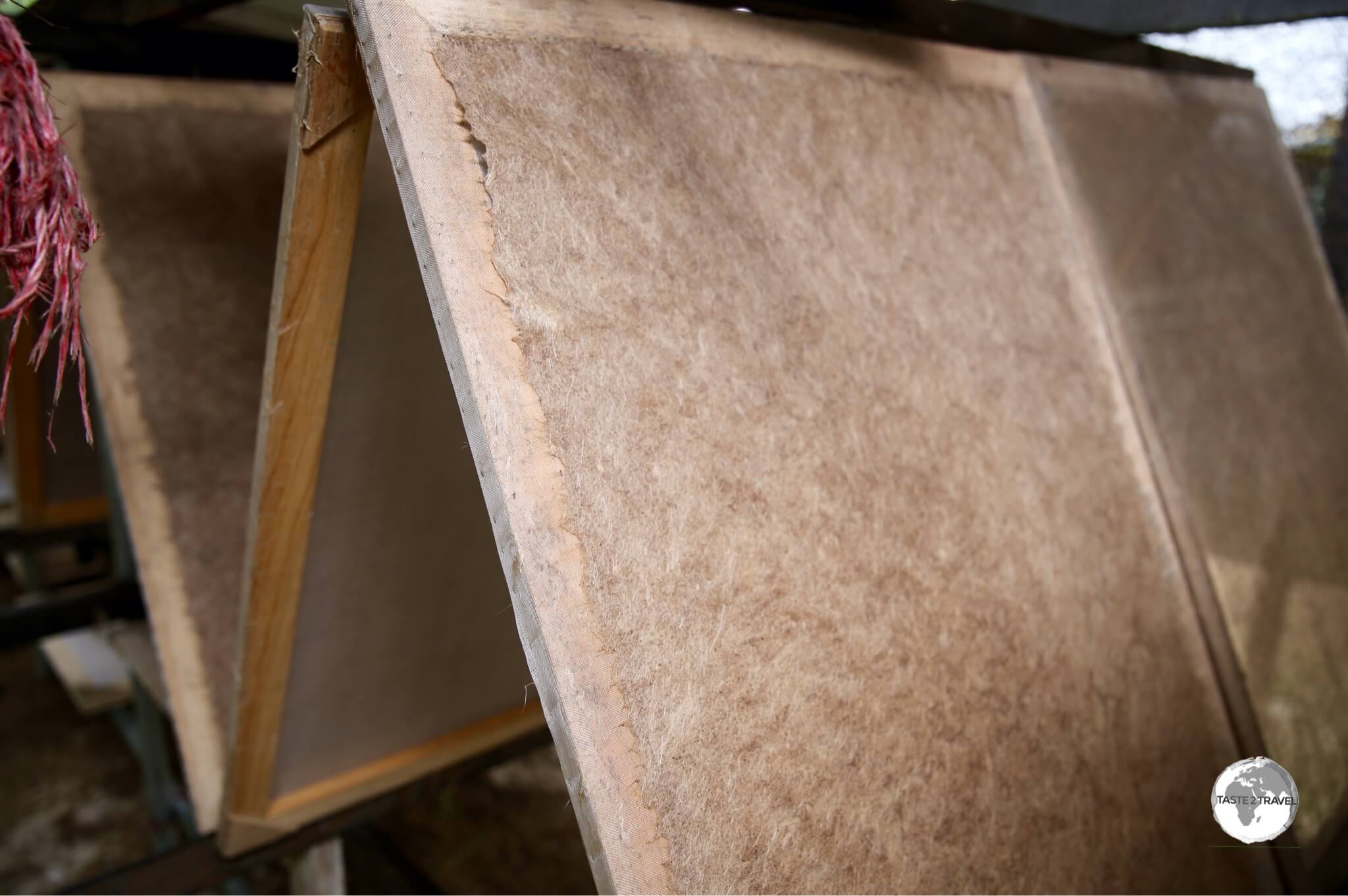
Step 4: The dried plant fibre is pulped with recycled paper and laid out to dry on wooden frames.

Step 4: The dried plant fibre is pulped with recycled paper and laid out to dry on wooden frames.


Step 5: Once dried, the company artisans transform the paper sheets into wallets, stationary, cards etc

Step 5: Once dried, the company artisans transform the paper sheets into wallets, stationary, cards etc.


Step 6. The final product, ready for sale at https://greenbananapaper.com/

Step 6. The final product, ready for sale at https://greenbananapaper.com/

Matt has also installed screen-printing equipment and has used his graphic-design skills to design his own range of ‘uniquely Kosrae’ t-shirts. The shirt designs are beautifully unique – a great souvenir of Kosrae.

The factory is located on the main road in the village of Finaunpes and is open for free tours during weekdays. There is an onsite gift shop where you can purchase the beautiful handmade products. The following images provide an overview of the paper making process:

The making of a ‘Dive Kosrae’ t-shirt:

The screen printers' colour palette.

The screen printers’ colour palette.


The screen featuring the 'Dive Kosrae' design.

The screen featuring the ‘Dive Kosrae’ design.

`

Screen printing the design onto the t-shirt.

Screen printing the design onto the t-shirt.


The applied design on the back of the t-shirt.

The applied design on the back of the t-shirt.


The final step - 'curing' the design.

The final step – ‘curing’ the design.

Accommodation

There are just three accommodation options on Kosrae which is more than enough to accommodate the trickle of visitors who make it to this remote outpost.

Island Hopper Hotel

The most recent addition to the accommodation scene on Kosrae, the Island Hopper Hotel is owned by Maria and Mark, who were the former owners of the Pacific Tree Lodge Resort (now rebranded as Senny’s Treelodge Hotel).

While I have not stayed at the hotel a recent traveller reported that the rooms are superb and spotlessly clean.

Rooms cost from US$119/night and can be booked by contacting Maria at info@islandhopperhotel.com

They also rent out Toyota Harriers for US$63/day.

The hotel includes a free shuttle service to and from the airport.

Senny’s Treelodge Hotel

The sprawling mangrove swamp at Senny's Treelodge Hotel.

The sprawling mangrove swamp at Senny’s Treelodge Hotel.

I chose to stay at Senny’s Treelodge Hotel which, during my visit,  was known as the Pacific Tree Lodge Resort.

The resort was owned and operated by wife and husband team – Maria (Italian) and Mark (American) who now operate the Island Hopper Hotel.

Located on the main road on the north-east coast, facing the ocean and surrounded by a mangrove swamp, the resort offers spacious rooms laid out around the edge of the mangrove.

It is also home to the #1 restaurant/ bar on Kosrae – Bully’s Bar  (see the ‘Eating out‘ below for more details). Bully’s is also used as a venue for other activities. On the day I arrived, Maria invited me to join the weekly yoga class on the deck of Bully’s overlooking the mangrove. There is a movie night held once a week at Bully’s – complete with popcorn. Basically everything you need is in one place.

The warm, friendly staff at the resort ensure your stay is a memorable one.

In between keeping the place spotlessly clean, they use the flowers from the garden to prepare floral lei’s for arriving guests, flower arrangements for the rooms and when in the mood will strum the ukulele in Bully’s and sing enchanting local folk songs.

It all forms part of the magic of the island.

Kosrae Nautilus Resort

Joshua, by the pool at his 'raffle-ticket-winning' property - Kosrae Nautilus Resort.

Joshua, by the pool at his ‘raffle-ticket-winning’ property – Kosrae Nautilus Resort.

Kosrae Nautilus Resort made worldwide headlines in 2016 when the original Australian owners, who had spent 20 years building up the business, decided to raffle the resort instead of selling it to a rich developer. This created a worldwide frenzy which resulted in the sale of 75,485 tickets at US$49 per ticket in 150 countries.

The lucky winner was Joshua, a 27 year old accountant from Wollongong, Australia.

On the evening the owners called Joshua to inform him that he had won a multi-million dollar, 18 room resort, he was at the pub having drinks with some friends. He thought his mates were on the phone playing a joke on him.

Little did he realise that at that moment his life was about to change in a monumental way.

Joshua had just been handed the keys to a resort which is free of debt, profitable and has more than 20 years remaining on its lease. Joshua first had to look on a map to check where in the world Kosrae was located, then hopped on a plane and the rest is history.

KNR offers an air-conditioned restaurant (important in this part of the world) and the only swimming pool on Kosrae. Surrounding the pool are lush tropical gardens, a vegetable garden (used to supply the restaurant) and eighteen fresh, modern rooms. For those interested in diving, KNR has a dive operation, Nautilus Divers, staffed by a resident Dive Master.

Both hotels can be booked on booking.com

Eating Out

When it comes to produce, Kosrae is blessed in many ways. Because of the rich volcanic soil, the whole island is one big fertile garden. Everywhere you look, you’ll see fruit trees, vegetable gardens and so much more.

A freshly picked Kosrae Tangerine.

A freshly picked Kosrae Tangerine.

The ocean waters surrounding the island provide an abundant supply of fish and as such, are favoured fishing grounds for countries such as Japan, Taiwan, Korea and the US. Tuna is king here but you will also find lobster everywhere on the menu. Whilst I was on the island, I enjoyed the freshest of sushi and sashimi at least once a day.

The awesome 'Sushi Deluxe' special at Bully's - incredible value!

The awesome ‘Sushi Deluxe’ special at Bully’s – incredible value!

There are just two restaurants on Kosrae, one at the Kosrae Nautilus Resort and one at the Pacific Treelodge Resort. The most popular of the two is Bully’s Bar. This restaurant/ bar is named after Bully Hayes, a notorious American-born ship’s captain who was variously described as a pirate, cheap swindler, bully, con man, thief and bigamist. Bully Hayes operated in the Pacific in the mid 19th century and always evaded capture. However he was eventually killed by his cook off the coast of Kosrae in 1877.

The tranquil view of the mangrove from the deck of Bully's restaurant.

The tranquil view of the mangrove from the deck of Bully’s restaurant.

Located on the edge of a lush, green mangrove, Bully’s is adjacent to Senny’s Treelodge Hotel.

The head chef at Bully’s is a local man who worked for many years in a Japanese restaurant in Waikiki. He returned to Kosrae armed with a whole lot of talent and ideas.

His creations are amazing (especially his freshly prepared ‘sushi deluxe’ platter) and the portions very generous. You can be sure that the sushi/ sashimi at Bully’s is prepared using fresh, local tuna, which is something everyone should get to tantalise their taste buds with at least once in their lifetime.

Pathway through the mangrove to Bully's Bar.

Pathway through the mangrove to Bully’s Bar.

The restaurant can be reached along an elevated pathway, which takes you through the mangrove swamp. The pathway is constructed from concrete slabs, which contain colourful shards of locally recycled glass – another recycling project from Mark and Maria.

Located at the front of Kosrae Nautilus Resort, and facing the ocean, is the one other dining option on Kosrae.

Food here is also very good and since there are just two choices on the island there is a good chance you’ll end up eating here at some stage. At KNR, you have the choice of dining in air-conditioned comfort inside the restaurant or outside by the swimming pool. As with Bully’s, you will dine on the freshest of local seafood. The resort has its own vegetable garden to supply the restaurant with the freshest produce possible.

Visa Requirements

Kosrae Passport Stamps.

Kosrae Passport Stamps.

Some nationalities require visas for the Federated States of Micronesia – check your visa requirements prior to arrival.

Getting There

By Air

Kosrae International Airport.

Kosrae International Airport.

Flights to Kosrae arrive at Kosrae International Airport, which is dramatically located on a slice of reclaimed land across a channel from the main island.

The airport is connected to the mainland by an ornate, balustraded, white-marble bridge which was a ‘gift’ of the government of China since the government of the FSM chooses to do business with China, rather than Taiwan.

The United Airlines 'Island Hopper' - UA154 - at Kosrae International Airport.

The United Airlines ‘Island Hopper’ – UA154 – at Kosrae International Airport.

United Airlines’ Island Hopper

There is only one way to reach Kosrae and that’s aboard United Airlines famous ‘Island Hopper‘ – flight UA154.

The Island Hopper essentially performs a huge milk run across the central pacific, connecting Hawaii with the Marshall Islands, Kosrae, Pohnpei, Chuuk then finally Guam – a journey of 6,117 kilometres (3801 miles) stopping at some of the remotest islands on planet earth.

The 'Island Hopper' departure board at Kosrae airport.

The ‘Island Hopper’ departure board at Kosrae airport.

It’s an essential service, but also a monopoly operation, so tickets are not cheap. United Airlines are part of the Star Alliance network. If you’re a member of a Star Alliance program, using points instead of paying cash can be a lot more reasonable.

For complete coverage of UA154, from Hawaii to Guam, please refer to my Central Pacific Island Hopping report.

Departing Kosrae on United Airlines "Island Hopper" UA154.

Departing Kosrae on United Airlines “Island Hopper” UA154.

Getting Around

Bus

There are no buses on Kosrae.

Taxi

There are three small taxi companies operating on the island.

Car

Cars can be rented through either of the two hotels or through agents in Tofol. I rented a car through Pacific Tree Lodge Resort at $30 per day. One day is sufficient to explore the entire island.

The license plate of my rental car on Kosrae.

The license plate of my rental car on Kosrae.

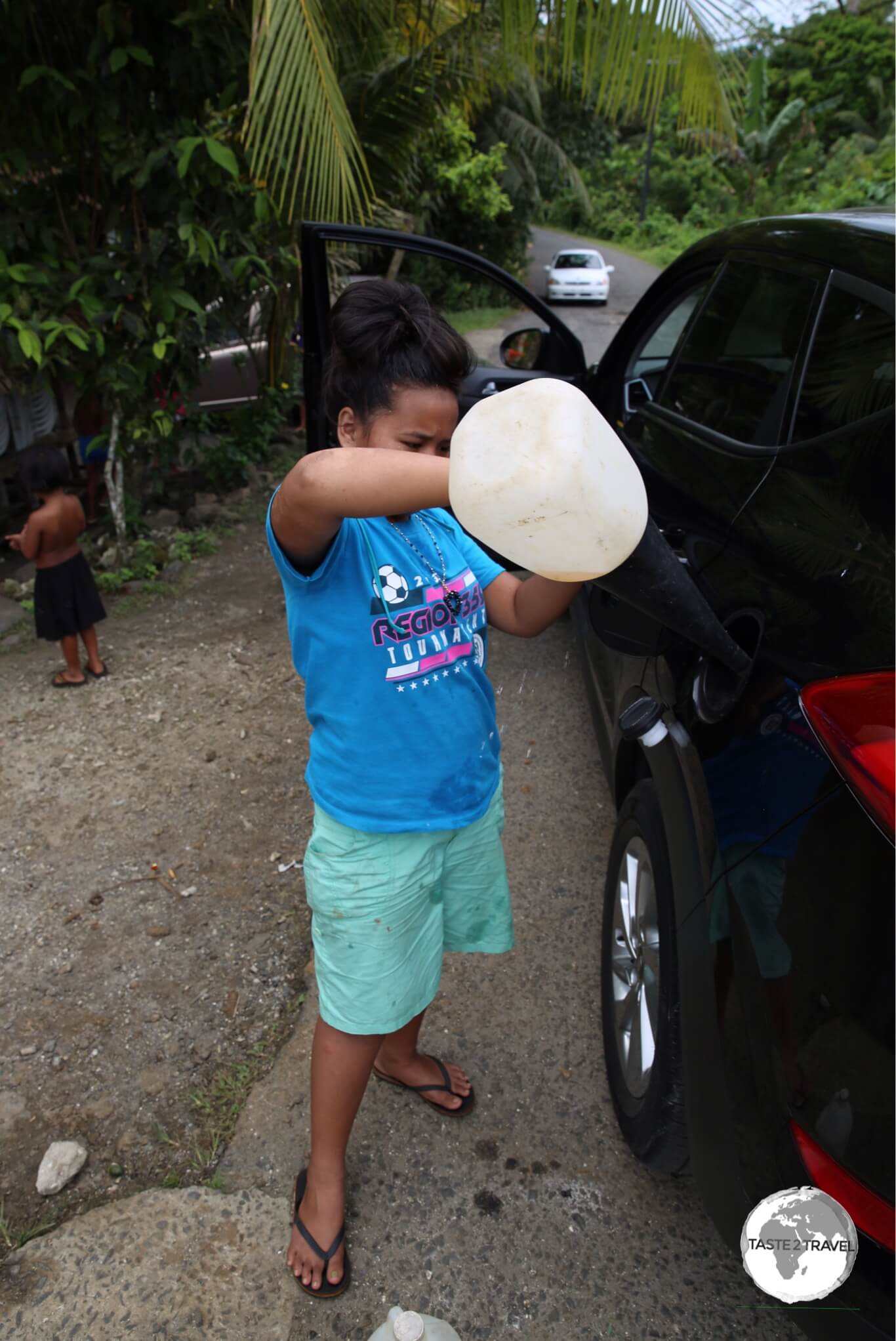
One quirk on the island is that cars are never refuelled directly from a petrol pump, but rather from one gallon containers, which have been filled from the pumped. It was explained to me that locals don’t trust what they can’t see so they will not use a pump.

Refuelling 'Kosrae style'.

Refuelling ‘Kosrae style’.


That’s the end of my Kosrae Travel Guide.

Safe Travels!

Darren


Follow me on Instagram: 

[instagram-feed feed=1]


Further Reading

Kosrae Travel Guide Kosrae Travel Guide Kosrae Travel Guide Kosrae Travel Guide Kosrae Travel Guide Kosrae Travel Guide Kosrae Travel Guide Kosrae Travel Guide Kosrae Travel Guide Kosrae Travel Guide

Marshall Islands Travel Guide

Traditional Boat Building workshop in Majuro.

Marshall Islands Travel Guide

Welcome to the taste2travel Marshall Islands Travel Guide!

Date Visited: January 2017

Introduction

Yokwe! Welcome to the very remote Republic of the Marshall Islands (RMI).

Located across the International date line, five and a half hours flight west of Hawaii. RMI is the first stop on the epic United Airlines Island Hopper (UA154) – a 14 hour, all stops, meander through the central Pacific from Honolulu to Guam.

For more on UA154, check out my Central Pacific island hopping blog.

The official currency of RMI is the US dollar.

United Airlines Island Hopper (UA154) departing from Kwajelein.

United Airlines Island Hopper (UA154) departing from Kwajelein.

RMI has a total population of 60,000. The capital and main hub, with a population of 27,700, is Majuro.

Here you’ll find the international airport, shops, restaurants, hotels and all services.

The highest point on Majuro is at a giddy 3 metres – this can be reached by walking to the top of the Majuro Bridge.

There is just one road on the atoll so you will not require Google navigation.

A wrecked, US, WWII-era plane, off the beach of Enemanit Island.

A wrecked, US, WWII-era plane, off the beach of Enemanit Island.
Image Source: Huffington Post

The real attractions of RMI lie offshore on the myriad islands where you’ll find great diving, snorkeling and fishing.

Location

Majuro Atoll, RMI

Located in the middle of nowhere halfway between Hawaii and Australia and north of Kiribati, RMI is made up of two parallel island chains; the Ratak (sunrise) and the Ralik (sunset).

The country consists of 29 atolls and 5 islands – the tops of ancient, submerged volcanoes.  RMI is the most easterly part of Micronesia.

The largest piece of real estate in this part of the world is Kwajalein Island. ‘Kwaj’ is a restricted US Army base, built on land the US government has leased from the RMI since pre-independence days.

UA154 makes a stop here but non-military personnel are not allowed to disembark. The island is home to the Ronald Reagan Ballistic Missile Defence Test Site.

The highest point on Majuro (3 metres), the Majuro Bridge connects Delap island to Long island.<br /> <i>Image Source: TripAdvisor</i>

The highest point on Majuro (3 metres), the Majuro Bridge connects Delap island to Long island.
Image Source: TripAdvisor

History

A 'Stick chart' in Majuro. These were used in ancient times for navigational purposes.

A ‘Stick chart’ in Majuro. These were used in ancient times for navigational purposes.

It is believed the Marshall Islands was originally settled around 1,500 B.C. by Micronesian’s, migrating from the west.

The first Europeans to make contact with the islands were the Spanish in 1529. They were passing through on a return voyage from their colony in the Philippines to Acapulco, Mexico.

The British were the next visitors – mapping the islands in 1788 under the direction of British naval captains Thomas Gilbert and John Marshall, for whom the islands are named (Kiribati to the south used to be known as the Gilbert Islands).

The islands remained largely untouched by Europeans until the Germans arrived in 1878 and set up a coaling station. They declared the islands a German protectorate.

The Japanese seized the islands in 1914 and held onto them until WWII at which point they became major battle grounds until US forces prevailed and liberated the islands.

View of Majuro from my Nauru Airlines flight to Kiribati.

View of Majuro from my Nauru Airlines flight to Kiribati.

In 1947, all former Pacific islands occupied by Japan were grouped together to form the Trust Territory of the Pacific Islands  – administered by the United States.

The Trust Territory included Palau, Guam, The Northern Mariana islands, Federated States of Micronesia and the Marshall Islands.

In 1978 the Marshallese voted to leave the trust territory, declaring independence in 1979 with Amata Kabua being elected as its first president.

Bikini Atoll

From atomic bombs….

Atomic bomb test at Bikini atoll.

Atomic bomb test at Bikini atoll.
Image Source: Wikipedia.

Following WWII, US President, Harry S. Truman, issued a directive to US army and navy officials that testing of nuclear weapons would be necessary to determine the effect of atomic bombs on US warships.

Due to its remote location, well removed from international flight paths and shipping lanes, Bikini Atoll had the misfortune of being selected as the site for such tests. The only problem were the 167 local residents.

On a quiet Sunday in 1946, the then US governor to the Marshall Islands, visited Bikini and, after the local church service had finished, asked the islanders if they would be willing to vacate the island temporarily. They have never been able to return home since that day!

Once the island had been vacated, the US military relocated 242 warships, 156 aircraft and 25,000 radiation recording devices to Bikini ready for testing.

Between 1946 and 1958, 23 nuclear devices were detonated at Bikini, some underwater, some on land and others in the air.

The largest detonation was from ‘Castle Bravo‘, which resulted in a staggering 15 megaton yield (a megaton is equivalent to one million tons of TNT).

The bomb was 1,000 times more powerful than the bombs dropped on Hiroshima or Nagasaki.

In total, the 23 tests yielded a combined 42.2 megatons of explosive power. The tests completely destroyed and contaminated this once pristine tropical paradise, rendering it unfit for habitation.

In the meantime the islanders, who had been transported on a US Navy boat 200-km to Rongerik atoll, were struggling to survive as the island offered no arable land for farming nor a reliable water supply.

They were eventually relocated to another atoll, but not before some had died from starvation. Today you can visit the Bikini atoll town hall on Majuro.

…to skimpy swimsuits!

The Bikini gets its name from Bikini atoll.

The Bikini gets its name from Bikini atoll.
Image Source: Vogue Magazine

Meanwhile, in 1946, a Parisian engineer by the name of Louis Reard, had just created a skimpy two-piece swimsuit and was looking for a catchy name.

In the headlines at the time was news of the nuclear testing at Bikini atoll – and the rest is history.

Flag

Marshall Islands Flag

Marshall Islands Flag

Designed by Emlain Kabua, who served as the first First Lady of the Marshall Islands, the flag of the Marshall Islands consists of a blue field with two diagonal stripes of orange and white radiating from the lower hoist-side corner to the upper fly-side corner and the large white star with four large rays and twenty small rays on the upper hoist-side corner above the stripes.

Like other flags of the Pacific, the blue field represents the Pacific ocean.

The rising diagonal band represents the equator, the star above representing this Northern Hemisphere archipelago.

The white and orange portions of the band represent, respectively, the Ratak Chain (“sunrise”) and the Ralik Chain (“sunset”).

The star’s 24 points represent the number of electoral districts, while the four elongated points represent the principal cultural centres of Majuro, Jaluit, Wotje and Ebeye.

Currency

US Dollar

The US Dollar.

As with other Pacific nations, which were once part of the United States-administered Trust Territory of the Pacific Islands, the official currency of the Marshall Islands is the US dollar.

Sightseeing

Majuro

Traditional Boat Building workshop in Majuro.

Traditional Boat Building workshop in Majuro.

Majuro is a quiet, relaxing place. Apart from one tiny museum, there are no sights to visit, but the experience here is to soak up the ambience of the atoll and plan trips to the nearby islands. I rented a scooter, which allowed me to explore the entire atoll.

It’s a long drive to the last village of Laura (named by US GIs in honour of Lauren Bacall).

On the way, you will pass through the equally sleepy village of Rita – (also named by US GIs after Rita Hayworth).

You will also pass a Copra processing plant which you can visit (weekdays only).

Adjacent to the Marshall Islands Resort is a traditional boat building workshop.

Early Micronesian’s were skilled boat builders and navigators who made long canoe journeys among the atolls.

Navigation was made by way of ‘stick charts’. At the workshop, you can observe the art of traditional boat building and have someone explain how to use a stick chart. Who needs Google maps?

If you wish to rent snorkeling gear or arrange diving, there is a dive shop at the Marshall Islands Resort, operated by a Japanese dive master.

Around Majuro

A relaxing Sunday at Enemanit Island, which is located a short boat ride from Majuro.

A relaxing Sunday at Enemanit Island, which is located a short boat ride from Majuro.

There are various offshore islands you can visit from Majuro. Arno island can be reached using the ferry from Robert Reimers Hotel (see the ‘Getting Around‘ section below). There is one basic guest house on Arno.

A highlight of my visit to Majuro was a Sunday trip to nearby Enemanit island.

The island was once used as an R&R base for US soldiers and it’s said Bob Hope once performed on stage here. The remains of the stage are still visible.

Today, Enemanit is a private island owned by Jerry Kramer, a local businessman – originally from the US – who,  over the last decades, has built up a collection of successful businesses, which now span the Pacific.

Despite his success, and the fact that he owns his own tropical island, Jerry is very unpretentious and grounded and is a great person to spend time with on a lazy Sunday.

Spending a day with Jerry, his family and friends was a memorable experience.

I was treated to a BBQ lunch, lots of beers and great conversation on the beautiful sandy beach. Jerry runs a boat every Sunday morning from the dock of his shipping company (PII) to the island. Friends and visitors are welcome to join him.

If you are interested you should inquire at the office of Pacific International Inc (PII) on the northern side of the Majuro bridge.

A pristine beach on Enemanit Island.

A pristine beach on Enemanit Island.

A highlight of a visit to Enemanit Island is the opportunity to snorkel above the remains of a wrecked passenger plane, which lies in shallow waters 100 metres off the beach.

A few metres in front of the plane is a wrecked helicopter – all great stuff. Ensure you bring your own snorkeling gear.

Accommodation

The view of Majuro lagoon from my room at the Marshall Island's Resort.

The view of Majuro lagoon from my room at the Marshall Island’s Resort.

Marshall Islands Resort

There are few hotels on Majuro – the largest, with 80% of beds on the island – is the Marshall Islands Resort (MIR).

Being the biggest fish in a very small pond, most tourists (including myself) end up staying here.

Formerly an outrigger resort, the hotel has seen better days. The rooms are old and tired, the pool is permanently closed due to problems with the filtering system, service is very lax, staff are less than enthusiastic and not very helpful.

The hotel restaurant is the largest on Majuro and hence is THE place for celebrations/ functions.

Food and service is hit and miss.

Anywhere else this hotel would not be so busy but there are few other choices on tiny Majuro.

Hotel Robert Reimers

One other choice is the much smaller Hotel Robert Reimers.

Thatched cabins cost from US$135, while rooms inside the hotel building cost US$104.

The staff here are much friendlier and more helpful than MRI.

This was my ‘go-to’ place whenever I needed information.

The hotel is conveniently located downtown and includes the best restaurant/ bar on Majuro – Tide Table (see ‘Eating Out‘ below for more).

Reimers also offer excursions to Eneko Island with a return boat trip costing US$30. The hotel also offers basic accommodation on the island in the form of basic cabins which cost US$40 and plusher cabins for $150.

You can book either of these hotels using Booking.com

Eating Out

Weekly farmer's market in Majuro.

Weekly farmer’s market in Majuro.

The best bar and restaurant on Majuro is Tide Table, part of the Robert Reimers Hotel complex.

With an array of flat screen TV’s on the walls, it has the feel of an American sports bar. The menu could also be best described as Sports Bar cuisine.

Open for breakfast, lunch and dinner, the burgers and pizzas are especially good. Happy hour is very popular and a great way to meet local expats.

The offerings at the Marshall Islands Resort restaurant are OK. This is the biggest restaurant on Majuro so you’ll probably end up here at some stage.

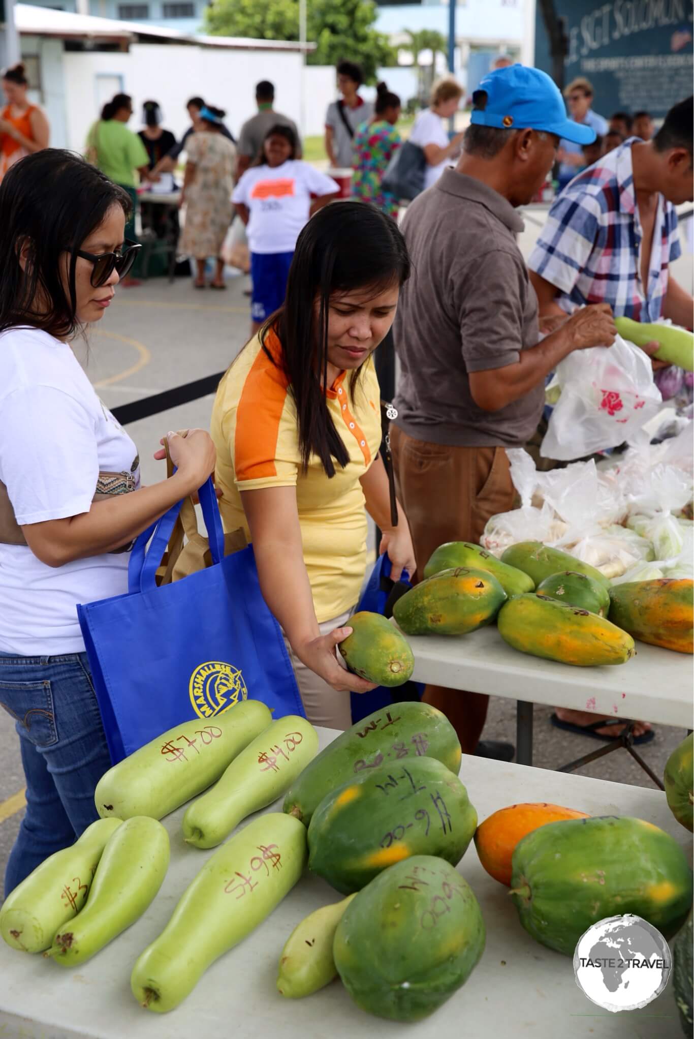
There is a weekly farmer’s market held every Saturday morning in downtown Majuro. On offer here, is fresh local produce grown on farms at the northern end of the atoll near the town of Laura.

Visa Requirements

Marshall Islands Passport stamps.

Marshall Islands Passport stamps.

Some nationalities require visas for the Marshall Islands – check your visa requirements prior to arrival.

Getting There

Sleepy Majuro Airport, gateway to the Marshall Islands.

Sleepy Majuro Airport, gateway to the Marshall Islands.

By Air


Arrival at Majuro airport.

Arrival at Majuro airport.

All flights to Majuro arrive at Amata Kabua International Airport (IATA: MAJ), which is located 11 km from downtown Majuro.

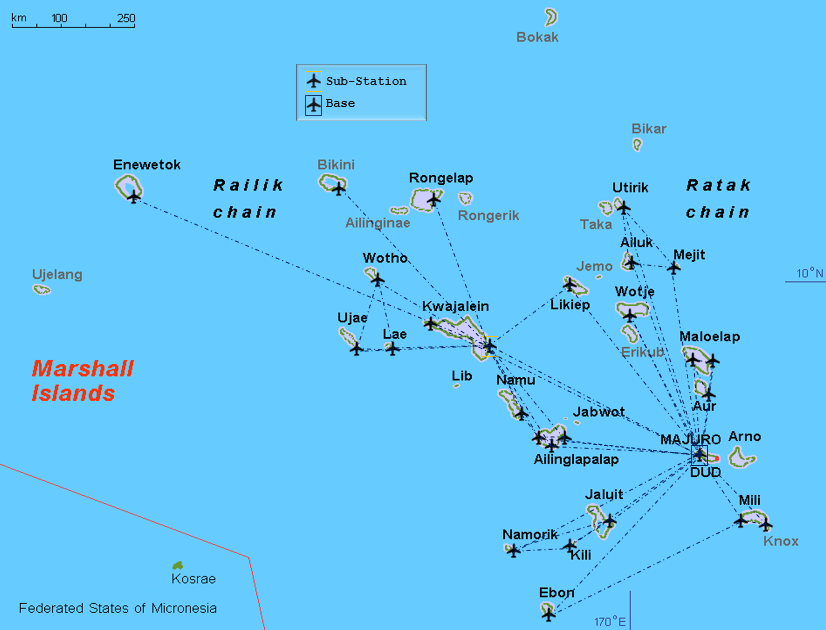
Air Marshall Islands Route Map.

Air Marshall Islands Route Map.

The airport serves as a hub for Air Marshall Islands, who offer domestic flights to almost all of the islands in the republic.

For more details on the airport, please refer to my Central Pacific island hopping guide.

Departing from Majuro.

Departing from Majuro.

The following airlines provide connections to/from Majuro:

  • Air Marshall Islands – flies to/from Ailuk, Airok, Aur, Bikini, Ebon, Elenak, Enejit, Enewetak, Jaluit, Jeh, Kaben, Kili, Kwajalein, Lae, Majkin, Maloelap, Mejit, Mili, Namdrik, Rongelap, Ujae, Utirik, Wotho, Wotje
  • Nauru Airlines – flies to/ from Koror (Palau), Nauru, Pohnpei (FSM), Tarawa (Kiribati)
  • United Airlines – flies to/ from Chuuk, Guam, Honolulu, Kosrae, Kwajalein, Pohnpei
Departing from Majuro Airport.

Departing from Majuro Airport.

Nauru Airlines

Nauru Airlines route map - as of August 2024.

Nauru Airlines route map – as of August 2024.

Nauru Airlines offer regular connections to many destinations in the Central Pacific, including Majuro, from their base at Brisbane International Airport.

An especially useful connection, for those already travelling in the South Pacific, is the airline’s regular flight from Nadi (Fiji) which offers connections to the Central Pacific.

Email address of the airline’s Brisbane office: book@ourtravel.com.au

Getting Around

Bus

There are no public buses on the island. Hotels operate minibus shuttles to/ from the airport.

Taxi

Shared taxis are the sole form of public transport on Majuro.

Taxis run shuttle services along the one main road between the airport and downtown.

You never have to wait too long and they’ll go out of their way to drop you off at your front door.

Fares are 0.50c for anywhere downtown or $4 for the 20 minute trip to the airport.

Ferry

Ferries to nearby islands, including Arno Island, operate from the dock at Robert Reimer’s. Best to ask the hotel reception staff for the current schedule.

Car

A Marshall Islands license plate.

A Marshall Islands license plate.

Hotels and various other companies offer hire cars on Majuro. I hired a scooter at $25 per day from MJCC (Marshall Japan Construction Company) in downtown Majuro.

The best way to explore Majuro is with a rental scooter.

The best way to explore Majuro is with a rental scooter.


That’s the end of my Marshall Islands Travel Guide.

If you wish to leave a comment/ feedback, you can do so using the form below.

Safe Travels!

Darren


Follow me on Instagram: 

[instagram-feed feed=1]


Further Reading

Other travel reports from the Pacific region:


Marshall Islands Travel Guide Marshall Islands Travel Guide Marshall Islands Travel Guide Marshall Islands Travel Guide Marshall Islands Travel Guide Marshall Islands Travel Guide

Kiribati Travel Guide

Young Kiribati boys playing in the tidal mudflats on South Tarawa.

Kiribati Travel Guide

Welcome to the taste2travel Kiribati Travel Guide!

Date Visited: January 2017

Introduction

Mauri! Welcome to Kiribati (pronounced ‘Kiri-bas’). You will get used to hearing the local version of ‘hello‘ as the friendly locals will greet you at every turn with a warm and welcoming ‘Mauri’.

A view of South Tarawa at low tide.

A view of South Tarawa at low tide.

Located in the central Pacific region, well off the tourist radar in the middle of nowhere is the surprisingly charming atoll nation of Kiribati. Very few people have heard of, much less visited this small country but that’s not surprising given its physical remoteness and lack of development.

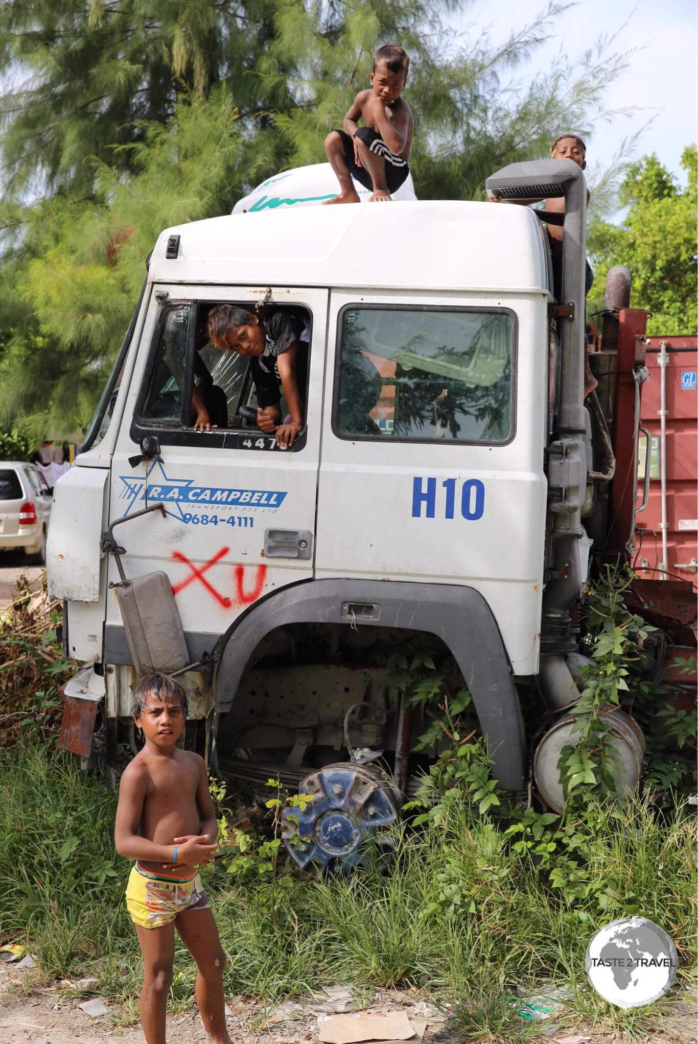
The kids on Kiribati love posing for the camera.

The kids on Kiribati love posing for the camera.

With an annual GDP of just US$1600, Kiribati is the poorest country in the Pacific. This is no Hawaii or Tahiti. With grinding poverty, many people living in makeshift shelters along rubbish-strewn beaches (which are also used as toilets), over-crowded South Tarawa feels more like Africa than the Pacific. Aid organisations are changing things slowly with garbage collections now being implemented and sewage systems being installed.

A Pacific Imperial Pigeon on Kiribati.

A Pacific Imperial Pigeon on Kiribati.

If you are in search of a tropical paradise where you can enjoy a relaxing holiday in a plush resort with fine dining options then Kiribati is not for you. There are no resorts or fine dining restaurants and the beaches (at least on South Tarawa) are heavily polluted. South Tarawa is the capital and hub and home to all services and most tourist infrastructure.

A view of Maiana Island with a stone fish trap visible below the shoreline.

A view of Maiana Island with a stone fish trap visible below the shoreline.

South Tarawa is an over-crowded, polluted, bustling, hectic, narrow atoll (just 100 metres wide in places), with one main road running along it connecting a myriad of villages. South Tarawa has a population of 50,000 (50% of the entire population).

An abandoned truck on Betio island serves as a playground for local boys.

An abandoned truck on Betio island serves as a playground for local boys.

Of the eight islands I visited on my island hop through the central Pacific, Kiribati was the highlight. What makes this place special are the people, they are some of the friendliest folks you’ll meet on this planet.

Rubbish removal is a problem on a remote Pacific atoll.

Rubbish removal is a problem on a remote Pacific atoll.

Without exception, they are warm, welcoming and engaging. From the moment you arrive, you are made to feel welcome. After an amazing week in the company of the I-Kiribati, I was sad to say goodbye.

A colourful Ferris Wheel at Bairiki.

A colourful Ferris Wheel at Bairiki.

In 2013, the island recorded 5900 visitor arrivals; most of these ‘visitors’ were foreign aid workers. There is a large ex-pat population on the island working for various governmental/ NGO organisations. During my visit, the only other tourists I met were a Dutch couple. I was also the only tourist that they met. The official currency is the Australian dollar.

If you ever have the chance to visit – and you don’t mind roughing it a little – then Kiribati is a truly rewarding destination.

Traditional house on South Tarawa.

Traditional house on South Tarawa.

Location

Straddling the equator halfway between Hawaii and Australia, Kiribati is comprised of three far-flung island groups (Gilbert, Line and Phoenix). Within these groups, there are 33 low-lying atolls (most of them uninhabited) spread over 3.5 million square kilometres – an area of ocean equivalent in size to the continental United States.

Kiribati

The date line has been diverted around Kiribati to ensure the Line Islands (closer to Hawaii than Tarawa) are in the same time zone (and day) as the rest of the country.

The International Date Line is shown in red.

The International Date Line is shown in red.

A Disappearing Nation

The average elevation of Kiribati is less than 2 metres. In places the width of the flat atolls is less than a 100 metres across. Many of the atolls are submerged during King Tides.

Just enough room for a two lane road on South Tarawa.

Just enough room for a two lane road on South Tarawa.

Rising sea levels and ocean temperatures caused by global warming threaten the people, economy, and very existence of Kiribati – some atolls have already disappeared. In 2014, the government of Kiribati paid US$8.77 million dollars to purchase a 5500 acre freehold estate on Fiji in the event that the nation must relocate.

Low tide on South Tarawa.

Low tide on South Tarawa.

History

The national flag of Kiribati features a gold Frigate bird flying over a golden sun with three blue/ white bands representing the ocean and the three island groups.

The national flag of Kiribati features a gold Frigate bird flying over a golden sun with three blue/ white bands representing the ocean and the three island groups.

Formerly a British colony known as the Gilbert Islands, the islands were captured by the Japanese during the Pacific War in 1941. The Japanese spent the next two years establishing bases and fortifying the islands, until Allied forces (led by US Marines) invaded in 1943. The islands of Makin and Tarawa were the sites of major battles. Reminders of the battles on Tarawa can still be seen, especially on the smaller Betio (pronounced ‘Beso‘) Island.

The Gilbert Islands coat of arms, displayed on the window of the General Post Office.

The Gilbert Islands coat of arms, displayed on the window of the General Post Office.

The assault on the island lasted 72 hours and cost approximately 6,000 lives on both sides. The Kiribati Cultural museum screens a short documentary of the American assault on Tarawa. The graphic footage was shot by an embedded camera crew and places the viewer squarely in the middle of the action. The film – “With the Marines at Tarawa” is 19-mins long but well worth watching as it gives you a real sense of the ferocity of the battle. The movie can be viewed from your armchair on YouTube.

The Allied forces eventually liberated the islands. The islands remained under British control until 1979 when they achieved full independence under the new name of Kiribati.

A wrecked Sherman tank laying in the sand on Betio Island.

WWII relic – a wrecked Sherman tank laying in the sand on Betio Island.

Sights

Kiribati has few sights as such. The real pleasure in exploring this tiny nation comes from the interactions you have with the friendly locals. I enjoyed walking around with my camera exploring different villages and neighbourhoods on both South and North Tarawa.

Introducing the children of Kiribati… 

A young girl on on Betio Island.

A young girl on on Betio Island.


Young Kiribati boys playing in the tidal mudflats on South Tarawa.

Young Kiribati boys playing in the tidal mudflats on South Tarawa.


Young girls on Betio Island.

Young girls on Betio Island.


Young boys on Betio Island.

Young boys on Betio Island.

Discarded WWII relics litter Betio island the location of the ‘Battle of Tarawa’. Reminders of the battle remain scattered around the island and are now used as playgrounds by the local children.

Japanese WWII ruins on the beach at Betio Island.

Japanese WWII ruins on the beach at Betio Island.


Japanese Artillery installation on Betio Island.

Japanese Artillery installation on Betio Island.

The best way to find the relics is to follow the coastline around the island. There is a large, abandoned concrete Japanese bunker in the middle of town.

A WWII-era Japanese Bunker on Betio island.

A WWII-era Japanese Bunker on Betio island.

Betio is home to the main port and since this country imports everything there are plenty of containers on the island. However there is no container storage facility at the port so the roadsides of Kiribati are littered with rows of containers. Many shop owners use these containers for temporary storage.

Discarded shipping containers line the streets on Betio Island. There is no real port facility so the containers are left on the roadside and are used for storage by local shop owners.

Discarded shipping containers line the streets on Betio Island. There is no real port facility so the containers are left on the roadside and are used for storage by local shop owners.

The Kiribati Cultural Museum in Bikenibeu village is the only museum in the country. It will require about 30 minutes of your time – if it’s open. I turned up on two different occasions during the posted ‘opening hours’ to find the museum was closed. On the third attempt I got lucky. The highlight of the museum is the overview of the battle of Tarawa. There is a big flat screen TV where you can sit and watch the 19-min documentary – With the Marines at Tarawa.

Fishing is the main pastime on all the islands of Kiribati.

Fishing is the main pastime on all the islands of Kiribati.

As with other Pacific islands, the hub of each village on Kiribati is the community meeting house – known as a ‘Maneaba‘. These are similar to Marae’s in New Zealand. The Maneaba are used for all community events and the cool lino-covered floors are a popular place to relax in the mid-day heat. The most traditional and picturesque Maneaba is in the village of Bonriki (near to the airport).

A traditional Maneaba (meeting house) in Bonriki village.

A traditional Maneaba (meeting house) in Bonriki village.

With ninety-six percent of the population being Christian (more than 50% Catholic), there are some impressive churches on South Tarawa. Unlike churches elsewhere, there are no pews here. Instead, just like the Maneaba, the locals sit on the cool lino-covered floor.

Interior of St. Paul's church on Betio Island.

Interior of St. Paul’s church on Betio Island.

Separated from South Tarawa via a narrow channel – which can be crossed by foot at low tide – is the much quieter, more traditional island of North Tarawa. There is a daily ferry which connects the island to South Tarawa (Bairiki port). Accommodation options are limited to a few simple guest houses.

Low tide on North Tarawa.

Low tide on North Tarawa.

Accommodation

Most accommodation options are located on South Tarawa but even here options are limited. A good place to start your search is the accommodation page on the Kiribati Tourism website.

Utirerei Motel

While on South Tarawa, I stayed at Utirerei Motel, which is located in Ambo village. This friendly, family-run hotel is staffed by enthusiastic staff who keep the place spotlessly clean and go out of their way to ensure your stay is memorable. Breakfast is included in the reasonable rate and the restaurant is one of the better places to eat on the island. You can book rooms using booking.com

Betio Lodge

Betio Lodge is another popular choice on Tarawa. The hotel includes a good restaurant and a cafe equipped with a proper espresso machine and the #1 barista in the country. The hotel is home to a fishing club which holds occasional tournaments.

Dreamers Kiribati Guest House

Located near Parliament House in the village of Ambo, Dreamers Kiribati Guest House offers three self-contained rooms with breakfast for AUD$120.

Airport transfers are also included in the nightly room rate.

Dinner is also available at AUD$15 per night.

Eating Out

Dining options are limited. Most locals cannot afford to dine out and there are few tourists requiring fancy restaurants. There are restaurants at the main hotels and also a few located along the main road.

BBQ fish at a roadside fish market.

BBQ fish at a roadside fish market.

The best café on Tarawa is Chatterbox, which is located inside a travel agent on the main road in Bikenibeu village. Everything here is very good from the latte’s and cappuccino’s to the food. This café is home to one of two espresso machines on Kiribati. Food supply on the island is erratic so the menu is kept simple. They also offer home made banana bread and other cakes. The whole place is kept clean and the air-con keeps things refreshingly cool. They also have a souvenir shop selling locally made handicrafts and a travel agent.

The one other place with decent espresso coffee is the café at Betio Lodge. The barista here (Peter) makes the best coffee on the island. Luckily it is at the other end of Tarawa from Chatterbox so regardless of which end of the island you are visiting – you are never far from a good coffee.

There is a roadside fish market near to the village of Bairiki. Do not be surprised to see live turtles being sold here.

Octopus for sale at a roadside fish market on South Tarawa.

Octopus for sale at a roadside fish market on South Tarawa.

Visa Requirements

Kiribati Passport Stamps.

Kiribati Passport Stamps.

Some nationalities require visas for Kiribati – check your visa requirements prior to arrival.

Getting There

By Air

Arrival at Bonriki International Airport, the gateway to Kiribati.

Arrival at Bonriki International Airport, the gateway to Kiribati.

International flights arrive at sleepy Bonriki International airport on Tarawa.

The following airlines provide connections to/from Tarawa (TRW):

  • Air Kiribati – flights to/from Abaiang, Abemama, Butaritari, Funafuti, Kuria, Maiana, Nadi, Nonouti, Tabiteuea North
  • Solomon Airlines – flights to/from Brisbane, Honiara
  • Fiji Airways – flights to/from Nadi
  • Nauru Airlines – flights to/from Majuro, Nauru, Pohnpei

Located in the car park of the airport is one of the best dining options on the island. Known as ‘Starbucks‘ – but so much better than it’s American namesake – the owner of this outdoor restaurant (actually a corrugated-iron shack) produces great tasting, delicious food over a gas cooker. It’s all wonderfully simple and unpretentious. Her banana bread is the best on the island.

The terminal at Bonriki International Airport.

The terminal at Bonriki International Airport.

Getting Around

Air

An Air Kiribati inter-island flight arriving at Bonriki Airport.

An Air Kiribati inter-island flight arriving at Bonriki Airport.

Domestic air services to the remote outer islands in the Gilbert Group are provided by Air Kiribati from their base at Bonriki Airport. Tickets are so reasonably priced (I paid A$56 return to Maiana Island), you can spend some of your time doing joy flights to different islands.

My Air Kiribati flight tickets to Maiana Island - AUD$28 each way.

My Air Kiribati flight tickets to Maiana Island – AUD$28 each way.

The helpful station manager at Bonriki Airport will explain flight options from the schedule, take your payment (cash only) and issue you a hand-written ticket. Like everything on Kiribati, the airport operation is very friendly, low-key and casual.

My inexpensive 'joy flight' ticket with Air Kiribati.

My inexpensive ‘joy flight’ ticket with Air Kiribati.

Some flights offer a circuitous, meandering journey stopping at four or five different islands before returning to Bonriki airport.

Air Kiribati Route Map

Air Kiribati Route Map

Most of the outer islands have no infrastructure or services so they don’t lend themselves to overnight stays unless you are fully self-sufficient. If you’ve ever dreamed of being Robinson Crusoe, the outer islands await you.

On approach to Maiama island - one of the outer islands.

On approach to Maiama island – one of the outer islands.

Runways on the outer islands are simple dirt strips. The arrival of a flight from Tarawa is something that creates an air of excitement and you can expect most locals to be at the tiny airport to greet the plane and its passengers. The arrival of a tourist dials up the excitement level considerably.

Children playing at Maiana airport.

Children playing at Maiana airport.

Most tourists don’t make it beyond South Tarawa so you can expect quite a welcome along with offers of accommodation if you wish to stay – perfect for those seeking out a Gauguin-esque experience.

Friendly local girls on Maiana island.

Friendly local girls on Maiana island.

Seat allocation is not a problem on domestic flights, which operate more like an inter-island bus service. Children are nursed on laps, a family of four will occupy a twin seat – you just need to ensure your ventilation is working well.

Plenty of room for everyone aboard the over-filled Air Kiribati flight from Maiana Island to Bonriki.

Plenty of room for everyone aboard the over-filled Air Kiribati flight from Maiana Island to Bonriki.

Bus

Most of the 50,000 inhabitants of South Tarawa rely on privately operated mini-buses, which shuttle back and forth along the one main road on the atoll.  Fares are generally less than A$1. Despite running frequently, the buses are normally over-crowded (a la sardine can) but provide a great way to meet the locals and contract the latest cold or flu.

The Australian Government and Asian Development Bank (ADB) have recently spent A$60 million upgrading the main road on the island. This has greatly improved life for the inhabitants and introduced speed humps to the island 🙁

My rental scooter on the newly upgraded road on South Tarawa.

My rental scooter on the newly upgraded road on South Tarawa.

Taxi

There are no taxis on Kiribati. Hotels offer shuttle service from the airport.

Car/ Scooter

Hotels on South Tarawa can provide rental cars and scooters. I rented a scooter at A$30 per day from the George Hotel on Betio.


That’s the end of my Kiribati Travel Guide.

Safe Travels!

Darren


Follow me on Instagram: 

[instagram-feed feed=1]


Further Reading

Other travel reports from the Pacific region:

Kiribati Travel Guide Kiribati Travel Guide Kiribati Travel Guide Kiribati Travel Guide Kiribati Travel Guide Kiribati Travel Guide Kiribati Travel Guide Kiribati Travel Guide 

Central Pacific Island Hopping

Island Hopping Route: Source - Great Circle Tracker

Central Pacific Island Hopping

Welcome to the taste2travel Central Pacific Island Hopping guide, which describes my journey on United Airlines’ Island Hopper – UA154. 

Date of Island Hop: 26th of January 2017 – 3rd of March 2017

Introduction

Taking the United Airlines’ Island Hopper (Flight: UA154) across the central Pacific had long been a dream.

I recently got to live the dream when I incorporated UA154 into a longer journey from Los Angeles to Manila.

This was a meandering odyssey from one side of the Pacific to the other, one which would take me to eight very remote islands.

Along the way, I detoured from United’s network by making a side-trip with Nauru Airlines from Majuro to Kiribati.

I’m glad I did – the people of Kiribati are the friendliest people I encountered on my journey.

More on them, and the atoll, can be found in my Kiribati Travel Guide.

This guide provides an overview of air services throughout the Central Pacific and describes my travel experiences on each flight.

I have published separate travel guides to each destination with links included in the relevant sections below.

Air Services

The following airlines offer services throughout the Central Pacific region:

United Airlines

United Airlines’ offers the most comprehensive network throughout the region.

In some cases, they are the only option!

The Island Hopper (UA154) travels three times a week (Mon/ Wed/ Fri) on a 14-hour ‘all stops‘ shuttle service from Honolulu to Guam with 45 minute stops at Majuro, Kwajalein, Kosrae, Pohnpei & Chuuk. For some of the islands (e.g. Kosrae), the flight is the only link to the outside world.

The same service operates in the reverse direction from Guam (UA155), departing on Mon/ Wed/ Fri.

The United flight crews are based in Guam and, due to FAA regulations, a duplicate crew is carried to cover the 14-hour flight ensuring no one exceeds the maximum number of work hours for a single flight.

From Guam, United offer connections to other Pacific islands such as the Northern Mariana islands of Rota & Saipan, Yap (FSM), Palau and also Asia (Manila, Hong Kong, Shanghai and various ports in Japan).

United Airlines' Micronesia routes, formerly operated by Continental Micronesia.

United Airlines’ Micronesia routes, formerly operated by Continental Micronesia.
Source: United Airlines.

Nauru Airlines

Nauru Airlines route map - as of August 2024.

Nauru Airlines route map – as of August 2024.

Nauru Airlines offer regular connections to many destination in the Central Pacific region, from their base at Brisbane International Airport.

An especially useful connection, for those already travelling in the South Pacific, is the airline’s regular flight from Nadi (Fiji) which offers connections to countries in the Central Pacific.

Email address of the Brisbane office: book@ourtravel.com.au

Star Marianas

Star Marianas is a small airline offering a once-daily service between Guam and the Northern Mariana Islands (Rota, Tinian and Saipan). Their fleet consists of 12 single-engine Piper planes. Their office at Guam airport is located inside the freight building between the main terminal and the United ticket office.

Travel Costs

Not cheap!

Apart from swimming or building your own raft, almost the only way between these islands is via the thrice-weekly United Airlines’ Island Hopper service.

United operate largely in a monopoly environment and like any monopoly player they can charge what they like.

There are no ‘deals’ on airfares in this part of the world.

I paid just over US$1500 for a one-way economy class ticket from Honolulu to Manila. Ouch!

You can get better pricing if you book a round trip.

Like United, Nauru Airlines operates in a monopoly environment, so there are no deals with them!

They are the only airline connecting Kiribati with the Marshall Islands.

The 75-min flight from Majuro to Tarawa cost AUD$385 return.

For travel between Guam and the Northern Mariana Islands, tiny Star Marianas airline offers much cheaper airfares than United Airlines.

I met few other travellers on these islands – no doubt the high travel costs deter many.

In-Flight Service

United Airlines

United offered a level of in-flight service typical of US carriers – i.e. minimal at best and pretty shabby!

Meals

As per the itinerary below, only one meal was served on the 14-hour flight from Honolulu to Guam.

On two of the legs I was served a ‘snack’ which consisted of a turkey-loaf sandwich.

On the remaining legs, you are offered a small packet of almonds or pretzels.

Non-alcoholic beverages are free, however if you wish to have a beer you will be charged US$7.99!

Wine and spirits are available at various (higher) prices.

Meals offered on the 14-hour Island Hopper.

Meals offered on the 14-hour Island Hopper.

The one meal – breakfast  consisted of something that resembled a McDonald’s Egg McMuffin.

The over-processed offering was not prepared by United but was supplied by a 3rd party caterer and tasted awful.

Best to bring your own food on this flight.

Entertainment

United’s Entertainment system is the old-style centrally controlled system, which is reset at the beginning of each hop.

The only chance to watch a complete movie is on the 3-hour flight from Honolulu to Majuro.

Since most hops are about one hour you will get to watch only the first hour of the movie of your choice.

There are four movie channels to choose from.

The flight map channel was never available.

I recommend bringing a good book or your own device.

As for the view outside, it’s blue ocean 99% of the time.

Crew

Considering the crew on the island hopper work a straight 14-hour shift (with no crew quarters) they do a remarkable job at maintaining a friendly, professional level of service.

In order to satisfy FAA ‘flying-time’ regulations a 2nd pilot and co-pilot accompany the flight and takeover at some stage.

They are seated upfront in seats 1A and 1B.

Due to the fact that there are no mechanical services at any of the airports a United Airlines mechanic is also included in the crew.

He is seated in the first row of economy class in seat 7C. All seats are blocked and marked ‘Crew Use’.

Nauru Airlines

Excellent service from this little-known airline.

I would certainly fly with them again.

The airlines’ head office is located on Nauru but their principle place of business is Brisbane.

The CEO is an Australian, maintenance is done at their facility at Brisbane airport and many of the crew have Australian accents.

Meals

A hot meal was served on all flights and all drinks were complimentary.

Entertainment

There is no entertainment, best to bring your own.

Crew

Very professional, efficient, Australian trained crew.

Itinerary

Boarding passes from my Central Pacific island hop.

Boarding passes from my Central Pacific island hop.

Honolulu – Majuro (Marshall Islands) – Kosrae (FSM) – Pohnpei (FSM) – Chuuk (FSM) – Guam (USA)

Itinerary - Honolulu to Guam on UA154.

Itinerary – Honolulu to Guam on UA154.

Guam – Palau – Manila

United Airlines' Itinerary from Guam to Manila.

United Airlines’ Itinerary from Guam to Manila.


Majuro – Tarawa (Kiribati) – Majuro

Itinerary - Majuro to Tarawa

Itinerary – Majuro to Tarawa.

Island Hops

Hop 1: Honolulu (HNL) – Majuro (MAJ)

Honolulu (USA)

The first thing you notice when you check in for the Island Hopper is that the preferred item of luggage, used by many of the islanders, is the durable and robust Coleman cooler box.

These are packed with all sorts of food and other goodies and sealed with duct tape.

The most popular form of luggage in the Pacific - the Coleman Cooler Box.

The most popular form of luggage in the Pacific – the Coleman Cooler Box.

After checking in I decided to find some breakfast.

Since I’d had an early departure (4:30 am) from my hotel in Waikiki, I was famished.

The only dining options open on the air-side were Burger King and Starbucks.

I chose Burger King and later, once on the flight, I was happy that I did.

Breakfast is the only meal served on the 14-hour flight and breakfast on my flight consisted of a cheap imitation McDonald’s’ Egg McMuffin.

Our flight left on time at 07:25 am.

I would later learn (while waiting for a delayed UA154) that the flight is often delayed departing HNL due to the late arrival of the incoming aircraft from Guam.

Departing Honolulu for the Marshall Islands.

Departing Honolulu for the Marshall Islands.

Majuro (Marshall Islands)


Interested in visiting the Marshall Islands? Click to read my Marshall Islands Travel Guide.


During the flight we crossed the International Date Line into Saturday and landed on time at Amata Kabua International Airport on the very remote Majuro atoll.

Arrival at Majuro Airport.

Arrival at Majuro Airport.

With the exception of Honolulu and Guam, all airports on the island hop feature small terminals with a single gate and no airbridges.

There are no taxi-ways with planes making their turns at the end of the runway, which is no problem since there is no other traffic.

Sleepy Majuro Airport, gateway to the Marshall Islands.

Sleepy Majuro Airport, gateway to the Marshall Islands.

Arriving at Majuro: My flight arrived on time at 10:35 am.

The few passengers which alighted formed an orderly line at the one immigration desk, where they handed over their completed arrival form (supplied on the flight) to the friendly immigration officer, who normally grants a 30-day stay without fuss.

Most passengers on the flight remained in-transit, with many being US Military personnel heading to Kwajalein.

Once you have passed immigration, you wait for your bag to be delivered through an opening in the terminal wall.

Everything is done manually and at a relaxed pace, so things take time but normally there are few passengers disembarking.

Having retrieved my bag, I then proceeded to customs where I handed in my customs declaration form, which was also supplied on the flight.

There are few hotels on Majuro, however, they all send shuttle buses to meet the flight.

If one is not provided, there are many shared taxis, which shuttle along the one, long road on the atoll.

The fare from the airport to downtown is US$4. Fares around town are just 75 cents.

While on Majuro, I stayed at the Marshall Islands Resort, which is where most tourists seem to stay.

Marshall Islands Passport stamps.

Marshall Islands Passport stamps.

Transiting Majuro

Transit passengers are allowed to de-plane to stretch their legs during the 45-minute stop at Majuro.

They are free to wait inside the small departure lounge where there is a kiosk selling snacks and a nice old Marshallese lady selling local handicrafts.

Wi-Fi is available for at the airport for purchase.

If you want a passport stamp as a souvenir of your stopover you can ask immigration.

I saw transit passengers getting stamps.

Hop 2: Majuro (MAJ) – Tarawa (TRW) – Majuro (MAJ)

Tarawa (Kiribati)


Interested in visiting Kiribati? Click to read my Kiribati Travel Guide.


While I was in this remote part of the world I decided to make a detour from the Island Hopper route and fly south to another remote atoll nation – Kiribati (pronounced: Kiribass).

Kiribati is one of the least developed nations in the Pacific.

Most of its inhabitants live in make-shift constructions on the over-crowded atoll of South Tarawa.

This is not a destination for those who dream of holidaying on a Pacific paradise isle.

This is a developing nation, where most people live in grinding poverty.

The beautiful turquoise waters of the Pacific are used as a toilet by the 50,000 inhabitants and the tiny atoll (100m across in most places) is covered in litter.

Things are changing with large investments being made by the Australian & NZ governments in various aid projects, which include the installation of public toilets, sewage treatment plants and rubbish collection.

If you are adventurous I would highly recommend a visit to Kiribati.

Without exception the people are very warm and friendly.

I spent a week on the atoll and was sad to leave.

You will not meet any other tourists here but a few aid workers.

Nauru Airlines at Pohnpei airport.

Nauru Airlines at Pohnpei airport.

The island is served by weekly flights from Nauru Airlines and Fiji Airlines.

Nauru Airlines flies every Friday from its base on Nauru to Kiribati and the Marshall Islands, returning the same way on Sundays.

The airline is a delight to fly with, offering a high level of service.

All flights to Kiribati arrive at Bonriki International Airport.

Fiji Airlines offers a weekly connection to their hub at Nadi (Fiji), with onward connections to other South Pacific destinations.

Arriving at Tarawa

My flight arrived on time at 10:05 am. 

Passengers are processed by the friendly immigration officers, who grant a 30-day stay.

Bags are delivered through an opening in the side of the terminal.

Kiribati Passport Stamps.

Kiribati Passport Stamps.

Most hotels will provide a shuttle service, but if you need to use public transport there are minibuses which run frequently from the airport along the new (Australian Govt. / Asian Development Bank funded) main road.

The currency of Kiribati is the Australian dollar.

Departing Tarawa

There are just three check-in desks at Bonriki Airport; two for domestic flights and one for international flights. 

Once you have checked in you get your passport stamped at the adjacent immigration desk then wait for security screening to open.

There is just one gate which is used by both domestic and international passengers.

Security staff only admit one group at a time, usually allowing international passengers into the lounge once their flight is close to arriving.

Unlike other airports in the region, there is no terminal fee charged here.

Flight departed on time at 12:00 pm.

Transiting Tarawa

Transit passengers are not allowed to de-plane at Tarawa.

Hop 3: Majuro (MAJ) – Kwajalein (KAJ) – Kosrae (KSA)

Majuro (Marshall Islands)

After spending an amazing six days on Kiribati I returned to the Marshall Islands for four days to explore Majuro and one of the offshore islands.

The Marshallese are much more reserved than the Kiribati folks but still pleasant.

More on my experiences there in my Marshall Islands Travel Guide.

Departing Majuro.

Departing Majuro.

Departing Majuro

The tiny terminal at Amata Kabua International Airport offers a decent café (home to the cleanest toilet at the airport), a few gift shops (which open when a flight is due), a small bank branch and a single check-in desk.

The check-in process is like a two-step shuffle, consisting of the following steps:

  • Step 1: Present your documents at the check-in desk. Staff will check you in, tag your bag and hand everything back to you – except your boarding pass.
  • Step 2: Take your tagged bag to the baggage guy who is located to the left of the check-in desk. He will inspect your bag (no x-ray here) and place it on a short conveyor which leads to the baggage cart.
  • Step 3: Pay your US$20 terminal fee at the window marked ‘Terminal Fee’. This is where you will receive your boarding pass – with the terminal fee receipt stapled to it.
  • Step 4: Once you have paid your fee and received your boarding pass you proceed to security screening and then immigration.

If you are hungry at the airport it is best to eat at the café in the departure area. Once on the air-side your food option is limited to one small kiosk selling snacks.

Flight departed on time at 11:20 am.

Kwajalein (Marshall Islands)

The first hop on this segment of the Island Hopper is a 45-minute flight from Majuro to Bucholz Army Airfield, which serves the island of Kwajalein .

Known locally as Kwaj, Kwajalein is a restricted US Army base, built on land the US government has leased from the Republic of the Marshall islands since pre-independence days.

The island is home to a small population of US Army personnel and other contractors – all of whom need authorisation from the US Army to be there.

The island is home to the Ronald Reagan Ballistic Missile Defence Test Site.

In addition to army personnel, there are about 14,000 Marshallese residents who live on adjacent Ebeye island.

Arrival at Kwajalein

Only US military personnel, other authorized persons and Marshallese residents of Ebeye are allowed to de-plane here.

Kwajalein transit passengers

Transit passengers are not allowed to de-plane.

No photos are allowed at the airport as it is a US Army base.

United Airlines Island Hopper (UA154) departing from Kwajelein.

United Airlines Island Hopper (UA154) departing from Kwajelein.

Kosrae – Federated States of Micronesia (FSM)


Interested in visiting Kosrae? Click to read my Kosrae Travel Guide.


Soaring up out of nowhere in the middle of the deep blue waters of the Pacific is a lush green, mountainous island known as Kosrae (pronounced ‘ko-shrye’).

It is known as the “island of the sleeping lady” due to the profile of the central mountain range, which does look strangely like a sleeping lady.

This is the first island of the FSM (Federated States of Micronesia) group you will arrive at if travelling from the east.

FSM is an independent nation, consisting of the island states of Kosrae, Pohnpei, Chuuk (formerly Truk) and Yap.

Kosrae is tiny, remote, wild and beautiful.

With a population of just 6,600 , the island is well off the tourist radar, receiving 300 tourists a year.

When I disembarked I was accompanied by five returning residents.

This is a special place and if you ever get the chance to visit you should do so.

Arriving at Kosrae

A dramatically located airport built on reclaimed land across a channel from the island itself. Just a few of us de-planed here.

I handed in my immigration form (handed out during the flight) and received a stay corresponding to the number of days I was staying on the island (this is standard practice throughout FSM).

Customs were very relaxed – happy to see a tourist.


Note:

Each state of FSM takes care of its own immigration formalities.

For each state you enter, you will be required to complete the same entry form and will be stamped in/ out of each state.


There are just two hotels on Kosrae; Kosrae Nautilus Resort and the Pacific Treelodge resort, both of which will collect you from the airport since there is no public transport on the island and very few taxis.

The 'Island Hopper' departure board at Kosrae airport.

The ‘Island Hopper’ departure board at Kosrae airport.

I stayed at the latter and would highly recommend staying there.

There are just two restaurants on the island, both located at the two hotels.

The restaurant at the Treelodge – Bully’s is the best choice.

The setting on the edge of the Mangrove is very special as is the food, which is prepared by a local chef who worked for years in a Japanese restaurant in Honolulu.

My favourite dinner was the $10 sushi platter, which included 21 pieces of freshly made sushi with a bottle of beer or a glass of wine. I was sad to leave here.

Kosrae Passport Stamps.

Kosrae Passport Stamps.

Transiting Kosrae

Like Majuro –  transit passengers are allowed to de-plane to stretch their legs during the 45-minute stop.

They are free to wait inside the small departure lounge where there is a kiosk operated by a nice lady who sells snacks.

I especially recommend buying a packet of the local banana chips. They are the best!

If you want a passport stamp as a souvenir of your stopover you can ask immigration.

Kosrae International Airport

Kosrae International Airport

Hop 4: Kosrae – Pohnpei

Kosrae – Federated States of Micronesia (FSM)

After five amazing days on Kosrae it was time to take my usual seat (32F) on UA154 for the one hour flight to Pohnpei.

The United Airlines 'Island Hopper' - UA154 - at Kosrae International Airport.

The United Airlines ‘Island Hopper’ – UA154 – at Kosrae International Airport.

Departing Kosrae: Similar check-in process as Majuro:

  • Step 1: Upon entering the airport you present your luggage for manual inspection. There are no x-ray machines here. Once inspected the customs official will place your bag behind the check-in counter.
  • Step 2: Present your documents at the check-in desk. Staff will check you in, tag your bag and hand everything back to you – except your boarding pass.
  • Step 3: Pay your US$20 terminal fee at the window marked ‘Terminal Fee’. This is where you will receive your boarding pass – with the terminal fee receipt stapled to it.
  • Step 4: Once you have paid your fee and received your boarding pass you get your passport stamped at the adjacent immigration desk.
  • Step 5: Proceed through security screening into the departure lounge,
  • Step 6: Buy a packet of local banana chips from the nice lady at the kiosk.

UA154 departed on time at 1:47 pm.

Departing Kosrae on United Airlines 'Island Hopper' UA154.

Departing Kosrae on United Airlines ‘Island Hopper’ UA154.

Pohnpei – Federated States of Micronesia (FSM)


Interested in visiting Pohnpei? Click to read my Pohnpei Travel Guide.


An hour after leaving Kosrae we landed on Pohnpei, home to the capital of FSM – the government enclave of Palikir.

The landing here takes you over the fringing reef then past the towering Sokeh’s Rock – a huge granite plug, which is the island landmark.

UA154 on approach to Pohnpei.

UA154 on approach to Pohnpei.

Arriving at Pohnpei

UA154 arrived on time at 2:50-pm.

I handed my arrival forms to immigration, received my stamp for the number of days corresponding to my stay, passed customs, collected my bag and met my hotel shuttle.

Like Kosrae there is no public transport on Pohnpei – although the island is much larger in terms of area and population (34,000).

You either have your own car or you walk.

There are some taxis available around the capital – Kolonia.

All hotels offer an airport shuttle service.

I stayed in downtown Kolonia at 7 Stars Inn, which I would recommend.

This is a good option if you want to be able to walk around town.

Other hotels are further out of town.

Transiting Pohnpei

Once again, transit passengers are free to de-plane during the 45-minute stop and wait inside the departure lounge, where you’ll find one café offering hot food, snacks, beer (cheaper than on the flight), coffee etc.

Souvenir passport stamps can be obtained from immigration.

Hop 5: Pohnpei – Chuuk

Boarding UA154 at Pohnpei airport.

Boarding UA154 at Pohnpei airport.

Pohnpei – Federated States of Micronesia (FSM)

After six days on Pohnpei it was time to re-join UA154 for the next leg of the hop – onto the diving paradise of Chuuk.

My flight was delayed by 2 hours.

This often happens so hotels along the route will always call ahead first to confirm the aircraft arrival time so their guests aren’t keep waiting around at the airport.

The next island hopper was delayed by six hours!

Departing Pohnpei: Similar process to Kosrae with a slight variation:

  • Step 1: Present your documents at the check-in desk. Staff will check you in, tag your bag and hand everything back to you – except your boarding pass.
  • Step 3: Pay your US$20 terminal fee to the attendant next to the check-in desk. He will issue you with a receipt and your boarding pass.
  • Step 4: Proceed to immigration to complete formalities.
  • Step 5: Pass through security screening into the departure lounge.

The departure lounge at PNI is the largest in FSM.

It offers one TV tuned to CNN, Wi-Fi (paid) and one café, which serves a reasonable selection of food and drinks.

View of the reef which surrounds Pohnpei from UA154.

View of the reef which surrounds Pohnpei from UA154.

Chuuk – Federated States of Micronesia (FSM)


Interested in visiting Chuuk? Click to read my Chuuk Travel Guide.


As a keen scuba diver, Chuuk (formerly Truk) was one of the key reasons I planned this trip.

During WWII, Chuuk was home to the Japanese Pacific Fleet.

After the Japanese bombed Pearl Harbour, the Americans retaliated by launching Operation Hailstone.

The attack took place over two days and involved a combination of airstrikes and submarine/ surface ship attacks.

More than 50 major shipwrecks from WWII litter the seabed of the lagoon.

Chuuk is considered the No. 1 shipwreck diving destination on the planet and has to be seen to be believed.

Incredible diving and lots of beautiful islands to explore in the large lagoon.

Arriving at Chuuk:

Due to its underwater attractions, Chuuk attracts more tourists than anywhere else in Micronesia.

Since it’s one stop from Guam most tourists choose to fly directly from there rather than sit on UA154 for 10 hours.

Due to the late arrival of the incoming flight to Pohnpei, we arrived 2 hours late on Chuuk.

Again – very few passengers disembarked here, most were travelling onto Guam.

I handed in my immigration form (same as the one used for all other FSM states), cleared customs, exited the airport and was surprised to see a hotel shuttle waiting for me.

Why surprised? I had booked in L5 Hotel, which is across the road from the airport. It was the shortest shuttle ride ever.

When I departed Chuuk, I told the hotel I would walk to the terminal – a 2 minute walk.

You can’t beat L5 for it’s convenient location, the fact that the whole place is newly renovated and that the best restaurant/ café on the island is located on the ground floor.

The restaurant has been established by a café owner from Honolulu.

The food is the best on the island and they have the only espresso machine I saw on Chuuk.

I did all my diving through The Truk Stop hotel, which I would recommend.

Chuuk Passport Stamps.

Chuuk Passport Stamps.

Hop 6: Chuuk – Guam

Chuuk – Federated States of Micronesia (FSM)

After 6 days of amazing diving on Chuuk, it was time to fly the last hop of the island hopper to Guam.

Departing Chuuk

To my surprise I was informed by my hotel that the flight was actually running ahead of schedule.

Luckily, I had a short walk across to the terminal where I checked in.

The process here is the same as everywhere else in FSM… Once you pay the $20 terminal fee you get your boarding pass.

On the air-side there is a small kiosk selling snacks.

These kiosks always get busy when the transit passengers file in off the incoming flight.

United Airlines' UA154 departing from Chuuk.

United Airlines’ UA154 departing from Chuuk.

Guam – USA


Interested in visiting Guam? Click to read my Guam Travel Guide.


After almost a month on remote, tiny Pacific islands I was looking forward to the hustle and bustle of Guam.

With its high-rise hotels wrapping around the emerald green waters of Tumon Bay, it’s shopping malls, outlets, American fast food chains, restaurants, bars etc. – Guam is a mini version of Hawaii.

Guam is home to the native Chamorro people, a large Filipino population and a sizable US Military population who work at the two large bases (Naval Base Guam and Andersen Air Force Base).

Added into the mix are 1000’s of Japanese, Korean and Chinese tourists who flock here for short breaks to spend some time shopping and relaxing in the Tumon Bay area.

Here you will find all the large hotels but they are not cheap due to the islands popularity.

I found a more reasonably priced apartment on booking.com.

The island is large and diverse, offering a wealth of sightseeing.

Rental cars are cheap at the airport and essential if you wish to explore beyond the tourist enclave of Tumon Bay.

I easily spent six days on the island.

If you are in town on a Wednesday evening be sure to join the throngs for the best local BBQ dinner at the Chamorro village in Agana.
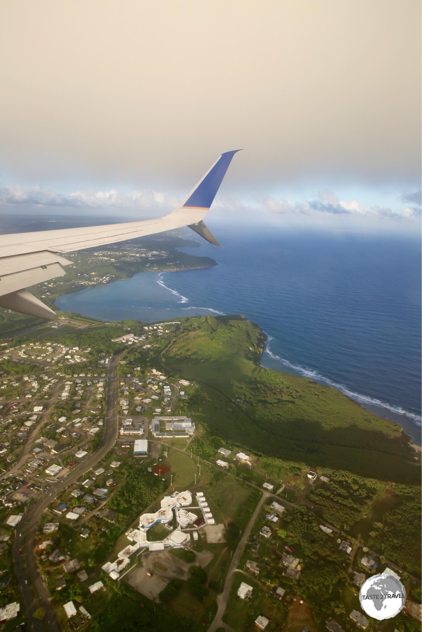
The view from my flight on United Airlines "Island Hopper" (UA154) on final approach to Guam.

The view from my flight on United Airlines “Island Hopper” (UA154) on final approach to Guam.

Arriving at Guam

If you have spent any amount of time on the other islands, the first thing you will notice upon arrival at Antonio B. Won Pat International Airport is how big and busy it is.

Lots of gates instead of the usual ‘1’ and lots of aircraft movement instead of one movement every few days.

This is a busy airport with most of the flights shuttling tourists from Japan and Korea and now increasingly China.

Guam serves as a regional hub for United Airlines.

The island Hopper was early into Guam which would have been good news for the Guam-based crew.

Arrival procedures here are the same as any other international gateway, but at this airport (unlike all others on UA154) your bag is delivered on a carousel – strange to see one after weeks of receiving my bag through a hole in the terminal wall.

Entry requirements for Guam are the same as the US.

In the terminal, there are all the usual US car rental agents.

I pre-booked a car with Alamo, which was reasonable at $30 per day.

You need a car here unless you are going to spend a short time lazing around the beach.

I also needed the car to get to my apartment, which was in the neighbourhood of Sinajana.

If you have a craving for anything from your favourite US restaurant chain your appetite will be satisfied on Guam.

From Denny’s to Tony Roma’s and many more – they are all here.

Hop 7: Guam – Palau

Guam – USA

After an amazing week on Guam it was time to move onto the next island – Palau.

Guam had been wonderful, providing all the conveniences of the US in the middle of the western Pacific.

From wonderful infrastructure, large supermarkets (I self-catered a little) to all the restaurants and shops you would find on the US mainland.

Where else can you shop at Macy’s in this part of the world?

Although the most popular shop on the island is the ‘Ross – Dress for Less‘ outlet at the Guam Premier Outlet Mall.

With opening hours from 6-am to 1-am, seven days a week, there is always a huge line of Asian tourists waiting patiently to pay for their bargains.

Departing Guam

I returned my car to Alamo and proceeded to the United check-in area.

The terminal is mostly used by large groups of tourists from Korea, Japan and China, with airlines from these countries providing frequent daily connections.

Exit formalities are the same as the US (i.e. no stamping of passports).

There is a small food court on the air-side, which was full of diving groups from Europe waiting for a flight to Chuuk.

Most of the shops close early so if you plan to purchase anything do it first.

My flight departed on time at 07:55-pm but most of the airport was closed well before this time.

The flight time to Palau was 90 minutes with United providing yet another ‘snack’.

Palau


Interested in visiting Palau? Click to read my Palau Travel Guide.


I had heard many good things about Palau and I wasn’t disappointed.

Despite being an expensive destination (it was the most costly destination on this journey) the diving was incredible, the environment is pristine and the local culture is very much alive and completely different to anywhere else in the region.

The government has taxes galore, which they charge tourists, including a US$50 departure tax which includes a $30 ‘green fee’.

Despite the expense, Palau is definitely worth visiting once in your life.

Arriving on Palau

UA157 touched down at a wet Palau International Airport on time at 9:05-pm.

Palau airport is larger and more modern than most in the region with air-bridges and at least two gates.

The flight was half full so clearing immigration and customs was fast.

I was granted a 30-day stay.

Palau passport stamps.

Palau passport stamps.

My hotel did not provide a shuttle service so I asked about car rental at the Alamo counter.

They quoted US$70 per day – more than double the cost on Guam.

Welcome to Palau!

I decided to settle for a taxi but there were none.

The kind lady at the Information Desk offered to take me instead for the same price ($25 to downtown Koror). She closed the Information counter and drove me to my hotel.

Hop 8: Palau – Manila

Palau

I spent a total of six days on Palau which is enough time to explore this little piece of paradise.

During this time, I got to scuba dive with Manta Rays, countless sharks and other amazing marine life, drive a rental car around the main island of Babeldaob and explore the offerings of the main town – Koror.

It was now time to wrap up this odyssey by taking my final flight to Manila.

Departing Palau

Due to the constant snaking line of traffic, which crawls along the one-lane main road of Koror, you should allow plenty of time to reach the airport.

If you arrive too early you will find the door to the check-in area is locked.

Once you have checked-in you go upstairs to pay your $50 departure tax ($20 terminal fee/ $30 green fee) then have your passport stamped and proceed through security screening into the lounge.

In the lounge, you’ll find one over-priced Duty Free shop and a small kiosk.

If you are hungry it’s best to eat in the one upstairs restaurant before you pass through immigration.

Flight time to Manila is just under 3 hours.

United once again provided a ‘snack’.

Non-alcoholic drinks are provided free of charge, anything else is available at cost.

Manila – Philippines

Arriving in Manila

Manila’s Ninoy Aquino International Airport (NAIA) has been operating over-capacity for years.

Whenever I have flown in here I have been delayed while the plane is put into a holding pattern. Tonight, was no exception.

After a smooth, on-time flight, the captain announced we were in a holding pattern and would be delayed approximately 50-mins.

NAIA has just two runways and four terminals with a capacity for 28 million passengers per year.

In 2015, almost 37 million passengers passed through the airport.

United arrive at Terminal 1 which is the main international terminal, where there are always long lines for immigration.

Grab Pick-up Point at NAIA in Manila.

Grab Pick-up Point at NAIA in Manila.

After receiving my bag I proceeded outside to take a taxi to downtown.

If you will be taking taxis (recommended in this crazy metropolis) it is worth installing the free ‘Grab‘ app on your smartphone before you arrive.

Uber is not available in the Philippines. 

This is the most popular ride sharing app in Manila (and other capital cities in Southeast Asia).

Unlike Uber, Grab allows cash payments (useful in a city where a fare can be just $3), so there is no need to register your credit card.

A regular taxi fare to downtown Manila (e.g. Makati) from the concession stand outside Terminal 1 is P650. The same trip on Grab will could less than P300.

Grab Taxi Service Desk at NAIA.

Grab Taxi Service Desk at NAIA.

Always request the driver to use the (faster) Skyway, an elevated freeway, which will cost you an extra P20 for the toll.

There are Grab stands outside of each terminal, where a Grab representative will order you a taxi – so if you don’t have the app you can still use the service.

From Manila it was onto the next adventure… more on that another time.


That’s the end of my United Airlines Island Hopper report.

If you wish to leave any comments/ feedback, you can do so using the form below.

Safe Travels!

Darren


Follow me on Instagram: 

[instagram-feed feed=1]


Further Reading

Other travel reports from the Pacific region:

Central Pacific Island Hopping Central Pacific Island Hopping Central Pacific Island Hopping Central Pacific Island Hopping Central Pacific Island Hopping Central Pacific Island Hopping Central Pacific Island Hopping Central Pacific Island Hopping Central Pacific Island Hopping Central Pacific Island Hopping Central Pacific Island Hopping Central Pacific Island Hopping Central Pacific Island Hopping Central Pacific Island Hopping