Tag - The Guianas

Guyana Photo Gallery

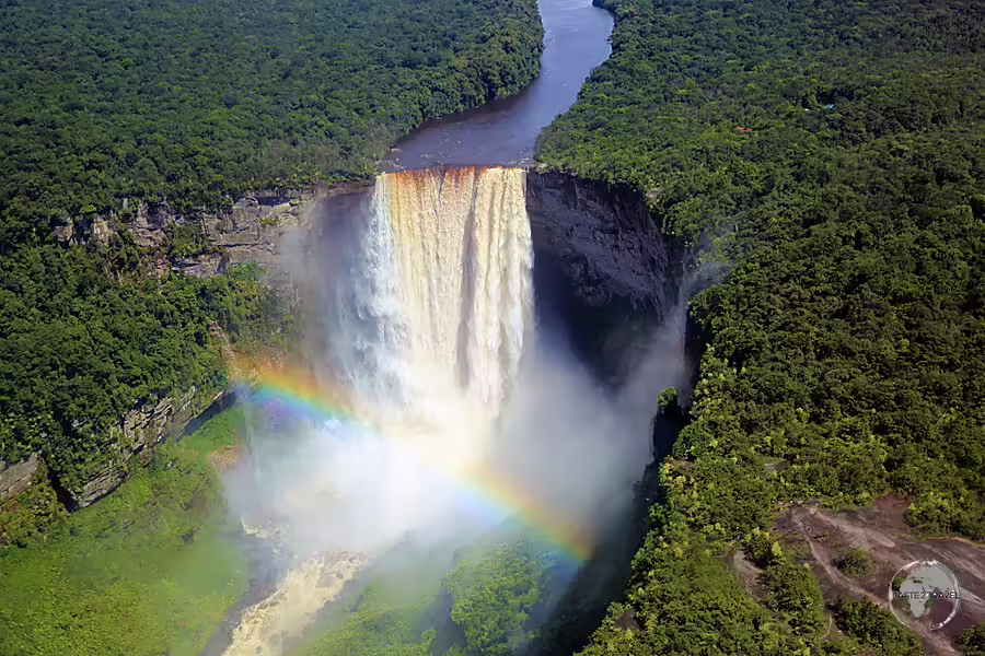
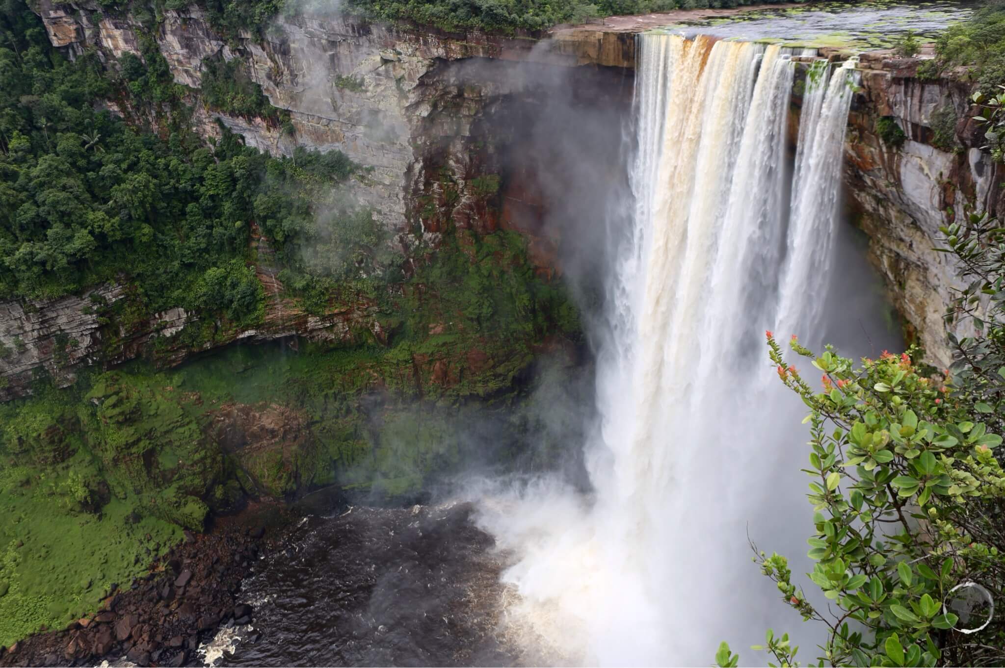
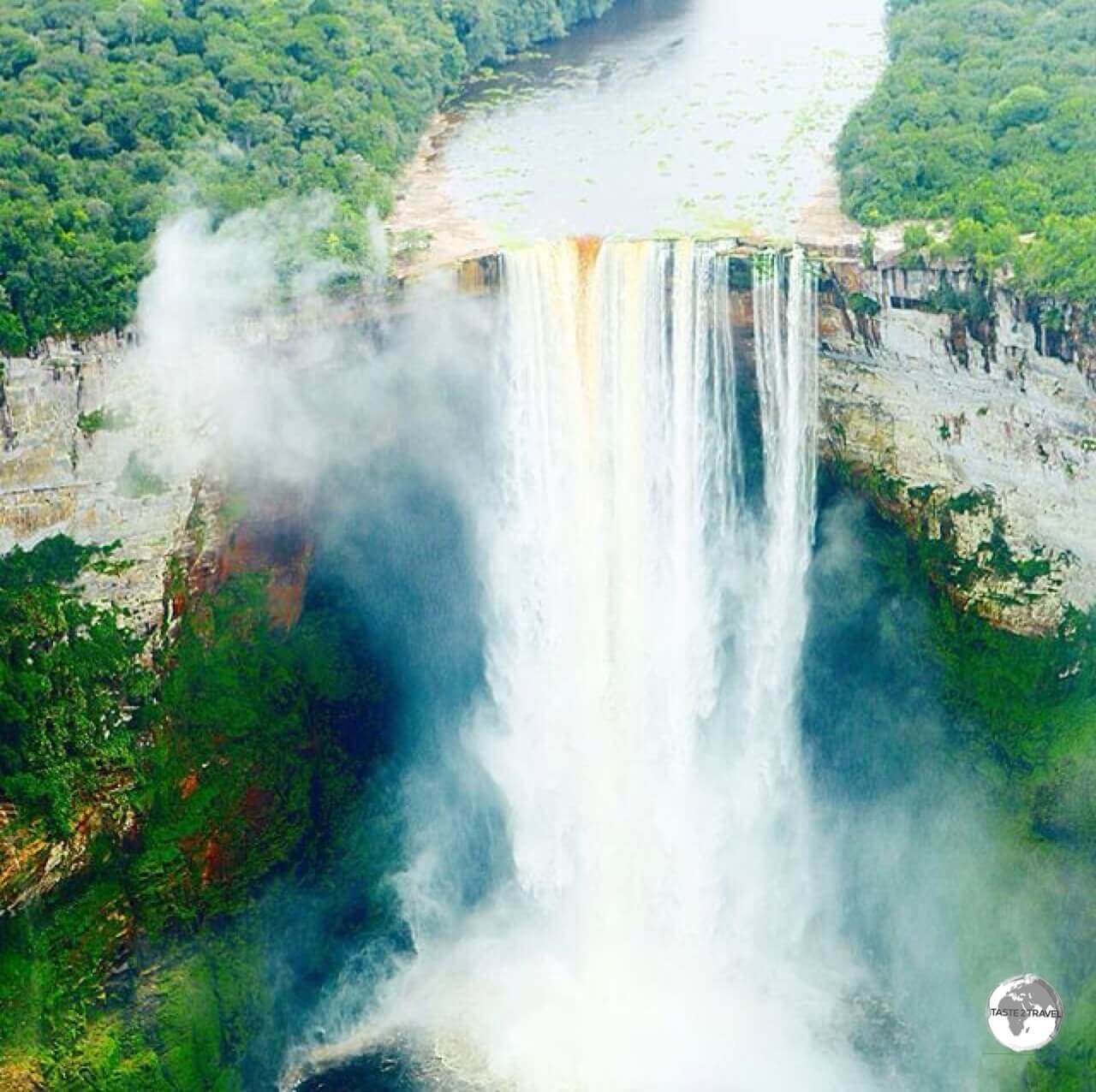
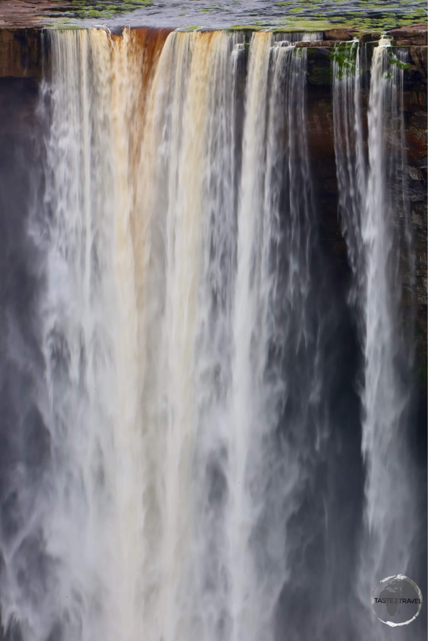
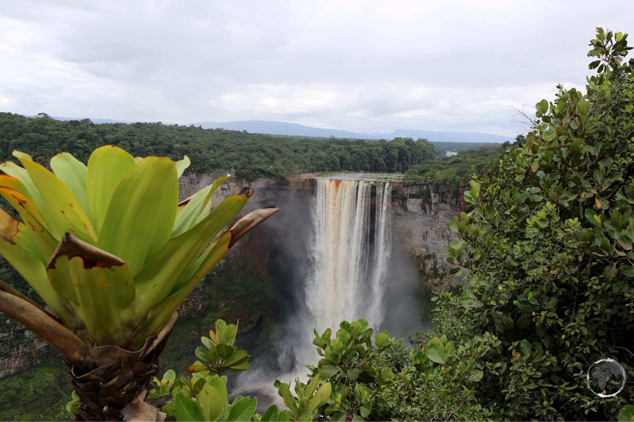
The majestic and awe-inspiring, Kaieteur Falls - a truly spectacular sight.

Guyana Photo Gallery

This is a Guyana Photo Gallery. To read about this destination, please refer to my Guyana Travel Guide, Guyana’s Essequibo Region Travel Guide and my Macapa to Manaus via the Guiana’s Travel Guide.


All images are copyright! If you wish to purchase any images for commercial use, please contact me via the Contact page.


About taste2travel!

Hi! My name is Darren McLean, the owner of taste2travel. I’ve been travelling the world for 33 years and, 209 countries and territories, and – seven continents later, I’m still on the road.

Taste2travel offers travel information for destinations around the world, specialising in those that are remote and seldom visited. I hope you enjoy my content!

Ever since I was a child, I have been obsessed with the idea of travel. I started planning my first overseas trip at the age of 19 and departed Australia soon after my 20th birthday. Many years later, I’m still on the road.

In 2016, I decided to document and share my journeys and photography with a wider audience and so, taste2travel.com was born.

My aim is to create useful, usable travel guides/ reports on destinations I have visited. My reports are very comprehensive and detailed as I believe more information is better than less. They are best suited to those planning a journey to a particular destination.

Many of the destinations featured on my website are far off the regular beaten tourist trail. Often, these countries are hidden gems which remain undiscovered, mostly because they are remote and difficult to reach. I enjoy exploring and showcasing these ‘off-the-radar’ destinations, which will, hopefully, inspire others to plan their own adventure to a far-flung corner of the planet.

I’m also a fan of travel trivia and if you are too, you’ll find plenty of travel quizzes on the site.

Photography has always been a passion and all the photos appearing in these galleries were taken by me.

If you have any questions or queries, please contact me via the contact page.

I hope you this gallery and my website.

Safe travels!

Darren


Suriname Photo Gallery

The Ministry of Finance building anchors one side of Independence Square in Paramaribo.

Suriname Photo Gallery

This is a Suriname Photo Gallery. To read about this destination, please refer to my Suriname Travel Guide and my Macapa to Manaus via the Guiana’s travel guide.


All images are copyright! If you wish to purchase any images for commercial use, please contact me via the Contact page.


About taste2travel!

Hi! My name is Darren McLean, the owner of taste2travel. I’ve been travelling the world for 33 years and, 206 countries and territories, and – seven continents later, I’m still on the road.

Taste2travel offers travel information for destinations around the world, specialising in those that are remote and seldom visited. I hope you enjoy my content!

Ever since I was a child, I have been obsessed with the idea of travel. I started planning my first overseas trip at the age of 19 and set sail from Australia soon after my 20th birthday. Thirty-two years later and I’m still on the road

In 2016, I decided to document and share my journeys and photography with a wider audience and so, taste2travel.com was born.

My aim is to create useful, usable travel guides/ reports on destinations I have visited. My reports are very comprehensive and detailed as I believe more information is better than less. They are best suited to those planning a journey to a particular destination.

Many of the destinations featured on my website are far off the regular beaten tourist trail. Often, these countries are hidden gems which remain undiscovered, mostly because they are remote and difficult to reach. I enjoy exploring and showcasing these ‘off-the-radar’ destinations, which will, hopefully, inspire others to plan their own adventure to a far-flung corner of the planet.

I’m also a fan of travel trivia and if you are too, you’ll find plenty of travel quizzes on the site.

Photography has always been a passionate and all the photos appearing in these galleries were taken by me.

If you have any questions or queries, please contact me via the contact page.

I hope you this gallery and my website.

Safe travels!

Darren


Follow me on Instagram: 


Venezuela Photo Gallery

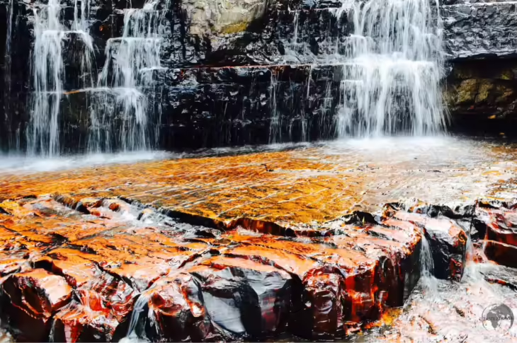
One of many waterfalls in Canaima National Park.

Venezuela Photo Gallery

This is a Venezuela Photo Gallery. To read about this destination, please refer to my Venezuela Travel Guide and my Macapa to Manaus via the Guiana’s Travel Guide.


All images are copyright! If you wish to purchase any images for commercial use, please contact me via the Contact page.


About taste2travel!

Hi! My name is Darren McLean, the owner of taste2travel. I’ve been travelling the world for 33 years and, 209 countries and territories, and – seven continents later, I’m still on the road.

Taste2travel offers travel information for destinations around the world, specialising in those that are remote and seldom visited. I hope you enjoy my content!

Ever since I was a child, I have been obsessed with the idea of travel. I started planning my first overseas trip at the age of 19 and departed Australia soon after my 20th birthday. Many years later, I’m still on the road.

In 2016, I decided to document and share my journeys and photography with a wider audience and so, taste2travel.com was born.

My aim is to create useful, usable travel guides/ reports on destinations I have visited. My reports are very comprehensive and detailed as I believe more information is better than less. They are best suited to those planning a journey to a particular destination.

Many of the destinations featured on my website are far off the regular beaten tourist trail. Often, these countries are hidden gems which remain undiscovered, mostly because they are remote and difficult to reach. I enjoy exploring and showcasing these ‘off-the-radar’ destinations, which will, hopefully, inspire others to plan their own adventure to a far-flung corner of the planet.

I’m also a fan of travel trivia and if you are too, you’ll find plenty of travel quizzes on the site.

Photography has always been a passion and all the photos appearing in these galleries were taken by me.

If you have any questions or queries, please contact me via the contact page.

I hope you this gallery and my website.

Safe travels!

Darren


Follow me on Instagram: 


Amazon River Travel Guide – Part 2

A painting of the 'Tres Fronteras' (Three Frontiers) region, the tri-meeting point of Colombia, Peru and Brazil which lies deep in the Amazon jungle.

Amazon River Travel Guide – Part 2

Welcome to the taste2travel Amazon River Travel Guide – Part 2!


Forward

A 4,334 kilometre (2,693 mile) meander along the Amazon River from Iquitos, Peru to the Atlantic Ocean in Brazil is an epic voyage and, as such, this travel guide was always going to be monumental in size.

To make the guide more manageable, I have split it into two parts:

  • Amazon River Travel Guide – Part 1: contains sections on History, Currency, Visa Requirements, Boat Travel and details on destinations in Peru (Iquitos/ Santa Rosa) and Colombia (Leticia).
  • Amazon River Travel Guide – Part 2: contains details on destinations in Brazil –TabatingaManausSantarém, Belém, Marajó Island and Macapá. 

Enjoy!


Slowly working my way towards the Atlantic Ocean - on a slow boat down the Amazon River.

Slowly working my way towards the Atlantic Ocean – on a slow boat down the Amazon River.

Destinations – continued from Part 1

Tabatinga (Brazil)

Introduction

The Brazilian border town of Tabatinga forms a single conurbation with neighbouring Leticia – you can simply walk between the two without passing through any immigration formalities.

Tabatinga is a small, gritty, frontier town with an edgy feel to it – there is nothing redeeming about it. The main reason you would come to Tabatinga is for transit purposes. If you are spending any time in the area, neighbouring Leticia is a much more inviting place to spend time.

I spent a total of 7 days cruising along the Amazon with each day ending with an amazing sunset.

I spent a total of 7 days cruising along the Amazon with each day ending with an amazing sunset.

Formalities

While in the three-way border zone, you can travel freely between Leticia (Colombia), Tabatinga (Brazil) and Santa Rosa (Peru) without restriction, although you should carry your passport with you at all times. Once you leave the zone, you’ll need to formerly exit whichever country you are departing and formally enter the country you are arriving into.

If you are travelling further into Brazil (or exiting), you will need to visit the Brazilian immigration office, which is located on the main avenue – Avenida da Amizade (Avenue of Friendship). If coming from Leticia, it’s best to take a taxi to the office.

The Brazilian authorities will not stamp you into Brazil until you have been stamped out of your previous country (they do check for your exit stamp).

If you’re traveling on either a Canadian, Australian or United States passport, you will need to obtain a Brazilian visa in advance. There are no visa’s issued upon arrival. Please refer to the ‘Visa Requirement‘ section below for more details.

A passenger ferry near Belém.

A passenger ferry near Belém.

Sightseeing

There are no sights to see.

Accommodation

Better accommodation options can be found in Leticia – please refer to that section.

Eating Out

Better restaurant options can be found in Leticia – please refer to that section.

Getting There/ Away

Air

Tabatinga International Airport (IATA: TBT) is located one kilometre from downtown Tabatinga and provides one connection to Manaus, which is operated by Azul Brazilian Airlines.

Boat

Sunset over the Amazon River.

Sunset over the Amazon River.

Slow boats to Manaus:

There are two slow boats which depart from Porto Fluvial in Tabatinga each Wednesday and Saturday at 11:00 AM, covering the 1,628 kilometres (1011 miles) journey in 4 days. The cost for hammock space is R$200 while a two-bed cabin costs R$1000. Meals and drinks are available on-board.

Fast boats to Manaus:

Rocketing along the Amazon river on a fast boat from Tabatinga to Manaus.

Rocketing along the Amazon river on a fast boat from Tabatinga to Manaus.

Fast boats between Tabatinga and Manaus are operated by Cris Transporte Maritimo (also known as Ajato) – who manage a fleet of fast lancha’s. You can access their Facebook page at Gloria de Deus III.

A meal served in my seat on the fast boat from Tabatinga to Manaus.

A meal served in my seat on the fast boat from Tabatinga to Manaus.


Currently one fast boat a week travels between Tabatinga and Manaus, departing from the Porto Fluvial on Friday morning, arriving in Manaus 30 hours later.

A one-way ticket costs R$550, which secures you a comfortable aircraft-style seat (i.e. you are sitting upright for the entire journey), access to clean bathrooms and all inclusive meals, which are served in-seat. 

Travelling from Tabatinga to Manaus on a fast boat.

Travelling from Tabatinga to Manaus on a fast boat.

Road

You can easily walk across the border between Colombia and Brazil by following the Avenida da Amizade – or you can take one of the many taxis and moto-taxis which cross the border freely.

Getting Around

Boat

Water taxis connect Tabatinga with the Peruvian settlement of Santa Rosa from where you can board boats to Iquitos, Peru.

Road

There are plenty of regular taxis and motorbike taxis on the streets of Tabatinga.

Manaus  

A long way from the sea - 1,400 km upriver, an ocean-going freighter approaches Manaus port.

A long way from the sea – 1,400 km upriver, an ocean-going freighter approaches Manaus port.

Introduction

With 2.1 million inhabitants, Manaus is the largest city on the Amazon (the 2nd largest is Belém with 1.5 million) and it’s busiest port. The city is located on the banks of the Rio Negro (the largest left tributary of the Amazon River and, the largest black-water river in the world) a few miles before it meets the Rio Solimões to form the Amazon River properly.

The two rivers flow side by side for many miles, different in colour, mixing in eddies: the “Meeting of the Waters.”

Despite being situated 1,400 km (900 miles) upriver from the Atlantic ocean, the Amazon is navigable for ocean-going vessels and the main economic engine of Manaus is the Duty Free port and the Manaus Free Economic Zone.

The Theatro Amazonas, Manaus.

The Theatro Amazonas, Manaus.

During colonial times, great wealth was generated from rubber plantations during the period known as the Amazon Rubber Boom (1879 to 1912). The proceeds from this boom were used to build magnificent buildings, including a copy of the Grand Opera de Paris – the Teatro Amazonas. Other monuments from this period are the Mercado Municipal, a copy of the famous market halls Les Halles in Paris, and the arts centre Palacio Rio Negro.

Apart from a wealth of history and sights, Manaus serves as a regional travel hub offering onward travel possibilities to Boa Vista, Guyana and Venezuela.

Two girls on the slow boat from Santarém to Belém.

Two girls on the slow boat from Santarém to Belém.

If you’re spending time meandering along the river, Manaus is the best place to take timeout, offering a good choice of accommodation, fine restaurants, bars and cafes and the biggest shopping mall on the Amazon – Amazonas Shopping.

Sightseeing

Theatro Amazonas

The most monumental building in the Amazon region, the opulent Manaus Opera House.

The most monumental building in the Amazon region, the opulent Manaus Opera House.

Dominating downtown Manaus, the spectacular Theatro Amazonas is certainly one of the most impressive sights in the entire Amazon region.

Constructed during the years of the rubber boom, when the city was awash with money, no expense was spared on its construction with the roof tiles being imported from Alsace, the steel walls from Glasgow and Carrara marble from Italy.

The ornate interior of the Theatro Amazonas, Manaus.

The ornate interior of the Theatro Amazonas, Manaus.

The dome is covered with 36,000 decorated ceramic tiles painted in the colours of the national flag of Brazil. Concerts are held often and tickets are very affordable at about US$10 each. I saw an amazing concert which showcased the culture of the Amazon, definitely a highlight of my stay!

Mercado Municipal

 This ‘touristy’ riverside market is very clean and organised. It’s a good place to buy souvenirs or to have a refreshing fruit juice (made from amazing Amazonian fruits).

Meeting of the Waters

The 'Meeting of the Waters', down-river from Manaus.

The ‘Meeting of the Waters’, down-river from Manaus.

The ‘Meeting of the Waters’ is one of the most popular sights in Manaus, but actually isn’t in Manaus. In order to see this interesting phenomenon, you’ll need to book yourself onto a boat sightseeing trip or take a slow boat down the Amazon.

This attraction lies at the point where the dark Rio Negro mixes with the sandy-coloured upper Amazon River, or Solimões, as it is known in Brazil.

Despite their coming-together, and due to their different properties, they do not immediately mix, but flow alongside each other. This Meeting of the Waters stretches for 6 km (3.7 miles) before the two different waters eventually blend together.

Our boat from Manaus to Santarém passing through the 'Meeting of the Waters'.

Our boat from Manaus to Santarém passing through the ‘Meeting of the Waters’.

This phenomenon is due to the differences in temperature, speed, and amount of dissolved sediments in the waters of the two rivers. The Rio Negro flows at near 2 km/h at a temperature of 28 °C, while the Rio Solimões flows between 4 and 6 km/h at a temperature of 22 °C.

The light-coloured water is rich with sediment from the river bed since the Andes Mountains, whereas the black water, running from the Colombian hills and interior jungles, is nearly sediment-free and coloured by decayed leaf and plant matter.

Accommodation

The best place to stay is in the historic old town where you have a good selection of guest houses, restaurants, bars and cafes and everything is within walking distance.

I stayed at the wonderful Boutique Hotel Casa Teatro which is across the road from the Opera house and in close proximity to all the sights in the old town. The neighbourhood is very pedestrian friendly with loads of dining and entertainment options.

If you prefer something more modern, there are many international chain hotels in the new town. There are plenty of options on booking.com

Eating Out

There is no shortage of good restaurants in Manaus, including a quirky revolving restaurant which is located on the top of the Taj Mahal Hotel. The décor is very 1970’s and the restaurant is tired and worn. It all feels like you’re on the set of a vintage James Bond movie set – waiting for the bad guys to arrive. The food, service and views are worthwhile and besides – where else can you eat in a revolving restaurant in the jungle?

Shopping

Manaus offers the same sort of shopping opportunities you would expect to find in any large metropolis. Something that is unexpected in the middle of the jungle is the glitzy, modern shopping mall – Amazonas Shopping – a short taxi ride from downtown. Whatever you need, you’ll find it here, along with a good selection of restaurants.

Getting There/ Away

A budding photographer on the 36-hour slow boat from Manaus to Santarém.

A budding photographer on the 36-hour slow boat from Manaus to Santarém.

Air

If you don’t fancy spending days traveling on a slow boat along the Amazon river (or if you’re not arriving on a bus from Boa Vista) then flying is your only other option for reaching this remote jungle metropolis. Flights arrive at Manaus International Airport – Eduardo Gomes, which is located 13 kilometres (8 miles) west of downtown.

The following airlines provide regular services:

  • American Airlines – flies to/ from Miami
  • Azul Brazilian Airlines  – flies to/ from Belém, Belo Horizonte-Confins, Boa Vista, Campinas, Cuiabá, Fortaleza, Parintins, Porto Velho, Santarém, Tabatinga, Tefé
  • Avior Airlines – flies to/ from Barcelona (Venezuela)
  • Copa Airlines – flies to/ from Panama City–Tocumen
  • Gol Airlines – flies to/ from Belém, Belo Horizonte, Boa Vista, Buenos Aires-Ezeiza, Brasília, Campo Grande, Cruzeiro do Sul, Cuiabá, Curitiba, Fortaleza, Foz do Iguaçu, Porto Alegre, Porto Velho, Recife, Rio Branco, Rio de Janeiro-Galeão, Salvador da Bahia, Santarém, São Luís, São Paulo-Guarulhos
  • LATAM Brasil – flies to/ from Belém, Boa Vista, Brasília, Fortaleza, Miami, Salvador da Bahia, São Paulo-Guarulhos
  • MAP Linhas Aéreas – flies to/ from Altamira, Belém, Carauari, Eirunepé, Lábrea, Parintins, Santarém, Tefé
  • Rima – flies to/ from Lábrea, Porto Velho
  • TAP Air Portugal – flies to/ from Lisbon
  • Total Linhas Aéreas – flies to/ from Carauari, Coari, Porto Urucu

A Lost Connection

The national airline of Curaçao, Insel Air, use to provide a very convenient connection from Manaus to Aruba. It was a great way of getting from the jungle onto a white-sand, Caribbean beach in just a few hours.

The flights were never well patronised and not surprisingly the service was terminated. I once took this flight from Manaus to Aruba, which I shared with just one other passenger. The Captain personally came to thank us for flying.

I shared this Insel Air flight from Manaus to Aruba with just one other passenger.

I shared this Insel Air flight from Manaus to Aruba with just one other passenger.

Road

Despite the fanciful lines often drawn onto road maps of Brazil, there are no roads connecting Manaus with the rest of Brazil – except for route BR174 which runs north to the Venezuelan border via Boa Vista (capital of Roraima state). This asphalt highway is in excellent condition, and the buses which ply the route are comfortable and fast.

To Boa Vista:

Frequent night buses run between Manaus and Boa Vista with the 746 kilometre journey taking approximately 12-13 hours. Three different companies offer multiple daily trips with fares ranging from R$157 – R$210Eucatur offer the only daytime service which departs Manaus at 10:00, arriving in Boa Vista at 21:55. You can book tickets online here.

To Venezuela: 

The Venezuelan border is 960 kilometres north of Manaus at the end of BR174. Any journey to the border will require a change of transport in Boa Vista (please refer to the ‘Boa Vista – Getting There‘ section for more details).

To Guyana: 

There are no direct transport options from Manaus to Guyana. Like Venezuela, you will first need to travel to Boa Vista then take a bus or shared taxi to the border town of Bonfim then cross the Takutu River Bridge, entering Guyana at the town of Lethem (please refer to the ‘Boa Vista – Getting There‘ section for more details).

Boat

Amazon river 'slow' boats docked in Manaus.

Amazon river ‘slow’ boats docked in Manaus.

Manaus is the busiest port on the Amazon with regular boats departing to all points along the river. Tickets should be purchased in advance from the ticket offices at the dock.

Slow Boats:

Slow boats depart from the chaotic and crowded docks in downtown Manaus. Departures include:

  • Manaus to Tabatinga: The up-river journey can take anywhere from 5-7 days. The cost for hammock space is R$330 while a cabin costs R$414 per person (two sharing). Meals and drinks are included.
  • Manaus to Santarém: The down-river journey takes about 30 hours. The cost for hammock space is R$80 while a cabin costs R$700 per person. Meals and drinks are not included.
  • Manaus to Belém: The down-river journey takes 80 hours with hammock space costing R$220. Meals and drinks are not included.
The captain of my slow boat from Manaus to Santarém.

The captain of my slow boat from Manaus to Santarém.

Fast Boats:

Currently four fast boats a week operate between Manaus and the border town of Tabatinga, completing the 1,628 kilometres (1011 miles) journey in 36 hours. Each boat offers comfortable aircraft-style seats, clean bathrooms and all inclusive meals which are served at your seat.

All boats depart from the ‘Terminal Ajato‘ wharf in Manaus as per the following timetable (current at March 2018):

  • The MV Expresso Madame Cris: Departs Thursday at 06:00 am (R$550 per seat)
  • The MV Expresso Gloria de Deus III: Departs Friday at 06:00 am (R$600)
  • The MV Expresso Cidade de Manaquiri: Departs Sunday at 06:00 am (R$600)
  • The MV Expresso Crystal I: Departs Tuesday at 06:00 am (R$600)

The company previously operated a fast boat from Manaus to Santarém but unfortunately suspended their service, leaving passengers at the mercy of the slow (30 hours) boats.

Seating on the boats is limited so it’s best to book tickets in advance on their website (only available in Portuguese) or from their ticket office at the wharf in Manaus. If booking from the wharf you’ll need to show your passport.

Santarém

Introduction

Located on the southern bank of the Tapajós River, at the point where it meets the Amazon River, Santarém lies approximately at the midway point between Manaus and Belém. This city of 300,000 has a good selection of accommodation, restaurants and a few sights, making it an ideal place for a few days’ stopover on a trip along the Amazon River.

Nearby, the pleasant, relaxed riverside town of Alter do Chão offers stunning beaches, amazing restaurants and lots of charming Pousada’s, making it an ideal destination for some well-earned R&R. 

Sightseeing

Within town, there are enough sights to keep you occupied for a day, but the main draw is the riverside town of Alter do Chão, which is 40 km west of Santarém.

Santarém

The historic Catedral Metropolitana de Santarém dominates the main square of Santarém.

The historic Catedral Metropolitana de Santarém dominates the main square of Santarém.

Overlooking bustling Praca de Matriz, the elegant, powder-blue, Catedral Metropolitana de Santarém Santarém Metropolitan was consecrated in 1761, on the site of the first permanent building in the city.

A congregation celebrating mass at the Catedral Metropolitana de Santarém.

A congregation celebrating mass at the Catedral Metropolitana de Santarém.

The church occupies a commanding position in the old town, close to the river, and while it has an opulent exterior, its interior is very simple and unpretentious.

Mercado Modelo (Amazon Fish Market)

Different species of Amazon fish can be seen at the Mercado Modelo in downtown Santerem.

Different species of Amazon fish can be seen at the Mercado Modelo in downtown Santerem.

Across the street from the Teatro Municipal Victória, the Mercado Modelo is the main market in town, where you can get up close with the amazingly large fish that call the Amazon river home.

The Mercado Modelo in Santarém is a great place to view the giant species of fish which inhabit the depths of the Amazon river.

The Mercado Modelo in Santarém is a great place to view the giant species of fish which inhabit the depths of the Amazon river.

If you’re in the mood to cook up a Piranha, the Mercado Modelo is the place to shop.

Museu Dica Frazão

Dica Frazão providing me with a tour of her unique collection in 2014. Sadly, she passed away in 2017.

Dica Frazão providing me with a tour of her unique collection in 2014. Sadly, she passed away in 2017.

Located downtown, the Museu Dica Frazão is a small museum, which is attached to the Frazão family home. This museum displays the amazing creations of Dica Frazão who was born in 1920. She makes women’s clothing and fabrics from natural fibres such as grasses and wood pulp. The work is extremely detailed and most very beautiful.

Items on display include a tablecloth made for Pope John Paul II, ornate handbags, elegant robes and much more. The works are intricate and (as told by Dica herself), very time consuming to produce with some items requiring months of work.

On a sad note, Dica Frazão died at the age of 96 in 2017, but the museum continues with a display room of her creations.

Alter do Chão

Flood waters from the wet season inundate the beaches and promenade at Alter do Chão.

Flood waters from the wet season inundate the beaches and promenade at Alter do Chão. 

Located on the banks of the Tapajós River, a short bus ride southwest of Santarém is the beautiful, historic village of Alter do Chão, which is also known as the “Caribbean in Brazil“.

Famous for it’s many white-sand river beaches (which contrast spectacularly against the dark water of the Tapajós River), Alter do Chão is where the locals flock to for weekend recreation. 

The size of the beaches vary depending on the season – I was there during the wet season so many of the beaches had been totally inundated by flood waters.

A short distance offshore, in the middle of the river, is the beautifully named, and simply wonderful Ilha do Amor (Island of Love). You can either swim to the island or hire a kayak for R$5.

The beaches are also popular with stingrays who like to rest on the sandy bottom. They’ll only sting when stepped on, so the local advice is to shuffle your feet when you walk in the water.

Accommodation

There are plenty of accommodation options in downtown Santarém, all a short walk from the riverfront. I stayed at the Pôr do Sol Hotel, which is located outside of the centre – on the road to the airport – and offers modern, spacious, comfortable rooms at a reasonable price. Booking.com currently lists 15 different properties in the city.

With its sandy beaches and relaxed ambiance, Alter do Chão is an ideal place to relax. Booking.com currently list 28 different properties, many of them reasonably priced Pousada’s.

Eating Out

Piranha can be found on many restaurant menus in Santarém.

Piranha can be found on many restaurant menus in Santarém.

Lining the Amazon river waterfront in Santarém are a good selection of restaurants. One of my favourites is Restaurante Nossa Casa, where you can sample fresh Amazonian fish such as Tambaqui, Piranha and Pirarucu (also known as Arapaima) – one of the largest freshwater fish in the world.

Getting There/ Away

Air

Santarém is served by the Santarém–Maestro Wilson Fonseca Airport (IATA: STM), which is named after the famous local composer – Wilson Fonseca.

The following airlines fly to/ from Santarém:

  • Azul Brazilian Airlines – flies to/from Altamira, Belém, Carajás, Manaus, Parintins, Porto de Trombetas
  • Gol Airlines – flies to/from Brasília, Fortaleza, Manaus, Recife, Rio de Janeiro-Galeão, Salvador da Bahia
  • LATAM Brasil – flies to/from Belém, Brasília
  • MAP Linhas Aéreas – flies to/from Altamira, Belém, Manaus, Parintins
  • Piquiatuba – flies to/from Altamira, Belém, Itaituba, Novo Progresso

Boat

A typical Amazon river settlement between Santarém and Belém.

A typical Amazon river settlement between Santarém and Belém.

Boats to Macapá (hammock R$140 including meals, 36 hours, 6:00 PM daily) arrive and depart from Praça Tiradentes, which is located one kilometre west of downtown.

Boats to Manaus and Belém arrive and depart from the Docas do Pará, which is 2.5 kilometres west of downtown. Slow boats travelling upriver to Manaus depart from Santarém daily (except Sunday).

Boats to Manaus

The only option to Manaus is a slow boat with one boat leaving each day (except Sunday) at 12:00 pm. The journey upriver takes 48 hours (versus 36 hours for the downriver trip) with hammock class costing R$130 (USD$32) and a cabin costing R$500 (USD$92).

While agents around town will sell you a ticket at an inflated price, its best to purchase your tickets directly at the Docas do Pará.

Boats to Belém

My cabin on the 'MV Amazonia', a slow boat which carried me from Santarém to Belém in 48 hours.

My cabin on the ‘MV Amazonia’, a slow boat which carried me from Santarém to Belém in 48 hours.

The only option to Belém is a slow boat with boats departing from Docas do Pará at 11:00 am most days. Tickets for the 48 hour journey can be purchased at the port and cost R$180 for hammock-class or R$800 for a private cabin.

The crew of the MV Amazonia loading freight into the hold at Santarém.

The crew of the MV Amazonia loading freight into the hold at Santarém.

I travelled in a cabin on the MV Amazonia which was a pleasant but long (48 hours) journey. We departed Santarém many hours late, while we waited for the crew to load freight into the hold by hand.

Loading sacks of coconuts at Monte Alegre.

Loading sacks of coconuts at Monte Alegre.

In the early hours of the morning the next day, we arrived at the small town of Monte Alegre where the boat docked for an hour or so while huge sacks of coconut were loaded into the hold of the boat.

And so it continued for the rest of the journey, stopping at every settlement to pick up freight.

Patience is a virtue on the Amazon River! 

Storm clouds over the Amazon river near Belém.

Storm clouds over the Amazon river near Belém.

Getting Around

Public Bus

Municipal buses run regularly to all points in Santarém and to Alter do Chão and the airport.

Taxi

Taxis are plentiful in Santarém and can be hailed on the street. If you wish to reserve a taxi to/from the airport, you can contact the Airport Taxi service company on +55 93 35 22 39 36.

Belém

Located one degree south of the Equator, Belém is one of the wettest places on the planet with almost daily storms.

Located one degree south of the Equator, Belém is one of the wettest places on the planet with almost daily storms.

Introduction

With a population of 1.5 million, Belém is the largest city (and capital) of Pará state and the 2nd largest city on the Amazon River, after Manaus. Founded in 1616 on the banks of the Pará River by Portugal, Belém was the first European colony on the Amazon but did not become part of Brazil until 1775.

Most afternoons, the city of Belém is enveloped by fierce tropical storms.

Most afternoons, the city of Belém is enveloped by fierce tropical storms.

The city blossomed during the rubber boom of the late 19th century and early 20th century when it accounted for nearly 40 per cent of the country’s rubber exports. The city today is an economic hub with a charming old town at it’s core, which is surrounded by a forest of high rise buildings which comprise the modern new town.

Monuments such as the ornate Theatro da Paz were built in Belém using riches from the rubber boom.

Monuments such as the ornate Theatro da Paz were built in Belém using riches from the rubber boom.

Belém, which translates as Bethlehem, is also known as the City of Mango Trees, due to the vast number of Mango trees which line the city streets. If you visit during Mango season, you’ll find the footpaths littered with fallen fruit.

The city is a centre of culture and learning in Northern Brazil and home to the Museu Paraense Emílio Goeldi, a Natural History and Ethnography museum focused on the fauna, flora and cultures of the Amazon Basin – a ‘must see’ for anyone with an interest in anything ‘Amazon‘.

Sightseeing

Ver-o-Peso Market

Souvenir stalls at the 'Ver-o-Peso' market in Belém.

Souvenir stalls at the ‘Ver-o-Peso’ market in Belém.

Created in 1688 by the Portuguese who decided to levy a tax on everything entering and leaving Amazonia, the Ver-o-Peso market is the main market for Belém and one of its main tourist attractions. The markets name is derived from the fact that the tax collector’s main post was located in a house which was called the “Casa do Haver-o-peso” (“Have-the-Weight House”). It was in this house that goods were weighed then taxed.

Peppers for sale at the 'Ver-o-Peso' market in Belém.

Peppers for sale at the ‘Ver-o-Peso’ market in Belém.

Today the market sprawls over 9 acres of prime riverfront land and is divided into different sections selling meat, fish, fruits, arts, crafts and traditional medicines (which includes an Amazonian version of Viagra).

Preparing a fiery pepper sauce at the 'Ver-o-Peso' market in Belém.

Preparing a fiery pepper sauce at the ‘Ver-o-Peso’ market in Belém.

The Brazil Nut

Brazil nuts on sale at the 'Ver-o-Peso' market in Belem.

Brazil nuts on sale at the ‘Ver-o-Peso’ market in Belem.

One of the most popular products offered at the ‘Ver-o-Peso’ market is the ubiquitous Brazil nut, where a kilo of freshly shelled nuts will cost you R$32 (US$10).

Brazil nuts on sale at the 'Ver-o-Peso' market for $R32 (USD$10) per kilo.

Brazil nuts on sale at the ‘Ver-o-Peso’ market for $R32 (USD$10) per kilo.

In German, the Brazil nut is known as the Para nut, being named after the state of Para of which Belém is the capital. In Portuguese, the nut is known as Castanha do Brasil.

Raw Brazil nuts ready for processing at the Ver-o-Peso market in Belem.

Raw Brazil nuts ready for processing at the Ver-o-Peso market in Belem.

Unlike other nuts, the shell of the Brazil nut does not crack open so the nut can be easily removed. Instead, sellers need to use a knife or guillotine to cut the shell away (piece by piece) from each nut, which is very time consuming and labour intensive.

Unlike most nuts, the hard shell of the Brazil nut cannot be cracked open but must be cut from the nut - piece by piece.

Unlike most nuts, the hard shell of the Brazil nut cannot be cracked open but must be cut from the nut – piece by piece.


Some nut sellers prefer to remove the shell using a knife rather than a guillotine.

Some nut sellers prefer to remove the shell using a knife rather than a guillotine.


Some traders use small guillotines to remove the shell, which is a little faster than a knife.

Some traders use small guillotines to remove the shell, which is a little faster than a knife.


Seeing the effort involved in removing the shell of the Brazil nut gives you a greater appreciation of each nut.

Seeing the effort involved in removing the shell of the Brazil nut gives you a greater appreciation of each nut.

After spending time watching the difficult shelling process, I now have a new-found appreciation for these special treats.

Estação das Docas

A former dock on the Amazon river, Estação das Docas has been converted into a modern entertainment area with restaurants, cafes and bars.

A former dock on the Amazon river, Estação das Docas has been converted into a modern entertainment area with restaurants, cafes and bars.

Estação das Docas – located on the waterfront, next to Ver-o-Peso market, this former dock and warehouse complex has been transformed into an eating and entertainment space. The main draw is the excellent Cervejaria Amazon – a craft beer brewery (for more on this, please refer to the Eating Out section below).

Forte do Presépio

The Portuguese-built, Forte do Presépio, overlooks the Amazon river in historic Belém.

The Portuguese-built, Forte do Presépio, overlooks the Amazon river in historic Belém.

Located on the riverfront, a short walk from Ver-o-Peso market, Forte do Presépio was built by the Portuguese in the 17th century when the city was founded. Today you can visit a small museum and view the cannons lined up along the river.

In the area surrounding the fort are other historical buildings such as Santo Alexandre Church, which has been converted into a Museum of Sacred Art. 

Also nearby is the refined and elegant Casa das Onze Janelas (House of Eleven Windows), which was originally built as a residence for a wealthy sugar plantation owner and today houses the Belém Museum of Contemporary Art.

Belém Cathedral

The imposing interior of Belém Cathedral.

The imposing interior of Belém Cathedral.

Across the road from the fort is the imposing Belém Cathedral (also known as Our Lady of Grace Cathedral) which has neoclassical and baroque influences. Constructed in 1748, the church is the oldest in the city.

Theatro da Paz

The imposing exterior of Theatro da Paz in Belém.

The imposing exterior of Theatro da Paz in Belém.

Like the Opera House in Manaus, the Theatro da Paz (Peace Theatre) in Belém was built during the golden age of the rubber boom in the neoclassical style. Overlooking Praça da República (Republic Square), the theatre is open daily for tours which are interesting and informative. Reasonably priced concerts are conducted most evening.

Paraense Emilio Goeldi Museum

Located away from the centre of town, the Paraense Emilio Goeldi Museum is a research institute and museum dedicated to studying and cataloguing the fauna, flora and cultures of the Amazon basin. Originally named the Pará Museum of Natural History and Ethnography, and was later named in honour of Swiss naturalist Émil August Goeldi who reorganized the institution and was its director from 1894 to 1905. The museum is set among lush, tropical gardens and usually features exhibits focused on the indigenous tribes of the Amazon. This is a must-see for anyone interested in the Amazon region.

Mosqueiro Island 

Located 67 kilometres north of downtown Belém (near to the Atlantic ocean), the river island of Mosqueiro offers some of the best sandy beaches in the region – 17 kilometres of them. Regular taxis and buses connect Belém and the island, which is especially busy on weekends.

Accommodation

My deluxe, reasonably priced, room at the Golden Tulip Hotel in Belém.

My deluxe, reasonably priced, room at the Golden Tulip Hotel in Belém.

From historical, old town guest houses to modern, high rise hotels, Belém offers a good selection of accommodation for all budgets. One of my favourite hotels is the Radisson, which offers spacious, modern rooms, often at discounted prices. The hotel is located on Avenida Bras de Aguiar, close to many fine restaurants, bars and cafés.

Also nearby is the Golden Tulip Hotel which offers a rooftop pool and deluxe rooms. Booking.com currently list 62 properties in the city.

Eating Out

The Cervejaria Amazon in Belém is the only craft brewery on the Amazon River.

The Cervejaria Amazon in Belém is the only craft brewery on the Amazon River.

Located on the banks of the Pará River, the Estação das Docas is a former dock/ warehouse complex which has been converted into a dining, shopping and entertainment space.

The most important tenant (and by far the largest) is the Cervejaria Amazon, the only craft brewery on the Amazon River. Beers are brewed using local Amazonian fruits such as Taperebá, Bacuri, Açaí and Cupuaçu.

Craft beer range from Cervejaria Amazon Beer in Belém.

Craft beer range from Cervejaria Amazon Beer in Belém.

Whatever you’re in the mood for, you’ll find it in the streets around Avenida Bras de Aguiar. This is also a nice neighbourhood in which to base yourself with a good selection of accommodation options (see the ‘Accommodation‘ section above).

Getting There

Air

Belém is served by the Val de Cans International Airport (IATA: BEL)

The following airlines fly to/ from Belém:

  • Avianca Brazil – flies to/ from Brasília, São Paulo-Guarulhos
  • Azul Brazilian Airlines  – flies to/ from Altamira, Belo Horizonte-Confins, Campinas, Carajás, Cayenne, Fort Lauderdale, Cuiabá, Fortaleza, Imperatriz, Macapá, Manaus, Marabá, Palmas, Porto de Trombetas, Recife, Rio de Janeiro-Santos Dumont, Salvador da Bahia, Santarém, São Luís, São Paulo-Guarulhos, Tucuruí
  • Gol Airlines – flies to/ from Brasília, Cruzeiro do Sul, Fortaleza, Macapá, Manaus, Marabá, Paramaribo-Zanderij, Porto Velho, Recife, Rio Branco, Rio de Janeiro-Galeão, Salvador da Bahia, Santarém, São Luís, São Paulo-Congonhas, São Paulo-Guarulhos
  • LATAM Brasil – flies to/ from Brasília, Curitiba, Fortaleza, Macapá, Manaus, Marabá, Miami, Rio de Janeiro-Galeão, Santarém, São Paulo-Guarulhos
  • MAP Linhas Aéreas  – flies to/ from Altamira, Manaus, Parintins, Santarém
  • Piquiatuba – flies to/ from Altamira, Itaituba, Novo Progresso, Santarém
  • Surinam Airways – flies to/ from Cayenne, Paramaribo-Zanderij
  • TAP Air Portugal – flies to/ from Lisbon

Boat

A moonlit Amazon River as seen from my boat as we slowly approached Belém.

A moonlit Amazon River as seen from my boat as we slowly approached Belém.

Belém is a major transport hub for Amazon River traffic with regular boats departing from its docks heading upriver to all ports including Santarém & Manaus. Heading in the opposite direction – regular boats make the 24-hour crossing of the mouth of the Amazon River to the northern city of Macapá, while daily ferries connect the city with nearby Marajó Island.

Santarém

The glow of bustling Belém lights up the sky as I approach on my slow boat from Santerem - the end of a 48 hour journey.

The glow of bustling Belém lights up the sky as I approach on my slow boat from Santerem – the end of a 48 hour journey.

Slow boats for Santarém (72 hours) depart Belém from Terminal Hidroviário 2 days a week – Wednesday and Friday. Tickets can be purchased directly from the company at the terminal and cost R$130 for hammock class or ?? for cabin class. Food is available for purchase with breakfast typically costing R$5 and a lunch and dinner buffet costing R$

Macapá

On-board the M/V Sao Francisco de Paula leaving Belém for Macapá, a journey of 24 hours.

On-board the M/V Sao Francisco de Paula leaving Belém for Macapá, a journey of 24 hours.

Slow boats travel twice a week from Belém to Macapá, departing Belém at 10:00 am every Wednesday and Saturday. The 482 kilometre (300 mile) journey across the mouth of the Amazon river (the largest river mouth in the world) takes 24 hours with boats arriving in the Macapá port suburb of Santana.

The captain of the M/V Sao Francisco de Paula steering a course to Macapá.

The captain of the M/V Sao Francisco de Paula steering a course to Macapá.

I travelled on the M/V Sao Francisco de Paula, paying R$225 for a berth in a private cabin – hammock space is available for R$120. Food and drinks are available on board.

The Brazilians love to party so many of the Amazon river boats, including the M/V Sao Francisco de Paula, include live entertainment.

The Brazilians love to party so many of the Amazon river boats, including the M/V Sao Francisco de Paula, include live entertainment.

Açaí Berries

Açaí merchants loading their haul onto the Sao Francisco de Paula ready for transportation from the remote jungle to Macapá.

Açaí merchants loading their haul onto the Sao Francisco de Paula ready for transportation from the remote jungle to Macapá.

During our trip from Belém to Macapá, we stopped mid-river, in the middle of nowhere, and were quickly surrounded by small boats which were filled to the brim with baskets of freshly picked Açaí berries, an Amazonian super-fruit which has become hugely popular around the world.

The Sao Francisco de Paula provides an important link to market for these Açaí merchants who live in the middle of the jungle.

The Sao Francisco de Paula provides an important link to market for these Açaí merchants who live in the middle of the jungle.

The crews on these boats then proceeded to load our boat with dozens of large baskets filled with Açaí berries which were destined for a processing plant in Macapá.

Açaí being loaded (mid-river) onto our boat for transportation from the middle of the jungle to Macapá.

Açaí being loaded (mid-river) onto our boat for transportation from the middle of the jungle to Macapá.

This bounty of berries was the harvest from several indigenous communities and our boat was the only means of transporting their product out of the jungle.

A whole section of the M/V Sao Francisco de Paula was reserved for Açaí transportation.

A whole section of the M/V Sao Francisco de Paula was reserved for Açaí transportation.

The Açaí berry is considered a super-fruit which is loaded with a high level of anti-oxidants. Along with fish and cassava, Açaí is a key part of the diet of communities living along the Amazon River where the skinny Açaí palms are commonly found.

Açaí berries are exported all over the world from the Amazon region.

Açaí berries are exported all over the world from the Amazon region.

The berries are harvested twice a year, with the first harvest between January and June, while the other is between August and December. My visit coincided with the 2nd harvest, which is the larger and more important.

After timber exports, Açaí berries are the 2nd most valuable export item for the Amazon region. After timber exports, Açaí berries are the 2nd most valuable export item for the Amazon region.

After timber exports, Açaí berries are the 2nd most valuable export item for the Amazon region.

Although Brazil is famous for its production of Açaí , the species is native to Brazil, Ecuador, Venezuela, Colombia, Guyana, French Guiana, Suriname and Trinidad and Tobago where it grows in swamps and floodplains.

Açaí palms in the grounds of the Casarão da Amazônia hotel on Marajó Island.

Açaí palms in the grounds of the Casarão da Amazônia hotel on Marajó Island.

Açaí palms, such as the ones pictured here in the garden of the Casarão da Amazônia hotel on Marajó Island, are tall, slender trees growing to more than 25 m (82 ft) in height.

Marajó Island

The captain of our ferry from Marajó Island to Belém, with the usual afternoon storm raging outside.

The captain of our ferry from Marajó Island to Belém, with the usual afternoon storm raging outside.

Passenger ferries leave Belém daily from the Terminal Hidroviário (Pier 9), arriving approximately 3.5 hours later in the port of Camará. Please refer to the Marajo Island section for more details.

The daily afternoon storm rages over Belém as we return from Marajó Island.

The daily afternoon storm rages over Belém as we return from Marajó Island.

Bus

Unlike most other cities along the Amazon River, Belém is connected to the main Brazilian road network. Frequent buses depart from the large Terminal Rodoviario de Belem (website only available in Portuguese) to a number of major cities in Brazil as well as other cities and smaller towns in Pará.

You can check timetables, costs and current seat availability online using the Busca Onibus website.

Getting Around

Road

Taxi’s in Belém are plentiful and relatively inexpensive for short distances.

There are many local buses travelling all over the city, although it can be difficult for non-Portuguese speakers to figure out the timetables and routes. Best to take a taxi or walk.

Marajó Island

The view from atop my Buffalo at São Jerônimo Farm, Marajó Island.

The view from atop my Buffalo at São Jerônimo Farm, Marajó Island.

Introduction

With a population of 200,000 living on an island the size of Switzerland in the mouth of the Amazon River, sparsely populated Marajó Island remains a world apart.

Almost all of the island is undeveloped, a huge virgin wetland which is the exclusive playground for tens of thousands of birds.

A Pileated Woodpecker on Marajó Island.

A Pileated Woodpecker on Marajó Island.

The tiny human population clings to a small strip of the eastern shore, living in the towns of JoanesSalvaterra and Soure (the quiet, relaxed ‘capital’ of Marajó).

The streets of Soure are very quiet as there are few cars on the island but it’s here you’ll find the best accommodation and dining options.

A boardwalk provides access to the mangrove swamp at São Jerônimo Farm, Marajó Island.

A boardwalk provides access to the mangrove swamp at São Jerônimo Farm, Marajó Island.

Sightseeing

There are few man-made sights on the island but plenty of stunning natural sights. A wonderful introduction to the beauty of the island is offered by the owners of the Fazenda São Jerônimoe (São Jerônimo Farm), which is located 3 kilometres north of Soure on the road to Praia do Pesqueiro.

Marajó Island features miles of deserted, sandy beaches, including Praia do Pesqueiro.

Marajó Island features miles of deserted, sandy beaches, including Praia do Pesqueiro.

During a two hour tour, you get to ride a buffalo (the buffalo population on the island out-numbers the human population), walk on an elevated boardwalk through a mangrove, stroll along a deserted sandy beach, then return to the farm via a boat ride through the mangrove, where you can spot many different birds, including Scarlet Ibis.

Accommodation

An old boat serves as a curb-side garden outside the Casarão da Amazônia hotel in Soure, the sleepy capital of Marajó Island.

An old boat serves as a curb-side garden outside the Casarão da Amazônia hotel in Soure, the sleepy capital of Marajó Island.

Booking.com lists 12 properties on Marajó Island, most of which line the quiet (traffic-free) streets of Soure. While on the island, I stayed at (and would recommend) Casarão da Amazônia which is set in a renovated, brightly painted, colonial mansion (built in 1896) and is a 3-minute walk from the centre of Soure.


Update 15/11/2020: Due to the Covid pandemic, the Casarão da Amazônia is closed until 30/06/2021.


The hotel provides breakfast and features a swimming pool, spacious, charming rooms and a beautiful garden with various (labelled) local fruit trees and Açaí palms.

The Casarão da Amazônia hotel is housed in a renovated colonial-era mansion.

The Casarão da Amazônia hotel is housed in a renovated colonial-era mansion.

Eating 

On an island where Buffalo are so numerous, it should come as no surprise that there are many opportunities to sample this lean (much healthier than fatty beef) and tasty meat. There are numerous restaurants in downtown Soure offering Buffalo meals and local fish dishes.

Getting There

Air

There is one small (non-commercial) airport in Soure. Air taxis can apparently be chartered from Belém.

Boat

Boats at Camará port, the main gateway to Marajó Island.

Boats at Camará port, the main gateway to Marajó Island.

The only real way of getting to Marajo is via the daily passenger ferries which depart Belém from the Terminal Hidroviário Pier 9, arriving 3.5 hours later at Foz do Rio Camará – Terminal Hidroviário.

Mini buses transfer passengers from Camará port to Soure (35 kilometres/ 1.5 hours), via the smaller town of Savaterra, which lies on the opposite bank of the Paracauari River.

Timetable Belém/ Marajó:

  • Monday to Saturday: 6.30 and 14.30
  • Sunday: 10.00

Timetable Marajó/ Belém :

  • Monday to Saturday: 6.30 and 15.00
  • Sunday: 15.00

Tickets cost R$20,00 in economy class or R$35,00 in 1st class.

Returning to Belém on the ferry from Marajó Island.

Returning to Belém on the ferry from Marajó Island.

Getting Around

The streets of Soure are eerily quiet due to an absence of cars on Marajó Island.

The streets of Soure are eerily quiet due to an absence of cars on Marajó Island.

Road

Mini Buses connect the two towns of Soure and Salvaterra with Camará port. 

Macapá

View of the Amazon River from Fortaleza de São José de Macapá.

View of the Amazon River from Fortaleza de São José de Macapá.

Introduction

It’s actually easier to reach Macapá from neighbouring  French Guiana than from the rest of Brazil, thanks to a highway that connects the city with Cayenne, the capital.

Canine-class on the boat from Belém to Macapá.

Canine-class on the boat from Belém to Macapá.

Macapá is strategically located on the northern channel of the Amazon River, near its mouth on the Atlantic ocean. At 400 kilometres (250 miles) across, the mouth is the widest in the world and effectively isolates Macapá from the rest of Brazil. The city has no land connections to other parts of Brazil, except other cities in Amapá state and French Guiana.

A boat cruising on the wide mouth of the Amazon River near Macapá.

A boat cruising on the wide mouth of the Amazon River near Macapá.

I arrived in the capital of Amapá state after spending a leisurely 24-hours crossing the mouth of the river on a slow boat from Belém (see the ‘Getting There – Boat‘ section below for details on the journey). During the colonial period the state was called Portuguese Guiana and so it was fitting that Macapá should serve as the launch pad for my foray into the other Guiana’s.

Macapá (pop: 500,000) is a relaxed, laid-back capital and, while not brimming with attractions, is a pleasant enough place to spend time recuperating between journey’s. I spent two days in the city before boarding a night bus to Oiapoque on the French Guiana border.

Sightseeing

Fortalzeza de Sao Jose de Macapá

The Portuguese-built Fortalzeza de Sao Jose de Macapá stands at the mouth of the Amazon river at Macapá.

The Portuguese-built Fortalzeza de Sao Jose de Macapá stands at the mouth of the Amazon river at Macapá.

The main attraction in Macapá is the sprawling ruin of the fort – Fortalzeza de Sao Jose de Macapá. The fort was built at the mouth of the Amazon by the Portuguese from 1764 to 1782 as a defence against the French who took control of what is now French Guiana in 1677. Entrance to the fort is free and while all information is in Portuguese, the sweeping views of the Amazon river require no translation.

Marco Zero Monument

The Marco Zero monument in Macapa indicates the Equatorial line.

The Marco Zero monument in Macapa indicates the Equatorial line.

Located 6 kilometres from downtown on Avenue Equatorial, the Marco Zero monument was built to mark the position of the equator, which cuts through the city. Where else can you stand on the equator? Or stand in both hemispheres? Or hop/ skip over the equator?

The 30-metre tall tower has a large open circle at its top. Twice a year, at the spring and autumn equinoxes, the sun aligns with that circle, focusing a line of sunlight along the equator.

Accommodation

Macapá offers a good selection of accommodation catering to all budgets from hostels to 4-star hotels. While in town, I stayed at the 4-star Hotel Do Forte, which is one of the better hotels in town. Located downtown, this comfortable, clean and modern hotel is a short walk from restaurants, bars and attractions such as the fort and the river. You can book properties using booking.com

Eating Out

Sleepy Macapá offers a surprisingly good number of restaurants with the standout being the Amazonas Peixaria. Overlooking the Amazon river, this is a good place to eat local fish and sample Amazonian cuisine.

Getting There/ Away

Air

A slow boat from Belém to Macapá takes 24 hours, while a flight takes just 55 minutes (but is nowhere near as adventurous). Not surprisingly, many people choose to fly to Macapá, which is served by Alberto Alcolumbre International Airport (located 3 kilometres north-west of downtown).

The following airlines provide regular flights:

Boat

From Belém:

Please refer to the Belém section for details on boat travel to Macapá.

The very crowded 'hammock-class' on the M/V Sao Francisco de Paula which connects Macapá and Belém.

The very crowded ‘hammock-class’ on the M/V Sao Francisco de Paula which connects Macapá and Belém.

From Macapá:

The M/V Sao Francisco de Paula, returns to Belém from Macapá (Santana) twice a week, completing the journey in 24 hours.  

Two fellow passengers, who loved posing for my camera, on the boat from Belém to Macapá.

Two fellow passengers, who loved posing for my camera, on the boat from Belém to Macapá.

Road

The road network in Amapá state is disconnected from the rest of Brazil, so long distance bus services are limited to within Amapá state.

The most useful connection for travellers are the two nightly Amazontur buses which make the 600-kilometre journey north along route BR156 to the border town of Oiapoque.

Buses depart from Macapá bus station at 17:00 and 18:00, arriving at the very quiet (and normally shut) Oiapoque bus station around dawn.

Early morning at Oiapoque bus station which was closed when I arrived at 5 am.

Early morning at Oiapoque bus station which was closed when I arrived at 5 am.

My bus seemed to cover the distance between Macapá and Oiapoque in record time, arriving at 5:00 am, where I was deposited at the very tiny, and closed, Oiapoque bus station.

It was great to have arrived early but the Brazilian immigration office wouldn’t open until 8:00 am, so I had no option but to sleep on a bench at the bus station until the border opened.

The immigration office is located a short walk from the river but requires a taxi ride from the bus station.

Built at a cost of US$50 million, the very grand Oiapoque bridge connects Brazil and French Guiana - the only land connection throughout the Guiana's.

Built at a cost of US$50 million, the very grand Oiapoque bridge connects Brazil and French Guiana – the only land connection throughout the Guiana’s.

Crossing from Brazil to French Guiana

Oiapoque, AP, 68980-000, Brazil


The Brazilian border town of Oiapoque is located on the banks of the Oyapok river, slightly upstream from the town of St. Georges in neighbouring French Guiana (click to read my French Guiana Travel Guide).

The border crossing over the Oyapok river is the only one in the Guiana’s which can be made via a bridge, but only if you are travelling in a vehicle.

This is where Brazil meets the European Union!

At the time of my visit in 2015, the bridge hadn’t been opened so I took a boat across the river, a journey of just 10 minutes, in which time I travelled from Brazil across to the European Union! It was strange to disembark in the sleepy town of St. Georges to see the French and EU flags fluttering in the wind.


Breakfast tip:

If you arrive at the border in the morning, it’s best to take breakfast in St. Georges where you’ll find French-style cafés, pâtisseries and boulangeries serving crusty baguettes and fluffy omelettes. So much better than the standard Brazilian breakfast of chocolate cake.


The Oiapoque Bridge

The Oiapoque bridge is a grand construction project which was intended to be a key plank in a highway connecting Cayenne and Macapá. An idea conceived between two presidents without any thought given to the practicalities on the ground. Consequently, the whole project has been lambasted as a US$50 million white elephant!

The bridge was completed in 2011 but, due to politics between Brazil and France, was not opened until March of 2017.

When it was opened, the bridge was only open to vehicular traffic of which there is very little since the French government insists on Brazilian vehicles paying a substantial amount for vehicle insurance.

Most people cross the border on foot, in which case they still use the boats which provide a direct connection between downtown Oiapoque and downtown St. Georges.

The bridge forms the only land connection between Brazil and France – or Brazil and the European Union and is the only bridge-crossing on any of the borders in the Guianas.

An early morning crossing on the Oyapok River from Brazil to French Guiana.

An early morning crossing on the Oyapok River from Brazil to French Guiana.

The end of the road for this epic journey…


You might also like…

Macapa to Manaus Guide Image


Travel Guide: Macapá to Manaus via the Guiana’s & Venezuela

A travel guide detailing an overland meander from Macapá to Manaus via French Guiana, Suriname, Guyana and Venezuela 


That’s the end of my Amazon River Travel Guide.

Safe Travels!

Darren


Follow me on Instagram: 


Further Reading

Other travel reports from the region include:

Amazon River Travel Guide Amazon River Travel Guide Amazon River Travel Guide Amazon River Travel Guide Amazon River Travel Guide Amazon River Travel Guide Amazon River Travel Guide Amazon River Travel Guide Amazon River Travel Guide Amazon River Travel Guide Amazon River Travel Guide Amazon River Travel Guide Amazon River Travel Guide Amazon River Travel Guide Amazon River Travel Guide Amazon River Travel Guide Amazon River Travel Guide  Amazon River Travel Guide

Amazon River Travel Guide – Part 1

A painting of the 'Tres Fronteras' (Three Frontiers) region, the tri-meeting point of Colombia, Peru and Brazil which lies deep in the Amazon jungle.

Amazon River Travel Guide – Part 1

Welcome to the taste2travel Amazon River Travel Guide – Part 1!

Forward

A 4,334 kilometre (2,693 mile) meander along the Amazon River from Iquitos, Peru to the Atlantic Ocean in Brazil is an epic voyage and, as such, this travel guide was always going to be monumental in size.

To make the guide more manageable, I have split it into two parts:

  • Amazon River Travel Guide – Part 1: contains sections on History, Currency, Visa Requirements, Boat Travel and details on destinations in Peru (Iquitos/ Santa Rosa) and Colombia (Leticia).
  • Amazon River Travel Guide – Part 2: contains details on destinations in Brazil – TabatingaManausSantarém, Belém, Marajó Island and Macapá. 

Enjoy!


Exploring the Amazon river around Iquitos, Peru.

Exploring the Amazon river around Iquitos, Peru.

Introduction

Travelling for thousands of kilometres by boat along the Amazon River is one of the more interesting journeys I’ve made during my travel career. In total, I spent 150 hours on six different journeys, traveling by both fast and slow boat from Iquitos in Peru across the South American continent to the Atlantic Ocean – a distance of 4,334 kilometres.

Along the way I made stops in a number of riverside towns and cities, including the Colombian outpost of Leticia (the only Colombia town on the river), and the Brazilian cities of TabatingaManausSantarém and Belém. 

From Belém, I travelled to the sparsely populated island of Marajó – an island the size of Switzerland which is anchored in the mouth of the Amazon River.

Storm clouds over the Amazon River near Belém.

Storm clouds over the Amazon River near Belém.

From Marajó, I returned to Belém then joined my final boat for the 24-hour journey across the mouth of the Amazon River to the city of Macapá. From Macapá I then embarked on a 3,000 kilometre meander back to Manaus via French Guiana, Suriname, Guyana and Venezuela. For details on this journey, please refer to my other post – Macapá to Manaus via the Guiana’s.

My journey down the Amazon River was an incredible journey and one I will not forget any time soon! If you ever have the inclination to make such a journey I would encourage you to do so – at least once in your life!

Amazon Facts

Known as the "River Sea", the Amazon River inundates riverside villages, such as Santa Luzia, during the annual wet season.

Known as the “River Sea”, the Amazon River inundates riverside villages, such as Santa Luzia, during the annual wet season.

Some interesting Amazon facts:

  • With an average discharge of about 209,000 cubic metres per second (7,400,000 cu ft/s), the Amazon is the largest river by discharge volume of water in the world. The annual discharge volume is greater than the next seven largest rivers combined.
  • The Amazon discharges nearly 25% of all freshwater into the oceans.
  • At approximately 6,400 kilometres (4,000 miles) in length, the Amazon is the world’s second longest river.
  • In places, the river has a depth of 70 metres (250 feet).
  • The Amazon is known as the ‘river sea‘ and during the wet season, it can measure over 190 kilometres (120 miles) in width.
  • The mouth of the river is the widest in the world, measuring 325 kilometres (202 miles) across.
  • The largest city along the Amazon River is Manaus. Located in Brazil it is home to over 1.7 million people.
  • There are no bridges that cross the Amazon, mostly because there is no need since the river runs through rainforests rather than big cities.
  • There are over 3000 known species of fish that live in the Amazon River, including the Piranha.
  • A total of 1,294 birds, 427 mammals, 428 amphibians and 378 reptiles have been scientifically classified in the Amazon Rainforest.
  • The diversity of plants in the Amazon is the highest of anywhere on earth. There have been more than 40,000 plant species recorded that include bananas, mangoes, guava, yams, nuts and spices.

Location

Manaus, State of Amazonas, Brazil

Belém, State of Pará, Brazil

Santarém, State of Pará, Brazil

Leticia, Amazonas, Colombia

Leticia, Iquitos, Peru

Iquitos, Peru

The Amazon River, begins life high in the Andes Mountains of Peru, just 160 kilometres (100 miles) from the Pacific Ocean. From its source, the river meanders eastward across the South American continent for 6,400 kilometres (4,000 miles) until it enters the Atlantic Ocean east of Belém, Brazil.

The river and its many tributaries drain the Amazon Basin, which is the largest drainage basin in the world at approximately 7,050,000 square kilometres (2,720,000 sq miles). If the basin was a country, it would be the ninth largest in the world. Brazil accounts for 60% of the total basin area, with Peru comprising approximately 13% and the remainder spread between Ecuador, Colombia, Venezuela, Bolivia, Suriname, French Guiana and Guyana.

History

A Portuguese cannon overlooks the Amazon river from Presepio Fort in Belem, Brazil.

A Portuguese cannon overlooks the Amazon river from Presepio Fort in Belem, Brazil.

Pre-Columbian Era

Archaeological finds, including pottery fragments and stone points, indicate that Native Indian tribes have inhabited the Amazon River area for at least 10,000-11,000 years.

Evidence indicates that the region was home to complex and large-scale indigenous societies, who developed large towns and cities. Archaeologists estimate that by the time the Spanish conquistador, Francisco De Orellana, travelled down the Amazon in 1541, more than 3 million indigenous people lived around the river.

European Era

Amazon River Travel Guide: A map showing Francisco de Orellana's Amazon Voyage. Source: Wikipedia.

A map showing Francisco de Orellana’s Amazon Voyage.
Source: Wikipedia.

The first European to fully explore the Amazon River was the Spanish explorer and conquistador, Francisco De Orellana. Born in Trujillo (Spain), Orellana never intended to explore the river.

Orellana initially served as a lieutenant on a larger expedition led from Quito (Ecuador) by his close friend and relative, Gonzalo Pizarro. As the newly appointed Governor of Quito, Pizarro organised an expedition to explore the lowlands of Ecuador where he believed he might find the lost city of gold – El Dorado.

While camped on the banks of the Coca River, a chronic food shortage prompted Pizarro to order Orellana to follow the river to it’s end and to gather food supplies and return as soon as possible. Upon reaching the end of the river (where it joins the Napo River), Orellana found a relatively friendly native village where he was given some food. Orellana intended to return to Pizarro with the food, but his men, not wishing to return upriver to their starved comrades, threatened him with a mutiny if he tried to force them to go.

Orellana and his men continued down the Napo River, eventually reaching the Amazon River on the 11th of February 1542. They sailed the length of the Amazon, reaching the Atlantic Ocean on the 26th of August 1542. Orellana eventually returned to Spain via Venezuela.

As they made their way along the river, Orellana and his men heard stories of fierce warrior women and occasionally encountered such women fighting alongside their men. Orellana named the River ‘Amazon‘ after the mythological Amazons – a kingdom of fierce warrior-women, who had fired European imaginations since the days of antiquity.

The opulent Teatro de Paz (Theatre of Peace) in Belem was built during the colonial era using proceeds from the Rubber boom.

The opulent Teatro de Paz (Theatre of Peace) in Belem was built during the colonial era using proceeds from the Rubber boom.

Although a complete commercial failure, this accidental journey of exploration provided a great deal of information on the Amazon basin and opened up the interior of South America for exploration. Within a century, European settlers had arrived in search of gold and other riches. The Spanish based their settlements on the Pacific and the Portuguese on the Atlantic, while the French, Dutch, and English built settlements in the Guyana region.

One of the biggest booms to occur in the Amazon during the colonial period involved the rubber tree, or Para rubber. Native to the Amazon, rubber had been used by indigenous tribes for thousands of years, but it wasn’t until Charles Goodyear invented the process of vulcanisation that demand for this raw material skyrocketed, especially from automobile manufacturers.

As a result of the boom, Manaus grew into a booming and opulent metropolis. It was during this epoch that the grand Manaus Opera House was constructed in Manaus and the Teatro de Paz constructed in Belem. The rubber boom however came at a price with the enslavement and near genocide of numerous groups of indigenous peoples.

Present Day

Despite government efforts to build a paved road through the Amazon Basin, the river remains the only means of transporting goods to isolated cities.

Despite government efforts to build a paved road through the Amazon Basin, the river remains the only means of transporting goods to isolated cities.

Since colonial times, the remote, and mostly impenetrable, Amazon basin has remained largely undeveloped by agriculture and continues to be occupied by indigenous people.

During the 20th century, the Brazilian government tried to open the region to development by constructing the Trans-Amazonian Highway (BR-230) which was intended to link the coastal city of João Pessoa with the Amazon town of Benjamin Constant. Funding difficulties meant the road could never be completed. The road currently ends in the town of Labrea (south of Manaus) but most of the road remains unpaved and impassable during the wet season.

One negative impact resulting from the construction of the road has been an increase in deforestation. Logging companies can now access areas which were previously inaccessible and the road makes it easier to transport timber.

Currencies

The official currency of Brazil - Brazilian Reals.

The official currency of Brazil – Brazilian Reals.

The following three currencies are used in this report:

  • The Brazilian Real (R$) is the official currency of Brazil. Click here to view the current exchange rate against USD$1.
  • The Colombian Peso (P) is the official currency of Colombia. Click here to view the current exchange rate against USD$1.
  • The Peruvian Sol (S/) is the official currency of Peru. Click here to view the current exchange rate against USD$1.

Voyages

Following is a summary of the six different voyages I made along the river. 

Voyage 1 – Iquitos (Peru) to Leticia (Colombia) via Santa Rosa (Peru)

Distance: 486 kilometres/ 302 miles
Duration: ~ 13 hours
Transport Operator: Golfinho (fast boat)
Cost: 200 Peruvian Soles (US$70)

Voyage 2 – Tabatinga (Brazil) to Manaus

Distance: 1,628 kilometres/ 1011 miles
Duration: ~ 30 hours
Transport OperatorLancha Glória De Deus lll (fast boat)
Cost: R$550 – R$600

Voyage 3 – Manaus to Santarém

Distance: 772 kilometres/ 480 miles
Duration: ~ 30 hours
Transport Operator: Slow Boat
Cost: I paid R$700 for a berth in a cabin. Hammock space is available for R$80. Food and drinks are available for purchase.

Voyage 4 – Santarém to Belém

Distance: 792 kilometres/ 492 miles
Duration: ~ 48 hours
Transport Operator: MV Amazonia (slow boat)
Cost: I paid R$700 for a berth in a cabin. Hammock space is available for R$200

Voyage 5 – Belém to Marajó Island (Return)

Distance: 174 kilometres/ 108 miles
Duration: ~ 3.5 hours (one way)
Transport Operator: Ferries depart daily from the Terminal Hidroviário (Pier 9) in downtown Belém.
Cost: R$20,00 in economy class; R$35,00 in 1st class

Voyage 6 – Belém to Macapá

Distance: 482 kilometres/ 300 miles
Duration: ~ 24 hours
Transport Operator: Sao Francisco de Paula (slow boat)
Cost: A shared berth cabin costs R$225(per bed) or you can pay R$60 to hang your hammock outside. As with all boats on the Amazon, you’ll need to provide your own hammock and rope to hang it from.

Amazon Boat Travel

Amazon River 'slow boats' docked in Manaus.

Amazon River ‘slow boats’ docked in Manaus.

It’s important to point out that the boats that travel along the Amazon are not meant for tourists – they are the default mode of transportation for goods and people from place A to place B.

The Amazon River is known as the ‘river sea‘ and for good reason – for most of its course, the river is incredibly wide and boats tend to travel down the centre of it, far from the nearest shore.

If you dream of sitting on the deck of a boat, observing passing wildlife and villages, then you need to find a smaller river upon which to travel.

However, most towns along the river (always located near the confluence of a tributary river) provide the opportunity to venture into the interior on smaller rivers where you can spot wildlife and have contact with local villagers.

The daily storm clouds gather over the Amazon River near Belem.

The daily storm clouds gather over the Amazon River near Belem.

There are two types of boats which travel along the river, fast boats and slow boats. While slow boats provide transportation along the entire length of the river, fast boats only operate on a couple of sections of the river. Slow boats are cheaper and provide both hammock and cabin space while fast boats provide seating only.

View from my fast boat traveling from Tabatinga to Manaus.

View from my fast boat traveling from Tabatinga to Manaus.

Fast Boats

Fast Boats are a great way of covering vast distances in a shorter space of time, unfortunately they were only available on two of my journeys – between Iquitos and Santa Rosa in Peru and between Tabatinga and Manaus in Brazil. Whereas a slow boat covers the 1,628 kilometre (1011 mile) journey from Tabatinga to Manaus in four days, a fast boat completes the journey in 30 hours.

The Brazilians, such as this girl on the Belem to Macapa slow boat, loved posing for photos.

The Brazilians, such as this girl on the Belem to Macapa slow boat, loved posing for photos.

Slow Boats

Slow boats are not built for comfort – they are noisy, dirty and don’t offer a lot of service. Their primary function is the transportation of goods along the river. Often you will spend hours in a remote port while goods are loaded (always by hand) on and off the boat.

Slow boats provide a crucial lifeline to remote communities who have no other connection to the outside world. Accommodation options on the slow boats include private cabins or communal hammock space.

The very crowded 'hammock-class', on my slow boat from Belem to Macapa.

The very crowded ‘hammock-class’, on my slow boat from Belem to Macapa.

As I travel with expensive camera equipment, I always paid extra for a berth in a lockable cabin and I normally had a cabin to myself. I appreciated that I could always lock my valuables in my cabin while I was showering or using the toilet.

The Brazilians are generally friendly, warm and kind. It's a pleasure spending time with them.

The Brazilians are generally friendly, warm and kind. It’s a pleasure spending time with them.

Those who travel in hammock class have nowhere secure to store valuables. You will also need to purchase your hammock (R$110) and some rope to hang it from prior to boarding your vessel. There are always vendors selling hammocks at the docks and if you’re unsure of how to hang a hammock, the locals will be more than willing to help you.

Hammock-class on the M/V Sao Francisco de Paula which connects Belem to Macapa.

Hammock-class on the M/V Sao Francisco de Paula which connects Belem to Macapa.

Meals are offered on-board with breakfast normally costing R$5 and a lunch/ dinner buffet costing R$10. The buffet’s almost always include rice, pasta, salad and some meat option. The one essential accompaniment to all meals served along the Amazon River is Farofa – a toasted cassava flour mixture.

Farofa

The staple of Amazonian cuisine, Farofa, being preparing at the 'Ver-O-Peso' market in Belem.

The staple of Amazonian cuisine, Farofa, being preparing at the ‘Ver-O-Peso’ market in Belem.

Farofa is a ubiquitous part of meals served in the Amazon region. Made by toasting cassava flour with butter, salt, garlic, onions, sausage and other savoury ingredients, Farofa has a salty/ smoky taste and is the condiment of choice for Brazilians at mealtimes.

Visa Requirements

A riverside border checkpoint in Leticia, Colombia.

A riverside border checkpoint in Leticia, Colombia.

[mks_accordion]
[mks_accordion_item title=”Peru“]

Peru provides visa-free access for a period of 183 days to 99 different nationalities. You can check your requirements here.

[/mks_accordion_item]

[mks_accordion_item title=”Colombia“]

Colombia provides visa-free access for a period of 90 days to 98 different nationalities. You can check your requirements here.

[/mks_accordion_item]

[mks_accordion_item title=”Brazil“]

Brazil provides visa-free access for a period of 90 days to 93 different nationalities, however this does not include Australian, Canadian or United States passport holders, who must apply for a visa in advance.

A new e-visa process is now available for holders of Australian, Canadian, Japanese and United States passports. The processing time for the e-visa is 5 days, with the visa valid for multiple visits (not exceeding 90 days per year) over a two year period.

More information, including a link to the online form, can be found here:

https://www.brazilevisas.com

Brazilian immigration does not issue visas upon arrival so if you find yourself in Leticia (without a visa) you will need to apply for one from the Brazilian vice-consulate who will require ten days to process your application.  You can check your requirements here.

[/mks_accordion_item]
[/mks_accordion]

Destinations

During my voyage, I traveled from Iquitos to Leticia, then TabatingaManaus, Santarém, Belém, Marajó Island then Macapá. Information for Iquitos and Leticia is provided below, while information on the other destinations is provided in Part 2 of the guide.

Iquitos (Peru)

A rainbow forms over the Amazon river at Iquitos.

A rainbow forms over the Amazon river at Iquitos.

Introduction

Iquitos is one of the more interesting destinations on the Amazon River, offering a vast selection of activities not found elsewhere in Peru, most of them focused on the Amazon River and the surrounding rainforest.

With a population of 437,000 – Iquitos is considered the largest city in the world unreachable by road and because of this motorcycles and moto-taxis dominate the roads.

The daily afternoon downpour in steamy Iquitos.

The daily afternoon downpour in steamy Iquitos.

Largely cut-off from the outside world, the only way to reach Iquitos is by boat or plane (see the ‘Getting There‘ section below for more details).

Macaws are a common sight in Iquitos.

Macaws are a common sight in Iquitos.

Besides the Amazon attractions, Iquitos attracts a lot of travelers who come to learn about, and experience, Ayahuasca, a powerful psychedelic, plant-based brew that is gaining increasing popularity worldwide.

If you’re arriving from anywhere else in Peru, you can’t help but notice that Iquitos has a completely different feel to it. From it’s tropical, year-round climate to it’s diverse population (including lots of local indigenous Indians), to its remote location which gives it the air of a frontier town.

I’ve made two separate trips to the city and would happily return for a third. There is something charming and magical in the moist, jungle air which hangs over Iquitos.

Sightseeing

The numerous waterways around Iquitos are full of attractions.

The numerous waterways around Iquitos are full of attractions.

There are plenty of sights in and outside the city, including:

Casa de Fierro (The Iron House)

The iconic Casa de Fierro (Iron House), which Gustav Eiffel designed, in downtown Iquitos.

The iconic Casa de Fierro (Iron House), which Gustav Eiffel designed, in downtown Iquitos.

Located on the main square (Plaza de Armas) and designed by Gustav Eiffel (of Eiffel Tower fame) – this is one of the more quirky sights in Iquitos.

Said to be the first pre-fabricated house installed in South America, the building was purchased at the International Exposition of Paris in 1889 by a local rubber baron who then had it shipped in pieces to Iquitos.

The many metal sheets, which comprise the walls, were apparently carried by hundreds of men through the jungle and re-assembled on the main square in 1890.

Amazonian Manatee Orphanage

Located 4.5 kilometres from Iquitos on the Nauta highway is this orphanage, which rescues baby Manatee’s (sea cows), whose mothers have been killed by local hunters. A moto-taxi from downtown will cost about S/15.

Pilpintuwasi Butterfly Farm & Amazon Animal Orphanage

One of the beautiful stars of the Pilpintuwasi Butterfly Farm.

One of the beautiful stars of the Pilpintuwasi Butterfly Farm.

The Pilpintuwasi Butterfly Farm & Amazon Animal Orphanage (Adult: S/20) is located near the village of Padre Cocha, a short boat ride from the rundown Bellavista-Nanay port in Iquitos.

Enthusiastic international volunteers will happily show you around the butterfly enclosure, where you learn about the life cycle of these fascinating insects. You are then free to wander around the orphanage to view animals that have been rescued, which includes one impressive Jaguar.

Yagua Indian Village

Indigenous dancers at the Yagua Indian Village.

Indigenous dancers at the Yagua Indian Village.

Something that is normally combined with a visit to the Butterfly farm is a visit to this remote, riverside Indian village.

Handwoven bags for sale at the Yagua Indian Village.

Handwoven bags for sale at the Yagua Indian Village.

Home to a group of Yagua Indians (there are an estimated 6,000 living in northern Peru and Colombia), the village is undoubtedly a tourism experience (especially the staged dancing), but does offer an opportunity to understand a little more about indigenous Amazonian culture

Accommodation

There are plenty of options in town, including larger hotels, and smaller family-run guest houses. Outside of town, there are a number of jungle eco-lodges which are accessible by boat. Booking.com currently lists 123 properties in the city.

Eating Out

This being Peru, there is no shortage of good food and fine restaurants in Iquitos. One of the joy’s of eating here is being able to sample the amazing and unique Amazonian produce. The best place to gain an understanding of this produce is the sprawling Belen Market, the largest in the Peruvian Amazon.

Camu Camu is an Amazonian super fruit and tastes amazing in a Pisco Sour.

Camu Camu is an Amazonian super fruit and tastes amazing in a Pisco Sour.

One of my favourite Amazonian fruits is Camu Camu, which is considered by health food aficionados as a ‘super fruit’. Famed for its antioxidant properties, proponents claim it’s anti-viral properties can help with cold sores, herpes, shingles, and the common cold. What I do know is that it tastes great in a Pisco Sour.

A very different dining experience is offered at 'Al Frio y Al Fuego', a floating restaurant barge in the middle of the Amazon river at Iquitos.

A different dining experience – Al Frio y Al Fuego floating restaurant in Iquitos.

Of all the restaurant options in town, the most unique has to be Al Frio y Al Fuego. Located on a floating pontoon in the middle of the Amazon River, you access the restaurant via a speedboat which leaves from the restaurant dock in downtown Iquitos.

The menu items are inspired by the Amazon and there’s a pool where you can swim and relax. Best time to come is late in the afternoon as the restaurant affords beautiful sunset views of Iquitos.

One of the many delicious meals served at 'Al Frio y Al Fuego' floating restaurant served with camu-camu sauce.

One of the many delicious meals served at ‘Al Frio y Al Fuego’ floating restaurant served with camu-camu sauce.

A great place for any meal and a popular meeting place for travelers and local expats is the riverside café – Dawn on the Amazon. Located off the Plaza de Armas, the café offers the best river views, great breakfast, good coffee and Ayahuasca-friendly items.

Getting There/ Away

Air

Iquitos is served by the Coronel FAP Francisco Secada Vignetta International Airport (IATA: IQT), which is located 11 kilometres south-west of downtown. Since the city is not linked to any road network, most visitors arrive by flight.

Both taxis and (three-wheel) moto-taxis can be found outside the arrivals hall with the former charging S/20 into the centre of town and the latter charging S/10.

The following airlines fly to/ from Iquitos:

Boat

Leticia/ Tabatinga

Transtur connect Iquitos (Peru) to Leticia (Colombia).

Transtur connect Iquitos (Peru) to Leticia (Colombia).

Travelling downriver from Iquitos to Leticia / Tabatinga, you have a choice of fast boat (13 hours) or slow boat (about 2.5 days). The latter are cargo boats and as such make frequent stops in small settlements along the river to take on and drop off passengers and cargo.

Boats travel downriver to the tiny Peruvian settlement of Santa Rosa, which is located across the river from Leticia and Tabatinga. Upon arrival in Santa Rosa, you get stamped out of Peru and take a taxi boat across the river to either Leticia or Tabatinga.

Update – This article in the Peru Telegraph suggests a newer, faster, full-size ferry is now operating from Iquitos to Santa Rosa, covering the distance in 8 hours. If you have taken this boat I would be interested in hearing about your experience. 

Fast boat

Two different companies, Transtur & Golfinho, operate fast boats (tickets cost 200 Peruvian Soles – US$70) five days a week from Iquitos to Santa Rosa, covering the 486 kilometre (302 mile) journey in 13 hours. The current timetable is:

  • Golfinho departs from the El Huequito dock on Wednesday, Friday and Sunday at 5:00 AM.
  • Transtur departs from the El Huequito dock on Tuesday, Thursday and Saturday at 5:00 AM.

Boats arrive in the evening in Santa Rosa where you complete Peruvian immigration formalities before crossing the river to either Colombia (Leticia) or Brazil (Tabatinga).

Slow Boat

If you prefer to embark on a more enduring adventure, slow boats depart from Iquitos, reaching Santa Rosa 3 days later. Cabins cost 80 soles, which includes meals.

Puccallpa/ Yurimaguas

Slow boats travel further upriver from Iquitos to the towns of Puccallpa and Yurimaguas, where you can connect to the Peruvian road network.

Getting Around

Boat

Amazon River Travel Guide: Boats are the primary means of transportation around Iquitos.

Boats are the primary means of transportation around Iquitos.

There are many attractions hidden away in the waterways surrounding Iquitos and the only way of accessing them is via small speedboats which depart from the grimy and chaotic Bellavista Nanay port, which is located three kilometres km (1.5 miles) north of downtown Iquitos at the end of Avenida La Marina.

Road

Despite being cut-off from the rest of Peru, there is still plenty of traffic on the streets of Iquitos.  The most ubiquitous vehicle in town is the mototaxi  a three wheel motorcycle with a small, rickshaw-like passenger cabin in the back. Additionally, regular taxis are available too.

A great way to travel around steamy, hot Iquitos is by open-air bus. These charming antiques from a bygone era run on fixed routes, including to the airport.

Tres Fronteras

A painting of the 'Tres Fronteras' (Three Frontiers) region, which encompasses the point on the Amazon river where Colombia, Peru and Brazil converge.

A painting of the ‘Tres Fronteras’ (Three Frontiers) region, which encompasses the point on the Amazon river where Colombia, Peru and Brazil converge.

The Tres Fronteras (Three Borders) region is named for the tri-point where the borders of Brazil, Peru, and Colombia meet. While you are in the area, you are free to move unrestricted without visiting immigration each time but should always carry your passport.

When you are departing a country or moving onto the next country, you need to visit the respective immigration office to be processed.

Santa Rosa (Peru)

Introduction

There is nothing much to be said about tiny Santa Rosa de Yavarí  (pop: 1,000) – a muddy, damp, mosquito infested place, the town serves as a checkpoint and crossing point for the Brazil-Peru and the Brazil-Colombia borders. The only thing to do here is get your passport stamped and move on.

Formalities

The Peruvian Immigration office is next to the dock and is open during day-light hours.  If you’re arriving from Iquitos, you should get your exit stamp prior to taking a boat across the river to Leticia or Tabatinga.

If you’re entering Peru you need to ensure you have your entry stamp prior to boarding the boat to Iquitos. If you’re taking the 4:00 am fast boat to Iquitos, you’ll need to get your Peruvian entry stamp the day before departure as the immigration office will be closed at the time of your departure and you will not be allowed on the boat without a Peruvian entry stamp.  

Accommodation

There are a few options in Santa Rosa but much better accommodation options are available across the river in Leticia. The only reason you might stay here is if you’re taking the early morning fast boat to Iquitos which departs at 4 AM.

Getting There/ Away

Boat

Santa Rosa is connected to Iquitos by fast and slow boats. The following information is for upriver travel, for downriver travel – please refer to the Iquitos section.

Fast Boats to Iquitos:

Two different companies (Transtur  Golfinho), operate daily (except Monday) fast boats from Santa Rosa to Iquitos, covering the 486 kilometre (302 mile) journey in 13 hours. Tickets cost 200 Peruvian Soles (US$70) with the boats departing Santa Rosa at 4:00 AM. If you’re staying in Tabatinga or Leticia you’ll need to take a boat across to Santa Rosa at 3:00 AM. 

I made the journey downriver with Transporte Golfinho who have departures for Iquitos three times a week (Tuesday, Thursday and Saturday). Tickets can be purchased from their office in Tabatinga:

Transporte Golfinho

Address: Av. Marechal Mallet N° 306
E-mail: jrcbra@hotmail.com

Slow Boats to Iquitos:

Slow boats crawl up the river to Iquitos, arriving 4 days later.

Getting Around

Boat

From Santa Rosa, water taxis make the 10 minute crossing to Leticia / Tabatinga for 2 Peruvian Soles.

Leticia (Colombia)

Introduction

With a population of 37,000, charming Leticia is Colombia’s southern-most town and the only Colombian town on the Amazon River. There are few sights in Leticia, however with it’s tree lined streets and leafy plaza’s, the town has a relaxed ambiance and is a pleasant place to spend time between boat journeys. It’s also an ideal launchpad for Eco-tourism activities in the surrounding rainforest, where you’ll find various Eco-lodges.

The Colombians are very hospitality-savvy, so it’s no surprise that Leticia is the place to stay when in the Tres Fronteras region. You’ll find lots of decent accommodation and dining options in town and lots of service companies catering to travelers. You’ll probably only venture across to ‘edgy’ Tabatinga to take a boat to Manaus.

Formalities

When arriving or departing Colombia, you will need to complete formalities at the Colombian Immigration office, which is located at the airport (3 km north of town).

Sightseeing

Around Town

While there are no real sights in Leticia, the town is a nice place to spend some time relaxing. Parque Santander and Parque Orellana are two municipal parks where you can relax and watch the world go by.

One interesting phenomenon that takes place each evening at sunset is the arrival at Parque Santander of thousands of parrots who roost in the trees for the night. The noise can be deafening.

Marasha Nature Reserve (Peru)

The kayak journey through an Amazon swamp to the Marasha Nature Reserve which lies in Peru opposite Leticia (Colombia).

The kayak journey through an Amazon swamp to the Marasha Nature Reserve which lies in Peru opposite Leticia (Colombia).

I spent time at the Marasha Nature Reserve which is an Eco-lodge located on the Peruvian side of the river (you can visit without getting stamped into Peru but must carry your passport) in the tiny settlement of Puerto Alegria.

To access the lodge, you first travel upriver from Leticia to Puerto Alegria where you disembark and, depending on the season either walk (dry season) or canoe (wet season) to the lodge.

A majestic Great White Heron at the Marasha Nature Reserve in Peru.

A majestic Great White Heron at the Marasha Nature Reserve in Peru.

I travelled during the wet season, so I got to sit back and relax while my Indigenous guide rowed myself and one other guest in a dug-out canoe through a flooded jungle forest. Along the way we passed Howler monkeys swinging through the trees, saw Caiman basking in the sun, Iguana’s and many different types of birds. After an hour of paddling, the jungle safari sadly ended as we reached the lodge, which is perched in a picturesque spot on the banks of a small lake.

While at the lodge you can fish for Piranha from the deck, feed giant Arapaima fish (one of the largest freshwater fishes in the world), make friends with the resident Macaws  and Toucans or spot the local Caiman who lurks around the deck (swimming is not recommended here!)

In the evening you have the opportunity to accompany the Indigenous guide for some Caiman spotting. We found several babies on our night safari and – while very cute – they still pack a nasty bite. Kayaks are also available and hiking trails around the lodge allow you to get close and personal with the wildlife.

Spending time at the Marasha Nature Reserve was one of the highlights of my meander down the Amazon River.

Accommodation

There are plenty of accommodation options in Leticia from hotels to guest houses, hostels and jungle lodges. Prices are very reasonable with a decent B&B charging US$20 per night (including breakfast).

Booking.com currently has 52 properties listed.

Eating Out

Leticia offers, by far, the best dining options in the Tres Fronteras area. The restaurants in town offer up a fusion of cuisines, blending Colombian, Brazilian and Peruvian influences.

If you wish to sample Colombian cuisine (one of the best in South America), the Tierras Amazonicas on Calle 8 is a standout choice. Also nearby on Calle 8 is El Cielo Fusion Amazonica, which as the name suggests, specialises in fusion cuisine using local Amazonian produce.

Getting There/ Away

Air

Flights into isolated Leticia arrive at Alfredo Vásquez Cobo International Airport (IATA: LET) which is located 3 kilometres north of downtown.

The following airlines provide regular services to/from Leticia:

Boat 

Being the only Colombian town on the Amazon River, no long distance boats call at Leticia. If traveling to Peru, you’ll need to take a boat from Santa Rosa and if traveling to Brazil you’ll need to take a boat from Tabatinga.

Road

You can easily walk across the border between Colombia and Brazil by following the Avenida da Amizade – or you can take one of the many taxis and moto-taxis which cross the border freely.

Getting Around

Boat

Water taxis connect Leticia with the Peruvian settlement of Santa Rosa from where you can board boats to Iquitos, Peru.

Road

There are plenty of regular taxis and motorbike taxis on the streets of Leticia.

Continuation

Amazon River Guide Part 2 Image

The journey continues in my Amazon River Travel Guide – Part 2.


You might also like…

Macapa to Manaus Guide Image


Travel Guide: Macapá to Manaus via the Guiana’s & Venezuela

A travel guide detailing an overland meander from Macapá to Manaus via French Guiana, Suriname, Guyana and Venezuela 


That’s the end of part 1 of my Amazon River Travel Guide.

Safe Travels!

Darren


Follow me on Instagram: 


Further Reading

Other travel reports from the region include:

Amazon River Travel Guide – Part 1 Amazon River Travel Guide – Part 1 Amazon River Travel Guide – Part 1 Amazon River Travel Guide – Part 1

Amazon River Travel Guide – Part 1 Amazon River Travel Guide – Part 1 Amazon River Travel Guide – Part 1 Amazon River Travel Guide – Part 1

Amazon River Travel Guide – Part 1 Amazon River Travel Guide – Part 1 Amazon River Travel Guide – Part 1 Amazon River Travel Guide – Part 1

Amazon River Travel Guide – Part 1 Amazon River Travel Guide – Part 1 Amazon River Travel Guide – Part 1 Amazon River Travel Guide – Part 1

Brazil and Guianas Travel Guide

The majestic and awe-inspiring, Kaieteur Falls - a truly spectacular sight.

Brazil and Guianas Travel Guide

Welcome to the taste2travel Brazil and Guianas Travel Guide!


Introduction

This Brazil and Guianas Travel Guide details a 3,000 kilometre (1,865 mile) overland journey between the Brazilian Amazonian cities of Macapá and Manaus via French Guiana, Suriname, Guyana and Venezuela.

After two years of meandering through most parts of South America, the one region I had yet to explore was the remote and little-visited north-eastern corner of the continent – home to the three Guianas; French Guiana, Suriname and Guyana.

In Cayenne, French Guiana, Carnival is celebrated from January to March each year.

In Cayenne, French Guiana, Carnival is celebrated from January to March each year.

In many respects, the three Guiana’s are an anomaly within South America. On a continent comprised mostly of Latino people who live in former Spanish colonies (and one Portuguese colony), this triumvirate is comprised of Guyana – a former British colonySuriname a former Dutch colony and French Guiana – a French territory (and a  distant outpost of the European Union).

The differences between the Guiana’s and the rest of South America are not only linguistic but cultural. With a combined population of less than 1.5 million (most of whom live along a narrow coastal corridor), the citizens of the Guiana’s face north to the Atlantic Ocean and look to their Caribbean neighbours for cultural references.

While Brazil and French Guiana are separated by the narrow Oyapok river, they are culturally worlds apart, with Cayenne having a distinctly Caribbean air.

Both Guyana and Suriname are members of Caricom (The Caribbean Community) with Guyana hosting the organisation’s headquarters in Georgetown.

The biggest mosque in Suriname is located on the Keizerstraat in Paramaribo.

The biggest mosque in Suriname is located on the Keizerstraat in Paramaribo.

Despite their small populations (Guyana: 773,000 / Suriname: 558,000), ethnic diversity is high due to the fact that the British and Dutch realised they couldn’t rely on the native Indian population as a labour force for their sugar plantations, so they imported African slaves. Once slavery had been abolished, imported indentured labourers from British India were introduced.

Christ Church in Georgetown, Guyana.

Christ Church in Georgetown, Guyana.

The Dutch also added Indonesian (Javanese) workers from the Dutch East Indies into the mix in Suriname. Through the centuries, the populations mixed, making for an interesting mélange. Walk the streets of Georgetown or Paramaribo and you’ll find churches, mosques, Hindu temples and (in the case of Paramaribo) a synagogue on the same street.

The biggest mosque in the country is located on the Keizerstraat in Paramaribo.

A map of the Guyana shield.
Source: Wikipedia

Adding to this feeling of ‘otherness’, the Guiana’s are isolated from their southern neighbours by a vast, dense rainforest. Development in the region has been hampered by the impossible terrain – created by the immense Guyana Shield – a series of mountain ranges and highlands punctuated by deep gorges and valley’s, seemingly designed to conserve the interior’s impenetrability. It’s due to this geographical feature that such spectacular waterfalls as Angel (Venezuela) and Kaieteur (Guyana) exist.

A rainbow over Kaieteur Falls, Guyana.

A rainbow over Kaieteur Falls, Guyana.

The difficult landscape has also hindered the development of road infrastructure in the region, with just one asphalt road connecting Brazil to French Guiana (along the coast) and one long, enduring gravel road connecting Guyana to Brazil through the remote and sparsely populated interior.

The 'highway' connecting Guyana with Brazil passes through the Iwokrama forest

The ‘highway’ connecting Guyana with Brazil passes through the Iwokrama forest in Guyana.

When borders were created in the region, the many wide rivers made for easy demarcation lines. If you follow the coastal route from Brazil to Venezuela, you’ll first cross the Oyapok River (the only one which has been bridged) into French Guyana, then the Maroni River into Suriname, then finally, the Corentyne River into Guyana.

Guyana and Venezuela share a remote and isolated land border but, for more than a century, Venezuela has disputed the present border, instead claiming all the territory as far east as the Essequibo River. You can read more about this dispute in my Essequibo Travel Guide.

Girls walking along the riverbank of the Essequibo in Bartica, Guyana.

Girls walking along the riverbank of the Essequibo in Bartica, Guyana.

Air services from the Guiana’s to other parts of South America are also limited. Despite billing itself as the ‘Gateway to South America‘, Cheddi Jagan International airport (Georgetown) only offers air connections (within South America) to neighbouring Suriname.

Services between Suriname (Paramaribo) and Brazil (Belém) are offered three times a week by Surinam Airways (via Cayenne) and once a week (Sunday) by the Brazilian carrier GOL. Azul Brazilian Airlines provides connections between Cayenne and Belém every Sunday and Cayenne and Fortaleza on Saturday.

If you wish to get off the well-beaten South American gringo trail, the three Guiana’s offer something completely different. From dramatic waterfalls, virgin rainforests, immense rivers, abundant wildlife and an ethnic potpourri, traveling here is a rewarding and fulfilling experience – and in most places you’ll encounter few, if any, other tourists. 

Location

A map showing the original five Guianas.

A map showing the original five Guianas.
Source: Wikipedia


The area covered by this report is known as the Guyana’s (also spelt: Guiana’s) – a vast tropical region in the North-East of South America which is bounded in the west by the Orinoco river (Venezuela) and in the east by the Amazon river (Brazil).

The name Guyana is derived from the Amerindian language, meaning “land of many waters” – a direct reference to the many large rivers which bisect the region, draining the Guyana Shield, eventually flowing into the Atlantic ocean.

Passenger speedboats on the Pomeroon River in the riverside town of Charity, Guyana. In the 'Land of Many Waters', many communities are accessible only by boat.

Passenger speedboats on the Pomeroon River in the riverside town of Charity, Guyana. In the ‘Land of Many Waters’, many communities are accessible only by boat.

In colonial times, every colonial power of importance had its own Guiana – these were (in geographical order from west to east):

  • Spanish Guiana – now the Guayana region of Venezuela
  • British Guiana – now the sovereign nation of Guyana
  • Dutch Guiana – now the sovereign nation of Suriname
  • French Guiana – now a French department known in French as ‘Guyane’
  • Portuguese Guiana – now the Brazilian state of Amapa

When Guyana declared independence, it changed its name from British Guiana to Guyana.

History

Pre-Columbian Era

Prior to European colonisation of the region, the Guiana’s were populated by native Arawak Indians. It was these Indians who immigrated from the Orinoco (Venezuela) and Essequibo (Guyana) river basin, establishing the first settlements throughout the Caribbean islands.

The Arawaks were eventually supplanted in the Caribbean by the more aggressive Carib Indians, who also originated from the Guiana’s.

European Era

The first European to discover the north-east coast of South America was Christopher Columbus in 1498. Columbus didn’t make any claims at the time and it wasn’t until the end of the 16th century when Sir Walter Raleigh published an account of his search for “Manoa“, the legendary city of the king known as El Dorado (the City of Gold), that interest in the region developed.

A world map showing the two hemispheres as defined by the Treaty of Tordesillas.

A world map showing the two hemispheres as defined by the Treaty of Tordesillas.
Source: The New York Times.

The 1494 Treaty of Tordesillas (a papal edict) divided the world into two spheres of control between Spain and Portugal. One of the dividing meridian lines passed through the Guiana’s, with Spain owning everything to the west and Portugal owning everything to the east.

While these two powers were busy developing their colonies to the south (and the Portuguese were busy expanding Brazil further west into the Spanish hemisphere), the protestant Dutch and English, who didn’t recognise the papal edict, established settlements along the fertile coast of the Guiana’s.

In the early 17th century, Protestant plantations sprang up along the fertile Guyanan coast-lands. Ironically, it was the Dutch who first settled Guyana (formerly British Guiana), while the British were the first to colonize Suriname (which would become Dutch Guiana).

France settled what was left, and the three powers proceeded to fight over and swap their Guyana territories like they did their nearby Caribbean possessions. The Spanish and Portuguese viewed settlement of the region as a violation of the treaty and repeatedly attacked and destroyed the settlements.

The Ministry of Finance building anchors one side of Independence Square in Paramaribo.

The Ministry of Finance building anchors one side of Independence Square in Paramaribo.

All the colonies along the Guiana coast were converted to profitable sugar plantations during the seventeenth and eighteenth centuries. However, war continued to be waged among the Dutch, French and British until a final peace agreement was signed in 1814 – the Convention of London – which heavily favoured the British.

Post-convention, the French retained French Guiana, while the Dutch retained Suriname but were forced to give up Berbice, Essequibo, and Demerara; these colonies were consolidated under a British administration and would be known after 1831 as British Guiana.

Entrance to prison cells at a former French penal colony on Îles du Salut, French Guiana.

Entrance to prison cells at a former French penal colony on Îles du Salut, French Guiana.

After 1814, the Guiana’s came to be recognized individually as British Guiana, French Guiana, and Dutch Guiana. British Guiana became independent of the United Kingdom on 26 May 1966, changing it’s name to Guyana.

In 1975, Suriname left the Kingdom of the Netherlands in 1975, gaining its independence while French Guiana continues to remain a territory of France and is – by default – a part of the European Union.

Generous annual subsidies from Paris ensure that any calls for independence don’t ever gain traction, however residents occasionally protest against the high cost of prices in the territory (compared to France).

Currencies

The official currency of Brazil - Brazilian Reals.

The official currency of Brazil – Brazilian Reals.

The following currencies are mentioned in this guide:

  • The Brazilian Real (R$) is the official currency of Brazil. Click here to view the current exchange rate against USD$1.
  • The Euro (€) is the official currency of French Guyana. Click here to view the current exchange rate against USD$1.
  • The Suriname Dollar (S$) is the official currency of Suriname. Click here to view the current exchange rate against USD$1.
  • The Guyana Dollar (GYD$) is the official currency of Guyana. Click here to view the current exchange rate against USD$1.
  • The Venezuelan Bolívar (VEF) is the official currency of Venezuela. Click here to view the official government exchange rate against USD$1.

Note: Due to hyperinflation in Venezuela, the unofficial exchange rate is changing constantly. You can check the current rate at dolartoday.com

The Surinamese dollar.

The Surinamese dollar.

Journey Map

A 3,000 kilometre (1,865 mile) odyssey from one Amazon city to another, via the Guiana’s. 

Destinations

Macapá (Brazil) 

View of the Amazon River from Fortaleza de São José de Macapá.

View of the Amazon River from Fortaleza de São José de Macapá.

Introduction

It’s actually easier to reach Macapá from neighbouring  French Guiana than from the rest of Brazil, thanks to a highway that connects the city with Cayenne, the capital.

Macapá is strategically located on the northern channel of the Amazon River, near its mouth on the Atlantic ocean. At 325 kilometres (202 miles) across, the mouth is the widest in the world and effectively isolates Macapá from the rest of Brazil. The city has no land connections to other parts of Brazil, except other cities in Amapá state and French Guiana.

I arrived in the capital of Amapá state after spending a leisurely 24-hours crossing the mouth of the river on a slow boat from Belém (see the ‘Getting There – Boat‘ section below for details on the journey). During the colonial period the state was called Portuguese Guiana and so it was fitting that Macapá should serve as the launch pad for my foray into the other Guiana’s.

Macapá (pop: 500,000) is a relaxed, laid-back capital and, while not brimming with attractions, is a pleasant enough place to spend time recuperating between journeys. I spent two days in the city before boarding a night bus to Oiapoque on the French Guiana border.

Sightseeing

Fortalzeza de Sao Jose de Macapá.

Fortalzeza de Sao Jose de Macapá.

The main attraction in Macapá is the sprawling ruin of the fort – Fortalzeza de Sao Jose de Macapá. The fort was built at the mouth of the Amazon River by the Portuguese from 1764 to 1782 as a defence against the French who took control of what is now French Guiana in 1677. Entrance to the fort is free and while all information is in Portuguese, the sweeping views of the Amazon river require no translation.

The Marco Zero monument in Macapá indicates the Equatorial line.

The Marco Zero monument in Macapá indicates the Equatorial line.

Located 6 kilometres from downtown on Avenue Equatorial, the Marco Zero monument was built to mark the position of the equator, which cuts through the city.

Where else can you stand on the equator? Or stand in both hemispheres? Or hop/ skip over the equator?

The 30 metre tall tower has a large open circle at its top. Twice a year, at the spring and autumn equinoxes, the sun aligns with that circle, focusing a line of sunlight along the equator.

Accommodation

Macapá offers a good selection of accommodation catering to all budgets from hostels to 4-star hotels. While in town, I stayed at the 4-star Hotel Do Forte, which is one of the better hotels in town. Located downtown, this comfortable, clean and modern hotel is a short walk from restaurants, bars and attractions such as the fort and the river. You can book properties using booking.com

Eating Out

Sleepy Macapá offers a surprisingly good number of restaurants with the standout being the Amazonas Peixaria. Overlooking the Amazon river, this is a good place to eat local fish and sample Amazonian cuisine.

Getting There/ Away

Air

A slow boat from Belém to Macapá takes 24 hours, while a flight takes just 55 minutes (but is nowhere near as adventurous). Not surprisingly, many people choose to fly to Macapá, which is served by Alberto Alcolumbre International Airport (located 3 kilometres north-west of downtown).

The following airlines provide regular flights to/ from Macapá:

Boat
On-board the M/V Sao Francisco de Paula leaving Belém for Macapá, a journey of 24 hours.

On-board the M/V Sao Francisco de Paula leaving Belém for Macapá, a journey of 24 hours.

From Belém

Slow boats travel twice a week from Belém, departing every Wednesday and Saturday at 10:00 am, arriving 24 hours later in Macapá’s port neighbourhood of Santana.

I traveled on the M/V Sao Francisco de Paula, paying R$225 for a berth in a private cabin – hammock space is available for R$120. Food and drinks are available on board.

The very crowded 'hammock-class' on the M/V Sao Francisco de Paula which connects Macapá and Belém.

The very crowded ‘hammock-class’ on the M/V Sao Francisco de Paula which connects Macapá and Belém.

From Macapá

The M/V Sao Francisco de Paula, returns to Belém from Macapá (Santana) twice a week, completing the journey in 24 hours.  

Land

The road network in Amapá state is disconnected from the rest of Brazil, so long distance bus services are limited. The most useful connection for travelers are the two nightly Amazontur buses which make the 600-kilometre journey north along route BR156 to the border town of Oiapoque.

The town is located on the banks of the Oyapok river, slightly upstream from St. Georges (French Guiana). Buses depart from Macapá bus station at 5:00 pm and 6:00 pm.

My bus seemed to cover the distance in record time, arriving very early (5:00 am) at the tiny Oiapoque bus station. It was great to have arrived early but the Brazilian immigration office wouldn’t open until 8:00 am so I had no option but to sleep on a bench at the bus station until the border opened.

Built at a cost of US$50 million, the very grand Oiapoque bridge connects Brazil and French Guiana - the only land connection throughout the Guiana's.

Built at a cost of US$50 million, the very grand Oiapoque bridge connects Brazil and French Guiana – the only land connection throughout the Guiana’s.

The border crossing over the Oyapok river is the only one in the Guiana’s which can be made via a bridge. The Oiapoque bridge is a grand construction which was completed in 2011 at a cost of US$50 million but – due to politics between Brazil and France – was not opened until March of 2017. It’s the only land connection between Brazil and France – or Brazil and the European Union.

If you arrive at the border in the morning, it’s best to take breakfast in St. Georges (please refer to my French Guiana Travel Guide) where you’ll find French-style cafés, pâtisseries and boulangeries – much better than the standard Brazilian breakfast of chocolate cake.

French Guiana 

Located in downtown Cayenne, Place du Coq is named after the rooster which sits atop a column in the middle of the square.

Located in downtown Cayenne, Place du Coq is named after the rooster which sits atop a column in the middle of the square.

For all details on French Guiana – including Sightseeing, Accommodation, Eating Out, Getting There & Away, please refer to my French Guiana Travel Guide.

Cayenne Carnival

A Cayenne Carnival Participant.

A Cayenne Carnival Participant.

French Guiana is home to the world’s longest running Carnival celebration, which is held every year between Epiphany (early January) and Ash Wednesday (February or March).

The celebrations include a very photogenic parade, which is held every Sunday afternoon in Cayenne. For more on this, please refer to my Cayenne Carnival report.

Suriname

Dutch-style colonial buildings in the UNESCO-listed old town of Paramaribo.

Dutch-style colonial buildings in the UNESCO-listed old town of Paramaribo.

For all details on Suriname – including Sightseeing, Accommodation, Eating Out, Getting There & Away, please refer to my Suriname Travel Guide

Guyana

The majestic and awe-inspiring, Kaieteur Falls - a truly spectacular sight.

The majestic and awe-inspiring, Kaieteur Falls – a truly spectacular sight.

I am currently sitting in my favourite Georgetown cafe – The Oasis Café – writing this guide. I first came to Guyana a few years ago and have returned many times since.

While the capital of Georgetown is less-than-appealing, the real attractions of Guyana lie in the remote, unexplored interior – a vast pristine wilderness full of incredible, dramatic nature and abundant wildlife.

The country receives very few tourists but offers so much for those who are adventurous and don’t mind for-going their creature comforts.

All details detailing my journey across Guyana – from the border of Suriname to Georgetown then south through the vast, empty interior to Lethem and the Brazilian border are covered in my Guyana Travel GuideDetails on all border crossing are included in the guide.

Essequibo Region

Essequibo Region Guyana Travel Guide: Father and daughter swimming at Lake Capoey

Father and daughter swimming at Lake Capoey

There are plenty of opportunities to get off the beaten track in remote Guyana. One fascinating area worth exploring is the Essequibo region. Named after the mighty Essequibo river (the 2nd largest in South America), there are few roads in this part of the world, with most journeys being made in small wooden boats which bounce their way across the choppy surfaces of wide, tea-stained coloured rivers.

For more information on this little-visited part of the world, please refer to my Essequibo Travel Guide.   

Boa Vista (Brazil)

Introduction

Boa Vista is the capital of Roraima state, the northern-most state of Brazil and the only Brazilian state capital located entirely north of the Equator (Macapá is on the Equator).

Despite it’s size (pop: 300 000), this clean, green, planned city has a quiet, relaxed, orderly air about it and is a pleasant place to spend a couple of days. Founded more than a century ago, the city has the aspects of a planned capital, with wide modern streets and traffic circles.

Sightseeing

What Boa Vista lacks in historical sights, it makes up for with it’s many green, open spaces. The joy of spending time in the city comes from meandering around the relaxed downtown area or taking a sunset cruise on the Branco river.

Accommodation

There’s no shortage of accommodation options in this cosmopolitan metropolis, from budget hostels to fancy hotels. While in town I treated myself and stayed at the very comfortable Aipana Plaza Hotel which is located downtown and features modern, stylish rooms and a beautiful swimming pool (a perfect way to cool off in this normally hot town).

Eating Out

Brazilians know a thing or two about BBQ (Churrascaria) and Boa Vista is home to some great Churrascaria’s. My favourite is Churrascaria Bhuritys, where succulent meats are served in a semi-formal dining room by attentive, friendly staff.

Getting There/ Away

Air

Boa Vista is served by the Boa Vista International Airport, which has the distinction of being the northern-most Brazilian airport served by scheduled flights. The following airlines provide services:

Land

Boa Vista is an important transport junction, providing daily bus connections to ManausVenezuela and Guyana.

To/ From Manaus:

Frequent buses run between Boa Vista and Manaus with the 746 kilometre journey (along route BR174) taking approximately 12-13 hours. Three different companies offer multiple daily trips with fares ranging from R$157 – R$210. The first bus departs Boa Vista at 09:00, arriving in Manaus at 21:30. You can book tickets online here.

To Venezuela:

Asatur offer one daily bus between Boa Vista and the Brazilian border town of Pacaraima, 214 kilometres to the north. The bus departs Boa Vista at 07:30, and travels north along BR174, arriving at the border at 11:02. Tickets cost R$30 and can be purchased online here.

The bus station in Pacaraima is a short stroll from the border post. It’s best to walk across the border before taking a taxi the 12 kilometres into the Venezuelan town of Santa Elena. Please refer to my Venezuela (Gran Sabana) Travel Guide for more on this crossing.

If the bus isn’t convenient, there are plenty of (faster) shared taxis shuttling between Boa Vista and Pacaraima. Taxi’s depart from Terminal Coimbe, charging R$40 per person.

From Venezuela:

The same Asatur bus returns to Boa Vista, departing from Pacaraima bus station at 15:00, arriving in Boa Vista at 18:32. If you miss the bus there are plenty of shared taxis.

To/From Guyana:

At the end of BR401, 124 kilometres north-east of Boa Vista, is the sleepy Brazilian border town of Bonfim. This town of 12,000 lies on the Takutu River across from Lethem, Guyana. The Takutu River Bridge (open from 7 am to 7 pm) links Brazil and Guyana, with the immigration posts for each country being on opposite sides of the bridge. The bridge includes a neat lane-changing design to switch vehicles from the left side of the road onto the right side or vice-versa.

If you’re arriving in Brazil from Guyana (and have completed the grueling overnight journey through the rainforest from Georgetown to Lethem), you’ll be happy to know that the road from Bonfim to Boa Vista is a top class, fully paved, fast highway.

Amatur operate four buses a day between Boa Vista bus station and Bonfim bus station (with an extra stop at the Brazilian border post). Tickets for the 2 hour journey cost R$18. Current bus times are:

  • Boa Vista to Bonfim: 7:00AM, 10:00AM, 2:00PM, 4:30PM
  • Bonfim to Boa Vista: 7:00AM, 10:00AM, 2:00PM, 4:30PM

Shared taxis also run between Boa Vista and Bonfim, completing the journey in one hour and charging R$25 per person.

If you are traveling into Guyana, please refer to my Guyana Travel Guide.

Santa Elena (Venezuela)

Jasper Creek Waterfalls.

Jasper Creek Waterfalls.

While in Boa Vista, I decided to make a side trip to the north, crossing into Venezuela to visit the picturesque Gran Sabana (Grand Savannah) region. The border town of Santa Elena provides lots of services for travelers, making it an ideal base for exploring this remote corner of the country.

You can read more on the sights of the Gran Sabana in my Venezuela (Gran Sabana) Travel Guide.

Manaus (Brazil)  

Manaus Opera House

Manaus Opera House

Introduction

With 2.1 million inhabitants, Manaus is the largest city on the Amazon (the 2nd largest is Belém with 1.5 million) and it’s busiest port.

The city is located on the banks of the Rio Negro (the largest left tributary of the Amazon River and, the largest black-water river in the world) a few miles before it meets the Rio Solimões to form the Amazon River proper. The two rivers flow side by side for many miles, different in colour, mixing in eddies: the “Meeting of the Waters.”

Despite being situated 1,400 km (900 miles) upriver from the Atlantic Ocean, the Amazon is navigable for ocean-going vessels and the main economic engine of Manaus is the Duty Free port and the Manaus Free Economic Zone.

A long way from the sea - 1,400 km upriver, an ocean-going freighter approaches Manaus port.

A long way from the sea – 1,400 km upriver, an ocean-going freighter approaches Manaus port.

During colonial times, great wealth was generated from rubber plantations during the period known as the Amazon Rubber Boom (1879 to 1912).

The proceeds from this boom were used to build magnificent buildings, including a copy of the Grand Opera de Paris – the Teatro Amazonas. Other monuments from this period are the Mercado Municipal, a copy of the famous market halls Les Halles in Paris, and the arts centre Palacio Rio Negro.

Apart from a wealth of history and sights, Manaus serves as a regional travel hub offering onward travel possibilities to Boa Vista, Guyana and Venezuela.

If you’re spending time meandering along the river, Manaus is the best place to take timeout, offering a good choice of accommodation, fine restaurants, bars and cafes and the biggest shopping mall on the Amazon – Amazonas Shopping.

Sightseeing

Theatro Amazonas

The opulent interior of the Theatro Amazonas, Manaus.

The opulent interior of the Theatro Amazonas, Manaus.

This spectacular theatre is a ‘must see’ in Manaus. Constructed during the years of the rubber boom, when the city was awash with money, no expense was spared on its construction with the roof tiles being imported from Alsace, the steel walls from Glasgow and Carrara marble from Italy.

The dome is covered with 36,000 decorated ceramic tiles painted in the colours of the national flag of Brazil. Concerts are held often and tickets are very affordable at about US$10 each. I saw an amazing concert which showcased the culture of the Amazon, definitely a highlight of my stay!

The Theatro Amazonas, Manaus.

The Theatro Amazonas, Manaus.

Mercado Municipal – This ‘touristy’ riverside market is very clean and organised. It’s a good place to buy souvenirs or to have a refreshing fruit juice (made from amazing Amazonian fruits).

Meeting of the Waters

The 'Meeting of the Waters', down-river from Manaus.

The ‘Meeting of the Waters’, down-river from Manaus.

The Meeting of the Waters is composed of water from the Rio Negro and Rio Solimões Rivers. They meet up to form the Lower Amazon River, but do not mix together initially. This amazing phenomenon stretches for 6 km (3.7 mi) and is caused by irreconcilable differences in the water properties between the two rivers.

Our boat from Manaus to Santarém passing through the 'Meeting of the Waters'.

Our boat from Manaus to Santarém passing through the ‘Meeting of the Waters’.

The Rio Negro, as the name implies, is a river of water that looks nearly black. It is relatively clear of sediment but has obtained its tea-like colour from large quantities of plant material steeping in the water as it comes down through the jungles of Colombia. The water has an average temperature of 28 degrees Celsius (82.4 degrees Fahrenheit) and flows slowly at about 2 kilometres per hour (1.24 mph).

Accommodation

The best place to stay is in the historic old town where you have a good selection of guest houses, restaurants, bars and cafes and everything is within walking distance.

I stayed at the wonderful Boutique Hotel Casa Teatro which is across the road from the Opera house and in close proximity to all the sights in the old town. The neighbourhood is very pedestrian friendly with loads of dining and entertainment options.

If you prefer something more modern, there are many international chain hotels in the new town. There are plenty of options on booking.com

Eating Out

There is no shortage of good restaurants in Manaus, including a quirky revolving restaurant which is located on the top of the Taj Mahal Hotel. The décor is very 1970’s and the restaurant is tired and worn. It all feels like you’re on the set of a vintage James Bond movie set – waiting for the bad guys to arrive. The food, service and views are worthwhile and besides – where else can you eat in a revolving restaurant in the jungle?

Shopping

Manaus offers the same sort of shopping opportunities you would expect to find in any large metropolis. Something that is unexpected in the middle of the jungle is the glitzy, modern shopping mall – Amazonas Shopping – a short taxi ride from downtown. Whatever you need, you’ll find it here, along with a good selection of restaurants.

Getting There/ Away

Air

If you don’t fancy spending days traveling on a slow boat along the Amazon river (or if you’re not arriving on a bus from Boa Vista) then flying is your only other option for reaching this remote jungle metropolis. Flights arrive at Manaus International Airport – Eduardo Gomes, which is located 13 kilometres (8 miles) west of downtown.

The following airlines provide regular services:

  • American Airlines – flies to/ from Miami
  • Azul Brazilian Airlines  – flies to/ from Belém, Belo Horizonte-Confins, Boa Vista, Campinas, Cuiabá, Fortaleza, Parintins, Porto Velho, Santarém, Tabatinga, Tefé
  • Avior Airlines – flies to/ from Barcelona (Venezuela)
  • Copa Airlines – flies to/ from Panama City–Tocumen
  • Gol Airlines – flies to/ from Belém, Belo Horizonte, Boa Vista, Buenos Aires-Ezeiza, Brasília, Campo Grande, Cruzeiro do Sul, Cuiabá, Curitiba, Fortaleza, Foz do Iguaçu, Porto Alegre, Porto Velho, Recife, Rio Branco, Rio de Janeiro-Galeão, Salvador da Bahia, Santarém, São Luís, São Paulo-Guarulhos
  • LATAM Brasil – flies to/ from Belém, Boa Vista, Brasília, Fortaleza, Miami, Salvador da Bahia, São Paulo-Guarulhos
  • MAP Linhas Aéreas – flies to/ from Altamira, Belém, Carauari, Eirunepé, Lábrea, Parintins, Santarém, Tefé
  • TAP Air Portugal – flies to/ from Lisbon
  • Total Linhas Aéreas – flies to/ from Carauari, Coari, Porto Urucu
A Lost Connection

The national airline of Curaçao, Insel Air, used to provide a very convenient connection from Manaus to Aruba. A great way of getting from the jungle onto a white-sand, Caribbean beach in just a few hours.

From the middle of the Amazon jungle to the white-sand beaches of the Caribbean, the Insel air flight was a dream connection for travellers but was never of interest to locals. As such, the flights were never well patronised and not surprisingly the service was terminated.

I once took this flight which I shared with just one other passenger. The Captain personally came to thank us for flying.

My Insel Air flight from Manaus to Aruba. I shared the flight with one other passenger.

My Insel Air flight from Manaus to Aruba. I shared the flight with one other passenger.

Land

Despite the fanciful lines often drawn onto road maps of Brazil, there are no roads connecting Manaus with the rest of Brazil – except for route BR174 which runs north to the Venezuelan border via Boa Vista (capital of Roraima state). This asphalt highway is in excellent condition, and the buses which ply the route are comfortable and fast.

To Boa Vista:

Frequent night buses run between Manaus and Boa Vista with the 746 kilometre journey taking approximately 12-13 hours. Three different companies offer multiple daily trips with fares ranging from R$157 – R$210. Eucatur offer the only daytime service which departs Manaus at 10:00, arriving in Boa Vista at 21:55. You can book tickets online here.

To Venezuela: 

The Venezuelan border is 960 kilometres north of Manaus at the end of BR174. Any journey to the border will require a change of transport in Boa Vista (please refer to the ‘Boa Vista – Getting There‘ section for more details).

To Guyana: 

There are no direct transport options from Manaus to Guyana. Like Venezuela, you will first need to travel to Boa Vista then take a bus or shared taxi to the border town of Bonfim then cross the Takutu River Bridge, entering Guyana at the town of Lethem (please refer to the ‘Boa Vista – Getting There‘ section for more details).

Boat
Amazon river 'slow' boats docked in Manaus.

Amazon river ‘slow’ boats docked in Manaus.

Manaus is the busiest port on the Amazon with regular boats departing to all points along the river. Tickets should be purchased in advance from the ticket offices at the dock.

Slow boats:

My deluxe cabin on the 'MV Amazonia', a slow boat which carried me from Santarém to Belém in 48 hours.

My deluxe cabin on the ‘MV Amazonia’, a slow boat which carried me from Santarém to Belém in 48 hours.

Slow boats depart from the chaotic and crowded docks in downtown Manaus. Departures include:

  • Manaus to Tabatinga: The up-river journey can take anywhere from 5-7 days. The cost for hammock space is R$330 while a cabin costs R$414 per person (two sharing). Meals and drinks are included.
  • Manaus to Santarém: The down-river journey takes about 30 hours. The cost for hammock space is R$80 while a cabin costs R$700 per person. Meals and drinks are not included.
  • Manaus to Belém: The down-river journey takes 80 hours with hammock space costing R$220. Meals and drinks are not included.
The captain of my slow boat from Manaus to Santarém.

The captain of my slow boat from Manaus to Santarém.

Fast boats:

Macapa to Manaus via the Guianas: Rocketing along the Amazon river on a fast boat from Tabatinga to Manaus.

Rocketing along the Amazon river on a fast boat from Tabatinga to Manaus.

Currently four fast boats a week operate between Manaus and the border town of Tabatinga, completing the 1,628 kilometres (1011 miles) journey in 36 hours. Each boat offers comfortable aircraft-style seats, clean bathrooms and all inclusive meals which are served at your seat. 

All boats depart from the ‘Terminal Ajato‘ wharf in Manaus as per the following timetable (current at March 2018):

  • The MV Expresso Madame Cris: Departs Thursday at 06:00 am (R$550 per seat)
  • The MV Expresso Gloria de Deus III: Departs Friday at 06:00 am (R$600)
  • The MV Expresso Cidade de Manaquiri: Departs Sunday at 06:00 am (R$600)
  • The MV Expresso Crystal I: Departs Tuesday at 06:00 am (R$600)

The company previously operated a fast boat from Manaus to Santarém but unfortunately suspended their service, leaving passengers at the mercy of the slow (30 hours) boats.

A meal served in my seat on the fast boat from Tabatinga to Manaus.

A meal served in my seat on the fast boat from Tabatinga to Manaus.

Seating on the boats is limited so it’s best to book tickets in advance on their website (only available in Portuguese) or from their ticket office at the wharf in Manaus. If booking from the wharf you’ll need to show your passport.

Getting to Colombia/ Peru

The kayak journey through an Amazon swamp to the Marasha Nature Reserve which lies in Peru opposite Leticia (Colombia).

The kayak journey through an Amazon swamp to the Marasha Nature Reserve which lies in Peru opposite Leticia (Colombia).

If you wish to travel by river to Leticia (Colombia) or Iquitos (Peru), you’ll first need to travel from Manaus upriver to the Brazilian border town of Tabatinga. At this point the three countries converge and while in this area, movement between the countries is unrestricted. However, when you do decide to leave, you’ll need to be stamped out of the country you’re exiting and stamped into the country in which you’ll continue your travels.

The Brazilian immigration office is located on Avenida da Amizade. This avenue continues, uninterrupted, across the border into Leticia.

The Colombian immigration office is at the airport, so if you’re flying in and moving on to a different country you should get your passport stamped when you land.

The Peruvian immigration office is on the muddy island of Santa Rosa, which can be reached in 10 minutes by boat from either Tabatinga or Leticia. Boats to Iquitos (Peru) arrive and depart from here.

If you must spend anytime in the border area, Leticia offers the best accommodation and dining options and is much more pleasant than either Tabatinga or Santa Rosa.

To Colombia

At Tabatinga you can simply walk across the border (or take a taxi) into neighbouring Leticia.

From Leticia airport, there are regular flights to Bogota.

To Peru

Exploring the Amazon around Iquitos.

Boats travel upriver to Iquitos from tiny settlement of Santa Rosa, which is located across the river from Leticia and Tabatinga. You have a choice of taking either a fast boat (13 hours) or a slow boat (4 days):

Fast boat to Iquitos

Three different companies (Transtur, Golfinho & Flipper), operate daily (except Monday) fast boats from Santa Rosa to Iquitos, covering the 486 kilometre (302 mile) journey in 13 hours. Tickets cost 200 Peruvian Soles (US$70) with the boats departing Santa Rosa at 4:00 am – yes that is AM! If you’re staying in Tabatinga or Leticia you’ll need to take a boat across to Santa Rosa at 3:00 am.

Note: If you are taking the 4:00 am fast boat to Iquitos, you need to get your Peruvian entry stamp the day before departure as the immigration office will be closed at the time of your departure and you will not be allowed on the boat without a Peruvian entry stamp.  

I made the journey with (and would certainly recommend) Transporte Golfinho who have departures for Iquitos three times a week (Tuesday, Thursday and Saturday). Tickets can be purchased from their office in Tabatinga:

Transporte Golfinho

Address: Av. Marechal Mallet N° 306
E-mail: jrcbra@hotmail.com

Slow Boat to Iquitos

If you prefer to embark on a more enduring adventure, slow boats depart from Santa Rosa each evening (except Thursday), reaching Iquitos four days later. Essentially cargo boats, the 2nd floor is used to transport passengers who must supply their own hammock. Tickets cost 80 Peruvian Soles (US$25).

From Iquitos you can then continue your journey into Peru by either:

  • Taking one of the regular daily flights from Iquitos airport to Lima.
  • Or – for the die hard overlander’s – taking a four day slow boat further up the Amazon to the town of Pucallpa where you can finally connect with the Peruvian road network


Visa Requirements

[mks_accordion]
[mks_accordion_item title=”Brazil“]

Brazil provides visa-free access for a period of 90 days to 93 different nationalities, however this does not include Australian, Canadian or United States passport holders, who must apply for a visa in advance. You can check your requirements here.

A new e-visa process is now available for holders of Australian, Canadian, Japanese and United States passports. The processing time for the e-visa is 5 days, with the visa valid for multiple visits (not exceeding 90 days per year) over a two year period.

More information, including a link to the online form, can be found here:

https://www.brazilevisas.com

[/mks_accordion_item]

[mks_accordion_item title=”French Guiana“]

While French Guiana is a territory of France, it applies its own visa policy. One key difference from the policy of France is that French Guiana places restrictions on Brazilian passport holders who wish to travel there.

You can check your requirements here.

[/mks_accordion_item]

[mks_accordion_item title=”Guyana“]

Citizens of 54 countries and territories are provided visa free access to Guyana for a period of 1,3 or 6 months, with most nationalities receiving a 3 month stay.

You can check your requirements here.

[/mks_accordion_item]

[mks_accordion_item title=”Suriname“]

Few nationalities are granted visa-free access to Suriname with many required to apply for a visa in advance or apply for a Tourist card (valid for single entry only).

You can check your requirements here.

[/mks_accordion_item]

[mks_accordion_item title=”Venezuela“]

Citizens of 70 countries and territories are provided visa free access to Venezuela for a period of 90 days.

You can check your requirements here.

[/mks_accordion_item]

[/mks_accordion]

The end of this meandering journey! 

Safe Travels! 

You might also like…

A painting of the 'Tres Fronteras' (Three Frontiers) region, which encompasses the point on the Amazon river where Colombia, Peru and Brazil converge.

A painting of the ‘Tres Fronteras’ (Three Frontiers) region, which encompasses the point on the Amazon river where Colombia, Peru and Brazil converge.


The journey in this region continues in my Amazon River Guides:


That’s the end of this Travel Guide.

Safe Travels!

Darren


Follow me on Instagram: 


Further Reading

Other travel reports from the region include:

Macapa to Manaus via the Guianas Macapa to Manaus via the Guianas Macapa to Manaus via the Guianas Macapa to Manaus via the Guianas Macapa to Manaus via the Guianas Macapa to Manaus via the Guianas Macapa to Manaus via the Guianas Macapa to Manaus via the Guianas Macapa to Manaus via the Guianas Macapa to Manaus via the Guianas Macapa to Manaus via the Guianas Macapa to Manaus via the Guianas Macapa to Manaus via the Guianas Macapa to Manaus via the Guianas Macapa to Manaus via the Guianas Macapa to Manaus via the Guianas Macapa to Manaus via the Guianas Macapa to Manaus via the Guianas Macapa to Manaus via the Guianas

Guyana Essequibo Region Travel Guide

Essequibo Region Guyana Travel Guide: Father and daughter swimming at Lake Capoey.

Essequibo Region Travel Guide

Welcome to the taste2travel Essequibo Region Travel Guide!

Date of Visit: August 2017

Introduction

Guyana

Guyana

Guyana

Guyana

Guyana

Guyana

The Essequibo region in western Guyana is defined by the mighty Essequibo River – the largest river in Guyana and the largest river between the Orinoco (Venezuela) and Amazon (Brazil).

The source of the river lies in the Acarai mountains near the Brazil-Guyana border and for most of it’s 1,014 kilometres (630 mi) northerly meander it passes through uninhabited rainforests and savanna, finally emptying into the Atlantic Ocean, downstream from the town of Parika.

The river is home to many islands including Leguan and Wakenaam, both of which are located in the 20 km (12 mi) wide mouth of the river.

There are few towns along the river, with Bartica and Parika being the biggest and almost no infrastructure, except for speedboats which connect remote Amerindian (indigenous) communities.

Unless specified, all prices in this blog are expressed in Guyanese dollars (GYD), which converts at USD$1 = GYD$210.

Territorial Dispute

Map showing the disputed Essequibo territory (pink).

Map showing the disputed Essequibo territory (pink).

The Essequibo region (comprising 60% of Guyana’s territory), has made international news headlines recently due to an ongoing territorial dispute with neighbouring Venezuela.

The dispute, which has no legal grounds, is being fuelled by Venezuela’s embattled President, Nicholas Maduro, and is (rightly) viewed as a distraction from the many issues he is facing at home. You can read more about the dispute here.

Getting There

The iconic wrought-iron clock tower of Stabroek Market in Georgetown.

The iconic wrought-iron clock tower of Stabroek Market in Georgetown.

International access to Guyana is via the capital city of Georgetown, where you’ll find travel agencies who can book you on organised day-trips or overnight trips throughout the Essequibo region. Tours in Guyana are not cheap so if you’re on a budget, you might prefer to make your own travel arrangements, which is easy to do.

Access to the Essequibo is via the port town of Parika, which lies on the eastern bank of the river, upstream from the Atlantic ocean. Parika is 42 km (one hour) west of Georgetown, at the end of a highway (currently being upgraded), which crosses the 2 km long floating Demerara harbour bridge. Frequent mini buses – often driven by kamikaze drivers – connect Georgetown (Stabroek market) to Parika at a cost of $500.

Getting Around

Essequibo Region Guyana Travel Guide: Passenger speedboats at Parika port.

Passenger speedboats at Parika port.

From Parika, small speedboats depart (whenever full) to all points along the river. Early morning is the best time to travel, with no boats allowed to commence travel after 6 pm due to a lack of navigational devices on the boats or buoys on the river – it’s dark out there after sunset!

Current one-way fares (GYD$) are:

  • Parika – Bartica = $2,500
  • Parika – Wakenaam Island = $1,000 
  • Parika – Leguan Island = $1,000
  • Parika – Supernaam (for Anna Regina and Charity) = $1,300

Places of Interest

Parika

A family at Parika port waiting for their boat.

A family at Parika port waiting for their boat.

A chaotic, crowded, polluted, noisy, smelly riverside port town – Parika serves as a transport and freight hub for the Essequibo region. The best thing you can do in Parika is get on the first boat out of town. If you are stuck in town, there are restaurants and food stores around the wharf and a Scotia Bank (with ATM’s), which is handy since there are few banks throughout the region.

Bartica

Girls walking along the bank of the Essequibo river in Bartica.

Girls walking along the bank of the Essequibo river in Bartica.

My first trip on the Essequibo took me 58 km upstream from Parika to the town of Bartica (pop. 15,000), which is located at the confluence of the Essequibo and Mazaruni rivers. The journey (in a fast speedboat) took one hour, with the boat dropping us at the stelling (wharf) which is located directly downtown.

A red-earth beach on the Essequibo river in Bartica.

A red-earth beach on the Essequibo river in Bartica.

The name ‘Bartica‘ is derived from an Amerindian word meaning ‘red earth’, which covers the entire region and provides red sand for the local river beaches.

Locals in Bartica escape the stifling, mid-day, heat by taking shelter in covered stands along the banks of the Essequibo river.

Locals in Bartica escape the stifling, mid-day, heat by taking shelter in covered stands along the banks of the Essequibo river.

One thing I noticed while walking around town were the large number of gold dealers and mining services shops. Bartica is the first stop for miners returning from the gold fields (with pockets full of treasure) and the last stop for those heading to the mines (last minute deal on explosives anyone?).

Piranha Caju fish, from the Essequibo river, on sale at Bartika market.

Piranha Caju fish, from the Essequibo river, on sale at Bartika market.

Apart from mining-related businesses, there is a colourful produce market housed in a building on the river, where local fisherman sell their fresh catch of the day – including the Piranha Pacu fish, which is a herbivorous freshwater fish, related to the Piranha.

I got to sample Pacu later in the day when I had lunch at a Brazilian restaurant. When it comes time to eat  I would recommend eating at one of the Brazilian restaurants on 2nd avenue.

The restaurants cater to the small army of itinerant Brazilian gold miners who work in the region and serve up traditional Brazilian cuisine – including Pacu fish, rice and beans, spaghetti and the ubiquitous farfola (toasted cassava flour seasoning, which Brazilians sprinkle onto every meal) – with typical Brazilian hospitality.

Typical road in the interior - outside Bartica.

Typical road in the interior – outside Bartica.

Located 10 km inland from Bartica are the BK falls. There is no public transport to these remote falls but taxis from Bartica will drive you out (on a very rough road) and wait while you swim then return you to town for about $8,000.

Swimming at the BK waterfall outside of Bartica.

Swimming at the BK waterfall outside of Bartica.

Like all other water in the region, the water in the falls is the colour of black tea. Unfortunately ongoing quarrying operations from BK International have scared the environment around the falls.

Fort Island

One of the oldest structures in Guyana, the Dutch-built Fort Zeelandia was constructed in 1743 on Fort Island.

One of the oldest structures in Guyana, the Dutch-built Fort Zeelandia was constructed in 1743 on Fort Island.

Located 16 kilometres from the mouth of the Essequibo River, Fort Island was once the capital of the Dutch colonies of Essequibo and Demerara during the 16th and 17th centuries. Originally known as Flag Island because of a large flag that was flown as a guide for ships, the island was later renamed for the fort located at its northern end.

During the 17th century, the Dutch government created a centre of government and defence on the island to protect the interests of the Dutch West Indies Company against European rivals who were active in the region.

The main defence component was Fort Zeeland – named after Zeeland county in the Netherlands from which many of the settlers originated.

Originally built from wood (which quickly deteriorated), the fort was later rebuilt by African slaves using bricks which were baked onsite. The Lozenge shaped design of the fort, is similar to other forts constructed in West Africa during that period.

The fort consisted of a redoubt of fifty square feet, with walls thick enough to endure the heaviest ordnance, however by 1781 the fort was no longer in a fit state and, following an invasion by British privateers, was surrendered by the Dutch.

The British takeover was short-lived, as the French captured the island the following year. The Dutch regained control of the fort two years after and by 1796, the fort went into a long period of decline, as attention shifted to the colony of Demerara.

Abandoned in 1781, the Dutch-built Fort Zeelandia is the namesake of Fort Island.

Abandoned in 1781, the Dutch-built Fort Zeelandia is the namesake of Fort Island.

Also worth visiting on Fort Island is the former Dutch administrative building – the Court of Policy. Restored in 2000 by the Guyana National Trust, the building originally served as a church, Court House and administrative office and today houses a small museum which provides ab overview of the Dutch colonial period.

The 'Court of Policy' building on Fort Island.

The ‘Court of Policy’ building on Fort Island.

The building also features three original tombs embedded the floor of the museum; Commander and Court member Johanes BackerLaurens Backer (who died at the age of one) and Michael Roth, a doctor for the British West India Company.

The tombstone of Laurens Backer which is embedded in the floor of the 'Court of Policy' building.

The tombstone of Laurens Backer which is embedded in the floor of the ‘Court of Policy’ building.

At its peak, the island was the seat of government for the colonies of Essequibo and Demerara, but was later replaced by a larger capital in Georgetown.

Getting There

Boats to Fort Island leave from a special wharf (stelling) located at the end of the road south of Parika.

Wakenaam Island

A young cyclist racing our taxi on Wakenaam Island.

A young cyclist racing our taxi on Wakenaam Island.

My next destination was sleepy Wakenaam (pop. 10,000), a 45 kmisland, located in the mouth of the Essequibo river. The island was occupied by Dutch settlers in the 18th century who named it ‘Wakenaam’ meaning ‘waiting for a name‘.

The boat to Wakenaam Island.

The boat to Wakenaam Island.

Included in the price of the boat ticket from Parika is a connecting mini bus shuttle which transfers passengers from the dock on the east coast to the main settlement (Sans Souci) on the west coast.

Sleepy Wakenaam receives very few tourists and offers very few services – no banks, no restaurants, one government-run Rest House, a post office, a wharf and a few general stores. The economy of the island is based on agriculture, with rice farming being the main occupation and everywhere I travelled on the island I saw the most beautiful, emerald coloured rice paddies.

Rice farming on Wakenaam Island.

Rice farming is the main occupation on Wakenaam Island.

Farmers also grow coconuts, plantain and various other vegetables and fruits. While walking along one quiet country lane (they’re all quiet on Wakenaam), I passed two young boys who were retrieving coconuts from a coconut palm. I must have looked hot and thirsty as they offered me a fresh coconut, the water of which was incredibly refreshing in the midday heat.

Apart from a couple of mini buses, there is no public transport on the island – so once I arrived in Sans Souci, I arranged a drive around the island (a journey of 60 minutes) with a taxi driver, for which I paid $3,000.

The friendly family, with whom I shared my taxi on Wakenaam Island.

The friendly family, with whom I shared my taxi on Wakenaam Island.

The first stop on our ‘island tour’ was to collect a family who the driver had previously agreed to drive to the corner store. They were very surprised to see a tourist sitting in the front seat of their taxi – a stranger who would intrigue and amuse them all the way to the shop. After dropping off the family, we continued on a circuitous route, along very rough roads, around the island, passing miles of rice paddies, each one lined with water-filled trenches, which are home to Caiman.

Travelling alongside the Essequibo river on Wakenaam Island.

Travelling alongside the Essequibo river on Wakenaam Island.

If you love bird-watching then Wakenaam island is heaven (actually – all of Guyana is a bird-watchers paradise). I did a 6 km walk out of town and saw many feathered creatures in the fields.

A Savannah Hawk on Wakenaam Island.

A Savannah Hawk on Wakenaam Island.


A Yellow-headed Blackbird on Wakenaam Island.

A Yellow-headed Blackbird on Wakenaam Island.


A Great-tailed Grackle on Wakenaam Island.

A Great-tailed Grackle on Wakenaam Island.


A Ruddy Ground Dove on Wakenaam Island.

A Ruddy Ground Dove on Wakenaam Island.


A Pied Water-Tyrant on Wakenaam Island.

A Pied Water-Tyrant on Wakenaam Island.


A Black-crowned Night Heron on Wakenaam Island.

A Black-crowned Night Heron on Wakenaam Island.


A Wattled Jacana on Wakenaam Island.

A Wattled Jacana on Wakenaam Island.

Apart from birds, there are lots of colourful butterflies on the island, including the Monarch.

A Monarch butterfly on Wakenaam Island.

A Monarch butterfly on Wakenaam Island.


Isabella's Long-wing butterfly on Wakenaam Island.

Isabella’s Long-wing butterfly on Wakenaam Island.

Leguan Island

Essequibo river beach on Leguan island.

Essequibo river beach on Leguan island.

My next destination was Leguan Island, which sits in the mouth of the Essequibo alongside neighbouring Wakenaam Island. The stelling (wharf) on Leguan lies across the Essequibo from Parika, with the speedboat ride lasting 5 minutes. The wharf is conveniently located at the main settlement, where there are a few small shops, a bar and a few snackettes. With a population of just 4,000 (and declining) – Leguan is even sleepier than Wakenaam and – at 19 km2 – it’s less than half the size of its neighbour.

There are no restaurants, hotels, banks or other services on the island for tourists – however there is a 52-feet statue of Lord Hanuman (the largest in Guyana) built at a cost of USD$5 million.

The 52-feet statue of Lord Hanuman on Leguan Island is the largest such statue in Guyana.

The 52-feet statue of Lord Hanuman on Leguan Island is the largest such statue in Guyana.

Like Wakenaam, there is no public transport on Leguan so I negotiated with a local taxi driver to drive me around the island. There are three main paved roads (better condition than Wakenaam), two running along the north and south coasts and a road that bisects the island connecting the two coastal roads, forming the shape of a giant ‘H‘. During the drive I saw similar landscapes to those on Wakenaam – lots of rice paddies and farms.

The exterior of the abandoned St Peter’s Anglican Church on Leguan Island.

The exterior of the abandoned St Peter’s Anglican Church on Leguan Island.

Highlights of the tour included visiting a nice river beach at the north-eastern end of the island (photo above), photographing a giant Hanuman statue at a Hindu temple and peering through the shuttered windows of historic St. Peter’s Anglican church (built in 1827), which is in a state of complete disrepair.

Interior of St. Peter's Anglican Church on Leguan island.

Interior of St. Peter’s Anglican Church on Leguan island.

Despite the agricultural job opportunities, the island’s population has been declining steadily over the last decade (it was previously double today’s figure) as people move elsewhere (including the United States) to seek employment.

One of the many abandoned cottages on Leguan Island.

One of the many abandoned cottages on Leguan Island.

This exodus has left a lot of abandoned houses in its wake and resulted in plots of land being sold for just USD$4,000.

Abandoned house on Leguan Island.

Abandoned house on Leguan Island.

Anna Regina

Swimming in Lake Mainstay.

Young boy swimming in Lake Mainstay.

My last destination was the west bank town of Supernaam, a journey which took me, via speedboat, across the entire 20 km wide mouth of the Essequibo river. From Supernaam, I took a connecting taxi into the regional capital of Anna Regina (45 minutes on a good, fast road). While I found nothing captivating about the regional capital, there are two beautiful ‘black water’ lakes located a short drive inland – Lake Mainstay and Lake Capoey. 

As for accommodation, I spent two nights at the Oasis hotel in nearby Queenstown. It’s enough to say this hotel is anything but an Oasis.

Lake Mainstay

Lake Mainstay.

The tea-coloured water of Lake Mainstay.

Located 10 km inland from Anna Regina (at the end of a long sandy road), Lake Mainstay is a large black-water lake. Black water rivers and lakes are common in Guyana – the result of tannin’s leached from jungle vegetation into the water.

The dark waters of Lake Mainstay.

The dark waters of Lake Mainstay.

The lake is home to the Lake Mainstay Resort, which features a selection of rooms, a restaurant and a nice stretch of white-sand beach lined with benab’s (shelters). Day-tripper’s pay $400 to enter the resort, which can be reached in 15 minutes from Anna Regina via a (not-too-frequent) mini bus ($300), which leaves from the marketplace.

The beach at Lake Mainstay.

The beach at Lake Mainstay.

Lake Capoey

Father and daughter enjoying a sunset swim on beautiful Lake Capoey.

Father and daughter enjoying a sunset swim on beautiful Lake Capoey.

Lake Capoey is a true paradise! This little-known piece of heaven is one of the largest lakes in the Essequibo region and is located a short drive north of Queenstown (a few kilometres east of Anna Regina).

Valisha enjoying the black waters of the Lake Capoey.

Valisha enjoying the black waters of the Lake Capoey.

The black-water, white-sand beach features benabs, a jetty and not much else – except pure nature. I visited during sunset and saw white egrets feeding in the reeds which surround the shoreline.

Sunset at Lake Capoey.

Sunset at Lake Capoey.

A sunset swim in the lake is a great way to end at hot day in the Essequibo. The water temperature is quite warm and once the sun goes down, the stars come out and the lake (far removed from civilisation) becomes the perfect place for star gazing.

Father and son enjoying a swim in the black waters of Lake Capoey.

Father and son enjoying a swim in the black waters of Lake Capoey.

Charity

Young boy playing dominoes at Charity dock.

Young boy playing dominoes at Charity dock.

Literally, the end of the road in western Guyana, well – the tarmac at least – Charity is the main service centre for this part of the country and can be reached by frequent mini bus ($300) from Anna Regina in less than an hour.

Boat on the Pomeroon river at Charity.

Boat on the Pomeroon river at Charity.

This bustling town sits on the banks of the Pomeroon river and – like Parika – serves as a transport and logistics hub for remote indigenous (Arawak) communities located along the river and west to Venezuela. If you wish to travel any further west you’ll need to transfer to a speedboat in Charity.

Passenger speedboats on the Pomeroon River in the riverside town of Charity.

Passenger speedboats on the Pomeroon River in the riverside town of Charity.

Like most end-of-the-road towns, Charity has a frontier feel to it, but – with it’s colourful market, riverside cafes and restaurants – it also offers a degree of charm. Due to economic instability in neighbouring Venezuela, Charity has seen a recent influx of citizens from that country (both traders and shoppers), who add to the ‘frontier’ feel and flavour of the town.

Riverside shop in Charity.

Riverside shop in Charity. I really wanted to buy the handmade wooden boat.

If your time is limited and you want to take a short cruise along the river, local boatman can be hired at the wharf for about $10,000 for 45 minutes.

Coconut Transport boats in Charity.

Coconut Transport boats in Charity.


That’s the end of this report from enchanting Guyana.

Safe Travels!

Darren


Follow me on Instagram: 


Further Reading

Other travel reports from the region include:

Essequibo Region Travel Guide Essequibo Region Travel Guide Essequibo Region Travel Guide Essequibo Region Travel Guide
Essequibo Region Travel Guide Essequibo Region Travel Guide Essequibo Region Travel Guide Essequibo Region Travel Guide
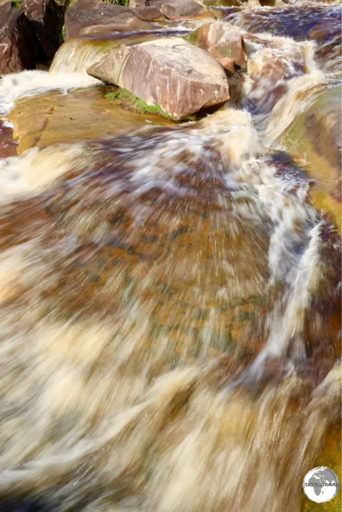
Essequibo Region Travel Guide Essequibo Region Travel Guide Essequibo Region Travel Guide Essequibo Region Travel Guide

Venezuela’s Gran Sabana Region Travel Report

The refreshing and spectacular, Jasper Creek Waterfalls, a highlight of the Canaima National Park.

Venezuela Travel Report

Welcome to the taste2travel Venezuela Travel Report!

Date visited: February 2015

Introduction

This report covers a side trip from Brazil into the Gran Sabana (Great Savannah) region of Venezuela – also known as the Guianan Savannah.

Venezuela

The Savannah region offers one of the oldest (two billion years) and most unusual landscapes in the world, with rivers, waterfalls and gorges, deep and vast valleys, impenetrable jungles and savanna’s that host large numbers and varieties of plant species, a diverse fauna and the isolated table-top mesas locally known as tepuis.

The most famous of the tepuis is Mount Roraima (2,800 m), which forms the border between three nations – Venezuela, Guyana and Brazil with 85% of the mountain in Venezuelan territory.

A map of the Guyana shield.

A map of the Guyana shield.
Source: Wikipedia

The landscape in this region is part of the Guiana Shield. Mount Roraima occupies the south-eastern corner of Venezuela’s 30,000-square-kilometre (12,000-square-mile) Canaima National Park. The mountain is the highest point in Guyana and the highest point of the Brazilian state of Roraima.

A table-top mountain, Mount Roraima is bounded on all sides by cliffs which rise 400 metres (1,300 ft).

A table-top mountain, Mount Roraima is bounded on all sides by cliffs which rise 400 metres (1,300 ft).

Safety

Venezuela today is always in the news for the wrong reasons. The country is suffering after years of political and economic mismanagement under Chavez and now under his successor, Nicholas Maduro.

Crime is rampant, the country has one of the highest homicide rates in the world and tourists do get kidnapped. This is not a place for a Club Med holiday. You should make your own assessment of the risks, depending on your destination, before you arrive.

All locals advised me to avoid Caracas.

I personally experienced no problems while in La Gran Sabana region. The locals were all very friendly and welcoming and it was business as usual in Santa Elena.

Tourism is an important source of revenue in this part of the country and the locals are very keen to ensure nothing happens to tarnish the industry.

Many businesses are suffering due to the lack of tourists. The only visitors in Santa Elena during my visit were Brazilian day-trippers on shopping trips taking advantage of the cheap prices.

Money Matters

The official currency of Venezuela is the bolívar.

The official currency of Venezuela is the bolívar.

While many aspects of Venezuela are currently unfavourable, the turmoil has created a favourable economic environment for travelers. Travel costs in Venezuela are the cheapest on the continent.

At the time of my visit (February 2015) the exchange rate was:

  • Official rate: USD$1 = VEF 6.35 (fixed)
  • Black market rate: USD$1 = VEF 150

Venezuela has the highest inflation rate of any country in South America. As of today (13th of March 2016) the black market rate is: USD$1 = VEF 1,211

It is illegal to publish black market exchange rates inside Venezuela, if you wish to check the current rate you can do so via the American website – dolartoday.

You should ensure you take enough cash – USD or, if you are entering from Brazil – Brazilian Reals, to last for the duration of your trip.

Exchanging with traders on the street is illegal but very common. In downtown Santa Elena you will find money traders on every street corner holding huge wads of Bolivares. I did one exchange while the trader was having a friendly conversation with a uniformed policeman.

Whatever you do – you should ensure you never expose yourself to the official exchange rate by using an ATM or credit card, otherwise you will find travel costs in Venezuela to be the most expensive on the continent.

Sightseeing

A map of Canaima National Park which includes Angel Falls, the world's highest waterfall.

A map of Canaima National Park which includes Angel Falls, the world’s highest waterfall.

Canaima National Park

The Jasper Creek Waterfalls are one of many waterfalls in the Canaima National Park.

The Jasper Creek Waterfalls are one of many waterfalls in the Canaima National Park.

The Savannah region covers an area of 10,820 square kilometres and includes the Canaima National Park, the 2nd largest park in Venezuela. The highlight of my trip was a visit to the park, all of the photos here were taken in the park.

As smooth as polished marble, Jasper is a mineral formed from Quartz.

As smooth as polished marble, Jasper is a mineral formed from Quartz.

One of the most beautiful sites in the park is Jasper Creek waterfalls. The creek gets its name from the fact that the water flows over a smooth bedrock of mostly red and black jasper.

One of many waterfalls in Canaima National Park.

One of many waterfalls in Canaima National Park.

The park is home to numerous waterfalls, which are popular swimming spots for the locals.

A family from Caracas enjoying a refreshing dip in one of the waterfalls at Canaima National Park.

A family from Caracas enjoying a refreshing dip in one of the waterfalls at Canaima National Park.


This was the perfect place to cool off after a hot day of touring Canaima National Park.

This was the perfect place to cool off after a hot day of touring Canaima National Park.

Getting There

Gran Sabana Region (Venezuela) Travel Report: View of the countryside in Canaima National Park, with the table-top Mount Roraima in the background.

View of the countryside in Canaima National Park, with the table-top Mount Roraima in the background.

Local tour operators in Santa Elena can organise day trips into the park. I travelled in a 4WD with four others travellers. The cost for the trip was $12 per person.

A bustling border town and main service centre for the region. Santa Elena is the first stop in Venezuela for travelers entering by land from Brazil.

In this small, friendly town, there are plenty of hostels, hotels and travel agents who can organise trips to Mount Roraima or the Canaima National Park and other places in the Savannah region.

Accommodation

Accommodation in Santa Elena de Uairén is plentiful but fills up quickly. With the current economic crisis, prices of goods in Venezuela are ridiculously cheap, so hotels are often booked out by visiting Brazilian shoppers.

Best to book ahead using an online agent such as booking.com

In Santa Elena de Uairén I stayed in the Hotel Le Gran Sabana, which is located on the outskirts of town on the highway to the border.

There are plenty of hostel options downtown, especially on Calle Urdaneta.

Eating Out

There are many good restaurant options in Santa Elena, especially in the backpacker neighbourhood on Calle Urdaneta.

Visa Requirements

Some nationalities require visas for Venezuela – check your visa requirements prior to arrival.

Getting There

By Air

Santa Elena de Uairén has an airport, but as of February 2016, all commercial service has been suspended.

Venezuelan airlines Rutaca and Conviasa used to operate flights between this airport and Ciudad Guayana or Ciudad Bolívar; you should check their websites to see if air service has been restored at the time of your visit.

By Road

To/ From Brazil

Coming from Brazil, you can reach the Brazilian border town of Pacaraima from Boa Vista by several daily buses (the earliest at 7:00 am) that leave from Terminal do Caimbé bus station. There are also shared taxis. The ride takes up to 3:30 hours on a single-lane but good paved road.

To cross the border from Pacaraima to Santa Elena, you need to take both Brazilian and Venezuelan stamps at the respective immigration checkpoints first, then return to Pacaraima, where shared taxis are waiting for passengers. Pacaraima lies right next to the border (200 m walk from the bus terminal), Santa Elena is 12 km away.

If you are coming from Santa Elena you should take the taxi only to the border as the bus terminal in Pacaraima is a short walk from the border.

Some nationalities require visas for Brazil – check your visa requirements prior to arrival.

Getting Around

There are taxis to get you around Santa Elena de Uairén although the town centre is small and compact and easily covered on foot.

Currently bus service exists between Ciudad Guayana and Santa Elena de Uairén, but car travel is recommended to allow for frequent stops in interesting places.

The journey from Caracas takes 22 hours and can be done in a semi-cama (reclining seat) bus.

Safe Travels!

Darren


Follow me on Instagram: 


Further Reading

Other travel reports from the region include:

Venezuela Travel Report Venezuela Travel Report Venezuela Travel Report Venezuela Travel Report l Report

Guyana Travel Guide

A rainbow over Kaieteur Falls, Guyana.

Guyana Travel Guide

Welcome to the taste2travel Guyana Travel Guide!

Date of visit: January 2015 &  October 2015

Introduction

Guyana is the fourth-smallest country in South America (after Uruguay, Suriname and French Guiana). It is bordered by the Atlantic Ocean to the north, Brazil to the south and southwest, Suriname to the east and Venezuela to the west. It’s capital and largest city is Georgetown.

History

Originally inhabited by several indigenous groups, Guyana was settled by the Dutch before coming under British control in the late 18th century. It was governed as the plantation economy of British Guiana until independence in 1966.

The legacy of British rule is reflected in the country’s diverse population, which includes Indian, African, Chinese, Portuguese, Amerindian, and European groups.

Guyana also has the distinction of being the only South American nation in which English is the official language. The majority of the population, however, speak Guyanese Creole, an English-based creole language with slight Dutch, Arawakan and Caribbean influences.

Guyana is called the ‘Bread Basket’ of the Caribbean. Major crops include rice, sugar, coffee, cocoa, coconuts, edible oils, copra, fruit, vegetables, and tobacco. Livestock include cattle, sheep, pigs, goats, and chickens.

In addition to being part of the Anglophone Caribbean, Guyana is one of the few Caribbean countries that is not an island in the West Indies.

The Caribbean Community (CARICOM), of which Guyana is a member, is headquartered in Georgetown.

Guyana Travel Guide: Fashion Parade in Georgetown

Fashion Parade in Georgetown

Guyana or Guiana

A map of the Guyana shield.

A map of the Guyana shield.
Source: Wikipedia

‘Guyana’ is derived from an Amerindian language and means “land of many waters”. The region comprised the large shield landmass north of the Amazon River and east of the Orinoco River.

In colonial times, there were five Guiana’s, these were (in geographical order along the coast):

  • Spanish Guiana – now the Guayana region of Venezuela
  • British Guiana – now the sovereign nation of Guyana
  • Dutch Guiana – now the sovereign nation of Suriname
  • French Guiana – now a French department known in French as ‘Guyane’
  • Portuguese Guiana – now the Brazilian state of Amapa

When Guyana declared independence, it changed its name from British Guiana to Guyana.

An historical map showing the five Guyanas.

An historical map showing the five Guyanas.

Flag

The flag of Guyana.

The flag of Guyana.

The flag of Guyana, known as The Golden Arrowhead, has been the national flag since the country become independent from the Great Britain in 1966.

Following a competition, the winning design for the flag was one created by an American, Whitney Smith, who later became a prominent vexillologist (flag historian).

The flag features a red background, green hoist triangle, and stylised yellow arrowhead. The Guyanese reversed the green and red and added a black fimbriation (narrow border) to the triangle and one of white to the arrowhead.

The green represents the jungles and fields that cover most of the country, as reflected in the national anthem, “Green Land of Guyana”. The white symbolises the many rivers, which provide the basis for the indigenous name Guyana (“land of waters”), while red represents zeal and sacrifice in nation-building, and the black symbolises perseverance.

The yellow arrowhead recalls the original Amerindian population of the area but also represents the golden future that citizens are committed to building on the basis of national mineral resources.

Georgetown

Georgetown is Guyana’s largest city (population: 250,000) and its capital. It is situated on the Atlantic Ocean coast at the mouth of the Demerara River and it was nicknamed ‘Garden City of the Caribbean’.

Through the years, Georgetown has been governed by the Dutch, the French, the Dutch again and finally the English until independence.

Georgetown was named in 1812 in honour of King George III.

The city is located on a flat coastal plain. The elevation of the land is one metre below the high tide level. This low elevation is protected by a retaining wall known as the seawall (originally constructed by the Dutch) to keep the ocean out and an innovative network of canals with kokers to drain the city of excess water.

Most of the sites of interest are conveniently located in the compact city centre and can be seen on foot within a day. The streets of the city are arranged on a grid format so orientation is easy. The best way to explore the city is to meander the tree-lined streets, exploring the beautiful wooden colonial buildings and churches.

Christ Church in Georgetown, Guyana.

Christ Church in Georgetown, Guyana.

The centre of the city is dominated by the large Stabroek Market (1792) containing the prominent cast-iron clock tower. Stabroek was the name the Dutch gave to the city the 2nd time they took control. The market is interesting but you should be extra vigilant with your personal belongings here. Likewise in the immediate neighbourhood where the streets are chaotic, crowded, rough and edgy.

The iconic wrought-iron clock tower of Stabroek Market in Georgetown.

The iconic wrought-iron clock tower of Stabroek Market in Georgetown.

For the best coffee in town (not to mention great food and good WiFi), you can not beat Oasis cafe. It’s located downtown on Carmichael street.

Kaieteur Falls

The majestic and awe-inspiring, Kaieteur Falls - a truly spectacular sight.

The majestic and awe-inspiring, Kaieteur Falls – a truly spectacular sight.

If there is one ‘must see’ attraction in Guyana then without a doubt it is the majestic and incredible Kaieteur falls. This is a site that must be seen to be believed and there is no better way of approaching it than from the air.

The falls are not accessible by road so they have largely escaped commercialism and development. On the day I visited there were just 8 other visitors – my fellow passengers on the Air Services flight.

Kaieteur Falls is the world's widest single drop waterfall. The falls plunge 226 metres in a single drop.

Kaieteur Falls is the world’s widest single drop waterfall. The falls plunge 226 metres in a single drop.

The falls are located in the middle of a huge, remote forest. It is four times higher than Niagara Falls and about twice the height of Victoria Falls. It is a very impressive single drop waterfall.

Depending on the season, Kaieteur falls vary in width from 76 metres (250 ft) to 122 metres (400 ft).

Depending on the season, Kaieteur falls vary in width from 76 metres (250 ft) to 122 metres (400 ft).

The 6 km trail approaching the falls is home to a variety of birds, and the minuscule golden poison frog, which produces a potentially fatal poison. The frogs live inside the leaves of the Giant Tank Bromeliads, which act as natural cisterns.

Giant-tank Bromeliads provide the perfect habitat for the Golden poison frog.

Giant-tank Bromeliads provide the perfect habitat for the Golden poison frog.


A Golden poison frog, a member of the Poison Dart Frog family at Kaieteur Falls.

A Golden poison frog, a member of the Poison Dart Frog family at Kaieteur Falls.

The golden poison frog’s skin is densely coated in an alkaloid toxin, one of a number of poisons common to dart frogs. This poison prevents its victim’s nerves from transmitting impulses, leaving the muscles in an inactive state of contraction. This can lead to heart failure or fibrillation. Some native people use this poison to hunt by coating darts with the frog’s poison.

A Golden poison frog inside a Giant-tank Bromeliads at Kaieteur falls.

A Golden poison frog inside a Giant-tank Bromeliads at Kaieteur falls.

Getting There

You can reach the falls either by boat along the lower reaches of the Potaro river, or the easy – and most popular way – by one hour flight in a small aircraft from Georgetown.

Flights from Ogle Airport are currently offered by Air Services Limited. Refer to their website for schedule and pricing.

Flights leave Georgetown at 1 pm and return at 5 pm. Included in the cost is a two-hour guided nature walk conducted by a local Amerindian guide.

There are two ways to purchase your ticket:

Local way: book direct with the airline for $145.

Tourist way: book with your hotel or a downtown travel agent and pay about $190. This includes return airport transfers plus lunch at the airport.

Iwokrama Forest

A Parrot Snake at Iwokrama Forest.

A Parrot Snake at Iwokrama Forest.

Covering 3710 square kilometres of central Guyana, the Iwokrama Forest is one of the four last pristine tropical forests in the world.

Access to the forest is either via private vehicle or one of the micro buses running from Georgetown to Lethem.

A curious Spider Monkey nearby the Atta Lodge in the heart of the Iwokrama Forest.

A curious Spider Monkey nearby the Atta Lodge in the heart of the Iwokrama Forest.

I stayed at Atta Lodge, which is located at the Iwokrama Canopy Walkway, Guyana’s only canopy walk. The walkway is suspended 30 m above the forest floor and provides an excellent viewing platform for birds, primates etc.

All lodge reservations plus transport arrangements must be booked and paid for in advance in Georgetown. I made my arrangements through Wilderness Explorers.

The 'highway' connecting Guyana and Brazil passes through the Iwokrama forest

The ‘highway’ connecting Guyana and Brazil passes through the Iwokrama Forest

Note: There are no transport options out here unless you hire an (expensive) private 4WD. You could try your luck hitching a ride on the Georgetown – Lethem road

Lethem

Lethem lies on the Takutu River, which forms the border with Brazil, opposite the Brazilian town of Bonfim. It’s a sleepy transit town. If you get stuck here there are a couple of hotel options.

For more on crossing the border, see the ‘Getting There‘ section below.

Accommodation

Like the other countries in the Guiana’s, accommodation in Guyana is limited. It’s best to book in advance using an online agent such as booking.com

In Georgetown I have stayed at Herdmanston Lodge, which is a well known favourite and the more centrally located Halito Hotel & Residence (my preference).

Eating Out

Food in Guyana is influenced by the different ethnic groups and is typical of other Anglo Caribbean countries. Curry and Chinese are popular.

Visa Requirements

Some nationalities require visas for Guyana – check your visa requirements prior to arrival.

Getting There

By Air

International flights arrive at Cheddi Jagan International Airport. The airport is located 41 kilometres (25 mi) south of Guyana’s capital, Georgetown.

The following airlines provide international flights to Timehri:

Ogle International Airport is primarily used for domestic flights and is located on the Atlantic Ocean coast 10 km from Georgetown. Flights to Kaieteur Falls depart from this airport.

The following airlines provide international flights to Ogle:

  • LIAT – flies to/from Barbados
  • Trans Guyana Airways – flies to/from Paramaribo (Zorg en Hoop) plus domestic destinations in Guyana.

From either airport you can get downtown via taxi.

By Road/ River

To/ From Suriname

The ferry service between Guyana (Molson Creek – Corentyne) and Suriname (South Drain) is operated by the Canawaima Ferry Company.

Services are either once a day or twice a day in each direction, depending on season. There is usually a ferry from Guyana at 1 pm.

South Drain is located 32 km south of Nieuw Nickerie on a fast paved road.

On either side you will find taxis and shared buses to transport you to Georgetown (3 hours), Paramaribo (5 hours) or Nieuw Nickerie (30 mins). Roads are paved and in excellent condition on both sides, although the driving is erratic and risky.

Most nationalities require either a tourist card or a visa for Suriname – check your requirements prior to arrival.

To/ From Brazil

The border between Brazil and Guyana is the bridge over the Takutu river between the Brazilian town of Bonfim and the Guyanese town of Lethem. The bridge includes a neat lane-changing design to get you from the left side of the road onto the right side.

Formalities are conducted on the respective sides of the river. There are local taxis, which will ferry you between the two posts.

On the Brazilian side you have shared taxis or buses which will take you to the city of Boa Vista, the capital of Roraima state.

On the Guyanese side you have micro buses that will transport you to Georgetown (20 hours) via the Iwokrama Rain forest (6 hours).

Note: Do not cross the border into Brazil with Guyanese dollars – they are impossible to change outside of Guyana.

Some nationalities require visas for Brazil – check your visa requirements prior to arrival.

Getting Around

There are frequent mini buses connecting all of the main centres in Guyana. Most buses from Georgetown commence their journey on the crowded, chaotic streets outside Stabroek market.

All taxis are registered under the term “Hackney Carriage” and carry the letter H at the beginning of their number plates. You can flag these in the street.

Safe Travels!

Darren


Follow me on Instagram: 


Further Reading

Other travel reports from the region include:

Guyana Travel Guide Guyana Travel Guide Guyana Travel Guide Guyana Travel Guide Guyana Travel Guide Guyana Travel Guide

Suriname Travel Guide

Dutch-style colonial buildings in the UNESCO-listed old town of Paramaribo.

Suriname Travel Guide

Welcome to the taste2travel Suriname Travel Guide!

Date of Visit: January 2015

Introduction

At 163,820 square km, Suriname is the smallest country in South America. Despite its size, Suriname is one of the most ethnically diverse countries in the region, with a population (576,000) comprised of descendants of African slaves, Dutch and British colonialists, Indian, Indonesian and Chinese indentured laborers and indigenous Amerindians.

The pulsating heart of the country is the capital, Paramaribo, a city loaded with lots of gorgeous Dutch-style architecture. The streets of the photogenic old town, which is a UNESCO-listed World Heritage Site, are lined with wooden buildings which would look more at home in The Netherlands rather than on the edge of a steamy jungle in South America. Grassy squares, parks and an old Dutch-built fort complete the picture-perfect setting.

In between sightseeing, the restaurants in the old town offer a plethora of cuisines which reflect the ethnic diversity of the country. The local brew, Parbo beer, is brewed by Heineken and, in my opinion, tastes even better! A great way to unwind after a day of sweaty exploration.

Away from the capital, the jungles of Amazonia are a short drive, with the excellent Brownsberg National Park (see ‘Sightseeing’ below) offering great hiking and the chance to spot some highly toxic frogs!

Location

Located on the remote north-eastern coast of South America, Suriname is bordered by French Guiana to the east, Guyana to the west and Brazil to the south. It is one of the three Guiana’s.

The bulk of the small land area is occupied by dense jungle, the northern extreme of the vast Amazon system. Almost all of the population can be found along the coast, while the sparsely populated interior is home to small Amerindian communities who are the original inhabitants of the region.

History

Originally inhabited by indigenous tribes, Suriname was explored and contested by European powers before coming under Dutch rule in the late 17th century. In 1975 Suriname declared independence from the Netherlands. It is the only officially Dutch speaking country in South America.

Suriname is culturally considered to be a Caribbean country, and is a member of the Caribbean Community (CARICOM).

Historic Dutch church in Paramaribo.

Historic Dutch church in Paramaribo.

People

The people of Suriname are among the most diverse in the world, spanning a multitude of ethnic, religious, and linguistic groups. As a plantation colony, Suriname was heavily dependent on manual labour, and after the abolition of slavery, there was a requirement to import labourers to make up for the labour shortfall.

The colourful Arya Dewaker Hindu temple, Meerzorg, Paramaribo.

The colourful Arya Dewaker Hindu temple, Meerzorg, Paramaribo.

The Dutch brought in contract labourers from the Dutch East Indies (modern Indonesia) and India (through an arrangement with the British). In addition, during the late 19th and early 20th centuries, small numbers of labourers were brought in from China and the Middle East.

The biggest mosque in the country is located on the Keizerstraat in Paramaribo.

The biggest mosque in the country is located on the Keizerstraat in Paramaribo.

The official spelling of the country’s English name was changed from “Surinam” to “Suriname” in January 1978, but “Surinam” can still be found in English. A notable example is Suriname’s national airline, Surinam Airways.

Flag

The flag of Suriname.

The flag of Suriname.

Adopted on the 25th of November 1975, upon the independence of Suriname, the flag is formed by five horizontal bands of green (top, double width), white, red (quadruple width), white, and green (double width). There is a large, yellow, five-pointed star cantered in the red band.

The star represents the unity of all ethnic groups, the red stripe stands for progress and love, the green for hope and fertility, and the white bands for peace and justice.

Currency

The Surinamese dollar.

The Surinamese dollar.

The Surinamese dollar (Sr$) is the official currency of Suriname, trading under the international code of SRD.

Bank notes are issued by the Central Bank of Suriname in denominations of 5, 10, 20, 50, 100 dollars. The dollar is divided into 100 cents, with coins issued in denominations of 1, 5, 10, 25, 100, 250 cents.

The current exchange rate against the US dollar is:

US$1 = SR$14.5 

You can check the current exchange rate here.

Paramaribo

Located on the banks of the Suriname River, near its outlet to the Atlantic ocean, Paramaribo is the capital and largest city of Suriname. The city has a population of roughly 240,000 people, almost half of Suriname’s population.

I arrived in Paramaribo from the border town of Albina. The city is very much the focal point of the country. The historical, Dutch-built, old town has been a UNESCO World Heritage Site since 2002.

The wooden interior of St. Peter and St. Paul Basilica in Paramaribo.

The wooden interior of St. Peter and St. Paul Basilica in Paramaribo.

The city centre is both grand and charming, containing beautiful colonial Dutch-style buildings arranged around grassy squares and streets. Most of the buildings have been restored but some are still in need of renovation and, apparently, UNESCO have threatened in the past to remove the World Heritage listing if the buildings aren’t maintained.

Dutch colonial buildings in the UNESCO-listed old town of Paramaribo.

Dutch colonial buildings in the UNESCO-listed old town of Paramaribo.

A highlight is the impressive Fort Zeeland which is located on the riverbank. The fort was originally built by the French, then occupied by the British then eventually captured by the Dutch. Like the other capitals of the Guiana’s, Paramaribo is small and compact, with most sights within a short stroll and easily covered on foot in one day.

Old Dutch letterbox in Paramaribo.

Old Dutch letterbox in Paramaribo.

In contrast to the old town, as you move further up the river things become much more vibrant, gritty and chaotic, the beautiful Dutch colonial architecture being replaced by ugly, modern monuments-to-bad-taste. Here you will find the main markets and most of the activity in town.

Historic Dutch Colonial architecture can be seen throughout Paramaribo.

Historic Dutch Colonial architecture can be seen throughout Paramaribo.

The population of the capital is very diverse and consists of Creole (African descent), Hindustani (East Indian descent), Multi-racial, Maroon (descendants of escaped African slaves), Javanese (Indonesian descent), Indigenous (descendants of native population), Chinese (descendants of 19th-century contract workers) and smaller numbers of European (primarily of Dutch and Portuguese descent), Lebanese and Jews. In the past decades Brazilian, Guyanese and new Chinese immigrants have settled in Paramaribo.

The diverse ethnic population ensures a culinary feast awaits the curious (and hungry) traveller. Around the city you will find cafes and restaurants selling a variety of food from India (Roti is popular), Dutch favourites such as pancakes, Bitterballen and Poffertjes, Indonesian favourites such as satay, gado-gado and loempia and Middle Eastern snack bars selling kebabs – just to name a few.

The local beer, Parbo, is brewed by Heineken and is very refreshing on a hot humid day.

Brewed by Heineken, the local brew, Parbo, is very quaffable and a nice way to cool down on a hot humid day.

Brewed by Heineken, the local brew, Parbo, is very quaffable and a nice way to cool down on a hot humid day.

After one day spent discovering the sights of the historic city centre I hired a bike on the second day, took it across the river in a pirogue and cycled to the historic village of Nieuw Amsterdam.

This is a nice day trip and provides the opportunity to get out into the countryside. The right bank of the river is very rural compared to the left bank. There is an old fort to be explored at Nieuw Amsterdam and an interesting historical museum.

Lotus Flower in Nieuw Amsterdam.

Lotus Flower in Nieuw Amsterdam.

Brownsberg

Three-striped poison dart frog at Brownsberg National Park.

Three-striped poison dart frog at Brownsberg National Park.

A nice day trip from Paramaribo is to Brownsberg National Park. Trips can be organised through any hostel and include transport, guide and lunch.

The park is located just 130 km south of Paramaribo and is certainly worth a visit. This is the most northern part of the Amazon rainforest. The park offers views of Lake Brokopondo and the chance to spot wildlife on nature trails while walking to various waterfalls.

Hoogmoed harlequin toad at Brownsberg National Park.

Hoogmoed harlequin toad at Brownsberg National Park.

Nieuw Nickerie

Nieuw Nickerie is the 3rd largest city in Suriname and lies on the mouth of the Nickerie river on the Atlantic coast, opposite the mouth of the Corantijn river (Courantyne) and the Guyanese town of Corriverton (Springlands), to which a ferry service operates.

See the ‘Getting There‘ section below for information on crossing the border to Guyana.

Bigi Pan

Black-collared hawk at Bigi Pan Nature Reserve.

Black-collared hawk at Bigi Pan Nature Reserve.

The one reason to come to Nieuw Nickerie is to visit the nearby nature reserve of Bigi Pan.

The reserve is 135,000 hectares in area and comprises a coastal lagoon which is influenced by the tides of the sea and is fed with both salt water and fresh water from the interior. The result is an impressive estuary, teeming with birds.

Suriname Travel Guide: Caribbean flamingos at Bigi Pan Nature Reserve.

Caribbean flamingos at Bigi Pan Nature Reserve.

I organised a boat trip through my hotel, on the trip we saw flamingo’s, scarlet ibis, black-collared hawk, woodpeckers, ibis and more. Lunch was also included.

An adult Scarlet Ibis at Bigi Pan Nature Reserve.

An adult Scarlet Ibis at Bigi Pan Nature Reserve.

If you wish to stay longer in the reserve there are guest houses built on stilts over the lagoon.

A juvenile Scarlet Ibis at Bigi Pan Nature Reserve.

A juvenile Scarlet Ibis at Bigi Pan Nature Reserve.

Accommodation

Like the other countries in the Guiana’s, accommodation in Suriname is limited. It’s best to book in advance using an online agent such as booking.com

I stayed in a private apartment in Paramaribo, which I booked through booking.com

Eating Out

Lots of variety to be found in this very ethnically diverse country.

Visa Requirements

Most nationalities require either tourist cards or visas for Suriname – check your requirements prior to arrival.

Getting There

By Air

International flights arrive at Johan Adolf Pengel International Airport (formerly called Zanderij International Airport). It is located 45 km south of Paramaribo and serves as the base for the national carrier Surinam Airways.

The following airlines provide connections to Paramaribo:

  • Caribbean Airlines – flies to/ from Port of Spain
  • Copa Airlines – flies to/ from Panama City
  • Fly All Ways – flies to/ from Camaguey, Havana, Santiago de Cuba
  • Gol Transportes Aéreos – flies to/ from Belem
  • KLM – flies to/ from Amsterdam
  • Surinam Airways – flies to/ from Amsterdam, Aruba, Belém, Cayenne, Curaçao, Georgetown–Cheddi Jagan, Miami, Port of Spain
  • Trans Guyana Airways – flies to/ from Georgetown (Guyana)
  • TUI fly Netherlands – flies to/ from Amsterdam

From the airport you can get downtown via either taxi or bus.

By Road/ River

To/ From French Guiana

Crossing the river Maroni between French Guiana (Saint-Laurent-du-Maroni) and Suriname (Albina) is very easy and straightforward.

The Immigration posts for each country are located on opposite banks of the river. There are many private pirogues that will ferry you across the river.

Once you cross you have taxis and shared transport that can get you to Paramaribo (2 hours) or to Cayenne (3 and a half hours). Roads on both sides are in excellent condition.

Some nationalities require visas for French Guiana  – check your visa requirements prior to arrival.

To/ From Guyana

The ferry service between Suriname (South Drain) and Guyana (Molson Creek – Corentyne) is operated by the Canawaima Ferry Company.

Services are either once a day or twice a day in each direction, depending on season.

South Drain is located 32 km south of Nieuw Nickerie on a fast paved road. You can reach here by taxi / bus. When I crossed I arrived at the port at 8 am (the opening time of the immigration office) in time to board the 9 am ferry to Guyana.

There is usually a return ferry from Guyana at 1 pm.

On either side you will find taxis and shared buses to transport you to Georgetown (3 hours), Paramaribo (5 hours) or Nieuw Nickerie (30 mins). Roads are paved and in excellent condition on both sides, although the driving is erratic and risky.

Some nationalities require visas for Guyana – check your visa requirements prior to arrival.

Getting Around

There are frequent micro buses and shared taxis connecting all the major centres.

Safe Travels!

Darren


Follow me on Instagram: 


Further Reading

Other travel reports from the region include:

Suriname Travel Guide Suriname Travel Guide Suriname Travel Guide Suriname Travel Guide Suriname Travel Guide

French Guiana Travel Guide

A red Macaw on Îles du Salut.

French Guiana Travel Guide

Welcome to the taste2travel French Guiana Travel Guide!

Date of Visit: January 2015

Introduction

French Guiana (French: Guyane), is an overseas department and region of France, located on the north Atlantic coast of South America in the Guyanas.

It borders Brazil to the east and south, and Suriname to the west. The country has a population of 250,109 inhabitants, 50% of whom live in the capital Cayenne.

‘Guyana’ is derived from an Amerindian language and means “land of many waters”. As such, this country is not an ideal beach destination as the coastline is lined with huge rivers, which dump brown water into the Atlantic Ocean. If you are looking for blue water you need to head to the Caribbean.

Part of France since 1946, Guiana joined the European Union, and its official currency is the euro. The region is the most prosperous territory in South America with the highest GDP per capita. A large part of Guiana’s economy derives from the presence of the Guiana Space Centre, now the European Space Agency’s primary launch site near the equator.

Sightseeing

Saint Georges

I crossed the Oiapoque river from Brazil to the French Guianese town of Saint Georges. It’s strange to arrive in a town in South America and see the French flag and the European Union flag flying in the main square.

St. Georges is a quiet little transit town, nothing to do here except get your passport stamped and organise onward transport. Upon arrival, I reported to the immigration office where a friendly French gendarme stamped my passport in less than 30 seconds – a very easy entry for me but Brazilians require visas to visit their neighbour. See ‘Getting There‘ below for more details on crossing the border.

After entering the country I went to the bank to withdraw some Euros. I was about to discover that the cost of living in this French territory is very European.

I arrived in St. Georges early in the morning to see the locals walking out of the town boulangeries with freshly back baguettes under their arms – how very French. So different from Brazil where breakfast consists of chocolate cake.

I had to wait for my micro bus to fill with passengers for the 2 hour trip to Cayenne (excellent, fast road) so I took breakfast at a nice cafe on the main square. Everything in this town is a 5 minute walk.

From St. Georges I travelled onto the capital, Cayenne.

The newly-opened Oiapoque bridge connects Brazil and French Guiana.

The newly-opened Oiapoque bridge connects Brazil and French Guiana.

Cayenne

I arrived in Cayenne overland from Brazil. Upon arrival it was clear I was now in a very different part of the world. The population in the city is manly Creole with some Haitian, Brazilian, European, and Asian added to the mix.

The architecture is very different – lots of colourful wooden houses painted in tropical shades of turquoise, pinks and yellows. The music and most other cultural aspects are Creole influenced. It felt more like the Caribbean than South America.

The city is nice and compact, wonderfully quaint, welcoming and relaxing. In one day you can visit most sights on foot. In a city of 56,000 people, traffic is never heavy.

If you are in Cayenne during Carnival (January – March) you should ensure you catch the Sunday parade.

Place du Coq, Cayenne.

Located in downtown Cayenne, Place du Coq is named after the rooster which sits atop a column in the middle of the square.

Cayenne Pepper

A Cayenne Pepper Plant.

A Cayenne Pepper Plant. Image: Franz Eugen Köhler, Köhler’s Medizinal-Pflanzen

What is Cayenne pepper? For all the facts you can refer to this site.

Despite the pepper being named after Cayenne, most peppers are now grown elsewhere in the world. There are no specific purveyors of Cayenne pepper in Cayenne.

From Cayenne I travelled along the coast to Kourou – home of the Guiana Space Centre and jumping off point for trips to Îles du Salut.

Kourou

The Guiana Space Centre at Kourou.

The Guiana Space Centre at Kourou.

The Centre Spatial Guyanais (CSG) is a French and European spaceport near Kourou. The location for the space centre was chosen because it fulfils the two major geographical requirements of such a site:

  • it is quite close to the equator, so that the spinning earth can impart some extra velocity to the rockets for free when launched eastward, and
  • it has uninhabited territory (in this case, open sea) to the east, so that lower stages of rockets and debris from launch failures cannot fall on human habitations.
This Ariane rocket can carry a payload of 10t into space - enough to lift my car (foreground) into orbit.

This Ariane rocket can carry a payload of 10t into space – enough to lift my car (foreground) into orbit.

You can visit the Space centre on a guided visit (well worth it). The visits are popular and spaces are limited so it’s best to book ahead in advance. You can do so by contacting CSG.

Inside the launch control centre at the Kourou Space Centre.

Inside the launch control centre at the Kourou Space Centre.

Îles du Salut

Entrance to prison cells on Îles du Salut.

Entrance to prison cells on Îles du Salut.

The Îles du Salut (in English: Islands of Salvation, so called because the missionaries went there to escape plague on the mainland) are a group of small islands about 11 km off the coast near Kourou.

Squirrel Monkey on Îles du Salut.

Squirrel Monkey on Îles du Salut.

The islands were part of a notorious penal colony from 1852 onward for only the worst criminals of France. The islands were featured in the novel Papillon, by Henri Charrière. He was imprisoned here for 9 years.

The prison was shut down in 1953. Today the islands are a popular tourist destination and are full of wildlife.

You can reach the islands by catamaran from Kourou. You need to reserve and pay in advance. I visited with Tropic Alizés, who I would recommend.

French Guiana Travel Guide: Capuchin monkey on Îles du Salut.

Capuchin monkey on Îles du Salut.

Mana

This tiny town north of Saint-Laurent-du-Maroni is home to a remarkable restaurant – Le Buffalo.

If you’re in this part of the country it is worth the detour to eat here. The restaurant itself is housed in a simple wooden building with an equally simple interior. It is located on a quiet side street in this sleepy town (population: 800).

However the chef is a properly trained French chef who has relocated to Mana and brought his culinary skills with him. During your meal he will appear in the restaurant in his white chef’s uniform (including the ‘toque’ – traditional chef’s hat) to ensure everyone is enjoying their meals.

I especially recommend the carpaccio of buffalo.

Local ex-pats drive here from more distant towns for weekend lunches.

Tel: 594344280
Address: 36 Rue Javouhey, Mana 97360, French Guiana

The beaches near to Mana are nesting sites for the huge leather-back turtles.

From Mana I made the short journey south to Saint-Laurent-du-Maroni, my exit point from French Guiana.

Saint-Laurent-du-Maroni

With 40,000 inhabitants this is the 2nd largest town in French Guiana and the border crossing to Suriname.

The town was founded in 1858, it was formerly the arrival point for prisoners, who arrived at the Camp de la Transportation, the buildings of which have been restored and can be visited.

The town is small and compact and easily seen in half a day.

Entering Suriname from here is very easy – see the ‘Getting There‘ section below.

Camp de la Transportation in Saint Laurent du Maroni.

Camp de la Transportation in Saint Laurent du Maroni.

Accommodation

Hotels are in short supply in Cayenne (and elsewhere in the territory). It’s always best to book in advance using an online agent such as booking.com

In Cayenne, I stayed downtown at Hotel Le Dronmi, which I would recommend. The hotel is conveniently located to everything of interest.

Eating Out

This is a former French colony – need I say more. Lots of good food available throughout the territory.

Visa Requirements

Some nationalities require visas for French Guiana – check your requirements prior to arrival.

Getting There

By plane

French Guiana’s main international airport is Cayenne – Félix Eboué Airport, located south of the city centre.

The following airlines provide flights to/ from Cayenne:

Air Caraïbes – flies to/ from Fort-de-France, Paris-Orly, Pointe-à-Pitre
Air France – flies to/ from Fort-de-France, Paris-Orly, Pointe-à-Pitre, Miami
Air Guyane – flies to/ from Grand Santi, Maripasoula, Paramaribo, Saint-Laurent du Maroni, Saül
Azul Brazilian Airlines – flies to/ from Belém, Fortaleza
Surinam Airways – flies to/ from Belém, Paramaribo

There are no bus services to the airport and of course the local taxi’s take full advantage of this by charging a flat fare of €35 to downtown Cayenne.

By Road/ River

To/ From Suriname

Crossing the river Maroni between French Guiana (Saint-Laurent-du-Maroni) and Suriname (Albina) is very easy and straight-forward.

The Immigration posts for each country are located on opposite banks of the river. There are many private pirogues who will ferry you across the river.

Once you cross you have taxis and shared transport that can get you to Paramaribo (2 hours) or to Cayenne (3 and a half hours). Roads on both sides are in excellent condition.

Some nationalities require visas for Suriname (e.g. Australian) – check your visa requirements prior to arrival.

To/ From Brazil

Update: since this was written the long-unused suspension bridge between St George d’Oiapok (French Guiana) and Oiapoque (Brazil) is now operational.

There are nightly buses from Macapa to the border town of Oiapoque. The road is mostly paved and the trip takes about 10 hours. I arrived at the small bus station in Oiapoque at 5 am and was informed I would need to wait until 8 am for the Brazilian immigration office to open. I joined my fellow transit passengers and slept in the bus station where there were some comfortable wooden benches to stretch out on.

At 8 am I took a taxi to the immigration office to get my exit stamp then down to the port for the crossing by pirogue to St. Georges.

From the river you can see the huge new bridge, which links French Guiana with Brazil. This was completed in 2011 at a cost of $33 million but still remains unopened. The French are waiting for the Brazilians who have promised to have all infrastructure in place and the bridge open in time for the Rio Olympics in 2016.

Once you reach the dock in St. Georges you will be greeted by micro bus drivers who can transport you to Cayenne. You will first need to get your passport stamped at the Gendarmerie (Police Station), which is inconveniently located on the outskirts of town (a 15 minute walk).

Some nationalities require visas for Brazil (e.g. Australian) – check your visa requirements prior to arrival.

Getting Around

Public transport is sporadic throughout the country. The best option, allowing you to maximise your time, is to hire a car. I did a one-way rental from Cayenne to Saint-Laurent-du-Maroni.

Safe Travels!

Darren


Follow me on Instagram: 


Further Reading

Other travel reports from the region include:

French Guiana Travel Guide French Guiana Travel Guide French Guiana Travel Guide French Guiana Travel Guide French Guiana Travel Guide